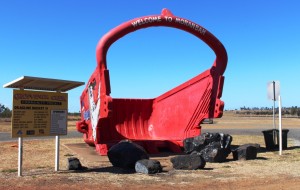
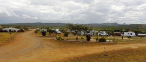
You have read the book – now see the movie : Cape York 2015

After we return from each of our extended tours I go through our images and videos and combine them into a video, or in some cases into a series of videos. When we did the Big Lap in 2009 the material took up almost all of 4 DVDs.

Normally I have produced one long story for each trip which has not been easy to break into sections. But for the Cape York trip last year I complied twelve shorter videos, which when combined, ran for almost an hour.

I have put links to some small video clips in various blog posts covering the Cape York trip so I thought I may as well break the longer production into manageable portions and load them to You Tube, to make the material more easily accessible to my blog readers.

The end result is six videos, each of a bit less than.ten minutes duration. Here is a summary of the videos and the link to each.

Cape York Adventure 2015 – Part 1. Covers from home to Airlie Beach and a day cruise through the Whitsunday Passage to Whitehaven Beach.

[youtube]https://youtu.be/Gb-xM_mio00[/youtube]

Cape York Adventure 2015 – Part 2. This video tells of the section from Airlie Beach to Weipa and our explorations around Weipa

[youtube]https://youtu.be/s3l03Rt5bdc[/youtube]

Cape York Adventure 2015 – Part 3. You will see much of what we saw as we travelled from Weipa to Punsand Bay, our visit to The Tip and our trips around Bamaga and Seisia

[youtube]https://youtu.be/Q693fD5CiFo[/youtube]

Cape York Adventure 2015 – Part 4. This covers two separate day trips to Thursday and Horne Islands. The material is combined into one story.

[youtube]https://youtu.be/1G168MSeuik[/youtube]

Cape York Adventure 2015 – Part 5. Join us as we travel down the East Coast of Far North Queensland from Seisia to Cairns and then visit Cairns city and the rain forest areas of Daintree and Cape Tribulation

[youtube]https://youtu.be/LrKySa1q42w[/youtube]

Cape York Adventure 2016 – Part 6. This video wraps up our trip with our visits to Tully Gorge and the Central Queensland gem field towns of Rubyvale and Sapphire.

[youtube]https://youtu.be/q0-Aud4KUYU[/youtube]

We hope that you will enjoy seeing something of the scenery and points of interest that we encountered on this enjoyable and challenging journey.

Until next time,

Kevin


Days 34 to 37 – Cape York Adventure

We departed Kurrimine Beach on Saturday morning, needing to be home on the next Wednesday; with a little over 1,600 km to do via the coast and a bit more if we took the inland route. Inland won, as that gave us a chance to at least drive through the gem fields. We had intended to spend two or three days there.
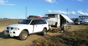
Ready for a quiet night

Ready for a quiet night

We left the Bruce Highway at Townsville and took the Flinders Highway, heading for Charters Towers. The revised plan was to spend the Saturday night at Macrossan Park on the east bank of an almost dry Burdekin River. Macrossan Park is a popular overnight stop, with flushing toilets and cold showers for the Spartan.
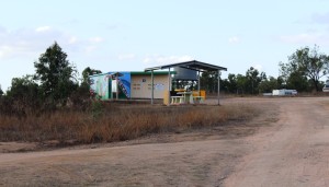
Information shelter and toilets at Macrossan Park

Information shelter and toilets at Macrossan Park

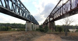
The camping area is between the highway and the railway, which is carried over the river by an impressive iron bridge. With the van set up for a comfortable night I went for a walk, to have a closer look at the rail bridge. Imagine my surprise when I found two rail bridges. It seems that many years ago the original iron bridge was replaced by a new bridge of similar design. The old one probably became unsafe, so a new bridge was built, just a few meters to the south. Once you know that the second bridge is there you see it straight away. But if you are expecting only one bridge then chances are that is what you will see, the structures are so similar.

[youtube]https://youtu.be/vfoHUPAXhUg[/youtube]
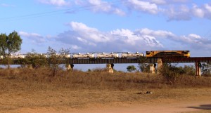
Fertiliser train approaching the main bridge

Fertiliser train approaching the main bridge

Queensland National obliged by sending a long fertiliser train over the bridge before dark and an other one after dark. There was at least one more during the night. The sun slid quietly behind the low range of hills that constitute the horizon, with a tinge of colour in the distant clouds which were rather a dark shade of grey. But the cloud
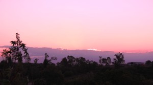
Tinges of sunset on the edge of storm clouds

Tinges of sunset on the edge of storm clouds

vanished westward with the sun and left us with a full moon rising into a clear sky.
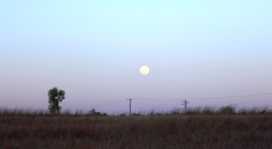


A full moon commences its assent
A full moon commences its assent

Res, there really are two bridges

There really are two bridges

On Sunday morning, a short run brought us to Charters Towers, where we refueled for the run south through Belyando Crossing and Clermont to our next overnight stop. Quite early in the trip we started to see signs of recent reasonably heavy rain. There looked to have been enough rain to put a smile on local farmers’ faces. When we crossed the first range from the coast the previous day, we could see how dry it was. That amount of rain would at least have brought some relief for beleaguered farmers. It certainly explained the grey clouds on the horizon the previous evening.

The Gregory Developmental Road passes through a mix of flat and undulating grazing country on its way through Emerald to Springsure, where it becomes the Dawson Highway, but we were not going that far. We refueled at the Belyando Crossing Roadhouse and continued on into the coal mining area of Clermont where we turned onto minor
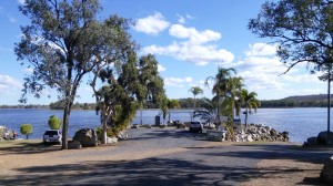
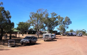
Theresa Creek Dam

Theresa Creek Dam

roads to reach the caravan park at Theresa Creek Dam, about 25 km to the south west of the town. We noticed that one long coal carrying conveyor that was working when we came through this area last year was now stationery, a victim of the slowdown in coal exports, probably.

Theresa Creek Dam has been there for many years with a recreation area for locals on its banks. But in recent years the local council has developed what was formerly an informal camping area into a comfortable caravan park. We lined up with other vans in the overnight area, but at a comfortable distance from our neighbor.  But not for enough away not to hear our next door neighbor’s generator. Peace was restored when it was turned off an hour later but we had spent that time walking about the caravan paek, so were not really inconvenienced.
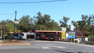
Rubyvale Post Office

Rubyvale Post Office

After another peaceful night we moved on for our drive through the gem fields. It wasn’t very far, probably about 50 km and we were parked in Rubyvale. Gem mining towns tend to be a bit of a shambles, due, I think, to the kind of people who become gem miners and the limited means with which they initially ply their trade.
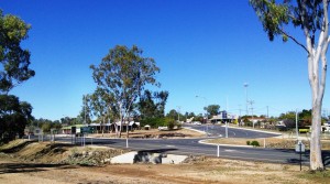
Rubyvale town centre

Rubyvale town centre

Rubyvale, however, has a very orderly centre with a general store, post office, caravan park and a new gem display and sales gallery that also houses a stylish coffee shop. There were not many gems in the gallery priced below $1,000 but the commodious coffee shop, probably built with the tourist coach trade in mind, had very affordable Devonshire Tea (or coffee). We also bought a small bag of washed gravel to put aside
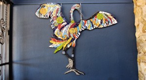
Decorations on the coffee shop wall

Decorations on the coffee shop wall

for sieving with our granddaughters at some suitable time. Perhaps we are sitting on a fortune. And perhaps not! But we may find something worth cutting and mounting into a piece of jewelry.

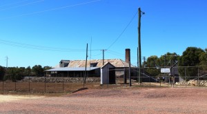
Coffee and scones consumed, we continued on to Sapphire, another ragged town with a less orderly centre than Rubyvale, but it’s town centre is clearly older. After a look around we continued to the
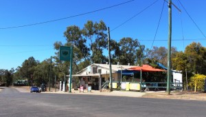
Sapphire General Store

Sapphire General Store

Capricorn Highway and then to a lunch stop at Emerald.

At Emerald we were back on the Gregory Developmental Road for the 56 km to Springsure. It was now a matter of how much further we went that day. We had in mind a river side camp where the Dawson Highway crosses the river from which it takes its name, but the caravans already there appeared to have been inserted by a sardine packing machine. We continued a further 20 km to the largely deserted caravan park in Moura. It is a large park, mostly of motel units and cabins for mine workers.
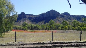
Hills near Springsure

Hills near Springsure

Our site was adjacent to a very noisy Coca-Cola machine that seemed to be trying to freeze its contents. We didn’t check. It was more of a night for hot drinks in this Central Highland town, the sleeping part of which we spent under a doona.

Home was now not much more than 600 km away with two days in hand, so we had the option of spending another night on the road or go for home. I find that these kinds of decisions take care of themselves. As the day progressed it was resolved in favor of going for home. We took a mid morning break at Monto, lunch at Ban Ban Springs and as the afternoon wore on stopped at Kybong, south of Gympie, for a very large container of caffeinated coffee and a serve of crisp hot chips.

So that brought us to the end of 37 days of fascinating adventure. Before we left home I had read a comment on Facebook where someone had remarked that a trip to Cap York was more an adventure than a holiday. That is one reason that I called this series of posts our Cape York Adventure. It’s both, really. Whoever said that you can’t have an adventure while on holiday?
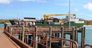
MV Trinity Bay berthed at Saisia wharf

MV Trinity Bay berthed at Saisia wharf

The opportunity to return by ship was pure luck, but the experience added greatly to the memories. I don’t mind driving on rough roads as we have the equipment to handle them, but I don’t go looking for them. If there is a choice of a sealed road that doesn’t take me too far out of my way I will opt for it every time, but there are iconic remote dirt roads and I get a great sense of satisfaction successful driving them.
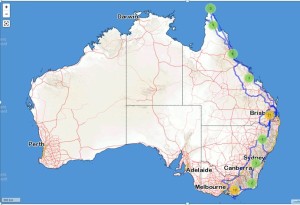
2015 travels

2015 travels. The blue line traces our path.

I have mentioned previously that we track our movements using a satellite tracking device. This provides a recorded track that can be superimposed on a map. I had a look at ours the other day, only to realise that  we had literately travelled from one end of the country to the other during the last twelve months. In the dying days of 2014 we were at Wilson’s Promontory and less than a month ago were at the tip of Cape York. Here is how it looks on the map.
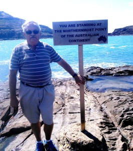
A windblown yours truly at the Tip

A windblown yours truly at the Tip

So, until next time, thanks for coming along with us to the Tip.

An Inland Detour

When we passed through Charters Towers on our way to Townsville we had decided to return to have a closer look at the town and then to journey down the Gregory Developmental Road to Clermont before turning east to again join the Bruce Highway to travel home.

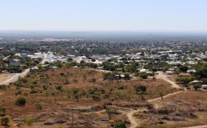
Charters Towers viewed from Tower Hill over mining scared ground

Charters Towers viewed from Tower Hill over mining scared ground

We had spent a couple of single nights in Charters Towers but had not really looked around. This visit was for two nights. The Charters Towers Tourist Park, where we stayed, allows the Charters Towers Lions Club to run fund raising dinners in the camp kitchen. Fifteen dollars buys a three course meal. We knew the format from last time, a meal and a brief talk on the area.

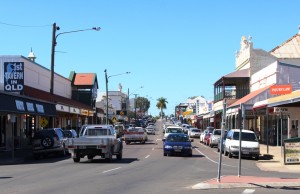
One of the main streets lined with historic buildings

One of the main streets lined with historic buildings

The talk provided a background for our sightseeing the next day. Charters Towers was already an established cattle town when gold was discovered in the 1880s. The gold was of high quality and quickly created great wealth. Mining companies sprang up in such numbers that the town opened its own stock exchange which operated in conjunction with the London stock exchange. But the gold rush ended and the town started to wind down. The current population is around 10,000. At its peak the town had 40,000 residents.

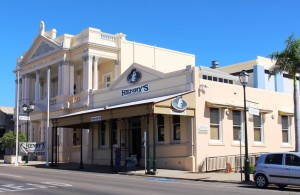
Another classic street scape

Another classic streetscape

Charters Towers also has a proud history of participation in WWII. American bombers were based there and it was one of two bases in Queensland from which bombers flew to attack Japanese war ships during the Battle of the Coral Sea. In more recent times education has added to the wealth of the town. It is the location of a number of prestigious colleges.

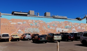
An impressive mural adorns a wall of a prominent building

An impressive mural adorns a wall of a prominent building

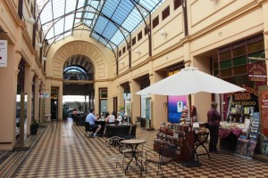
The town has always been aware of its history and has turned it to good account. Preservation of original buildings has always been important, so to walk down the street today is to experience many of the same sensations as visitors of days now long gone. We had lunch at a cafe in the arcade of the original stock exchange. Just along the street the Town Hall has an extensive display of war time photos and almost directly opposite much of the history of the town has been recorded on a huge mural on the wall of a large building.

Venus Gold Battery

Venus Gold Battery

We visited the Venus Gold Battery before driving to the summit of Towers Hill Lookout where a substantial structure has been built to commemorate and record much of the mining history. The observation point is appropriately sighted above the many shafts from which the city’s golden wealth was extracted.

We lunched at a cafe in the historic arcade of the old stock exchange building

We lunched at a cafe in the historic arcade of the old stock exchange building

Charters Towers is located at the junction of the Flinders Highway and the Gregory Developmental Road, which goes south via Clermont and Emerald to Springsure and north west to The Lynd Junction where it intersects with the Kennedy Developmental Road. We had not previously travelled this road so our journey south broke new ground.

The road house at Belyando Crossing

The road house at Belyando Crossing

The distance to Clermont, our destination for that day, is about 350 km. Until you reach the coal mines near Clermont the only sign of habitation on the entire journey, apart from some cattle stations, is the roadhouse at Belyando Crossing where the highway crosses the Belyando River. It was a hive of activity. Everyone seems to stop there. The most common vehicles on the road were cars with Victorian number plates towing large caravans. Ruth stopped counting after her count reached 100 vans.

Clermont is another of those agricultural and mining towns. It is an old town, with commercial buildings dotted around its streets but with lots of mining vehicles, various makes of four wheel drives with the distinctive yellow stripe along the side.

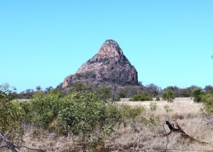
The prominent Woolfang Peak beside the Peak Downs Highway

The prominent Woolfang Peak beside the Peak Downs Highway

Out route next day took us along the Peak Downs Highway past a succession of coal mines and near to the coal mining town of Moranbah. After passing the Clermont mine there is an area of agricultural and grazing properties before the mines start again. Interest is maintained through this area by a succession of unique mountain peaks of which Woolfang Peak is the most dramatic. I wondered if the peaks had anything to do with the name of the highway.

An appropriate welcome to Moranbah

An appropriate welcome to Moranbah

During my transport industry days I was a regular visitor to Moranbah as, for a time, it was part of my area of responsibility. Ruth had never been there, so we drove the 13 km in from the highway to see how things had changed. McDonald’s is there now and the town is bigger but the central business district looked substantially unchanged. The surprise was the airport. It is a much larger structure with large parking areas and signs directing users to drop off points and arrival and departure points. It was a reminder of the extent to which fly-in-fly-out staffing of coal mines has taken over.

The tranquility of the Cape Palmerston Caravan Park

The tranquility of the Cape Palmerston Caravan Park

The Peak Downs Highway goes to Mackay but we left it east of Moranbah and followed the coal railway towards Sarina where it briefly joins the main north line before diverging to the east to the bulk coal loading terminals at Hay Point and Dalrymple Bay. Our destination was a caravan park near the hamlet of Greenhill on the coast just south of Sarina.