Destination Tasmania – Part 5 – Mountain Roads and Highland Lakes

12th to 14th February 2020

Please Note: Videos covering the material in this blog post can be found at the bottom of the post.

Clouds against mountains approaching Queenstown from Strahan

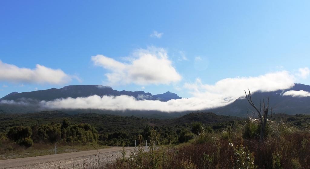
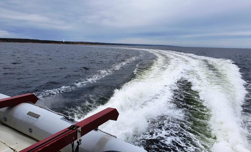
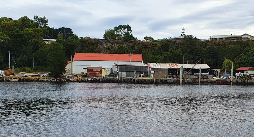
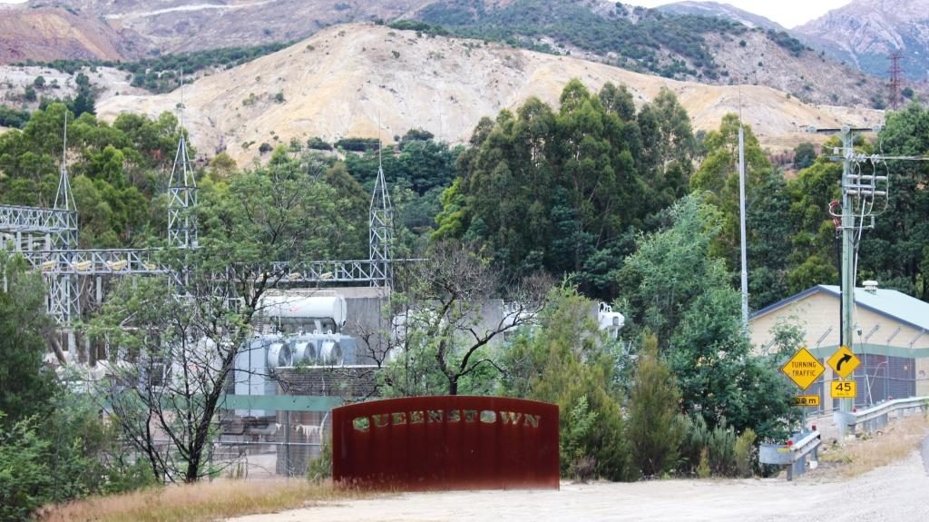
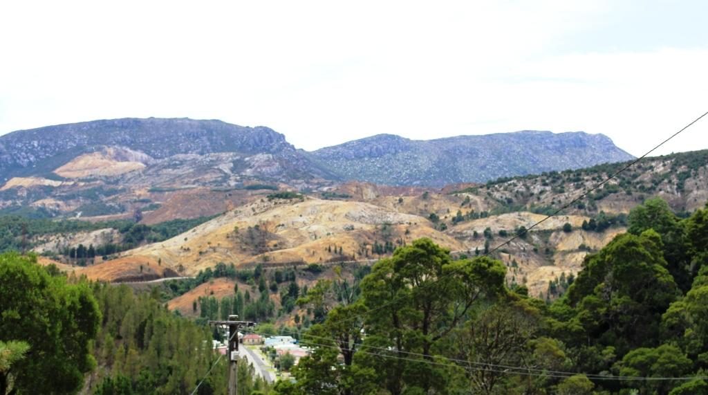
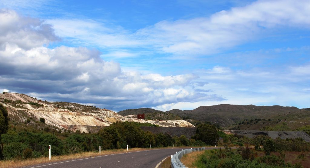
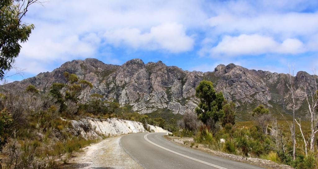
There was a suspicion of drizzle as we packed the car to leave Strahan.  In several areas, as we drove to Queenstown, our way was partly obscured by cloud cover that sat atop the mountains like a blanket. The point from which we viewed the mountains behind Queenstown the previous morning was a totally clouded, with no view at all.  As we approached Queenstown, banks of cloud hung in front of the mountain range, but all of the cloud vanished as we drove up the range towards the east to give us an almost cloudless sky.

Queenstown from the Lyell Highway heading east
Queenstown in the valley and the road east clinging to the side of the mountain
A caravan making its way up the mountain from Queenstown

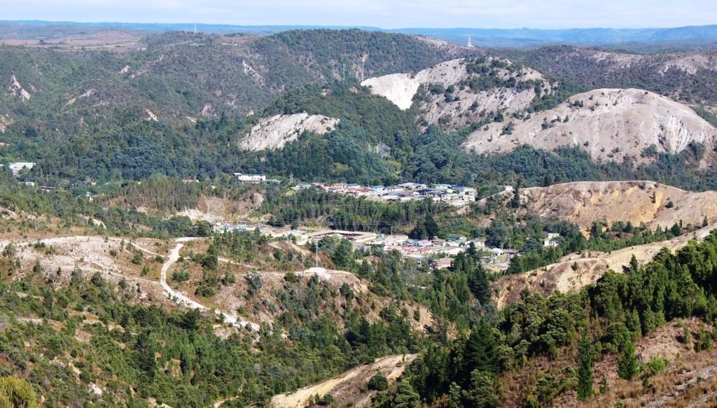
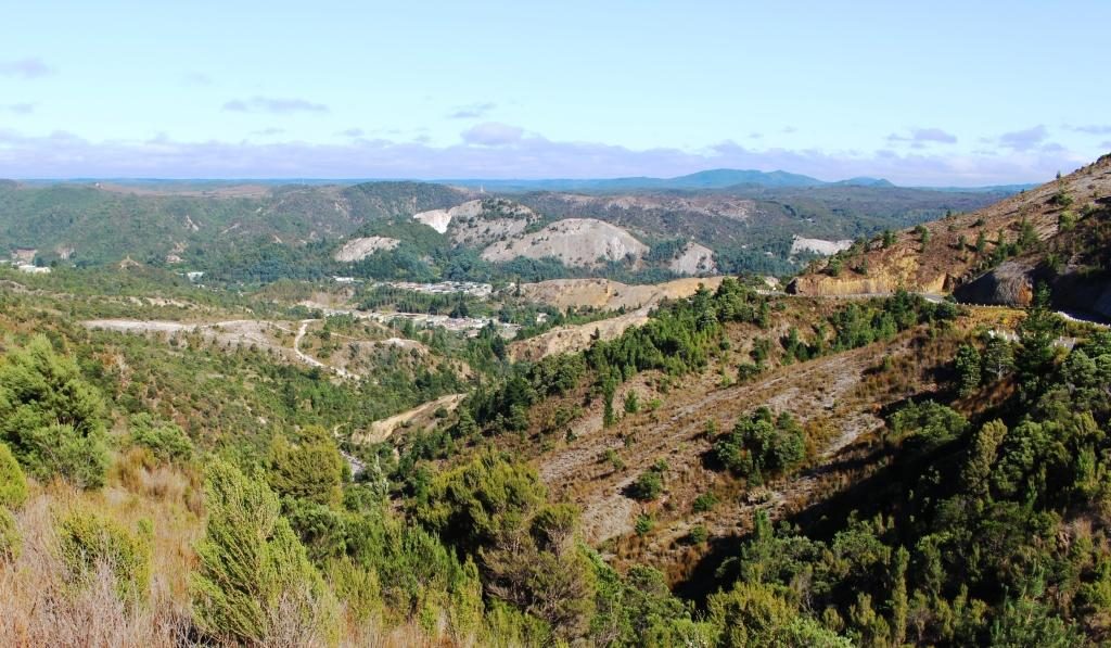
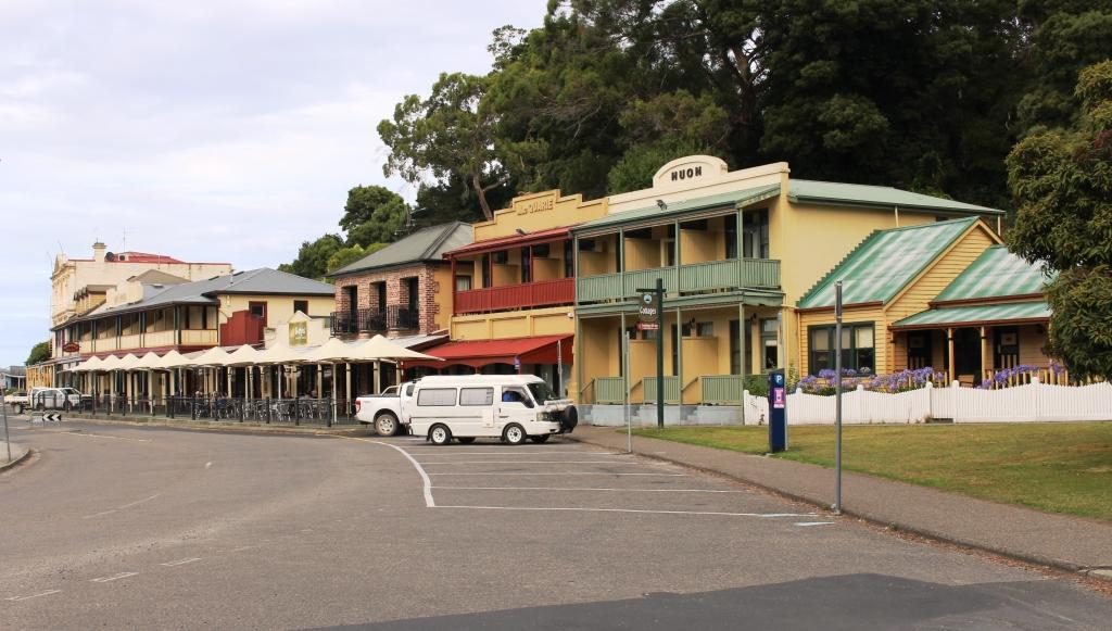
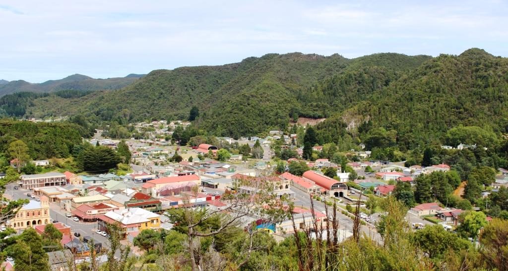
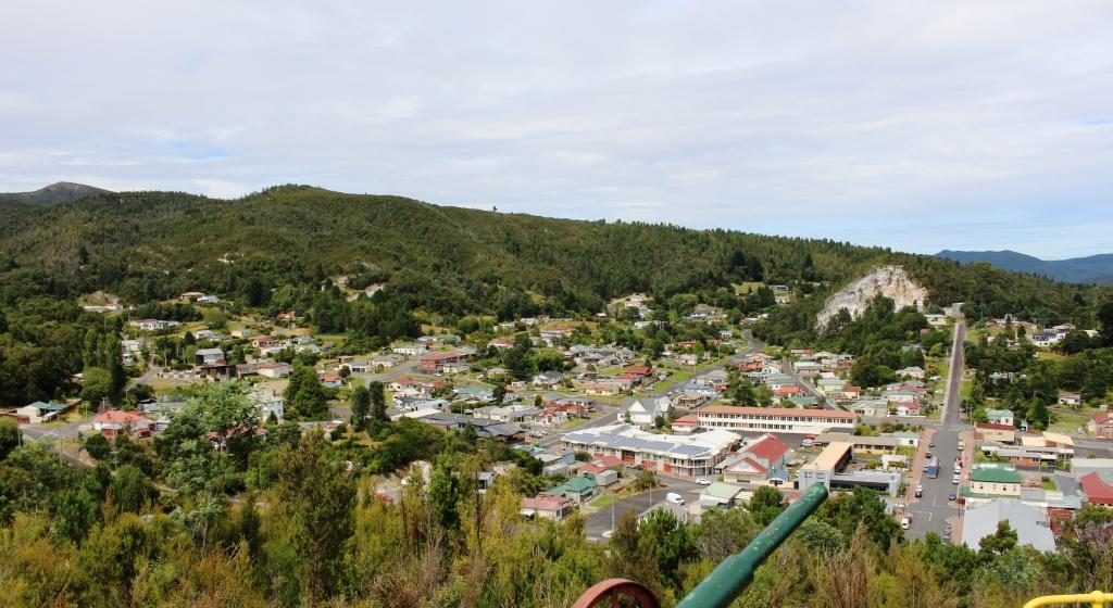
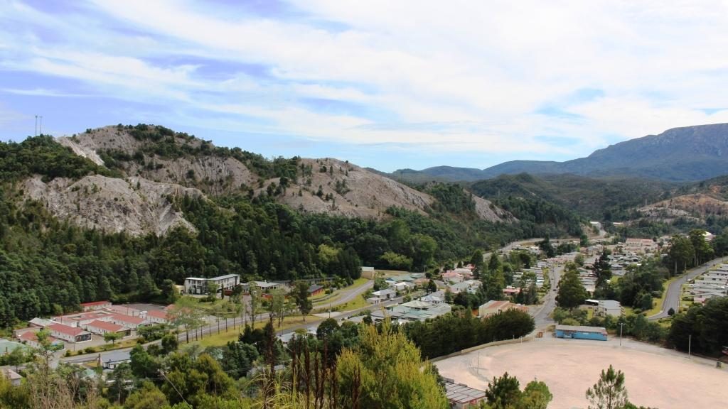
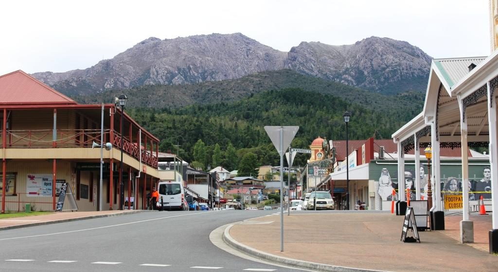
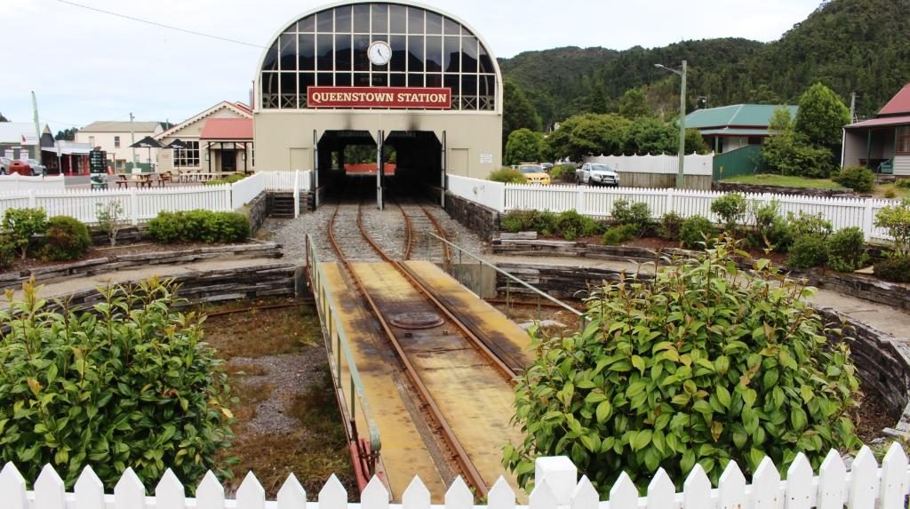
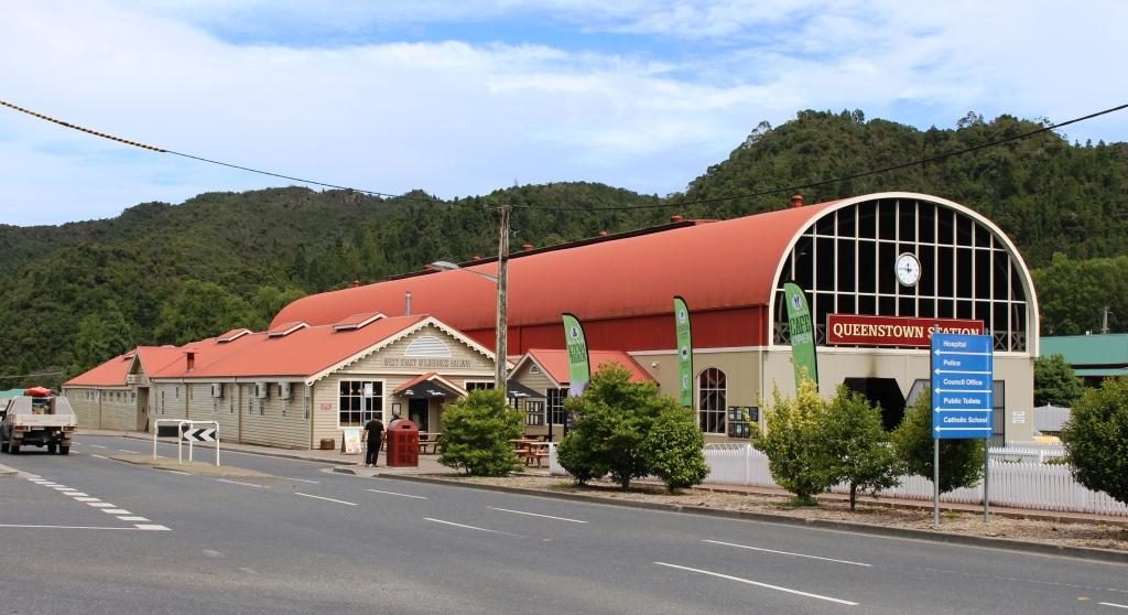
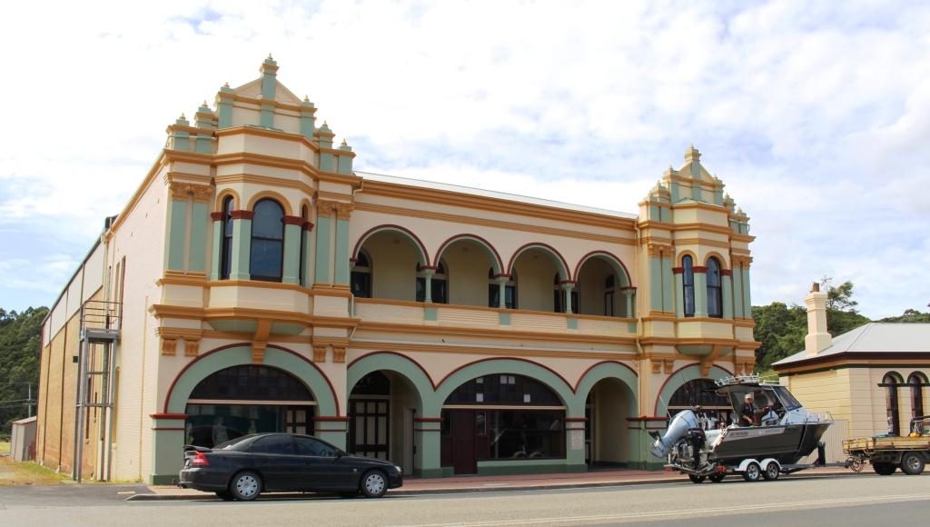
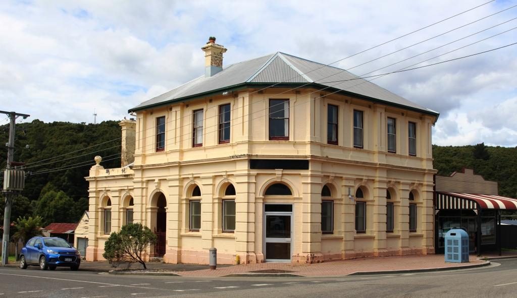
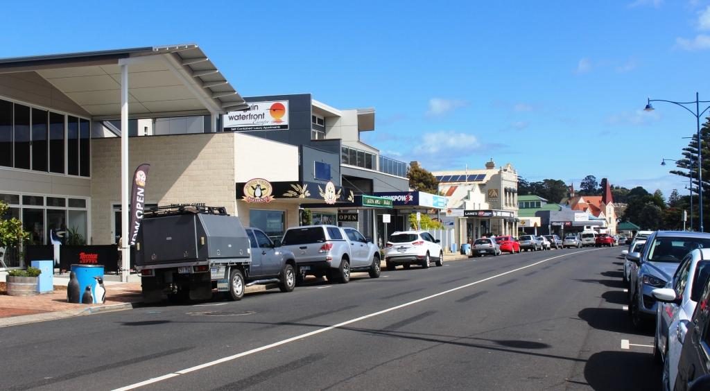
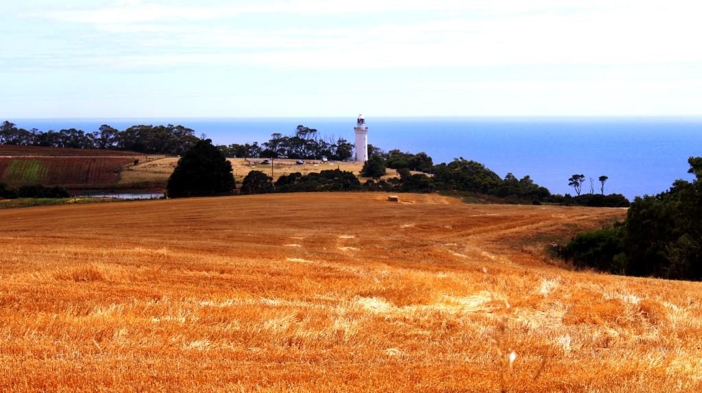
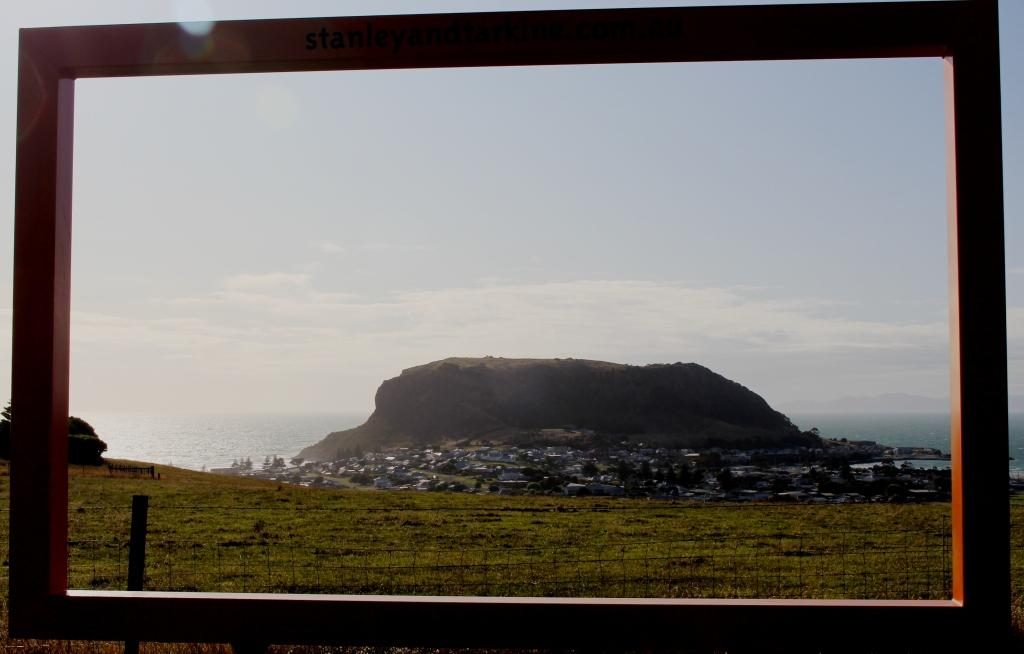
We paused at Queenstown for fuel and stopped again at the observation point part way up the baron slopes for that final view of the town.

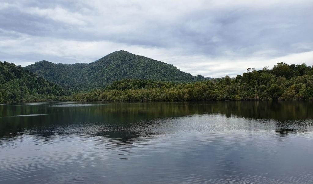
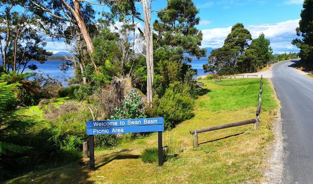
Lake Burberry is one of Tasmania’s newer dams. The Lyell Highway crosses it by bridge at its narrowest point.  A National Parks camping area on the east bank provides picnic facilities, so we stopped there for morning coffee.

Lake Burberry has a good boat launching ramp

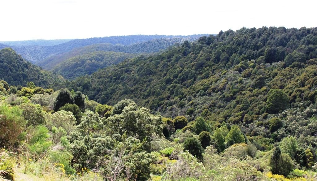
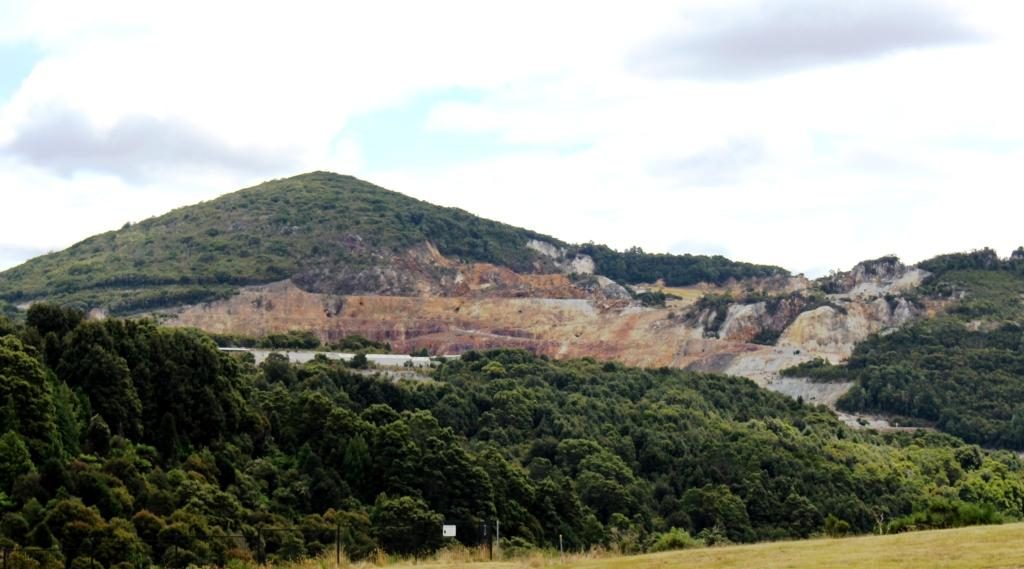
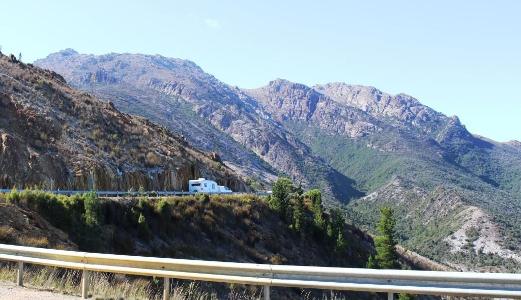
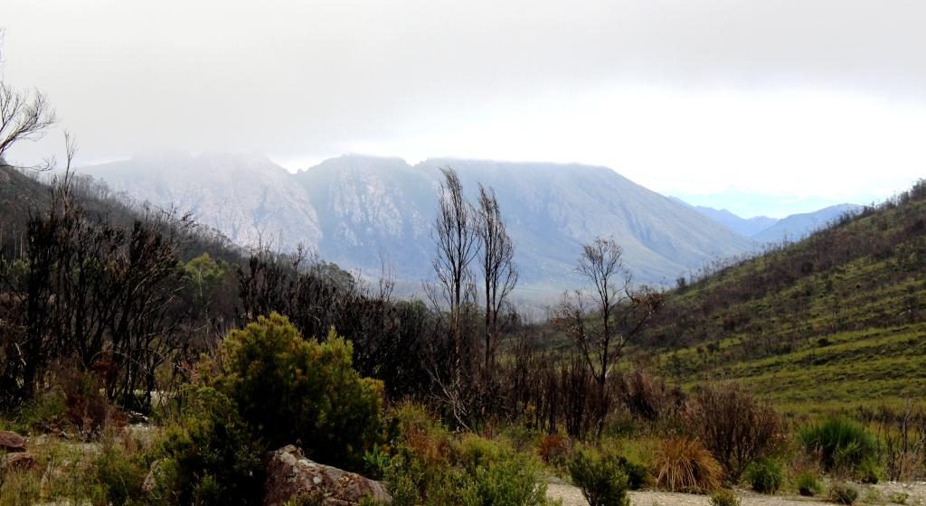
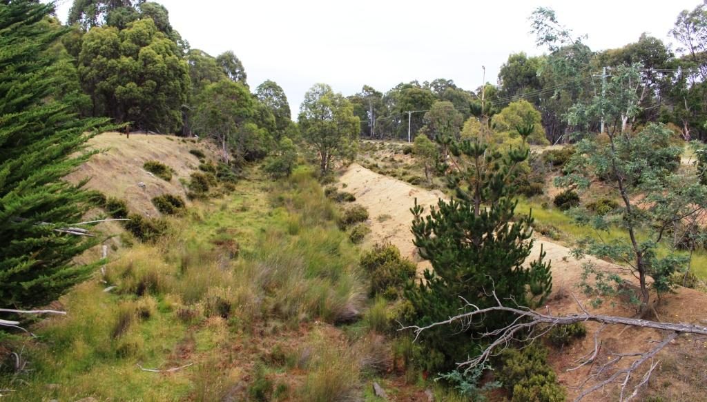
The road from the dam to Derwent Bridge runs through endless national park, and is lined with an infinite variety of vegetation as it passes over mountain ranges and through rain forest filled valleys.

Information at the highest point on the Lyell Highway between Queenstown and Derwent Bridge
A view into misty mountains at the geographic high point

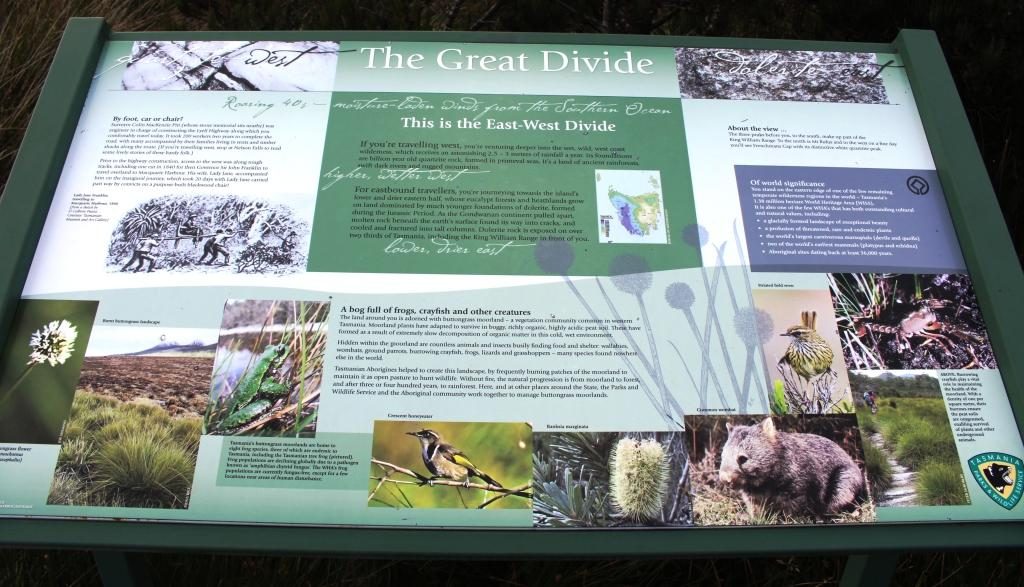
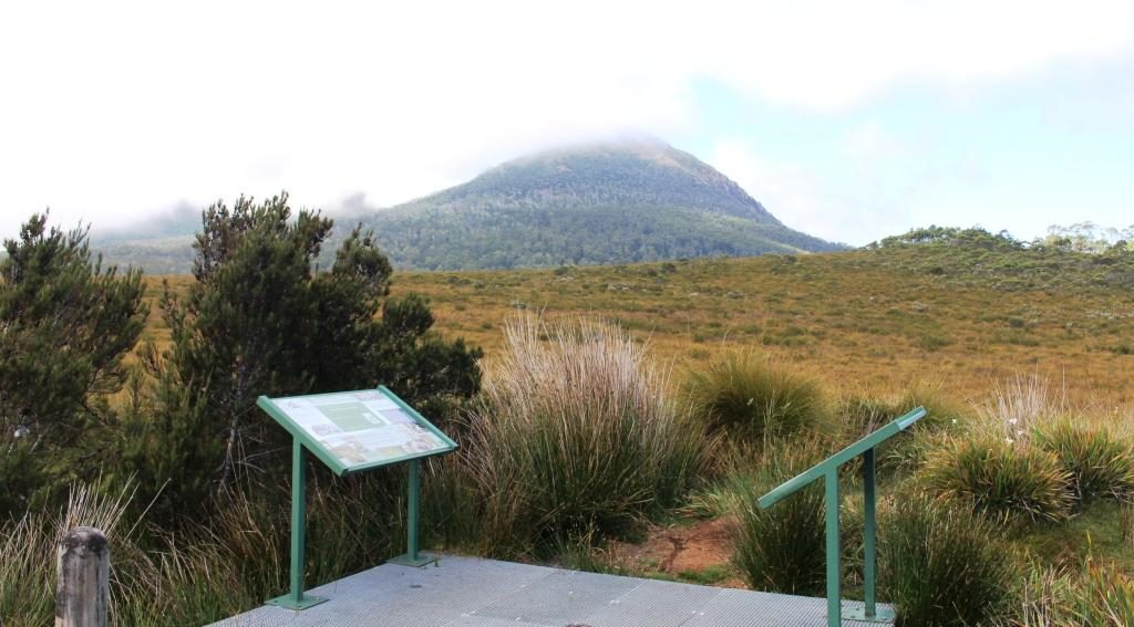
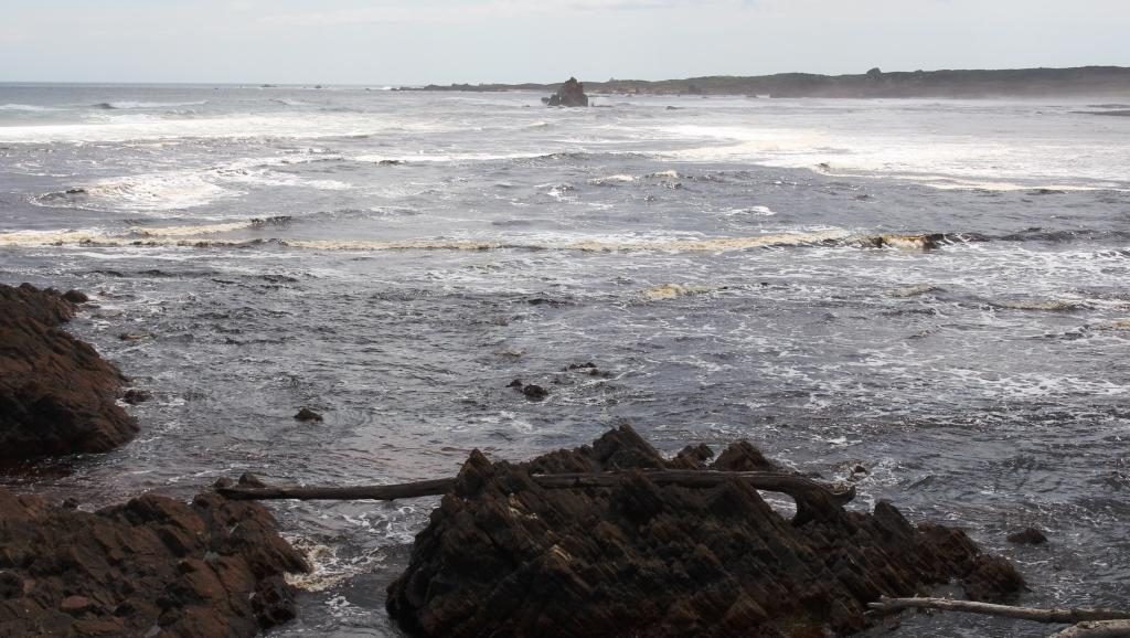
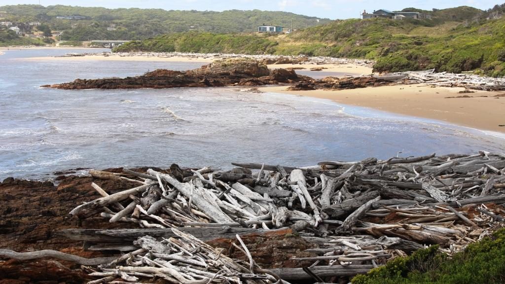
At a number of places along this road there are parking areas giving access to short to medium walks to features such as lookouts and waterfalls.  One parking area is the starting point for longer walks that extend to several days in the area of the Frenchman’s Cap range.  Another stop marks the highest point in the range that divides east from west. Interestingly, we could see Frenchman’s Cap from the boat on Macquarie Harbour.  At 1,446 metres it is quite prominent.

National Park visitor centre at Lake St. Clair

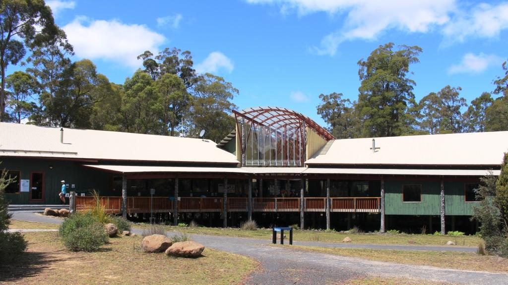
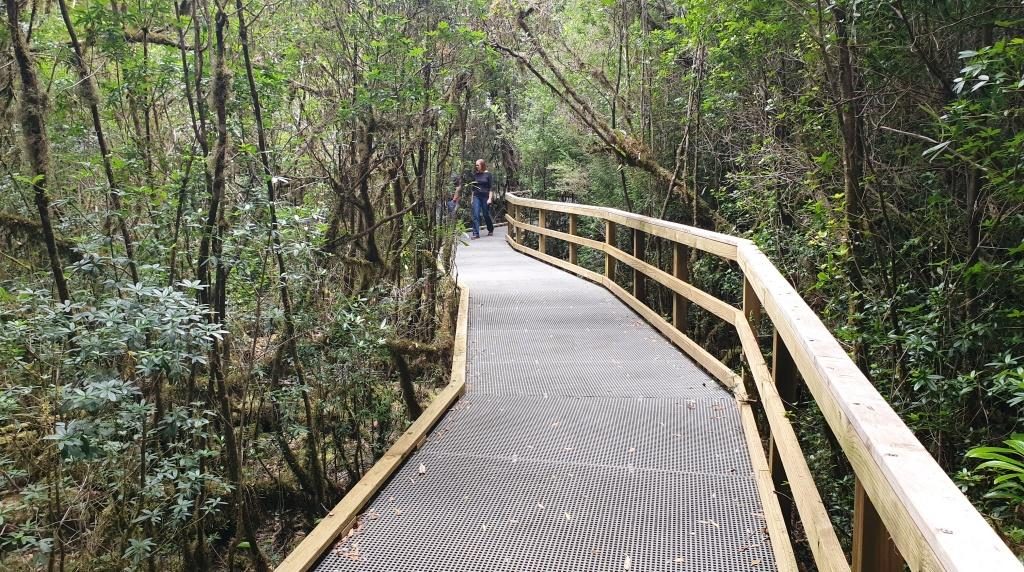
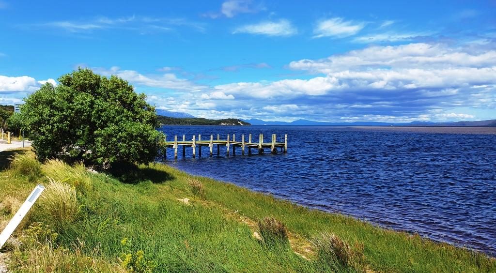
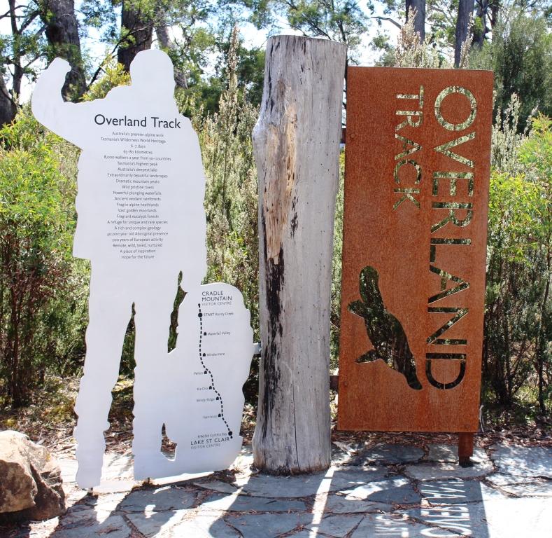
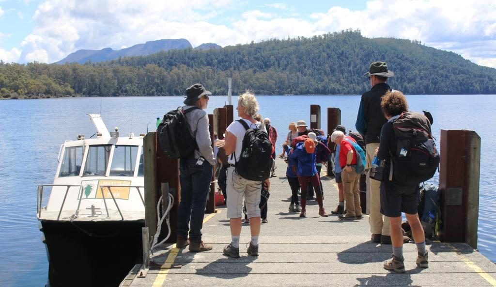
We turned at the small town of Derwent Bridge for the short drive to the Lake St Clair National Park Visitor Centre.  As well as being a worthwhile place to call, it is the southern end of the Cradle Mountain to Lake St Clair 6 to 7 day walk.  Many hikers, carrying back packs, were either arriving from the walk or waiting to leave to walk north.  A ferry service links the southern end of the walk with the visitor centre at Lake St Clair.

The official end of the Overland Trail from Cradle Mountain to Lake St Clair

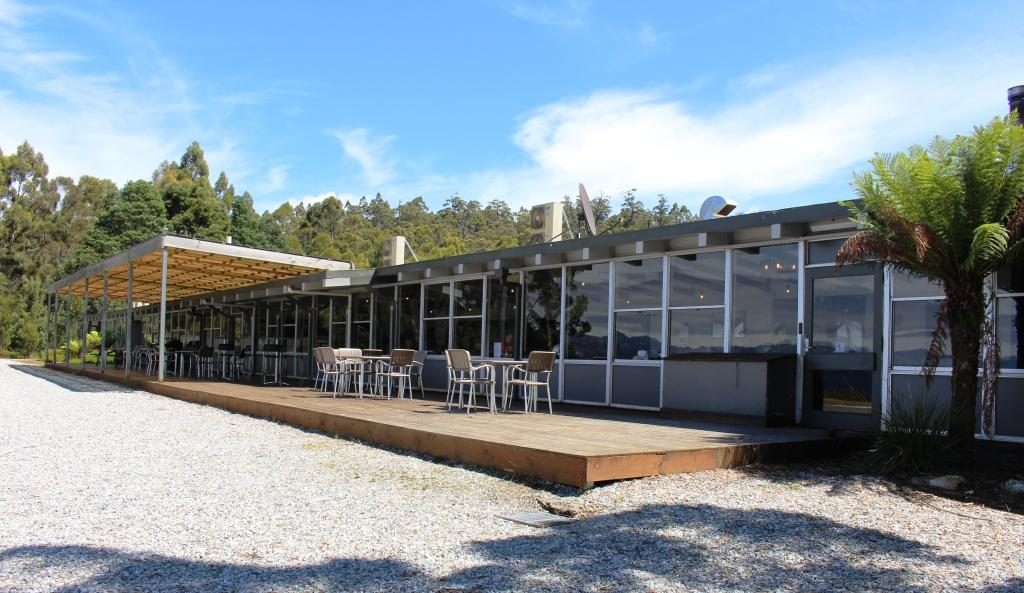
We had intended to have a picnic lunch at Lake St Clair, but we were attacked by a swarm of March flies. Tasmania seems to have a March fly plague but today was the worst that we had encountered.  So the picnic went back in the car and we took refuge in the restaurant.

Arriving and departing hikers at Lake St Clair ferry

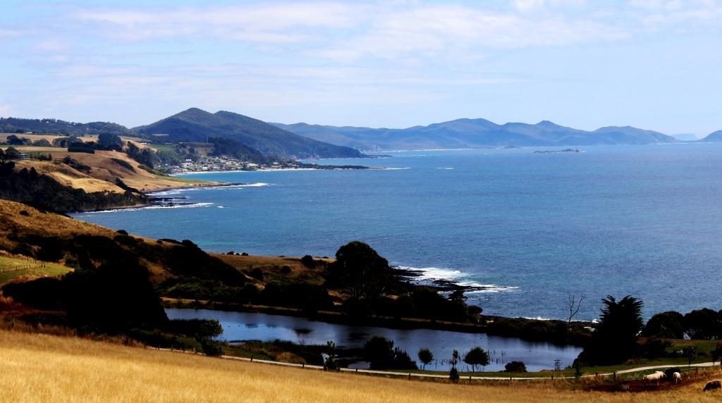
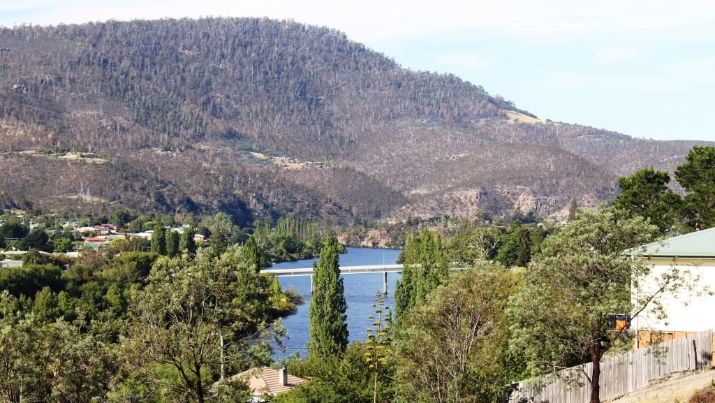
It is about 140 km from Derwent Bridge, mostly down the Derwent Valley, to New Norfolk. Most of the journey is through mountainous timbered country. The road passes a number of dams used for hydro electricity generation.  In the Tarraleah area, we saw a couple of sets of huge water supply pipes descending steeply into power stations.

Derwent Valley near New Norfolk
Hop fields, Derwent Valley

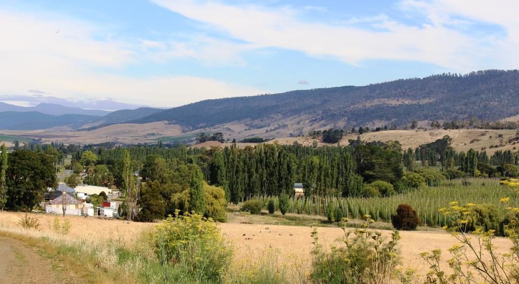
The forests finally give way to farm country with grazing cattle beside the road.  Just before New Norfolk, orchards appear along the banks of the Derwent, which is quite a substantial river at this point.

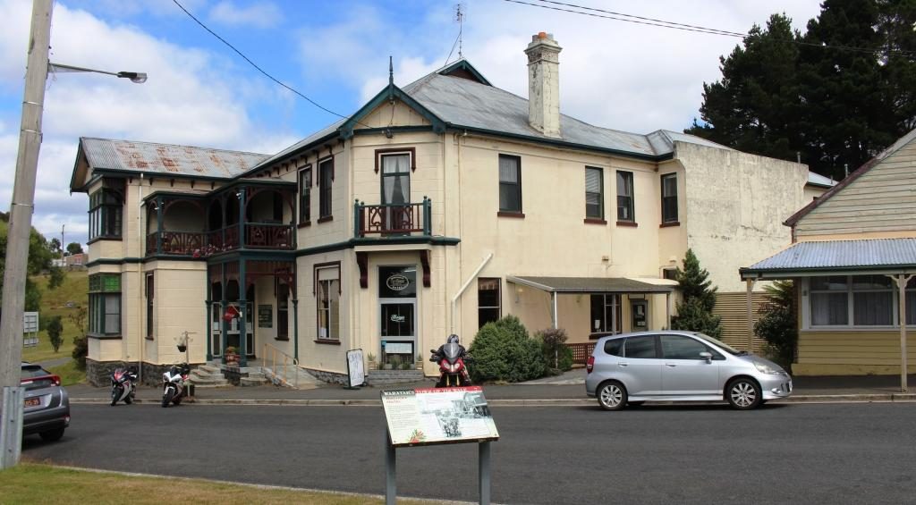
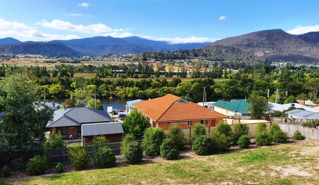
Our apartment was on a hillside overlooking the Derwent River, with views over the town on the eastern bank and the mountains beyond. We were there for three nights. New Norfolk was our first encounter with a digital reception. A sign on the door gave a phone number to call, A code was then sent, by text message. The code was our door key.

New Norfolk and the Derwent River from our balcony at New Norfolk
Lyell Highway bridge over the Derwent at New Norfolk

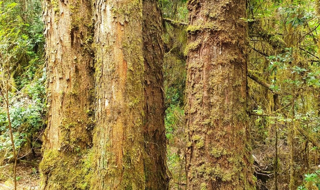
If someone tells you that more trees should be planted, tell them to visit Tasmania. We spent yet another day driving through trees, trees and more trees. Tasmania’s south and south west have an abundance of trees.

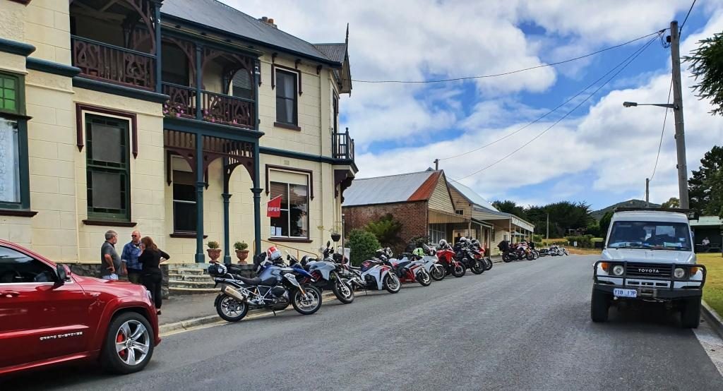
We started the day with some medical maintenance at a New Norfolk pharmacy and then headed for the trees and the mountains. In Tasmania trees and mountains seem to go together.

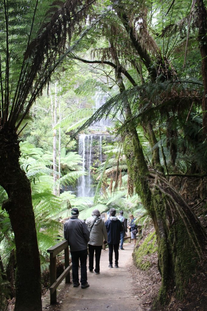
The road on the west side of the Derwent is a shorter route to Mount Field National Park. There is quite a lot to do in this extensive park but time limited us to the short walk to Russell Falls. Like many falls walks the path leads along the ravine that carry the waters of the host stream. The view of the tiered cascade is all the reward needed for the easy 30 minute walk.

Russell Falls, Mount Field National Park
Russell Falls are popular. It was hard to get photos without strangers in them.

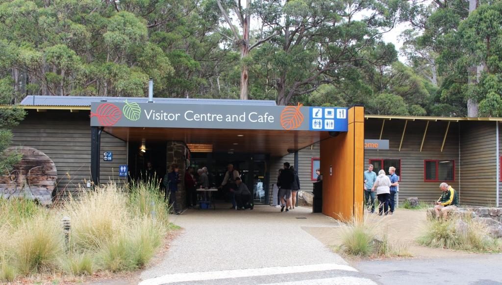
Like Lake St Clair, the visitor centre here was busy. There are a number of walks and other attractions and it is only about 80 km from Hobart. Some walks lead to elevations that provide views back along the Derwent Valley to Hobart. Given an absence of cloud, of course.

Mount Field National Park Visitor Centre.

We then drove on a further 95 km along the Gordon River Road to reach the Gordon Dam and Lake Gordon. It is a lonely road passing through a handful of small locations, the last and most substantial of which is Maydena, followed by 70 km of sealed mountain forest road.

Misty mountain on the road to Gordon Dam

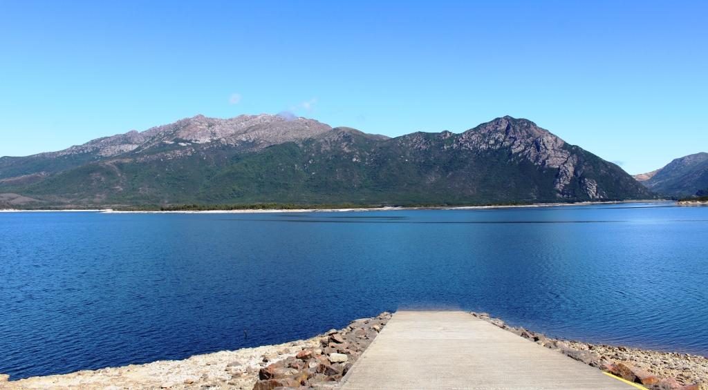
Lake Gordon and its neighbour, the better known Lake Pedder, are just over a ridge from each other at Strathgordon. There was a huge environmental fight over Lake Pedder that the Hydro Commission eventually won, which helped achieve its icon status.

The Sentinel Range near Lake Pedder

Strathgordon was only ever a dam construction town. Nothing much has changed, with administration and some worker accommodation still there. What was, I think, the single worker facility, is now a wilderness lodge that provides accommodation as well as the facilities of a pub, cafe, restaurant and coffee shop.  Fuel is available as well.

Lake Pedder Wilderness Lodge
View of Lake Pedder from the Lodge

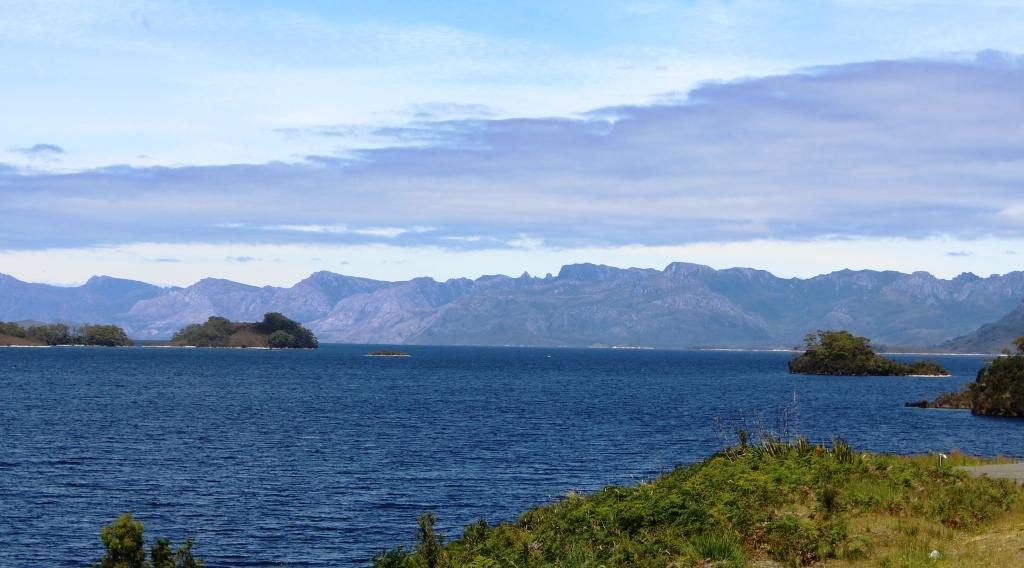
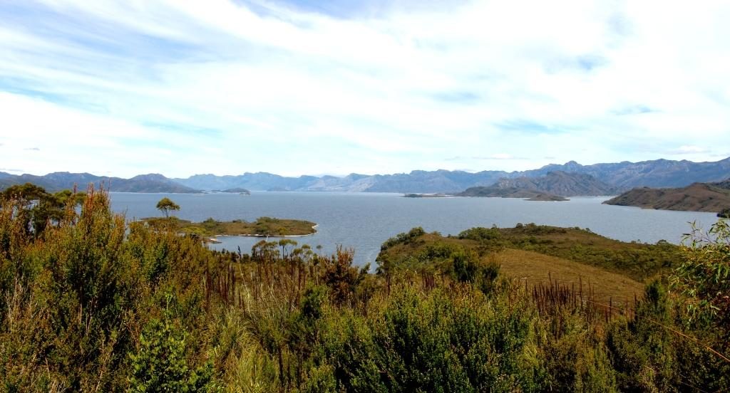
These huge water storages look fantastic as they lie among the mountain ranges, some of which are densely forested and others massive piles of almost bare rock. A clear sky produced striking reflected blue water.

Gordon dam is 140 metres high

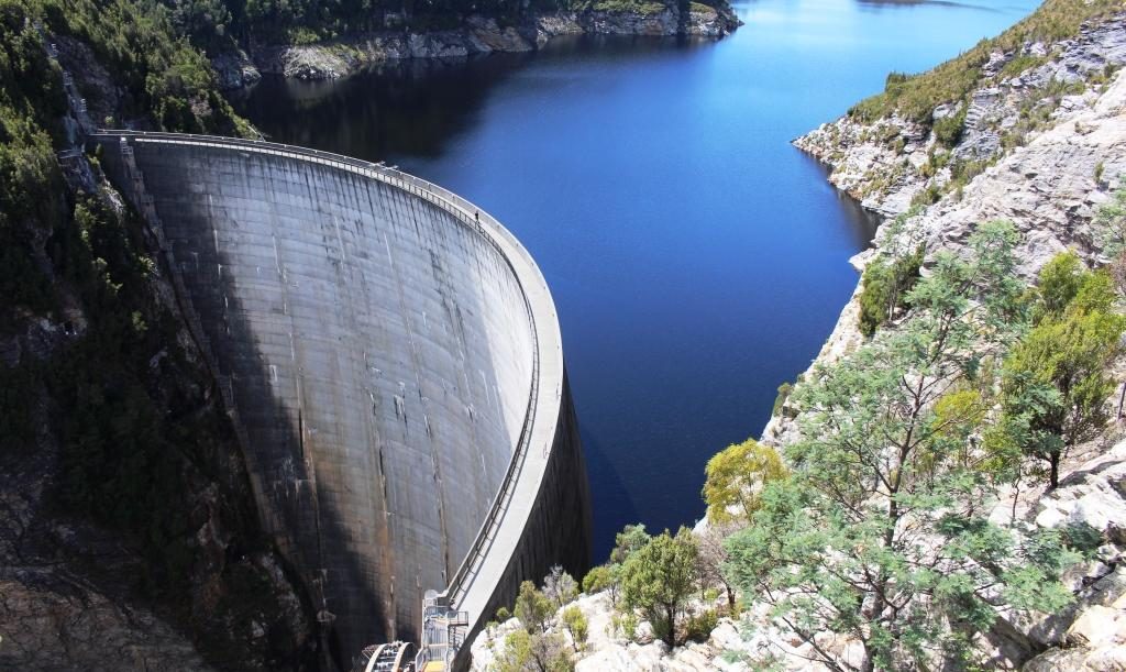
The dam that holds back the waters of Lake Gordon is quite a sight at 140 metres high with a pronounced curve in the wall to cope with extreme pressure. Both lakes cover more than 500 square kilometres and hold the equivalent of 37 Sydney harbours.

The bottom of the wall of Gordon Dam is accessible by these stairs. It is a long way down.
Outlet and part of the power station at Lake Gordon
Lake Pedder from the road to Gordon Dam
This channel carries water from Lake Pedder to Lake Gordon

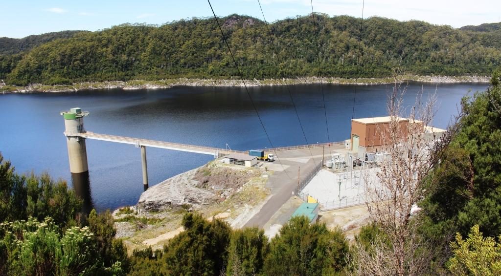
Gordon and Pedder dams are connected by a narrow channel that carries water from Lake Pedder to Lake Gordon. Lake Pedder appears not to have its own hydro power generator. Its water is directed through the Lake Gordon.

The return journey is over the same road as we travelled outward bound. We used Maydena as an ice-cream stop, pleasantly absorbing the warmth of the afternoon sun as we enjoyed the treats. And so, back to our comfortable unit, which was easily the best accommodation that we had so far occupied in Tasmania.

The next day, Friday, dawned overcast with a chill breeze. Just the day to drive through areas where snow regularly falls during winter. We were bound for The Great Lake in the Central Highlands of Tasmania but by an indirect route.

We drove down the east bank of the Derwent River to Bridgewater and joined Highway One, heading north. Downstream from New Norfolk, the river is not as confined by its banks and sprawls into wider expenses of water, some of which are shallow and marshy. The bridge at Bridgewater is at one this wider area so the bridge is rather long with a causeway and a lift section for taller boats.

Historic houses at Bothwell are still in use

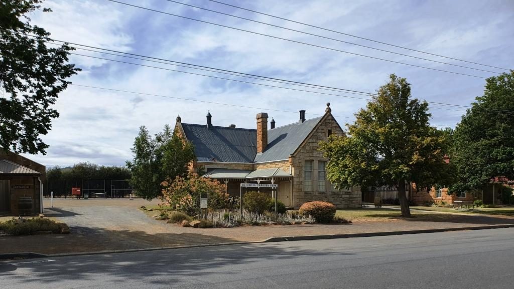
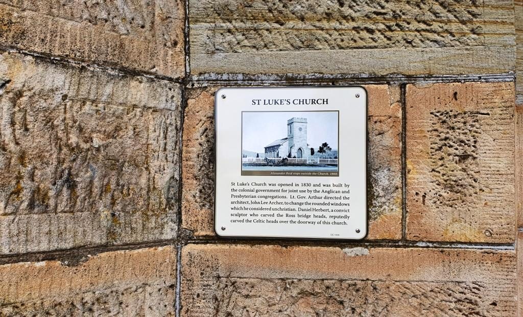
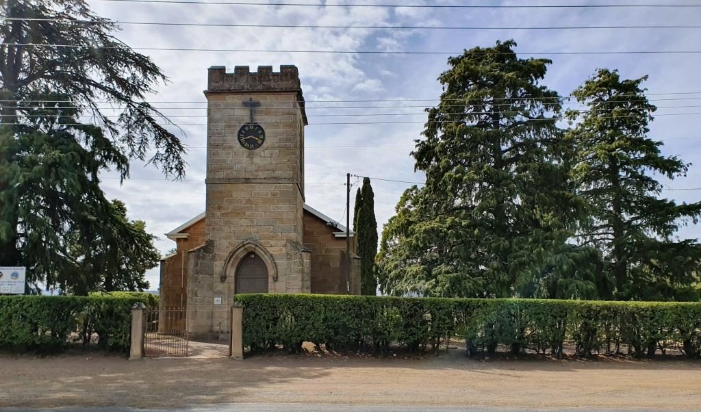
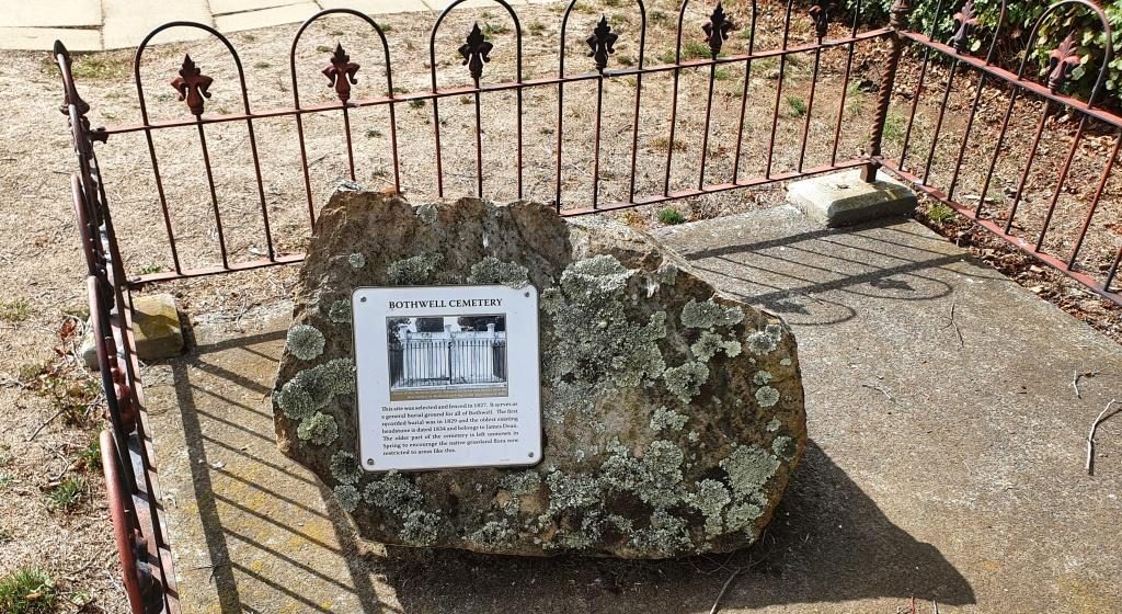
Highway One, the Midland Highway is the main road link between Launceston and Hobart. After about 50 km we turned left for Bothwell, a small rural town, full of historical buildings. A sheltered corner in the park provided a morning coffee stop and a pause while we looked at history dating back to early settlement in Tasmania. The area was settled by farmers in the 1820s.

The visitor information centre at Bothwell
Historic plaque on St Lukes church in Bothwell, The plaque dates the building at 1830.
St Lukes church was built in 1830
Part of St Lukes’ cemetery

After Bothwell, the road continues to the North West until Miena is reached. Miena is a spread out town of highland holiday houses and well housed permanent residents. A couple of small hills provide lots of water view opportunities over the southern end of the Great Lake.

The Steppes Sculptures information board

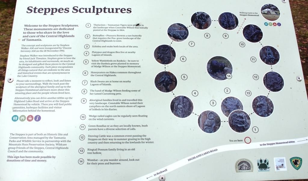
The only real point of interest along the road to Miena, about half way, is a collection of sculptures, in the bush just off the road. They are at the end of a short dirt road with a small parking area. The road is marked by a simple sign that announces the “Steppes Sculptures”.

Plinths holding animal sculptures form a circle

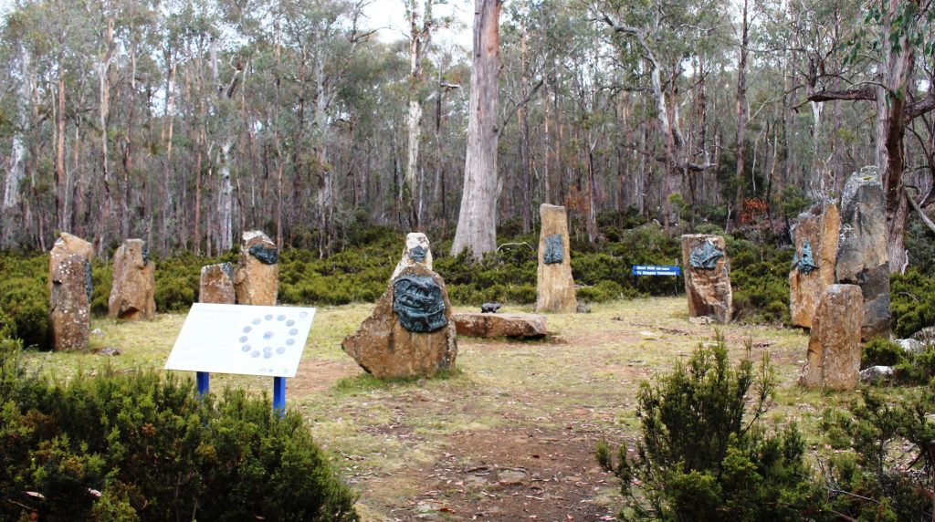
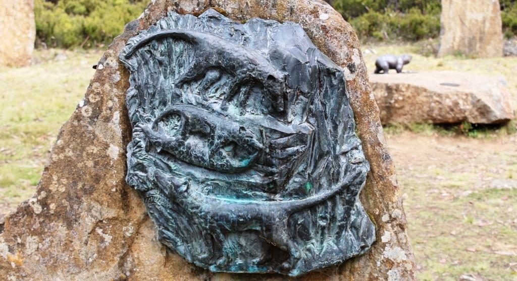
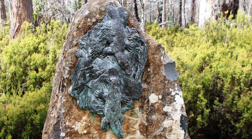
A short walk away a circle of twelve stone plinths each hold a bronze sculpture with a thirteenth in the centre. They are the work of Stephen Walker, a well known sculpture who has work that decorates the Hobart waterfront and who sculpted the whale memorial at Cockle Creek. More of Cockle Creek in a future post.

This appears to be a Tasmanian Devil
Sculpture of Platypus

The area is known as The Steppes, presumably because it is part of the area that “steps” up to the highlands. A historic farm house on the property can be visited either by a short walk or a short drive. We passed up on the house as it is not often open and it was not a day to be out of the car for too long without being rugged up.

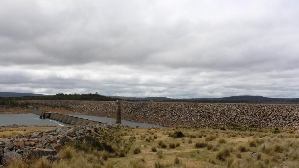
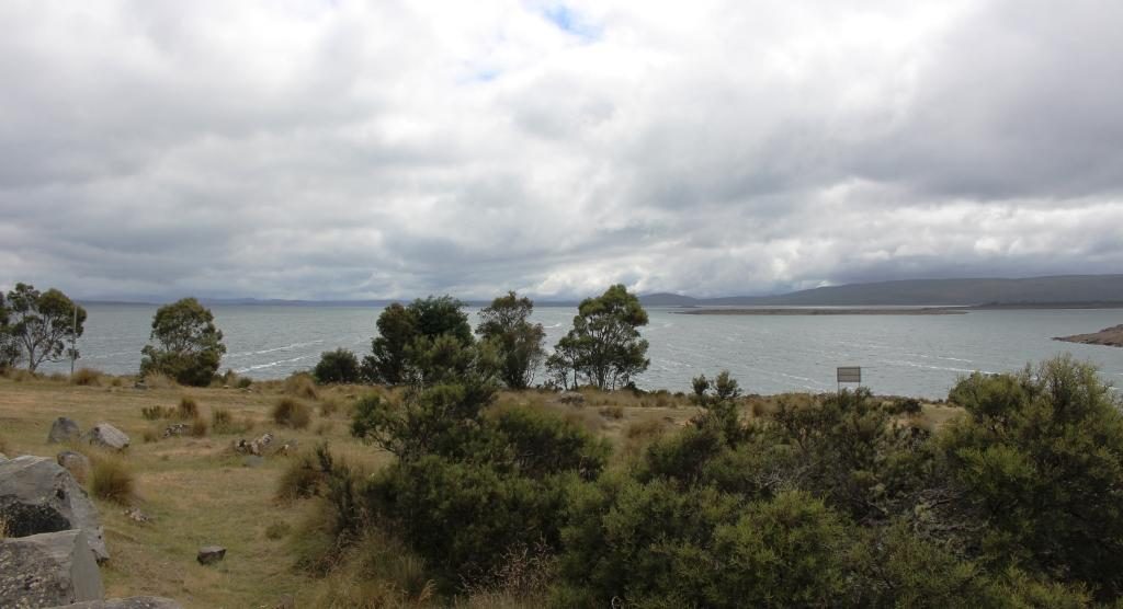
Just before Miena we pulled off the road to look at the Miena Rockfill Dam the construction of which created The Great Lake by backing up the Shannon River and caused two smaller lakes to become one much larger lake. A lookout provides excellent views of the retaining wall and the lake that backs up to the north, way out of sight. On the south side of the lake is Shannon Lagoon. But more of that shortly.

Mienna Rockfil Dam holds back the waters of The Great Lake
The Great Lake viewed from the South

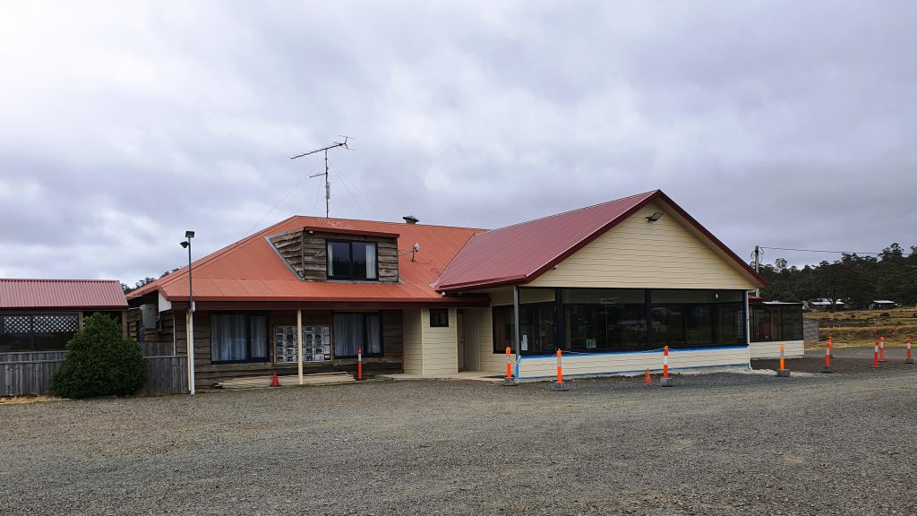
We drove further into this very spread out town and found the Central Highlands Lodge, a sort of guesthouse hotel of the kind that you find in these kinds of places. We were served a good hot meal suitable for the day and, of course, coffee. We then drove on through the town and along the road to the west of the lake that would have taken us to the Bass Highway, but the clouds were below the tops of the distant mountains and showers of rain were moving over the surrounding planes and across the lake. Frankly, it was quite uninviting, so we turned around and headed back into town.

Central Highlands Lodge provided a lunch suitable for a cold day
Part of the town of Miena

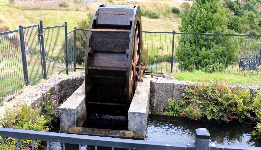
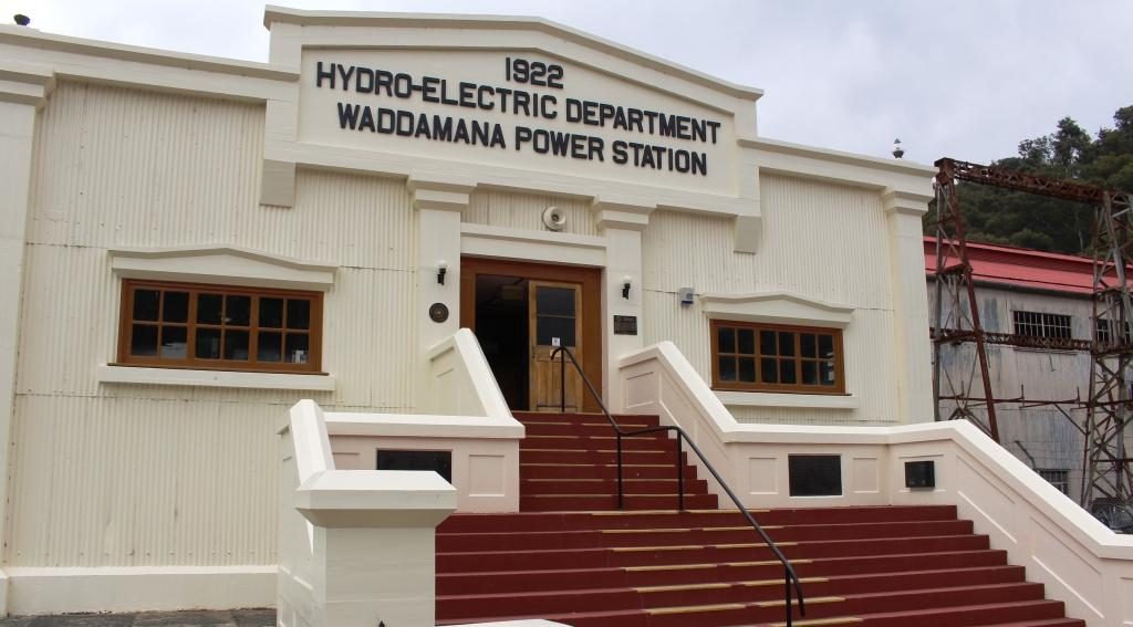
When I was learning about Mount Bischoff tin and Mount Lyell copper at school I was also learning about the Tasmanian hydro electric generation industry and particularly Tarraleah and Waddamana. I remembered Tarraleah because we had spent a night there 45 years ago and it had snowed. We had driven through this town two days before and noted its steeply sloping water pipes feeding the generators. But where was Waddamana? That question was answered on the drive earlier in the day when we had seen a sign pointing to Waddamana and the historic hydro electric trail. The turn was about 15 km back towards Bothwell.

The Historic Hydra Trail had information signs at regular intervals describing the project
The water supply channel as pictured on the information sign
Water supply channel as it is now

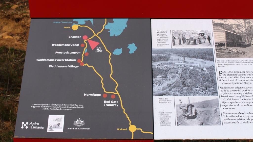
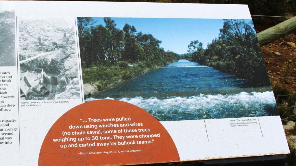
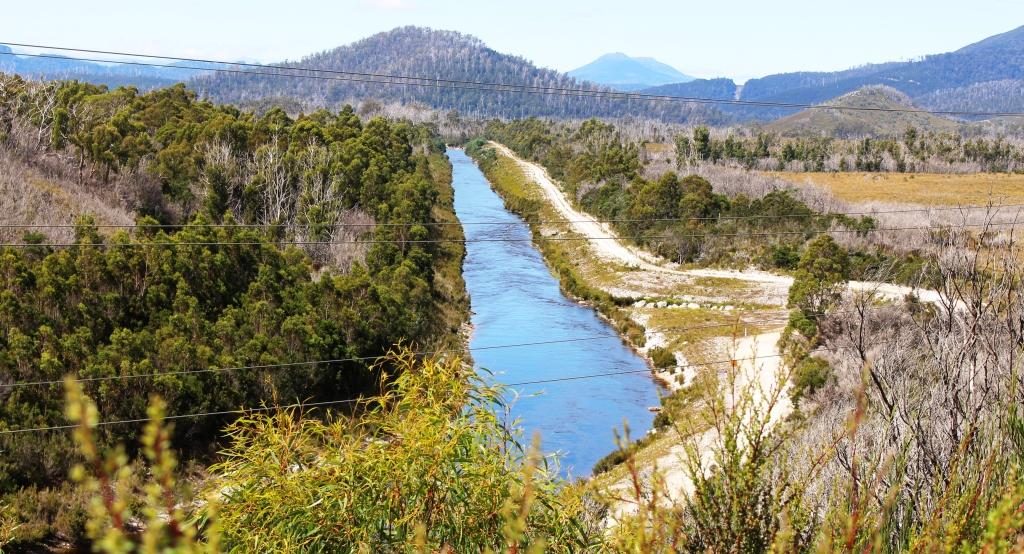
The great lake is the birthplace of serious hydro electricity generation in Australia. It all started in about 1910 when a dam was built at the bottom of The Great Lake which channelled water through pondages and canals to the top of a steep slope and shot it down the slope to Waddamana A power station. The scheme was commissioned in 1916, held up by bad weather and the start of WWI.

Penstock Lagoon was the final holding basin before the water was released into the channel and pipes that fed the turbines
Old water supply pipes protruding from the retaining wall at Penstock Lagoon
This channel leads to the point where the water enters the large pipes for the final plunge to the turbines

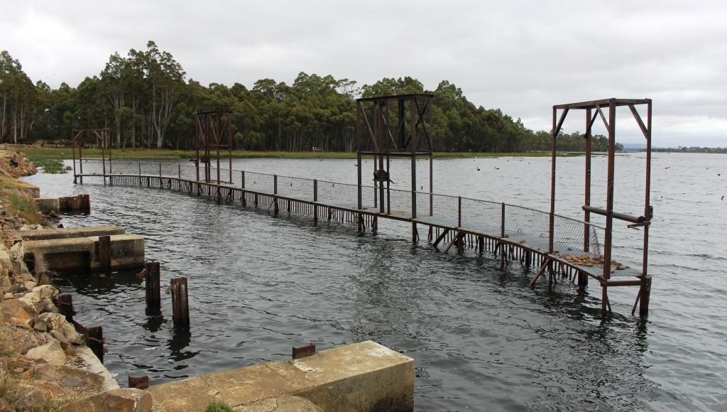
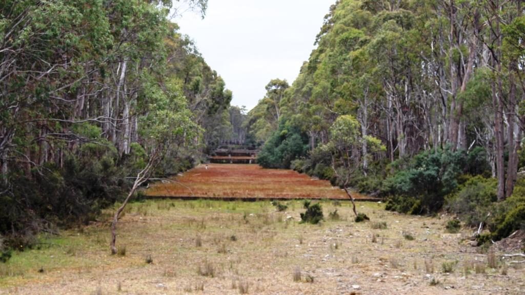
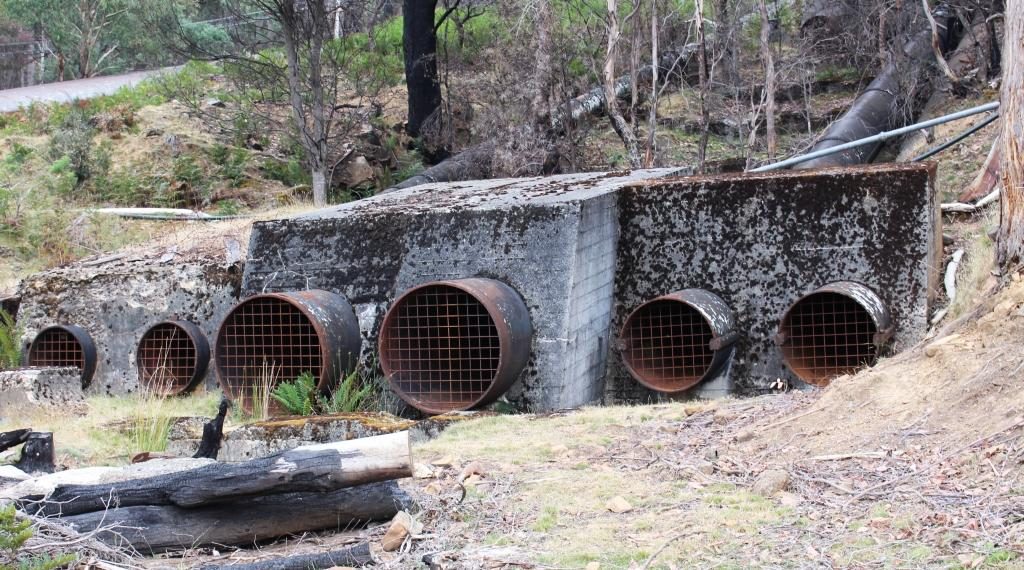
Shannon Lagoon was a balancing pondage which fed water into a manmade channel that carried water to Penstock Lagoon. From this temporary storage water was released into another man made channel and then down the precipitous mountain side to Waddamana A. There was a construction town named Shannon but it ceased to exist many years ago.

Entrance to Waddamana power station
Information boards for stations A and B at Waddamana

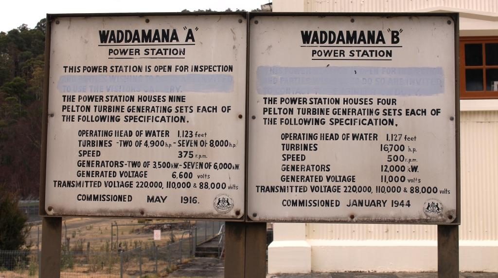
Waddamana B was commissioned 1946 so was slowed, in its turn, by WWII. This expansion of generation capacity greatly increased the output of Waddamana and helped to set the paten for future power generation.

Turbines in Station A. The water was used several times as it flowed through the line of turbines. This photo shows a turbine with its protective cover removed.

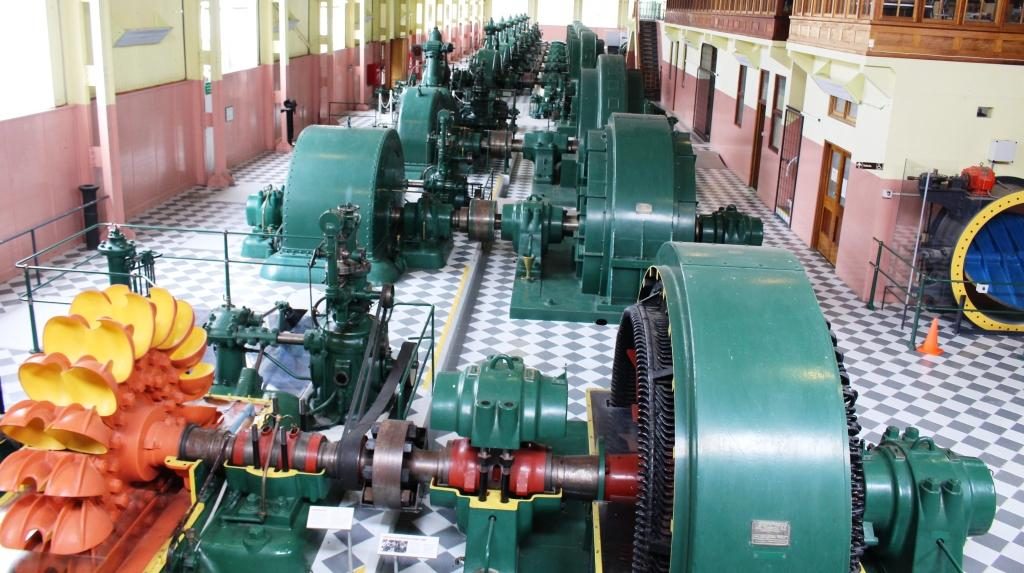
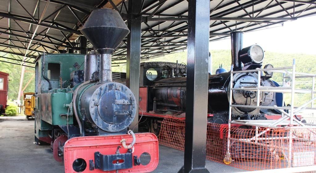
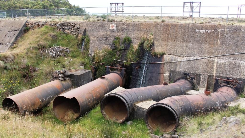
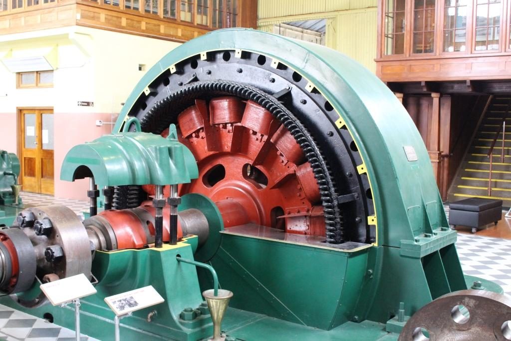
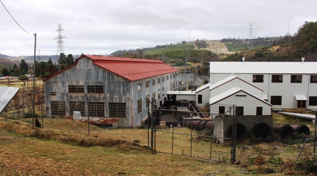
Waddamana A is now a museum with most of its turbines still in place with some cut away to show what really makes the system work. I was able to walk through among the equipment and gained a good understanding of it. Most of the pipes that fed water to the turbines are still in place although truncated and often incomplete.

A partly stripped view of the electricity generator
Truncated pipes at the bottom of the hill behind the power stations.

There was a small town at Waddamana back then which is still there but not used for power station workers any more. Some of the houses appeared to be occupied. On a hill above the town and power station a new and substantial wind farm has been built. The wind vanes were still against the afternoon sky but we heard on the news a few days later that is had been officially commissioned and was in production.

Waddamana A on the left and B on the right,.

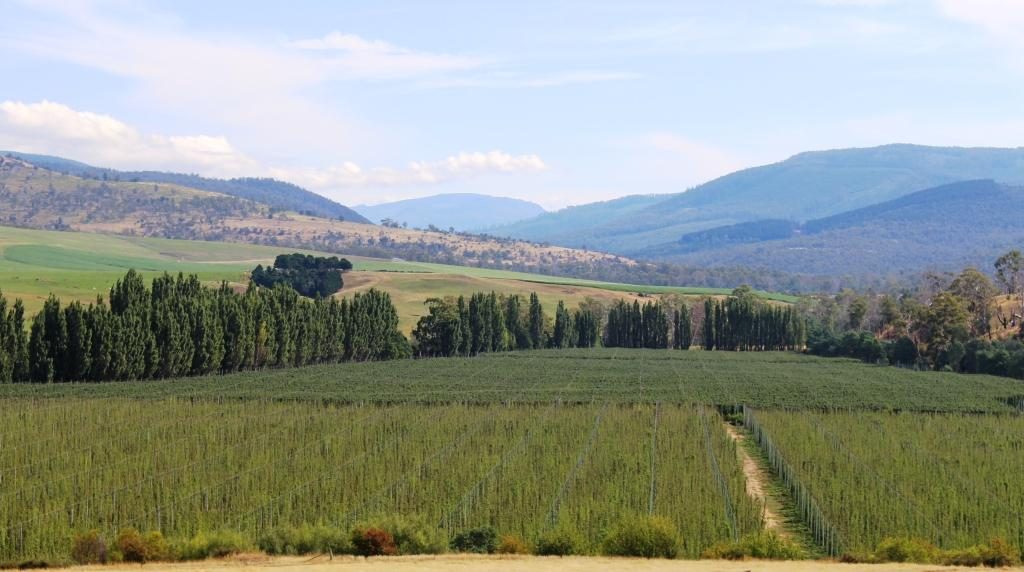
We made our way home on an alternative road that was sealed so long ago that it was like driving on gravel but it was in surprisingly good condition. It brought us back to the Lyell Highway at the town of Ouse which is on the Ouse River, a tributary of the Derwent. The final part of our drive was again through the vinyards, orchards and hop fields of the Derwent Valley.

https://youtu.be/QPqo67G5Srg
https://youtu.be/QJOtfudx6wQ
https://youtu.be/IqBL0Q8WuLA

Destination Tasmania – Part 4 – Strahan, Queenstown and Zeehan

10th & 11th February, 2020

Please Note: Videos covering the material in this blog post can be found at the bottom of the post.

Heritage Tours boat “Harbour Master” at Sarah Island jetty

I suppose tours of Macquarie Harbour and The Gordon River were operating 45 years ago when we were last at Strahan, but I have no recollection of them. But that was well before the issue of the Franklin Dam and all of the disputes over Lake Pedder gave this area such prominence. We had become aware that the cruise was one of the attractions that draw tourists to Strahan. We booked in advance to make sure that we had a good seat.

The day started overcast and cool but improved to produce sunshine by mid afternoon. We were not affected by the morning chill as we were on board the “Harbour Master” our Heritage Tours cruise boat, protected by its broad glass windows.

Departing Strahan cruise terminal
Strahan Railway Station at Regatta Point

The cruise boat headed directly to Hells Gates, the entrance through which ships had to pass to reach the convict settlement on Sarah Island. The entrance is narrow and dangerous, particularly when a sea is running. In the days of sail, ships would anchor outside of the harbour, wait for slack tide and be towed through by sailors rowing the ship’s longboat.

Old Macquarie Heads Signal Station
Coloured rocks at Hell’s Gate
Hell’s Gate passage from the ocean side

There was no sign of Hell at the gates. The sea was like a mill pond. Not only did we proceed through the heads at full speed but continued out past the Cape Sorrel lighthouse into the Indian Ocean for a look both ways along the coast. Such conditions only occur about five times per year, we were told.

A breakwater and the coast outside Macquarie Harbour heads
Cape Sorrel Lighthouse at the south of Macquarie Harbour entrance
In the open sea. View south past Cape Sorrel Light
View from inside Hell’s Gate out to sea. Ships entering and leaving port had to pass between the channel light and the point on the left.

I had read about Sarah Island as a convict prison but for some reason thought that it was located near the heads. But it is at the other end of this rather long harbour. On our way to Sarah Island from Hell’s Gates we stopped to see the salmon and trout farms where the fish are grown to eating size in large circular mesh cages that are anchored in the waters of the harbour. There is nothing to see other than the nets but the skipper of the boat gave us quite a bit of information about the husbandry practices. In short, they feed the fish and the fish grow to eating size. What else is there to known?

Fish farms in Macquarie Harbour
View to the east in Macquarie Harbour

Sarah Island had the worst reputation of any Australian convict settlement. It was established to gather Huon pine from the surrounding forests, but when the difficult harbour entrance restricted the transport of the timber, shipbuilding was established at Macquarie Harbour at the Sarah Island convict settlement. Well over one hundred boats were built with over half of them ocean going ships.

Walking ashore at Sarah Island
Sarah Island landing

A solid path has been built linking the ruins to the jetty for ease of access. Guides are on hand to tell tourists all about the settlement. You can still see remnants of the construction slipways embedded in the shoreline. There are ruins of buildings with information signage throughout. It is all very well done.

Remnants of boat building slipways in the shore line of Sarah Island
A larger ship building slipway and an alternative landing jetty
Information shelter

As we departed Sarah Island, the crew prepared a delicious buffet lunch of cold meats and salad including slices of Camembert cheese so large that you would think the stuff was made in Tasmania.

Cruise passengers with a guide at convict prison ruins
Ruins of Sarah Island Bakery
Information plaque showing layout of Sarah Island administration building

From Sarah Island we motored directly to the mouth of the Gordon River where speed was reduced to a sedate 5 knots or so. The destination in the river was Heritage Landing, where berthing facilities have been built for the boat and a board walk constructed to provide access to the rain forest that covers the steep sides of the Gordon valley. Particularly, it gives access to Huon pine in its natural setting. Huon pine is not only resistant to rot but also to the marine worm that destroys lesser timber. It is a slow growing tree. Large specimens are thousands of years old.

Excellent reflections are sometimes viewed on the Gordon but the wind had come up by the time we reached it so the surface was a series of ripples instead of a mirror.

The placid Gordon River near where it joins Macquarie Harbour
Boardwalk to Huon pine viewing area at Heritage Landing

As we cruised slowly up the river the skipper retold the story of the Franklin River protests of thirty or forty years ago when the Tasmanian Hydro Electricity Commission wanted to build a dam on the Gordon River downstream from where it is joined by the Franklin River. If you are over 60 you will no doubt remember all the fuss.

Mature Huon pine
The “Blue Boat” from the other cruise operator at Strahan

On the quayside at Strahan there remains an operating sawmill that processes Huon pine. The cruise boat completes the tour by berthing at the mill to enable passengers to see the Huon pine being worked. The mill sells completed timber products including a range to appeal to tourists with spare money. I would rather spend the money on the finished product of the fish farm.

The sawmill that works Huon pine at Strahan wharf

Our second day in the South West was set aside for a driving tour in the area. We did the triangle Strahan-Queenstown-Zeehan-Strahan, about 125 km. But before heading off on the 47 km first part of the trip to Queenstown we took a closer look at Strahan.

We first visited Regatta Point to look at the Strahan end of the Queenstown to Strahan tourist railway. This service operates on the railway built to get copper ore from the mines in Queenstown to the port, to be shipped to the world.  Because of steep inclines on the route, part of the track uses a rack and pinion system where drive cogs on the engine engage with teeth in a track that is positioned between the normal rails.

Strahan historic railway station
Cafe tables at Strahan station
Strahan waterfront area viewed from Regatta Point station

The station building in Strahan is the original, built in the late 1990s. It now contains a cafe and gift shop and normal tourist facilities.  We were a bit early for coffee, but the view from the tables on the old platform is such that you would not want to finish your coffee too quickly.

Historic buildings over the street from the wharf at Strahan
Tourist cruise base at Strahan
Strahan main street
Tourist accommodation overlooking Strahan waterfront

Queenstown occupies one of the most dramatic sites that you can imagine. It is totally surrounded by rocky mountain ranges, much without vegetation. Some naturally lack vegetation, but hills were denuded in a clearing frenzy to feed the copper smelters in the early days of mine operation.  It is a town where I would prefer not to be on a hot day.

Rocky mountains approaching Queenstown
Queenstown sign approaching from Strahan

We drove around to get a feel for the place and then walked around the main streets of the commercial area. We then located the nearest street access to the Spoin Kopf lookout which is conveniently located near the CBD, almost in the centre of town. I climbed the steep track to the summit and I am glad that I did. The view was spectacular. The lookout was built as a memorial to its namesake, a battle for a hill during the Boer War in South Africa.

Main business area of Queenstown from Spion Kopf
Queenstown suburbs to the east of the central business district
Mine workings and the corner of Queenstown where the highway passes through
Hills surrounding Queenstown were stripped of vegetation to fire refinery furnaces. The area is slowly re-vegetating.

Queenstown’s history has long been tied to the mining industry. This mountainous area was first explored in 1862. Later alluvial gold was discovered at Mount Lyell, prompting the formation of the Mount Lyell Mining Company in 1881. In 1882 the company began searching for and discovered copper. The Mount Lyell company ultimately became the Mount Lyell Mining and Railway Company.

Queenstown’s Empire Hotel. Completed in 1901.
View along Orr Street towards Mount Owen
Queenstown Post Office. Built in 1902.

The Queenstown end of the railway has a smartly rebuilt station that offers the same facilities as its counterpart at Strahan, but on a larger scale. We had lunch in the cafe and then waited a few minutes to watch the train come huffing in from its return trip to a point about half way to Strahan.  There was a good number of people on board who seemed to have enjoyed the experience.

Queenstown Railway Station and engine turn table
Queenstown Railway Station. New building for the West Coast Wilderness Railway
A steam engine at the end of its days work
Tourist cafe at Queenstown Railway Station. You can watch the train through the glass wall on the right

We then drove the 35 km or so to Zeehan, another mining town, but this time a producer of silver and zinc.  I am not sure of the status of mining in Zeehan but the town appears to be partly closed down. But it had its days of grandeur, demonstrated by the fine buildings that line its main street. The West Coast Heritage Centre is in Zeehan, housed in the ornate School of Mining and Metallurgy building.

Gaiety Theatre and Grand Hotel, Zeehan
Zeehan Post Office
Zeehan School of Mines and Metallurgy is now the West Coast Heritage Centre
The Railway Museum is part of the West Coast Heritage Centre
One of Zeehans banks

Returning to Strahan, we were on the same road as we had travelled two days before. We had noticed mining residue beside the road but we now had time to stop and take a look. Some old pieces of equipment were strewn over the area but it was not clear what kind of mining activity had been conducted there.

Mining area at Zeehan on the road to Strahan
Four wheel drive access to the beach at Henty Dunes

With time left in the day, before we returned to our cabin, we took the opportunity to drive out to Macquarie Heads, to see it from the land as well as having seen it from the boat. It is Strahan’s closest surf beech with a reasonable drive over sealed and dirt roads. There is also a caravan park and on the way out, a neat little picnic area with a boat launching ramp.

Jetty at Macquarie Heads
Swan Basin near Strahan
https://youtu.be/XTpxzJUPzcA
https://youtu.be/vDiJUQX9rmU

Destination Tasmania – Part 3 – North West Tasmania and the West Coast

8th & 9th February 2020

Please Note: Videos covering the material in this blog post can be found at the bottom of the post.

Leven River, Ulverstone

From Fourth we made the short drive to Ulverstone where we did morning coffee in a riverside park and had a drive around town. We then moved on to Penguin, where we again stopped to do the tourist thing. We were following the road nearest to the coast. Sometimes this was the Bass Highway and sometimes secondary coastal roads.

Sea side at Penguin
Ruth and the Big Penguin at Penguin
Penguin main street

After Penguin, Burnie is the next major town. It is a significant sea port, handling export cargo such as wood chips and it handles much of the freight to and from the mainland. This port doesn’t have a harbour or major river mouth but the wharf area gets some shelter from a bit of a bulge in the coast. Burnie is probably the major industrial centre on the Bass Strait coast of Tasmania.

Port of Burnie from the Bass Highway

Wynyard is the next town and is home to the Burnie-Wynyard airport, which services the North West area. Wynyard has a beach and some retirement homes but not much more, other that to provide the eastern approach to and view of Table Cape, a flat topped promontory that pokes out into Bass Strait. 

Table Cape from Wynyard

The cape is elevated and quite prominent. It is a rich agricultural area with crops rather that sheep and cattle. One of its crops is industrial poppies, grown under tight governmental control, for the pharmaceutical industry. At its highest point a lookout is provided near to its lighthouse. The views of the coast in both directions and to the mountainous inland are excellent. There is also a popular tulip farm but we were not there at tulip time.

Wynyard from Table Cape
Table Cape Lighthouse over harvest stubble
An industrial poppy field.
Boat Harbour and the western end of the North coast

We bypassed Stanley, our stop over place for the night, and passed through Smithton to join the road that would take us to Arthur River and the lookout known as The Edge of the World.

Arthur River is a small remote settlement in the Arthur-Pieman Conservation Area, a reserve that covers a substantial proportion of the northern part of the west coast of Tasmania. One of the tourist attractions is a cruise on the river. There appeared to be two cruise boats, a red boat and a blue boat, but I think they have the same operator. Under the right conditions the reflections in the river are said to be magnificent.

Arthur River estuary
The troubled waters of the Arthur River bar, on a calm day

But for those, like Ruth and I with less time, the attraction is the Edge of the World, a lookout on an elevated dune just south of the mouth of the Arthur River. It is so named because as you look west the next land is Argentina, 40,000 km away, so you can’t quite see it. When strong westerly winds blow, the waves can be huge. The light wind was out of the north, so it was relatively calm.

South from Arthur Mouth. Coloured rocks and drift wood
The Red Cruise boat at Arthur River
The Blue Cruise Boat and the Arthur River bridge.

Apart from a great view of the Indian Ocean and the river mouth, you get to see a display of driftwood in its larger form. Logs that wash into the sea during floods, or perhaps fall off the decks of ships, end up washed ashore on this coast and into the small coves and exposed rocks of the river estuary. Some of it is said to be Huon Pine.

Serious drift wood at Arthur River

We found a cup of tea and a biscuit to nibble at the towns small general store, then returned to Stanley to spend the night in a very comfortable cabin in the Stanley Caravan Park. The plan was to explore Stanley and the famous Stanley Nut next morning.

Sunday 9th February dawned in Stanley with the wind trying to blow the town into Bass Strait.  Overnight, yesterday’s mild northerly became a budding south easterly gale. It started howling around our cabin in the early hours of the morning and had lost none of its enthusiasm by get up time. Rows of white capped waves were dashing across the bay and dumping themselves on the beach.

Waves on Sawyer Bay, Stanley
And waves on Perkins Bay, Stanley.

The wind strength at the summit of the Nut would require you to hold on to your hat with one hand and a stout post with the other. This being the case, we abandoned my plan to ride the chair lift to the summit. Instead we looked around town before starting on our drive for the day. On the way out of town (we had noticed it on the way in) a road turned to a lookout.

The chair lift at Stanley Nut

The lookout is located on the next hill inland from The Nut and provided an elevated viewing platform and a giant picture frame, through which to view or photograph Stanley. The view emphasised that Stanley Nut is a promontory with bays on each side. It also provided good views of the pasture land that surrounds Stanley.

Stanley Nut inside of the frame

The road to the central west coast ( you can’t drive to the southern end of the west coast) turns near Burnie, so we had to retrace our route along the Bass Highway for about 50 km. On our way to the turn we stopped to take a closer look at the shipping wharf at Port Latta. This port is a long loading conveyor that makes its way out to deep water. Iron ore and magnetite are mined at Savage River near Queenstown and pumped as slurry through a pipeline. It is then solidified and converted to pellets at Port Latta and shipped overseas.

Loading conveyor at Port Latta. The Nut in the background.
Ore processing facility at Port Latta

We diverted to Burnie for a visit to a pharmacy. While we were there we had coffee, but at a handy McCafe, not at the pharmacy.

Burnie to Strahan is 180 km. After leaving the coast we travelled through dairy, beef and sheep country followed by endless forests, always with mountains in the far or muddle distance. About half way along, just off the highway to the right, is Waratah. About 40 km to the left, as the crow flies, is Cradle Mountain. You pass its turn to the left a bit further south.

Waratah information, water fall and tow,
Old mining ruins can be seen during a walk through this gorge at Waratah

As I learned in primary school, Waratah is the home of the Mount Bischoff tin mine. The body of ore was discovered in 1871 and mining commenced, initially using water from the water fall in the middle of the town, in a sluicing process. Later the water fall was used to power one of Tasmania’s first hydro electric generators to power the tin refining process.

Bischoff Hotel, Waratah
The Bischoff Hotel seems to be a Sunday destination for bikers.
A water wheel now used for a display instead of work

Tin mining continued until 1929, but was opened again in 1942, to support the war effort. It finally closed permanently 1947, about the time that I was learning about it at school.  Displays in the town relate to those times. A walking trail leads into the gorge where those with the time can see more of the mining relics. The excavation activities created a huge gouge into the face of the mountain, although much of the mining was under ground.

The above ground part of the Mount Bischoff tin mine
This hut was the home of James “Philosopher” Smith, one of the prospectors who discovered tin at Mount Bischoff

We continued south to Tullah, after which we had a choice of road. We chose the route nearest to the west coast, through Rosebery and Zeehan. Tullah is a Tasmanian Hydro Electricity town with some tourism based on two large man made lakes. Rosebery and Zeehan were both mining towns. Zeehan was a tin, silver and zinc mining town. We returned to Zeehan a couple of days later. Rosebery was a gold, zink and copper mining area.

After Zeehan the road swings west towards the coast and crosses a winding mountain range, the road running through rain forest that is often like a tunnel. As the ocean comes into view a lookout has been provided. It gives sweeping views of the coast including the distant Cape Sorrel Lighthouse at the mouth of Macquarie Harbour, but you need a long lens or binoculars to see the lighthouse clearly.

A view of the west coast to the north of Strahan and Macquarie Harbour.

The drive to Strahan from here is along the coastal plain, mostly behind sand dunes. The road, known as the Murchison Highway, for the entire distance from Burnie is well formed and sealed throughout, although a bit on the narrow side, as are many of the secondary roads in Tasmania. Our accommodation for the next three nights was in a cabin in the Strahan Caravan Park.

https://youtu.be/ZLedbr1t1Jk
https://youtu.be/Ot_Zz94hYAM