Interrupted Journey – North Queensland 2022 – Part 5

Dinosaurs and Brolga

Note: A video link appears at the bottom of this blog post.

A gliding Black Kite.

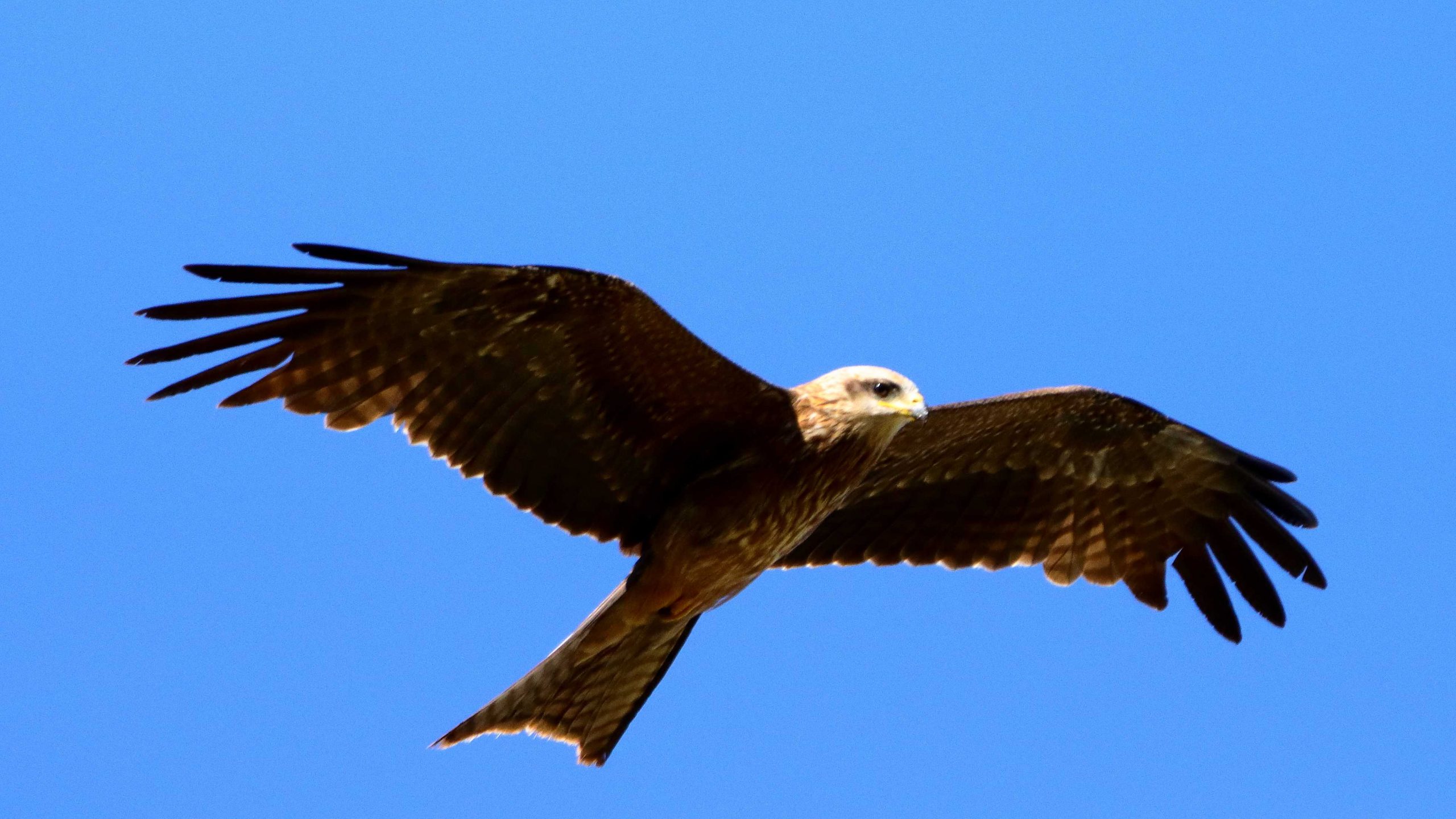
All along the highway from about Blackall, roadkill was attended by birds that I thought were a type of Kite and black Crows. Once I got a photo, I was able to identify them as Black Kites. Their appearance and behaviour, such as their swooping flight and that they were in flocks. I posted about Plumed Whistling Ducks and Crested Pigeons in the previous post. So that’s it for Birds at Longreach.

We departed Longreach early to reach Winton in good time as we had a drive of about two and a half hours after Winton, to reach our overnight stop at Hughenden.

Australian Age of Dinosaurs layout. Entrance road is in the lower left hand corner.
The Dinosaur footprints, recovered from swamp country and reinstalled in a temperature controlled building for display and preservation.

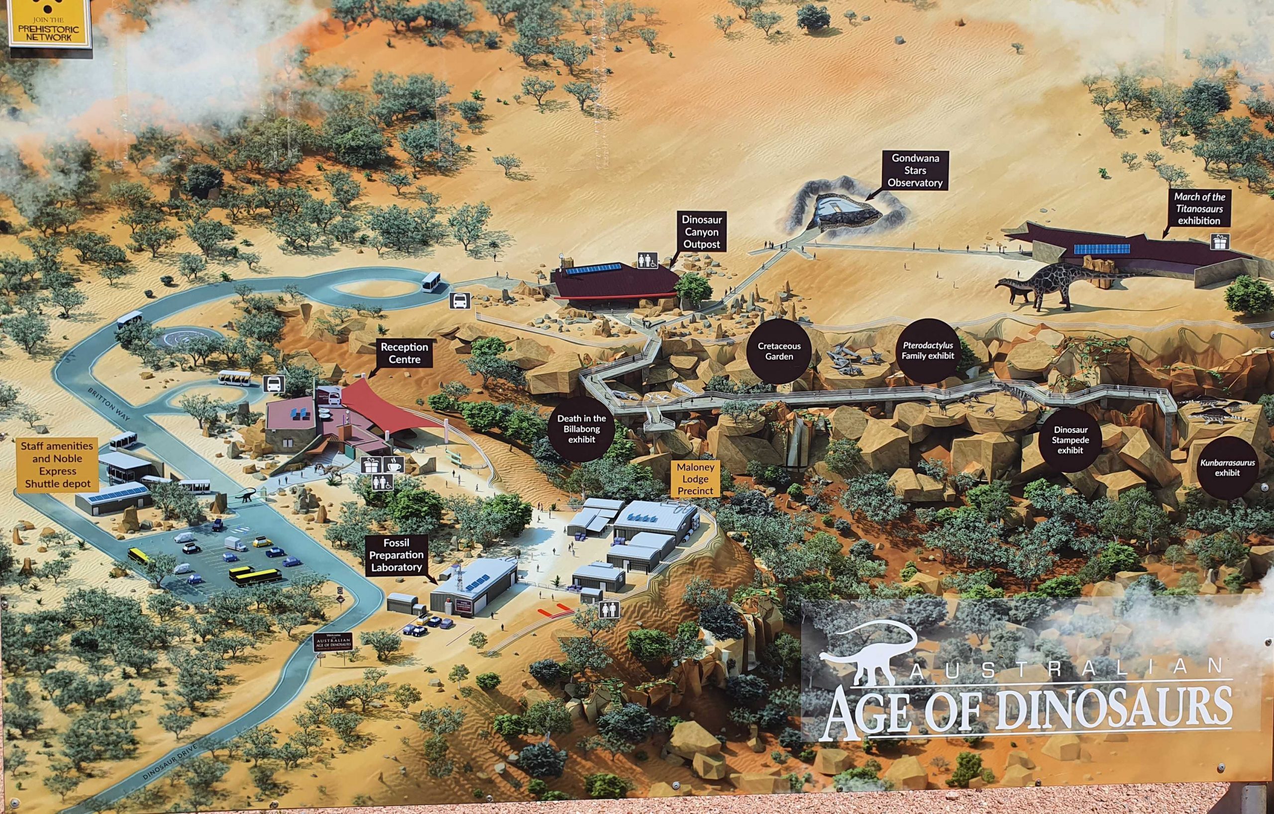
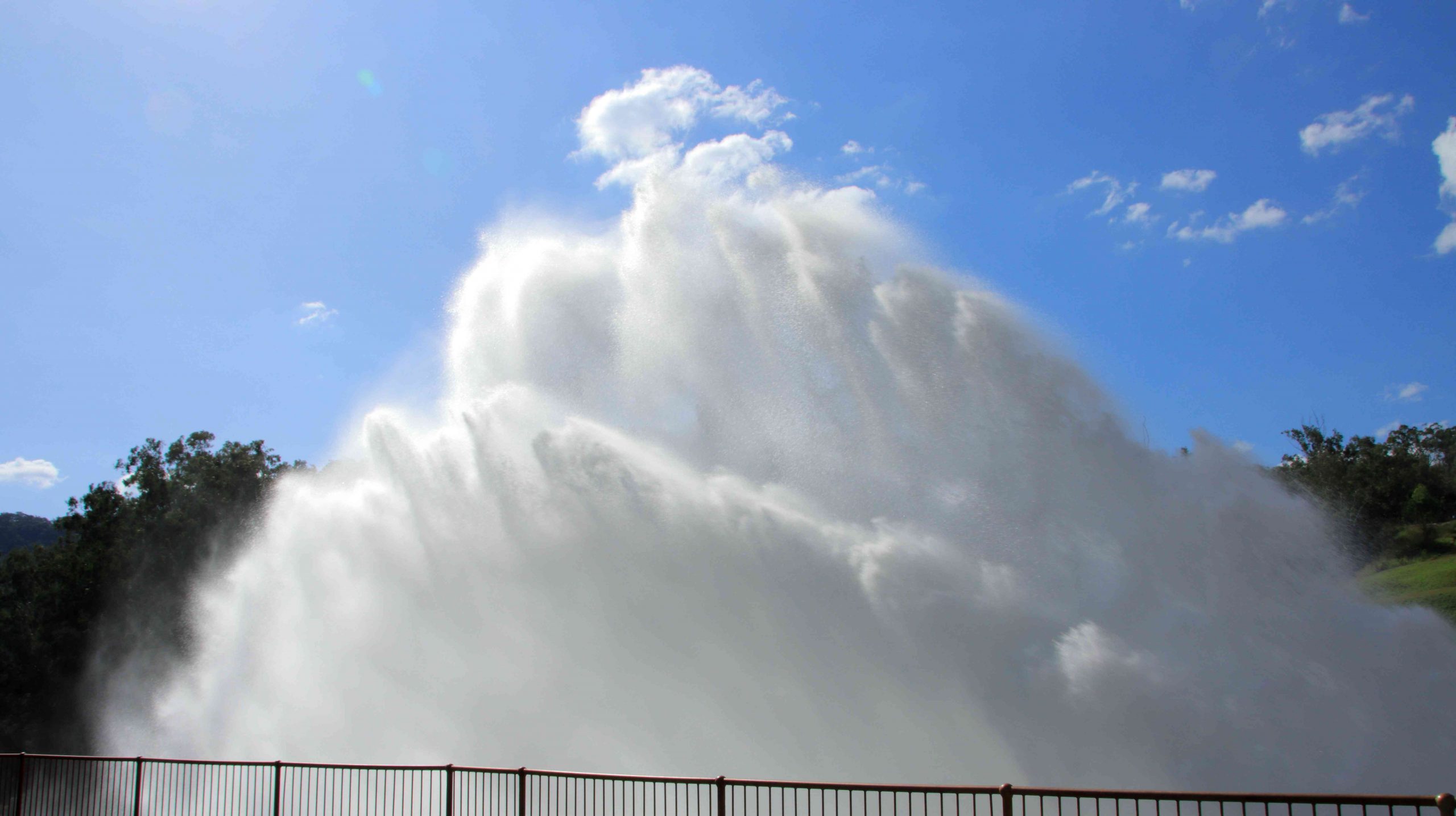
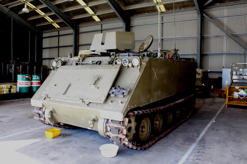
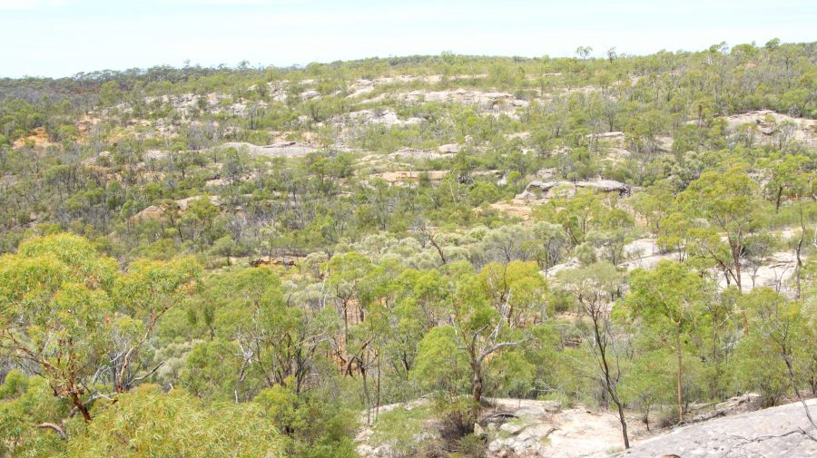
The location of The Australian Age of Dinosaurs is on the Longreach side of Winton, so that helped. Part of the success of this attraction is the brilliant sighting on top of a jump up. The top is quite flat, probably a couple of hundred metres above the grassy plains of the grazing area. Huge rocks have broken away around the edge and moved a short distance to where they have become stable. All of the buildings are on the plateau, but some displays have been built on and among those huge rocks around the plateau rim.

March of the Titanosaurs Building where the footprints are displayed.

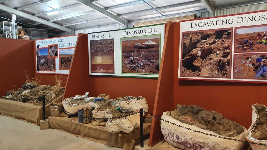
We arrived about an hour ahead of our tour and presented ourselves at reception. We were given an earlier tour start. The session required a short trip on a shuttle to the Dinosaur Canyon Outpost. This part is relatively new. It is in a large fully enclosed building into which has been moved a large area of fossilised rock that was found in the lower country. It is part of an ancient swamp where Dinosaur footprints of various sizes have been frozen in time. The guide points out some differences between the footprints and what it is thought the creatures were doing at the time.

A board walk extends to the Dinosaur Canyon Walk.
A diorama of Dinosaurs in stampede mode.
Tumbled boulders at the edge of the Jump Up.

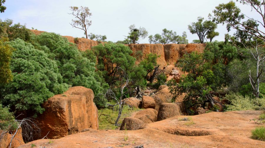
The displays that have been built among the rocks on the side of the jump up, are in this area.

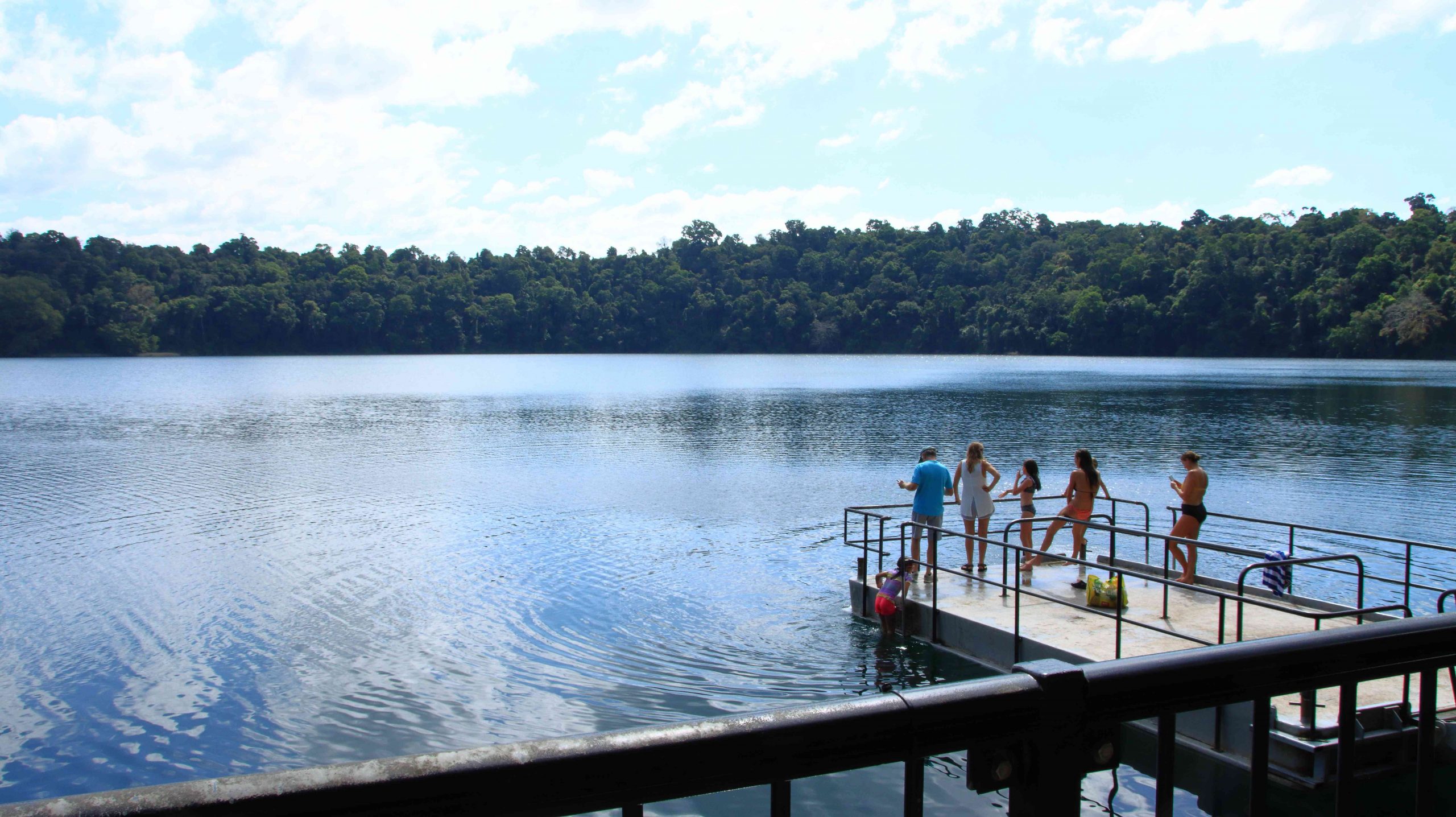
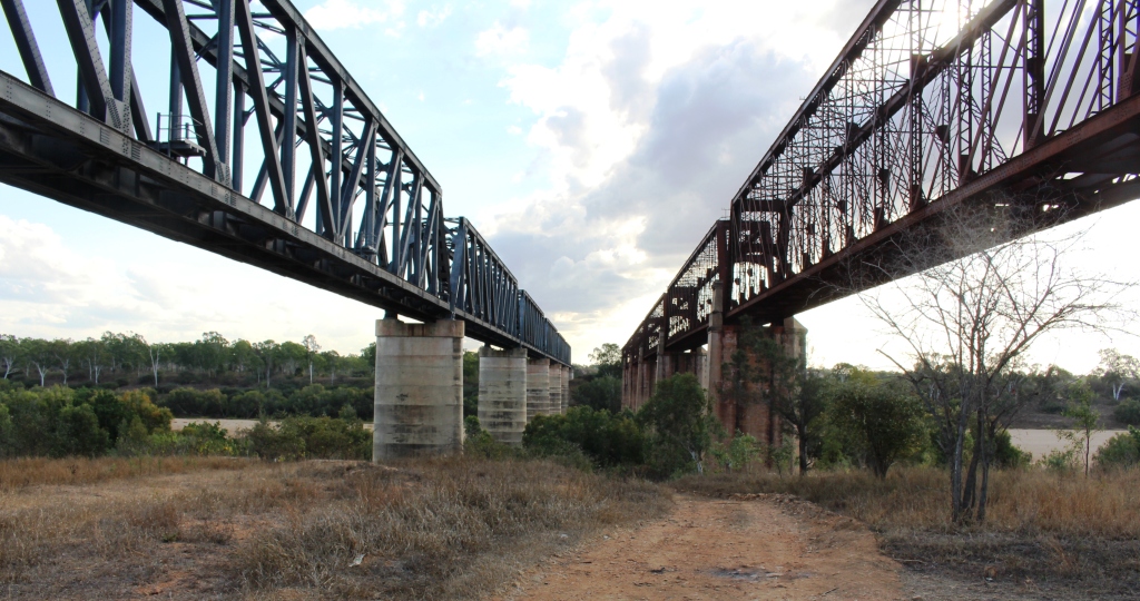
About 50 km away on the Jundah Road south of Winton is the site of the dinosaur stampede. We saw it years ago and found it to be most interesting but inconvenient to get to, because of the condition of the road. So to have this display of similar footprints so easily accessible is a great convenience.

Digs, recovery of fossils and storage of fossils awaiting processing.

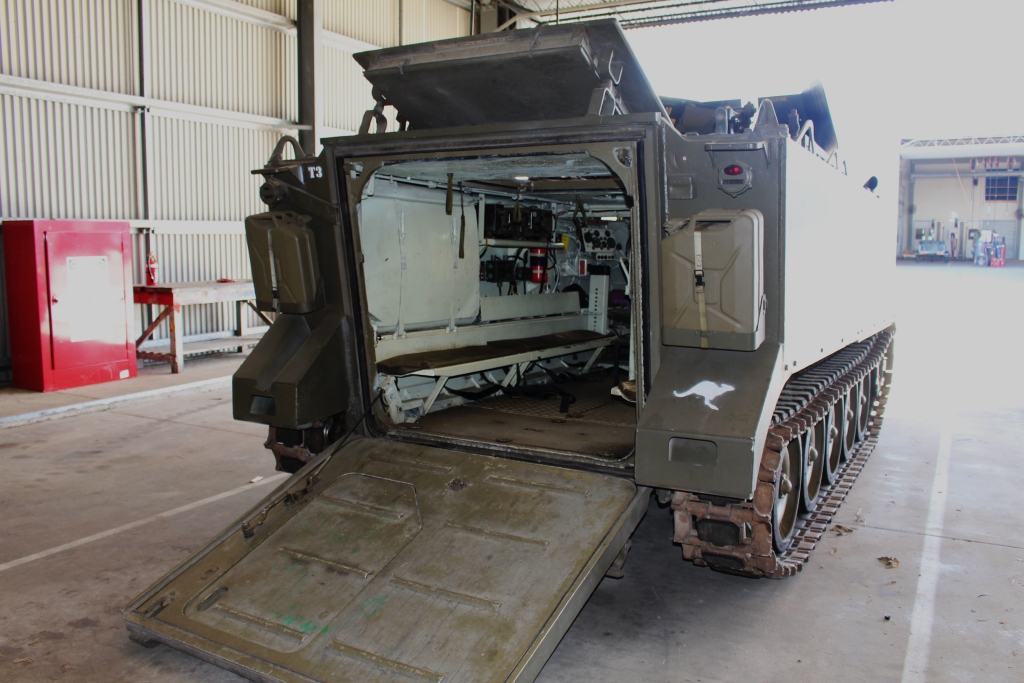
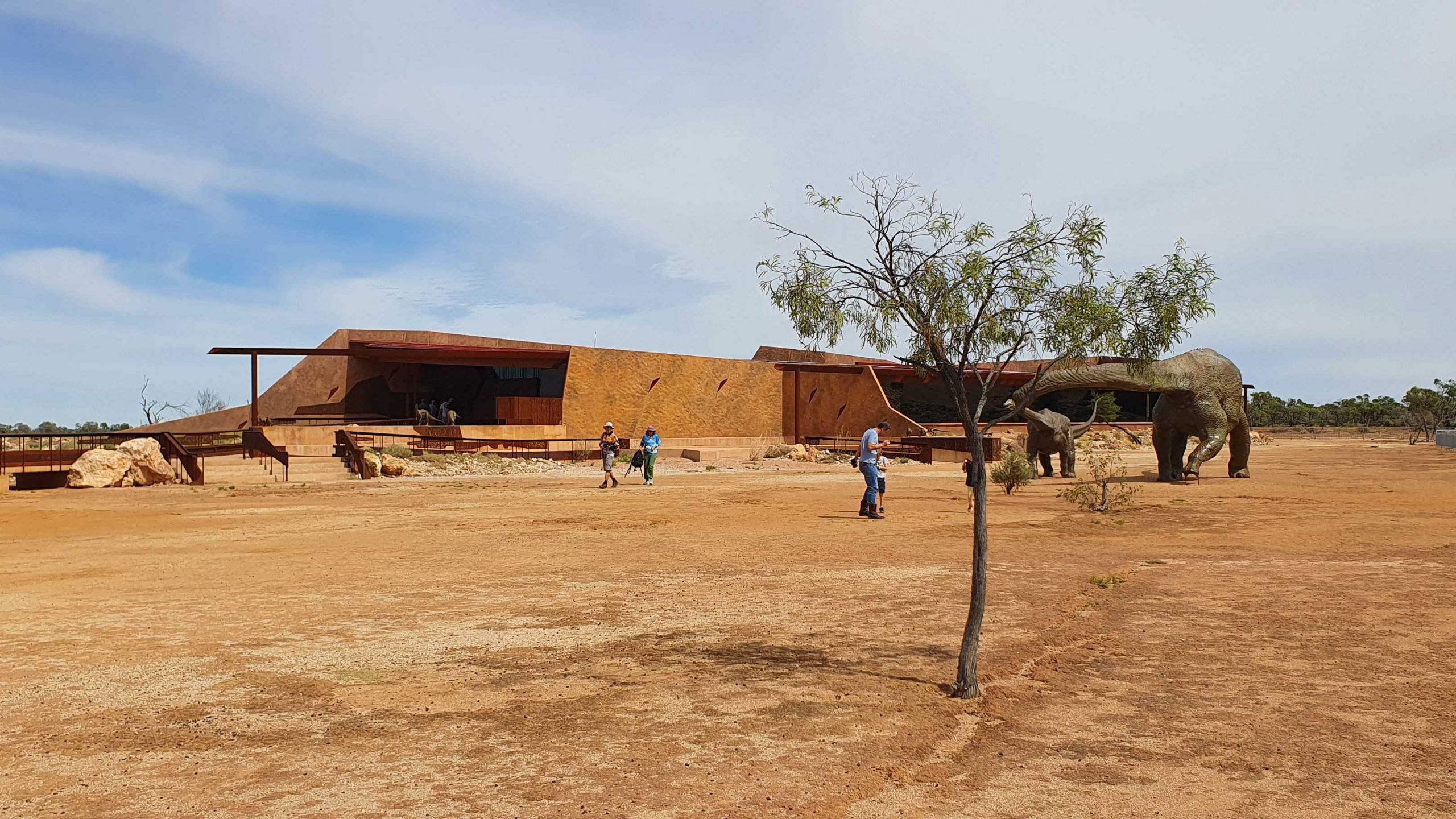
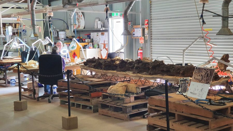
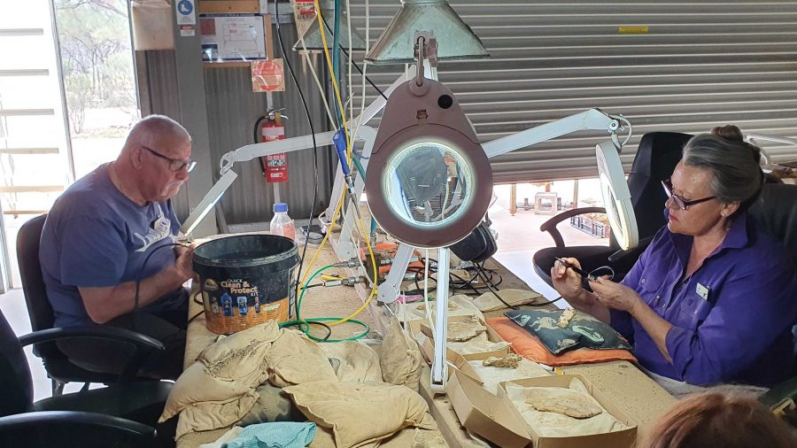
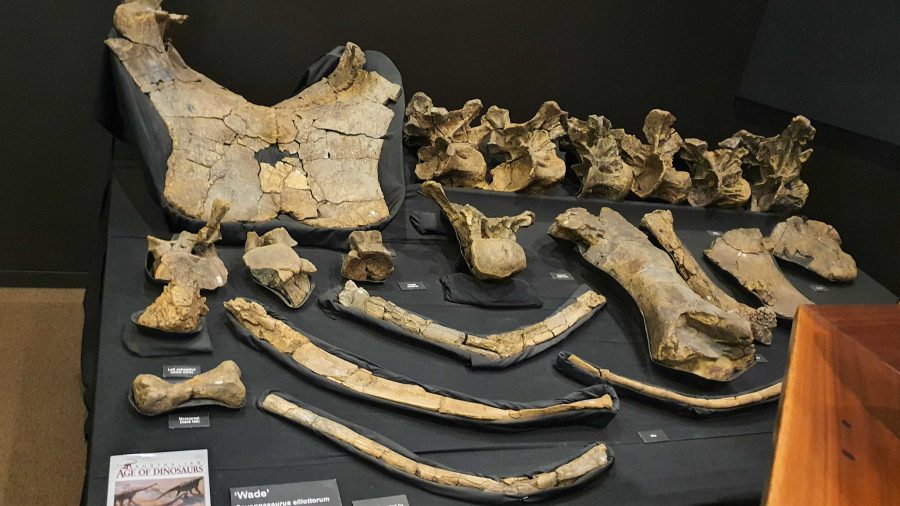
The next part of the tour required a drive or walk of about 500 metres to the laboratory, where the fossils are prepared for display or further research. We were taken through the detail if how digs for fossils are conducted and the fossils secured and brought back for further processing so that the item can be positively identified. Finally we watched as the workers used a variety of tools to remove foreign material without causing damage to the fossil.

Work in progress
Two volunteers working to on fossils.
Recovered and restored fossils.

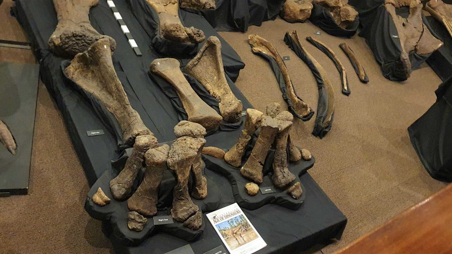
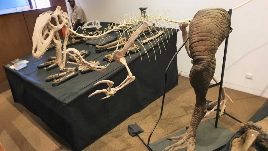
Finally, we returned to the museum at the main building for a presentation of how the finished fossils are used to recreate the original creature, or part of a creature, using genuine parts or parts fabricated to replace the missing bit. These are displayed as models, a leg for example, and in photographs or sketches. There is an interesting display of parts that don’t fit with anything else but are genuine.

More recovered and processed fossils.
An example of the use of fossilised parts to recreate a body part,

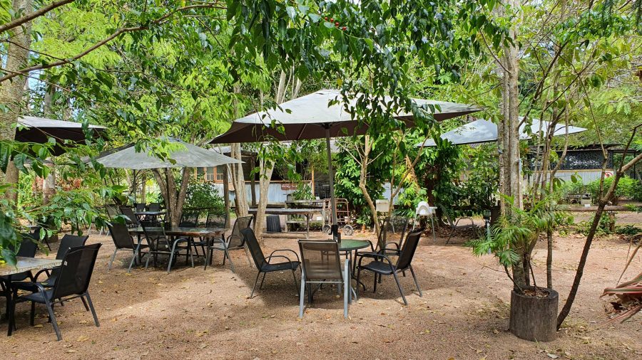
Since the café is in the same building as the museum, we had coffee and a sandwich and drove into Winton for a petrol refill at $2.02 per litre. But that now seems cheap compared to $2.15 that I saw on a pump at Redcliffe yesterday.

A view from the museum grounds of a distant jump up. Part of Winton about centre left, just below the skyline. The flat topped mountains are a feature of this part of Queensland.
A typical small jump up or mesa in the area.
Corfield Hotel, currently closed.

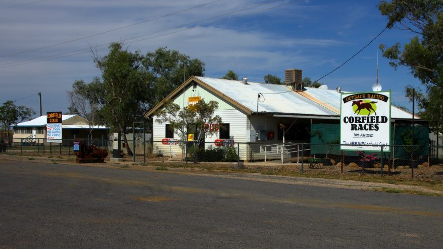
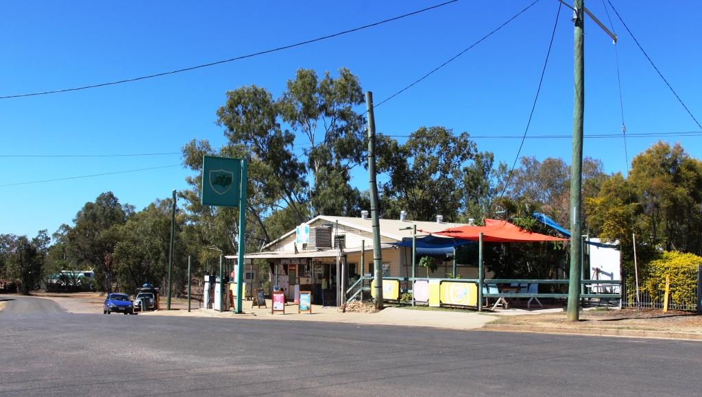
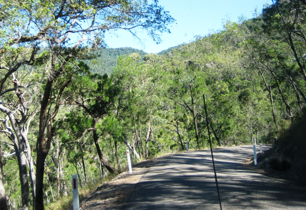
The drive to Hughenden is on sealed road except for the first 15 km that is currently a dirt side track running parallel with an almost completed new road. We stopped at the tiny town of Corfield for a break. This “town” boasted a pub and racetrack. The pub is now permanently closed but I am not sure about the racetrack. They used to conduct a “Corfield Cup” but a lot of those country events were cancelled during the Covid epidemic and have not restarted.

 There are no real towns along this road, just one other notable locality, Stamford that has a school.

Brolga near Hughenden
Rainbow Lorikeets on our door step at Hughenden.

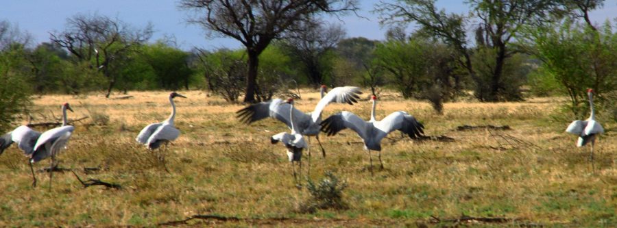
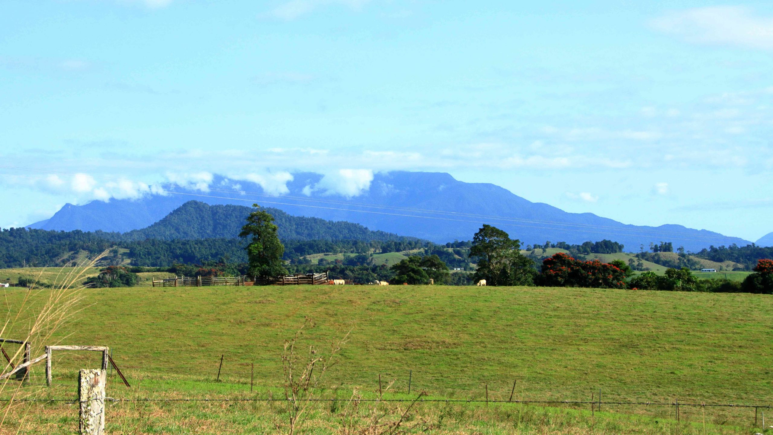
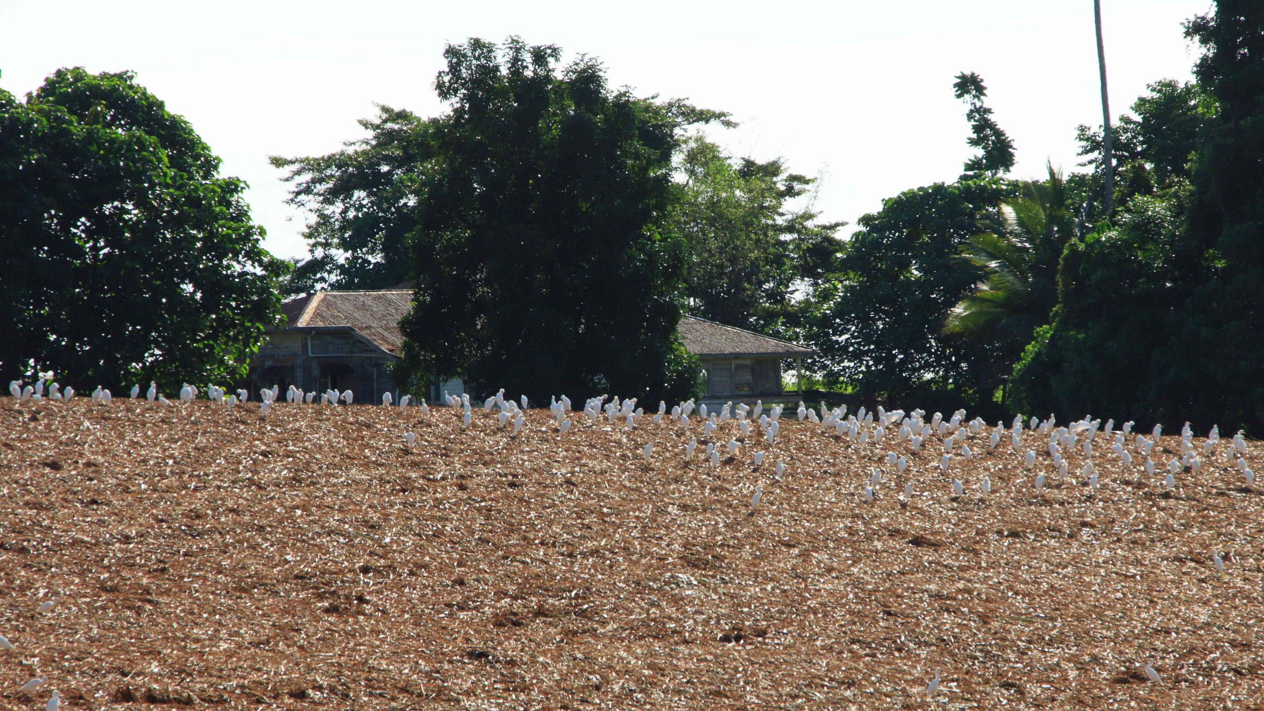
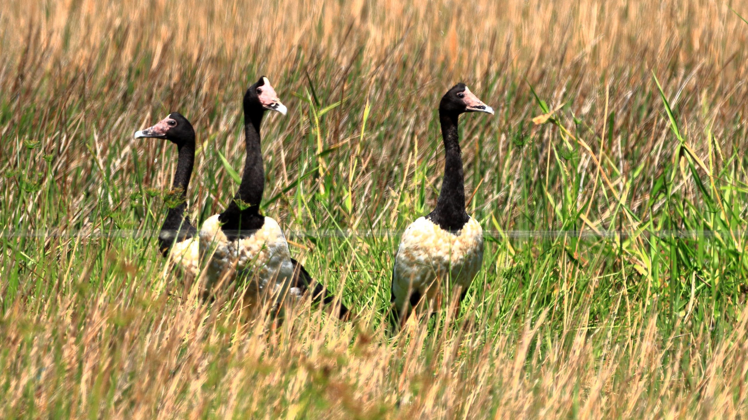
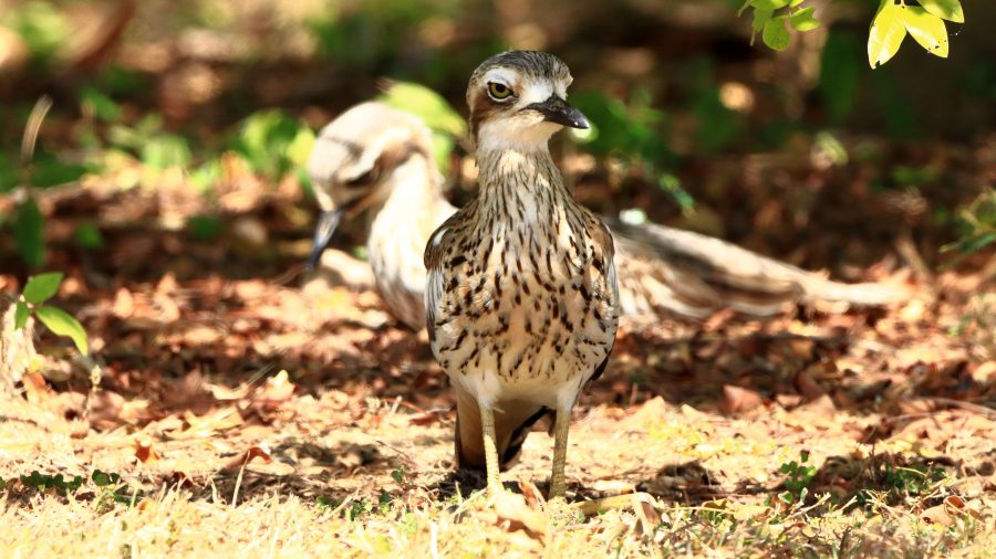
About 30 km short of Hughenden, we came across a group of Brolga. The Brolga were in a paddock about 30 km south of our destination. I was separated from the Brolgas by a 4 strand well maintained barbed wire fence, when I took some photos. They kept moving away until I reached the fence. Then they turned around and looked at me. I wonder if they knew that I could not get through the fence.

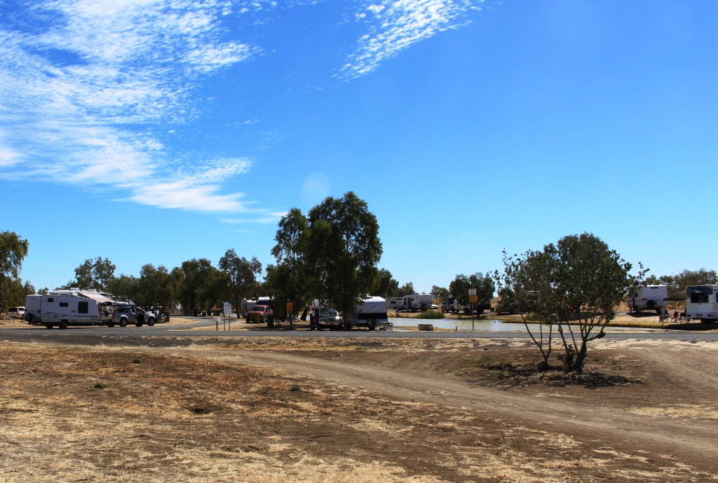
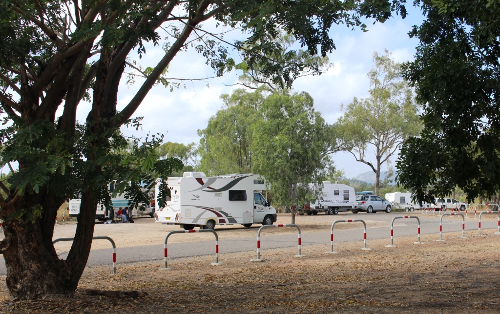
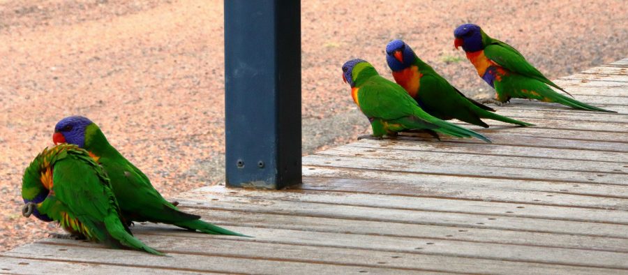
On our arrival at the caravan park in Hughenden, our doorstep was taken up by Rainbow Lorikeets being fed by a resident. Most flew away but some stayed to see if there was more food on offer.

The area at the summit of Mt Walker. All lookouts are joined to the central area by gravel paths.
Lookout to the Southeast.

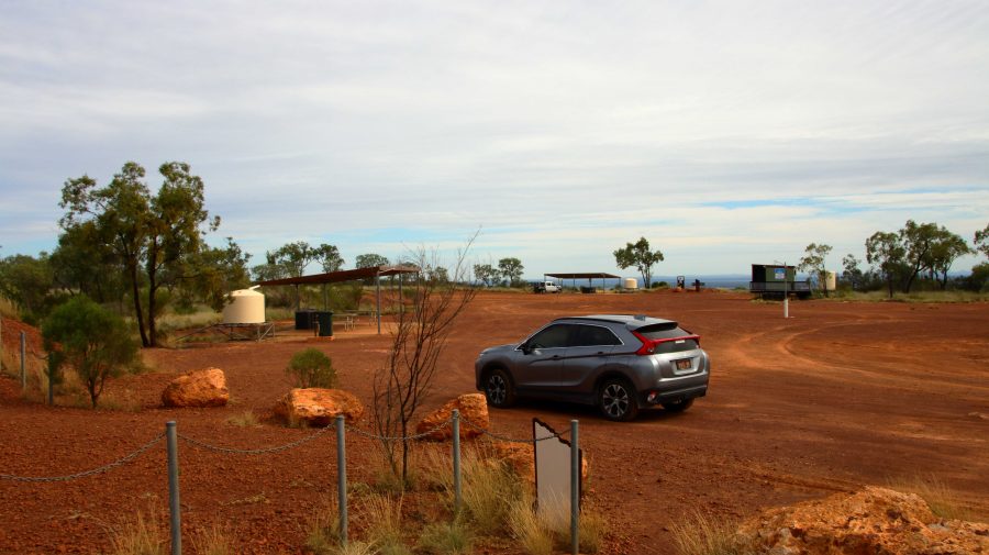
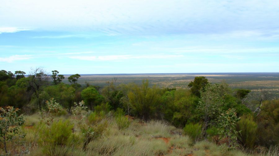
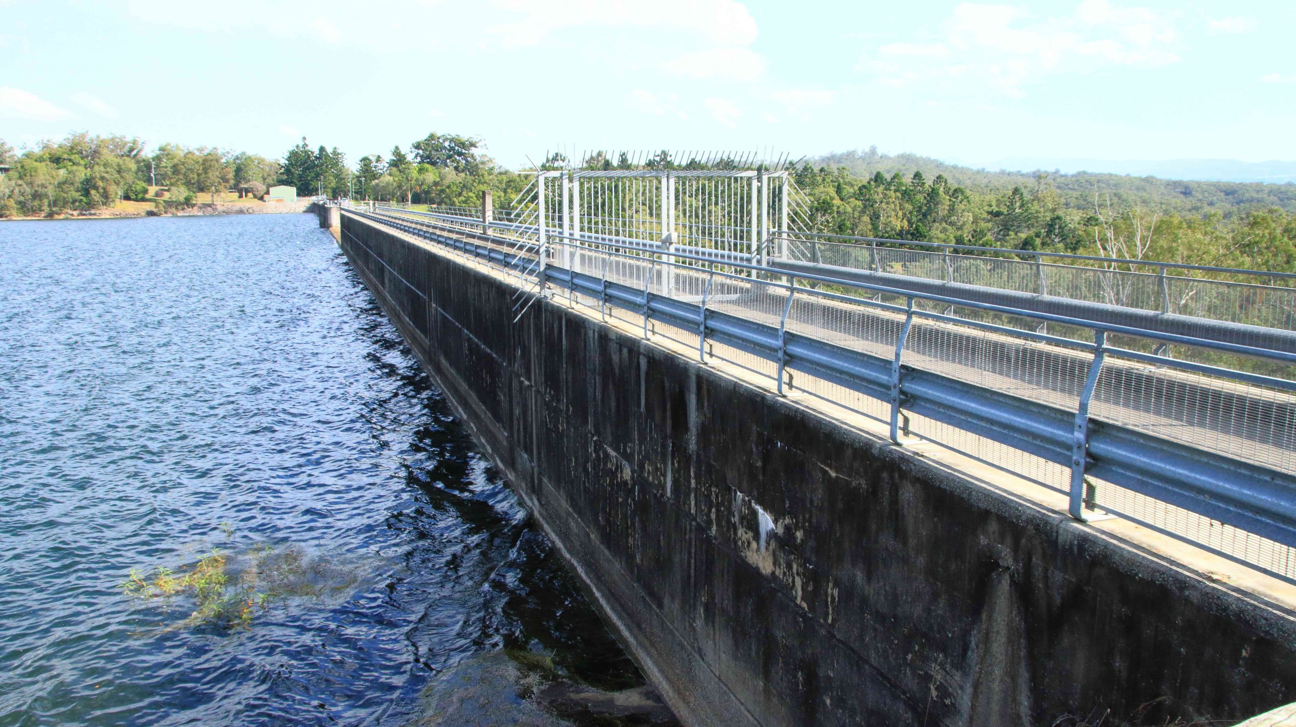
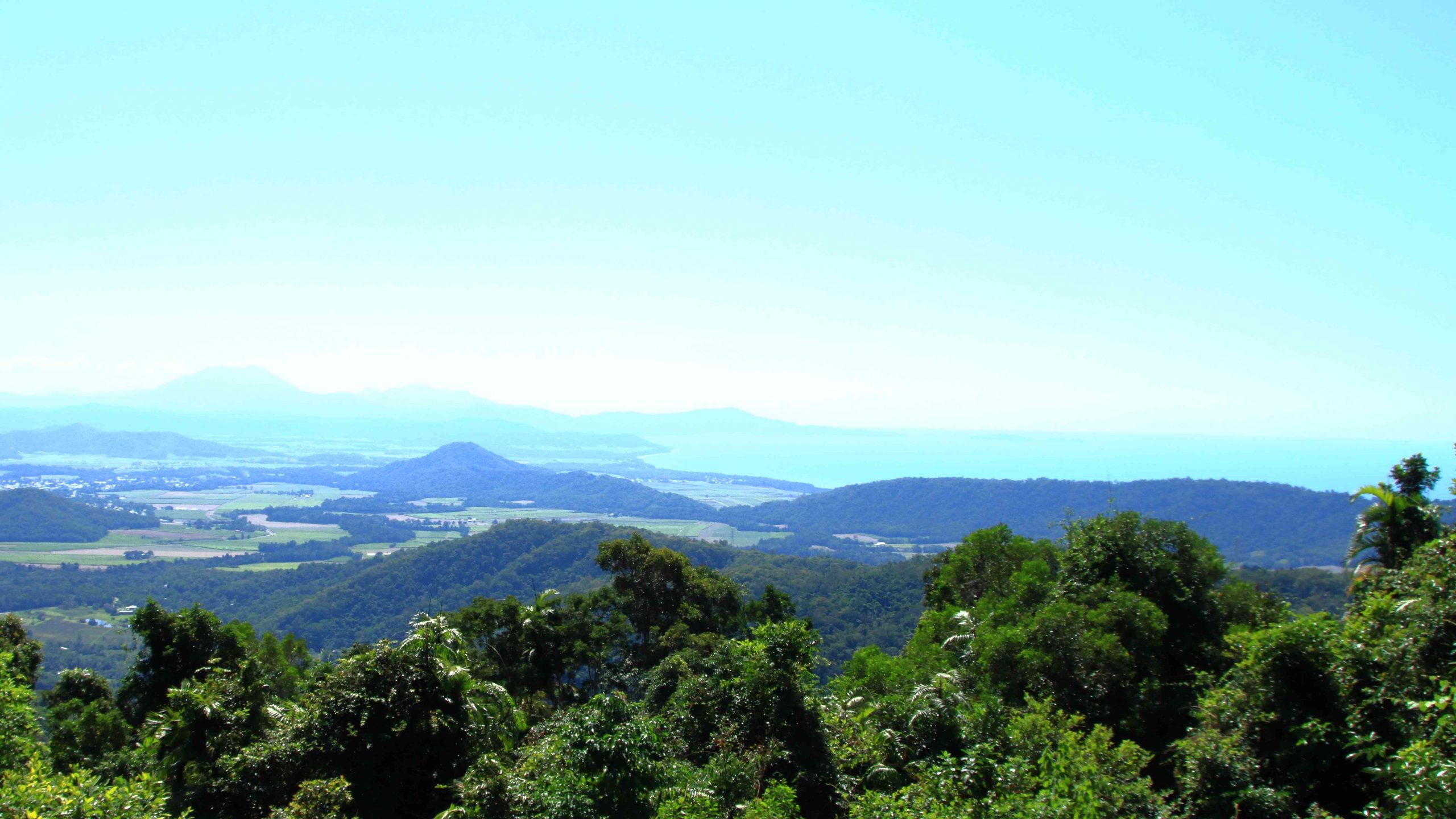
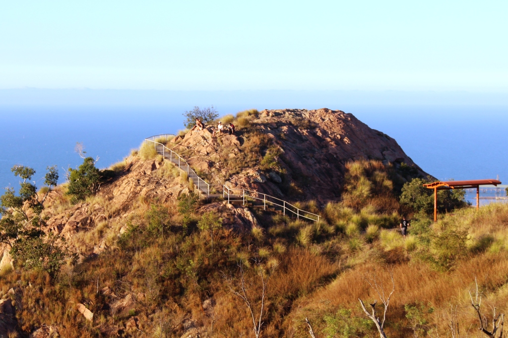
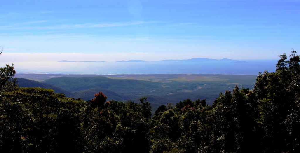
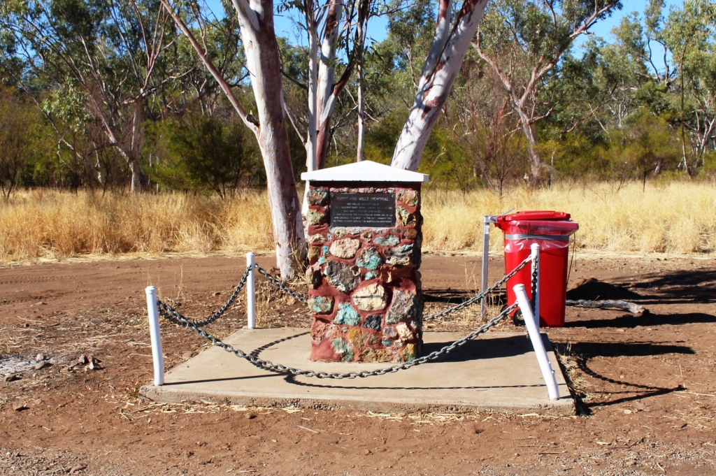
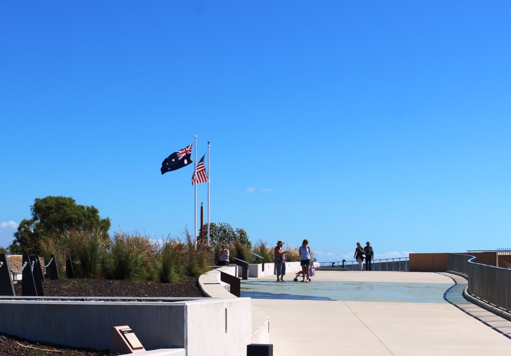
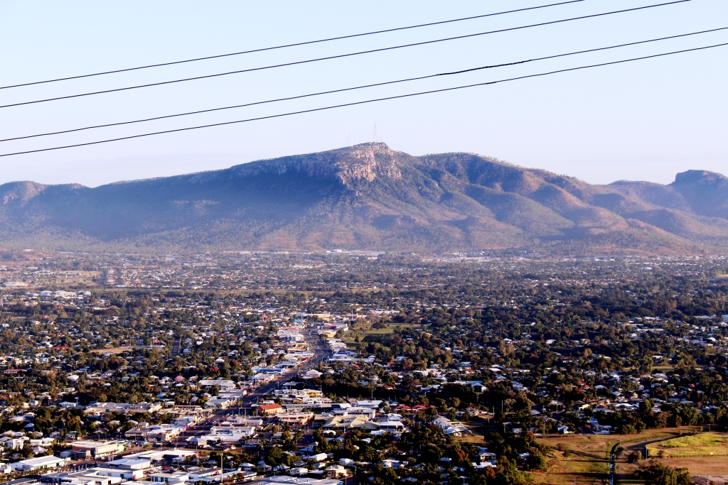
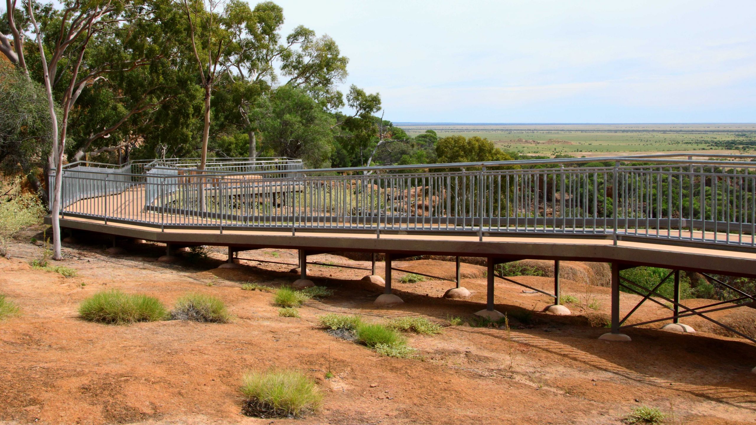
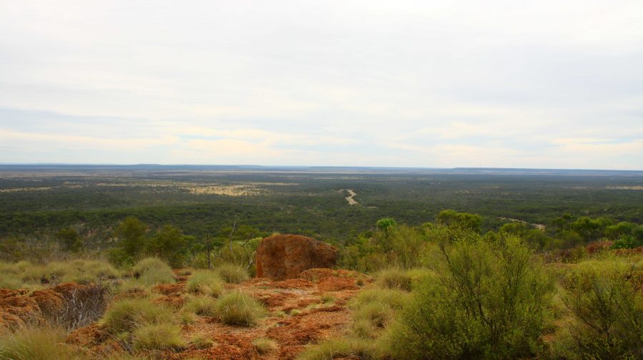
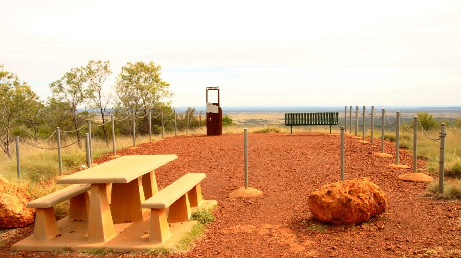
About 10 km south of Hughenden is Mount Walker, named in memory of the leader of an expedition to find Bourke & Wills. It is about 450 metres above sea level but stands well above the surrounding terrain. It is part of two adjoining stations, the owners of which combined with the local council to install a road and visitor facilities. There are about six lookouts that face in all directions, each one providing panoramic views. We made it our first call of the morning, before heading east.

View to the Northeast. The road to Hughenden can be seen below.
Tables and seats are scattered around the area.
White Mountain National Park near Torrens Creek

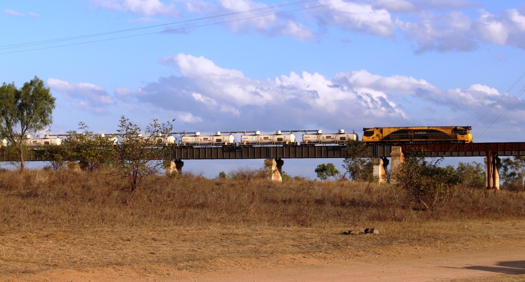
There are only small towns on this stretch of road, until we reached Charters Towers with its approximately 9,000 population. We did coffee at Torrens Creek and experienced the “excitement” of a 60-truck fertiliser train passing through.

Memorial to the Completion of the Sealing of the Hervey Range Road.

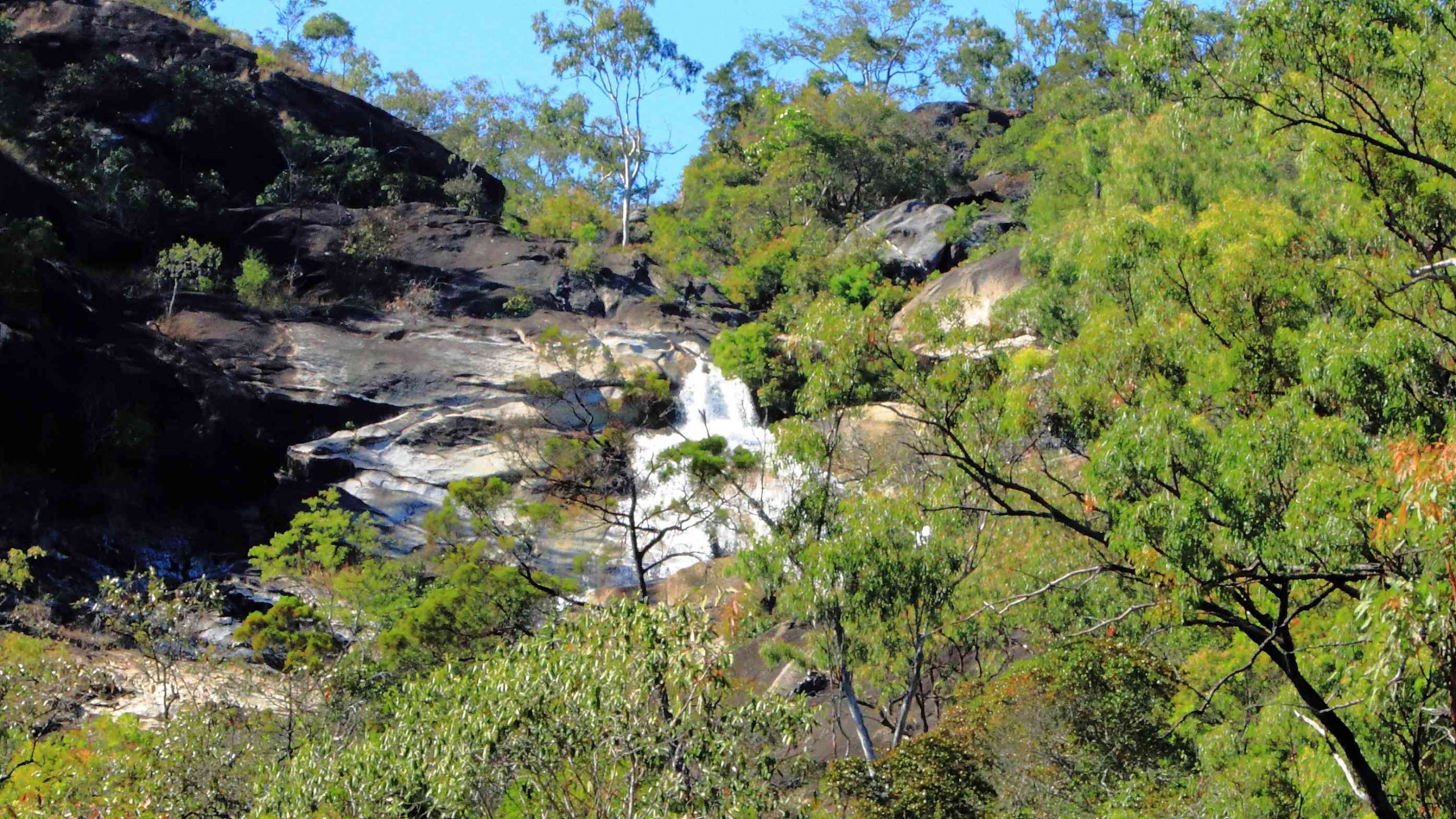
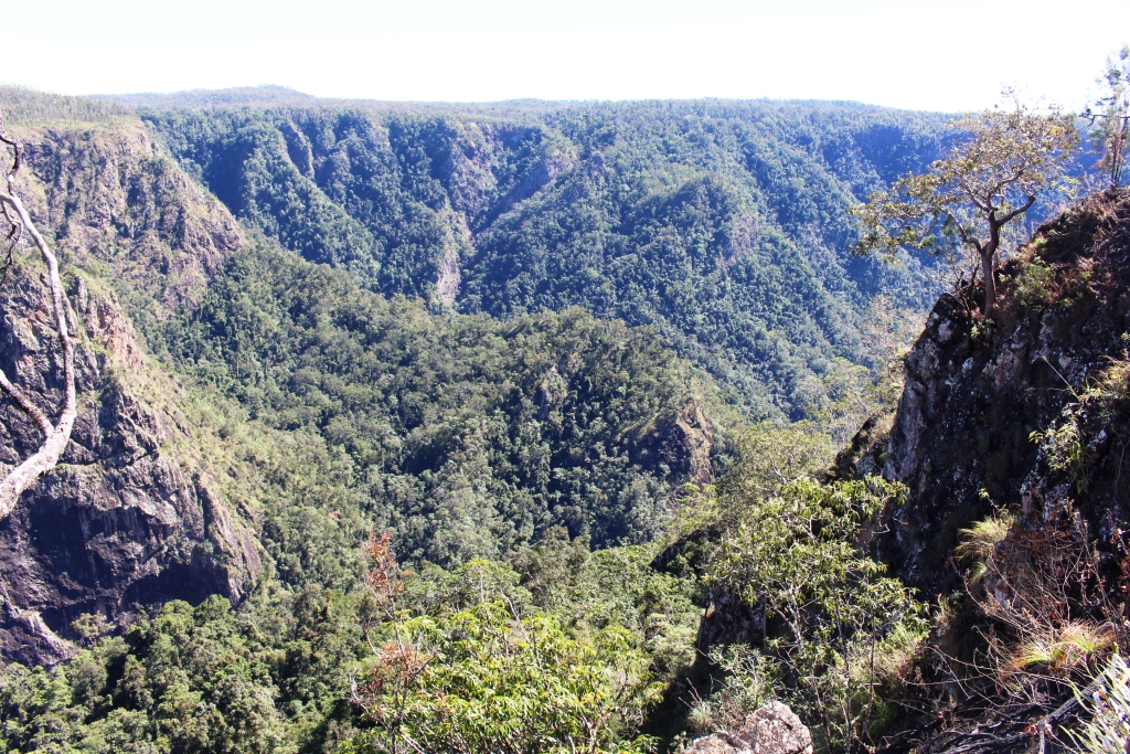
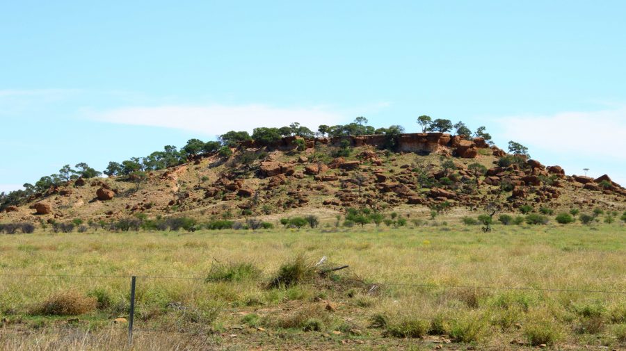
A geological feature of some note, the White Mountain National Park, is a further 30 km. You need a 4WD to get into the park but some of its signature white stone is visible from a rest stop by the highway.

We continued amid little traffic to Charters Towers, where we arrived at about 1 pm. It was pleasing to see petrol at around $1.70 per litre.

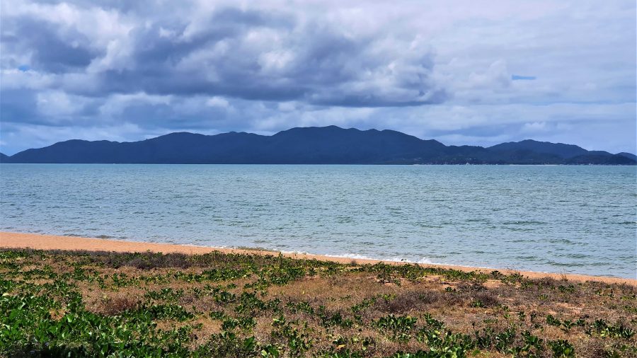
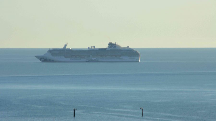
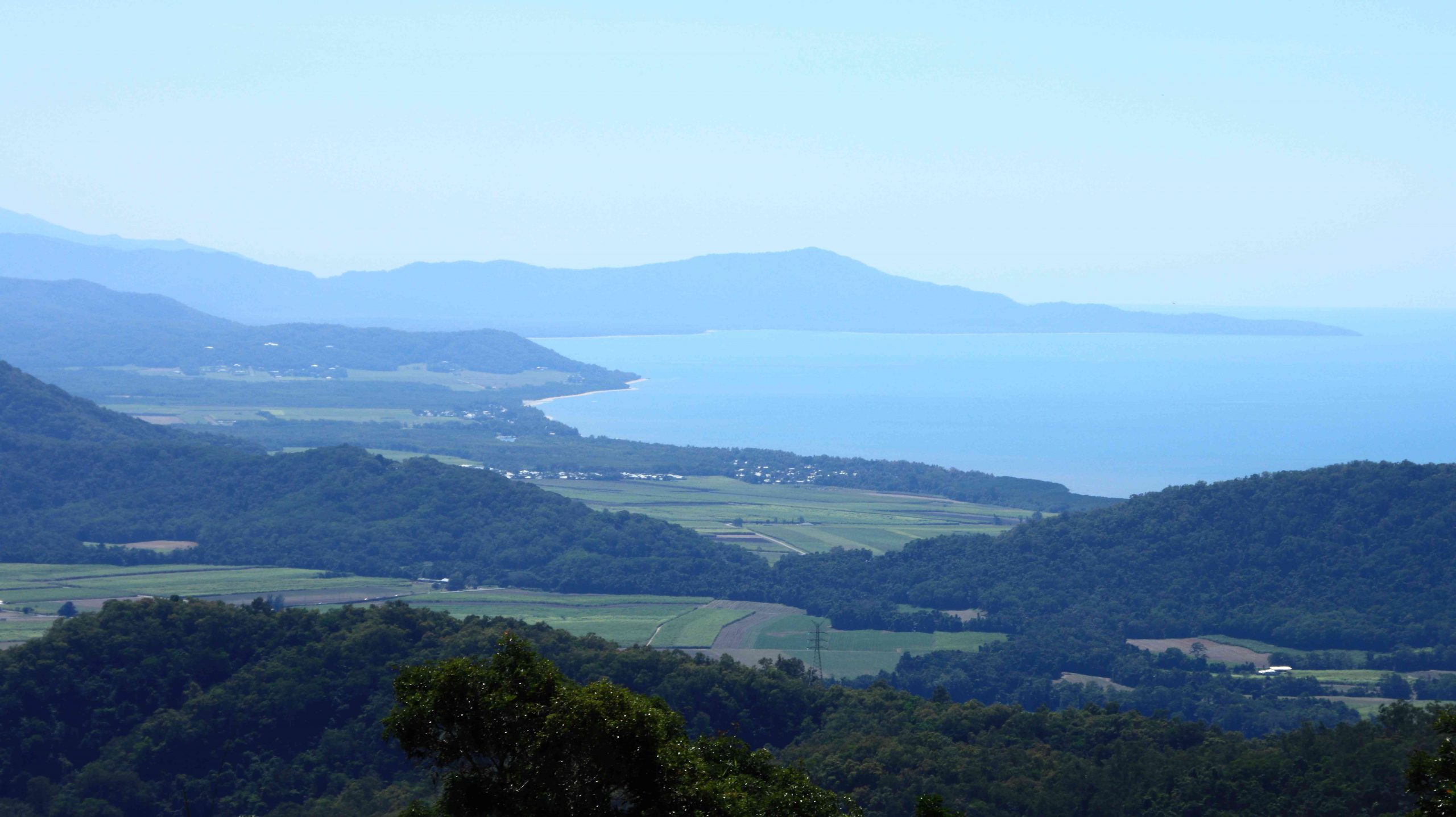
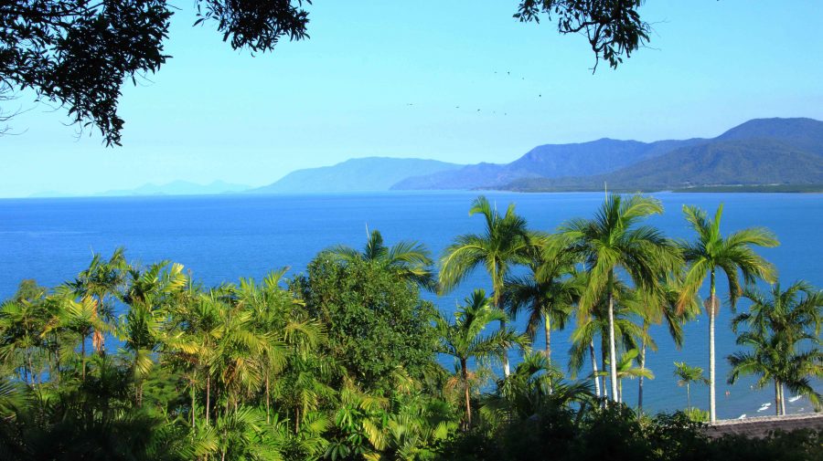
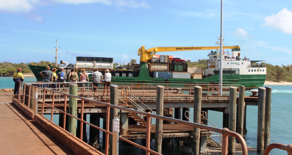
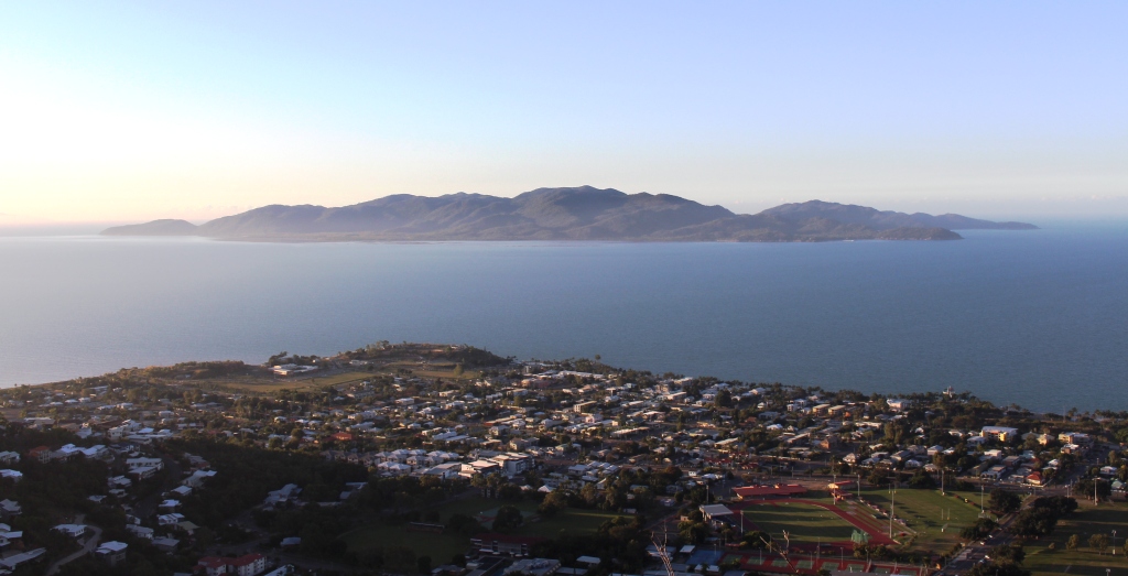
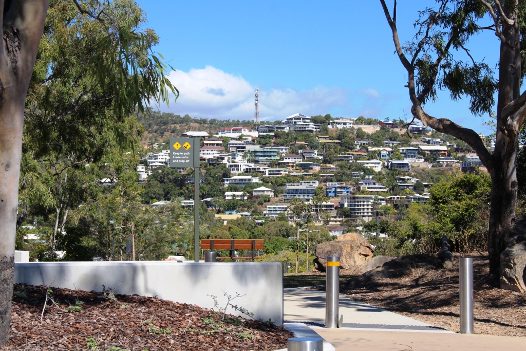
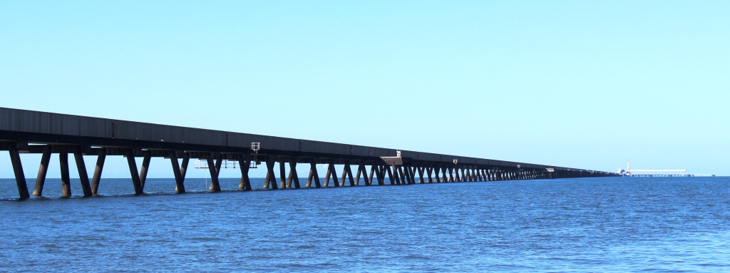
After a restful afternoon and evening, we left next morning for Townsville and the ferry terminal, but went the long way. We drove north-west on the Gregory Highway until we reached a place called Basalt, where we turned east into the Hervey Range Road. We stopped to see a memorial to the completion of sealing the road. Hervey Range Road is part of the network of “beef roads” that criss-cross Northwest Queensland. This one takes beef to the processing works at Townsville.

The Burdekin River upstream of the Hervey Range Road Crossing.
The Hervey Range Tea House without customers. A very present place to stop for a break, Wednesday to Sunday.
Ah! The Tropics! Beach goers relaxing on Townsville Beach.

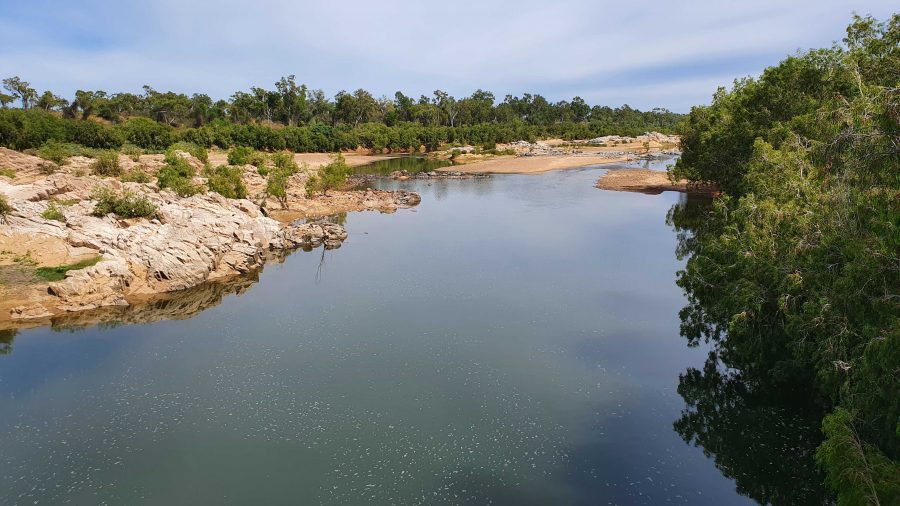
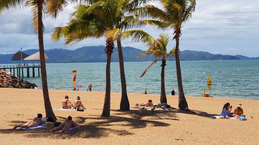
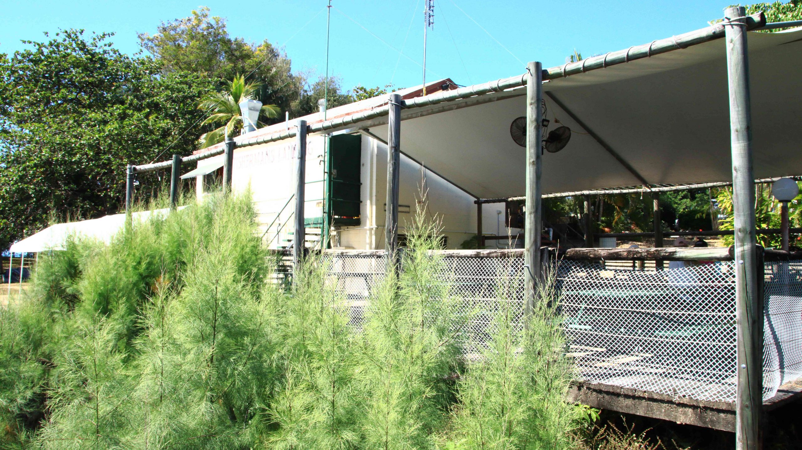
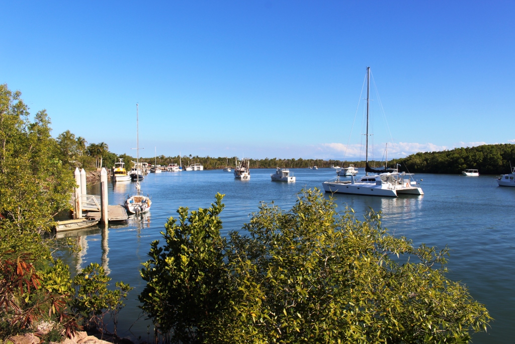
We then crossed the Burdekin River and stopped at the Hervey Range Tea House. The day was Monday, and this is a weekend drive location for Townsville residents. The tea house is closed on Mondays and Tuesdays, but we knew that. There were no coffee stops available until we reached the suburbs of Townsville. Topped up with coffee and with some time to fil in before the departure of the ferry, we found a parking space in The Esplanade where we were able to see Magnetic Island and enjoy the beach, fresh air and sunshine. We caught our ferry with time to spare,

Magnetic Island from Townsville beach.

Interrupted Journey – North Queensland 2022 – Part 2

Part 2 – North to Port Douglas via The Atherton Tablelands

Note: A video link appears at the bottom of this blog post.

Coral Princess lying off Airlie Beach.

When you have a view like we did at Airlie Beach, the first thing that you do when you get up of a morning is open the blinds. We opened our blinds on Sunday morning and there in the middle of our view was the Coral Princes, in port for a visit. Our friends Jim and Frances Weir were on board, but we were gone by the time that they come ashore.

Sunday was one of making distance up the coast. Our Sunday night overnight stop was at Innisfail.   The sun shone on us all day. We struck some low-lying fog both on land and over the bay as we approached Bowen, making slower progress than we had hoped as we coped with the long slow kilometres of roadworks. Almost the entire length of road from where we entered the highway just north of Proserpine to Bowen, was limited to 60 and 40 kph with a few areas of 80 kph.

Balgal Beach. The view goes all the way to Magnetic Island and Townsville.

The run for the rest of the distance to Innisfail was much better, but still with a lot of areas of road works. We bypassed Townsville on the convenient ring road, as you do now, but called in a Balgal Beach. near Rollingstone. We knew where we could get near the beach for lunch, from previous visits.

Fisherman’s Landing at Balgal Beach. The restaurant overlooks the jetty where fishing boats dock.
The mountains northwest of Innisfail

We had a quiet night in Innisfail. The motel was right in town but quiet. All we wanted was somewhere to eat and sleep.

A cap of cloud was sitting on the top of that mass of mountains to our north as we left Innisfail. The mountain ranges inland from the coast are home to Queensland’s two highest mountains, Bartle Frere at 1,611 metres and Bellenden Ker which reaches a height of 1,593. At those heights they and the surrounding ranges rise well above the Atherton Tablelands, to which they provide a backdrop to the east.

The drive from Innisfail ascends some steep grades but on a good road. When you reach the edge of the Tableland the height gain from the coast is obvious. The first town is Millaa Millaa, but first you will see signs that point to a drive that leads you past four waterfalls, before returning you to the main road. We have done this drive before but did it again before stopping for coffee at the park in the main street. The town has a couple of good café/coffee shops as well.

Zillie Falls on the Falls Circuit near Millaa Millaa.
Millaa Millaa Falls also in the Falls Circuit.
The mountain ranges viewed from Millaa Millaa Lookout.

 We then crossed to Herberton to look at the tin mining museum. Soon after you leave the town of Millaa Millaa, you reach a steep ascent. Just before the summit, a left-hand turn takes you to a lookout which, unsurprisingly is named Millaa Millaa Lookout. Equally predictably the lookout provides fine views back over Millaa Millaa and the ranges nearer to the coast. We were greeted on our arrival by some domestic hens.

Mining machinery and buildings at Herberton Mining Museum.

There is much to see at the Herberton Museum, particularly for those with an interest in old machinery and historic mines. You could spend quite some time there if that were the direction in which your interests lay.

Malanda Falls is located in parkland near the town.

We then turned back to the east to Malanda. We wanted to lunch at Gallo Dairyland but research had shown them to be a Wednesday to Sunday operation, which seems to be quite common in areas that are within an easy weekend drive of major population centres.

Malanda Café, our lunch location.

So, after visiting Malanda Falls we lunched at a café in town before making a return visit to Lake Eacham, where some hardy souls were swimming and sun baking. It is a beautiful location and wasn’t all that cold but not my idea of swimming weather.

Lake Eacham with bathers.
Reflections in Lake Eacham.
We passed through the attractive town of Yungaburra on our way to Tinaroo Dam.
Patient Cattle Egrets waiting for the cane harvest to move on.

We had seen a large flock of Cattle Egrets (the little white Egrets that are often found where cattle are grazing) back nearer to Innisfail. They were waiting for a cane farmer to finish harvesting a field. Some were near to the road, but all took off and flew to the top of a hill overlooking the cane fields when we stopped. Newly cut cane must produce good eating grounds for them. We saw the same phenomenon at a couple more cane harvesting sites the following day, but other harvest sites had no birds at all.

To complete the day, we drove to Tinaroo Dam, where operators were discharging quantities of water, no doubt to the delight of tourists who see it flowing down the Baron Falls as they look down from the Kuranda train or the cable Skyway. There is plenty more where that is coming from. The dam is near to full.

Rather spectacular water discharge from Lake Tinaroo.
Tinaroo Dam
Agricultural land, irrigated by water from Lake Tinaroo.

We then drove on to Atherton and checked into our motel. It was a shorter and easier day. We travelled just over 200 km. Yesterday was a little over 600 km.

We departed Atherton on the morning of Tuesday 16th August, heading for Mareeba initially but with Port Douglas as our end-of-day goal. We turned east at Mareeba to drive to Emerald Falls. The facilities at the car park suggest that it is quite popular with visitors.

The top section of Emerald Falls.
The memorial to Luke McDonald who lost his life in the waters of Emerald Creek
Emerald Creek below the falls and series of rapids.

The walk to the falls is a little under a kilometre one way and quite easy until the last couple of hundred metres, when a series of well-built stone steps lead to the lookout and a rougher path to the foot of the falls. Visitors are reminded of the perils of mountain streams by a memorial, built by the side of the track, to a young man who perished in the stream.  Being conscious that we were there on our own and that I am not as young as I once was, I gave the walk away when the top of the falls were in sight. Thy are partly obscured by vegetation. But a great spot for a picnic and walk.

Magpie Geese near Mount Molloy on the Mulligan Highway.

We returned to Mareeba to revisit Coffee Works, a local success story, for morning coffee, before continuing north on the Mulligan Highway. We had intended to call into the nature reserve at Lake Mitchell, but the gate was closed, and the track did not look very inviting. We drove on. The highway runs beside a wetlands area that is part of the dam. There we found a Great Eastern Egret and a flock of Magpie Geese, both feeding in the pools. There was also a Pelican, but out of camera range.

View north east from the highway above Mosman.
The coast towards Daintree National Park
Daintree River ferry that provides the road link to Cape Tribulation.

We passed through Mount Molloy and took the right hand turn towards the coast and Mossman. There are two lookouts as the road begins its decline to the coast. Both give excellent views of Mossman and the coast to the Daintree River and to the ranges of the national park. We lunched at Daintree Village and photographed some Straw-necked Ibis in the park, before driving down to the Daintree River ferry. The crocodile tours along the Daintree River were doing a great trade, boosted by visitors from Coral Princess.

Crocodile viewing cruises on the Daintree River.
Coral Princess awaiting its passengers.

As we approached Port Douglas, we could see the Coral Princess anchored off the port. We called our passenger friends, but they were still on a day tour near Daintree. They are probably thankful that they missed us as I, at least, was incubating Covid at the time.

A view south from Flagstaff Hill at Port Douglas.

We had two nights at the Ramada Resort at Port Douglas. Since we had been through the area a number of times on previous trips we had decided on a quiet day. We checked out Four Mile Beach and spent time in the town area, We had visited the famous Flagstaff Hill Lookout, with its views along the beach to Cairns, the previous afternoon. We finished the day with room service dinner, a bit later than planned because the hotel lost our order.

We made a pre-breakfast start from Port Douglas next morning, as we had a 400+ km drive to catch the ferry at Townsville, to cross to Magnetic Island. We breakfasted at North Cairns and continued south. We diverted at Cardwell into the cyclone damaged Hinchinbrook Resort. There we found that most houses seem to have been repaired and reoccupied, but the marina, which was the centrepiece of the resort, remains in ruins, so there is no real resort anymore. But I did spy a pair of Bush Stone-curlews in the shade of a shrub on the rather broad media strip and got some photos. I had not previously photographed this bird. So, another “lifer” on my list.

Bush Stone-curlews at Hinchinbrook Resort at Cardwell.

I wasn’t feeling particularly well from the start of the day, so before we joined the queue for the Magnetic Island vehicle ferry, I decided to do a test for Covid-19. I returned a positive test so that was effectively the end of this trip.

Getting home was not a great amount of fun but with a highlight. We reached Proserpine at dusk and as the sun set, we were enveloped in a radiance of colour that reached across the sky from East to West and in front of us to behind us as well. The colour was a golden purple that faded as night fell. I was too intent on getting home to stop for a photo, but I now regret not doing so. But I do wonder if the camera would have done the colours justice.

The rest of the trip was to have taken us not only to Magnetic Island but then to Mackay and through the coal fields of the Bowen Basin to Emerald, Longreach and Winton. We are hopeful of completing the trip around the end of September.

You have read the book – now see the movie : Cape York 2015

After we return from each of our extended tours I go through our images and videos and combine them into a video, or in some cases into a series of videos. When we did the Big Lap in 2009 the material took up almost all of 4 DVDs.

Normally I have produced one long story for each trip which has not been easy to break into sections. But for the Cape York trip last year I complied twelve shorter videos, which when combined, ran for almost an hour.

I have put links to some small video clips in various blog posts covering the Cape York trip so I thought I may as well break the longer production into manageable portions and load them to You Tube, to make the material more easily accessible to my blog readers.

The end result is six videos, each of a bit less than.ten minutes duration. Here is a summary of the videos and the link to each.

Cape York Adventure 2015 – Part 1. Covers from home to Airlie Beach and a day cruise through the Whitsunday Passage to Whitehaven Beach.

[youtube]https://youtu.be/Gb-xM_mio00[/youtube]

Cape York Adventure 2015 – Part 2. This video tells of the section from Airlie Beach to Weipa and our explorations around Weipa

[youtube]https://youtu.be/s3l03Rt5bdc[/youtube]

Cape York Adventure 2015 – Part 3. You will see much of what we saw as we travelled from Weipa to Punsand Bay, our visit to The Tip and our trips around Bamaga and Seisia

[youtube]https://youtu.be/Q693fD5CiFo[/youtube]

Cape York Adventure 2015 – Part 4. This covers two separate day trips to Thursday and Horne Islands. The material is combined into one story.

[youtube]https://youtu.be/1G168MSeuik[/youtube]

Cape York Adventure 2015 – Part 5. Join us as we travel down the East Coast of Far North Queensland from Seisia to Cairns and then visit Cairns city and the rain forest areas of Daintree and Cape Tribulation

[youtube]https://youtu.be/LrKySa1q42w[/youtube]

Cape York Adventure 2016 – Part 6. This video wraps up our trip with our visits to Tully Gorge and the Central Queensland gem field towns of Rubyvale and Sapphire.

[youtube]https://youtu.be/q0-Aud4KUYU[/youtube]

We hope that you will enjoy seeing something of the scenery and points of interest that we encountered on this enjoyable and challenging journey.

Until next time,

Kevin


Days 34 to 37 – Cape York Adventure

We departed Kurrimine Beach on Saturday morning, needing to be home on the next Wednesday; with a little over 1,600 km to do via the coast and a bit more if we took the inland route. Inland won, as that gave us a chance to at least drive through the gem fields. We had intended to spend two or three days there.

Ready for a quiet night

Ready for a quiet night

We left the Bruce Highway at Townsville and took the Flinders Highway, heading for Charters Towers. The revised plan was to spend the Saturday night at Macrossan Park on the east bank of an almost dry Burdekin River. Macrossan Park is a popular overnight stop, with flushing toilets and cold showers for the Spartan.

Information shelter and toilets at Macrossan Park

Information shelter and toilets at Macrossan Park

The camping area is between the highway and the railway, which is carried over the river by an impressive iron bridge. With the van set up for a comfortable night I went for a walk, to have a closer look at the rail bridge. Imagine my surprise when I found two rail bridges. It seems that many years ago the original iron bridge was replaced by a new bridge of similar design. The old one probably became unsafe, so a new bridge was built, just a few meters to the south. Once you know that the second bridge is there you see it straight away. But if you are expecting only one bridge then chances are that is what you will see, the structures are so similar.

[youtube]https://youtu.be/vfoHUPAXhUg[/youtube]

Fertiliser train approaching the main bridge

Fertiliser train approaching the main bridge

Queensland National obliged by sending a long fertiliser train over the bridge before dark and an other one after dark. There was at least one more during the night. The sun slid quietly behind the low range of hills that constitute the horizon, with a tinge of colour in the distant clouds which were rather a dark shade of grey. But the cloud

Tinges of sunset on the edge of storm clouds

Tinges of sunset on the edge of storm clouds

vanished westward with the sun and left us with a full moon rising into a clear sky.


A full moon commences its assent

A full moon commences its assent

Res, there really are two bridges

There really are two bridges

On Sunday morning, a short run brought us to Charters Towers, where we refueled for the run south through Belyando Crossing and Clermont to our next overnight stop. Quite early in the trip we started to see signs of recent reasonably heavy rain. There looked to have been enough rain to put a smile on local farmers’ faces. When we crossed the first range from the coast the previous day, we could see how dry it was. That amount of rain would at least have brought some relief for beleaguered farmers. It certainly explained the grey clouds on the horizon the previous evening.

The Gregory Developmental Road passes through a mix of flat and undulating grazing country on its way through Emerald to Springsure, where it becomes the Dawson Highway, but we were not going that far. We refueled at the Belyando Crossing Roadhouse and continued on into the coal mining area of Clermont where we turned onto minor

Theresa Creek Dam

Theresa Creek Dam

roads to reach the caravan park at Theresa Creek Dam, about 25 km to the south west of the town. We noticed that one long coal carrying conveyor that was working when we came through this area last year was now stationery, a victim of the slowdown in coal exports, probably.

Theresa Creek Dam has been there for many years with a recreation area for locals on its banks. But in recent years the local council has developed what was formerly an informal camping area into a comfortable caravan park. We lined up with other vans in the overnight area, but at a comfortable distance from our neighbor.  But not for enough away not to hear our next door neighbor’s generator. Peace was restored when it was turned off an hour later but we had spent that time walking about the caravan paek, so were not really inconvenienced.

Rubyvale Post Office

Rubyvale Post Office

After another peaceful night we moved on for our drive through the gem fields. It wasn’t very far, probably about 50 km and we were parked in Rubyvale. Gem mining towns tend to be a bit of a shambles, due, I think, to the kind of people who become gem miners and the limited means with which they initially ply their trade.

Rubyvale town centre

Rubyvale town centre

Rubyvale, however, has a very orderly centre with a general store, post office, caravan park and a new gem display and sales gallery that also houses a stylish coffee shop. There were not many gems in the gallery priced below $1,000 but the commodious coffee shop, probably built with the tourist coach trade in mind, had very affordable Devonshire Tea (or coffee). We also bought a small bag of washed gravel to put aside

Decorations on the coffee shop wall

Decorations on the coffee shop wall

for sieving with our granddaughters at some suitable time. Perhaps we are sitting on a fortune. And perhaps not! But we may find something worth cutting and mounting into a piece of jewelry.

Coffee and scones consumed, we continued on to Sapphire, another ragged town with a less orderly centre than Rubyvale, but it’s town centre is clearly older. After a look around we continued to the

Sapphire General Store

Sapphire General Store

Capricorn Highway and then to a lunch stop at Emerald.

At Emerald we were back on the Gregory Developmental Road for the 56 km to Springsure. It was now a matter of how much further we went that day. We had in mind a river side camp where the Dawson Highway crosses the river from which it takes its name, but the caravans already there appeared to have been inserted by a sardine packing machine. We continued a further 20 km to the largely deserted caravan park in Moura. It is a large park, mostly of motel units and cabins for mine workers.

Hills near Springsure

Hills near Springsure

Our site was adjacent to a very noisy Coca-Cola machine that seemed to be trying to freeze its contents. We didn’t check. It was more of a night for hot drinks in this Central Highland town, the sleeping part of which we spent under a doona.

Home was now not much more than 600 km away with two days in hand, so we had the option of spending another night on the road or go for home. I find that these kinds of decisions take care of themselves. As the day progressed it was resolved in favor of going for home. We took a mid morning break at Monto, lunch at Ban Ban Springs and as the afternoon wore on stopped at Kybong, south of Gympie, for a very large container of caffeinated coffee and a serve of crisp hot chips.

So that brought us to the end of 37 days of fascinating adventure. Before we left home I had read a comment on Facebook where someone had remarked that a trip to Cap York was more an adventure than a holiday. That is one reason that I called this series of posts our Cape York Adventure. It’s both, really. Whoever said that you can’t have an adventure while on holiday?

MV Trinity Bay berthed at Saisia wharf

MV Trinity Bay berthed at Saisia wharf

The opportunity to return by ship was pure luck, but the experience added greatly to the memories. I don’t mind driving on rough roads as we have the equipment to handle them, but I don’t go looking for them. If there is a choice of a sealed road that doesn’t take me too far out of my way I will opt for it every time, but there are iconic remote dirt roads and I get a great sense of satisfaction successful driving them.

2015 travels

2015 travels. The blue line traces our path.

I have mentioned previously that we track our movements using a satellite tracking device. This provides a recorded track that can be superimposed on a map. I had a look at ours the other day, only to realise that  we had literately travelled from one end of the country to the other during the last twelve months. In the dying days of 2014 we were at Wilson’s Promontory and less than a month ago were at the tip of Cape York. Here is how it looks on the map.

A windblown yours truly at the Tip

A windblown yours truly at the Tip

So, until next time, thanks for coming along with us to the Tip.

Mountains and Waterfalls

Townsville has a wonderful mountain. It is called Castle Hill. Its battlements tower over the Central Business District with the scenic Strand running along its eastern foundations.

Magnetic Island offshore from Townsville's beach side suburbs

Magnetic Island offshore from Townsville’s beach side suburbs

Great views are to be enjoyed from this vantage point that sweep from Magnetic Island to the east, to the sprawling western suburbs and to coastal plains and mountains to north and south. To the south west stands Townsville’s other viewing platform Mount Stuart, with the regimented neatness of the Army’s Lavarack Barracks at its feet.

Hill side homes with views over Magnetic Island

Hill side homes with views over Magnetic Island

It took us two attempts to reach the summit of Castle Hill. The first attempt was thwarted by the phone call that confirmed our appointment with WO Hema at the military museum. We needed to find a place to turn around on the narrow and steep road to return to earth to keep our appointment. We only found turning space a couple of hundred meters from the top.


Our second attempt was later in the day, as sunset was approaching. We then discovered the extent to which residents of Townsville use this rocky elevation for exercise. The participants in this activity are mostly young and female but the slim black tighted majority

Misting station at the summit of Castle Hill

Misting station at the summit of Castle Hill

are interspersed with the not so slim, older men with looks of grim determination on their faces, the odd younger male on a bicycle. Young mothers with children in pushers were making the climb, some accompanied by young children on foot.

The Council has installed what could best be described as a misting booth at the summit so that hot climbers can cool themselves

Climbers resting as they wait for the setting of the sun

Climbers resting as they wait for the setting of the sun

at the end of the climb. It is not greatly used on a winter afternoon but probably very popular in hotter weather. Some climbers wait to get their breath back, in tranquil solitude or small groups, before starting down again. Others occupy one of the many vantage points to watch the sunset.

Our most northern point on the coast this trip was Ingham. We stayed for three nights so that we

Ingham's Tyto wetlands are worth a visit

Ingham’s Tyto wetlands are worth a visit

had time to explore the mountains of The Great Dividing Range. This spine that runs the length of our east coast is never far inland in North Queensland. But first we used the afternoon of our arrival to take the drive to Lucinda, a small town adjacent to the southern tip of Hinchinbrook Island, to see the six kilometer long bulk sugar loading jetty.

The six kilometre jetty seems to almost reach the horizon

The six kilometre jetty seems to almost reach the horizon

It was a beautiful afternoon, warm with a light breeze. It is not possible to walk along the jetty, which is really a huge conveyor belt with a maintenance road on top, but we walked around the adjoining park, stopping to talk to other strollers or to watch workers replacing the roof of one of the bulk sugar terminal

Boats at anchor at Dungeness

Boats at anchor at Dungeness

buildings. After driving the short distance to the neighboring town of Dungeness we refreshed ourselves with a restoring iced coffee as we enjoyed the view of the rugged peaks of Hinchinbrook.

The main reason for our visit to the area, apart from our search for warmth, was to visit Wallaman Falls. For a water fall to be worth visiting, you need water. Last time we were in the area, dry weather had reduced to flow over the falls to little more than a trickle. Current flows are sufficient for a good show.

The full view of Wallaman Falls

The full view of Wallaman Falls

Wallaman Falls, at a straight drop of about 230 meters, is the longest drop in Queensland. To get there you drive about 50 km west of Ingham, park in the area provided, then walk about 100 meters to the viewing platforms and there are the falls in all their magnificence.

The water tumbles over the edge of a precipice in a plunge that is unimpeded until it creates a continuous explosion of water on the rocks of the continuation of the stream into which it falls. Nature has dictated that the falls face about north east so are directly lit by sunlight for most of the day. The rays of the sun create rainbows in the spray. The rainbows move up and down the column of water, changing with the position of both sun and viewer. At times, from a particular position you can watch two rainbows move together to become one.

The gorge down stream from Wallaman Falls

The gorge down stream from Wallaman Falls

Those with much more energy than I possess can descend by a steep but well formed path to the foot of the falls and no doubt, from that changed vantage point, can view more rainbows in the spray. But the return journey is a kilometer multiplied by two. That requires a lot of energy.

The first 30 km of the drive is through cane fields and grazing

The rainbow in the spray

The rainbow in the spray

country. The final 20 km is up the mountain. The road is a good width, but steep and winding for most of the way. Only about 5 km remains unsealed and roadwork in the area suggest that this will soon be fixed.

On our way home we encountered the unexpected! We had slowed as we approached a creek crossing because of the rough surface and noticed that an approaching vehicle had pulled to our side of the road and stopped. So we stopped too. And there, walking casually along the road towards us was a fully grown Cassowary. It was in no hurry and walked within a meter of my open window. Then a third car approached, in a hurry, and the bird was gone, frightened back into the scrub.

A sample of the narrow Mt Spec Road

A sample of the narrow Mt Spec Road

The following day we travelled about 40 km south on the Bruce Highway and drove up the Paluma Range to the mountain top town of Paluma and on a further 12 km to the Paluma Dam. We had tried to do this a couple of years ago but were thwarted by cloud over the mountain. About a kilometer from the top we had encountered thick fog. This time the sky was blue, without a cloud in sight.

The view from near Paluma

The view from near Paluma

The scenery is not of the standard of the Wallaman Falls drive but the lookout at Paluma provides sweeping views of the coast and off lying Islands, of which Palm Island is the most dominant.

Access is via Mt. Spec Road, which is interesting in its own right. Built during the depression, the construction was accomplished mainly by manpower with little mechanical assistance. The workforce was substantial, probably because men were more readily available than machines. The road climbs and twists its way to the summit providing tempting glances of the view to be seen from the lookout at the top.

Below the bridge over Little Crystal Creek

Below the bridge over Little Crystal Creek

Certainly the most charming spot on the road is the bridge that crosses Little Crystal Creek. It is a single arch structure of concrete but beautifully faced with stone in the manner of so many historic bridges in Australia. But if you simply drive over it you miss the best. For where it spans the creek waterfalls tumble into rock pools that make great swimming holes on warm days. It is a magic place. The amenities block at the picnic area even has a change room.

At the top of Birthday Falls

At the top of Birthday Falls

The drive to the dam is through rain forest and over mountain ridges on a narrow gravel road. About halfway between the town and dam a clearing in the bush provides parking for those who go on the 500 meter walk to the top of the Birthday Falls and perhaps the 500 meter scramble to the bottom. We chose the former and while the view from the top is probably not as good as from the bottom you still get the idea of a stream of water plunging into a valley far below.

The waters of Paluma Dam

The waters of Paluma Dam

The dam is part of Townsville’s water supply but is also a favorite camp site for locals. We met a surprising succession of vehicles as we returned down the range. Paluma is probably something of a weekend retreat for Townsvillians and it was Saturday afternoon. We completed the day with a stop at the Frosty Mango for an ice cream as we returned to Ingham.

Wandering Nomads & Military Museums

During the four days spent in Mount Isa we had discussed our route to reach home. The idea of going south seemed attractive until the weather forecast suggested rain just at the time when we would have been in unsealed road territory. Morning temperatures were looking a bit low further south, so staying north was an easy decision.

Our path crossed that of explorers Burke & Wills on their journey across the country

Our path crossed that of explorers Burke & Wills on their journey across the country

The obvious choice was to travel east. Townsville is about one thousand kilometres east of Mount Isa. We did the distance in three easy days, with overnight stops at Richmond and Charters Towers. This was the first time we had covered the full length of the Flinders Highway in one journey, although we had travelled most of it at different times. The only town that we had not previously visited was Julia Creek.

It was Sunday morning and the town was surprisingly active. Two supermarkets were open and several caravans were parked in the main street. There was a queue for service at the roadhouse when we bought fuel.

Part of the main street of Julia Creek

Part of the main street of Julia Creek

Caravans and motor homes are everywhere at this time of year. Towns like Julia Creek are awake to the tourist potential and are taking action to encourage travelers to stay a while. Gray nomads are a responsive target market. Not all are doing “the big lap” and those that are aren’t always in a hurry. Many from Victoria, South Australia and the southern regions of New South Wales are simply looking for a place in the sun.

Self contained RVs in residence by the waterhole near Julia Creek

Self contained RVs in residence by the waterhole near Julia Creek

Just past Julia Creek, by what appears to be a permanent waterhole, the council has planted an extensive grove of trees, which are thriving on irrigation. We nearly bogged when we drove between them to find shade for a lunch time stop. There is an extensive camping area where there is no charge for staying, but a camp host is proved to maintain order. No other facilities are provided so the area is most suitable for fully self contained vans, but there are plenty of those on the road. There were about 30 vans and motor homes set up there with more arriving as we lunched.

Free camping RVs at Reid River rest stop by the Flinders Highway

Free camping RVs at Reid River rest stop by the Flinders Highway

This was only one example of modern gypsy camps. On our way out from Lawn Hill we crossed the Gregory River at Gregory Downs. The river banks are high and the bridge is above flood level. It provided a great view of what can best be described as a caravan village. Gregory Downs is serious distance from anywhere but it is the nearest free camp to the end of the sealed road so the conventional vans and motor homes stop there for a day or three to do a day or overnight trip to Lawn Hill National Park and Adel’s Grove, or just spend the time watching the river flow by. There are a lot worse things to spend your time doing!

Travelling east, the Flinders Highway starts at Cloncurry and its surface is a bumpy old affair. Not a very good tribute to the great explorer in whose memory it is named, I thought, “There needs to be a concerted effort to bring the highway up to a better standard”. As they say, you need to be carefully of what you wish for. Not too far along we came to the first of many automated red lights. You know the type? A two wheeled device with solar panels, an antenna and a closed circuit camera? One side of the road was closed and the traffic from each direction had to take turns using the remaining side while work progressed on the closed side. For the remainder of that day and the next we encountered over twenty of them, often six or more in quick succession and most at least a kilometre long. They totally blew my ETA at the next caravan park out of the water.

The memorial atop the historic Kissing Point Artillery Battery

The memorial atop the historic Kissing Point Artillery Battery

The sun was shining in Townsville and we rediscovered humidity. But a pleasant breeze was blowing. We spent the remainder of arrival day on camp duties. But we had come to Townsville, in part, on a mission.

Ron, our next door neighbor is a Vietnam veteran. He was an Armored Personnel Carrier (APC) driver and part of the first Australian force to be deployed there. Ron was injured in action in Vietnam and has recently suffered a stroke. He has lost a great deal of his mobility but none of his fighting spirit.

Laravack Barracks covers a large area at the foot of Townsville's Mount Stuart.

Laravack Barracks covers a large area at the foot of Townsville’s Mount Stuart.

At a Christmas function at our units last year he told me that his old APC was now at Lavarack Barracks at Townsville and was available for viewing to the general public. I decided then that I would like to see it. Our changed plans would take us through Townsville so here was the opportunity.

Ron's Armored Personnel Carrier

Ron’s Armored Personnel Carrier

We started our search at the gate house at Lavarack Barracks but no one there knew about it so they referred us to the military museum at the northern end of The Strand, that ocean side boulevard that runs

APC with rear ramp down ready to load troops

APC with rear ramp down ready to load troops

north from the CBD and gives such magnificent views of Magnetic Island. It was here that we struck pay dirt. This museum is worth a look in its own right. It covers from the period from the Boer War to modern engagements such as Afghanistan, but mainly from the perspective of Townsville as a garrison city. The restored Kissing Point Fortress is right next door.

APC drivers position and steering levers

APC drivers position and steering levers

The very helpful volunteers at this museum gave us a name and mobile number for a the curator of a museum for the armored regiment that is within the confines of Lavarack Barracks. Soon we had an appointment with WO2 Rocky Hema who signed us in and took us to the museum area where equipment with historic significance is stored. There we found Ron’s APC. It was opened up for us so we were able to climb inside and have a real good look.

I asked Warrant Officer Hema why this particular APC had been preserved. He told us that it had carried the officer in charge of the convoy and that with different crew had played an important role at the battle of Long Tan. He then took us to see the more conventional part of the museum where we saw a photograph of a young and handsome Ron Jose.

Part of the military museum complex at the northern end of Townsville's Strand.

Part of the military museum complex Jezzine Barracks on Townsville’s Strand.

This regimental museum will only be at Lavarack Barracks for another two years, after which it will be moved to a new permanent home at Puckapunyal, near Seymour in Victoria, a place familiar to me from my brief encounter with National service Training over 50 years ago. We took photos of Ron’s APC and sent one off to him attached to a text message. The rest we will pass on when we arrive home.