

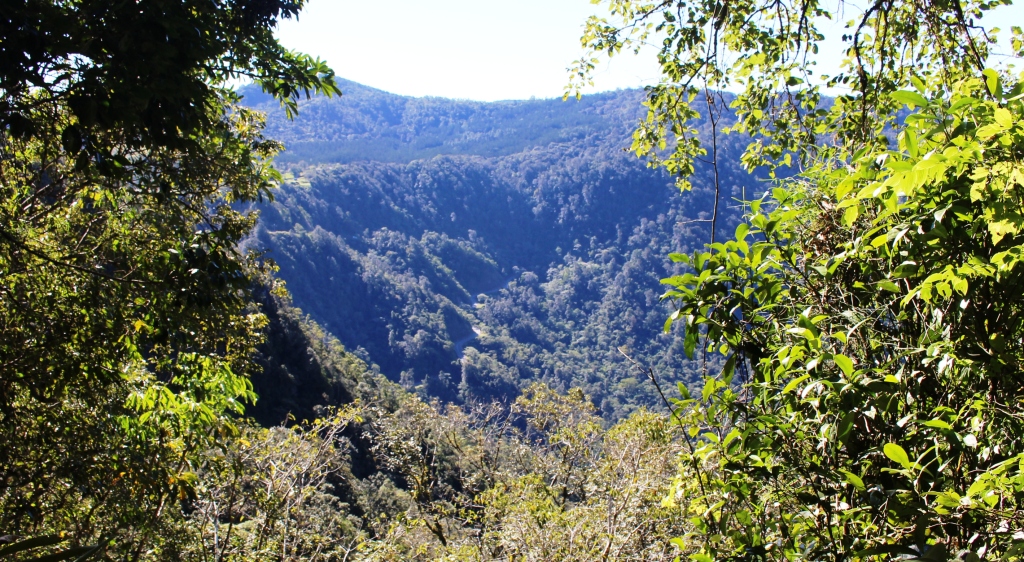
Roadworks. This ravine was much deeper than it appears.
Day 5
Yet another sunny morning! There is hardly a cloud in the sky, but it is quite chilly. It is time to break out the “long johns” I think.
Much of the Fitzroy Developmental Road was quite new and easy going. Later in the day the roads became narrower and bumpier from constant use by heavy transport vehicles. There were road and bridge works under way in several places. At one point we plunged into a deep ravine and out the other side on a temporary road.
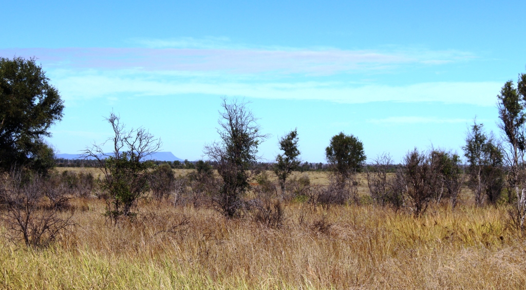
Not many hills in this area but Blackdown Tableland can be seen in the distance
We drove north from Dingo for about one hundred kilometres on the Fitzroy Developmental Road deep into the southern Bowen Basin. There is no coal mining at Dingo or any sign of it until near Middlemount , which we reached a few minutes after turning of the Fitzroy Developmental Road. From Middlemount to Dysart there are mines, but not prominent and most are well off the road. Middlemount and Dysart are both mining towns.

Public sporting facilities at Dysart
Both are modern with extensive community facilities and shopping centres that contain the shops that sell the essentials and some that sell luxuries.
Further on, we reached the longer established mining area where the mining activity is more extensive and visible. The road runs right through the middle of Peak Downs mine. Two over passes carry mining traffic over
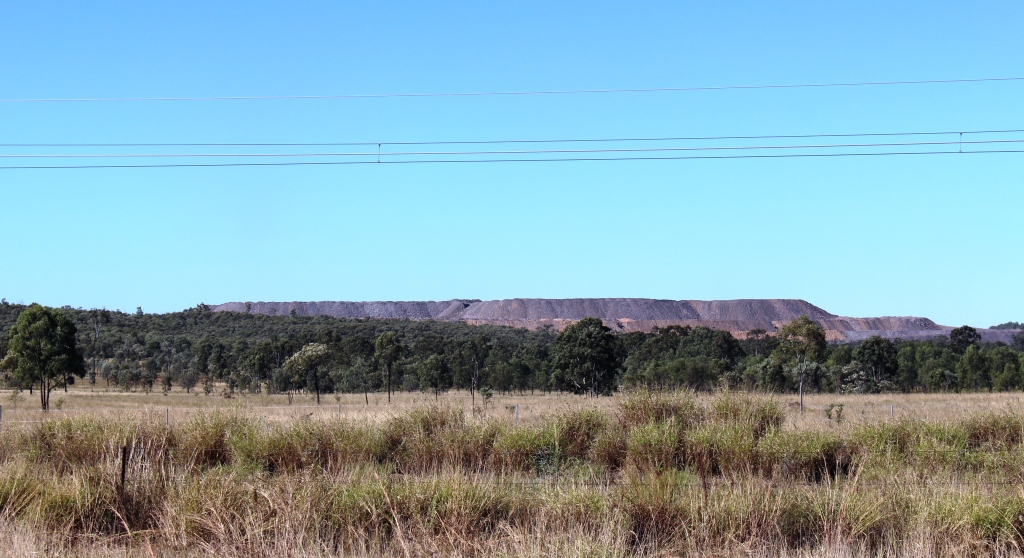
Overburden is a sure sign of a coal mine
the highway, traffic including the huge dump trucks that carry the coal from the mine to the processing and loading facilities. We parked beside the road and while I walked around taking photos Ruth had the best seat in the house. She sat in the front of the car and watched the parade of dump trucks crossing the over pass no more than 200 metres in front of her.
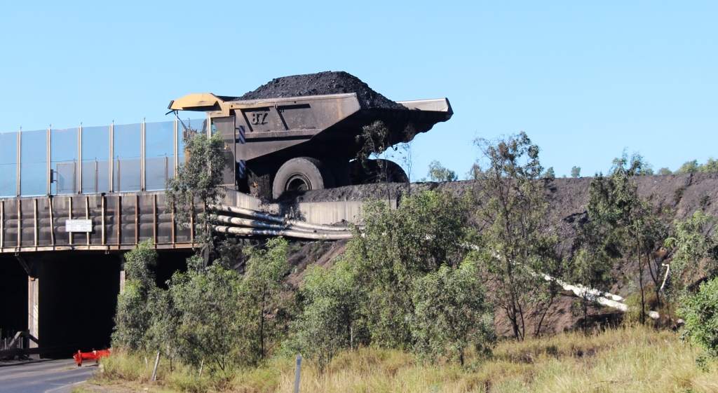
A coal laden dump truck traveling from the mine to the loading facility

Coal production equipment at Peak Down Mine

Peak Downs Mine coal washing plant
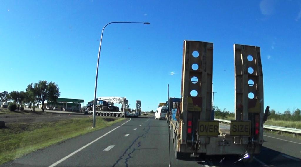
The wide load turning off the highway ahead of us
Just before turning onto the Peak Downs Highway near Moranbah we came up behind a very wide load. The escorts were not interested in letting anyone get past so the journey to the junction of the road into Moranbah was a bit slow. We had visited that particular town when in the area two years ago, so we refueled and continued on the few kilometres to our

Vans parked at the Isis River camping area
stopping off point for the night beside the Isaac River.
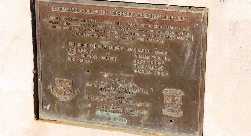
A plaque commemorates the passing of this site by the Leichhardt expedition in 1844-45
Day 6
The weather is starting to get boring. It’s sunny and cool again but with temperatures in the mid 20s promised. The activity today was to get ourselves from Isaac River to Finch Hatton, a small town inland from Mackay, in the Pioneer Valley.
There was not much traffic going our way but there was a constant stream of oncoming traffic, most of it large trucks bound for the mining area. The Fitzroy Developmental Road that we had started out on the previous day, but left after about 100 kilometers, joins the Peak Downs Highway not far into our day’s journey. As we approached the intersection flashing yellow lights confirmed the chatter that we had been hearing on the two way radio and a truck carrying a very long bridge beam entered the road right in front of us.
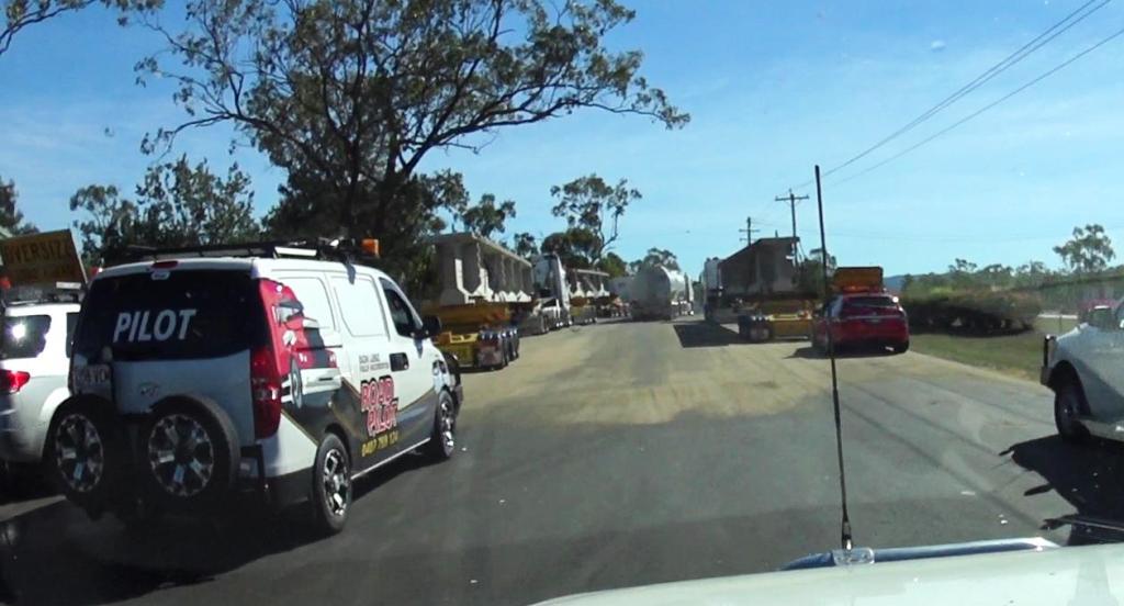
About to drive through the parked convoy vehicles
We soon found that there were two more ahead, making a convoy of three over dimensional trucks and six escorts vehicles. We, and the string of vehicles behind us, knew that we could not pass, so we settled in to be part of a convoy of ever increasing length. Fortunately the large trucks up ahead were able to maintain speeds of about 80 to 90 kph so everyone was happy. This arrangement continued until the trucks pulled off for a rest break at the small town of Nebo.
That was the end of excitement for the day.
Those familiar with this end of the Peak Downs Highway might be interested to know that work is under way to bypass the steep winding section where the road climbs from the Pioneer Valley to the plateau that leads to the Bowen Basin. The work is well under way.
Driving through cane fields
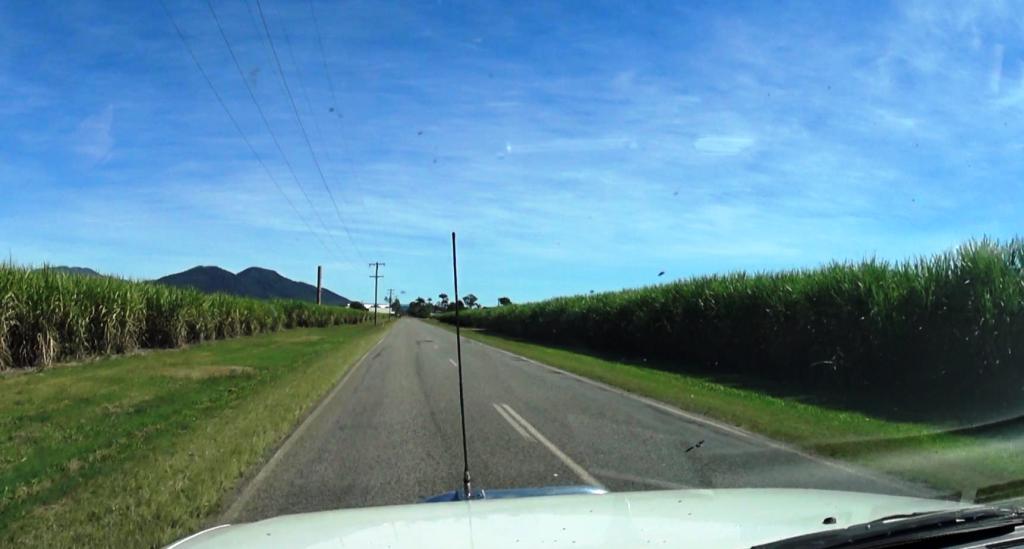
The drive from Eaton to Finch Hatton is through sugar cane fields where the harvest was just getting under way. Cane harvest produces hazards on the road, particularly cane trains at level crossings, slow moving cane transport vehicles and cane harvesting machinery as it moves from farm to farm. The approach to a sugar mill is marked by that tell tale sweet smell of sugar juice. But to the ,locals the smell is the odor if liquid gold.
We drove to Finch Hatton via Marian, for fuel, and then drove through the neighboring town of Mirani. I was amazed at the extent to which suburbia has reached out from Mackay to those towns. Partly the result of housing demand from the mining boom, I suppose.
We arrived and set up in the Finch Hatton showground, which doubles as their caravan park, in time for a late lunch. We spent a lazy afternoon, mostly reading.
Day 7
Our reason for visiting Finch Hatton was to see Finch Hatton Gorge. A few years ago we drove to the start of the walks but didn’t have time to do any of them.
Finch Hatton Gorge is not a gorge in the normal expectation of gorges that are tourist attractions. It runs into a rain forest covered mountain range and its floor and sides are rain forest covered. It’s unique feature is the stream that runs through it, but more particularly two features of the stream.
There are two walks, the second being an extension of the first. The walk to reach Araluen Cascades is about 1.4 kilometres from the car park. The path winds through dense rain forest, around the heads of a number of gullies, for about 900 metres and then descends about 500 metres to the falls. A viewing platform provides an close view of the falls themselves but a staircase has been provided to access the rock pools into which the water tumbles.
I have put my video clips and images into a short video to give you an idea about the drive in to the area, the walk to the cascades and the Araluen Cascades themselves. Here it is.
[youtube]https://www.youtube.com/watch?v=yjQv55Cpd4k[/youtube]
We did the walk to this point and spent 30 minutes or so just absorbing the beauty and atmosphere of the place. While there, a couple of French backpackers arrived. On our walk back we met several groups of walkers, many of who were in our age group. This is the most ambitious walk that Ruth has done since her knee replacement. She passed the challenge with flying colours.
The extension to the walk is a further 1.4 kilometre return to Wheel of Fire rock pool. We didn’t do this part but understand the feature to be a particularly large rock pool suitable for swimming. Both locations are popular with locals as swimming facilities, particularly in summer time and because they are free of crocodiles. The water looked to be well below swimming temperature to me but I suppose it is warmer in Summer.
The road winds up the mountain to Eungella village
After lunch we drove up the remainder of the Pioneer Valley and ascended the steep climb to the village of Eungella and the Eungella section of the National Park of the same name. Finch Hatton Gorge is also in the Eungella National Park. Before taking in the views from Eungella we drove on to Broken River with a objective of spotting a Platypus.
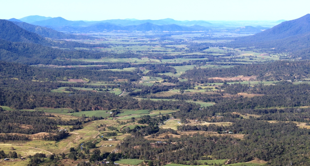
The Pioneer Valley from a Sky Window viewing area
But first we came to that 300 metre stroll known as Sky Window. I had forgotten all about it. The loop track leads to two excellent views. The first is over the mountain side where the road snakes up from the valley. The road is clearly visible from this vantage point. The second view is of the Pioneer Valley and the mountain ranges that form it. Today the view was clear with not much haze. The patch work of cane farms is quite attractive.
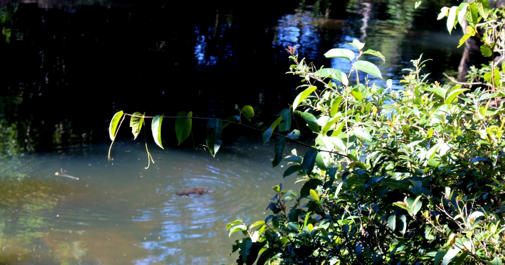
Our Platypus sighting
Our luck was in at Broken River. We sighted a Platypus three times before it headed for the river bank, probably going home to its burrow.
We returned to Eungella village to take in that perspective of the Pioneer Valley from a different angle before descending to the valley and returning to Finch Hatton for the night.
Just for fun, I edited some action camera videos, that we had filmed on the way up the range and coming down again, to give you an idea of what the drive is like. Here it is:
[youtube]https://www.youtube.com/watch?v=RSdqdmS5JIw[/youtube]