
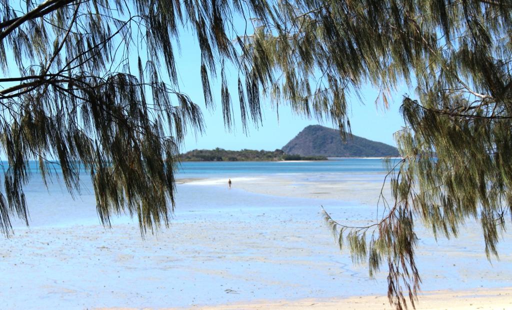
Hideaway Bay
Our next objective was Hideaway Bay. This quiet sea side corner is about 30 kilometres north of Proserpine on the north western end of the Whitsunday Peninsula, just before the coast swings away into the bay before Bowen. If travelling by sea, that is. It is about 700 road kilometres on from Hervey Bay.
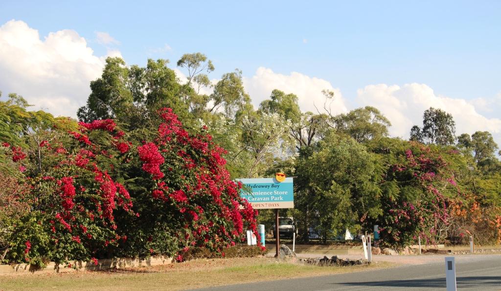
The entrance to the caravan park
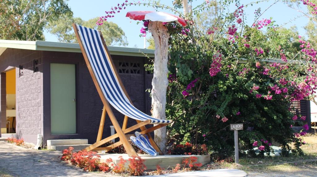
And you can relax big time!
We had planned to reach Rockhampton, about 400 km on, the first day but continued a further 100 and stopped in a pleasant roadside park at Marlborough. We easily made Mackay the next day, despite a lengthy chat with some fellow nomads from Tasmania at a rest stop along the way. It was then another 160 km to Hideaway Bay the next day.
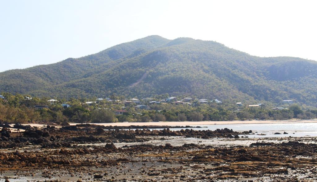
Houses at Hideaway Bay – between the sea and the hills
Hideaway Bay is a collection of houses built on the lower slopes of the ranges that run down to the sea. Some are permanently occupied while others are holiday homes, both private and rented. The town has no shops. Its commercial centre is a telephone box. The caravan park is at the entrance to the town. At the other end of Hideaway Bay Road, where the sealed road ends, is a turning circle and what must be one of the best placed picnic shelters in the world.
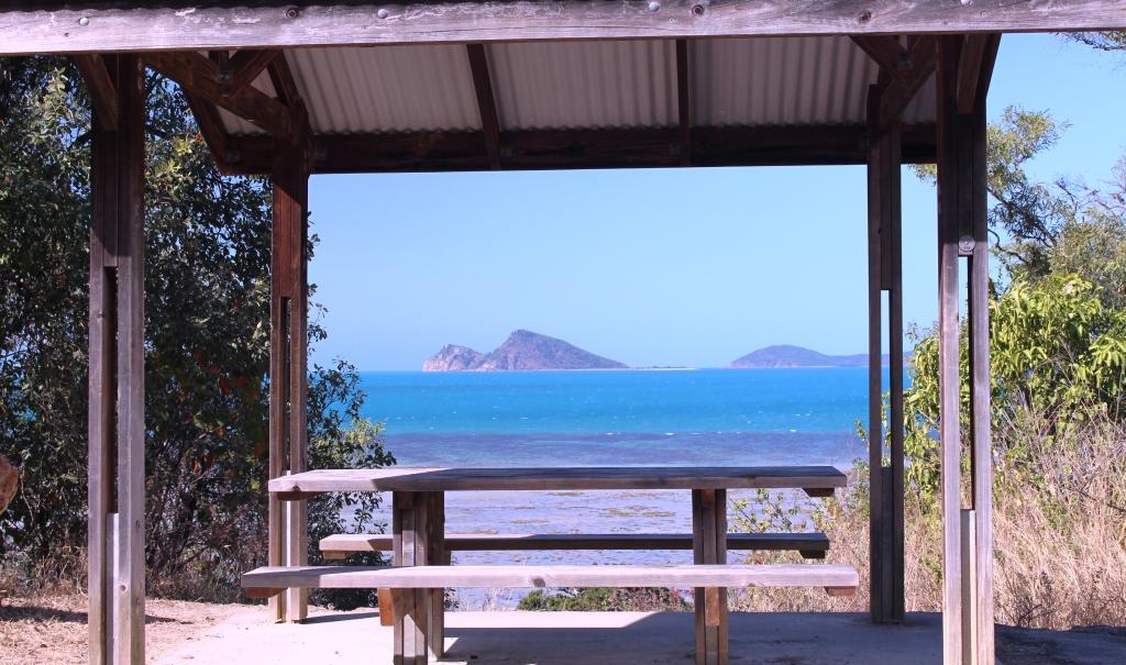
A well positioned picnic shelter
A gravel road continues from the turning circle and about 5 kilometres further on it passes Cape Gloucester, Gloucester Passage and Gloucester Island. On the western shore of Cape Gloucester two small resorts are located in what must be the most idyllic locations in the Whitsunday area. They are not flash establishments, in fact they are quite basic, but absolutely ooze charm.

Ruth and the view – and a drink
About 8 kilometres away is Dingo Beach which boasts a pub with attached store and fuel pumps and other essentials like bait sales and boat hire. For all else please drive to Proserpine.
Dingo Beach – A stroll at low tide

My “Fantasy Island” – off Dingo Beach
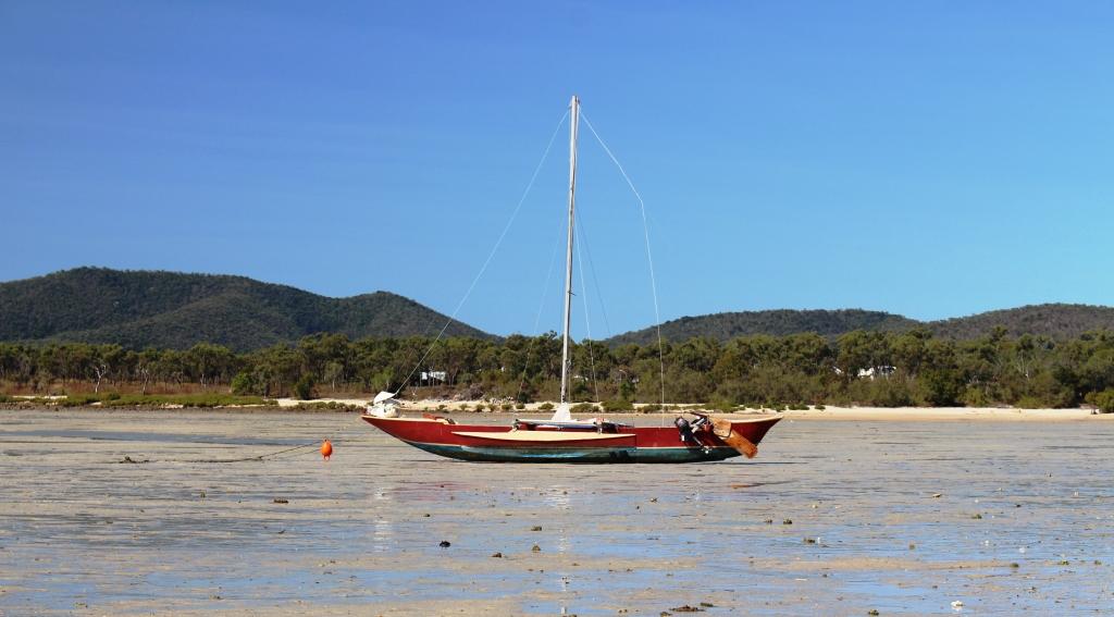
Outrigger boat on Dingo Beach
Clients of the caravan park include grey nomads escaping the rigors of southern winters, those who come for the fishing, including some of the nomads and people passing through, like us.
View from the beach to Gloucester Island
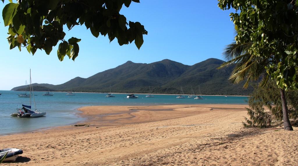
We stayed for three nights and did very little but did visit the beach and took a drive beyond Cape Gloucester to check out the resorts. As we rounded a further point we were surprised to find over 60 yachts, multihulls and power boats, anchored just off shore.
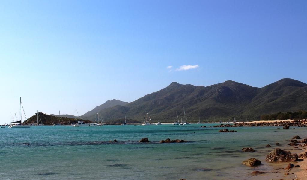
Boats at cnchor off Montes Resort
The Cape Gloucester Eco Resort was quiet but at Montes next door it was all “go”. You see, Montes were hosting the Shag Island Regatta, a charity fund raising event that has become a fixture. That explains all the anchored pleasure craft. We were told that there were many more to come. I’m not sure how it all works but last year they raised $35,000. But I get the impression that the pecking order among participants has more to do with drinking than nautical skills.

Preparing for the revelries at Montes Resort
Neighbours on one side at the caravan park were from Bairnsdale in Victoria. The lady had worked for an Orbost transport company with which I later had a close association so we knew many of the same people. They were also skilled fishing people which yielded a couple of meals of freshly caught sweet lip.
Our next target was the Burdekin Falls Dam. The Burdekin River flows into the Coral Sea after passing between the sugar cane towns of Home Hill and Ayr. My interest is that one of the transport companies for which I was responsible, after our relocation to Brisbane, carried into the sight substantial quantities of the materials used to construct the dam. We also had some heavy cranes on site. I had not visited during construction and have always wanted to see the final construction.
Ravenswood & Burdekin Falls Dam
Our plan had been to shorten the journey by using a mostly dirt and gravel road that cuts across from Ayr to Ravenswood, but when advised that it was in poor condition decided to travel further north before cutting back to the main access road. This meant spending an extra night somewhere, so we checked out a free camp at Giru, just north of Ayr, but finding it to be of a standard somewhere below ordinary we continued on to a park that we had used previously in Townsville’s southern suburbs.
Burdekin Falls Dan – a solid concrete structure
Ruth had previously received notification of a 25% discount sale at Noni B (where she used to work) and with a gift voucher burning a hole in her handbag had been hunting on the their web site, unsuccessfully, for a suitable purchase. Magnanimous Kev, seeing that it was Saturday morning, offered to drive past a Noni B store before we headed out of town.
Google search directed us to a shop that no longer exists but neighbouring traders pointed us in the right direction and a purchase was made. But that was the minor purchase. The more important one was some fresh cooked prawns that we devoured for lunch with fresh bread rolls with lashings of butter – well, margarine actually. I had forgotten that grey nomads had it so good!
The road to Burdekin Falls Dam leaves the Flinders Highway 90 kilometres from Townsville at the tiny village of Mingela, population 20. It is 121 kilometres to the dam from the turn but after 40 of them you reach the fascinating gold mining town of Ravenswood. The town is littered with remnants of its past, located right beside a town of about 500 people and ongoing gold mining activities. There is both an open cut and an underground mine in the area.
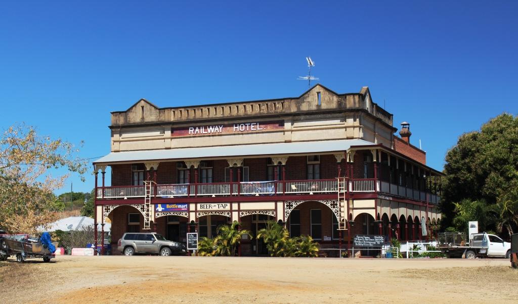
The Railway Hotel, Ravenswood
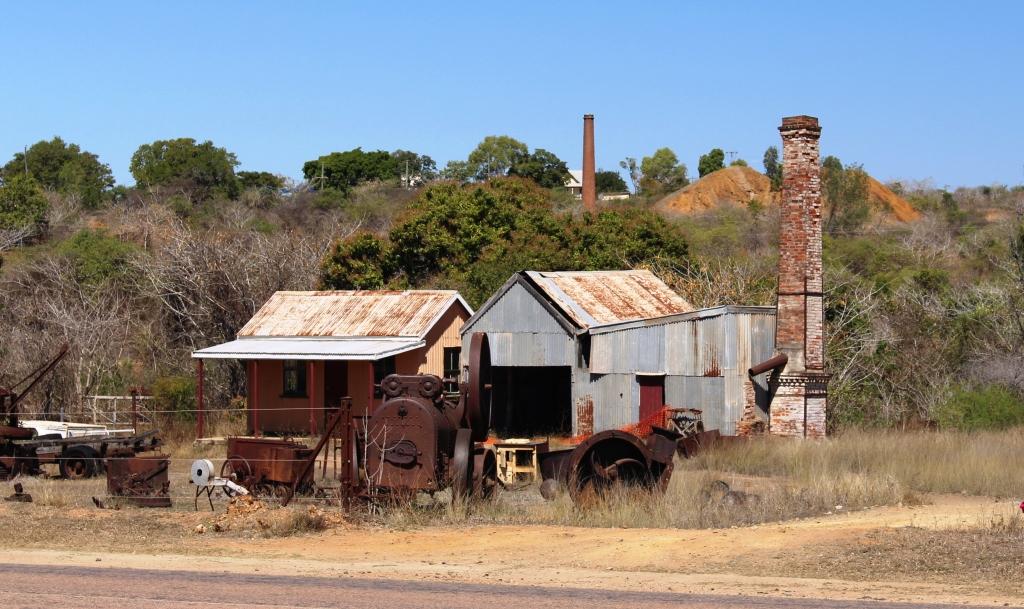
Relics of the town’s gold mining history are everywhere
Like most old gold mining towns its size and success is indicated by the number and quality of pubs. Ravenswood has three two storey hotel buildings two of which still operate and have been licensed for more than 100 years. Mining commenced in 1868 and faded away after a strike in 1912 and the outbreak of WWI. There were 48 pubs at the peak of operations and a population of around 5,000. A railway line came to the town for passengers and gold.
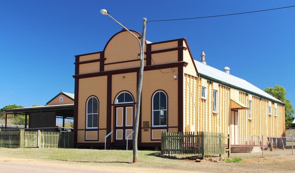
The School of Arts hall is in excellent condition
This is a town where it is possible to investigate much of the history up close. There are many heritage listed buildings and areas, most of which are quite accessible. Just out of town on the road to Ayr is a large white quartz outcrop known as the White Blow. The outcrop is 15 metres high and about 45 metres in diameter. It sits at the peak of a small hill in a conservation park of the same name. It is geologically unique in size and shape.
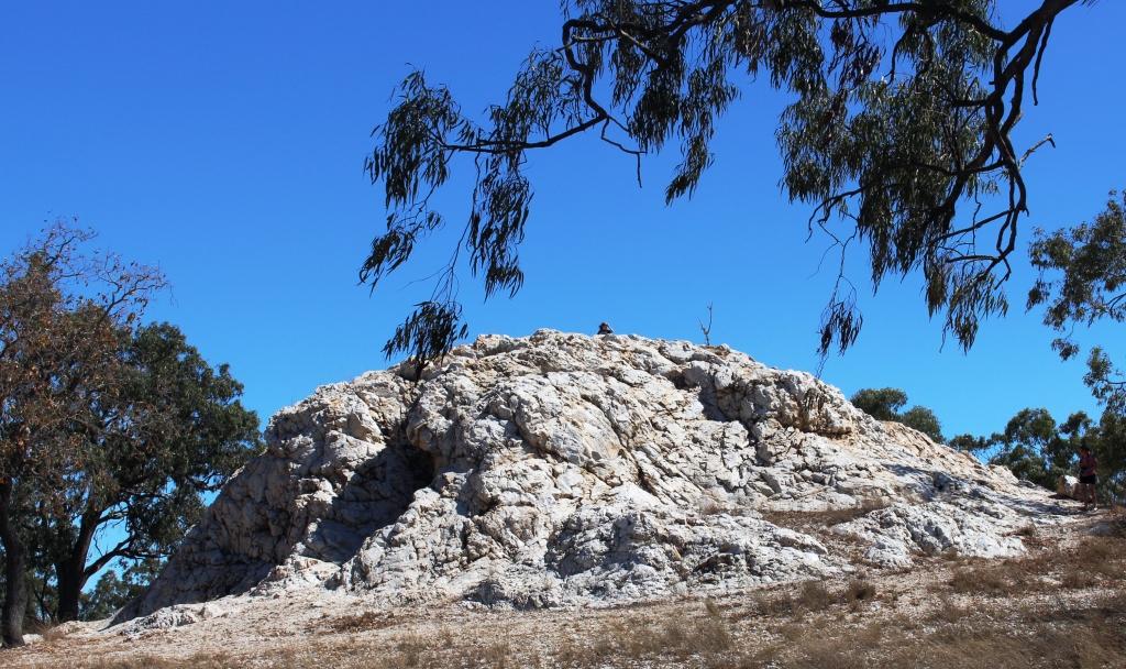
The White Blow is unique in both shape and size
It is a further 81 kilometres to the dam, through cattle country. The road is of redish bitumen, with painted centre lines and clear verges so that although cattle grids are used to minimise fencing the presence of hazards in the shape of beef cattle are easily seen. An interesting feature is the maze of cattle paths that run beside the road, leading to drinking holes and troughs. Generally the stock seems to stay clear of the road. We only encountered beasts on the road on two occasions although one was a very large hornless bull who refused to move as we scraped by.
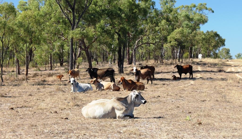
Cattle by the road side
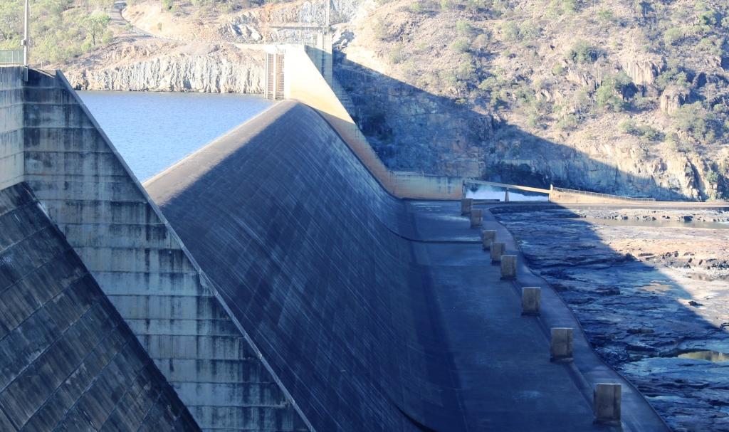
The Burdekin Falls Dam is quite a body of water. It dams the river at the head of a series of majestic falls and rapids that disappear from view around the bend in the gorge through which the river flows at this point. The wall is 876 metres in length and contains a spillway 504 metres long and 37 metres above the bed of the river. It has a surface area of 220 km2 and holds 1,860,000 mega litres. Get the picture? By comparison Sydney Harbour holds 500,000 mega litres and has a surface area of 55 km2.
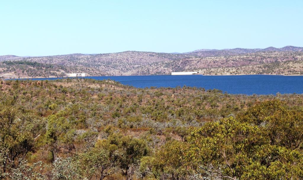
The body of water is known as Lake Dalrymple
There are no controlling gates so when the permanent bypass can no longer handle river flows the excess comes over the spillway. When this happens the road that leads on to Collinsville and the Bowen Basin coal area (it is a back road) is cut. The road, quite uniquely, runs at the foot of the spillway so is inundated as soon as the dam overflows
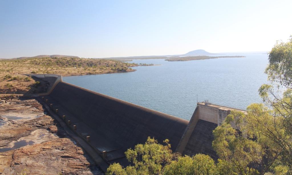
The road runs along the foot of the spillway
Because of the height of the wall, saddle dams have been built across ravines which would now be inundated with water at flood time. And when it comes to floods this river has some that were large.
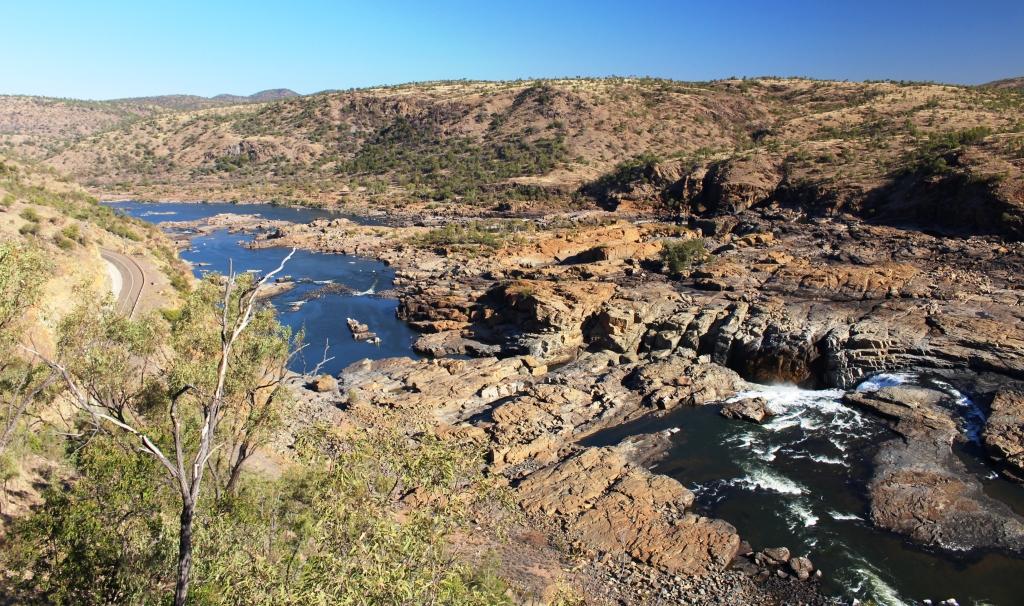
The Burdekin Falls start below the dam
Note the picture of the flood marker pole beside the road where the Flinders Highway crosses the Burdekin near Charters Towers and remember that the base if the pole stands above the level of the roadway. This location is well upstream from the dam.
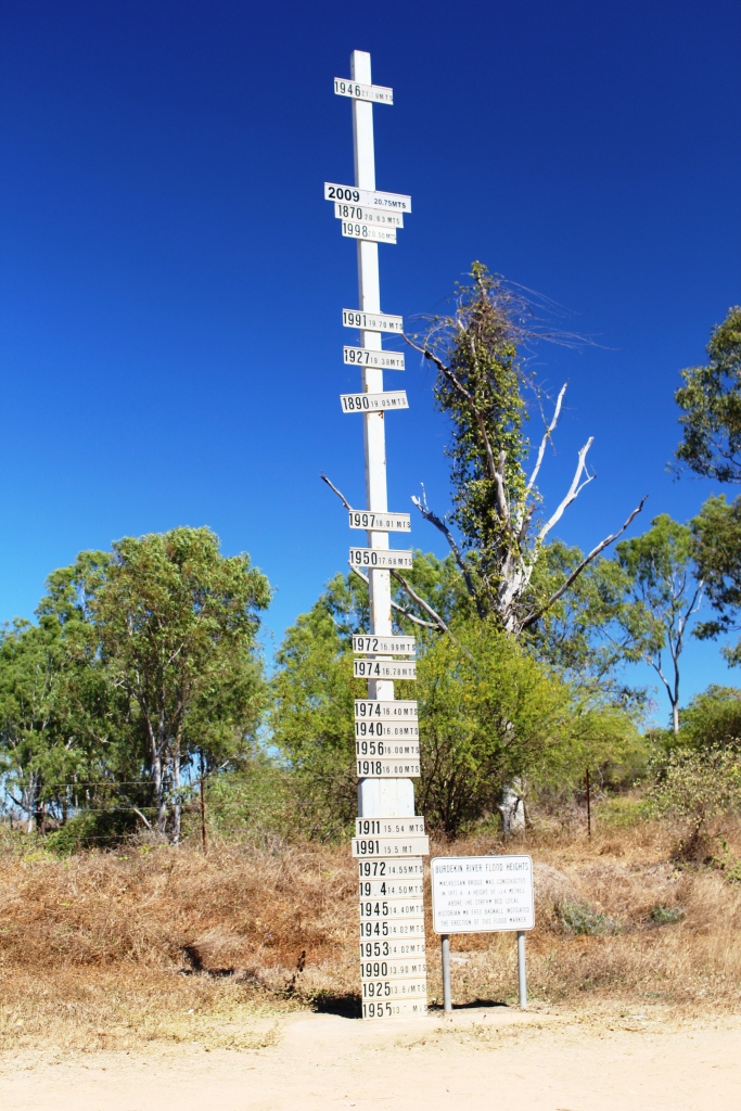
Burdekin River flood levels well upstream from the dam
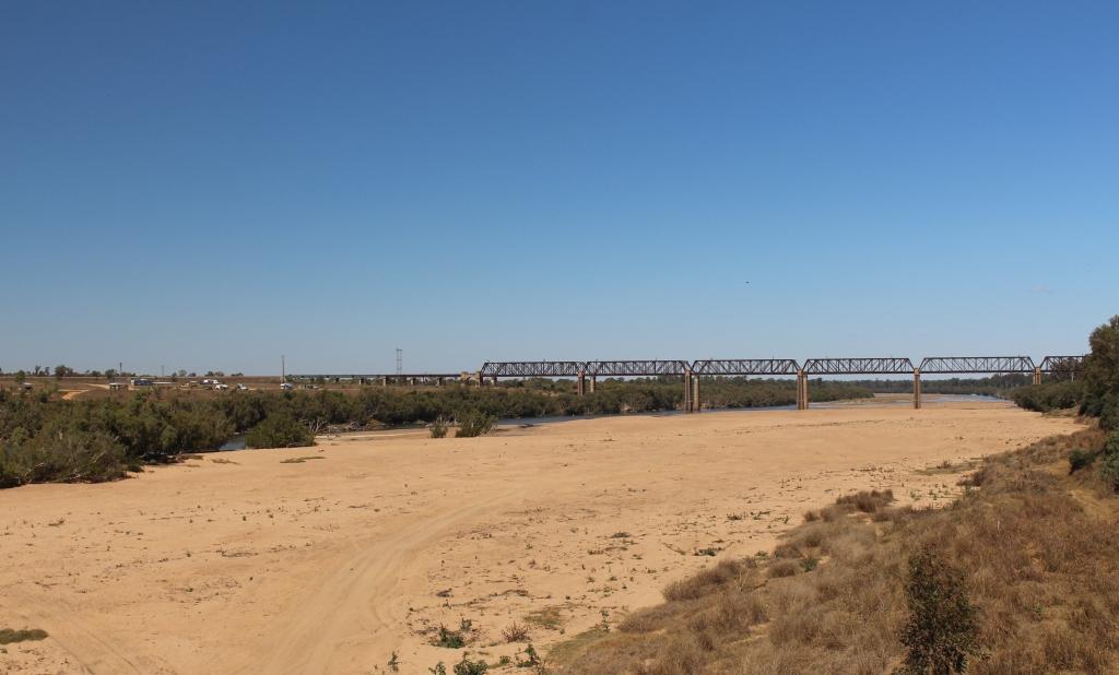
Railway bridge over the Burdekin River near Charters Towers
The only habitation at the dam is the resident rangers for SunWater and the caravan park that they run. With regularly watered grass, concrete pads for an annex, power, water and sullage it is the best value around at $15 per night for two adults. It has the added advantage of a flock of peacocks in residence, a great variety of visiting birds and regular visits from kangaroos. As a bonus we had a clear night with a magnificent display of stars.
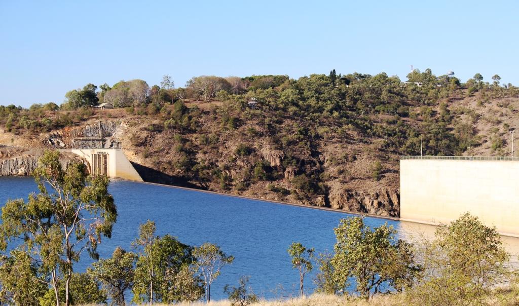
The caravan Park is on the hill above the dam
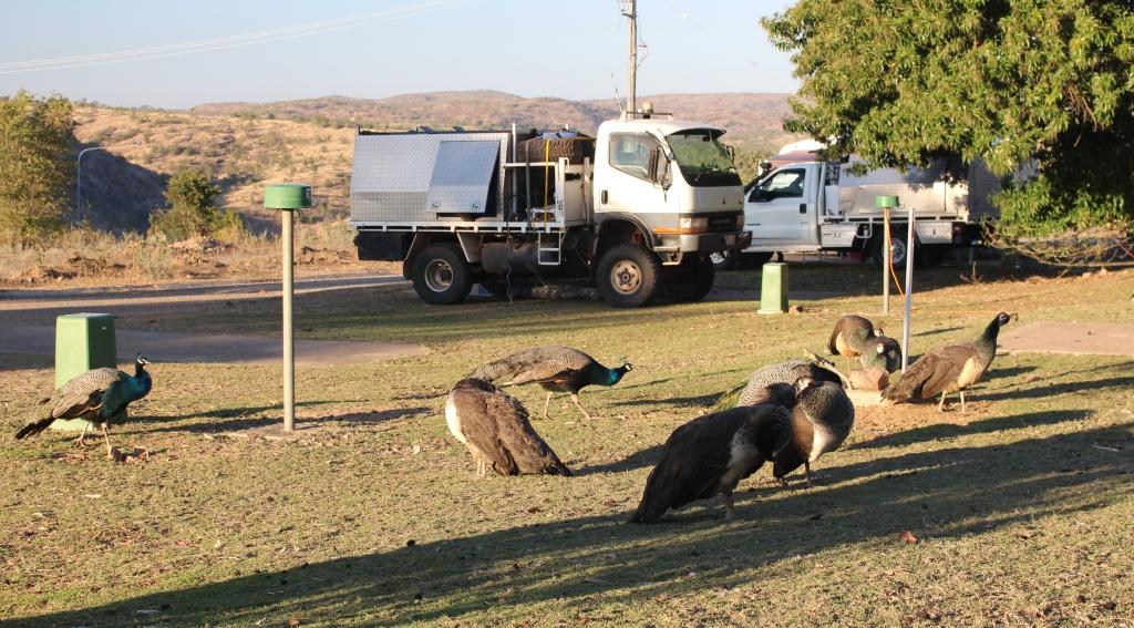
Peacocks waiting for food
We have moved on to Charters Towers for the night. Our stay in the park coincided with a three course dinner, run as a fund raiser by the local Lions Club. When I asked Ruth if she thought we should participate, her affirmative reply came without much hesitation.