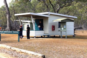
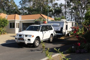
 On the trek into Mount Moffatt, the first real point of interest is the Slab Hut, a relic of earlier days of cattle grazing in the area. But it failed to grab our attention when our six vehicle convoy stopped to inspect this example of pioneering residential stamina. Ruth opened the caravan door to find the contents of our refrigerator on the floor with the fridge door underneath. Our consternation was quickly shared by our travelling companions with the Slab Hut fading to insignificance. Some perishables were quickly moved to spare capacity in other refrigerators while we considered what to do.
Our group leader quickly spied the problem. The door is hinged on a fixed pin at the bottom and a threaded pin at the top. The top pin had worked loose, allowing the door to fall off. Not a very good design in my view. Another member of the group produced a gleaming set of spanners and very soon the door was back in place and the food replaced. Then, following an inspection of the hut we continued on our way to our destination at the Dargonally Rock Pool camping area, within the Park.
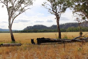
The area of Central Queensland west of the Great Dividing Range hosts a series of sandstone mountain ranges. A substantial proportion of them are enclosed within the borders of the four areas that make up the Carnarvon Gorge National Park. The best known is the Carnarvon Gorge itself but, although more difficult to access, the Mount Moffat section runs a close second. The area is a plateau at around 700 meters with mountain peaks to more than 1,200 meters. The weather was quite cool at this time of the year.
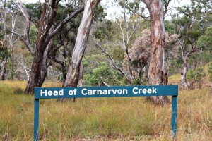
Vegetation is open bush land with some areas of denser growth and open grass land. In the north of the park, near the top of Carnarvon Gorge and the source of the Carnarvon Creek, there is an impressive stand of Mahogany trees that brought back memories of my roots in the timber areas of the Central Coast of New South Wales and my timber cutting father. I could almost hear the sound of the fall of the axe and the rasp of the crosscut saw. The Maranoa River also rises in this area.
The Dargonally Rock Pool camping ground is, unsurprisingly, beside a stream that would have had rock pools with more rain, but only provided a few puddles. Fortunately the National Park authorities had provided a tap and although the water was untreated it was clean and provided a valuable backup for our drinking supply. We set up our vans, camper trailers and one tent in a rough circle around the all important camp fire.
The camp fire was the center of social activity, as well as the main cooking medium for some. An experienced camper brought a spike that, when driven into the ground, supported a barbecue plate and a hook from which a camp fire kettle hung over the flames. The fireplace was surrounded by logs sawn in half length wise to provide seating, to which we added comfortable chairs and tables for
meals. Food preparation included use of camp ovens for those with the required skills. Dishes prepared for community consumption in these handy devices included delicious dampers and a huge apple pie.
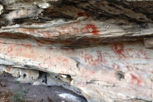
The park attracts visitors because of its remoteness, its physical attractions and its history. There are two areas of significant Aboriginal art and historic sites associated with bush ranger activity.
In the late Nineteenth Century the Kenniff Brothers, the last of Queensland’s bush rangers, frequented the area, pursuing their trade of cattle stealing . An offended
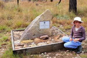
station owner and a police officer went into the hills to arrest them and were murdered by the brothers. To conceal the crime the Kenniff Brothers attempted to cremate the bodies. The bush rangers were ultimately brought to justice. The murder and cremation sites are marked on the map but we could only find the latter. The site, on flat rocks in the bed or a Creek, is marked by a memorial to the fallen police officer.
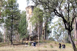
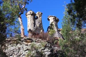
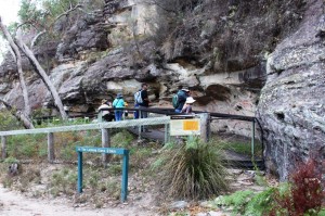
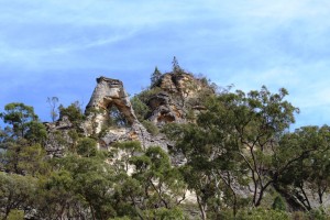
A six kilometer morning walk included the best of the Aboriginal art, which was similar to the art we had seen several years ago in the Carnarvon Gorge section of the park, possibly done by the same group. This walk included The Chimneys, a triple column of rock, a sort of mini Three Sisters and The Looking Glass, a rock formation high on a cliff top and where the center has weathered away forming a mirror like appearance and The Tombs, an Aboriginal burial site decorated with typical art work.
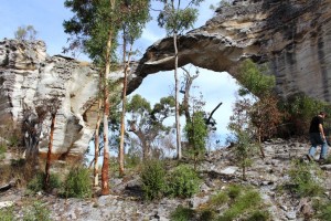
Lot’s Wife, a solitary pillar of sandstone and Marlong Arch, a narrow bridge of rock spanning a gap between two large rock outcrops were deeper into the park and we had checked them out the day before. On the final day we drove to the high country at the back of the park and while there walked 850 meters to Kookaburra Cave, the other Aboriginal art site.
On the final night we all gathered around the camp fire, discussing all manner of things while we waited for an apple pie to cook in a camp oven. Then with custard and cream provided by others, we finished our meal with a slice of the very delicious pie.
On Monday morning, the Queen’s Birthday holiday, we packed and, now a convoy of seven vehicles, headed out of the Park towards Mitchell, where we said our farewells over a late lunch before going our separate ways. Most turned east towards home, but Ruth and I and a lone traveler have headed west for Birdsville and parts beyond. Or at least that was the intention.
Mount Moffatt is accessed from Injune on the Carnarvon Highway or Mitchell on the Warrego Highway. Both roads are via Womblebank Station that is located where the roads meet. The distance from Injune is about 150 km and it is about 200 km from Mitchell. The last 80 km or so from either starting point is unsealed and a mixture of sand, dirt and gravel.
You ave read the story, now watch the movie.

