5th to 8th March 2020
Please Note: At the foot of this post you will find a series of videos covering the material that the blog post contains.
With our family visit concluded, we left Drouin in the continuing rain that followed the previous night’s heavy falls.
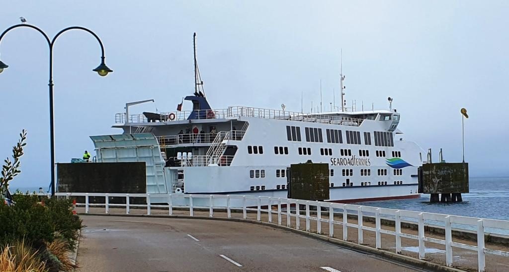
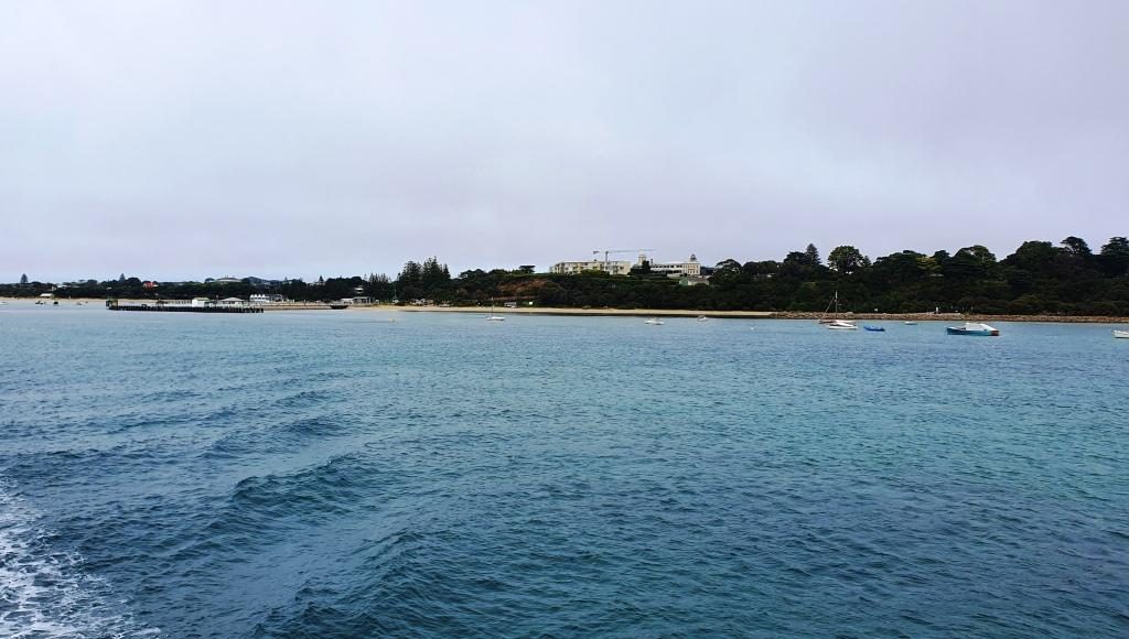
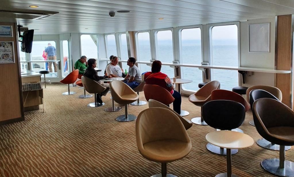
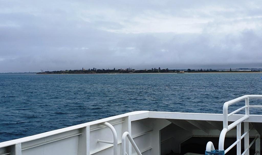
Rainfall was evidenced in flooded fields, overflowing drains and the odd closed road. As the day progressed the rain eased to persistent drizzle. We travelled to Sorrento on the Mornington Peninsular and caught the vehicle ferry to Queenscliff. Once again we experienced smooth waters without a white cap in sight.
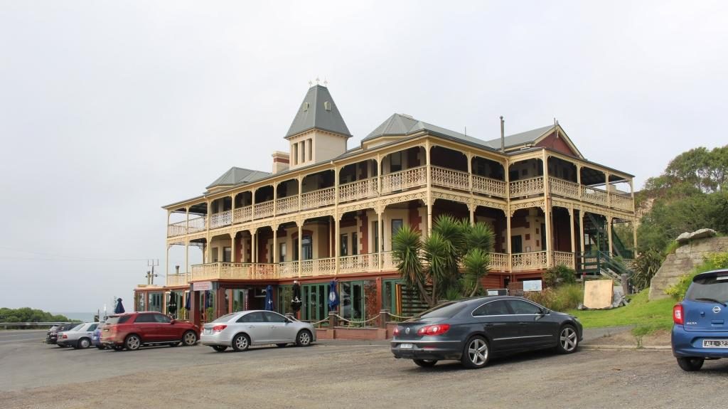
Queenscliff became the starting point for a short tour of the Bellarine Peninsular. We drove through St Leonards, stopped at Portarlington for lunch, drove through Clifton Springs and Ocean Grove, to our motel at Torquay.
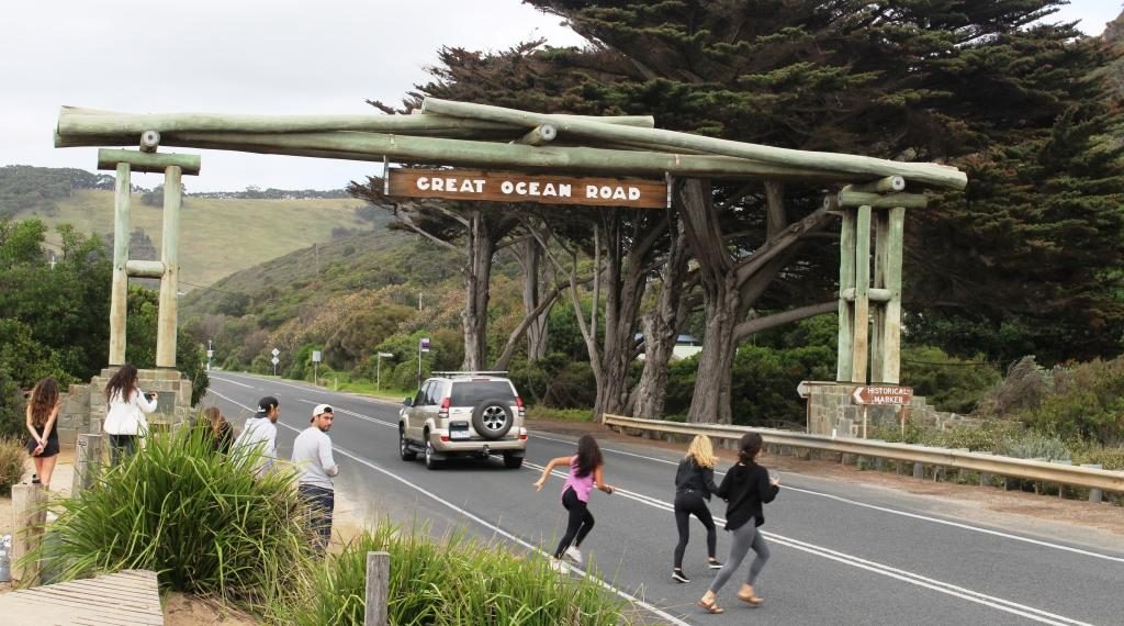
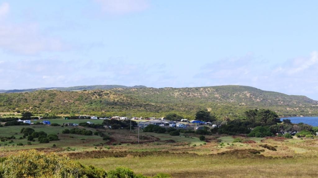
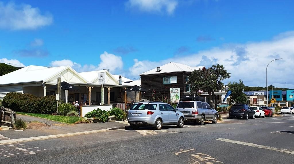
Torquay seems to have become the capital of surfing in Victoria. The local area is known as “The Surf Coast”. Torquay has an externally impressive surfing museum.
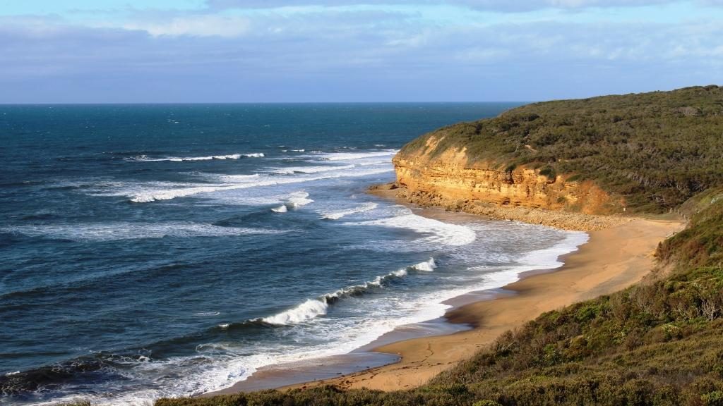
We commenced the next morning with a drive around Torquay. Then, in the true spirit of surfing, we dropped in to Bells Beach. There we found some real waves pounding onto the beach but not a surfer in sight. Although the sun was shining from a mostly blue sky the surfers were absent. We did see some board riders a bit further down the coast.
In Victoria it was the start the Labour Day long weekend so this area was busy with people away from Melbourne for a break. In Melbourne it was Moomba weekend and the Formula 1 car races.
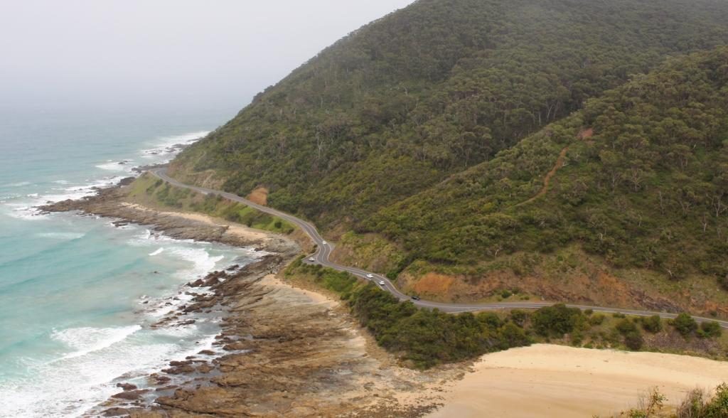
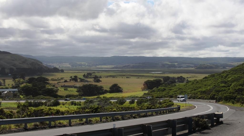
We drove in a generally south westerly direction along the Great Ocean Road and watched the weather deteriorate to a constant drizzle. We were able to see the points of interest and take short walks, but the windscreen wipers had been working for much of the day.
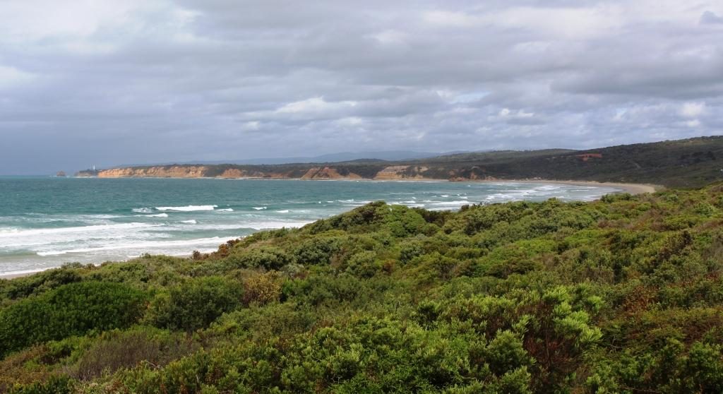
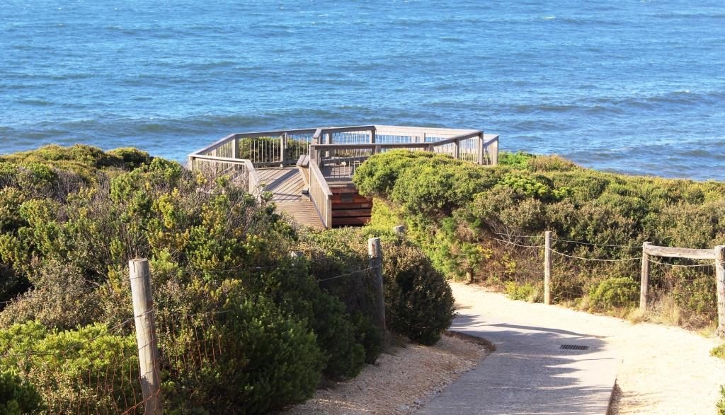
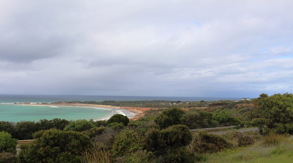
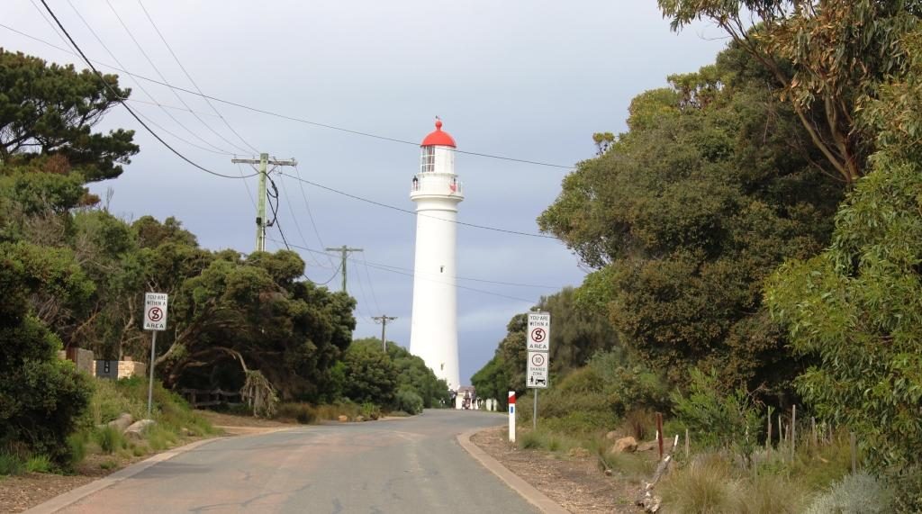
After Torquay the succession of settlements are mostly small towns until you reach Lorne. We took our morning coffee break at Anglesea and detoured from the main road at Aireys Inlet to take in the Split Point Lighthouse. The short walk to the lighthouse provided good views of the coast in both directions and a direct view of the sandstone island that gives the point its name.
We had thought that Lorne would be our lunch stop but we were a bit early and found the town to be crowded with no convenient parking available. So we passed it by, as a lunch stop, and drove on to Wye River, where we found a cafe with a covered alfresco deck with views over the ocean.
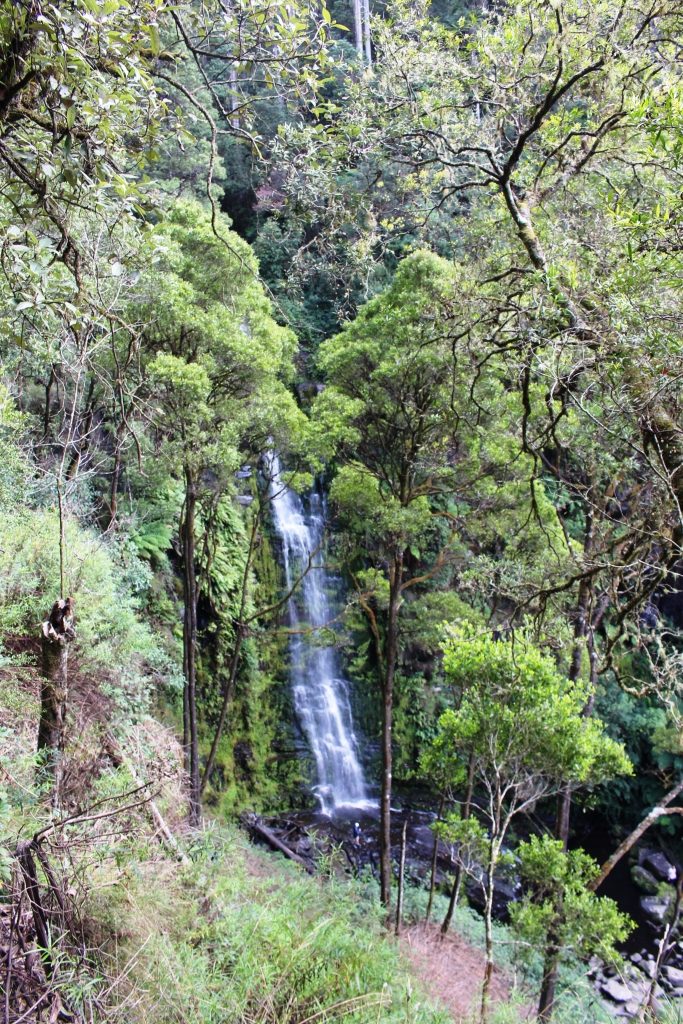
Before bypassing Lorne we had turned inland and drove about 10 km to Erskine Falls, a rather pretty spot with a short walk to see the actual falls.
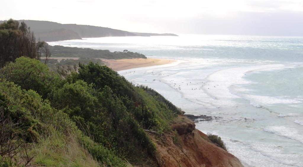
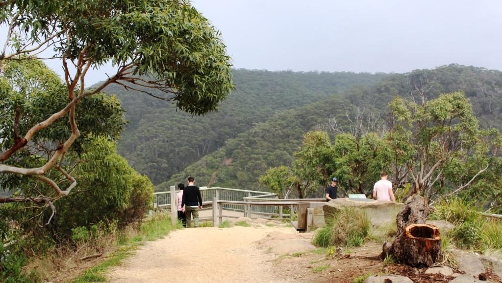
On the way back to the main road we drove into Teddy’s Lookout. That vantage point is located on the top of the hill directly above Lorne and provides great views of the road, snaking along the foot of the coastal mountains and views out to sea. The weather made the sea view rather bleak.
Mariners Lookout, on a hill overlooking Apollo Bay, also provides great views over that town but unfortunately not for us. As we arrived at the car park the rain got serious again. So we drove on to our motel and booked in. The motel has very effective reverse cycle air conditioning so Apollo Bay will wait until tomorrow, when there is the promise of a better day.
When we checked into our motel our car was almost the only one in the car park. Overnight the car park filled up and so did the town. Saturday was market day and the long weekend crowd was out in force. With the town so full it was a good time to leave. We had more sunshine than forecast but not enough to attract people into the ocean.
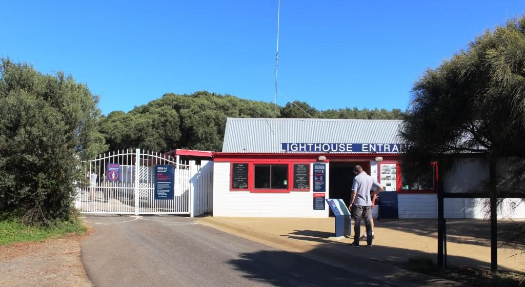
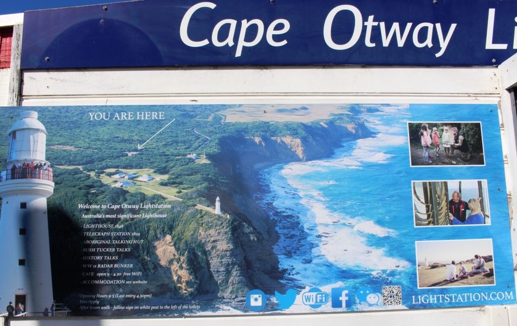
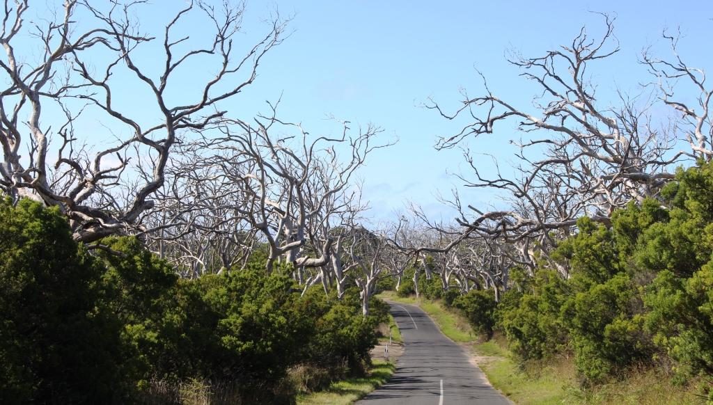
From Apollo Bay the road turns inland to negotiate the mountain ranges that run down to Cape Otway. We took the indicated turn and drove to the lighthouse. I think we had been there a long time ago but I couldn’t see anything familiar at all, so perhaps I was remembering somewhere else.
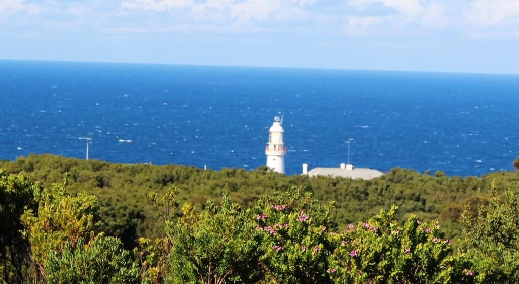
You don’t get to see the lighthouse close up unless you part with the best part of $20 and walk about 500 metres. Then Parks Victoria will give you a tour. The walk was too far for Ruth and I was disinclined to do it on my own so we decided against it. But a 350 metre walk down the Great Otway Walk got me to a point where I could see the top of the building over the trees, so that had to do.
We returned to the Great Ocean Road, turning left to make for Port Campbell and the sandstone wonders of that part of the coast.
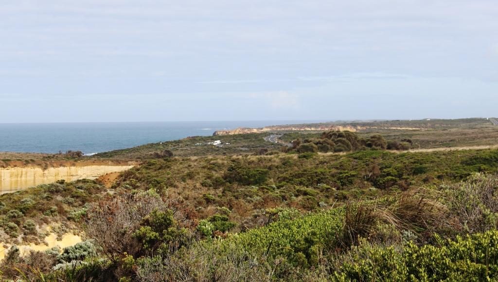
After we emerged from the mountainous inland section of the Great Ocean Road we travelled through an area of valleys and hills until we reached the village of Princetown that overlooks the estuary of the Gellibrand River and a caravan park that is larger than the town.
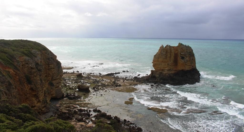
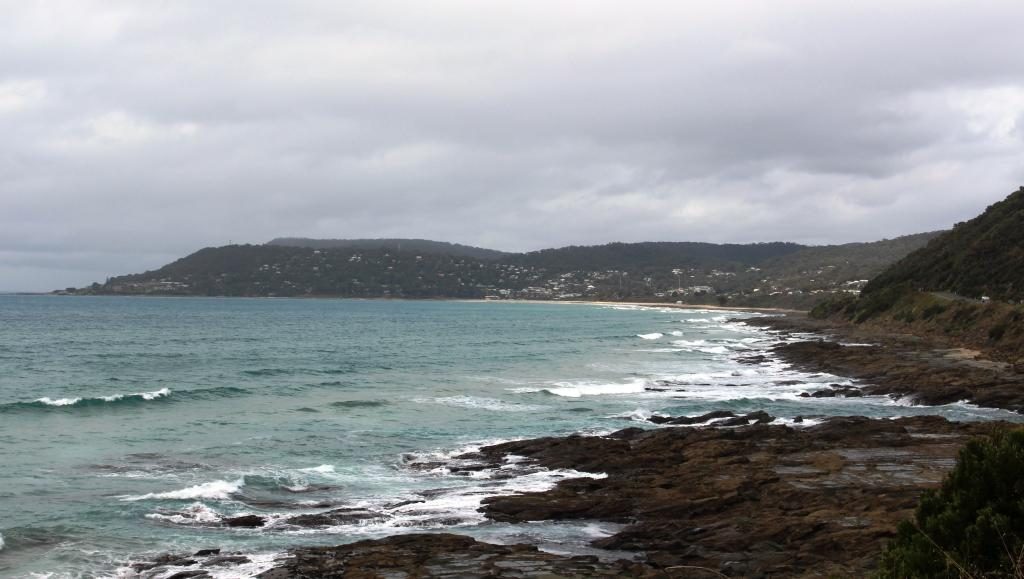
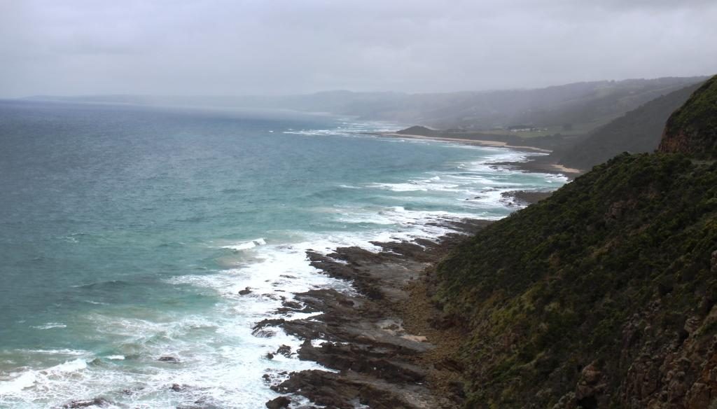
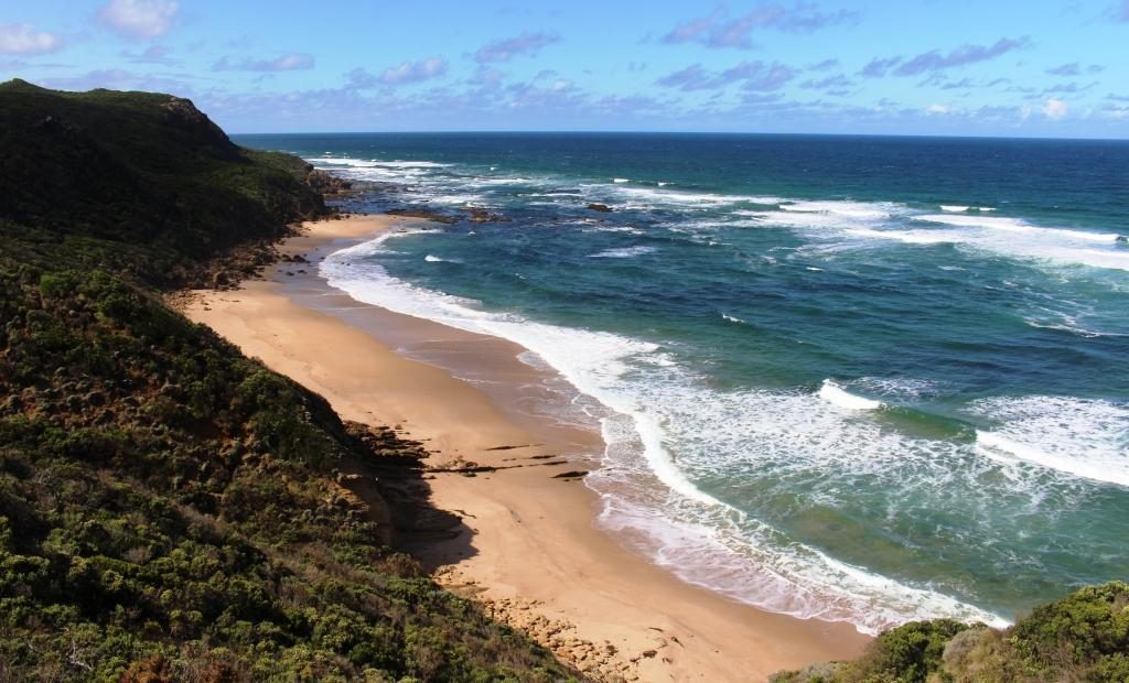
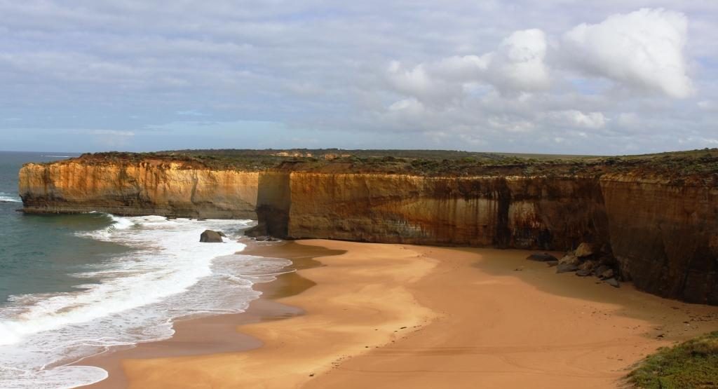
Just past Princetown the highway ascends a coastal hill that provides a pull off point for a lookout that gives the best ocean views for a while. At about the middle of the beach immediately below the lookout, if the tide is right, the remains of the timbers of a wrecked ship are clearly visible.
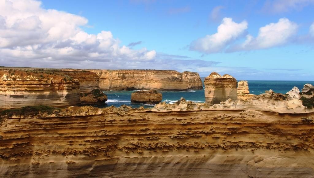
A bit further on, and just before you reach the Twelve Apostles you come to Gibson Steps that used to give access to the beach but no longer do due to their poor state of repair. They are locked off with a gate part way down.
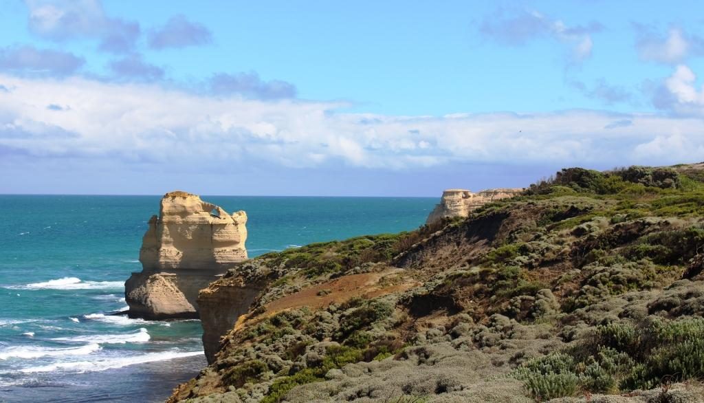
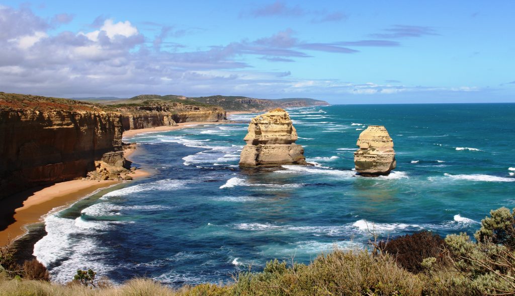
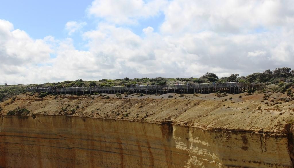
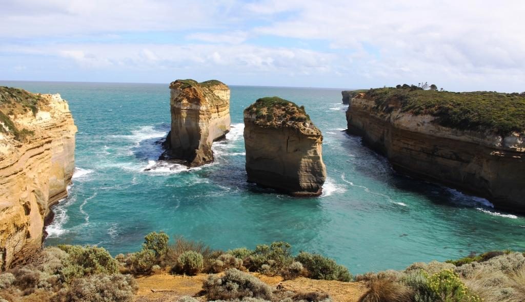
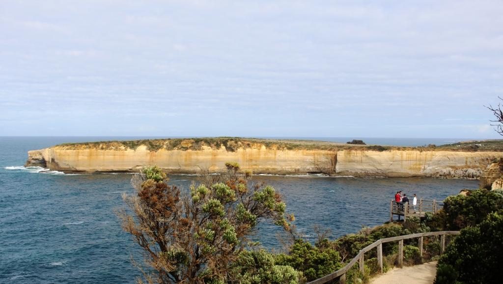
When we were last in that area parking was beside the road, for a short walk to the cliff top. Visitor numbers have forced an upgrade. Now there is a huge car park on the inland side of the road and an large visitor centre. Access to The Twelve Apostles is through the visitor centre and on a path under the road to an elaborate arrangement of platforms, boardwalks and lookouts.
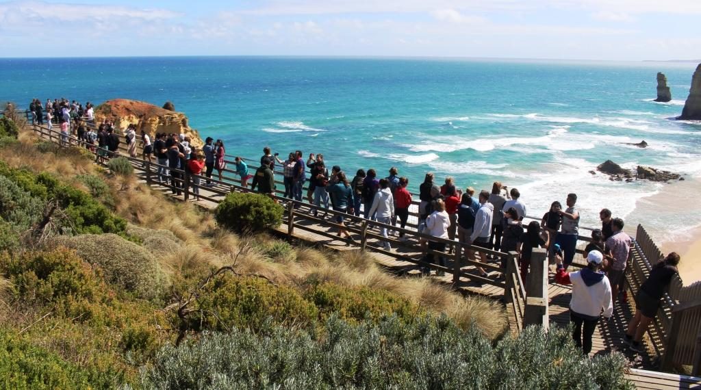
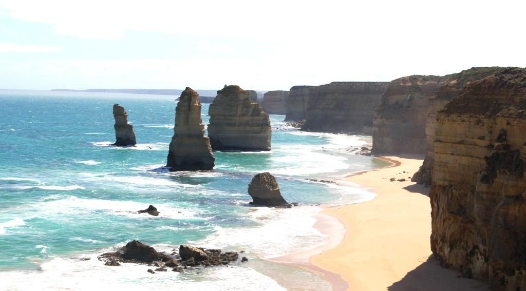
There are not as many apostles as there used to be. Constant weathering has removed some of them and reduced the size of the others. There will be a time when they will not exist at all. Even in their reduced numbers they draw an ever increasing volume of visitors.
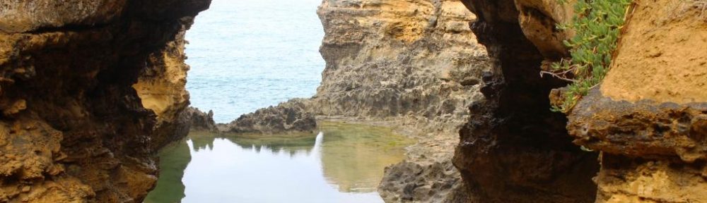
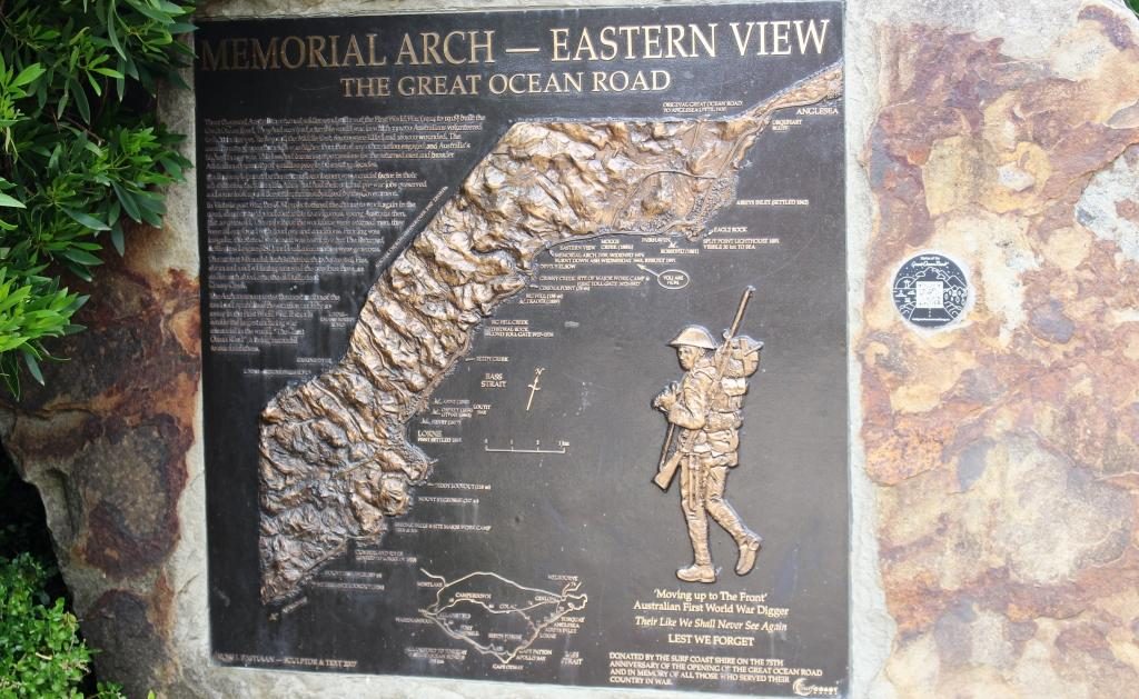
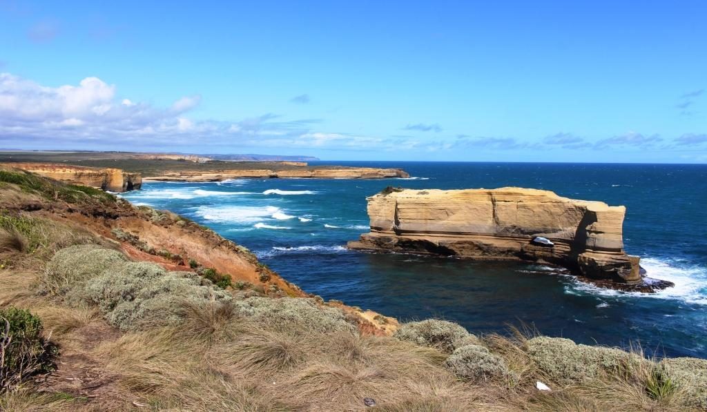
A couple of kilometres towards Port Campbell, Loch Ard Gorge is a gap in the coast named in remembrance of the clipper ship of the same name that beached on adjacent Mutton Bird Island on 1st June 1878, with only two survivors. The survivors made their way to safety through the gorge.
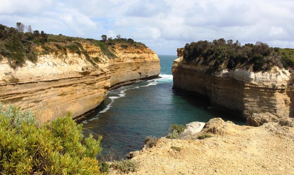
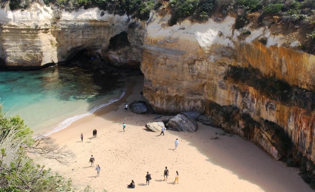
The walks around the gorge give access to some fantastic rock formations and expansive seascapes. Wooden steps lead down to one of the most protected beaches that you will ever see.
Our motel in Port Campbell overlooked the small protected port, itself a gap in the cliff, into which a stream flows at the western end of the beach. It is almost as sheltered as Loch Ard Gorge but somewhat larger. A substantial concrete wharf is tucked into a sheltered corner and is used by fishing boats and land based anglers.
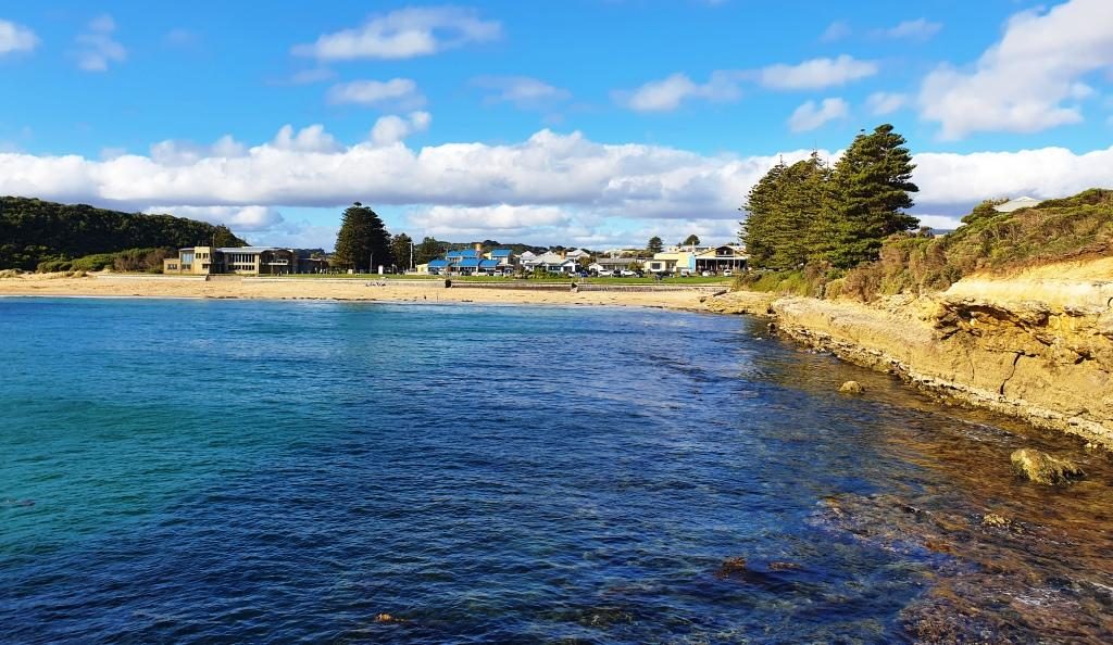
Port Campbell is a tourist town. Many of the buildings in its main street have been converted to restaurants and bars or other eateries or offer accommodation. It has two pubs and several motels. Many houses are B&Bs or private accommodation of some kind.
It is a most attractive town. We would like to have stayed longer but were lucky to get a booking for one night on Saturday of a long weekend.
Sunday dawned another fine day but we again had rain overnight. There was a bit more cloud than the previous day. The temperature may have reached 20C.
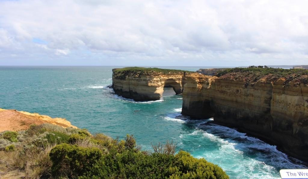
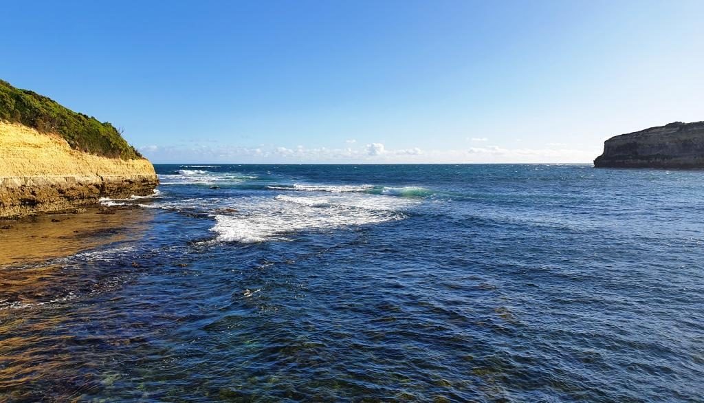
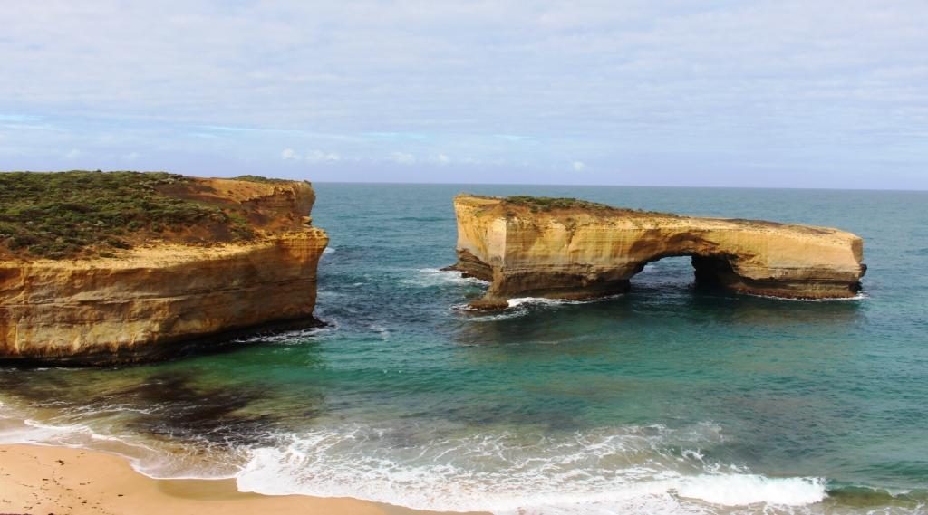
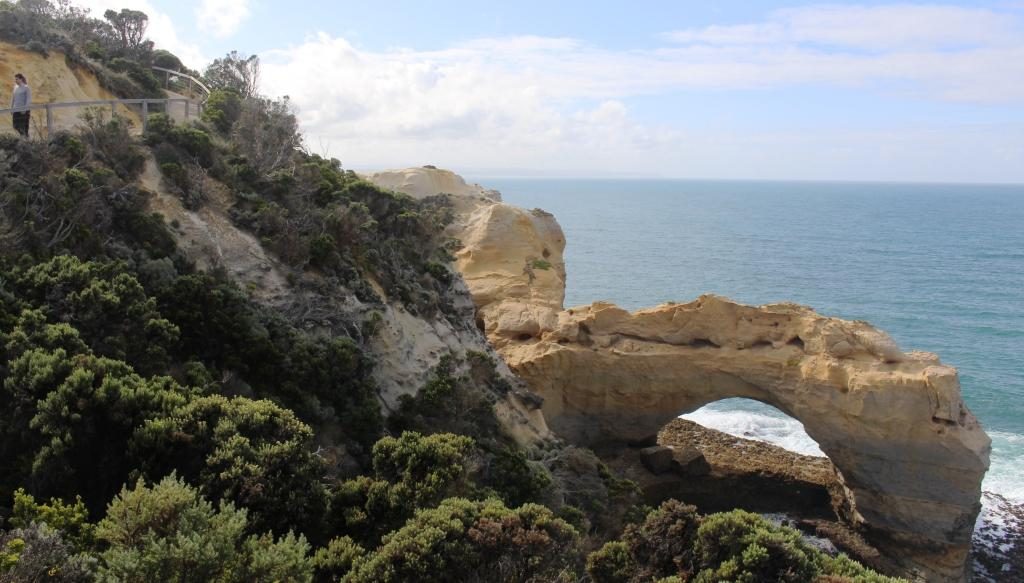
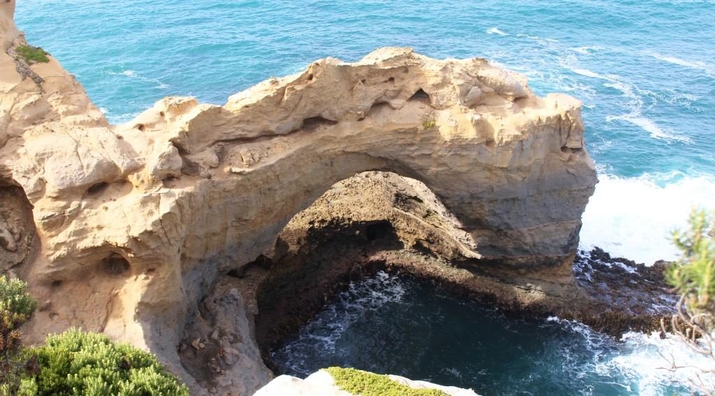
There were now only three things to look at to finish the Great Ocean Road. They were The Arch, London Bridge and The Grotto. All are past Port Campbell towards Peterborough. We visited them in that order.
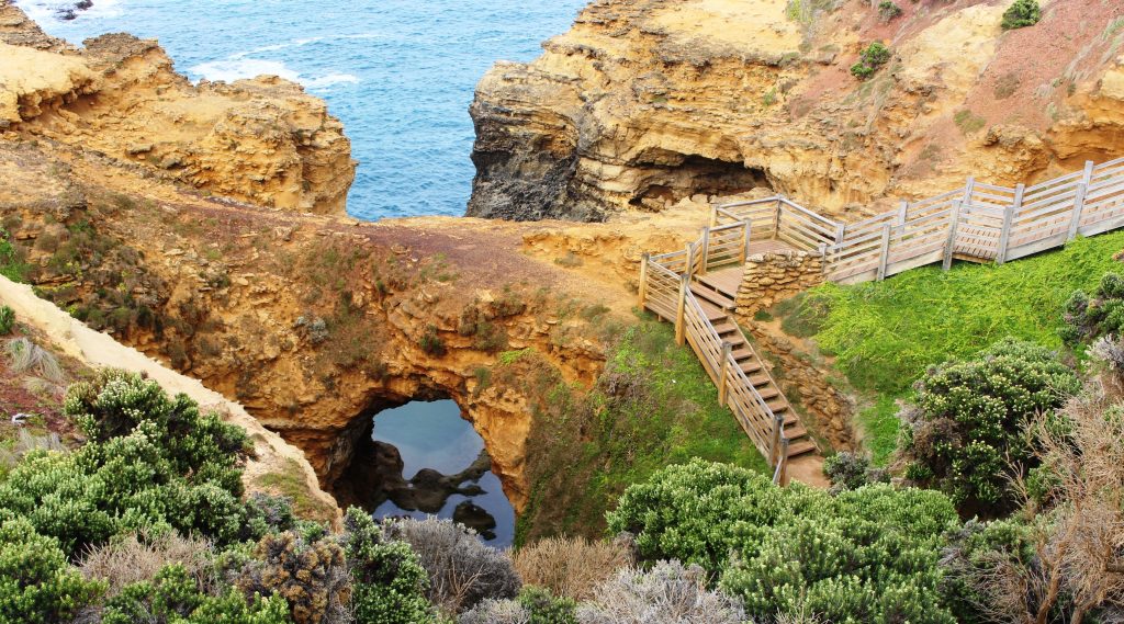
The first was about a 200 metre walk with some steep parts and stairs in the path. The second was an easy 50 metres to an extensive observation deck. The third was a walk of about 350 metres with steep sections and with about 70 steps to get the best view from near sea level.
I had just climbed back up the stairs and decided to look at the photos that I had just taken. When I tried, I got a message that told me there was no data card in my camera. Shock horror! I checked, and sure enough, the card was not properly seated. I had not put it back properly after transferring yesterday’s photos to my phone. I do this at the end of each day to make it easier to select photos for my Facebook posts.
So back down 70 steps again and then a return to the other two locations to retake the photos that otherwise would be lost. By the time we did all that and had coffee it was about 11.00 am. We had thought that we would go all the way to Port Fairy, which is the official end of the Great Ocean Road, but that would take us 60 km out of our way. We turned for Ballarat on the road out of Port Campbell. But we did drive on as far as Peterborough before turning back.
We travelled via Cobden and Camperdown, then through a number of small towns to reach Ballarat. All of the holiday weekend activity was on the coast, with very little action in the towns that we passed through.
As we drove away from the coast the pastures became less green but there were still plenty of cattle and sheep in the paddocks. I think, apart from the sheep, we travelled through mainly dairying country today.
Our Ballarat accommodation was out on the Melbourne side just off the Great Western Highway. Once checked in and settled we returned towards Ballarat city in search of our evening meal. Good old Domino’s Pizza came to the rescue.
Unfortunately the photos that I took as we drove from the coast to Ballarat were taken on my phone. For some reason they cannot be found. I don’t know why they deleted, but they are gone.