Please Note: At the foot of this post you will find videos covering the material that the blog post contains.
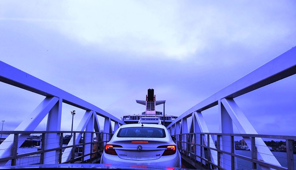
Our location for our last night in Tasmania provided a further benefit as we drove the short distance, through a morning shower, to the ferry. We had to turn at a roundabout that put all the traffic coming out of Devonport to catch the Spirit on our left, giving us right of way. But loading was still a slow progress as the ship arrived late from Melbourne. I felt sorry for the yellow coated attendants as they stood around in the rain waiting for something to happen.
Driving up the ramp to board the Spirit of Tasmania
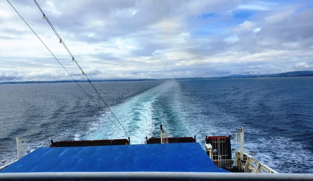
We had another good Bass
Strait crossing. The expected strong winds did not eventuate. There was a
slight swell running through the Strait but not enough wind to produce white
caps.
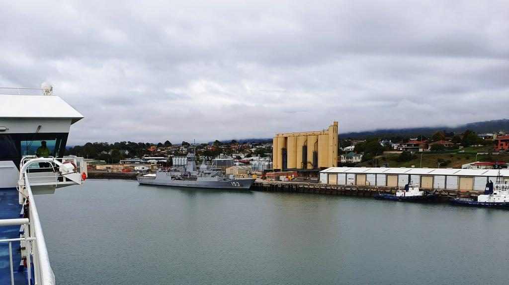
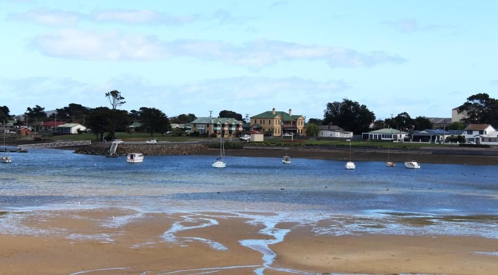
The wharves on the Mersey River and HMAS Stewart visiting its home port
We had travelled south on Spirit of Tasmania One and returned on Spirit of Tasmania Two. They appear to be identical twins and very suited to their task. We had no complaints at all about either of them.
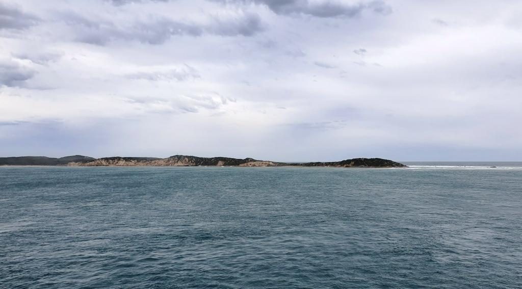
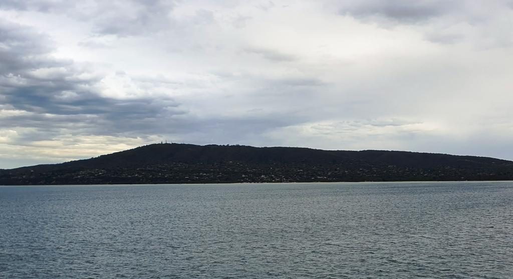
The north coast of Tasmania sliding under the horizon. The flat coast does not suggest the mountainous nature of Tasmanian topography.
We had booked recliner
seats for the return, as a cabin was not needed for a day crossing. The
recliner seats are at the back of the vessel, facing towards the stern. There
are four rows and the seats have full height backs so unless you are in the
first row your view is of the back of the seat in front. So we spent much of
the day in the top deck lounge where the view of the water was good and we were
near food and coffee.
Point Nepean, the eastern headland of Port Philip Bay viewed from inside the heads
We reached Port Philip
Heads in daylight and came up the bay as the daylight faded. We docked in
darkness with the City of Melbourne a mass of lights ahead of us. Disembarking
was a slow process as Melbourne’s peak hour traffic made it difficult for
vehicles exiting the terminal to merge into the traffic flow.
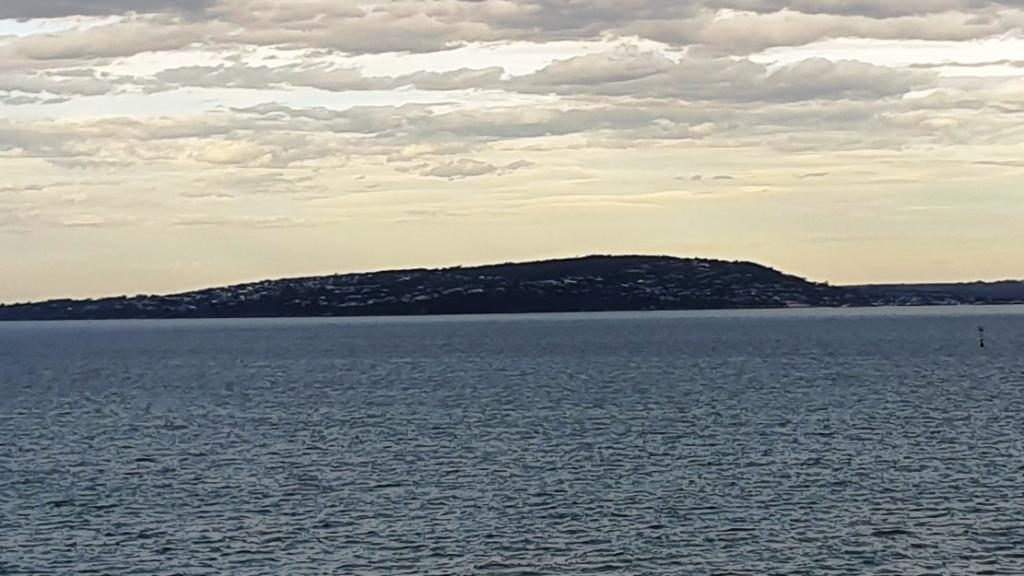
Mount Martha and bay side suburbs of the Mornington Peninsula
But eventually we were moving and making our way through the near city streets to the Monash Freeway. Streets in the near city area have changed since we lived in Victoria and I was working in a near city location. Google maps didn’t have it quite right but we found our way to our hotel in Waverley, without too much drama.
Mount Eliza with its covering of prestigious homes
Friends who we had
called on in Ballina on our way south were in Melbourne for a couple of weeks
and staying quite near to where we were. So we arranged to meet them at a
nearby shopping centre for morning coffee before we headed out to West
Gippsland to where we were spending a few days with my sister and her husband.
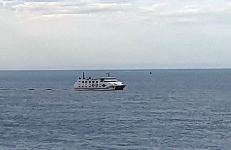
A vehicular ferry operates from Sorento to Point Lonsdale
A visit to a supermarket indicated that the shelf stripping that we had seen in Launceston stores was more prevalent that we thought. We now know the full story, of course, but then we thought that the cause was the many Asian tourists with whom we had shared Tasmania.
Empty shelves in a Melbourne supermarket
On Wednesday, after doing
normal family catch ups, we joined our hosts and other family members in a day
out into the mountains that are part of the southern Victorian Alps and lie to
the north of the rolling hills of the agricultural country of West Gippsland.
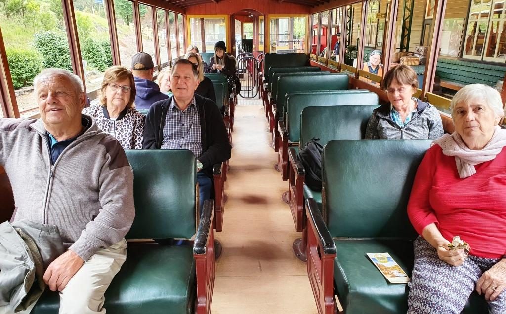
Walhalla Town Ride. Left to Right: Brother Bernard, Sister Aileen, Brother-in-law Colin, Sister-in-law Helen (widow of deceased brother Winston) and Ruth.
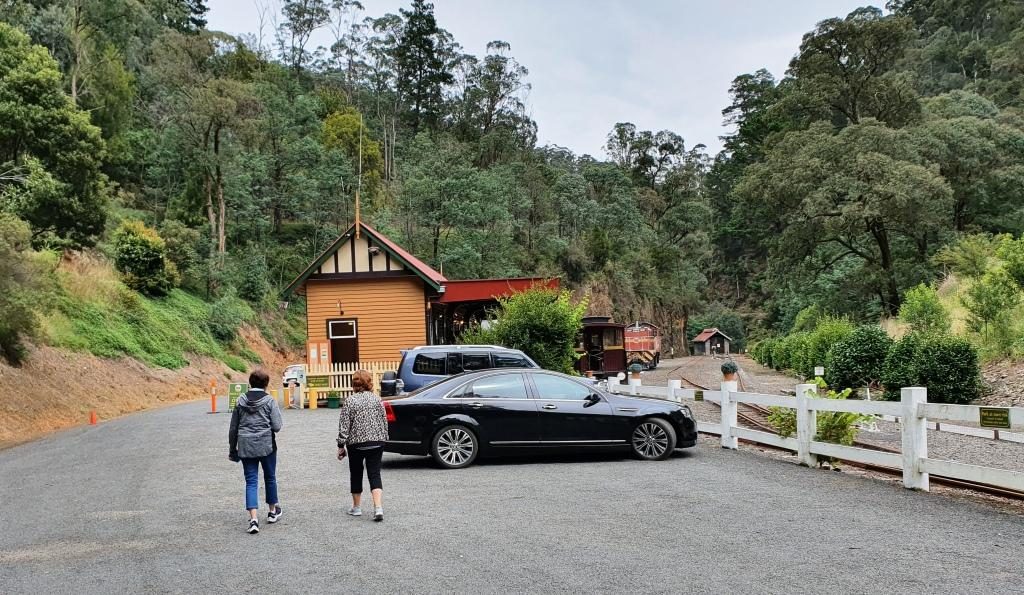
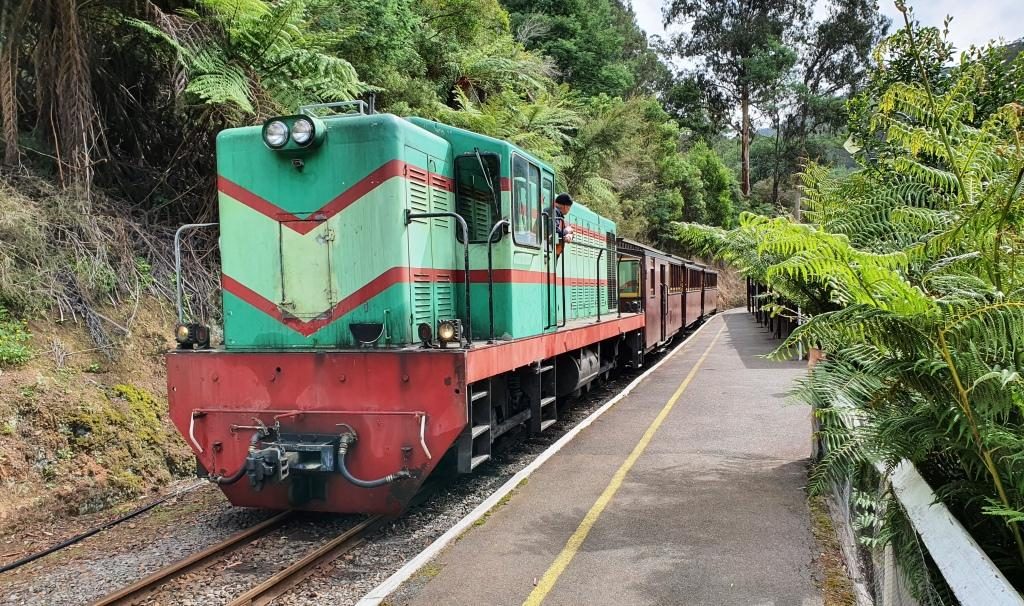
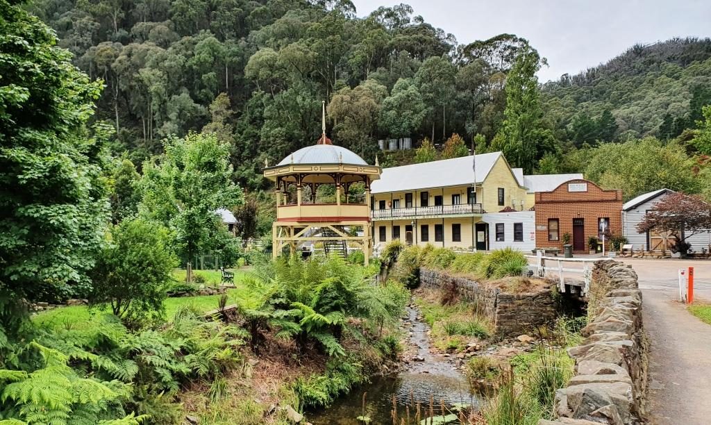
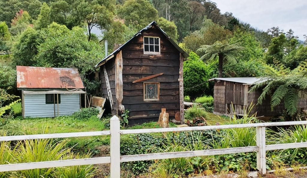
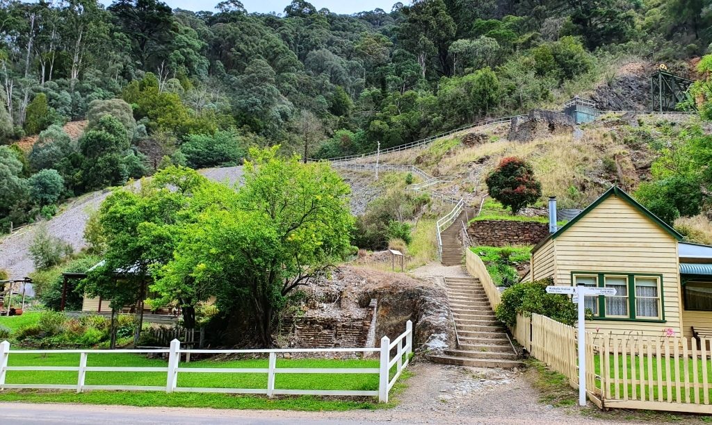
Walhalla is a historic gold mining town about 90 km from Drouin. It takes about 90 minutes to drive there. It is a well preserved heritage town with a full sized rebuilt railway that operates on several days of the week. It is popular with all ages and well patronised, particularly at weekends and very popular for school excursions.
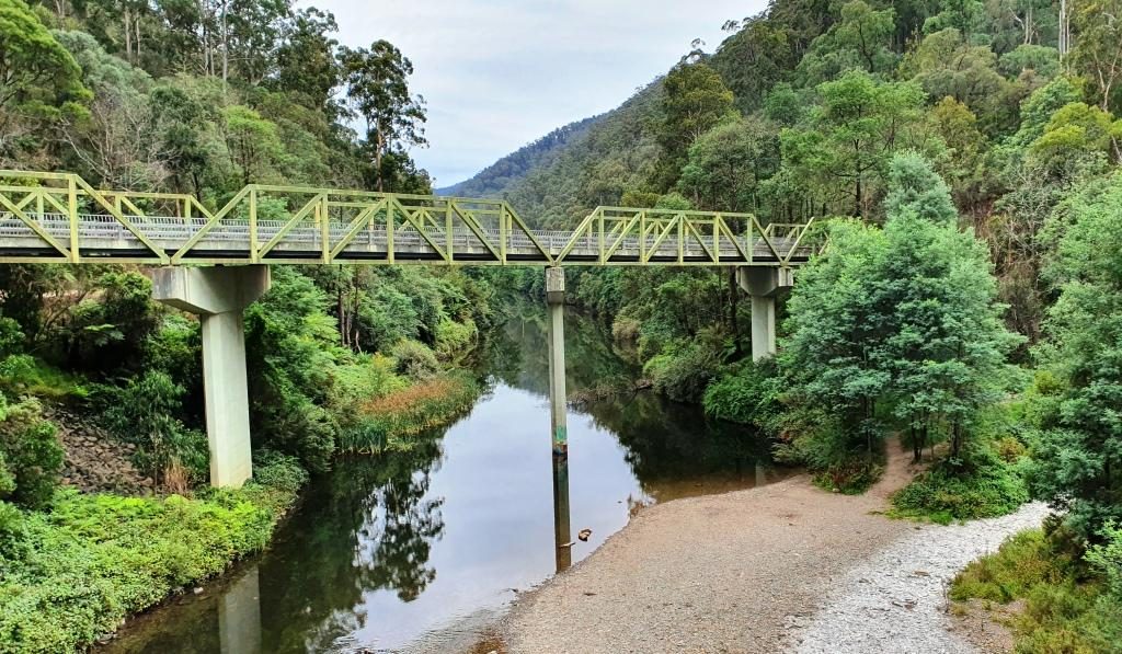
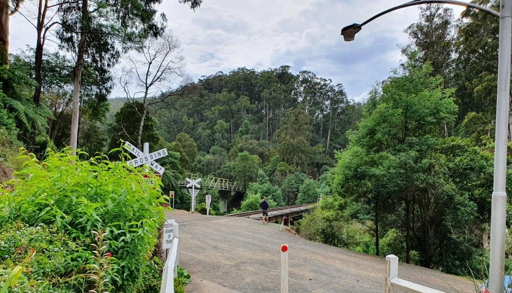
The road bridge over the Tomson River
The original rail connection arrived in the mid 1920s, just as the gold started to be worked out and the town started its decline. In more recent years enthusiastic volunteers restored the line, rolling stock and infrastructure and volunteers continue to operate and maintain it.
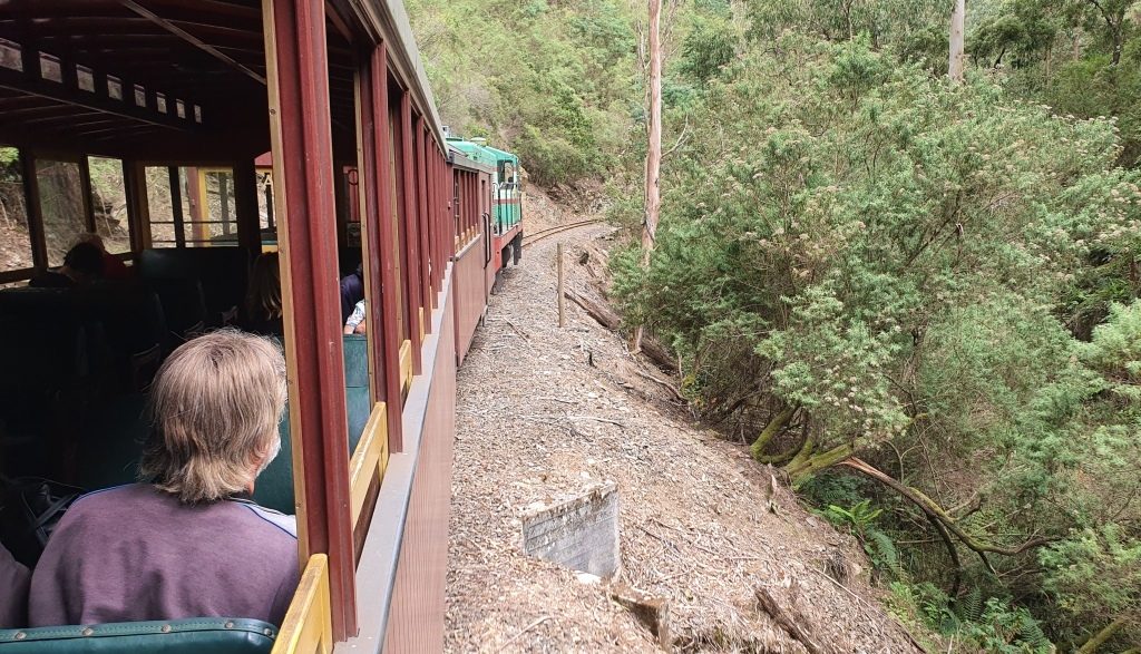
Running along beside Springers Creek on the outward journey.
The final few kilometres of the road to Walhalla runs beside the Thomson River before crossing it to then follow its tributary, Springers Creek, to the town. Thomson River Station is located where the road bridge crosses the Thomson. It is to Thomson River Station that the train runs.
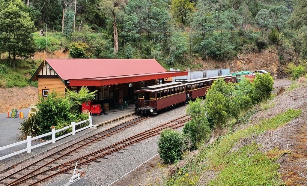
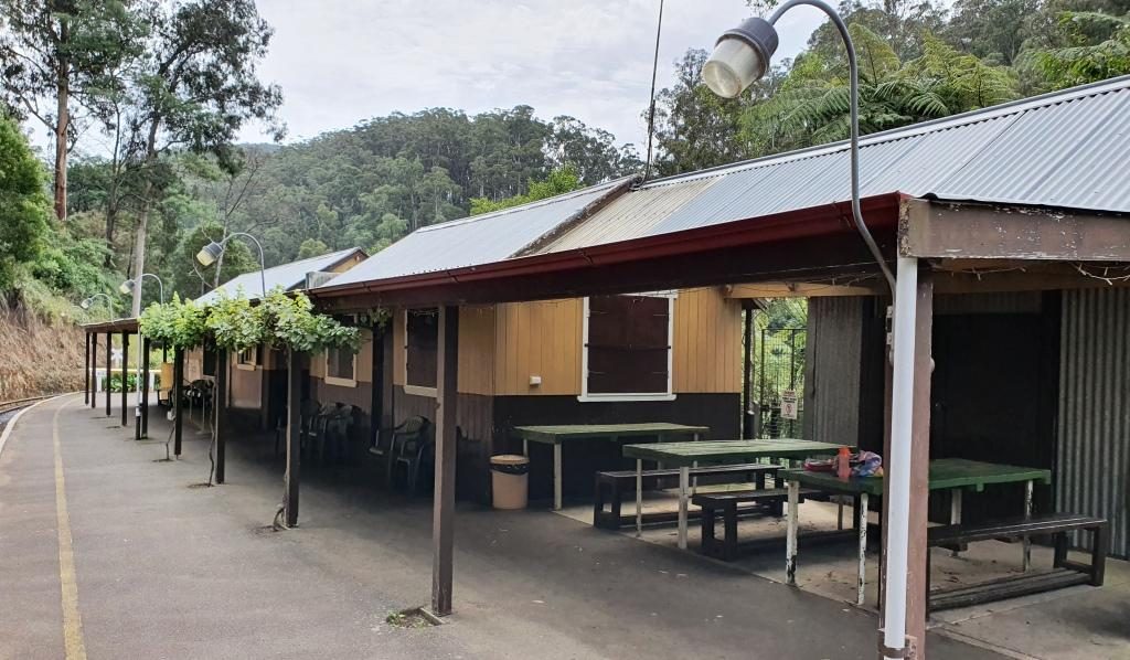
Walhalla Railway Station viewing outboundThe train ready for departure at Walhalla Station
The railway runs along Springers Creek opposite to the road and when fully operational turned downstream beside the river after Thompson River Station. The ride is about 20 minutes out to Thomson River Station which is equipped with refreshment rooms just like the old days. The coffee was dispensed by a machine on the press of a button, so was not of coffee shop quality, but it was coffee and it was past coffee time by then. As we refreshed ourselves the train moved up the track so that the engine could be manoeuvred back to the front of the carriages for the return journey.
Thomson River Station with everyone aboard the trainThe train about to move off to change the engine to the other end for the return journeyThe Thomson River road and rail bridges viewed from the Thomson River Station
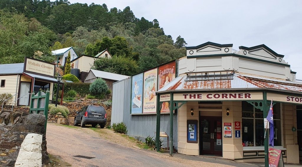
Train ride over, we drove up into the town and followed the main street as it wended its curving way through the narrow valley. The commercial buildings stand beside the road and on the flat land beside the creek, but the rest of the housing steps up the steep hillsides. The accompanying photos tell more of the the story.
Trading continues in original and historic buildings in Walhalla
As you enter the town the mining area is on the left with convenient foot tracks and stairs leading to points of interest. We have looked at these before, when we were much younger. We had no difficulty in resisting the temptation to climb the steps that lead to the hillside path.
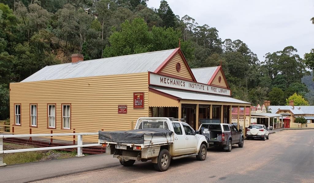
Band Rotunda, Star Hotel (closed) and a solicitors branch office.The old Mechanics Institute building is now used for another purpose
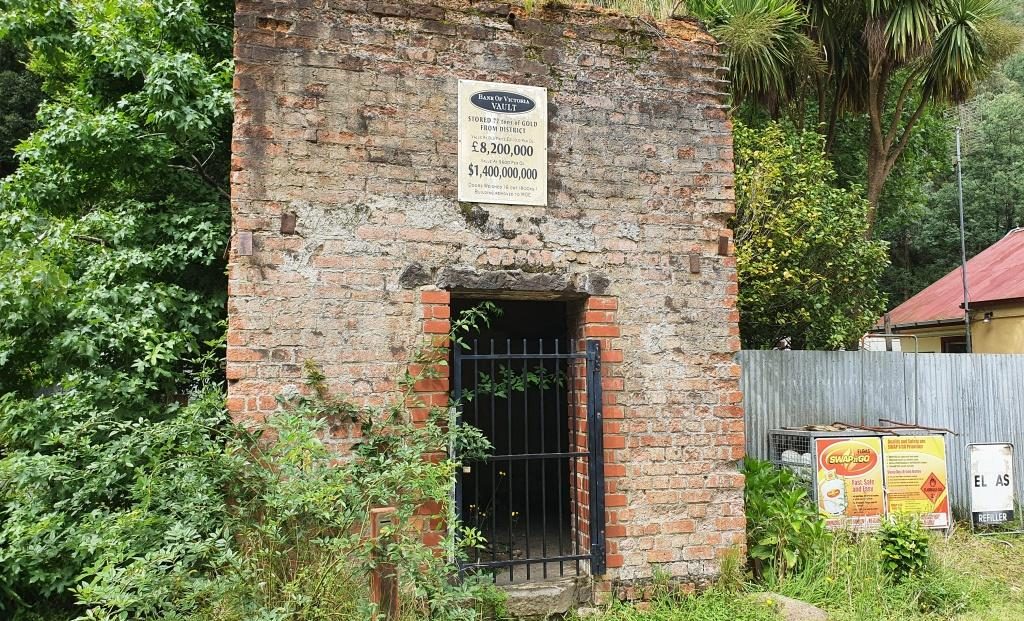
The best known of the
Walhalla gold mines is the Long Tunnel Extended Mine. Access to this mine has
been preserved making it suitable for public inspection. Tours are conducted on
a regular basis and have just recommenced following Covid-19 shut down. $20
will gain entry for adults or $15 if you rate as a senior.
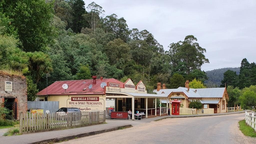
Old buildings beside Springers CreekMore historic buildings that are still in use
From the train we had
seen a group of teen age school children camping beside Springers Creek. As we
came out of the pub after lunch we saw them again. They had made it back to
town and had climbed to the hillside track to take a closer look at the mines.
The facade of the original gold storage vaultThe stairway to the Long Tunnel Extended Mine
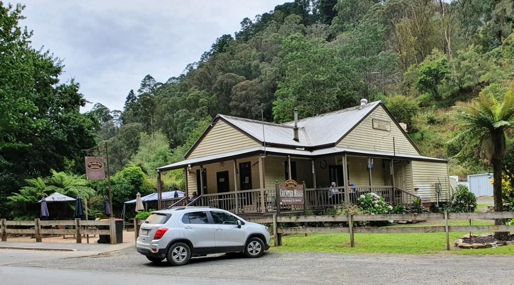
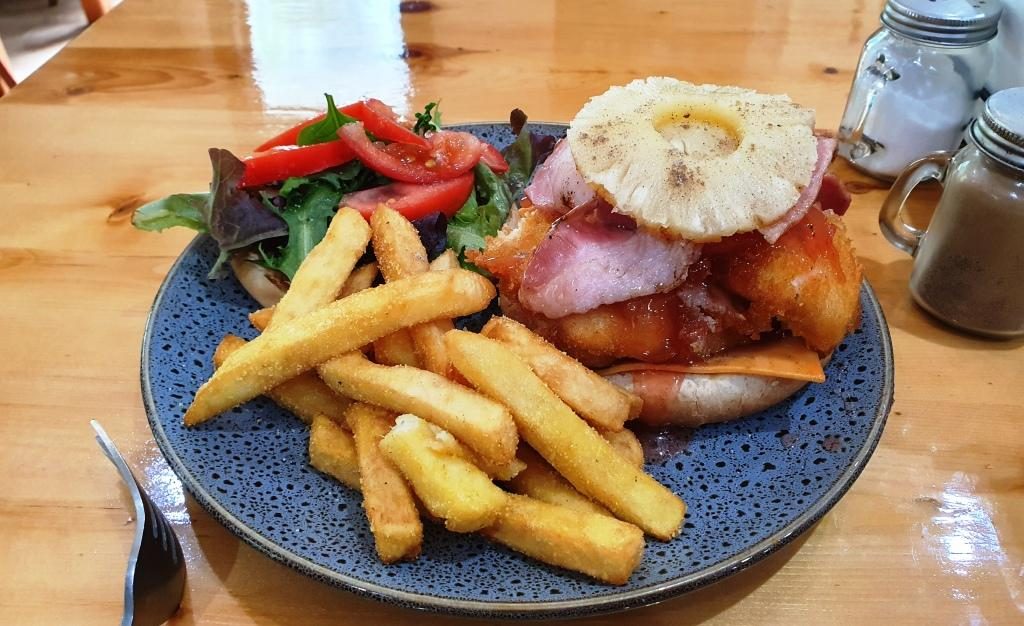
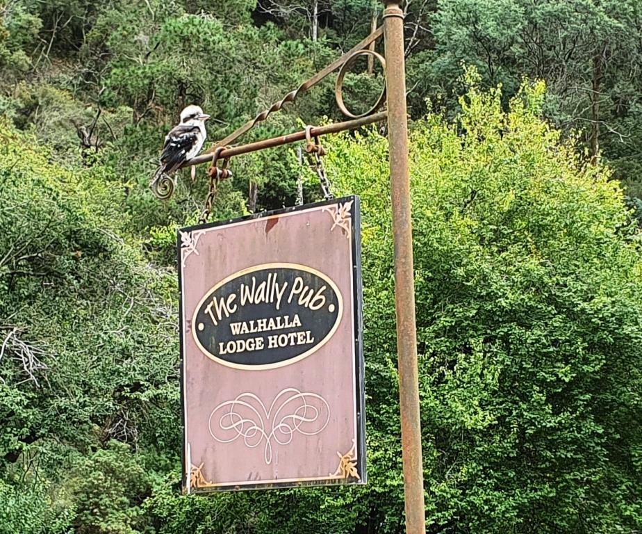
The only place
available for lunch was the Walhalla Lodge Hotel which is a fairly typical
country pub. The meals were generous in size and hit the spot after our train
ride.
Out luncheon venue, the Walhalla Lodge HotelA more than adequate lunch for oneA Kookaburra waits patiently on the hotel sign. Waiting for scraps perhaps?
On our way back to Drouin we made a detour to look at a house that our niece (sister’s daughter) and her family had just bought but had not yet moved into. Such are the interests of family visits.
Please Note: Videos covering the material in this blog post can be found at the bottom of this post.
We were now down to
our last two days in Tasmania. We had allocated Thursday 28th to the
eastern side of the Tamar Valley and Friday 29th (Leap Year Day) to
the west side and to make our way to Devonport to catch the Spirit of Tasmania
back to Melbourne on Saturday 1st March.
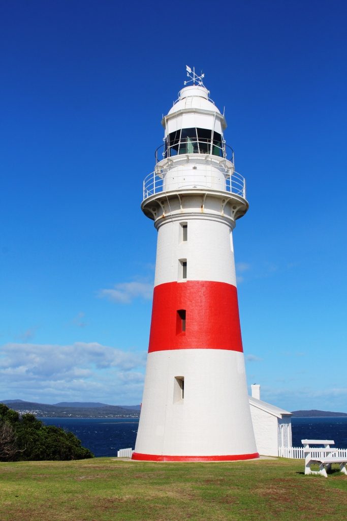
So on Thursday morning we set off to visit the area to the north and north east of Launceston, starting by following the East Tamar Highway on the east side of the river, through Georgetown to Low Head, to see the historic maritime facilities at the mouth of the Tamar River.
Low Head Lighthouse
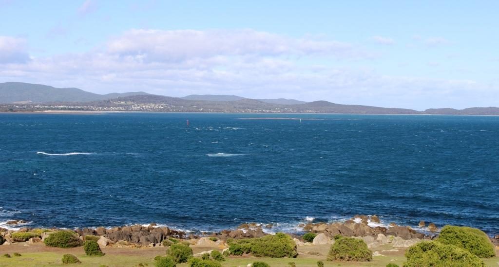
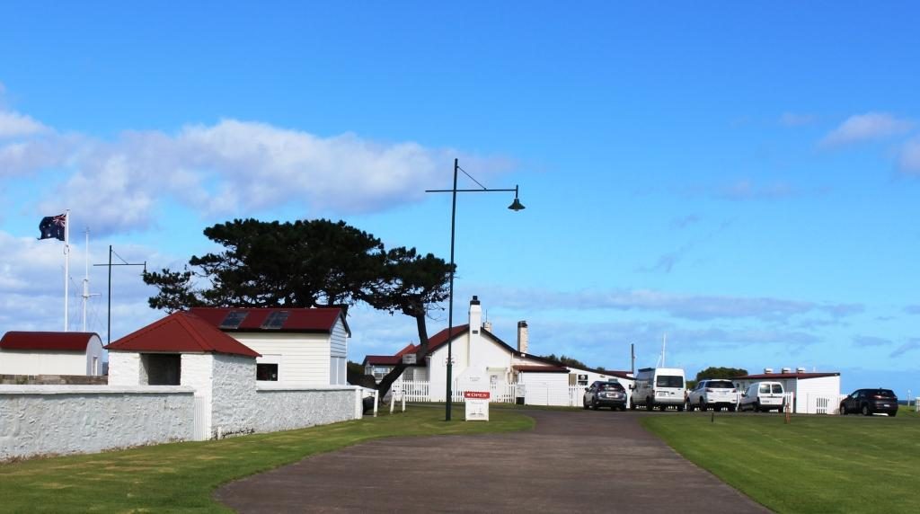
The Low Head lighthouse looks over Bass Strait and the river mouth. The area near the river is dotted with white painted brick houses with red roofs, with more modern and larger houses on the higher ground. These white houses were the homes of the many people needed to run the labour intensive services required in the early days when ships plied the Tamar River right up to Launceston. The original signal station still operates as does the pilot service. Bass Strait looked calm with the icy wind coming from the south west, but the sun was shining so it was pleasant in shelter.
View from the lighthouse at Low Head across the Tamar mouth to Greens Beach on the western headlandThe house at the centre is now a cafe. The building to the left is a maritime museam. The buildings of the signal station surround a village green
We returned to George Town, but history there is not recorded in the continuing use of old buildings. Driving through, it looked like most country towns. The town is built on an inlet from the river called Stone Quarry Bay.
George Town on Stone Quarry Bay
When we drove around to the other side and looked across, older houses were visible that we could not see from the main street and we had a better view of the town centre. A substantial and modern resort, the York Cove Holiday Hotel, on the south bank of the inlet, didn’t look very busy but we did see a house maid trundling her trolley between buildings.
York Cove Holiday Hotel at George Town
Bell Bay is only a short distance south of George Town. It is an
important industrial port with an aluminum refinery, a ferromanganese plant and
a port for handling cargo. It replaced the old docks in Launceston for handling
of freight for this part of Tasmania many years ago.
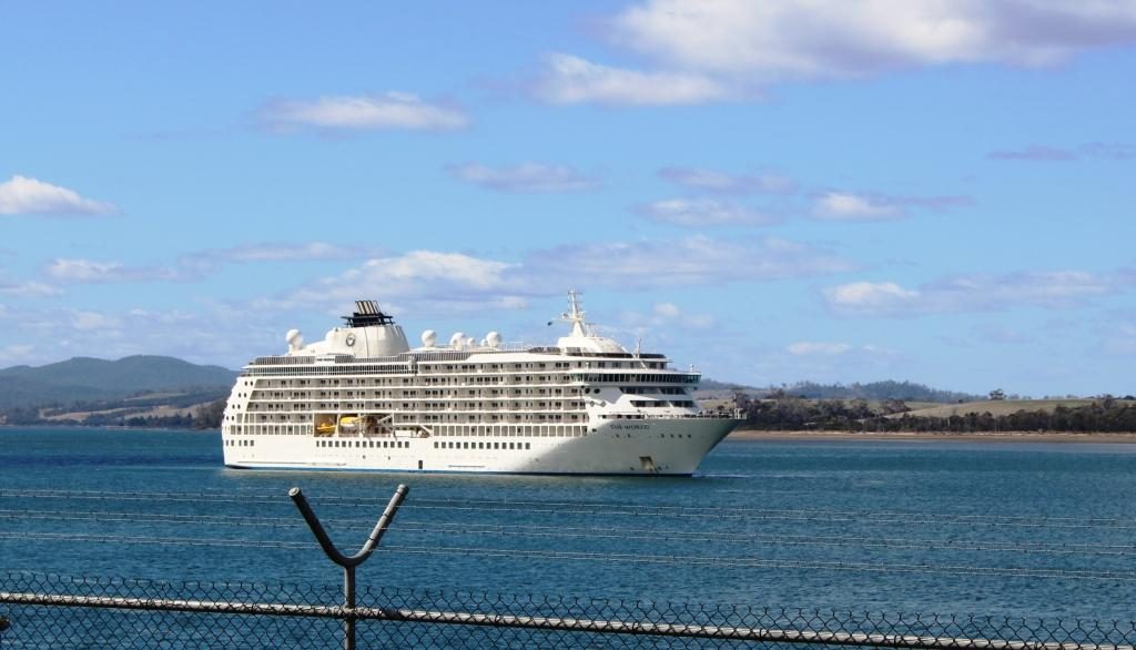
MV The World moored at Bell Bay
Upstream from the port a large white ship was at anchor. We took
it to be a cruise ship visiting Launceston at first but a closer look through
binoculars showed it to be passenger vessel named “The World” but
with no cruise line identification. A Google search informed that it is the
largest private yacht in the world. It is a floating block of apartments owned
by permanent residents and wealthy folk who take their holidays aboard and rent
their apartments when absent. It pulls up for several days at a time at various
ports. It cost $13.5 million to buy into the scheme initially, so it is not for
your every day battler.
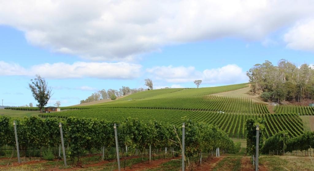
We moved on towards Bridport via the north Tasmanian wine trail.
We saw hillsides covered in lush green vines but mostly producing cool climate
white wines. The heavier end of the red wine range seems scarce in Tasmania. Pinot
Noir is as serious as wine production gets. The weather is probably too cold.
If you are looking for a Cab Sav or a Shiraz don’t bother with Tasmania.
Pipers Brook Vineyards
Pipers Brook is a well known brand of white wines. The winery is near to the road so we called in. The entrance driveway passes through a couple of kilometres of vineyards, making it a pleasant drive, but you do start to wonder when you will arrive. There is a cellar door and restaurant. We went in, but I don’t taste when driving and Ruth seldom does, so we had a look at some historical artefacts and then moved on. Winery restaurants are for more leisurely dining than we had in mind for that day.
Pipers Brook Winery and Cellar Door.
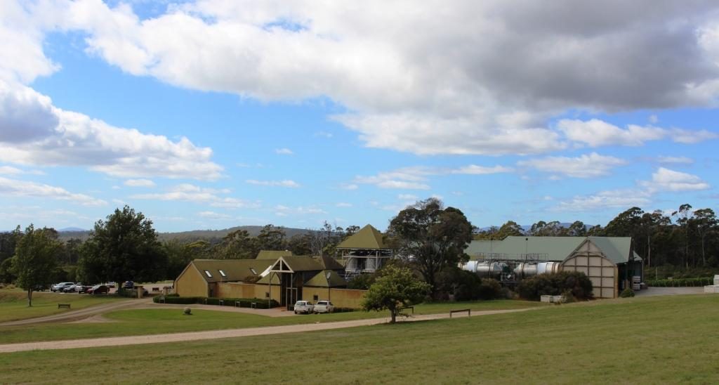
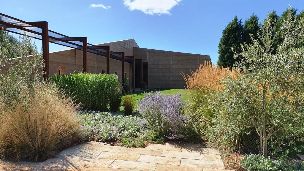
Located quite near to Pipers Brook is Clover Hill Wines. They specialise in sparkling wines produced by traditional methods. The cellar door building was quite new, very modern and attractive in the vineyard setting.
Clover Hill Wines Cellar Door
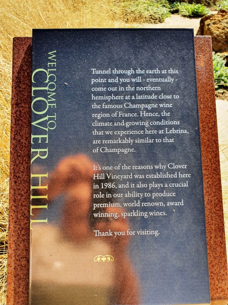
A sign near the buildings advised that if you were to dig through the earth from that spot that you would come up near the champagne area of France. I had always heard that you would come up in China. But France does sound a better proposition right now.
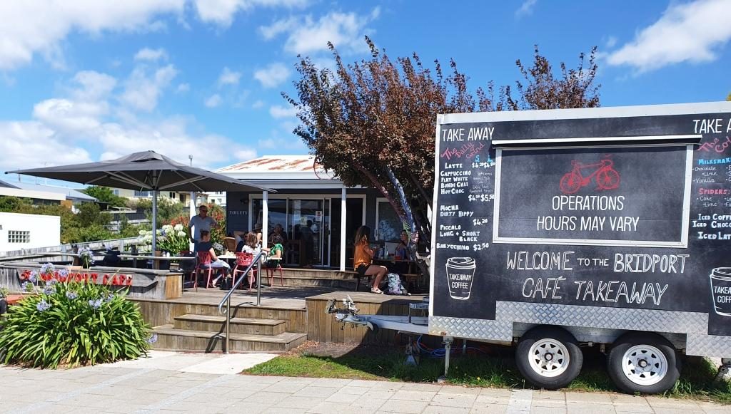
Bridport commands views over Bass Strait and is a pleasant town and is the principle beach side town on the eastern part of the north coast. We found a pleasant cafe that commanded those same views over Bass Strait and with seafood chowder on the menu. Well, what else could we do but go in and order? Ruth settled for fish. Our tastes in food often differ.
Bridport Cafe with indoor and alfresco dining
About 20 km south brought us to Scottsdale, the last major town through which we passed coming over from the east coast a couple of days before. This time we took an alternative road to Launceston that avoided the worst of mountain range. Scottsdale is 62 km from Launceston via the Tasman Highway (over the mountains) and 68 km via Lillydale. It is a substantial town and has a Woolworth’s anchored shopping mall as well as the kind of businesses that support agricultural production.
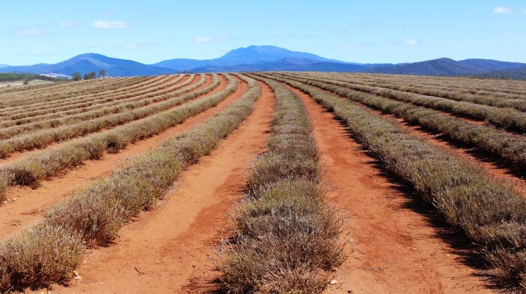
Sadly the lavender was not in bloom at Bridestowe Lavender Farm
The road through Lillydale brought us near to what is, I think, Australia’s largest lavender farm. Bridestowe Lavender Farm grows lavender which is converted to a wide range of products sold in the farm’s retail outlet.
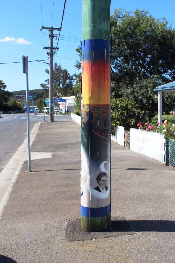
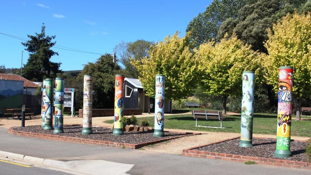
An artist decorated power pole at Lillydale
Later we drove through Lillydale, a town that has attracted artists to take up residence. As a community project, locals have assisted a number of the now local artists to paint murals on the electric power poles. Consequently Lillydale is known as The Town of the Painted Poles. It is about 28 km from Launceston.
Shorter decorated poles surround the park at the rest area.
We checked the time and decided that we would try for seats on
the last Tamar River cruise for the day, if seats were available. We would have
made it except for Launceston’s peak hour. I didn’t know it had one but we were
held up for about 20 minutes as traffic made its way from north to south
through the city. We returned to our unit for another quiet night.
The following morning we packed and loaded the car. As I sat in the seat to drive I noticed a slip of paper under the wiper blade. When I retrieved it I found that it was a note from the old neighbours who we had met on Bruny Island. They had spent the previous night under the same roof as we had.
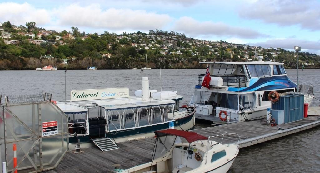
Launceston river cruise ferries. Our craft was the smaller boat with transparent blinds.
Before we set off to
explore the west side of the Tamar we gave the Cataract cruise another try. We
were successful and got tickets for the first cruise.
Walkways and modern accommodation now occupy this part of the river. This is the mouth of the North Esk River.
The opportunity to see Launceston and the Cataract Gorge from the water was better than the commentary from the expatriate Kiwi skipper, but he did add some interesting information. The day was sunny but with the same persistent cold wind that has apparently been blowing all summer. The see through blinds on the cruise boat were kept down.
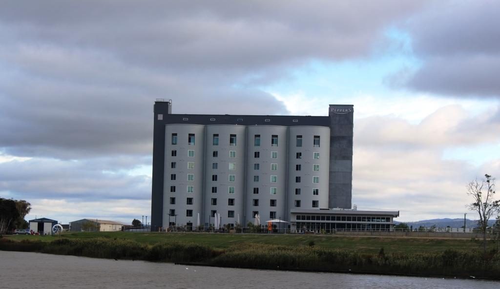
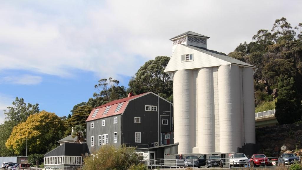
This Peppers hotel was developed in a set of four silos.A house on the western side of the river has its very own set of silos.
There has been a great deal of development of the old Launceston river waterfront with extensive walking and bike ways that run between the river and modern unit developments. Open space has not been forgotten. The development has provided for public access to the river bank. The development includes new hotels like the Pepper’s hotel developed in a set of four grain silos over the North Esk River mouth, directly opposite the tour boat wharf.
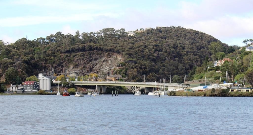
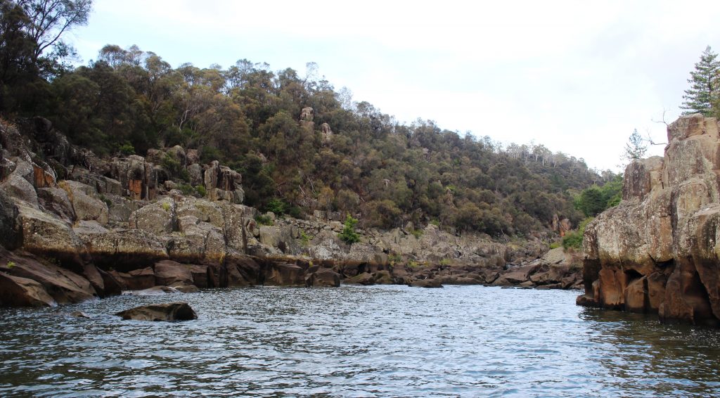
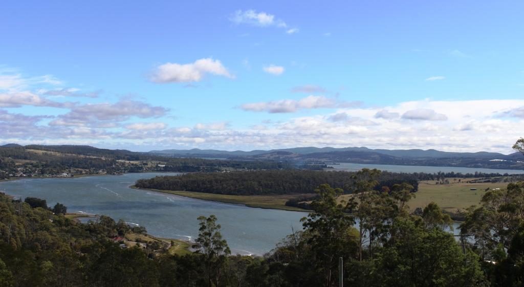
Bridges span the mouth of the South Esk River where it enters the Tamar. Original iron bridges carry local traffic while the new concrete bridge carry the through lanes of the West Tamar Highway.The navigable limit if the South Esk River within Cataract Gorge.
It is at the wharf
area that the Tamar splits into its two major tributaries, the North Esk and
South Esk Rivers. The North Esk River
turns to the east before moving off in a south easterly direction. The South
Esk River flows from south of Launceston, through Cataract Gorge and joins the
Tamar opposite the ferry terminal. We had crossed both Esk rivers on our drive
two days earlier to the stately estate homes to the south of Launceston.
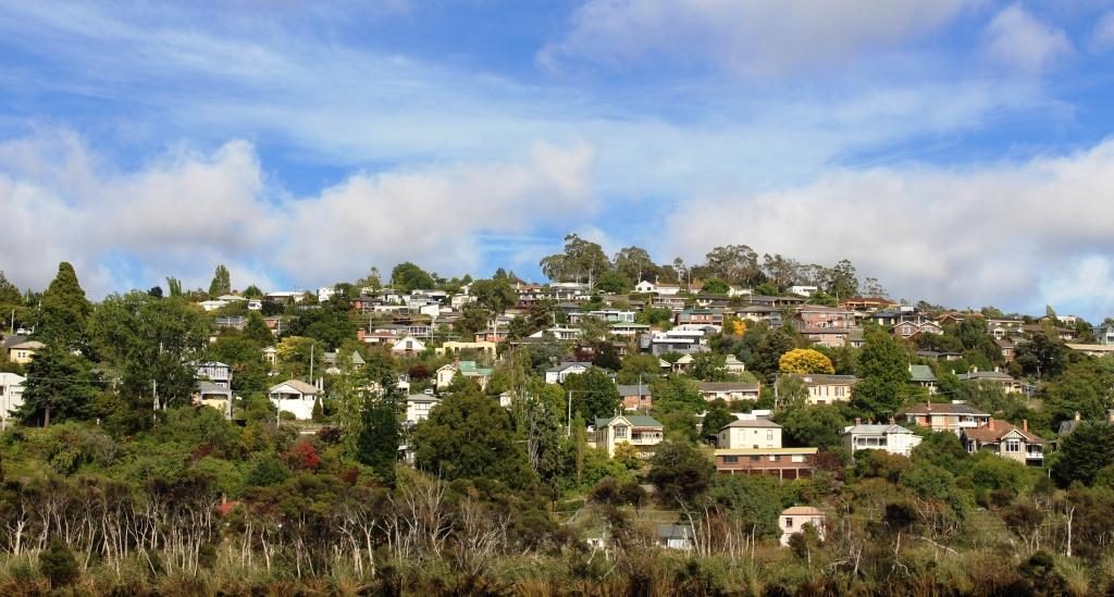
Houses on the western bank of the Tarmar have fine views of the river and the city
We disembarked and set
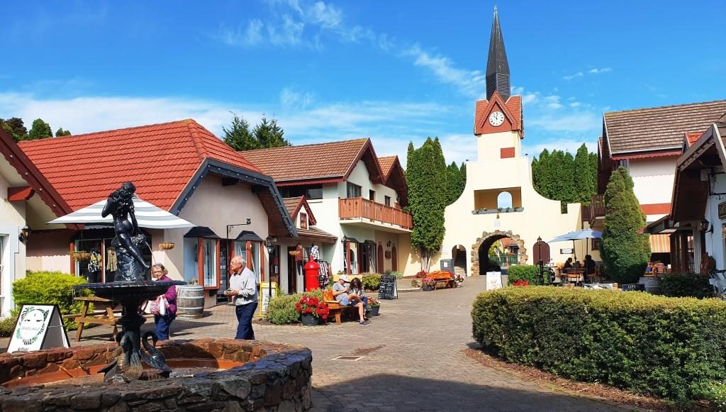
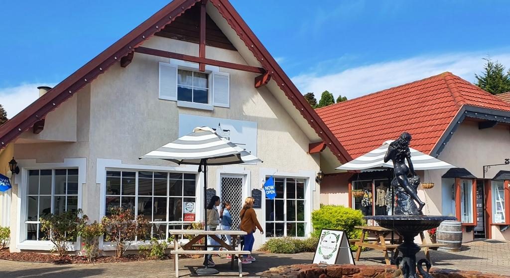
off on the day’s drive. Our first stop was the shopping village at the Aspect
Tamar Valley Resort at Grindelwald. There we found a neat little Swiss bakery
with good coffee and pastries as well as specialty shops, within a Swiss themed
shopping mall.
The Grindelwald Swiss themed mallThe Swiss bakery. Choosing a pastry to go with the coffee was quite a challenge
Having returned to the
West Tamar Highway our next stop was Brady’s lookout, named after Tasmanian
bush ranger Matthew Brady. The lookout provides sweeping views of the Tamar,
particularly to the north towards the river mouth.
The Tamar flowing towards Bass Strait from the vantage point of Brady’s Lookout.
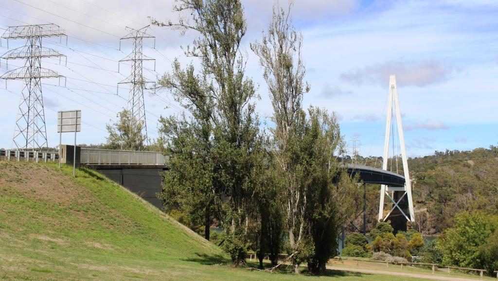
We headed then towards
Beaconsfield, of gold mine collapse fame, but first made a detour to see and
cross the Batman Bridge over the Tamar River. It is a single span “A” frame
bridge with the span supported by cables. It looks quite spectacular but is not
new. But new to us!
The Batman Bridge over the Tamar between Launceston and the river mouth
The mine collapse at Beaconsfield
killed one miner and buried two more for a couple of weeks. The widely
publicized event put the town on the map.
The residents have worked hard to keep it there. The mine was on our
itinerary but our interest was sharpened when we heard a couple of days before
that the mine had been sold to a mining company and there were plans to restart
gold production.
The mine head facilities at Beaconsfield
There is real history in old buildings but the heritage centre built to commemorate the mine disaster is the focal point. There is a mining display in part of the original mine buildings but it costs $16 for an adult so you need time to get value. You can get the idea from outside and you can shop in the attached gift shop for souvenirs and the like.
The view of a water wheel through a window.
A new brewery has been
built next door that has used the gold theme for a partial free ride. It is
called the Miners Gold Brewery.
Buildings of the Miners Gold Brewery
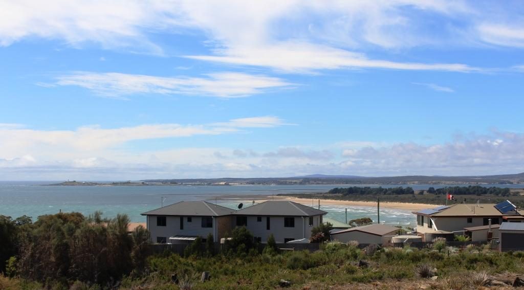
Moving on, we drove directly to Greens Beach, a seaside town immediately opposite Low Head on the west side of the Tamar Mouth. If it has a commercial centre we didn’t find in but it does have many large homes overlooking Bass Strait and the river.
The view over the mouth of the Tamar from Greens Beach. The Low Head Lighthouse is on the tip of the point in the background.
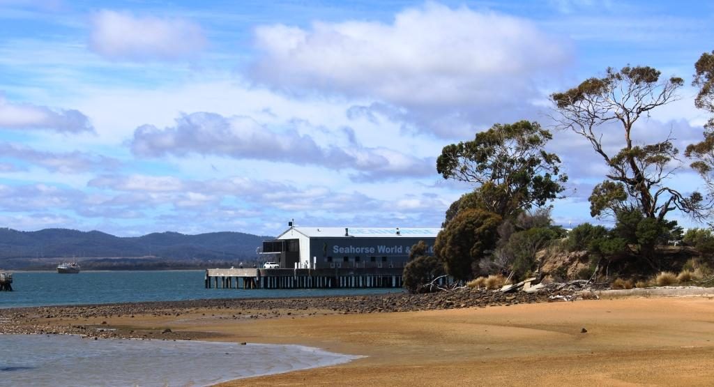
On the way back we
detoured to Beauty Point, a pleasant river side community where, among other
attractions, there is Seahorse World, an aquarium specialising, as you might
guess, in sea horses. On the same wharf structure you will find Platypus House
where you can see platypus and echidnas up close.
Seahorse World. The Platypus aquarium is out of sight behind the trees.
We stopped at the Jubilee Bakery for lunch as we passed back through Beaconsfield and discovered more history. The “Jubilee” part of the name was in honour of the 50th anniversary of the coronation of Queen Victoria. Irishman Paddy Manion opened the bakery in 1887. Some modernisation has since occurred but the original wood fired baking ovens remain in use. So my lunch time paste was cooked in the original wood fired oven, installed in 1887. The story goes that Paddy used to claim that his products were made with holy water because it came off the roof of the church next door.
Bakery and church at Beaconsfield. The holy water may have come from the roof of an earlier building.
We then drove south
over a collection of country roads to Deloraine before joining the Bass Highway
to Devonport.
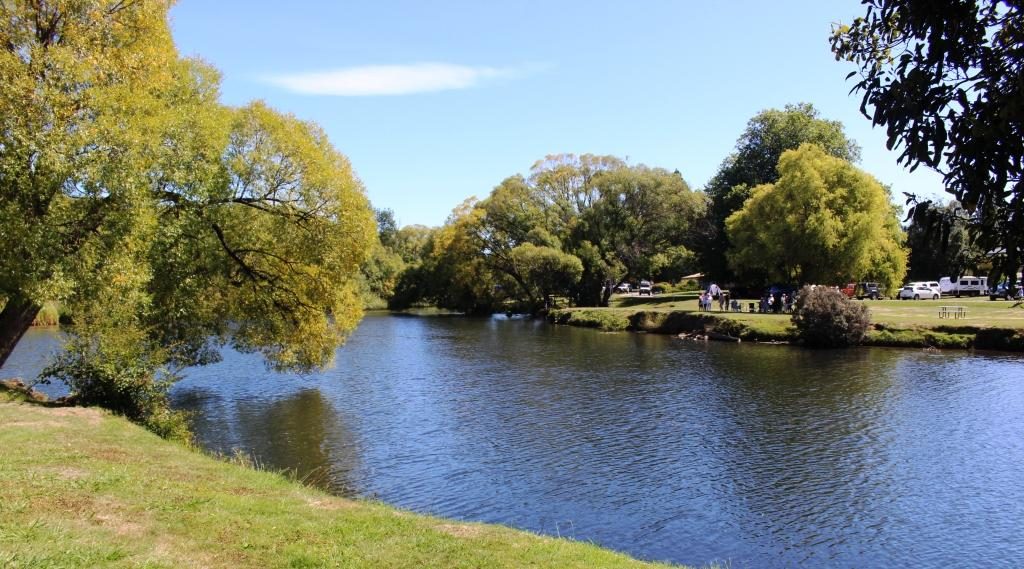
Deloraine has park lands on both banks of the Meander River.
Deloraine, on the
Meander River, is another town of historic buildings. The town is close to the
mountain range known as The Great Western Tiers, named because of the way the
range steps down, with each successive mountain lower than the last, as it
progresses to the North West.
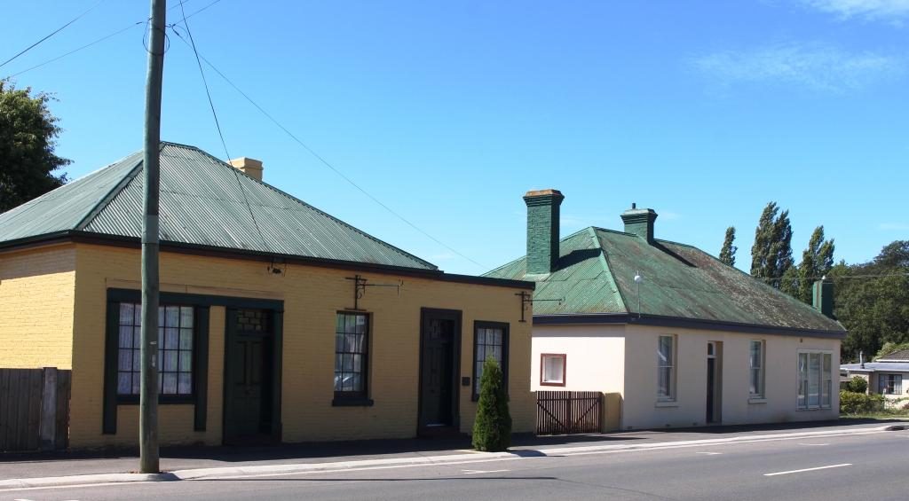
Historic buildings by the road side as you enter Deloraine from Launceston.
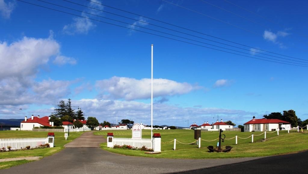
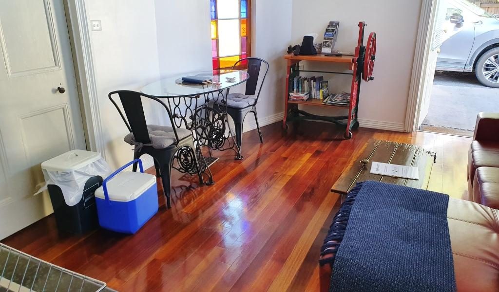
We spent the last night in Tasmania in a unit at the Postmasters Quarters, a modern development of historic buildings at East Devonport. This was another digital reception establishment with the access code texted to us, before our arrival. The interior decoration was a bit quirky but functional and comfortable. The location is within walking distance of the Spirit of Tasmania terminal. There is a pizza shop even closer.
Both table and book shelves were adaptions of machines at The Postmaster’s Quarters.