West, Centre & Flinders – Days 30 to 32 – Weather Impacts and Highways

The rain actually amounted to quite a lot. It started with sprinkles during the afternoon and intensified during the evening. Come Tuesday morning the sky was still black, with periods of heavy rain. So we decided to stay put at Barkly Homestead and paid for another night.

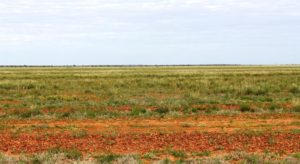
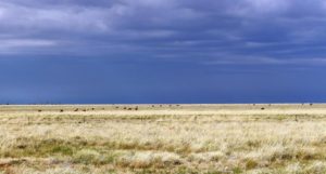
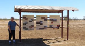
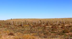
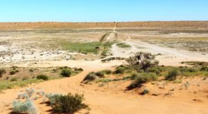
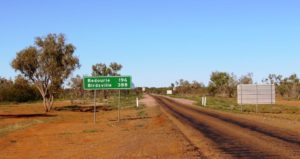
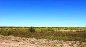
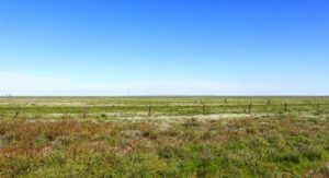
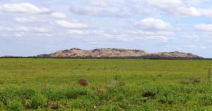
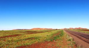
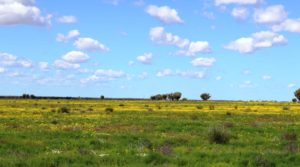
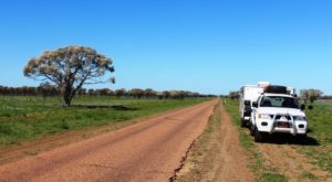
The broad plains of the Barkly Tableland

The broad plains of the Barkly Tableland

Before the rain came we were considering our options. If we are to continue to Alice Springs our arrival will be greeted by a number of mornings with lowest temperatures of 2 to 4 degrees C. To turn north to Cape Crawford and Borroloola would see us with top temperatures of about 34 to 36 degrees C. To be hot or cold became the question.

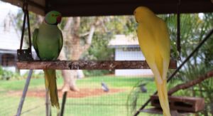
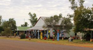
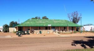
Caged birds on display at Barkly Homestead

Caged birds on display at Barkly Homestead

But the rain changed the equation completely. The Tablelands Highway, that leads north from Barkly, is a single lane sealed road that carries many road trains. When you meet a road train on such roads it is necessary to pull right off the road to leave the sealed road clear. I didn’t fancy pulling off on to rain soaked shoulders, so Alice Springs and cold mornings, here we come!

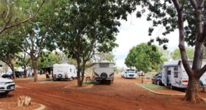
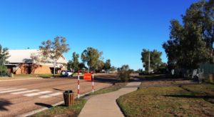
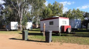
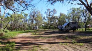
Caravan parking layout at Barkly Homestead

Caravan parking layout at Barkly Homestead

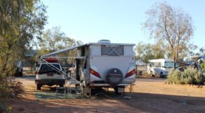
Spending a day at Barkly Homestead has been quite pleasant. A few vans had declared a lay day. We have carried out a few chores but mainly sat and read. The caravan park here is designed for one night stopovers with vans remaining hooked up to tow vehicles. The grounds are laid out in a series of parking lanes separated by a raised gravel area and with a section of artificial grass placed to be directly outside of the door of the van. This provides a refuge from the inevitable mud that occurs whenever the rains descend in torrents, as they tend to do in this part of Australia.

Wednesday dawned with some cloud to the west but it soon cleared to a cloudless warm day. I enjoy driving the Barkly Highway. It is one of the best quality country highways in Australia. The tablelands change from flat to undulating and back to flat again, with open grassland changing to low wooded scrub land. Sprinkled through the scrubby vegetation are eucalypts with white boughs (Ghost gums, I believe) that branch a couple of metres above the ground, producing trees that seem to have been designed for climbing.

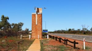
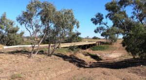
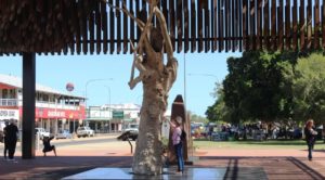
The memorial to Rev. John Flynn beside the Stuart Highway at Three Ways north of Tennant Creek

The memorial to Rev. John Flynn beside the Stuart Highway at Three Ways north of Tennant Creek

We turned south at Three Ways, where the Barkly Highway intersects with the Stuart Highway, but first we made the 200 metre journey north to visit the pillar built in memory of Rev. John Flynn, founder of the Royal Flying Doctor Service. It stands prominently beside the highway.


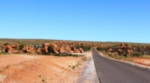
Approaching the Marbles from the North

Approaching the Marbles from the North

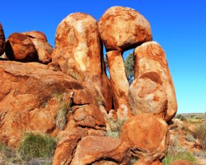
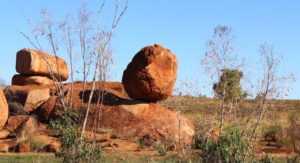
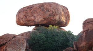
Out destination for the day was the camping reserve at the Devils Marbles. We set up for the night, before taking a long stroll around and among these amazing boulders with their endless variety of shapes and sizes. The information displays at the day use area inform us that the boulders are slowly breaking down and become rounded as they shed their “skin”, a bit like peeling an onion. As the day ended, I found a large slab of rock like a ramp and was able to walk to an elevated level to watch the sun disappear for the day.

So we woke to the sun shining on the pile of rocks that comprised our private view, before packing and setting off to Alice Springs. The morning was cold but the day quickly warmed. Again, clear blue sky with a few scattered clouds, as we approached our destination.

Strange balancing arrangements are common

Strange balancing arrangements are common

You would think that someone would have pushed it over by now!

You would think that someone would have pushed it over by now!

You do have to wonder how it got there

You do have to wonder how it got there

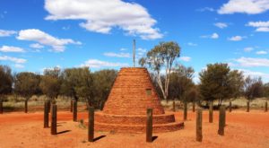
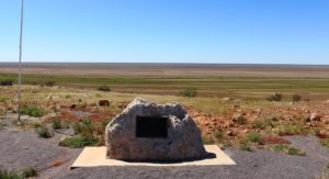
The cairn marking the highest point on the Stuart Highway north of Alice Springs

The cairn marking the highest point on the Stuart Highway north of Alice Springs

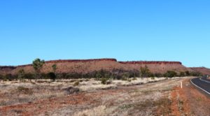
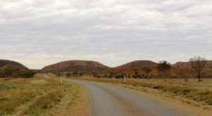
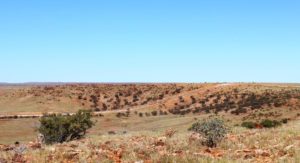
Although the highest point of the road is a bit to the north of Alice Springs there is no feeling of climbing. The terrain appears quite flat most of the way but with some ranges of hills beside the road or visible in the distance. After turning south at Three Ways the Davenport Range and the national park of the same name can be seen to the east. Approaching Tennant Creek from the north a low range of hills dissects the highway while on both sides of Barrow Creek, on both sides of the road, hills with stone caps, like battlements, add a fortress quality to this tiny town. They remind of the Great Wall of China.

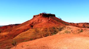
Capped hills near Barrow Creek

Capped hills near Barrow Creek

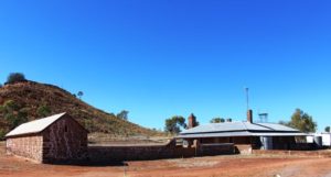
Barrow Creek Telegraph Repeater Station

Barrow Creek Telegraph Repeater Station

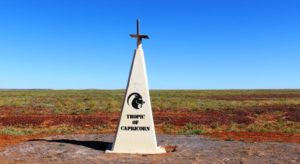
There is a great deal of history along this road. Not only does the Stuart Highway generally follow the route of the Overland Telegraph Line but telegraph repeater stations have been preserved at Barrow Creek and Tennant Creek. Road side monuments honour explorers like Stuart and Warburton. We again crossed the Tropic of Capricorn.

The Stuart Highway was not as busy as the Barkly. For substantial periods we had the highway to our selves, sometimes in the centre of a straight section of highway that extended to the horizon in both directions. Parts of the highway that we drove today had sections with no speed restrictions at all. The rest mainly had a limit of 130 KPH but at no time did we see fellow road users doing excessive speed.

So here we are at the Wintersun Caravan Park, for three days, during which we will wash cloths, shop, have haircuts and look at some things that we have missed in previous visits.

https://youtu.be/AO5hUwTxjNU

West, Centre & Flinders – Days 24 to 29 – Mt Isa and Other Things

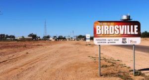
This is the sign that welcomes you to Birdsville. We photographed it on the way out

This is the sign that welcomes you to Birdsville. We photographed it on the way out. The +/- 7000 relates to visitors at major events

The next two days were spent travelling back to Boulia, so there is not much to be said, as we were covering ground already covered in this trip. But we did take some photographs, of things that we had missed on the way down.


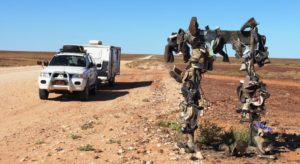
People hang the strangest things beside the road

People hang the strangest things beside the road

Have you ever seen such a descriptive name?

Have you ever seen such a descriptive name?

But Boulia to Mount Isa represented new fields as we had not travelled this road before.

The ranges near Dajarra

The ranges near Dajarra

This part of the Diamantina Developmental Road can be best described as a single lane ribbon of tar punctuated periodically by wider stretches of pavement, officially named Passing Opportunities –  and Dajarra. Dajarra is a predominantly Aboriginal town about 140 kilometres north of Boulia. It is situated near the only decent range of hills that is encountered on the entire journey, until nearing Mount Isa.

The Museum in Dajarra

The Museum in Dajarra

Much of the country is treeless plains of varying quality but a good portion carried good grass. Other parts are not so lush and have the appearance of not having received as much rain as pastures further south.

I mentioned in a previous post the lack of cattle grazing on the fresh grass. It appears that cattle are being trucked into the area from

Grazing lands south of Mt Isa

Grazing lands south of Mt Isa

further north. Someone to whom I spoke suggested that the cattle were sourced from the area around Catherine in Northern Territory. We camped at a rest area about 60 kilometres north of Boulia and during late afternoon and early evening saw around 10 double deck three trailer road trains, fully loaded and heading south. Just before we reached the rest area we had seen a herd of several hundred beasts that looked to have been recently unloaded.

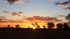
Sun sett at our Peek Creek Bore camp sight north of Boulia

Sun sett at our Peek Creek Bore camp sight north of Boulia

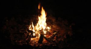
This stop, at Peek Creek Bore afforded us the opportunity for a second camp fire for this trip. But the fire did not produce enough quality coals to try using the camp oven.

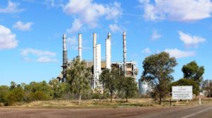
Mount Isa is a shopping and washing stop for us. We have been here at least five times so there is not much new to see. This time we approached from the south so passed not one but two power stations that we had not seen before. Mount Isa is a substantial centre dominated by the huge mine operated by Mount Isa Mines.

One of the power stations at Mt Isa

One of the power stations at Mt Isa

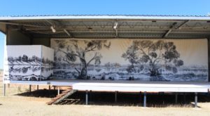
The stage at the Drovers Museum. Anne Kirkpatrick, daughter of Slim Dusty, will perform here during the festival

The stage at the Drovers Museum. Anne Kirkpatrick, daughter of Slim Dusty, will perform here during the festival

This stop over was for Friday and Saturday nights, so on Sunday morning we continued north west to the border town of Camooweal. You may recall that two of our fellow dinner guests at the remote Middleton Hotel were on their way to Camooweal to assist with preparation for the annual drovers’ festival. Camooweal has a drovers’ museum which is the base for the festival. This is where we found the folk that we met at Middleton. I had told them that we would call but they were still surprised to see us.

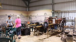
Ruth talking to our new acquaintance at the museum

Ruth talking to our new acquaintance at the museum

The museum has the normal memorabilia but also a great deal of cattle droving related artifices, dozens of artists portraits of droving identities and several displays that tell the history of cattle droving in northern Australia. All this is supplemented by a video made of a conducted tour of the museum. We had no trouble in spending 90 minutes there before taking our leave of our new friends.

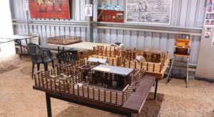
Model stock yards are used to demonstrate cattle handling techniques

Model stock yards are used to demonstrate cattle handling techniques

Cattle grazing against the background of a grey sky

Cattle grazing against the background of a grey sky

Mount Isa is in a mountainous area but is surrounded to the south, west and north by the flat sweeping plains.  The pastures through which we drove are not as green as to the south as they have not had the same amount of rain. The border between Queensland and Northern Territory is a line drawn across a featureless plain that stretches to the horizon in every direction.

This is the Barkly Tableland, that covers a large part of Northern Territory and encroaches well into North West Queensland. It is prime grazing land and produces a substantial proportion of Australia’s beef.

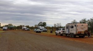
Some of our fellow campers at Avon Downs

Some of our fellow campers at Avon Downs

Our journeys on this Sunday has brought is to Avon Downs Rest Area, about 60 kilometres inside the NT border. Avon Downs cattle station surrounds us and the Avon Downs police station, the first in NT, is across the road. We are sharing the space with about twenty other vans, motor yard. Occasionally another road train thunders by, but less frequently as the night passes, we hope.

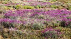
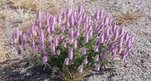
Some wild flowers along the way

Some wild flowers along the way

We had set an easy task for Monday (22nd August) with only 190 kilometres to get us to Barkly Homestead Roadhouse. Cloud started to build yesterday and there were some blustery winds during the night. Lots of blue sky this morning but it did not last. Grey skies soon set in. As we pulled in to the fuel pumps at Barkly Homestead rain spots appeared on the windscreen. Rain has been forecast throughout the area for about this time. We thought we might be far enough to the north to miss it, but no such luck.

Flowers road side at Mt Isa

Flowers road side at Mt Isa

About the most exciting things to happen to us on the drive this morning was to be passed by two road trains. As an interest, as we have crossed this part of the Barkly Tableland, Ruth has been keeping an inventory of the traffic we met. That is, east bound traffic. I will include the details in a future post. But one comment can be made. If you remove the caravans and motor homes there is not much traffic left.

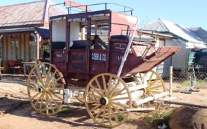
The Nine Pillars of Cobb & Co

The Nine Pillars plaque at Middleton. Under the sign on the right.

The Nine Pillars plaque at Middleton. Under the sign on the right.

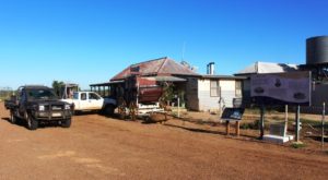
To back track a bit, during our stay at the Middleton Hotel our host pointed out to us a plaque declaring his establishment to be the Fourth Pillar of Cobb & Co. When a mail contract was awarded to Cobb & Co in 1892 the Middleton Hotel was already operating, having opened in 1876. It was soon joined by others that also became horse change stations and providers of food and overnight accommodation for coach passengers. All other hotels are gone with the only relic being the chimney of the Hamilton Hotel. That hotel, well known to locals was sighted on the Hamilton River nearer to Boulia.

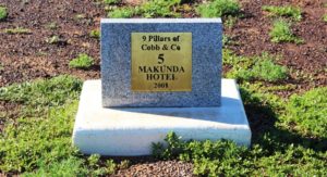
Makunda Hotel was where the coaches from Winton and Boulia met. No sign of the hotel remains.

Makunda Hotel was where the coaches from Winton and Boulia met. No sign of the hotel remains.

We found some of the plaques as we drove the rest of the way to Boulia. Number 1 is in Winton and Number 9 is outside the Min Min Experience at Boulia. A brochure that gives details of the old mail run, presented as a tour, is available at information centres. It includes a return route that includes the Diamantina Lakes National Park and points of interest along the Diamantina River.

West, Centre & Flinders – Days 22 to 23 – Enjoying Birdsville

The Information Centre in Birdsville

The Information Centre in Birdsville

We had problems in finding a place to park out van in the small caravan park in Bedourie. Enthusiastic watering to produce grass had turned most of it into a quagmire. It doesn’t take much water to create a bog hole in this country.


Set up in Birdsville Caravan Park

Set up in Birdsville Caravan Park

But there was no such pretense at Birdsville Caravan Park. It is an orderly, well kept park but there is not a blade of grass in sight. Fence to fence it is compacted fine gravel. The events that draw large crowds here, particularly the Birdsville race meeting and the Big Red Bash, have made it necessary that the park be able to handle crowds. The amenity block is sized accordingly. The races are less than three weeks away, so preparations for the crowds are under way.

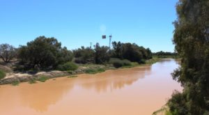
The Diamantina River at Birdsville. Water levels are rising as the recent rains to the north slowly move towards Lake Eyre

The Diamantina River at Birdsville. Water levels are rising as the recent rains to the north slowly move towards Lake Eyre

Our Monday activity was to have been a trip to the Big Red sand dune on the edge of the Simpson Desert, but no sooner had we left town than out navigation system stopped showing us the way. This necessitated a return to camp to fix the problem. While I puzzled over the problem Ruth started some washing. By the time that we were ready to go it was a bit late, so we had lunch and set off to see closer sights.
The Bourke & Wills tree at Birdsville

The Bourke & Wills tree at Birdsville

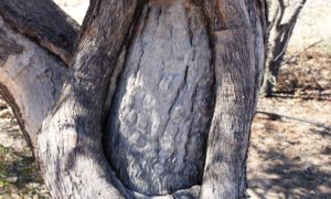
Just over the Diamantina River there still stands a tree into which explorers Bourke and Wills cut a blaze and chiseled some markings. Look carefully and you can see parts of some of the characters that they cut, still visible after more than 150 years.


The Birdsville Racecourse from the highway into town

The Birdsville Racecourse from the highway into town

Right next door are the facilities for horse trainers, probably built here for proximity to the river. A little further from town the race course itself is located beside the highway, which is the northern end of the Birdsville Track. Preparation is also under way there.


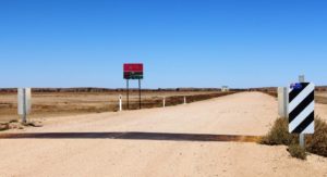
Ruth stands beside the information booth at the Queensland/SA border

Ruth stands beside the information booth at the Queensland/SA border

There is still a temptation to change our plans and go down the Track, so we drove the first 30 kilometres to gauge its condition. It is a full width gravel road and is in quite good nick at this end. Just some more grist for the decision mill.


A holding yard built from local timber

A holding yard built from local timber

The drive took us over the South Australia border, which is only 15 kilometres south of Birdsville. By the time that we turned around we were well into the long sand dunes that cross the country side. The border is well sign posted by both states and an

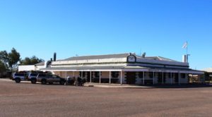
The Birdsville Hotel. It has stood for over a century

The Birdsville Hotel. It has stood for over a century

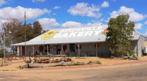
Birdsville Bakery, home of the curried camel pie

Birdsville Bakery, home of the curried camel pie

Tuesday dawned, another cloudless day with a cool easterly breeze and flies. We made a fairly early start on the 35 kilometre drive into the edge of the Simpson Desert, arriving at the boundary of the National Park at about 10.00 am. Since the authorities had provided a picnic shelter there, the last one until the other side of the desert probably, we shared it with a family of Swallows that had built their nest in the roof frame.

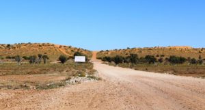
The road from town leas to the foot of Little Red. The Simpson Desert starts at the sign.

The road from town leas to the foot of Little Red. The Simpson Desert starts at the sign.

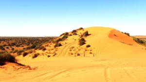
The sand dune known as Big Red is the tallest sand dune in the Simpson Desert. In reality it is the highest spot on a sand dune that disappears into infinity in both directions. The dune could be over one hundred kilometres long. A couple of kilometres to the south, part of the same dune, is Little Red. The road leads directly to Little Red which you can cross and continue on into the desert. Or you can turn right and follow the foot of the dune until you come to Big Red.

To drive over Little Red is a bit of an anticlimax. To drive to the summit of Big Red is one of the most iconic things that a four wheel drive enthusiast can do.

Just loo at all that lovely sand!

Just loo at all that lovely sand!

We parked at the foot of Little Red and I climbed to the summit along with two or three other people. We then drove to the foot of Big Red. Again I climbed to the summit and discussed matters with another driver who had taken the walk just before I did. We decided to reduce tyre air pressure, as recommended, and give it a try. I offered to video his ascent and did. He then took my camera as I returned to the car, reduced air pressure and made the climb. We ascended without problem. Another item ticked off the bucket list!

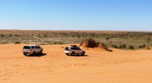
Parked at the summit of Big Red

Parked at the summit of Big Red

The track down the western face of Big Red and into the Simpson Desert

The track down the western face of Big Red and into the Simpson Desert

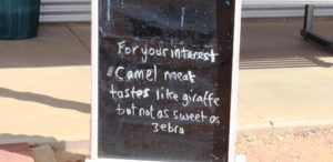
A sign outside of the Birdsville Bakery

A sign outside of the Birdsville Bakery

We agreed that the drive up the dune had been easy and wondered what all the fuss was about. Then we looked over the western edge and understood. Because of prevailing easterly winds most of the loose sand has been blown from the eastern side to the western side of the dune. Those travelling in an easterly direction face piles of soft sand, fluffed up by the wind.  We watched as two drivers struggled with the conditions. They were still struggling when we drove back down the dune, re inflated our tyres and returned to town.

It was now lunch time. Another iconic activity in Birdsville is to eat a curried camel pie at the Birdsville Bakery. Ruth chickened and had ordinary beef. We washed them down with cappuccinos. The curried camel was not bad. It tasted a bit like beef but with a distinct difference. The accompanying picture will explain.


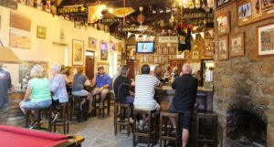
The main bar at the Birdsville Hotel

The main bar at the Birdsville Hotel

That left us with one last traditional activity before leaving Birdsville. A drink at the very historic and dare I say it, iconic Birdsville Hotel. We arrived at the same time as two of our fellow adventurers from this morning’s activity at Big Red. So we joined them and chatted about the kind of things that folk chat about under such circumstances.

The Birdsville Track reaches south into South Australia

The Birdsville Track reaches south into South Australia

For William Shakespeare the big question was to be or not to be. For us it was to go or not to go. Here we are at the northern end of the Birdsville Track and one of my ambitions has always been to drive its length. But if we do that we will arrive in the Flinders Ranges to a succession of 4 degree mornings and several following that will, in all probability, won’t be much warmer . That makes it a no brainer. Tomorrow we will retrace our course back to Boulia and from there to Mount Isa and points west. And ultimately south, but only after minimum daily temperatures increase a bit, hopefully.

West, Centre & Flinders – Days 20 to 21 – To Bedourie and Birdsville

The sign at Boulia for the turn South

The sign at Boulia for the turn South

It is just less than 400 kilometres from Boulia to Birdsville, neatly dissected by Bedourie, which is about 200 kilometres from both. As there are no other towns on the road we made Bedourie our destination on Saturday and finished the journey on Sunday. On both days we arrived for a late lunch. That allowed us time to look around on our day of arrival.

The Royal Hotel Bedourie

The Royal Hotel Bedourie

Our last visit to Bedourie was by air, during our air tour of the area around Lake Eyre in 2011. The first night of the tour was spent at the historic Royal Hotel at Bedourie. Licensee Jim Smith had provided hospitality beyond the call of duty, so we called to see him. Sadly he was away in Mt. Isa. But we, as the only customers, got talking to the young lady behind the bar. Clearly she was a northern European back packer.

The part of main street at Bedourie

The part of main street at Bedourie

We mentioned that while here, we had visited nearby Cluny Station. That led her to tell us that she had been at a party at Cluny the previous night. Soon other party participants arrived. I could see another party starting, so we said our farewells and departed but with a bit more knowledge of life in this remote town.

A bridge over one of the channels of the Georgina River

A bridge over one of the channels of the Georgina River

The terrain between Boulia and Birdsville is flat, with few hills. It is the quintessential land of rolling plains. A little less than half way to Bedourie we crossed the Georgina River, which with the Diamantina, drains the north west area of Queensland, ultimately running into Lake Eyre. For most of the way to Bedourie the river and its flood plains were to our left, a never ending swathe of green, mostly treeless plain but with the normal growth of trees along the river.

The marker for the Tropic of Capricorn sits by the road where it crosses a treeless plain

The marker for the Tropic of Capricorn sits by the road where it crosses a treeless plain

I mentioned a post or two ago about explorer Major Sir Thomas Mitchell and his exploration of the area. One of his discoveries was vast areas of treeless plains covered with natural grasses. The most prominent of the grasses was named in his honour, Mitchell grass. The plains over which we were driving are Mitchell grass plains. This type of treeless country accounts for about 14% of Queensland’s land area.

The official marker for the Vaughan Johnson Lookout overlooks Diaimantina flood plains

The official marker for the Vaughan Johnson Lookout overlooks Diaimantina flood plains

On the border between Boulia and Diamantina Shires (Diamantina Shire is based on Bedourie), right by the road, is the most prominent hill of the trip. At the summit the councils have built a rest and information area. It is named after and was opened by Hon. Vaughan Johnson, now retired, but a long time member for the Queensland state seat of Gregory and a former government minister.

The steep climb to the lookout

The steep climb to the lookout

I don’t want to over work the word but the view is magnificent. Through an arc of about 270 degrees the view is over flood plains, now green from recent rain. From this vantage point it is easy to believe that this area was once an inland sea. Equally interesting are the six double sided information boards that provide historical and environmental information. In a protective cage a piece of road building equipment used on the original road is now on display.

The old causeway over King Creek south of Bedourie

The old causeway over King Creek south of Bedourie

Bedourie is partially surrounded by Eyre Creek, a waterway that follows the road that we were on, now the Eyre Developmental Road, for some distance. A variety of water birds can be sighted at Cuttaburra Waterhole beside the road. The stream finally crosses the road for the last time, a little further south at Cuttaburra Crossing, before heading through a couple of lakes and into the desert, to then run south again to its final destination at Lake Eyre.

The main channel of Eyre Creek near Glengyle Station

The main channel of Eyre at Cutta Burra crossing

Diamantina Shire describes its municipality as “Where the Desert Meets the Channel Country”. This is an apt description. The further south the less frequent the lush green of newly growing grass and the more frequent becomes the expenses of red gravel, sand and clay patches and the scrubby salt bush type vegetation that dominates in these regions. And then, of course, there is the increased frequency of sand dunes, partially covered with vegetation, that stretch from one horizon to the other.

The sealed road crosses a sand dune south of Bedourie

The sealed road crosses a sand dune south of Bedourie

The road was good. There is now only eight kilometres of unsealed road north of Bedourie and a bit less than 80 kilometres between Bedourie and Birdsville. The unsealed sections were in good condition. Our lower than normal average speed was the result of frequent stops to take photos rather than the condition of the road.

The road over Eyre Creek at Glengyle Crossing

The road over Eyre Creek at Glengyle Crossing

Lush vegetation on the flood plains of the Diamantina

Lush vegetation on the flood plains of the Diamantina

Birdsville, on our arrival, seemed to be full of motor bikes. They were roaring around the streets and the caravan park most of the afternoon. It seems that some groups of bikers are crossing the Simpson Desert and have all arrived in town at once.

This morning, at Bedourie, in our caravan park, I spoke to one motor cyclist involved with a group raising funds for Sudden Infant Death Syndrome (SIDS for Kids). They have two groups crossing the continent from Cape Byron in NSW to Steep Point in WA. Some will cross the Simpson Desert but others will get to Alice Springs via the Donohue and Plenty Highways. They will join up to proceed to Uluru and then cross the Great Central Road and ultimately reach Steep Point, the most westerly point in WA. Challenging stuff! They had already raised about $65,000 as they reached Birdsville

West, Centre & Flinders – Days 18 to 19 – Further West

It is not easy to predict the movements of the travelling public. On our first night at the Longreach Tourist Park the place was near to full. After we arrived, about mid-afternoon, the vans flooded in and flooded out again next morning. But on the second night

Sweeping plains near Winton

Sweeping plains near Winton

occupancy would have been no more than 40%. Perhaps folk had been in to complete the census. Forms were available at the office. We opted to complete it on line and couldn’t even log in. Perhaps we will try again at Alice Springs.

We left Longreach at the start of Day 18 driving towards Winton, about 180 kilometres to the North West.

North Gregory Hotel where legend has it Waltzing Matilda was first performed

North Gregory Hotel where legend has it Waltzing Matilda was first performed

Winton has always been a prosperous place but the drought has taken its toll. There are several empty shops in the main street. But the pubs continue to thrive. The Tattersals’  hotel that occupies a corner had about 20 tables set up for lunch on the pavement and more inside. Many caravans and their towing vehicles were parked in the street. Winton must be a favored lunch stop among grey nomads.

The vacant space was once occupied by The Waltzing Matilda Centre

The vacant space was once occupied by The Waltzing Matilda Centre

As some of you will know, Winton lost its famous Waltzing Matilda Centre to fire a year or so ago. That was a serious blow to the town. But they have bounced back with a new museum called the Qantilda Museum. It is much smaller, as a great deal of history was lost in the fire, but deals with Winton’s two main claims to fame. Winton  is the birth place of Qantas Airways and Waltzing Matilda was written by Banjo Patterson at Dagworth Station to the north of Winton and was first performed in public at Winton’s North Gregory Hotel.

Self explanatory!

Self explanatory!

The “sweeping plains” continue to Winton and beyond. Green as far as the eye can see.  But in most of the pasture there are no cattle eating the lush grass. Drought plays havoc with stocking density and it takes a long time to rebuild a production herd.


The first real jump up on the way to Middleton

The first real jump up on the way to Middleton

When we came this way last year on our way to The Centre, I said that the road from Winton to Boulia was one of the most attractive outback drives in Queensland and having done it a second time I have not changed my mind. Along the first section, until just past the multiple channels of the Diamantina River, the terrain is fairly flat. Some areas are so green with lush growth that they look like a planted crop. Then  Mount  Booka Booka appears to the left of the road. From there, for the next hundred kilometres or so, the road passes through the Sword Range which is mostly a series of jump ups, or mesas, with their defining crowns of red rock and slopes clad with small bushy vegetation of brilliant green.

A main channel of the Diamantina River almost full of water

A main channel of the Diamantina River almost full of water

Last time through we did Winton to Boulia, a distance of 360 kilometres, in a day. This time, having started the day at Longreach we have broken our journey at the lonely road side pub at Middleton. There was a town of Middleton but it is long gone and only the 130 year old hotel remains. Free camping is available over the road. Most who use the area express their appreciation by patronising the hotel.

Middleton Hotel

Middleton Hotel

We went over for a drink after setting up and then later, went back for dinner. Dinner guests included a couple from Taroom in Queensland on their way to Camooweal to help run the annual drovers festival. An other couple have just travelled the Birdsville Track and were able to give us some good information on road conditions.

An old Cobb & Co coach stands outside the Middleton Hotel

An old Cobb & Co coach stands outside the Middleton Hotel

The Middleton Pub is over 130 years old. The area was first explored by John McKinley who was leading a group searching for lost explorers Bourke and Wills. W Middleton was second in command. The area when opened shortly afterwards was named Middleton in his honour.

The publican and his wife are elderly but are assisted by younger family members. They were most welcoming. The menu was surprisingly extensive but we chose the “house” meal of corned beef with potato, cabbage and white sauce. The serving was generous. The facilities were basic with outside toilets and showers constructed of corrugated iron. The plumbing for the shower looked like a plumber’s nightmare but the rusty shower head was large and hot water cascaded out.

We went to sleep to the gentle lowing of cattle in a yard behind the hotel, probably waiting for a truck to take them to market.

Approaching Cawnapore Lookout

Approaching Cawnapore Lookout

The overnight stay at Middleton produced an unexpected bonus. Soon after leaving Middleton, jump ups start to appear on the horizon. The road turned towards them and as we drew closer the morning sun illuminated the red stone caps and eroded upper reaches turning them to shades of deep red. The green vegetation that clings to the slopes takes on a brilliancy that makes it look painted on.

A path for the fitter leads to the summit if the Cawnpore jumpup

A path for the fitter leads to the summit if the Cawnpore jump up

A picnic shelter marks Cawnpore Lookout, a vantage point that stands above a cutting through the hills. To reach it you must scramble up a steep gravel path but the effort is well worth while. The views through 360 degrees are stunning. Those fitter than I can follow a path that leads to the very top of the jump up for even better views, I imagine.  Accompanying photos illustrate.

A view from the lookout

A view from the lookout

From here the dramatic hills reduce in frequency. The final 80 kilometres or so into Boulia returns to endless green planes with scattered trees. The only dense vegetation lines the many water ways, most of which retain some of the recent rain.


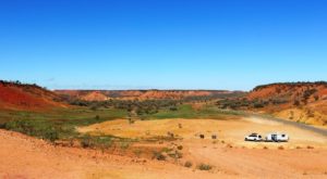
Car and van from the lookout and hills to the west

Car and van from the lookout and hills to the west

The Min Min Centre in Boulia

The Min Min Centre in Boulia

We have reached Boulia and are in the caravan park, with the Bourke River only a few metres from the back of our van. Boulia is a small service town at the junction of Kennedy and Diamantina Developmental Roads. The Donohue Highway that leads to Alice Springs via the Plenty Highway branches off just out of town. The town has museum displays of dinosaur fossils and other items relating to the past when where Boulia stands was part of an inland sea. It also has the Min Min Experience, an animated show that tells of the mysterious Min Min Lights.
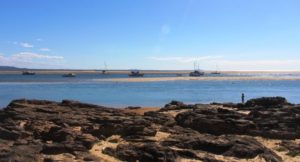
A full Bourke River at Boulia.

A full Bourke River at Boulia.

Weather has been brilliant. Morning temperatures have been around 10 C with day temperatures in the mid twenties. We experienced some cloud and a few spots of rain on the windscreen as we approached Middleton, but by evening the stars shone from a cloudless sky. But we have had some chilly breezes from east to south west, but they are easy to avoid or you put on something warmer.
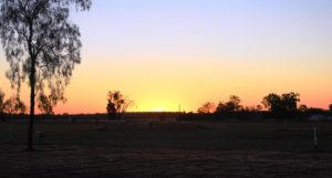
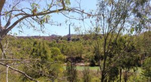
Tomorrow we head south for Bedourie and Birdsville.


West, Centre and Flinders – Days 12 to 17 – Traveling West

Ducks around a roadside pond as we left Rockhampton

Ducks around a roadside pond as we left Rockhampton

According to Google Maps, by the time we turn south at Boulia, we will be 1,288 kilometres by road from the coast at Yeppoon.  This will have taken about eight days, so you can see that we are not in a hurry. But we will have covered about 200 extra kilometres by turning south at Barcaldine, then travelling west to Isisford and then back to the Capricorn Highway at Ilfracombe, before turning west again to Longreach.

The coastal area is relatively flat and there is no real sensation of gaining elevation as we travel towards the Central Highlands until quite some distance west of Rockhampton. At a couple of places the climb is steep but generally the country undulates with each up grade taking us higher than the last.


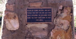
Inscription from the Mitchell plaque

A commemorative plaque to Major Sir Thomas Mitchell who explored this area

After Dingo, the road flattens and points like an arrow or wavers slightly toward the ever moving horizon which may be a distant arc where sky meets the plain or the variable outline of a range of hills. We are surprised to find that we are just 20 kilometres east of Alpha, or 460 kilometres from our starting point at the coast, before we reach the summit of the Great Dividing Range. The whole 444 metres of it! We are then in the Lake Eyre catchment. We feel as though we are getting somewhere.

Our first night was spent at Duaringa, in a council sponsored camping area, which we shared with about 40 other vans and motor homes. Late in the afternoon we were visited by a representative of the local Lions Club, with a notice that they will be serving breakfast the following morning. Egg and bacon muffins were our choice, with fruit juice.

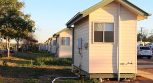
Mobile worker accommodation at Alpha

Mobile worker accommodation at Alpha

A new shopping centre has been built on the eastern fringe of Emerald, where we stopped to buy some required items. We had intended another roadside stop that night but nothing took our fancy, so we continued to the Alpha caravan park. Alpha is near to the location of the proposed coal mine that is causing some controversy at the moment. Project type accommodation units in the park suggest that some of the development team have been accommodated here.

Next we passed through Jericho, where a road side sign proclaimed that Jericho is the only town in Australia that has crystal trumpeters. Well they would, wouldn’t they?

Part of the long main street of Barcaldine

Part of the long main street of Barcaldine

Since we left Rockhampton we have met an endless parade of caravans and motor homes. You name a brand and we have probably seen it. Strangely, there has been very little traffic, caravan or otherwise, going in our direction. When on country highways we cruise at about 80 kph. Most vans and almost all other vehicles, road trains included, travel much faster than we do, particularly when the speed limit is 110 kph. Perhaps it was because we were travelling on Saturday and Sunday. I think the lack of caravans going our way has to do with the direction in which southerners do their loops through NSW and Queensland. The majority seem to travel north inland and return home via the coast.

Inside the Tree of Knowledge memorial

Inside the Tree of Knowledge memorial

Barcaldine is reached next. It has historical fame as the birth place of the Australian Labor Party. Shearers famously went on strike here in the late nineteenth century. By the look of the main street on Sunday, when we passed through, no one much has gone back to work. Caravans and motor homes lined both sides of the long main street but barely a shop was open to serve them. Is this the dead hand of unionism or high Sunday penalty rates? Or perhaps trading laws?

Set up among the trees at Barcaldine South

Set up among the trees at Barcaldine South

Barcaldine marked the temporary ending of our westward passage as we turned there to go south to Blackall. A convenient roadside rest area about 30 kilometres south provided a suitable over night stopping place. And with a bonus! Some kind soul had left a small pile of firewood right where we parked the van for the night.  So we had dinner under the stars by firelight. Adding to our carbon footprint, of course! We thank the kind prior occupant.

Our one and only camp fire for the trip so far

Our one and only camp fire for the trip so far

The Barcoo River at Blackall

The Barcoo River at Blackall

The following day we continued south to Blackall. This substantial town is on the Landsborough Highway and on the Barcoo River. After refueling we turned wast to travel across the rich flood plains of the Barcoo River system. Like many rivers in this area it is not a single stream but a series of channels and water holes that only flow when there is significant rainfall.

Yellow daises adorn the Barcoo flood plains

Yellow daises adorn the Barcoo flood plains

The recent rains have done their work and what was barren drought afflicted earth is now brilliantly green, with grazing stock and expanses of wild flowers. We think the flowers are daises, some white but mostly yellow. It was a very pleasant drive along a good sealed road that was almost normal double carriage way width most of the way.

Weir on the Barcoo at Isisford

Weir on the Barcoo at Isisford

At Isisford we set up the van for the night in a council supplied area beside the weir that retains some of the water in the Barcoo. We slept to the gentle rumble of water cascading over the spillway as the recent rains make their way down stream to join with the Thompson River near Jundah to become the famous Cooper Creek.

Set up on the river bank as Isisford

Set up on the river bank as Isisford

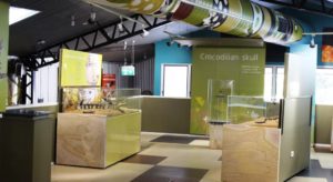
Inside the crocodile museum at Isisford

Inside the crocodile museum at Isisford

During the afternoon we took a walk through the small town. We were surprised to see a modern coffee shop with alfresco tables. On closer scrutiny, we realised that it was part of museum for the display of fossils of a prehistoric crocodile found in the area some years ago. The Isisford croc, scientifically known as Isisfordia Duncania (the last part for the discoverer whose surname was Duncan). The Isisford croc is believed to be the ancestor of the 20 plus species of crocodile and alligator known today.

The road between Isisford and Ilfracombe is not as wide as that traveled the previous day

The road between Isisford and Ilfracombe is not as wide as that traveled the previous day

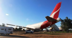
A jumbo jet at the Qantas Founders Museum

A jumbo jet at the Qantas Founders Museum

The Thompson is the river at Longreach. We arrived here yesterday. We have visited and blogged about Longreach before and have previously visited its main attractions. The Qantas museum is obvious as you drive into town. A jumbo jet parked by the road in a country town can hardly be missed. The Stockman’s Hall of Fame is almost directly opposite on the other side of the highway.

The Stockmans Hall of Fame

The Stockmans Hall of Fame

En suit units at the caravan park. A row of what?

En suit units at the caravan park. A row of what?

We are at the Longreach Tourist Park and have declared a lay day. That means that we have delayed moving on for a day. It was time for a breather after five days on the move.

West, Centre and Flinders – Days 9 to 11 – Relatively Speaking

My Nexus 7 tablet developed charging problems before we left home. They became worse as we travelled. I use navigation apps on the Nexus which run while we travel. Normally, because it is plugged into a 12 volt charger all day, we arrive at that days destination with the Nexus fully charged. Now it slowly goes flat during the day.

After a few tries I found a repairer in Rockhampton who was prepared to look at it. His diagnosis is that wires that connect the USB port are loose and need soldering. But on such a device the repair requires micro soldering and that is not a common process and probably not available outside of Brisbane at best. So the much loved Nexus is out of service, at least until we are back in Brisbane.

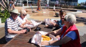
Ready to deal with the fish and chips

Ready to deal with the fish and chips

Fortunately I have another tablet, a Samsung Tab 3, which I received from Telstra as a reward for upgrading the data package on my phone. I have transferred the navigation apps to the Tab 3 but it has a larger screen that the Nexus so won’t fit in the frame attached to the dash board of the car. So I have had to order a larger size which, hopefully, will meet us in Longreach, on Tuesday. We will, of course, spend at least part of Tuesday night filling in our Census form.

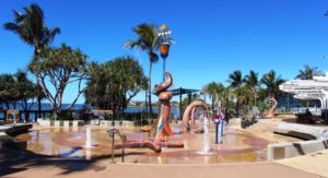
The wet play area at Yeppoon

The wet play area at Yeppoon

But back to the narrative! The distance from Gracemere to Kinka Beach is only 60 km, so even with a stop at the shops in North Rockhampton, we were at Kinka Beach by 11.30 am.  Registration formalities complete, we proceeded to park the van beside the allotted concrete slab. No easy task, as there was a large tree in the way. We finally prevailed, had lunch and settled in to wait for the arrival of Sister Aileen and brother-in-law Colin and their friends Marj and Vic.

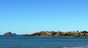
View south from Yeppoon. Rosslyn Bay is on the left

View south from Yeppoon. Rosslyn Bay is on the left

We didn’t do a great deal during the two days.  An outing to Emu Park the first day to stock up on food. Ruth went with the others while I stayed behind to get my blog up to date. On day two we drove up to Yeppoon for lunch (excellent fish and chips followed by coffee) and then drove steadily back down the coast road, known as Scenic Highway, taking in the panorama of beach, ocean and islands and stopping in at the Rosslyn Bay marina, where we sat and watched what little activity there was while soaking up some wonderful sunshine. Here I write particularly on behalf of the four Victorian visitors.

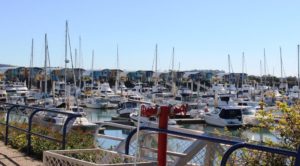
Boats and residential area at Rosslyn Bay

Boats and residential area at Rosslyn Bay

In between, we spent a considerable amount of time chatting, as we caught up on news of the Victorian branch of our family, seated in the sunshine and protected as much as possible from a pesky chilly south westerly wind. Daytime temperatures were low to mid twenties, but overnight got down to below 10 C most nights. But that is mostly how it has been since we left home.

West, Centre and Flinders – Days 5 to 8 – Filling In Time

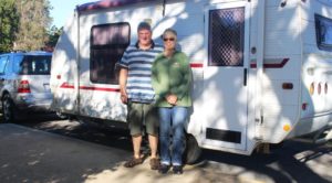
Keith and Linda. Van packed and hitched and ready to go

Keith and Linda. Van packed and hitched and ready to go

Our original plan, on which we set our departure date, had us meeting Keith and Linda (see previous post) further north, possibly as far north as Airlie Beach. But their progress down the coast was a bit faster than we had anticipated so we met them at Bundaberg, as most readers will already be aware.


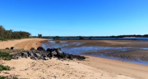
Near the mouth of the Burnett River at Burnett Heads

Near the mouth of the Burnett River at Burnett Heads

When we parted with them at Burnett Heads we had five days in hand for which we had no predetermined plans. Not a problem! There are always things to look at and places to go.

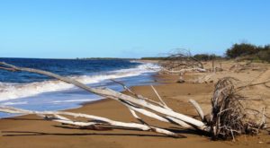
Beached flood debris on Rules Beach near Baffle Creek

Beached flood debris on Rules Beach near Baffle Creek

We decided to spend a couple of days at Agnes Water/Seventeen Seventy, but a lot of other people had made the same decision. All caravan parks were fully booked. As an alternative we chose Baffle Creek Caravan Park, located about equidistant from Bundaberg and Seventeen Seventy.

If you want other residents to talk to you at Baffle Creek Caravan Park it is best to arrive with a boat on top of your car, or at least have a conspicuous fishing rod on board. This is a fishing area and people go there to fish. We used it as a base for a day trip to Agnes Water and Seventeen Seventy.

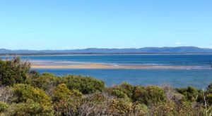
Sand banks in Round Head Creek at Seventeen Seventy

Sand banks in Round Head Creek at Seventeen Seventy

We have visited this area before and I have blogged about it. The day was near perfect. Clear skies and a gentle breeze, although up on Round Hill Head, the headland that stands above the town of Seventeen Seventy, the wind was stronger. We did a couple of walks to take in the rugged scenery and the panoramic views of the ocean provided by this vantage point, before returning to the water side park, near the Seventeen Seventy hotel, where we settled ourselves in a picnic shelter for a leisurely lunch.

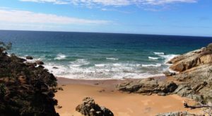
A small bay on the ocean side of Round Hill Head

A small bay on the ocean side of Round Hill Head

Boats at anchor in Round Hill Creek

Boats at anchor in Round Hill Creek

The sun sets over the agricultural fields at Biloela

The sun sets over the agricultural fields at Biloela

That took care of the first two days. For the remaining three days we decided to go inland to Biloela via Calliope and the Dawson Highway. We wanted to cross from Miriam Vale to the Boyne Valley, as an alternative road to Calliope, but tales of horrendous road conditions on the first part of that road put us off, so we stayed on the Bruce Highway.

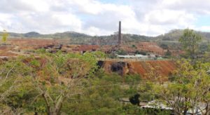
The 70 metre chimney at Mount Morgan gold mine

The 70 metre chimney at Mount Morgan gold mine

We returned to the Queensland Heritage Park at Biloela for the night. In our short trip north in June we had spent a night here so were on familiar tertiary.

The logical path to the Yepoon area from Biloela took us through Mount Morgan. I think we had only driven through this historic gold town previously but our plans for a closer look were made a bit more difficult when we found that the only decent caravan park in Mount Morgan was booked out.

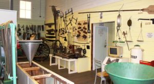
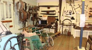
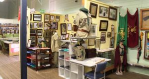
Mount Morgan museum display

Mount Morgan museum display

Mount Morgan museum display

Mount Morgan museum display

Mount Morgan museum display

Mount Morgan museum display

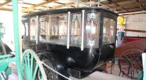
A rear view of Mount Morgan's first motor hurse

A rear view of Mount Morgan’s first motor hurse

The old gold mine, viewed from a vantage point in the town

The old gold mine, viewed from a vantage point in the town

So we booked two nights at Gracemere, a town that is now almost a suburb of Rockhampton, but still close enough to Mount Morgan to make a day trip back. On our way through the town we drove around to get our bearings and to find mine viewing vantage points. We then visited the superb museum in the town. The vast collection of historical memorabilia is divided into categories and themes, with the mine dominating. But other sections contained material related to the hospital, armed forces, scouts and guides, religions, local aboriginal history and more.

We found that a tour of the mine was available on a daily basis so when we reached Gracemere we phoned to make a reservation for the next day.

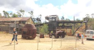
The head equipment of the shaft that took miners to their work

The head equipment of the shaft that took miners to their work

Gold mining was commenced by two Morgan brothers in 1882 but the scale of operations increased in 1888 when a company was formed and more finance became available. Mining finally ceased in 1990 but there was a period in the late 1920s when the mine was closed for five years, due to flooding to extinguish a fire in the mine shafts.

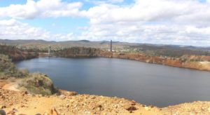
The pit, one of the largest in the Southern Hemisphere, is now almost full of water

The pit, one of the largest in the Southern Hemisphere, is now almost full of water

But it was a very successful mine for most of its one hundred year life and many fortunes were made. One example of this was Walter Hall who was an early shareholder and director. Some of his fortune was later used to found the Walter and Elisa Hall medical research foundation.  This is just another example of the extent to which gold played such a dominant role in the foundations of Australia.

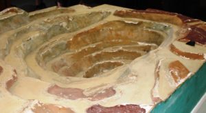
A model of the Mount Morgan pit displayed in the museum section of the company office

A model of the Mount Morgan pit displayed in the museum section of the company office

Our return to the caravan at Gracemere brought to a conclusion the brief period of filling in days. The next day we travelled to Kinka Beach, south of Yepoon, for our few days with sister Aileen and brother-in-law Colin, before we head west for the main part of this trip.