Interrupted Journey – North Queensland – 2022 – Part 4

Jumbo Jets & Old Machines

Note: A video link appears at the bottom of this blog post.

Reception & Tours Areas at the Qantas Founders Museum

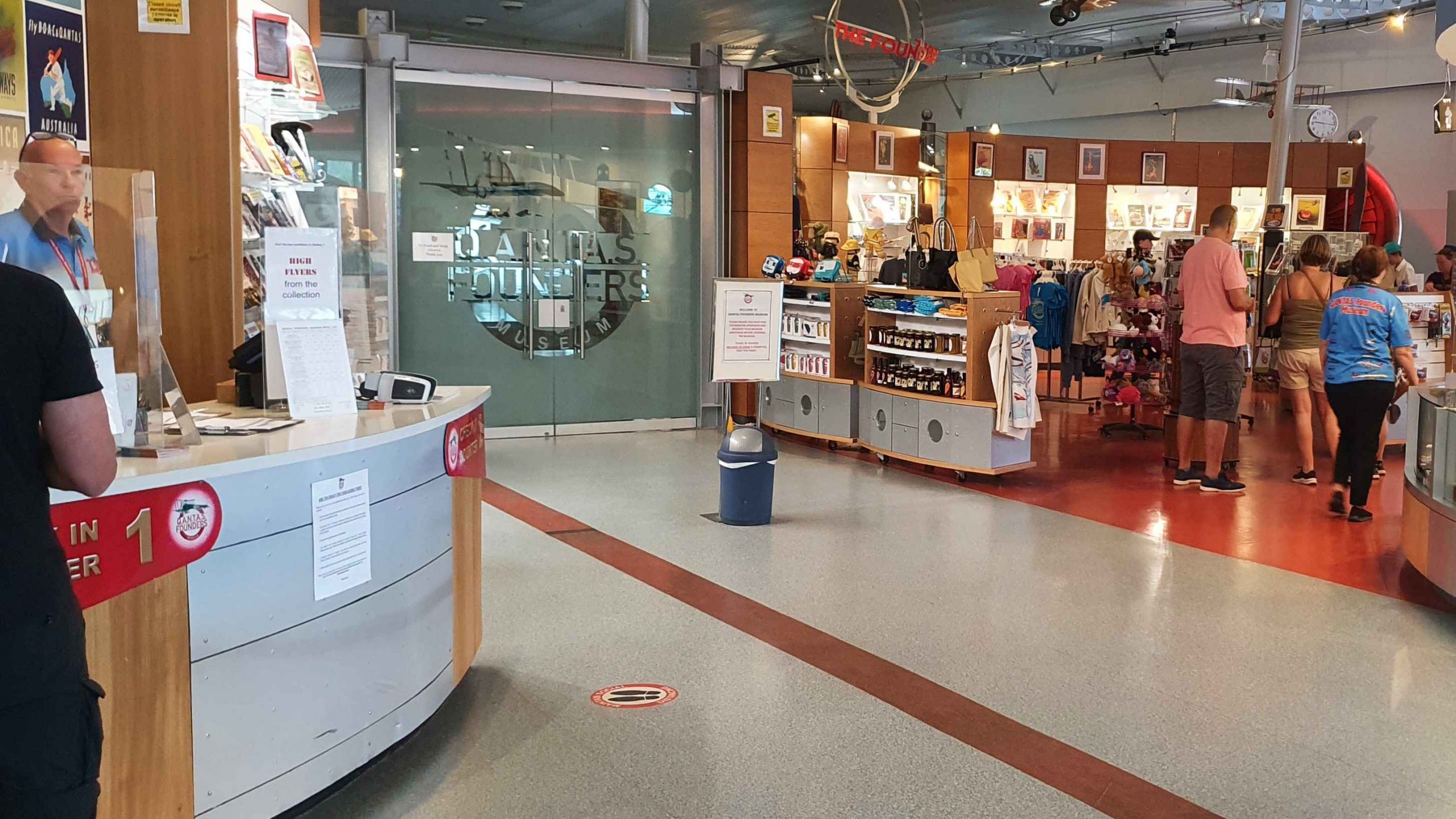
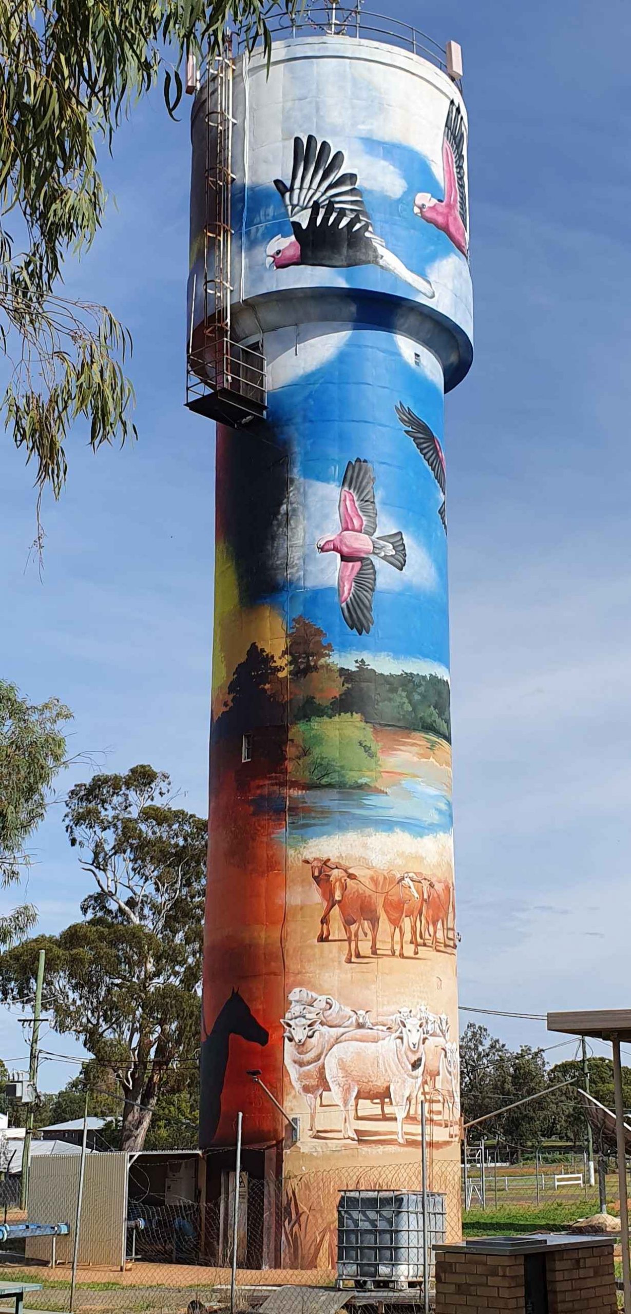
Over our many years of caravan travel we have passed through and stayed at Longreach many times. We have learned that if arriving from the East the first thing you will now see is the roof that shelters the aircraft at Qantas Founders Museum. The roof has not always been there. For the previous few years, the first sight was the tail of the Boeing 747. Prior to that it was probably the water tower at the roundabout, adjacent to the Longreach CBD.

Starboard Fuselage and Wing compared to humans demonstrates the size of the aircraft. The engine seen under the fuselage is a spare allowing replacement engines to be transported.
Jumbo nose wheel with DC3 and Boeing 707. Plus air conditioning to keep the display aircraft cool.
The orange items are the aircraft “black box”.
The door mounted raft/slide is an Australian invention.
Boeing 707 with boarding stairs in place.

Thursday 28th September was Qantas day. We had booked the Museum Tour for Ruth and I and the Aircraft Tour for me. All those steps! Then we were both booked to return in the evening for the Light Show. That left time for a nap in the afternoon.

Boeing 747 City of Bunbury.

The museum tour is confined to the original museum building and is all at ground level. It includes a Catalina Flying Boat in the grounds, a wide range of aircraft and vehicle models inside and the old workshop buildings that were the original Qantas Longreach hanger. Basically, it tells the story of the founding of Qantas and of its growth until 1934.

Visitors clustered around the doorway of the DC3.

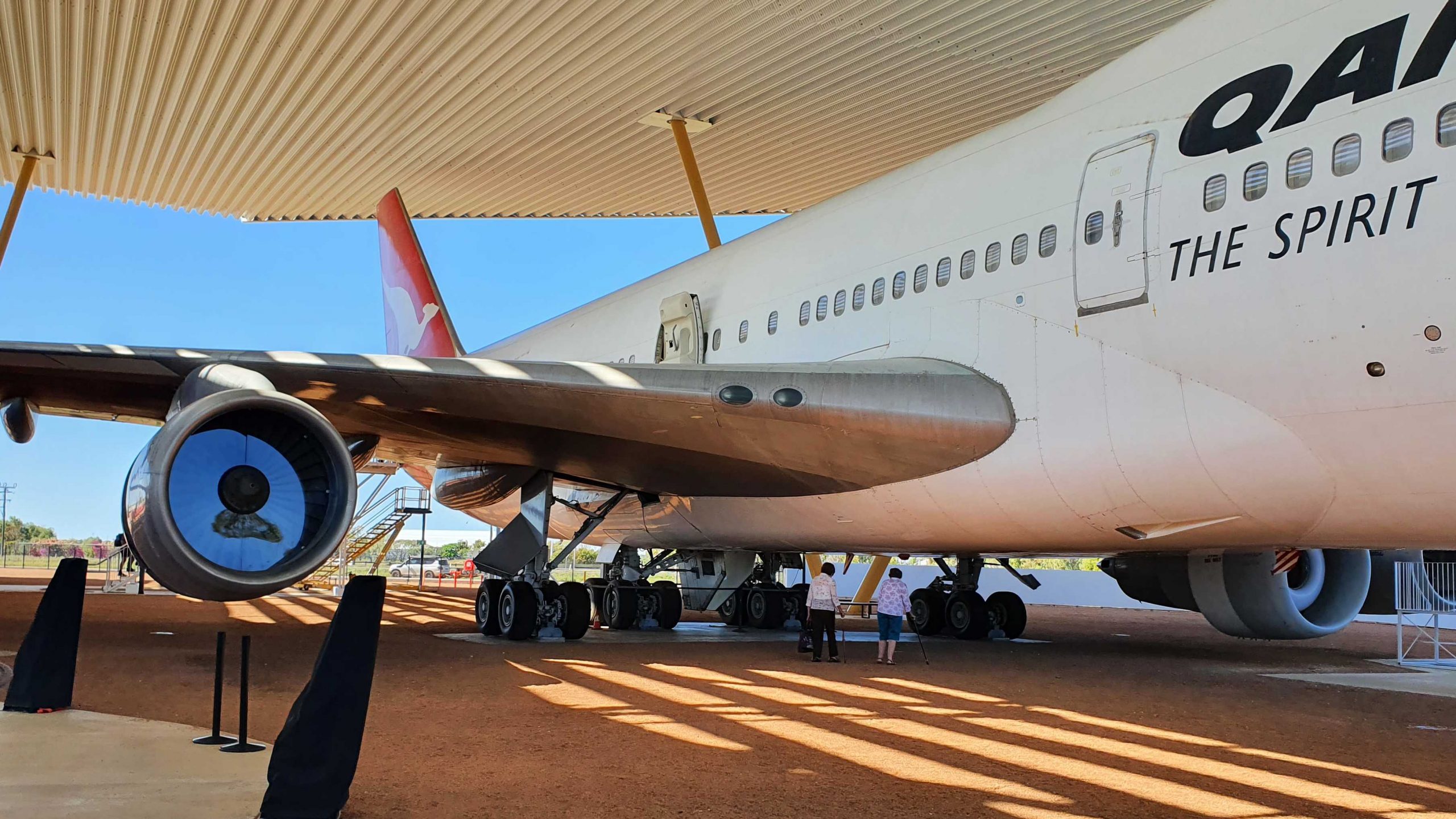
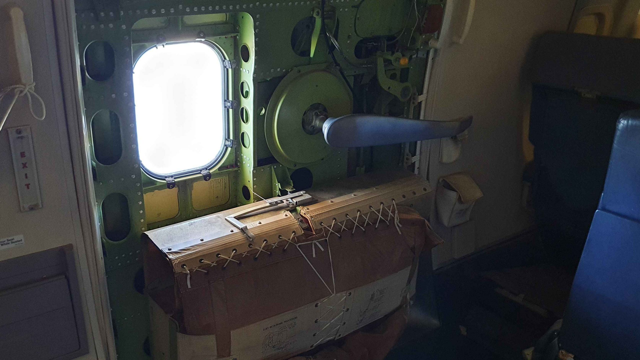
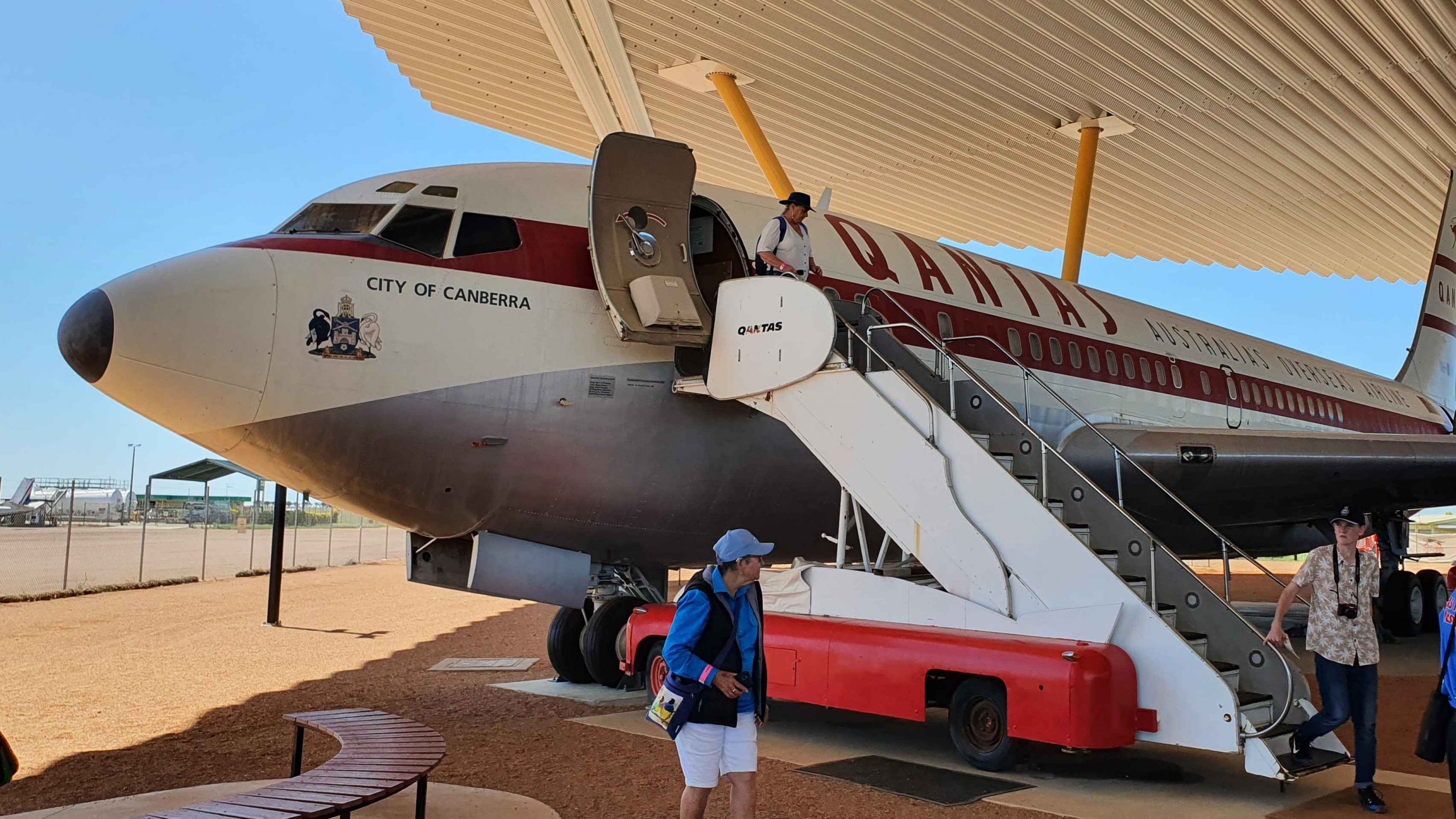
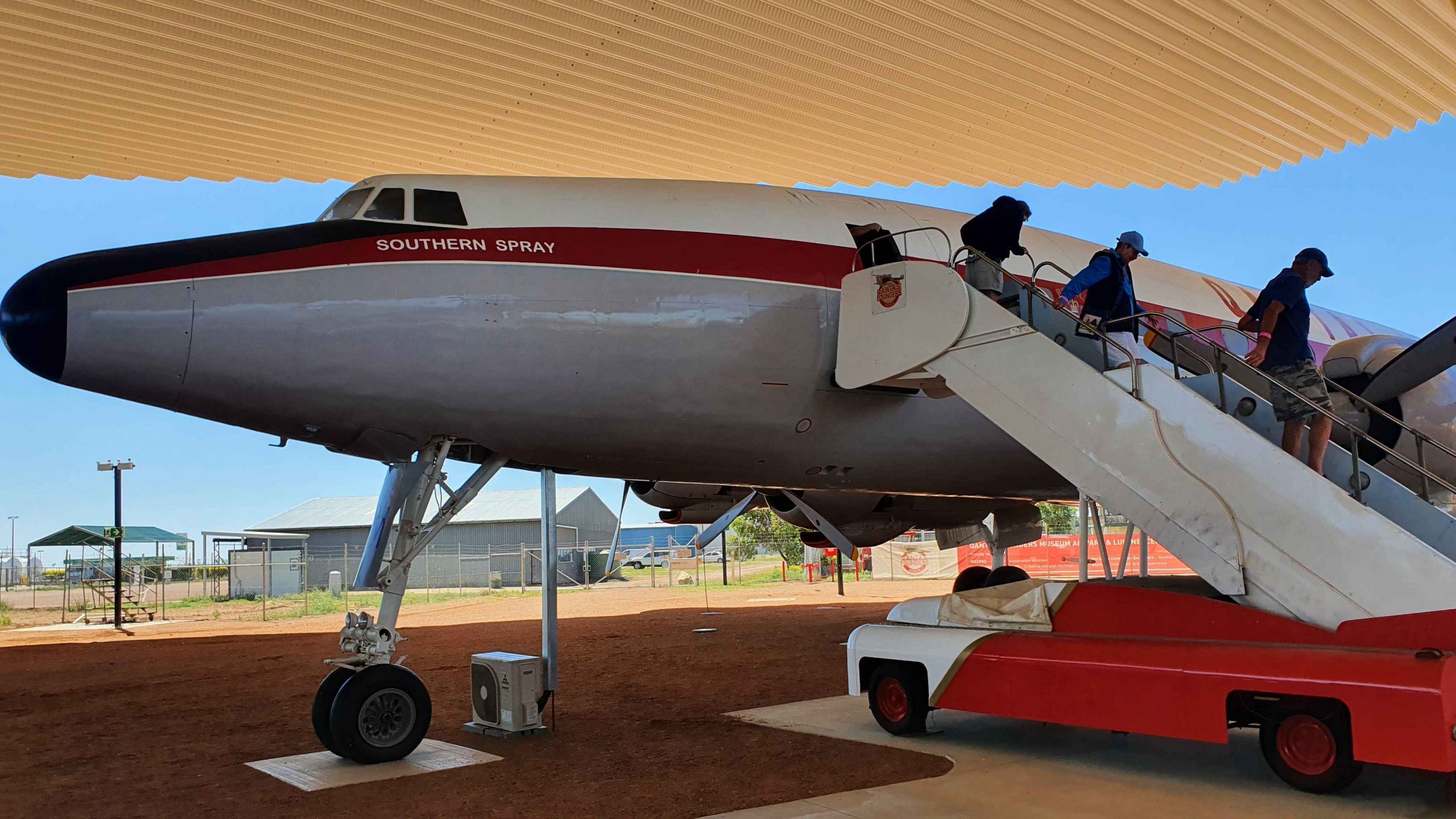
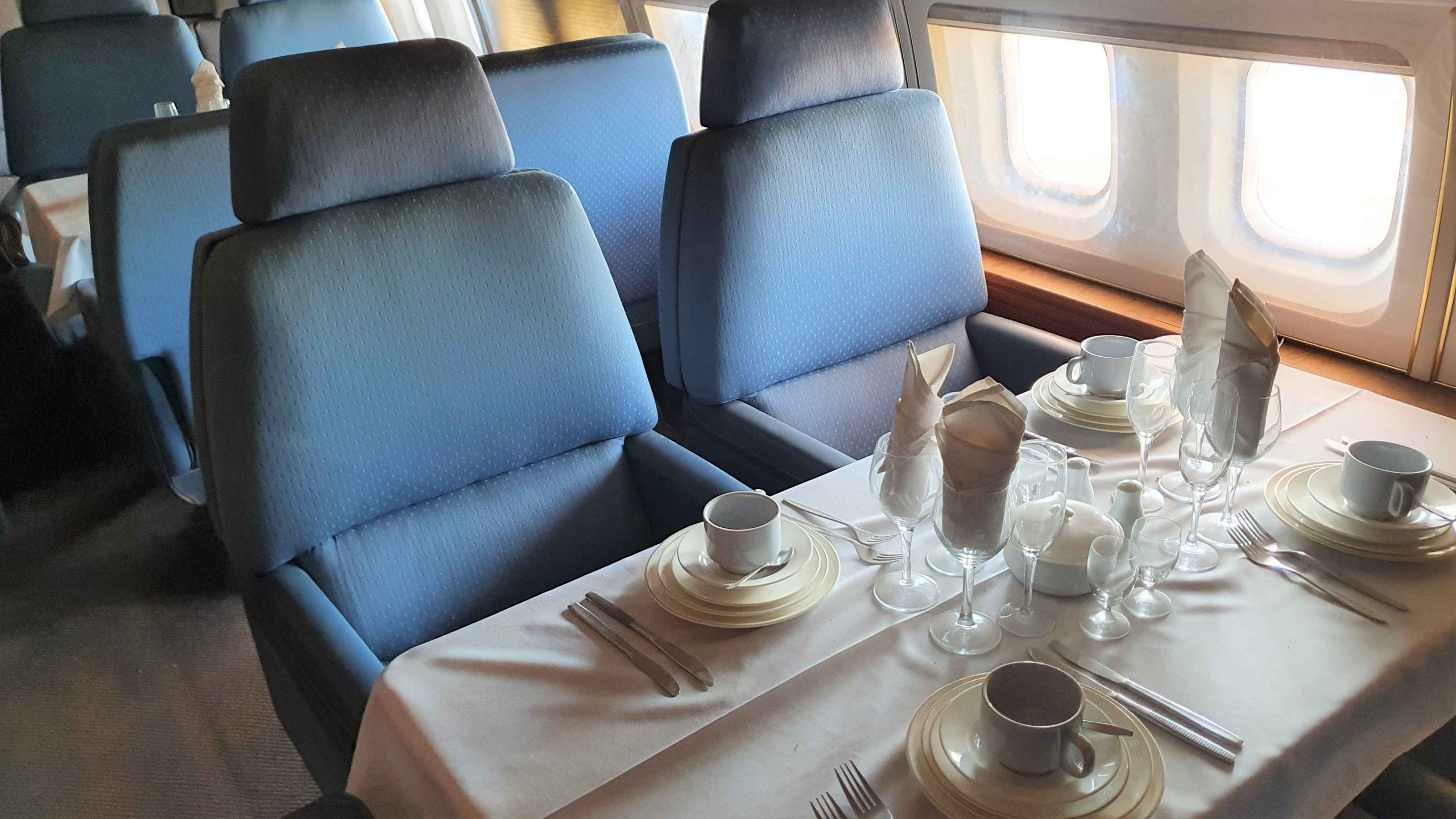
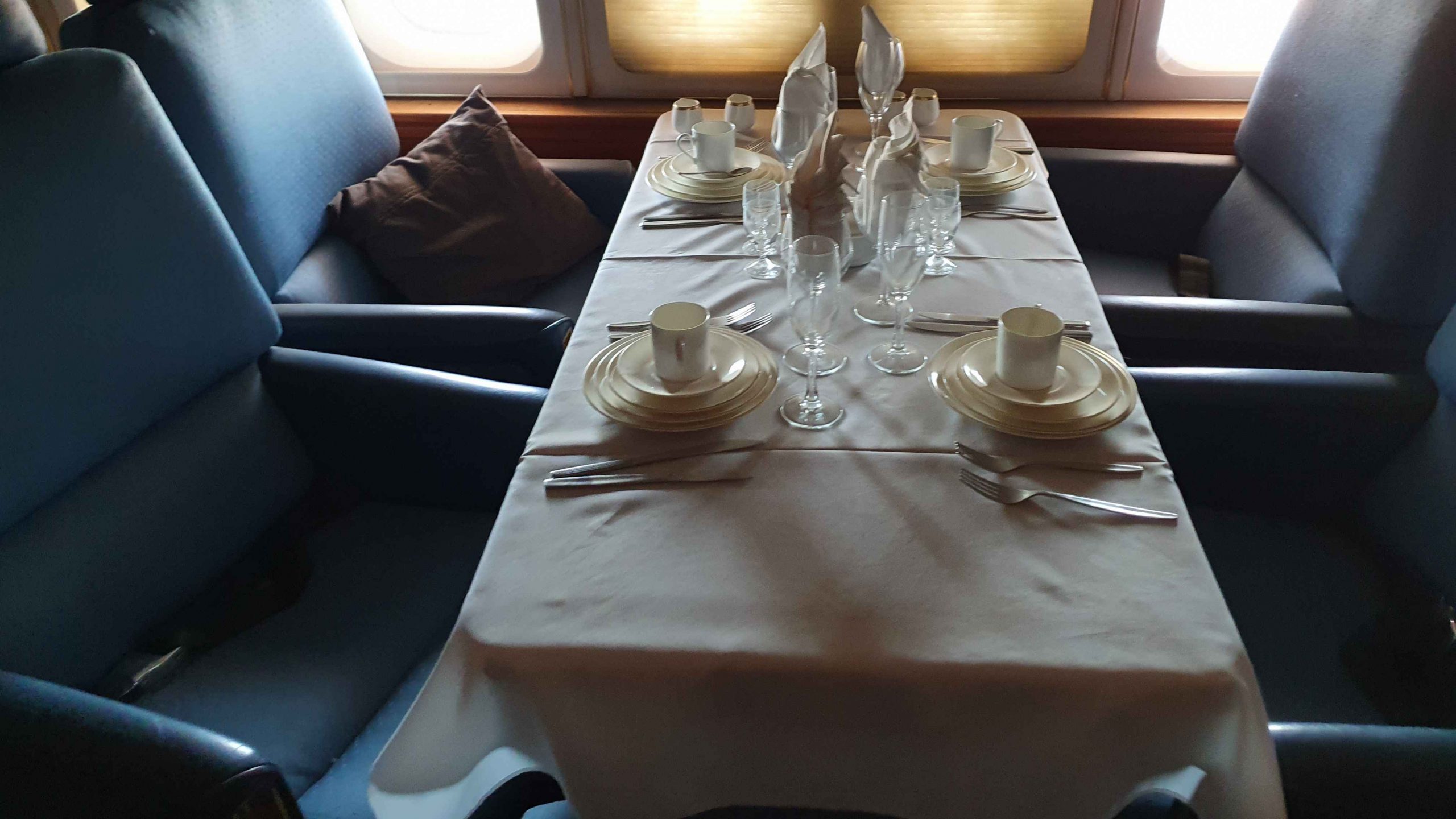
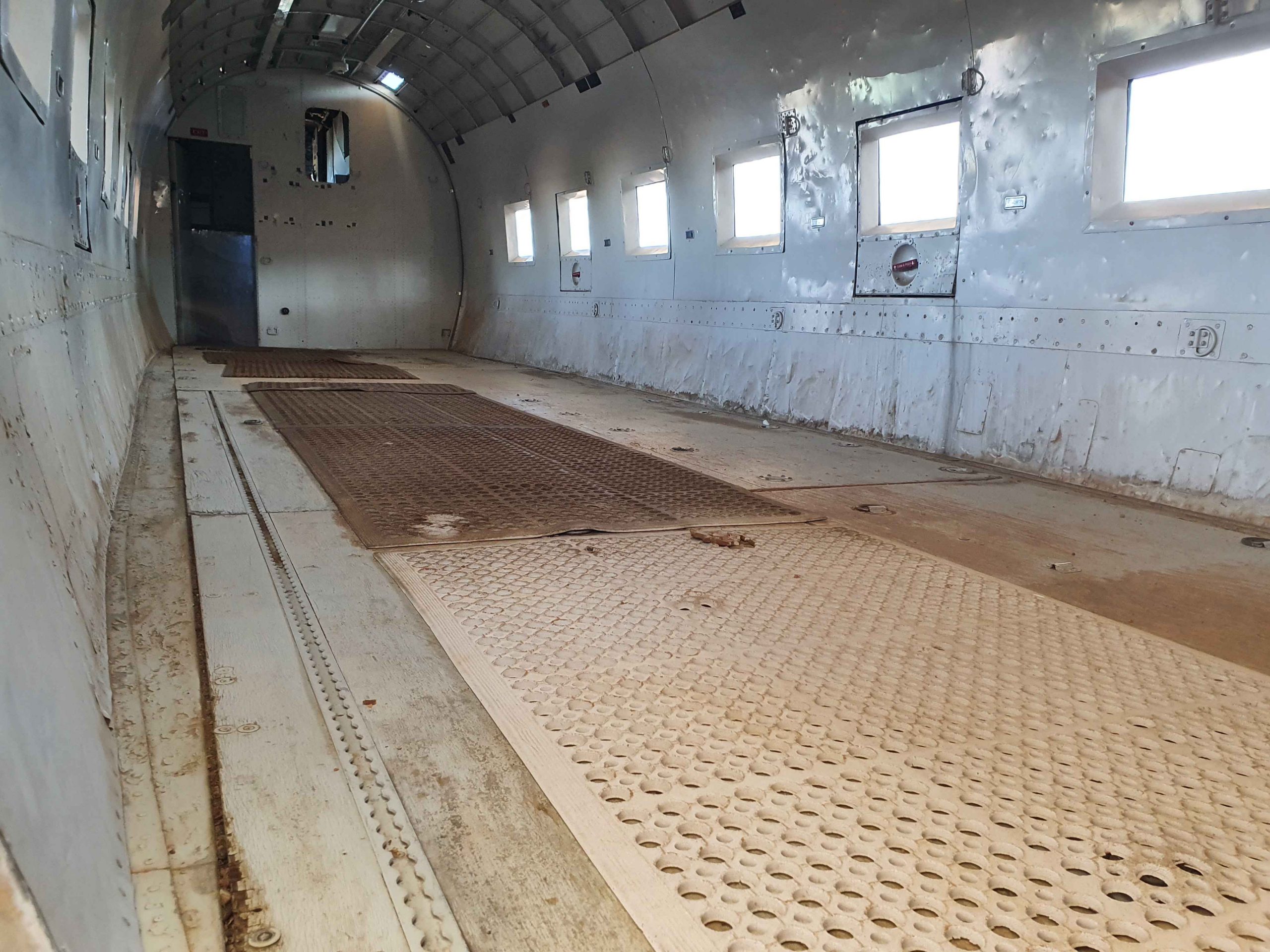
The story from 1934 to the era of the Jumbo Jet is told in the aircraft display, now housed under a huge canopy, a sort of hanger without walls. The Boeing 747 is so large that some of the other craft are under its wings. Three of them are accessed by permanent stairs to their side and rear doorways. The Douglas DC3 is small enough to be examined from the ground.

Super Constellation with boarding stairs in place.

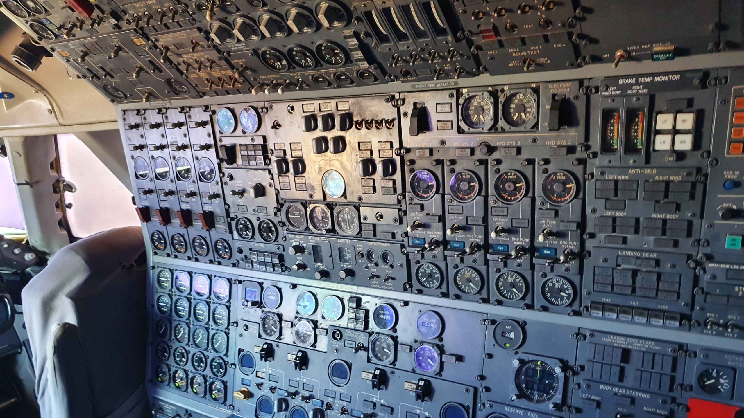
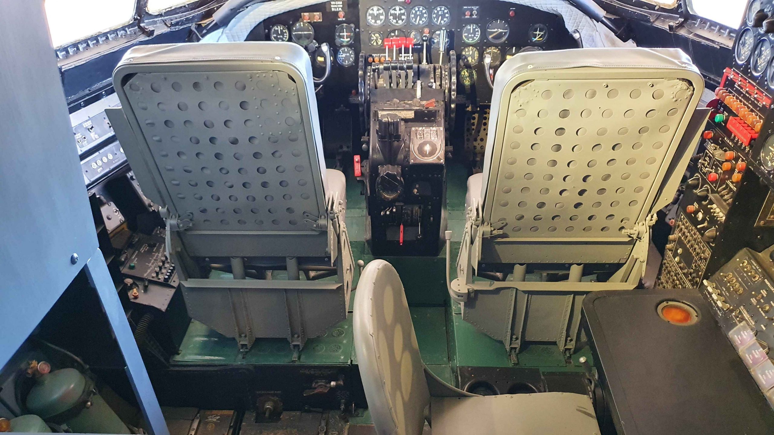
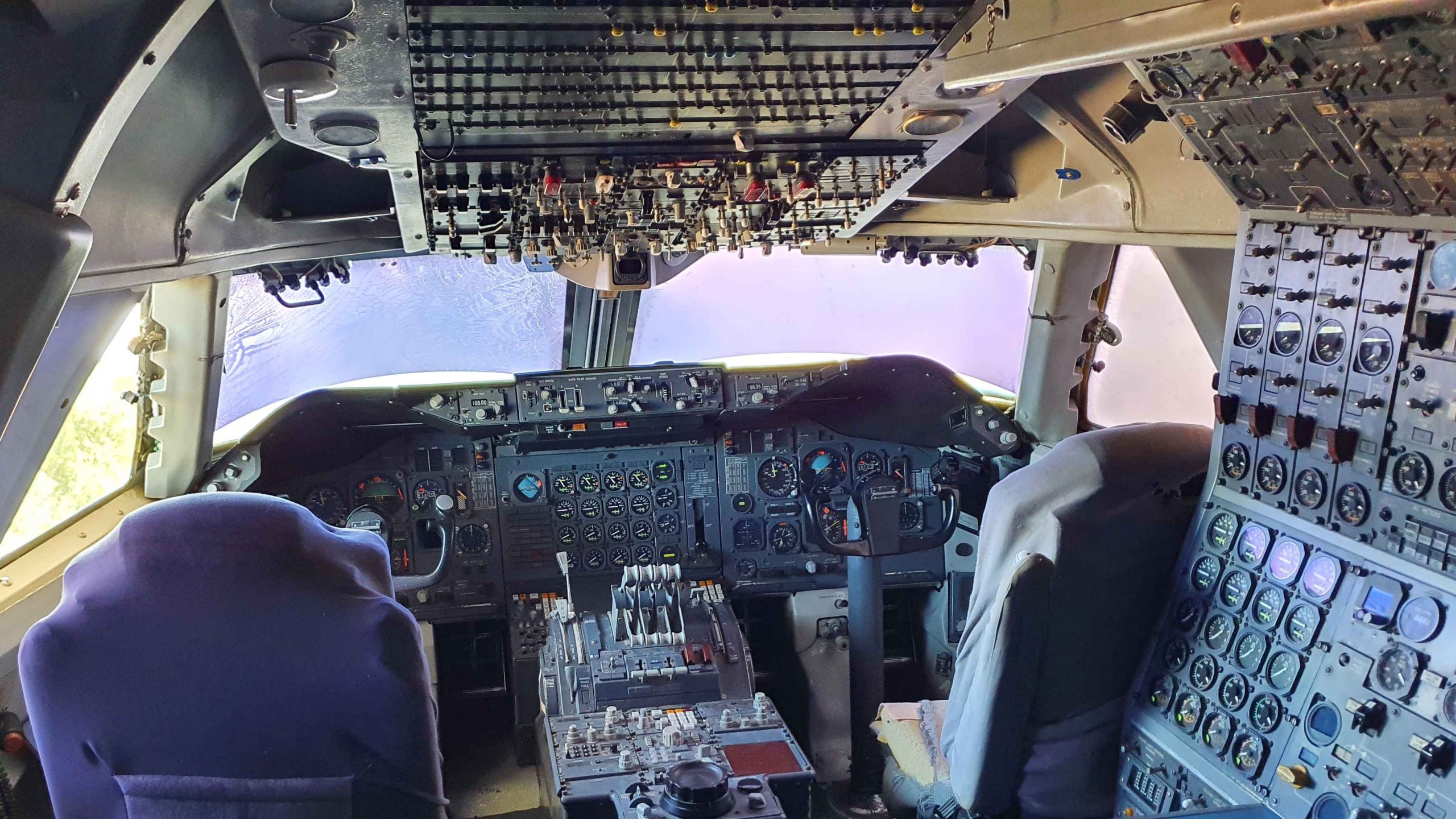
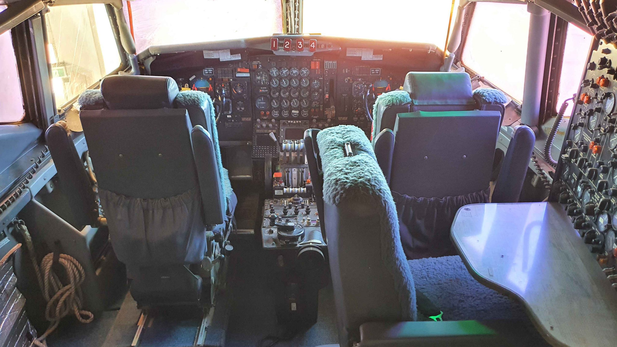
There are three tours of the aircraft museum. The one that I did takes visitors through the aircraft, with a very informative guide to explain what you are looking at and relate to you the history. The next is more expensive. It is for smaller groups and includes the opportunity to climb onto spaces normally only accessed by the crew and allows you to sit in the pilot’s chair and stand out on the wing for a photo. Then there is an evening sound and light show, where the Qantas story is projected onto the mostly white fuselages of the three larger aircraft.

Boeing 747 instrument paned on the earlier three crew Boeing 747s.
Catalina Flying Boat is located at the museum building.
In the early days of the Boeing 747 having your photo taken standing in the engine cowl was quite the thing to do.
The orange items are the aircraft “black box”.

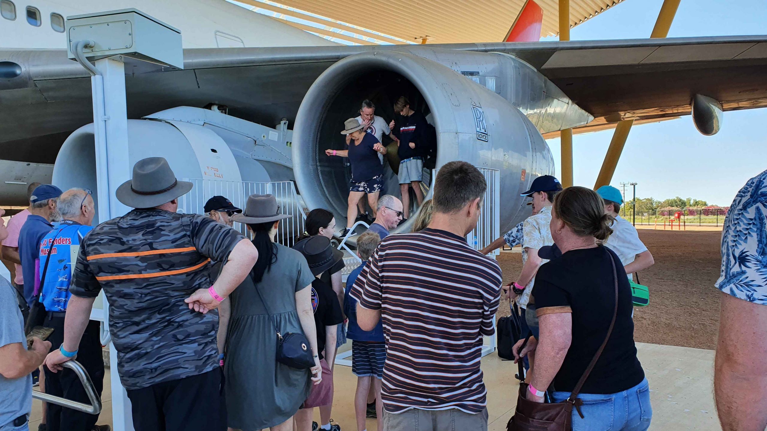
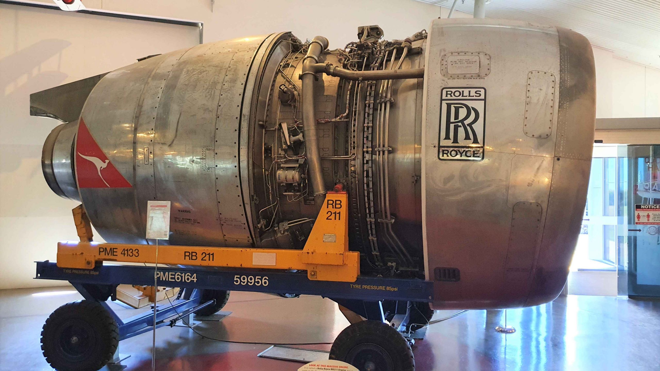
On display is the Douglas DC3, the Lockheed L-1049 Super Constellation, The Boeing 707 and the Boeing 747 Jumbo.

Cockpit on the Lockheed Super Constellation
Cockpit of Boeing 747
Cut away section to expose the frame of the aircraft.
The Lockheed DC3 was an Early Workhorse of the Airline.

The Boeing 707 is an interesting exhibit. It was purchased by Qantas and joined the international fleet. When it was retired at the end of its passenger carrying life it was acquired by a business that converted it into a five star flying hotel suite. It later became a luxury charter aircraft used on one occasion by Micheal Jackson, during a tour. It was finally retired to an open field in the south of England.

Dining table in the converted aircraft
Table for a meeting in flight. Perhaps as board room?
The luxury extends to cockpit seating.

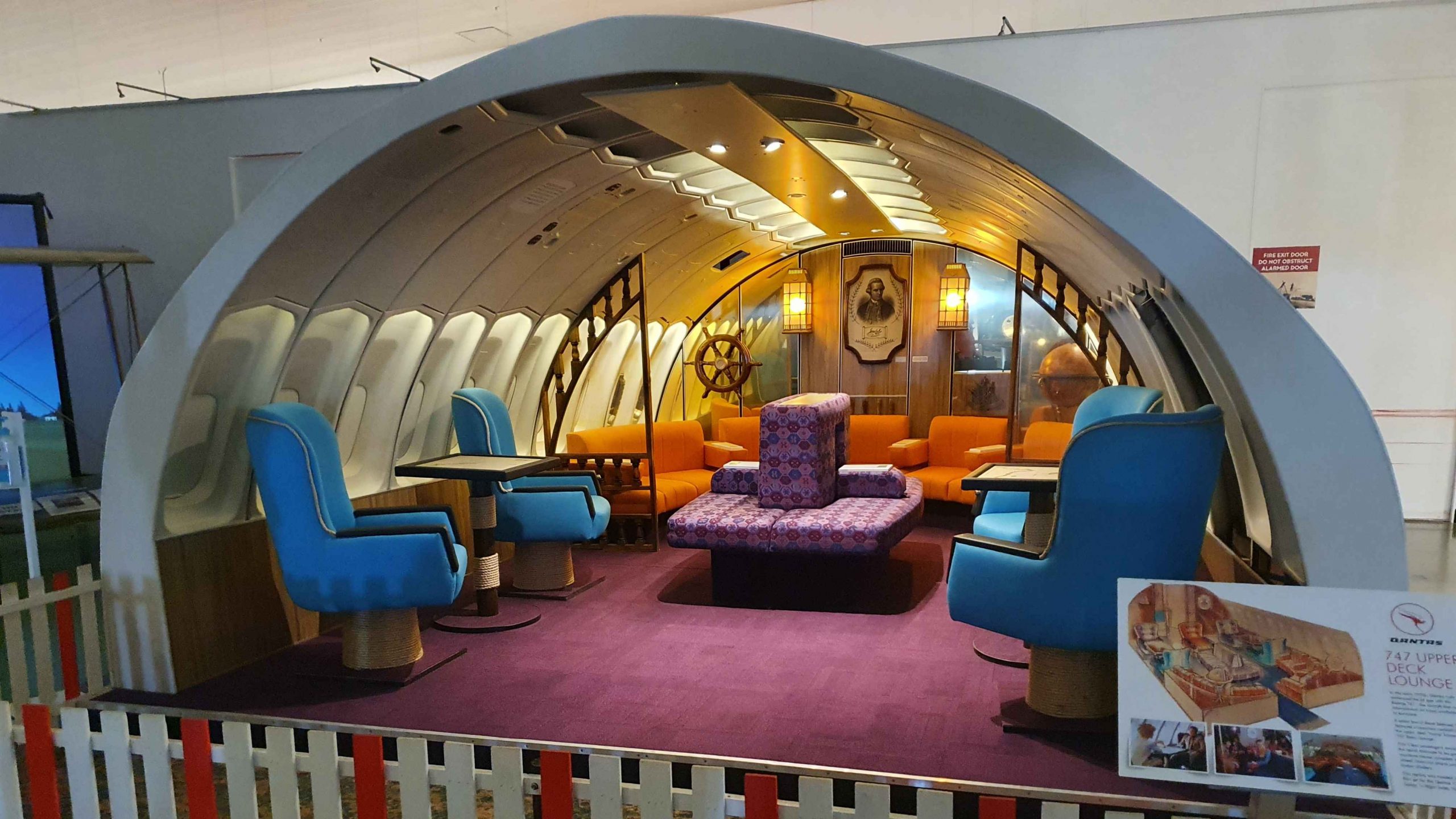
Someone connected with the museum heard about this aircraft and recognised its historical significance. It was purchased and restored to flying order by a team of volunteers who travelled to England for several months to complete the task. It then flew to Longreach to join the fledgling museum fleet. I remember when it arrived.

The light show is particularly well done. Visitors sit or stand on a concrete area between the aircraft. Seating is on high stools. Just grab one if you get tired of standing. As the program is projected onto the sides of three aircraft it is necessary to be a bit mobile.

Rolls Royce Jet Engine for a 747.
Inside the Catalina Flying boat.
DC3 with seating removed for freight.

On the morning aircraft tour, one of the tour members was a retired Qantas Boeing 747 captain, who was able to add to the information provided by the guide from his personal experience.

Stone pitching for water control
An example of Stone Pitching at the site south of Ilfracombe.

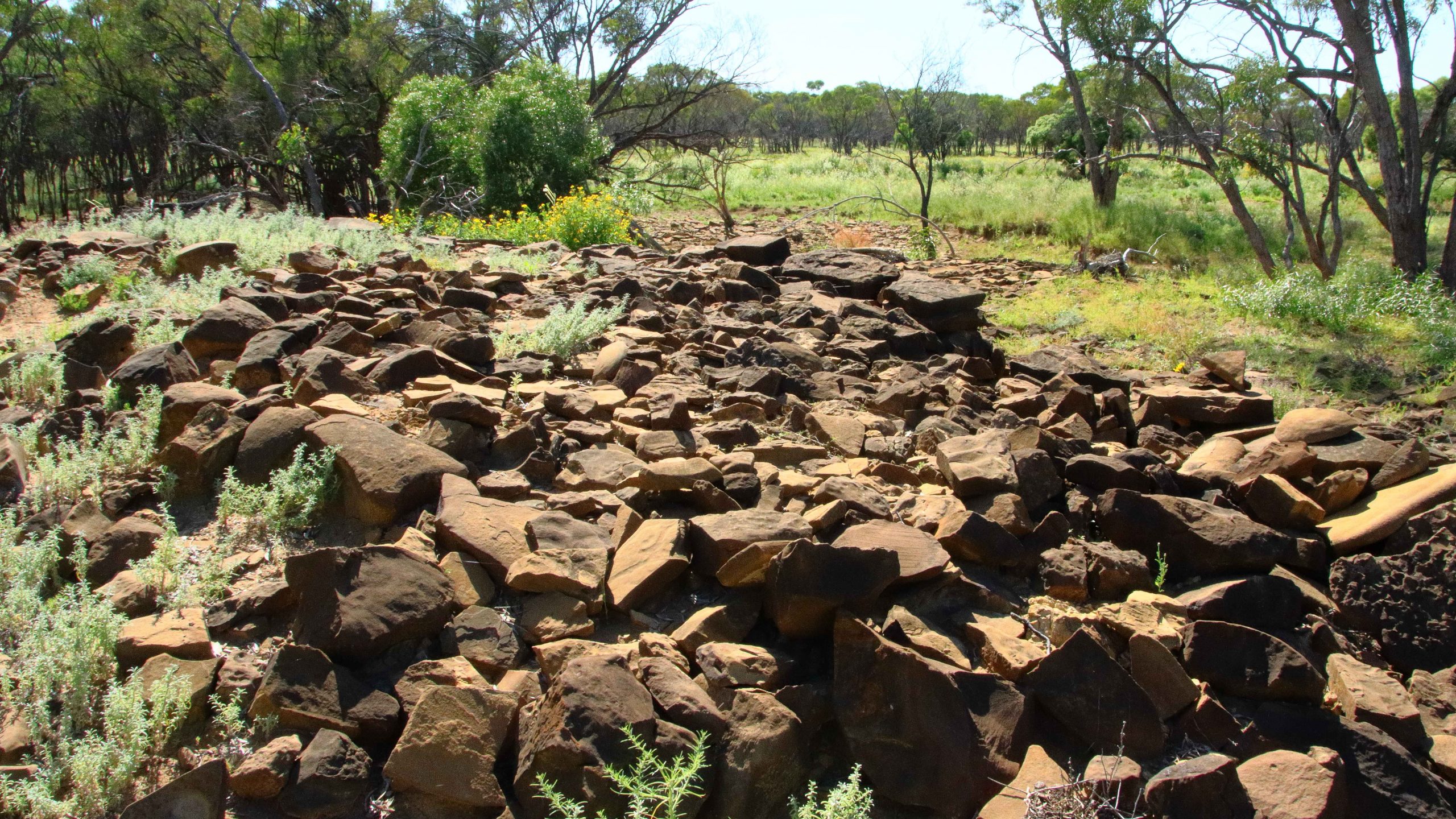
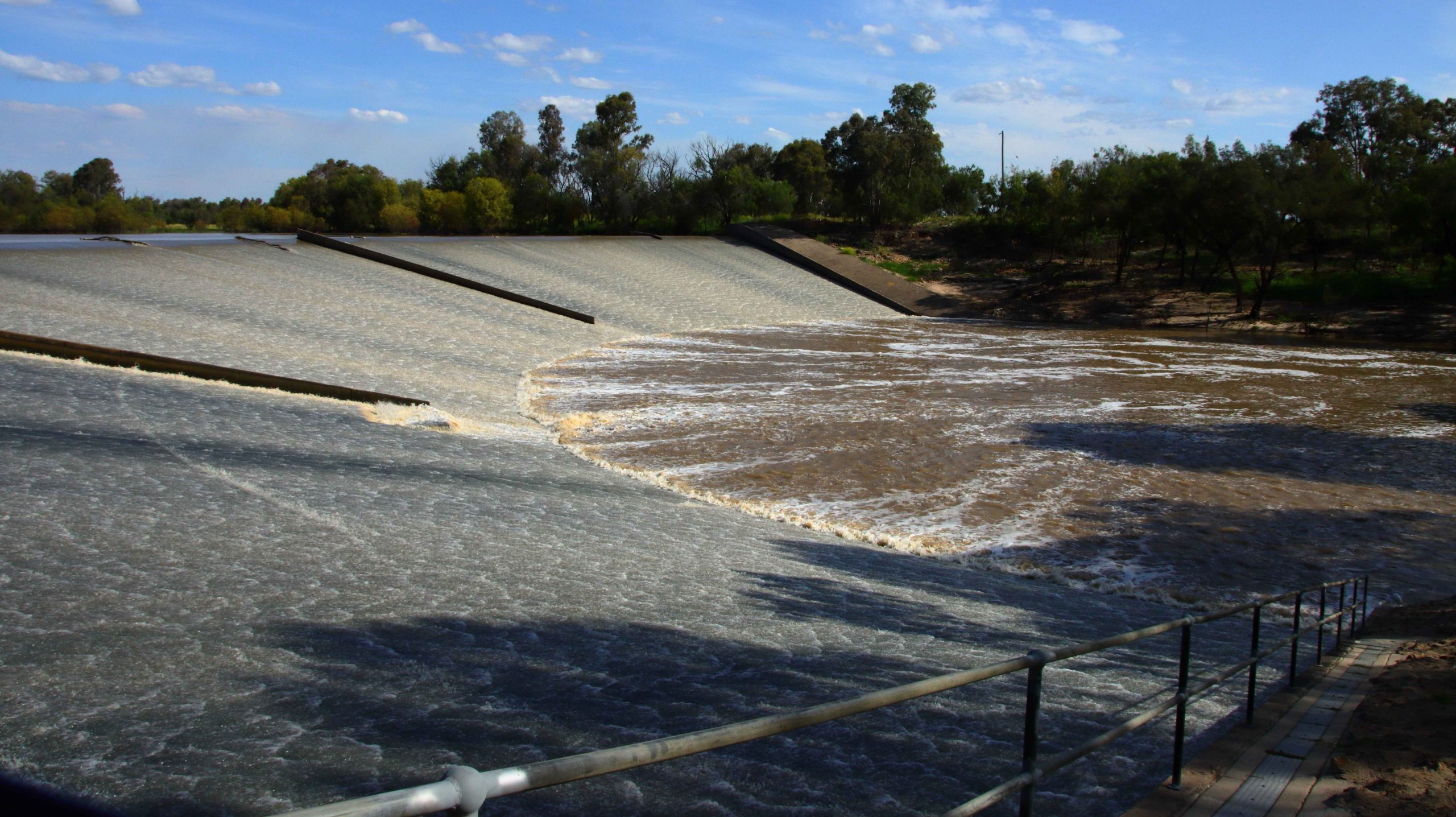
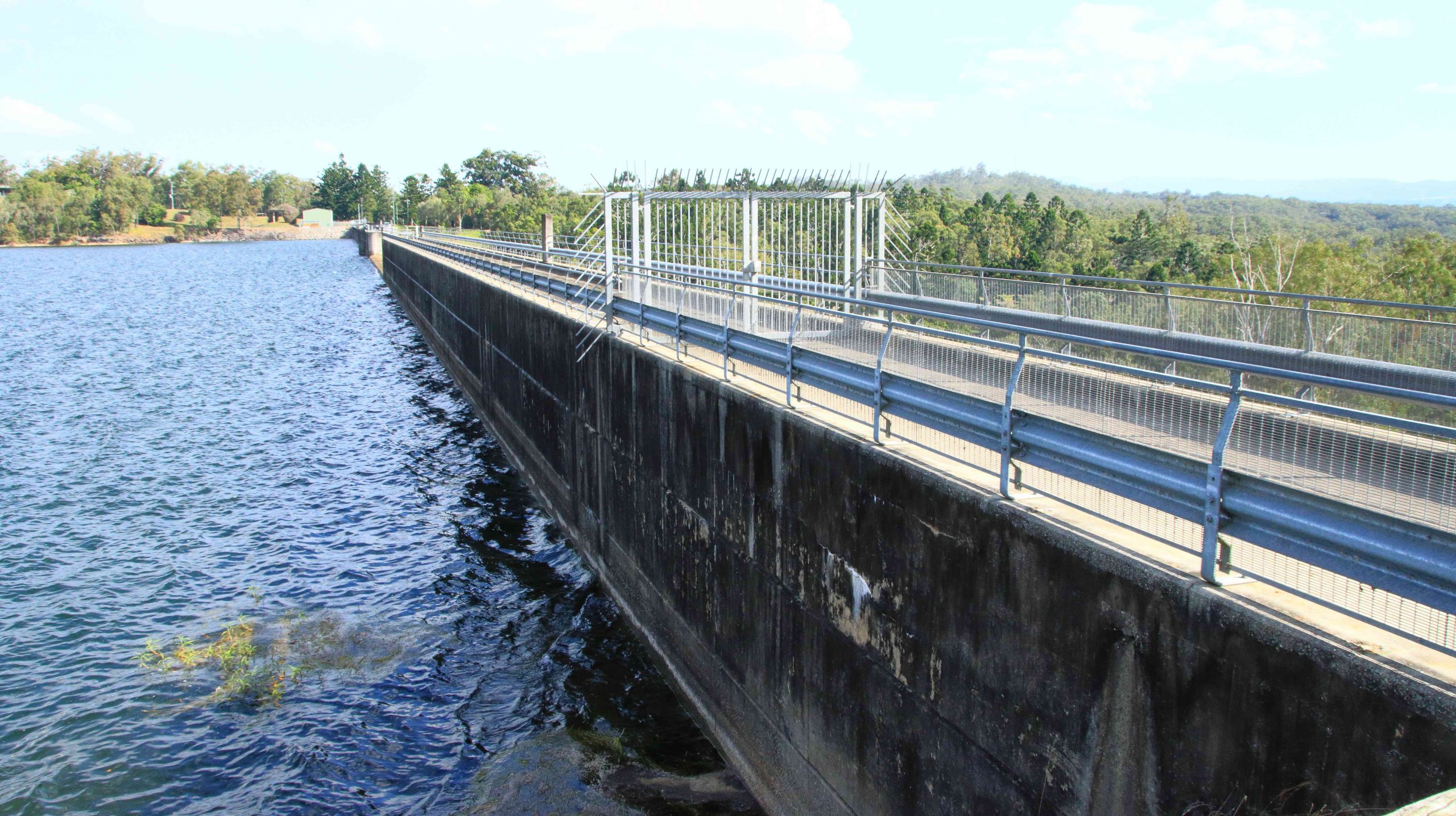
On Friday morning, five days after leaving home, we made an early start to head back to Ilfracombe where we turned south to Isisford. About 20 km south of Ilfracombe, at a rest stop, we drove a few hundred extra metres to an area where stone pitching had been used to retain and divert water into a dam. The work is over one hundred years old and may have been carried out by Chinese workers, although the skills were probably brought from England.

Roadside flowers. “Pitilotus nobilis”

Stone pitching is building structures from natural stone without mortar to hold the stones in place. So, each stone is held in place by those around it. The structure is particularly useful in sandy soil where running water quickly washes earthen structures away.

More roadside flowers.

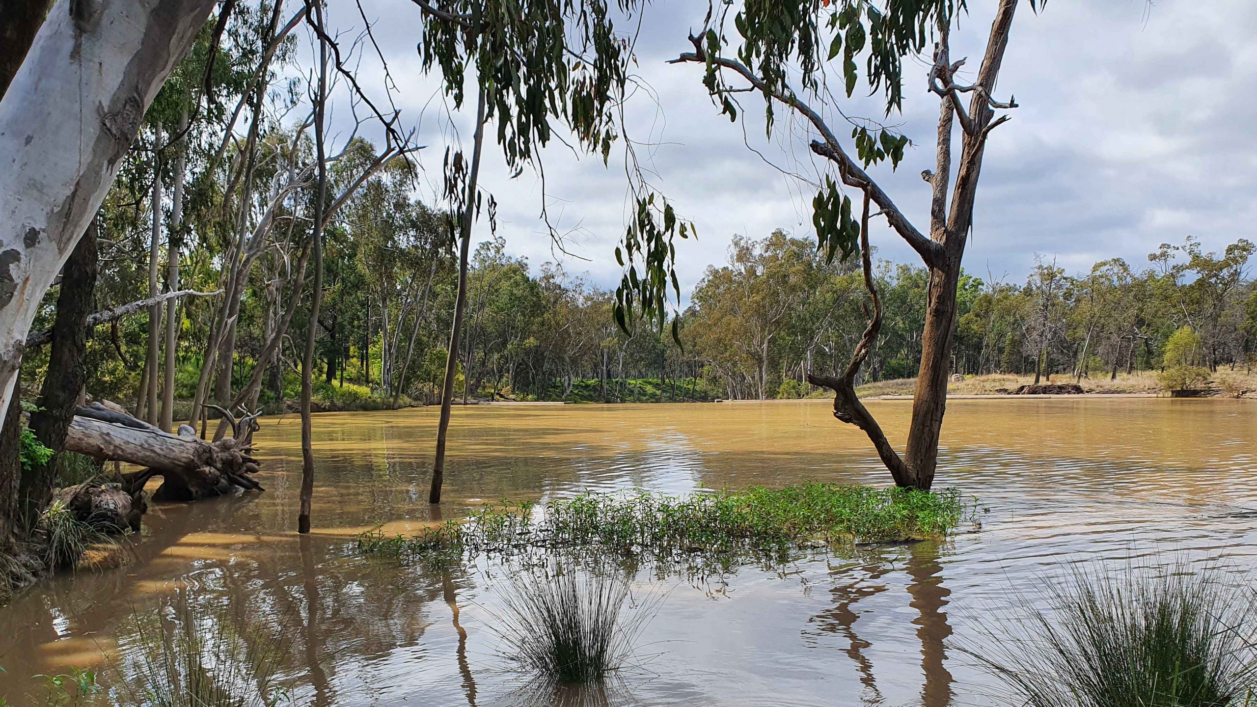
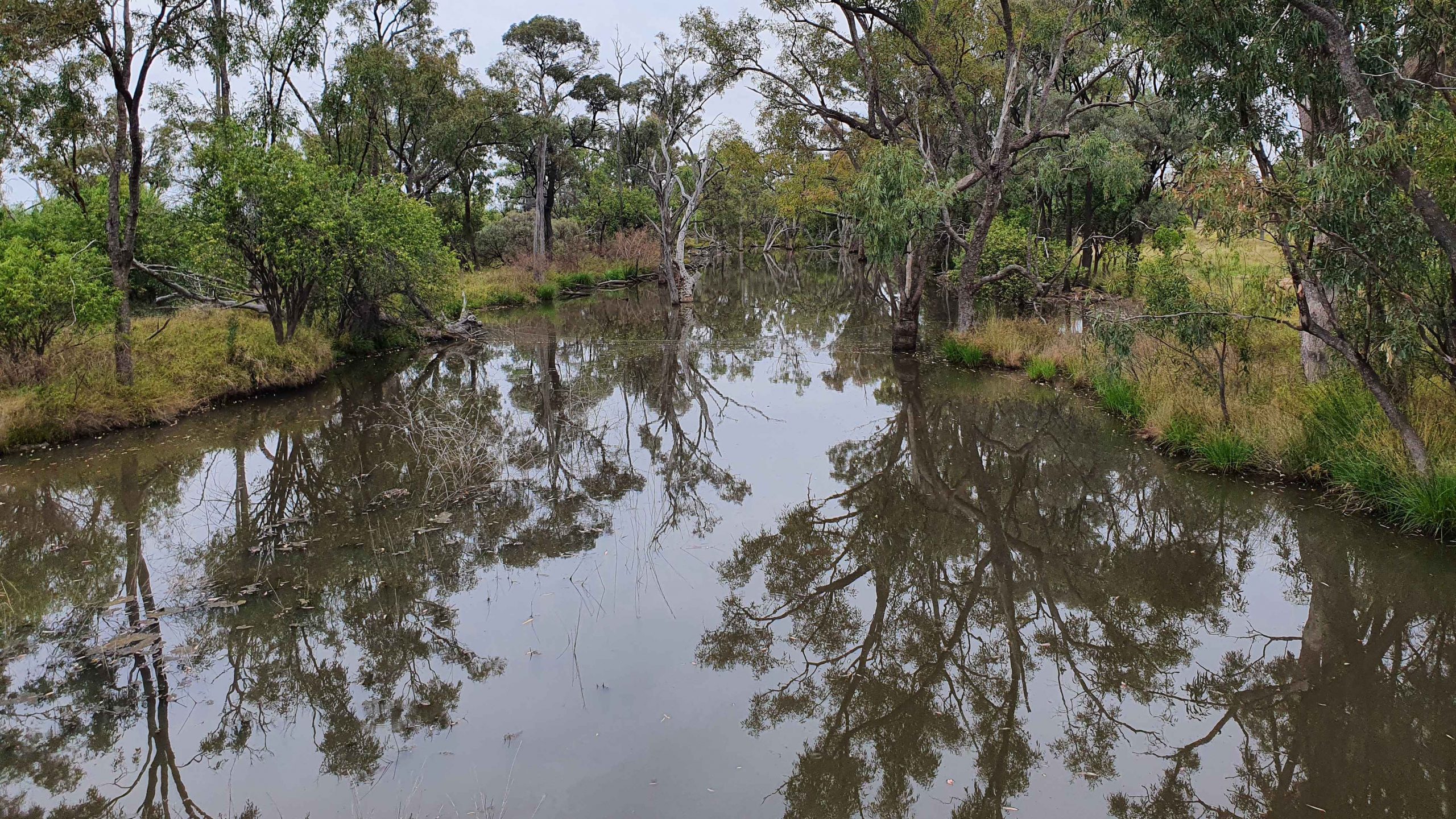
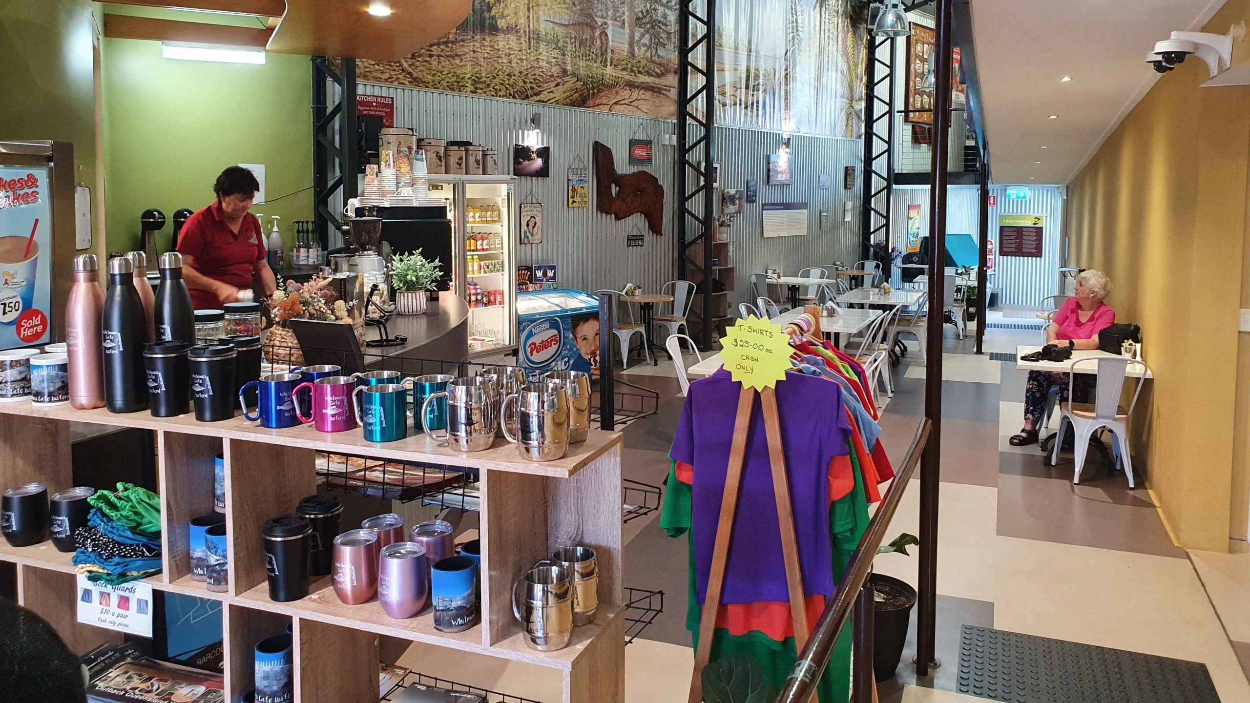
When we were in this area back in caravanning days, we spent a couple of nights in the riverside camp at Isisford, on the Barcoo River. There was an excellent museum there with a display of the ancient forebears of the Crocodile. It had an excellent cafe /coffee shop for such a small and remote place. The cafe is in the museum building, which partly explains why it exists in such a small and remote community.

On that occasion we had morning coffee at the van before going into town. We said that it would be nice to go back. And so, we did. Sadly, some of the fossils that were on display have been moved elsewhere. Probably to another museum where more people visit.

Natural History Museum at Isisford.
Whitman Café at the Natural History Museum.
Barcoo River at Isisford

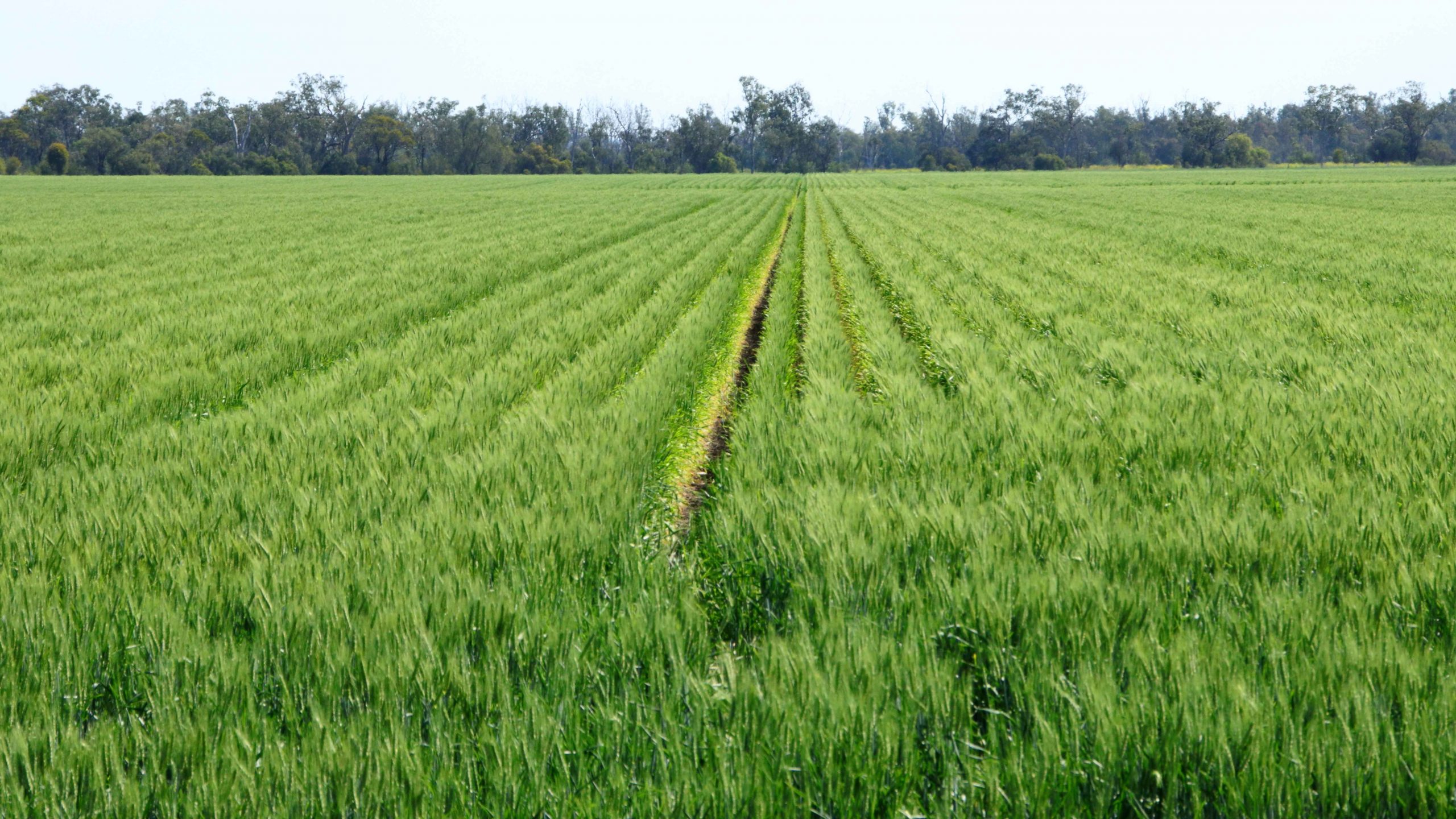
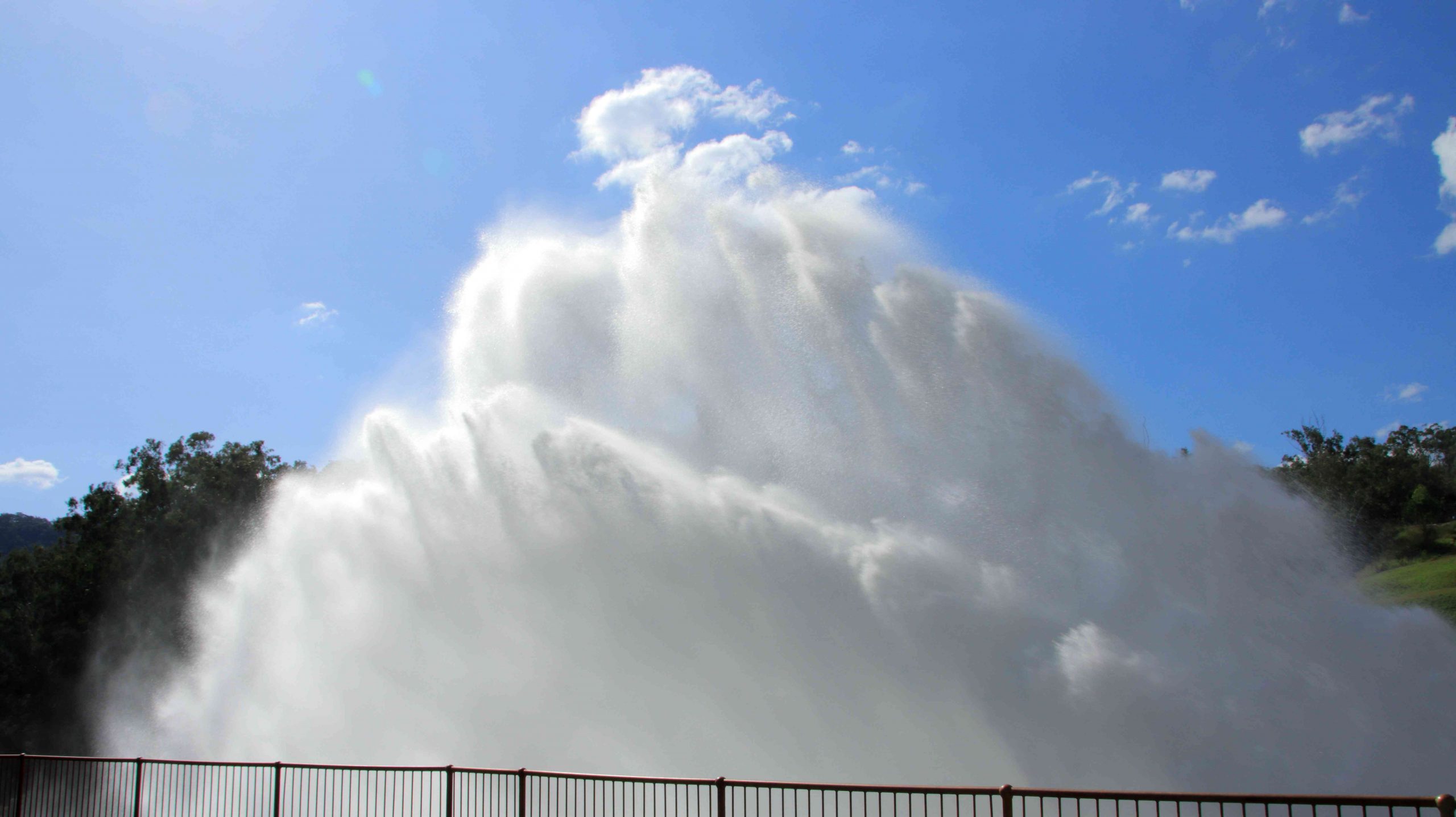
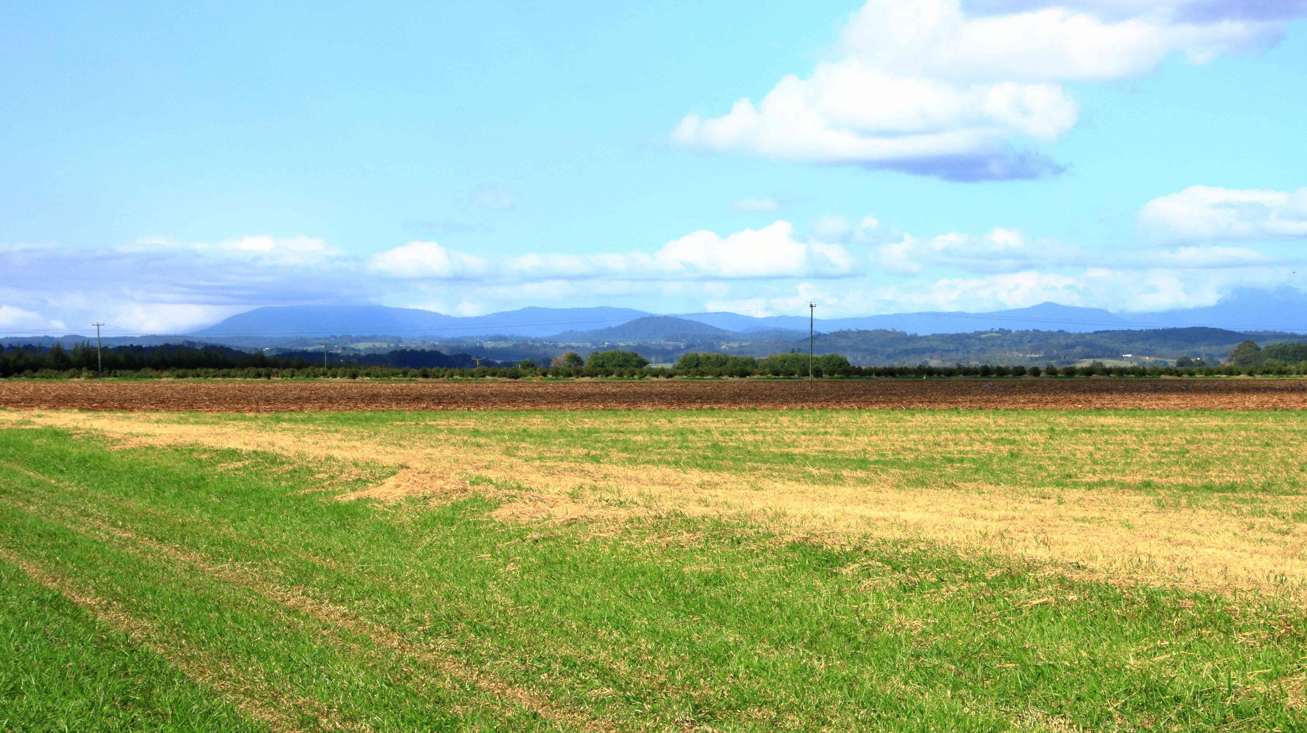
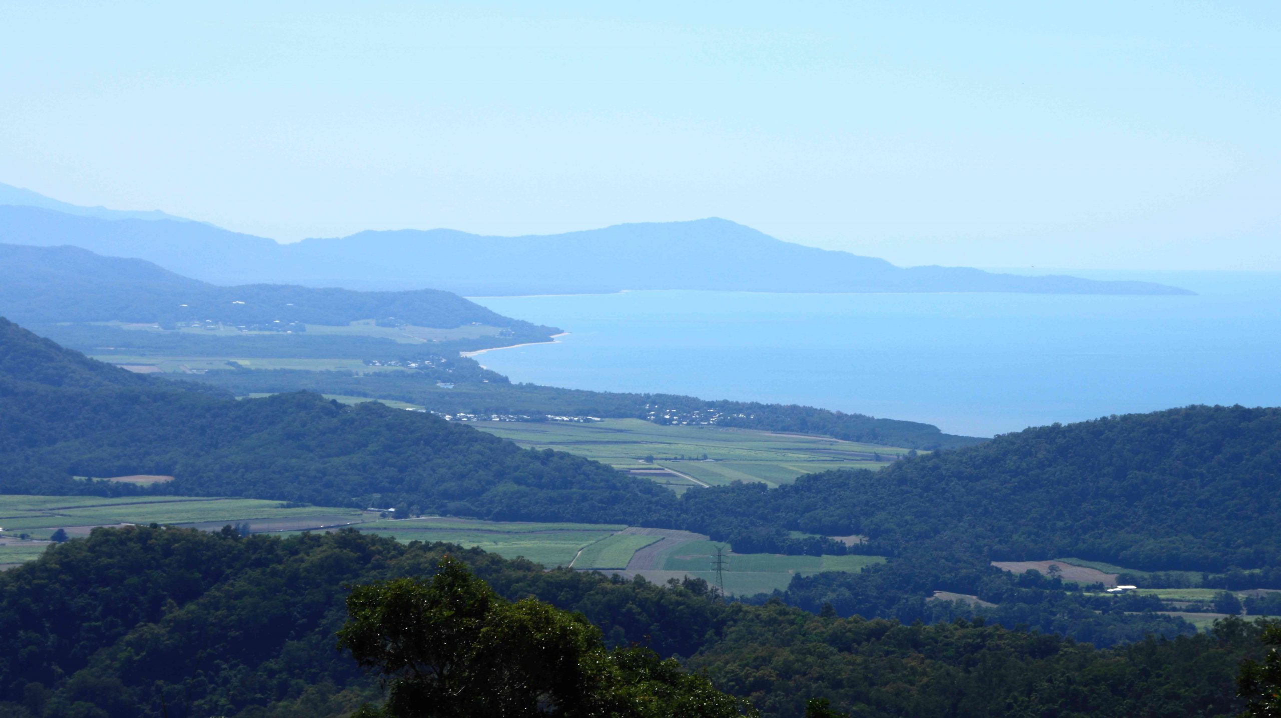
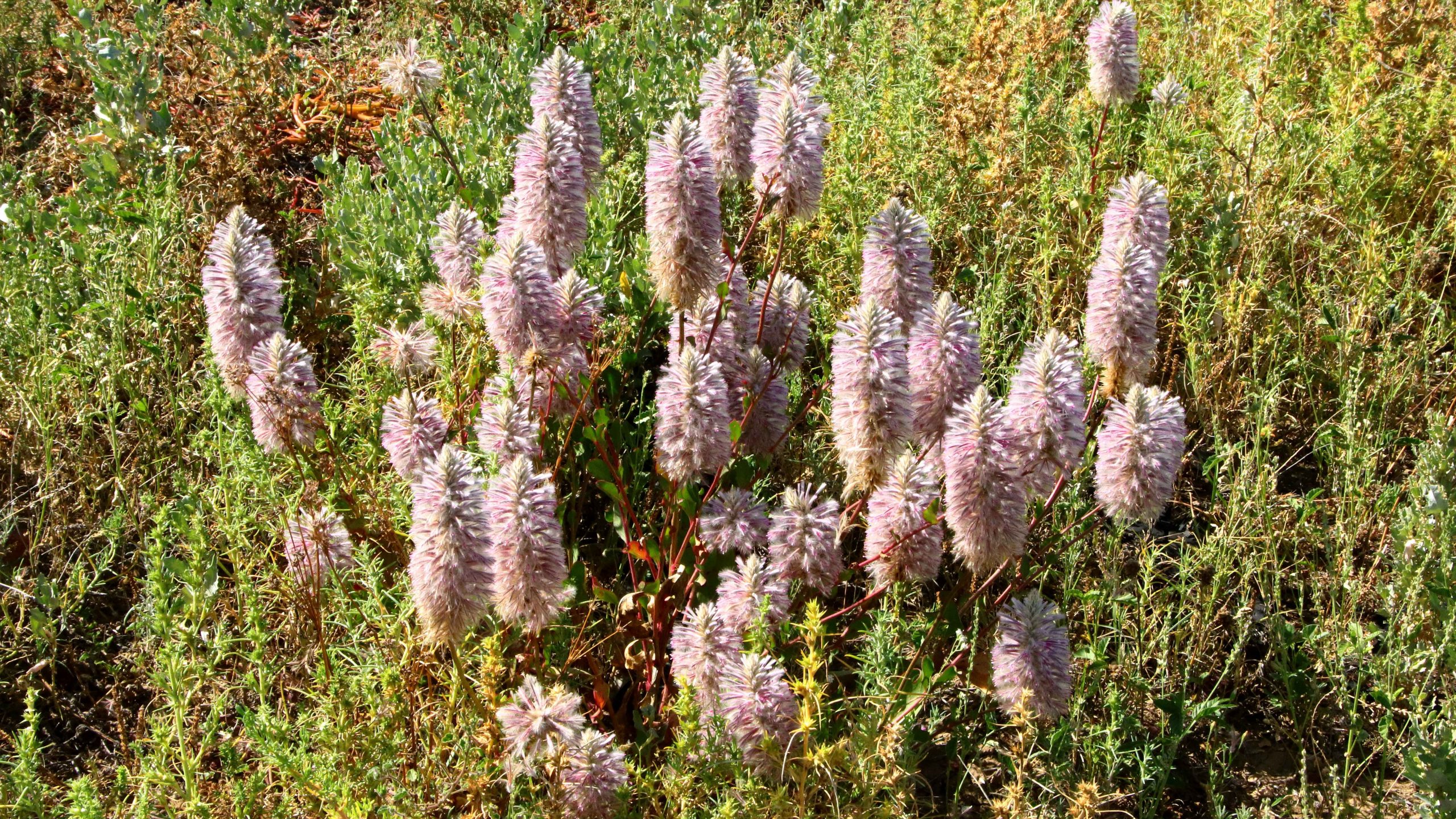
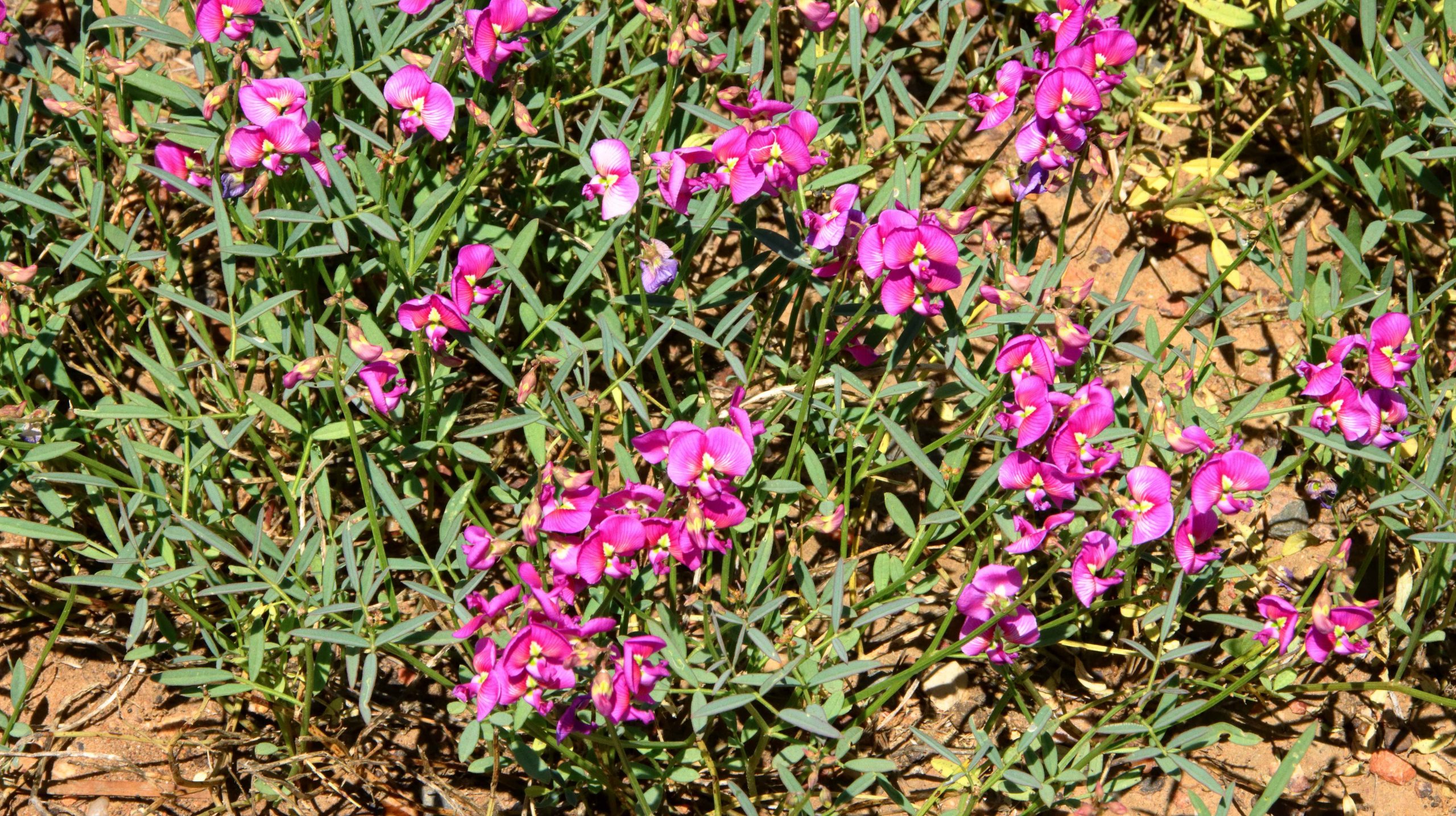
Roadside flowers were in abundance, particularly towards Isisford. The grass is a brilliant green. The Barcoo has been in minor flood three times this year, so there is a lot of water, on its way to Lake Eyre. The Barcoo and Thompson Rivers join near Windorah to form Cooper Creek which feeds the lake, if there is enough water to travel that far.

The Wellshot Centre at Ilfracombe.

We returned to Ilfracombe and visited the Wellshot Centre. The building was the police station in the town but was converted to a museum to display items from nearby (we passed it on the way to Isisford) Wellshot Station. Wellshot Station was one of the first stations in the area. It was developed with Scottish money and Australian know how.

Southern Cross Water Boring Machine
A well kept Ferguson Tractor.
Tracked Earth Moving Tractor

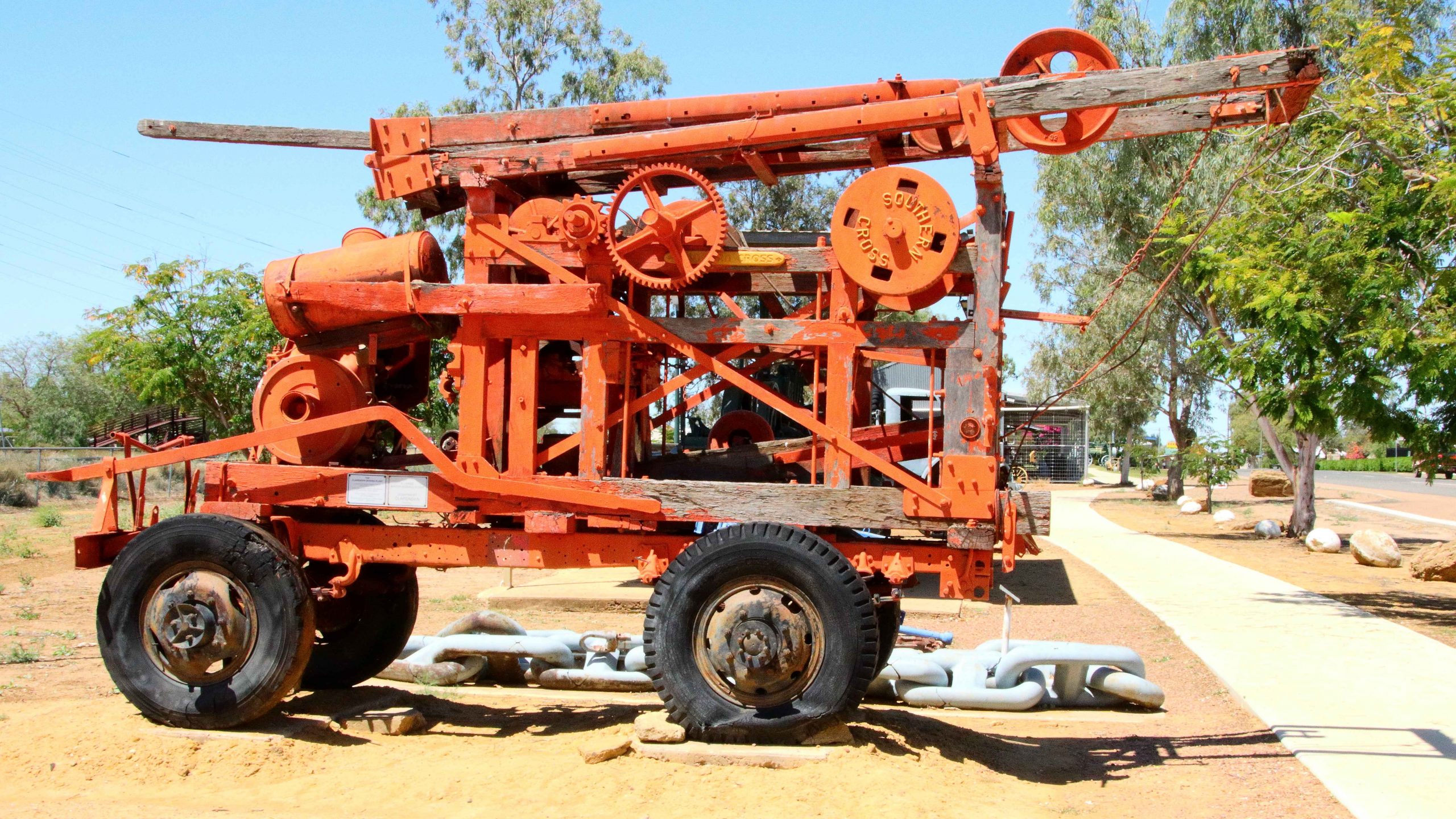
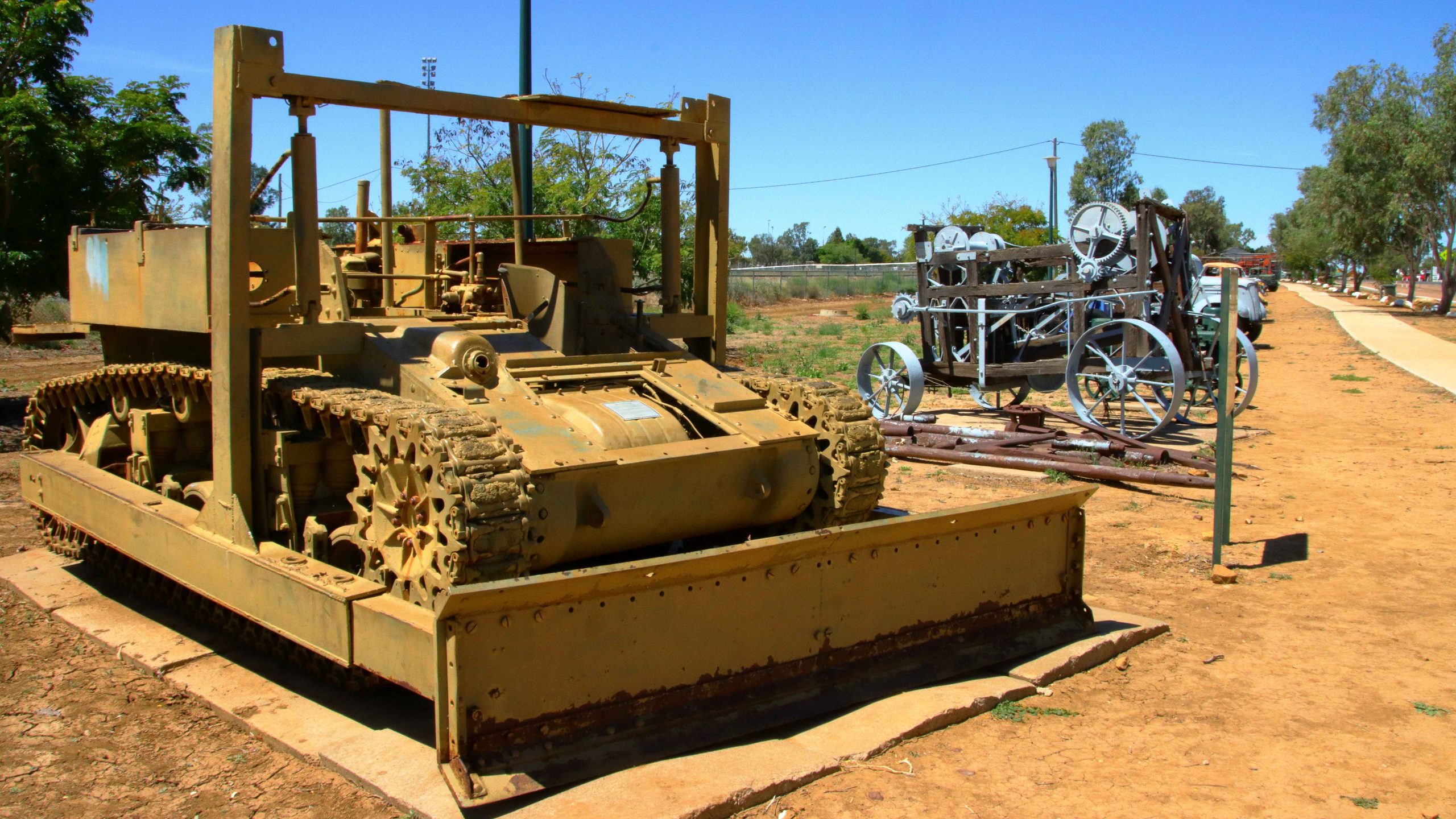
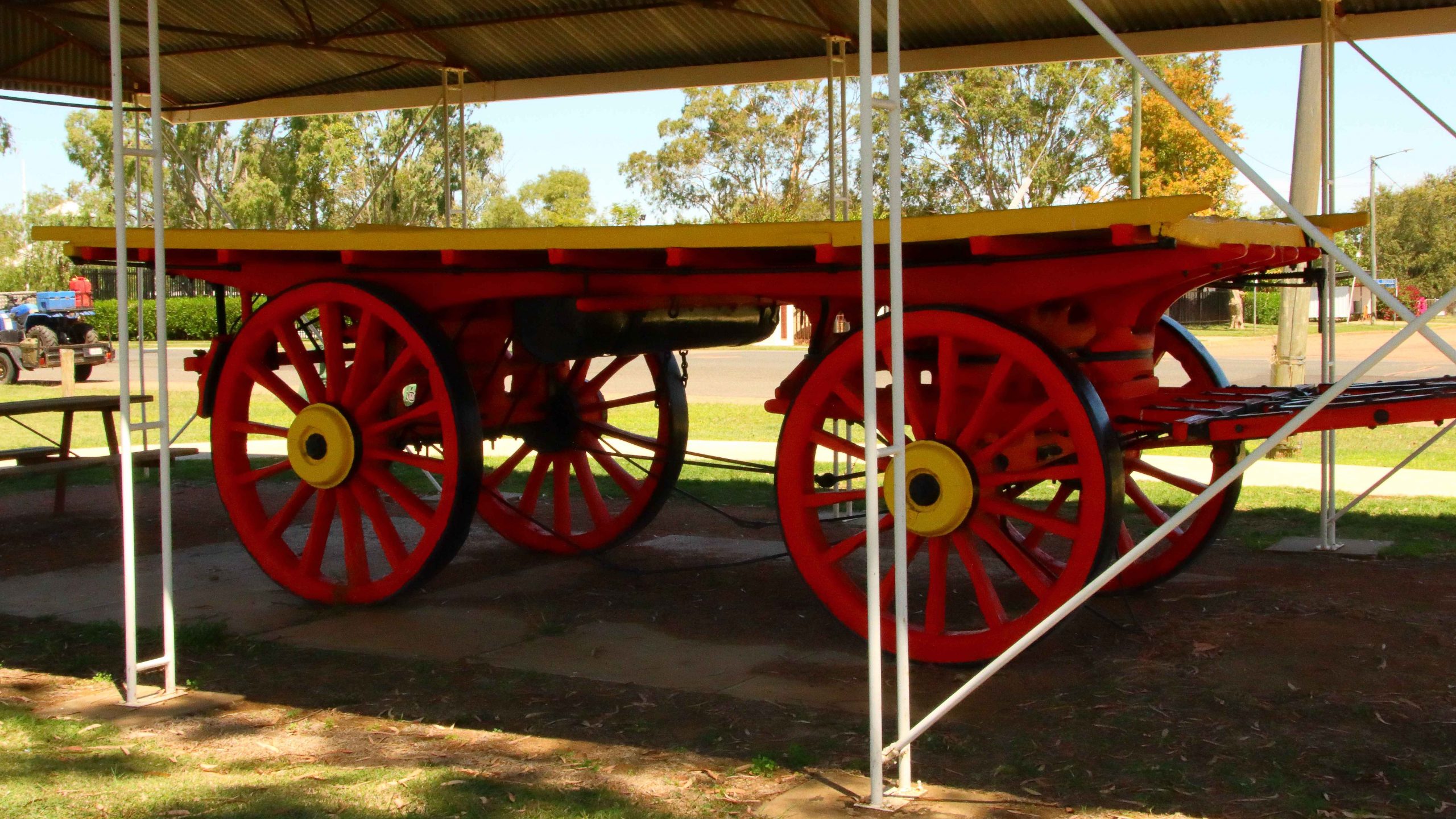
Ilfracombe has a “Mile of Machinery” as a memorial to the pioneers. It stretches along the north side of the highway for most of the length of the main street. I took a walk along most of it. Included is an example of the ubiquitous Ferguson 35 tractor. I learned to drive on one.

A line of road graders.
A bullock cart that probably was used for transporting wool.
A full stop of Bougainvillea at the end of the machinery queue.
Plumed Whistling Ducks

We returned to Longreach for a pie and coffee before returning to our unit for a nap. Late afternoon we went out looking for a sunset but tonight it was rather ordinary. The sunset the previous evening looked to be a beauty, but we were occupied at the Qantas sound and light show.

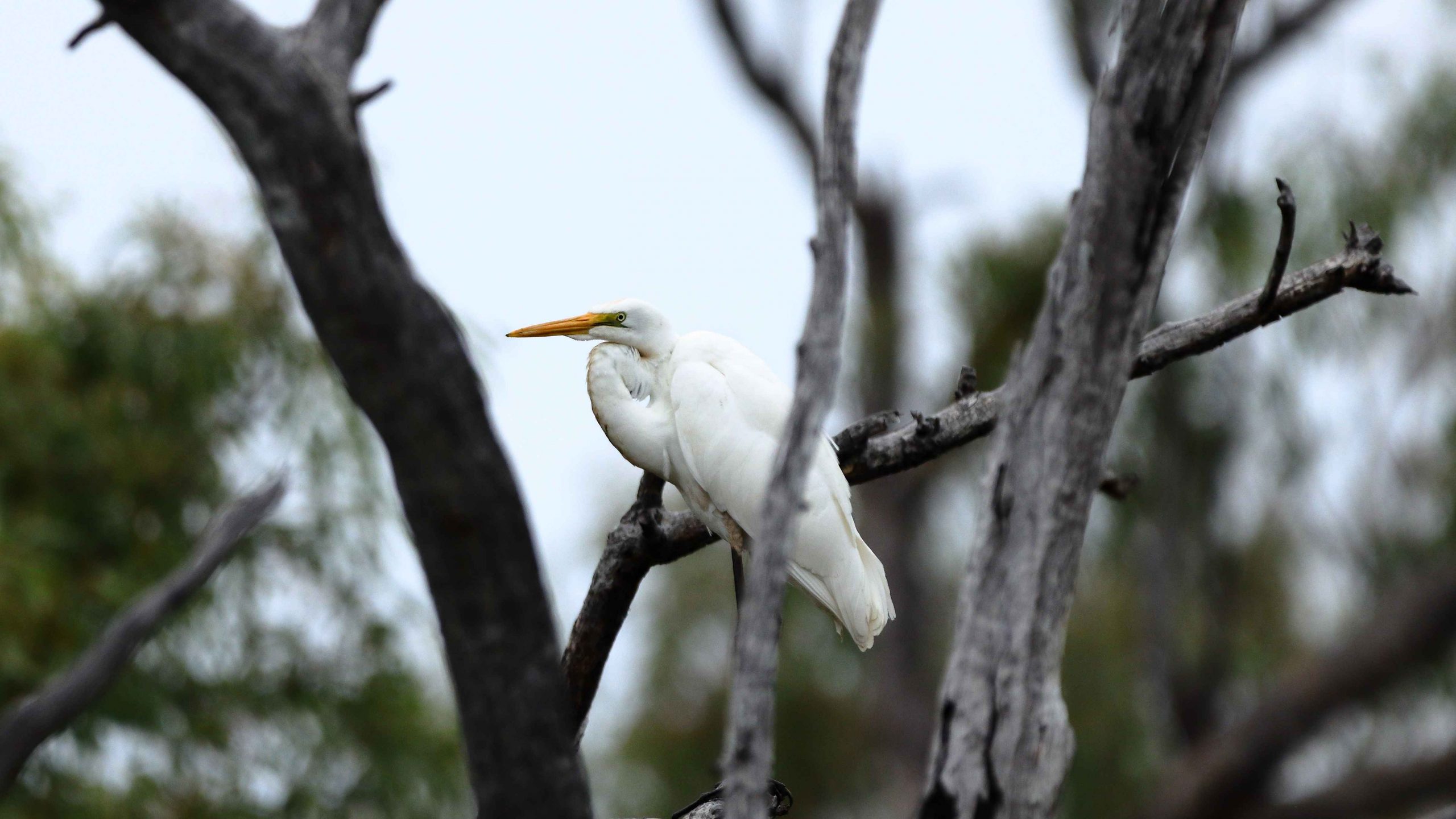
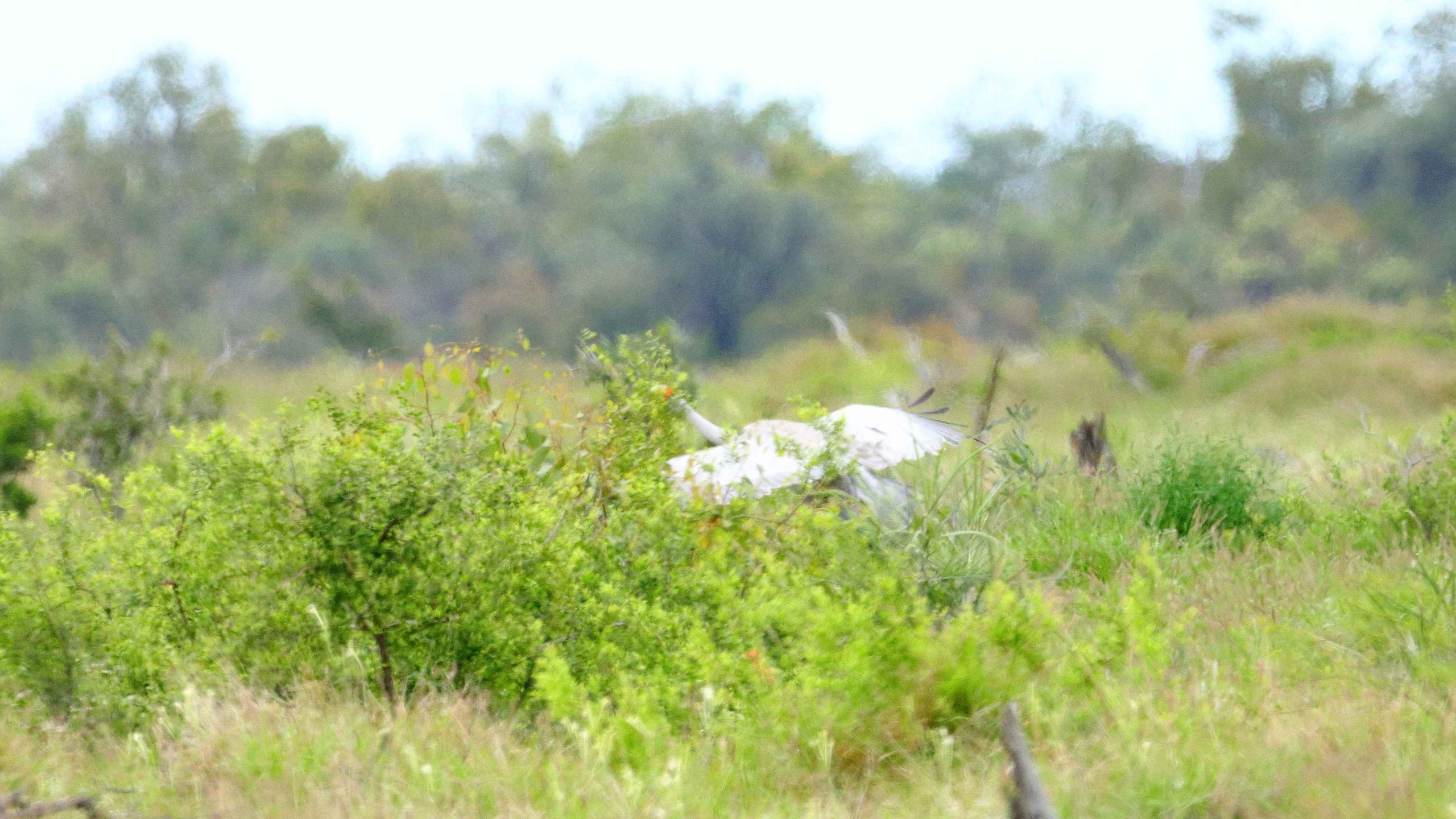
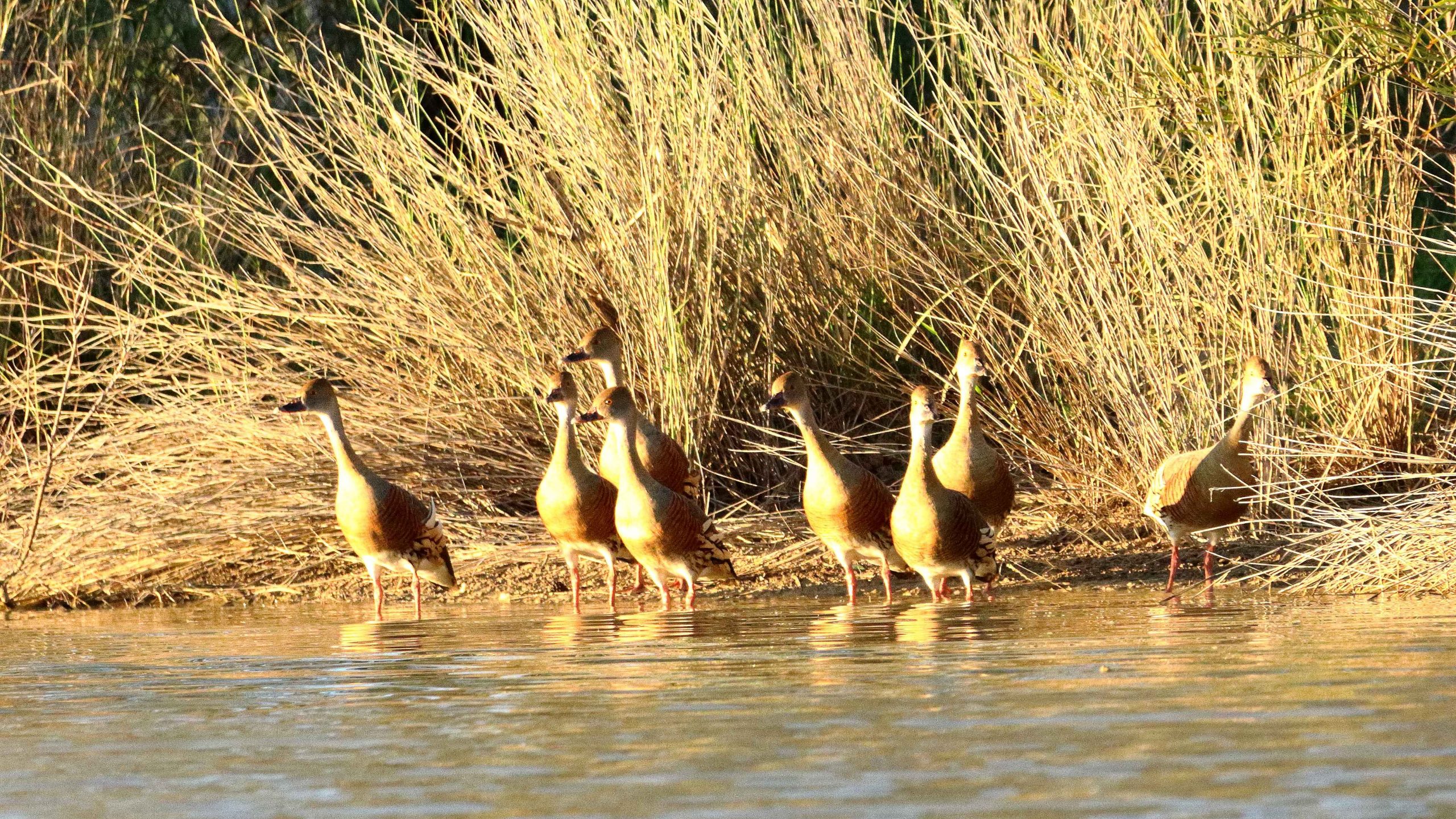
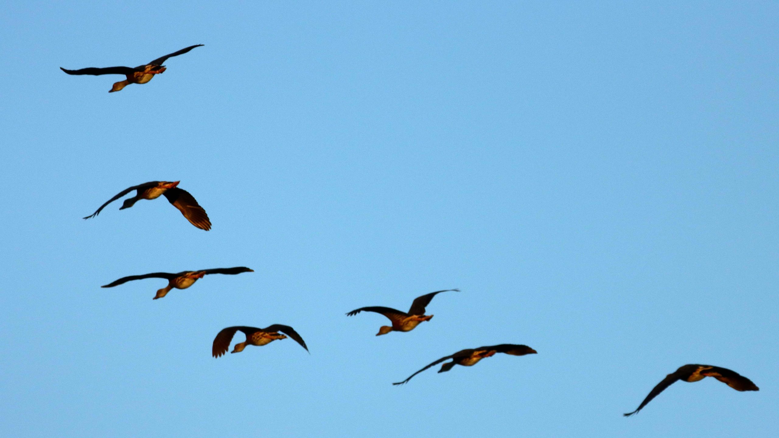
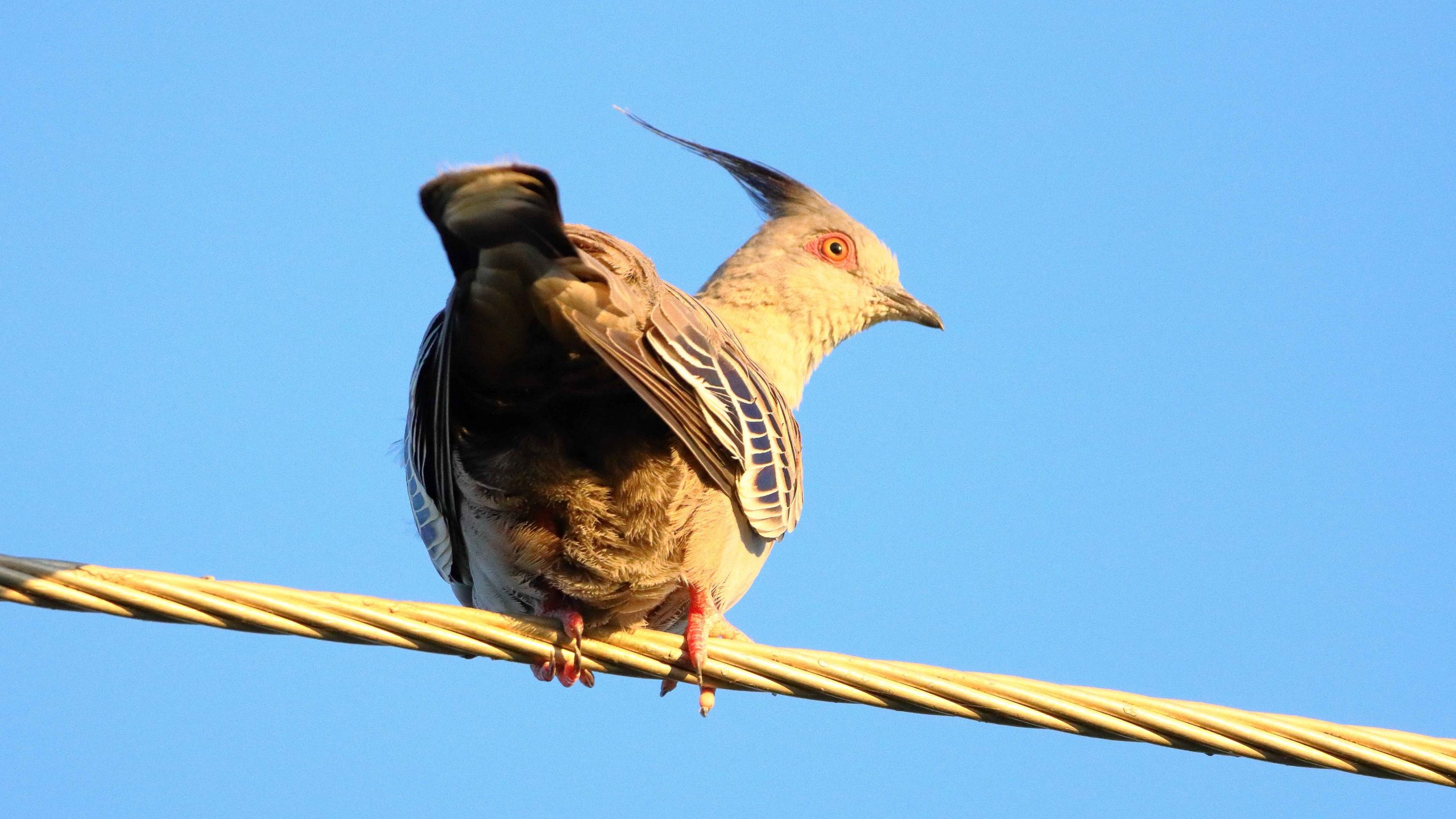
In the waning afternoon light, I found some Plumed Whistling Ducks at a waterhole at the north of town. I was trying to get closer for a better shot when they took off. Above the ducks, on the power lines, some Crested Pigeons were sunning themselves and looking a bit surprised. But they just sat and didn’t move.

The ducks after take off.
Crested Pigeon in the afternoon light.

We returned to the cabin for our final night at Longreach. Tomorrow we are off hunting Dinosaurs.

Interrupted Journey – North Queensland 2022 – Part 3

Heading for Dinosaur Country

Note: Two video links appears at the bottom of this blog post.

Please note the video link at the foot of this post to the Carnival of Flowers.

We set off on the morning of Monday 26th September to complete our Covid interrupted tour. Instead of going back to Townsville to start where we left off, we travelled inland via Toowoomba and took the opportunity to visit the Carnival of Flowers as we passed through, spending our first night at Chinchilla.

The flowers at Toowoomba were up to the normal high standard. As our visit was late in the carnival, most of the additional activities had finished. The flowers and a few food vans parked down the back was all that remained of the festive area. But we were there to see the flowers and were well satisfied with the offerings on display. The greatest challenge was to take a photo of a flower bed without an Asian tourist in the foreground having their photo taken.

A thin sheet of water over the face of Chinchilla Weir as the water flows towards the Murray River.

We drove on to Dalby for lunch having skipped morning coffee. In planning I had identified some likely bird locations to try before reaching our overnight stop at Chinchilla. I had no luck until Chinchilla Weir where we found greatly improved camping conditions from those we remembered from our previous visit. And we found a flock of Apostle Birds. I believe these birds are so named because of their practice of flocking in groups of about a dozen. Water was cascading over the weir.

A thin sheet of water over the face of Chinchilla Weir as the water flows towards the Murray River.
Recently germinated crops line the roadside in this part of the Darling Downs.
Boonagara, reached just before Chinchilla, built a public hall to commemorate success in using a grub to defeat cactus infestation.
Gil Weir is located just west of the Leichardt Highway, south of Miles

Friday saw us headed for Morven, a very small town where the Landsborough Highway branches from the Warrego Highway. It leads to Longreach as the major town in that direction. This piece of road is also known as the Matilda Way, but that is more for promotional purposes that accurate geography.

We checked for birds at Gill Weir, south of Miles and Judd’s Lagoon, south of the highway, closer to Roma. All that we found in both places was overflowing weirs and long term bush campers, most of which were in their highly equipped caravans. Rising water levels inundate water bird feeding grounds and I imagine, causes the birds paddle harder to stay in the same place. The birds are not silly. Thy go somewhere else.

Memorial to fettlers wives near Dulacca
The informative plaque that is part of the memorial.

Roadside, just before Dulacca out towards Roma, we came upon a memorial to the railway fettlers and the women who supported them while building the western railway line from Miles to Dulacca in 1978-79. In those days families had to travel with their breadwinners if they wanted to see them. No FIFO in those days.

Australian Darter, drying off following a fishing session.

After morning coffee at Roma’s Big Rig, we had a look at Roma Bush Gardens, located just off the highway past the town centre. Walking around the lake was restricted by flooding but I did see some Mallards and an Australian Darter, drying its wings in the morning sunshine after fishing excursion.

Neil Turner Weir on the Maranoa River at Mitchell was overflowing. We have not seen this in several visits.

We took our lunch break at Neil Turner Weir, a water storage on the Maranoa River near Mitchell. Mitchell is probably best known for its therapeutic artesian spars. We have used the camping area at the weir on several occasions but had not seen the dam overflowing before. It reminded us that so much of our travel through Australia’s outback occurred during the drought years.

The Pick-a-Box Motel at Morven
A Royal Flying Doctor Promotional Van Parked Outside The Motel.

The Pick-a-Box Motel was our resting place for the night. The motel is a small group of newish iron-clad cabins near to and managed by the Morven Hotel, recently rebuilt following a fire. The only excitement in town was a Royal Flying Doctor Service caravan in the shape of an aircraft fuselage, parked in the street outside.

So, from Morven on Wednesday morning, we turned north-west on the Landsborough Highway. First stop was a call at the first town, Augathella, a distance of about 90 km. The town is quite old and has been supporting the local agricultural community since its founding in 1883. Like many outback towns, it has upgraded its visitor facilities for grey nomads. Artists have painted pictures on its water tower, art silo fashion.

The Ellangawan Hotel bears Augathella’s original name.
The list of local water birds at Tambo. Most on the list were conspicuous by their absence.

Next, about the same distance further north-west, we arrived at Tambo, another pioneering town (1868) with good visitor facilities. We paused for morning coffee beside the small dam at the entrance of the tow. By the lake there is an information sign providing details of the many water birds to be found in the area. There were very few on display for us, although small birds such as Noisy Miners were busy in the tree.

Continuing, we crossed the Barcoo River and arrived at Blackall, which was built on the banks of that stream. Major Thomas Mitchell explored this part of Australia in 1846. The town developed in the 1860s as an agricultural service centre. Again, it has good tourist facilities. It is surrounded by vast expanses of open naturally grassed pasture, as is much of this area. We had been driving through it all morning.

The Barcoo River at the Landsborough Highway crossing.
An Eastern Great Egret perched in a tree over the Barcoo River.
Blackall main street is the highway.
Part of the billabong and camping area at Lara Wetlands

The next town along this highway is Barcaldine, but about 45 km before that we turned off to the left and drove the 16 km of dirt station road to look at Lara Wetlands. This is a camping area that almost surrounds a large waterhole filled with dead trees, so is probably the result of a dam. Lara Station is an operating cattle station. They run the camping ground in conjunction with the station. There are reported to be 164 species of birds identified in the area. But there is no power and only one cabin. Interesting spot, all the same.

A Brolga by the road as we drove into Lara Wetlands.

As we drove into the Lara Station, Ruth saw a large grey bird at the edge of the trees. I stopped and got some good photos of a Brolga. It was wandering up and down and seemed quite settled but as I turned back to the car, I heard the whoomp whoomp whoomp of large wings as the Brolga took to flight. I turned just in time to snap it disappearing behind some brush. Not a very good photo, sadly.

The Brolga landing in the brush by the roadside.

We refuelled at Barcaldine, paying for the first time just over $2 per litre for unleaded petrol. At Barcaldine the highway turns left and west through Ilfracombe to Longreach. Scattered cloud meant that the western sun was not too much of a problem. We had travelled quite a distance in pursuit of the setting sun since leaving Brisbane, so the days were ending quite a bit later.

The deck at the Woolshed Restaurant at Longreach.

We were able to get a booking at the Woolshed Restaurant at Longreach Tourist Park, where we had a cabin. Last time we were here they were booked out. They were again but we had booked in time. An excellent meal even if the entertainment was a bit loud.

While at Longreach we returned to Ilfracombe and also drove south to Isisford. That drive is covered in the next blog post.

Interrupted Journey – North Queensland 2022 – Part 2

Part 2 – North to Port Douglas via The Atherton Tablelands

Note: A video link appears at the bottom of this blog post.

Coral Princess lying off Airlie Beach.

When you have a view like we did at Airlie Beach, the first thing that you do when you get up of a morning is open the blinds. We opened our blinds on Sunday morning and there in the middle of our view was the Coral Princes, in port for a visit. Our friends Jim and Frances Weir were on board, but we were gone by the time that they come ashore.

Sunday was one of making distance up the coast. Our Sunday night overnight stop was at Innisfail.   The sun shone on us all day. We struck some low-lying fog both on land and over the bay as we approached Bowen, making slower progress than we had hoped as we coped with the long slow kilometres of roadworks. Almost the entire length of road from where we entered the highway just north of Proserpine to Bowen, was limited to 60 and 40 kph with a few areas of 80 kph.

Balgal Beach. The view goes all the way to Magnetic Island and Townsville.

The run for the rest of the distance to Innisfail was much better, but still with a lot of areas of road works. We bypassed Townsville on the convenient ring road, as you do now, but called in a Balgal Beach. near Rollingstone. We knew where we could get near the beach for lunch, from previous visits.

Fisherman’s Landing at Balgal Beach. The restaurant overlooks the jetty where fishing boats dock.
The mountains northwest of Innisfail

We had a quiet night in Innisfail. The motel was right in town but quiet. All we wanted was somewhere to eat and sleep.

A cap of cloud was sitting on the top of that mass of mountains to our north as we left Innisfail. The mountain ranges inland from the coast are home to Queensland’s two highest mountains, Bartle Frere at 1,611 metres and Bellenden Ker which reaches a height of 1,593. At those heights they and the surrounding ranges rise well above the Atherton Tablelands, to which they provide a backdrop to the east.

The drive from Innisfail ascends some steep grades but on a good road. When you reach the edge of the Tableland the height gain from the coast is obvious. The first town is Millaa Millaa, but first you will see signs that point to a drive that leads you past four waterfalls, before returning you to the main road. We have done this drive before but did it again before stopping for coffee at the park in the main street. The town has a couple of good café/coffee shops as well.

Zillie Falls on the Falls Circuit near Millaa Millaa.
Millaa Millaa Falls also in the Falls Circuit.
The mountain ranges viewed from Millaa Millaa Lookout.

 We then crossed to Herberton to look at the tin mining museum. Soon after you leave the town of Millaa Millaa, you reach a steep ascent. Just before the summit, a left-hand turn takes you to a lookout which, unsurprisingly is named Millaa Millaa Lookout. Equally predictably the lookout provides fine views back over Millaa Millaa and the ranges nearer to the coast. We were greeted on our arrival by some domestic hens.

Mining machinery and buildings at Herberton Mining Museum.

There is much to see at the Herberton Museum, particularly for those with an interest in old machinery and historic mines. You could spend quite some time there if that were the direction in which your interests lay.

Malanda Falls is located in parkland near the town.

We then turned back to the east to Malanda. We wanted to lunch at Gallo Dairyland but research had shown them to be a Wednesday to Sunday operation, which seems to be quite common in areas that are within an easy weekend drive of major population centres.

Malanda Café, our lunch location.

So, after visiting Malanda Falls we lunched at a cafĂ© in town before making a return visit to Lake Eacham, where some hardy souls were swimming and sun baking. It is a beautiful location and wasn’t all that cold but not my idea of swimming weather.

Lake Eacham with bathers.
Reflections in Lake Eacham.
We passed through the attractive town of Yungaburra on our way to Tinaroo Dam.
Patient Cattle Egrets waiting for the cane harvest to move on.

We had seen a large flock of Cattle Egrets (the little white Egrets that are often found where cattle are grazing) back nearer to Innisfail. They were waiting for a cane farmer to finish harvesting a field. Some were near to the road, but all took off and flew to the top of a hill overlooking the cane fields when we stopped. Newly cut cane must produce good eating grounds for them. We saw the same phenomenon at a couple more cane harvesting sites the following day, but other harvest sites had no birds at all.

To complete the day, we drove to Tinaroo Dam, where operators were discharging quantities of water, no doubt to the delight of tourists who see it flowing down the Baron Falls as they look down from the Kuranda train or the cable Skyway. There is plenty more where that is coming from. The dam is near to full.

Rather spectacular water discharge from Lake Tinaroo.
Tinaroo Dam
Agricultural land, irrigated by water from Lake Tinaroo.

We then drove on to Atherton and checked into our motel. It was a shorter and easier day. We travelled just over 200 km. Yesterday was a little over 600 km.

We departed Atherton on the morning of Tuesday 16th August, heading for Mareeba initially but with Port Douglas as our end-of-day goal. We turned east at Mareeba to drive to Emerald Falls. The facilities at the car park suggest that it is quite popular with visitors.

The top section of Emerald Falls.
The memorial to Luke McDonald who lost his life in the waters of Emerald Creek
Emerald Creek below the falls and series of rapids.

The walk to the falls is a little under a kilometre one way and quite easy until the last couple of hundred metres, when a series of well-built stone steps lead to the lookout and a rougher path to the foot of the falls. Visitors are reminded of the perils of mountain streams by a memorial, built by the side of the track, to a young man who perished in the stream.  Being conscious that we were there on our own and that I am not as young as I once was, I gave the walk away when the top of the falls were in sight. Thy are partly obscured by vegetation. But a great spot for a picnic and walk.

Magpie Geese near Mount Molloy on the Mulligan Highway.

We returned to Mareeba to revisit Coffee Works, a local success story, for morning coffee, before continuing north on the Mulligan Highway. We had intended to call into the nature reserve at Lake Mitchell, but the gate was closed, and the track did not look very inviting. We drove on. The highway runs beside a wetlands area that is part of the dam. There we found a Great Eastern Egret and a flock of Magpie Geese, both feeding in the pools. There was also a Pelican, but out of camera range.

View north east from the highway above Mosman.
The coast towards Daintree National Park
Daintree River ferry that provides the road link to Cape Tribulation.

We passed through Mount Molloy and took the right hand turn towards the coast and Mossman. There are two lookouts as the road begins its decline to the coast. Both give excellent views of Mossman and the coast to the Daintree River and to the ranges of the national park. We lunched at Daintree Village and photographed some Straw-necked Ibis in the park, before driving down to the Daintree River ferry. The crocodile tours along the Daintree River were doing a great trade, boosted by visitors from Coral Princess.

Crocodile viewing cruises on the Daintree River.
Coral Princess awaiting its passengers.

As we approached Port Douglas, we could see the Coral Princess anchored off the port. We called our passenger friends, but they were still on a day tour near Daintree. They are probably thankful that they missed us as I, at least, was incubating Covid at the time.

A view south from Flagstaff Hill at Port Douglas.

We had two nights at the Ramada Resort at Port Douglas. Since we had been through the area a number of times on previous trips we had decided on a quiet day. We checked out Four Mile Beach and spent time in the town area, We had visited the famous Flagstaff Hill Lookout, with its views along the beach to Cairns, the previous afternoon. We finished the day with room service dinner, a bit later than planned because the hotel lost our order.

We made a pre-breakfast start from Port Douglas next morning, as we had a 400+ km drive to catch the ferry at Townsville, to cross to Magnetic Island. We breakfasted at North Cairns and continued south. We diverted at Cardwell into the cyclone damaged Hinchinbrook Resort. There we found that most houses seem to have been repaired and reoccupied, but the marina, which was the centrepiece of the resort, remains in ruins, so there is no real resort anymore. But I did spy a pair of Bush Stone-curlews in the shade of a shrub on the rather broad media strip and got some photos. I had not previously photographed this bird. So, another “lifer” on my list.

Bush Stone-curlews at Hinchinbrook Resort at Cardwell.

I wasn’t feeling particularly well from the start of the day, so before we joined the queue for the Magnetic Island vehicle ferry, I decided to do a test for Covid-19. I returned a positive test so that was effectively the end of this trip.

Getting home was not a great amount of fun but with a highlight. We reached Proserpine at dusk and as the sun set, we were enveloped in a radiance of colour that reached across the sky from East to West and in front of us to behind us as well. The colour was a golden purple that faded as night fell. I was too intent on getting home to stop for a photo, but I now regret not doing so. But I do wonder if the camera would have done the colours justice.

The rest of the trip was to have taken us not only to Magnetic Island but then to Mackay and through the coal fields of the Bowen Basin to Emerald, Longreach and Winton. We are hopeful of completing the trip around the end of September.

Interrupted Journey – North Queensland 2022 – Part 1

Part 1 – The Whitsunday Islands

Note: A video link appears at the bottom of this blog post.

Please Note: There is a video of the day in the Whitsunday Islands ay the end of this post.

The Mobile Sheathers are mobile again. We left home on the morning of Wednesday 10th August, for a tour that was planned to absorb the remaining days in August. But unexpected events occurred.

Our view to Port Airlie approaches

We departed in sunshine, came through a cloudy period around Gympie, then fine to our overnight stop at Gladstone. Brilliant sunrise on Thursday morning could only be seen through a window, without getting dressed and going outside, so no sunrise photograph.

A bit of rain south of Sarina and a bit more between Mackay and Proserpine but plenty of sun shining through the clouds as we topped the rise coming in to Airlie. We were able to enjoy that fantastic sunshine on blue water and green mountains view that is the reward for just getting there.

Whitsunday sunset from our balcony

We stayed at Club Wyndham, situated on the hill directly above the Port of Airlie, with little to obscure the view, after a fairly good drive, apart from road works. We estimate that at least 40% of the highway between Gympie and Gladstone has road works speed limits, 80, 60 or even 40 MPH if they get the chance. A bit frustrating but necessary. If you wonder why Australia is short of people to pick fruit, make coffee or all those other vacancies we keep hearing about, it is probably because so many are working building and repairing roads.

We enjoyed good weather at Airlie Beach, noticeably warmer than recent Redcliffe temperatures.  There has been early cloud, burning off to a clear afternoon.

New Shute Harbour Passenger terminal

On Friday morning, our first day at Airlie, we drove out to Shute Harbour to check out the new passenger terminal, built since the last cyclone. We also checked the logistics of the cruise through the Whitsunday Islands that we planned to do for suitability for Ruth, who gave it the thumbs up. We booked for the following day.

A view of Shute Harbour from near the houses on Coral Point, accessed from the road that runs behind and above the Shute Harbour car parking area.

We did a drive around the residential area that overlooks Shute Harbour area, then drove out to Mandalay Point (the range of hills opposite to Airlie Beach) to check on how the rich people live, or at least the houses that they live in. Some are beautiful houses with magnificent views of the bays and headlands around the residential area. A few original fisherman’s shacks remain.

Units on the hill at Airlie Beach.
The beach at Airlie Beach at low tide.

After lunch we did a walk around the Airlie town, including enjoying an ice-cream. Then back to our resort for a rest and dinner. Club Wyndham is built on the steep hill that overlooks the town and port facility. It is very steep but that provides the views. It is a very nice resort. We are staying here through the kindness of our son and daughter-in-law.

Shute Harbour Road in the heart of Airlie tourist strip
Poolside at Airlie, near the main beach
A recently completed mansion overlooks Airlie Beach
Cruise morning sunrise reflected on the clouds

On Saturday morning we drove out to Shute Harbour and boarded the “Nancy Wake”, our tour boat for the day.  From Shute Harbour we cruised past Daydream Island, through the Mole Passage and past the now unused South Mole Island where the once famous resort that was so badly damaged by Cyclone Debbie remains closed and unrepaired.

The charter yacht base at Shute Harbour

Our passage then led inside Cid Island and through the both picturesque and functional deep-water anchorage. The harbour was used for refuge for Naval vessels during WWII.

Daydream Island resort

The cruise continued through Hook Passage, the narrowing body of water between Hook & Whitsunday Islands and the shortest passage from Airlie and Shute Harbour to The Great Barrier Reef. The north-east part of Whitsunday is mountainous with precipitous drops to the sea. But not far along this coast is an inlet and Tongue Point, that provides a sheltered anchorage for vessels visiting Hill Inlet. A twenty-minute climb to the summit reveals sweeping views of Hill Inlet, Whitehaven Beach, Solway Passage and Haslewood Island.

A motor yacht making for Cid Harbour

With all back on board, lunch was served, after which we moved on to anchor off the southern end of Whitehaven Beach, to allow passengers ashore for a guided walk, sunbake or swim. My legs were a bit tired from the climb to Hill Inlet Lookout but I did go ashore for a walk along the beach. We were anchored there for about two and a half hours, with plenty of company from private and other tourist boats and even a small amphibious aircraft.

The southern end of Whitehaven Beach . Swim, sun bake, snorkel, hike. Take your pick.
Our tour boat, “Nancy Wake”.
A breaching Whale off Solway Passage

With all hands back on board, afternoon tea was served. We then set off then to complete our journey. We continued south through Solway Passage where we came upon some Whales playing, so stopped to watch their show. After a pause of 10 minutes or so, the Whales dived and we moved on past Hamilton Island and the neighbouring Dent Island and returned to Shute Harbour.

A Pleasure Boat passing Perseverance Island
The main Hamilton Island resort area
Hamilton Island Yacht Club and harbour entrance
Dent Island. The residence of the original owners is among the trees in the centre foreground.

The cruises past Hamilton Island provided an excellent view of both the tourist facilities and the stunningly located private accommodation on the northern end if the Island. This is a rich persons’ playground. Hamilton island Week was about to commence. Some of the large racing yachts were visible as our cruise boat proceeded past the harbour entrance, before turning for home. The afternoon light on both island and water was pleasing, as the sun moved towards sunset.

Hamilton Island, viewed over the stern of “Nancy Wake” as we headed back to Shute Harbour.

We had enjoyed a very pleasant day, to say the least. Lots of sunshine, seascapes, mountains, resorts plus more food than we could comfortably eat. We will move on tomorrow, very contented with our short stay in this paradise.