Interrupted Journey – North Queensland 2022 – Part 3

Heading for Dinosaur Country

Note: Two video links appears at the bottom of this blog post.

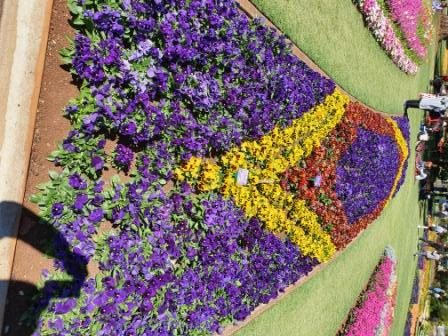
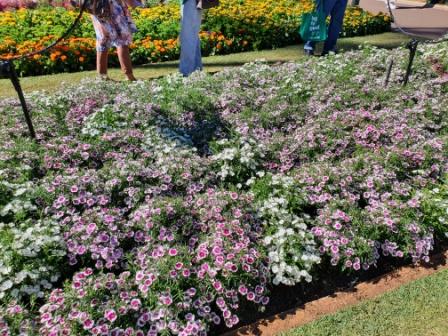
Please note the video link at the foot of this post to the Carnival of Flowers.

We set off on the morning of Monday 26th September to complete our Covid interrupted tour. Instead of going back to Townsville to start where we left off, we travelled inland via Toowoomba and took the opportunity to visit the Carnival of Flowers as we passed through, spending our first night at Chinchilla.

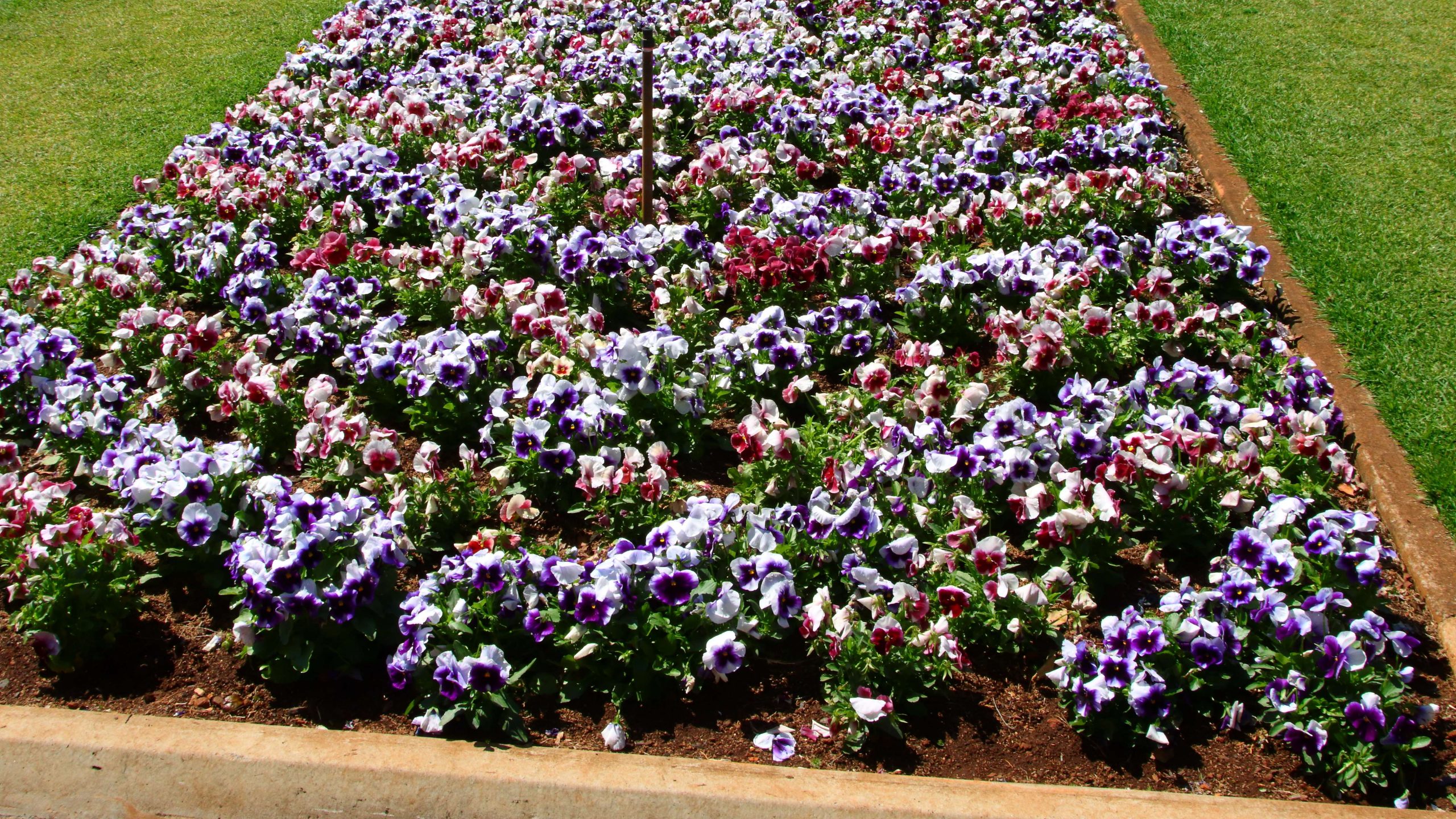
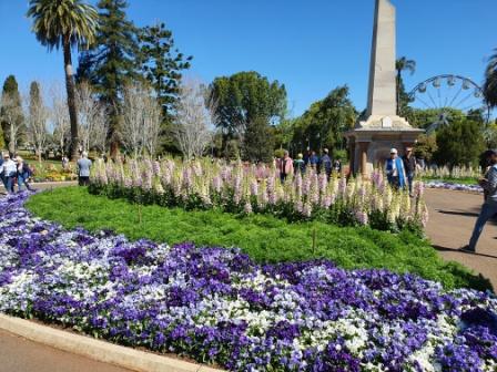
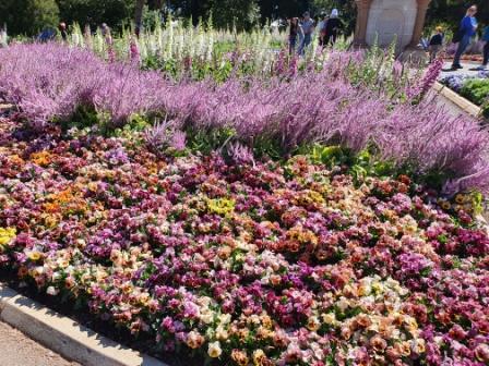
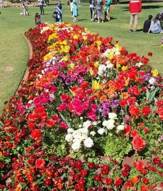
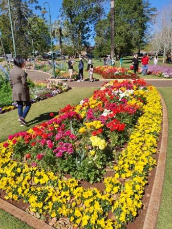
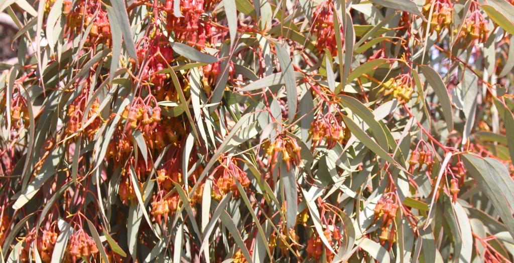
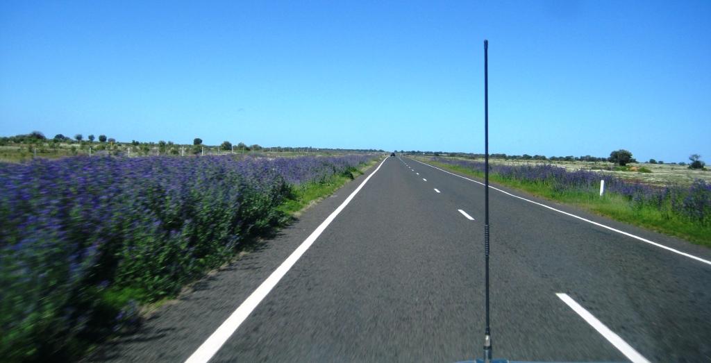
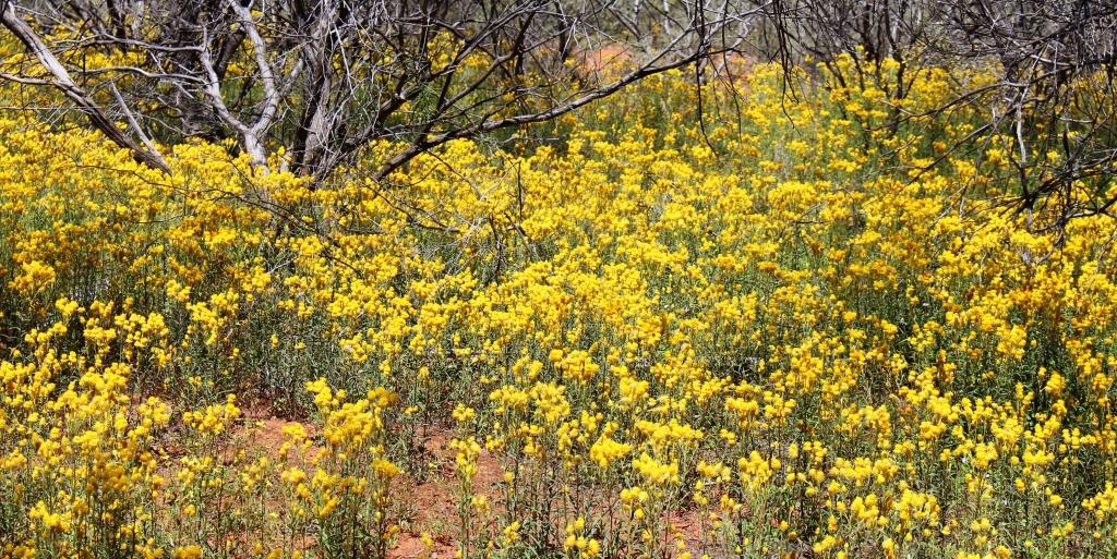
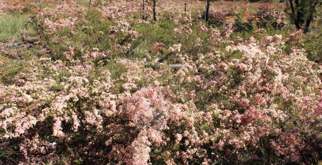
The flowers at Toowoomba were up to the normal high standard. As our visit was late in the carnival, most of the additional activities had finished. The flowers and a few food vans parked down the back was all that remained of the festive area. But we were there to see the flowers and were well satisfied with the offerings on display. The greatest challenge was to take a photo of a flower bed without an Asian tourist in the foreground having their photo taken.

A thin sheet of water over the face of Chinchilla Weir as the water flows towards the Murray River.

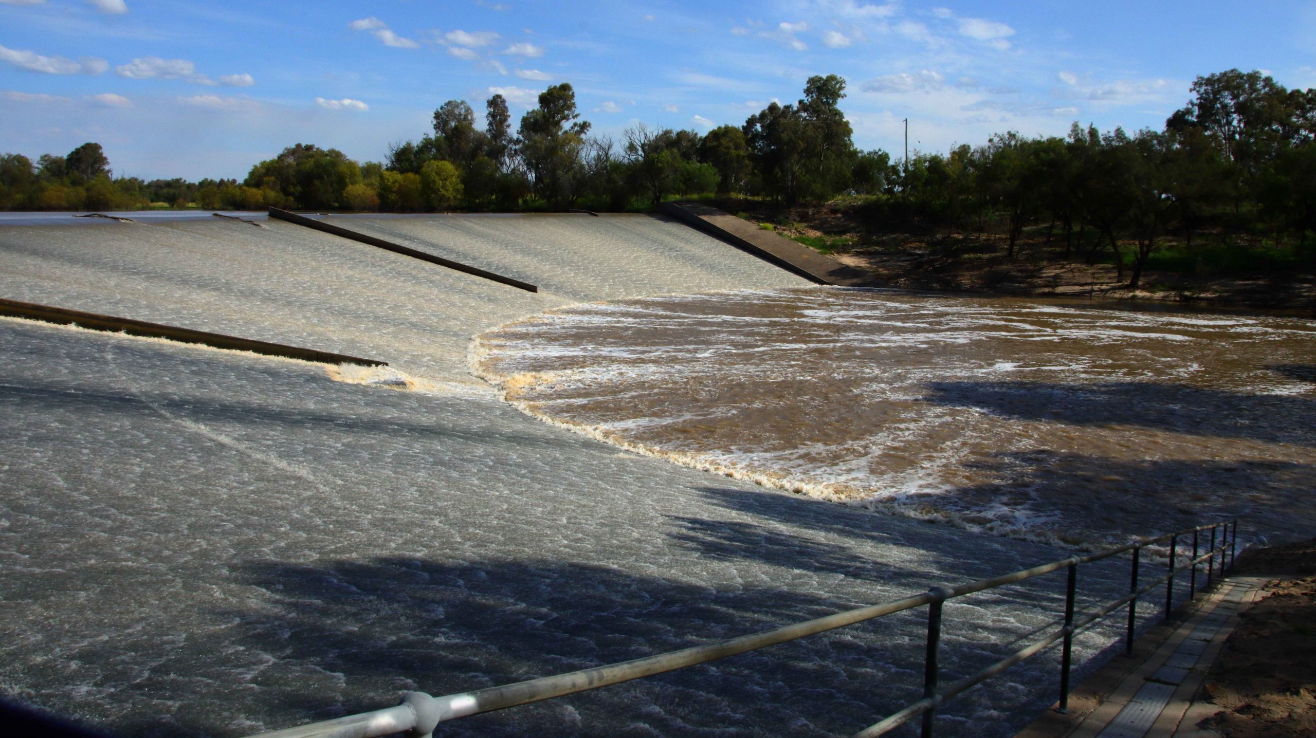
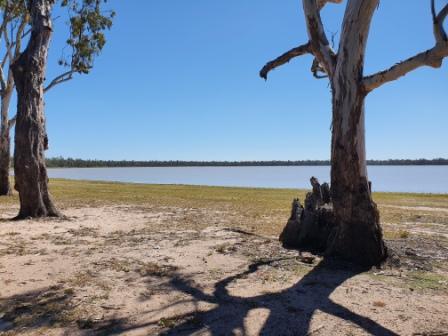
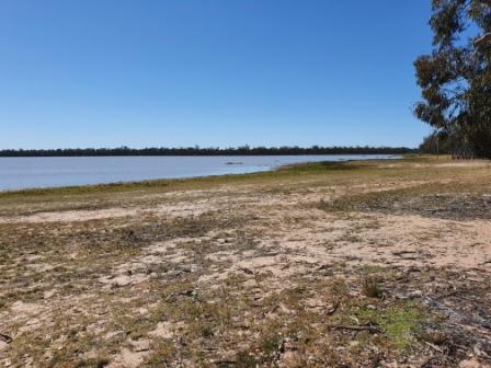
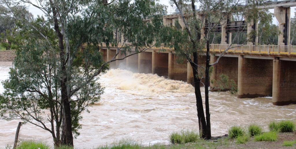
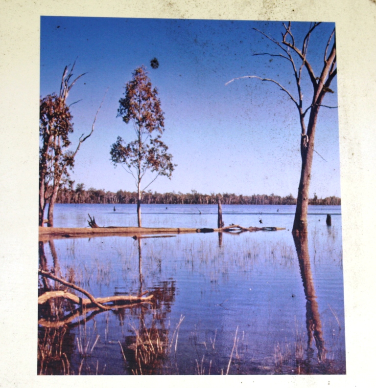
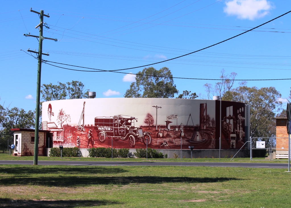
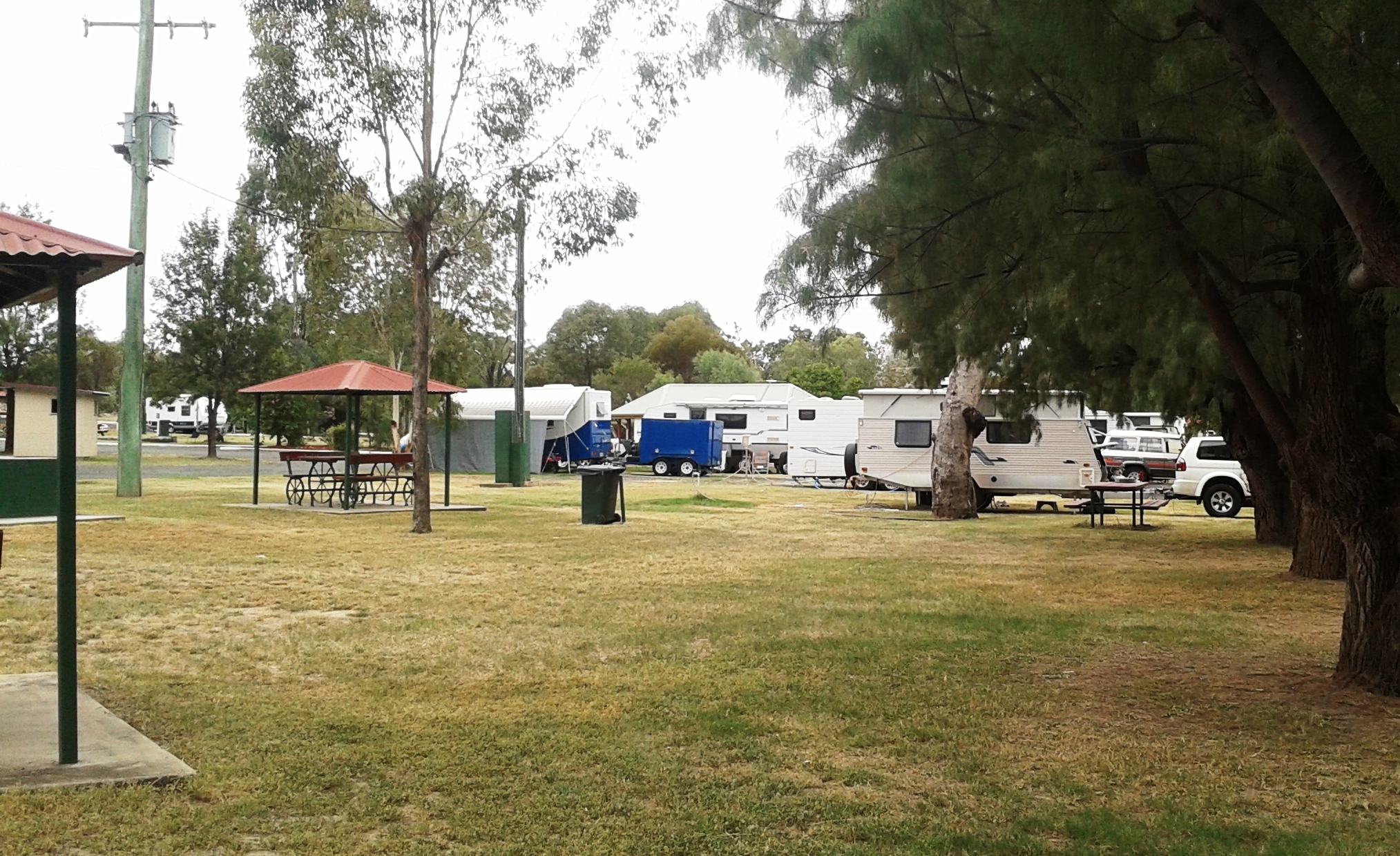
We drove on to Dalby for lunch having skipped morning coffee. In planning I had identified some likely bird locations to try before reaching our overnight stop at Chinchilla. I had no luck until Chinchilla Weir where we found greatly improved camping conditions from those we remembered from our previous visit. And we found a flock of Apostle Birds. I believe these birds are so named because of their practice of flocking in groups of about a dozen. Water was cascading over the weir.

A thin sheet of water over the face of Chinchilla Weir as the water flows towards the Murray River.
Recently germinated crops line the roadside in this part of the Darling Downs.
Boonagara, reached just before Chinchilla, built a public hall to commemorate success in using a grub to defeat cactus infestation.
Gil Weir is located just west of the Leichardt Highway, south of Miles

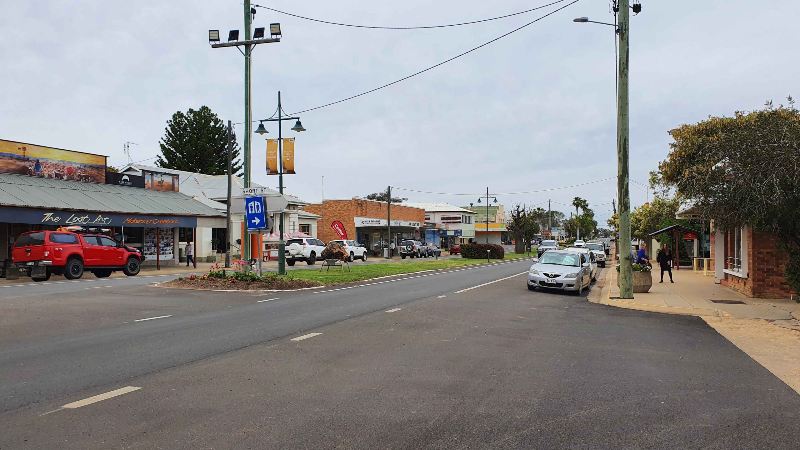
Friday saw us headed for Morven, a very small town where the Landsborough Highway branches from the Warrego Highway. It leads to Longreach as the major town in that direction. This piece of road is also known as the Matilda Way, but that is more for promotional purposes that accurate geography.

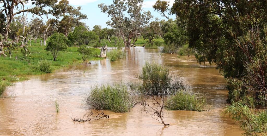
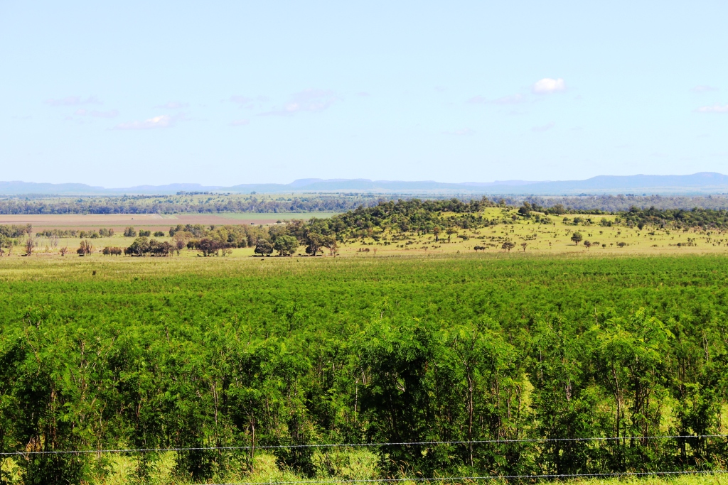
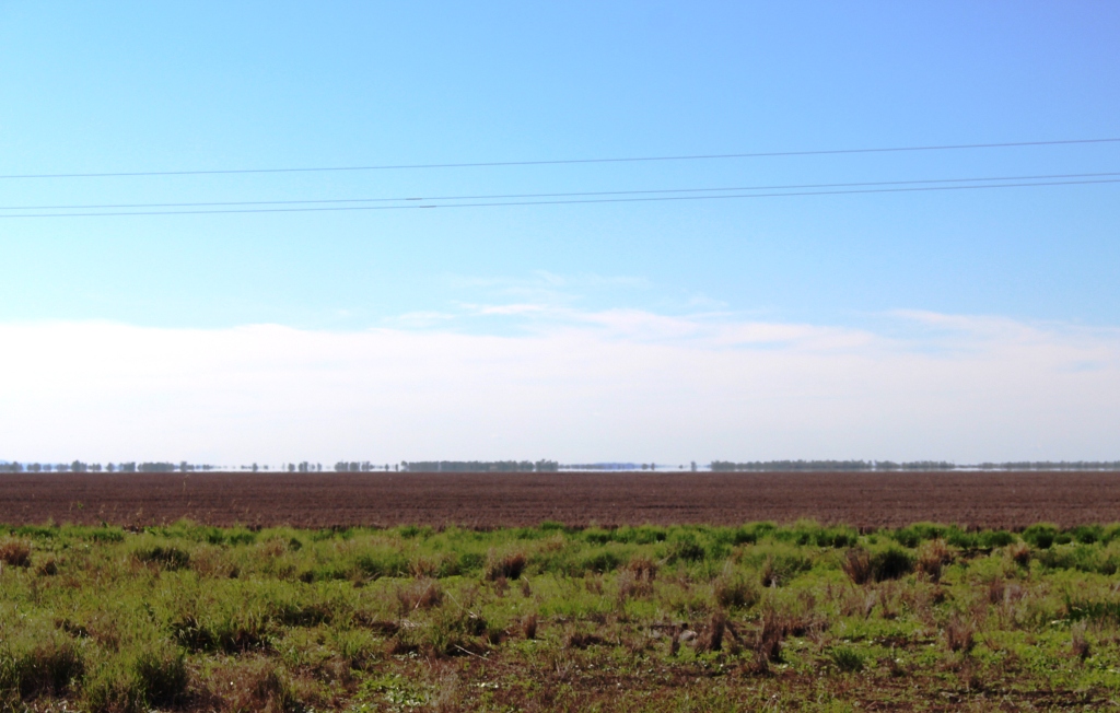
We checked for birds at Gill Weir, south of Miles and Judd’s Lagoon, south of the highway, closer to Roma. All that we found in both places was overflowing weirs and long term bush campers, most of which were in their highly equipped caravans. Rising water levels inundate water bird feeding grounds and I imagine, causes the birds paddle harder to stay in the same place. The birds are not silly. Thy go somewhere else.

Memorial to fettlers wives near Dulacca
The informative plaque that is part of the memorial.

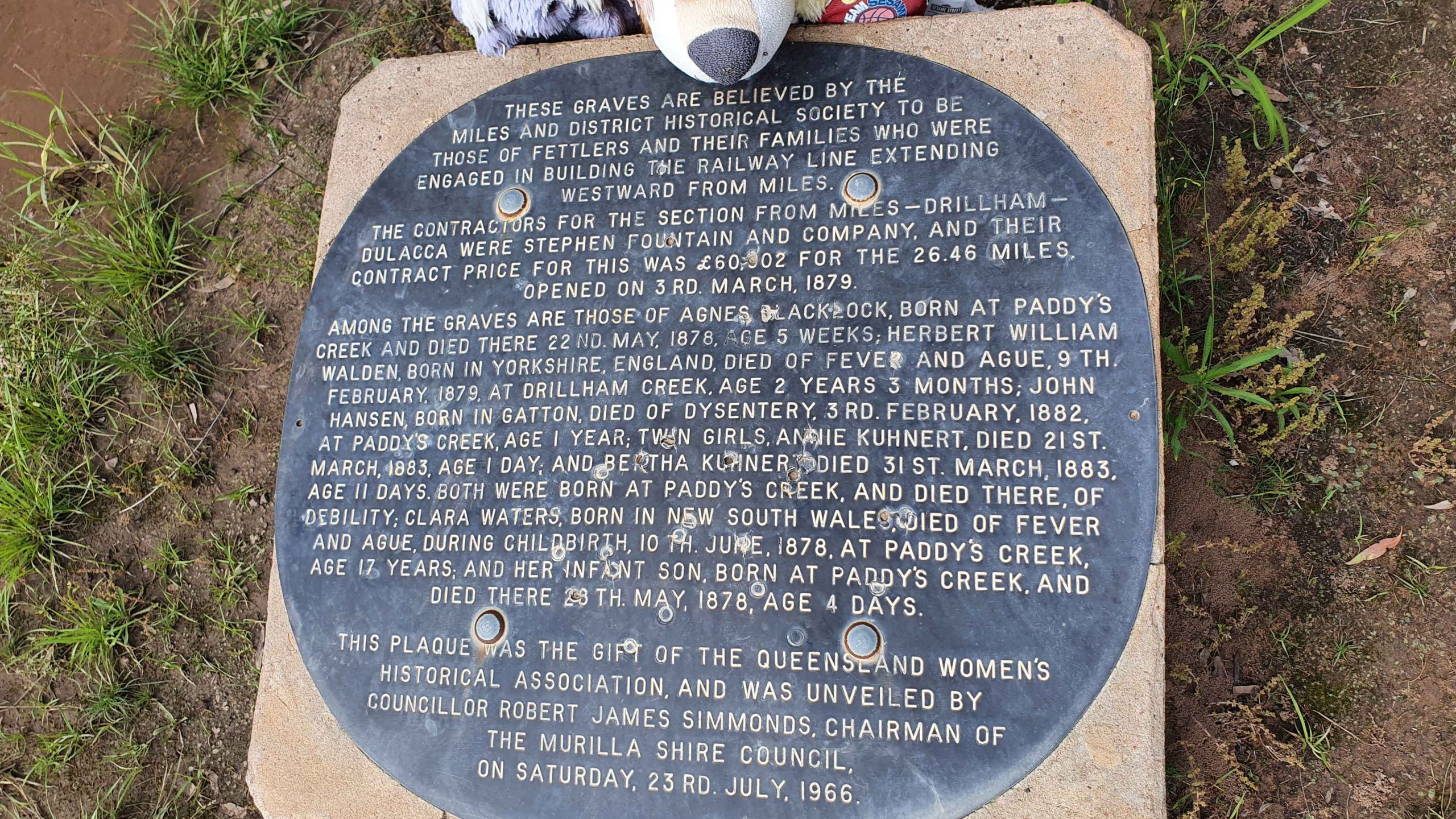
Roadside, just before Dulacca out towards Roma, we came upon a memorial to the railway fettlers and the women who supported them while building the western railway line from Miles to Dulacca in 1978-79. In those days families had to travel with their breadwinners if they wanted to see them. No FIFO in those days.

Australian Darter, drying off following a fishing session.

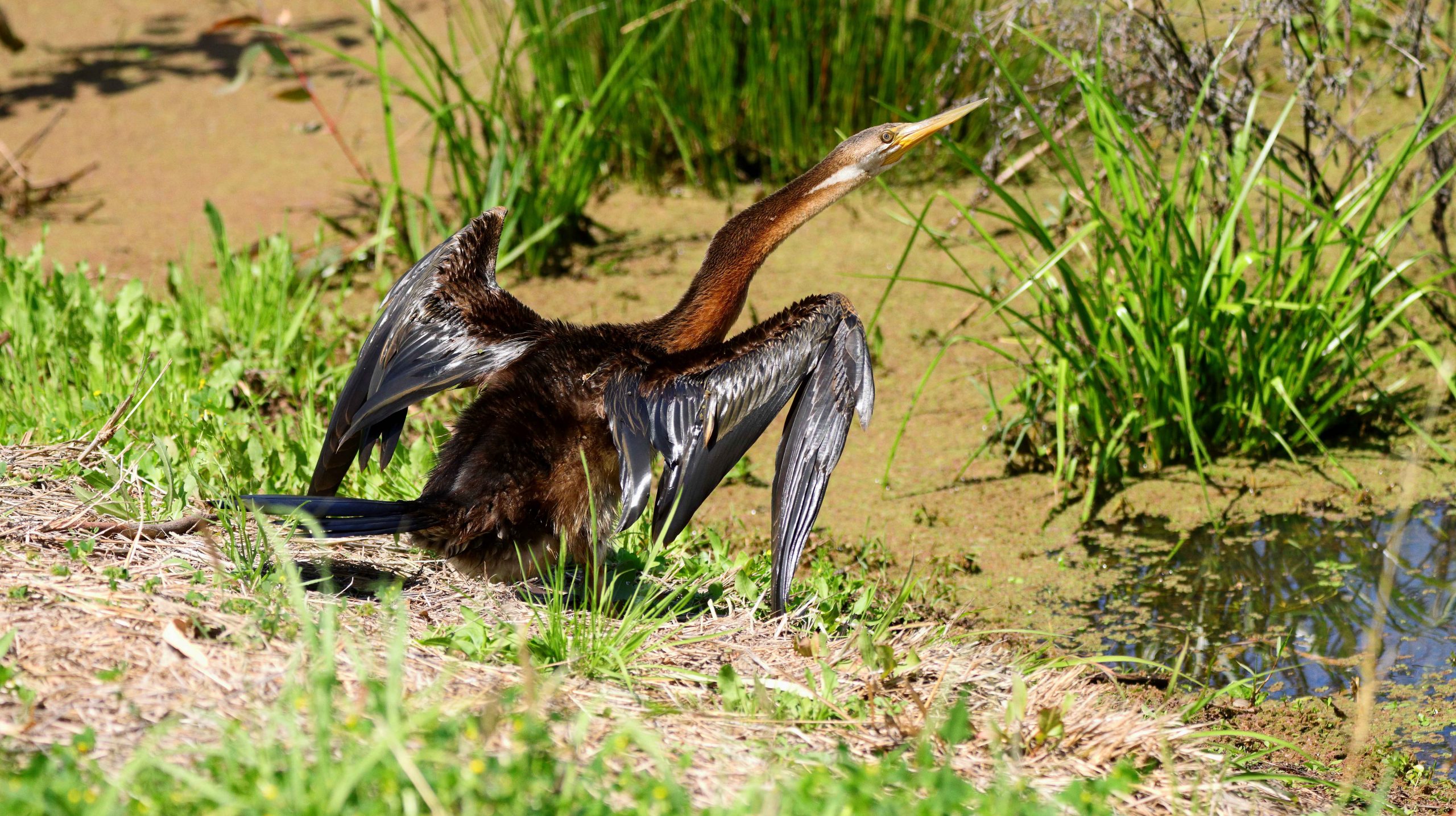
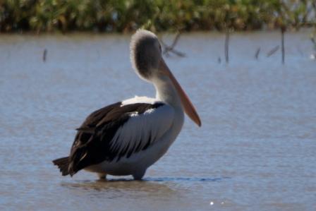
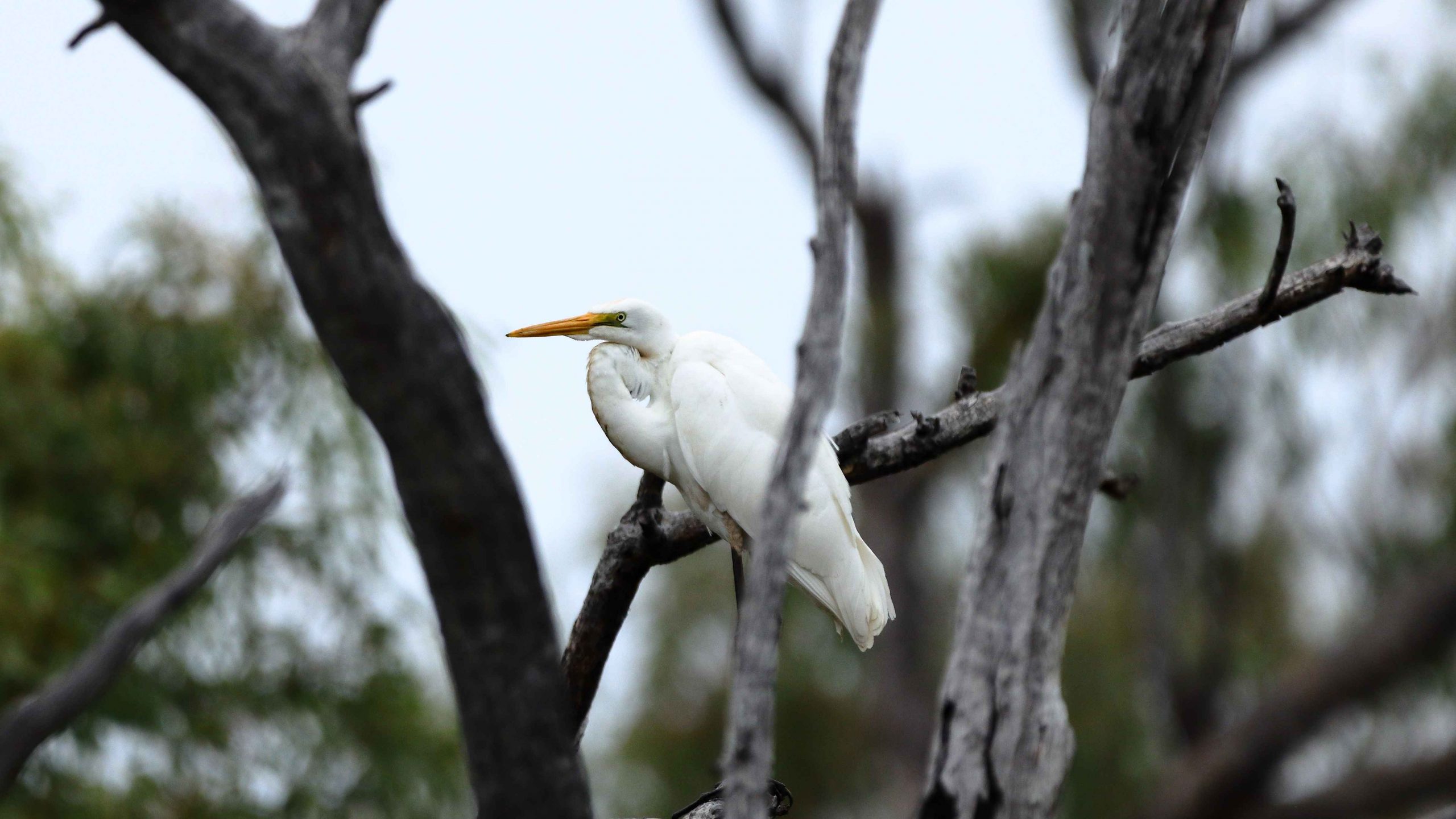
After morning coffee at Roma’s Big Rig, we had a look at Roma Bush Gardens, located just off the highway past the town centre. Walking around the lake was restricted by flooding but I did see some Mallards and an Australian Darter, drying its wings in the morning sunshine after fishing excursion.

Neil Turner Weir on the Maranoa River at Mitchell was overflowing. We have not seen this in several visits.

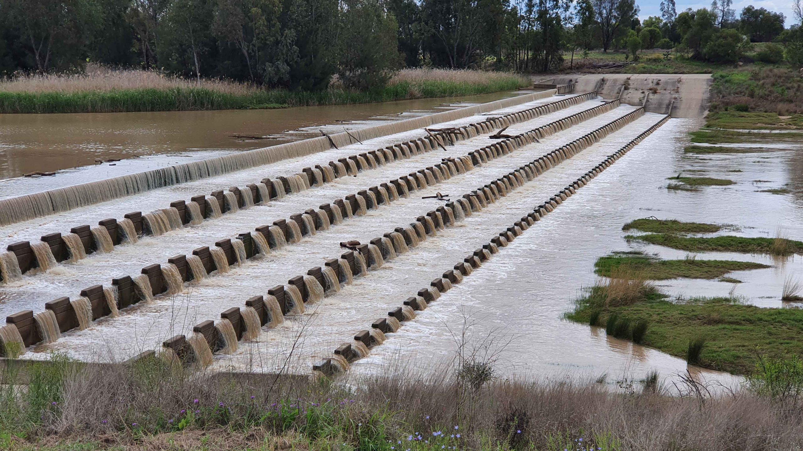
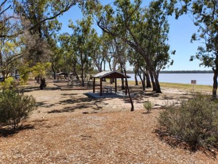
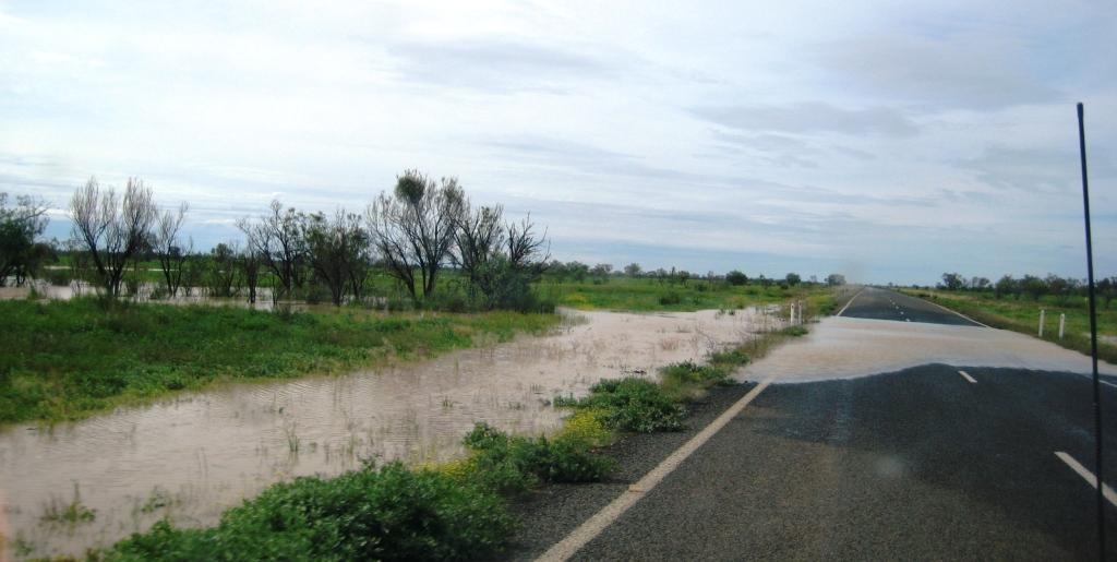
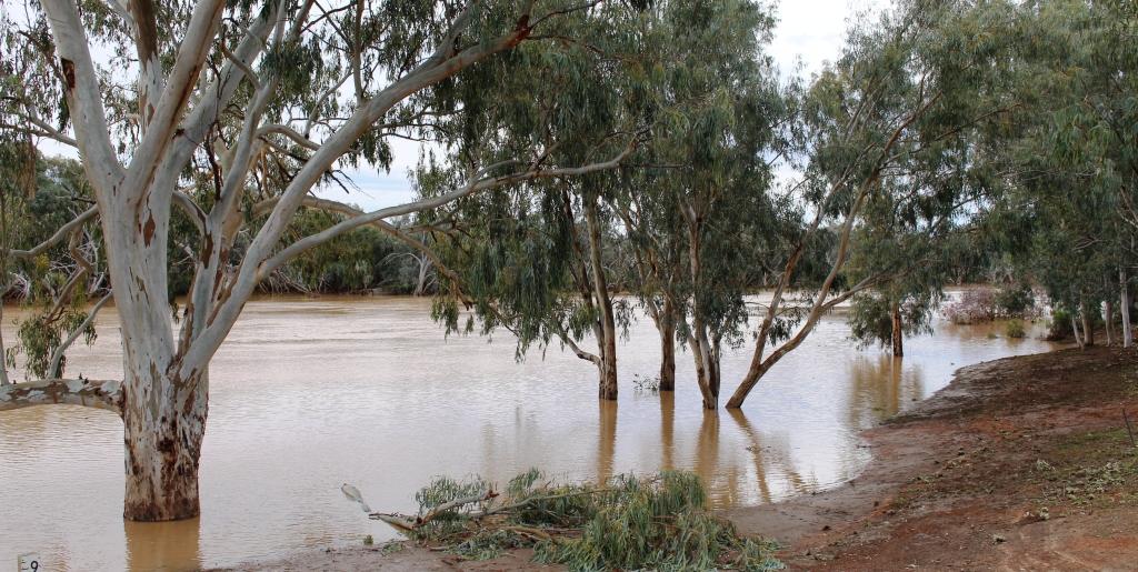
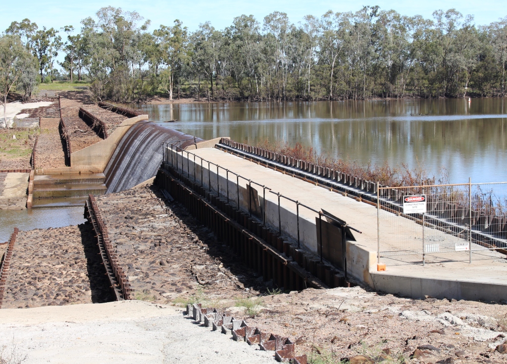
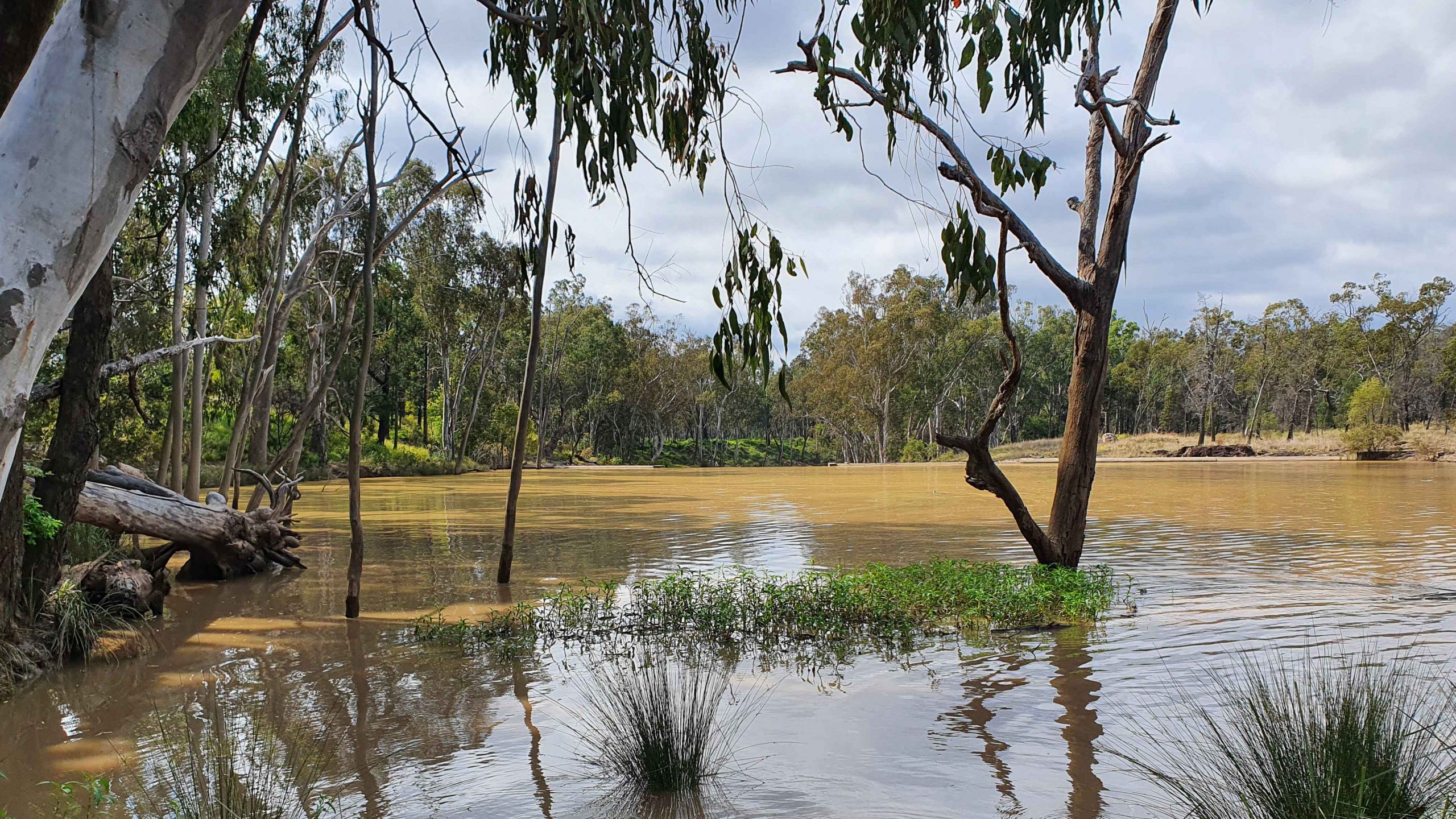
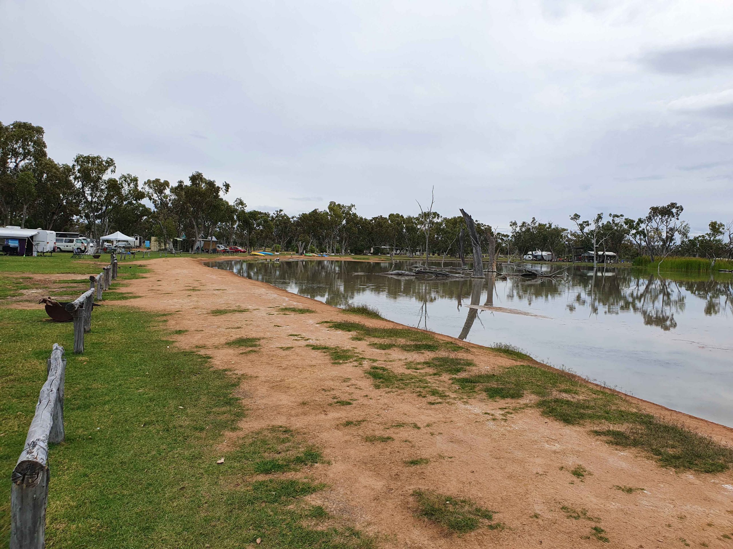
We took our lunch break at Neil Turner Weir, a water storage on the Maranoa River near Mitchell. Mitchell is probably best known for its therapeutic artesian spars. We have used the camping area at the weir on several occasions but had not seen the dam overflowing before. It reminded us that so much of our travel through Australia’s outback occurred during the drought years.

The Pick-a-Box Motel at Morven
A Royal Flying Doctor Promotional Van Parked Outside The Motel.

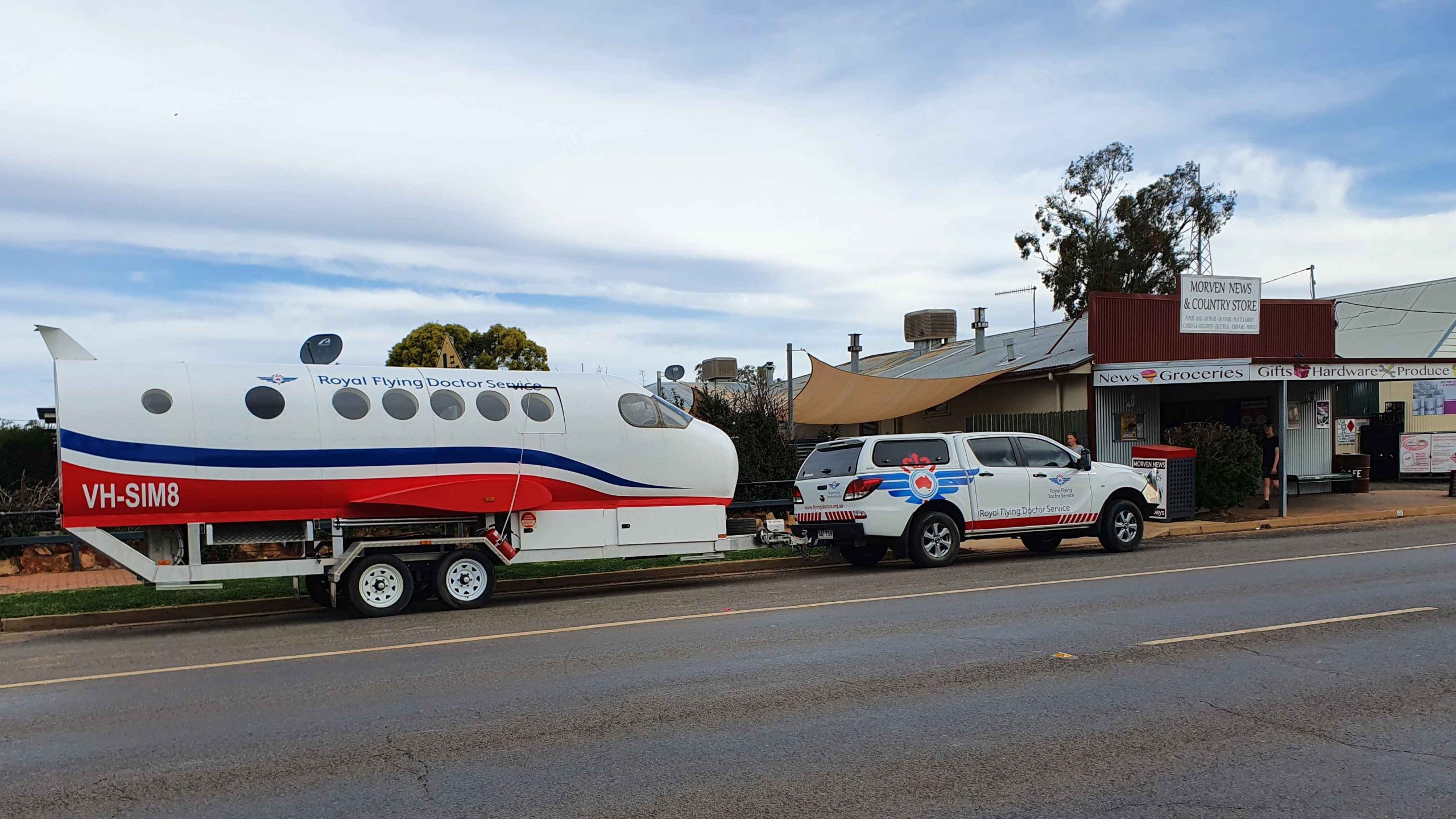
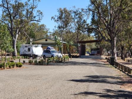
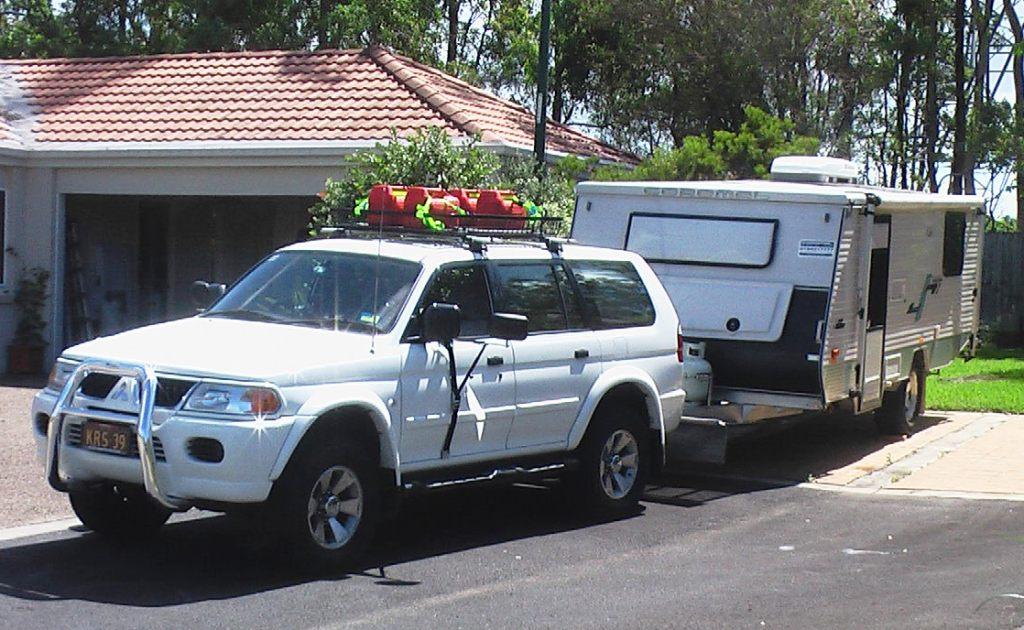
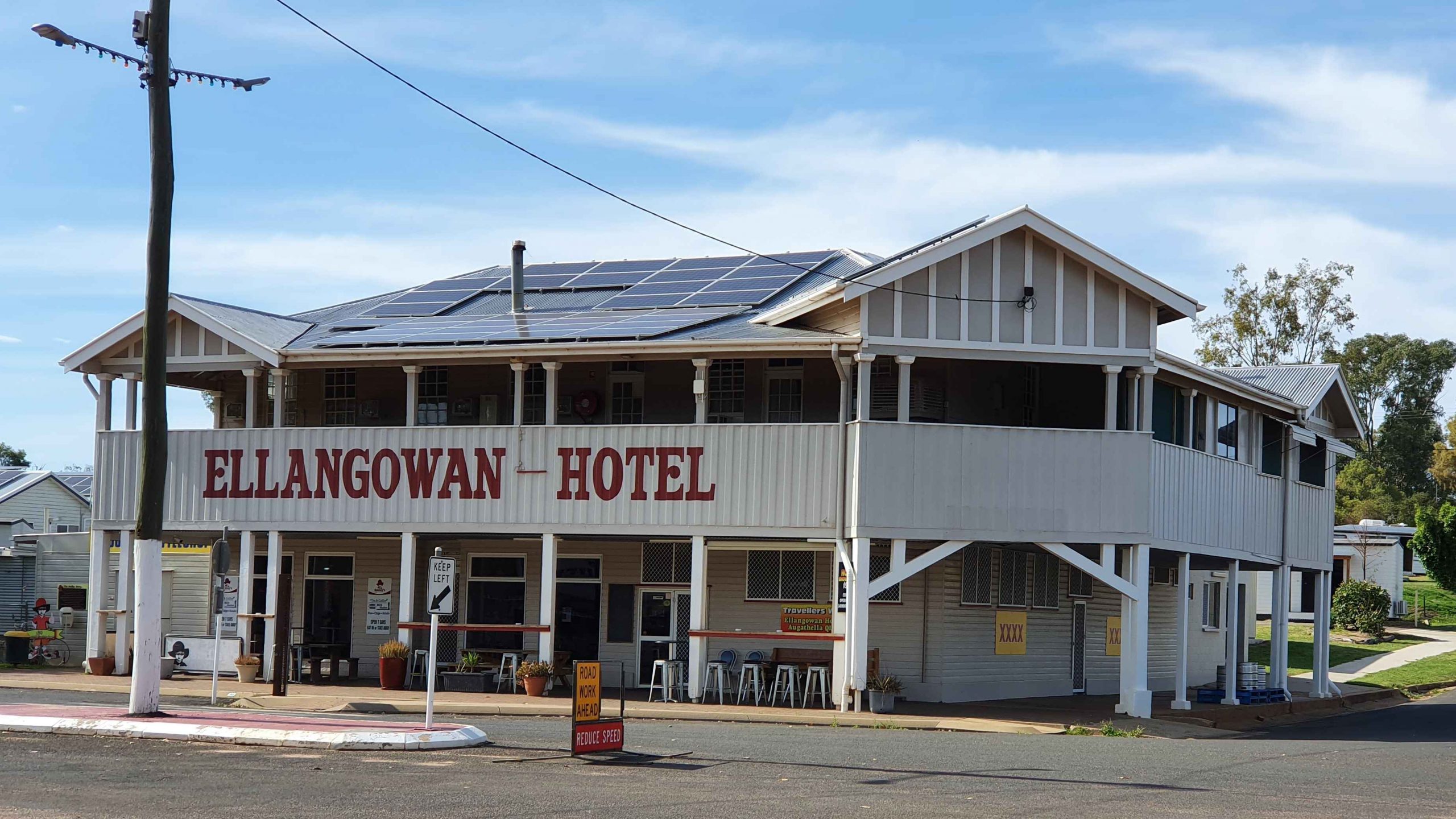
The Pick-a-Box Motel was our resting place for the night. The motel is a small group of newish iron-clad cabins near to and managed by the Morven Hotel, recently rebuilt following a fire. The only excitement in town was a Royal Flying Doctor Service caravan in the shape of an aircraft fuselage, parked in the street outside.

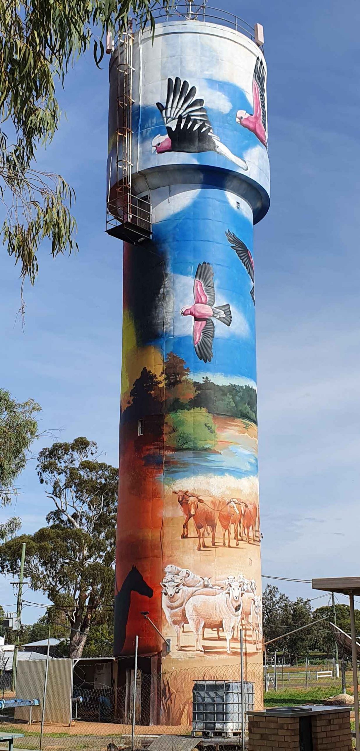
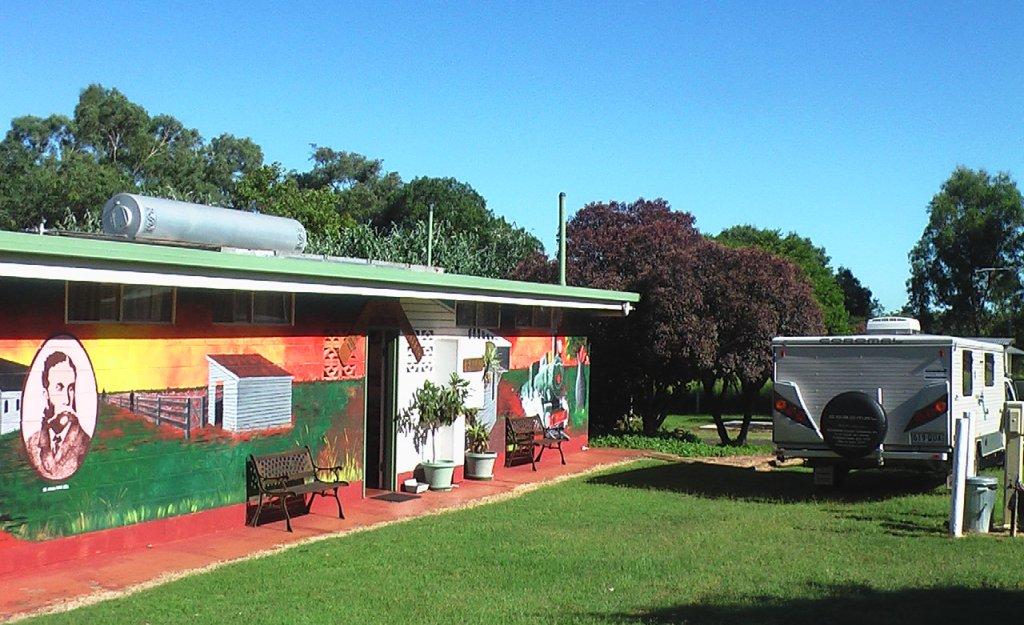
So, from Morven on Wednesday morning, we turned north-west on the Landsborough Highway. First stop was a call at the first town, Augathella, a distance of about 90 km. The town is quite old and has been supporting the local agricultural community since its founding in 1883. Like many outback towns, it has upgraded its visitor facilities for grey nomads. Artists have painted pictures on its water tower, art silo fashion.

The Ellangawan Hotel bears Augathella’s original name.
The list of local water birds at Tambo. Most on the list were conspicuous by their absence.

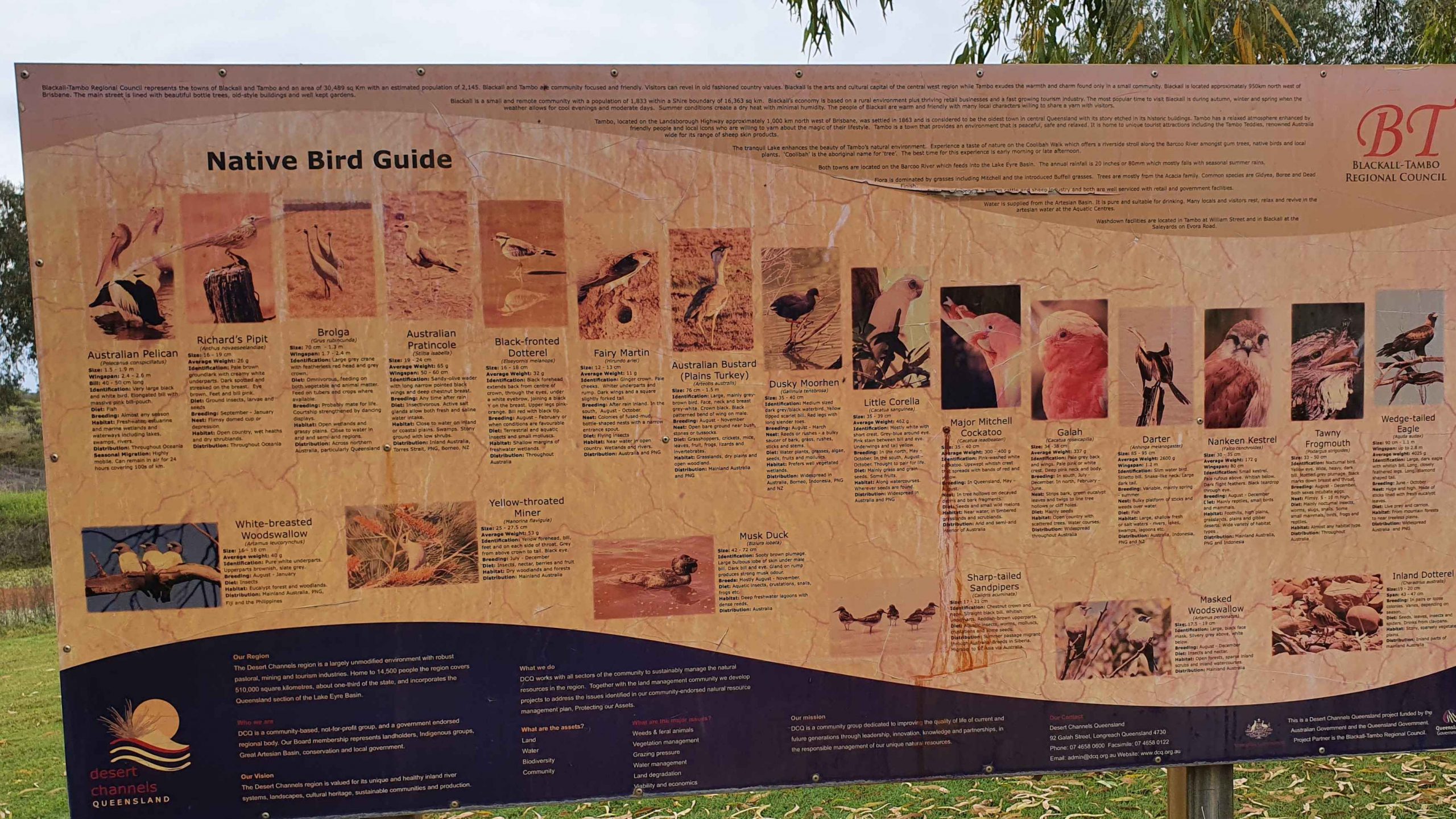
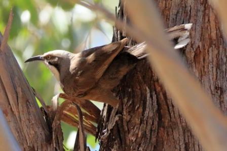
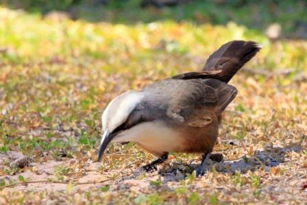
Next, about the same distance further north-west, we arrived at Tambo, another pioneering town (1868) with good visitor facilities. We paused for morning coffee beside the small dam at the entrance of the tow. By the lake there is an information sign providing details of the many water birds to be found in the area. There were very few on display for us, although small birds such as Noisy Miners were busy in the tree.

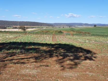
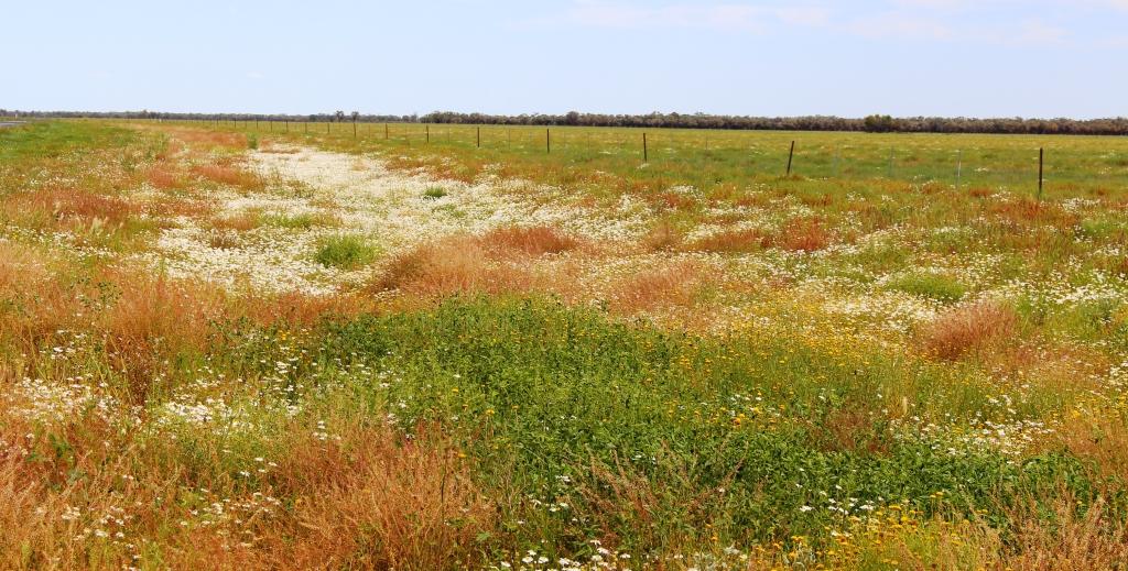
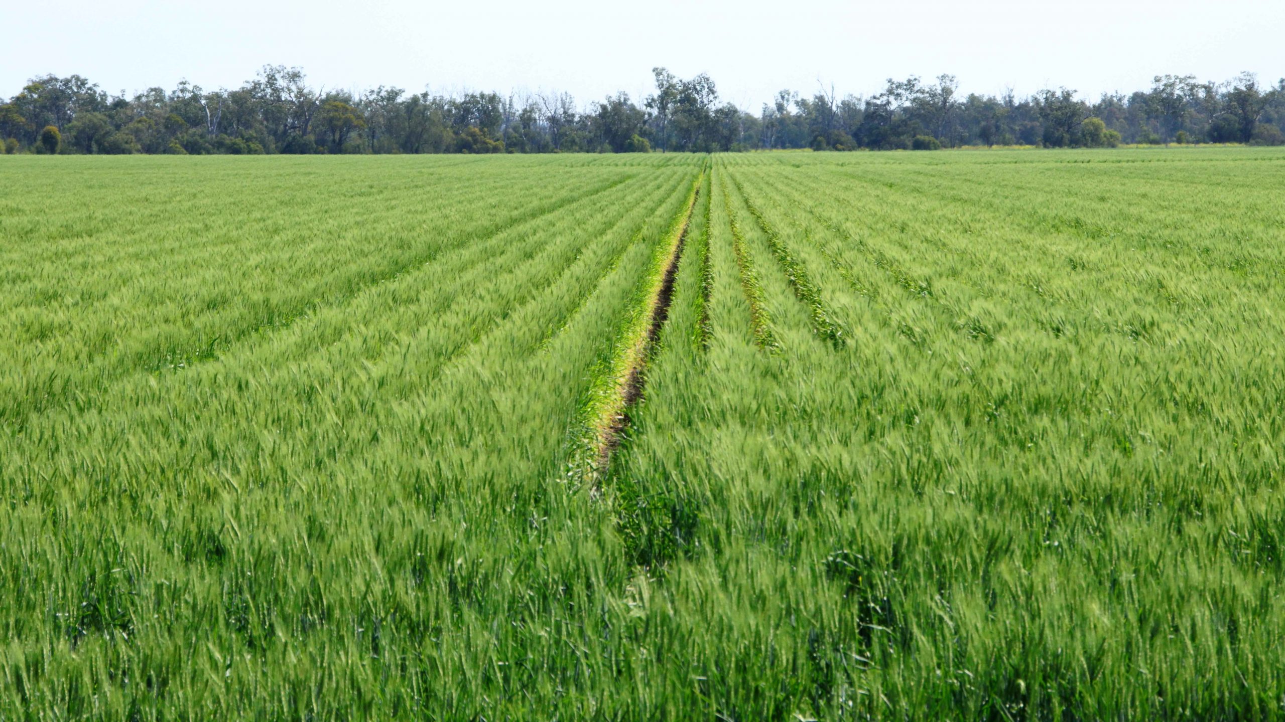
Continuing, we crossed the Barcoo River and arrived at Blackall, which was built on the banks of that stream. Major Thomas Mitchell explored this part of Australia in 1846. The town developed in the 1860s as an agricultural service centre. Again, it has good tourist facilities. It is surrounded by vast expanses of open naturally grassed pasture, as is much of this area. We had been driving through it all morning.

The Barcoo River at the Landsborough Highway crossing.
An Eastern Great Egret perched in a tree over the Barcoo River.
Blackall main street is the highway.
Part of the billabong and camping area at Lara Wetlands

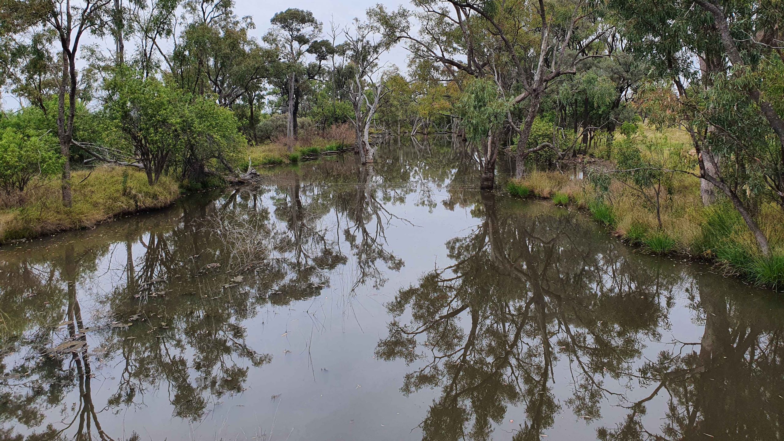
The next town along this highway is Barcaldine, but about 45 km before that we turned off to the left and drove the 16 km of dirt station road to look at Lara Wetlands. This is a camping area that almost surrounds a large waterhole filled with dead trees, so is probably the result of a dam. Lara Station is an operating cattle station. They run the camping ground in conjunction with the station. There are reported to be 164 species of birds identified in the area. But there is no power and only one cabin. Interesting spot, all the same.

A Brolga by the road as we drove into Lara Wetlands.

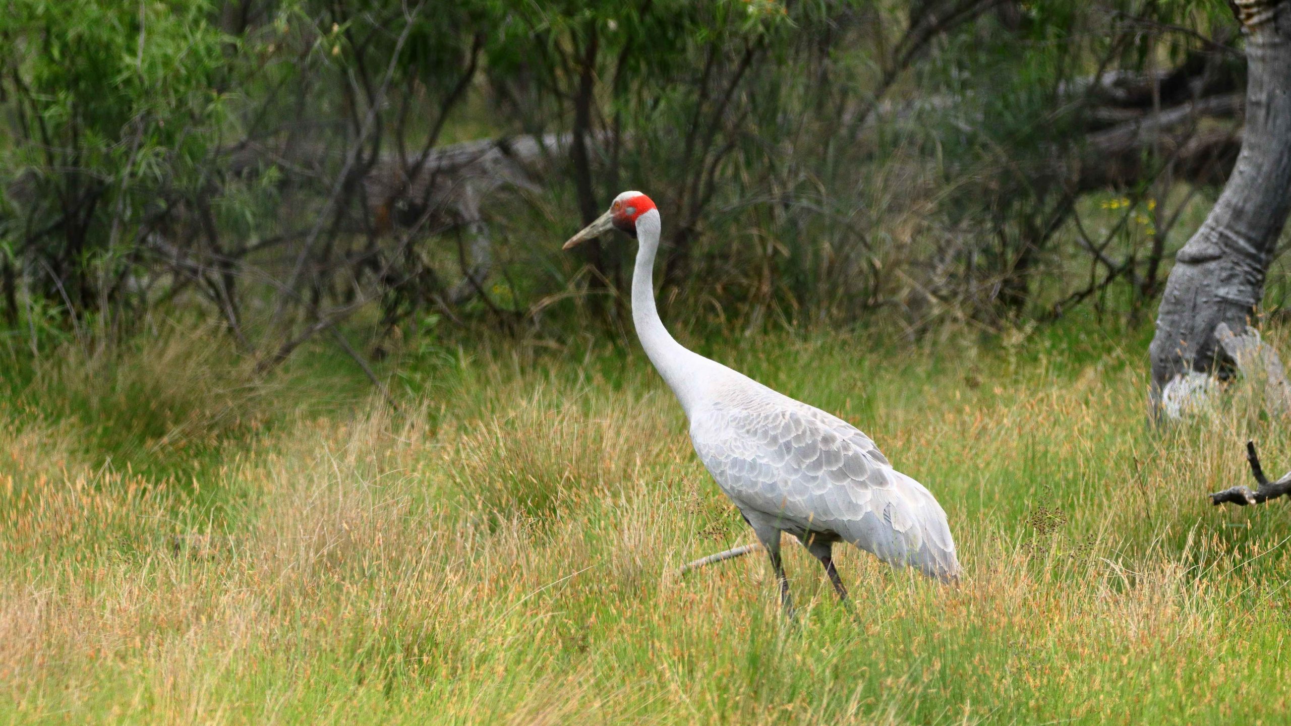
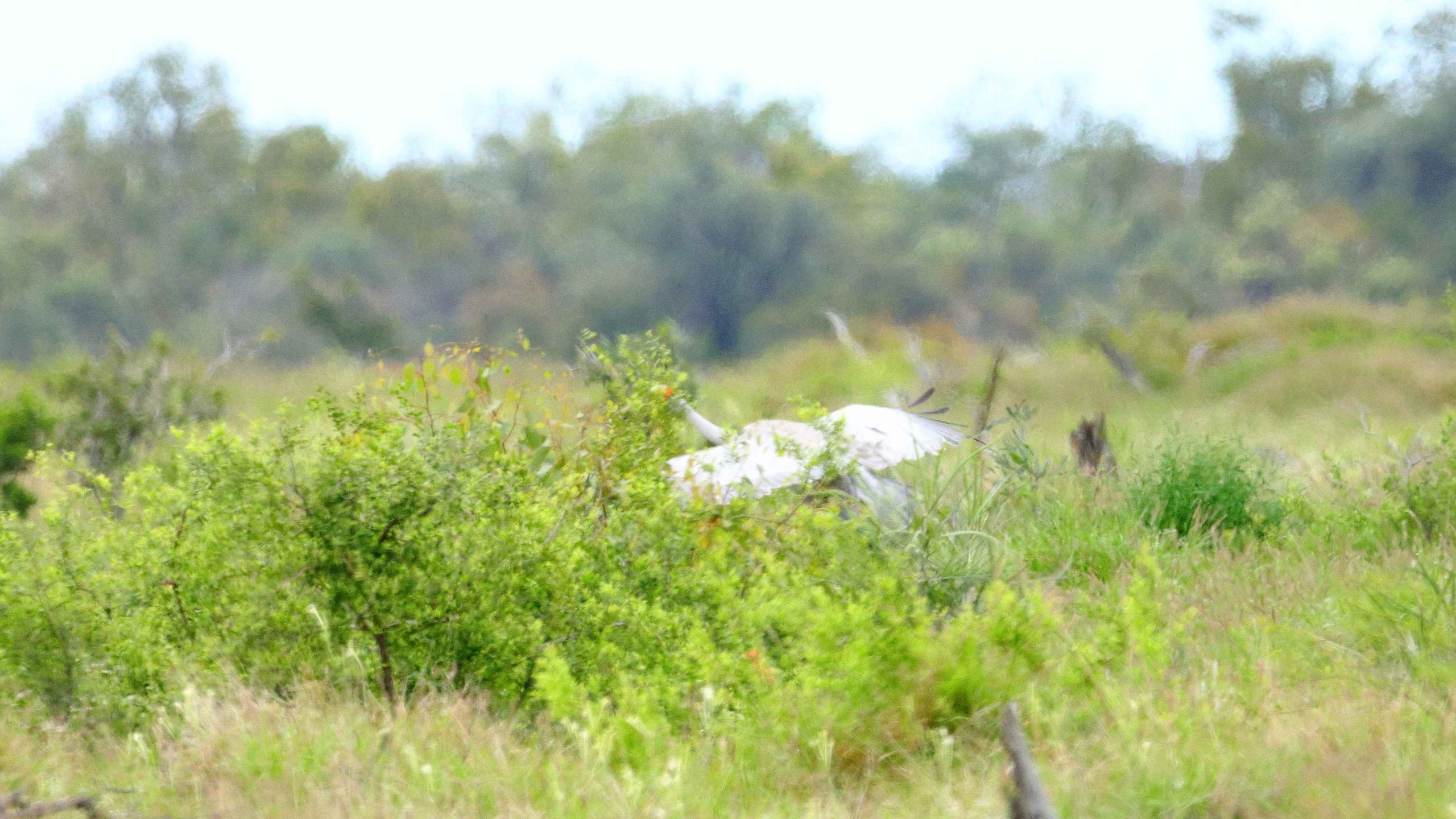
As we drove into the Lara Station, Ruth saw a large grey bird at the edge of the trees. I stopped and got some good photos of a Brolga. It was wandering up and down and seemed quite settled but as I turned back to the car, I heard the whoomp whoomp whoomp of large wings as the Brolga took to flight. I turned just in time to snap it disappearing behind some brush. Not a very good photo, sadly.

The Brolga landing in the brush by the roadside.

We refuelled at Barcaldine, paying for the first time just over $2 per litre for unleaded petrol. At Barcaldine the highway turns left and west through Ilfracombe to Longreach. Scattered cloud meant that the western sun was not too much of a problem. We had travelled quite a distance in pursuit of the setting sun since leaving Brisbane, so the days were ending quite a bit later.

The deck at the Woolshed Restaurant at Longreach.

We were able to get a booking at the Woolshed Restaurant at Longreach Tourist Park, where we had a cabin. Last time we were here they were booked out. They were again but we had booked in time. An excellent meal even if the entertainment was a bit loud.

While at Longreach we returned to Ilfracombe and also drove south to Isisford. That drive is covered in the next blog post.

Dalby to the Gold Coast

I would like to have visited the Cunnamulla area, to check out some of the better known birding sites in the area, but time available in between commitments did not allow for this to be planned. So instead we went only as far as Dalby and returned home via the Gold Coast, to keep an appointment for lunch with friends.

So on Tuesday 21st September we drove to Dalby via the Bunya Mountains. It’s not much further than the Warrego Highway, but does take a bit longer. At Dandabah, the tiny community centre of the Bunyas, it was blowing a gale and was about 10C, so no photos were taken and no walks attempted, but we did have lunch at Poppies Coffee Shop. The gale was still blowing at Dalby, with winds of 50+ km per hour, from the south west. So no Dalby photos either, but we did brave a visit to Myall Creek and I had a walk along the path beside the creek.

The attraction at Dalby was Lake Broadwater, 30 km to the south west. Had weather been normal we had intended to visit on Tuesday afternoon in an attempt to maximise the opportunity for bird photographs. That didn’t work out, so we did not visit there until Wednesday morning. The wind had abated and the surface of the lake was relatively undisturbed.

We had intended to call at Lake Broadwater during our caravaning days, but never did. We found a surprisingly good camping area and lots of day use facilities along the shore line. We enjoyed a Thermos morning coffee with a view over the lake. But of the 180 or so species of bird claimed to be resident in the reserve we saw but a few. I did make a first sighting of the Grey-crowned Babbler but apart from Magpies and Pelicans there was few to see. A bit too late in the day, probably.

From the lake we returned to Dalby and then drove south east to Toowoomba, via Oakey and a lunch stop at the suburb of Wilsonton. It being September and school holidays, Toowoomba was in the grip of the colourful blaze of Carnival of Flowers.

As the gardens at Laurel Bank were almost on our path through the town they were our first choice. But alas! No parking spaces were available. So we went to Queens Park and lucked onto a spot right near the gate. We wondered if the displays might be damaged from the high wind on Tuesday but there was little sign of damage. But, as usual, an exquisite display.

We wandered through the rather crowded area and gave ourselves plenty of time to view the displays. But as you leave you cannot help but enquire of yourself “Isn’t there another photo that I should take?”

Warwick is an easy 84 km drive south of Toowoomba. But we diverged at Emu Creek to visit the Steele Rudd Memorial Park. Rudd’s real name was Arthur Davis, who later used his experiences as a youth on the “selection” as material for his book “On Our Selection” and some of his other work. He was quite a prolific writer of novels and plays in the late 1800s and early 1900s. The old radio series “Dad and Dave” was based on his writing.

Surrounding Farmlands

The park is on the site of the house on the selection where Watson (Rudd) lived as a child. Recreated versions of the buildings of the day are on display, with a bit of farm equipment and numerous plaques that tell much of the story of his life.

The park is only about 1.5 km from the New England Highway and is well worth the effort to call. If you were diverging on a drive from Toowoomba to Brisbane, the park is on a road that leads to the Clifton to Gatton road that provides an alternative route from the Southern Darling Downs to Brisbane.

We drove on and spent the night in Warwick, where the temperature at 8.00 AM next morning was a mere 8C. So we lingered to a bit closer to check out time.

If time had permitted the previous day we would have called at Glengallan House as we drove past. This interesting piece of history is located about 15 km north of Warwick, beside the New England Highway, a couple of clicks past the intersection with the Cunningham Highway.

The mansion was built on one of the first grazing leases in the Southern Darling Downs. It has a long history and has had many owners. It fell into serous disrepair but was rescued and has been restored to some of its former glory. It is now owned by a trust purposed for its improvement. There is still a lot of work to be carried out.

Glengallan House Café

A café has been included in a reception building, with a gift shop and administration offices. It costs $10 to see through, and the tour is self conducted. Your effort is well rewarded by the picture that you will gain of life in the area in the late 1800s and the early 1900s. We had coffee before moving on.

We travelled to the Gold Coast via Killarney and Queen Mary Falls. I finally realised my ambition to walk down to the bottom of the Falls. The full walk was about 2 km and took about 45 minutes, including stops for photos. There is a good quantity of water flowing down the river at that point. Waterfalls are their own reward.

We then drove the mountainous and winding Spring Creek Road to Boonah and on to the Coast. We were lucky to have been able to do the drive, as roads between Queen Mary Falls and Boonah were to have been closed for major repairs. But because border closures have had such an impact on businesses in the area the work has been deferred.

We spent two nights at the RACV Royal Pines Resort at Benowa on the Gold Coast. On the intervening day we took a run up to Binna Burra. We hadn’t been there for a some time. The resort area and visitor facilities, of course, had been burned out in the interim.

The Visitor Centre/Café

The Binna Burra visitor area and other track head parking lots remains popular as access points to the eastern parts of the Lamington National Park. Groups of cars were parked at the start of walking tracks. At the visitor facilities, we secured the last parking space.

I walked the 1.2 km Rain Forest Circuit, during which I met a number of other walkers, some casual and some with back packs, as parts of the path are shared by other walks including the Border Track that links Binna Burra with O’Reillys Rainforest Resort.

The visitor area has been rebuilt since the fires with the old facilities renovated or replaced. It now has a modern appearance.

Our lunchtime view

The main change is that the original chalet building that was at the top of the mountain as you turned right at the T intersection has not been rebuilt. A large shed occupies that site. New luxury units have been built to the east of that area where they enjoy sweeping views of the coast and the privacy provided by a “Guests Only” sign. But you can see the top of the units from the road, just before you reach the resort entrance.

We had lunch in the café located in the visitor centre building, with coastal views through the vegetation, but views were obscured a bit by haze.

Binna Burra is always a pleasant place to visit.

Back at the hotel, room service sufficed for dinner. We couldn’t be bothered leaving the room, let alone the hotel. Increasing age has its effects.

With a lunch appointment at the Kurrawa Surf Lifesaving Club at 11.30 AM there was no hurry. Check out time was at 11.00 AM so there was plenty of time. After a leisurely lunch we made our way back to Brisbane along a pleasantly quiet highway.

Sunset Over the Mountains

.

West, Centre & Flinders – Days 61 to 68 – Homeward Bound


We stopped for lunch near a flowering gum tree

We stopped for lunch near a flowering gum treeWe gave ourselves an easy day on Saturday with only 137 kilometres to the steam museum town of Peterborough. This reasonably substantial town is on the main Sydney to Adelaide railway line, which is also the line on which ore mined in Broken Hill makes its way to the smelter at Port Pirie. Peterborough was a major rail town during the days of steam. It now uses its heritage as a tourist attraction.

The day had improved by the time we had booked into the Peterborough Caravan Park but a chilly night followed. Sunday morning was overcast, but as we made our way to Broken Hill the clouds made way for real warmth from the sun.

The restaurant building at the Miners' Memorial.

The restaurant building at the Miners’ Memorial.

We booked two nights at Broken Hill to allow for shopping for the final days to home but also to allow us to do the tourist thing. We drove to the Miners’ Memorial at the top of the huge mullock heap that separates the town from the mining area. We were disappointed to find the memorial buildings closed. The restaurant and adjoining gift shop that was so “in” when we were last there, seemed completely closed and the actual memorial building was closed for renovations as well.

Roadside flowers on the road to Silverton

Roadside flowers on the road to Silverton

After lunch we drove the 24 kilometres to the historic silver mining town of Silverton. Not much remains of the original town but most remaining buildings have been restored and “reading desk” type information signs provide details of restored buildings and some other features. The amount of vacant space between the remaining buildings and relics

With new owners the Silverton Coffee Shop may reopen.

With new owners the Silverton Coffee Shop may reopen.

indicate that it was a substantial town. A coffee shop, still operating on our last visit, is now closed, although the building has been sold. The pub seems to do a good trade and the Mad Max Museum continues to pull in devotees. There are also two or three artists who work from galleries in the town.


Silverton's Mad Max Museum

Silverton’s Mad Max Museum

The approach to the Day Dream Silver Mine passes the old smelter flue on the hilltop

The approach to the Day Dream Silver Mine passes the old smelter flue on the hilltop

This visit we did the side trip to the Day Dream Silver Mine, where I did the underground tour. The mine is about 15 kilometres off the Silverton Road. In its day the mine was a rich source of silver with its own smelter sighted on a neighboring hill top to take advantage of gravity to assist the smelting process. The tour visited points of interest on the surface before we donned hard hats with miner’s lights for the underground portion of the tour.

Mining equipment under ground. Visitors can stand at the drill and gain some idea of what it was like to work in the mine.

Mining equipment under ground. Visitors can stand at the drill and gain some idea of what it was like to work in the mine.

The mine was quite deep, descending four levels. There were only a few steps, as the tour followed the sloping shaft that had itself followed the ore body into the bowls of the earth. The irregularities of the floor provided for secure footing and stout hand rails had been installed.


A display of mining tools in an area where the roof is supported by local timber.

A display of mining tools in an area where the roof is supported by local timber.

Mining tools, both manual and mechanical, were on display in appropriate locations throughout the mine. The guide was an experienced miner with a real gift for telling the mining story. To hear it all right where the underground activity occurred made it all very real. We finished the visit with a mug of tea and fresh scones, baked on the premises.

This photo was taken from the moving vehicle. There were no shoulders on the road to pull over.

This photo was taken from the moving vehicle. There were no shoulders on the road to pull over.

Tuesday was about making distance in an attempt to avoid rain and strong head winds. Cobar, yet another mining town, was our stopover destination for Tuesday evening. The only town between Broken Hill and Cobar is Wilcannia, where we stopped for fuel. After leaving Wilcannia the elevated roadway runs for several kilometres over Darling River flood plains, before entering low hills.

Massed floral displays between Bourke & Cunnamulla

Massed floral displays between Bourke & Cunnamulla

Generally the terrain is flat with only modest hills to provide some variety. Recent rain is evident from water lying beside the road and the abundance of greenery. And wild flower! The sides of the road were covered in masses of purple blooms. The purple is frequently interspersed with a variety of smaller flowers. Periodically the pastures are covered with masses of yellow and white. While watching such natural beauty, the kilometres and hours passed relatively quickly.

More roadside floral displays

More roadside floral displays

For the second day in succession we have driven past endless kilometres of road side gardens. Colours of white, blue, yellow, orange and shades of red have appeared like a planted garden against a background of the greens of grass, shrubs and trees. Periodically patches of white, yellow and red have run out of sight, between road side trees or reached in masses towards the horizon of the open fields.

The drive was between Cobar and Cunnamulla with a brief refueling stop at Bourke, a distance of around 415 kilometres. We saw the first evidence of the amount of rain that has fallen through the area. Up to now all we have seen, besides the rain, has been abundant grass and wild flowers.

Several streams had broken their banks.

Several streams had broken their banks.

The level of water in the Darling at Bourke was the highest that I have seen in several visits. North of Bourke, drainage channels beside the road were full of water. North of the Queensland /NSW border several streams had broken their banks and a few centimeters of water were running across the pavement in two places.

The remaining water over the road was shallow but had obviously been deeper.

The remaining water over the road was shallow but had obviously been deeper.

From Cobar to Burke we were on the final section of the Kidman Way. From Burke we had joined the Mitchell Highway that terminates where it joins the Landsborough Highway at Augathella. But it all seems to be part of the Matilda Way, but I’m not sure where the Matilda Way starts and finishes. But it is a busy road being a link between Southern capitals and both Northern Territory and Queensland and carries a lot of heavy traffic. We met several over dimensional loads, one requiring us to move right off the road.

The weather had been warmer, but the forecast is for rain and reduced temperatures over night and for the next few days. Fairly strong winds were forecast. When they eventuated they were behind us, pushing us along.

The swollen Warrego River at Cunnamulla. Water heading for the Darling River

The swollen Warrego River at Cunnamulla. Water heading for the Darling River

Before we booked into the caravan park at Cunnamulla we drove through town to check the water level in the Warrego River. The water level was well below the bridge but much higher than we had ever seen it before.

The forecast rain caught us at Cunnamulla but the greater part of it fell to the north of us. The rain had passed through by morning but we caught up with the last of it on the way to St George.

Water flooding over the weir on the Bolonne River at St. George

Water flooding over the weir on the Balonne River at St. George

Another 300 kilometres of flat road, some of it a bit narrow but most quite rough, due to periodic flooding, I suspect. The Weir on Wallam Creek, beside the road at Bollon, was overflowing as was the major weir on the Balonne River at St George. All of the excess water is heading for the Darling and the Murray Rivers.

The only disturbance to a peaceful night at the Pelicans Rest Caravan Park was the yapping of two dogs in the caravan next to us, whenever something disturbed them.

Flowering shrubs between St George and Dalby.

Flowering shrubs between St George and Dalby.

Dalby was our destination on Friday, which would have been another 300 kilometre day. But we were there by lunch time so decided to go on a further 100 kilometres to Yarraman. This very pleasant town sits almost at the foot of Bunya Mountains and has a caravan park atop a hill. We had been travelling in sunshine all that day, pushed along by a stiff but a cool westerly, that moderated by evening. But we still needed the heater that night.

On Saturday morning the easterly aspect of our overnight position gave us a brilliant sunrise and a promise of a day with temperatures in the mid twenties.  Saturday was the first day of a long weekend so the road was busy, particularly the lanes leading away from Brisbane. Traffic accumulating behind us made it necessary to keep the rig moving and to pull over occasionally to let our “tail” go by.

We arrived home just before lunch, to start the tasks of unpacking and cleaning and to deal with two months accumulation of dead gum leaves, blown down by winter winds while we have been away.

The promised temperature eventuated. I am back in shorts and all is right with the World.

So ends another trip, shorter in duration than originally intended but not much shorter in distance. We lost about two weeks to wet weather but the days that it did not rain were mostly sunny although sometimes kept rather cool by persistent winds. But we had a good time, saw some new places, met new friends and learned new things.

We can’t ask for much more, can we?

Central Queensland Plus – Days 5 to 8

Day 5 – 21st April

Eidesvold to Taroom  248 km

Cracow Hotel

Cracow Hotel

Clear and sunny again, a temperature range of about 16 to 29. We bought fuel early just in case the service station closed early. A leisurely breakfast and we were off to Theodore via Cracow The road is excellent, but there are roadworks for 8 kilometers before reaching Cracow, resulting in a mix old tar and fairly good gravel. Cracow is an old mining town which is now not much more than a pub, a mine and a workers camp. The pub seems to provide all services as well as beer.

Gold Mine at Cracow

Gold Mine at Cracow

But there is still community spirit. The town won the County Spirit award in 2004 and in 2010 built a small building that contains honour rolls from two World wars and quite a lot of memorabilia of soldiers and wars. Beside the building they have fashioned a cenotaph. I expect there will be a march on 25th April with many of the participants both returned service people and returned residents.

View into the Dawson Family

View into the Dawson Valley

Theodore was the next stop and like most towns in the area during this Easter season was almost totally closed. The town is located on the Dawson River and the Leichhardt Highway. As we approached the town we noticed telltale tufts of white fiber, a sure sign of cotton products. Before long we were driving through irrigated cotton plantations.


Main street of Theodore

Main street of Theodore

We were out of bread but had to settle for bread rolls from the cafe at the service station. So while we were there we had a hamburger for lunch and headed for Isla Gorge. But we didn’t find it. There was a sign to Isla Gorge Lookout on a bend at the top of a hill with a narrow track running back at a sharp angle, but no sign of the normal National Park signage or the kind of turn you would expect from a major highway into a designated National Park. So we decided to press on. Perhaps next time.

Irrigation weir on Dawson River

Irrigation weir on Dawson River

So we came on to Taroom, a small agricultural town on the edge of the five kilometer wide Dawson River flood plains. At the bottom of the caravan park is the 11 meter flood mark.

11 Leichardt TreeA sign advises that at full flood 5 years normal water flow can pass in two days. The water in this river ends up in the Fitzroy. No wonder Rockhampton floods so badly.

We are now seeing signs of gas exploration. The caravan park is now owned by an energy company and workers accommodation takes up much of the park. And the rates have gone up.

Main street of Taroom

Main street of Taroom

Day 6 – 22nd April

Around Taroom    208 km

“Next time” came much more quickly than we thought. This morning Ruth and I decided to stay at Taroom for another night so that we can see some of the things that we did not know about and go back to find Isla Gorge National Park.

Dry Lake Murphy

Dry Lake Murphy

The year before Taroom was founded, explorer Ludwig Leichhardt travelled through the area on his 1844 expedition. He blazed his initials and the date onto a number of trees along his route. One such tree stands in the main street of Taroom. Leichhardt crossed and named the Dawson River. Soon after, he camped beside what is now known as Lake Murphy. Today Lake Murphy was out first objective.

Picture of a flooded Lake Murphy

Picture of a flooded Lake Murphy

Seventeen kilometers back along the Leichhardt Highway and another 13 kilometres to the west, the lake is to be found in Lake Murphy Nature Reserve. The final 13 kilometres is good gravel and is on the road to the Expedition National Park, a worthwhile place to visit in its own right. Lake Murphy fills with water when the Robinson Creek overflows. It then becomes a water bird wonderland.

But Murphy’s Law was in operation. There was neither water in or water birds at the lake. But we had morning tea in what is one of the best kept picnic and camping areas that we have seen. The facilities were opened in 1994 to commemorate the 150th anniversary of the Leichhardt expedition. After 20 years it is still in great condition.

The under story of palms

The under story of palms

An interesting feature of the forest that is part of this reserve is the under story of Livistona palms that grow beneath the taller eucalypts . The same natural arrangement can be seen by the highway just north of Taroom.


Isla Gorge

Isla Gorge

Isla Gorge is 45 kilometres further north from the turn to Lake Murphy. As we were not towing the van it did not take long to cover the distance. The park is the eastern extremity of the sandstone mountain ranges that cover a substantial area of inland central Queensland and includes the better known Carnarvon Gorge.  The picnic and camping areas are only 1.5 km from the highway and are situated at the end of a ridge that protrudes into a valley. The point is called Isla

Isla Gorge

Isla Gorge

Gorge Lookout and gives a great view of the surrounding eroded sandstone cliffs, deep ravines and more distant mountain ranges.

The facilities for day visitors and campers are of a good quality and provide great views. A couple of the camp sites are almost on the edge of the precipice. Parents would need to keep a close eye on their children when staying in this park.

Glebe Weir

Glebe Weir

On the drive back to Taroom we did a side trip to Glebe Weir. This is an irrigation dam but is also used for fishing and boating. A small camping area has been provided near the retaining wall where there are toilets, water and power for $7 per night. There was also 4 bars reception on my Telstra phone. I could come here and still be in touch with the world.

In this area the Dawson flows through broad river flats that are not much higher than the normal level of the river. When the river floods the flats act as reservoirs that retain water and so slow its passage. It helps to explain why Rockhampton flood peaks take so long to occur and why the floods are so often very severe.

Day 7 23rd April

Taroom to Dalby via Tara      333 km

Today was a longer drive than planned.

Decorated water storage tank

Decorated water storage tank at Wandoan

Out first stop was for morning tea at Wandoan. This town is a rural and gas production center, about 60 km south of Taroom and about half way to Miles. From the number of mining vehicles on the road I think the gas industry is winning over agriculture as a growth industry.

We moved on to Miles, did some grocery shopping and had lunch by the Warrego Highway. The endless flow of traffic has to be seen to be believed. If anyone has doubt about the vitality of the Queensland economy they should sit beside the highways that serve the resources and agricultural industry.

A bottle tree at the Wandoan Rest Stop

A bottle tree at the Wandoan Rest Stop

It is interesting to talk to the locals about the industry and its impact on their lives. Those who work in tourist related jobs are concerned that the industrialisation alienates tourists, particularly the conversion of caravan parks to workers camps. Tourists tend to drive past if they can’t stay in the town. Then they don’t visit the town’s attractions but drive through to the next town. Some locals are worried about pollution and damage to the environment. But most benefit. Work is easier to find and the larger towns that host gas industry development and support facilities receive a very real economic boost.

The western entrance to Miles

The western entrance to Miles

As mentioned earlier, we saw evidence of the passage of Ludwig Leichhardt through the Miles area. As we sat by the highway having lunch, right in front of us was a sign advising that the creek, Dogwood Creek, had been crossed at that point and had been named by Leichhardt on his 31st birthday. He named the crossing point Dogwood Crossing.

A new motel in Miles

A new motel in Miles

I had heard, over a period of time, that the town of Tara, situated about 100 kilometres south of Miles, had been a beneficiary of the gas industry to the extent that what was a town down on its luck had received a boost. So we included it in our itinerary and planned to stay there overnight. But we couldn’t find a decent caravan park so we kept on going to Dalby.

If Tara has benefited from the gas extraction industry it is not obvious in the buildings in the main street but the shops in the street do suggest that there is money being spent. Development is a bit more obvious in some of the larger centres where there are new buildings in the main streets. I’m sure that a visit to industrial areas of these towns would show solid development.

Cotton almost to the horizon

Cotton almost to the horizon

We commenced the day driving through rolling hills including crossing part of the Great Dividing Range between Wandoan and Miles. But once past Miles the terrain became absolutely flat. The wheat stubble fields looked like huge furry billiard tables reaching almost to the horizon. In more than one place we saw flood warning signs saying “Road subject to flooding for the next 20 kilometres”.

We think this crop is sorgham

We think this crop is sorgham

There was evidence of recent rain through much of the area. There was not much barren ground and many of the roadside paddocks were stocked with cattle in good condition. When most of the animals are lying in the shade by lunch time there is plenty of feed about.

Day 8 24th April

Dalby to Tenterfield      327 km

We decided this morning to stick as much as possible to our original itinerary, which meant that we needed to be at Tenterfield tonight. When we stopped last night we found that we had driven off and left the step to get into the caravan where we had last used it; at our final afternoon roadside stop. So first order of business today, was to buy a replacement. That done, we headed out of town.

Silos behind the Cecil Plains rest area

Silos behind the Cecil Plains rest area

The first leg was to Cecil Plains, a small town about 40 km south of Dalby. I had no idea that so much cotton was grown near Dalby, but today we drove past hundreds of hectares of it; white flowers stretching almost as far as you can see and here and there harvesting equipment moving through the fields. White flowers mean harvest time. If you want to understand what broad acre farming means, come and take a look at this. Grain crops also are produced. In most cases wheat fields have not yet been ploughed but there are large areas of what we think is sorghum.

Harvest ready cotton

Harvest ready cotton

On arrival at Cecil Plains we discovered that the original Cecil Plains Station was where Ludwig Leichhardt first had the idea of an overland expedition to Port Essington,which was a port that had been established in Northern Territory prior to the establishment of Darwin. We also discovered that Cecil Plains claims all of the cotton grown in the area as its own as it is processed at a gin just out of the town.

A well known land mark at Millmerran

A well known land mark at Millmerran

Still travelling south, we crossed the Gore Highway at Millmerran and the Cunningham Highway at Inglewood. We continued on to Texas, on the NSW border, where we stopped for lunch.

Agriculture extends south of Cecil Plains but gradually the land gives over to grazing. There are several forest areas, particularly as Texas is approached. We drove past the relatively new Millmerran power station and under its multiple power lines.

Some very flat country

Some very flat country

Texas is, appropriately, a cattle town, but it also has a silver mine. We departed Texas to the east on the road to Stanthorpe but after 34 kilometres turned south into Glenlyon Dam Road, crossing into NSW at the mini town of Mingoola. Although the state border in this area follows a stream and the Bruxner Highway is near the border it is quite hilly so the last 50 kilometres was a slower than the earlier  part of the journey.

We are at a higher altitude at Tenterfield so will probably have a fairly cold night.


A Different Way There …. and Back – Post 1


Day 1 – 27th March – Home to Bell – 234 km

The early part of our trip has changed. Our visit to the Mount Moffatt section of the Carnarvon Gorge National Park has been cancelled. There has been constant wet weather across the Central Highlands of Queensland to the extent that a number of features in the park have been closed. Because of this  a number of participants pulled out. We were still going in company with the organiser until his wife, who suffers from MS, had a relapse and was ordered by her specialist to rest. So we have called the Mount Moffatt visit off for the time being.

That left us all dressed up with nowhere to go! As we had an arrangement to meet friends at Mitchell we decided to fill in the time exploring the Warrego Highway from Dalby to Charleville.

Ready for the road

Ready for the road

We expected to get away from home by late morning but finally rolled out the gate at a few minutes past 1.00 pm. We took our normal route when heading west – north to Caboolture and then follow the Daguilar Highway to Yarraman where it meets the New England Highway. There we turn south and then south west to Dalby. This time we turned north before reaching Dalby and came to the small town of Bell on the Bunya Highway about 40 km north of Dalby.

Bell CP 1

The amenities block was almost our en suite

Bell is a quiet country town on the Darling Downs. It contains some historic buildings which we will check tomorrow morning. We are resident in the Bell N Whistle Caravan Park. Except for a hand full of permanents we were the only guests. The northern migration of Victorians clearly has not started yet.

Bell CP 2

Perhaps this is the train from which the caravan park got its name

The rain has missed us so far. A storm passed ahead of us near Cooyar but we enjoyed a rainless evening, sitting out until after a very red sun disappeared over the distant, rather flat horizon.

Day 2 – 28th March – Bell to Roma – 307 km

It is normally an easy start when you have been on a drive through site. We did a small tour of Bell before leaving, to get some photos, but then encountered an unexpected problem. The still or image facility on my video camera that I use for most of my still shots that had worked at the caravan park refused duty when I attempted to take photos in the town. So for the time being I am using the camera on my phone or shooting short bursts of video from which I can cut still pictures.

Pictures taken (but later lost. My fault) we journeyed to Roma, refuelled both the car and ourselves and proceeded north west on the Warrego Highway; first stop Chinchilla for some last minute items before shops closed for Easter. Shopping completed we drove out of town for lunch at Chinchilla Weir, before moving on. I lost the pictures of that, too.

We have been hearing about the frantic mining activity on the Darling Downs, but as soon as we reached Dalby we could see the evidence. The highway to Roma is not much different to coastal highways in traffic density. Endless strings of vehicles including many very big trucks. The commercial centre of Chinchilla, which has a Woolworths supermarket, and a McDonalds, was almost like a city mall on Christmas Eve. We were glad to escape back to the relative calm of the busy highway.

We made a stop at Miles to see the well publicised and historic Pioneer Village. A bit pricey at $12 each to see it, but it has been very well done with authentic buildings brought in from their original locations. The buildings are well set up with all the things that I remember from my childhood. It is sobering to realise that your own early years actually reach back into “history”.

Miles Village 5

Village street scape

Miles Village 2

Half size model of Cobb & Co coach

Miles Village 4

I started my education in a school like this one

Miles Village 3

Have you ever heard the expression “Wouldn’t work in an Iron Lung”?

We would have spent the night at Miles but the two caravan parks have beeen converted almost entirely to cabins to capitalise on accommodation requirements for the mining boom. They both looked like building sites, which is what they were. So we phoned ahead to Roma and booked a site. We found later that we had got one of the last available in town. There is a major festival held there over Easter which includes a race meeting and many other activities, so all accommodation is booked out.

Tomorrow we will move on to Mitchell. Roma was only a short stop for fuel on the original itinerary as it is from here that we were to turn north to Injune and then Mount Moffatt, so the activities here would not have impacted us.

Day 3 – 29th March – Roma to Mitchell – 88 km

The cool nights of the west make for good sleeping. We had early morning coffee under the awning. The sun was about to rise, a pale full moon hung in the western sky just above a newly launched hot air balloon that drifted along the horizon. Just part of the rewards of early rising! But I lost those pictures as well.

We have been to Roma before. There was a great deal of evidence of the oil and gas industries when we were here in 2008 but there is a lot more now. The streets of this substantial town are crowded with mining vehicles and equipment in transit to mine sites. Trucks, including road trains, rumble through at all hours.

We called in at the information centre at the Big Rig where there is an exhibition if the petroleum industry and where a light show telling the story of local oil recovery is held most nights. After collecting some information we joined the queue of motorists at the Woolworths service station who, like us, were claiming their discount dockets and then probably joined some of them on the road to Mitchell. We were part of an extended procession of utilities and 4WDs packed with camping equipment some towing trailers with bush bikes, others towing horse floats and the inevitable camper trailers and caravans.

New bridge on the Maranoa River

Mitchell is getting a new bridge across the Maranoa River

The Major Mitchell Caravan Park is on the banks of the Maranoa River opposite the town. Our site was on the river bank on grass. We had a very quiet afternoon, reading and doing odd bits and pieces. Mitchell is known for its mineral baths and we had intended to visit them but in deference to Easter, or to a day off, they were closed. Maybe next time!

Mitchell CP

Settled in at the Major Mitchell Caravan Park

A relatively quiet evening at Mitchell!  At a van just across from us a “would be” country and western singer and friends entertained us for two hours or more. They packed up at about 8.45 pm so did not encroach on our slumbers.

Mitchell main street looking west

Looking west down MItchell’s main street

Day 4 – 30th March – Mitchell to Charleville – 181 km

The 180 km to Charleville follows the Warrego Highway to the Warrego River which flows through the town and frequently floods it. The terrain is mostly open farm lands with some agriculture but mostly grazing lands.  In times past it was Merino sheep territory but is now mostly beef, although there is a thriving export goat meat industry in the area. Many of the road trains were returning empty from moving cattle to somewhere. There is plenty of green grass but an acute shortage of drinking water for cattle due to recent lack of rain.

Morning Tea at Morven

Morning tea at Morven

The road also passes through some bush land made up mainly of the kind of scrubby growth that is common in western Queensland.

We were met at Charleville by temperatures in the low 30s with high humidity. A storm is due through tonight or early tomorrow, so there probably will be no relief until then. Unfortunately the air conditioning in the van is not as efficient as the unit at home.