West, Centre & Flinders – Days 61 to 68 – Homeward Bound


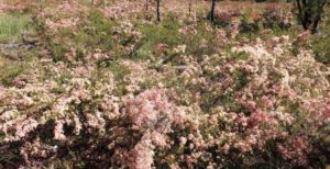
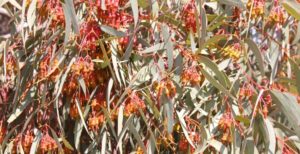
We stopped for lunch near a flowering gum tree

We stopped for lunch near a flowering gum treeWe gave ourselves an easy day on Saturday with only 137 kilometres to the steam museum town of Peterborough. This reasonably substantial town is on the main Sydney to Adelaide railway line, which is also the line on which ore mined in Broken Hill makes its way to the smelter at Port Pirie. Peterborough was a major rail town during the days of steam. It now uses its heritage as a tourist attraction.

The day had improved by the time we had booked into the Peterborough Caravan Park but a chilly night followed. Sunday morning was overcast, but as we made our way to Broken Hill the clouds made way for real warmth from the sun.

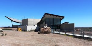
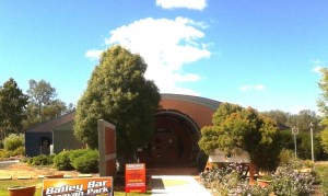
The restaurant building at the Miners' Memorial.

The restaurant building at the Miners’ Memorial.

We booked two nights at Broken Hill to allow for shopping for the final days to home but also to allow us to do the tourist thing. We drove to the Miners’ Memorial at the top of the huge mullock heap that separates the town from the mining area. We were disappointed to find the memorial buildings closed. The restaurant and adjoining gift shop that was so “in” when we were last there, seemed completely closed and the actual memorial building was closed for renovations as well.

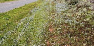
Roadside flowers on the road to Silverton

Roadside flowers on the road to Silverton

After lunch we drove the 24 kilometres to the historic silver mining town of Silverton. Not much remains of the original town but most remaining buildings have been restored and “reading desk” type information signs provide details of restored buildings and some other features. The amount of vacant space between the remaining buildings and relics

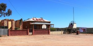
With new owners the Silverton Coffee Shop may reopen.

With new owners the Silverton Coffee Shop may reopen.

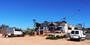
indicate that it was a substantial town. A coffee shop, still operating on our last visit, is now closed, although the building has been sold. The pub seems to do a good trade and the Mad Max Museum continues to pull in devotees. There are also two or three artists who work from galleries in the town.


Silverton's Mad Max Museum

Silverton’s Mad Max Museum

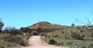
The approach to the Day Dream Silver Mine passes the old smelter flue on the hilltop

The approach to the Day Dream Silver Mine passes the old smelter flue on the hilltop

This visit we did the side trip to the Day Dream Silver Mine, where I did the underground tour. The mine is about 15 kilometres off the Silverton Road. In its day the mine was a rich source of silver with its own smelter sighted on a neighboring hill top to take advantage of gravity to assist the smelting process. The tour visited points of interest on the surface before we donned hard hats with miner’s lights for the underground portion of the tour.
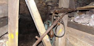
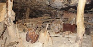
Mining equipment under ground. Visitors can stand at the drill and gain some idea of what it was like to work in the mine.

Mining equipment under ground. Visitors can stand at the drill and gain some idea of what it was like to work in the mine.

The mine was quite deep, descending four levels. There were only a few steps, as the tour followed the sloping shaft that had itself followed the ore body into the bowls of the earth. The irregularities of the floor provided for secure footing and stout hand rails had been installed.


A display of mining tools in an area where the roof is supported by local timber.

A display of mining tools in an area where the roof is supported by local timber.

Mining tools, both manual and mechanical, were on display in appropriate locations throughout the mine. The guide was an experienced miner with a real gift for telling the mining story. To hear it all right where the underground activity occurred made it all very real. We finished the visit with a mug of tea and fresh scones, baked on the premises.

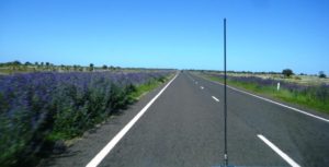
This photo was taken from the moving vehicle. There were no shoulders on the road to pull over.

This photo was taken from the moving vehicle. There were no shoulders on the road to pull over.

Tuesday was about making distance in an attempt to avoid rain and strong head winds. Cobar, yet another mining town, was our stopover destination for Tuesday evening. The only town between Broken Hill and Cobar is Wilcannia, where we stopped for fuel. After leaving Wilcannia the elevated roadway runs for several kilometres over Darling River flood plains, before entering low hills.

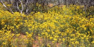
Massed floral displays between Bourke & Cunnamulla

Massed floral displays between Bourke & Cunnamulla

Generally the terrain is flat with only modest hills to provide some variety. Recent rain is evident from water lying beside the road and the abundance of greenery. And wild flower! The sides of the road were covered in masses of purple blooms. The purple is frequently interspersed with a variety of smaller flowers. Periodically the pastures are covered with masses of yellow and white. While watching such natural beauty, the kilometres and hours passed relatively quickly.

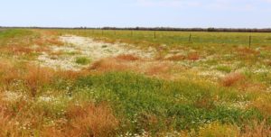
More roadside floral displays

More roadside floral displays

For the second day in succession we have driven past endless kilometres of road side gardens. Colours of white, blue, yellow, orange and shades of red have appeared like a planted garden against a background of the greens of grass, shrubs and trees. Periodically patches of white, yellow and red have run out of sight, between road side trees or reached in masses towards the horizon of the open fields.

The drive was between Cobar and Cunnamulla with a brief refueling stop at Bourke, a distance of around 415 kilometres. We saw the first evidence of the amount of rain that has fallen through the area. Up to now all we have seen, besides the rain, has been abundant grass and wild flowers.

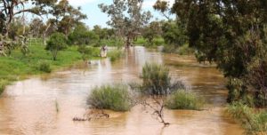
Several streams had broken their banks.

Several streams had broken their banks.

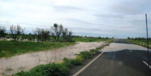
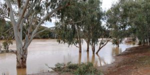
The level of water in the Darling at Bourke was the highest that I have seen in several visits. North of Bourke, drainage channels beside the road were full of water. North of the Queensland /NSW border several streams had broken their banks and a few centimeters of water were running across the pavement in two places.

The remaining water over the road was shallow but had obviously been deeper.

The remaining water over the road was shallow but had obviously been deeper.

From Cobar to Burke we were on the final section of the Kidman Way. From Burke we had joined the Mitchell Highway that terminates where it joins the Landsborough Highway at Augathella. But it all seems to be part of the Matilda Way, but I’m not sure where the Matilda Way starts and finishes. But it is a busy road being a link between Southern capitals and both Northern Territory and Queensland and carries a lot of heavy traffic. We met several over dimensional loads, one requiring us to move right off the road.

The weather had been warmer, but the forecast is for rain and reduced temperatures over night and for the next few days. Fairly strong winds were forecast. When they eventuated they were behind us, pushing us along.

The swollen Warrego River at Cunnamulla. Water heading for the Darling River

The swollen Warrego River at Cunnamulla. Water heading for the Darling River

Before we booked into the caravan park at Cunnamulla we drove through town to check the water level in the Warrego River. The water level was well below the bridge but much higher than we had ever seen it before.

The forecast rain caught us at Cunnamulla but the greater part of it fell to the north of us. The rain had passed through by morning but we caught up with the last of it on the way to St George.

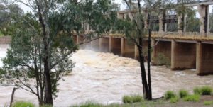
Water flooding over the weir on the Bolonne River at St. George

Water flooding over the weir on the Balonne River at St. George

Another 300 kilometres of flat road, some of it a bit narrow but most quite rough, due to periodic flooding, I suspect. The Weir on Wallam Creek, beside the road at Bollon, was overflowing as was the major weir on the Balonne River at St George. All of the excess water is heading for the Darling and the Murray Rivers.

The only disturbance to a peaceful night at the Pelicans Rest Caravan Park was the yapping of two dogs in the caravan next to us, whenever something disturbed them.

Flowering shrubs between St George and Dalby.

Flowering shrubs between St George and Dalby.

Dalby was our destination on Friday, which would have been another 300 kilometre day. But we were there by lunch time so decided to go on a further 100 kilometres to Yarraman. This very pleasant town sits almost at the foot of Bunya Mountains and has a caravan park atop a hill. We had been travelling in sunshine all that day, pushed along by a stiff but a cool westerly, that moderated by evening. But we still needed the heater that night.

On Saturday morning the easterly aspect of our overnight position gave us a brilliant sunrise and a promise of a day with temperatures in the mid twenties.  Saturday was the first day of a long weekend so the road was busy, particularly the lanes leading away from Brisbane. Traffic accumulating behind us made it necessary to keep the rig moving and to pull over occasionally to let our “tail” go by.

We arrived home just before lunch, to start the tasks of unpacking and cleaning and to deal with two months accumulation of dead gum leaves, blown down by winter winds while we have been away.

The promised temperature eventuated. I am back in shorts and all is right with the World.

So ends another trip, shorter in duration than originally intended but not much shorter in distance. We lost about two weeks to wet weather but the days that it did not rain were mostly sunny although sometimes kept rather cool by persistent winds. But we had a good time, saw some new places, met new friends and learned new things.

We can’t ask for much more, can we?

A Different Way There … And Back – Post 2

Day 5 – 31st March 2013 – Charleville

At some point during the night I turned the air conditioner off and pulled up the doona. Rain had been falling all night. We awoke to a grey sky and weather reports that told us that it was 17C, half of yesterday’s temperature. Are we in Melbourne already?

We got a bit of a fright at lunch time. We turned on a second light and it came on very dimly. We then noticed that the lights had gone out on the refrigerator. Oh no! Not battery charger problems on a one year old van. Fortunately not!  On our short test trip to check on our electrics for bush camps I had to replace a fuse. To get at the fuse box I had to unplug the battery charger … and forgot to plug it back in. So we had been living on charge put into the battery when moving since we left home. The battery had been progressively discharging. All seems well now.

Intermittent rain fell all day so we stayed in the warmth of the van and read, including tourist information in our reading. The forecast for tomorrow is for fine weather, so we will check the place out.

I guess you don’t normally think of a town facing in a particular direction but Charleville definitely faces south, because that is where the tourist money comes from. North Queensland has a wet season and a dry season. Charleville has a “Grey Nomad” season and a “Rest of the Year” season. Charleville is on the main route that Victorians and South Australians take when starting out on The Big Lap (around Australia). Most lappers do the lap in an anticlockwise direction.

Charleville Info Centre

Charleville Information Centre

Tourist authorities have marketed the town well. The Information Centre is on the Mitchell Highway to the south of the town. Most lappers do the around Australia lap anticlockwise so will only ever approach the town from the south. Their printed material is excellent, particularly the visitors guide that they produced annually. Activities are set out in detail with times, amount of time to allow and the cost. And most things have a cost. Some have a substantial cost. Perhaps they think that grey nomads have money running out of their pockets this early in the circumnavigation.

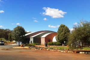
Info and Cosmos Buildings

Cosmos Centre Building

Weather permitting we will look at some of these attractions for you, and us, tomorrow.

Day 6 – 1st April, 2013 – Charleville

Yesterday’s rain was followed by a fine sunny day so, after breakfast, we set off to see the town. We started at the Information Centre, located at the southern entrance to town. It is part of the Charleville Cosmos Centre, which in turn is the jewel in Charleville’s crown. The information centre is modern, contains a very pleasant coffee shop and all the information on other relevant destinations that you could want.

The Cosmos Centre is about looking into the heavens. Charleville normally has an abundance of clear skies so is ideal for things celestial. The main event occurs at night but there are a number of simulated activities, some of them interactive, that can be used in daylight hours to cater for those who don’t get to the evening show. For those who have an interest in such matters, or first timers, it is a great opportunity see the realms beyond.

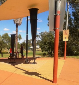
Clement Wragg's Vortex Rain Guns

Clement Wragg’s ineffective Vortex Rain Gun

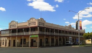
From there we took a look at meteorologist Clement Wragg’s Vortex rainmaker guns that didn’t make rain and then took the Timber Walk to view samples of the trees and shrubs that grow in the area. As this was Easter Monday the town was closed but we walked the main street to get a feel for the town. All was quiet. Even the famed Hotel Corones was closed for business. The old lady is in need of much TLC but tours and after noon teas are available spasmodically now but will rev up as the southern tourists start to move through.

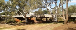
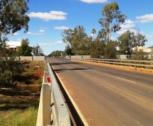
Warrego Bridge & Flood Barrier Bridge & Barrier 2

Two views of the bridge and flood barriers

Charleville floods regularly but now has a flood barrier along the banks of the Warrego River. But the town has that “what’s the use” look about it and could not be described as attractive. It is, in fact, quite down at heal.

Hotel Corones

Hotel Corones looking a little tired

After lunch we drive 20 km out of town to look at Ward River, a local fishing location. We found a body of water larger than the Warrego with fisher folk doing their thing.

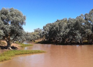
Ward River

Broad waters of Ward River

Ward River Fisher Folk

Fishing in the shade

When we came back to the park at lunch time, a sandwich board at the gate proclaimed a camp oven dinner to be available that evening, so we booked. The operators erected a marquee under which they set up metal open fire containers for cooking and ambiance. Attendees were required to bring a chair, plate, bowl and cutlery. The main meal was a large ladle of mashed potatoes covered with an even larger ladle of excellent beef stew with Johnny cakes made of damper mixture. Dessert was apple crumble with custard followed by genuine billy tea. Great meal and we met some great people.

Day 7 – 2nd April – Charleville to Mitchell – 181 km

With only about 180 km back to Mitchell we were able to make a leisurely start and cruised sedately along a road that we had almost to ourselves. The high point was refuelling at Morven.

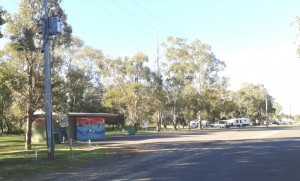
Neil Turner Weir camp area

Neil Turner Weir camping area

We located the free camp site at Neil Turner Weir and were set up in time for lunch. About an hour later Bruce and Annie arrived. We met this couple at St George last year. They would have been in the Mount Moffatt group but they are off on a four month trip to NT and The Kimberly. We have kept in touch but our paths crossing here gave an opportunity to catch up physically. We examined their new and well fitted Isuzu D-MAX Ute, had dinner and a chat around the camp fire and turned in with almost total darkness and near complete silence. There were probably twenty or so other campers there, but they were all quite as mice.

Early Morning Departure

An early morning departure

Day 8 – 3rd April – Mitchell to St George – 283 km

Our original path from Mitchell was directly to St George but problems with the Wi-Fi function on our wireless broadband modem dictated that we return to Roma, as that is the only town in which we would find a Telstra shop. So, armed with a new 4G Wi-Fi modem that would fit in your pocket, we headed to St. George via Surat. The country is similar to that between Roma and Mitchell but flatter.

Surat, a name familiar to many from the Surat Basin gas fields, sits on the high bank of the Maranoa River from where its citizens can watch the fairly frequent floods. At the bridge plaques show photos of the river in flood with the tops of the street lights at waist height above the water.

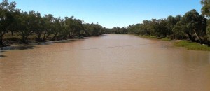
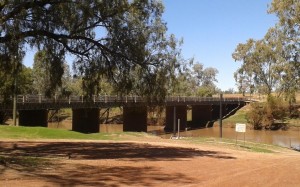
Warrego River not in flood

An unflooded Maranoa River

We spent the night at the Pelican Rest Caravan Park at St George with not a pelican in sight.

Day 9 – 4th April – St George to Lightning Ridge – 230 km

The destination at day’s end was Lightning Ridge to call on another couple that we had met at St George last year and then called on at Lightning Ridge a few days later as we travelled south. Trevor and Margaret live near Murwillumbah in northern NSW but have a family cabin on an old opal mining lease that has been converted to a residential lease. It is in the scrub surrounded by the evidence of opal mining.

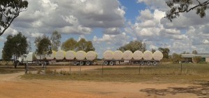
St George is Cotton Central. The harvest is in full swing and the roadside is scattered with the whisps of cotton that blow off as the journey is made to the cotton gin. Trucks like the one below are frequent company on the road.

Cotton bales

We parked our van in the yard beside their camper and that of Margaret’s brother and his wife (another Margaret) with whom they were travelling. They were only there for a few days so we were lucky that our passing through coincided with their brief stay. A bar-be-cue meal was followed by yet another talk session around a camp fire. Trevor and Margaret, together with the brother and wife, visited the most remote parts of the Kimberly last year, so there was much travel talk to be enjoyed.

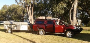
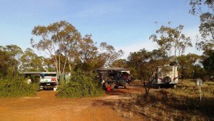
Parked at Lightning Ridge

Parked at Lightning Ridge

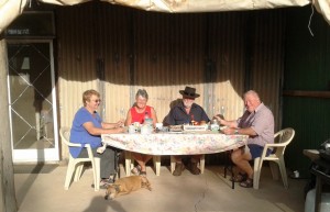
Our hosts at breakfast

Our hosts at breakfast

Then, another very dark and quite night, but a night that seemed long to this early waking bloggist. Our crossing into NSW the day before meant that the sun did not rise until an hour later. Why can’t these people in the south keep normal time?

Day 10 – 5th April – Lightning Ridge to Dubbo – 357 Km

Today was just a straight forward run from Lightning Ridge to Dubbo. Talk about flat country! From the Central Highlands of Queensland (where we were supposed to be at Mount Moffatt) to the Great Dividing Range north of Melbourne the country hardly hosts a decent hill let alone a mountain.

Castlereagh River

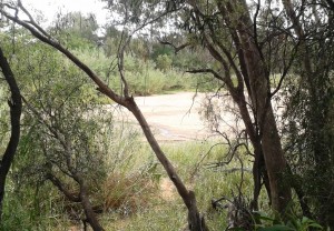
A sandy Castlereagh River

From Walgett we followed the Castlereagh River through Coonamble and Gulargambone (I love that name) with the source of the river in the Warrumbungle Ranges to our left as we approached Dubbo. The Warrumbungle Ranges are quite an impressive sight up close but from a distance they appeared to be almost cowered by the vastness of the gently rising plain. The area is known as the North West Slopes and Plains. An aptly descriptive name!

In the caravan park in Dubbo they placed our modest van between two huge fifth wheelers. They must be trying to stop us getting too big for our boots!