Destination Tasmania – Part 16 – Southern NSW, Canberra and Home

14th to 18th March 2020

Please note: A link to a video covering material included in this blog post can be found at the bottom of the post.

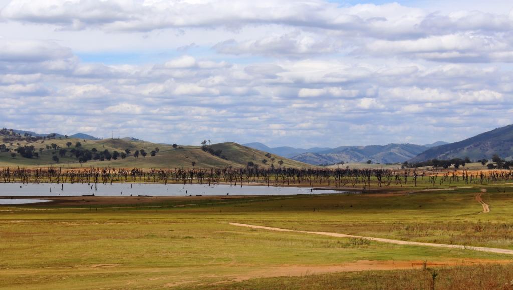
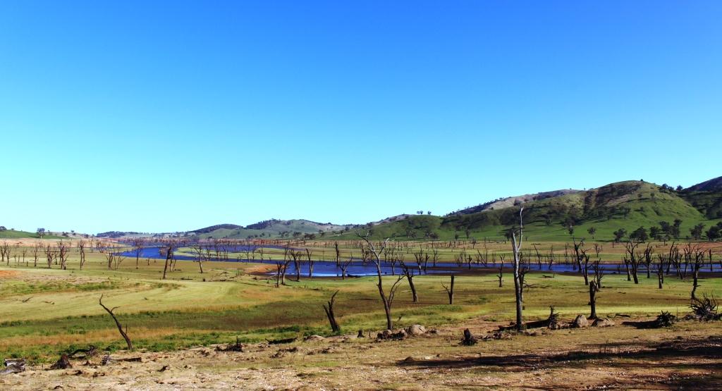
We awoke to a view over Lake Hume and a chilly morning with blue skies. Great touring weather but the tour is almost over.

The plan had been to stay at Corryong or Khancoban the previous night and drive the Alpine Way to Jindabyne that day But we had not reckoned with the Bush Fire Relief Fun Day to be held that day in Corryong, or the weather. There was not a bed to be had in that area so we ended up at Hume Weir, as reported in the previous post. And despite our clear morning the forecast for Thredbo was snow above 1,400 metres, rain and temperatures ranging from zero to 6C. The chill wind was a north easterly, blowing from where we had intended to be. It felt as if the snow was already falling.

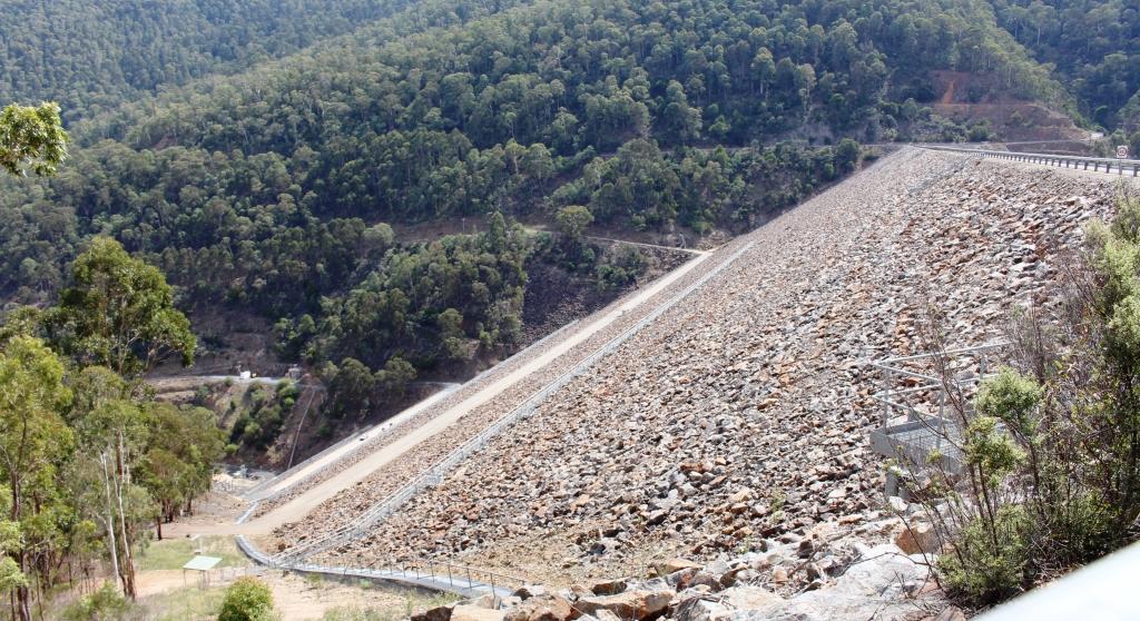
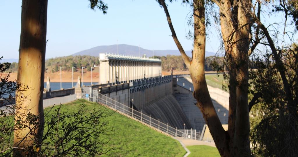
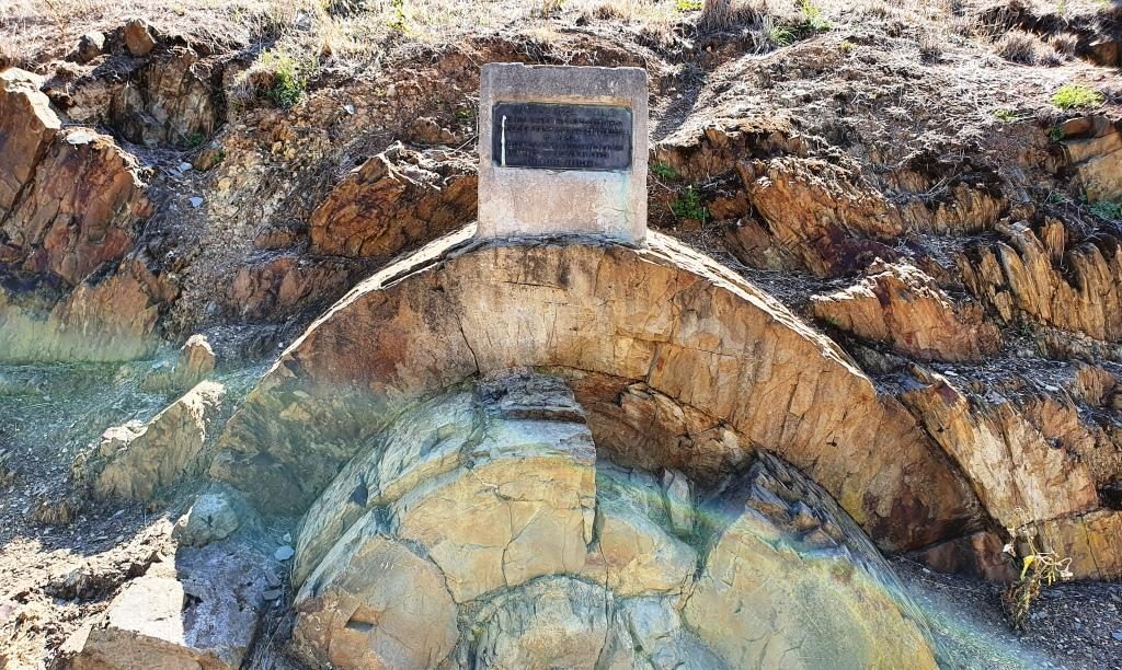
So we started the day by taking a look at the Hume Dam retaining wall and floodgates (pictured in the previous day’s post). The floodgates don’t appear to have been used recently. Then, rather than spend the day with the tedium of a four lane highway all the way, we added a side trip.

The bridge over the Murray River at Bellbridge, Victoria

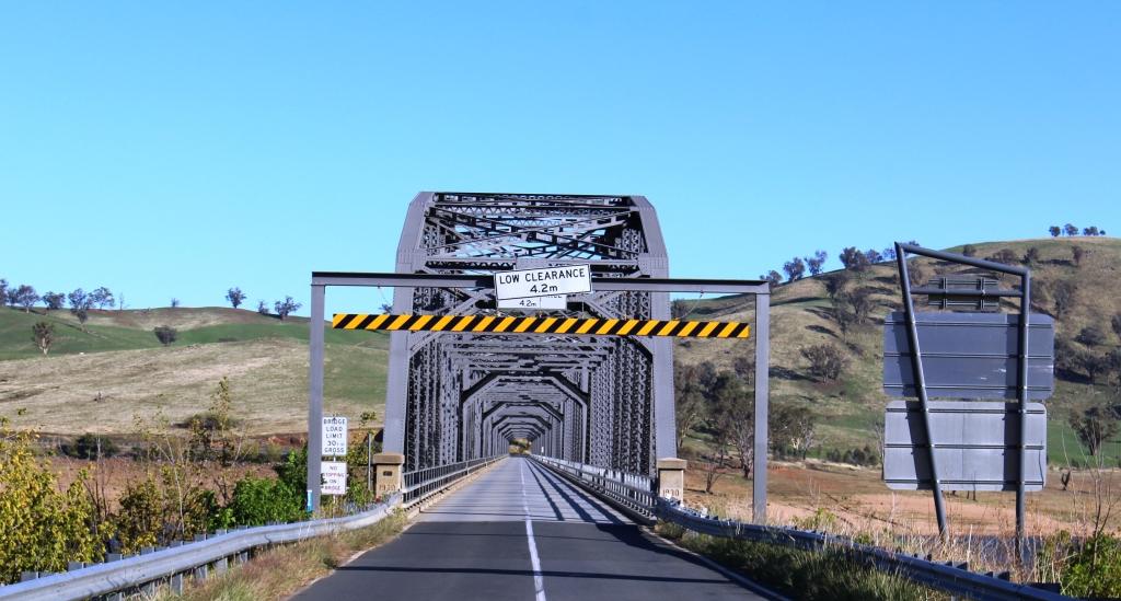
We crossed the Murray River proper over a rather magnificent iron bridge just north of the dam, back into Victoria, at the small town of Bellbridge. The road that we had travelled the previous day followed the inlets on the south side of southern arm of Lake Hume that swing back into Victoria, the inlets created by streams flowing in from the south. Today we followed the NSW/Victorian border, which is the southern bank of the Murray, initially following the south bank of the northern arm of the lake and then driving mostly within sight of the stream.

Trees that have died while inundated by the waters of Lake Hume now line the banks of the clearly defined original stream.

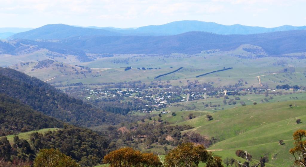
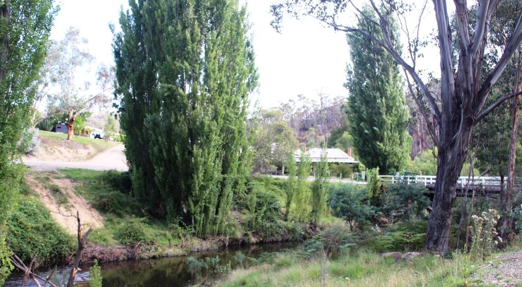
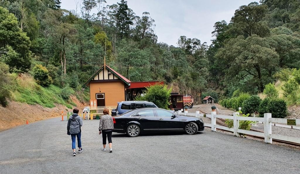
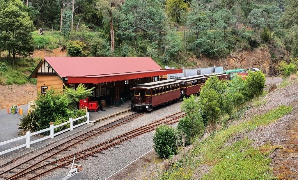
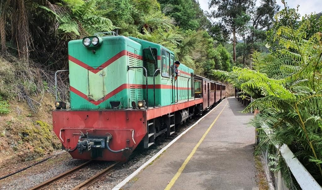
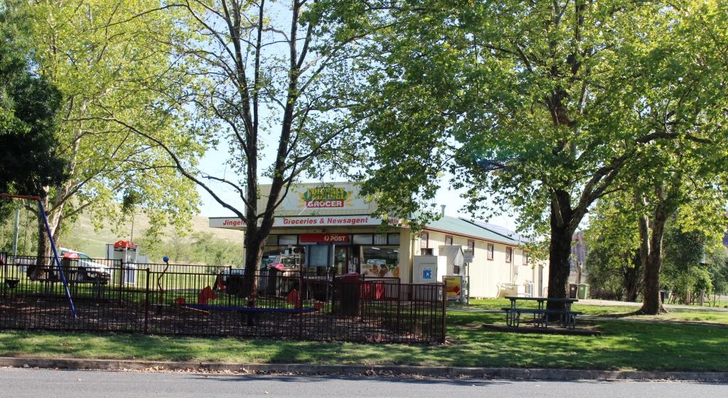
After 95 km we crossed the Murray at Jingellic, pausing there for coffee. It is a place that I had wanted to see, after passing signs on the Hume Highway that point towards it, for the better part of 60 years.

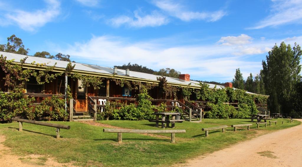
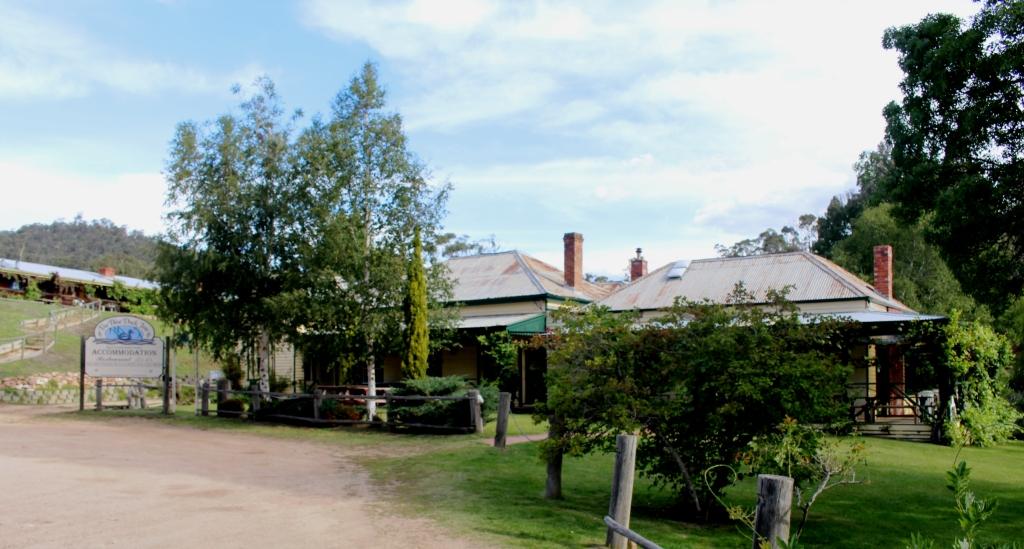
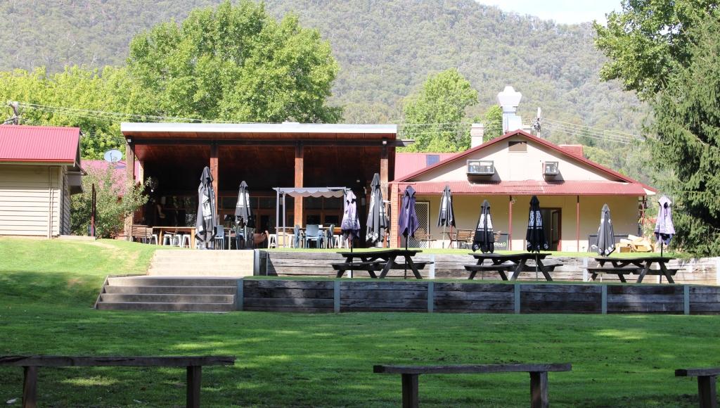
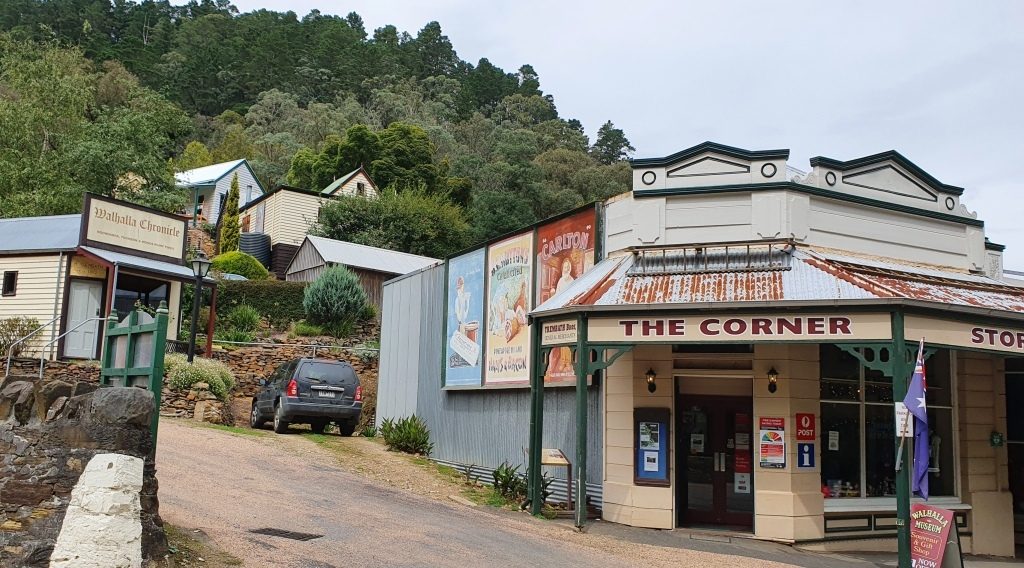
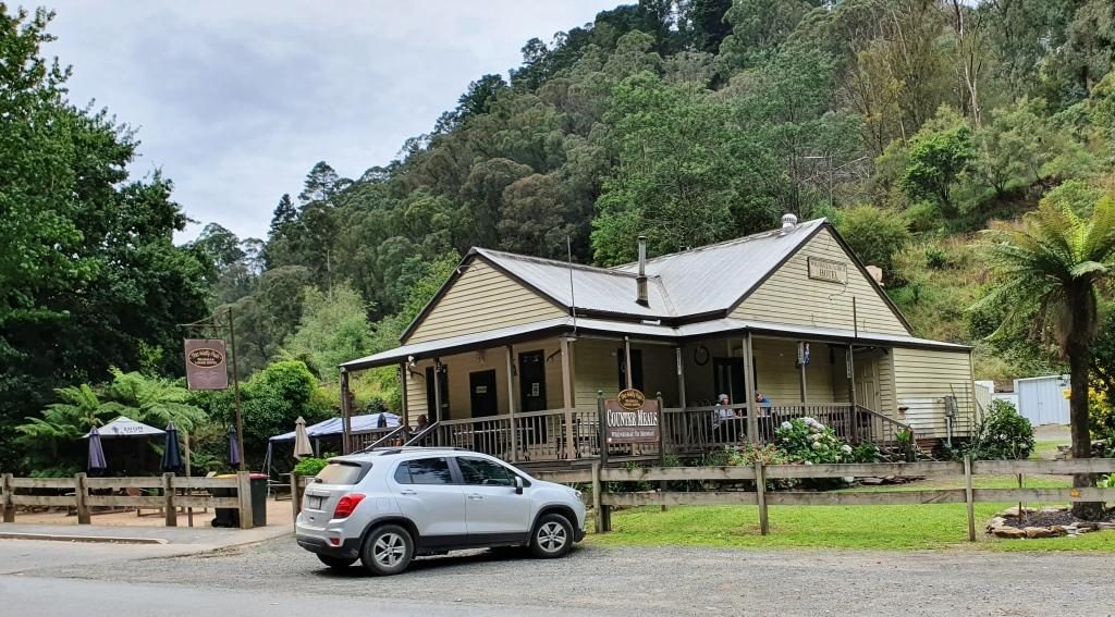
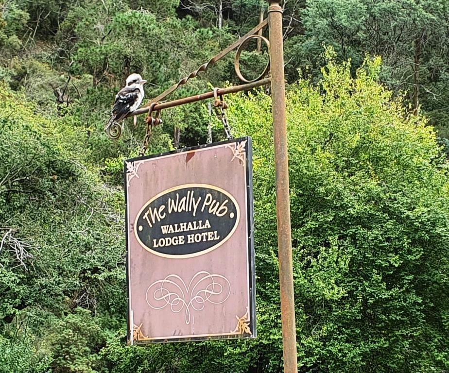
There is not much to the town. It has just a few houses, a general store, a show grounds that double as a low cost caravan park and a pub. We missed the pub. It was down a side road out of sight.

Mount Alfred Gap Lookout rests on a summit on the Victorian side of the border with NSW, provides picnic facilities and a view of the Murray valley. And a fine sculpture of a Wedge tailed eagle.

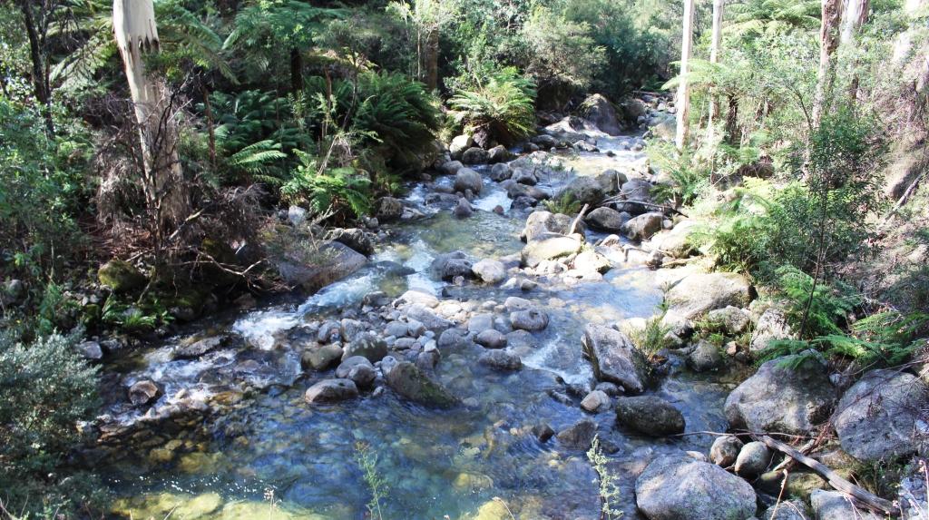
The countryside is beautifully green with mobs of cattle, mostly dairy cows, grazing on the lushness. Periodically, we came upon caravans parked right on the river bank. We passed the last of the backed up water well before we reached the point to which the water had backed in earlier days.

The view from Mount Alfred Gap Lookout

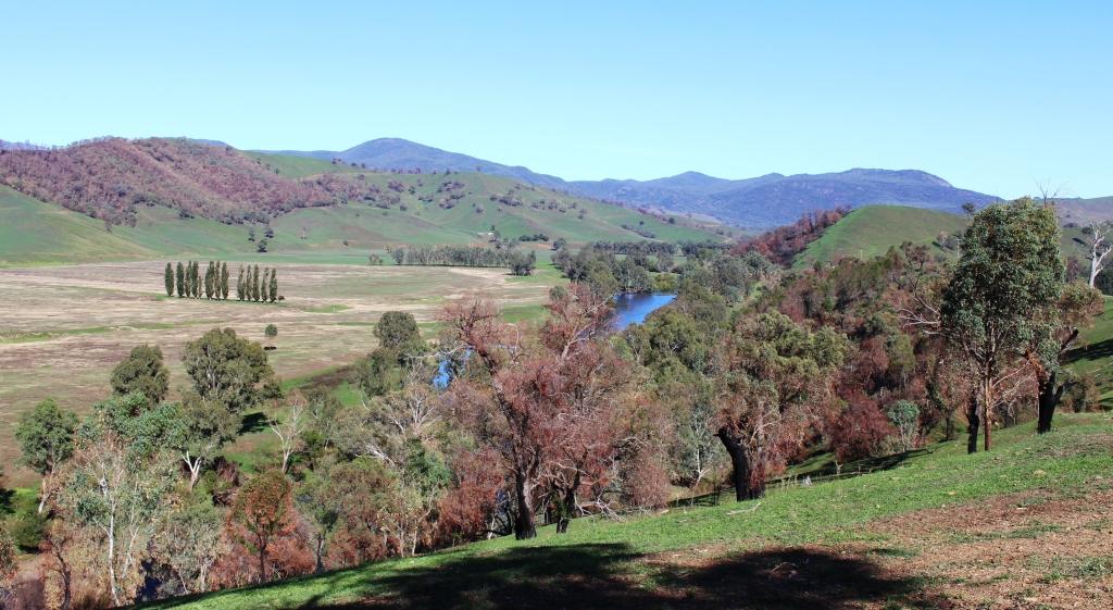
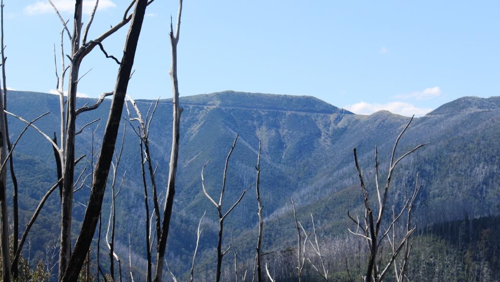
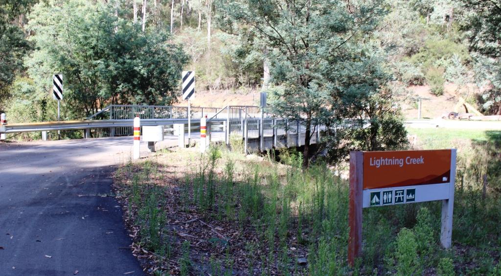
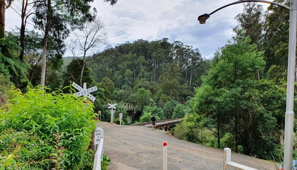
Just before we crossed the river at Jingellic we started to pass through extensive burned areas. Whole mountain sides of bush and pine plantations had been scorched. Jingellic had not been missed by much. Fires north of there, near Tumbarumba, were reported on news broadcasts as being quite severe with that town largely evacuated.

Jingellic General Store

We returned to the Hume Highway at Holbrook, an inland town known as the home of a submarine. One of the Japanese subs that attacked Sydney Harbour during WWII was on display in a park for as long as I can remember. But the Japanese sub has gone and been replaced by the top half (cut off at the waterline) of HMAS Otway, a decommissioned Australian submarine.

The top half of the HMAS Otway on display by the roadside at Hollbrook, NSW

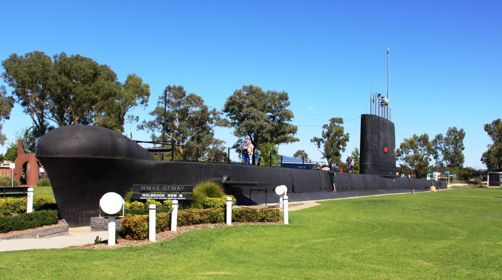
I can’t find what happened to the Japanese sub but I think it is in a museum somewhere. Or was it returned to the Japanese? Can someone tell me?

The Hume Highway was not carrying much traffic so we made good time, pausing at Gundagai for lunch and arriving at Canberra just as rain started to fall. We were booked into Canberra for two nights. There are always things to see in Canberra. A visit to the War Memorial is never a waste of time so was on the agenda.

Canberra is a widely spread city. Our accommodation was at a hotel at Gungahlin, in the outer northern suburbs. We had a drive of near to 20 km to our first visiting point.

Parliament House from the Telstra tower

Two nights in Canberra meant a sleep in. Partly to let the clouds drift away and partly to be a bit lazy, we spent the morning in, delaying sightseeing until after an early lunch.

Telstra Tower viewed from the car park at the summit of Black Mountain.

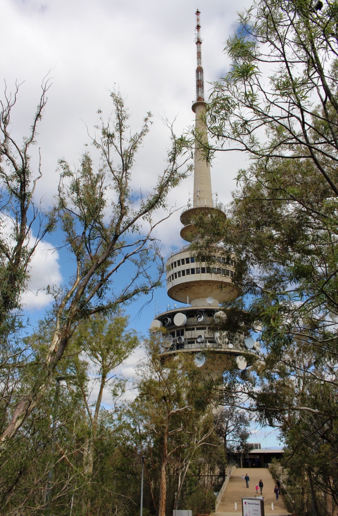
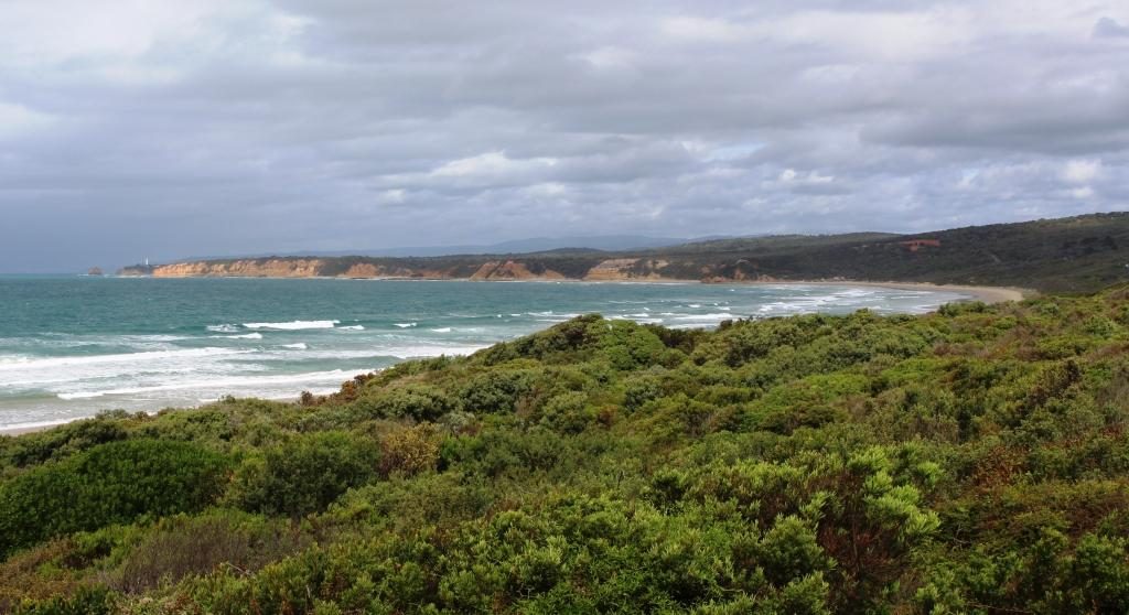
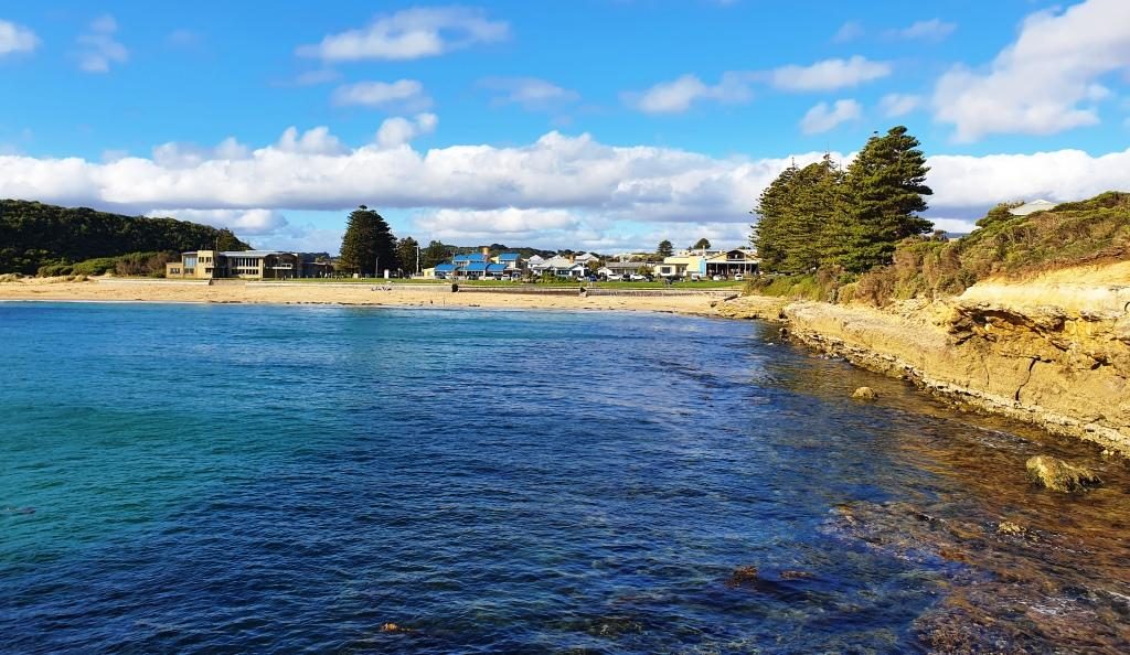
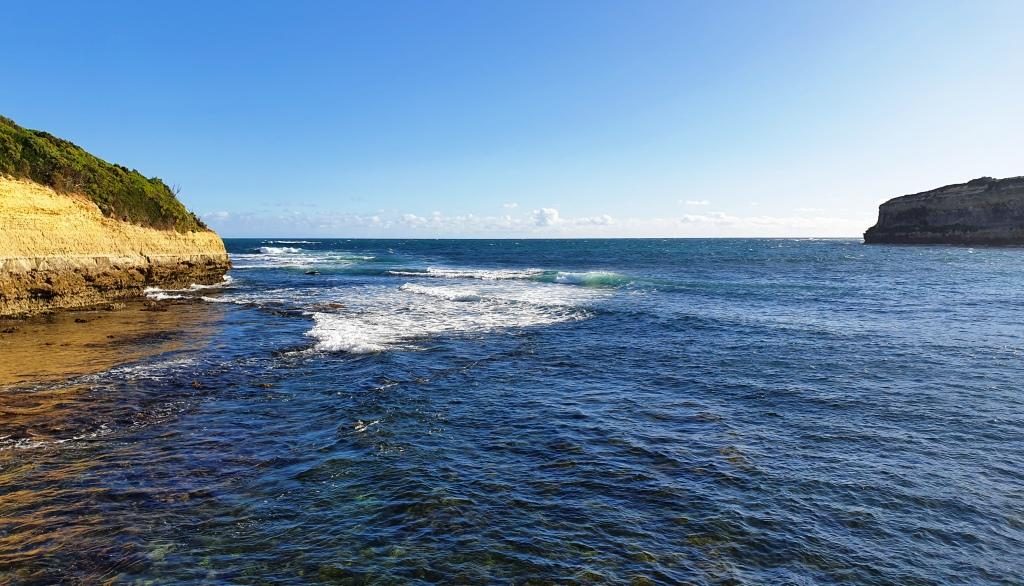
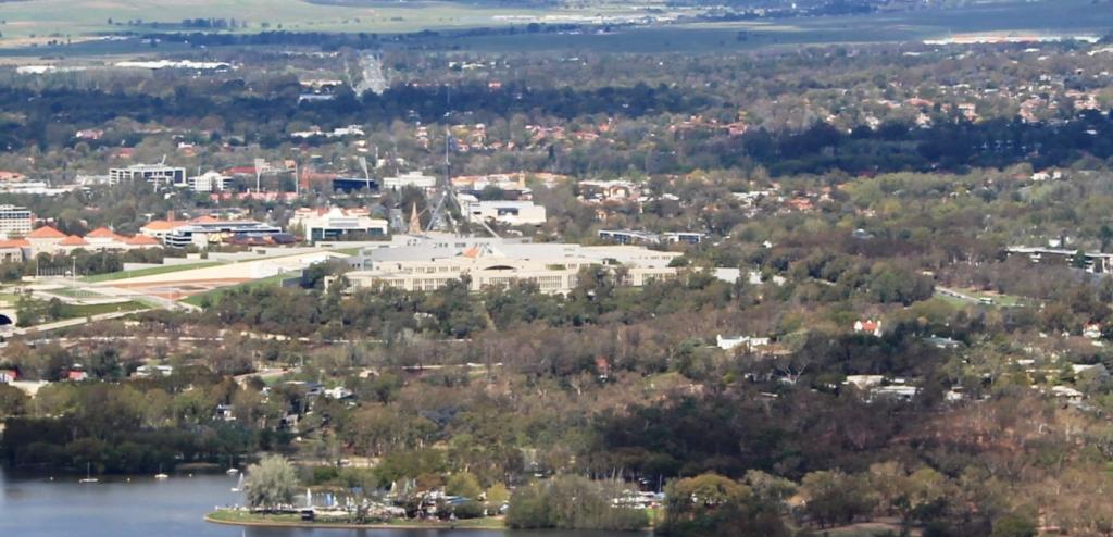
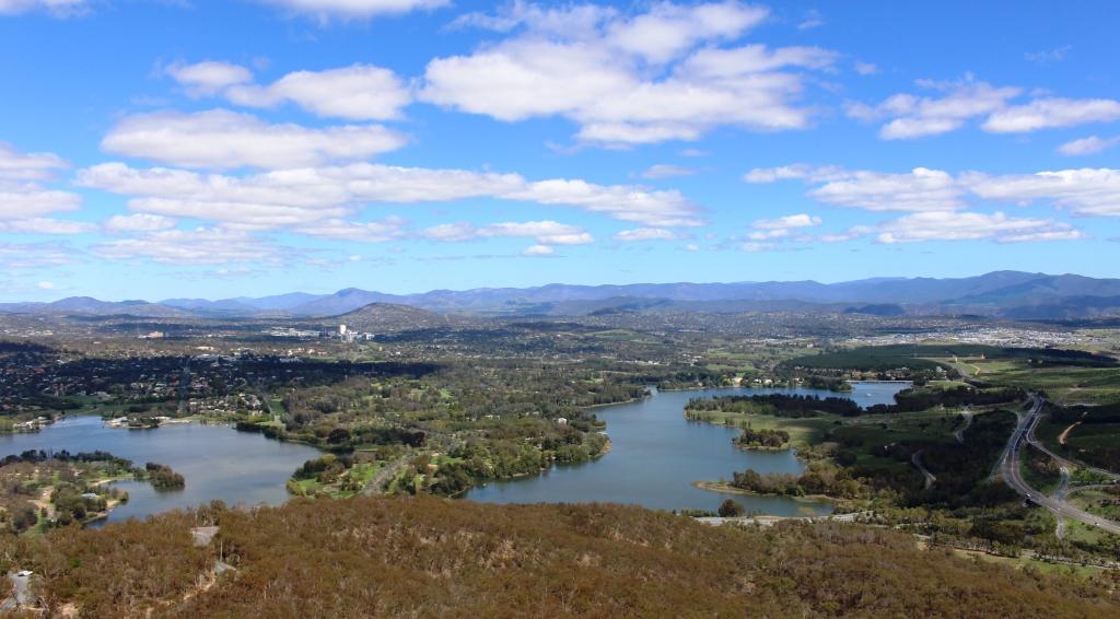
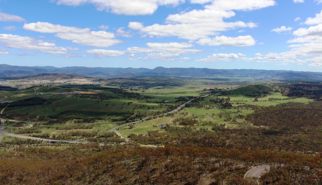
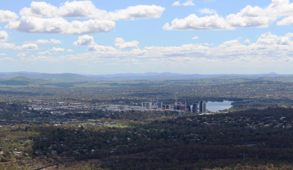
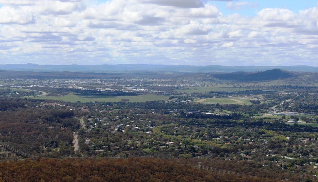
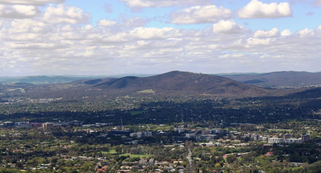
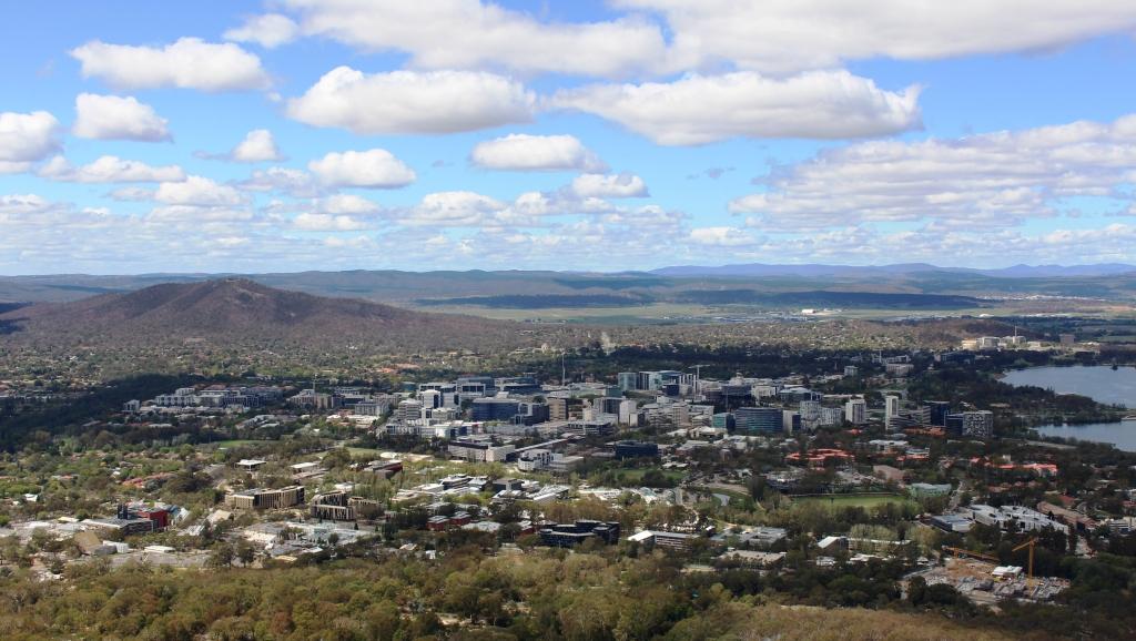
If you want to see all of Canberra there is only one place to go and that’s to the Telstra Tower on Black Mountain. This rocky peak is located in the middle of Greater Canberra. It rises to 812 metres above sea level. The Telstra Tower is at the top. Two levels of observation decks are accessible by elevator. This vantage point allows for a full overview of Canberra, its suburbs and the surrounding hills and countryside.

Parliament House and Lake Burley Griffin

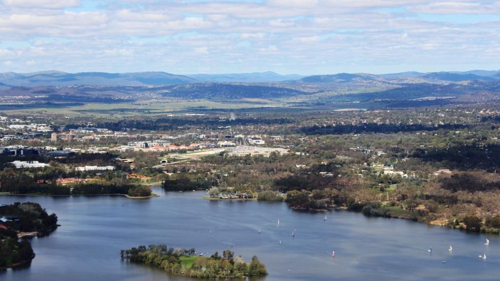
I took a series of photos giving views all the way around from the top open deck. A selection appears below.

View to the south from Telstra Tower. Government House is located on the peninsula on the lower right.
A view to the south west. Note new suburbs under construction
The high rise by the smaller lake is the suburb of Belconnen and its surrounds.
The view to the north east from Telstra Tower
Mount Majura provides a eastern boundary for Canberra suburbs.
Canberra city area. Canberra airport can be seen at the centre right of the photo.

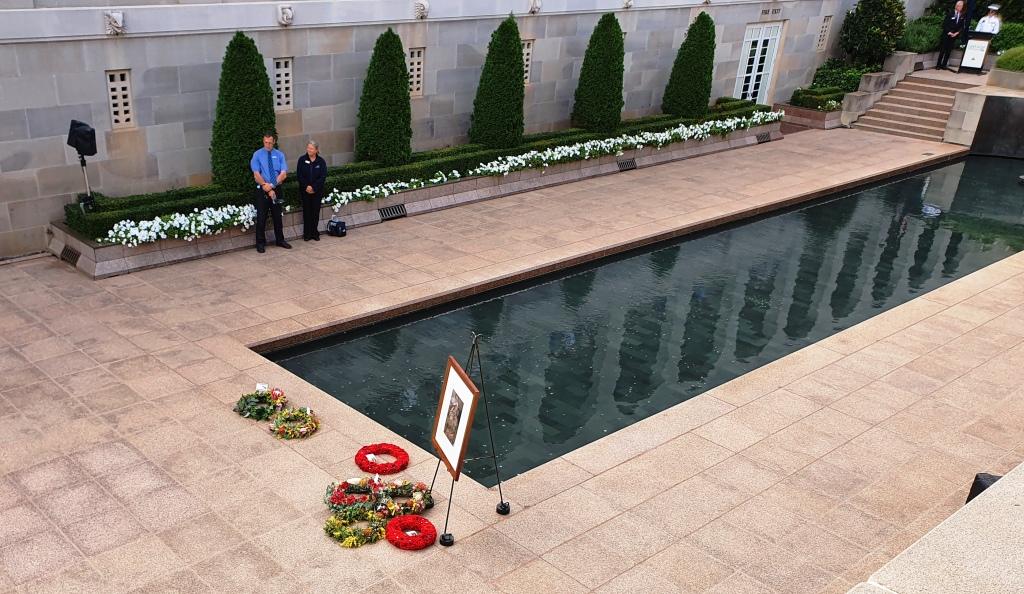
We then visited the Australian War Memorial. We normally spend some time there when we visit Canberra. There are normally changes and new exhibits, particularly if we have not visited recently.

The central courtyard at the War Memorial is flanked by the galleries that record the names of the fallen. Note the remembrance poppies that can be seen beside names in the gallery to the right.

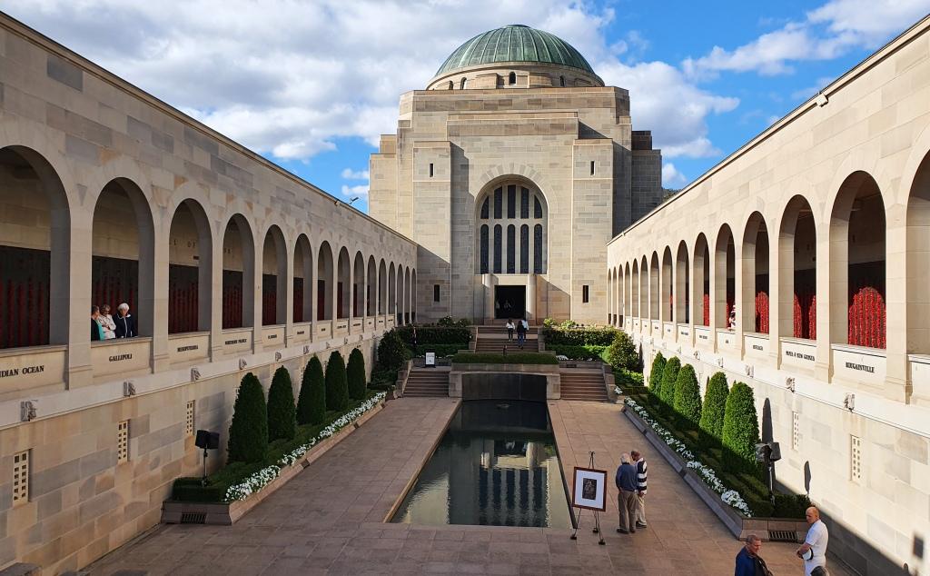
I didn’t take any photos of the displays but only some outside shots. Because we were there towards the end of the day we were able to stay for the daily closing ceremony. We had time for a quick afternoon tea break at the conveniently located Poppy’s Café. We had to be quick as they were about to close.

Family members and those laying wreaths wait for the start of the ceremony.

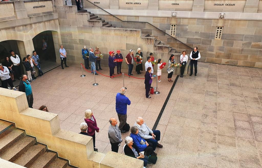
Each day a different service person who lost their life during hostilities is featured. Their photo is displayed and their story told by a currently serving member of the armed forces. Often relatives of the fallen service person are present and take part in a wreaths laying ceremony. The National Anthem is sung and the last post sounded. The ceremony is held in the central court near to the reflective pool and the eternal flame. It was a very moving experience.

The photo of the honoured service person of the day with wreaths placed during the ceremony.
The final message at the pedestrian entrance to the car park.

We had planned to spend a couple of days at daughter Briony’s unit in Sydney, as she was away for a few days. But with the seriousness of the corona virus situation becoming clearer, we had decided to give up on that plan and head home.

Our interim destination became Bowral, in the NSW Southern Highlands, to visit Ruth’s youngest brother and our sister-in-law. We had an invitation to lunch. Following this very pleasant occasion we departed mid afternoon for Katoomba, to spend the second last night of our trip.

Travel via Katoomba was a longer way home but we wanted to see fire damage in the Blue Mountains. We had heard that fire had burned very close to the Three Sisters. There was no sign of fire damage from the Great Western Highway.

It was drizzly and cold when we arrived at the motel so we deferred visiting Echo Point until next morning.

Big mistake! Next morning dawned with a thick fog over the mountains that hung well below the altitude of Katoomba. We didn’t break out of the fog until well on the way to Lithgow.

We spent one more night along the way at Moree, arriving home about mid afternoon on Wednesday 18th March.

In all we had driven just over 10,000 km and had been away for 50 days. The distance Melbourne – Devonport – Melbourne did not register on the odometer, of course but was a further 436 km each way.

Would we visit Tasmania again? Yes! But realistically, at our age, we don’t expect to have the opportunity again.

Destination Tasmania – Part 15 – Victorian High Country

11th to 13th March 2020

Please Note. Two videos covering material in this post ate to be found at the bottom of the post.

Our tour was not quite over. The Victorian high country is among our favourite areas. So, having bid our hosts goodbye, we set off over the mostly flat country of Northern Victoria, heading to Bright in the western foothills of the Victorian Alps. We arrived at about the same time as singer Katy Perry, who was there to perform at a bush fire fund raiser. She performed for about six thousand locals at a sports ground. The only evidence of this extravaganza was more traffic than usual and barricades blocking some roads.

Our track took us through Redesdale, Heathcote, past the back of the Puckapunyal military area to Nagambie and over to the Hume Highway near Euroa. Heathcote and Nagambie are both wine producing areas. Puckapunyal produces soldiers. We left the highway north of Glenrowan to drive through the wine country at Milawa (Brown Brothers) and on to Bright. Much of this area was tobacco producing back when smoking was not a proscribed social evil. Tobacco drying sheds can still be seen on properties that have been converted to other agricultural purpose.

Eurobin Creek on the Mount Buffalo Road

Before reaching our destination we turned at Porepunkah intending to drive to the summit of Mount Buffalo. But it is a long drive, continually climbing on what is often a narrow road with a precipice on one side. We gave it away at about 900 metres and returned to earth. Its summit is 1,721 metres above sea level, so we still had a long way to climb. It is at times like these that advancing age starts to show.

The Great Alpine Road approaching its highest point at Hotham Heights, travelling from Bright.

There was sufficient daylight when we arrived to see Bright, most of which we achieved while looking for our motel. It was hard to find, with Google Maps sending us along many streets that were never going to get us there. That was how we came across the Katy Perry barricades.

Dead trees from earlier bush fires appear like stubble on the ranges south of Hotham Heights

Unfortunately we were too early for autumn tints in the foliage. The copious quantities of poplars, maples and other deciduous trees had not yet started to stage their annual show. It is autumn colours that bring the influx of visitors to Bright each year. 

Sorry, there are no photos of Katy Perry.

The western gateway to Mount Hotham Alpine Village

The next day, Thursday, was a perfect day in the high country. We enjoyed endless blue skies with only a light wind all day. We waited for the time to reach 9.00 am in Queensland, made a couple of phone calls and headed out through Harrietville towards Mt. Hotham.

The top of a ski lift above Mount Hotham

Narrow winding roads with sheer drops to valley floors hundreds of metres down, only a few areas protected by Armco barriers and the possibility of meeting trucks and caravans. What fun! Actually we saw more cyclists than other vehicles, met no trucks and only one caravan.

Part of Mount Hotham Alpine Village

We stayed for only a short time at the 1,800 metres altitude of Hotham Heights before continuing to Dinner Plains, looking for lunch. We thought we were out of luck, but noticed a “coffee” sign and found a small shop called The Stables run by a very enthusiastic young lady who had only opened the doors of her new business on the previous Saturday.

Lunch stop at The Stables at Dinner Plains.
The hotel at Dinner Plains is a good example of the architecture of the whole town. It was still closed for the summer season.

The road between Hotham and Omeo took us through several areas burned in the recent fires. Some parts were burned on just one side of the road but in other areas, where the fire had come up the mountain, it jumped the road and continued on its way towards the higher ground. The ski fields of Hotham seemed to be untouched so the ski season will not be adversely effected. The area has had much worse fires in the past.

After a refueling stop at Omeo we drove the remaining winding kilometres to our destination.

A view of Omeo from the Great Alpine Road.

We first saw the Blue Duck Inn in 1965 when we decided to return to our home in Drouin in Victoria from Sydney, via the Omeo Highway. It was all gravel then but now fully sealed. We saw the building as we drove past and thought it would be great to return and stay. We drove past again a couple of years ago on a day trip from Omeo, but this time we realised our ambition.

Accommodation at the Blue Duck Inn at Anglers Rest

We were the only guests when we arrived but another couple came later. The number of diners reached 6 when another couple of about our age, who had their caravan in a camping area over the river, came in to dine. We spent a pleasant evening in their company.

The Blue Duck Inn at Anglers Rest

The cabins at Blue Duck are spacious and well fitted but lined with unpainted timber and heated by a wood heater. Mains electricity does not reach Anglers Rest so they generate their own. The generator goes off at about 10.00 pm and batteries take over so our rest was not disturbed.

The hotel dining room at the Blue Duck Inn. But I think that my smoked trout came from Tasmania and not from the stream that flows by the hotel.

Omeo was a gold producing area with mostly alluvial mining, so streams in the area were prospected to within an inch of their lives. But no gold was found at Anglers Rest. Failure to find gold in a stream is known as a blue duck. So the hotel that dates back to the 1890s was named the Blue Duck Hotel.

The Blue Duck Inn viewed from the camping area on the opposite bank.

The objective of this part of the trip was to drive the Omeo Highway. Staying at the Blue Duck Inn was part of that. So after breakfast on Friday morning we set forth to complete the task. The distance from Omeo to Tallangatta is 167 km. When we resumed our journey we still had 139 km to go.

The turn to the Lightning Creek rest area on Snowy Creek near Mitta Mitta

From Anglers Rest the road follows first the Cobungra River and then the Big River until it leads into serious mountains that carry the road to over 1,300 metres over the Great Dividing Range, before making its winding way into the Mitta Mitta Valley. The road then follows Snowy Creek all the way to the small town of Mitta Mitta where the creek flows into the Mitta Mitta River.

The Lightning Creek rest area had one tenant.

This neat riverside village is the first town past Omeo. There are several good rest areas with toilets and picnic and camping facilities along the way.

A weir in the Mitta Mitta River at Mitta Mitta
The rear of the Laurel Hotel overlooks the Mitta Mitta weir.

Very shortly after Mitta Mitta we reached the turn to the town of Dartmouth and the Dartmouth Dam. It is a detour of about 40 km return and well worth the effort. The wall, spillway and earth works are quite dramatic and would be awesome with water coming over the spillway. A hydro power station is located at the foot of the wall. A few km further downstream a small retaining wall has been built, with another power station, so the water is used twice before being released to flow down the valley into Hume Weir at Tallangatta.

The retaining wall at the Dartmouth Dam
The face of the mountain was removed to construct the spillway at the Dartmouth Dam
Downstream view of the hydro power station and the Mitta Mitta River

We continued on to Tallangatta and then followed the Murray Valley Highway, that skirts the southern edges of Lake Hume, until we turned at Bonegilla to finally cross the Murray River into NSW and to our cabin at Lake Hume Village.

The extent of the water in Hume Dam. Initially it backed up to Tallangatta which had to be moved and rebuilt on higher ground.

The water level in the dam is well down, so the water is often a long way from the road. There are several kilometres of grass lands on the valley floor where the dam used to back up towards Tallangatta, with cattle grazing on well established grass. It is now several, perhaps many, years since the dam has been full. I speculate, but perhaps not since the conclusion of the Snowy Mountains dam construction, much of which is in the headwaters of the Murray River.

The flood gate controls and spillway at the Hume Dam in the Murray River near Albury.

Destination Tasmania – Part 14 – Ballarat to Castlemaine

9th to 10th March 2020

9th March was a Monday. We spent some time driving around central Ballarat, including an attempt to drive around Lake Wendouree, which was thwarted by barriers sealing off some streets for a parade for the Begonia Festival. We had visited Ballarat for the festival in years long gone, when residents of Victoria. It is held on Victoria’s Labour Day weekend. We didn’t get to see any begonias this time but Ballarat was looking its normal trim self with its many well tended roadside flower gardens.

After coffee, we headed out to the north east towards Castlemaine where we were staying with friends for two nights. The road took us through Daylesford and Hepburn Springs, both towns being of high tourist significance. Here again I must apologise for no photos. I took quite a few, all on my smart phone, but they seem to have disappeared along with those of the latter part of the previous day.

Both towns were full of visitors taking advantage of the holiday long weekend. It was a beautiful Victorian Autumn day, with the sun shining from a clear sky but with a slight cool breeze that had us reaching for our jackets. But the locals were in shorts and tee shirts.

Daylesford has botanical gardens near the town centre on the top of Wombat Hill, with a road on which cars can drive and a restaurant that, from the number of parked cars, seemed popular. We found a parking space so that we could walk around to view the gardens.

We then drove out to Hepburn Springs to check that town out before returning to Daylesford for lunch. Parking was at a premium but sometimes you luck in and we did that day. As we drove along the main street looking for our chosen eatery, a car pulled out almost in front of it, leaving a vacant space.

My last trip to Daylesford was in the middle of a cold winter’s night, with temperatures about zero. I was delivering spare parts to a broken down truck. The impression today was rather different than on that night.

After lunch we drove on to Castlemaine, arriving at our friends’ home mid afternoon. We have known Keith and Lynda almost forever. We have a sort of family connection but we lived near to them during part of our time in Melbourne. I sailed with Keith and one of our children went to the same school as their children. I think our youngest is about the same age as their eldest. Or something like that!

A main street in Castlemaine
Buildings from just after the gold rush continue to provide premises for Castlemaine businesses.

On the following morning we all went into town for morning coffee and spent some time looking at the historic buildings, of which there are many. The main point of interest was the old market building that is now their tourist information centre. Although modernized in a heritage kind of way, the facilities that allowed the market stall holder to back a cart up to a platform and transfer the items for sale inside, have been retained.

The visitor information section of the old market building

Castlemaine was a gold town but also developed other industries including beer and engineering.

The gold rush that commenced in Ballarat came to Castlemaine in the early 1850s. Many of the old buildings date from shortly after that time. The Bendigo, Maldon, Castlemaine triangle was the most significant gold producing area in Victoria.

The diving bell on display in the main concourse of the Castlemaine Visitor Information Centre.

 Castlemaine’s engineering expertise is commemorated at the Information Centre. In June 1940 the liner “Niagara” left Auckland harbour carrying over $5 million in gold ingots. The gold was the property of the Bank of England on its way to America to pay for badly needed war materials.

Four hours into the voyage, the ship struck a German mine and sank, without loss of life, in 73 fathoms of water, much deeper than the depth limit for conventional diving.

The Navy said salvage was impossible but a private Melbourne company offered to do the job. They designed a diving bell that would allow a diver to reach that depth and direct the salvage cranes. The bell was built by the engineering company Thompson’s of Castlemaine. In all, 94% of the gold was recovered.

When the diving bell was retired it was returned to Castlemaine where it is now on display at the historic Market Building.

The Anticline in a Castlemaine street.

Part of an embankment to a street in Castlemaine has a rock formation called an anticline. Pressure has forced rock into a natural arch. Anticlines are relatively rare. This one was probably unearthed when streets were being constructed and left on display. The rocks in an anticline are of different geological ages with the oldest rocks at the centre of the formation. Google it if you want to know more.

Destination Tasmania- Part 13 – The Great Ocean Road

5th to 8th March 2020

Please Note: At the foot of this post you will find a series of videos covering the material that the blog post contains.

With our family visit concluded, we left Drouin in the continuing rain that followed the previous night’s heavy falls.

This ferry took us across Port Philip Heads from Sorento to Queenscliff

Rainfall was evidenced in flooded fields, overflowing drains and the odd closed road. As the day progressed the rain eased to persistent drizzle. We travelled to Sorrento on the Mornington Peninsular and caught the vehicle ferry to Queenscliff. Once again we experienced smooth waters without a white cap in sight.

The town of Sorento hiding behind the foreshore trees
The lounge area on the ferry

Queenscliff became the starting point for a short tour of the Bellarine Peninsular.  We drove through St Leonards, stopped at Portarlington for lunch, drove through Clifton Springs and Ocean Grove, to our motel at Torquay.

Queenscliff

Torquay seems to have become the capital of surfing in Victoria. The local area is known as “The Surf Coast”. Torquay has an externally impressive surfing museum.

The famous Bells Beach home of Victorian surf carnivals

We commenced the next morning with a drive around Torquay. Then, in the true spirit of surfing, we dropped in to Bells Beach. There we found some real waves pounding onto the beach but not a surfer in sight. Although the sun was shining from a mostly blue sky the surfers were absent. We did see some board riders a bit further down the coast.

A lookout platform overlooking Bells Beach

In Victoria it was the start the Labour Day long weekend so this area was busy with people away from Melbourne for a break. In Melbourne it was Moomba weekend and the Formula 1 car races.

Surfers in the water. A view along the coast north east towards Torquay
Point Addis township and beach

We drove in a generally south westerly direction along the Great Ocean Road and watched the weather deteriorate to a constant drizzle. We were able to see the points of interest and take short walks, but the windscreen wipers had been working for much of the day.

A distant view of Split Point lighthouse

After Torquay the succession of settlements are mostly small towns until you reach Lorne. We took our morning coffee break at Anglesea and detoured from the main road at Aireys Inlet to take in the Split Point Lighthouse. The short walk to the lighthouse provided good views of the coast in both directions and a direct view of the sandstone island that gives the point its name.

The lighthouse at Split Point. Tours are available. It is a short drive from Aireys Inlet
The off lying rock that splits Split Point

We had thought that Lorne would be our lunch stop but we were a bit early and found the town to be crowded with no convenient parking available. So we passed it by, as a lunch stop, and drove on to Wye River, where we found a cafe with a covered alfresco deck with views over the ocean.

The memorial arch on The Great Ocean Road. The road was started to provide employment to servicemen from WWI.
One of the many plaques along the road that commemorate progress with the project.

Before bypassing Lorne we had turned inland and drove about 10 km to Erskine Falls, a rather pretty spot with a short walk to see the actual falls.

View towards Lorne from the Big Hill, one of the major challenges of the road construction.
Erskine Falls

On the way back to the main road we drove into Teddy’s Lookout. That vantage point is located on the top of the hill directly above Lorne and provides great views of the road, snaking along the foot of the coastal mountains and views out to sea. The weather made the sea view rather bleak.

The viewing platform at Teddy’s Lookout at Lorne.
The Great Ocean Road wends its way around the foot of a mountain south west of Lorne
The Grand Pacific Hotel at Lorne. One of the early accommodation houses on the south west coast of Victoria.

Mariners Lookout, on a hill overlooking Apollo Bay, also provides great views over that town but unfortunately not for us. As we arrived at the car park the rain got serious again. So we drove on to our motel and booked in. The motel has very effective reverse cycle air conditioning so Apollo Bay will wait until tomorrow, when there is the promise of a better day.

The murk descending on the coast north east of Apollo Bay

When we checked into our motel our car was almost the only one in the car park. Overnight the car park filled up and so did the town. Saturday was market day and the long weekend crowd was out in force. With the town so full it was a good time to leave. We had more sunshine than forecast but not enough to attract people into the ocean.

The gate to the Cape Otway Lighthouse

From Apollo Bay the road turns inland to negotiate the mountain ranges that run down to Cape Otway. We took the indicated turn and drove to the lighthouse. I think we had been there a long time ago but I couldn’t see anything familiar at all, so perhaps I was remembering somewhere else.

Photo of the lighthouse site on the coast that stands at the entrance.

You don’t get to see the lighthouse close up unless you part with the best part of $20 and walk about 500 metres. Then Parks Victoria will give you a tour. The walk was too far for Ruth and I was disinclined to do it on my own so we decided against it. But a 350 metre walk down the Great Otway Walk got me to a point where I could see the top of the building over the trees, so that had to do.

Cape Otway Lighthouse from the Great Otway Walk
Dead trees from a long ago bush fire still stand and add their character to the scene

We returned to the Great Ocean Road, turning left to make for Port Campbell and the sandstone wonders of that part of the coast. 

After we emerged from the mountainous inland section of the Great Ocean Road we travelled through an area of valleys and hills until we reached the village of Princetown that overlooks the estuary of the Gellibrand River and a caravan park that is larger than the town.

The caravan park at Princetown. The Gellibrand River just gets into the picture on the right.
View of the Gellibrand Valley from the lookout near Princetown

Just past Princetown the highway ascends a coastal hill that provides a pull off point for a lookout that gives the best ocean views for a while. At about the middle of the beach immediately below the lookout, if the tide is right, the remains of the timbers of a wrecked ship are clearly visible.

View of the beach from the roadside lookout. The timbers from a shipwreck are clearly visible in the sand.

A bit further on, and just before you reach the Twelve Apostles you come to Gibson Steps that used to give access to the beach but no longer do due to their poor state of repair. They are locked off with a gate part way down.

The most north easterly of the Apostles taken from the truncated Gibson’s Steps.

When we were last in that area parking was beside the road, for a short walk to the cliff top. Visitor numbers have forced an upgrade. Now there is a huge car park on the inland side of the road and an large visitor centre. Access to The Twelve Apostles is through the visitor centre and on a path under the road to an elaborate arrangement of platforms, boardwalks and lookouts.

Tourists viewing The Twelve Apostles
Some of the remaining Apostles

There are not as many apostles as there used to be. Constant weathering has removed some of them and reduced the size of the others. There will be a time when they will not exist at all. Even in their reduced numbers they draw an ever increasing volume of visitors.

Another apostolic view
The main viewing platform for the Apostles

A couple of kilometres towards Port Campbell, Loch Ard Gorge is a gap in the coast named in remembrance of the clipper ship of the same name that beached on adjacent Mutton Bird Island on 1st June 1878, with only two survivors. The survivors made their way to safety through the gorge.

The narrow entrance of Loch Ard Gorge
Loch Ard Gorge beach
Outer entrance to Loch Ard Gorge and off lying Mutton Bird Island
A good example of the effects of erosion near Loch Ard Gorge

The walks around the gorge give access to some fantastic rock formations and expansive seascapes. Wooden steps lead down to one of the most protected beaches that you will ever see.

More examples of sandstone formations in the Loch Ard area

Our motel in Port Campbell overlooked the small protected port, itself a gap in the cliff, into which a stream flows at the western end of the beach. It is almost as sheltered as Loch Ard Gorge but somewhat larger. A substantial concrete wharf is tucked into a sheltered corner and is used by fishing boats and land based anglers.

Port Campbell Harbour

Port Campbell is a tourist town. Many of the buildings in its main street have been converted to restaurants and bars or other eateries or offer accommodation. It has two pubs and several motels. Many houses are B&Bs or private accommodation of some kind.

The entrance to Port Campbell Harbour

It is a most attractive town. We would like to have stayed longer but were lucky to get a booking for one night on Saturday of a long weekend.

The main street of Port Campbell

Sunday dawned another fine day but we again had rain overnight. There was a bit more cloud than the previous day. The temperature may have reached 20C.

The coastal area south west of Port Campbell. The vehicles are in the London Bridge car park

There were now only three things to look at to finish the Great Ocean Road. They were The Arch, London Bridge and The Grotto. All are past Port Campbell towards Peterborough. We visited them in that order.

Stairway to The Grotto

The first was about a 200 metre walk with some steep parts and stairs in the path. The second was an easy 50 metres to an extensive observation deck. The third was a walk of about 350 metres with steep sections and with about 70 steps to get the best view from near sea level.

London Bridge is a great example of erosion on the sandstone coast. There used to be a connection arch. It fell down without warning leaving some tourists marooned on the remaining part.

I had just climbed back up the stairs and decided to look at the photos that I had just taken. When I tried, I got a message that told me there was no data card in my camera. Shock horror! I checked, and sure enough, the card was not properly seated. I had not put it back properly after transferring yesterday’s photos to my phone. I do this at the end of each day to make it easier to select photos for my Facebook posts.

The beach on the coast at London Bridge. Note the perpendicular square edges cliffs

So back down 70 steps again and then a return to the other two locations to retake the photos that otherwise would be lost. By the time we did all that and had coffee it was about 11.00 am. We had thought that we would go all the way to Port Fairy, which is the official end of the Great Ocean Road, but that would take us 60 km out of our way. We turned for Ballarat on the road out of Port Campbell. But we did drive on as far as Peterborough before turning back.

The track to The Arch provides good views of sandstone cliffs

We travelled via Cobden and Camperdown, then through a number of small towns to reach Ballarat. All of the holiday weekend activity was on the coast, with very little action in the towns that we passed through.

A first look at The Arch
This is as close to The Arch as you can get without getting wet

As we drove away from the coast the pastures became less green but there were still plenty of cattle and sheep in the paddocks. I think, apart from the sheep, we travelled through mainly dairying country today.

Our Ballarat accommodation was out on the Melbourne side just off the Great Western Highway. Once checked in and settled we returned towards Ballarat city in search of our evening meal. Good old Domino’s Pizza came to the rescue.

Unfortunately the photos that I took as we drove from the coast to Ballarat were taken on my phone. For some reason they cannot be found. I don’t know why they deleted, but they are gone.

Destination Tasmania – Part 12 – Bass Strait & Walhalla

2nd to 5th March 2020

Please Note: At the foot of this post you will find videos covering the material that the blog post contains.

Our location for our last night in Tasmania provided a further benefit as we drove the short distance, through a morning shower, to the ferry. We had to turn at a roundabout that put all the traffic coming out of Devonport to catch the Spirit on our left, giving us right of way. But loading was still a slow progress as the ship arrived late from Melbourne. I felt sorry for the yellow coated attendants as they stood around in the rain waiting for something to happen.

Driving up the ramp to board the Spirit of Tasmania

We had another good Bass Strait crossing. The expected strong winds did not eventuate. There was a slight swell running through the Strait but not enough wind to produce white caps.

The wharves on the Mersey River and HMAS Stewart visiting its home port

We had travelled south on Spirit of Tasmania One and returned on Spirit of Tasmania Two. They appear to be identical twins and very suited to their task. We had no complaints at all about either of them.

The north coast of Tasmania sliding under the horizon. The flat coast does not suggest the mountainous nature of Tasmanian topography.

We had booked recliner seats for the return, as a cabin was not needed for a day crossing. The recliner seats are at the back of the vessel, facing towards the stern. There are four rows and the seats have full height backs so unless you are in the first row your view is of the back of the seat in front. So we spent much of the day in the top deck lounge where the view of the water was good and we were near food and coffee.

Point Nepean, the eastern headland of Port Philip Bay viewed from inside the heads

We reached Port Philip Heads in daylight and came up the bay as the daylight faded. We docked in darkness with the City of Melbourne a mass of lights ahead of us. Disembarking was a slow process as Melbourne’s peak hour traffic made it difficult for vehicles exiting the terminal to merge into the traffic flow.

Mount Martha and bay side suburbs of the Mornington Peninsula

But eventually we were moving and making our way through the near city streets to the Monash Freeway. Streets in the near city area have changed since we lived in Victoria and I was working in a near city location. Google maps didn’t have it quite right but we found our way to our hotel in Waverley, without too much drama.

Mount Eliza with its covering of prestigious homes

Friends who we had called on in Ballina on our way south were in Melbourne for a couple of weeks and staying quite near to where we were. So we arranged to meet them at a nearby shopping centre for morning coffee before we headed out to West Gippsland to where we were spending a few days with my sister and her husband.

A vehicular ferry operates from Sorento to Point Lonsdale

A visit to a supermarket indicated that the shelf stripping that we had seen in Launceston stores was more prevalent that we thought. We now know the full story, of course, but then we thought that the cause was the many Asian tourists with whom we had shared Tasmania. 

Empty shelves in a Melbourne supermarket

On Wednesday, after doing normal family catch ups, we joined our hosts and other family members in a day out into the mountains that are part of the southern Victorian Alps and lie to the north of the rolling hills of the agricultural country of West Gippsland.

Walhalla Town Ride. Left to Right: Brother Bernard, Sister Aileen, Brother-in-law Colin, Sister-in-law Helen (widow of deceased brother Winston) and Ruth.

Walhalla is a historic gold mining town about 90 km from Drouin. It takes about 90 minutes to drive there.  It is a well preserved heritage town with a full sized rebuilt railway that operates on several days of the week. It is popular with all ages and well patronised, particularly at weekends and very popular for school excursions.

The road bridge over the Tomson River

The original rail connection arrived in the mid 1920s, just as the gold started to be worked out and the town started its decline. In more recent years enthusiastic volunteers restored the line, rolling stock and infrastructure and volunteers continue to operate and maintain it.

Running along beside Springers Creek on the outward journey.

The final few kilometres of the road to Walhalla runs beside the Thomson River before crossing it to then follow its tributary, Springers Creek, to the town. Thomson River Station is located where the road bridge crosses the Thomson. It is to Thomson River Station that the train runs.

Walhalla Railway Station viewing outbound
The train ready for departure at Walhalla Station

The railway runs along Springers Creek opposite to the road and when fully operational turned downstream beside the river after Thompson River Station.  The ride is about 20 minutes out to Thomson River Station which is equipped with refreshment rooms just like the old days. The coffee was dispensed by a machine on the press of a button, so was not of coffee shop quality, but it was coffee and it was past coffee time by then. As we refreshed ourselves the train moved up the track so that the engine could be manoeuvred back to the front of the carriages for the return journey.

Thomson River Station with everyone aboard the train
The train about to move off to change the engine to the other end for the return journey
The Thomson River road and rail bridges viewed from the Thomson River Station

Train ride over, we drove up into the town and followed the main street as it wended its curving way through the narrow valley.  The commercial buildings stand beside the road and on the flat land beside the creek, but the rest of the housing steps up the steep hillsides. The accompanying photos tell more of the the story.

Trading continues in original and historic buildings in Walhalla

As you enter the town the mining area is on the left with convenient foot tracks and stairs leading to points of interest. We have looked at these before, when we were much younger. We had no difficulty in resisting the temptation to climb the steps that lead to the hillside path.

Band Rotunda, Star Hotel (closed) and a solicitors branch office.
The old Mechanics Institute building is now used for another purpose

The best known of the Walhalla gold mines is the Long Tunnel Extended Mine. Access to this mine has been preserved making it suitable for public inspection. Tours are conducted on a regular basis and have just recommenced following Covid-19 shut down. $20 will gain entry for adults or $15 if you rate as a senior.

Old buildings beside Springers Creek
More historic buildings that are still in use

From the train we had seen a group of teen age school children camping beside Springers Creek. As we came out of the pub after lunch we saw them again. They had made it back to town and had climbed to the hillside track to take a closer look at the mines.

The facade of the original gold storage vault
The stairway to the Long Tunnel Extended Mine

The only place available for lunch was the Walhalla Lodge Hotel which is a fairly typical country pub. The meals were generous in size and hit the spot after our train ride.

Out luncheon venue, the Walhalla Lodge Hotel
A more than adequate lunch for one
A Kookaburra waits patiently on the hotel sign. Waiting for scraps perhaps?

On our way back to Drouin we made a detour to look at a house that our niece (sister’s daughter) and her family had just bought but had not yet moved into. Such are the interests of family visits.