Note: A video link appears at the bottom of this blog post.
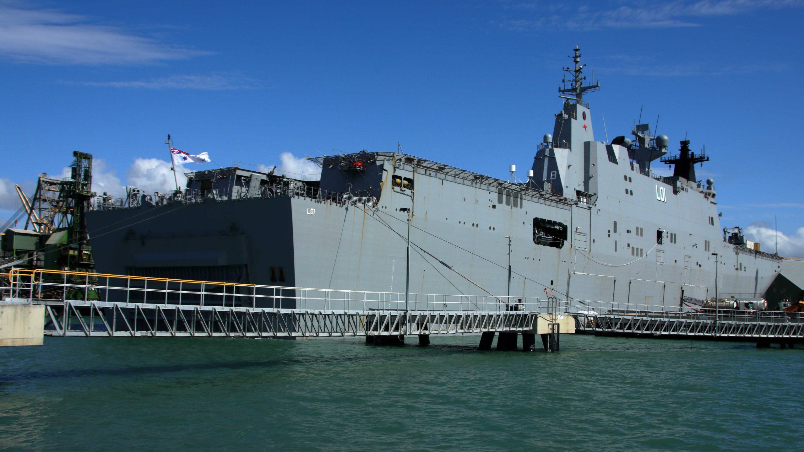
HMAS Adelaide in Townsville Harbour.
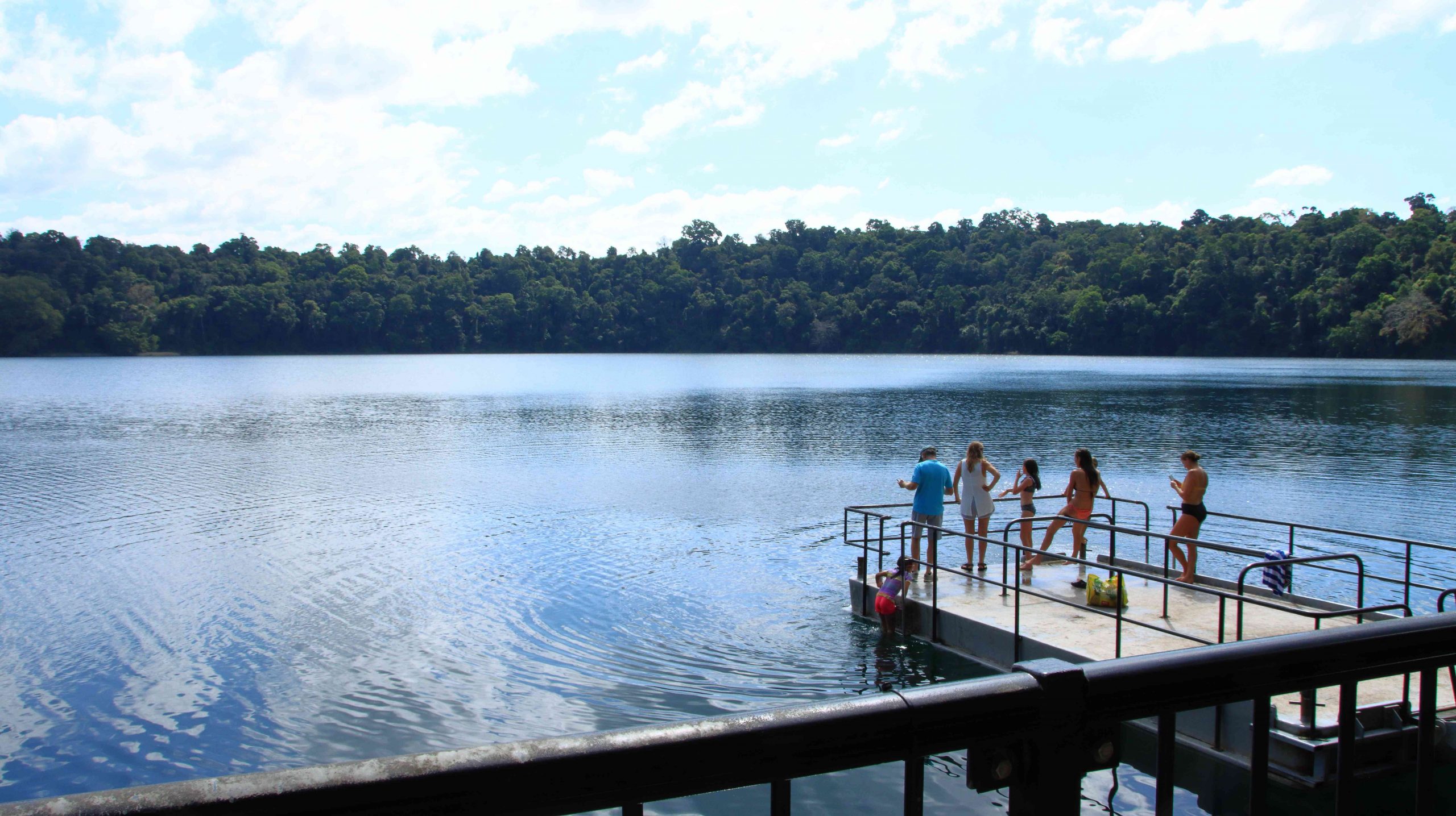
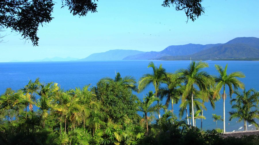
The ferry departed on time, turned in the limited width of Ross Creek and slowly made its way down the channel and out into the broader waters of Cleveland Bay. The harbour activities were on our right, including HMAS Adelaide, probably in port replenishing its supplies since it is a supply ship.
Reminder: Click on pictures to expand to full screen size.
Drilling Platform for Extension to Port of Townsville.
Substantial work is under way to increase the size of Townsville Harbour. As we cruised past we could see where work has commenced to construct footings for a sea wall to enclose a large area which will ultimately be pumped dry and filled, to allow the building of wharves and freight handling facilities. I understand that the existing port is literally bursting at the seams.
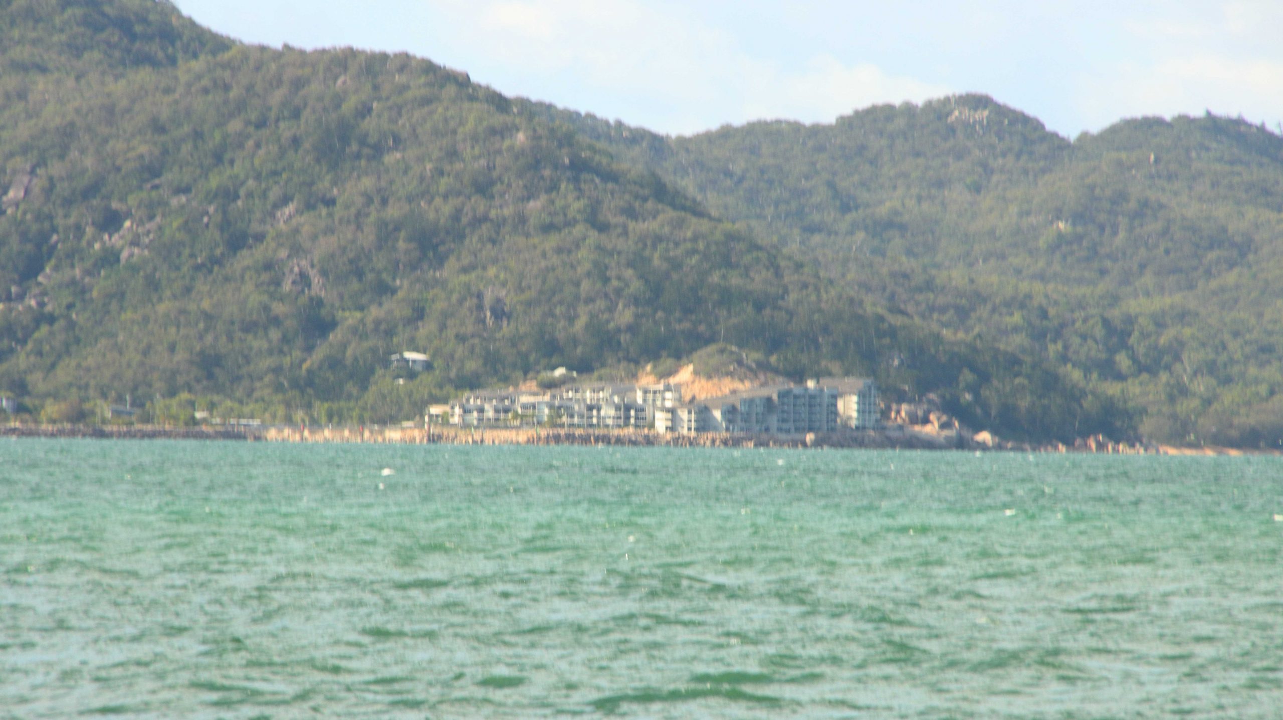
Distant Bright Point and Harbour Entrance
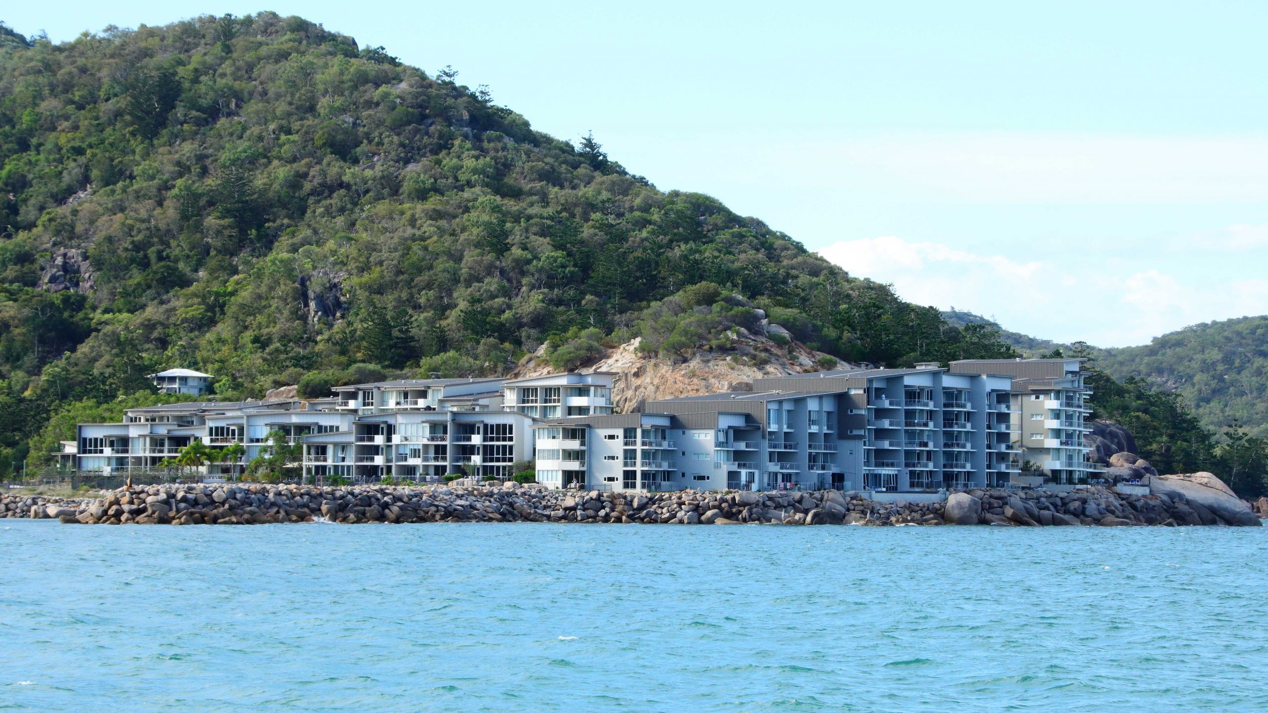
Luxury Units & Hotel on Bright Point, Nelly Bay.
SeaLink Ferry passing Luxury Units on Bright Point.
An Allied Rock Wallaby on a Rock. Eating.
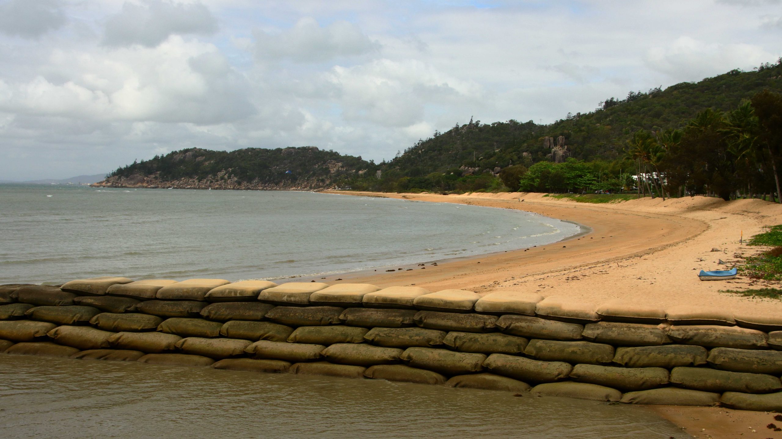
Nelly Bay Beach. Picnic Bay is just over the point.
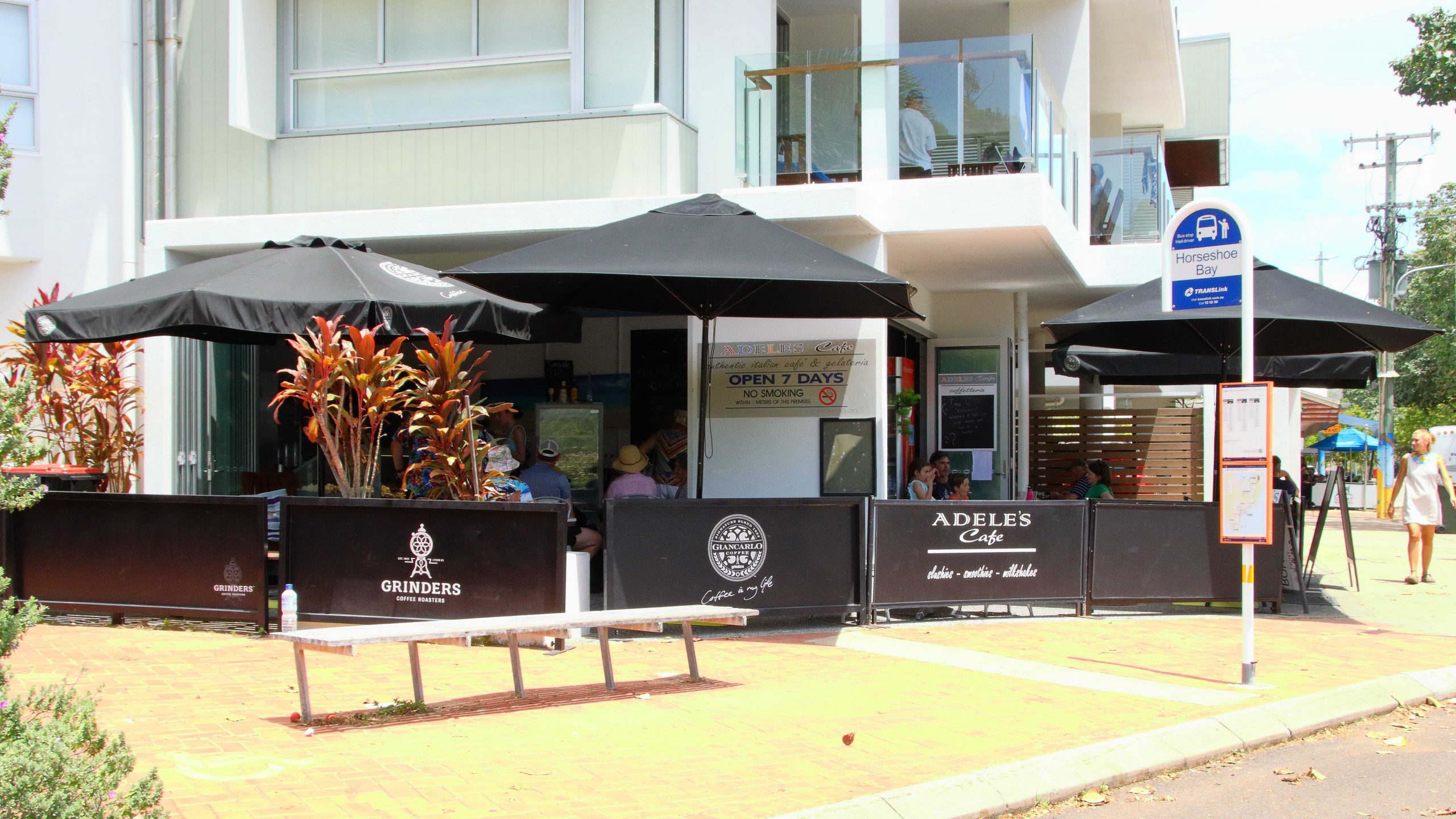
On our first day on the island we took it easy, with a slow start, although I did take a walk out onto the west side breakwater which was just down the street in front of our resort complex. After coffee we crossed the island to Horseshoe Bay and stayed for lunch. We returned in stages, looking at items of interest, such bays and headlands and other features.
Adele’s Café at Horseshoe Bay. Lunch venue on the first day.
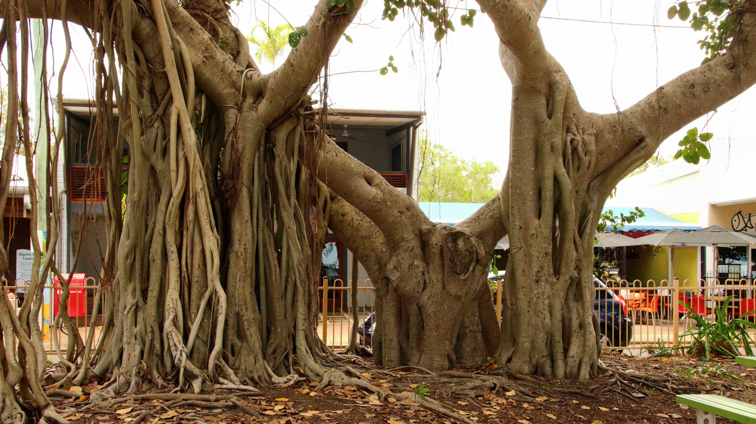
Large Banyan Trees are a Feature of the Horseshoe Beachfront.
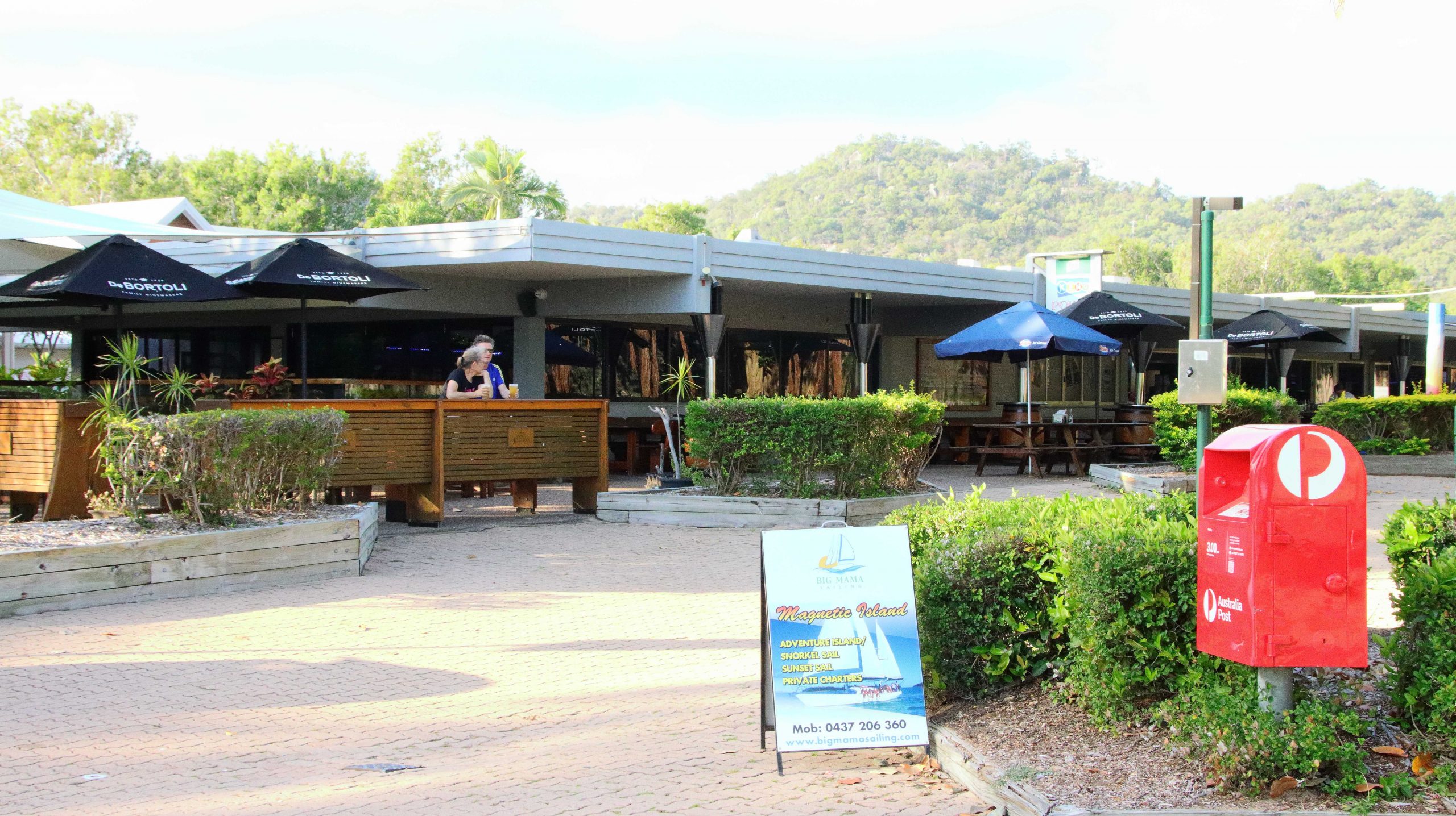
The ferry base is at Nelly Bay, near the southwest corner if the island. When you leave the ferry, if you drive to the left, you reach Picnic Bay, so named because in the early days Townsville residents would cross by boat to the nearest point on the island, for a picnic. It is a short drive. Just along Nelly Bay Beach, over a ridge and down to the town area, which is clustered around an hotel.
Allied Rock Wallaby Habitat.
Picnic Bay Jetty
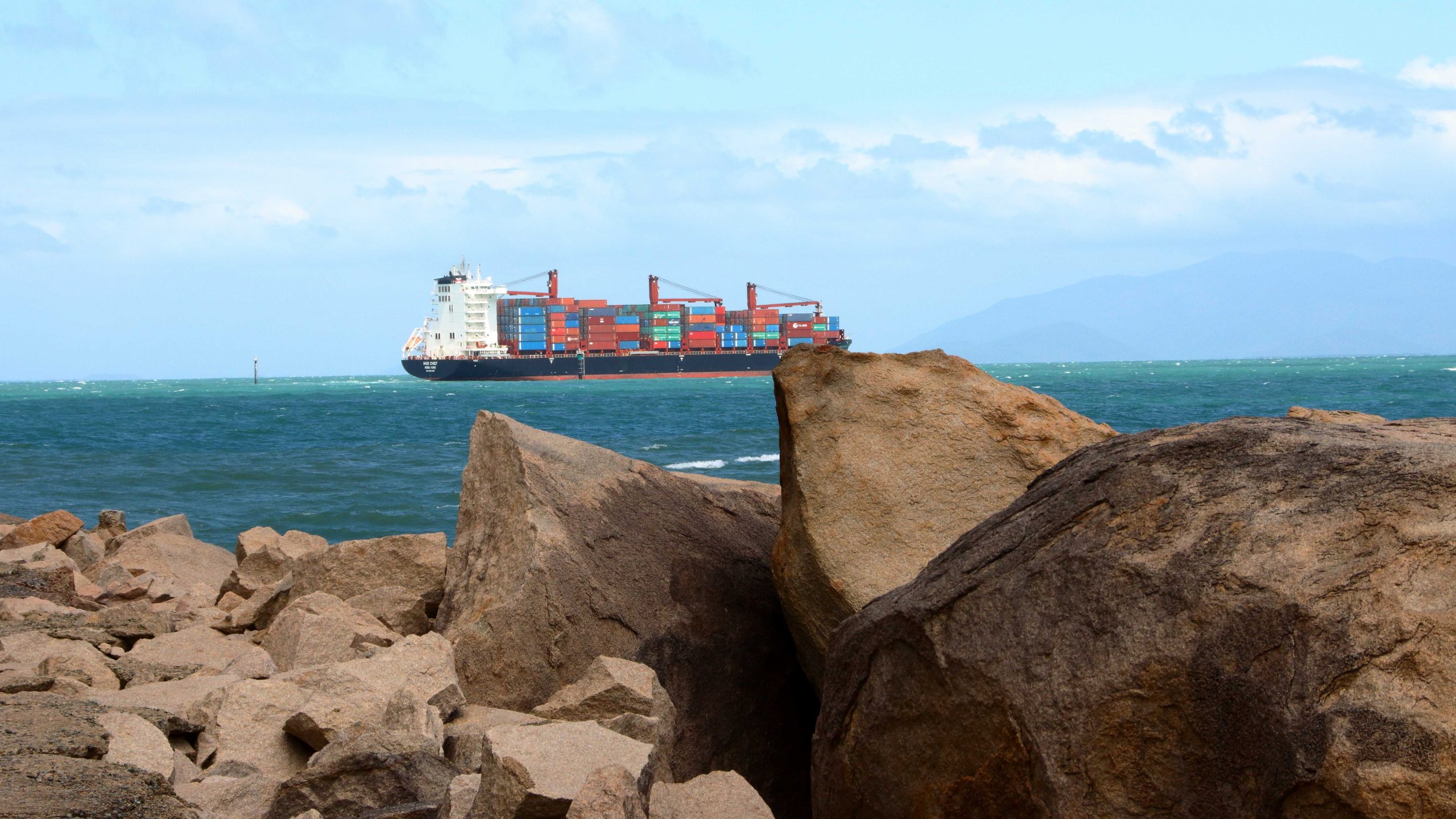
A Container Ship Passed Magnetic Island on its way to Townsville Harbour.
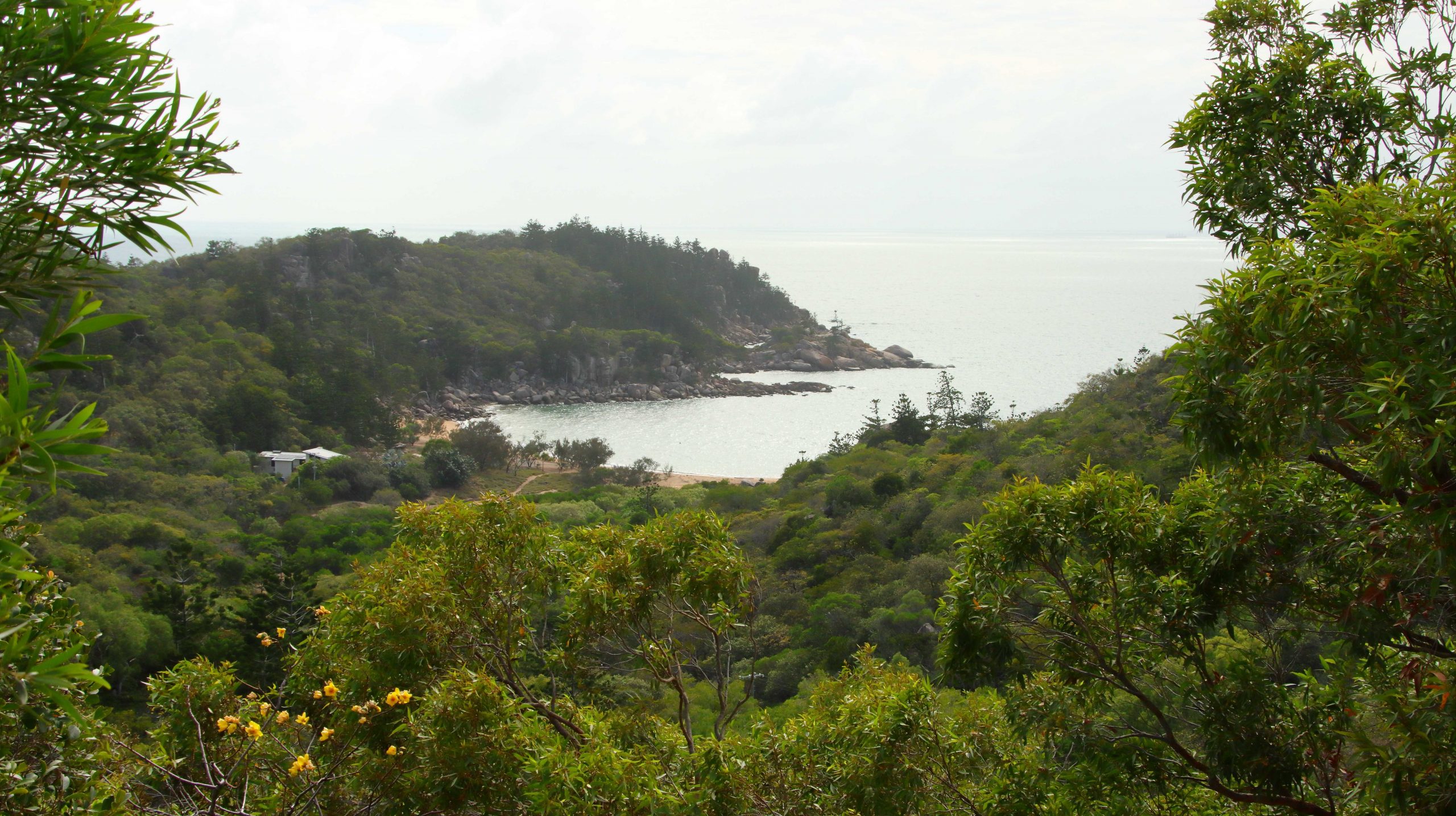
If you turn right from the ferry the road leads through Arcadia, then across the island to Horseshoe Bay. A national park occupies most of the island, which is in reality a huge pile of tree covered rocks with a coast which alternates between bays with sandy beaches divided by rocky promontories.
Picnic Point Hotel
The population centres are more a series of small residential towns than an island of holiday resorts, although some high-quality holiday accommodation and higher priced residential units have been built in recent years. Most residents commute to Townsville to work via the SeaLink passenger ferry. Parking spaces are at a premium during the day anywhere within walking distance of the ferry terminal.
We went looking for sunsets in the late afternoon, but the sun sets behind mangrove covered shores on the largely inaccessible north-western corner of the island, making the exercise a bit difficult. At least that is where the sun set while we were there. We gave up and went back to our unit.
The Original Vehicle Track to the Fort Area.
Balding Bay from the Fort Track.
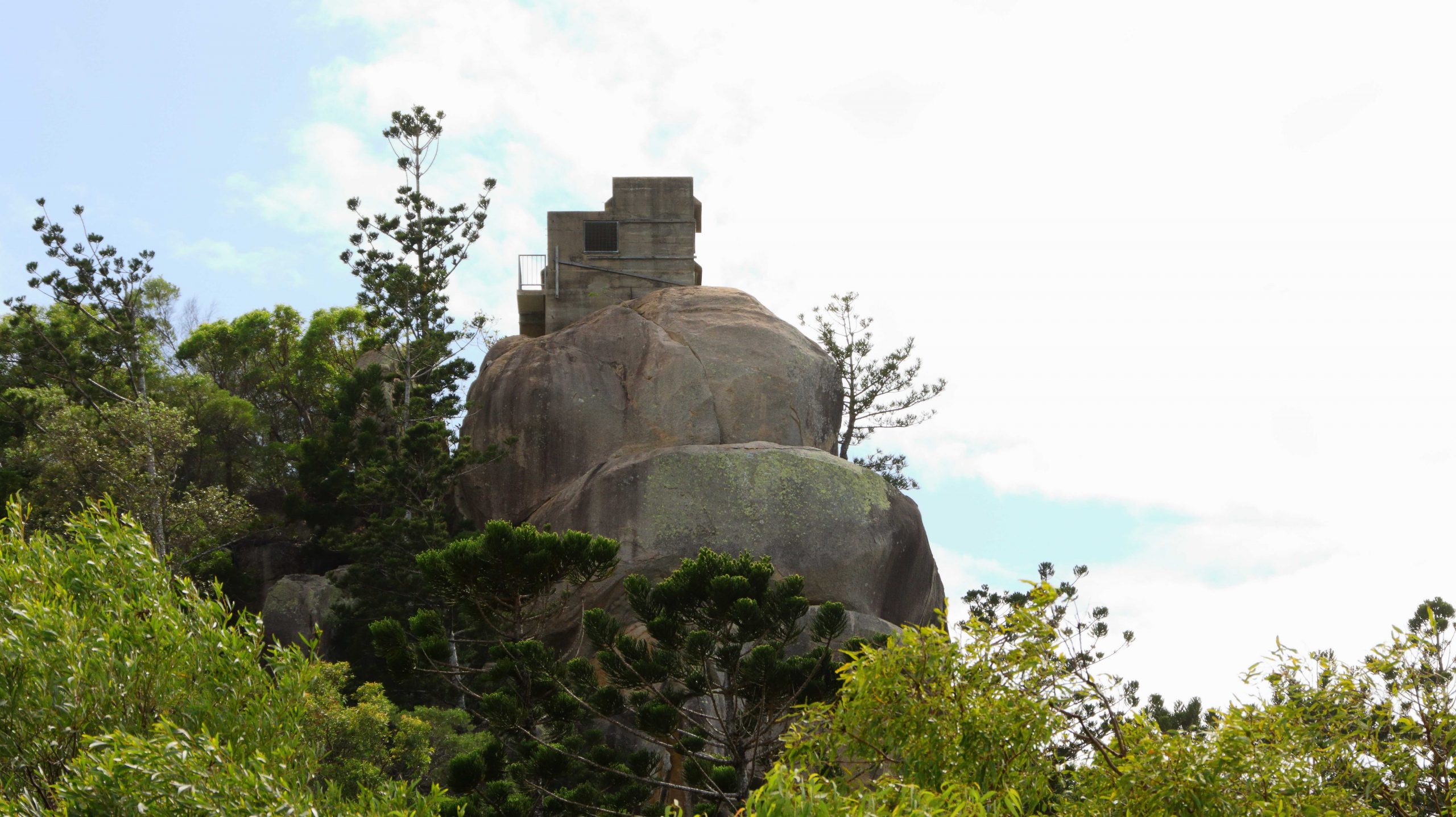
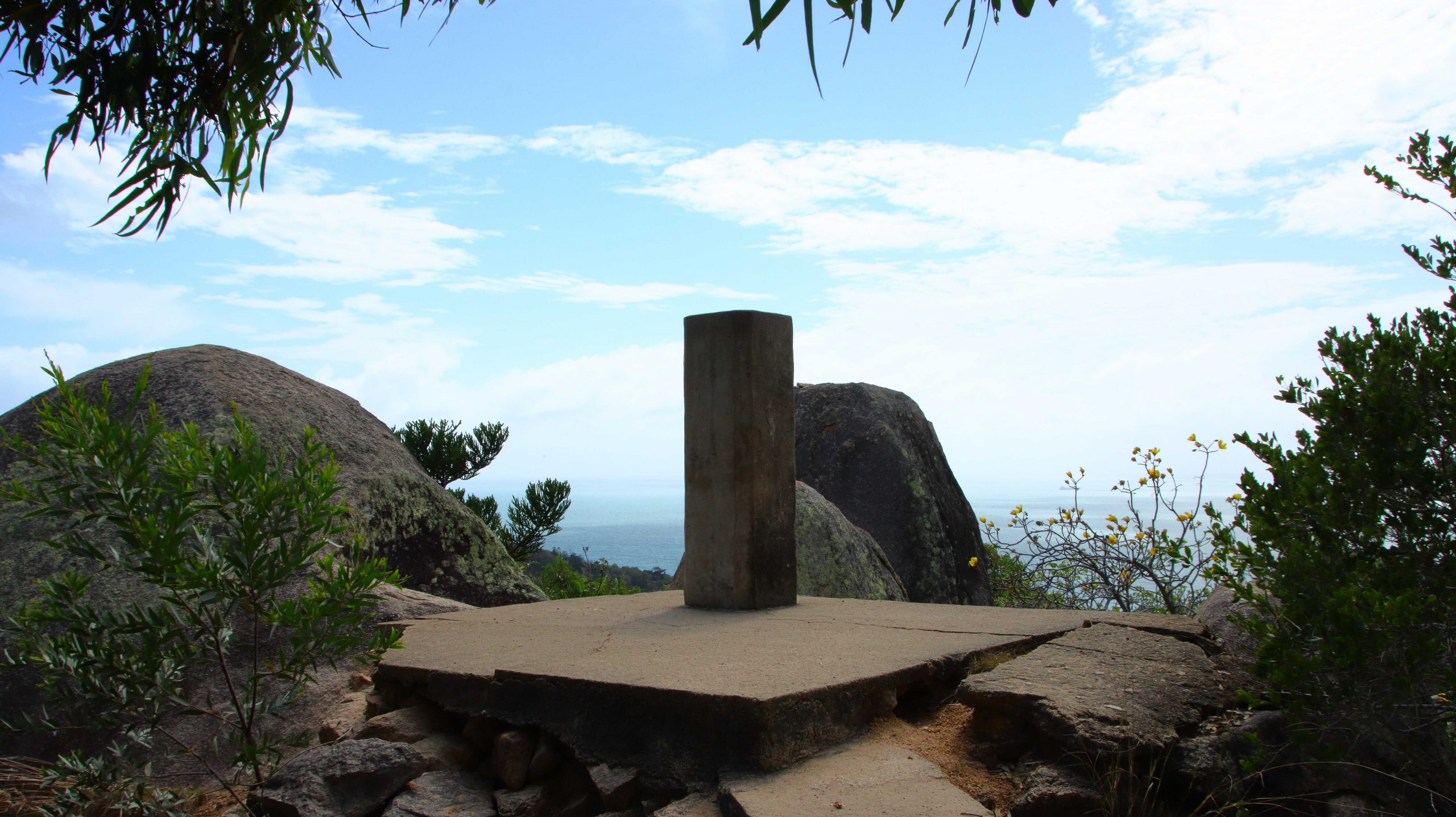
The Observation Post on Top of The Highest Peak.
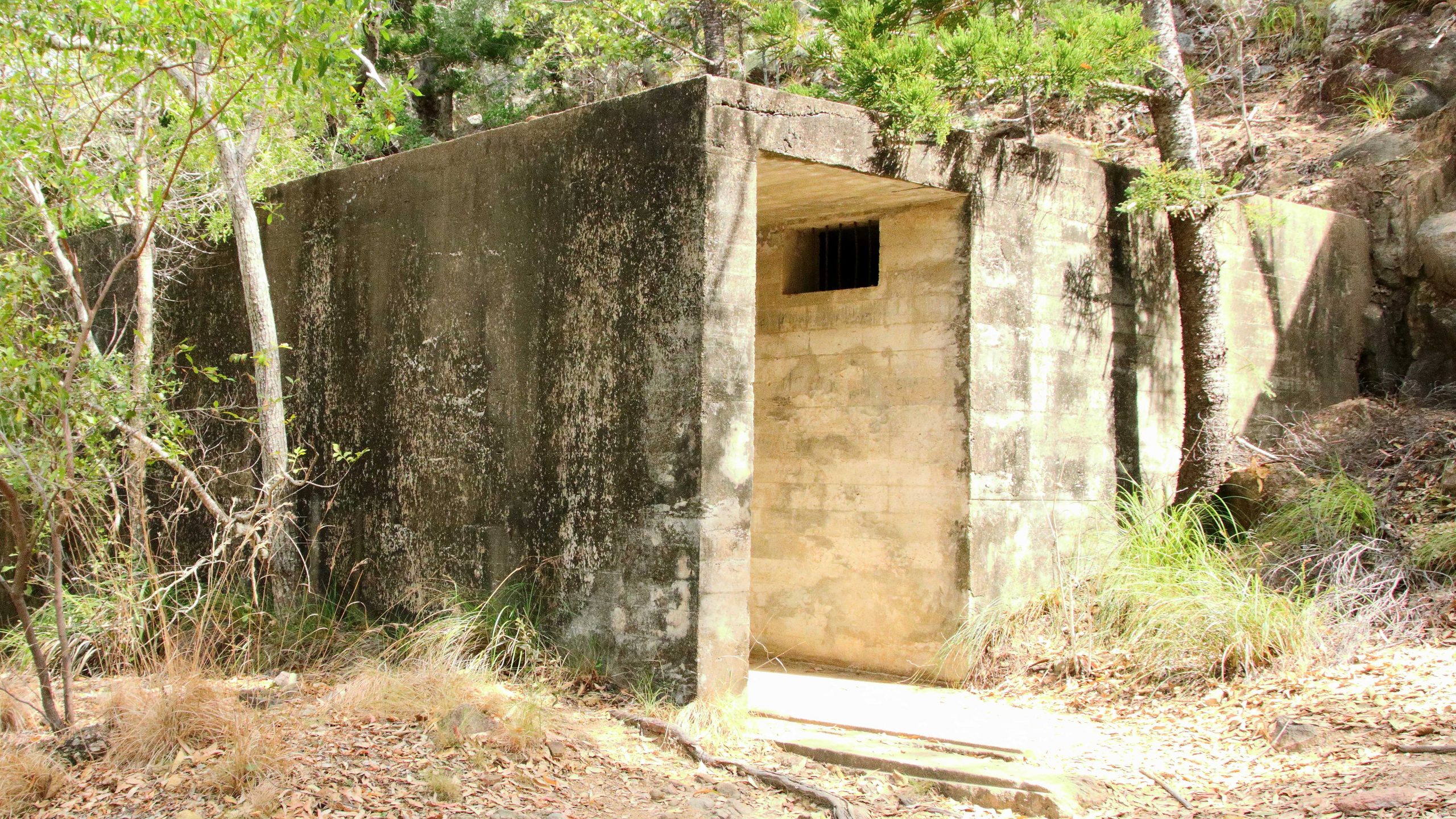
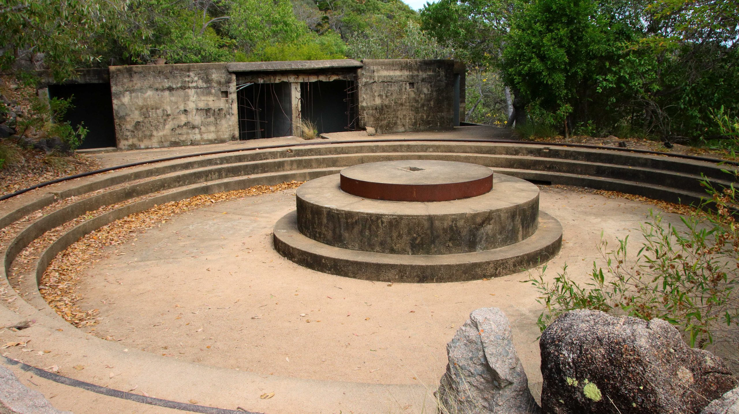
Because the island is mountainous there are not many easy walks, certainly not that lead to elevated lookouts. On the morning of our second day, with no other plans made, I decided to set out on a walk to the area of military installations from WWII days. The access road that visitors use to access the site is the one built during the war. It is a fairly easy walk to the site of the camp but when you get there you are confronted with a long flight of rough stone steps, that lead up to the gun platforms and lookout posts. The ammunition magazine is part way up.
The Main Amination Magazine
One of Two Main Gun Mounts.
The Remains of the Range Finder.
The planners really did use the topography to advantage. There were two large guns, one placed higher than the other but placed to increase the arc of fire. There are two observation points for lookouts and signals, set on the highest rocks and a range finder to tell the guns how much powder they needed to reach the target. The construction would have been a huge challenge and I am glad that I was not one of the soldiers with the task of getting ammunition up to the guns.
A Sleeping Koala
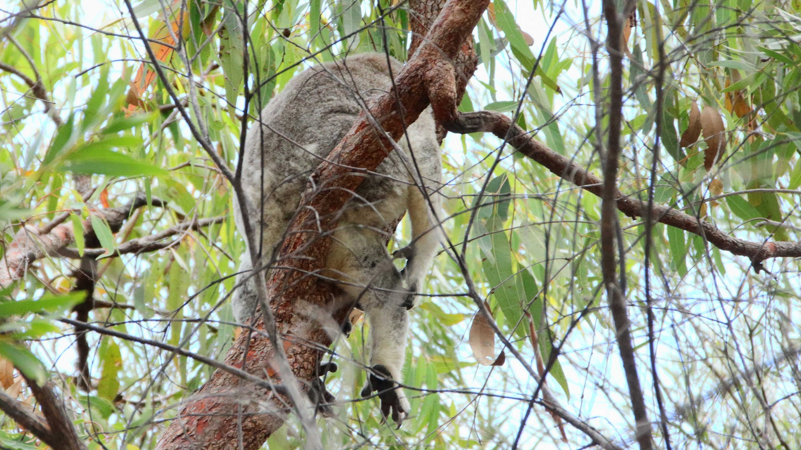
There are Koalas on Magnetic Island and the walk to the fortress passes through some of their habitat. I saw two of them, but not very clearly. They were not at all keen to show their faces.
I was rather tired when I got back to the unit. My smart watch told me that I had climbed the equivalent of sixteen stories. So we had a quiet lunch and rested up, making a final visit to Horseshoe Bay later in the afternoon to enjoy an ice-cream, as we looked out over the blue water at the small boats on their moorings..
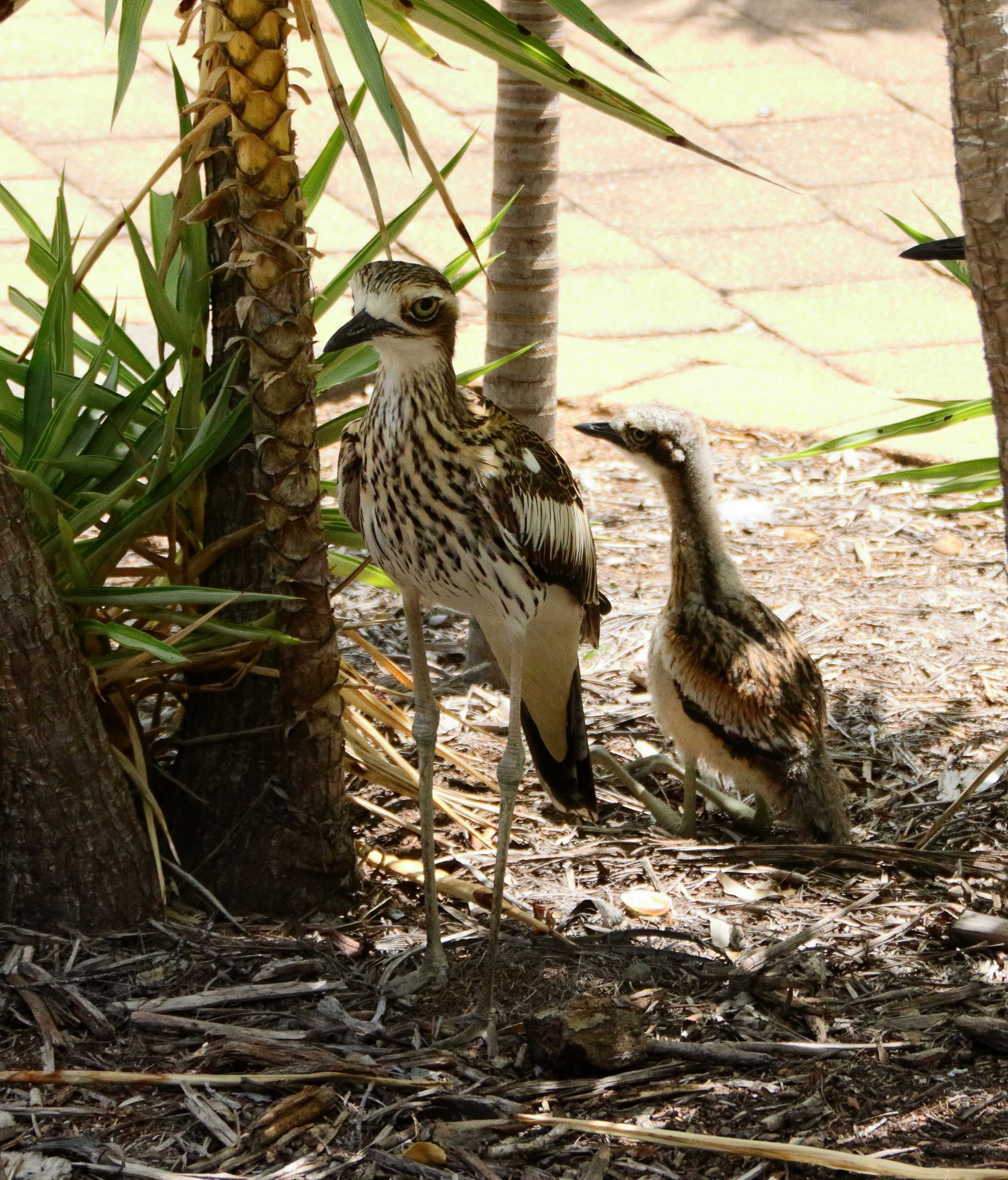
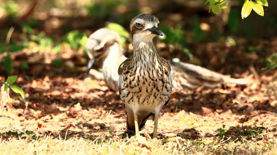
Bush Stone-Curlews, Parent and Fledgling.
Just before lunch our attention was drawn to a Bush Stone-curlew family, parents and one young bird, who were making themselves at home in a garden bed under an ornamental tree. As we were having lunch, we looked out the door and there they were, looking in at us. More photos and they finally moved on. They are apparently regulars.
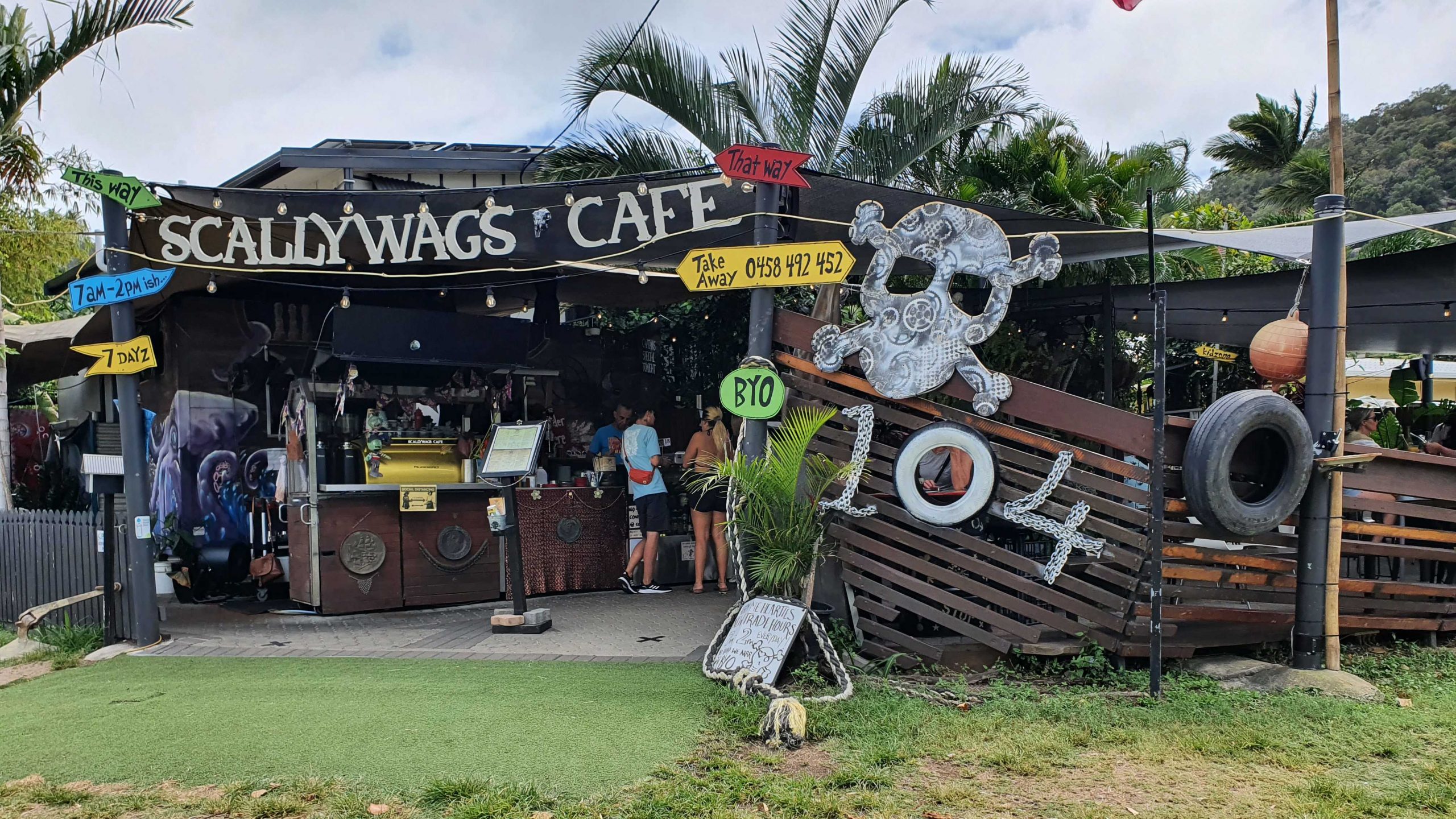
We were on the mid-day ferry back to Australia, so with check out at 10.00 am we had ample time for a leisurely brunch before we queued up to board the ferry. We stopped off at Scallywags Café, up the street a bit from our unit, for a very pleasant brunch. We even had some time left to read and watch the waters of Cleveland Bay, before boarding the ferry.
Part 2 –North to Port Douglas via The Atherton Tablelands
Note: A video link appears at the bottom of this blog post.
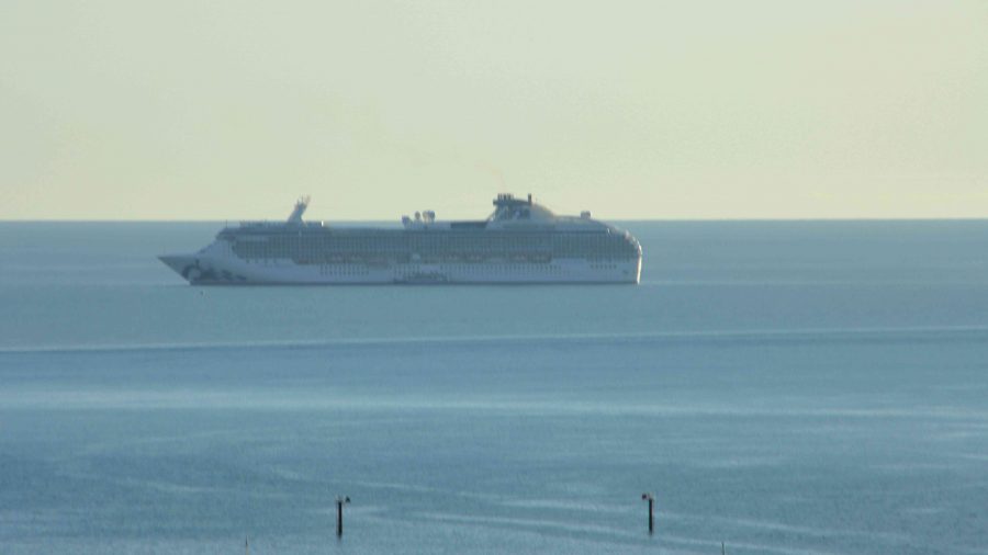
Coral Princess lying off Airlie Beach.
When you have a view like we did at Airlie Beach, the first thing that you do when you get up of a morning is open the blinds. We opened our blinds on Sunday morning and there in the middle of our view was the Coral Princes, in port for a visit. Our friends Jim and Frances Weir were on board, but we were gone by the time that they come ashore.
Sunday was one of making distance up the coast. Our Sunday night overnight stop was at Innisfail. The sun shone on us all day. We struck some low-lying fog both on land and over the bay as we approached Bowen, making slower progress than we had hoped as we coped with the long slow kilometres of roadworks. Almost the entire length of road from where we entered the highway just north of Proserpine to Bowen, was limited to 60 and 40 kph with a few areas of 80 kph.
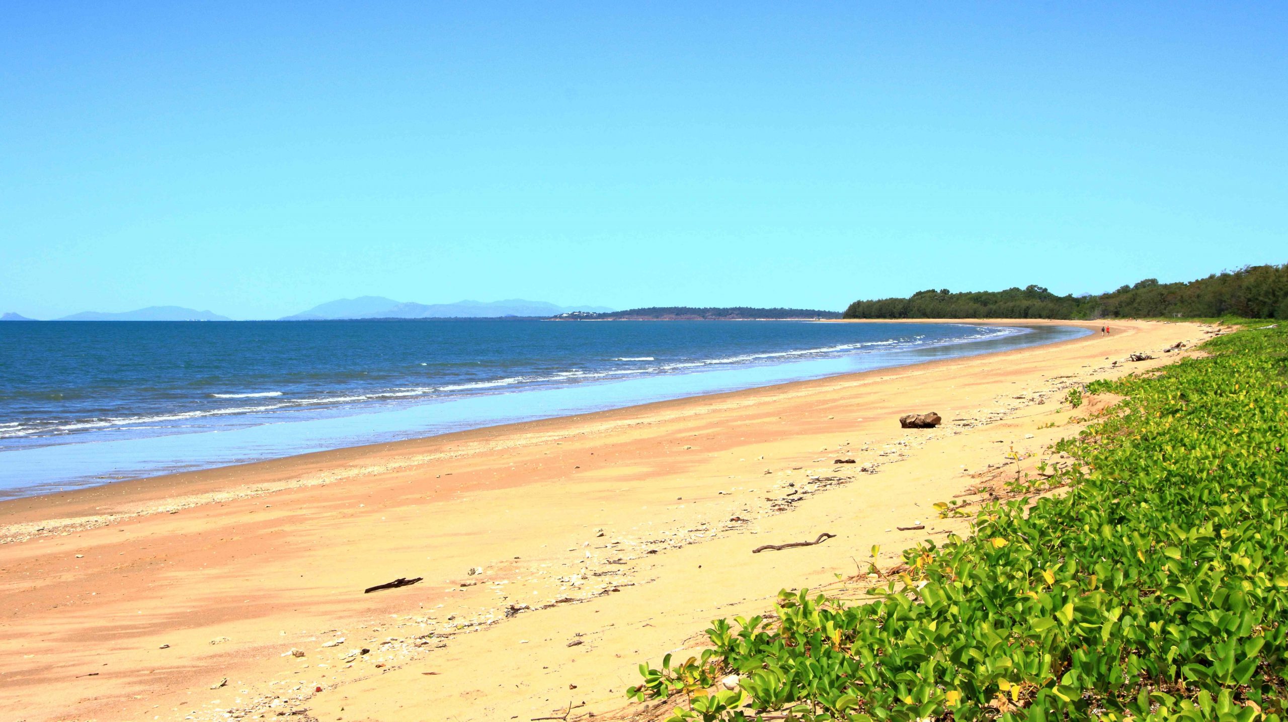
Balgal Beach. The view goes all the way to Magnetic Island and Townsville.
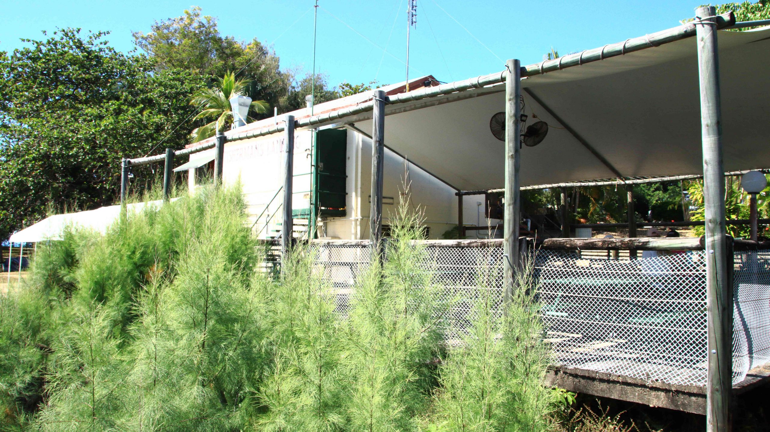
The run for the rest of the distance to Innisfail was much better, but still with a lot of areas of road works. We bypassed Townsville on the convenient ring road, as you do now, but called in a Balgal Beach. near Rollingstone. We knew where we could get near the beach for lunch, from previous visits.
Fisherman’s Landing at Balgal Beach. The restaurant overlooks the jetty where fishing boats dock.
The mountains northwest of Innisfail
We had a quiet night in Innisfail. The motel was right in town but quiet. All we wanted was somewhere to eat and sleep.
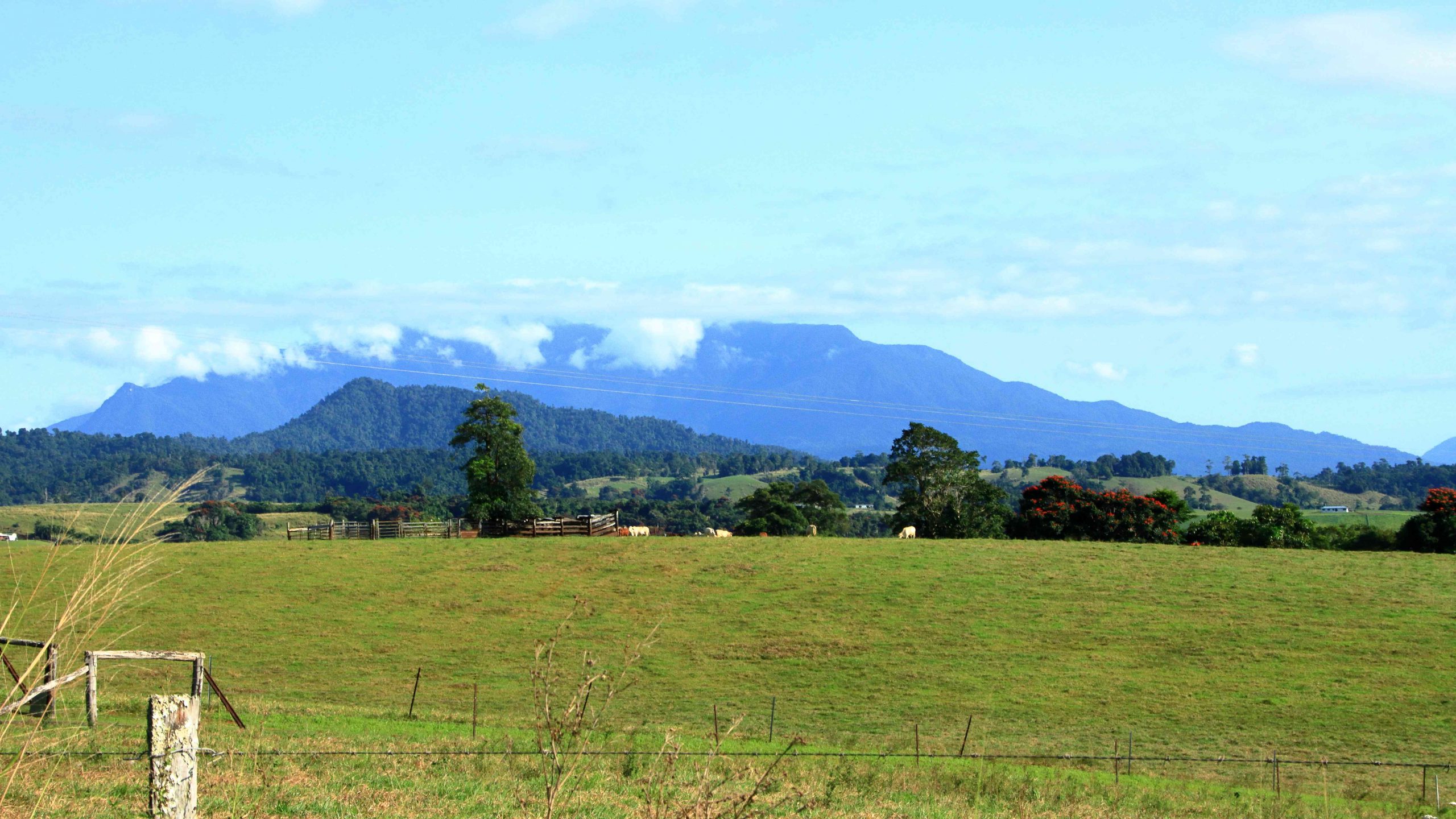
A cap of cloud was sitting on the top of that mass of mountains to our north as we left Innisfail. The mountain ranges inland from the coast are home to Queensland’s two highest mountains, Bartle Frere at 1,611 metres and Bellenden Ker which reaches a height of 1,593. At those heights they and the surrounding ranges rise well above the Atherton Tablelands, to which they provide a backdrop to the east.
The drive from Innisfail ascends some steep grades but on a good road. When you reach the edge of the Tableland the height gain from the coast is obvious. The first town is Millaa Millaa, but first you will see signs that point to a drive that leads you past four waterfalls, before returning you to the main road. We have done this drive before but did it again before stopping for coffee at the park in the main street. The town has a couple of good café/coffee shops as well.
Zillie Falls on the Falls Circuit near Millaa Millaa.
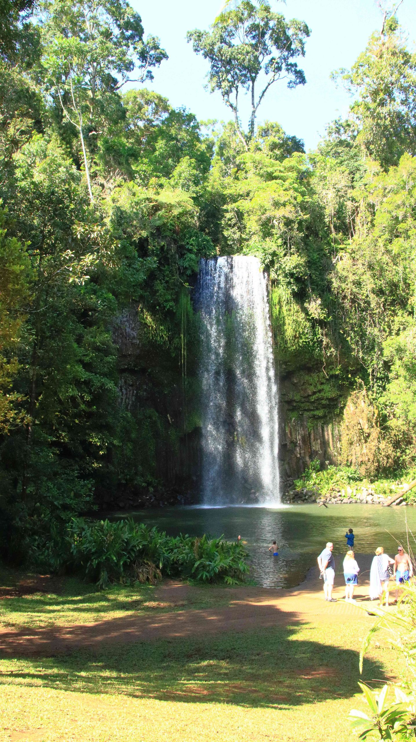
Millaa Millaa Falls also in the Falls Circuit.
The mountain ranges viewed from Millaa Millaa Lookout.
We then crossed to Herberton to look at the tin mining museum. Soon after you leave the town of Millaa Millaa, you reach a steep ascent. Just before the summit, a left-hand turn takes you to a lookout which, unsurprisingly is named Millaa Millaa Lookout. Equally predictably the lookout provides fine views back over Millaa Millaa and the ranges nearer to the coast. We were greeted on our arrival by some domestic hens.
Mining machinery and buildings at Herberton Mining Museum.
There is much to see at the Herberton Museum, particularly for those with an interest in old machinery and historic mines. You could spend quite some time there if that were the direction in which your interests lay.
Malanda Falls is located in parkland near the town.
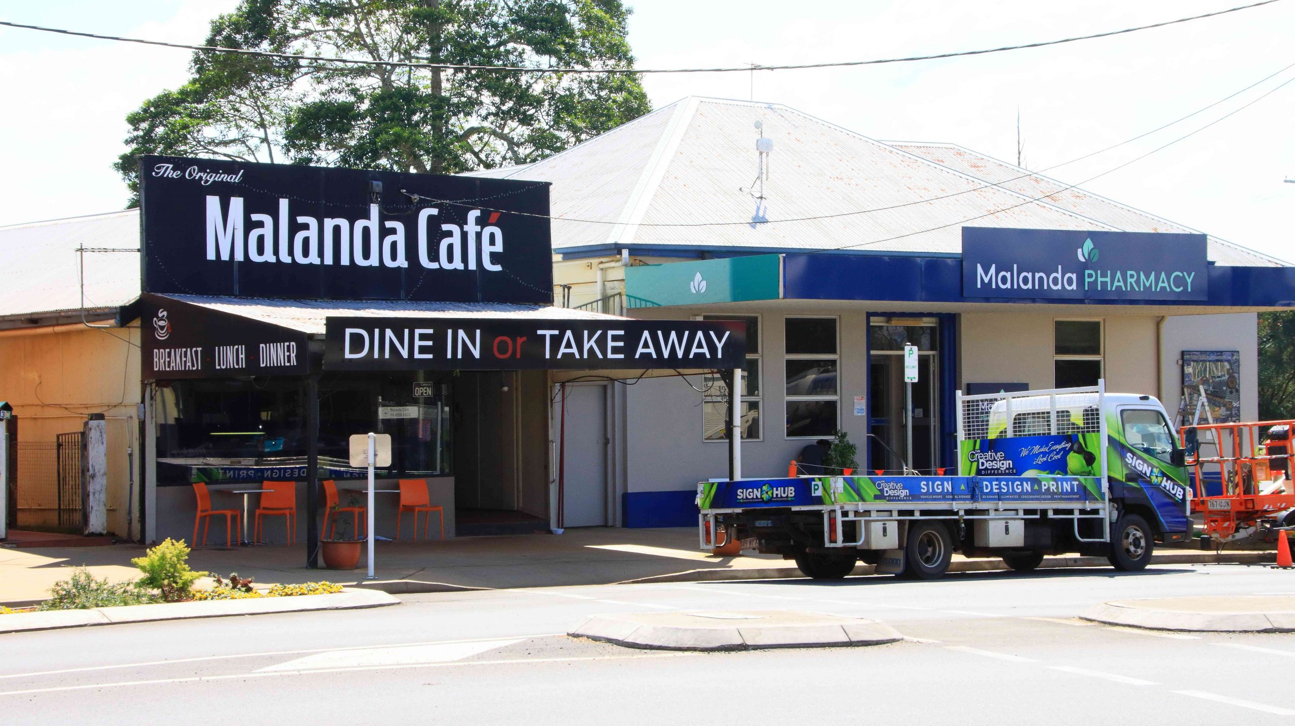
We then turned back to the east to Malanda. We wanted to lunch at Gallo Dairyland but research had shown them to be a Wednesday to Sunday operation, which seems to be quite common in areas that are within an easy weekend drive of major population centres.
Malanda Café, our lunch location.
So, after visiting Malanda Falls we lunched at a café in town before making a return visit to Lake Eacham, where some hardy souls were swimming and sun baking. It is a beautiful location and wasn’t all that cold but not my idea of swimming weather.
Lake Eacham with bathers.
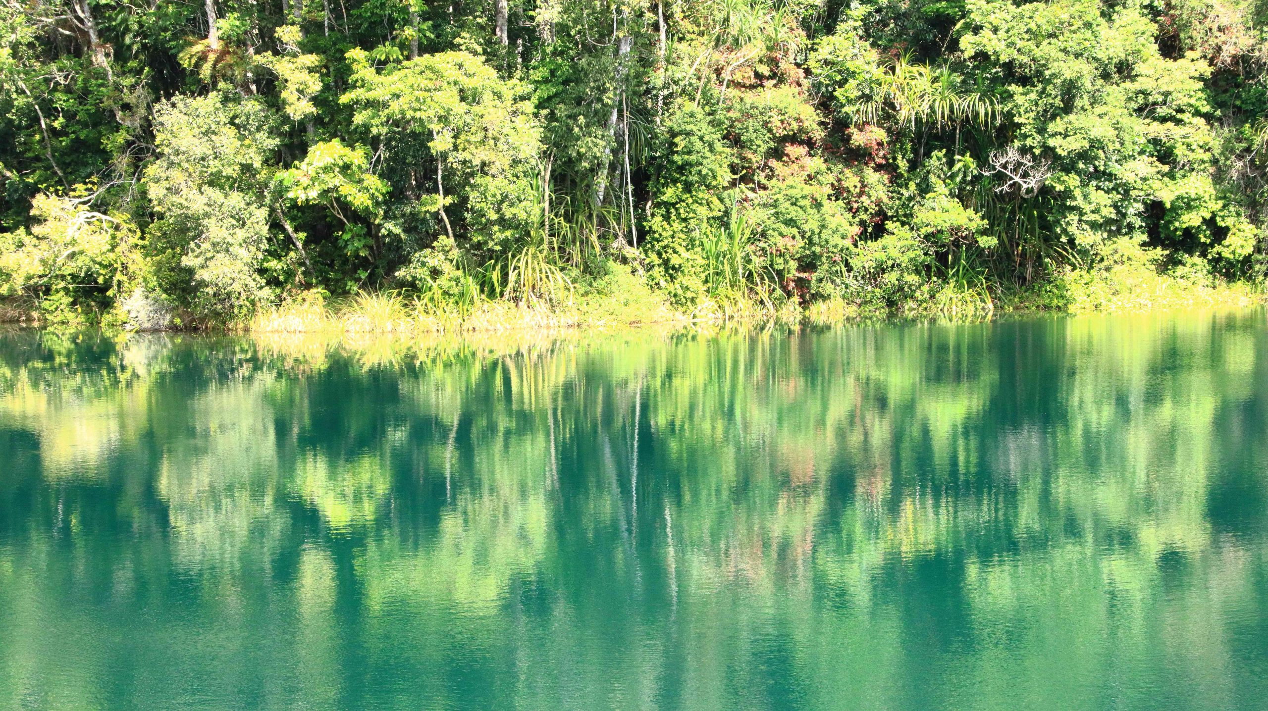
Reflections in Lake Eacham.
We passed through the attractive town of Yungaburra on our way to Tinaroo Dam.
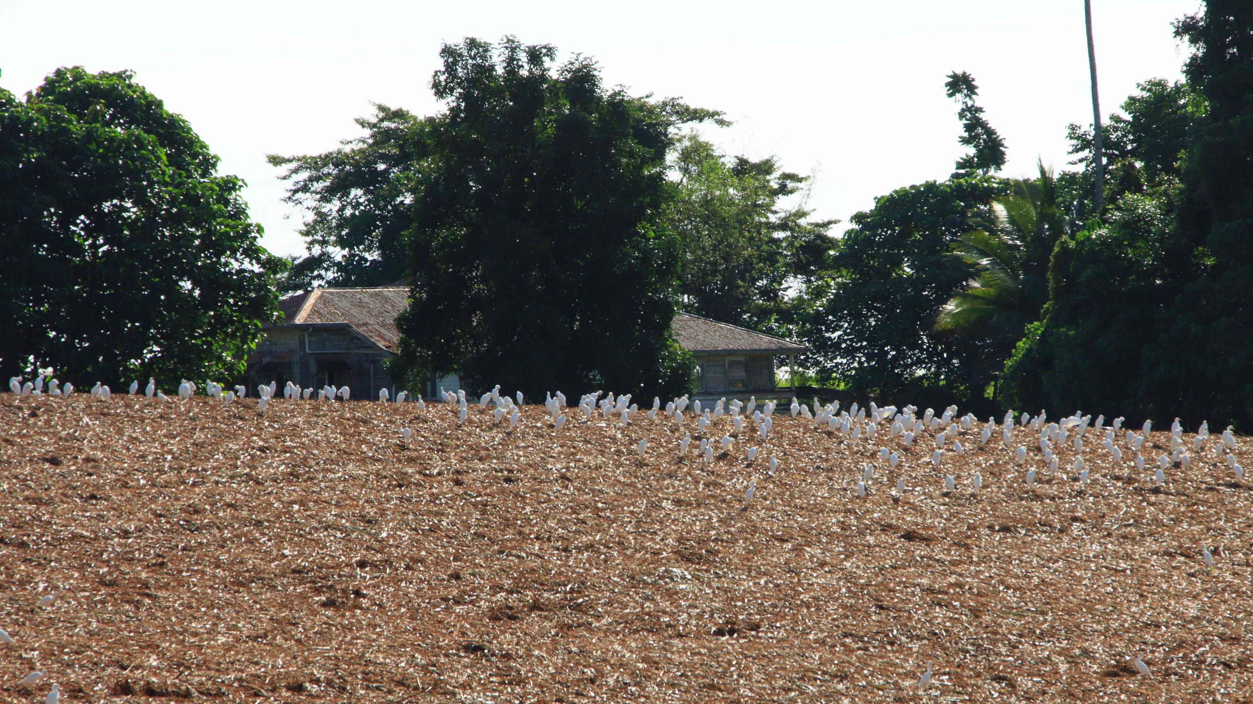
Patient Cattle Egrets waiting for the cane harvest to move on.
We had seen a large flock of Cattle Egrets (the little white Egrets that are often found where cattle are grazing) back nearer to Innisfail. They were waiting for a cane farmer to finish harvesting a field. Some were near to the road, but all took off and flew to the top of a hill overlooking the cane fields when we stopped. Newly cut cane must produce good eating grounds for them. We saw the same phenomenon at a couple more cane harvesting sites the following day, but other harvest sites had no birds at all.
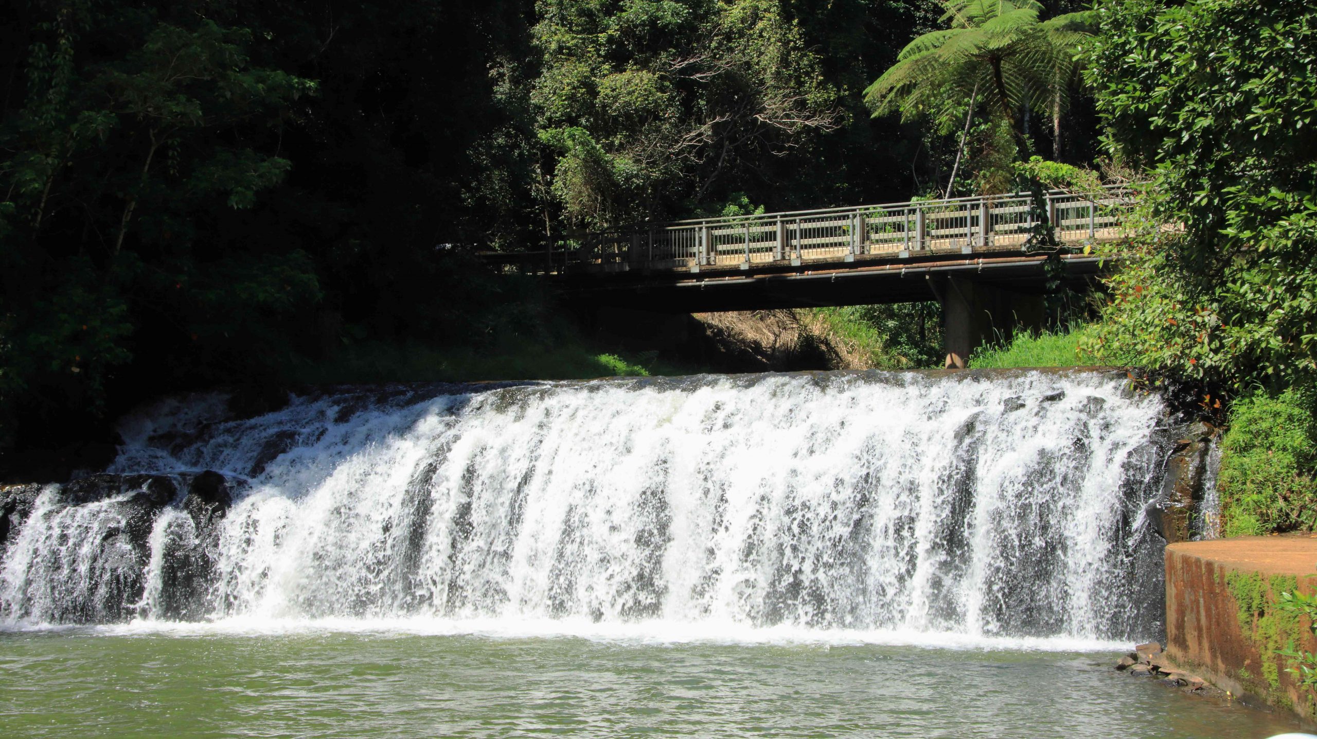
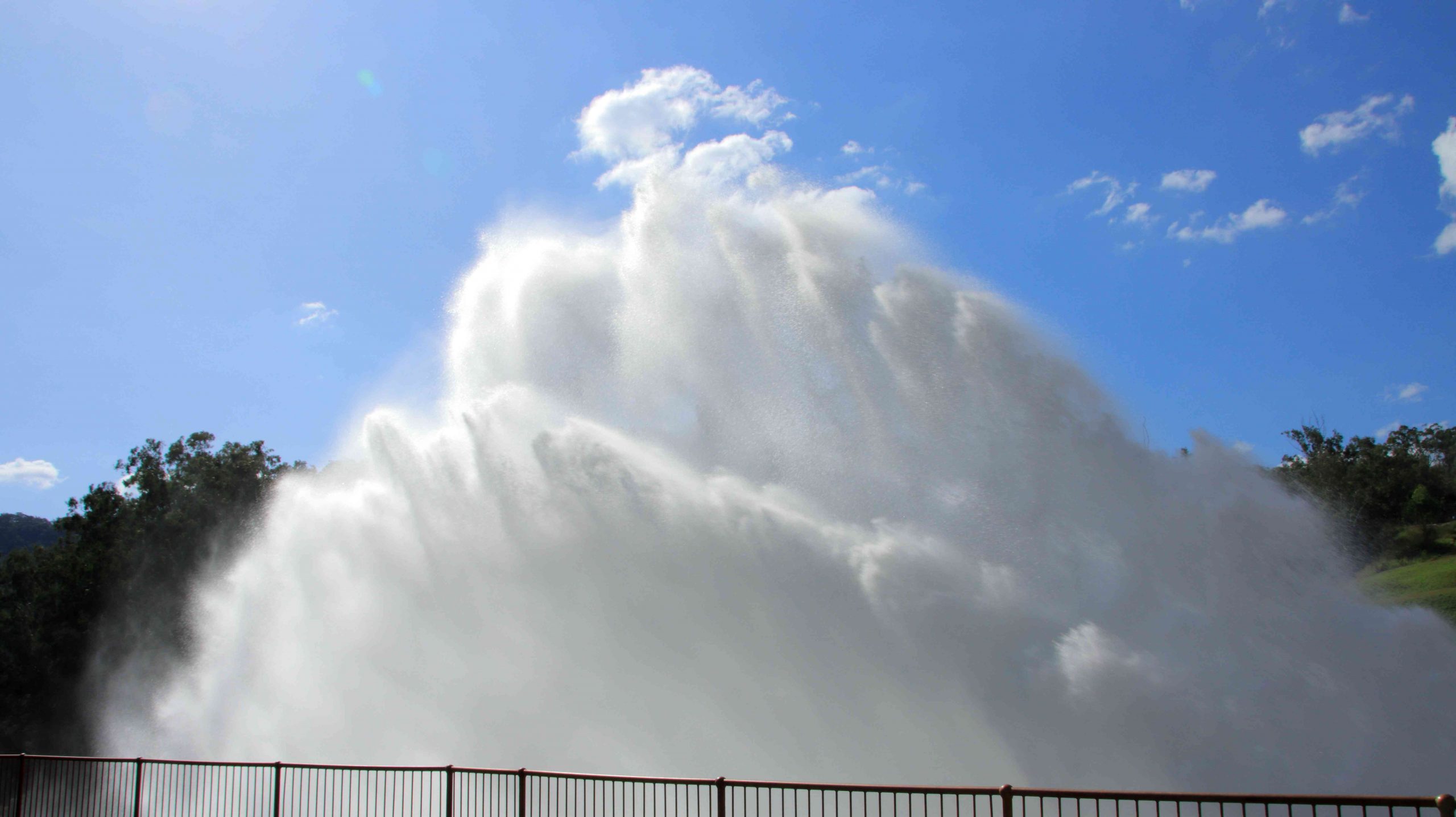
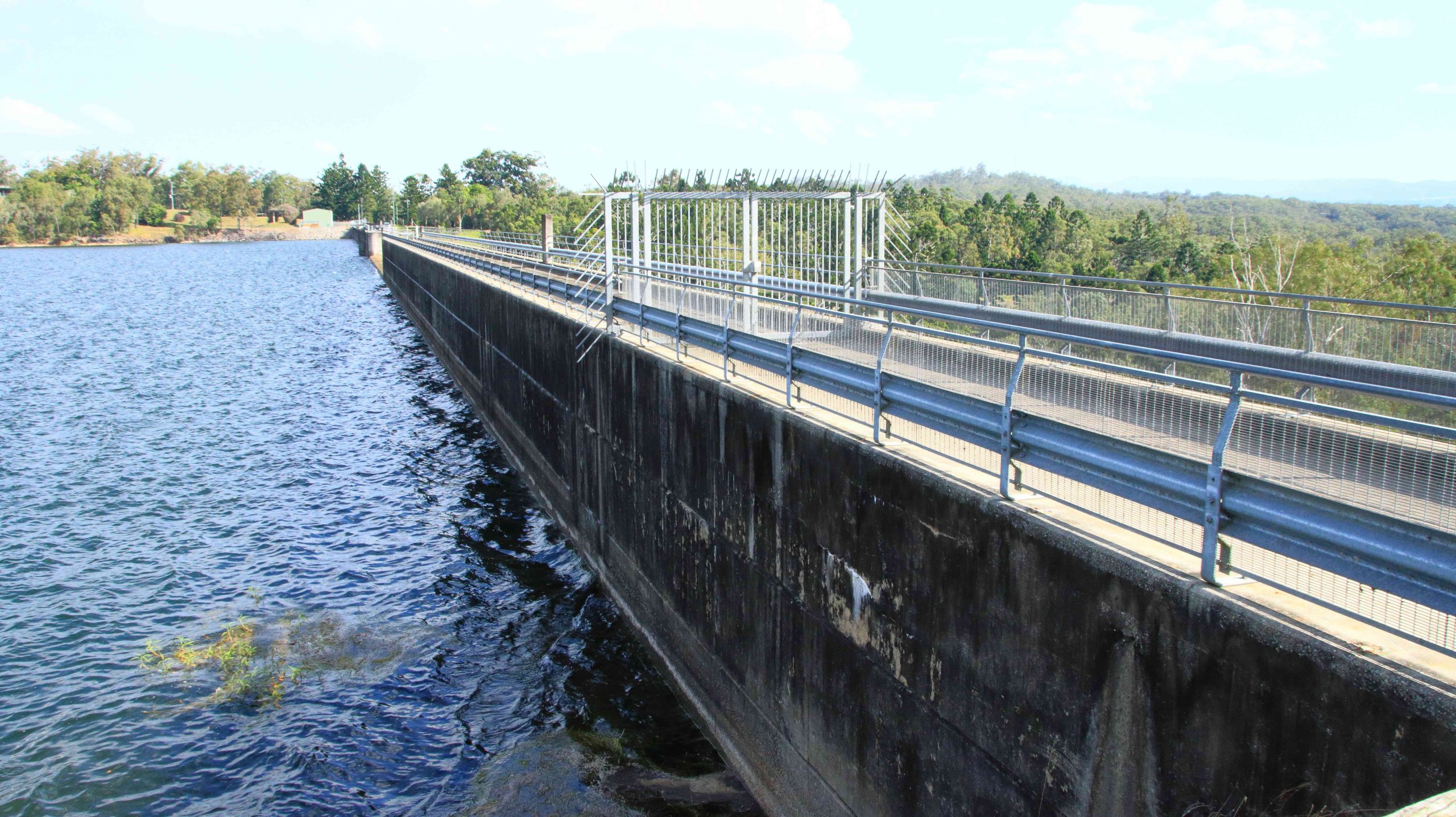
To complete the day, we drove to Tinaroo Dam, where operators were discharging quantities of water, no doubt to the delight of tourists who see it flowing down the Baron Falls as they look down from the Kuranda train or the cable Skyway. There is plenty more where that is coming from. The dam is near to full.
Rather spectacular water discharge from Lake Tinaroo.
Tinaroo Dam
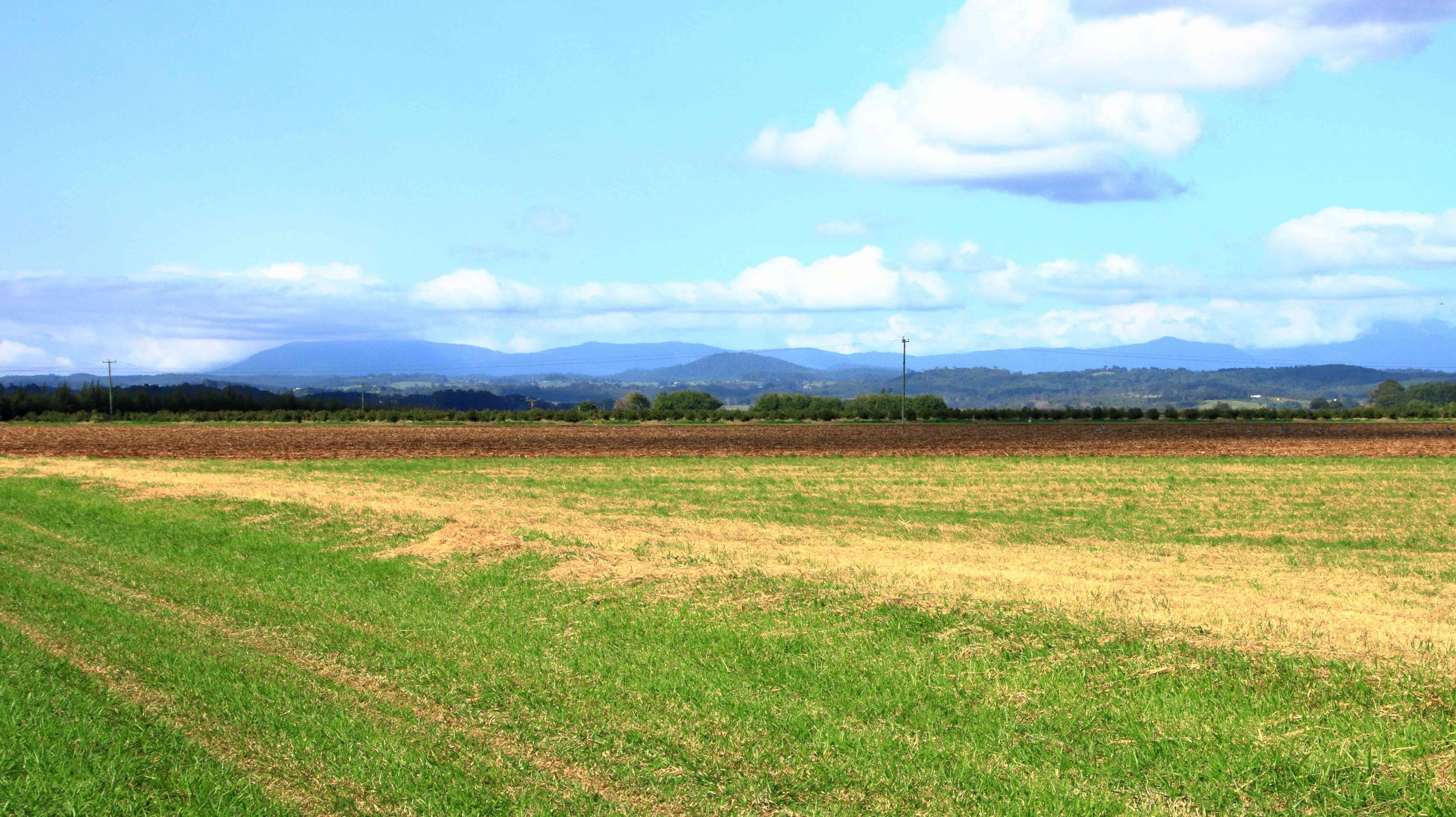
Agricultural land, irrigated by water from Lake Tinaroo.
We then drove on to Atherton and checked into our motel. It was a shorter and easier day. We travelled just over 200 km. Yesterday was a little over 600 km.
We departed Atherton on the morning of Tuesday 16th August, heading for Mareeba initially but with Port Douglas as our end-of-day goal. We turned east at Mareeba to drive to Emerald Falls. The facilities at the car park suggest that it is quite popular with visitors.
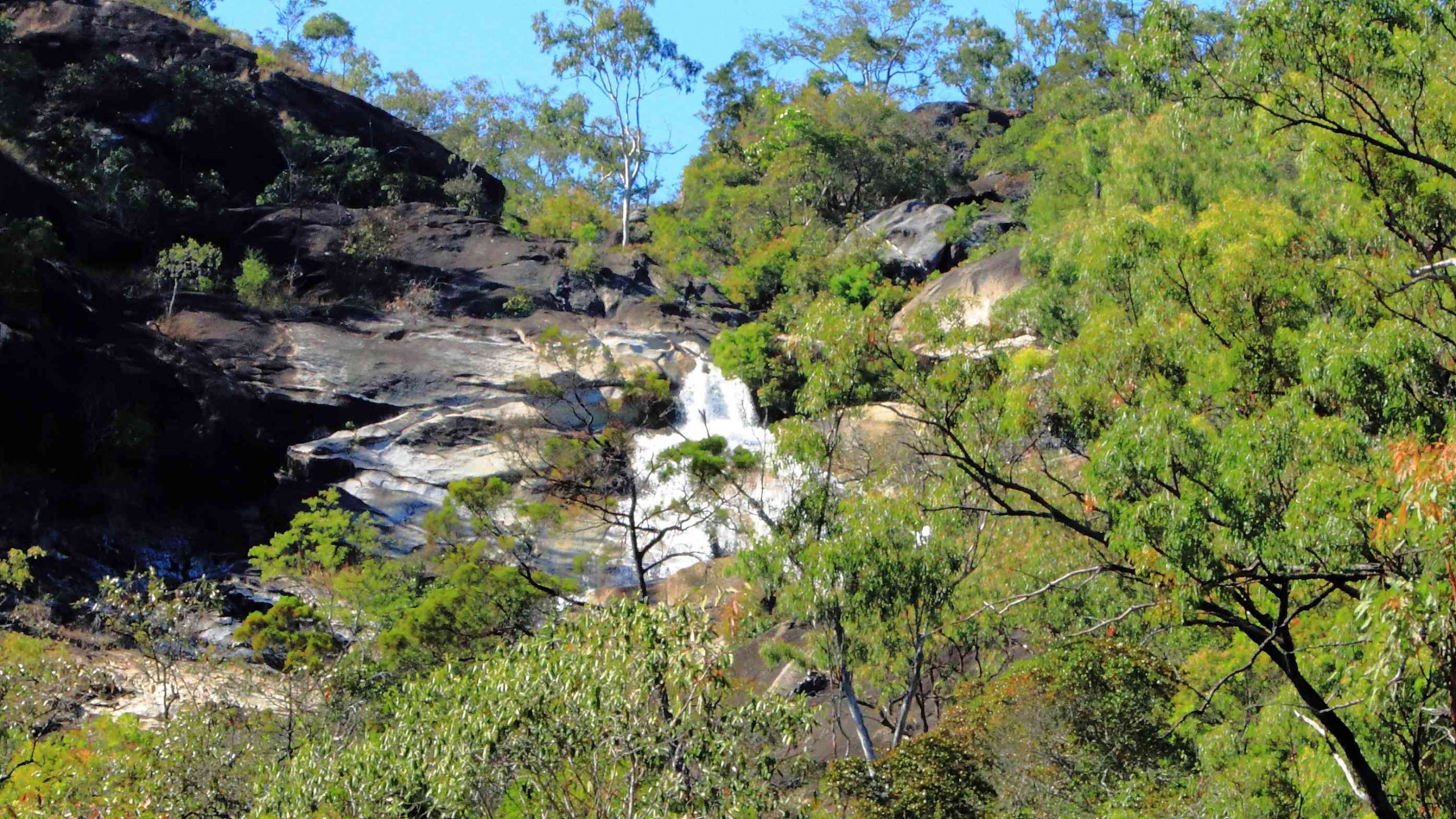
The top section of Emerald Falls.
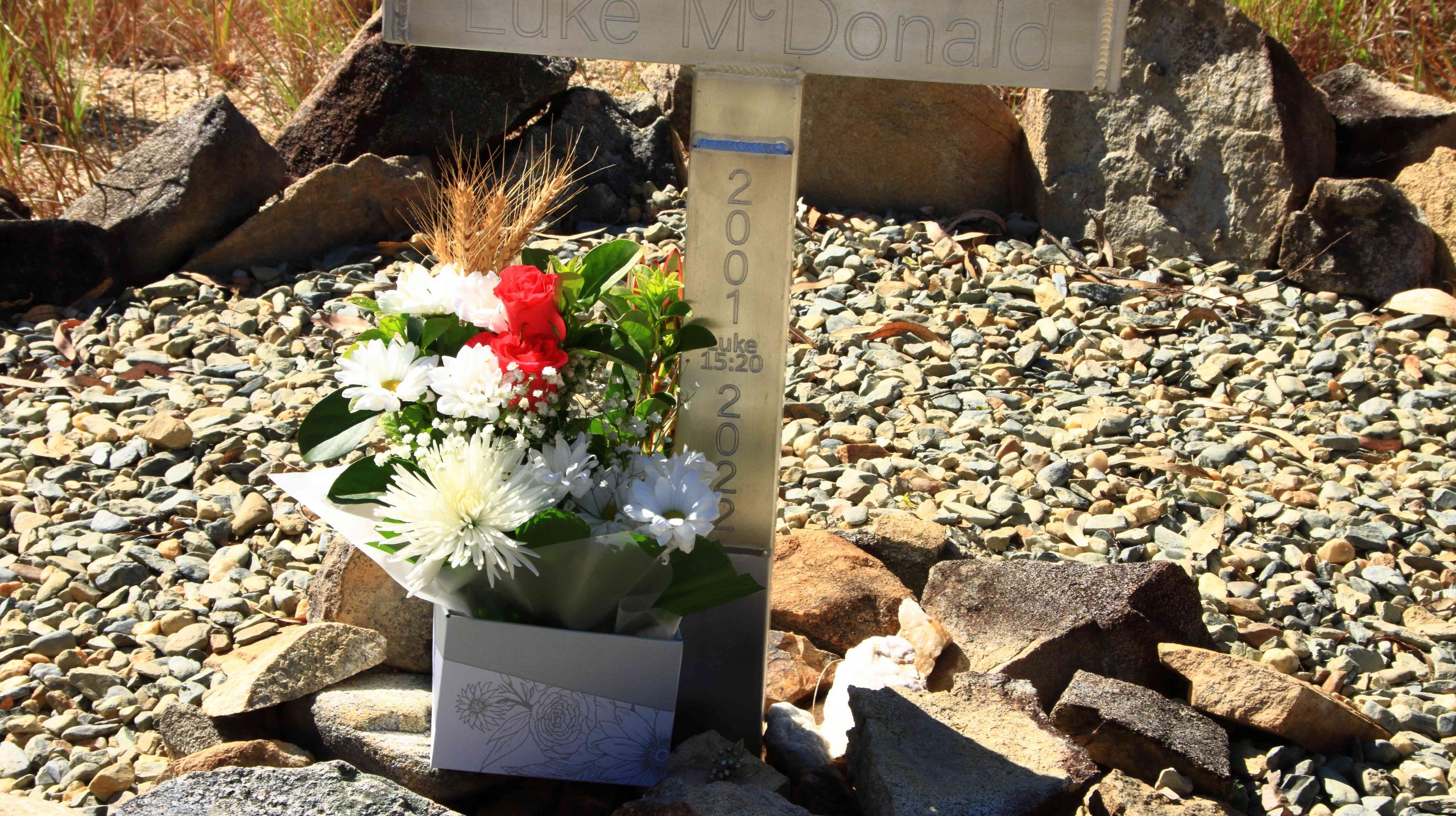
The memorial to Luke McDonald who lost his life in the waters of Emerald Creek
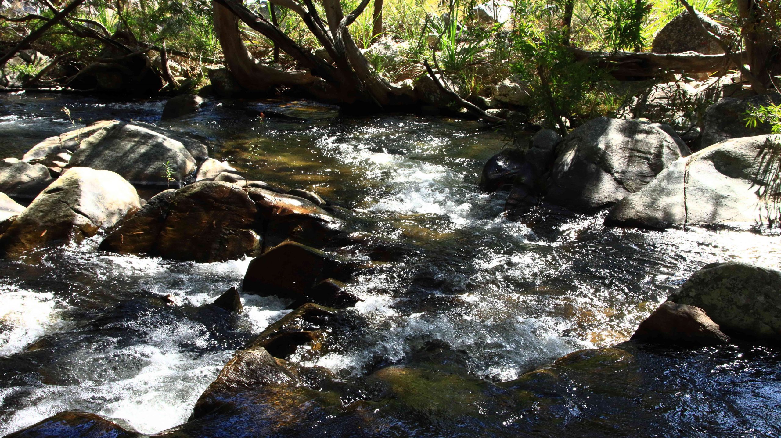
Emerald Creek below the falls and series of rapids.
The walk to the falls is a little under a kilometre one way and quite easy until the last couple of hundred metres, when a series of well-built stone steps lead to the lookout and a rougher path to the foot of the falls. Visitors are reminded of the perils of mountain streams by a memorial, built by the side of the track, to a young man who perished in the stream. Being conscious that we were there on our own and that I am not as young as I once was, I gave the walk away when the top of the falls were in sight. Thy are partly obscured by vegetation. But a great spot for a picnic and walk.
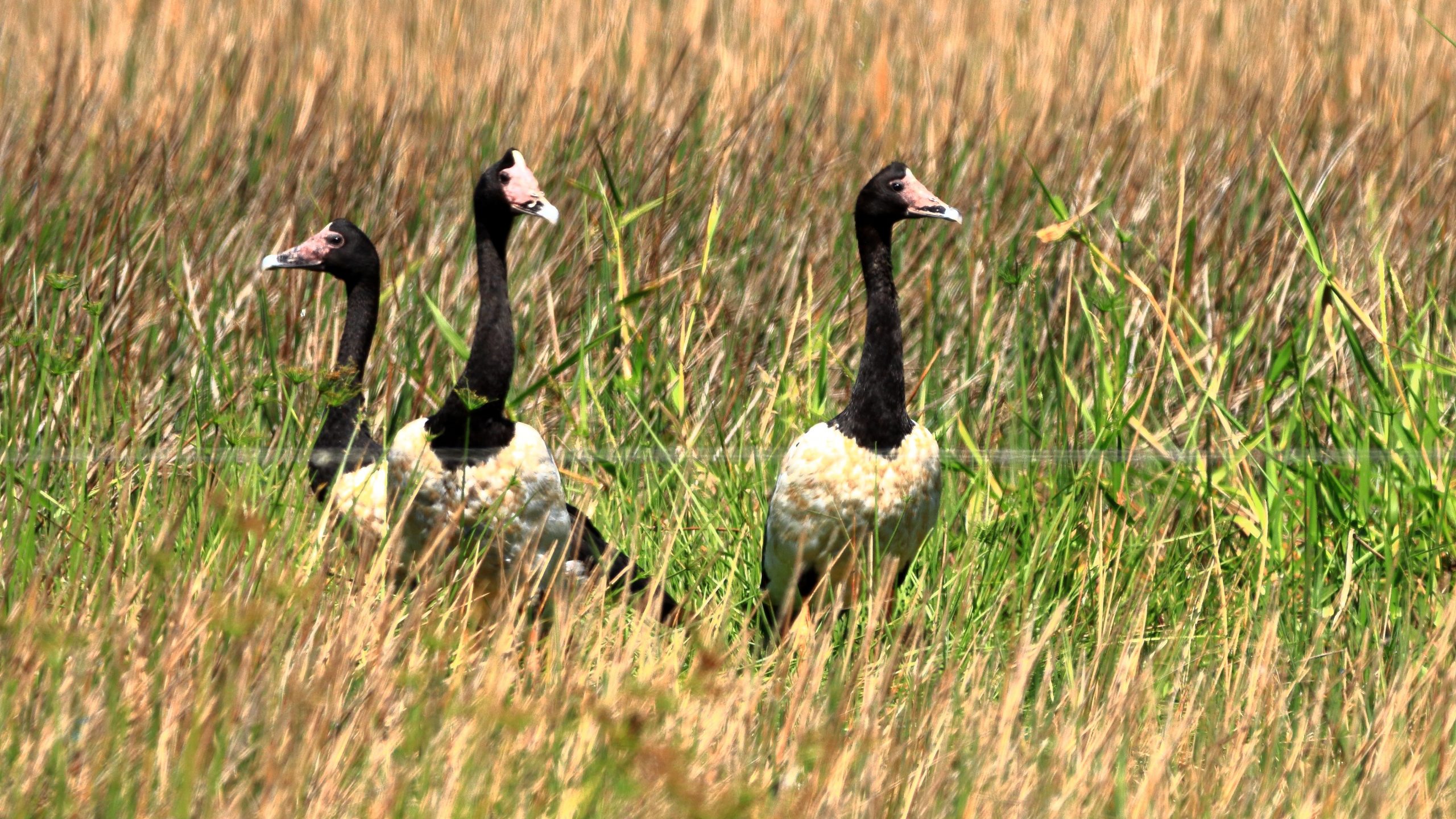
Magpie Geese near Mount Molloy on the Mulligan Highway.
We returned to Mareeba to revisit Coffee Works, a local success story, for morning coffee, before continuing north on the Mulligan Highway. We had intended to call into the nature reserve at Lake Mitchell, but the gate was closed, and the track did not look very inviting. We drove on. The highway runs beside a wetlands area that is part of the dam. There we found a Great Eastern Egret and a flock of Magpie Geese, both feeding in the pools. There was also a Pelican, but out of camera range.
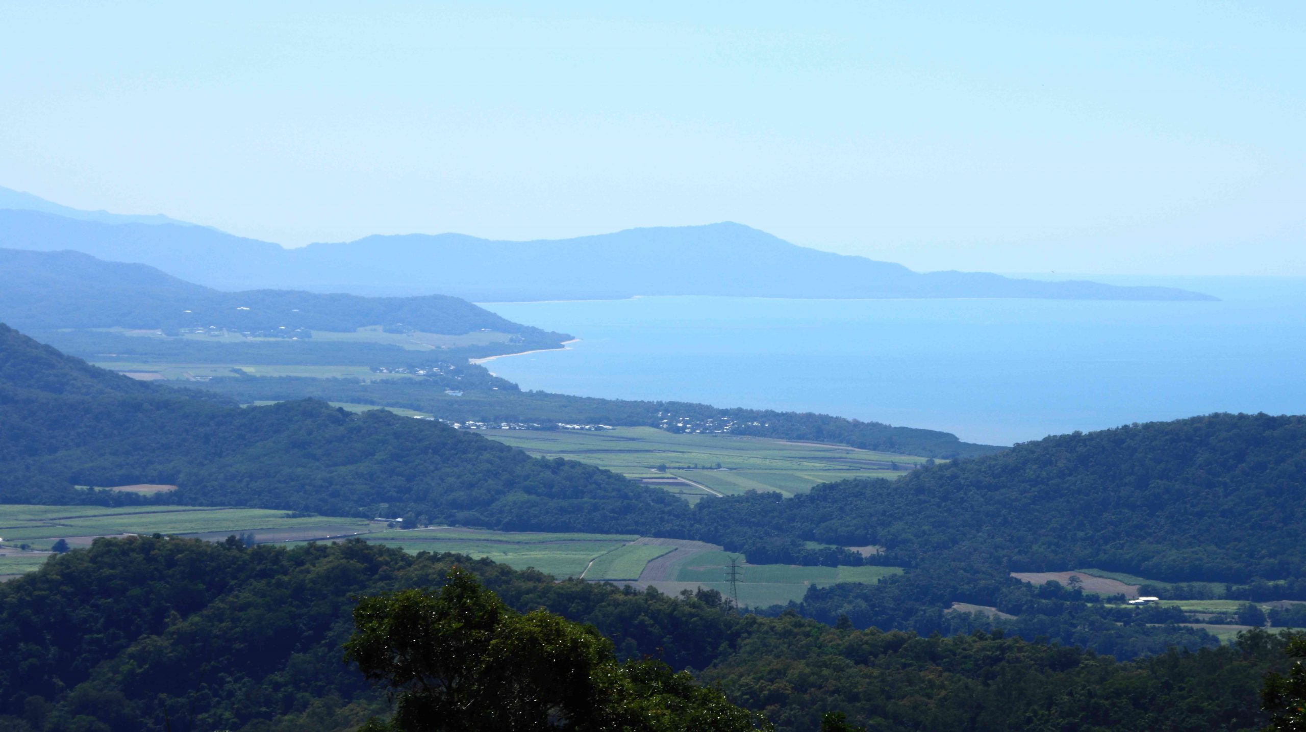
View north east from the highway above Mosman.
The coast towards Daintree National Park
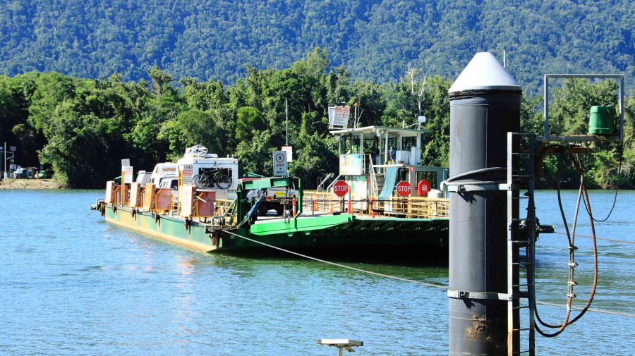
Daintree River ferry that provides the road link to Cape Tribulation.
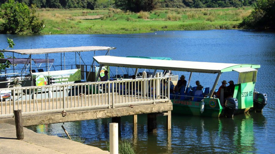
We passed through Mount Molloy and took the right hand turn towards the coast and Mossman. There are two lookouts as the road begins its decline to the coast. Both give excellent views of Mossman and the coast to the Daintree River and to the ranges of the national park. We lunched at Daintree Village and photographed some Straw-necked Ibis in the park, before driving down to the Daintree River ferry. The crocodile tours along the Daintree River were doing a great trade, boosted by visitors from Coral Princess.
Crocodile viewing cruises on the Daintree River.
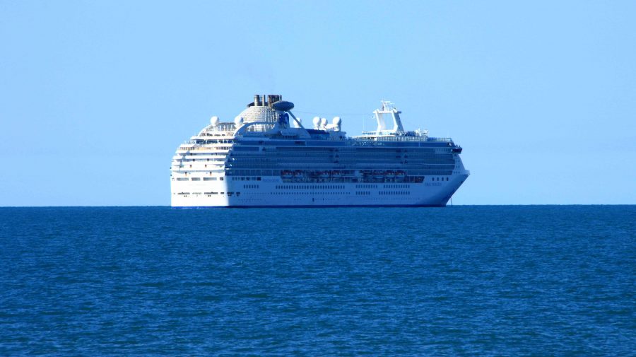
Coral Princess awaiting its passengers.
As we approached Port Douglas, we could see the Coral Princess anchored off the port. We called our passenger friends, but they were still on a day tour near Daintree. They are probably thankful that they missed us as I, at least, was incubating Covid at the time.
A view south from Flagstaff Hill at Port Douglas.
We had two nights at the Ramada Resort at Port Douglas. Since we had been through the area a number of times on previous trips we had decided on a quiet day. We checked out Four Mile Beach and spent time in the town area, We had visited the famous Flagstaff Hill Lookout, with its views along the beach to Cairns, the previous afternoon. We finished the day with room service dinner, a bit later than planned because the hotel lost our order.
We made a pre-breakfast start from Port Douglas next morning, as we had a 400+ km drive to catch the ferry at Townsville, to cross to Magnetic Island. We breakfasted at North Cairns and continued south. We diverted at Cardwell into the cyclone damaged Hinchinbrook Resort. There we found that most houses seem to have been repaired and reoccupied, but the marina, which was the centrepiece of the resort, remains in ruins, so there is no real resort anymore. But I did spy a pair of Bush Stone-curlews in the shade of a shrub on the rather broad media strip and got some photos. I had not previously photographed this bird. So, another “lifer” on my list.
Bush Stone-curlews at Hinchinbrook Resort at Cardwell.
I wasn’t feeling particularly well from the start of the day, so before we joined the queue for the Magnetic Island vehicle ferry, I decided to do a test for Covid-19. I returned a positive test so that was effectively the end of this trip.
Getting home was not a great amount of fun but with a highlight. We reached Proserpine at dusk and as the sun set, we were enveloped in a radiance of colour that reached across the sky from East to West and in front of us to behind us as well. The colour was a golden purple that faded as night fell. I was too intent on getting home to stop for a photo, but I now regret not doing so. But I do wonder if the camera would have done the colours justice.
The rest of the trip was to have taken us not only to Magnetic Island but then to Mackay and through the coal fields of the Bowen Basin to Emerald, Longreach and Winton. We are hopeful of completing the trip around the end of September.