West, Centre & Flinders – Days 36 to 44 – Filling in Time, Ayres Rock & The Olgers

Monday produced a reasonable morning, but cloud moved in during the afternoon and rain arrived by early evening. The rain was fairly constant until the early evening on Tuesday when it reduced to a slow drizzle that went on and on. You become very aware of it under a caravan roof. Wednesday was a good day with long periods of sunshine.

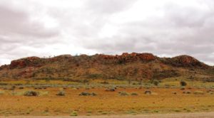
Hills by the road side south of Alice Springs

Hills by the road side south of Alice Springs

The rain promised for Thursday did not eventuate although it was cloudy for most of the day, with a few brief periods of sprinkles. We discovered later that the rain all fell to the south, around Coober Pedy. About two seasons worth of it!

So what does one do to fill in time in Alice Springs while waiting for the weather? Well, I decided to be sick. After a walk along the sandy floor of Trephina Gorge in the midday sun on Sunday I felt a bit more knocked up that I would have expected, but put it down to the warm day. Not as young as I used to be, you know! But by evening I had back aches and headaches and general lethargy. Seems I had picked up a local gastric bug that has been doing the rounds. Ruth had a touch of it as well.

So the diet changed to dry biscuits, toast and Vegemite drinks, with lots of rest. We spent the four days restfully, with only one outing, to buy supplies for the next leg of the journey.

We left town with the exhaust noises of rebuilt classic and hot rod cars ringing in our ears. A gathering of exponents was being hosted by Alice Springs. Some had already arrived in our caravan park and were disturbing the peace.

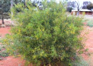
A Waxy Wattle at Erldunda

A Waxy Wattle at Erldunda

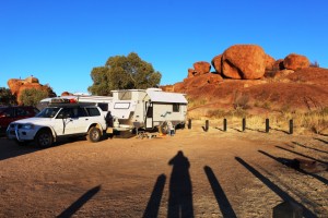
Erldunda is a bit less than 200 kilometres south of Alice, at the intersection of the Lassiter Highway with the Stuart. Lassiter Highway leads to Uluru. The only establishment at the intersection is The Desert Oaks Resort. The Resort is a roadhouse, hotel, motel, tour bus camping area and a caravan park. Quite a good caravan park and it is where we spent Friday night.

The drive to Erldunda was through more kilometres of green desert, mostly flat but with occasional jump up ranges to give some relief. We were pushing into a cold stiff south-westerly wind, but arrived mid afternoon to a grassy drive through sight. Our neighbors were almost all travelling to the same destination as we are. The caravan park has a platform for viewing sunsets but the cloud was packed solid with not a single glimpse of the sun.

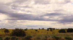
Daisies to the horizon

Daisies to the horizon

We drove through similar terrain on Saturday but the hills are sand dunes rather than jump ups. Yulara is a further 250 kilometres west from Erldunda and more desert like, but still green. We had been passing wild flowers for a number of weeks and frequency had been increasing, but as we turned west the frequency increased further. Fields of yellow daisies stretched to the horizon, often interspersed with smaller areas of white ones and other wild flowers.

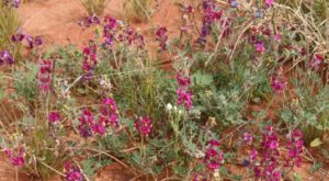
Unknown flower. Who knows what it is?

Unknown flower. Who knows what it is?

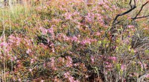
I am no expert in wild flowers so many sightings remain unidentified. Today I realised that bushes of small yellow blooms were Waxy Wattles. We thought that hectares of shrubs with small mauvish white flowers is Heath, but now find that it is Desert thryptomene. Perhaps readers can help by responding to photographs. I will include “Unknown” in the picture title. Watching for the flowers sure brightens the journey.

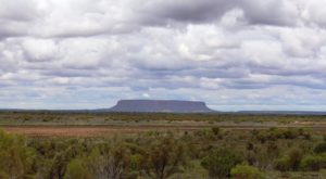
Mount Conner near Curtain Springs is often mistaken for Uluru

Mount Conner near Curtain Springs is often mistaken for Uluru

Saturday afternoon brought us to Yulara and the Ayers Rock Caravan Park. It is a large park with a high turnover of visitors, as people only seem to stay for a couple of days to see Uluru (Ayres Rock)and its sister range, Kata Tjuta (The Olgas).

A three day National Park pass costs $25 for each of us and the caravan park offers a “pay three and stay four night” special, so we increased our stay by two days. But there is a second reason. Things that we want to see as we go south are not accessible because of rain affected roads. A couple of additional days will give more time for roads to dry out.

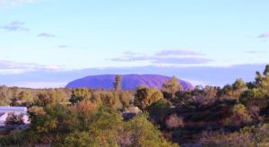
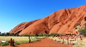
Ayres Rock (Uluru) from the camp lookout

Ayres Rock (Uluru) from the camp lookout

We wasted no time in starting the tourist ritual. The first priority is always to gain an uninterrupted view of “The Rock”. Sightings are rare as you approach Yulara, due to a succession of sand hills that obscure the view. Resort designers thoughtfully provided a lookout on a sand dune on the Uluru side of the camp ground, with expanded mesh pathways to the top. So we walked up to see the sun seting on The Rock.

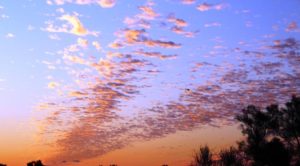
Sunset cloud patterns from the camp lookout

Sunset cloud patterns from the camp lookout

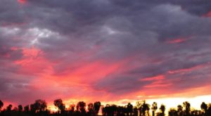
From this distance and direction the result was unspectacular, but the sunset was nice and illuminated some intricate skeins of cloud, remnants of the day’s heavier cloud cover. The accompanying photo demonstrates how attractive they were.


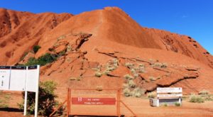
A climbers view of Ayres Rock

A climbers view of Ayres Rock

On Sunday morning we set off for the national park, parting with $50 at the gate. We drove directly to the area where most visitors start their walk around the base of Uluru and where people climb the rock. There was no one climbing. The climb was closed due to high winds at the summit. It was quite breezy at the base so that made sense. The most prominent signage is that encouraging visitors not to climb.

The start of the walking track around the base of Uluru

The start of the walking track around the base of Uluru

We then commenced a clockwise drive around the encircling road. We had completed the walk around the base on our last visit in 2010. At a distance of 10.5 km, to do it would be a bit of a stretch. Photo opportunities from the road are limited due to yellow “no standing” lines on both edges of the tar where the road runs adjacent to areas of cultural sacred significance.

Another unknown flower

Another unknown flower

The circumnavigation complete, we visited the cultural centre where photography is totally forbidden. It is an extensive building taken up by cultural displays, a gift shop, an art shop and a working Aboriginal art studio. There is also a Holy of Holies. A coffee shop!


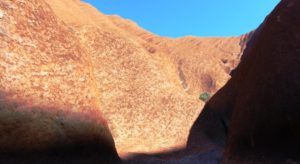
On Monday morning we put on our tourist boots again to do the Kuniya Walk into Mutiijulu Waterhole. We had seen this area on our walk last visit and wanted to see it again. On the southern face of Uluru there is a huge “scooped out” valley that acts as a funnel for water

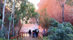
Tourists standing by the pool

Tourists standing by the pool

off the Rock, which it drains into the waterhole. From there a stream passes along the foot of the Rock and then drains away to marsh land. It is easy to understand the importance of such a water source to locals before water started running out of a tap.


The rock forms a natural funnel

The rock forms a natural funnel

The stream runs along the foot of the rock

The stream runs along the foot of the rock

The Olgas from the sunrise viewing area

The Olgas from the sunrise viewing area

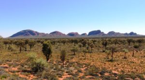
Having completed Uluru, with the exception of a sunset visit still to come, we drove the 45 kilometres to The Olgas, now re-badged as Kata Tjuta, stopping on the way to view this group of domes from the sunrise viewing facility on a sand dune to the east of the range.

Valley of the Winds Walk

Valley of the Winds Walk


I completed two walks, but the terrain was a bit rough for Ruth, so she sat them out. Both walks had been done on our last visit but were worth repeating. I prefer The Olgas to Ayers Rock in many ways. Uluru is huge and awesome but The Olgas have variety, as each dome is different to its neighbor.

The Valley of the Winds walk is sometimes closed as wind velocity can be dangerous. It was open today and I did it first.

More flowers by the math

More flowers by the math

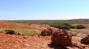
The track leads at first along the bed of a stream that carries water down a slope, before crossing extensive beds of conglomerate, the rock from which the domes are formed. The path then climbs in a series of steps, over more conglomerate and loose rock, to a saddle between two domes. The view is over more domes in another part of the range. A second walk starts from the saddle. It is a loop into a ravine and around other domes, but it is more demanding and adds another hour or so to the walk.

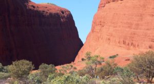
The domes that form Walpa Gorge

The domes that form Walpa Gorge

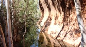
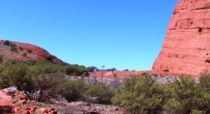
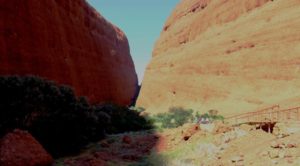
The second walk was into Walpa Gorge. This walk is between the southernmost dome and its counterpart, immediately to the north. Most of this walk is over exposed conglomerate and is a bit like a moon walk. The path follows the lower northern slopes of the southern dome.  The rock is intersected periodically by small vegetated streams that drain the upper slope and run to a stream that divides the domes. Foot bridges have been built over the streams for safety and convenience. The Walpa Gorge path leads almost through between the two domes to a rock fall that blocks what would otherwise be a complete passage to the eastern side.

Walking over conglomerate rock in Walpa Gorge

Walking over conglomerate rock in Walpa Gorge

The final part of the Walpa Gorge walk

The final part of the Walpa Gorge walk

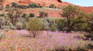
The walks in Kata Tjuta allow you to get up close and personal with the domes. The Valley of the Winds walk provides elevation for a different perspective to that available from the surrounding plain. Walpa Gorge allows close inspection of the lower reaches of the domes. The stunning addition to what we saw on our last visit is the wild flowers. Wherever there is some soil to give vegetation a toe hold, there are blooms. The sides of the road between Uluru and Kata Tjuta are similarly decorated.

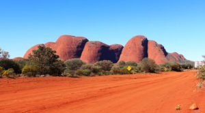
The Olgas from the start of The Great Central Road

The Olgas from the start of The Great Central Road

Just before Kata Tjuta is reached from Uluru or Yulara, Tjukaruru Road turns to the west. It is part of the Great Central Road that leads across the western part of the Continent to the West Australia gold fields. It is also part of the Outback Way that stretches from Cairns in the east to Perth in the west. The Outback Way is also known as The Longest Short Cut.

I can never stand at the start of such a road without getting itchy feet. So as a minor indulgence we drove the first few hundred meters of the rutted dirt and took a photo of the road, disappearing into the West. And a final shot of The Olgas from the road.

The final Tuesday evening activity was to go out to watch the changing colours as the setting sun reflects off Uluru. We took soup in a thermos and fresh rolls from the local bakery. The sun doesn’t set until almost 6.30 pm (7.00 pm EST) so that looked after the first course of dinner.
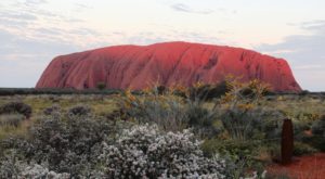
The setting sun touches the top of Ayers Rock

The setting sun touches the top of Ayers Rock. Desert thryptomene and Honey grevillea in the foreground

The signs were not hopeful. There was a heavy bank of cloud obscuring the sun in the west as we drove out to the viewing area. Initially the rock was in the shadow of the cloud but then the sun began to break through and to illuminate different parts of the rock as the sun sank and the clouds moved. There were some great effects, quite different to what we saw last visit when we had a cloud free view.

The final sunset at Uluru

The final sunset at Uluru

We almost missed the final act. We were so focused on Ayers Rock that we were not watching the setting sun behind us. As we started to drive home the road turned us to the west. We were faced with a breath taking sight. Clouds near the horizon and .higher in the sky almost appeared to be on fire. By the time we had parked and got the camera out the very best had gone, but what remained was well worth photographing.

So it was back to camp for the remainder of our evening meal.

West, Centre & Flinders – Days 33 to 35 – Alice Springs & Rain

Our intention has been to spend just one night at Alice Springs. Now it seems that we are to be here for a week. The main issue has been the uncertainty of weather predictions. We abandoned plans to take the van into the ranges to the east and west of the town in favour of setting up in a central location and doing day trips. Saturday was to have been very windy and it was to start raining on Sunday, continuing into Monday. The strong winds did not eventuate and the rain has been deferred until Tuesday and Thursday. Patience is called for!

And to demonstrate meteorological variability we had a minimum of 3 C on Saturday and a maximum of about 32 C yesterday.

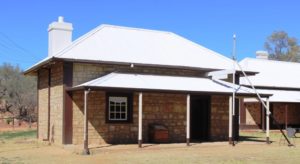
The original telegraph and post office in Alice Springs

The original telegraph station and post office in Alice Springs

Having passed two historic telegraph stations on the way south, we thought we should take a closer look at the restored station at Alice. The buildings were initially well built and have been carefully restored. A restoration of the original office environment, in the original office, has been well done, including sound effects of messages being transmitted by Morse code. Residential buildings have been fitted with furniture of the period and a school room is functional. School children are able to stay overnight, playing the roles of original characters.

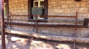
Samples of original and replacement telegraph poles

Samples of original and replacement telegraph poles

The tour guide’s spiel covered the explorations of John McDowell Stuart, who made no less than six trips into the area. The telegraph line was built along the route of his final exploration, under the supervision of Charles Todd. The line was built with poles cut locally as they progressed, but termites proved the folly of that option, so the timber posts were soon replaced with telescopic tubular steel posts.

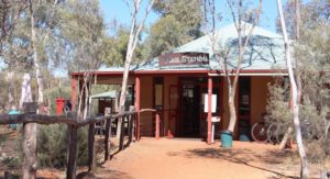
Where I got my warm inner glow

Where I got my warm inner glow

The spiel also included a section on the “Stolen Generation” and included several highly contestable claims. One of the buildings has been used to set up a display on the subject. I guess it gives some visitors a warm inner glow. I achieved my warm inner glow from a cup of coffee and an excellent vanilla slice at the Trail Station coffee shop that also acts as the gateway to the Telegraph Station.

The telegraph line was an important step in Australia’s development as it linked to the newly laid cable under the Timor Sea and ended our communication isolation from the world, particularly from England.

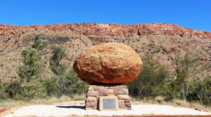
The grave of Rev John Flynn outside Alice Springs. The stone came from The Devils Marbles near Tennant Creek

The grave of Rev John Flynn outside Alice Springs. The stone came from The Devils Marbles near Tennant Creek

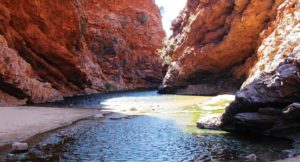
In the afternoon we drove out to the near west McDonnell Ranges, pausing at the grave of Rev. John Flynn, and then took another look at Simpsons Gap. There was water in the gap, as usual, and a cool breeze was blowing through.


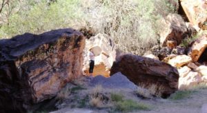
Simpsons Gap

The performer in the Gap

We could hear an pleasant vocal sound, not words but a musical tone, from a pure clear female voice, accompanied by a slow drum beat, coming from the gap. As we walked in we could see a young woman, positioned to gain the advantage of the acoustics of the gap. It was a pleasant accompaniment to viewing such spectacular scenery


Simpsons Gap

Simpsons Gap

We then headed further out Larapinta Drive and drove the northern section of the Owen Springs Track that leads through historical relics and geographical features to the Stuart Highway. The first cattle station in the Northern Territory was established at Owen Springs. Ruins of station buildings remain. It was getting late in the day so we turned back sooner that we had hoped, so didn’t get to see them. The consolation was that we drove back beside the long stone capped mountain ranges, displayed to advantage in the light of the afternoon sun.

The Bluff at the foot of Trephina Gorge

The Bluff at the foot of Trephina Gorge

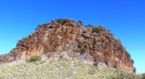
We returned, yesterday, to one of our favourite places on the East MacDonnell ranges. Trephina Gorge is yet another gap in the range through which a stream passes, on its way to the desert. The Ross Highway runs between red stone capped mountains and passes at least three other gaps through which streams flow when there is rain. The best known of the gaps are Emily and Jessie Gaps. The other main feature of interest is Corroboree Rock, a striking rock formation where, you guessed it, corroborees were held.

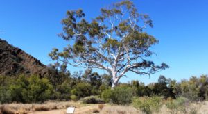
The tallest Ghost gum

The tallest Ghost gum

Trephina Gorge has been cut by the passage of water through red rock that now direct its flow. At least that is the case when it is flowing, which it was not doing yesterday. After exiting the gorge the stream passes at the foot of a huge mound of red stone named The Bluff. From there it makes its way out of the mountains to join those other streams that dissipate into the desert. The gorge also contains the largest Ghost gum in Australia.

Corroboree Rock

Corroboree Rock

There was a final touch of drama as we travelled home. While driving on the gravel road out of the gorge we noticed a continuous trail of fluid. So we were not surprised, just after rejoining the Ross Highway, to see a vehicle stopped part way off the road, with a couple of other vehicles nearby. The fluid trail on the road was transmission fluid. They had damaged something important.

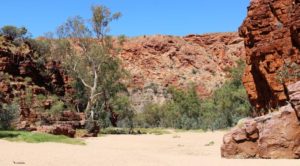
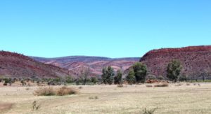
The beauty of the East McDonnell Ranges

The beauty of the East McDonnell Ranges

The vehicle was an aged Ford Maverick and its occupants were a couple of French back packers whose English was inadequate, to say the least. Neither we nor the other vehicles that stopped were able to agree any assistance with them as they preferred to wait for some folk who they had met in the Gorge who were travelling a distance behind them. We can only hope that it worked out for them.

We have been into town on two or three occasions. It is unchanged from last time. Out of town locals wander the streets and seem to be the taxi companies best customers. Security is everywhere, particularly where there are liquor stores. But the commercial centre seems busy and a parking space can be hard to find.

At the caravan park there is an endless procession of arrivals and departures. One night stopovers are common, as visitors restock and head for the scenic areas to the east and west. Much as we had intended. It is hard to detect the colour of some vehicles through the coating of mud that they carry. I suspect that they have come in off the Tanami Track that has had rain in recent days.

So now we wait on the weather. I will deal with that in the next post.

West, Centre & Flinders – Days 30 to 32 – Weather Impacts and Highways

The rain actually amounted to quite a lot. It started with sprinkles during the afternoon and intensified during the evening. Come Tuesday morning the sky was still black, with periods of heavy rain. So we decided to stay put at Barkly Homestead and paid for another night.

The broad plains of the Barkly Tableland

The broad plains of the Barkly Tableland

Before the rain came we were considering our options. If we are to continue to Alice Springs our arrival will be greeted by a number of mornings with lowest temperatures of 2 to 4 degrees C. To turn north to Cape Crawford and Borroloola would see us with top temperatures of about 34 to 36 degrees C. To be hot or cold became the question.

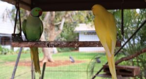
Caged birds on display at Barkly Homestead

Caged birds on display at Barkly Homestead

But the rain changed the equation completely. The Tablelands Highway, that leads north from Barkly, is a single lane sealed road that carries many road trains. When you meet a road train on such roads it is necessary to pull right off the road to leave the sealed road clear. I didn’t fancy pulling off on to rain soaked shoulders, so Alice Springs and cold mornings, here we come!

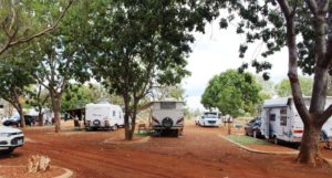
Caravan parking layout at Barkly Homestead

Caravan parking layout at Barkly Homestead

Spending a day at Barkly Homestead has been quite pleasant. A few vans had declared a lay day. We have carried out a few chores but mainly sat and read. The caravan park here is designed for one night stopovers with vans remaining hooked up to tow vehicles. The grounds are laid out in a series of parking lanes separated by a raised gravel area and with a section of artificial grass placed to be directly outside of the door of the van. This provides a refuge from the inevitable mud that occurs whenever the rains descend in torrents, as they tend to do in this part of Australia.

Wednesday dawned with some cloud to the west but it soon cleared to a cloudless warm day. I enjoy driving the Barkly Highway. It is one of the best quality country highways in Australia. The tablelands change from flat to undulating and back to flat again, with open grassland changing to low wooded scrub land. Sprinkled through the scrubby vegetation are eucalypts with white boughs (Ghost gums, I believe) that branch a couple of metres above the ground, producing trees that seem to have been designed for climbing.

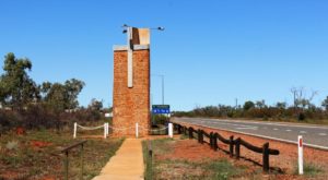
The memorial to Rev. John Flynn beside the Stuart Highway at Three Ways north of Tennant Creek

The memorial to Rev. John Flynn beside the Stuart Highway at Three Ways north of Tennant Creek

We turned south at Three Ways, where the Barkly Highway intersects with the Stuart Highway, but first we made the 200 metre journey north to visit the pillar built in memory of Rev. John Flynn, founder of the Royal Flying Doctor Service. It stands prominently beside the highway.


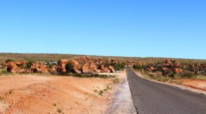
Approaching the Marbles from the North

Approaching the Marbles from the North

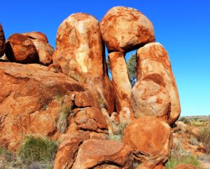
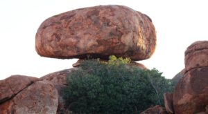
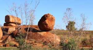
Out destination for the day was the camping reserve at the Devils Marbles. We set up for the night, before taking a long stroll around and among these amazing boulders with their endless variety of shapes and sizes. The information displays at the day use area inform us that the boulders are slowly breaking down and become rounded as they shed their “skin”, a bit like peeling an onion. As the day ended, I found a large slab of rock like a ramp and was able to walk to an elevated level to watch the sun disappear for the day.

So we woke to the sun shining on the pile of rocks that comprised our private view, before packing and setting off to Alice Springs. The morning was cold but the day quickly warmed. Again, clear blue sky with a few scattered clouds, as we approached our destination.

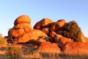
Strange balancing arrangements are common

Strange balancing arrangements are common

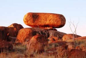
You would think that someone would have pushed it over by now!

You would think that someone would have pushed it over by now!

You do have to wonder how it got there

You do have to wonder how it got there

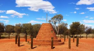
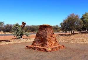
The cairn marking the highest point on the Stuart Highway north of Alice Springs

The cairn marking the highest point on the Stuart Highway north of Alice Springs

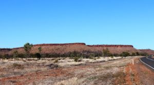
Although the highest point of the road is a bit to the north of Alice Springs there is no feeling of climbing. The terrain appears quite flat most of the way but with some ranges of hills beside the road or visible in the distance. After turning south at Three Ways the Davenport Range and the national park of the same name can be seen to the east. Approaching Tennant Creek from the north a low range of hills dissects the highway while on both sides of Barrow Creek, on both sides of the road, hills with stone caps, like battlements, add a fortress quality to this tiny town. They remind of the Great Wall of China.

Capped hills near Barrow Creek

Capped hills near Barrow Creek

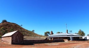
Barrow Creek Telegraph Repeater Station

Barrow Creek Telegraph Repeater Station

There is a great deal of history along this road. Not only does the Stuart Highway generally follow the route of the Overland Telegraph Line but telegraph repeater stations have been preserved at Barrow Creek and Tennant Creek. Road side monuments honour explorers like Stuart and Warburton. We again crossed the Tropic of Capricorn.

The Stuart Highway was not as busy as the Barkly. For substantial periods we had the highway to our selves, sometimes in the centre of a straight section of highway that extended to the horizon in both directions. Parts of the highway that we drove today had sections with no speed restrictions at all. The rest mainly had a limit of 130 KPH but at no time did we see fellow road users doing excessive speed.

So here we are at the Wintersun Caravan Park, for three days, during which we will wash cloths, shop, have haircuts and look at some things that we have missed in previous visits.

Another Change of Plan

When we bought our current van we had warmer climes in mind, so we didn’t pay much attention to heating. Cooling was more important, so air-conditioning was fitted. Heating is now provided by either aircon on reverse cycle or the $20 fan heater from Bunnings. The $20 heater wins hands down.

As a consequence of about 10 consecutive mornings of around zero degrees, and that our travel plans, if followed, would require several nights away from power, a new plans was called for. We were already on Plan B so Plan C was essential to our cumfort. The answer was a no brainer, of course.  Go north!

A monument to John McDowell Stuart beside the highway north from Alice Springs. Reminders of Stuart's explorations are scattered through the area

A monument to John McDowell Stuart beside the highway north from Alice Springs. Reminders of Stuart’s explorations are scattered through the area

Research on the Weather Channel app indicated that to drive 500 km north to Tennant Creek would improve the minimum temperature by about 10 degrees. Alice Springs is quite elevated. Most mornings it felt like it was above the snow line.

A solitary sunset watcher on one of the highest Marbles

A solitary sunset watcher on one of the highest Marbles

So we headed north. Last time we departed Alice Springs heading north we were travelling in company with friends who had a need to return to Brisbane, so we put in a couple of long days with them. This departure was more leisurely.

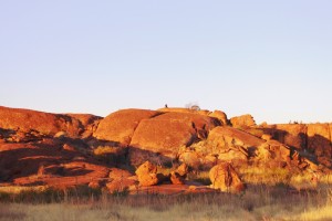
Piles of "marbles" lit by the setting sun

Piles of “marbles” lit by the setting sun

On an impulse and because of the promise of higher minim temperatures, we decided to try for a space in the camping area at the Devil’s Marbles. We were successful, getting the second last

A cap stone not likely to fall any time soon

A cap stone not likely to fall any time soon

spot from the far end, by a nose. We were attracted to the Marbles by folk who wax lyrical about the wonder of sunrise and sunset light on the unique naturally rounded rocks.

See! I was up early.

See! I was up early.

Once again my imagination was missing. But having now been there, I think much of the appeal is to those with younger bodies who climb to the vantage points on the highest marbles to watch the sunset. Noticeably fewer climbed to see the sun rise. Perhaps about 8 degrees and a cool breeze had something to do with it.

The old Tennant Creek Telegraph Station. The history of the Center is so involved with the Overland telegraph Line that reminders are everywhere

The old Tennant Creek Telegraph Station. The history of the Center is so involved with the Overland Telegraph Line that reminders are everywhere

Next day we started out across the Barkley Highway that crosses the Barkley Tableland. This was our second Barkley crossing this trip having crossed it further south via

The caravan parking area at Barkley Homestead

The caravan parking area at Barkley Homestead

the Donohue and Plenty Highways. About halfway across, at the junction with the Tablelands Highway, Barkley Homestead offers its services to the travelling public. It is a homestead no longer, but a roadhouse, superior in quality to many similar establishments in the area, and offering a full range of price competitive services. Even petrol prices were in line with those of Tennant Creek and Mount Isa, slightly higher, but reasonable

Water lilies on Camooweal billabong

Water lilies on Camooweal billabong

The next night was spent beside the Camooweal Billabong with a substantial number of Australia’s caravan owners. As a stopover for free campers the place is legendary. And with good reason! It hosts huge clumps of water lilies and a range of water birds. Of particular interest was a pair of pelicans doing a synchronized feeding dive as well as a pair of preening brolgas. But they are on video and not immediately available.

All this on the way to a return visit to Adel’s Grove and the Lawn Hill National Park.

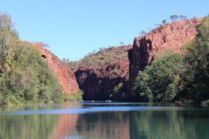
Tranquil waters of Lawn Hill Creek as it flows through the gorge

Tranquil waters of Lawn Hill Creek as it flows through the gorge

We first visited this natural gem four years ago as a follow on to our first visit to the Red Center. On that occasion we left the van at Burke and Wills Roadhouse and stayed in the cabin accommodation at Adel’s Grove. This time we went in from Camooweal. Of the total distance of about 290 km about half is gravel and rather rough in many places. That made for a slow and dusty journey with frequent oncoming traffic, speeding at the head their personal cloud of dust. A cross wind meant that our dust blew clear of the road while their dust blew into our path often totally obscuring our view of the road. And whatever has become of the once practiced courtesy of slowing down to reduce dust and flying stones.
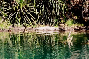
A local resident taking the sun

A local resident taking the sun

There are two choices for staying in the Lawn Hill area. NT National Parks have a camping area at Lawn Hill Gorge and Adel’s Grove offers a range of accommodation options. Adel’s Grove is located 10

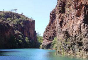
A natural barrier of calcium divides the lower and middle gorges

A natural barrier of calcium divides the lower and middle gorges

km before the gorge is reached and is our choice as a place to stay. When we were there it was also the choice of a large team of paleontologists who were there for a dig at the nearby Riversleigh fossil sight. So there was

Another view of the gorge

Another view of the gorge

not enough hot water to go around and the restaurant was booked out for the two nights that we were there.

But there are improvements since we last visited. A new amenities block is

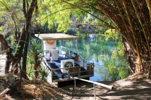
One of the two cruise boats moored in the creek near the resort

One of the two cruise boats moored in the creek near the resort

a great improvement and a take away shop sells fish and chips and other deep fried food that is probably not good for you. And a brand new service, a cruise boat on the gorge and another on the creek at the Grove. In the past the options for viewing the gorge were canoeing or walking. Now a solar powered boat takes up to 10 people at a time upstream through the gorge to the natural dam that divides the lower and middle gorges. To take the cruise is an hour well spent. At $35 per adult it is good value. The range of small coach tours has been expanded and now include one to the nearby Century zinc mine.

We departed Adel’s Grove to the east through Gregory Downs and the intersection of the Burke and Wills Developmental Roads. The 70 km of gravel was in much better condition than the road in from Camooweal, particularly after you pass the turn to the Century Zinc Mine. We travelled back south to Cloncurry where we spent a night before going back west to Mount Isa for a few days.

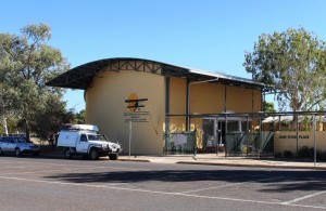
The John Flynn Memorial Museum in Cloncurry

The John Flynn Memorial Museum in Cloncurry

The overnight stop in Cloncurry provided an opportunity to visit the Dr. John Flynn Memorial Museum. The first Flying Doctor flight took place in Cloncurry. H.V. McKay of Sunshine Harvester Company fame had left 2,000 pounds to Flynn to start the service, to be available if the Presbyterian Church raised another 3,000 pounds. With fund raising complete, Hudson Fysh (later Sir Hudson) who had commenced the air service that became Qantas, made an aircraft available and what we now know as the Royal Flying Doctor Service was born. Flynn! McKay! Fysh! All towering figures in their fields! No wonder the R.F.D.S has become such a success.

If you visit Cloncurry, the museum is worth some of your time. It tells the story in detail and is supplemented by a fine art collection. We have visited Flynn’s grave near Alice Springs, the memorial to him by the Stuart Highway north of Tennant Creek and the small town of Beltana in South Australia where the R.F.D.S concept was born in Flynn’s mind. To finally visit the memorial museum was a very special experience.