
Although I lived not far away from the area during the first 15 years of my life and have passed the roads that lead to it countless times, I don’t remember ever visiting the southern shores of Port Stephens. Certainly, I had visited the northern shore at Tea Gardens and spent time within what is now the Myall Lakes National Park, but had not been to the area often known generically as Nelsons Bay.

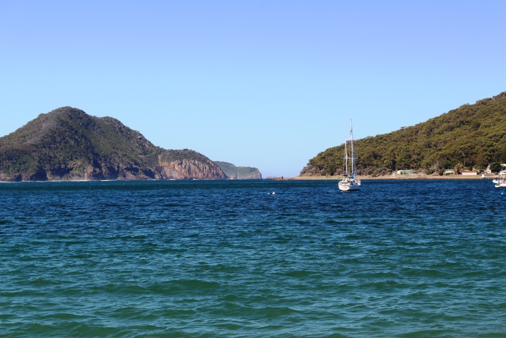
Entrance to Port Stephens from the lookout at the old lighthouse
The entrance from Shoal Bay beach.
Several years ago Ruth and I bought a yacht in Sydney. I sailed it up the coast with a couple of mates. The plan was to call in at Port Stephens, but we arrived off the entrance at around midnight. There was no moon and it was pitch dark, or at least as dark as it gets at sea on a fine moonless night. We decided to sail on rather than risk a night entrance to a strange port. I was now able to see what would have been revealed by daylight had we made the nocturnal entrance.

The entrance from the second lookout
This is a most beautiful part of the NSW coast and is very popular with the residents of Sydney and Newcastle. We stayed it Shoal Bay, from the crescent beach of which the entrance to this harbour can be clearly seen. We stayed at one of many well patronised caravan parks in the area. Brother Ivan and Sister-in-law Marjorie were right next door, an arrangement that proved to be ideal for chats when in camp.
Our early afternoon arrival allowed us to set up for the three night stay and then have an extended chat. Marjorie had prepared an evening meal for us so the talk went on until bed time.
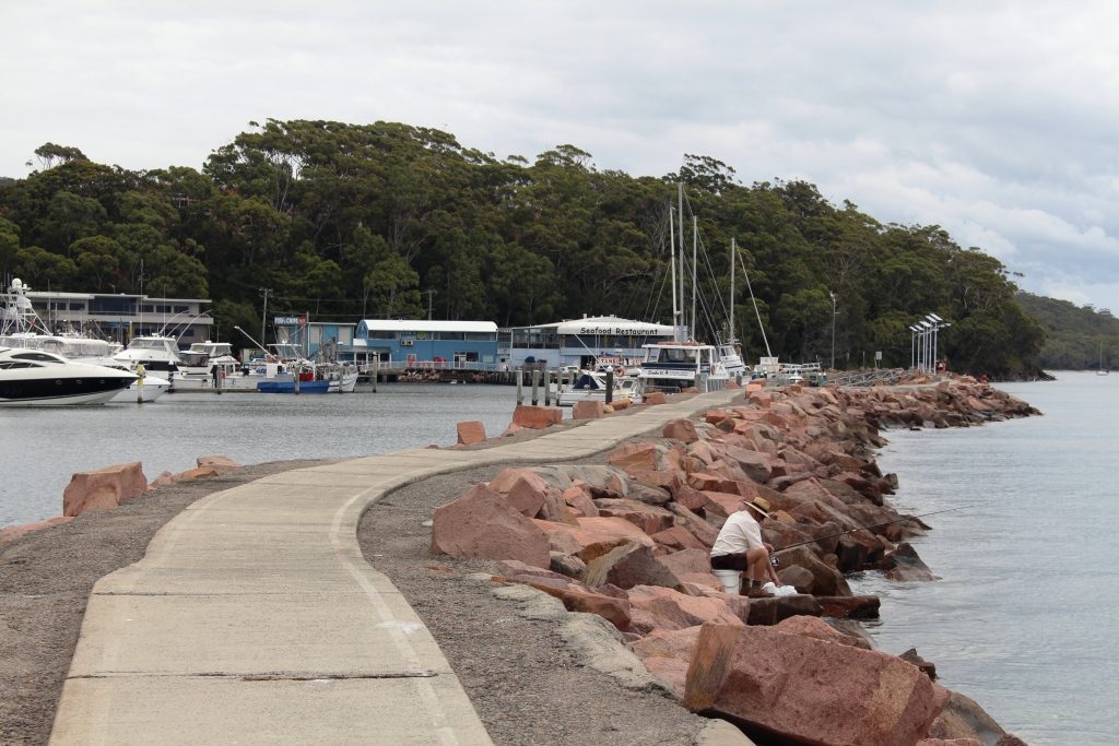
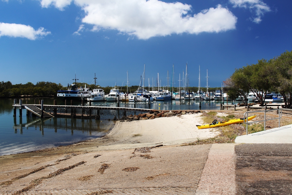
A favourite and often visited fishing wall.
After clearing some commercial duties the next morning we all climbed into Ivan’s car for a tour. He, as the local, knew his way around. That allowed Ruth and I an uninterrupted view of the passing scenery.
The eastern end on the bay is a succession of beaches and headlands. Nature has been kind in providing hill tops suitable for lookouts just where they are needed. The old lighthouse on the western end of Shoal bay provided a superb view of the heads while another hilltop a little further inland provided a panorama of most of the extensive waterway.
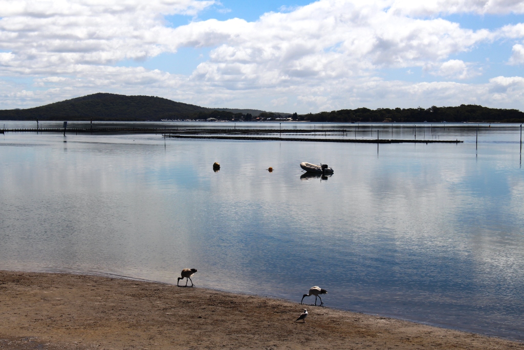
The reflective waters of the further reaches of the bay.
The waterway has a maximum length of 24 km and a width of 6.5 km in the widest part. It has a surface are of 134 square km. It shallows further inland and distributes into several bays, inlets and creeks. The Myall and Karuah Rivers empty into Port Stephens.
Ivan has been a keen fisherman most of his life, so we saw many of his favourite fishing spots, including a convenient flat rock on the marina breakwater from which he has caught luderick , or black fish as they were known in less PC times.
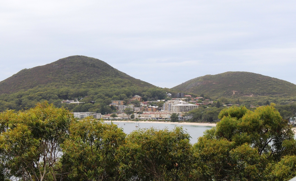
Harbour side development
The development around the waterfront, particularly in elevated positions, is impressive. Much is tourist oriented with resorts, units, motels and hotels in copious number. This is a boating and fishing area so has its share of boat ramps, marinas and extensive areas of moored pleasure craft.
We enjoyed lunch in the café at the main marina and watched the commercial marine activity. This is a whale watching port, but when whales are out of season dolphins seemed to be a viable replacement. Tourist boats kept up a constant shuttle with tourist buses arriving regularly with loads of overseas tourists, predominantly Koreans. While we watched, a crocodile of school children passed, some with fishing rod and others with hand lines, heading for the harbour wall. It would seem that living off the land is still taught in NSW schools.
Recreational craft at anchor in Lemon Tree Passage marina
On Friday we travelled further afield to see more upstream parts of the bay, including fishing spots of course, and then drove to Anna Bay to see the eastern end of the massive sand deposit known as Stockton Beach. If the tide had been suitable I would have taken the party for a drive over that magnificent stretch of sand in the Challenger, but high tide occurred around noon so the timing was not good.
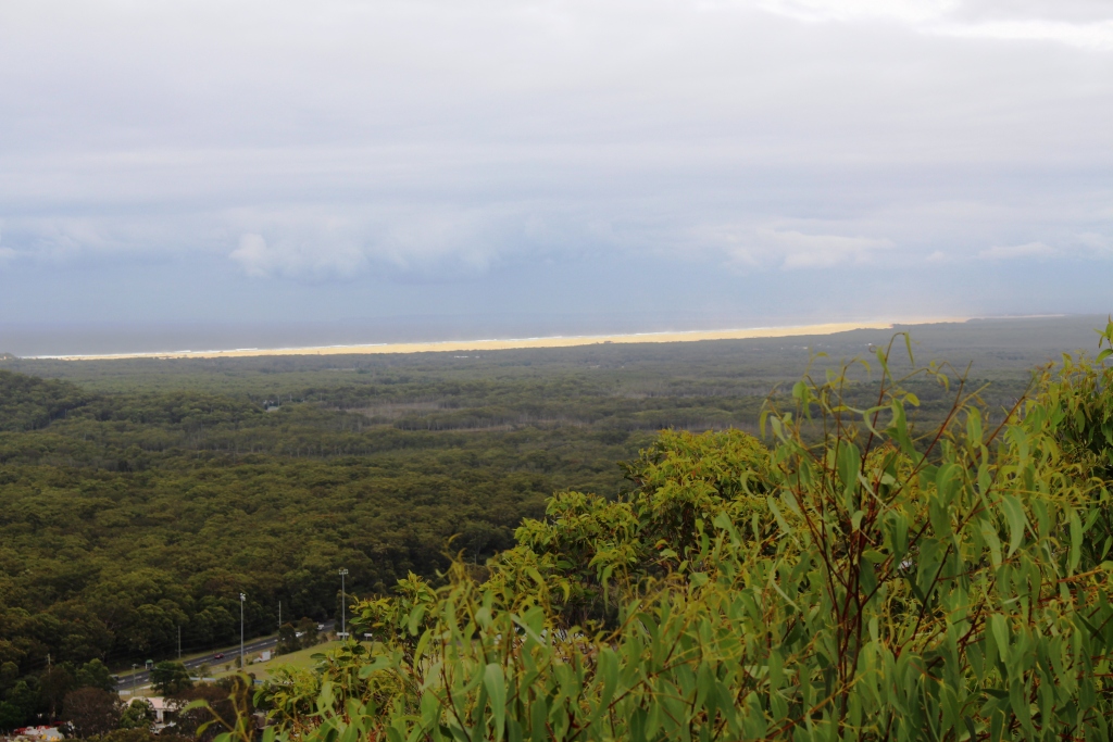
The extensive Stockton Beach from the lookout above Nelson Bay
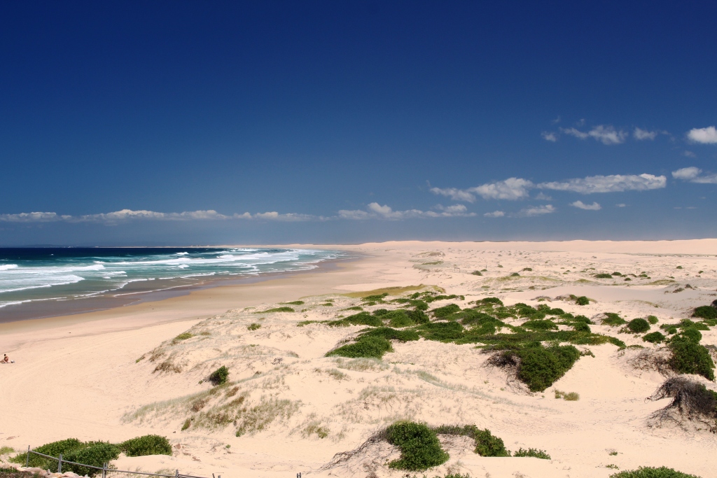
A closer view of the vast sand deposits of Stockton Beach
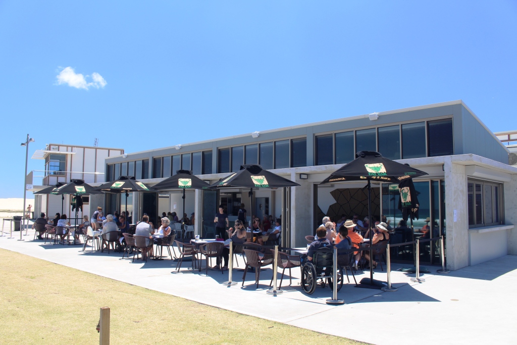
Our lunch venue at Birubi Point at the eastern end of Stockton Beach.
So we consoled ourselves by lunching at the front of the Birubi Point Surf Lifesaving Club café with a view down the length of the beach, with the hills behind Newcastle in the far distance. What a magnificent view! And with good food to eat while we enjoyed the view.
The caravan park was well appointed but busy. Grey nomads are known to hitch up their caravans as soon as children return to school. The population of the park was older but some families were still holidaying.
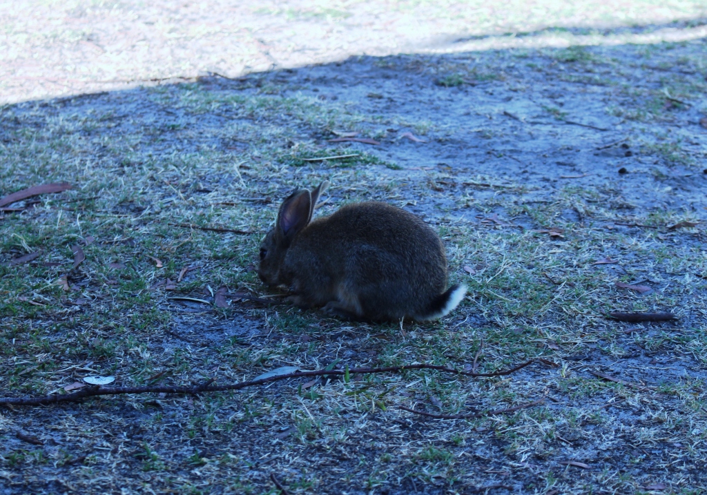
The crazing didn’t seem to stop!
Among the constant movement of people and vehicles, three small rabbits kept a close eye on the activity as they calmly grazed among the van sites. They showed little fear – just looked at you and grazed on.