
When we passed through Charters Towers on our way to Townsville we had decided to return to have a closer look at the town and then to journey down the Gregory Developmental Road to Clermont before turning east to again join the Bruce Highway to travel home.
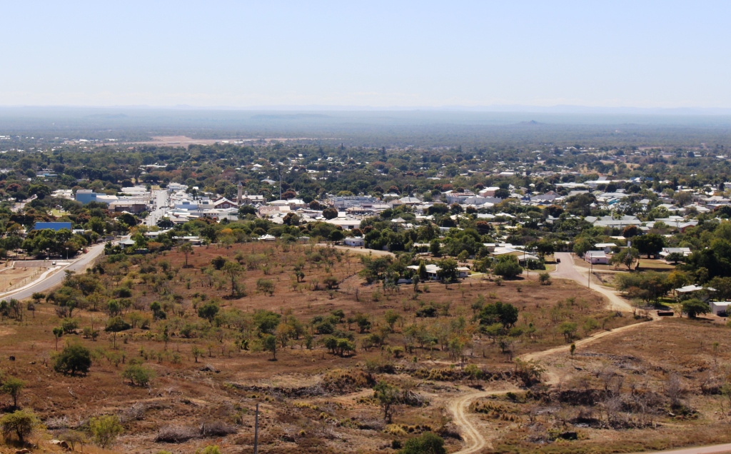
Charters Towers viewed from Tower Hill over mining scared ground
We had spent a couple of single nights in Charters Towers but had not really looked around. This visit was for two nights. The Charters Towers Tourist Park, where we stayed, allows the Charters Towers Lions Club to run fund raising dinners in the camp kitchen. Fifteen dollars buys a three course meal. We knew the format from last time, a meal and a brief talk on the area.
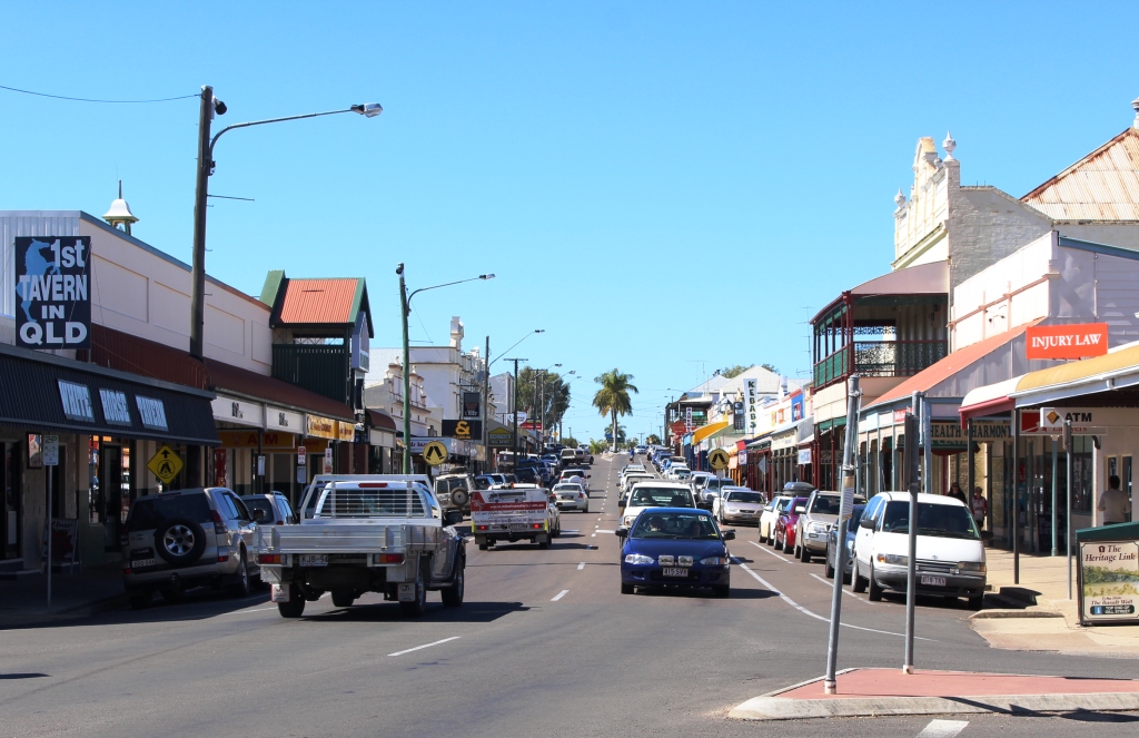
One of the main streets lined with historic buildings
The talk provided a background for our sightseeing the next day. Charters Towers was already an established cattle town when gold was discovered in the 1880s. The gold was of high quality and quickly created great wealth. Mining companies sprang up in such numbers that the town opened its own stock exchange which operated in conjunction with the London stock exchange. But the gold rush ended and the town started to wind down. The current population is around 10,000. At its peak the town had 40,000 residents.
Another classic streetscape
Charters Towers also has a proud history of participation in WWII. American bombers were based there and it was one of two bases in Queensland from which bombers flew to attack Japanese war ships during the Battle of the Coral Sea. In more recent times education has added to the wealth of the town. It is the location of a number of prestigious colleges.
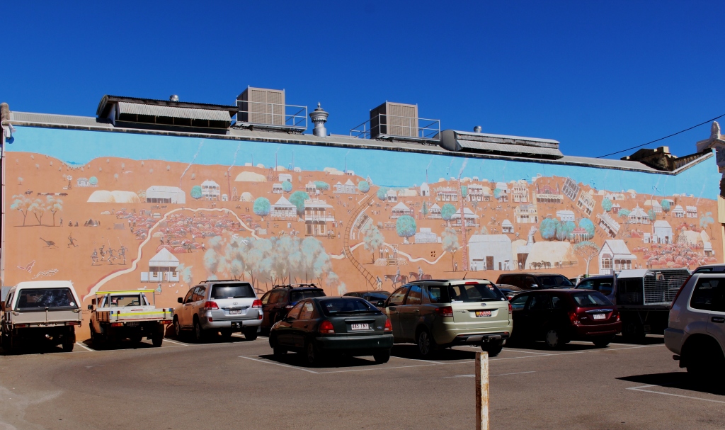
An impressive mural adorns a wall of a prominent building
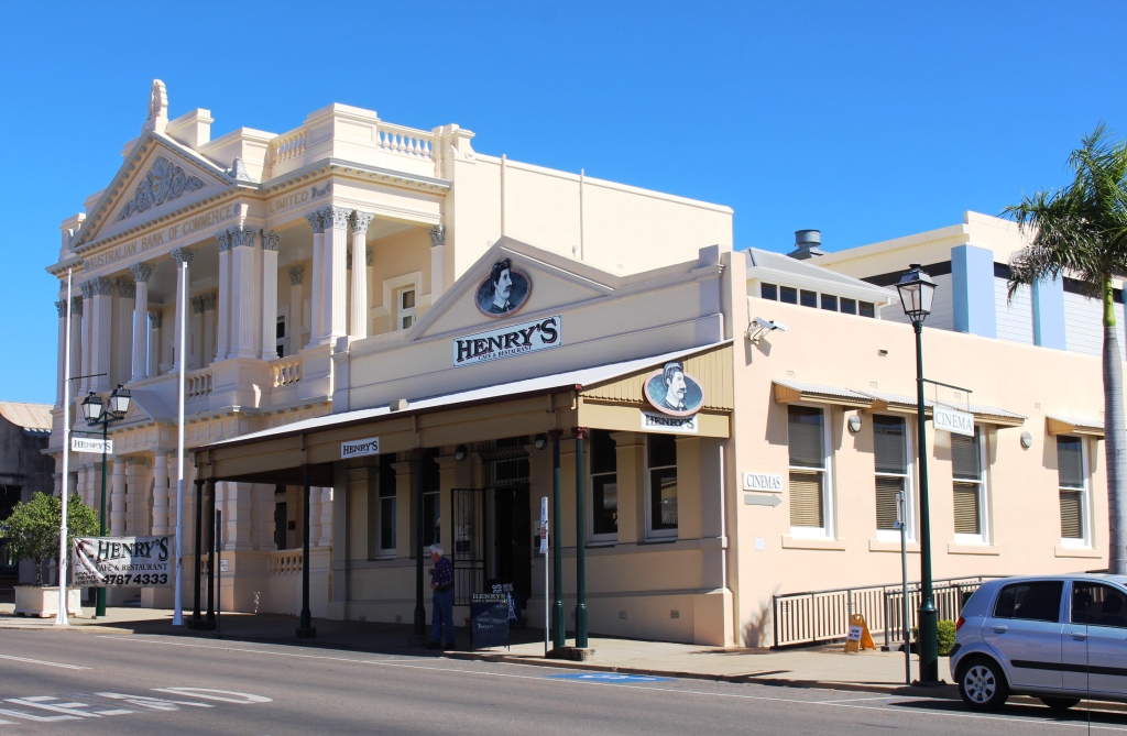
The town has always been aware of its history and has turned it to good account. Preservation of original buildings has always been important, so to walk down the street today is to experience many of the same sensations as visitors of days now long gone. We had lunch at a cafe in the arcade of the original stock exchange. Just along the street the Town Hall has an extensive display of war time photos and almost directly opposite much of the history of the town has been recorded on a huge mural on the wall of a large building.
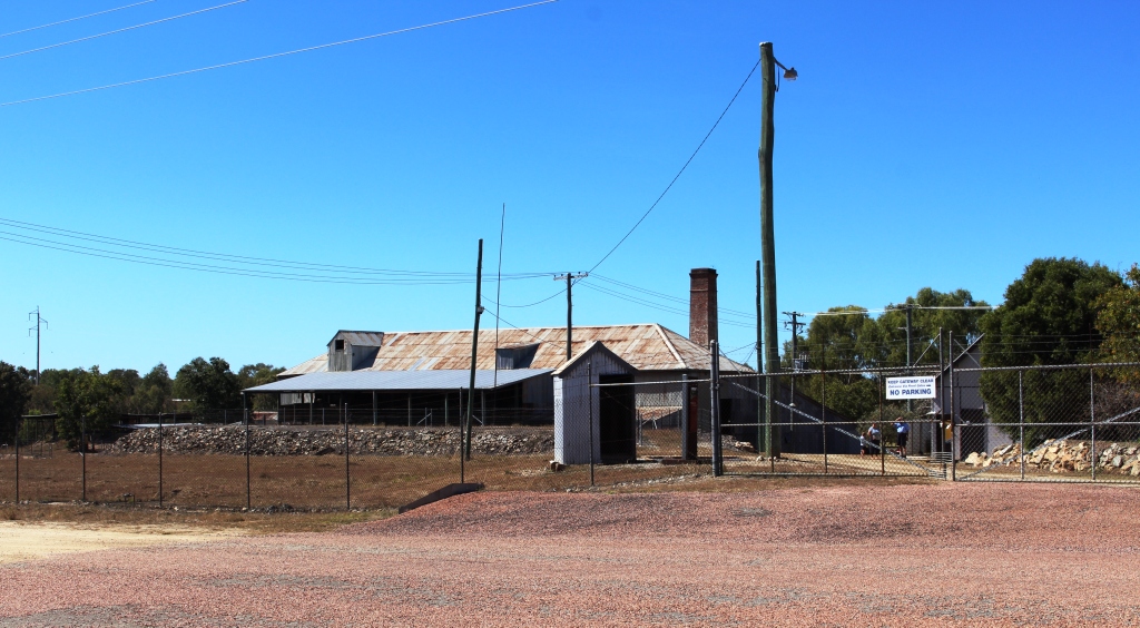
Venus Gold Battery
We visited the Venus Gold Battery before driving to the summit of Towers Hill Lookout where a substantial structure has been built to commemorate and record much of the mining history. The observation point is appropriately sighted above the many shafts from which the city’s golden wealth was extracted.
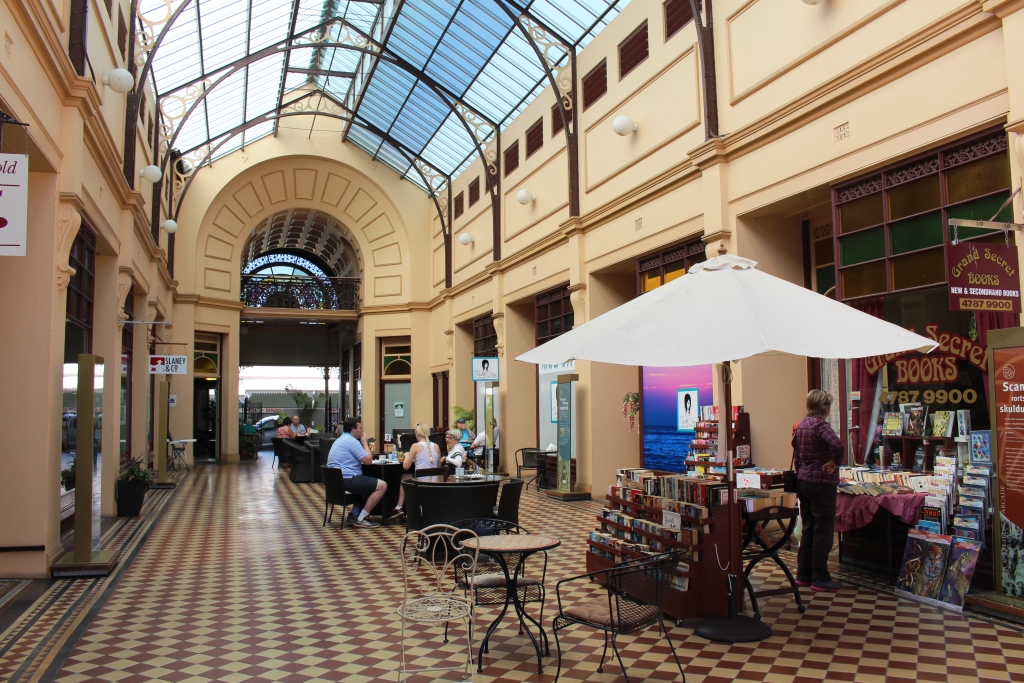
We lunched at a cafe in the historic arcade of the old stock exchange building
Charters Towers is located at the junction of the Flinders Highway and the Gregory Developmental Road, which goes south via Clermont and Emerald to Springsure and north west to The Lynd Junction where it intersects with the Kennedy Developmental Road. We had not previously travelled this road so our journey south broke new ground.
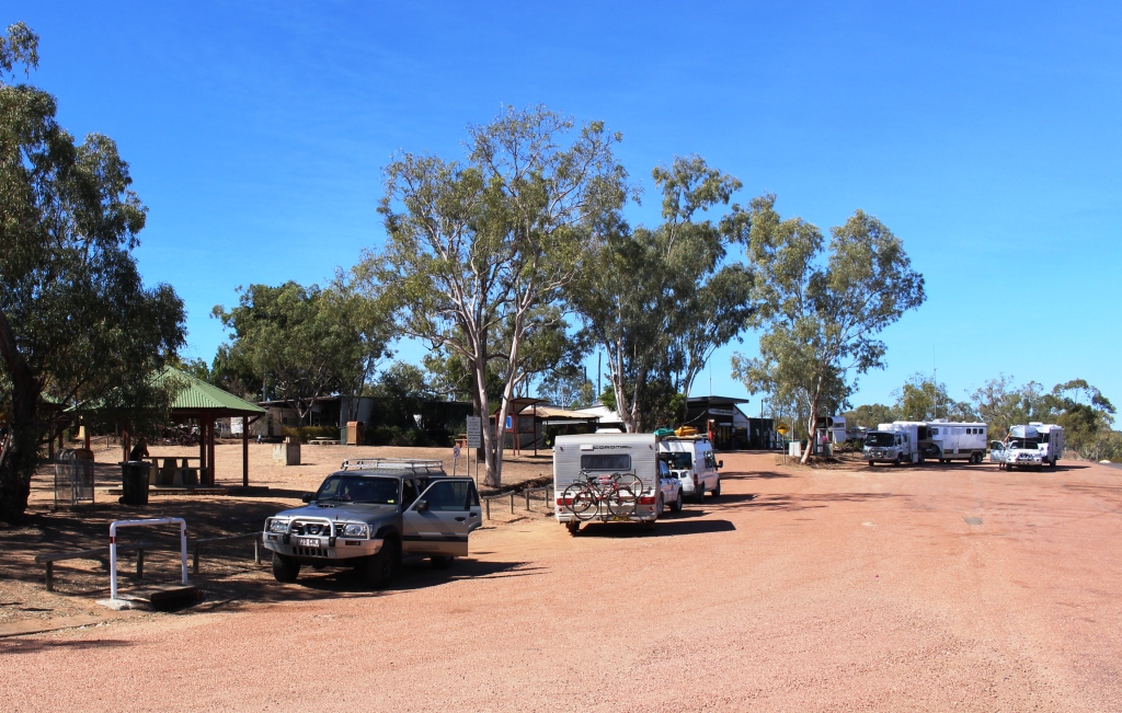
The road house at Belyando Crossing
The distance to Clermont, our destination for that day, is about 350 km. Until you reach the coal mines near Clermont the only sign of habitation on the entire journey, apart from some cattle stations, is the roadhouse at Belyando Crossing where the highway crosses the Belyando River. It was a hive of activity. Everyone seems to stop there. The most common vehicles on the road were cars with Victorian number plates towing large caravans. Ruth stopped counting after her count reached 100 vans.
Clermont is another of those agricultural and mining towns. It is an old town, with commercial buildings dotted around its streets but with lots of mining vehicles, various makes of four wheel drives with the distinctive yellow stripe along the side.
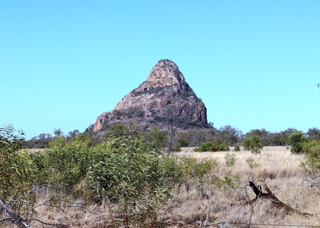
The prominent Woolfang Peak beside the Peak Downs Highway
Out route next day took us along the Peak Downs Highway past a succession of coal mines and near to the coal mining town of Moranbah. After passing the Clermont mine there is an area of agricultural and grazing properties before the mines start again. Interest is maintained through this area by a succession of unique mountain peaks of which Woolfang Peak is the most dramatic. I wondered if the peaks had anything to do with the name of the highway.
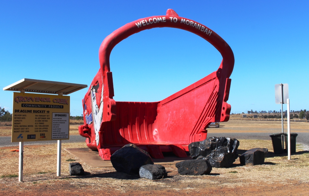
An appropriate welcome to Moranbah
During my transport industry days I was a regular visitor to Moranbah as, for a time, it was part of my area of responsibility. Ruth had never been there, so we drove the 13 km in from the highway to see how things had changed. McDonald’s is there now and the town is bigger but the central business district looked substantially unchanged. The surprise was the airport. It is a much larger structure with large parking areas and signs directing users to drop off points and arrival and departure points. It was a reminder of the extent to which fly-in-fly-out staffing of coal mines has taken over.
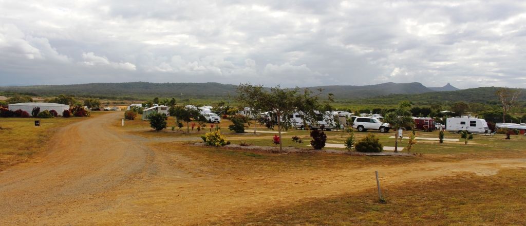
The tranquility of the Cape Palmerston Caravan Park
The Peak Downs Highway goes to Mackay but we left it east of Moranbah and followed the coal railway towards Sarina where it briefly joins the main north line before diverging to the east to the bulk coal loading terminals at Hay Point and Dalrymple Bay. Our destination was a caravan park near the hamlet of Greenhill on the coast just south of Sarina.