
Day 31 – 26th April – Mt Beauty to Mansfield – 200 Km
We made an early start, ground our way up Tawonga Gap, stopped at the lookout at the top and eased down the other side to Bright. We have visited Bright before so we contented ourselves with a slow drive through its tree lined streets. The autumn tints are not as far advanced as in Mt. Beauty but are still most attractive.
Mount Buffalo was the next geographical feature and appeared prominently on our left as we left Bright. It is on the list for a visit some time. The entire area is worth more time but so does much of Australia.
I wonder, as we pass through this former tobacco growing region, why property owners have never removed the drying kilns that seem to be a feature of most properties. Do they think that the anti-smoking movement is just a passing fad?
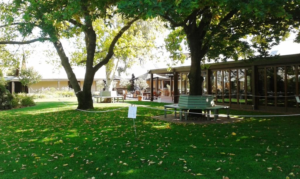
Tasting Room and Restaurant at Brown Brothers Winery
Our first objective was to visit the Brown Brothers winery at Milawa and perhaps to sample some of the other culinary delights of the Gourmet Trail. Brown Brothers lived up to expectations, perhaps exceeded them. We would like to come back at some time to experience a meal in their epicurean centre. We did become members of their Epicurean Club which is worth 10% on purchases.
We also checked out the cheese shop at the other end of town. Another delightful place where to linger too long would not be good for the waist line. The shop incorporates a bakery and a restaurant. The show cases almost bulge with goodies.
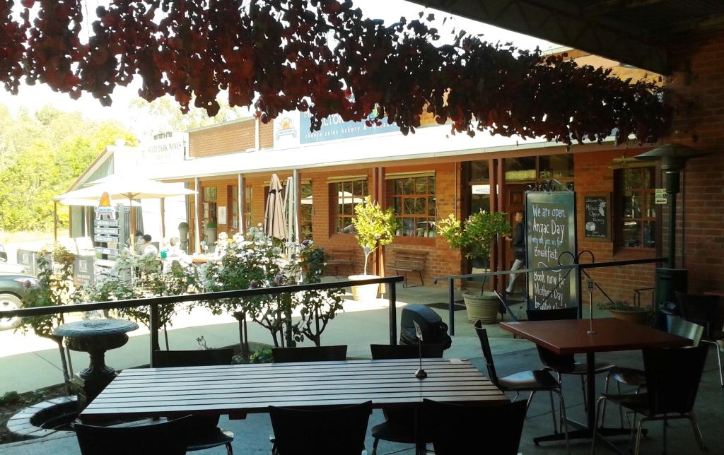
Milawa Cheese Shop cafe area
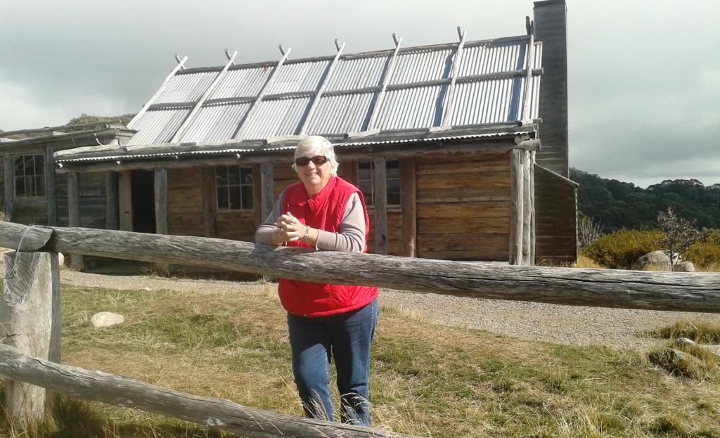
The rest of the day, until mid afternoon, was spent travelling to Mansfield via Whitfield. This trip involved climbing a mountain range to about 800 metres before descending again into the valley that leads to Mansfield. We made a small detour to Power’s Lookout, where we had lunch. I had not heard of Harry Power but it appears that he terrified the good people around Whitfield back in the days when bush rangers were doing their thing. The detour allowed us to share his view into the King Valley. He was looking out for policemen. We were looking at a tranquil valley.

Harry Power’s view of the King Valley
Day 32 – 27th April – The Victorian High Country
In recent years, as I have developed my interest in four wheel driving, I have read quite a bit about the Victorian High Country. The High Country covers a substantial part of Victoria from Central Victoria right through to where it joins the NSW Southern Alps at the Snowy Mountains. Mt, Beauty and Mansfield are both part of this region but, from a 4WD point of view, Mansfield is the more popular. The roads into the mountains provide access to a vast selection of mountain roads, bush tracks and camping sites.
We used our day at Mansfield to explore some of this country. We chose the Mt Stirling Circuit because it allowed us to visit the iconic Craig’s Hut, a prop built for the shooting of the film “The Man from Snowy River”. We and a large number of other people!
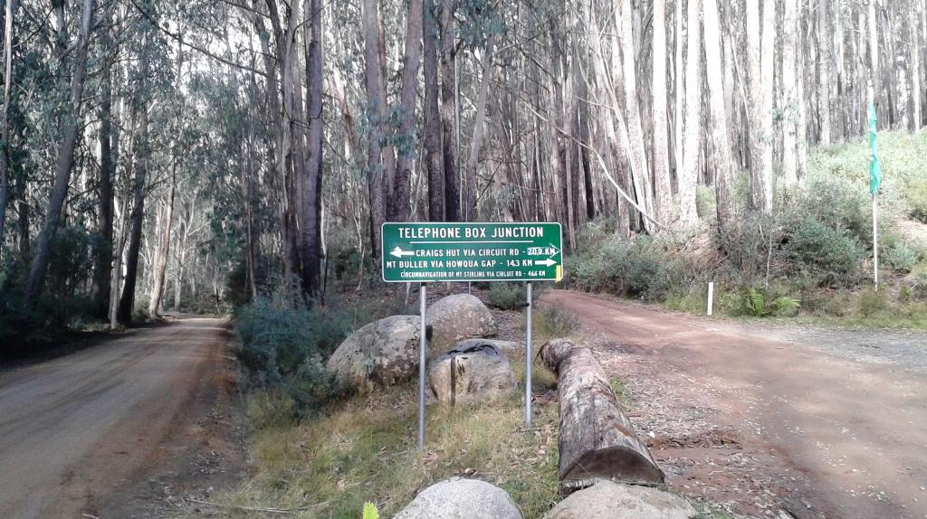
Telephone Box Junction – the start of the circuit propper. Out to the left .. back to the right.
The circuit road is about 80 Km of mountainous gravel road. Most is winding and narrow. Its main contribution to tourism is the magnificent views that it offers of Victoria’s mountain ranges but it also leads to other roads and tracks. The roads were originally used for carting logs to saw mills and still carry some log trucks at times. But the main users are drivers of SUVs, although in dry weather it is a 2WD road as well.
Most of the road was in good condition but there were some areas of fairly severe corrugations.The only real 4WD track in this drive is the track from the circuit road to Craig’s Hut. This track is narrow and steep and today it was busy. When we arrived at the destination, after giving the Challenger the best work out that it has had to date, the car park was full with more than 30 4WDs of all descriptions.
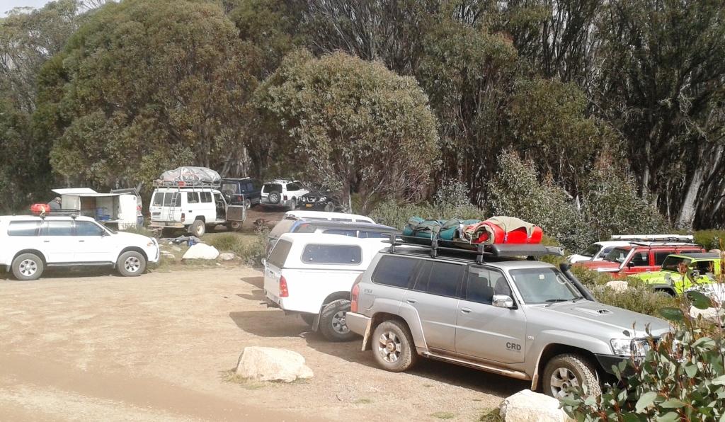
Part of the crowded car park
There was also a horse riding tour group. The horses tethered to the rail fence around the hut gave the whole scene a sense of authenticity which was offset by the number of people walking around. There was a great deal of movement at this station!

Horses tethered to the fence of Craig’s Hut
Ruth leaning on the back fence of Craig’s Hut
The view from Jim Craig’s back fence
After completing the circuit, we drove up the serpentine road to the Mount Bulla ski village. But it is no village. It is a small city placed at the very summit of a mountain peak that rises to almost 1,700 metres above sea level. Many of the buildings look almost new and additional accommodation is being added now. I don’t like snow very much but I would like to visit there during the snow season just to see what it is like. But I would stay inside by the fire!
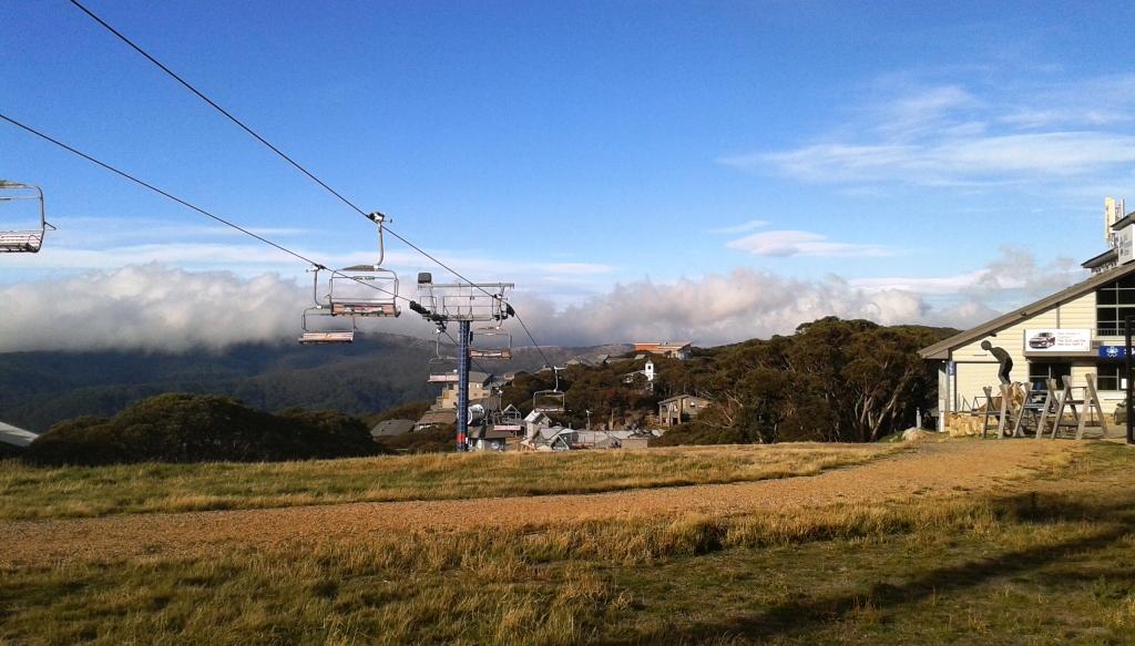
A chair lift passes right by houses at Mt Bulla
The view from a Mt Bulla street
Day 33 – 28th April – Mansfield to Drouin – 270 Km
We left Mansfield in cloudy and cool (well, perhaps cold) weather heading for Drouin in West Gippsland. Drouin is the town where I spent the second half of my teens and where Ruth and I lived for the first two years of married life. My sister Aileen and her husband Colin now live there having moved from their home of the 48 years of their married life at neighbouring town, Longwarry. Aileen and Colin will be joining us at Lakes Entrance but we wanted to see their new house.
The trip was uneventful but interesting. I had no idea of the extent of the wine industry in the Yarra Valley. It reaches out almost to Healesville. The vineyards grow on rolling hillsides on both sides of the highway. Vines in this area have not yet lost their leaves but the foliage has turned an almost uniform shade of yellow that, from a distance, looked like canola fields.
Aileen and Colin have a very nice home. We backed the van into the drive at the side of the house and abandoned it for a bed inside. A very warm and comfortable bed!
Day 34 – 29th April – Drouin to Stratford – 133 Km
We made a late start after a leisurely breakfast and then morning tea sitting in the sunshine. Our destination is Stratford on Avon. Yes, Victoria has one as well as England. And the town hosts, unsurprisingly, an annual Shakespeare Festival. The caravan park is on the banks of the Avon River and we have another river side site.
We arrived mid afternoon and settled in. And that was it for the day.
Day 35 – 30th April – Dargo and more High Country.
Many of the mountain roads and tracks that can be accessed from Mansfield can also be reached from Gippsland. One of the most popular entry points is the small alpine town of Dargo. Dargo is a small town, its few houses stretching along the valley through which runs the Dargo River. It’s most famous and prominent building is the Dargo pub, which I am sure has retained its tumble-down appearance for good commercial reasons.
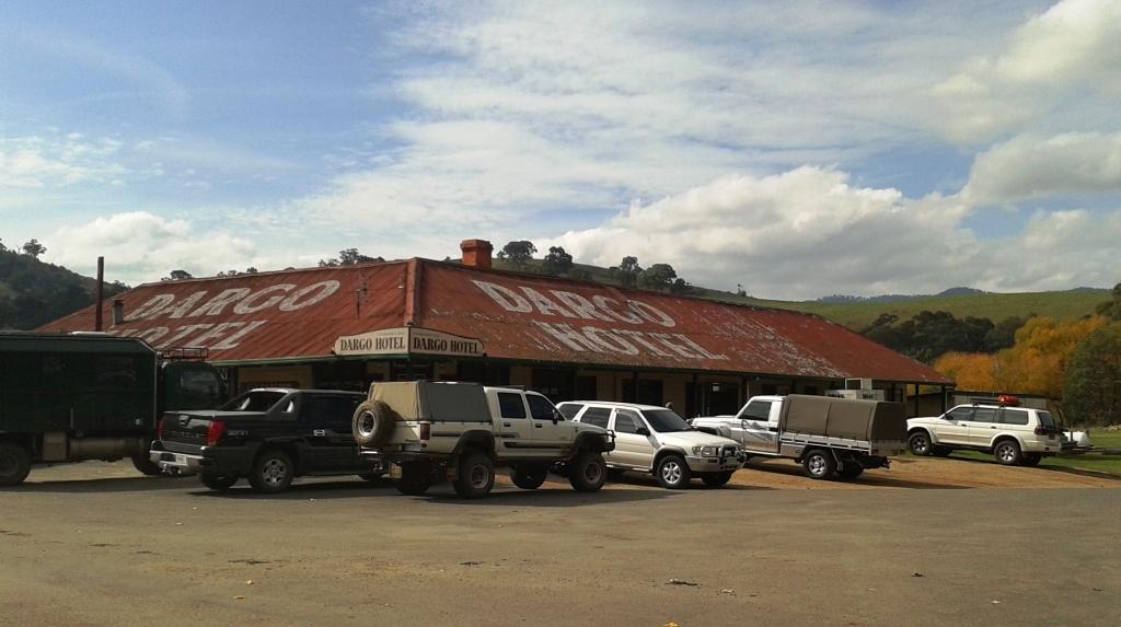
Dargo Hotel
The road from Stratford runs first along the Princes Highway and turns north to traverse flat open farm country, although most of the paddocks were empty with only a few sheep and cattle in evidence. Then the road climbs to about 600 metres above sea level and undulates a bit over two or three timbered mountains before dropping into the Dargo Valley.
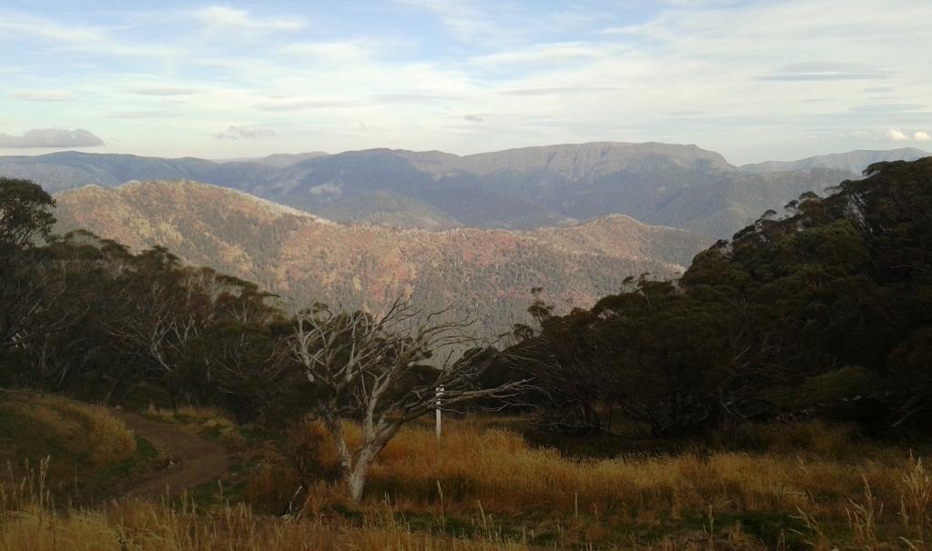
Immediately after passing through Dargo the mountains start in earnest. In about 8 Km the road rises to around 1,200 metre and the views are spectacular. This area has numerous roads and tracks. They ascend to the giddy peaks of mountains, run along the spines of alpine ridges and dive into protected valleys where camping areas sprinkled along the river banks.
One of the main rivers is the Wonnangatta, which runs through the mountains accompanied by tracks that lead to historic locations unknown to most people. This was gold rush country and relics of mining history are still there to be seen.
We drove to the top of the mountain above Dargo so that we could claim to have seen the Dargo High Plains, the scene of many years of summer grazing activity as well as timber getting. We also did the first few kilometres of the Crooked River Track that runs beside the Wonnangatta and checked out the Wonnangatta Caravan Park, although it is already closed for the winter. The 4WD season is almost finished for this year. There were few other vehicles on the road and Dargo was very quiet.

Part of the Wonnangatta Caravan Park
I will always be grateful to the pioneers who planted the deciduous trees that so add to the beauty of the scenery with their magnificent colours. The Dargo River near the town is lined with large autumn tinted trees that provide a brilliant backdrop to the town. From the heights of the mountain we looked down into the Dargo River valley, upstream from the town, and there were splashes of gold and scarlet contrasting with the lighter green of the grass and the grey green of the Australian bush.
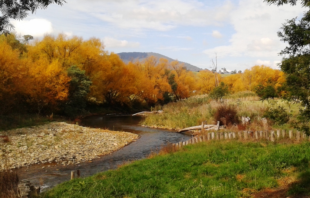
Autumn colours along the Dargo River