Destination Tasmania – Part 12 – Bass Strait & Walhalla

2nd to 5th March 2020

Please Note: At the foot of this post you will find videos covering the material that the blog post contains.

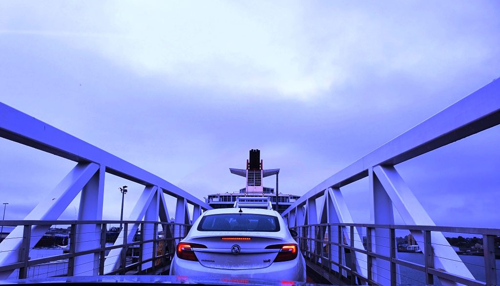
Our location for our last night in Tasmania provided a further benefit as we drove the short distance, through a morning shower, to the ferry. We had to turn at a roundabout that put all the traffic coming out of Devonport to catch the Spirit on our left, giving us right of way. But loading was still a slow progress as the ship arrived late from Melbourne. I felt sorry for the yellow coated attendants as they stood around in the rain waiting for something to happen.

Driving up the ramp to board the Spirit of Tasmania

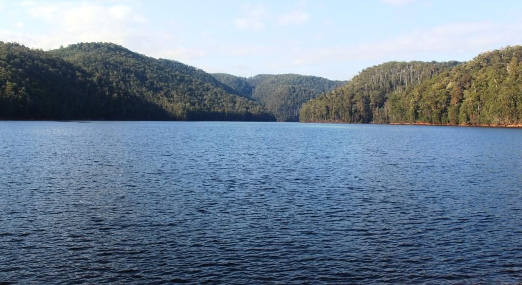
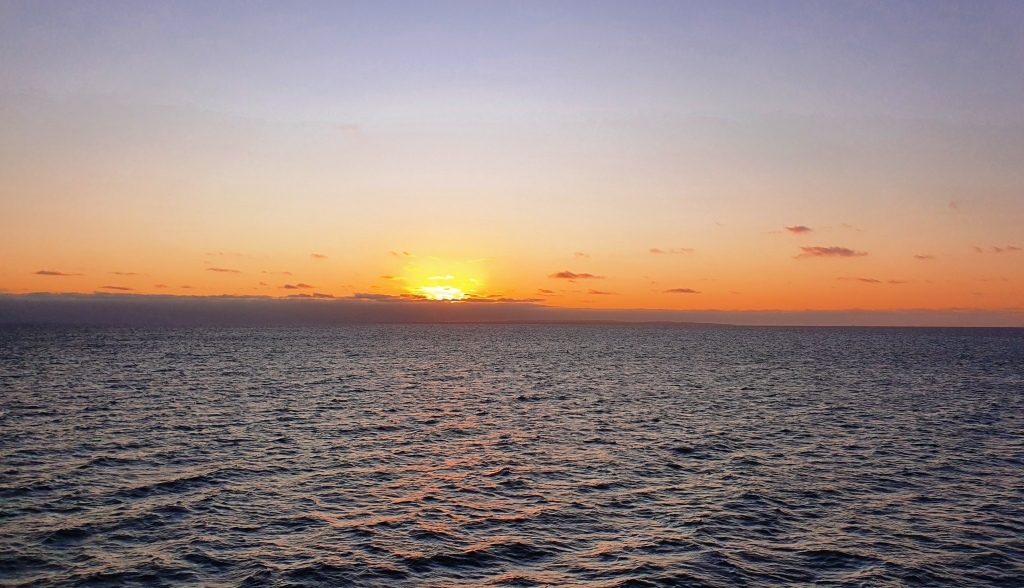
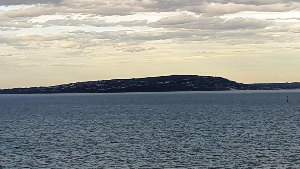
We had another good Bass Strait crossing. The expected strong winds did not eventuate. There was a slight swell running through the Strait but not enough wind to produce white caps.

The wharves on the Mersey River and HMAS Stewart visiting its home port

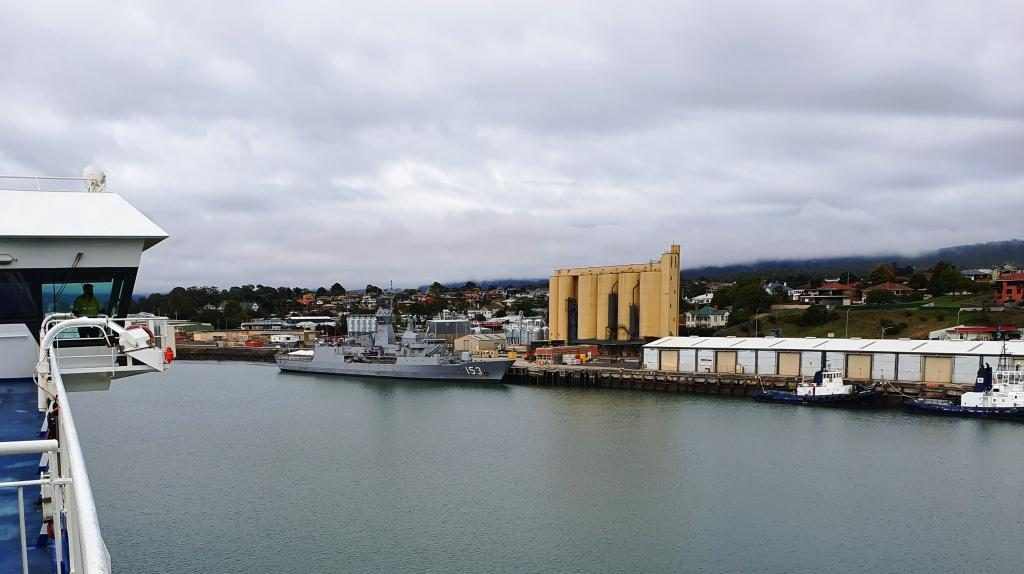
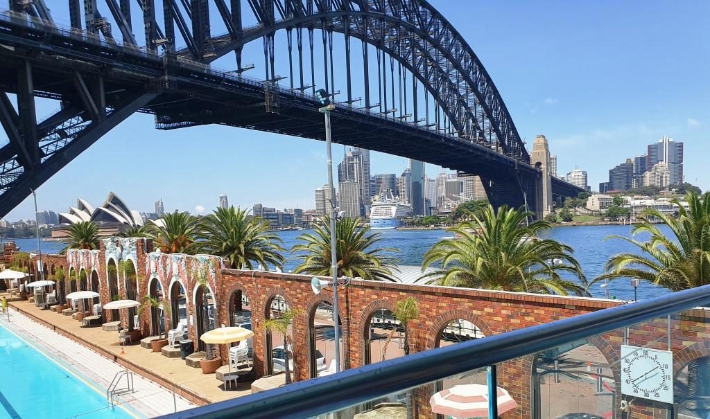
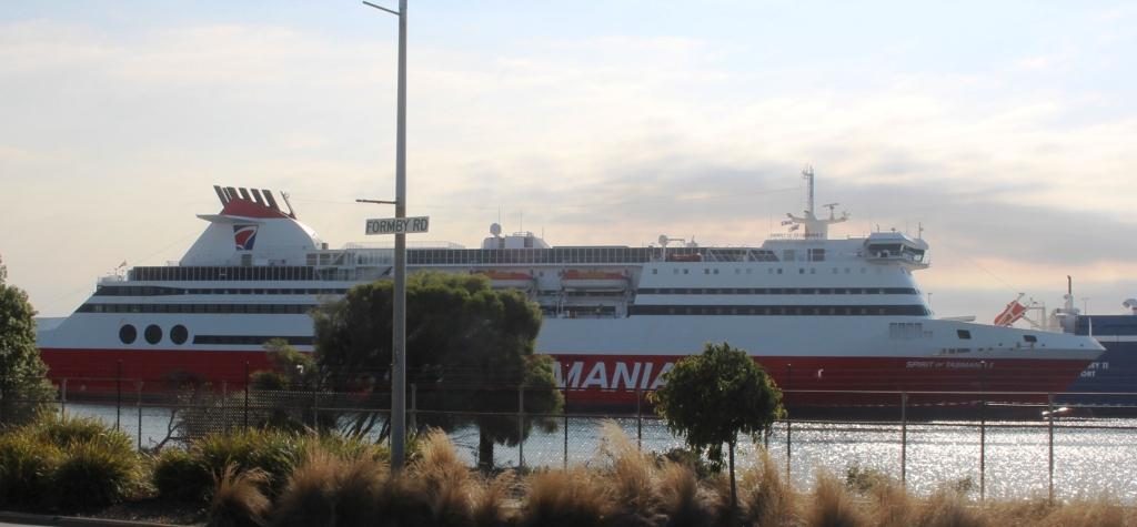
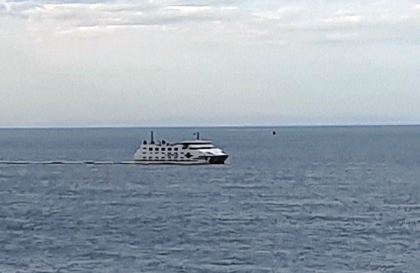
We had travelled south on Spirit of Tasmania One and returned on Spirit of Tasmania Two. They appear to be identical twins and very suited to their task. We had no complaints at all about either of them.

The north coast of Tasmania sliding under the horizon. The flat coast does not suggest the mountainous nature of Tasmanian topography.

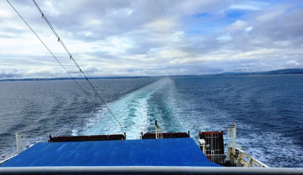
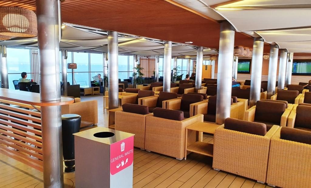
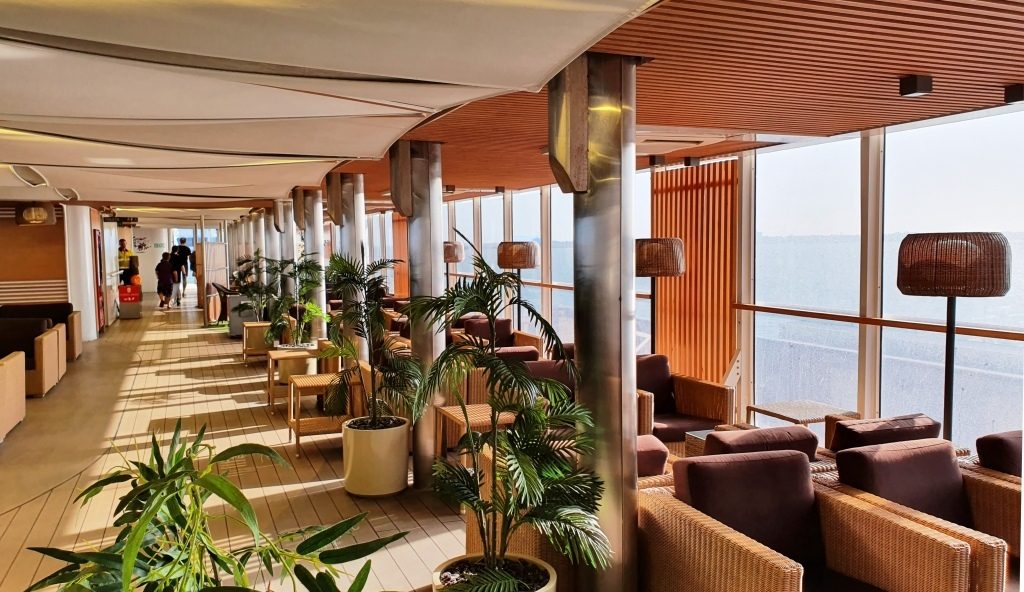
We had booked recliner seats for the return, as a cabin was not needed for a day crossing. The recliner seats are at the back of the vessel, facing towards the stern. There are four rows and the seats have full height backs so unless you are in the first row your view is of the back of the seat in front. So we spent much of the day in the top deck lounge where the view of the water was good and we were near food and coffee.

Point Nepean, the eastern headland of Port Philip Bay viewed from inside the heads

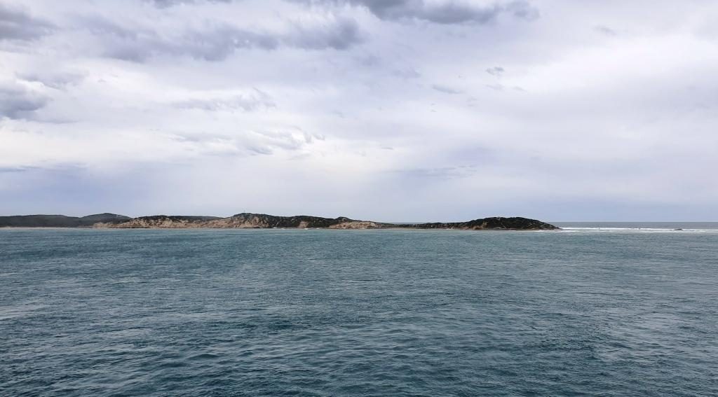
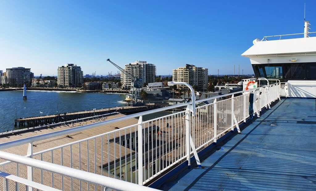
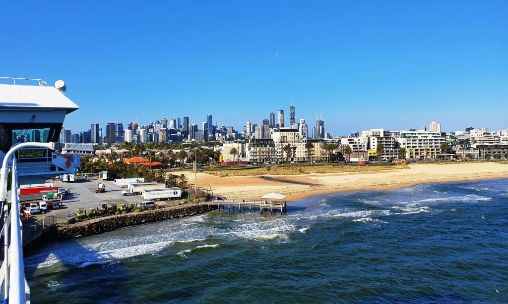
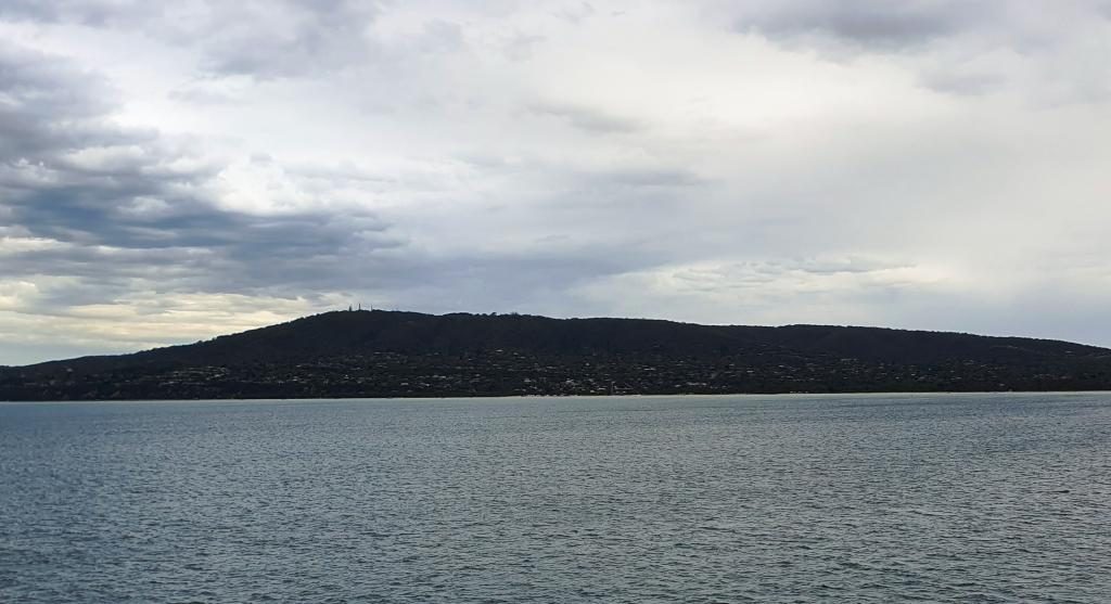
We reached Port Philip Heads in daylight and came up the bay as the daylight faded. We docked in darkness with the City of Melbourne a mass of lights ahead of us. Disembarking was a slow process as Melbourne’s peak hour traffic made it difficult for vehicles exiting the terminal to merge into the traffic flow.

Mount Martha and bay side suburbs of the Mornington Peninsula

But eventually we were moving and making our way through the near city streets to the Monash Freeway. Streets in the near city area have changed since we lived in Victoria and I was working in a near city location. Google maps didn’t have it quite right but we found our way to our hotel in Waverley, without too much drama.

Mount Eliza with its covering of prestigious homes

Friends who we had called on in Ballina on our way south were in Melbourne for a couple of weeks and staying quite near to where we were. So we arranged to meet them at a nearby shopping centre for morning coffee before we headed out to West Gippsland to where we were spending a few days with my sister and her husband.

A vehicular ferry operates from Sorento to Point Lonsdale

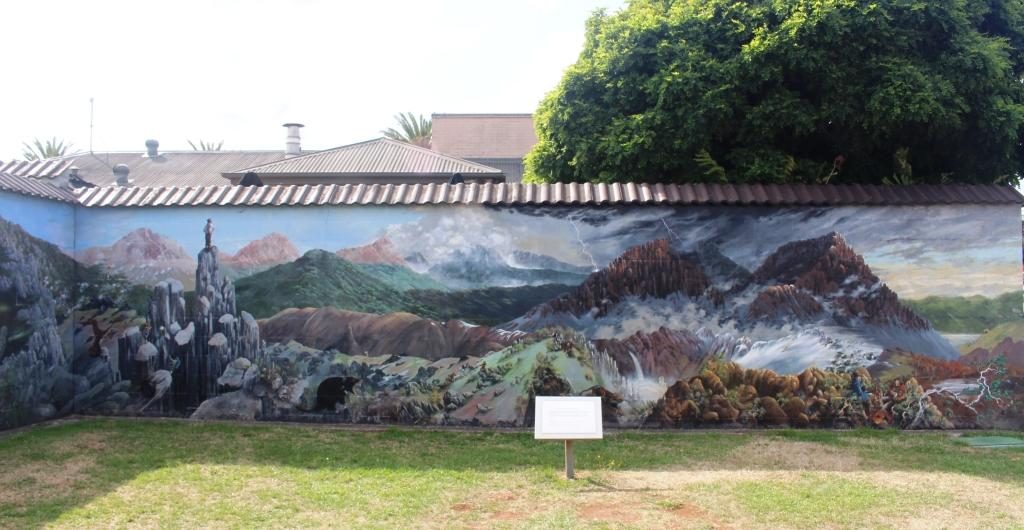
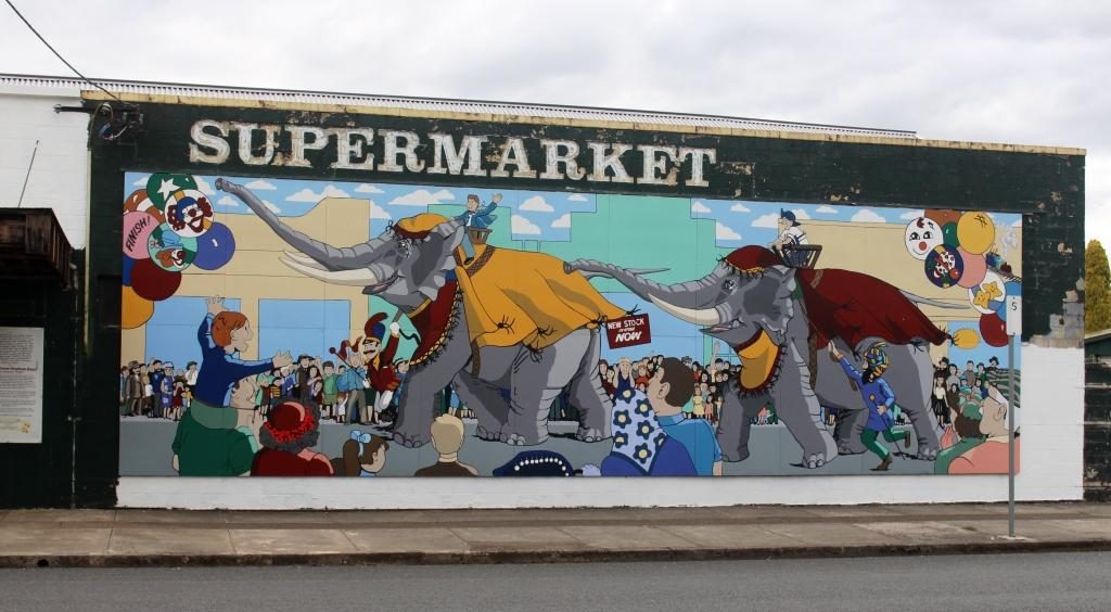
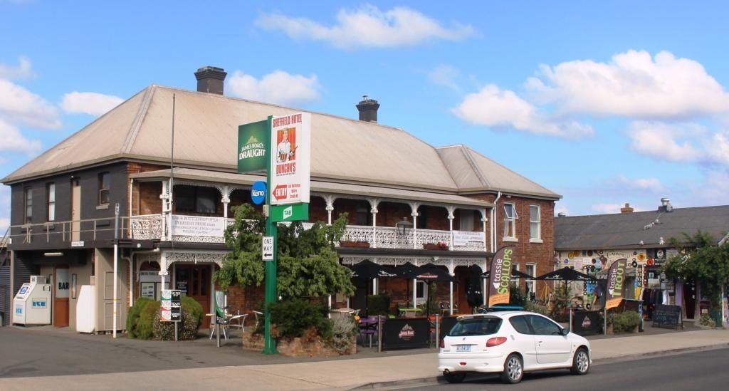
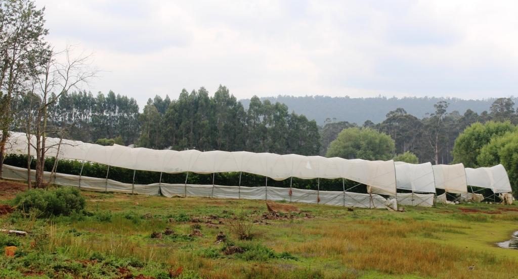
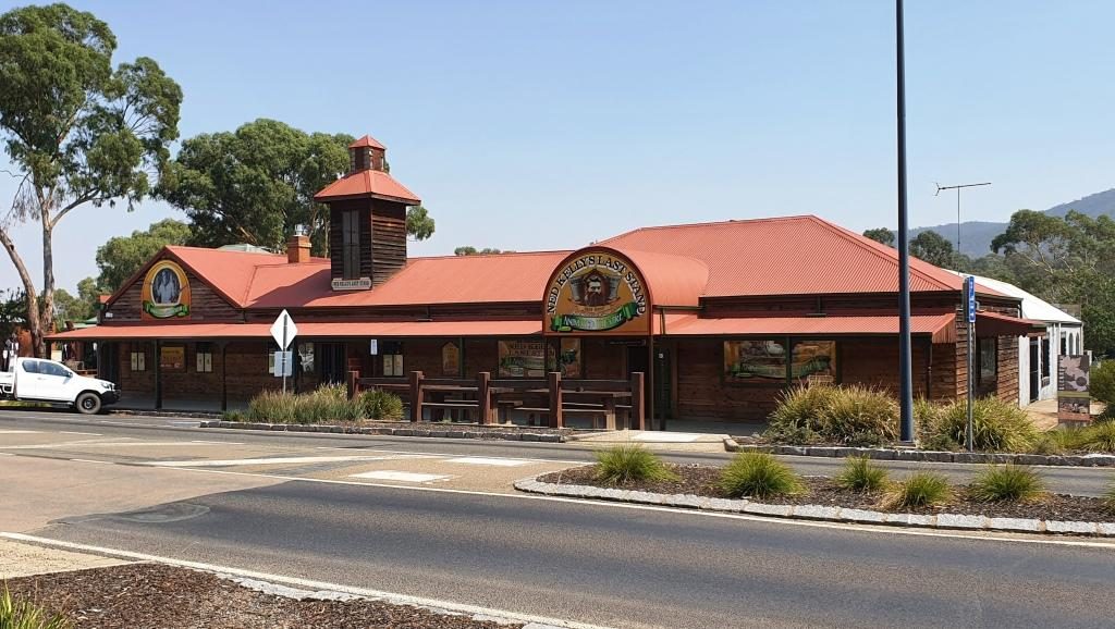
A visit to a supermarket indicated that the shelf stripping that we had seen in Launceston stores was more prevalent that we thought. We now know the full story, of course, but then we thought that the cause was the many Asian tourists with whom we had shared Tasmania. 

Empty shelves in a Melbourne supermarket

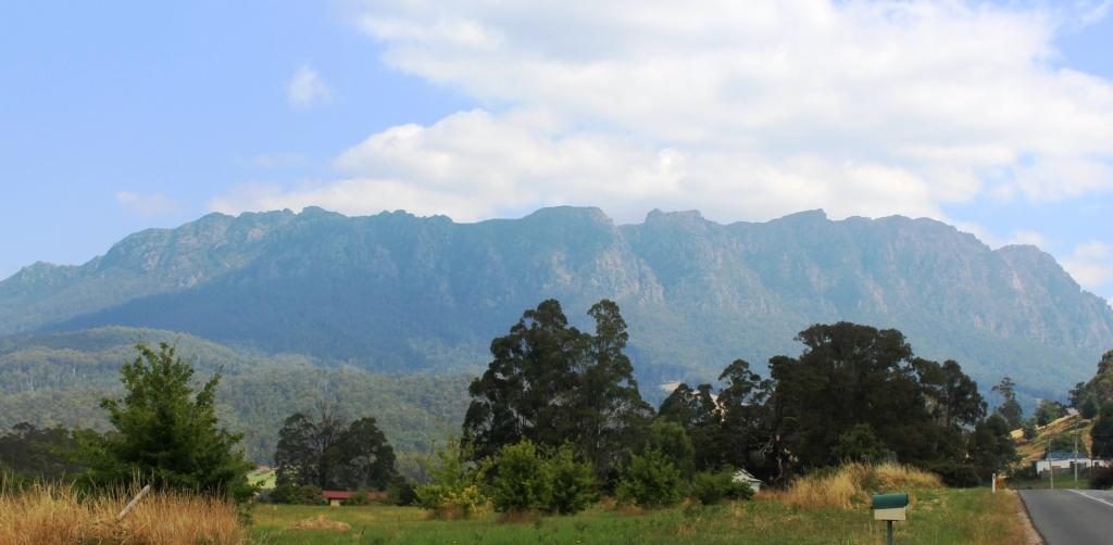
On Wednesday, after doing normal family catch ups, we joined our hosts and other family members in a day out into the mountains that are part of the southern Victorian Alps and lie to the north of the rolling hills of the agricultural country of West Gippsland.

Walhalla Town Ride. Left to Right: Brother Bernard, Sister Aileen, Brother-in-law Colin, Sister-in-law Helen (widow of deceased brother Winston) and Ruth.

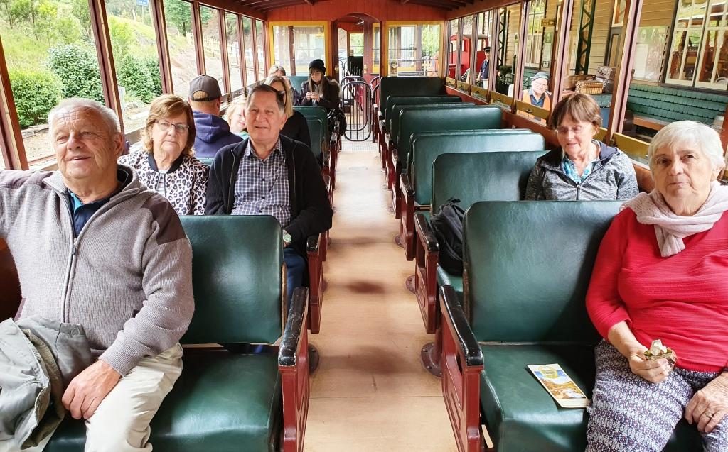
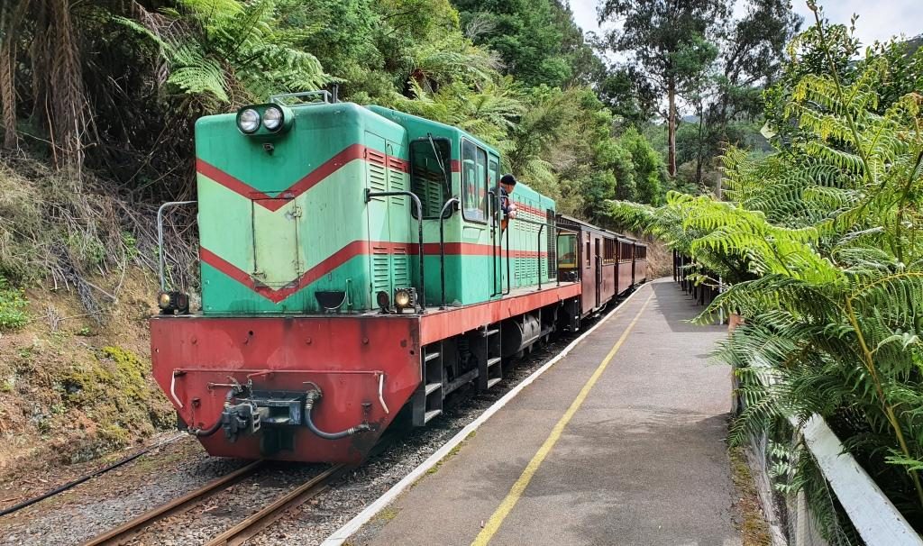
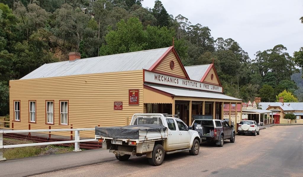
Walhalla is a historic gold mining town about 90 km from Drouin. It takes about 90 minutes to drive there.  It is a well preserved heritage town with a full sized rebuilt railway that operates on several days of the week. It is popular with all ages and well patronised, particularly at weekends and very popular for school excursions.

The road bridge over the Tomson River

The original rail connection arrived in the mid 1920s, just as the gold started to be worked out and the town started its decline. In more recent years enthusiastic volunteers restored the line, rolling stock and infrastructure and volunteers continue to operate and maintain it.

Running along beside Springers Creek on the outward journey.

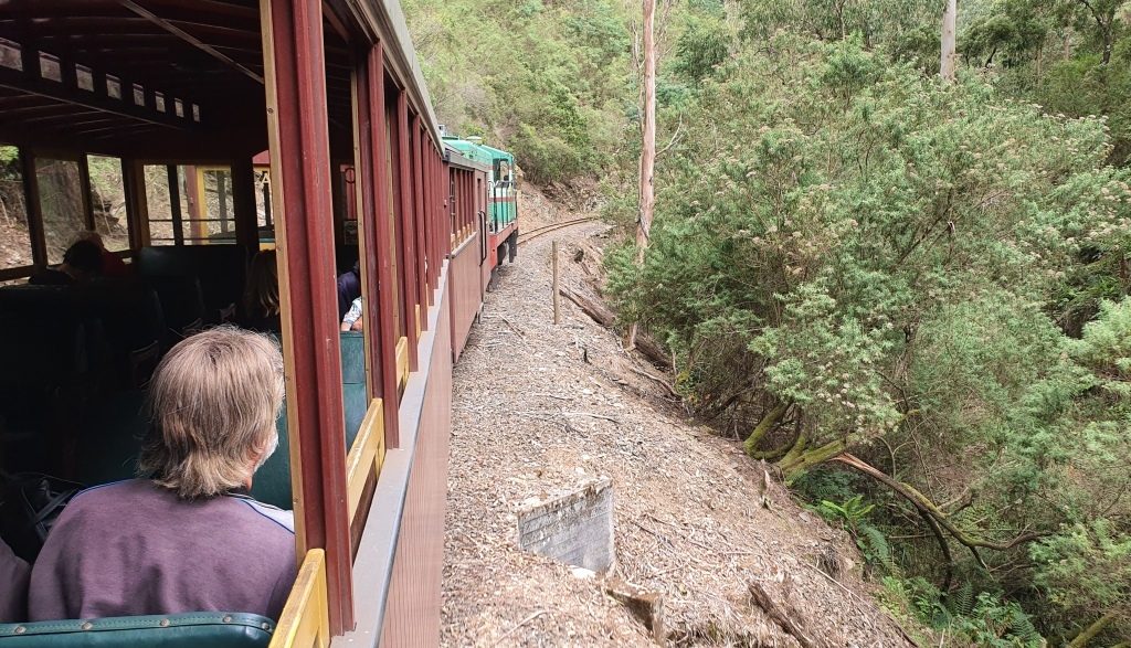
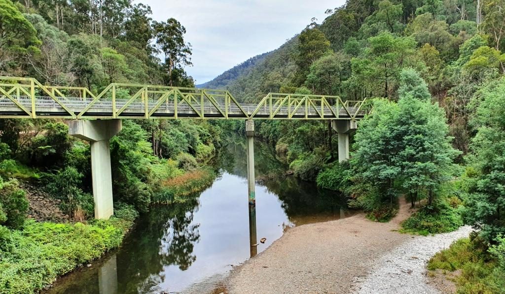
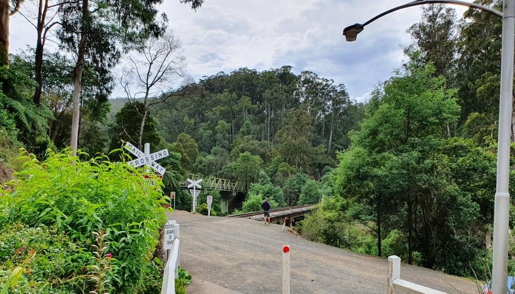
The final few kilometres of the road to Walhalla runs beside the Thomson River before crossing it to then follow its tributary, Springers Creek, to the town. Thomson River Station is located where the road bridge crosses the Thomson. It is to Thomson River Station that the train runs.

Walhalla Railway Station viewing outbound
The train ready for departure at Walhalla Station

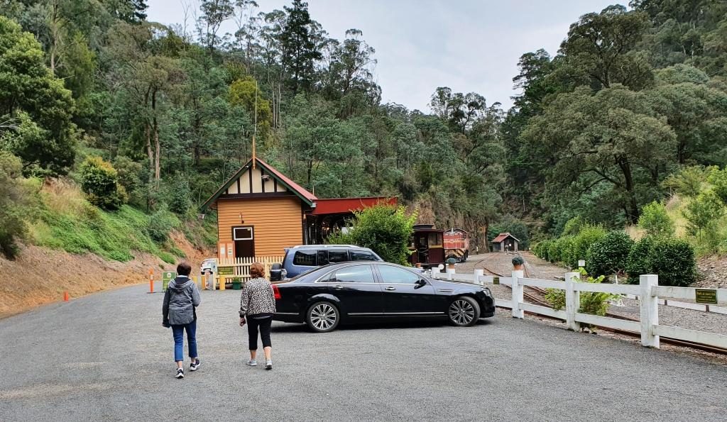
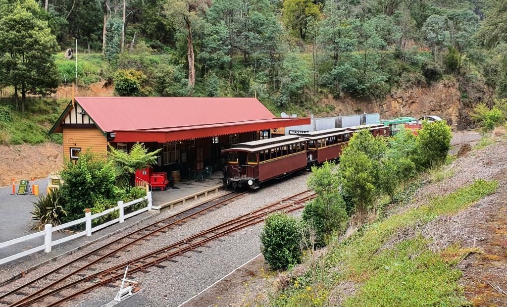
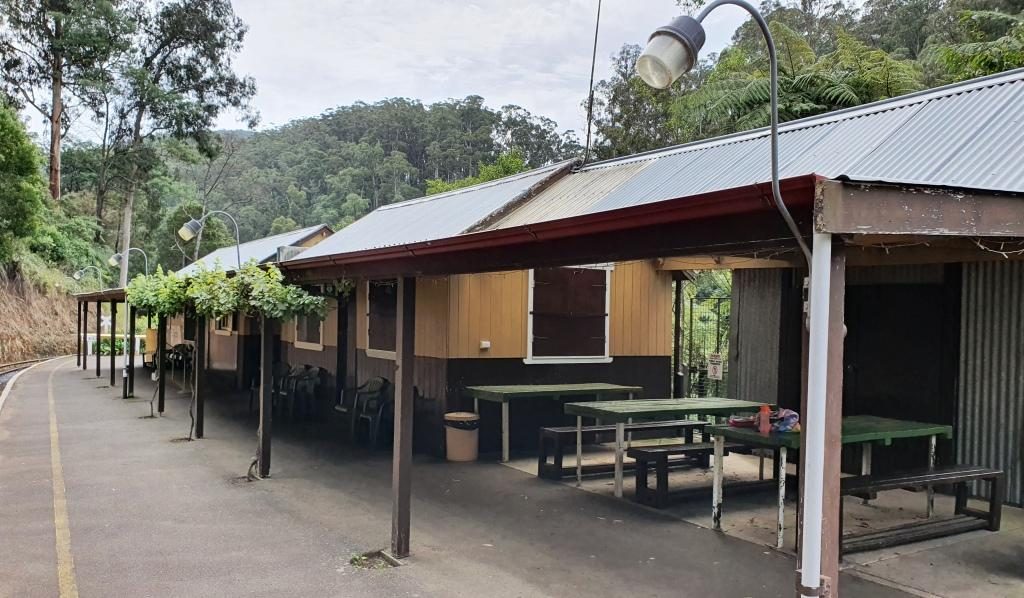
The railway runs along Springers Creek opposite to the road and when fully operational turned downstream beside the river after Thompson River Station.  The ride is about 20 minutes out to Thomson River Station which is equipped with refreshment rooms just like the old days. The coffee was dispensed by a machine on the press of a button, so was not of coffee shop quality, but it was coffee and it was past coffee time by then. As we refreshed ourselves the train moved up the track so that the engine could be manoeuvred back to the front of the carriages for the return journey.

Thomson River Station with everyone aboard the train
The train about to move off to change the engine to the other end for the return journey
The Thomson River road and rail bridges viewed from the Thomson River Station

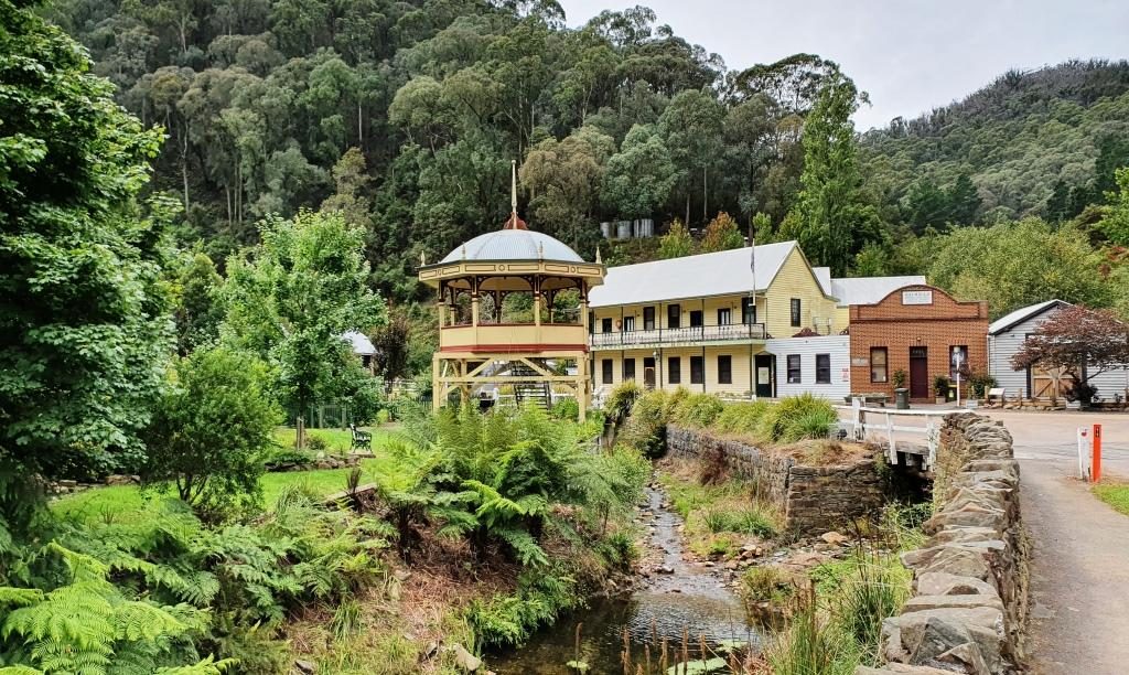
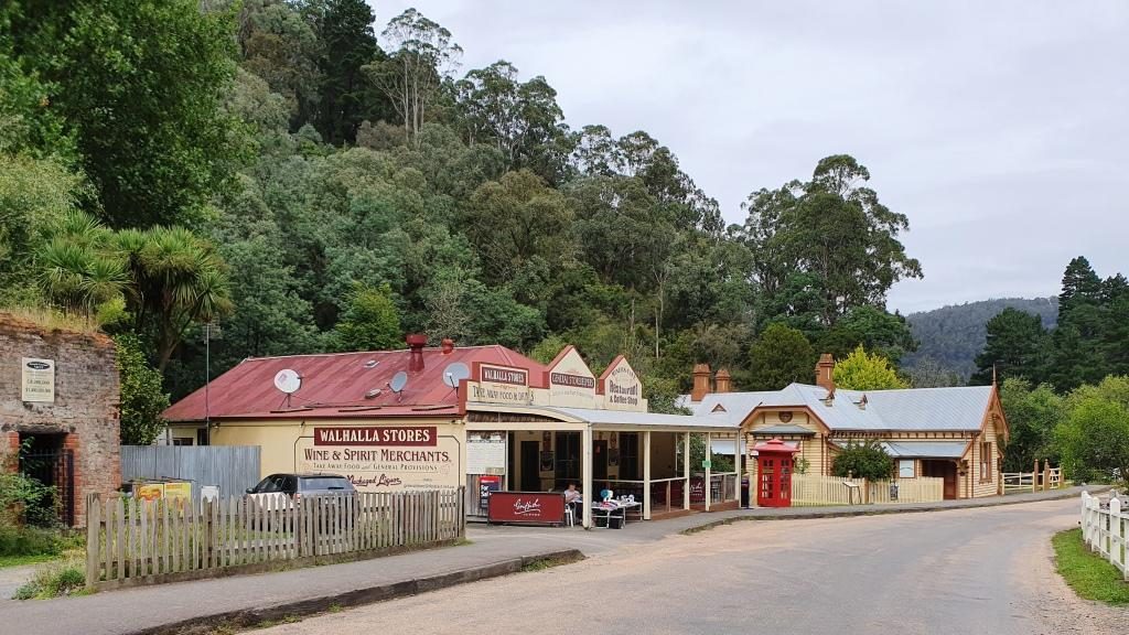
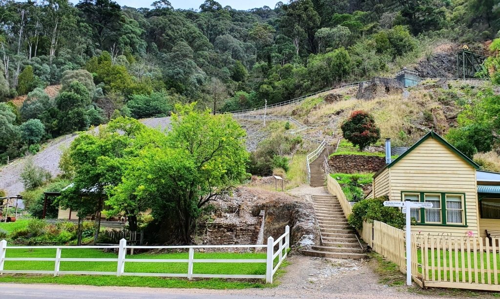
Train ride over, we drove up into the town and followed the main street as it wended its curving way through the narrow valley.  The commercial buildings stand beside the road and on the flat land beside the creek, but the rest of the housing steps up the steep hillsides. The accompanying photos tell more of the the story.

Trading continues in original and historic buildings in Walhalla

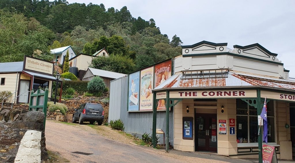
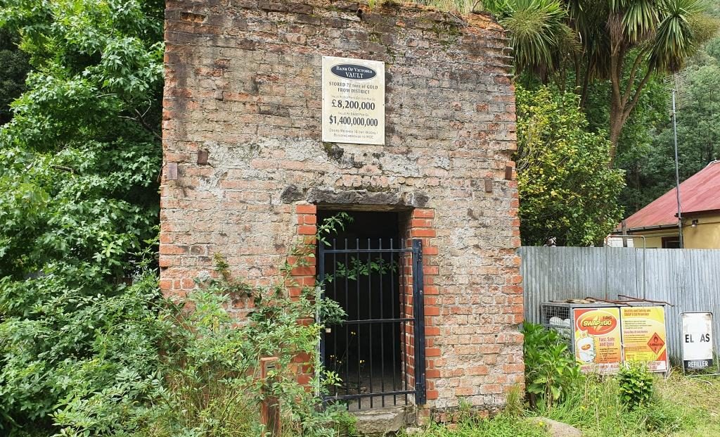
As you enter the town the mining area is on the left with convenient foot tracks and stairs leading to points of interest. We have looked at these before, when we were much younger. We had no difficulty in resisting the temptation to climb the steps that lead to the hillside path.

Band Rotunda, Star Hotel (closed) and a solicitors branch office.
The old Mechanics Institute building is now used for another purpose

The best known of the Walhalla gold mines is the Long Tunnel Extended Mine. Access to this mine has been preserved making it suitable for public inspection. Tours are conducted on a regular basis and have just recommenced following Covid-19 shut down. $20 will gain entry for adults or $15 if you rate as a senior.

Old buildings beside Springers Creek
More historic buildings that are still in use

From the train we had seen a group of teen age school children camping beside Springers Creek. As we came out of the pub after lunch we saw them again. They had made it back to town and had climbed to the hillside track to take a closer look at the mines.

The facade of the original gold storage vault
The stairway to the Long Tunnel Extended Mine

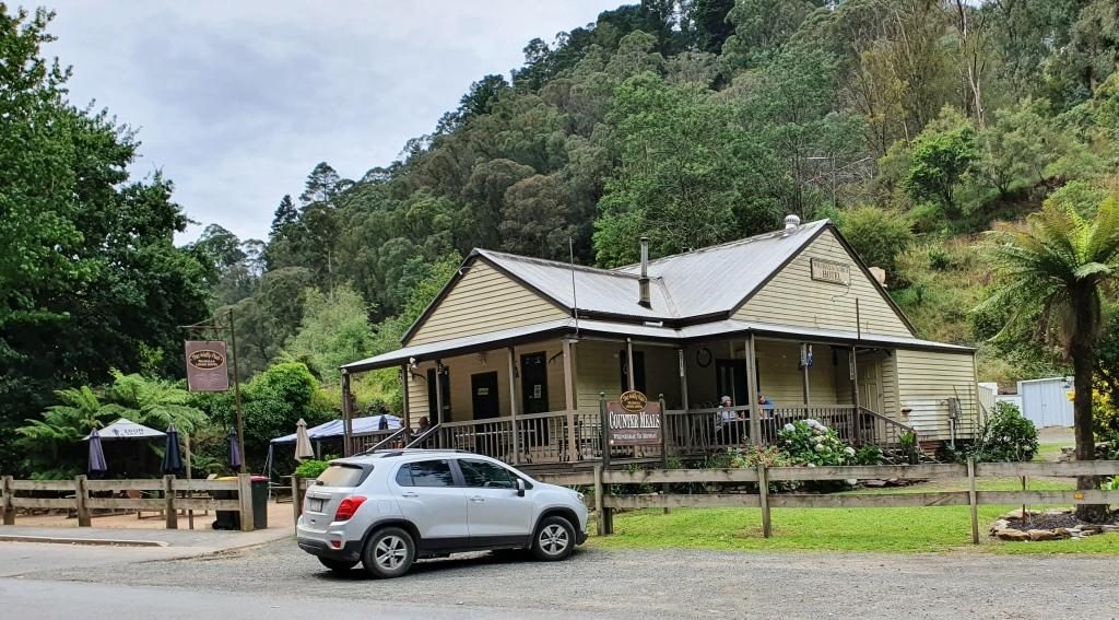
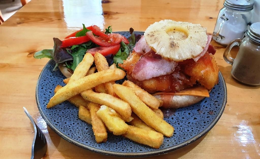
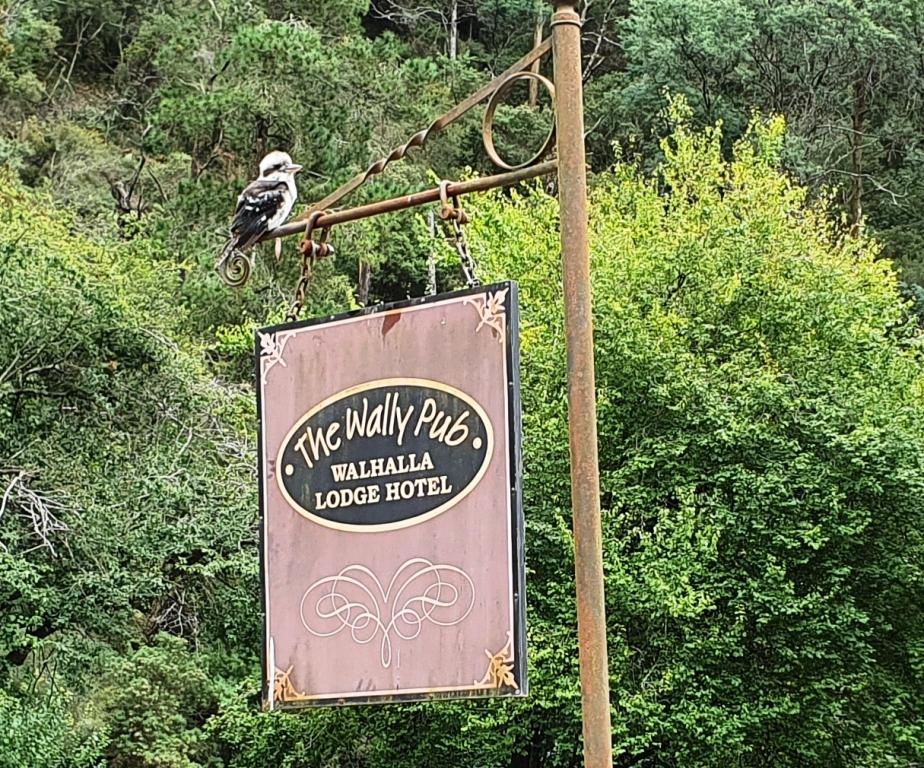
The only place available for lunch was the Walhalla Lodge Hotel which is a fairly typical country pub. The meals were generous in size and hit the spot after our train ride.

Out luncheon venue, the Walhalla Lodge Hotel
A more than adequate lunch for one
A Kookaburra waits patiently on the hotel sign. Waiting for scraps perhaps?

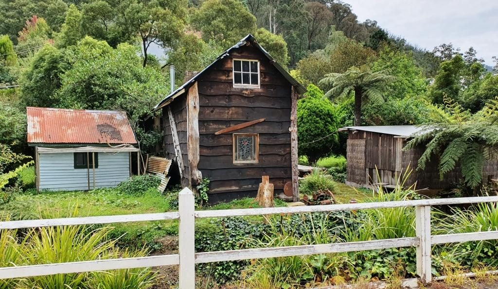
On our way back to Drouin we made a detour to look at a house that our niece (sister’s daughter) and her family had just bought but had not yet moved into. Such are the interests of family visits.

Destination Tasmania – Part 2 – Devonport Area and Cradle Mountain

6th to 8th February 2020

Please Note: Videos covering the material in this blog post can be found at the bottom of the post.

On our first day on Tasmanian soil our first priority was breakfast and then the purchase of some supplies. The food that we were able to take into Tasmania was limited to prepackaged items. We then drove south from Devonport to Sheffield.

Mural of Cradle Mountain
Farm scene on a church
Farm Lands and Mountains
Domestic Scene
Circus Animals on the Supermarket

This farming town is famous for its murals. It is built atop a hill, providing rural views in all directions. The most arresting view is to the south west where the huge bulk of Mount Roland fills the lower sky. The mountain is a multi peaked rocky range reaching a height of 1,234 metres. It has a number of walking tracks, but they were not in our plans. Tasmania is a walkers’ paradise, but you need time. Before we went there we had not even heard of Mount Roland, let alone its walking tracks.

Mount Roland behind the town
Farm lands at the end of the street
Mount Roland again taken, later in the day when our track came back past it.
Sheffield Hotel.

Sheffield is, like so many in Tasmania, comprised predominantly of older buildings. Many provide a suitable canvass upon which artists have painted expansive scenes. The town’s first mural was unveiled in December 1986. Since then over sixty murals, depicting the area’s rich history and beautiful scenery, have been painted on walls throughout the district.

Grazing dairy cows on the way to Railton
Topiary in Railton Main Street
Could that be a hippo?
Probably a sheep. There are a lot of sheep in Tasmania.
A crocodile?
This hedge is also a train.

After coffee, we moved on to the neighbouring town of Railton, known for topiary, which I learned, is the art of shaping trees, shrubs, hedges etc., by trimming them.

We then moved on to Elisabeth Town by continuing on the same road, until it met the Bass Highway, the main road that runs along the north coast of Tasmania. We were looking for the Christmas Hills Raspberry Farm, the sign for which was not visible from the Railton Road, which we had just driven, or perhaps we missed it.

We turned left at the intersection, stopped and entered the name into Google maps. We were directed to drive the way we were facing until we reached a left turn 8 km further on. But the indicated road was not there so the navigator revised its instructions that included a large increase in the distance. We could see that we were well towards Latrobe, a town that we wished to visit, so we kept on going.

The sign for the Australian Axmans Hall of Fame

Latrobe is known for its antiques and I am known for not being very interested in them. Its other claim to fame is that the sport of wood chopping was developed there. As the son of a onetime timber cutter, that fact held interest for me. There is a museum there which we drove past, but did not have time to examine.

But the town supplied a lunch stop on the banks of the Mersey River and a helpful lady at the information centre who supplied a map that showed us exactly where the raspberry farm was. It was a couple of kilometers in the opposite direction at Elizabeth Town.

Protective covering for raspberry vines

The raspberry then farm became our next destination. As a tourist attraction it is more a restaurant and ice-cream shop, but a walk leads past an ornamental lake (also their water supply) to the sheltered growing area. We had not long finished lunch, but ice-cream seemed appropriate. The raspberry flavour was delicious, as was the free sample chocolate coated raspberry.

Christmas Hills Raspberry Farm Restaurant
The main street of Moles Creek

The day was slipping away so we moved on. To reach Moina, where we were spending a couple of nights, we continued south to the edge of Deloraine and took Mole Creek Road. Mole creek is one of the locations where Tasmanian Devils can be seen in captivity. Just past the township we turned right, crossed a mountain range to arrive at the town of Paradise and then turned left over more mountainous roads, past more mountains before descending sharply down a steep grade and over the bridge at the foot of Cethana Dam on the Fourth River. We then climbed back up the next mountain, equally steep, to reach Moina.

Moina is situated where the road that we were on intersects with the Cradle Mountain Road. We had a comfortable unit in a bush setting. It is part of the Cradle Forest Inn, a Swiss or Bavarian themed mountain retreat that offers a café/restaurant and bar as well as accommodation. There is not much else of Moina but the road side signs suggest that there is no shortage of accommodation in the area. Logical since it is such a short drive away from the more expensive accommodation at Cradle Mountain.

Cradle Forrest Inn Reception and Dining/Bar
Our cabin was to the left. It was named “Wattle”.

During the latter part of our drive we encountered a lot of smoke haze that made mountain photography a bit difficult. Someone suggested that the cause was fires near Launceston.

The house and farm along Cradle Mountain Road.

On our second day in Tasmania we started by driving the 26 km to Cradle Mountain. The road leads through mountain farm land with a few isolated farms. The area is around 500 metres above sea level.

Part of the visitor centre at Cradle Mountain.

A new looking visitor centre has been built not too long ago, with a large parking area to handle the crowds. This is a popular place. The parking area was substantially full when we arrived at about 10.00 AM. It is possible to drive a bit further in, but our National Park pass provided free shuttle bus transport to the tourist area, so we chose that option.

After coffee in the café, I left Ruth lingering over her refreshments and caught the bus. It was quite a thrill to see Cradle Mountain for the first time. It and the picturesque Dove Lake suddenly appeared as we rounded a corner.

Dove Lake and Cradle Mountain from the bus stop
The smorgasbord of walks

After departing the bus stop I set out on the 6 km walk around Dove Lake. It is one of many walks in the area, some of them much longer, like the overland track to Lake St Clair that takes several days to complete.  Most of the Dove Lake track is an easy walk, good gravel and board walks with timber or stone steps where required. I walked clockwise as the earlier part of the walk is easier that way.

The boat shed viewed over the lake from near the start of the walk
Looking back early in the walk to the bus stop and other walkers behind me.
Cradle Mountain from about one third of the way around

The walk follows the edge of the lake for much of the distance but at about 75% of the way around there is a steep climb over a promontory that juts out into the lake, named Truginini Point. That slowed me down a bit. I was quite happy to see the old boat shed come into view as I reached the top of the ridge. The boat shed is only 10 minutes from the car park and bus terminal, so the end was in sight. Ruth had caught a later bus and was waiting at the finishing line. I achieved the 6.1 km in 1 hour 37 minutes including rests. That’s an average of about 3.8 km/hr. A few breathers were necessary on the steeper climbs.

Walking track ahead at about the half way point
The mountain from just before the start of the climb over Trunanini Point.
The much photographed boat shed on Dove Lake.

By the time we reached the visitor centre it was getting on for 2 o’clock, so we returned to the cafe for a late lunch and then returned to our unit at Moina. Then I had a nap. Totally appropriate for an 80 year old who had done all that walking.

Final view of lake and mountain from the rise near the end of the walk

We had planned Cradle Mountain at the start of our trip in the hope of getting good weather. The weather could hardly have been better. But it was now time to return to the coast and get on with our anti clockwise tour of the island.

Lake Barrington is formed by a dam on the Fourth River.

So on day three in Tasmania, breakfast done, we finished packing and headed down the mountain. At Wilmot we made a short detour to see Barrington Dam, one of three long thin dams that have been built on the Forth River. It backs up to where we had crossed the Fourth two days before. We were following the Forth River valley and rejoined the Bass Highway near the town of Forth. But now it was the 8th, the story of which will continue in the next post.,

Destination Tasmania – Part 1 – Home to Devonport

29th January to 5th February, 2020.

Please Note: A videos covering the material in this blog post can be found at the bottom of the post.

Tasmania has been in the planning for some time. We made plans to visit, with the caravan, in 2018. We even booked the passage on the Spirit of Tasmania, but then cancelled in favour of repeating our 2009 trip around Australia. You may recall that we reached South Australia, but returned home at that point due to the poor health of my brother Winston. Win died a couple of months later, so we had certainly made the right decision.

So, with the caravan and the Mitsubishi Challenger both sold, we set off on 29th January in our new Mitsubishi Eclipse Cross. Motel and caravan park cabin accommodation from how on.

An early start got us to Ballina at about 10.30 AM for morning coffee with our long time friends Joe and Thelma. For those who don’t know, Joe and Thelma have left Melbourne to continue their retirement at Ballina. These folks have been friends for almost all of our married life and all of theirs.

Ramada Resort, Flynn’s Beach, Port Macquarie
Flynn’s Beach Lifesaving Club
Viewing Flynn’s Beach to the south east

We had chosen Port Macquarie as our overnight stop and happily pulled up at the Ramada Resort at Flynn’s Beach after a drive of just less than 600 km.

Day two brought us from Port Macquarie to West Wallsend, a suburb of Newcastle. On the way we drove through some bush fire affected areas south of Taree. The Taree fires featured prominently in press coverage on the run up to Christmas.

Morning coffee at Bulahdelah

We detoured for morning coffee at my old home town of Bulahdelah at The Detour Cafe. The cafe looked familiar. I asked the lady who made the coffee if it had always been a café. She said that it had been for most of its existence. That is why it was familiar.  I used to call there for an after school milk shake about 65 years ago.

We then called on my eldest brother Ivan and his wife Marjorie, who live just off the highway north of Newcastle, where we had lunch and generally caught up on family matters and doings.

Then off to West Wallsend where we spent the night with Ruth’s eldest sister Judy and her husband Alan. Another session of catching up on family matters and news of mutual acquaintances and travels completed and planned.

Anglers Rest Hotel at Brooklyn on the Hawksbury River
Waiting for lunch to be prepared at Brooklyn
The new office for the Riverboat Mailman. We did the mail run a couple of years ago. The new office was just being built then.
The marina restaurant and shopping complex at Brooklyn.

The run to Sydney along the Pacific Motorway was easy with no congestion. We pulled off the highway at the exit on the north bank of the Hawksbury River and drove over the old bridge to reach Brooklyn. We like Brooklyn and have frequently stopped there over the years. Many years ago we hired a boat there and spent a great week on the river and Broken Bay. That was back in family holiday days.

Briony’s view of the city.

Day three brought us to daughter Briony’s unit in Erskineville, a near Sydney city suburb. February 3rd is Briony’s birthday. Our activities included hiding in a shopping mall and the car to avoid high 30s temperatures on Saturday and her personally organised birthday, with friends in a private room at the cafe at her complex, on the following, cooler day.

Briony and Ruth waiting for guests to arrive.

On Monday, her birthday, we enjoyed a delightful birthday lunch for just the three of us at Aqua Dining. This restaurant, with excellent outdoor seating, is near the front gate of Lunar Park and overlooks the North Sydney Olympic Pool. It is in part of the buildings that adjoin the pool. So we had a great view of a local school’s swimming carnival. Of course we also had views of the Sydney Harbour Bridge, the cruise liner terminal, the Sydney Opera House and a broad sweep of the harbour, both east and west of the city

This hardly needs a caption.
Harbour Bridge, Sydney city and the wall of the pool. But you knew that, didn’t you?
Children waiting for the next event.

On 4th February, with family commitments finalised, it was time to deal with the main objective of the trip, Tasmania. We set off at about eight, pausing “where the dog sits on the tucker box 5 miles from Gundagai” and stopping for lunch in Gundagai before reaching our Albury motel late in the afternoon. Another 544 km completed.

The Dog on the Tucker Box near Gundagai.
The signs are self explanatory.
The Kelly Museum at Glenrowan, Victoria.

We only had a short drive to Port Melbourne to the Spirit of Tasmania terminal (334 km), so detoured into Glenrowan, of Ned Kelly fame, and spent the remainder of time until boarding having lunch and shopping. We drove aboard at about 5.30 PM and sailed for Devonport just after seven o’clock.

Part of the passenger area on the Spirit of Tasmania.
More of the passenger area on the Spirit.

Daylight saving ensured that we sailed through Port Philip Heads in daylight. We had a smooth crossing, arriving at East Devonport at about 6.00 AM on Thursday 6th.

Medium rise accommodation at Port Melbourne.
A view of Melbourne city from the deck of the Spirit of Tasmania.

Our cabin was comfortable, catering in the dining areas, although we only ate casually, was adequate and in all a pleasant experience. We were in the car ready to go by before 7.00 AM, drove off without incident and headed around to Devonport proper (on the opposite side of the river) looking for breakfast.

Sunset over Port Philip Bay. We were almost out of the heads.
The Spirit of Tasmania berthed at East Devonport in the Mersey River.