Quilpie Number 1 Mail Route

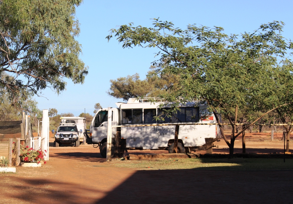
Our tour vehicle at Alaric Station

Our tour vehicle at Alaric Station

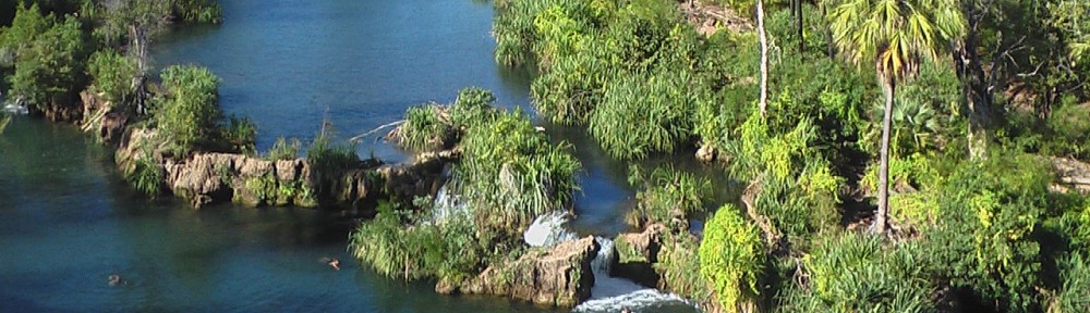
In the early 1860’s Patrick “Patsy” Durack, with his brother-in-law John Costello, travelled north in search of land to claim for a cattle station. They found a group of Aborigines camped by a water hole. Somehow they found that the water hole never dried out and chose the site to build their station. They named the water hole Thylungra from the Aboriginal word for permanent water and named their venture Thylungra Station, the name that it retains to this day. This land acquisition was the real beginning of the “Kings in Grass Castles” legend and the grazing industry in the Channel Country.

During our trip around Australia in 2009 we spent a couple of nights at the caravan park at the resort at Lake Argyle, the mega sized lake on the Ord River in Western Australia’s Kimberly Region. One of the attractions was the relocated house from the Durack property, now flooded by the dam, which has been rebuilt below the wall of the dam, as a museum and memorial to the pioneers of the Northern Australian cattle industry.
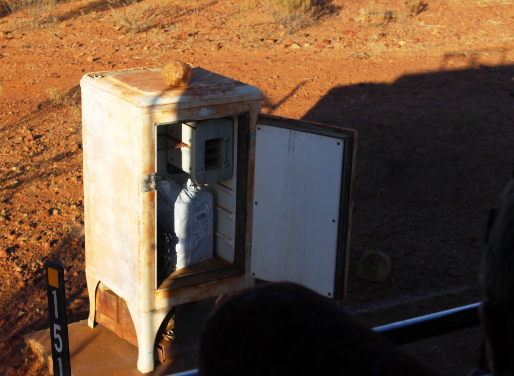
A very old fridge as a mail box

A very old fridge as a mail box

We had seen the mail run tour advertised when we were in Quilpie previously, so decided to extend our stay in the town to provide time to include it in our itinerary. The tour departs on Tuesdays and Thursdays on a 430 km mail delivery route making deliveries to 10 stations to the north of Quilpie. The delivery vehicle is a 4WD 12 seater bus with a freight compartment at the rear and a trailer in tow if needed.
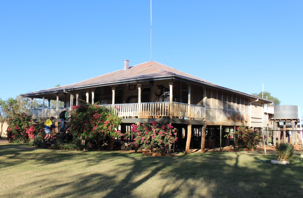
Alaric Station - now a veteran's retreat

Alaric Station – now a veteran’s retreat

We were picked up at the caravan park at 6.45 am, collected the mail that had just arrived from the east and headed for the Adavale “black” road: black because it crosses the black soil pains of the Bullo River. A little to the east is the “red” road, so named for the soil that it crosses. The Red Road is less affected by rain, but today that was not a problem.

A tapestry on the wall of a room at Alaric Station

A tapestry on the wall of a room at Alaric Station

The first couple of stations were simply mail box drops, a drum and an ancient refrigerator, but the third was our morning tea stop. Alaric Station has become a sort of retreat for war veterans. The homestead was to be demolished but a request was made for the alternative use. Interested parties made renovations and they were open for business. Hospitality is available to veterans, their families and friends.
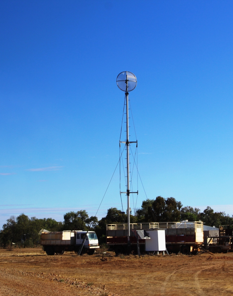
Modern station communications tower

Modern station communications tower

There are dormitory rooms at reasonable prices and provision for caravan parking. Veterans come from all over Australia, some staying for considerable periods. The house is decorated with war time memorabilia including many historic pictures. An old windmill is decorated with the names of theaters of war and crowded with the red rooster symbol from Vietnam operations. There is a thriving vegetable garden, watered from the permanent billabong onto which the home-stead faces.

We made a quick toilet stop at Trinidad Station, to be our lunch stop, but then went further north to our most northern delivery to Budgerygar Station. To
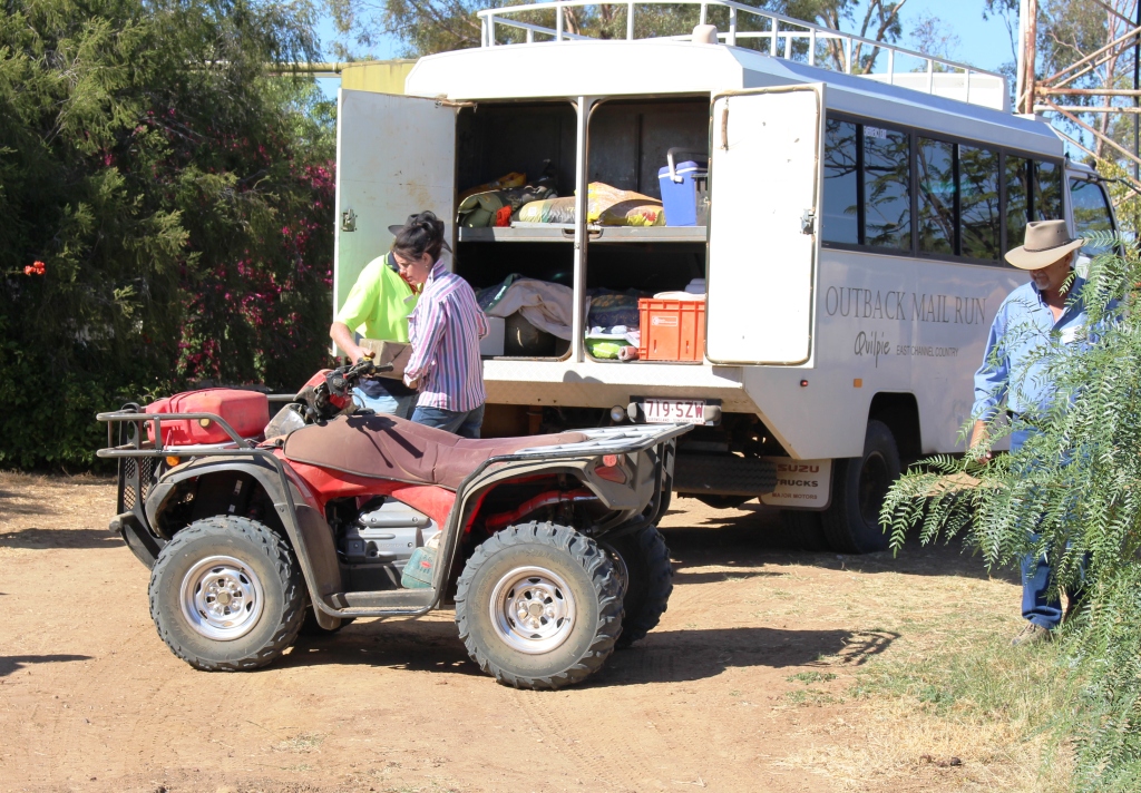
Transferring freight from bus to shed

Transferring freight from bus to shed

get there we passed through Durack Gap, a flat passage between red rock capped mountains, through which Patsy Durack drove his herd of cattle when he moved his operation to the Kimberly region.
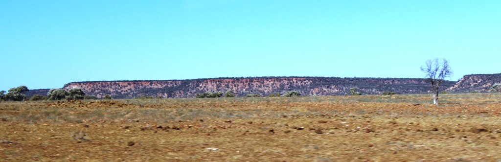
 

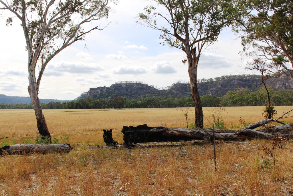
Grazing plains with a rocky mountain backdrop

Grazing plains with a rocky mountain backdrop

Budgerygar Station (correct spelling) is very remote with its northerly border not far south of the Welford National Park near the tiny town of Jundah, where I am writing this post. But we were met by a well dressed lady of the station, probably in her early thirties, with a young family who she is home schooling. She made easy work of tossing the large bags of animal feed that we had delivered, onto a quad bike for storage in a shed.

After examining samples of bolder opal found in the area, brought out by a young daughter of the household, we returned to Trinidad Station for lunch. On the way our driver pointed out two places where extensive excavation had taken place on mountain sides in search of bolder opals.
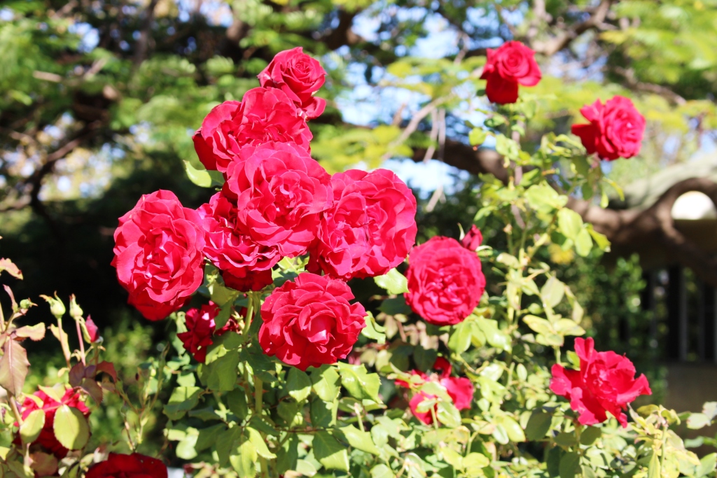
We were greeted by roses at Trinidad Station

We were greeted by roses at Trinidad Station

Trinidad Station was operated by Margaret Pegler and her now late husband. The station is now managed by children, a common situation in the rural scene. Despite the many reports of young people leaving for the cities, a great number of properties are handed on to children. Margaret was away, returning from Brisbane that day, but we were hosted by a daughter who was visiting, from Brisbane, with her husband.

Garden at Trinidad Station.

Garden at Trinidad Station.

Similar to other homesteads that we saw, Trinidad is enveloped by shady trees. Margaret is a keen gardener. We were greeted by vivid reds and yellows of perfect roses at the front gate. At the rear an extensive orchard provided evidence of the productivity of this land, when you add a little water.

And water was the common theme of much of the conversation. The drought is really hurting and the desire for relief is palpable. As we sat in our van the next day, listening to the rain on the roof, we could not help but be glad for these brave people, despite the damage that we knew the rain was doing to the dirt road to Birdsville that we had planned to travel over the next couple of days.
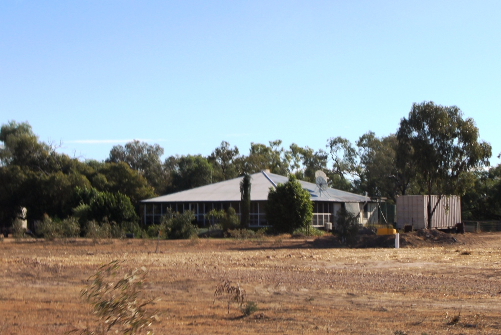
A home at Thylungra Station

A home at Thylungra Station

After our lunch stop we were on our way home. There were a couple of deliveries to make but we were now on the main council road that these stations use to get to Quilpie. But there were two remaining agenda items, a visit to Thylungra Station and afternoon tea beside Thylungra waterhole.
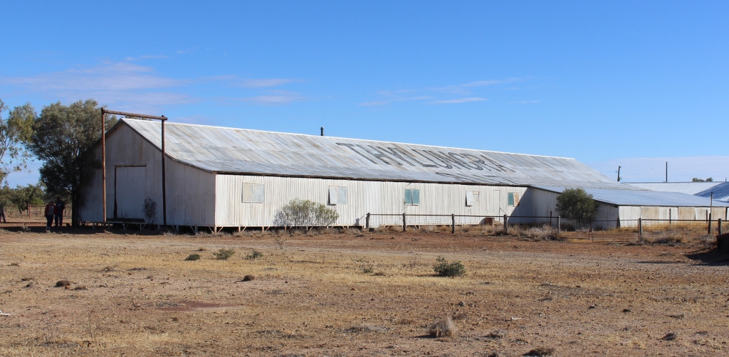
Thylungra wool shed

Thylungra wool shed

At its peak about 80 people lived on Thylungra. Now the permanent residents are much fewer but the place has a certain stateliness about it. The remaining houses, including

Sheep pens inside the wool shed

Sheep pens inside the wool shed

the homestead, are spaced along the creek. We had access to the shearing shed, which is huge, but no longer used, as this station, like so many others, now concentrates on cattle production. But the scope of past operations is obvious.

The never dry Thylungra waterhole

The never dry Thylungra waterhole

Afternoon tea was served by Dave, the mailman, in the picnic shelter of the Main Roads provided rest area by Thylungra billabong. A range of beverages were on offer plus care and biscuits. It was a fitting last activity for a very pleasant and interesting day. The final leg of the journey was on the highway that links Quilpie with Windorah, so the distance sped by bringing us back to Quilpie at just after 4.30 pm. As we walked back to our van the grey clouds of tomorrow’s rain were drifting in from the west.


Here is a link to a video of this story.
www.youtube.com/edit?o=U&video_id=pXc_cD2OFos

Mount Moffatt National Park

IMG_1829On the trek into Mount Moffatt, the first real point of interest is the Slab Hut, a relic of earlier days of cattle grazing in the area. But it failed to grab our attention when our six vehicle convoy stopped to inspect this example of pioneering residential stamina. Ruth opened the caravan door to find the contents of our refrigerator on the floor with the fridge door underneath. Our consternation was quickly shared by our travelling companions with the Slab Hut fading to insignificance. Some perishables were quickly moved to spare capacity in other refrigerators while we considered what to do.

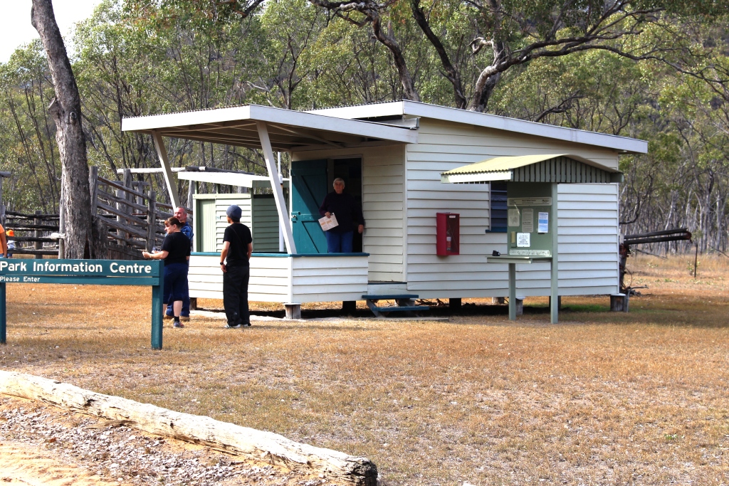
The Information Center at the Ranger Station

The Information Center at the Ranger Station

Our group leader quickly spied the problem. The door is hinged on a fixed pin at the bottom and a threaded pin at the top. The top pin had worked loose, allowing the door to fall off. Not a very good design in my view. Another member of the group produced a gleaming set of spanners and very soon the door was back in place and the food replaced. Then, following an inspection of the hut we continued on our way to our destination at the Dargonally Rock Pool camping area, within the Park.

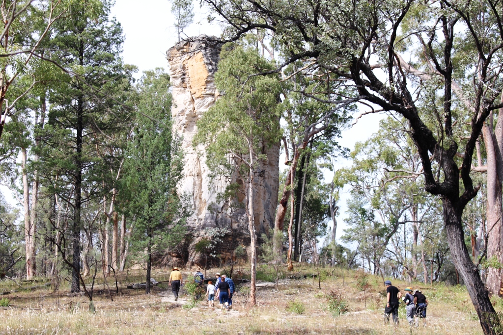
The sandstone column known as Lot's Wife.

The sandstone column known as Lot’s Wife.

The area of Central Queensland west of the Great Dividing Range hosts a series of sandstone mountain ranges. A substantial proportion of them are enclosed within the borders of the four areas that make up the Carnarvon Gorge National Park. The best known is the Carnarvon Gorge itself but, although more difficult to access, the Mount Moffat section runs a close second. The area is a plateau at around 700 meters with mountain peaks to more than 1,200 meters. The weather was quite cool at this time of the year.

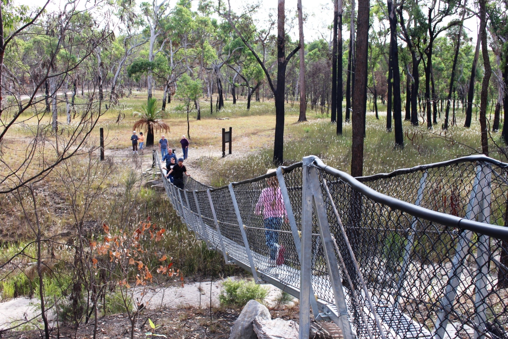
Suspension bridge on path to the Great Walk

Suspension bridge on path to the Great Walk

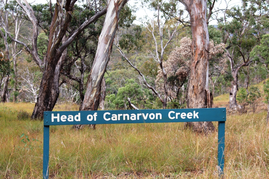
Vegetation is open bush land with some areas of denser growth and open grass land. In the north of the park, near the top of Carnarvon Gorge and the source of the Carnarvon Creek, there is an impressive stand of Mahogany trees that brought back memories of my roots in the timber areas of the Central Coast of New South Wales and my timber cutting father. I could almost hear the sound of the fall of the axe and the rasp of the crosscut saw. The Maranoa River also rises in this area.

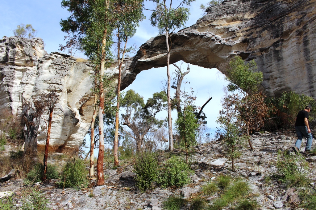
Marlong Arch

Marlong Arch

The Dargonally Rock Pool camping ground is, unsurprisingly, beside a stream that would have had rock pools with more rain, but only provided a few puddles. Fortunately the National Park authorities had provided a tap and although the water was untreated it was clean and provided a valuable backup for our drinking supply. We set up our vans, camper trailers and one tent in a rough circle around the all important camp fire.

The Chimneys

The Chimneys

The camp fire was the center of social activity, as well as the main cooking medium for some. An experienced camper brought a spike that, when driven into the ground, supported a barbecue plate and a hook from which a camp fire kettle hung over the flames. The fireplace was surrounded by logs sawn in half length wise to provide seating, to which we added comfortable chairs and tables for

Viewing area at the Toombs

Viewing area at the Toombs

meals. Food preparation included use of camp ovens for those with the required skills. Dishes prepared for community consumption in these handy devices included delicious dampers and a huge apple pie.


Aboriginal Art

Aboriginal Art

The park attracts visitors because of its remoteness, its physical attractions and its history. There are two areas of significant Aboriginal art and historic sites associated with bush ranger activity.

In the late Nineteenth Century the Kenniff Brothers, the last of Queensland’s bush rangers, frequented the area, pursuing their trade of cattle stealing . An offended

Memorial to the murdered police officer

Memorial to the murdered police officer

station owner and a police officer went into the hills to arrest them and were murdered by the brothers. To conceal the crime the Kenniff Brothers attempted to cremate the bodies. The bush rangers were ultimately brought to justice. The murder and cremation sites are marked on the map but we could only find the latter. The site, on flat rocks in the bed or a Creek, is marked by a memorial to the fallen police officer.

The Looking Glass

The Looking Glass

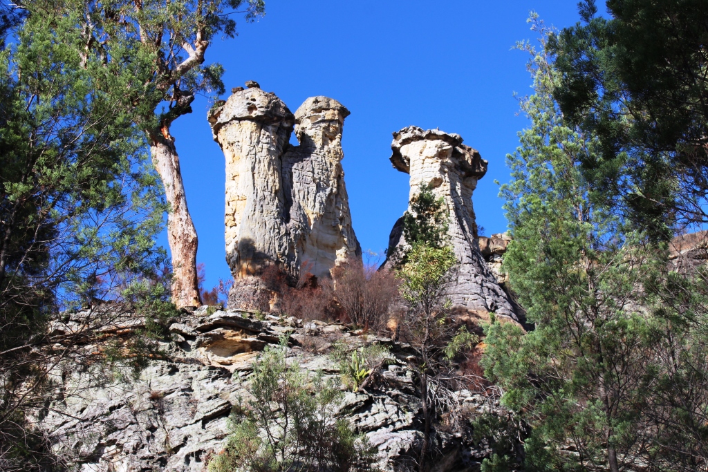
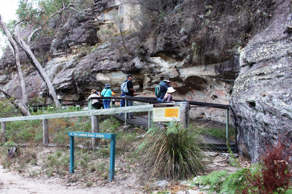
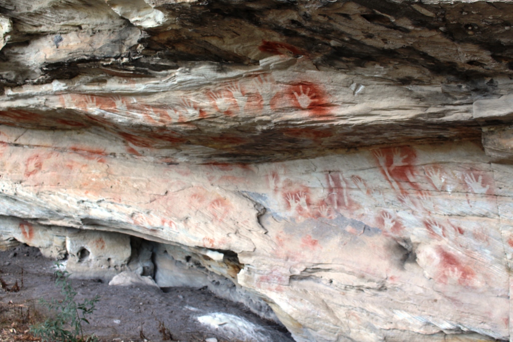
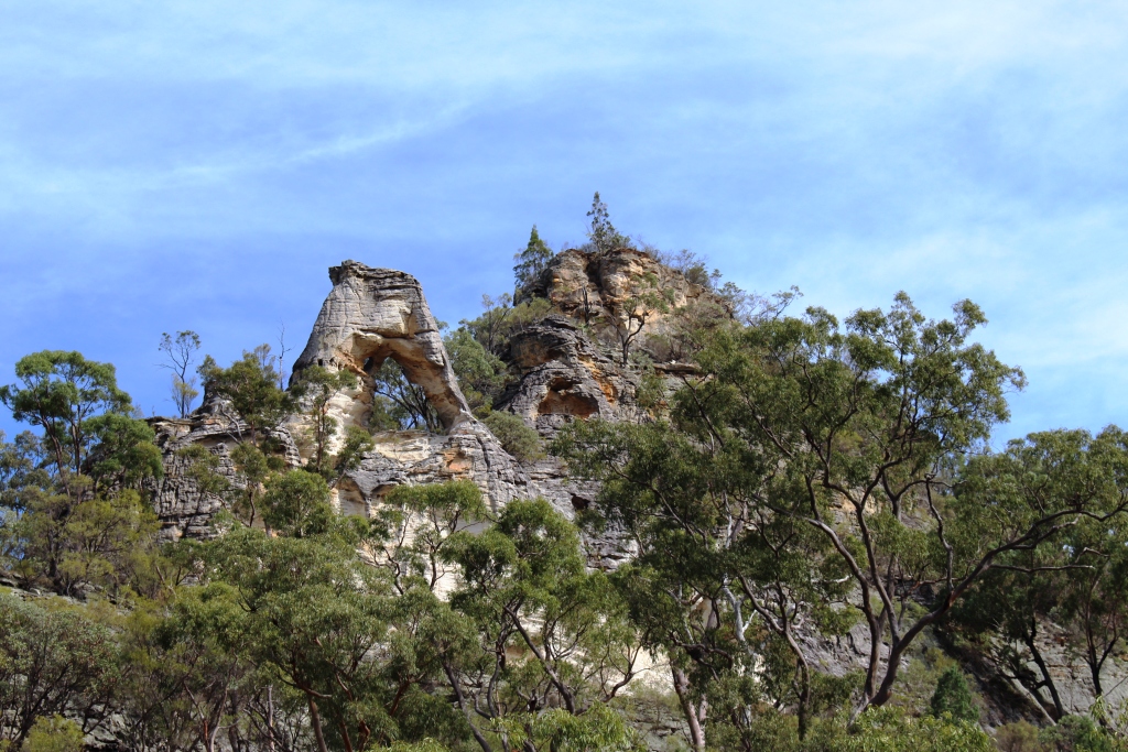
A six kilometer morning walk included the best of the Aboriginal art, which was similar to the art we had seen several years ago in the Carnarvon Gorge section of the park, possibly done by the same group. This walk included The Chimneys, a triple column of rock, a sort of mini Three Sisters and The Looking Glass, a rock formation high on a cliff top and where the center has weathered away forming a mirror like appearance and The Tombs, an Aboriginal burial site decorated with typical art work.

Marlong Plains

Marlong Plains

Lot’s Wife, a solitary pillar of sandstone and Marlong Arch, a narrow bridge of rock spanning a gap between two large rock outcrops were deeper into the park and we had checked them out the day before. On the final day we drove to the high country at the back of the park and while there walked 850 meters to Kookaburra Cave, the other Aboriginal art site.

The very top of Carnarvon Gorge

The very top of Carnarvon Gorge

On the final night we all gathered around the camp fire, discussing all manner of things while we waited for an apple pie to cook in a camp oven. Then with custard and cream provided by others, we finished our meal with a slice of the very delicious pie.

On Monday morning, the Queen’s Birthday holiday, we packed and, now a convoy of seven vehicles, headed out of the Park towards Mitchell, where we said our farewells over a late lunch before going our separate ways. Most turned east towards home, but Ruth and I and a lone traveler have headed west for Birdsville and parts beyond. Or at least that was the intention.

Mount Moffatt is accessed from Injune on the Carnarvon Highway or Mitchell on the Warrego Highway. Both roads are via Womblebank Station that is located where the roads meet. The distance from Injune is about 150 km and it is about 200 km from Mitchell. The last 80 km or so from either starting point is unsealed and a mixture of sand, dirt and gravel.

You ave read the story, now watch the movie.

Days 29 to 32 – 14th & 17th February – Coffs Harbour, Brooms Head. Kingscliff & Home

We had planned to spend the last three nights at Kingscliff where our friends Jim & Frances Weir are currently ensconced, along with three other couples who we have got to know during our visits there. But it was not to be. The Surf Lifesaving folk had decided to hold a Nippers carnival at the Kingscliff SLC so the caravan park was booked out.

Ruth’s younger sister Kathy and her husband Barry have recently settled in the small town of Townsend which is located to the east of the highway adjacent to Maclean. We had arranged to call and had received an invitation to lunch.

We had packed up in rain at Coffs Harbour but the weather had improved to overcast at Townsend. If it had still been raining we probably would have, after lunch, kept on directly to home. We decided to continue along the road through Townsend to the coastal settlement of Brooms Head where we knew there was a caravan park.

Lower area at Brooms head Caravan Park.

Lower area at Brooms head Caravan Park.

Caravan parks are frequently in towns. Brooms Head is almost a town in a caravan park. The park stretches 1.5 km along the beach and includes part of a hill on which there are van sights with excellent views. The remainder of the town is comprised of houses, mostly holiday rental and the Brooms head general store.

The day area at Brooms head beach

The day area at Brooms head beach

High winds were forecast so we acquired a site in the lower area, in behind the sand dune that runs the length of the beach. As it turned out the winds did not reach predicted strength so we have had a comfortable stay.

The attractions here are the beach and fishing. The other points of interest are Sandon River to the south and Red Cliff to the north.

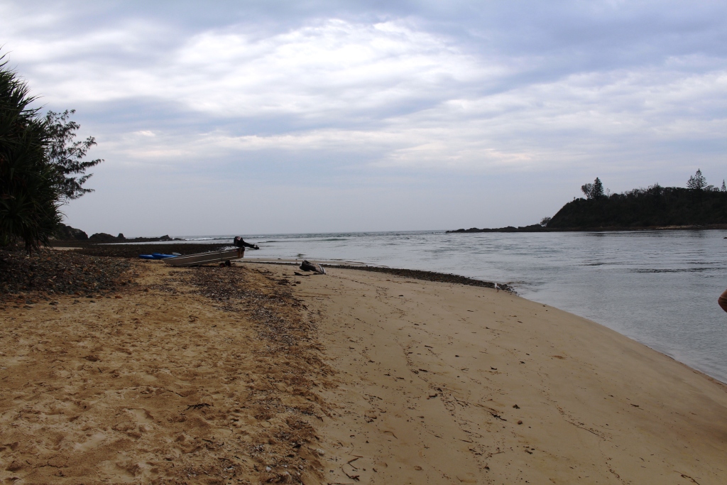
The mouth of the Sandon River

The mouth of the Sandon River

Both are fishing locations with camping facilities within the Yuraygir National Park. Surprisingly both camping areas were almost full of caravans and tents.

Sandon has a private enclave within the national park, with a few old fishing shacks. The river is quite broad, has good boat access

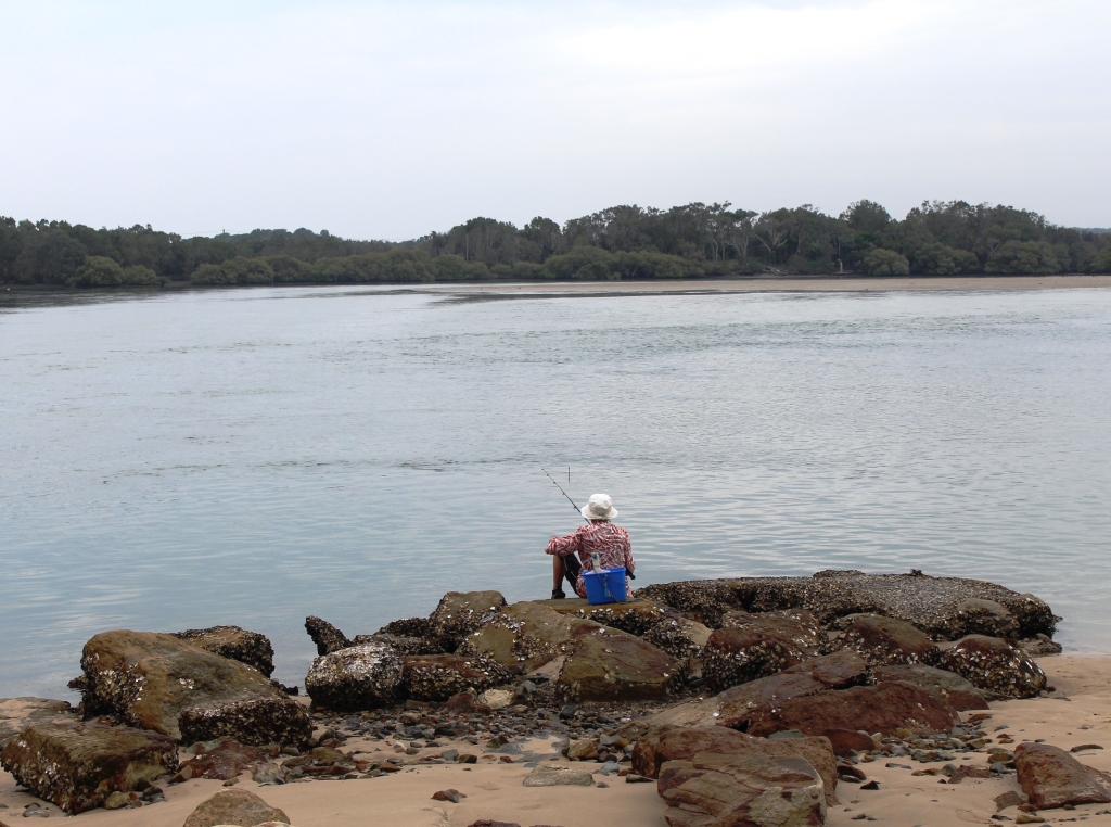
A lone fisherman at Sandon River

A lone fisherman at Sandon River

and was the sight of much fishing activity. The vegetation is typical of the low coastal areas on this part of the coast. It is about 10 km from Brooms Head.


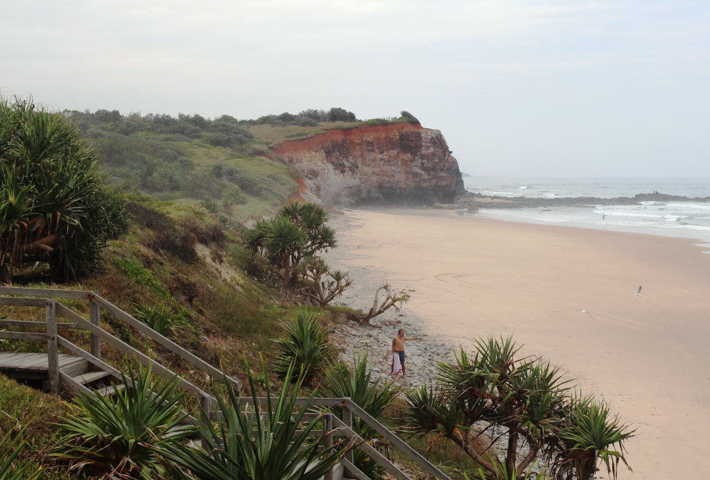
Red Cliff headland

Red Cliff headland

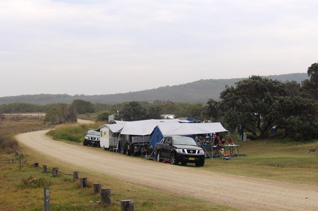
Red Cliff is, as its name suggests, a red cliff in the form of a headland that stands above the beach just north of Brooms Head. A National Parks provided camping area stretches along the hills behind the headland. The area is partly open and partly vegetated with camp sites cut back into the scrub to provide semi private accommodation. The area is

A group camping at Red Cliff

A group camping at Red Cliff

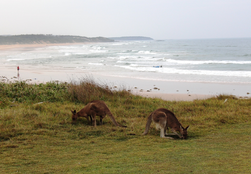
popular with kangaroos as well as with people. Several tame specimens were quietly grazing, mostly ignoring the humans.


Roos grazing at Red Cliff

Roos grazing at Red Cliff

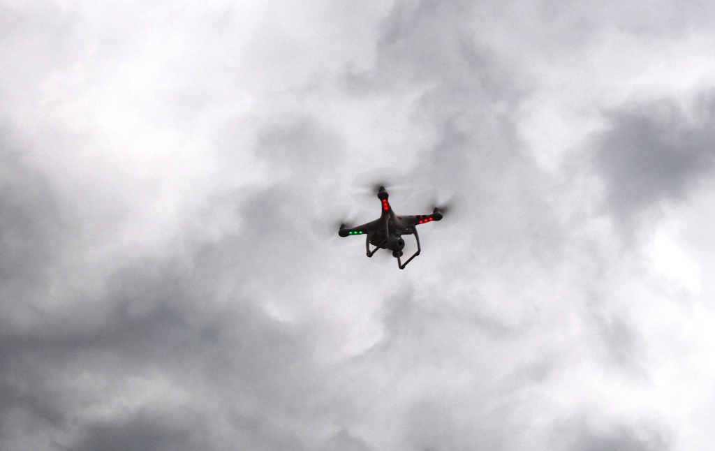
Buzzed from above!

Buzzed from above!

In the cool of the evening we walked along the beach to the other part of the caravan park. On the hill above the beach we could see a group of young blokes all looking down at the beach. We could hear a buzzing noise and looked up to see ourselves being buzzed by a radio controlled drone. We waved it its camera and the group waved back. We are

Brooms Head at low tide

Brooms Head at low tide

always happy to help with the entertainment!

The following morning we travelled to Kingscliff near Tweed Heads where we spent the last night of the trip. With the Nippers carnival complete we were able to find a site for one night.. This is familiar ground so no need for photos.

After spending the night at Kingscliff, we arrived home at about midday on 17th February. On 18th Ruth saw her orthopaedic surgeon, who has given her clean bill on her knee.  Her next visit is in 9 months time. On 19th, Eldest daughter Karen arrived from her stay in Tasmania to spend a month with us before returning to India. After a short stay at her India home she is off to USA for several weeks in conjunction with her work in India.

So here ends the current series of blog posts. We will keep you advised about future travel.

Until then Ruth joins me in extending our best wishes to all readers.

Kevin

Sydney 2014 – Days 26 to 28 – 11th to 13th February – Coffs Harbour

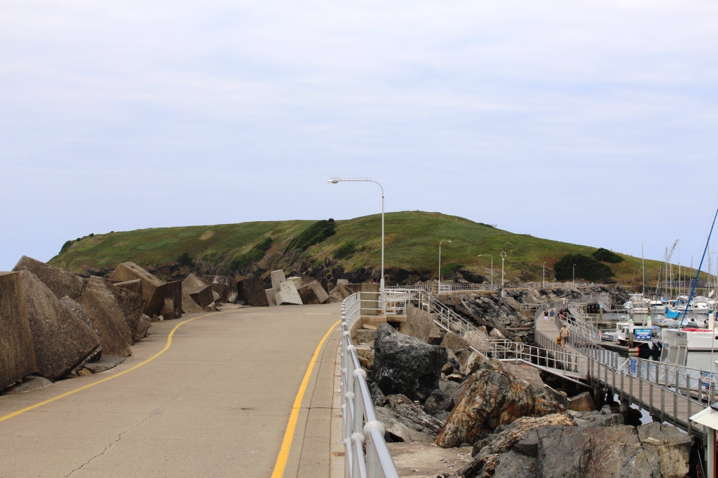
The headland at Coffs Harbour

The headland at Coffs Harbour

There is not much to report from Coffs Harbour. The two day stop was for mostly commercial reasons as there was work to be done. But we did have time for sightseeing on the second afternoon, so we did a round trip through Nana Glen, a small town on the back road from Coffs Harbour to Grafton and a station on the north coast railway line.

Both road and railway line follow the Orara River. The road is known as the Orara Way. This small town received much publicity some years ago when actor Russell Crowe bought a rural retreat near the town. Singer Wendy Matthews did likewise a bit later. Both events received a fair amount of coverage in capital city media.

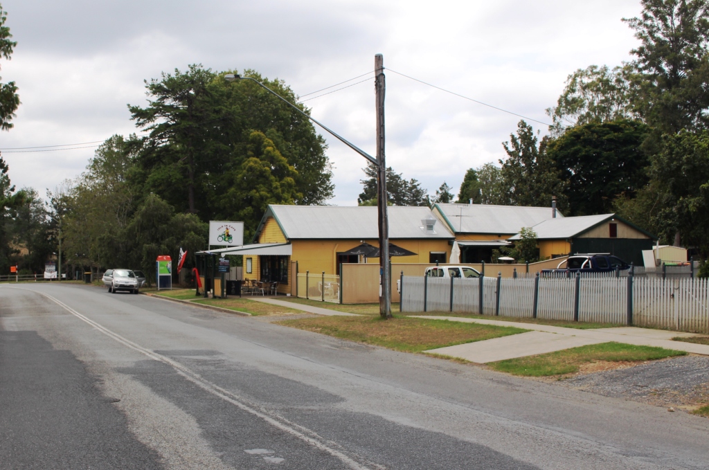
Café on the main road to Grafton

Café on the main road to Grafton

Nana Glen is really two towns, one on the railway and the other on the road. It is all quite old looking but there are signs of benefit from the Coffs harbour tourist boom. A small restaurant operates on the main road and a little further from town another restaurant/bar  was promoting live music, no doubt to attract tourists from the coast. Coastal holiday makers seem to like to include a hinterland experience in their holiday.

The town has facilities including a pub and fuel supplies.

The town has facilities including a pub and fuel supplies.

The drive that we did would be ideal for a diversion from sun and sand. We drove north, through the extensive road works that seem to have been going on for ever, for about 10 km and turned into Bucca Road. A further 20 km brought us to Nana Glen. We then turned south to travel through the small rural towns of Coramba and Karangi and back into the centre of Coffs Harbour, a round trip of a little over 60 km.

Coffs Harbour is the home of the Big Banana, but perhaps not for long. Banana production is moving away. We passed some plantations as we approached Coffs Harbour from Nana Glen but there do not seem to be many more around. And we saw no bananas at Nana Glen!

Sydney 2014 – Day 25 – 10th February – Around Harrington

The main Harrington training wall

The main Harrington training wall

Harrington was a special place to our family. Dad was born and raised in the Lansdowne area, just west of the mouth of the Manning, and had fished the training walls along the river since his youth. Holidays there were always about fishing and I have fond memories of helping to eat Dad’s catch.

There are two hills that are part of

Harrington town and lagoon

Harrington town and lagoon

the town. They rise from the flat river plain like a giant had emptied two huge buckets of dirt by the river. One has a water tower and houses. The other has a lookout and houses. I believe the hill with the lookout is Flagstaff Hill.

A pilot station was built on this hill in 1856 but was closed in 1861 after the death of one William

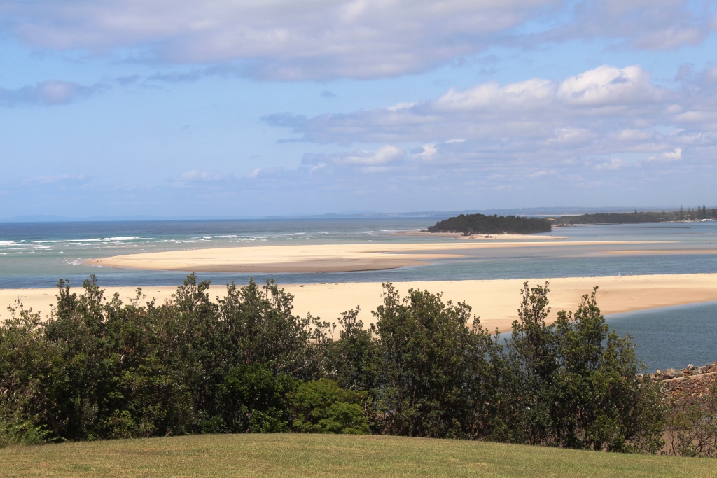
Manning River mouth and Manning Point

Manning River mouth and Manning Point

Whitmore. One of Dad’s sisters was named Whitmore, so I am wondering if there is a family connection.

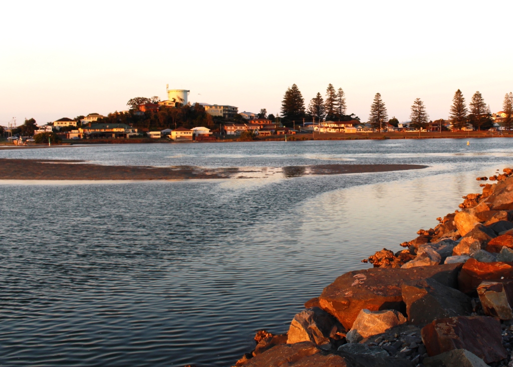
The views over the Manning Estuary are excellent, particularly of the paved training wall from which Dad did most of his fishing. Late in the day Ruth and I walked along the wall, following the

Harrington in the evening light

Harrington in the evening light

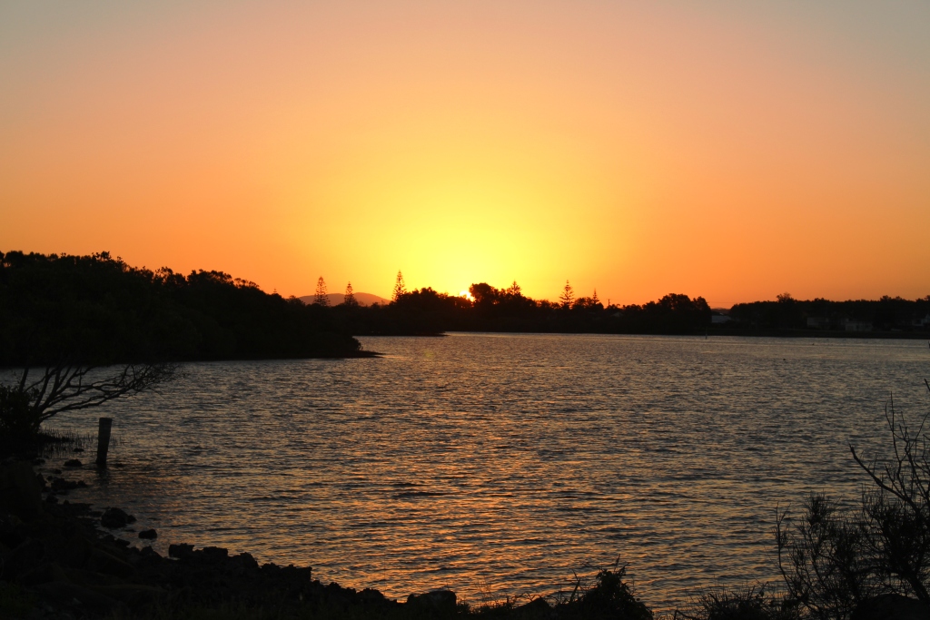
setting sun and walked back as the daylight faded. We noted several plaques attached to some of the rocks on top of the wall, obviously in memory of departed fisher folk to who this wall must have been a special place.


Manning River Sunset

Manning River Sunset

The main jetty at Crowdy Harbour

The main jetty at Crowdy Harbour

We then drove the 8 km to Crowdy Head, the sight if a lighthouse and a harbour which is mainly used by professional fishermen but also provides access to the open sea for hobby anglers.

A story attaches to this place as well. I mentioned a couple of posts back ferrying a yacht from Sydney to Brisbane. Having sailed through the night passing Port Stephens,

Fishing jetty at Crowdy Head

Fishing jetty at Crowdy Head

we were rather tired by the end of the next day, so decided to spend the night in a port. We were trying for the Camden Haven River but when it became clear that darkness would beat us we settled on Crowdy Head as an alternative.

One of my crew, the previous owner, was a New South Welshman and the other a Queenslander and that night was

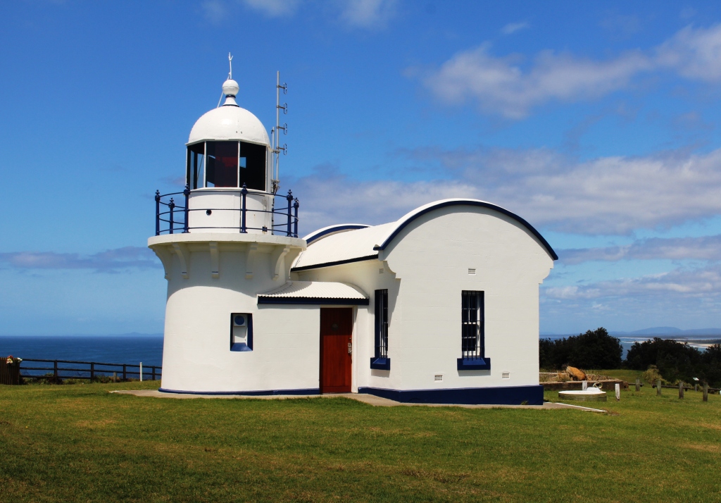
Crowdy Head Lighthouse

Crowdy Head Lighthouse

a State of Origin league football match between Queensland and NSW. My intention was to buy them a pub meal where they would be able to watch the match. But Crowdy Head doesn’t have a pub or any other eating establishment. I had to settle for buying fresh fish fillets at the cooperative and serve them a meal of yacht cooked fish and chips while we listened to the match on the radio.

Crowdy Head still does not have much of a commercial centre but there is a cafe at the surf club but that would have been too far to walk. The headland is crowned by the heritage lighthouse and its slopes adorned with very expensive houses. They are probably owned by successful folk from Taree.

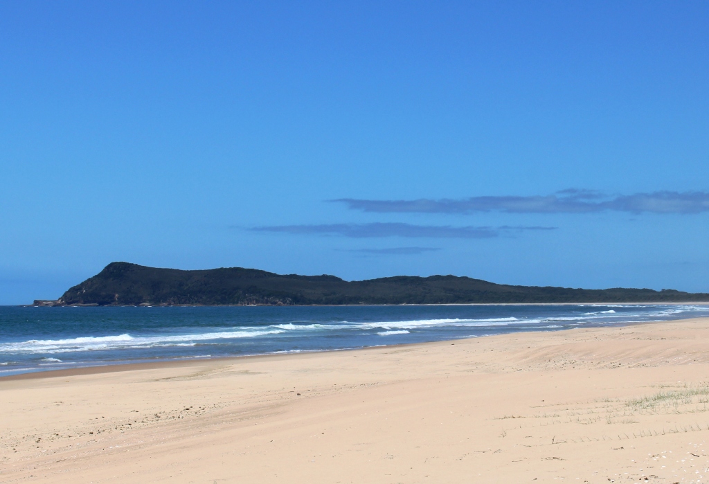
Diamond Head

Diamond Head

We then drove north through the Crowdy Bay National park to Diamond Head and then on to the triplet towns of Laurieton, Dunbogan and North Haven on the Camden Haven River. We found a pleasant place for lunch overlooking the river.

To the south of Laurieton lie the Brother Mountains. There are

Training walls at the mouth of the Camden Haven River

Training walls at the mouth of the Camden Haven River

three of them, North Brother, South Brother and Middle Brother. They are prominent mountains and can be seen from a great distance. I recall using North Brother for a compass bearing during the yacht passage. Prominent mountains usually provide great platforms for lookouts and such is certainly the case with North Brother.

Lunch completed we drove the

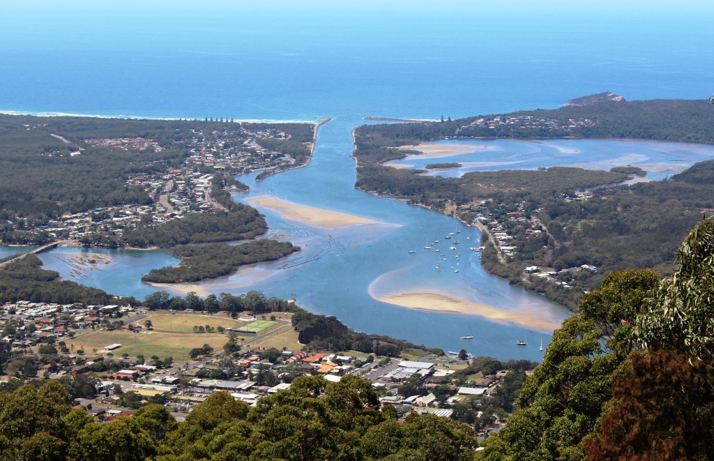
The Camden Haven Estuary from North Brother Lookout

The Camden Haven Estuary from North Brother Lookout

steep 5 km ascent to the North Brother summit. We had been there before, but the view is one that can be enjoyed time and again. The view of the mouth of the Camden Haven River and the three towns is spectacular as the accompanying photo attests. Looking south the Watson Taylor Lake, skirted on the west by the Pacific Highway, is no less impressive, particularly the long

The river flows through a long neck of land into the Watson Taylor Lake near Laurieton.

The river flows through a long neck of land into the Watson Taylor Lake near Laurieton.

neck of land through the river runs before it discharges into the lake.

Middle Brother is clearly visible from its northern brother. We decided to drive to its summit where a tall communications tower is located. But I made a navigational error and ended up on a dead end road. As the day was quickly getting away we decided to leave Middle Brother as unfinished business to be addressed at another time. As we followed the Pacific Highway south to return to Harrington we passed a road boldly sign posted “Middle Brother Road”, so now we know where to start out drive next time.