
Another cold night bur no fog this morning – only cloud cover but higher cloud than yesterday. By mid-morning the cloud burned off leaving us with a clear sunny day.
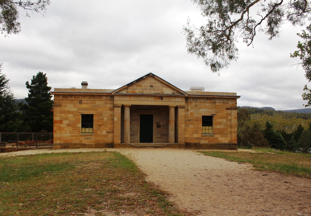
The Court House at the Hartley Historic Village
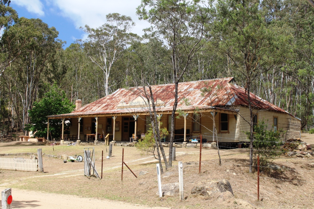
The long since unlicensed Newnes Hotel, now a museum and kiosk.
We went further afield today. Travelling west we passed through the remaining Blue Mountain towns, down the steep Victoria Pass, made a brief stop at the Hartley Historic Village, passed through Lithgow and on to a small place called Newnes. Newnes is at the southern border of Wollemi National Park. It is a very popular camping place, particularly with 4WD owners as a river crossing is necessary to reach the main camping area.
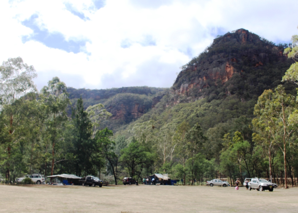
The camping area is surrounded by sandstone topped mountains.
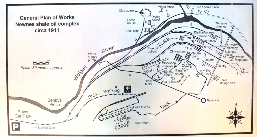
Layout of the processing plant is shown on the information board.
But Newnes has historical significance. In 1906 the Commonwealth Oil Company commenced building a shale oil mine and refinery just down the Wolgan River from the site of the town which was built by the company and named after its Chairman. The product was transported to Sydney by rail over a purpose built railway that joined
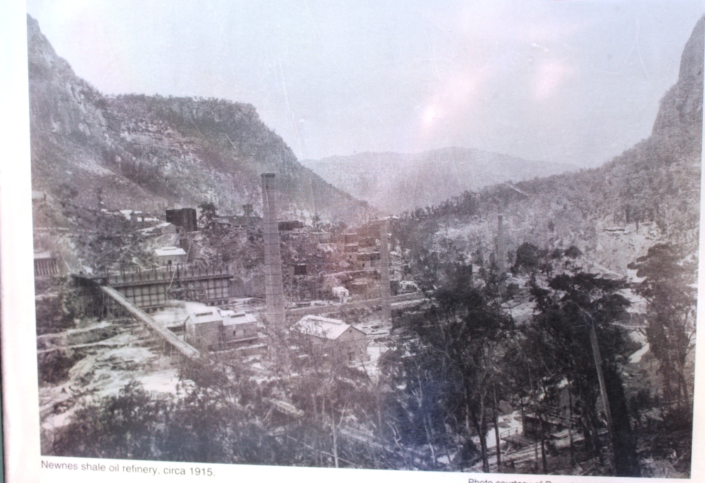
Old photograph of the processing plant.
the Government rail system between Lithgow and Bell. The line ran through difficult country and included two tunnels. The line has been out of commission for many years and the rails removed but one tunnel can be driven through on the way to the second that has become home to a glow worm colony.
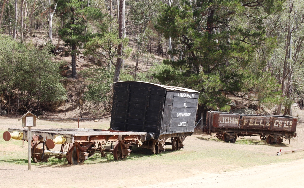
Old rolling stock waits for restoring to its original condition.
The refinery was apparently quite sturdily built as substantial relics remain. To tour them requires about 2 hours walking over a path not designed for new knees. We started out but it soon became obvious that we would run out of time, so turned back to the car.
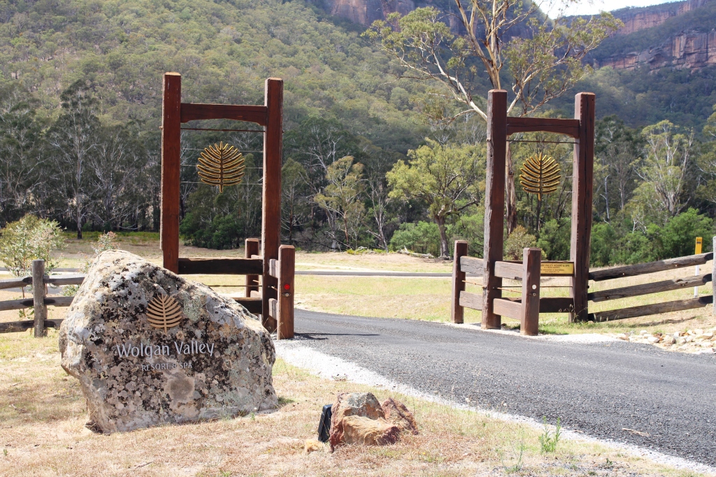
Gates by the road side announce the Wolgan Valley Resort & Spa.
The Wolgan Valley was the centre of a controversy not long ago when a hospitality company from the Middle East was granted approval to build a rather lavish resort and spa primarily, it seemed, for their own nationals. Some locals and others were not happy with the arrangement and the matter raged on Sydney radio for a while. The resort was built and is operating but it can’t be seen from the road, which incidentally, is now sealed to about 200 metres past the front gate of the resort.
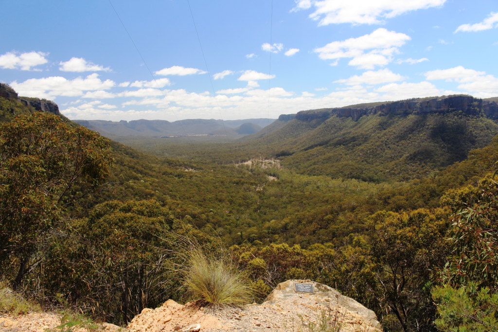
Looking north along the valley from the top of the cutting that descends into the southern end.
The valley is beautiful. It is narrow and follows the stream that flows through its centre. The mountains that form the valley rise steeply and are capped with sandstone cliffs that display most attractive colours. Apart from the national park at the lower end of the valley the remainder is farm country with cattle and sheep. Maybe a return visit with the caravan one day so there will be time to do the walk and soak up the history.
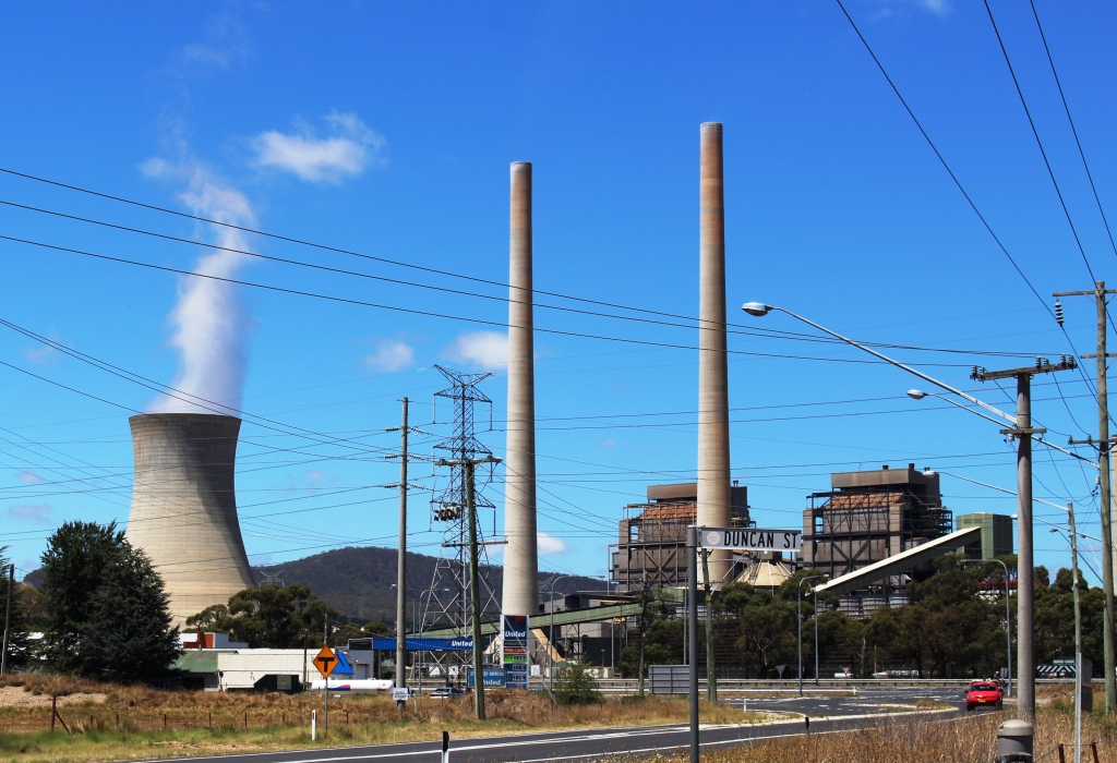
Wallerawang Power Station is powered by local coal.

Ruth on Clarence Station platform. This is part of the currently suspended tourist rail operation.
We returned to Lithgow, pausing to photograph the Wallerawang power station. Lithgow is a coal town and is surrounded by coal mines. Instead of returning via the Victoria Pass we took the Chifley Road to Bell, stopping in to the currently dormant Zig Zag Railway. It is out of commission due to damage sustained during the Blue Mountains bush fires last October. We deviated from the
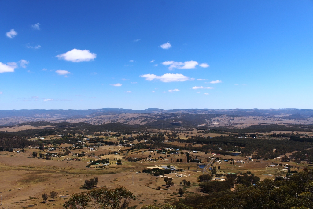
Hartley Vale from Mt York Lookout.
Darling Causeway that follows the railway between Bell and Mount Victoria to drop down into Hartley Vale, returning to the Great Western Highway at Little Hartley.
We spent the afternoon looking at the iconic lookouts and waterfalls of the western Blue Mountain Plateau. These included Mount York, Mount Piddington, Govett’s Leap and Govett’s Falls and Evans Lookout and drove out onto the Narrow Neck Plateau that divides the Jamison
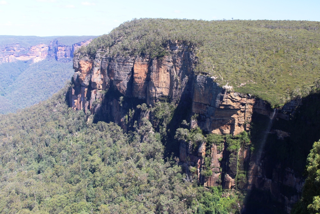
Govett’s Leap Falls and cliff face.
and Megalong Valleys. This last feature was a bit of a dead loss as, after experiencing easily the worst road on this trip we discovered that there is not much to see without embarking on long walks. Walks of various lengths were required to reach the lookout point from the various car parks.
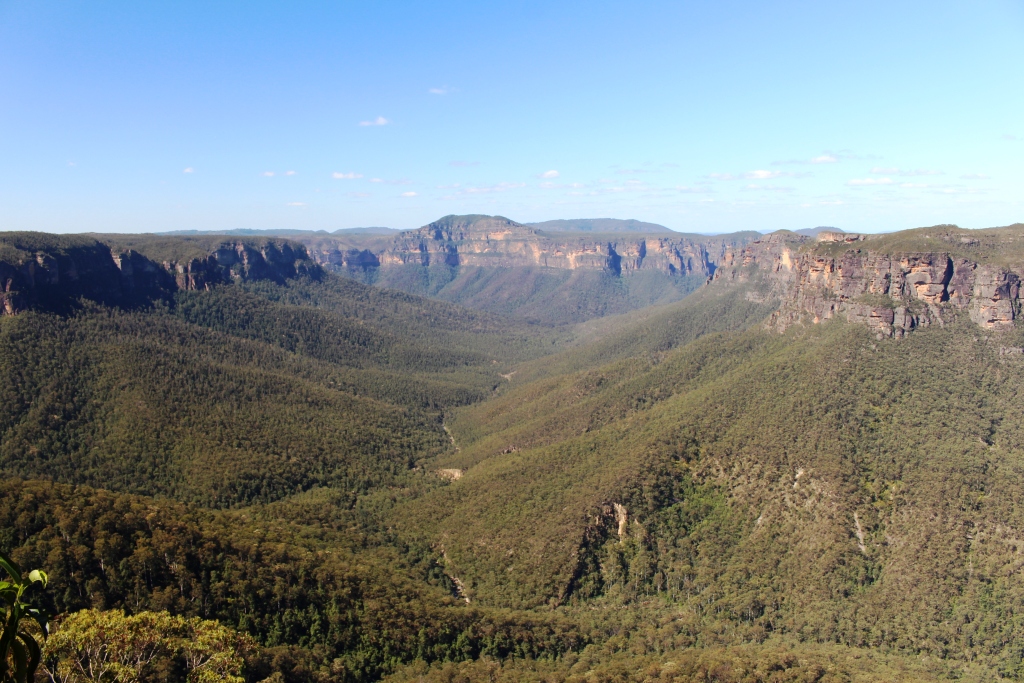
View from Govett’s Leap Lookout
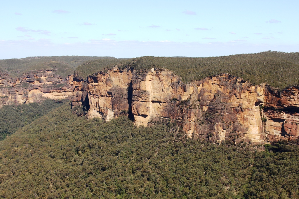
Another view from Govett’s Leap Lookout.
So that was our day driving. After a bit of a rest in the sunshine by the van I went for a walk to look for the Katoomba Falls. We had tried to find them yesterday but had turned
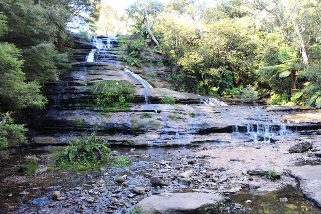
The main fall at Katoomba Falls.
back because of steep stairs. They are indeed at the bottom of steep and rather rough steps. The main falls are near the road, only about 300 metres from the caravan park. The Katoomba Creek then runs through a very pretty gorge and over a series of smaller falls and rapids until it plunges over a cliff into the Jamison Valley.

The final run of Katoomba Creek before it drops into the Jameson Valley.