I had been wondering how I would handle reporting our return over the same roads in my blog when the problem was solved in an unexpected way.
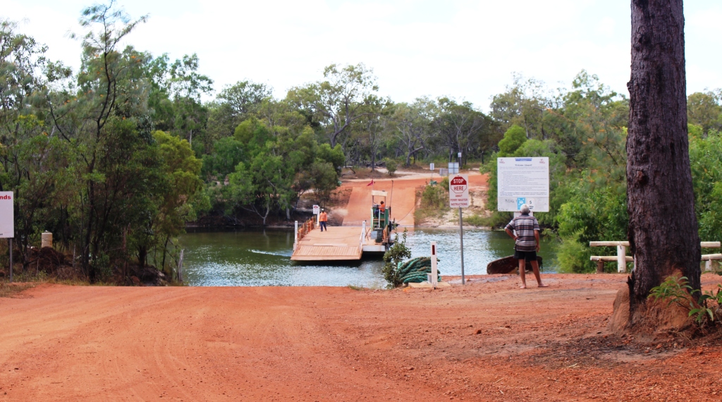
We had travelled down from Punsand Bay to Seisia on Sunday, with the intention of doing the Seisia to Bramwell Junction section the following day. That meant again traversing the Bamaga Road and I wanted to be well rested for it. Driving on those roads requires intense concentration and is rather tiring.
I did not sleep well on the Sunday night, so we decided to take a rest day. Early on Monday morning I walked to the camping park office to pay for another night and was
MV Trinity Bay approaching Seisia
confronted by a sign that said, “Why drive back?” I really related to that question. And since it was on a sign for SeaSwift, the shipping company that services Torres Straight, I figured that they just might have vacancies on the ship back to Cairns.
So I went to their office, and yes, there was space for the car and van and yes, they had a cabin available. And just to clinch the deal, because departure was only four days away, stand by rates would apply. Done deal!
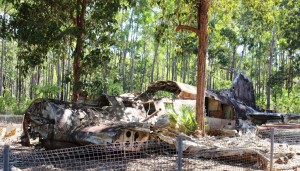
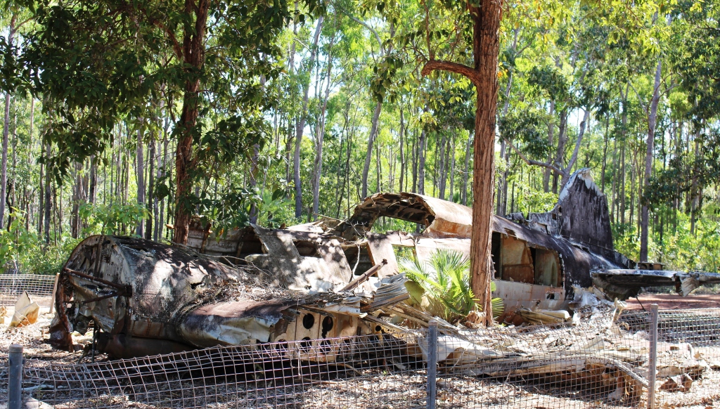
The crash site of a DC3 near Bamaga airport
We filled in the intervening days easily. One was spent on the trip back to Thursday Island and during one other I got as much of the red paste off the car and van as possible. The vehicles were to be shipped as deck cargo. I didn’t want to arrive in Cairns with salt encrusted red paste all over the car and van. As it turned out we had a very smooth passage, so there was not much spray. A heavy rain
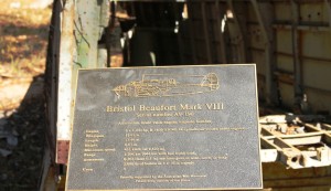
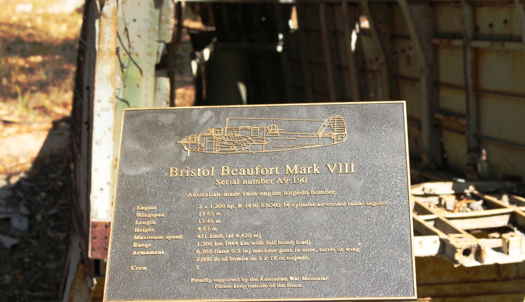
The plaque commemorating the loss of a Bristol Beaufort Mark VIII with all crew near Bamaga Airport
shower as we approached Cairns took care of any salt that had settled on the vehicles.
We also took the opportunity of visiting some of the WWII history around Bamaga. The current Bamaga airport was an air force base during the war so logically there are crashed aircraft in the area. Two have been retained and partially protected for posterity. To reach the crash site near the airport it is necessary to drive through an area of bush. Lying in the undergrowth there are thousands of rusting fuel drums. Imagine the logistical task of moving those huge volumes of supplies to such a remote area over 70 years ago.

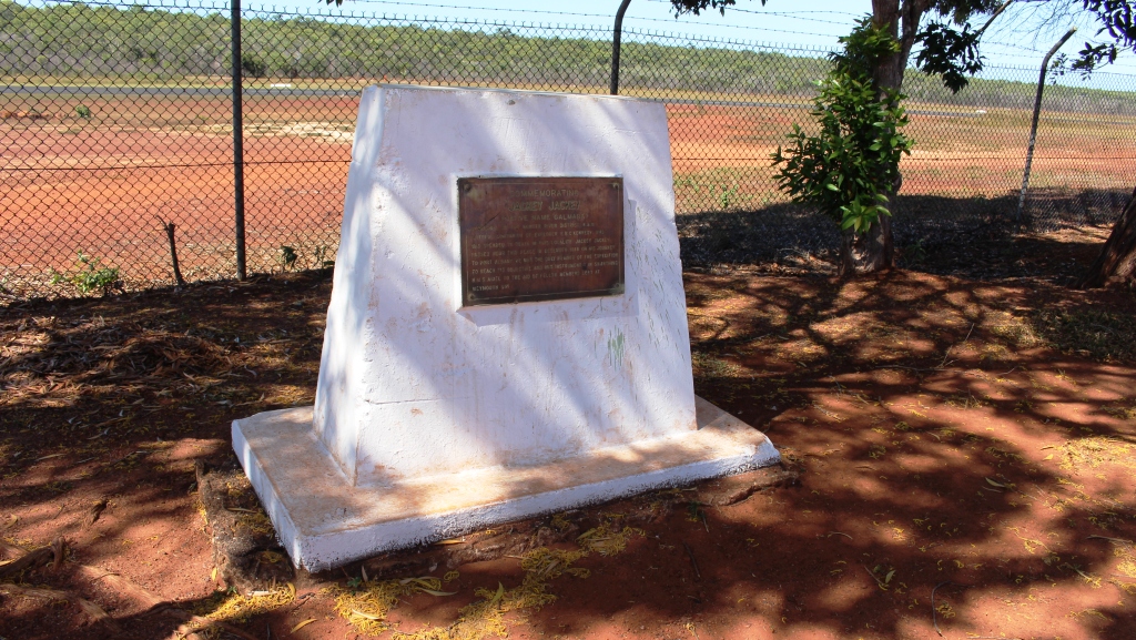
The Jacky Jacky memorial is placed in a corner of the car park at the airport.
There are two interesting memorials in the airport car park at Bamaga. One is to Aboriginal tracker and loyal companion to the ill fated explorer Edmond Kennedy, Jacky Jacky. There are a number of reminders of his bravery and loyalty in the northern area of the Cape. Indeed, I wonder if Loyalty Beach near Seisia is named in honour if his actions.
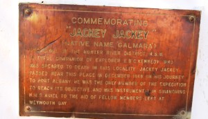
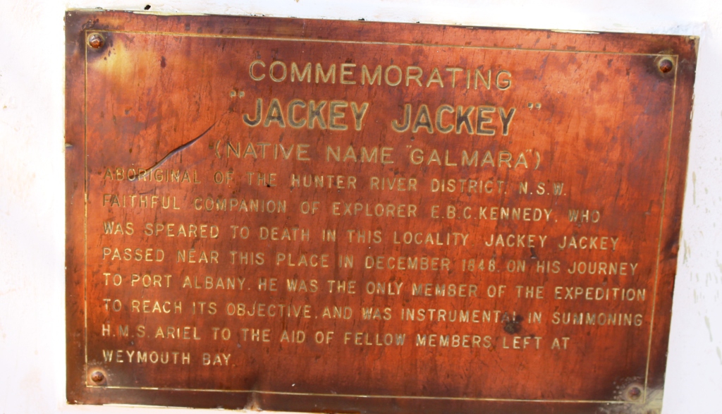
The wording on the Jacky Jacky memorial
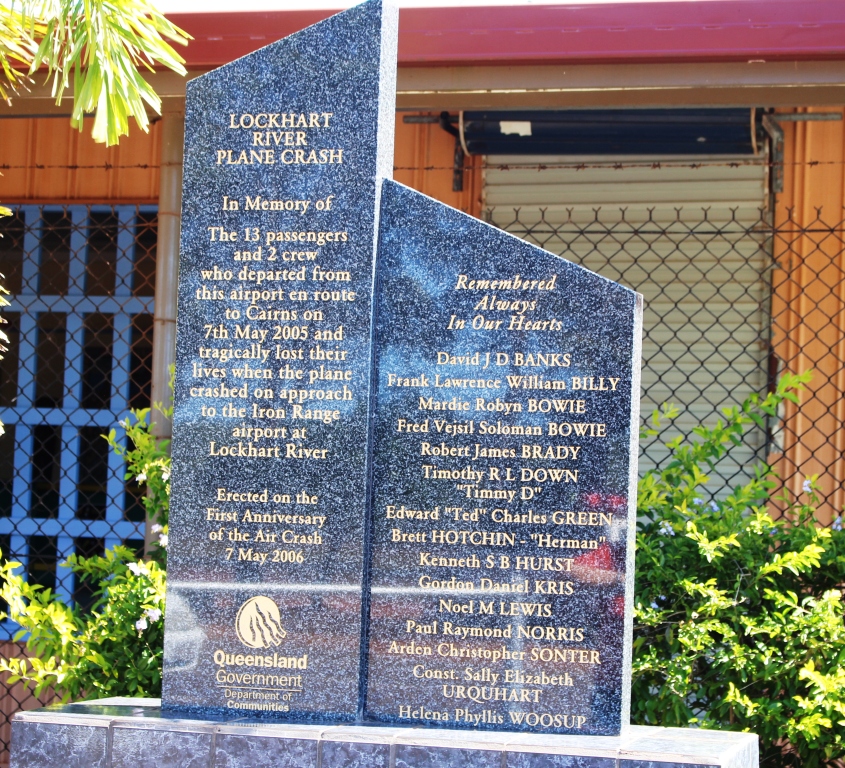
At the front of the small airport terminal, a monument to the victims of that aircraft crash several years ago in the Iron Range National Park near Lockhart River, has been erected. The doomed aircraft departed Bamaga airport and was lost before it reached its first stop on its run back to Cairns. The shape of the memorial is similar to many of the headstones that we

The memorial for the Lockhart River aircraft crash
saw on graves at Thursday Island cemetery.
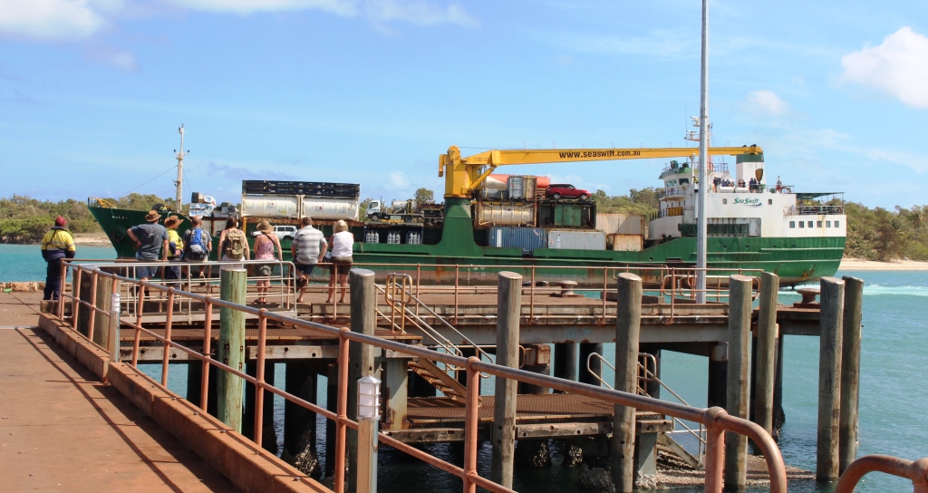
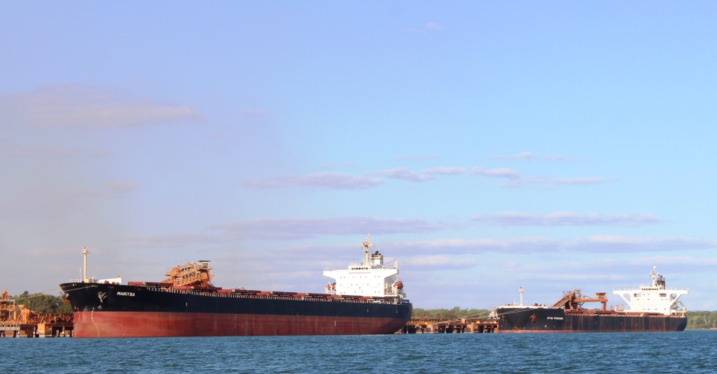
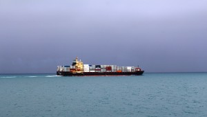
MV Trinity Bay berthed at Seisia wharf
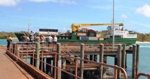
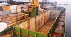
We boarded MV Trinity Bay at about 11.00 am, settled into our cabin, lunched and then watched the container unloading and reloading process. The ship is fitted with a crane.The whole process of loading and unloading is handled by the ship’s crew, as there are no stevedore facilities at Seisia or Thursday Island.
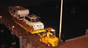
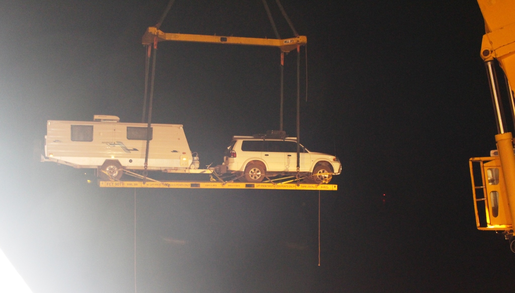
Our car and van being positioned for lifting on board
Passenger vehicles are loaded last at Seisia so they can be unloaded first at Cairns, so it was dark and we had finished dinner by the time vehicles were loaded. Ours was second last. Car and van were loaded coupled for towing. They had been driven onto a freight base with the front wheels of the car at one extremity and the wheels of the van at the other. That portion of the van behind the wheels was hanging

Up, up and away!
in space. Our pride and joy swinging into the sky before being deposited cross ways at the very front of the ship is a sight that I will never forget.
We had gone to our cabin for the night before we left Seisia but when we started to move I went on deck to watch the lights if Seisia disappear astern. Normally Trinity Bay heads directly for Cairns from Seisia, but had to return to Horn Island to load more containers, before returning south. We slept through the first couple of hours of loading containers but were awake for the last hour and for the departure from Horn Island at about 3.00 am.
[youtube]https://youtu.be/jLkYV09ct_k[/youtube]
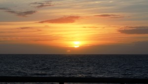
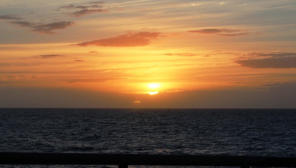
Sunrise at sea
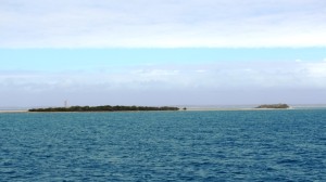
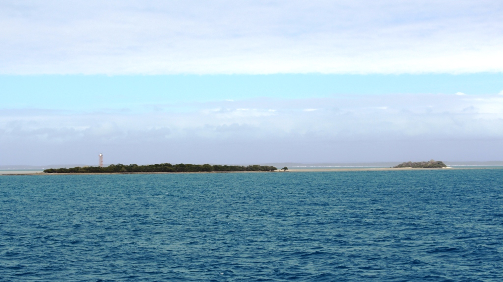
A typical coral cay with light tower
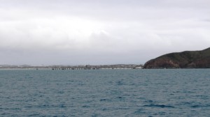
When we woke at about 6.00 am we had rounded Cape York and had commenced our passage south. Unless we were crossing a large Bay we were close to the coast and could see most of its features. There was an increase in the amount of cloud with further increased, including rain, by the time we reached Cairns. But it was pleasant weather and most passengers spent their time on the open deck at the stern where we could select sunshine or shade and were sheltered from the wind, which was coming from the direction of the bow, helped, of course, by the passage of the ship.
There is a routine to shipboard life. Breakfast was at 7.00 am, lunch at 12 noon and dinner at 6.00 pm. Standard procedure is for the passengers to stand back and allow the crew to serve themselves first. It is, after all, a working ship, not a passenger liner. A cake would appear, freshly baked from the galley at about 9.30 am and happy hour nibbles at around 5.00 pm. Coffee, tea and biscuits were available at any time, but self service, of course.
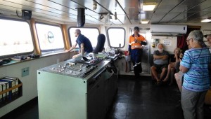
The control area on the bridge. The sailor in the chair is the duty officer.
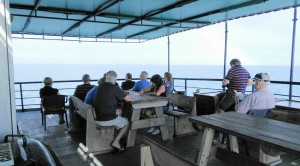
Passengers on the open deck
On Sunday morning, the second morning on board, passengers were invited by the Captain to visit the bridge for a presentation on the operation of the vessel. We were given statistical information and details of the operation and navigation. Trinity Bay has two captains and two separate crew. They work in rotation, working for four weeks on duty and four weeks off. Automatic pilot was engaged so no passengers got to steer.
There was only one task for Trinity Bay to perform on the way south. On Saturday evening, just before dusk, the ship stopped in a sheltered bay near the Aboriginal settlement of Lockhart River, where we were met by a barge. Trinity Bay used its crane to load a refrigerated container and a fork lift onto the barge. The fork lift was used to transfer the contents of the container into permanent cold storage on the barge. The empty container and the fork lift were loaded back on board and we were on our way into the gathering darkness while the barge proceeded to Lockhart River with its frozen and chilled supplies.
Passed by a larger and faster ship
During the night we passed the broad expanse of Princess Charlotte Bay, the scene of probably the greatest maritime disaster in Australian waters. A pearling fleet of between 80 and 100 boats was totally destroyed when Cyclone Marino swept across the bay in 1899. About 100 Aborigines and 307 pearling crew lost their lives.
The silica loading jetty at Cape Flattery
By morning we had rounded Cape Melville and when I went on deck before breakfast, we were off Berwick Island with Cape Flattery soon to be passed as we approached Cooktown.
Cape Flattery is home to a silica mine, the loading Jetty for which was clearly visible as we passed, but no ships were loading. The pure white of the silica deposits stand out in sharp relief from the surrounding vegetation. Not surprising since the deposits are 98% pure silica.
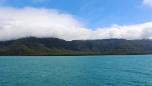
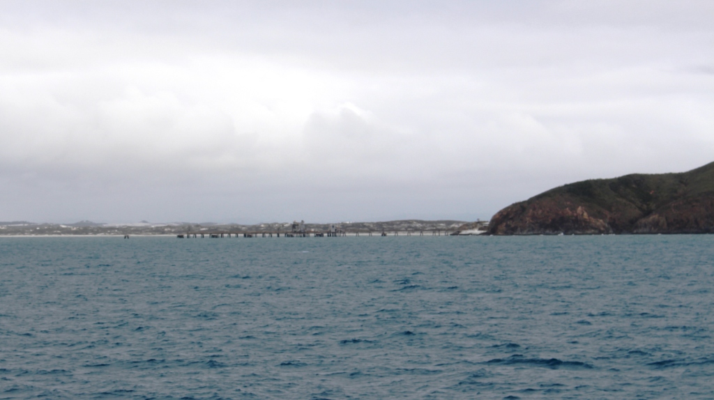
The coast south of Cooktown
A little further south, and inland, is the Aboriginal community of Hope Vale that both supplies labour to the silica mine and is the home of well known Aboriginal leader, Noel Pearson.
We could clearly see the mouth of the Endeavor River but Cooktown is out of site behind Grassy Hill, the elevated area to which James Cook would climb to plot a route through the coral reefs as he planned his escape from the temporary sandbank dockyard where the Endeavor was under repair by its crew.
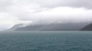
Cloud over Cape Tribulation
Most passengers were looking forward to seeing the mountains of the Bloomfield Ranges and their precipitous plunge into the sea, but Mother Nature had other ideas. A heavy rain storm came through and obliterated the view of the coast. Rain was still falling as night fell and we retired to the dining room for dinner.
Rain clouds hid Port Douglas as well but the weather had cleared
Ready for another load
as we started to pass the northern suburbs of Cairns. The resulting improvement to conditions on the upper deck attracted most passengers out of the dining room to line the rails as MV Trinity Bay made her way down the long channel and turned in the basin to sidle into her berth.

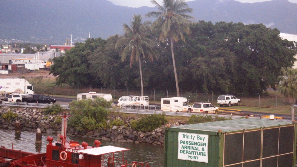
Ready to drive away
Passengers with hotel accommodation disembarked, but about half of us, who were going to caravan parks, stayed on board for a third night, to allow time for vehicles to be unloaded. When we came on deck next morning the containers were all on the wharf and our vehicles were parked on an adjacent roadway in readiness for our departure. With breakfast over we were soon disembarked and on our way to our caravan park.