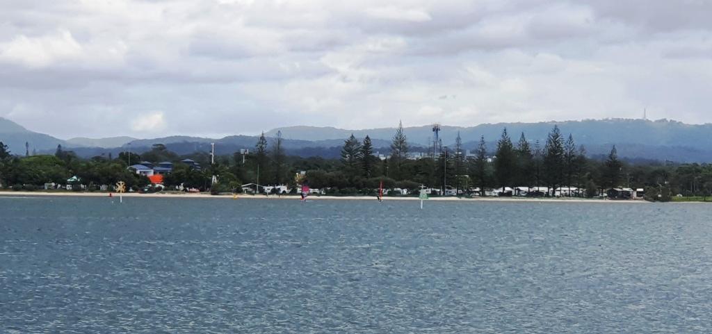
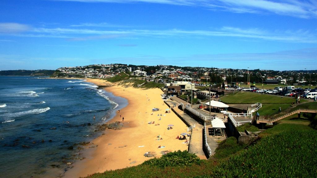
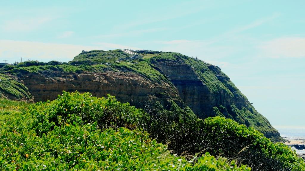
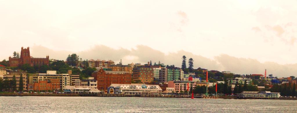
A three image panorama of Merewether Beach and suburbs further south.
With some embarrassment, I see that it is a year since I have added to our travel Web site www.mobilesheathers.com. One reason for the delay is that we are less mobile, with advancing age and the disposal of our caravan and tow vehicle. But despite Covid-19 we have made some excursions of several days duration. I will start getting the site up to date with a report on our most recent trip south.
Gold Coast high rise from the Broadwater
We have, for obvious reasons, been reluctant to venture out of Queensland, due to the possibility of being locked out or needing to deal with the expense of getting back in. With the prolonged period of no community Covid infections as encouragement, we took our courage in both hands and crossed that border at Tweed Heads, heading south. What was the experience like, you may ask? Well, very much the same as on previous occasions. All the border closing gear had been placed out of sight, so all was normal again. But, for how long? The answer to that question remains unanswered, thankfully.
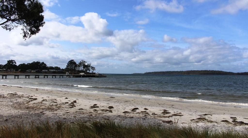
A distant view of the caravan park on the waters edge at Southport.
The decision to go south was brought about by an earlier decision to join a group from our Probus Club at the Broadwater Tourist Park at Southport, near Surfers Paradise, for a few days. We do this periodically, at different locations, generally staying for three nights. Normally, some of our group come with their caravans, while the other attendees take up residence in park cabins. This time, with inclement weather both with us and projected, we all chose cabins.
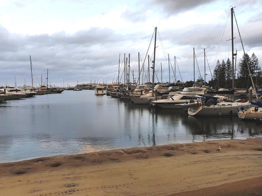
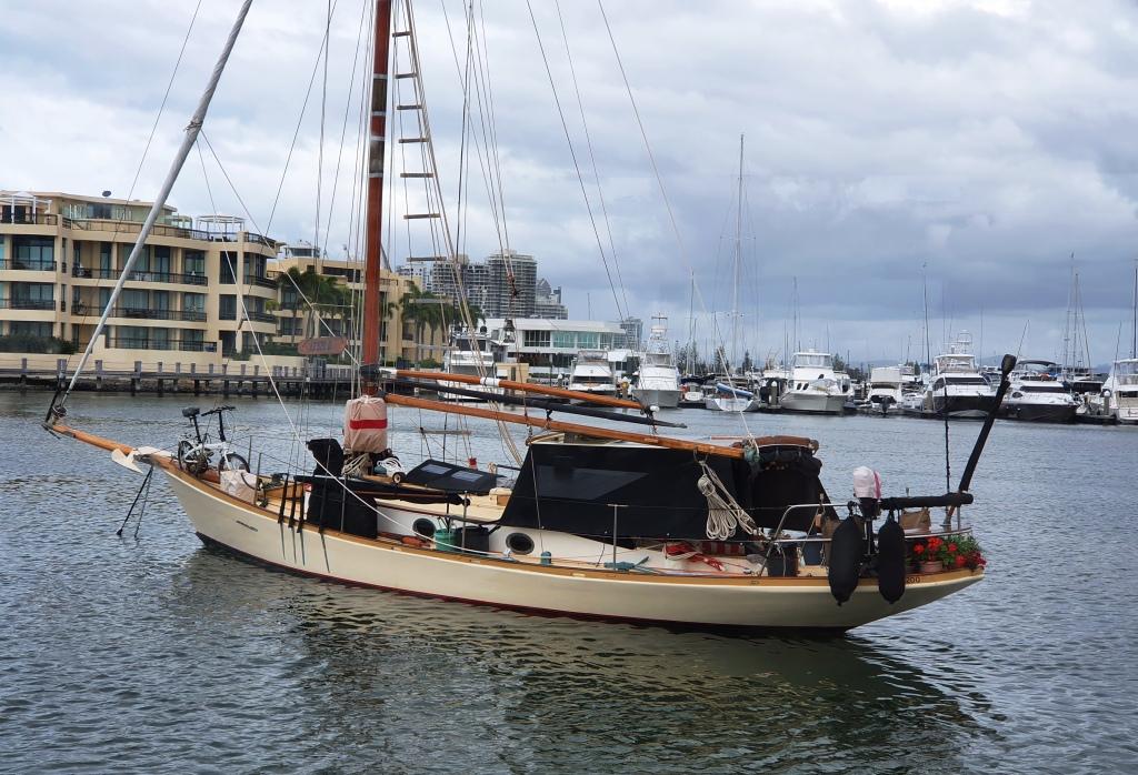
Boats in the Southport Yacht Club marina, viewed from the club in the early evening.A cruising yacht complete with flower garden, moored in front of the Palazzo Versace hotel.
Our program included dinner at the Southport Yacht Club, a luncheon cruise of the Broadwater on a Sea World ferry and each evening a happy hour in one of the park camp kitchens. The periods not organised were free time, but no one did very much due to disagreeable weather. I did go for a wander during the first morning, with my longest lens on my camera, to photograph some local shore birds. Bird photography is my latest hobby interest.
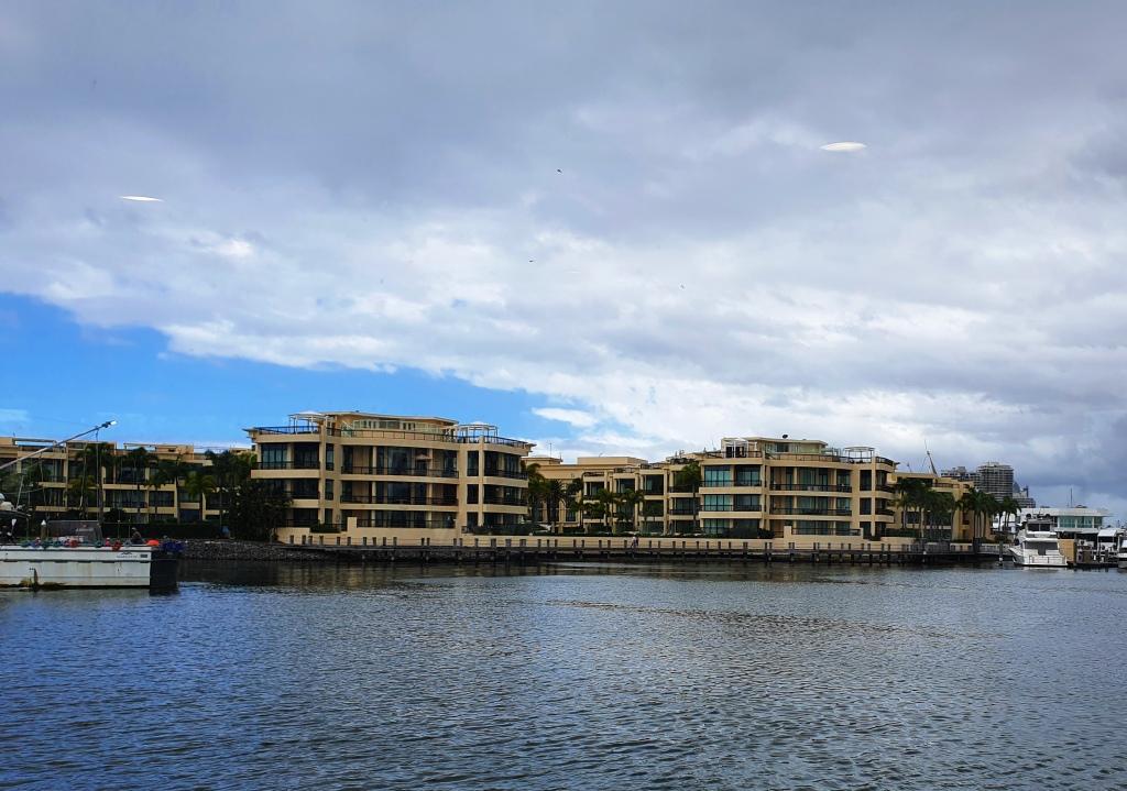
Palazzo Versace hotel with the Sheraton Grand Mirage Resort in the background.
So on Friday, day 4 of our travels, we crossed the border and drove a further 90 kilometres to Ballina, where we spent two nights with our longest time friends Joe and Thelma, who relocated themselves from Melbourne to Ballina a couple of years ago. Renovations are complete on their house and have been very well carried out. The house is as new. We enjoyed a day and two nights with them, resuming conversations interrupted when we parted from them the last time. Thank you, Thelma and Joe.
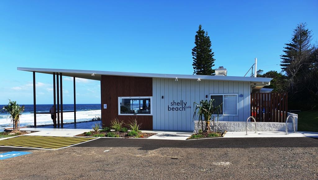
Shelly Beach and the ocean at North Ballina.A new eating location that was closing when we were there in the late afternoon. The photo of the beach was taken from here.
This brought us up to Sunday 7th March. The 8th March was my Brother Ivan’s 87th birthday, so we had a day to reach Newcastle and our accommodation at Merewether Beach. The only impediment to traffic flow on the Pacific Highway, between the Queensland Border and the northern approaches to Newcastle, are the multiple (is it 12 or 14?) sets of traffic lights through Coffs Harbour, so we made the journey in comfort and with ease.
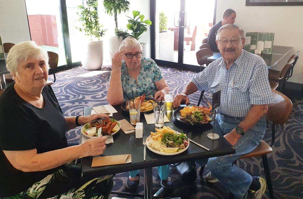
We had lunch with Ivan and Marjorie at the Windsor Hotel in East Maitland on Ivan’s birthday. He drove us there in their new Nissan X-Trail, having a few days previously passed his second “old persons” driving test with flying colours. We returned to their home to again resume old conversations. We stayed with them for a light evening meal and then returned to our digs.
The 87th birthday lunch. All participants looking younger than their years.
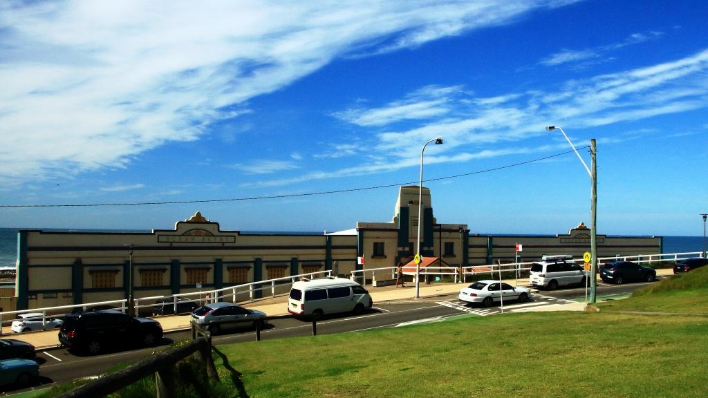
We arrived back at our motel too late to lodge breakfast menus, so next morning needed to embark on an excursion to find breakfast. We drove to Merewether Beach but all the Newcastle city workers who park there and walk to work for exercise got there first. So there was breakfast but no parking. A little further up the beach we found a venue and parking but breakfast was down a long and steep flight of stairs. Closer to our motel we found a café that did the poached eggs and bacon to a turn and provided excellent coffee.
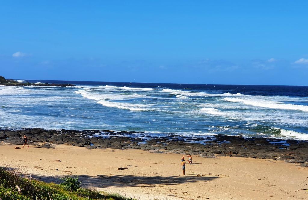
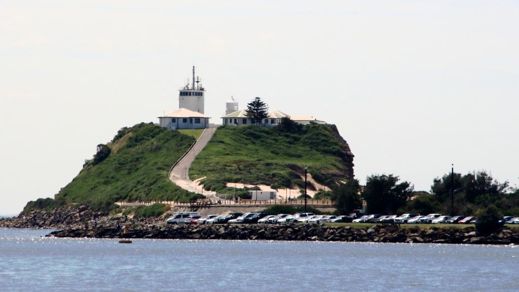
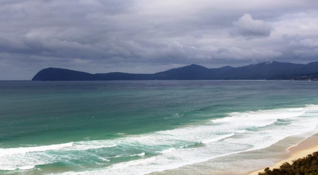
Merewether Beach. The parked out area is near the distant end.Empire Park covers much of what I believe to be the actual hill named Cooks Hill, from which the suburb of the same name presumably takes its name.
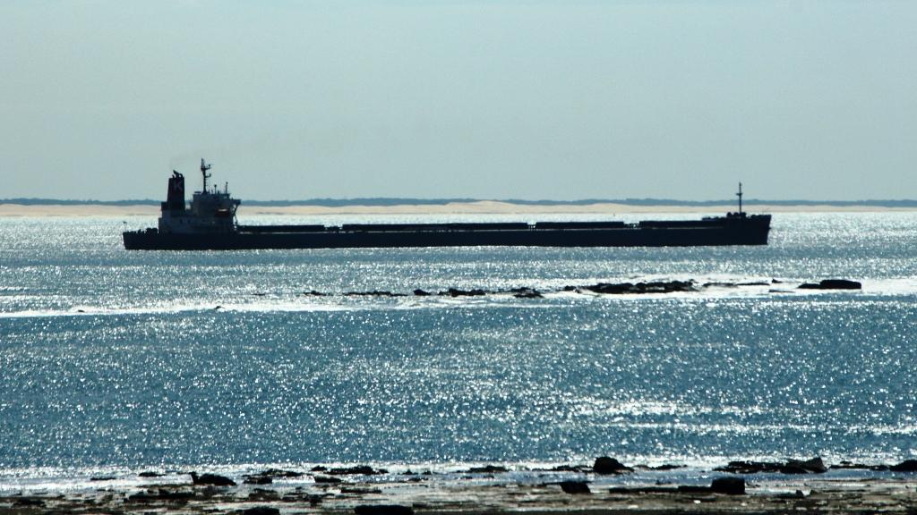
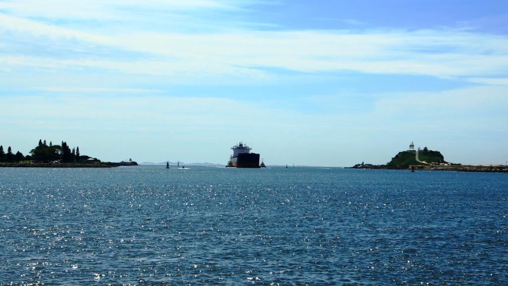
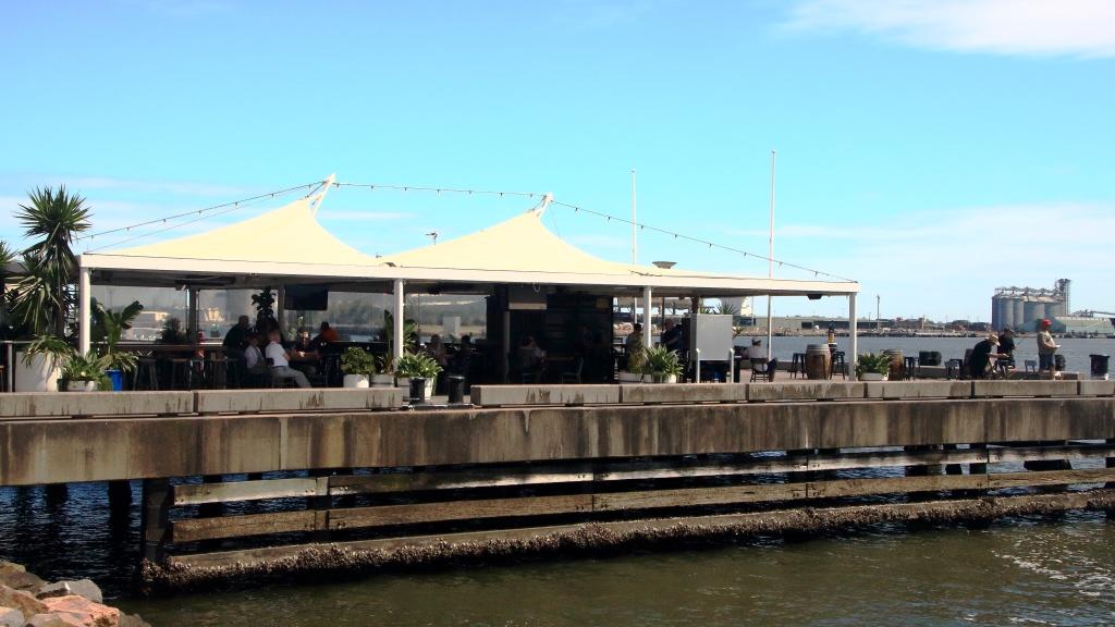
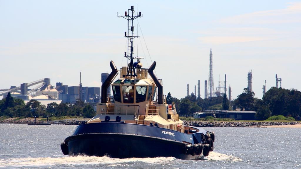
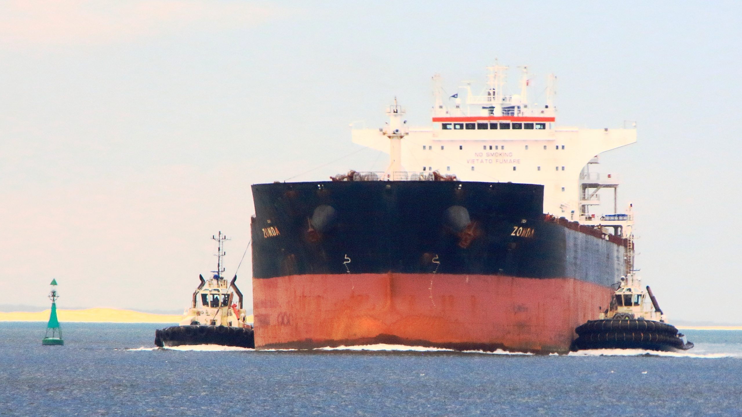
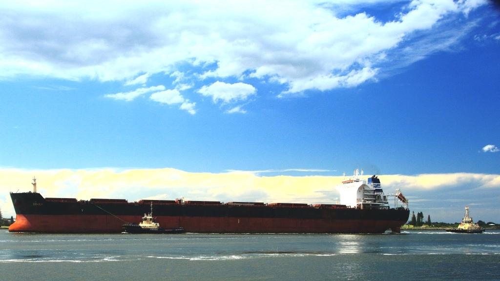
The rest of the morning was free until we were due to meet Ruth’s eldest sister Judy and Alan her husband at 1.00PM, after they kept some previously made appointments. We used this time to revisit familiar areas and to find some that were less so. Judy and Alan arrived right on time. We enjoyed a leisurely (about 2 ½ hours) lunch at the pier which is part of the Queens Wharf Hotel, while we chatted and watched the procession of bulk carriers and tugs on the busy Newcastle coal port pass by.
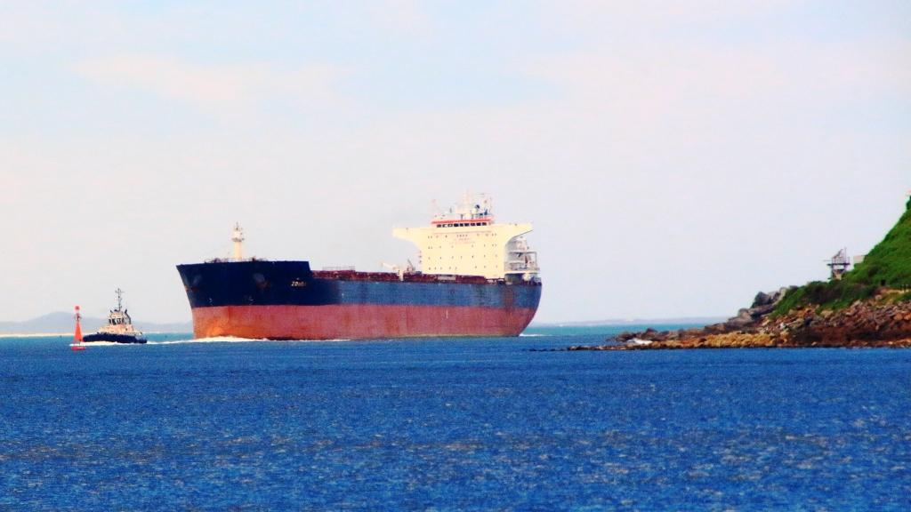
A bulk carrier, probably coal, leaves the Port of Newcastle.Newcastle Ocean BathsA bulk carrier entering the Port of Newcastle.Nobbys Head at the southern side of the port entry
There had been a severe thunder storm while at Ivan’s place the previous day. As we approached the expiry of our parking meters the signs were building up for a repeat performance. This one was less severe. We said our goodbyes and made it to our vehicles before the first drops fell.
Out luncheon venue. We were seated just to the right of the second pillar from the left.A busy tug on the Port of Newcastle.A bulk carrier entering port.This view from water level could mean that you are in a lot of trouble.
With time to fill before we needed to be back at our motel, we set off through the rain on the 20 kilometre drive to Stockton Wharf. Our destination had been visible to us as we sat at lunch, about one kilometre across the harbour from us. The purpose of the drive was some photos of the unobscured Newcastle riverside precinct, from a distance. The bonus was that the road took us very close to the shipping berths and the loading equipment that handles much of the freight volume that passes through the Newcastle port. The bad news was that rain was falling again , so no photos.
The bulk carrier side on. It has seven hatch covers. She is the MV Zonda, flagged out of Panama. The vessel is 229 metres long, 38.3 meters beam and a deadweight tonnage of 51,225 tones. She left port the following day, loaded with coal bound for Taiwan.A panorama of the Newcastle waterside. The waterside building to the left is the Queens Wharf Hotel.
After a substantial lunch only a light evening meal was required, so we dined on previously acquired rations and went to bed to build up our strength for the drive further south the next day.
Please Note: Videos covering the material in this blog post can be found at the bottom of the post.
The objective that day was to travel
to the furthest point south on our trip and the furthest south ever, in a
lifetime of travelling. To better the day’s effort we will need to go to New
Zealand, South America or to the Antarctic.
Cockle Creek flows into Recherche Bay near the southern tip of Tasmania.
Go to Google Maps or I maps and
enter Cockle Creek, Tasmania. That’s where we were headed, as far south as we
could drive in Tasmania. There is not much of Tasmania south of Cockle Creek,
is there?
We had rain overnight, both while we were out to dinner and while we were sleeping. It was drizzling as we loaded the car and a brisk 13C. It dropped to 11C as we drove south, drove inland and climbed a bit, but the day improved and was sunny by lunch time. The mercury probably struggled to about 16C by mid afternoon, depressed by a cold breeze from the ocean.
Southport bay and jetty. It was as cold as it looks.
We left Sandy Bay and used
the Southern Outlet to Kingston and then went inland on the Huon Highway. Once
we reached Huonville and crossed the bridge, the Huon River was to our left and
remained there until we turned inland again. We returned to the water at Southport.
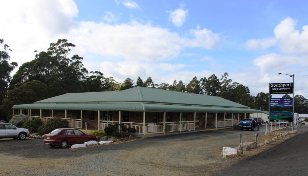
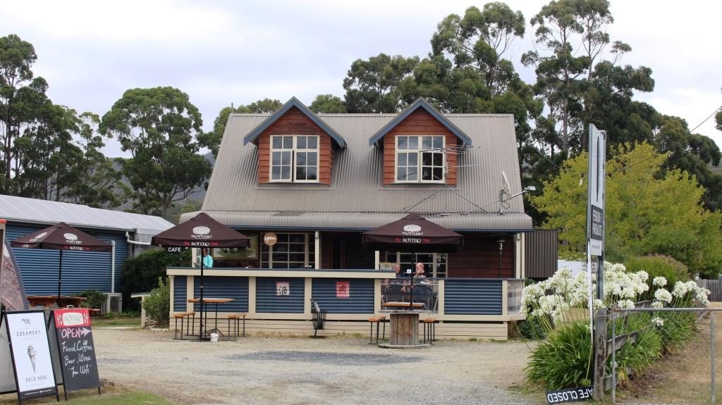
Southport Hotel has a caravan park at the rear.
Southport is a short detour from the main road. It has only a tavern with a caravan park attached by way of commercial facilities. The houses in the area mostly occupy high ground with water views, so are probably mostly holiday homes. We sat in the warmth of the car for coffee, which I made on the top of a post. Picnic facilities are scarce in Tasmania.
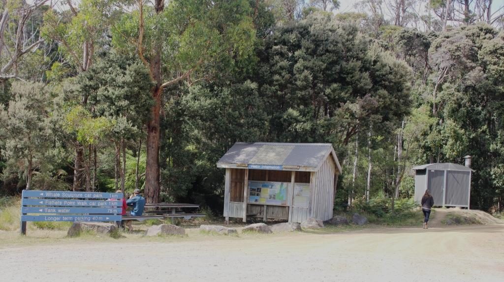
Day visitor facilities at Cockle Creek
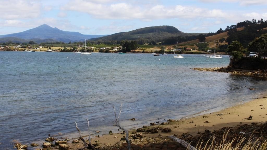
Southport to Cockle Creek is about 30 km, 20 km of which is fair quality gravel. The rest is sealed. There are a couple of small hamlets overlooking Recherché Bay and then a succession of free camping areas, each with at least one toilet. At the end of the road is a more substantial area with a volunteer caretaker and individual camping spaces. It is a very attractive location. Had we still been caravaning we probably would have stopped there for a day or so.
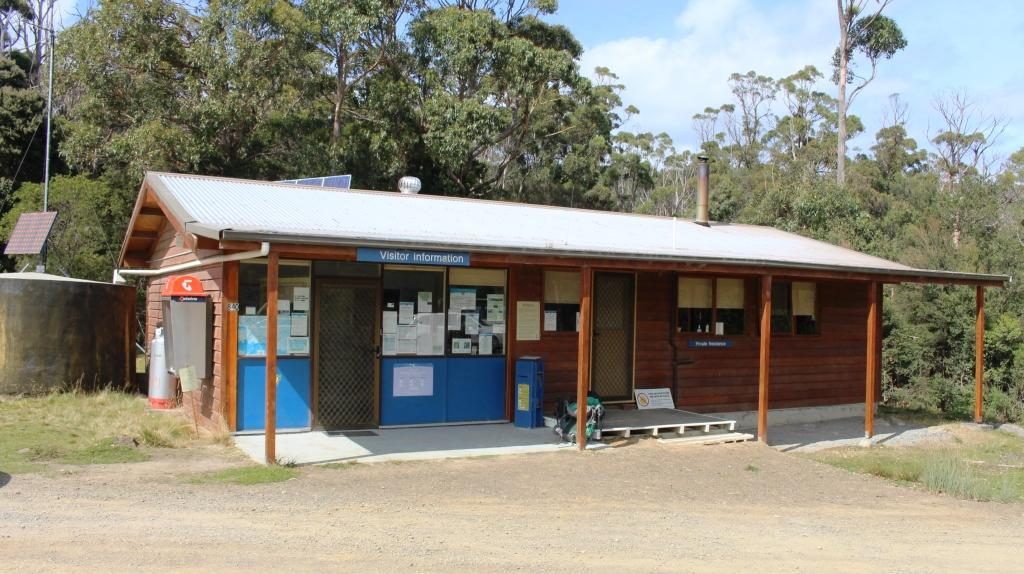
Cockle Creek visitor centre has a resident volunteer caretaker during the tourist season.
We drove as far as we reasonably could without a 4WD vehicle. In turning to find a spot to park so that we could look around, I forgot about the whale lookout and its bronze whale sculpture, produced by the sculpturer mentioned in our post of the Central Highlands. Bother! Now we will have to go back one day. We would be happy to do that, actually.
On the return journey, we paid more attention to the towns that we had passed through on our outward journey. Of these the most significant are Dover, Geeveston, Port Huon, Franklin and Huonville.
The residential coastal strip at Dover.
Dover is an oyster port. Geeveston calls itself the “Timber Town” and seemed to be a busy centre. We stopped there for lunch. There is a timber themed park not far away but it has been closed since it was damaged by bush fires last year. There are also national parks and caves in the area.
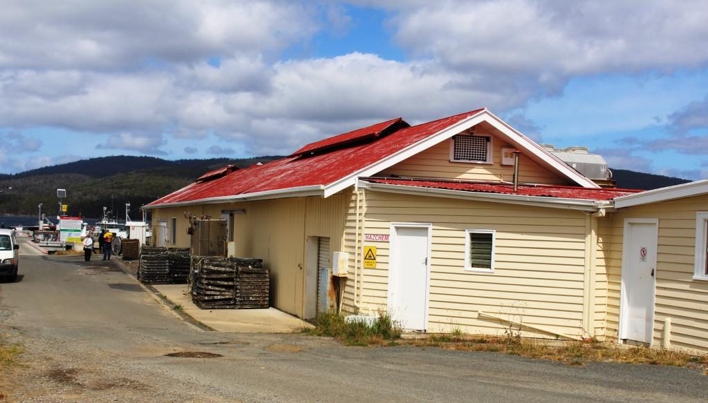
Oyster sheds and wharf at Dover.
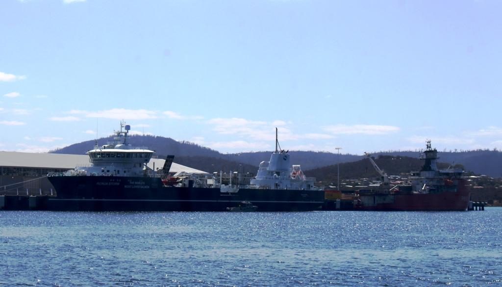
Port Huon has a substantial wharf which is now a service area for the numerous salmon and trout farms in the Huon estuary. A salmon industry support boat that we had seen in Hobart on Monday, was at the wharf as we passed.
The vessel on the left is the Tuna support vessel berthed at Hobart. The ship on the right is a French Antarctic expedition vessel.
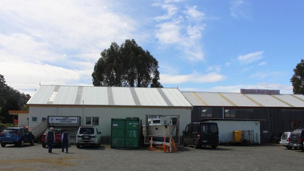
Franklin appears to have been the major river port in the days before road, when supplies came from Hobart by boat. The town is host to the Wooden Boat Information Centre. The Centre is just what its name suggests but also conducts a school of wooden boat building. Visitors can look through glass partitions to watch ship wrights in action.
The Wooden Boat Centre at Franklin.
Tasmania conducts a wooden
boat festival every other year, based at Franklin. This was an off year. If the
festival had been on this year we would have tried to fit it into our
itinerary.
Day sailing sail boat at Franklin wharf. The Huon River is wide at this point.
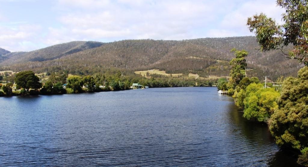
Huonville is the major town
in the Huon Valley and is by far the largest. The Huon River is a broad stream
where the road crosses it south of the town and broadens further into a substantial
inlet, as it nears the sea.
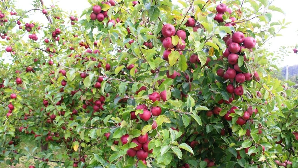
Apples almost ready to pick. I resisted the temptation to sample one.
The Huon Valley is still a major fruit producing area although it produces nothing like the volumes export fruit of the days before Great Briton joined the European Economic Community. Apple production remains substantial. Pears and stone fruit, berries and of course grapes, are also grown in the area.
THe Huon River at the bridge at the south of the town.
We turned off at Huonville to pass through Cygnet, itself a town of reasonable size, before cutting across to the small town of Snug where we planned to snuggling for the next two nights. The heater supplied in the cabin was most welcome.
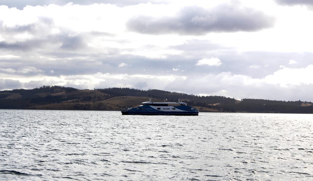
Kettering receding in our wake as we head for Bruny Island.
Snug is near
Kettering, the small town from which the ferry sails to Bruny Island. Its proximity was why we stayed
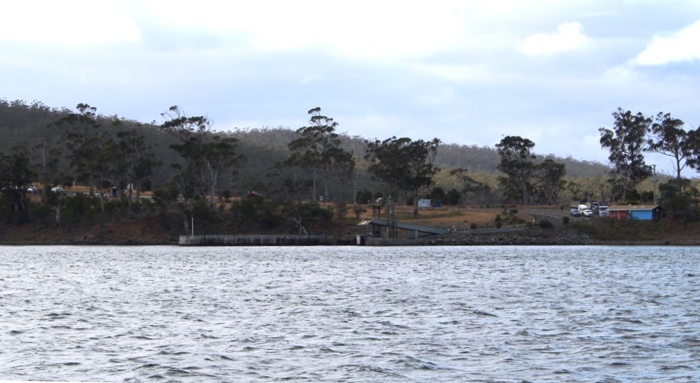
there. A drive of about 6 km brought us
to Kettering and to a ramp facility designed for its purpose. A similar
facility on North Bruny only has a snack bar in addition to the ramp.
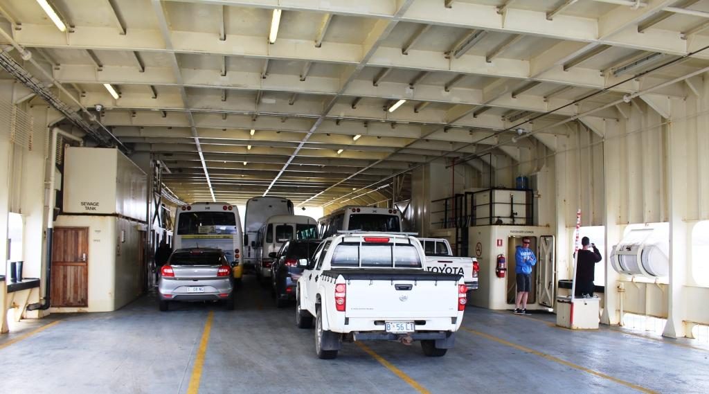
We travelled on the lower deck. More cars above.
Bruny Island is a piece of
rural southern Tasmania that remained detached from the rest, so needs a 15
minute ferry journey to get there. That costs $38 return unless you catch an
early ferry. That will save you about $6.
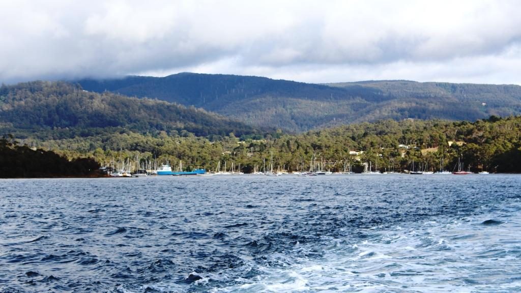
A sister ferry returning from Bruny Island.Arrival and departure ramp at Bruny Island. There is no town there. Only a snack bay for long queue days.
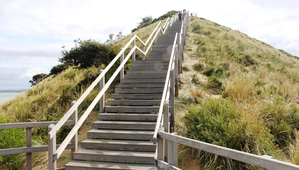
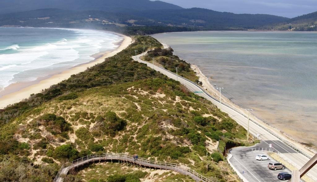
North and South Bruny Island are joined by a long narrow isthmus named The Neck. It is mostly composed of sand, with beaches on both sides and a prominent hill (probably a sand dune) at the northern end. Stairs and boardwalks lead to the top of the hill for views and to the beach. Views are 360 degrees and sweeping, particularly to the south . Toilet facilities are located here. Tourist busses stop for the view. A Penguin rookery is located on the ocean beach.
Stairs to the lookout at The Neck.The Neck stretches south to South Bruny Island.
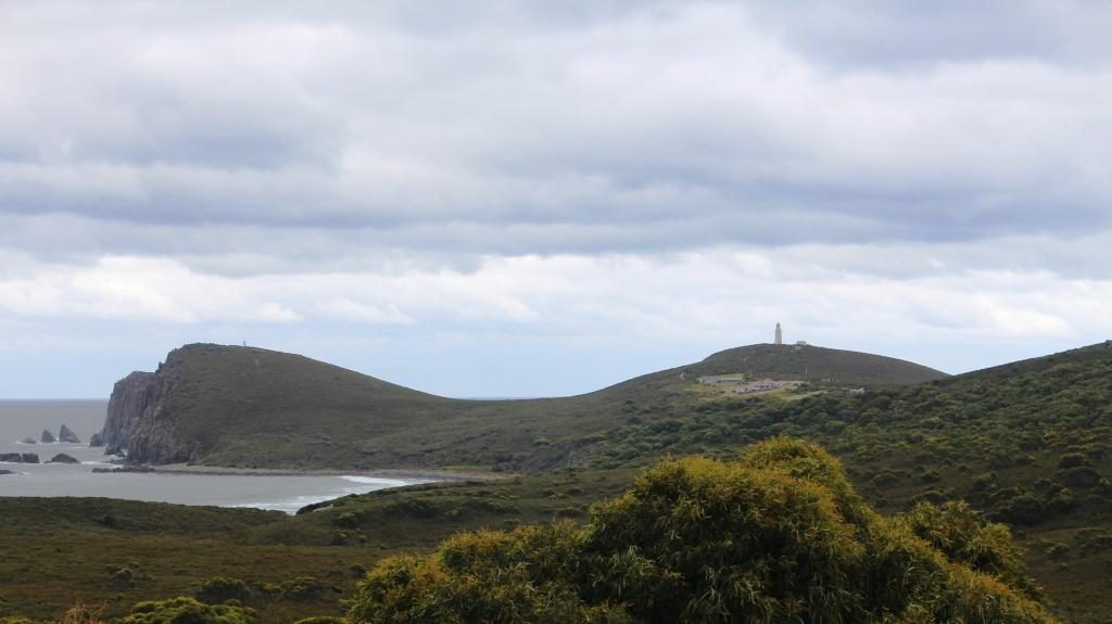
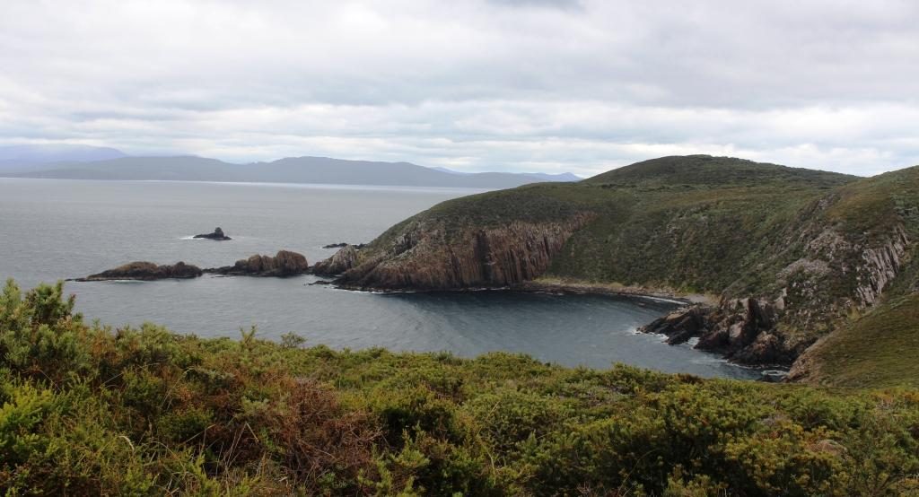
Like most places where mountains meet the sea there is spectacular scenery, particularly at the southern tip around the Cape Bruny Lighthouse and at Adventure Bay to the south east.
To the south east Grass Point marks the eastern land point. Adventure Bay is located to the left of Grass Point.
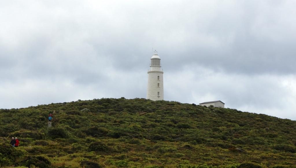
You get to the Lighthouse and its scenery under your own steam on a typical national park road with a very rough section inside the lighthouse grounds. Excellent scenery along the road with plenty of places to pull over and look.
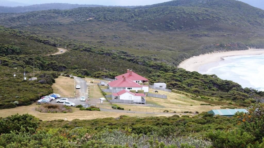
Cape Bruny and the original lighthouse. The new light is on the hill to the left. If you look closely you can see it.From the lighthouse looking north west towards Southport.
I didn’t get to see the interior of the lighthouse or climb to its observation deck. It was fully booked to bus tour groups. But I was able to walk to the original and now unused lighthouse and enjoy the magnificent views of the coast. A new automatic lighthouse has been built on an adjoining headland, to the east.
The original lighthouse is reached by a short walk from the car park. Lighthouse keeper cottages. Nearest is a museum and visitor facility. The others are available for holiday rental.View from the car park towards the north east and the south eastern tip of South Bruny Island.
Adventure Bay is reached by a drive of 40 km, if you choose the best road. You head back to the southern end of The Neck and then turn south for about 10 km.
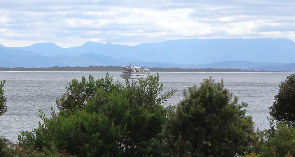
A smaller Tasmanian cruise boat that does tours around the south coast. It was in Adventure Bay.
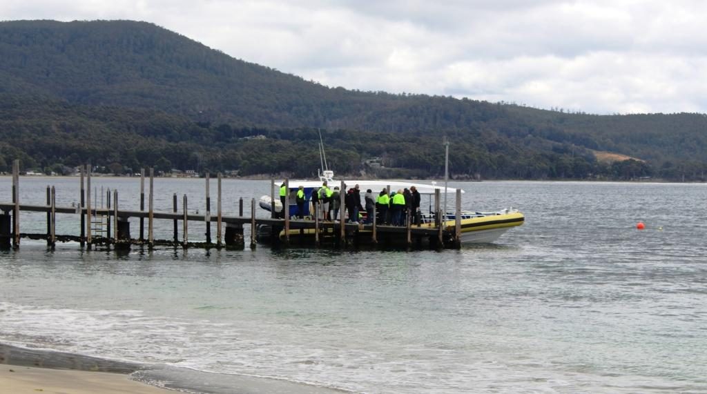
Pennicott Wilderness Journeys have a base at the end of the road where they will put you into a small boat to show the wonders that are out of sight around Grass Point. On that tour you get to see Fluted Cape and Penguin Island plus wild life, including seals. That costs about $125 and you could get cold and wet. But that is adventure for you. On the day of our visit the seas were smooth and there was no rain, so the experience would have been quite pleasant. Bookings are normally necessary. The tours were fully booked several days in advance of our visit.
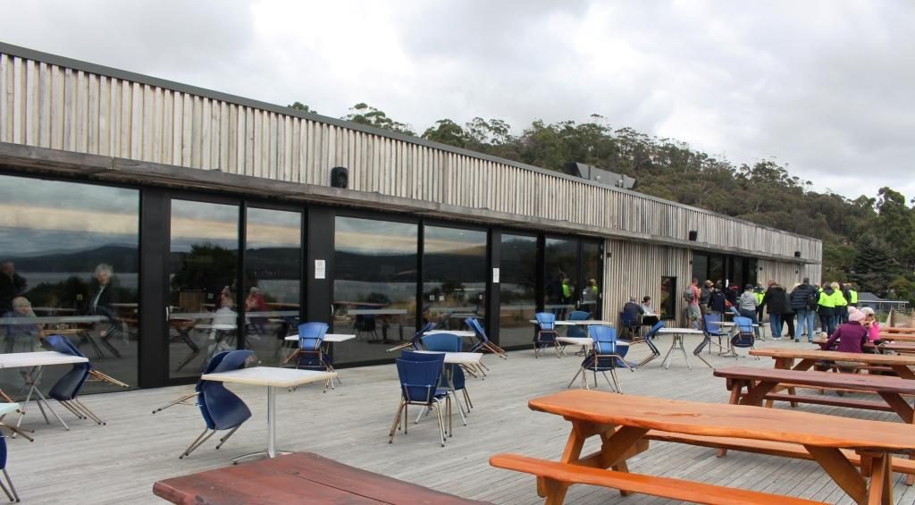
The deck at the Pennicott tour base at Adventure Bay. The restaurant is behind the glass doors.A tour boat preparing to depart on the Fluted Cape tour.
We knew that the tour base has a great restaurant, so it was on our list as a lunch spot. The building is on the back of a sand dune. The restaurant overlooks a broad deck and has a view to the north east over Adventure Bay. We were not disappointing with our choices from the extensive menu. See below.
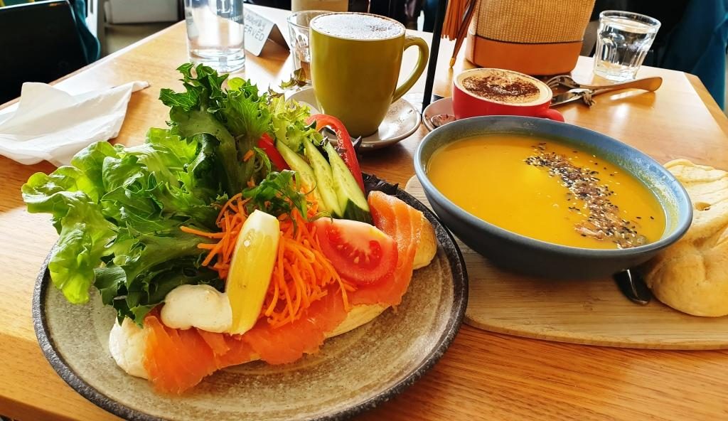
Adventure Bay lunch. Soup was good on a cool day and I love fresh smoked salmon.The cafe/coffee shop at Adventure Bay township. Bruny Island’s main caravan aprk is just down the road.
That part of the island has
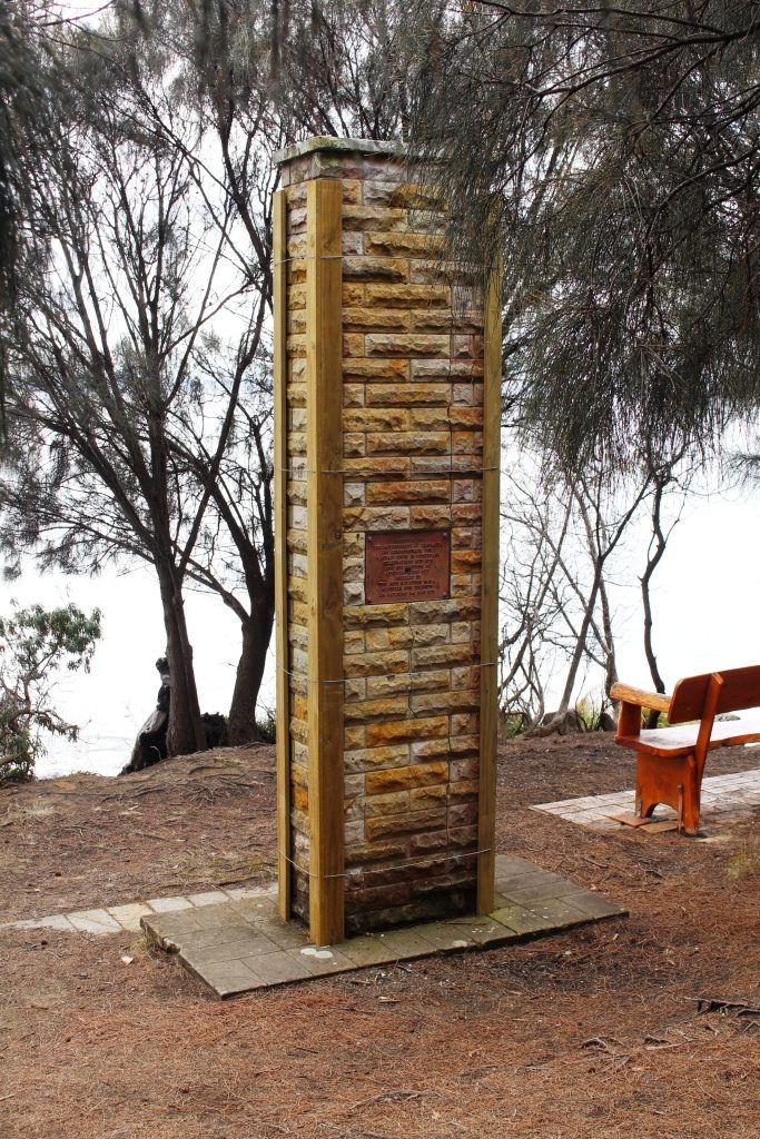
historical significance in that Captain James Cook landed there during his
third exploration in 1777. A monument has been erected at the landing site.
Also former Captain, but by then Governor William Bligh, visited and planted
some of the first fruit trees to be grown in Tasmania.
The monument to the 1777 visit of Lt (Captain) James Cook.
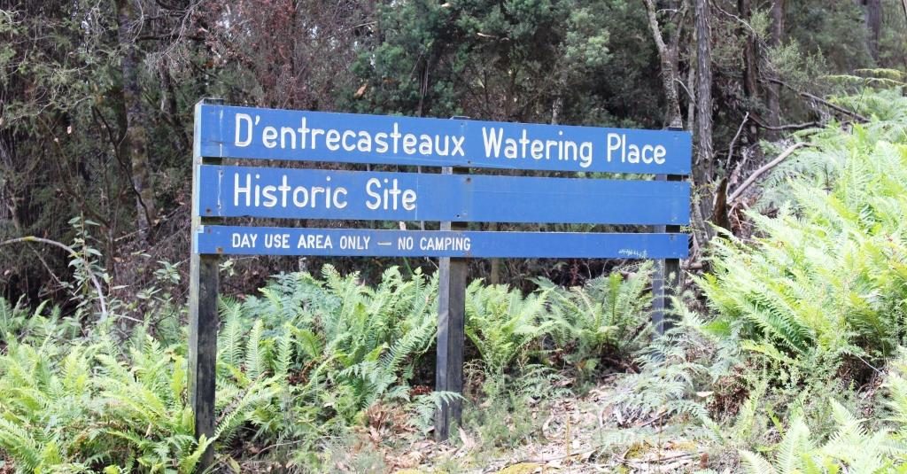
Antoine Raymond Joseph de Bruni, chevalier d’Entrecasteaux (1737 – 1793) was a French mariner who explored part of the east coast of Australia in 1792, including this part of Tasmania, during his search for the missing exploration party of La Perouse. The channel between Bruny Island and the Tasmanian main land is named after him and the island clearly took its name from a misspelled portion of his name. The d’Entrecasteaux Channel is pronounced “Doncastro”, or something similar.
The previous day, near Cockle Creek, we had seen a sign marking the place where d’Entrecasteaux came ashore for water in a sheltered cove. A fresh water stream runs nearby.
The sign marking the visit of d’Entrecasteaux . A fresh water stream is nearby.
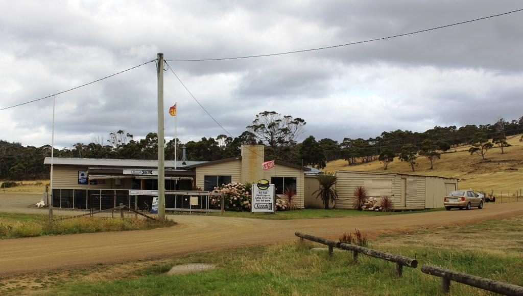
On the drive down to Cape Bruny we had passed through Aloonah, the “capital” of Bruny Island and drove back through the town again on the way back, as the turn to Adventure Bay is about a further 5 km to the north. So, as our return drive to the ferry took is within 5 km of Aloonah, we decided to drive back to take a closer look at this small town.
The general store and cafe at Aloonah.
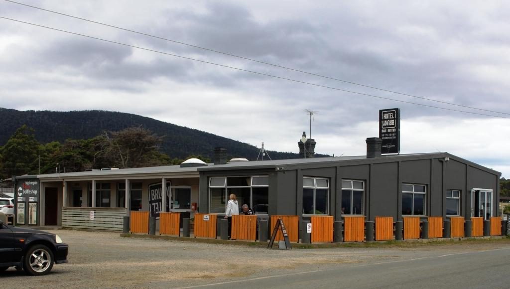
I walked
over to the shore line to photograph the island’s only hotel. As I looked,
prior to taking the photo, I saw a couple who I thought looked like neighbors
from our days at Murrumba Downs, but then thought probably not! But as I walked
back to the car they were walking right in front of me as they returned to
their tour bus from their lunch stop. Absolutely no doubt now!
Bruny Island Hotel at Aloonah. Our former neighbours are the couple in the outdoor area.
They told us
that they had seen us in the street at Geeveston the day before, as we walked
past where they were having lunch. They planned to intercept us on our return
but we stopped for lunch further down the street. It truly is a small world.
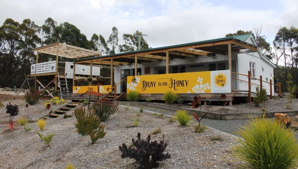
The honey shop without bee boxes. But we say many areas with bee boxes all over Tasmania, particularly in the National Parks.
The other tourist attractions on Bruny Island are man made and while legitimate activities for Tasmania, lack authenticity because they have so obviously been put there to be tourist attractions. Things like an oyster shop well away from the sea, a honey shop without a bee box in sight and a place selling cheese with only two types available for tasting and a clear emphasis on selling on line.
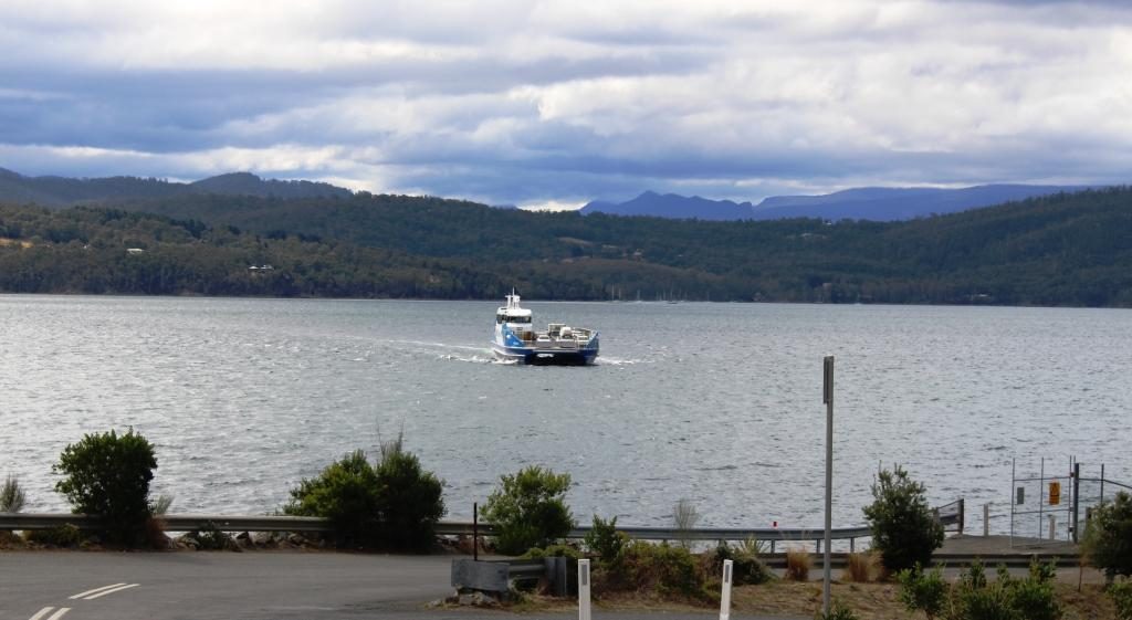
We returned from Bruny Island on the smallest of their ferries.
But the visit made for a
pleasant day. The roads are narrow and winding but mostly sealed. Gravel roads,
of which there are a few, are mostly well maintained and smoother often than
the sealed roads. The worst were within the grounds of the lighthouse.
Most tourist activities are
to the south of the ferry landing. The largest settlement is Dennes Point in
the extreme north. This town is reached by a good gravel road that provides
sweeping views of the ocean and bays on both sides of the island. It is well worth
the effort, if you have time
Visitors with more time would find a lot more to see and do on the island. There are lots of walks to suit all levels of ability in the most scenic parts of the island.
In summary, we are glad that we visited Bruny, but much was not as I expected. And after calling at a whiskey outlet (enquiring for a friend), I will never again complain of cellar door prices for wine.