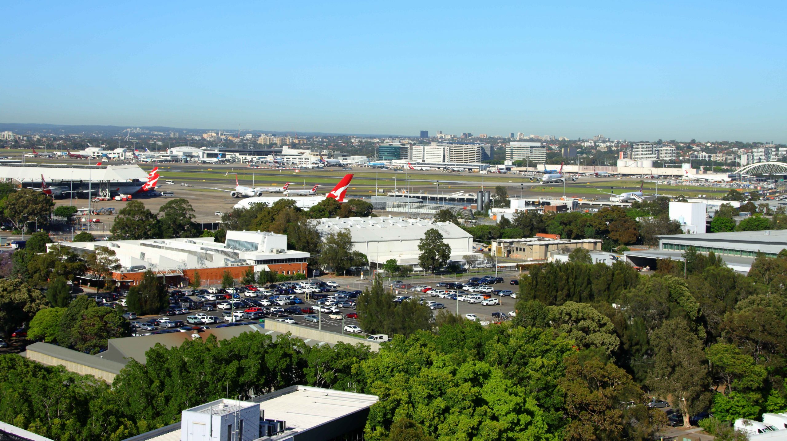
Before our 10.00 am checkout we took the elevator to the roof garden on 15th floor. That vantage point provides views of the area, including the Sir Kingsford-Smith Airport.
Sydney Airport from the roof garden of Meriton Suites Hotel in Mascot, Sydney.
Enjoying reduced traffic, we headed north through Sydney suburbia. As we approached the Hawkesbury River we were experiencing caffeine withdrawal so we turned into Brooklyn, to the Brooklyn Corner coffee shop, across the street from the Brooklyn Hotel.
A solitary coffee drinker at the next table struck up a conversation with us, probably after seeing our Queensland registration plate. He had just returned to his old hometown after forty years living in the Brisbane suburb of Windsor. He lives in Mooney Mooney, where we had lunch the previous day. Coffee cups empty, he headed home, and we returned to the car to resume our journey.
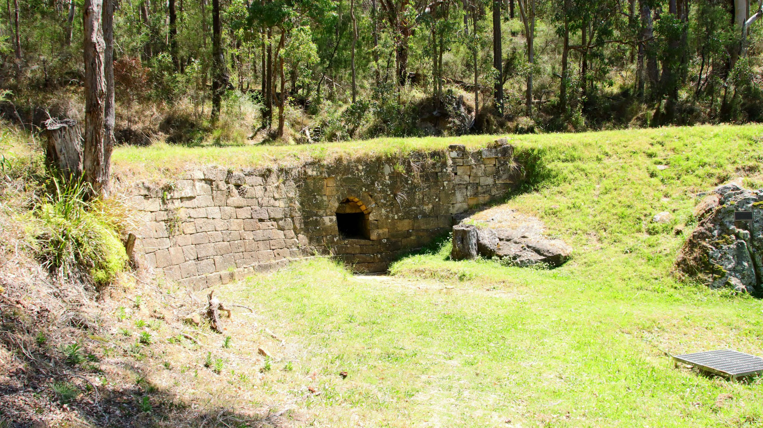
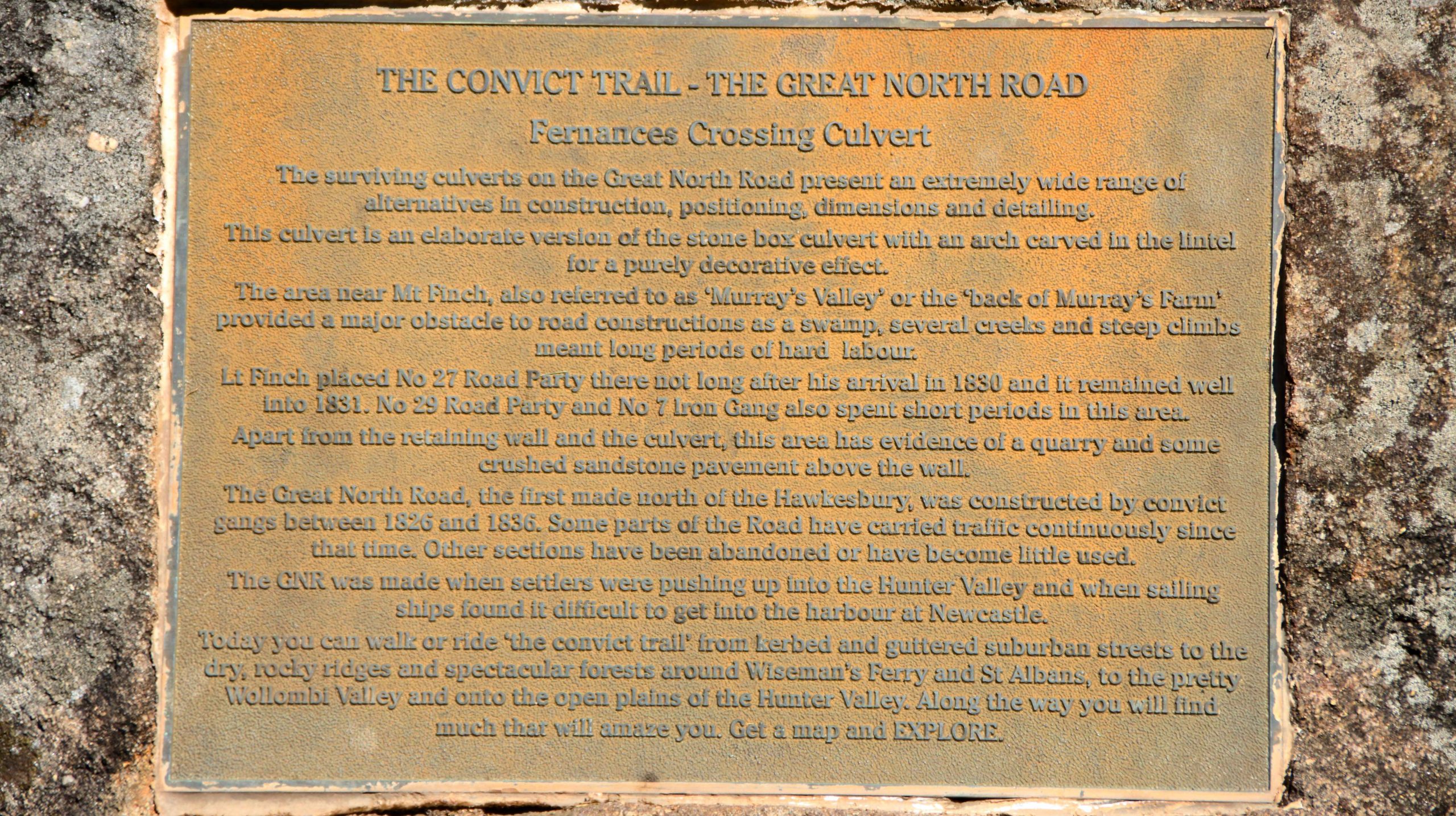
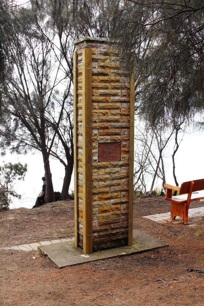
Historic culvert on Great Northern Road, Wollombi, NSW.
A plaque at the sight of an historic culvert on the Great Northern Road, Wollombi, NSW.
Our day end destination was Cessnock, but we turned from the highway at Calga and took the road through Central Mangrove to the historic town of Wollombi, a very pleasant drive of 78 kilometres, through mostly farmland and bush. Near the locality of Bucketty, the road that we were on intersects with the old Great Northern Road. The Great Northern Road was the first road ever built between Sydney and Newcastle. It was convict built so is over two hundred years old. That’s old for a structure in Australia. Some road works, particularly culverts, have been preserved and memorialised. Although they no longer carry the road they are intact and serviceable.
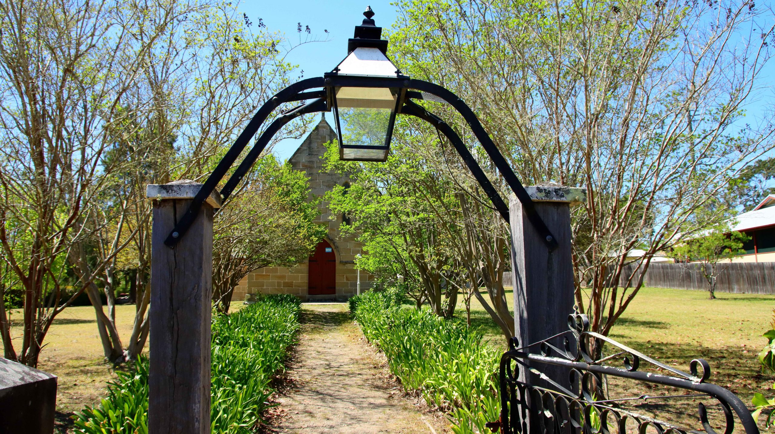
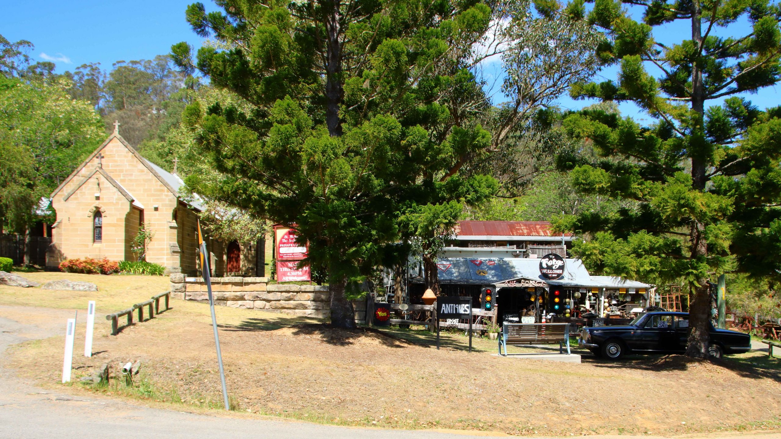
ST Johns Anglican Church, Wollombi, NSW.
The road from Calga to Bucketty is George Downes Drive. Together with the Northern end of the Great Northern Road it still provides a useful link into the Hunter Valley. The road appears to be popular with motor bike riders, as it is part of a circuit to and through the Hunter Valley wine region and back to Sydney via the M1 Motorway. Calga to Wollombi provides lots of those sweeping curves so beloved by motorcyclists.
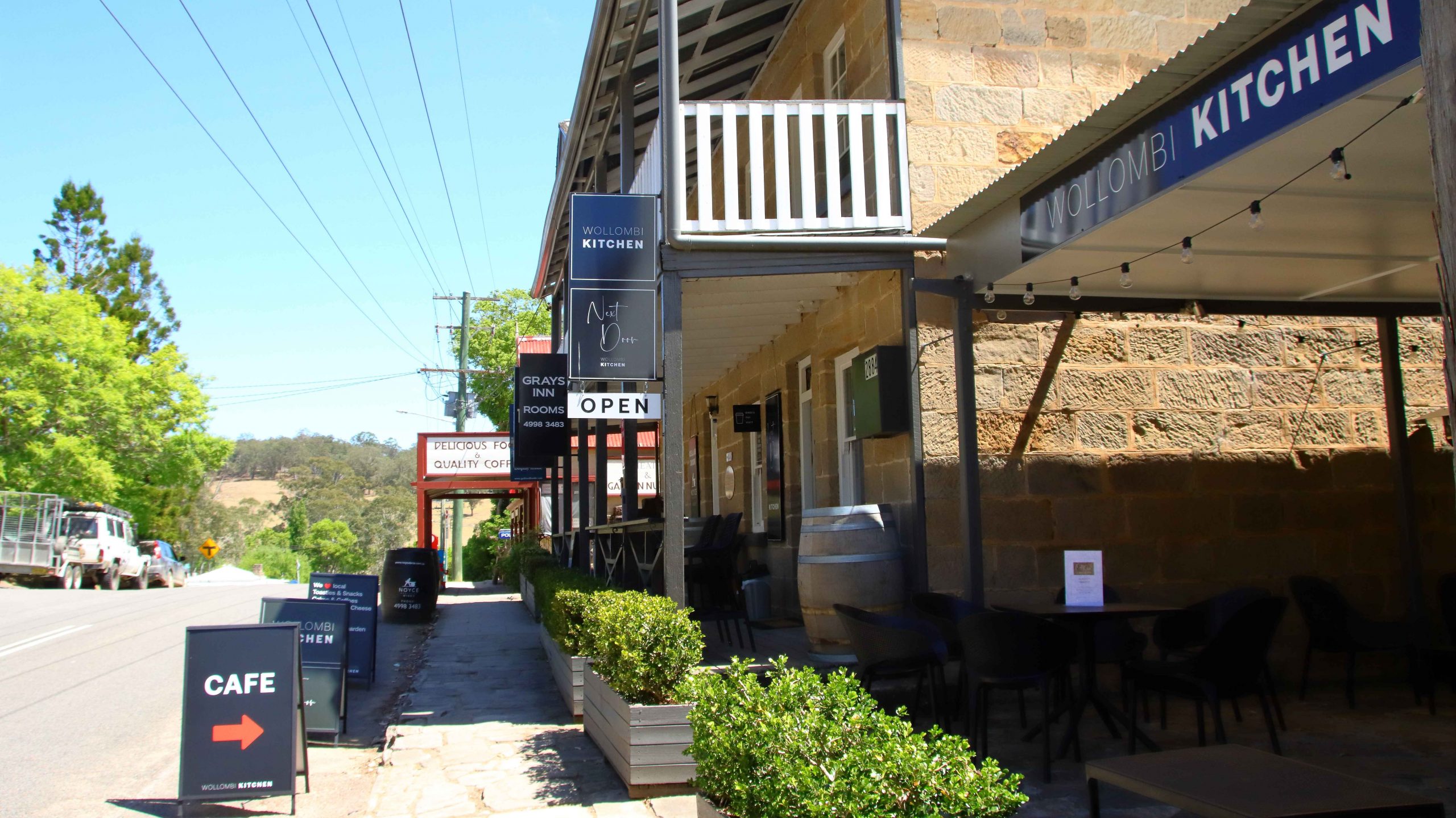
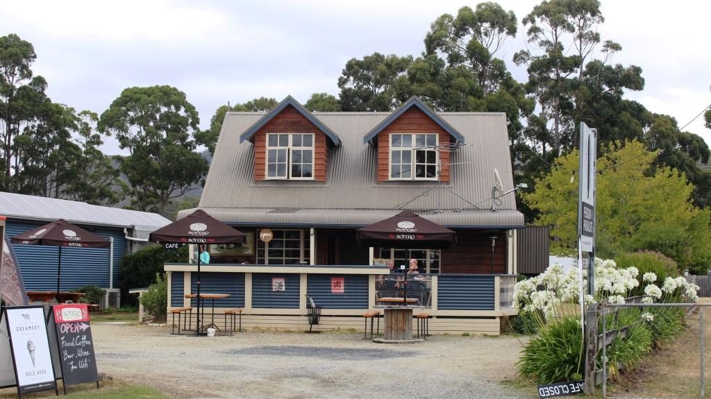
Eating establishments in the main street of Wollombi NSW.
Tourist traffic has kept Wollombi a viable town. Two roads lead into the wine region from there, either via Broke or directly to Cessnock.
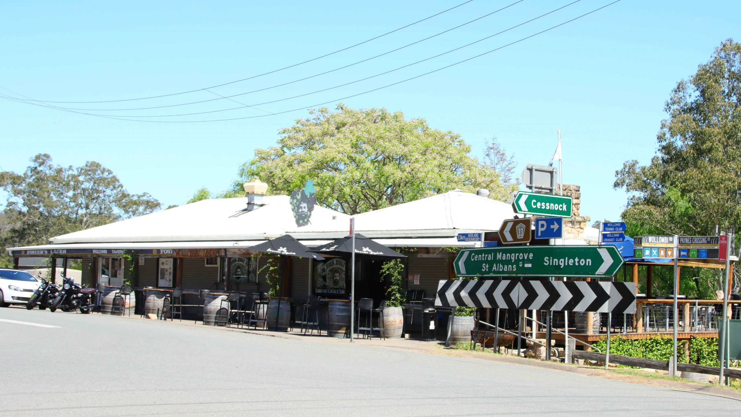
Wollombi has a number of eating establishments in its main street, plus a tavern at the southern entrance. There are two historic churches and an old wares shop with an aging but stately Bentley for sale at the entrance. The town also has one of the best constructed and maintained amenities blocks at its rest area, that we have seen in a long time.
St Michael the Archangel Roman Catholic Private Chapel and the old wares shop. complete with a dated Bentleigh car.
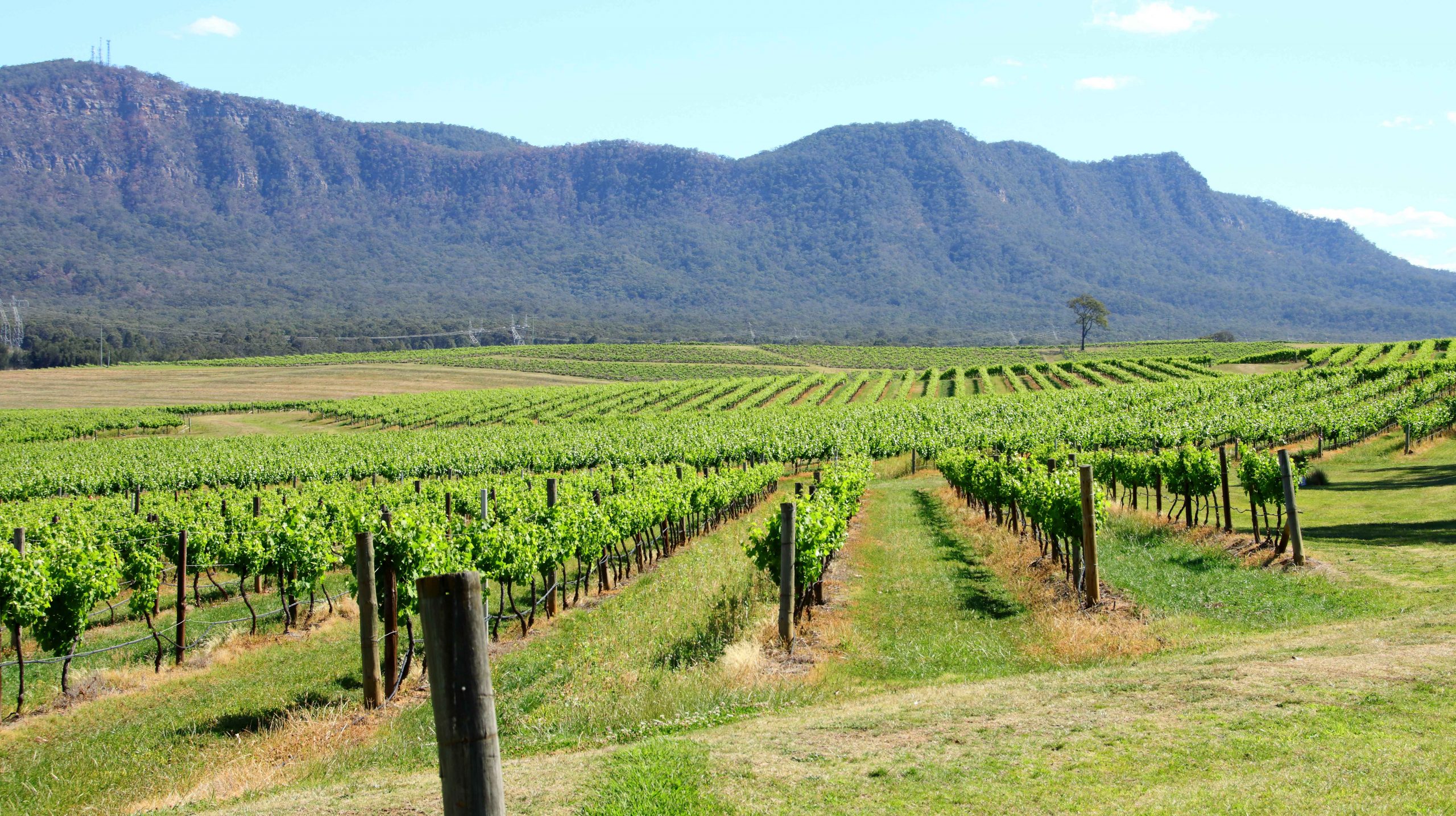
We left Woolombi along Wollombi Road that runs beside and crosses Wollombi Brook, a stream that ultimately makes its way to the Hunter River. Broke is a small town on the fringe of the wine area. We passed many vineyards and wineries with their supporting infrastructure. I love the disciplined order of vineyards, particularly when they are set out on undulating ground, the rows forming parallel threads of green. It is particularly so now, as the vines are set with juvenile bunches of fruit.
Wollombi Tavern – on the left as you enter the town from Sydney.
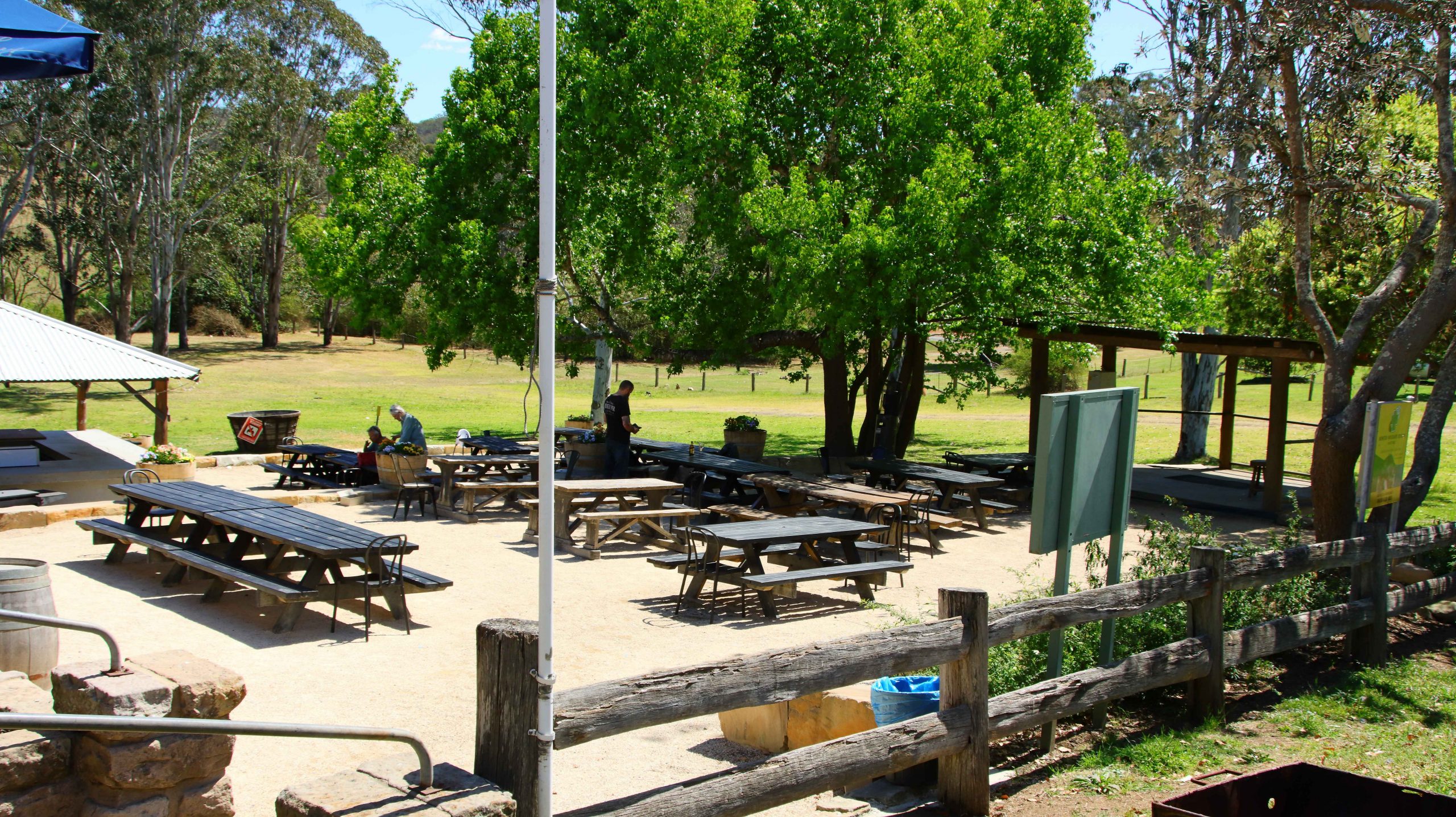
Tavern outdoor area. It was a light day for motor bikes.
Grape vines in the Hunter Valley near the mountains that form its southern boundary.
We reached our cabin in Cessnock via queues of traffic caused by road works on the only access street. We had replenished our supplies for a quiet night in after reaching town, so didn’t have to experience the delay a second time. The following morning, as we approached the exit road to execute a right hand turn, we were confronted by a line of banked traffic reaching out of sight to our left. But as the traffic control lights changed to green a kind lady at the head of the stream of traffic signalled to us to enter. We appreciated the kind gesture.
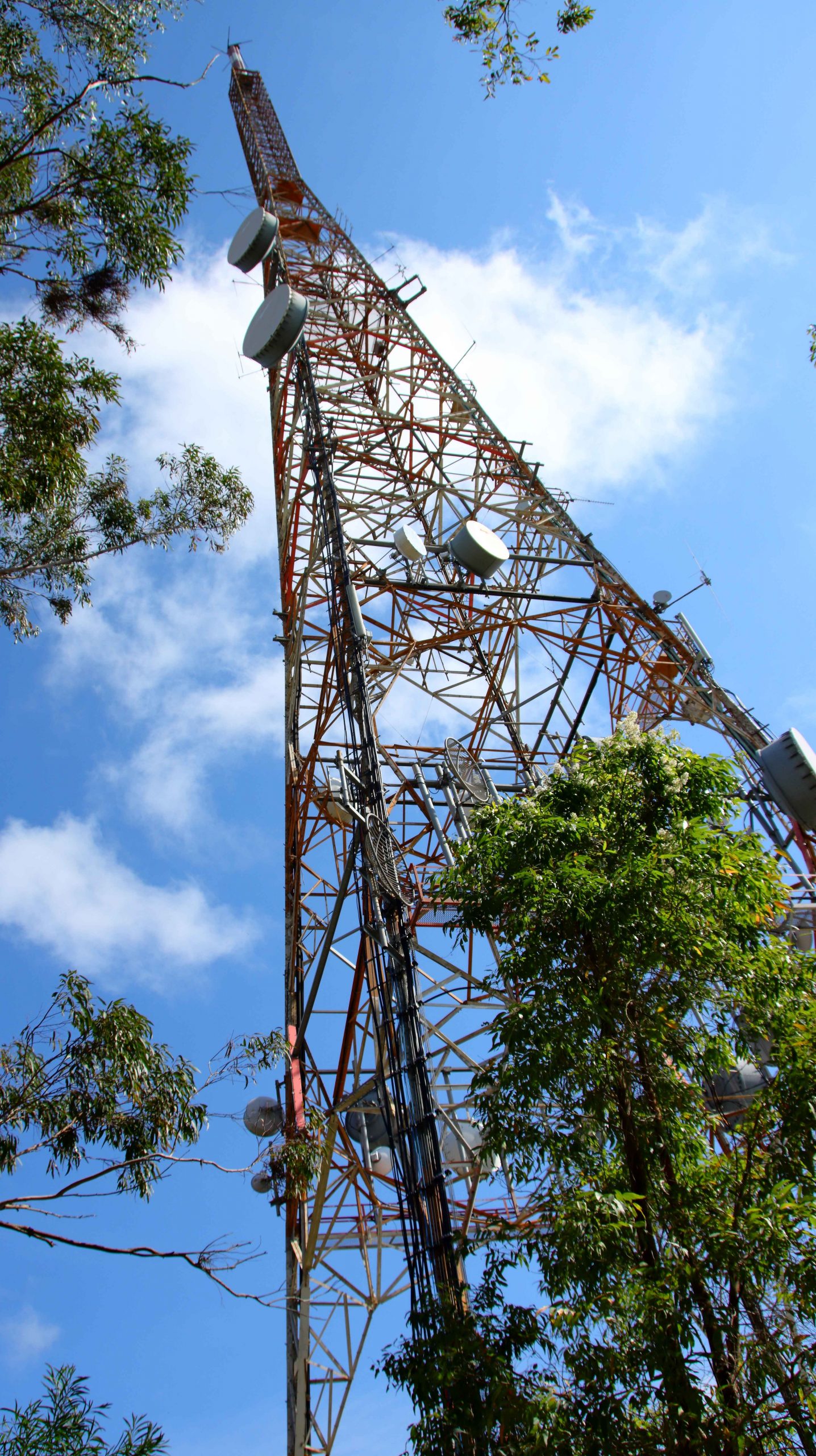
The NBN transmission tower on Mount Sugarloaf
The previous night we had decided to start our day with a visit to Mount Sugarloaf, the mountain behind Newcastle on which the television transmission masts are located. The shortest route from Cessnock took us over country roads. At one point we passed the large decorative gates of the homestead on a grazing property. We could see a waterway behind the house as we turned a bend in the road and drove up a hill. The increased elevation provided a view of a huge modern house built on the edge of a very large dam. Not far from the main house, also on the water’s edge, was the remains of an old brick building, possibly the original homestead. It was such a tranquil scene that we continued to look at it for several minutes. The featured photo at the head of this post is our view after driving past the property.
It is many years since we had last visited Mount Sugarloaf. We found it is virtually unchanged. Despite the views over the Greater Newcastle area, including the Port on a clear day that it provides, no work has been done to turn it into the tourist attraction that it could undoubtedly be. I passed on the walk to the summit. It was a bit steep for my old legs.
To cap things off, visibility was not good due to a heavy haze, as the photo below demonstrates.
The view over the Newcastle area from Sugarloaf. The city is out there in the line between land and ocean.
There is more to come from the activities on this day. That will be part of the next blog post.
Please Note: Videos covering the material in this blog post can be found at the bottom of the post.
The objective that day was to travel
to the furthest point south on our trip and the furthest south ever, in a
lifetime of travelling. To better the day’s effort we will need to go to New
Zealand, South America or to the Antarctic.
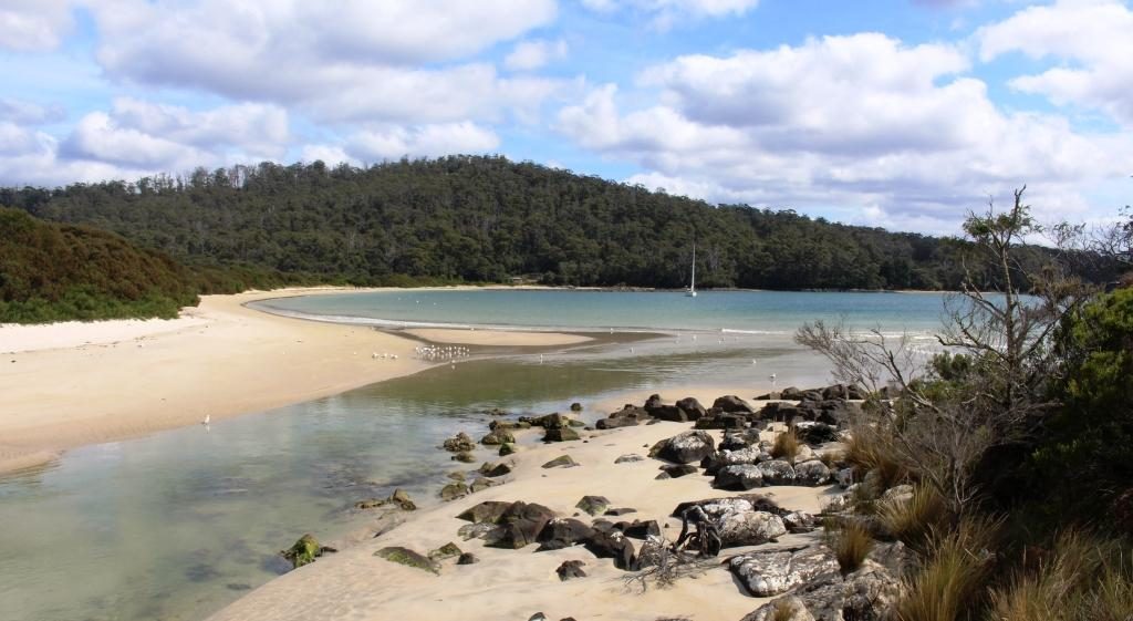
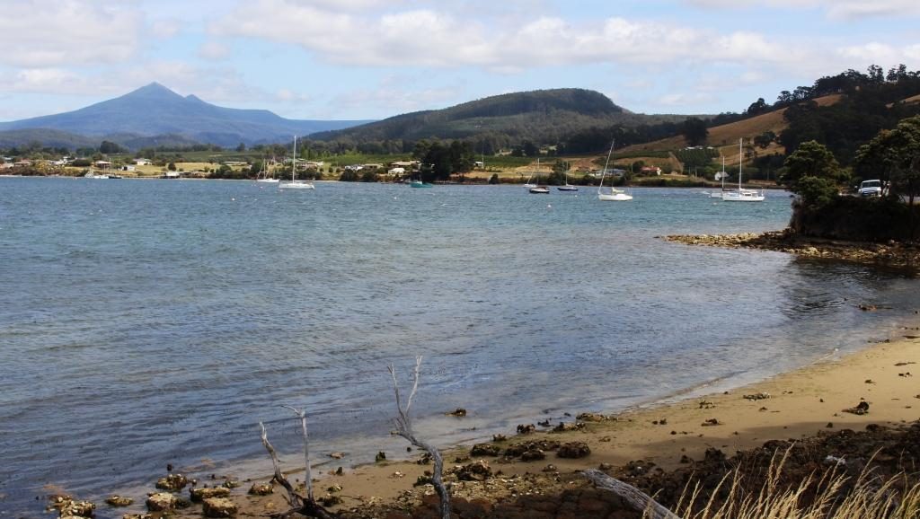
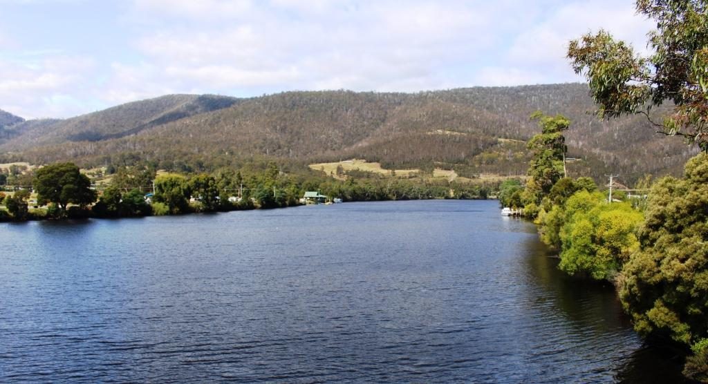
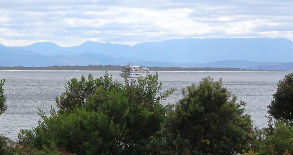
Cockle Creek flows into Recherche Bay near the southern tip of Tasmania.
Go to Google Maps or I maps and
enter Cockle Creek, Tasmania. That’s where we were headed, as far south as we
could drive in Tasmania. There is not much of Tasmania south of Cockle Creek,
is there?
We had rain overnight, both while we were out to dinner and while we were sleeping. It was drizzling as we loaded the car and a brisk 13C. It dropped to 11C as we drove south, drove inland and climbed a bit, but the day improved and was sunny by lunch time. The mercury probably struggled to about 16C by mid afternoon, depressed by a cold breeze from the ocean.
Southport bay and jetty. It was as cold as it looks.
We left Sandy Bay and used
the Southern Outlet to Kingston and then went inland on the Huon Highway. Once
we reached Huonville and crossed the bridge, the Huon River was to our left and
remained there until we turned inland again. We returned to the water at Southport.
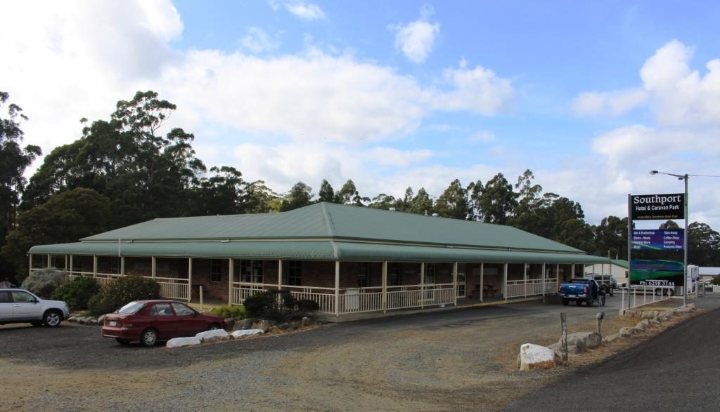
Southport Hotel has a caravan park at the rear.
Southport is a short detour from the main road. It has only a tavern with a caravan park attached by way of commercial facilities. The houses in the area mostly occupy high ground with water views, so are probably mostly holiday homes. We sat in the warmth of the car for coffee, which I made on the top of a post. Picnic facilities are scarce in Tasmania.
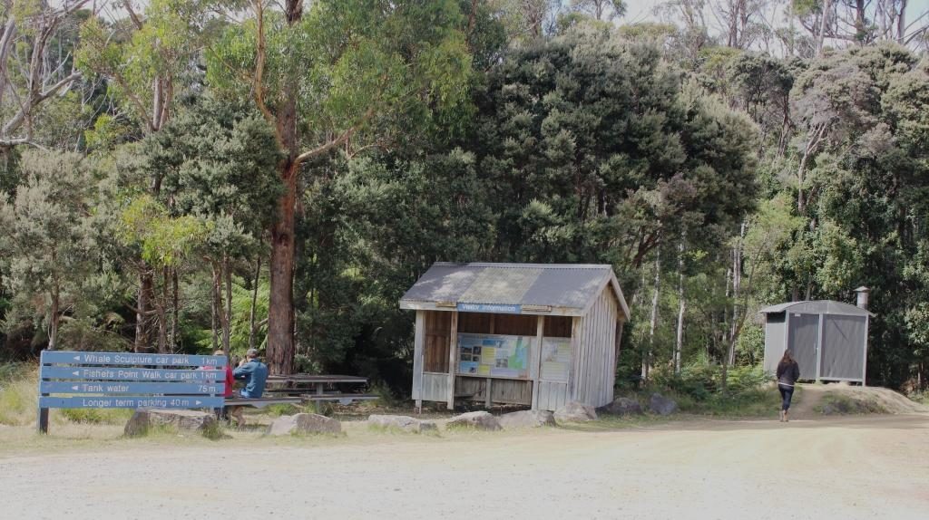
Day visitor facilities at Cockle Creek
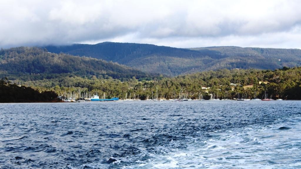
Southport to Cockle Creek is about 30 km, 20 km of which is fair quality gravel. The rest is sealed. There are a couple of small hamlets overlooking Recherché Bay and then a succession of free camping areas, each with at least one toilet. At the end of the road is a more substantial area with a volunteer caretaker and individual camping spaces. It is a very attractive location. Had we still been caravaning we probably would have stopped there for a day or so.
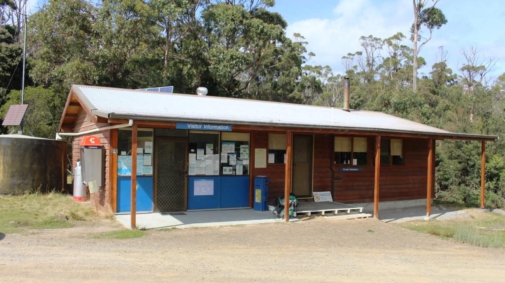
Cockle Creek visitor centre has a resident volunteer caretaker during the tourist season.
We drove as far as we reasonably could without a 4WD vehicle. In turning to find a spot to park so that we could look around, I forgot about the whale lookout and its bronze whale sculpture, produced by the sculpturer mentioned in our post of the Central Highlands. Bother! Now we will have to go back one day. We would be happy to do that, actually.
On the return journey, we paid more attention to the towns that we had passed through on our outward journey. Of these the most significant are Dover, Geeveston, Port Huon, Franklin and Huonville.
The residential coastal strip at Dover.
Dover is an oyster port. Geeveston calls itself the “Timber Town” and seemed to be a busy centre. We stopped there for lunch. There is a timber themed park not far away but it has been closed since it was damaged by bush fires last year. There are also national parks and caves in the area.
Oyster sheds and wharf at Dover.
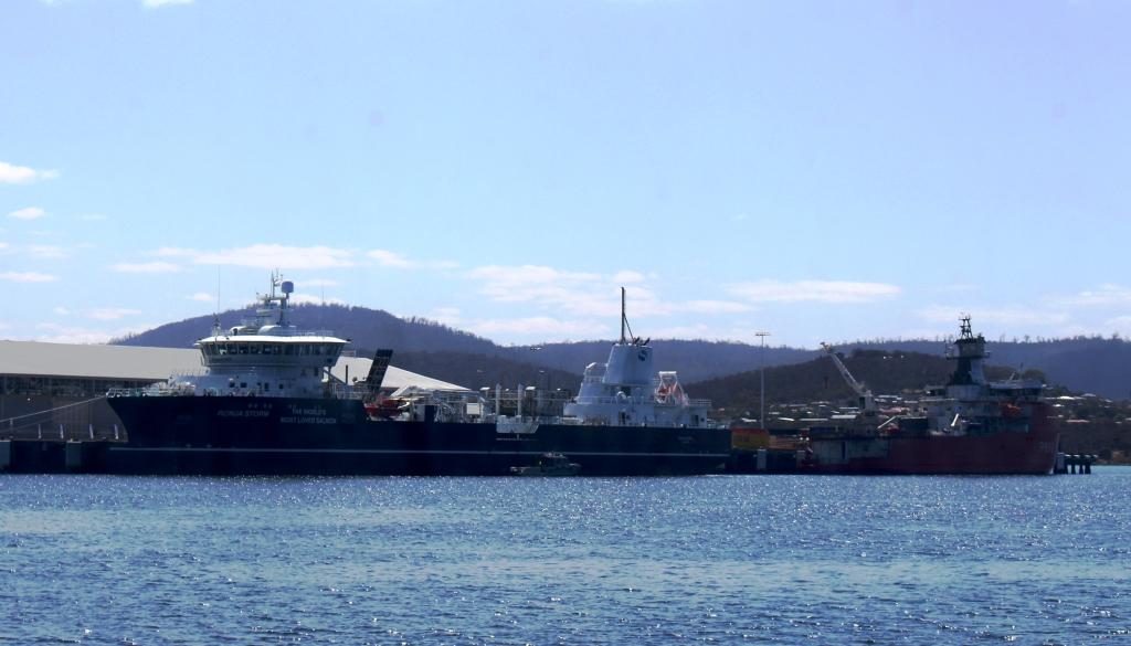
Port Huon has a substantial wharf which is now a service area for the numerous salmon and trout farms in the Huon estuary. A salmon industry support boat that we had seen in Hobart on Monday, was at the wharf as we passed.
The vessel on the left is the Tuna support vessel berthed at Hobart. The ship on the right is a French Antarctic expedition vessel.
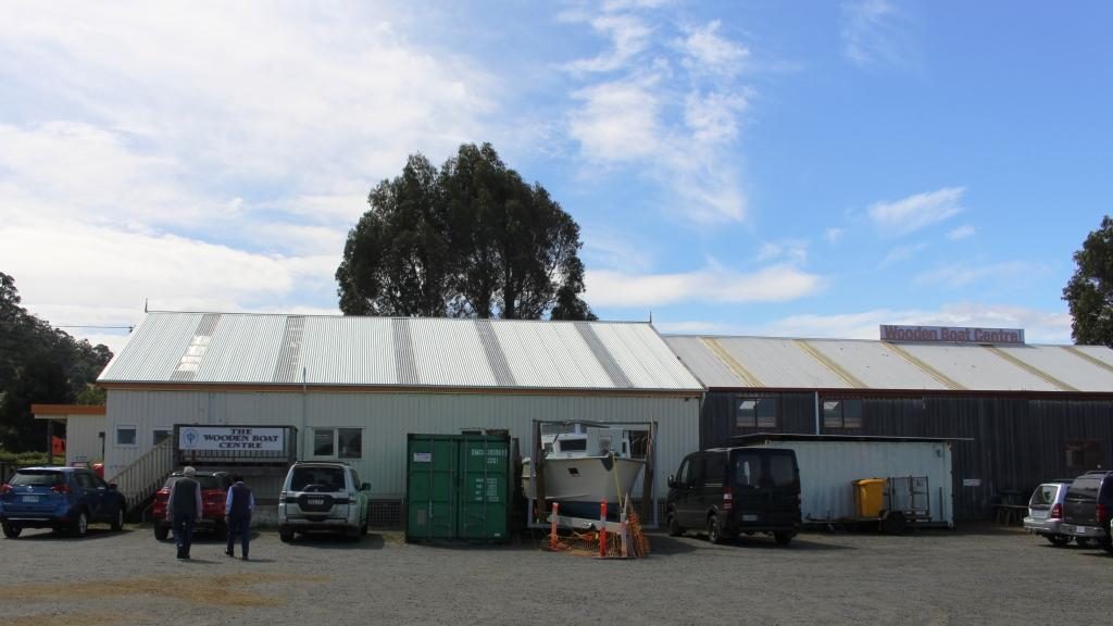
Franklin appears to have been the major river port in the days before road, when supplies came from Hobart by boat. The town is host to the Wooden Boat Information Centre. The Centre is just what its name suggests but also conducts a school of wooden boat building. Visitors can look through glass partitions to watch ship wrights in action.
The Wooden Boat Centre at Franklin.
Tasmania conducts a wooden
boat festival every other year, based at Franklin. This was an off year. If the
festival had been on this year we would have tried to fit it into our
itinerary.
Day sailing sail boat at Franklin wharf. The Huon River is wide at this point.
Huonville is the major town
in the Huon Valley and is by far the largest. The Huon River is a broad stream
where the road crosses it south of the town and broadens further into a substantial
inlet, as it nears the sea.
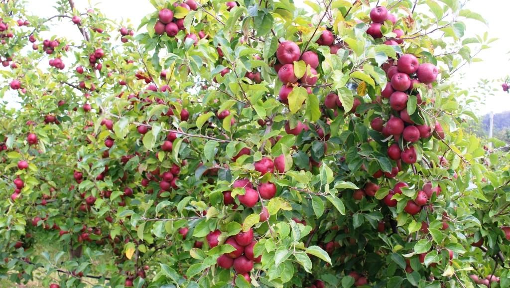
Apples almost ready to pick. I resisted the temptation to sample one.
The Huon Valley is still a major fruit producing area although it produces nothing like the volumes export fruit of the days before Great Briton joined the European Economic Community. Apple production remains substantial. Pears and stone fruit, berries and of course grapes, are also grown in the area.
THe Huon River at the bridge at the south of the town.
We turned off at Huonville to pass through Cygnet, itself a town of reasonable size, before cutting across to the small town of Snug where we planned to snuggling for the next two nights. The heater supplied in the cabin was most welcome.
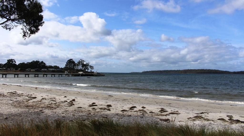
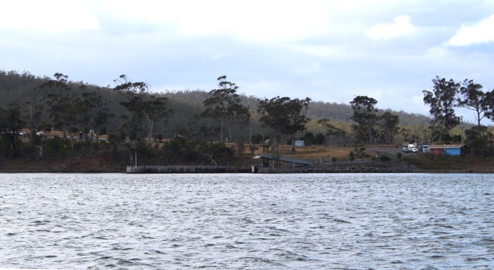
Kettering receding in our wake as we head for Bruny Island.
Snug is near
Kettering, the small town from which the ferry sails to Bruny Island. Its proximity was why we stayed
there. A drive of about 6 km brought us
to Kettering and to a ramp facility designed for its purpose. A similar
facility on North Bruny only has a snack bar in addition to the ramp.
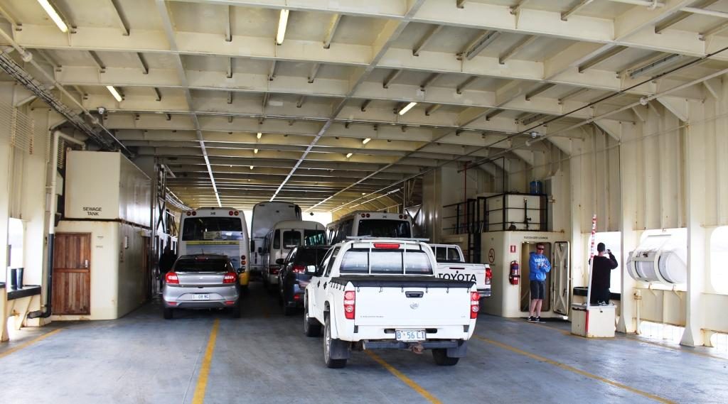
We travelled on the lower deck. More cars above.
Bruny Island is a piece of
rural southern Tasmania that remained detached from the rest, so needs a 15
minute ferry journey to get there. That costs $38 return unless you catch an
early ferry. That will save you about $6.
A sister ferry returning from Bruny Island.Arrival and departure ramp at Bruny Island. There is no town there. Only a snack bay for long queue days.
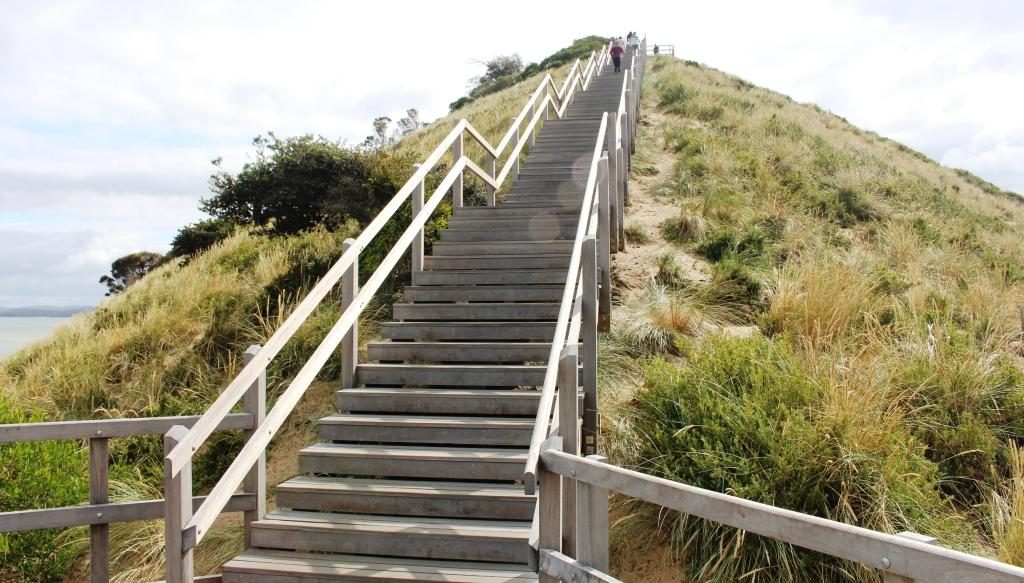
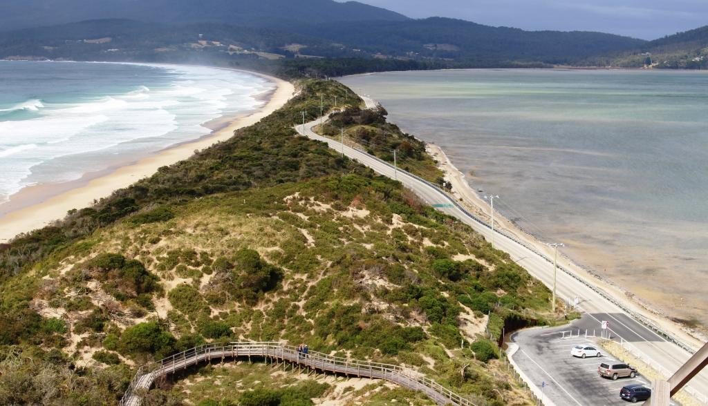
North and South Bruny Island are joined by a long narrow isthmus named The Neck. It is mostly composed of sand, with beaches on both sides and a prominent hill (probably a sand dune) at the northern end. Stairs and boardwalks lead to the top of the hill for views and to the beach. Views are 360 degrees and sweeping, particularly to the south . Toilet facilities are located here. Tourist busses stop for the view. A Penguin rookery is located on the ocean beach.
Stairs to the lookout at The Neck.The Neck stretches south to South Bruny Island.
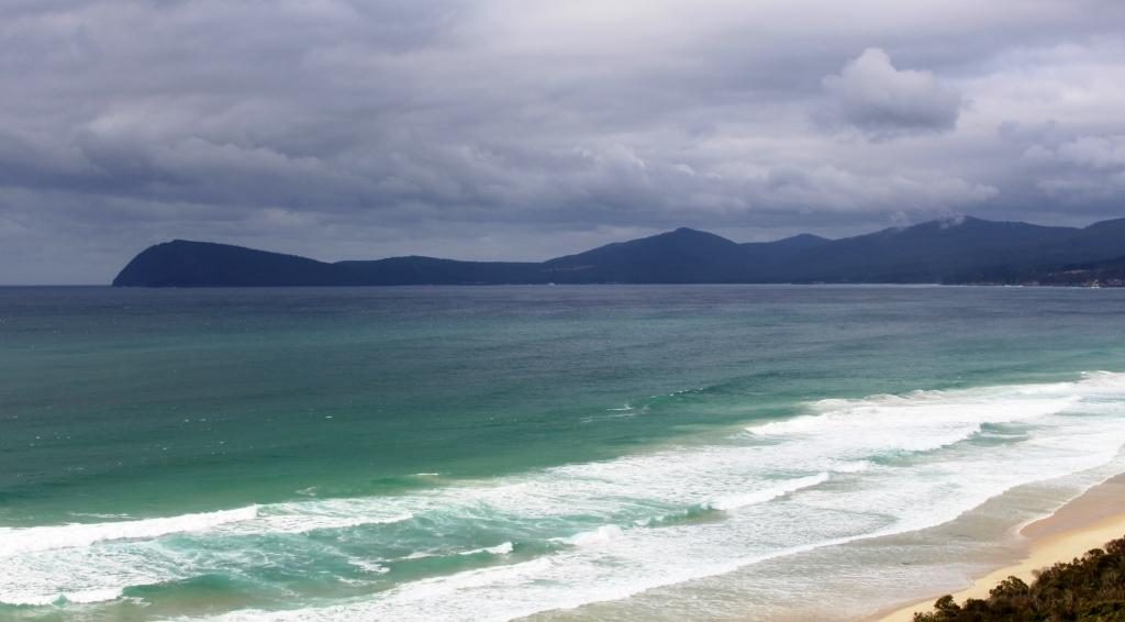
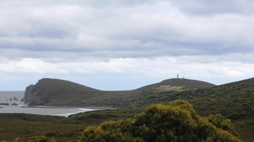
Like most places where mountains meet the sea there is spectacular scenery, particularly at the southern tip around the Cape Bruny Lighthouse and at Adventure Bay to the south east.
To the south east Grass Point marks the eastern land point. Adventure Bay is located to the left of Grass Point.
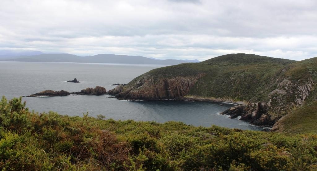
You get to the Lighthouse and its scenery under your own steam on a typical national park road with a very rough section inside the lighthouse grounds. Excellent scenery along the road with plenty of places to pull over and look.
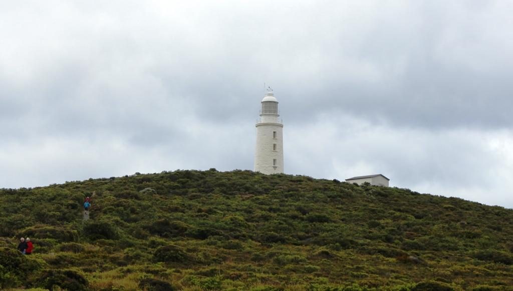
Cape Bruny and the original lighthouse. The new light is on the hill to the left. If you look closely you can see it.From the lighthouse looking north west towards Southport.
I didn’t get to see the interior of the lighthouse or climb to its observation deck. It was fully booked to bus tour groups. But I was able to walk to the original and now unused lighthouse and enjoy the magnificent views of the coast. A new automatic lighthouse has been built on an adjoining headland, to the east.
The original lighthouse is reached by a short walk from the car park. Lighthouse keeper cottages. Nearest is a museum and visitor facility. The others are available for holiday rental.View from the car park towards the north east and the south eastern tip of South Bruny Island.
Adventure Bay is reached by a drive of 40 km, if you choose the best road. You head back to the southern end of The Neck and then turn south for about 10 km.
A smaller Tasmanian cruise boat that does tours around the south coast. It was in Adventure Bay.
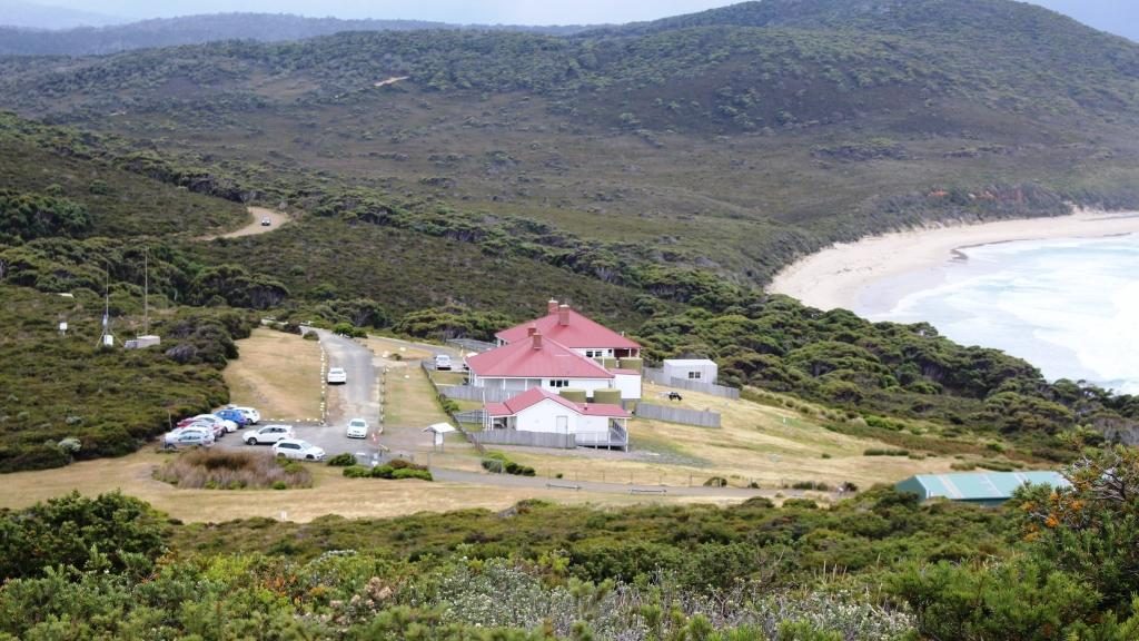
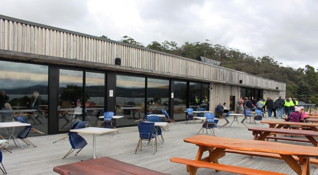
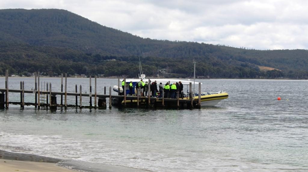
Pennicott Wilderness Journeys have a base at the end of the road where they will put you into a small boat to show the wonders that are out of sight around Grass Point. On that tour you get to see Fluted Cape and Penguin Island plus wild life, including seals. That costs about $125 and you could get cold and wet. But that is adventure for you. On the day of our visit the seas were smooth and there was no rain, so the experience would have been quite pleasant. Bookings are normally necessary. The tours were fully booked several days in advance of our visit.
The deck at the Pennicott tour base at Adventure Bay. The restaurant is behind the glass doors.A tour boat preparing to depart on the Fluted Cape tour.
We knew that the tour base has a great restaurant, so it was on our list as a lunch spot. The building is on the back of a sand dune. The restaurant overlooks a broad deck and has a view to the north east over Adventure Bay. We were not disappointing with our choices from the extensive menu. See below.
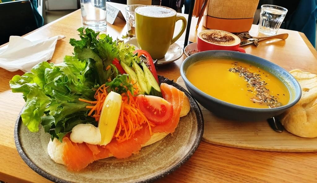
Adventure Bay lunch. Soup was good on a cool day and I love fresh smoked salmon.The cafe/coffee shop at Adventure Bay township. Bruny Island’s main caravan aprk is just down the road.
That part of the island has
historical significance in that Captain James Cook landed there during his
third exploration in 1777. A monument has been erected at the landing site.
Also former Captain, but by then Governor William Bligh, visited and planted
some of the first fruit trees to be grown in Tasmania.
The monument to the 1777 visit of Lt (Captain) James Cook.
Antoine Raymond Joseph de Bruni, chevalier d’Entrecasteaux (1737 – 1793) was a French mariner who explored part of the east coast of Australia in 1792, including this part of Tasmania, during his search for the missing exploration party of La Perouse. The channel between Bruny Island and the Tasmanian main land is named after him and the island clearly took its name from a misspelled portion of his name. The d’Entrecasteaux Channel is pronounced “Doncastro”, or something similar.
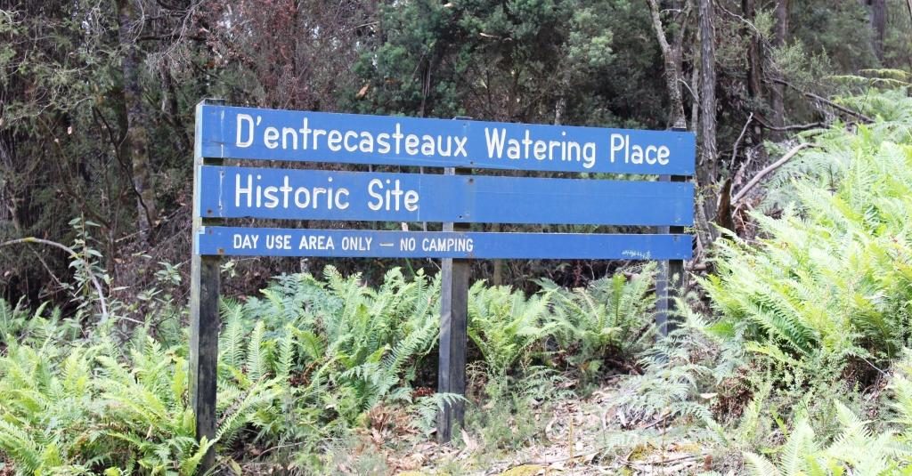
The previous day, near Cockle Creek, we had seen a sign marking the place where d’Entrecasteaux came ashore for water in a sheltered cove. A fresh water stream runs nearby.
The sign marking the visit of d’Entrecasteaux . A fresh water stream is nearby.
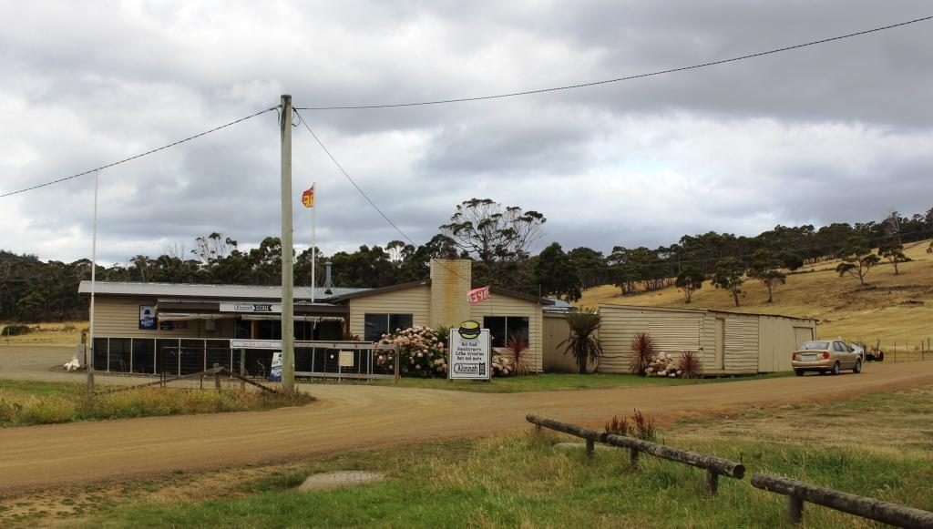
On the drive down to Cape Bruny we had passed through Aloonah, the “capital” of Bruny Island and drove back through the town again on the way back, as the turn to Adventure Bay is about a further 5 km to the north. So, as our return drive to the ferry took is within 5 km of Aloonah, we decided to drive back to take a closer look at this small town.
The general store and cafe at Aloonah.
I walked
over to the shore line to photograph the island’s only hotel. As I looked,
prior to taking the photo, I saw a couple who I thought looked like neighbors
from our days at Murrumba Downs, but then thought probably not! But as I walked
back to the car they were walking right in front of me as they returned to
their tour bus from their lunch stop. Absolutely no doubt now!
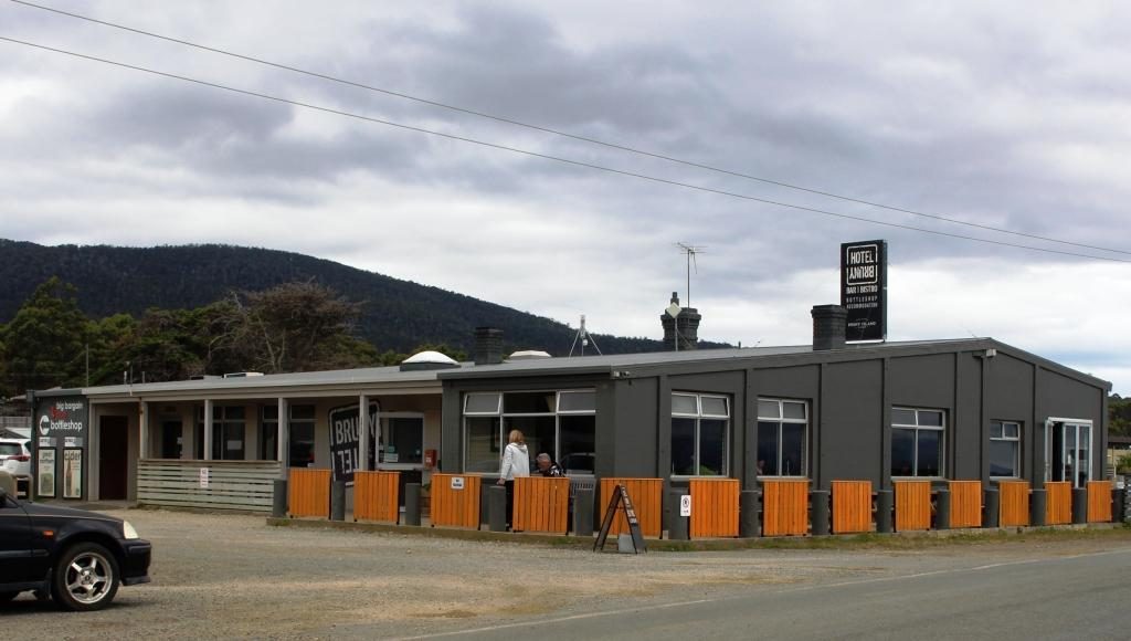
Bruny Island Hotel at Aloonah. Our former neighbours are the couple in the outdoor area.
They told us
that they had seen us in the street at Geeveston the day before, as we walked
past where they were having lunch. They planned to intercept us on our return
but we stopped for lunch further down the street. It truly is a small world.
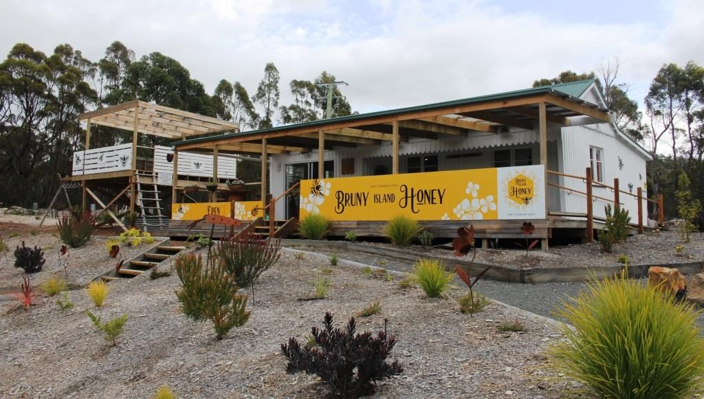
The honey shop without bee boxes. But we say many areas with bee boxes all over Tasmania, particularly in the National Parks.
The other tourist attractions on Bruny Island are man made and while legitimate activities for Tasmania, lack authenticity because they have so obviously been put there to be tourist attractions. Things like an oyster shop well away from the sea, a honey shop without a bee box in sight and a place selling cheese with only two types available for tasting and a clear emphasis on selling on line.
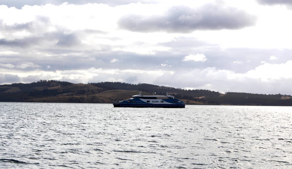
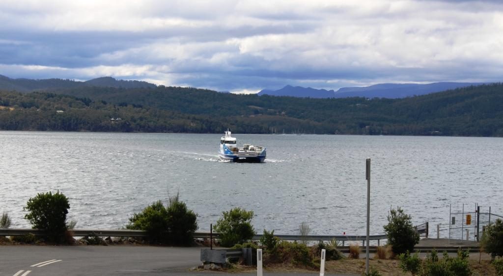
We returned from Bruny Island on the smallest of their ferries.
But the visit made for a
pleasant day. The roads are narrow and winding but mostly sealed. Gravel roads,
of which there are a few, are mostly well maintained and smoother often than
the sealed roads. The worst were within the grounds of the lighthouse.
Most tourist activities are
to the south of the ferry landing. The largest settlement is Dennes Point in
the extreme north. This town is reached by a good gravel road that provides
sweeping views of the ocean and bays on both sides of the island. It is well worth
the effort, if you have time
Visitors with more time would find a lot more to see and do on the island. There are lots of walks to suit all levels of ability in the most scenic parts of the island.
In summary, we are glad that we visited Bruny, but much was not as I expected. And after calling at a whiskey outlet (enquiring for a friend), I will never again complain of cellar door prices for wine.