Interrupted Journey – North Queensland 2022 – Part 2

Part 2 – North to Port Douglas via The Atherton Tablelands

Note: A video link appears at the bottom of this blog post.

Coral Princess lying off Airlie Beach.

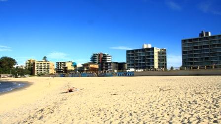
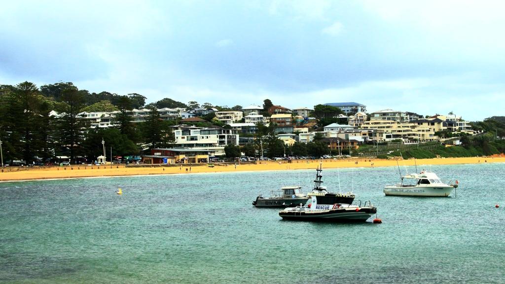
When you have a view like we did at Airlie Beach, the first thing that you do when you get up of a morning is open the blinds. We opened our blinds on Sunday morning and there in the middle of our view was the Coral Princes, in port for a visit. Our friends Jim and Frances Weir were on board, but we were gone by the time that they come ashore.

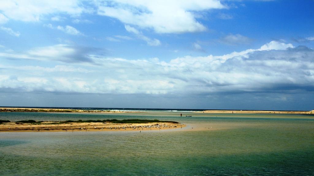
Sunday was one of making distance up the coast. Our Sunday night overnight stop was at Innisfail.   The sun shone on us all day. We struck some low-lying fog both on land and over the bay as we approached Bowen, making slower progress than we had hoped as we coped with the long slow kilometres of roadworks. Almost the entire length of road from where we entered the highway just north of Proserpine to Bowen, was limited to 60 and 40 kph with a few areas of 80 kph.

Balgal Beach. The view goes all the way to Magnetic Island and Townsville.

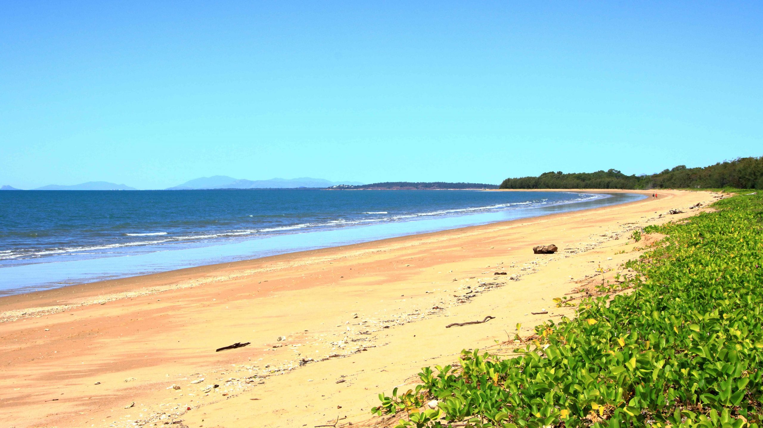
The run for the rest of the distance to Innisfail was much better, but still with a lot of areas of road works. We bypassed Townsville on the convenient ring road, as you do now, but called in a Balgal Beach. near Rollingstone. We knew where we could get near the beach for lunch, from previous visits.

Fisherman’s Landing at Balgal Beach. The restaurant overlooks the jetty where fishing boats dock.
The mountains northwest of Innisfail

We had a quiet night in Innisfail. The motel was right in town but quiet. All we wanted was somewhere to eat and sleep.

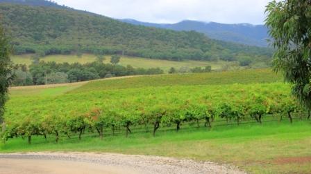
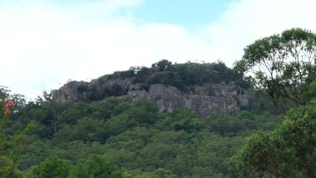
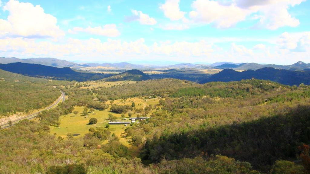
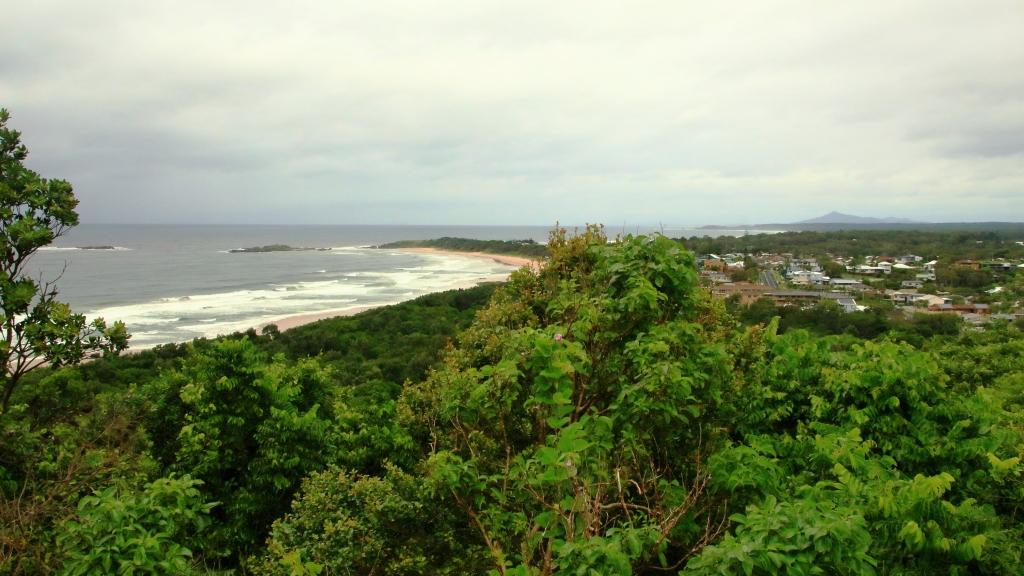
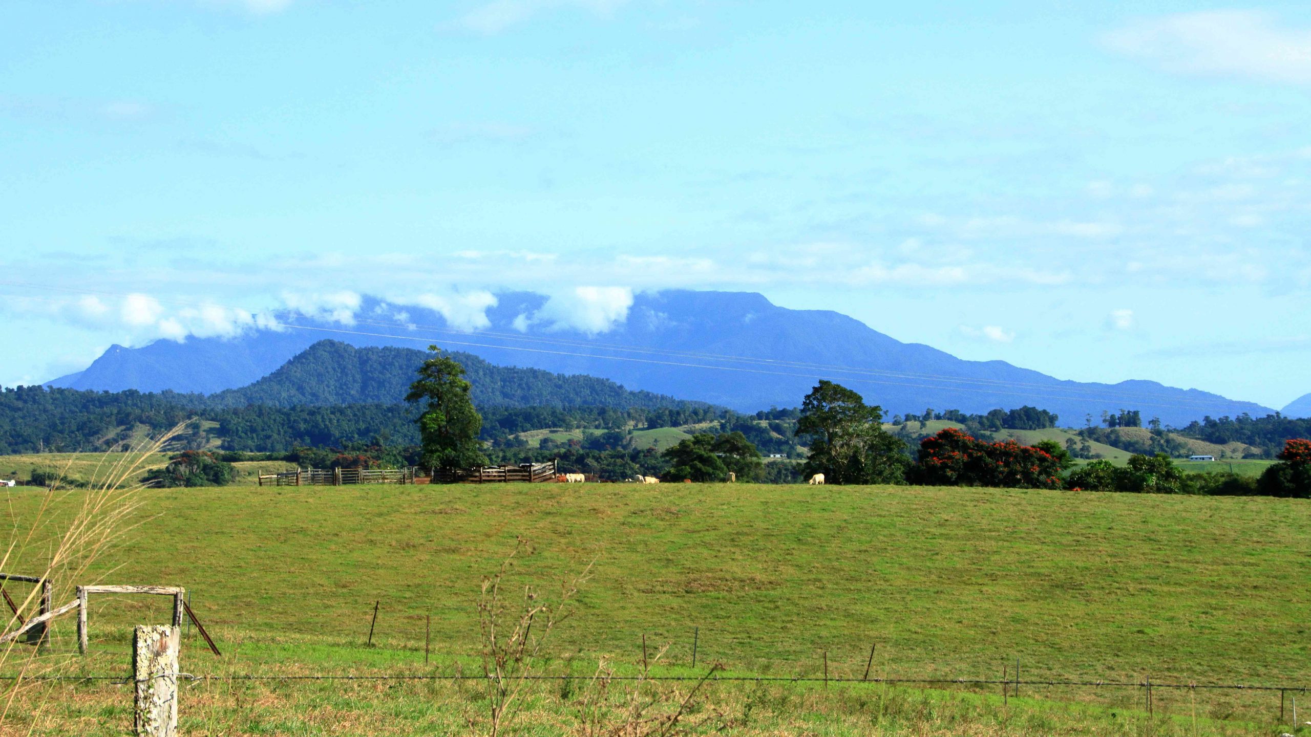
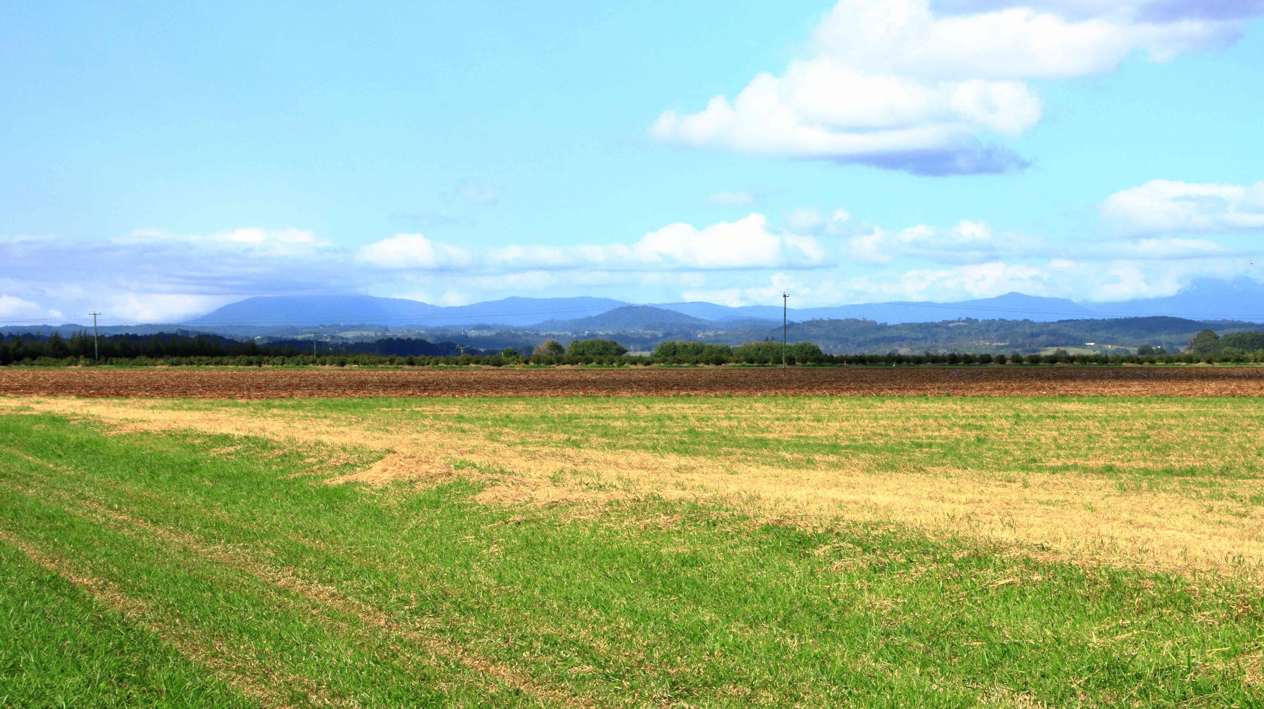
A cap of cloud was sitting on the top of that mass of mountains to our north as we left Innisfail. The mountain ranges inland from the coast are home to Queensland’s two highest mountains, Bartle Frere at 1,611 metres and Bellenden Ker which reaches a height of 1,593. At those heights they and the surrounding ranges rise well above the Atherton Tablelands, to which they provide a backdrop to the east.

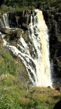
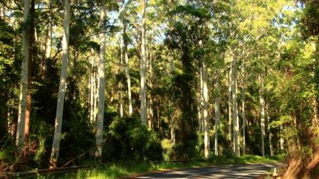
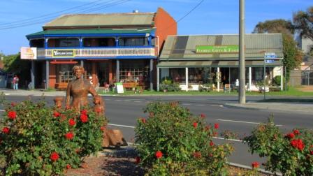
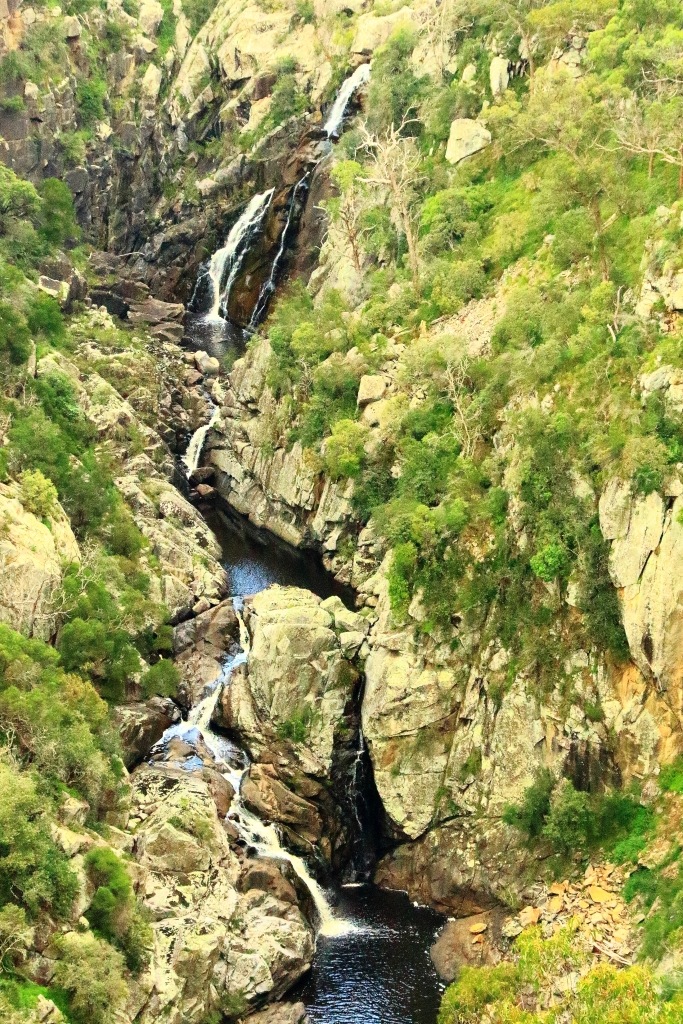
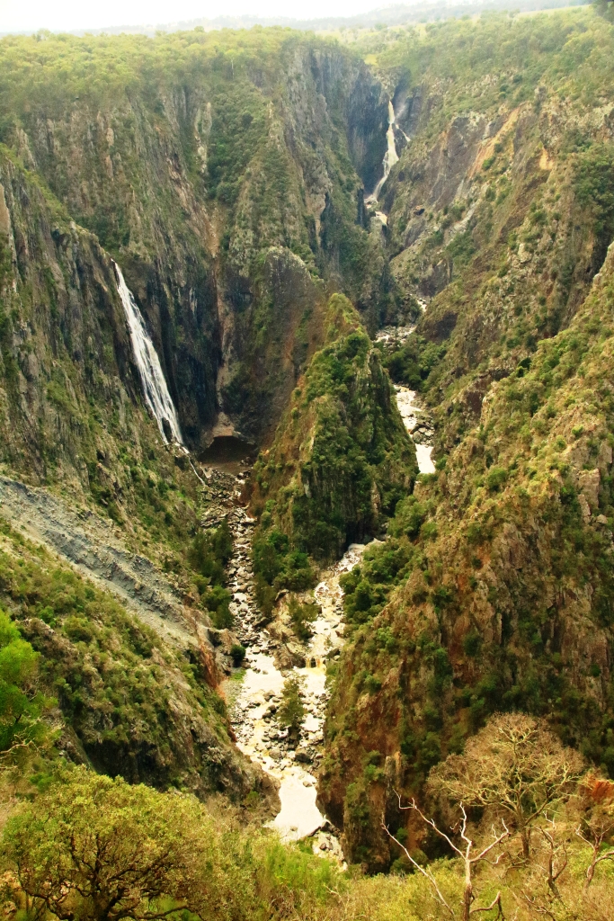
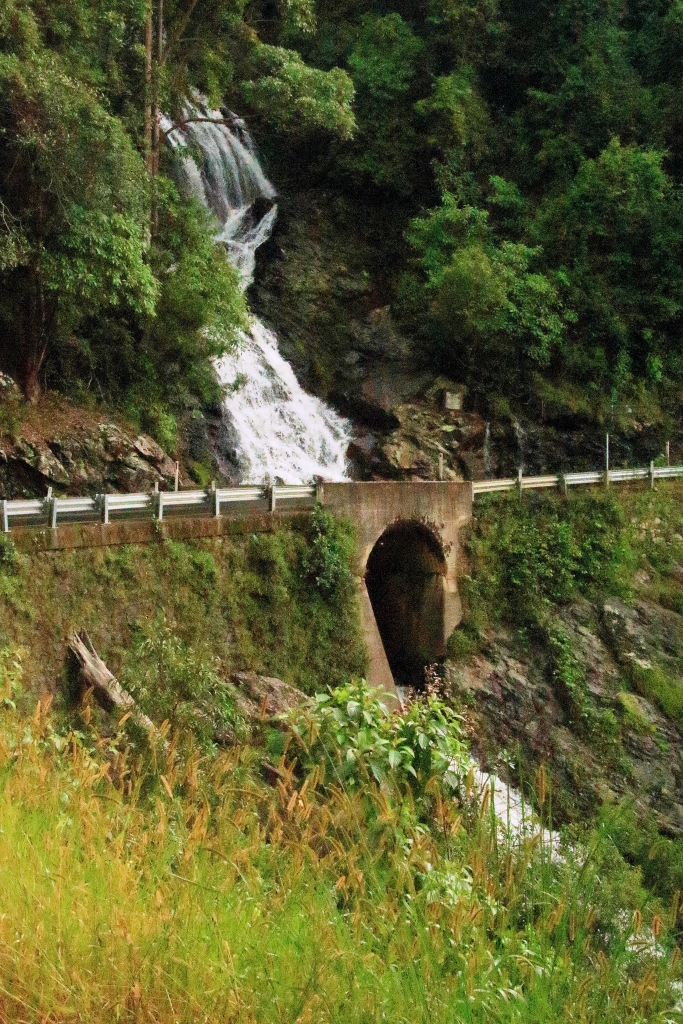
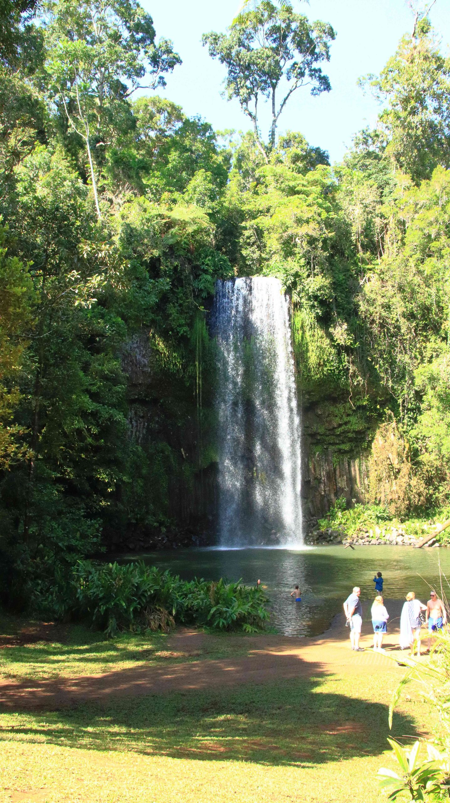
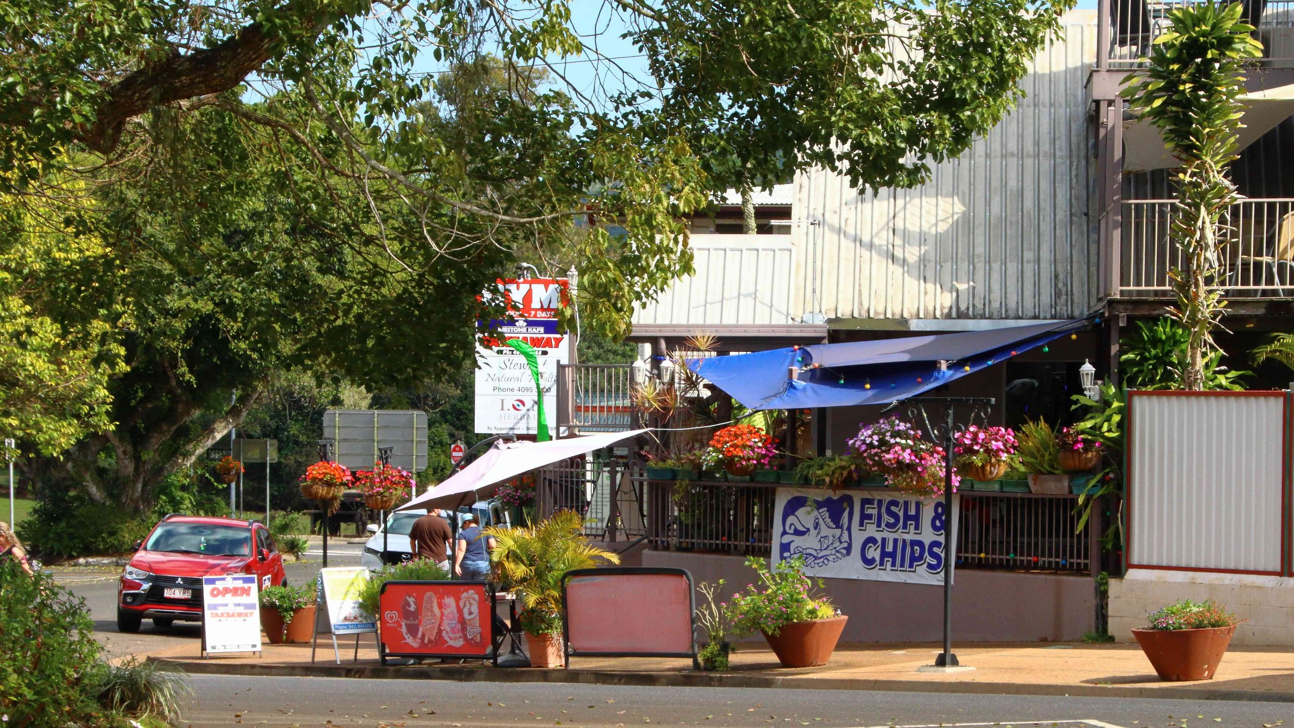
The drive from Innisfail ascends some steep grades but on a good road. When you reach the edge of the Tableland the height gain from the coast is obvious. The first town is Millaa Millaa, but first you will see signs that point to a drive that leads you past four waterfalls, before returning you to the main road. We have done this drive before but did it again before stopping for coffee at the park in the main street. The town has a couple of good café/coffee shops as well.

Zillie Falls on the Falls Circuit near Millaa Millaa.
Millaa Millaa Falls also in the Falls Circuit.
The mountain ranges viewed from Millaa Millaa Lookout.

 We then crossed to Herberton to look at the tin mining museum. Soon after you leave the town of Millaa Millaa, you reach a steep ascent. Just before the summit, a left-hand turn takes you to a lookout which, unsurprisingly is named Millaa Millaa Lookout. Equally predictably the lookout provides fine views back over Millaa Millaa and the ranges nearer to the coast. We were greeted on our arrival by some domestic hens.

Mining machinery and buildings at Herberton Mining Museum.

There is much to see at the Herberton Museum, particularly for those with an interest in old machinery and historic mines. You could spend quite some time there if that were the direction in which your interests lay.

Malanda Falls is located in parkland near the town.

We then turned back to the east to Malanda. We wanted to lunch at Gallo Dairyland but research had shown them to be a Wednesday to Sunday operation, which seems to be quite common in areas that are within an easy weekend drive of major population centres.

Malanda Café, our lunch location.

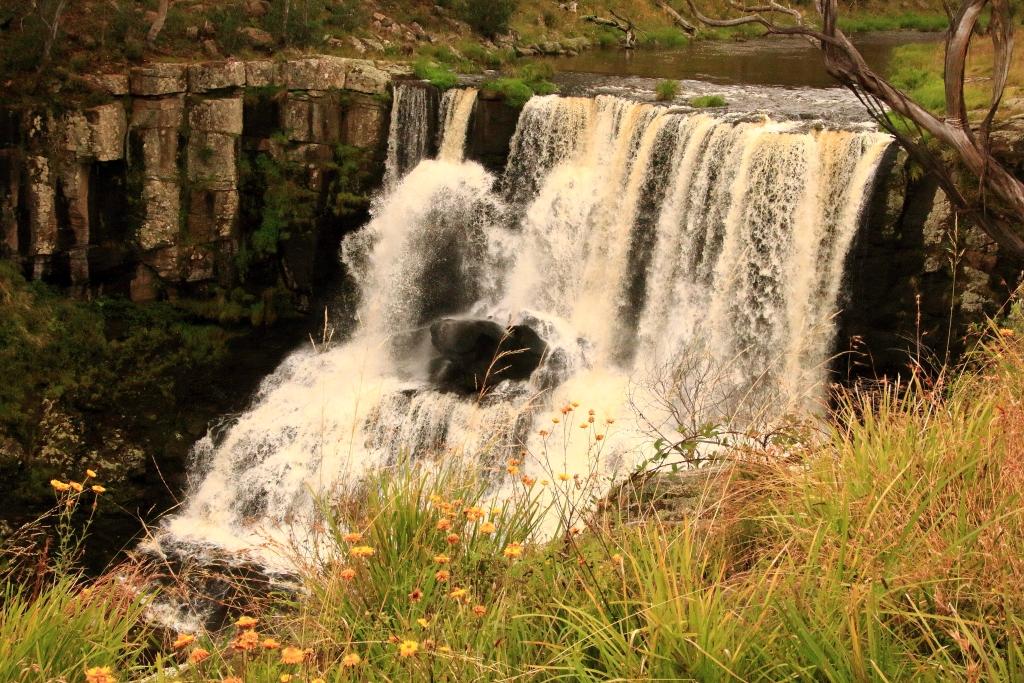
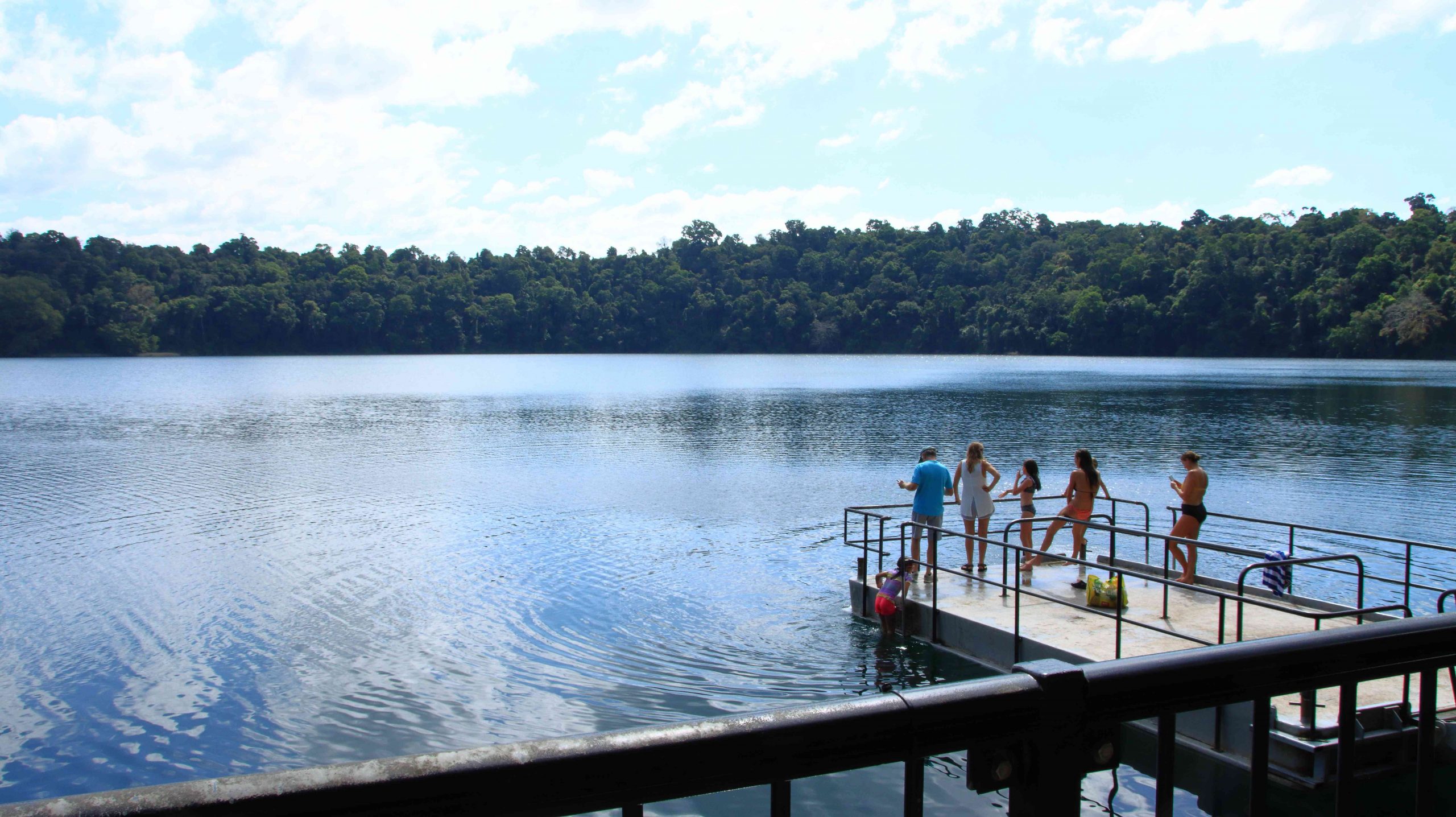
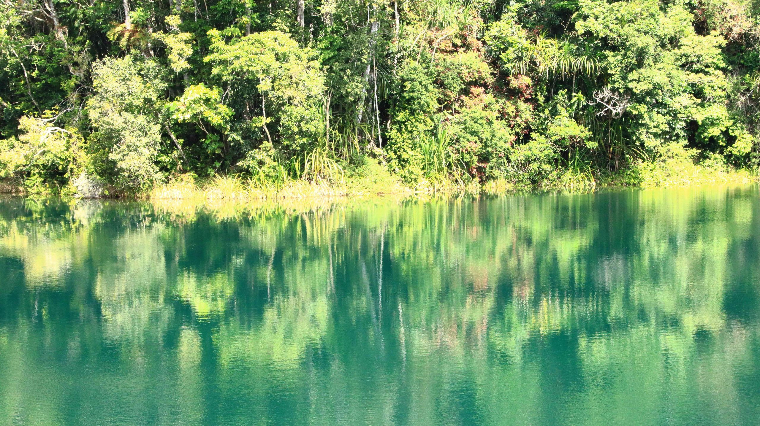
So, after visiting Malanda Falls we lunched at a café in town before making a return visit to Lake Eacham, where some hardy souls were swimming and sun baking. It is a beautiful location and wasn’t all that cold but not my idea of swimming weather.

Lake Eacham with bathers.
Reflections in Lake Eacham.
We passed through the attractive town of Yungaburra on our way to Tinaroo Dam.
Patient Cattle Egrets waiting for the cane harvest to move on.

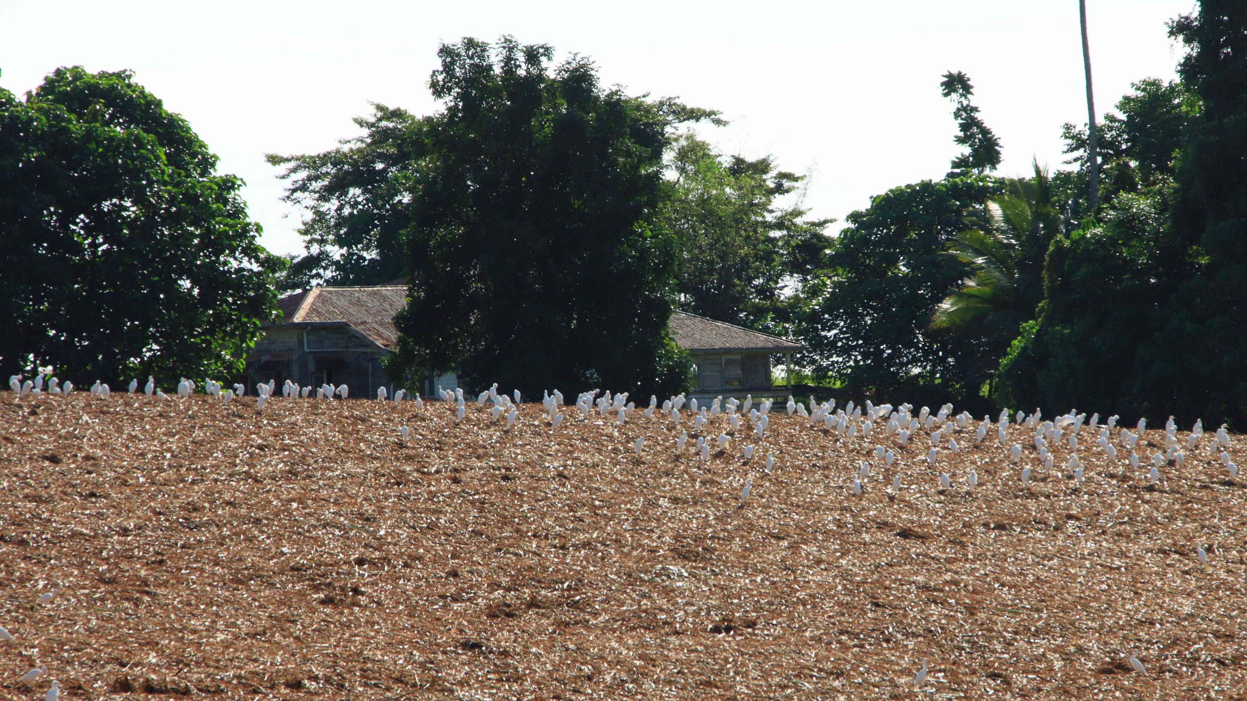
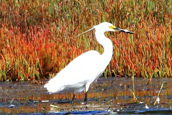
We had seen a large flock of Cattle Egrets (the little white Egrets that are often found where cattle are grazing) back nearer to Innisfail. They were waiting for a cane farmer to finish harvesting a field. Some were near to the road, but all took off and flew to the top of a hill overlooking the cane fields when we stopped. Newly cut cane must produce good eating grounds for them. We saw the same phenomenon at a couple more cane harvesting sites the following day, but other harvest sites had no birds at all.

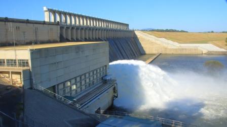
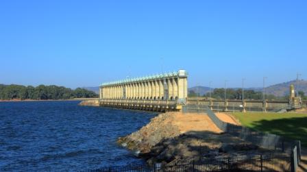
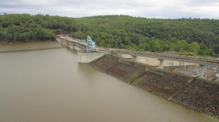
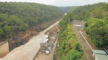
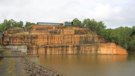
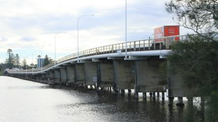
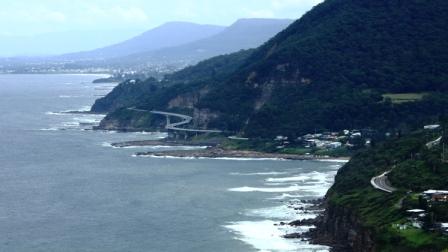
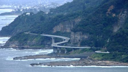
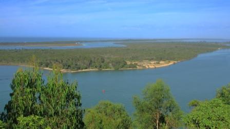
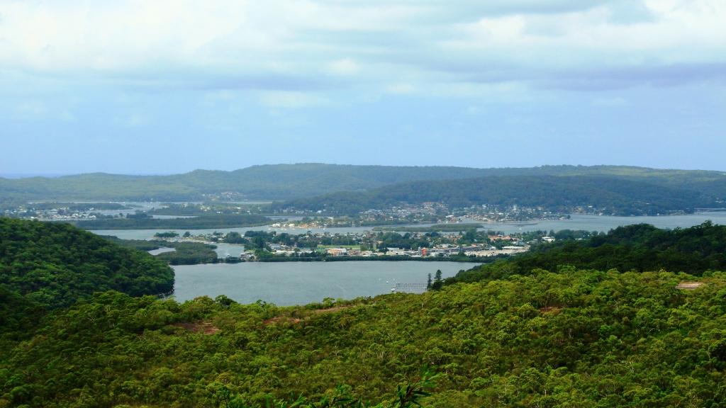
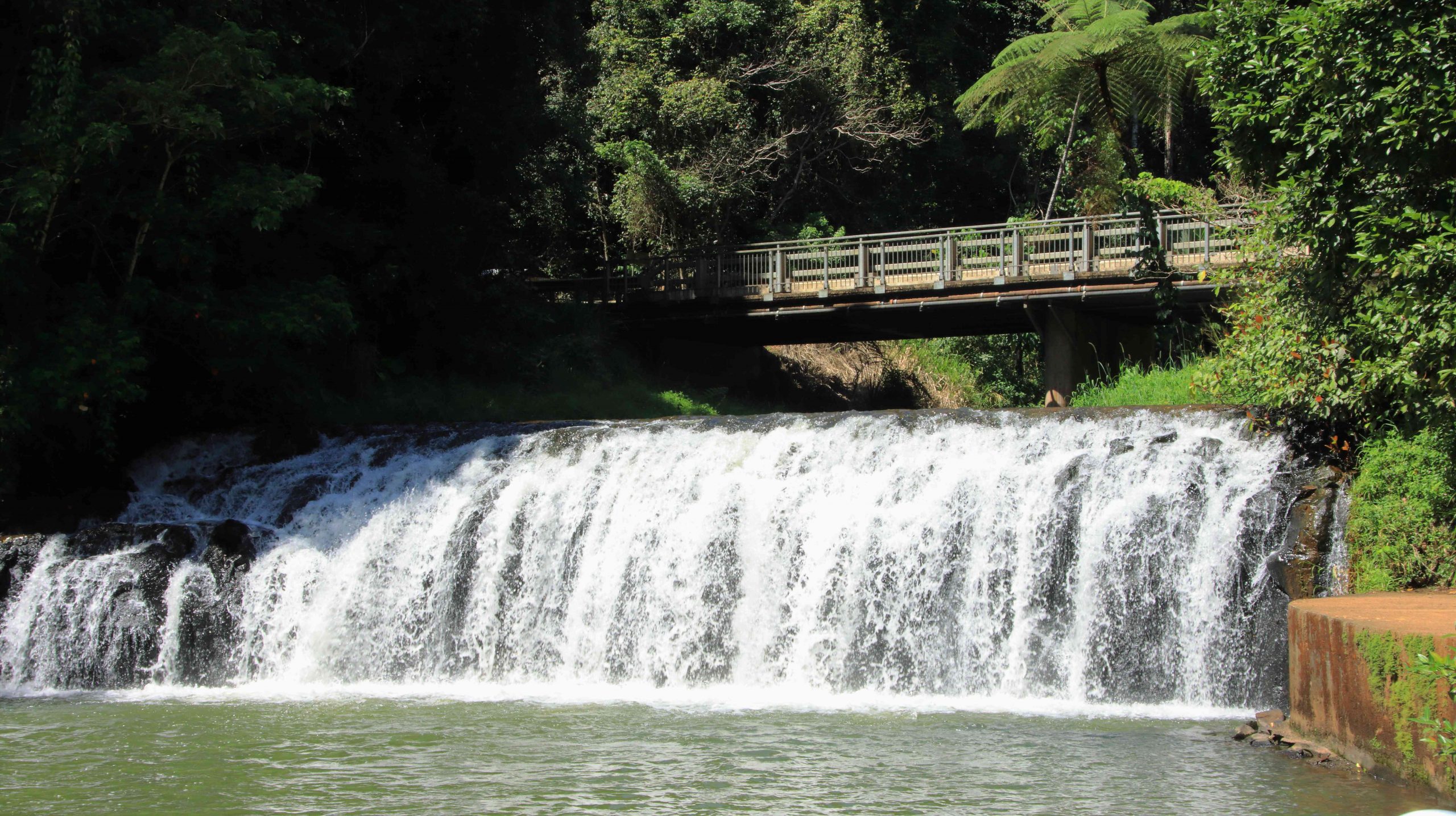
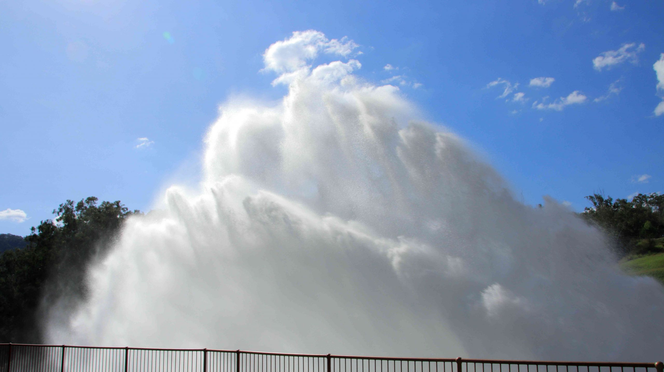
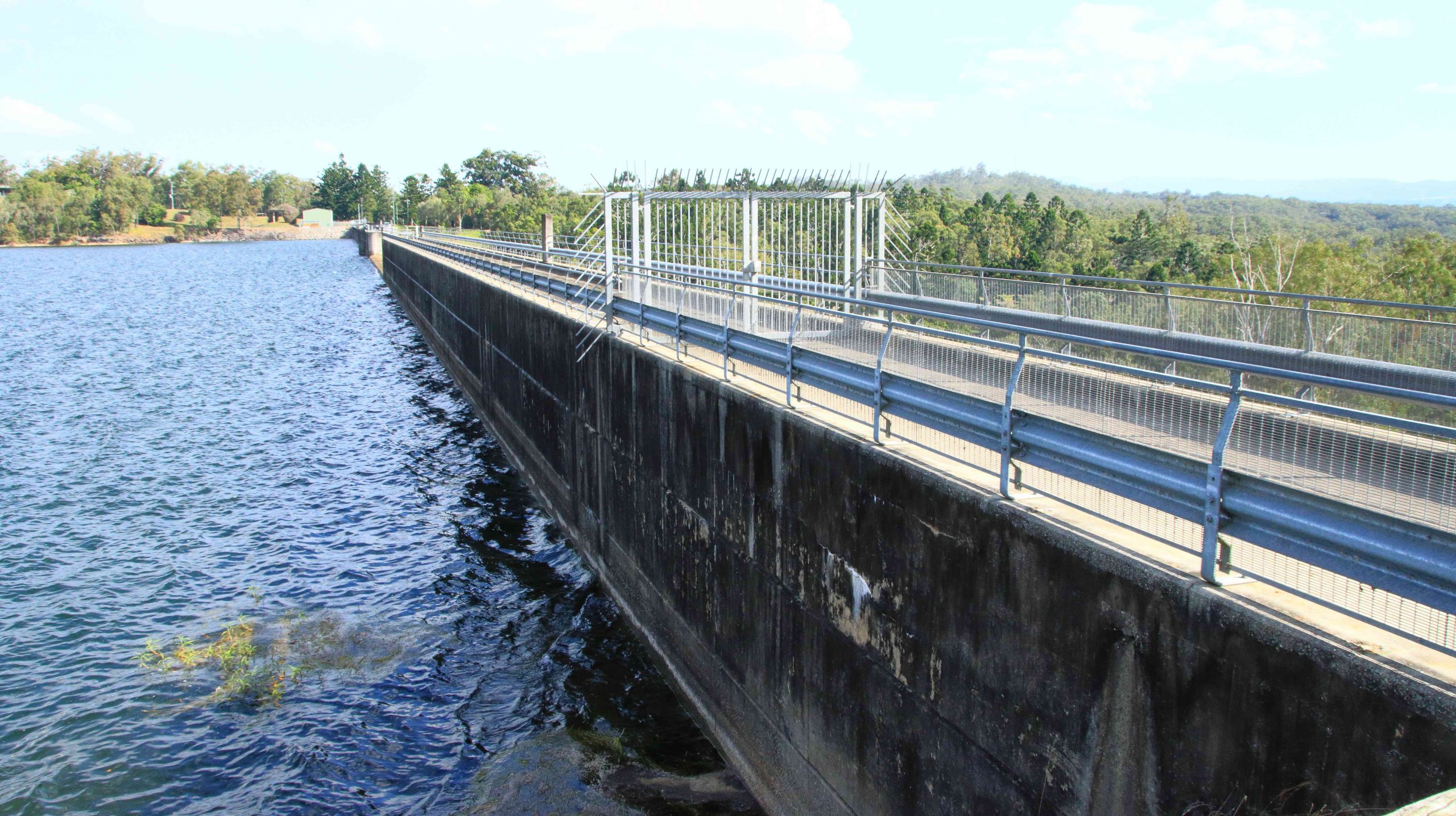
To complete the day, we drove to Tinaroo Dam, where operators were discharging quantities of water, no doubt to the delight of tourists who see it flowing down the Baron Falls as they look down from the Kuranda train or the cable Skyway. There is plenty more where that is coming from. The dam is near to full.

Rather spectacular water discharge from Lake Tinaroo.
Tinaroo Dam
Agricultural land, irrigated by water from Lake Tinaroo.

We then drove on to Atherton and checked into our motel. It was a shorter and easier day. We travelled just over 200 km. Yesterday was a little over 600 km.

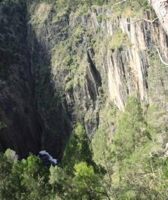
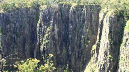
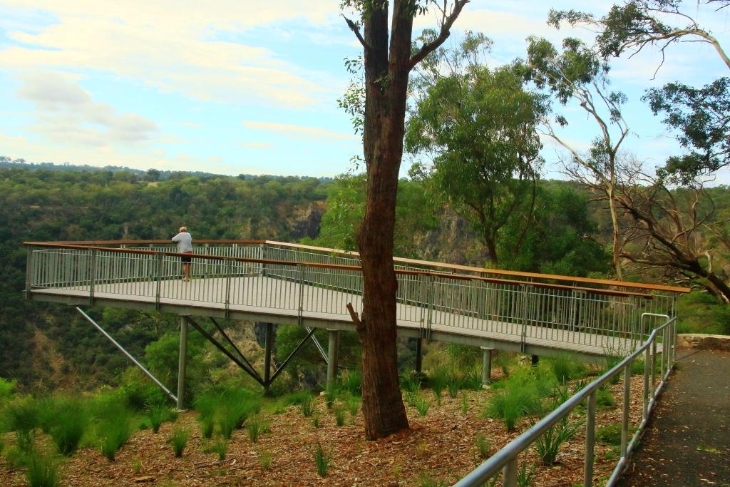
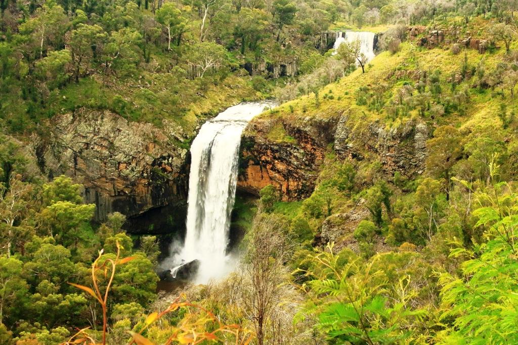
We departed Atherton on the morning of Tuesday 16th August, heading for Mareeba initially but with Port Douglas as our end-of-day goal. We turned east at Mareeba to drive to Emerald Falls. The facilities at the car park suggest that it is quite popular with visitors.

The top section of Emerald Falls.
The memorial to Luke McDonald who lost his life in the waters of Emerald Creek
Emerald Creek below the falls and series of rapids.

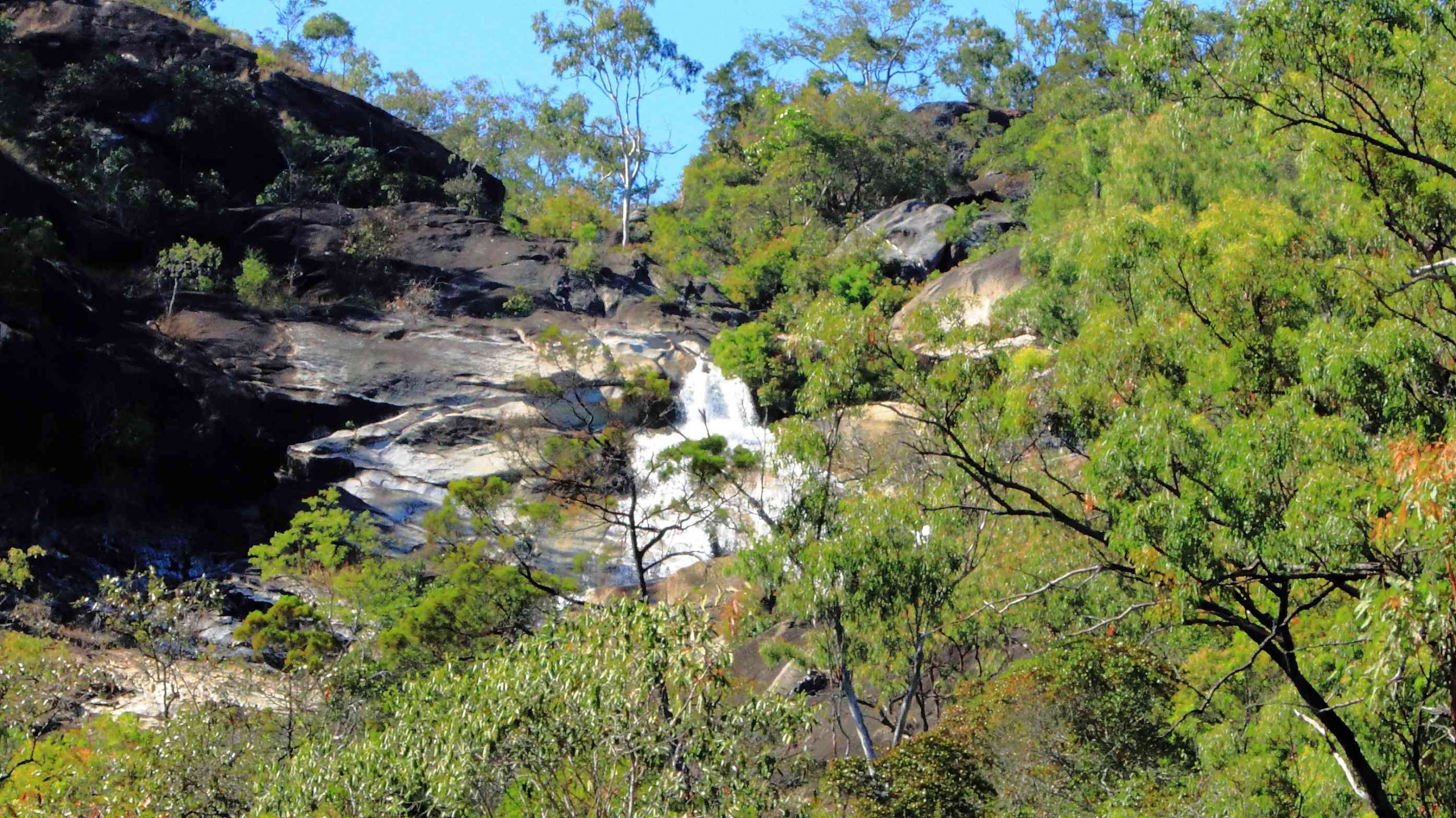
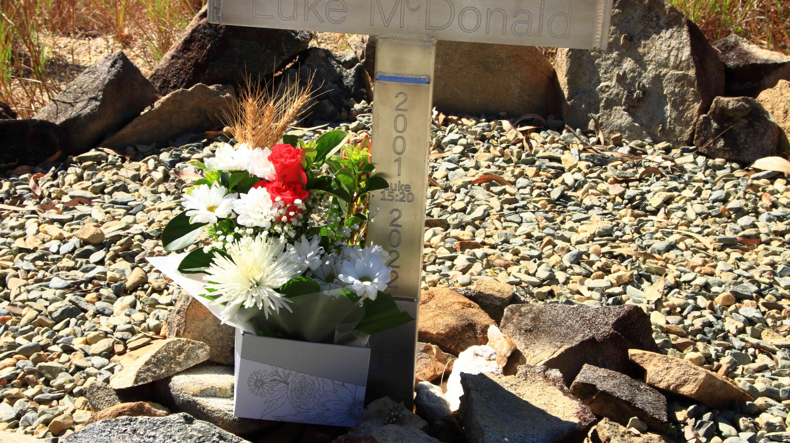
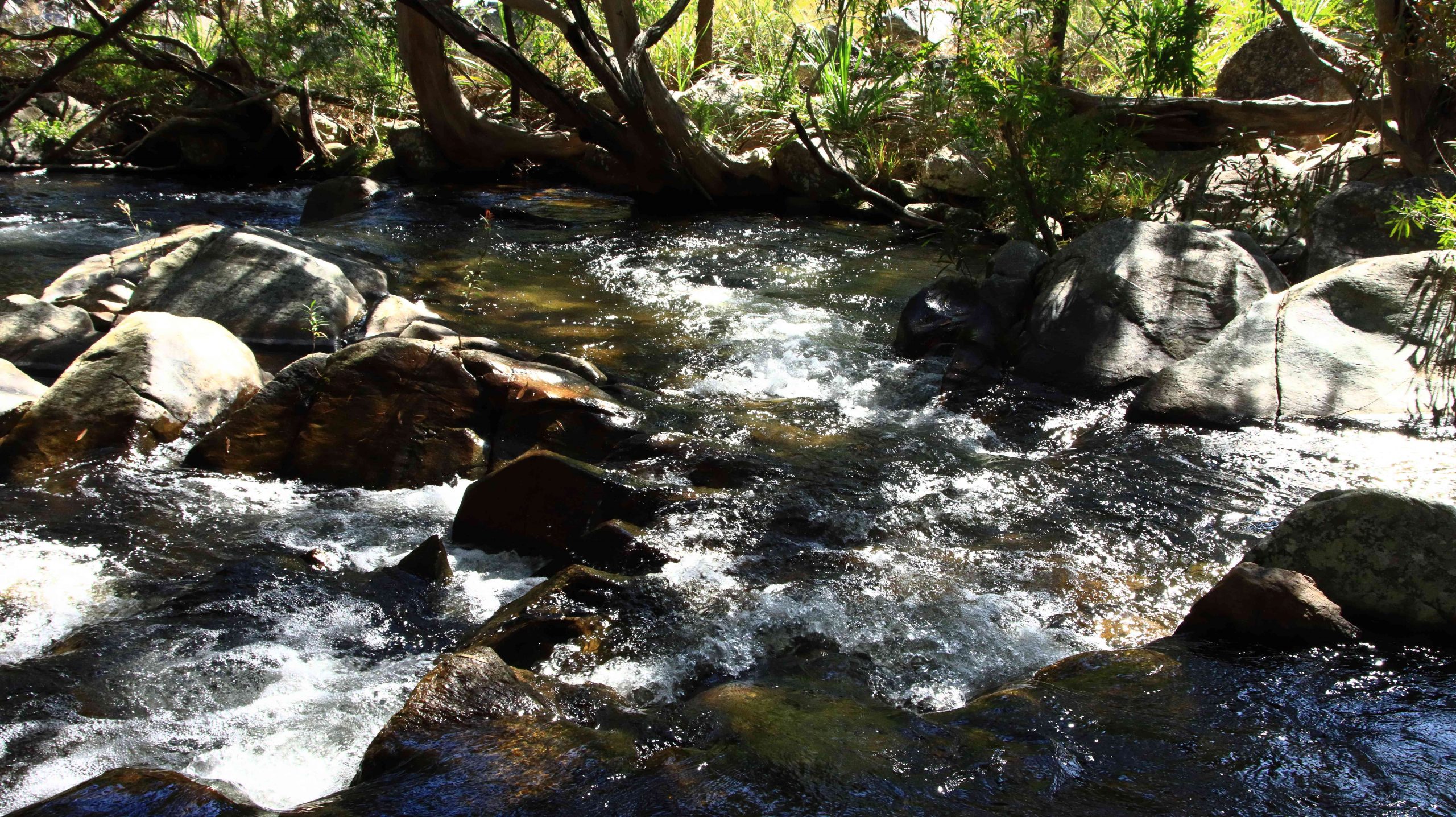
The walk to the falls is a little under a kilometre one way and quite easy until the last couple of hundred metres, when a series of well-built stone steps lead to the lookout and a rougher path to the foot of the falls. Visitors are reminded of the perils of mountain streams by a memorial, built by the side of the track, to a young man who perished in the stream.  Being conscious that we were there on our own and that I am not as young as I once was, I gave the walk away when the top of the falls were in sight. Thy are partly obscured by vegetation. But a great spot for a picnic and walk.

Magpie Geese near Mount Molloy on the Mulligan Highway.

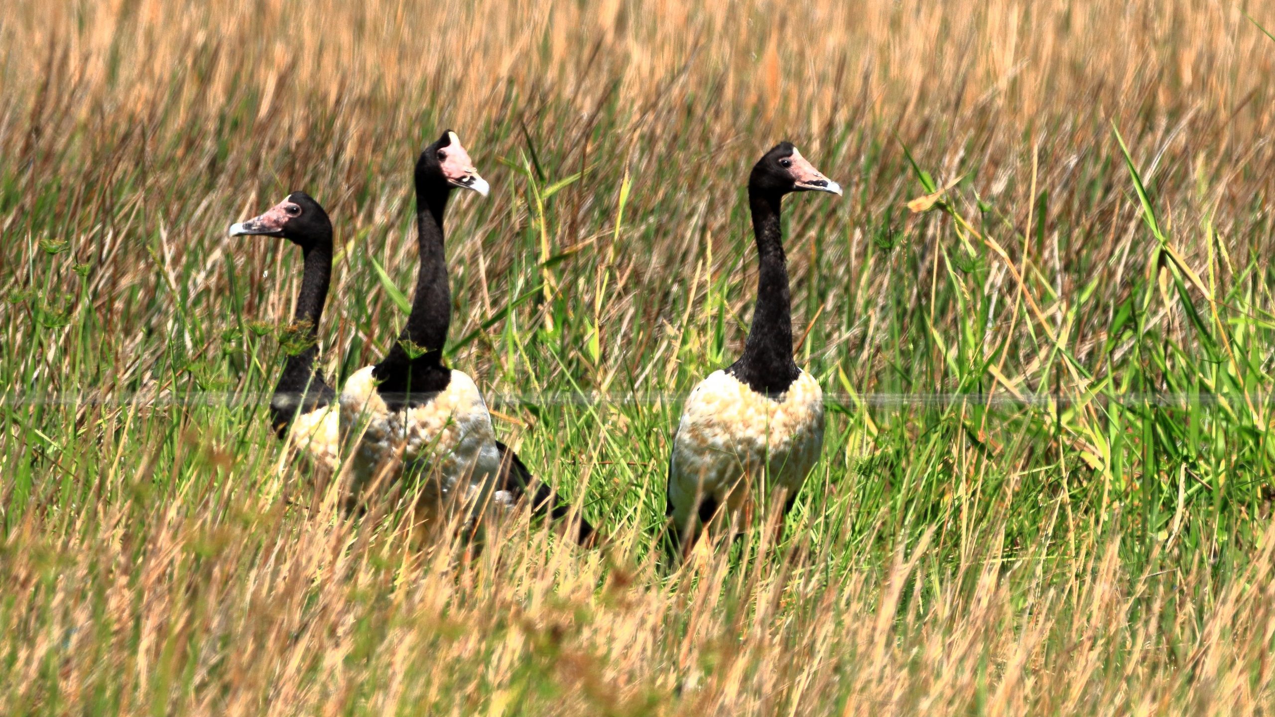
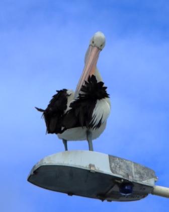
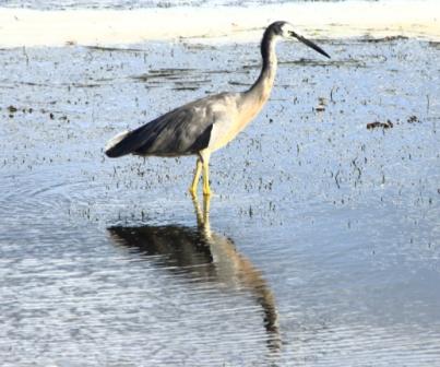
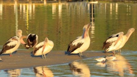
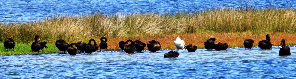
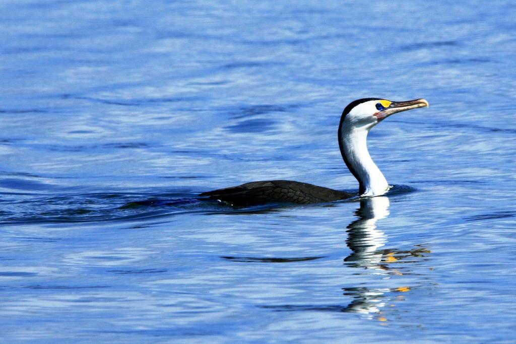
We returned to Mareeba to revisit Coffee Works, a local success story, for morning coffee, before continuing north on the Mulligan Highway. We had intended to call into the nature reserve at Lake Mitchell, but the gate was closed, and the track did not look very inviting. We drove on. The highway runs beside a wetlands area that is part of the dam. There we found a Great Eastern Egret and a flock of Magpie Geese, both feeding in the pools. There was also a Pelican, but out of camera range.

View north east from the highway above Mosman.
The coast towards Daintree National Park
Daintree River ferry that provides the road link to Cape Tribulation.

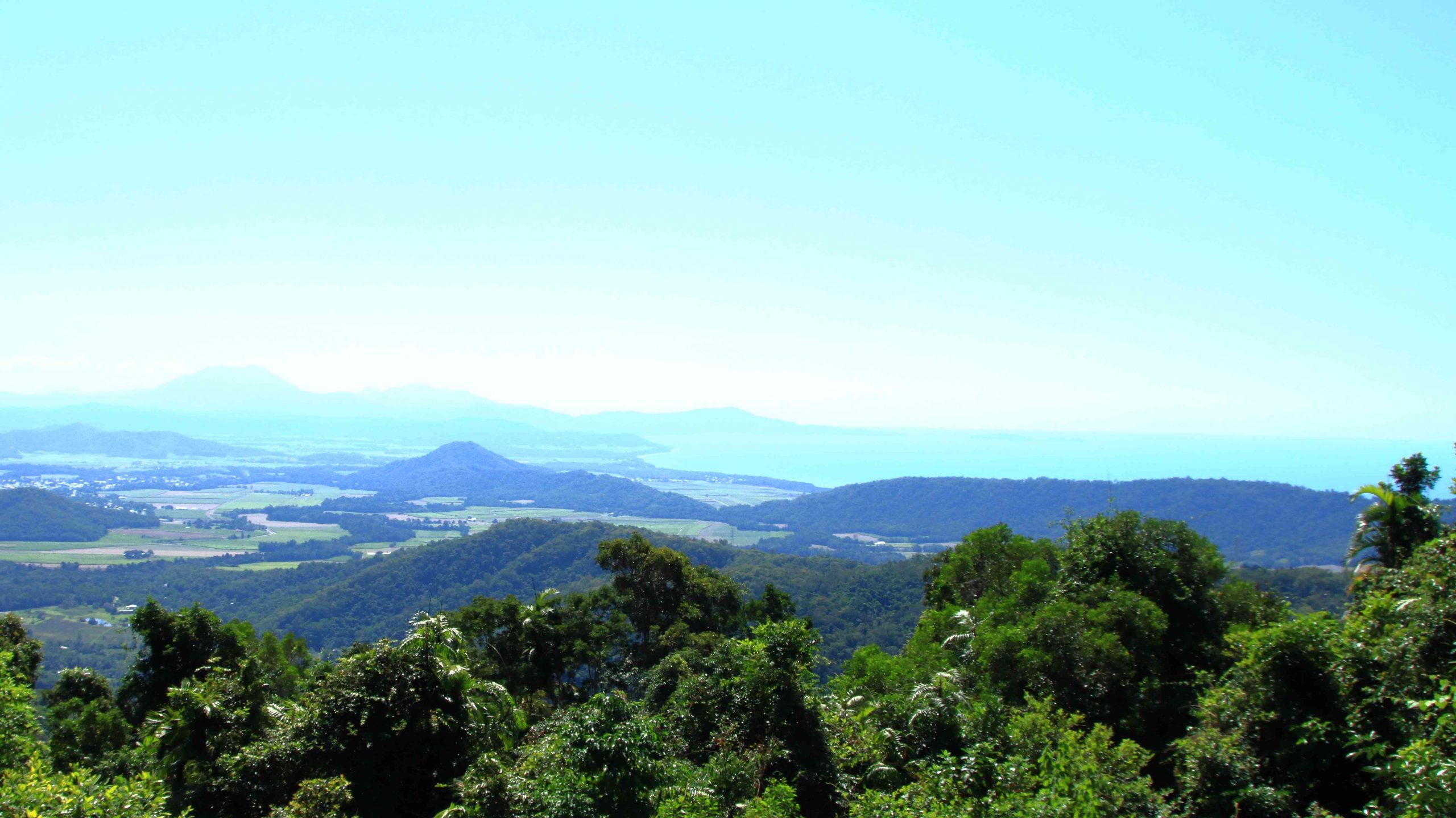
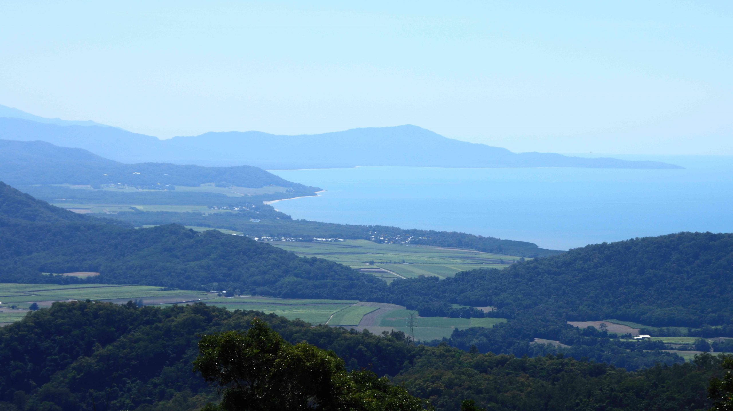
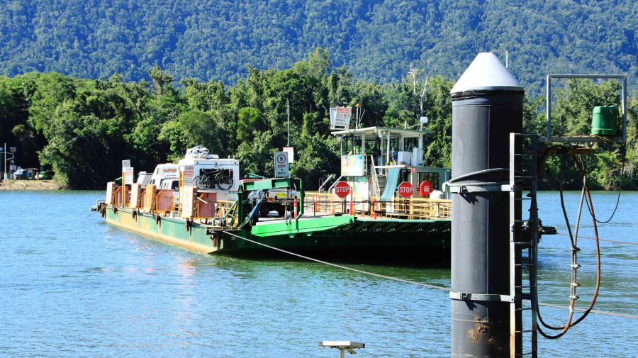
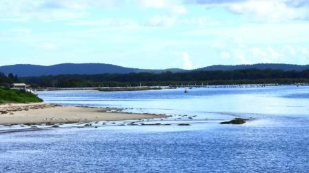
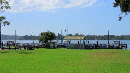
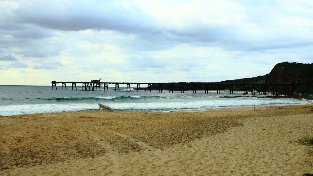
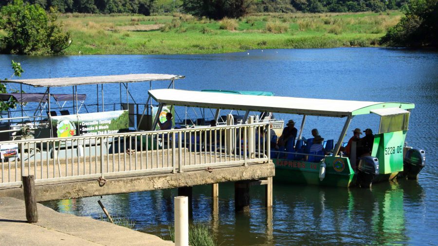
We passed through Mount Molloy and took the right hand turn towards the coast and Mossman. There are two lookouts as the road begins its decline to the coast. Both give excellent views of Mossman and the coast to the Daintree River and to the ranges of the national park. We lunched at Daintree Village and photographed some Straw-necked Ibis in the park, before driving down to the Daintree River ferry. The crocodile tours along the Daintree River were doing a great trade, boosted by visitors from Coral Princess.

Crocodile viewing cruises on the Daintree River.
Coral Princess awaiting its passengers.

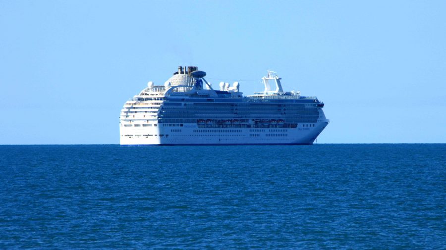
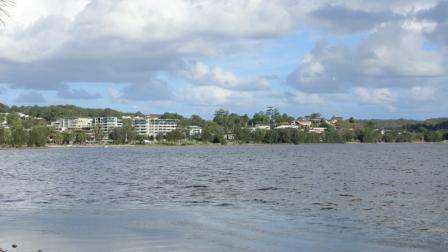
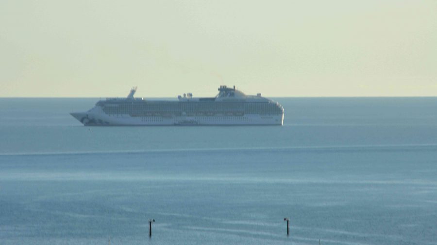
As we approached Port Douglas, we could see the Coral Princess anchored off the port. We called our passenger friends, but they were still on a day tour near Daintree. They are probably thankful that they missed us as I, at least, was incubating Covid at the time.

A view south from Flagstaff Hill at Port Douglas.

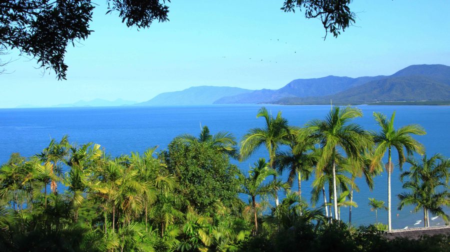
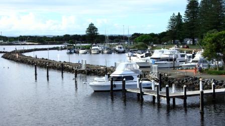
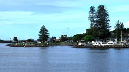
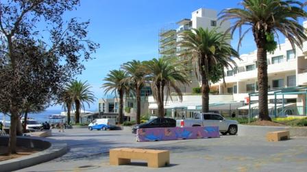
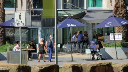
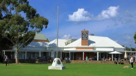
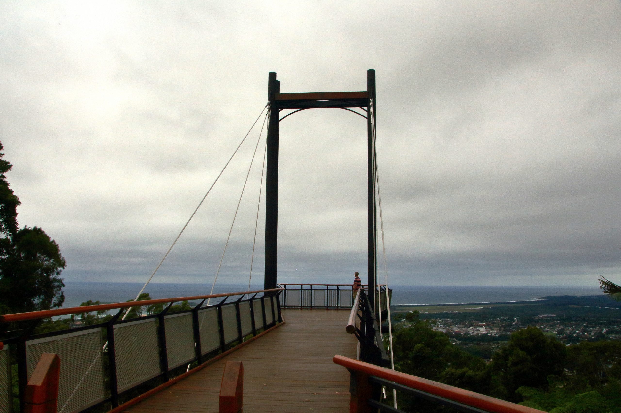
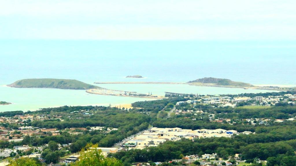
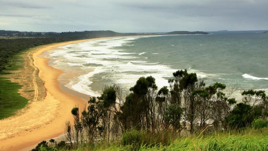
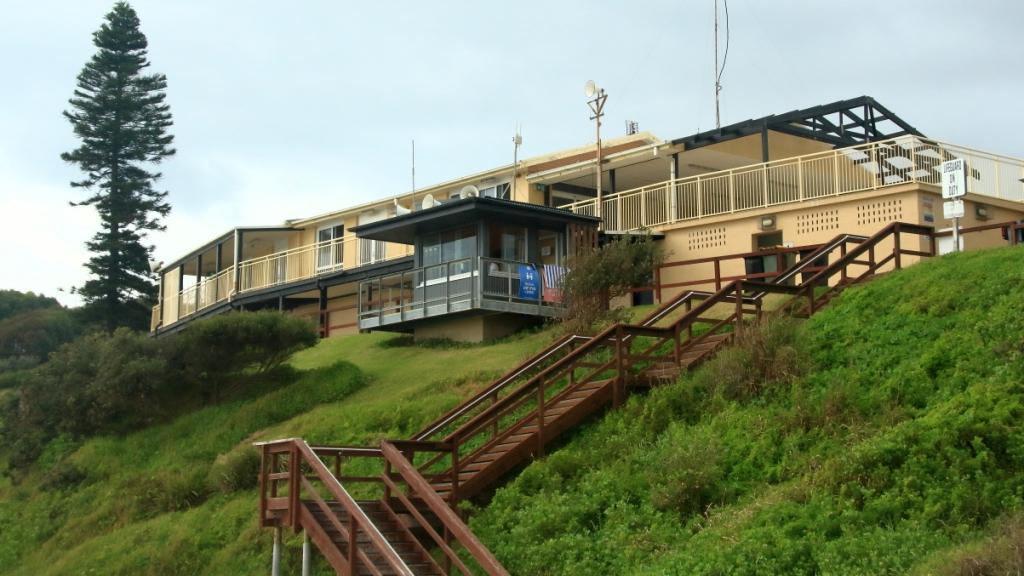
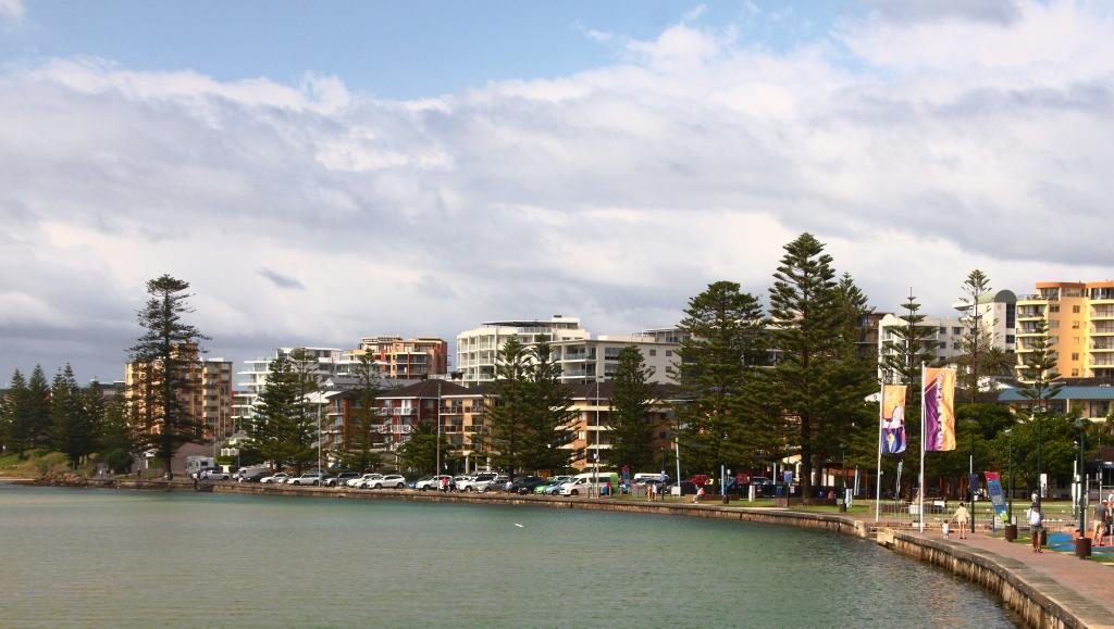
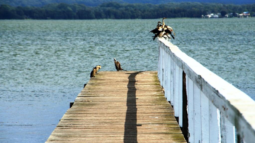
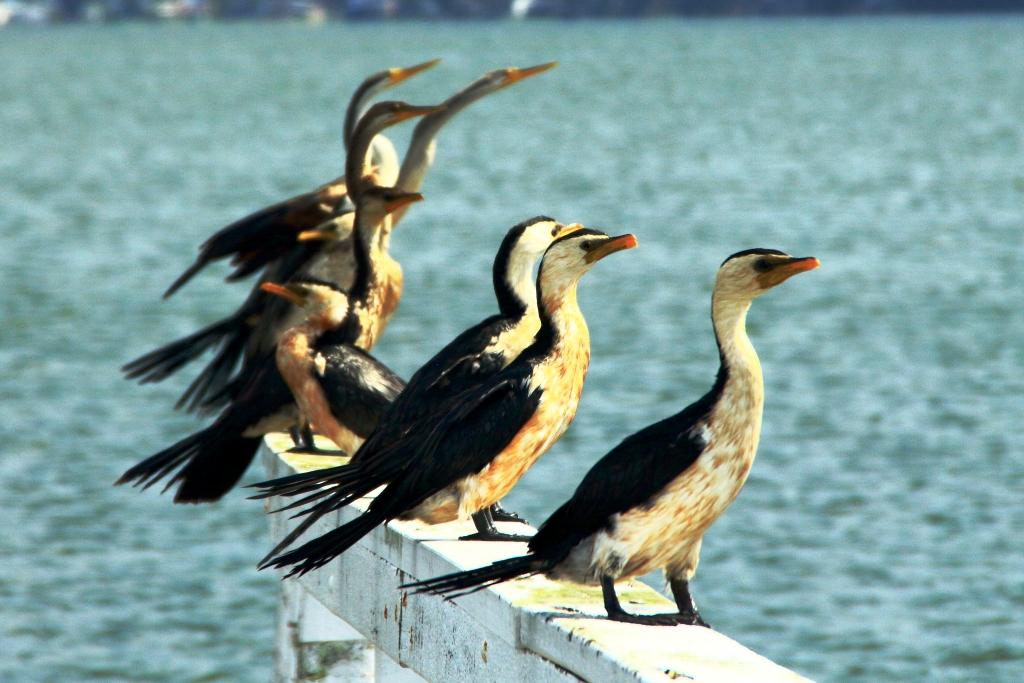
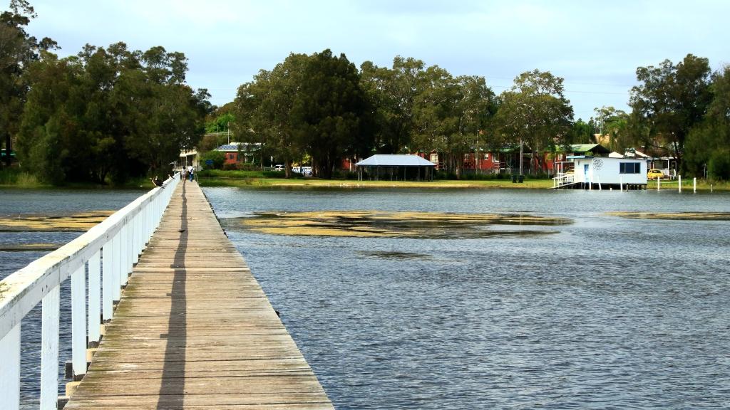
We had two nights at the Ramada Resort at Port Douglas. Since we had been through the area a number of times on previous trips we had decided on a quiet day. We checked out Four Mile Beach and spent time in the town area, We had visited the famous Flagstaff Hill Lookout, with its views along the beach to Cairns, the previous afternoon. We finished the day with room service dinner, a bit later than planned because the hotel lost our order.

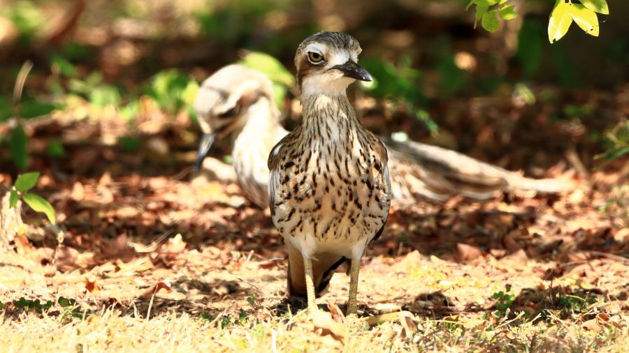
We made a pre-breakfast start from Port Douglas next morning, as we had a 400+ km drive to catch the ferry at Townsville, to cross to Magnetic Island. We breakfasted at North Cairns and continued south. We diverted at Cardwell into the cyclone damaged Hinchinbrook Resort. There we found that most houses seem to have been repaired and reoccupied, but the marina, which was the centrepiece of the resort, remains in ruins, so there is no real resort anymore. But I did spy a pair of Bush Stone-curlews in the shade of a shrub on the rather broad media strip and got some photos. I had not previously photographed this bird. So, another “lifer” on my list.

Bush Stone-curlews at Hinchinbrook Resort at Cardwell.

I wasn’t feeling particularly well from the start of the day, so before we joined the queue for the Magnetic Island vehicle ferry, I decided to do a test for Covid-19. I returned a positive test so that was effectively the end of this trip.

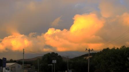
Getting home was not a great amount of fun but with a highlight. We reached Proserpine at dusk and as the sun set, we were enveloped in a radiance of colour that reached across the sky from East to West and in front of us to behind us as well. The colour was a golden purple that faded as night fell. I was too intent on getting home to stop for a photo, but I now regret not doing so. But I do wonder if the camera would have done the colours justice.

The rest of the trip was to have taken us not only to Magnetic Island but then to Mackay and through the coal fields of the Bowen Basin to Emerald, Longreach and Winton. We are hopeful of completing the trip around the end of September.

The Family Responsibilities Tour – Part 3

Note: A video covering the material in this post can be found at the foot of this blog post.

Excess water released from Hume Dam

We left Phillip Island amid showers sweeping across Westernport Bay and the adjoining coastal plains. Our route lead along the South Gippsland Highway, Monash Freeway, skirting around the city to reach the Tullamarine Freeway and finally to the Hume Highway. We were headed to Bright to see if Autumn had yet reached the area, famous for its Autumn colours.

Afternoon tea on the lawn
Bright Cenotaph
More colour in Bright
Rosella in the tree on the lawns

We only took necessary breaks, arriving in Bright in the late afternoon. Our motel backed onto lawns that run down to the path that runs along Ovens River. We look our afternoon tea to the lawn and were joined by some Parrots.

Early Autumn at Bright

The Liquid Amber trees were turning nicely but the Poplars and other deciduous trees had only just started to put on their show.

We left town next morning via Yackandandah, a nearby town also known for its colours, but it seemed to be running later than Bright.

We were bound for Hume Dam on the Murray River to see what it looked when when full. Excess water was being released to a huge roar, in sufficient quantities to fill the river down stream to the top of its banks. When we came through there on our way home from Tasmania two years ago the water level was well below the spillway and further up stream, cattle were grazing on river flats that had been exposed for years but now are inundated by the water in the dam.

Sunlit clouds over Goulburn.
Lake Hume, full to the brim

We made our way to the Hume Highway and continued on to Goulburn for the night.

Heavy rain was forecast for the recently flooded North Coast of NSW so we decided to cross the Blue Mountains and make our way home inland. But first we wanted to see the recently overflowing Warragamba Dam. Warragamba was not far off our track.

Warragamba Dam, also full to the brim
Water released into the Warragamba River.

We thought that refreshments might be available at the visitor center at the dam, but no such luck. We did our tourist thing under increasingly threatening skies. Walking back from an observation point I took a wrong turn and came upon a pair of Rosellas. Then a Wonga Pigeon landed on stairs behind me, the first of this type that I had seen.

The visitor centre overlooks the dam

Soon, after departing the dam, the sky opened and stayed that way. As we approached the Great Western Highway, traffic congestion was becoming an issue so a quick change of plans and we were on the highway heading west. With the rain still falling and a stop becoming necessary, we found a convergent McDonald’s and stopped for lunch. Back on the road the rain continued to well on the way to Mudgee, our next overnight stop.

Wonga Pigeon at Warragamba Dam

Mudgee is a week end town, thriving on visitors from the coast, so they have their weekend on Monday and Tuesday. We were there on Monday night and found most restaurants were closed. The Chinese restaurant at the Gold Club was recommended. They served excellent food in huge quantities. We only eat half the food served to us but were able to take the leftovers. They were sufficient for dinner the following night.

Silo artwork at Dunedoo in Central NSW

Next morning, we had passed through Gulgong and Dunedoo when a phone call from last night’s motel advised that I had left my binoculars behind. So, after returning the necessary 85 kilometres, we had coffee and started again. We left Mudgee, this time by the Ulan Road, then through Binnaway so saw some new country. Lunch at Coonabarabran and a stop for the last night at Moree to rest and deal with leftover Chinese food.

Vineyard near Mudgee

The plan was to do the last leg of the journey via the Gore Highway to Toowoomba and then the Warrego Highway to Brisbane but as we left Goondiwindi a roadside sign advised that the Gore Highway was closed. So on through continuing rain with a stop at Warwick and arrived home mid afternoon. 

Eighteen days and a bit over 5,000 kilometres with average weather and escalating petrol prices. But we saw all of the relatives that were planned and respects paid at two grave sites. In all a successful trip. 

The Family Responsibilities Tour – Part 1

Note: A video covering the material in this post can be found at the foot of this blog post.

Apsley Falls in full flow. Walcha NSW.

On 23rd November 2021 I lost both my eldest brother, Ivan, and my brother-in-law Colin, my only sister Aileen’s husband. Colin passed in the morning, Ivan in the early evening. Ivan was in the northern suburbs of Newcastle and Colin at Moe in Victoria’s West Gippsland region. There was no connection in their deaths, just one of life’s coincidences.

Covid-19 was at its high point, with borders closed in some states but not in others. We could have travelled to NSW, possibly to Victoria, but we would not have been permitted back into Queensland. We faced a real travel ban. So we had to provide our condolences and the support that we so much wanted to give by phone call, email and text message. We decided that as soon as possible after borders opened, we would travel south to visit grieving relatives and graves.

The opportunity came in March. With borders open and three vaccinations completed we headed south on 12th March, just four days after what would have been Ivan’s 88th birthday celebration.

Apsley Gorge. Walcha NSW

Our intention had been to first spend a couple of days with friends in Ballina, but they had been evacuated a few days before due to flooding of the Richmond River, which had closed the Pacific Highway from Ballina to south of Grafton. Their home was not inundated, and they returned to it after a couple of days, but a visit was not practical so soon after the floods, so we opted for the New England Highway.

Our first family call was to Marjorie, my sister-in-law, who requires constant care and who had gone into respite care in a retirement home in Bulahdelah, which is located about an hour north of her home in Newcastle. You will possible have read of Bulahdelah in the pages of these blogs. It is the town near which I spent the first 15 years of my life and where I met Ruth, my wife of almost 60 years. Ruth, of course, has been part of all the travels covered by the mobilesheathers.com blogs.

Apsley Gorge. Walcha NSW
Forster-Tuncurry Bridge on Wallis Lake

We spent the first night in Armidale. On day two we drove south to Uralla and there turned to join the Oxley Highway at Walcha, to reach the coast again. When we travel for almost any reason we are touring and taking in sights and points of interest along the way. We had been hoping for some early Autumn colours in the roadside trees so were a bit disappointed by the lack of colour, but the area had not progressed far into Autumn but it was very green from recent rain.

But just east of Walcha the Apsley Falls were at their thundering best. On our previous visit, back in our caravanning days, the drought was it its height and there was not even a trickle of water on the falls, just a pool of brackish water at the bottom. Viewing facilities at the falls are excellent. Ruth was able to make her way to the main viewing deck and was able to see as much as I could. There are some good walks at the falls, but time did not permit. We had appointments to keep.

Wallis Lake, Forster NSW

We paused for lunch at Wauchope and made it to our motel at Forster, at the mouth of Wallace Lake, in good time. Time to fit in a walk! So, with camera in hand, I set off for the bridge that spans the lake at a narrow point between Forster and neighbouring Tuncurry. The bridge is about one kilometre long with a hump on each end to allow boats to pass underneath.

Resort building beside Wallis Lake

An area south of Forster, Tiona, was a favourite holiday destination during my childhood, as it offered a range of options for my fishing loving Father. There were two ways of getting there from where we lived back then. If we came via Tuncurry the car and trailer (containing our camping equipment) would be loaded onto a small punt which was pulled through the meandering channel to the other side. Now the sand bars that shaped the channel carry the pylon foundations that support the bridge.

The bridge provides a scenic vantage point for both towns, Wallace Lake, and the entry to the lake from the ocean. Ever watchful for sea birds I noticed an Eastern Osprey making long sweeps over the lake in search of dinner, or perhaps a late lunch. After several failed attempts, it landed on a bridge street light and remained on its perch as I walked past taking photos of it. A call at the ocean beach and it was time to return to the motel for dinner.

Wootton School now a community centre

The easiest route from Forster to our next call at the retirement home at Bulahdelah was to fallow the Pacific Highway but a more interesting way was to leave the highway south of Coollongolook and followed The Wootton Way to where it re-joins the highway just north of Bulahdelah. This detour took us past a school that I attended for a couple of years during primary school and past the property on which I and my family lived for about 5 years prior to moving to Victoria when I was 15.

Tall strait trees

The school is now a community centre and the town much smaller than it was 70 plus years ago. The road is sealed as, for a time, it was the Pacific Highway. Further on we drove through magnificent stands of white-trunked trees, typical of the area. Further on we came to the property where our house stood near the road. The house was moved shortly after we vacated. New owners built further back on the property, behind the tree line and have operated a farm stay business for many years.

The old shed in which I milked the house cows

We arrived at the nursing home in good time next morning to complete the Covid safety procedure before visiting sister-in-law Marjorie. We found her in good spirits despite having been told a few days previously that the nursing home was to close thus causing uncertainty about her future. We stayed for morning coffee and lunch before making our way further south. Happily, Marjorie’s future accommodation arrangements were settled a few days later when her two daughters completed arrangements for her to take up residence on the top floor of a facility near Lake Macquarie in Newcastle, where she will have views of the lake as well as, we hope, good care.

Bulahdelah Alum Mountain
The sloping lawns of the Lake Macquarie Memorial Park

We stayed two nights at Warners Bay, our motel overlooking the northern end of Lake Macquarie. Ivan is buried at Lake Macquarie Memorial Park at Ryhope, just a few hundred metres off the Pacific Motorway, south of Newcastle. A very convenient location for paying our respects during future trips south.

Warners Bay viewed across the lake

We met Ivan’s two daughters with their respective spouses at the park. They showed us to the grave site, already almost covered with grass. The plaques are under way and should be in place when next we call. The grave is in a pleasant area on the side of a gently sloping hillside. The entire garden area appears to be well kept and will continue to be so. We left the cemetery and drove to the sports club in Toronto where we lingered over coffee with nieces and nephews that we rarely see.

White-necked Heron at Warners Bay

The afternoon was fine and sunny so we parked, and I took a walk on the path provided between Warners Bay and Speirs Point. It is not always possible to keep up my walking schedule when we are travelling, so such opportunities are not to be missed. As a bonus there were birds to photograph, including a White-necked Heron, a first sighting for me.

Next morning, Tuesday, we took the short drive to the home of Ruth’s elders sister Judy and her husband Alan, at West Wallsend. Judy has mobility problems but maintains a positive attitude which is most demonstrated by her determination to keep travelling. So over lunch we discussed, as well as family, travel plans and experiences. Visit over, we headed for Sydney.

Cronulla Beach

We were to have spent two nights with our daughter Briony at her Erskinville home, but she had come down with a non-Covid virus that we did not want to catch. A quick change of arrangements took us to the Travelodge at Bankstown, a bit of an experience as it is also the Bankstown Sports Club. Temporary club membership was bestowed upon us so that we could use the facilities of the club.

Coffee shop at Cronulla Beach

On our second night with Briony we had planned to meet Ruth’s youngest sister Dorothy (Dot) for dinner. So, a quad became a threesome at the NEM Riverwood Vietnamese restaurant, for good food and a good old family catch up.

Ferry terminal at Bundeena

To fill in the intervening day we revisited old stamping grounds from the first period of joint residence in Sydney during the time of my appointment to East Coast Transport at Botany. We started with morning coffee at Cronulla, right on the water on a lovely sunny morning. We then drove past Miranda Fair, where we used to do our shopping and stopped for a look at our former residence at 4 Tulong Place, Kirrawee. This house was built on top a couple of huge boulders, with views over the Royal National Park. Every time I see this house, I wish that we still lived there.

Bundeena main street

Next, we drove into the Royal National Park to the town of Bundeena on the southern shore of Port Hacking. This was to have been our lunch location but, after a largish morning coffee we were just not ready for more food. After looking around Bundeena we returned to the road through the park that leads to its southern coast entrance at Otford. At this point you will find one of the best scenic lookouts in Sydney. Otford lookout has an elevated viewing platform, heaps of parking space, a kiosk and views over the coast and from Sea Cliff Bridge to Port Kembla. We had a snack there before driving back through Stanwell Tops and Waterfall to Bankstown and dinner.

The following morning, we left Sydney early and drove to Bowral in the Southern Highlands of NSW, to call on Ruth’s youngest brother Wallace and his wife Ginny. Wallace is in advanced stages of a degenerative disease (similar to Parkinson’s disease) so our visits are relatively short. We joined them for lunch and family news. These calls are always sad and happy events because you never know if each one will be the last.

View from the Monaro Highway

Our destination for the night was Canberra. We were joined for breakfast next morning by grandson Jeremy who now works in the National Capital. The remainder of the day was spent driving via the Monaro Highway to its junction with the Princes Highway at Cann River. Then the run through the East Gippsland mountains and Orbost brought us to Lakes Entrance for the night.

There is always bird life at Lake Entrance, so the long lens got some use that evening and again on my walk next morning. Swans and Pelicans predominate, but there are many others. After leaving Lakes Entrance we detoured to Metung for morning coffee, lunched in Traralgon and arrived at our accommodation in Trafalgar in time to unpack and go out to find some dinner. 

Relative Travel – Days 10 to 14

At breakfast, I confirmed with my niece that a left turn back at the main road, the Old Hume Highway, would take us through Camden and Picton.  I used to know that road well until it changed its character completely, when multiple suburbs were built along it and it ceased to be the Hume Highway.  But I forgot the second left turn at Narellan town centre.  We were crossing Peter Brock Drive at Oran Park before I realised my mistake.

We turned and allowed Google Maps to guide us over several country roads, including one called Sheather Lane, until we reached Camden. The Old Hume Highway then lead us over The Razorback to Picton, where we stopped for coffee. The wrong turn had cost us time, so the quickest route, out to the motorway and directly to Bowral, was needed to bring us to our destination on schedule. We didn’t want to be late for lunch.

The next call was very much of the reason for the trip. Ruth’s youngest brother lives with his wife in the beautiful eastern suburbs of Bowral, in the NSW Southern Highlands. Wallace and Virginia (Wall & Jinny) have lived in Bowral for many years. As time passed they bought the block in a then new area to the east of the town and built a nice house around which they have laid out beautiful gardens.

Our hostess with a regular visitor. Guess why it calls?

Sadly Wall is in advanced stages of Parkinson’s disease. Jinny is his devoted carer these days. We spent a night with them and left next morning. We had as pleasant a time together as circumstanced would allow.  It was pretty good.

Not only is Jinny a keen gardener but loves birds. Local birds know it as a good place for a regular feed. The current favourite is a Crimson Rosella that sits on Jinny’s thumb and eats out of the palm of her hand. Kookaburras call and laugh and other Australian native birds in the vicinity drop in.

For a couple of days we had been watching wet weather approach from the south. As we departed Bowral on that Saturday morning, it was clear that we were heading towards the front of the change. We reached Goulburn in slight drizzle. After coffee we took the Crookwell Road to the north, heading for a lunch stop at Bathurst. Beyond Crookwell the road passes through several kilometres of mountains, resulting in steep winding roads. It was on this section of road that the weather caught up with us. Heavy rain and gusty winds added to the challenge but there was not much other traffic.

Approaching Bathurst, we attempted to take a drive around the Mount Panorama circuit. It was not to be. From the foot of the serious mountains until the outskirts of Bathurst, road side signs warned of cycling activity in the area. We discovered that the centre for this Lycra clad event was the straight and buildings of the Mount Panorama racing circuit. Spectators were driving into parking areas and barriers protracted the track.

From Bathurst we drove through intermittent rain to Orange, Wellington and finally Dubbo, where we spent the night. The next day we followed the Newell Highway to Coonabarabran where we turned for Gunnedah.  We enjoyed views of lush green Western Plains, so different to the drought conditions of recent trips.   The grasshopper plague, part of which spread itself over the front of the car, was less welcome.  We progressed under sunny skies having temporarily left the rain behind. It really was a pleasant drive.   Morning coffee was taken at Coonabarabran and lunch at Gunnedah.

The lookout on Moonbi Hill

We joined the New England Highway at Moonbi after skirting to the north of Tamworth. This is quite a good alternative if you want to avoid Tamworth and interesting scenery, as the road runs through the collection of huge boulders known as the Moonbi Gap.  A short side trip took us to the summit of Moonbi Hill.  From there we drove to Armidale for the night.

The view Tamworth from Moonbi Lookout

Sunday 14th April dawned in Armidale with blue skies overhead but heavy cloud to the south west. We could have kept to the New England Highway by continuing north, but we figured that we could make it along the Waterfall Way and check out the area after recent rain, before more rain fell. So off we went.

Bakers Creek Falls are a series of smaller falls

There is a lot to see along this road but we stuck to waterfalls. The first call was at falls that we had not previously visited.  About 20 km east of Armidale you turn to the right into Old Hillgrove Road, which starts as a narrow sealed road but quickly changes to corrugated gravel.  The road leads down a hill, over an old wooden bridge over Bakers Creek and up the other side to a small car park hidden behind trees. A rough bush path leads to a surprisingly elaborate timber viewing platform that provides good views of the falls. It is a good spot and worth the roughish road.

Bakers Creek flows down this gorge from the falls.

From Bakers Creek Fall you can continue on Old Hillgrove Road to the historic mining town of Hillgrove, returning to the Waterfall Way via Stockton Road, that is now the main access to Hillgrove. We retraced our steps to Waterfall Way, having visited Hillgrove on a previous journey.

Wollomombi Falls viewing deck

Next up was the Wollomombi Falls. Just a few kilometres along the Waterfall Way the turn again is to the right. A sealed road leads for about a kilometre, through a farm, into the Oxley Wild Rivers National Park.  It is then only a few hundred metres to the day visitors’ area located on the edge of the gorge. The falls can be viewed through the trees at the edge of the picnic area, but a better view is had by taking a short walk to a commodious viewing platform.

Wollomombi Falls

The falls, which are on the Wollomombi River, are a spectacular 150 to 230 metre drop into Wollomombi Gorge.  The elevation of the top of the falls above sea level is 907 meters.

At our last visit there was no water at all so it was great to see the falls flowing. Just downstream of the falls the Wollomombi River joins the Chandler River which empty into other rivers until the water reaches the Macleay River which flows through Kempsey and enters the Pacific Ocean at South West Rocks.

Not far along the highway, a turn to the left leads over a rise to the village of Wollomombi, where the general store provided acceptable coffee and with morning nibbles or lunch. It was too early for lunch so we nibbled with our coffee.

The top fall at Ebor Falls

Ebor is the next waterfall stop along the road but to get there you pass the turn on the right that leads to the magnificent views of Point Lookout and a trout hatchery that offers smoked trout. Today the views would probably be of clouds and fog. On the left you pass the Cathedral Rock National park and the road to Guyra.  Ebor falls are to the left before you reach the town. Views of the cascades in this impressive river are unfortunately marred by wire mesh barricades. As is so often the case, NSW authorities find it easier to erect a fence instead of maintaining tourist facilities. This is a very odd approach at a time when they are spending big on advertising programs to entice tourists to holiday in their own state. But we don’t do public tourist facility maintenance very well anywhere in Australia.

Barricades preventing access to the viewing platform
An example of deterioration
Both of the cascades of Ebor Falls

From Ebor we drove the undulating plateaux to Dorrigo where we headed to the Canopy Café at the Dorrigo National Park, for lunch. We took the mandatory walk along the Skywalk Lookout before returning to the car. As we returned to the highway the first sprinkles hit the windscreen but the deluge waited until we had descended the mountain to Urunga before it started. By the time we reached Coffs Harbour almost all of the deceased grasshoppers that had spread themselves over the front of the car were washed away.

A waterfall beside the road between Dorigo and Urunga

We stayed two nights at Coffs, in a small apartment a little to the north of the main area, with glimpses of the ocean. The heavy rain experienced over night withdrew sufficiently for us to visit the lookout on the mountain behind Coffs Harbour and to drive to Sawtell where we had lunch in a pleasant cafe in the main street. We checked out the observation points in the area before returning north along the road nearest the coast. Just a quick look in at the harbour area and back to the unit as the rain became serious again.

Observation deck at the lookout on the hill behind Coffs Harbour
A view from the deck over Coffs Harbour and the harbour
Boambee Beach near Coffs Harbour airport
Sawtell Beach and Bonville Head

The trip ended with the drive home from Coffs Harbour the next day. We had been away for exactly two weeks.

Relative Travel – Day 9 – Newcastle to Mount Annan

Sleeping water birds at a mini island in Tuggerah Lake, near The Entrance.

Our destination for the day was Mount Annan, near Liverpool, south of Sydney.  Tollways with 80kph speed limits now bypass Sydney.  You don’t see a single traffic light until after turning off the Hume Highway at Campbelltown.   With a mid afternoon ETA we had time to spare, so stayed east of the Newcastle bypass highway, travelling down the Old Pacific Highway until we turned further east to join the real coast road at Budgewoi.

Most of our drive was familiar, but not all.  We had intended to do a run into Caves Beach, just south of Swansea, but missed the turn in the new (to me) road arrangements south of the bridge over the entrance to Lake Macquarie.  But we did take a run into Catherine Hill Bay.  I wanted to see the old coal loading jetty, last viewed during an inshore tack when sailing a newly acquired yacht from Sydney to Brisbane, many years ago.

The historic Catherine Hill Bay coal jetty is under threat after damage from the bush fires in the area last year.
Catherine Hill Bay Surf Lifesaving Club overlooks the beach.

This was a coal mining area, of course.  As you approach the beach and jetty, you pass through streets lined by old miner’s cottages, many under renovation, probably reaching seven figure valuations as a result. We parked above the beach so that I could walk down a sandy ramp to the ocean’s edge to take some photos.

The entrance to Tuggerah Lake at The Entrance.
In past times Pelican feeding was a feature activity in Marine Parade at The Entrance. Pelicans still wait on a small adjacent island. They must have long memories.

We re-joined the highway via the southern access to the town, passing new houses, including large homes with ocean views and a new subdivision, down in a valley, with no views at all.   At Doyalson we turned in again to the coast, driving through Budgewoi, over the bridge that spans the narrow waterway that joins Lake Munmorah and Lake Budgewoi.  We then travelled through Toukley and Noraville to The Entrance  which we made our morning coffee and photo stop.

Residential accommodation on Marine Parade at The Entrance.

As we had approached The Entrance we both noticed water birds in Tuggerah Lake.  With morning coffee done, we returned the couple of kilometres to where we had seen the birds. I fitted my long lens and took a number of photos, including some with which I was reasonably happy.

The road bridge over the entrance to the lakes at The Entrance.
An Intermediate Egret showing some breeding plumage.
A Pied Cormorant out for a swim.

Retracing our steps, we drove through The Entrance to Long Jetty, on the eastern shore of Tuggerah Lake.  Long Jetty is both a suburb and a long jetty. I had heard of it in both forms and driven through the suburb a number of times.  Today we called to visit.

Water birds perched on the end of the long jetty at Long Jetty NSW.

The jetty is intended for foot traffic, with a hand rail on one side.  The timber deck is about a metre above the water. On the outer end of the jetty I could see a group of water birds, sitting on the rail.  My bird lens was not attached to the camera but the smaller one would do.  But on the spur of the moment I forgot to change the camera settings from general sightseeing to bird photography.  The result was photos of less quality than they could have been.  We live and, hopefully, learn and remember in the future.

A closer view of the perched birds on Long Jetty. Australian Darter and Pied Cormorants.
Long Jetty suburb at the shore end of the long jetty.
An example of what you get when you do not have correct settings on your camera.

We continued south, keeping as near to the ocean as possible, turning east for a better view of the coast whenever the opportunity presented.  Then we came to Terrigal and I realised that I had never been there.  I was impressed.  We drove through town to the bay where the launching ramp is located and where views are to be had over the bay, back to the residential and commercial development of the town centre.  This location provided views of magnificent sea cliff top houses, the kind that dreams are made of.

Part of Terrigal across the bay.

After a viewing and photo stop we drove around point Kurrawyba with its two headlands and then via the Scenic Highway to eventually reach Woy Woy.  There we did some necessary shopping and returned to the Pacific Motorway near Gosford to continue south.  So after crossing the Hawkesbury River and reaching Hornsby we were taken underground for a long sweep to the west on the M7 until we swung back east to the Hume Motorway at Casula.  It was then a quick and easy drive to Mount Annan, our destination.

The Skillion is the southern most of the two headlands on the point at Terrigal.

There we caught up with Ruth’s youngest sister Dorothy (Dot) and her family, including newly minted grandson Max. We also caught up with Max’s mum Deahna, our niece Madison, Madison’s fiancé Josh and Dot’s other half, Peter. Max’s dad had work commitments.

Luxury homes overlook the Pacific Ocean at Terrigal Beach.

After much talking and taking of refreshments, Peter took to the barbeque to produce the protein to accompany the other portions of the meal, previously prepared.  With a libation or two we all enjoyed a very pleasant evening, called to an earlier close than might otherwise have been the case by our hosts need to make early departures for work the following morning.

A final view of Woy Woy before we re-joined the Pacific Motorway near Gosford.