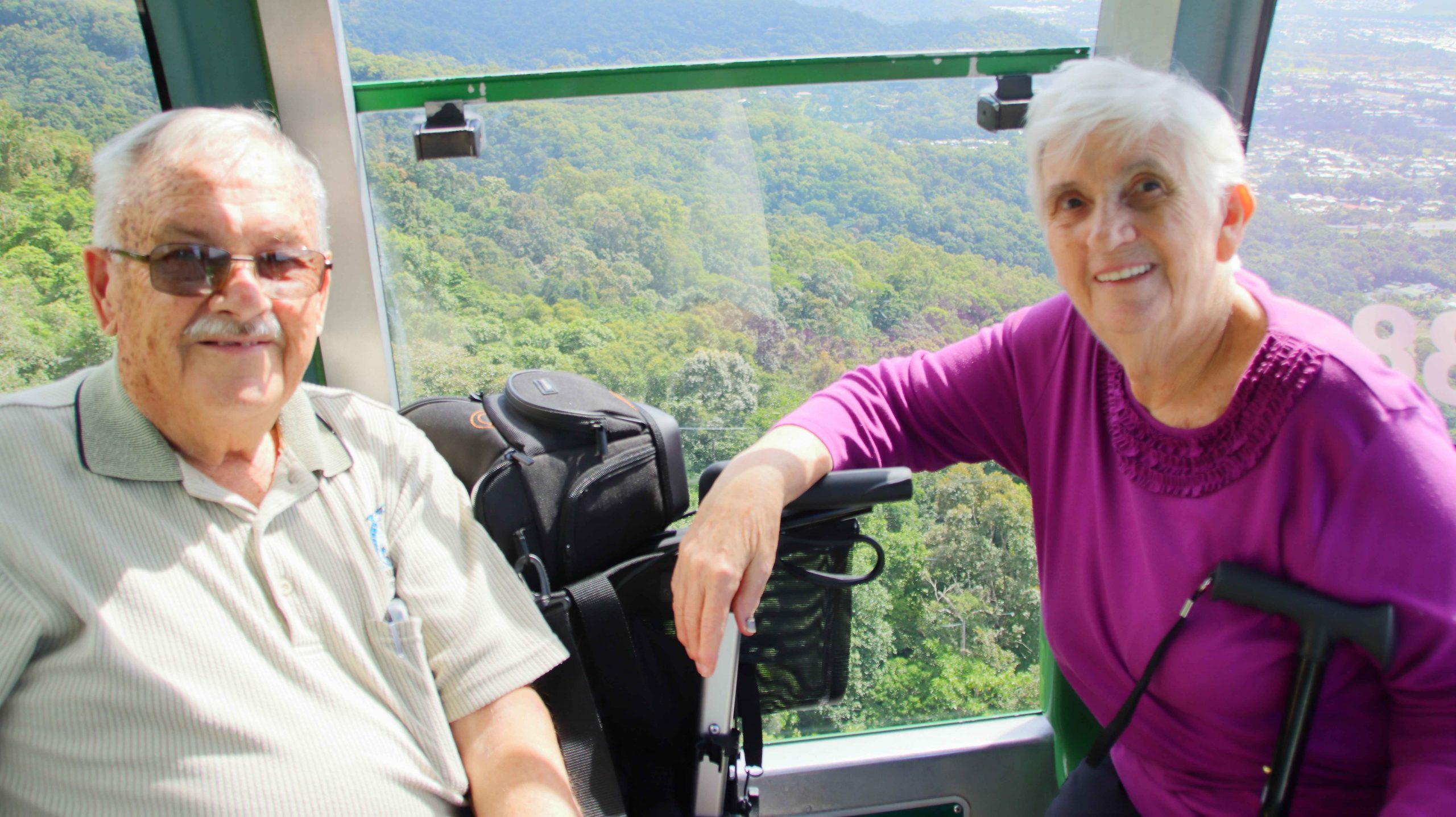
Ruth and I photographed by one of our Japanese fellow passengers
It was a big day, for both of us, but particularly for Ruth.
We were picked up from neat to our motel by the Skyrail shuttle bus and were driven directly to the Skyrail terminal at Smithfield, as we were last pick up. There were rain clouds around with a clear treat of rain, but it was holding off or the moment.
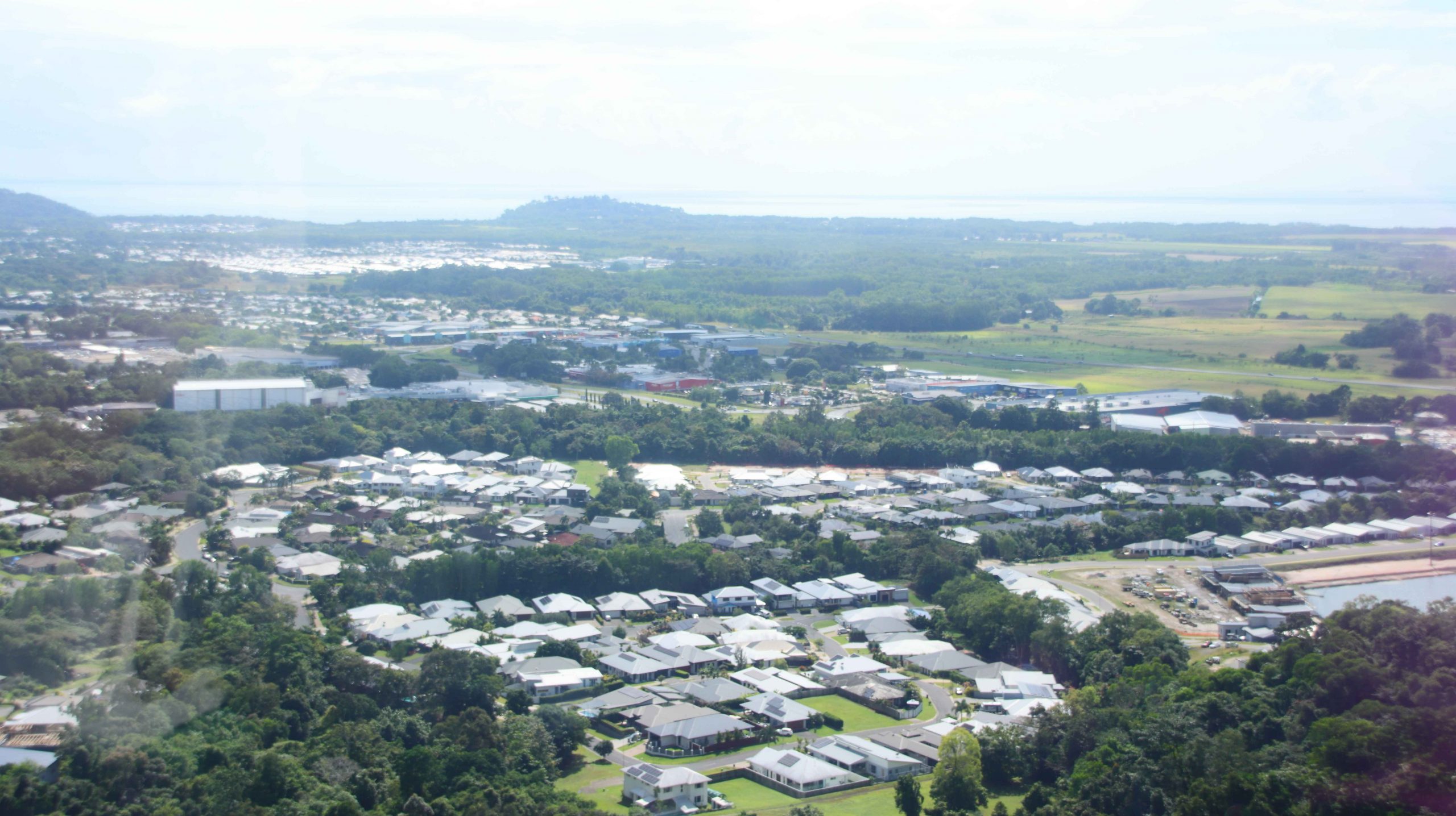
Smithfield homes, as we lifted off at Cairns Skyrail Station
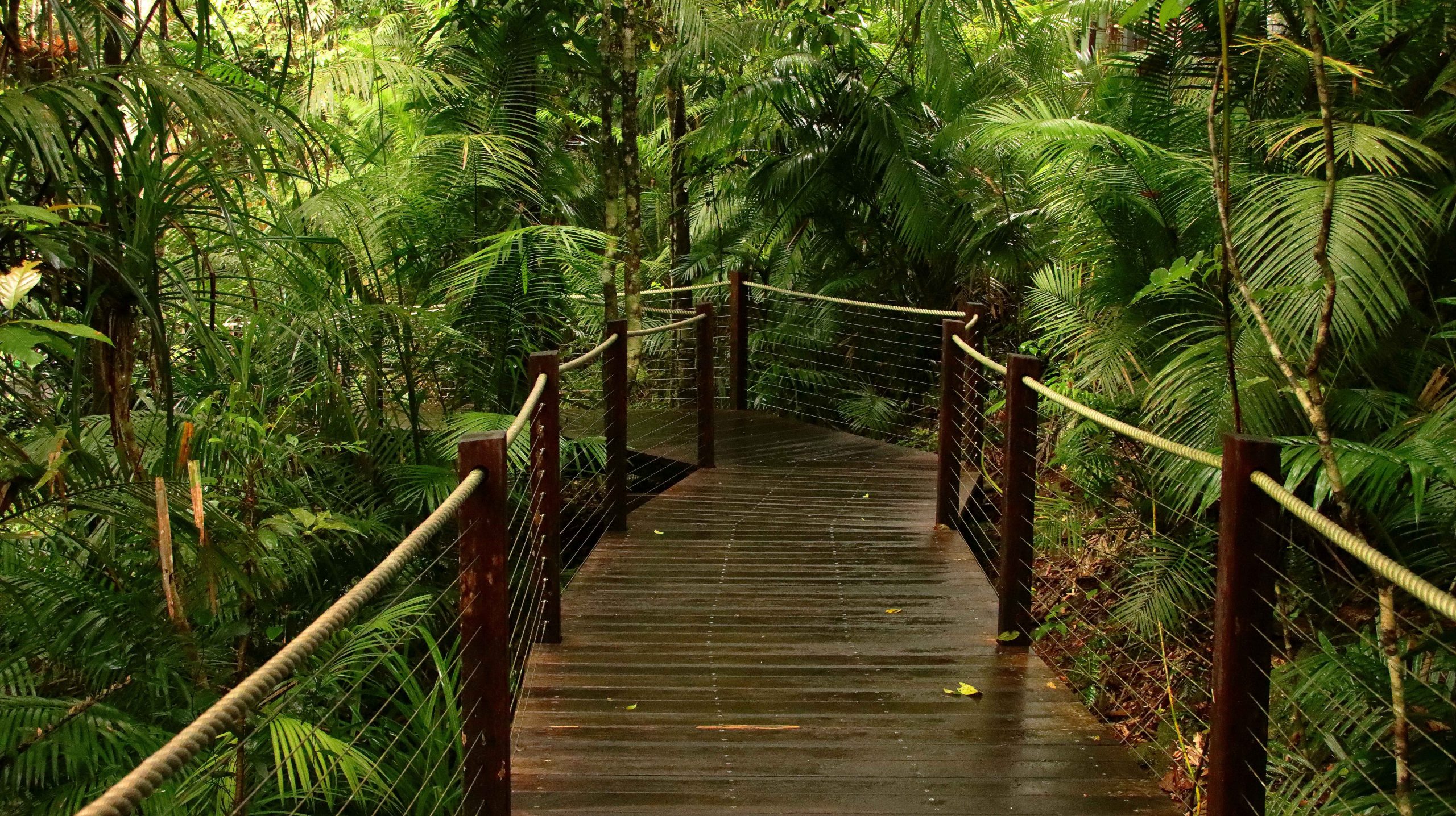
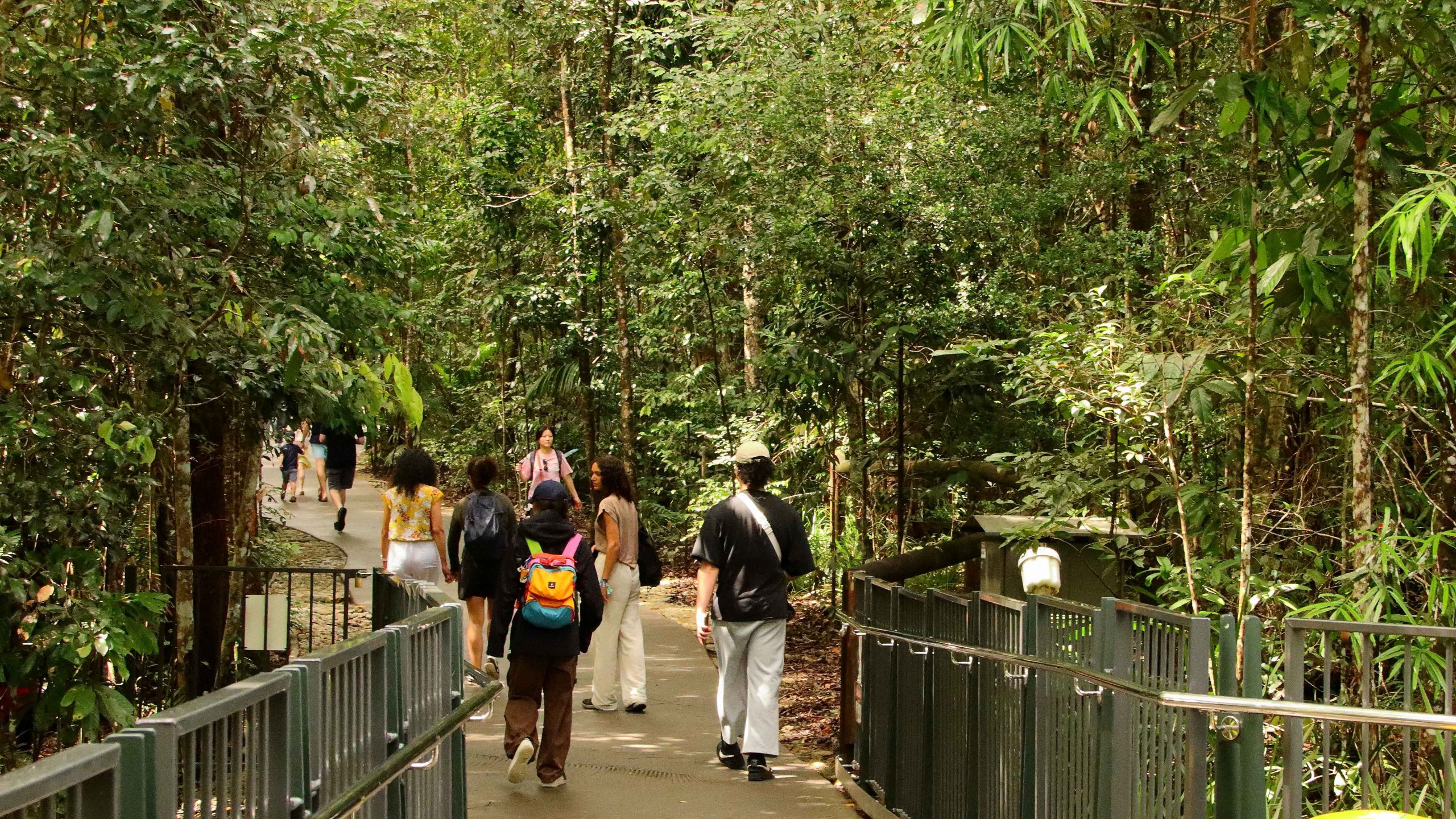
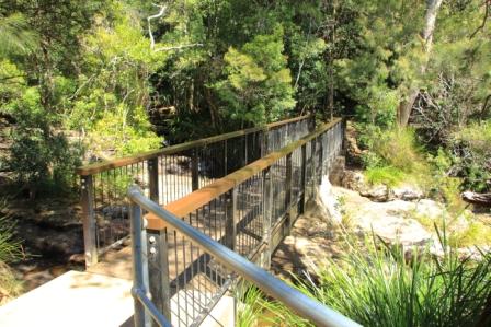
We had taken care when booking to ensure that Ruth would be able to access the Skyrail gondolas and were assured that she could be accommodated. And accommodate her they did. The Skyrail gondolas can be stopped for short periods. The whole section of the system can be stopped if necessary. But slowing was all that was required. I folded Ruth’s walker and took it on board. Staff then helped Ruth to board and get her seated. There was even time for two more people to join our gondola.
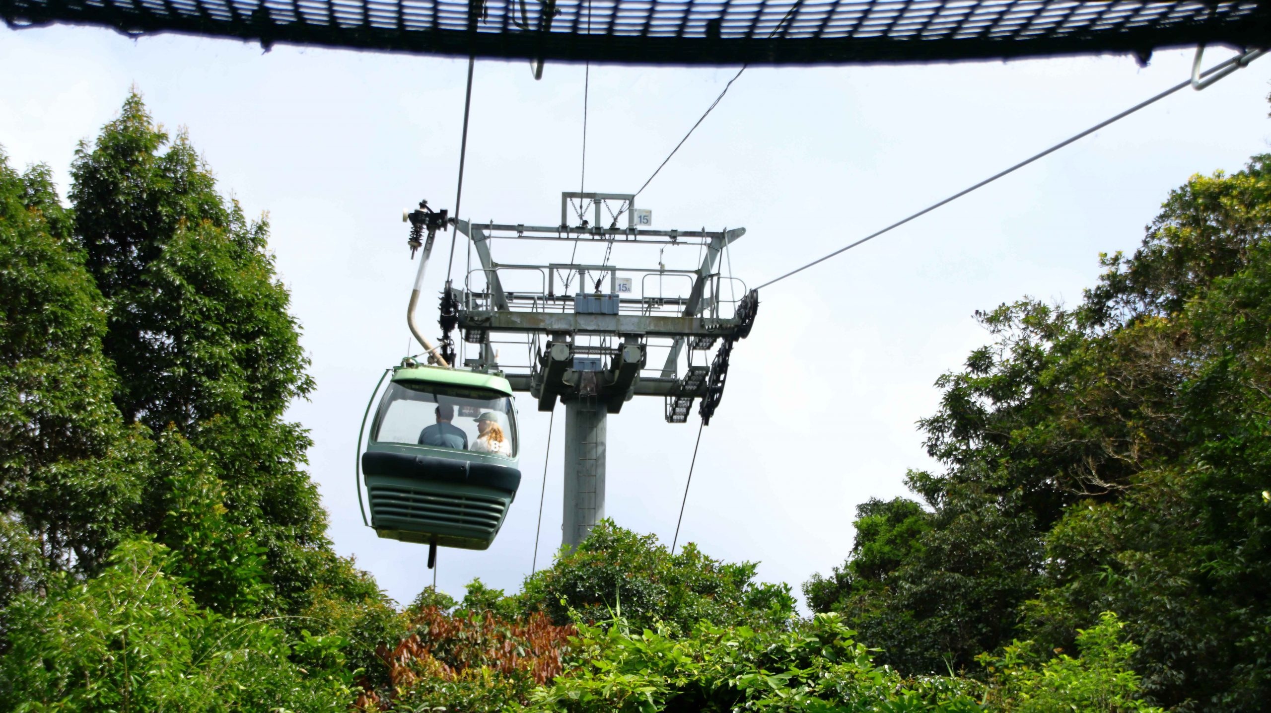
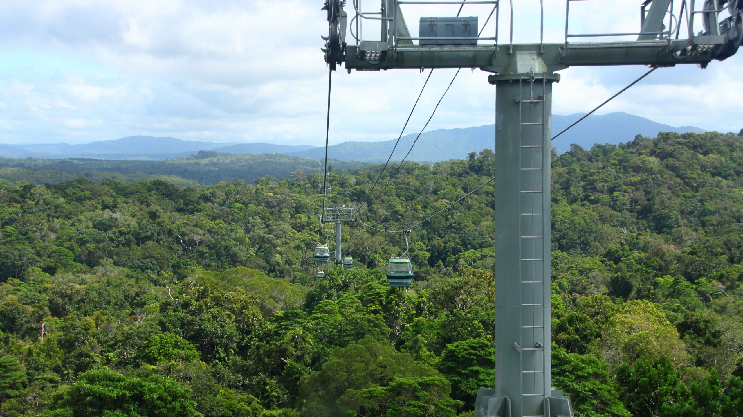
The gondola ahead about to pass a support pylon
So, we were whisked away into the air and carried towards the top of the first lift, which is also the first stop. The cable car operation is divided into two separate sections. The first lifts the cars to the top of the range to Red Peak where gondolas turn and return to the start. The Western section lifts gondolas from Kuranda through Barron Falls to Red Peak.
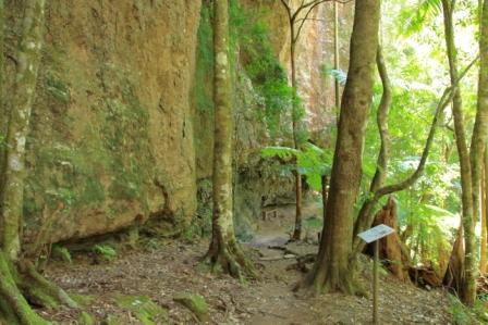
Most passengers alight at both stations. At Red Peak it is compulsory, unless you want to return to the start. The rainforest walk attracts most passengers. It is a most pleasant walk on an even surface. The walk at Barron Falls provides good views of the entire length of the Falls and much of the gorge.
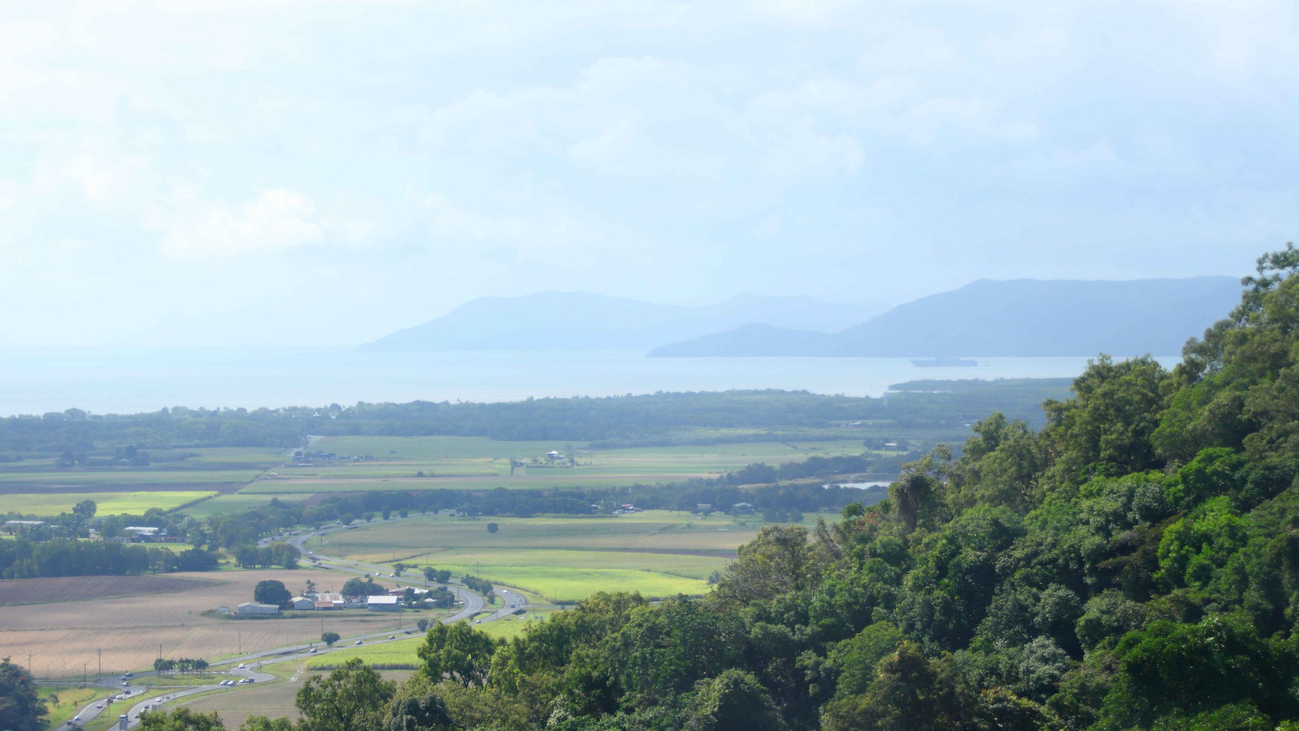
View back over Trinity Bay to Cape Grafton
Part of the Board Walk at Red Peak station
Descending towards Barron Falls
The boardwalk was very suitable for Ruth’s walker, as the grades were gentle and the pathway quite wide. Displays and signs help visitors to understand what they are seeing.
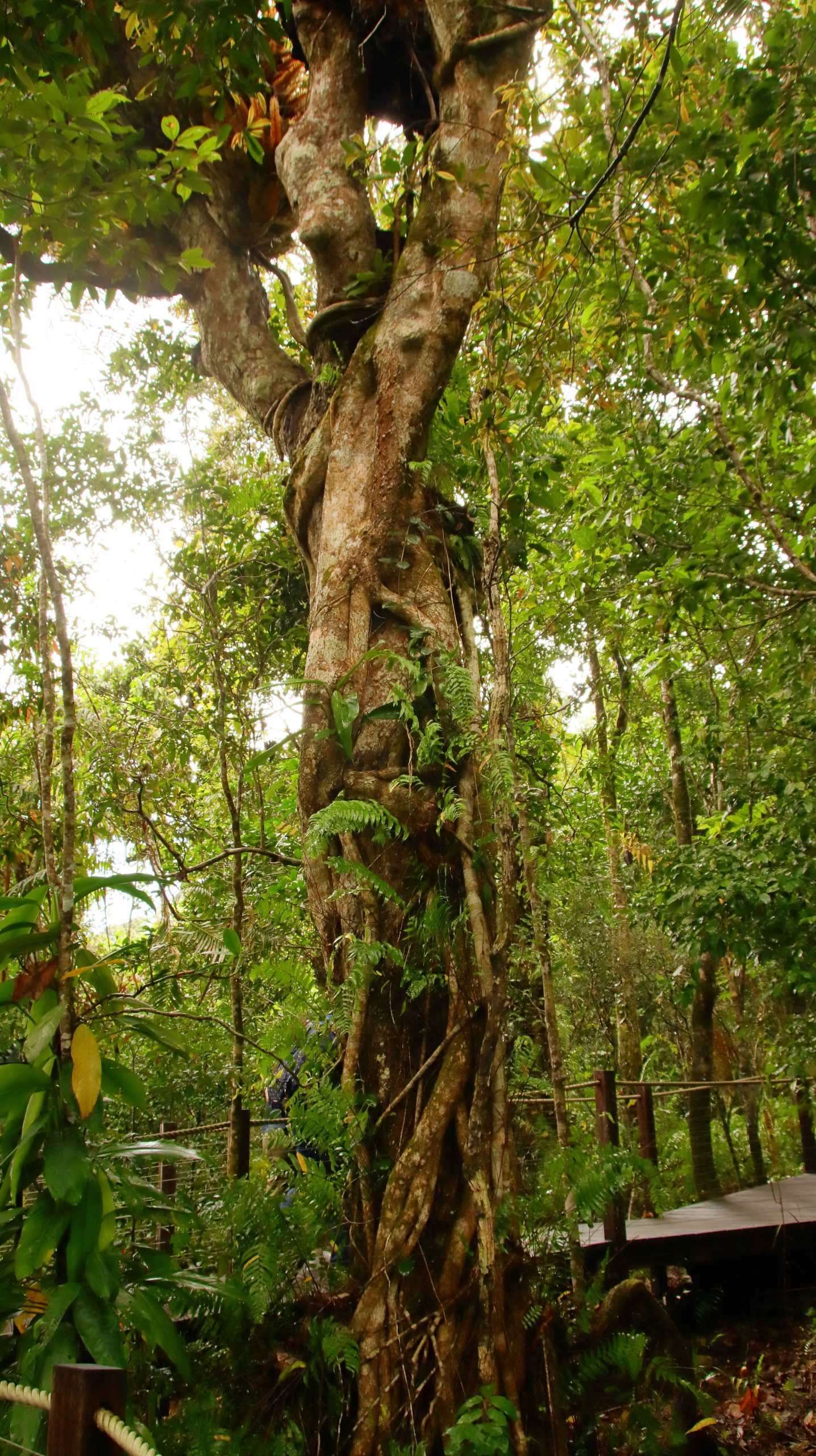
A Strangler Fig tree beside the boardwalk at Red Peak station
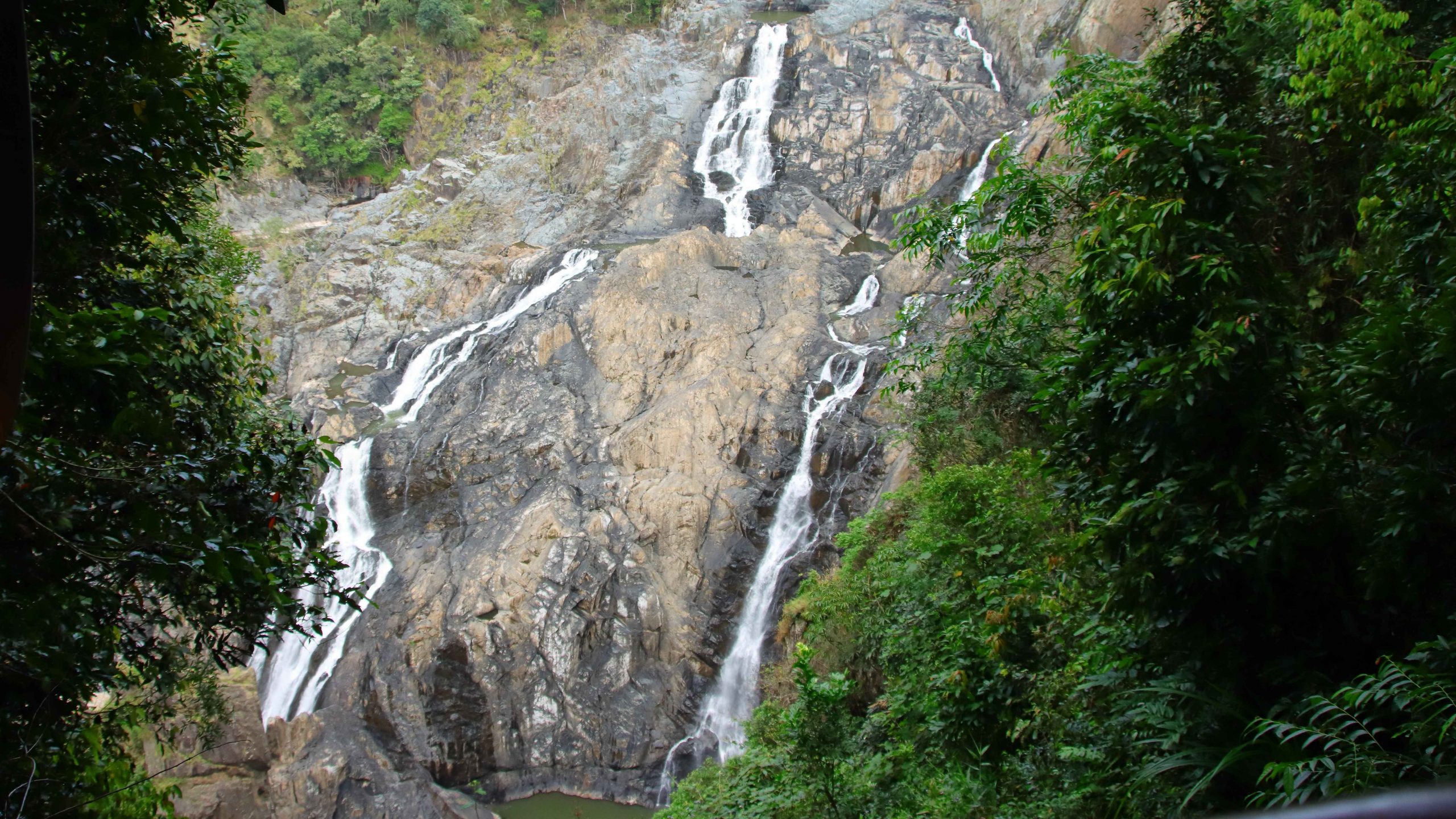
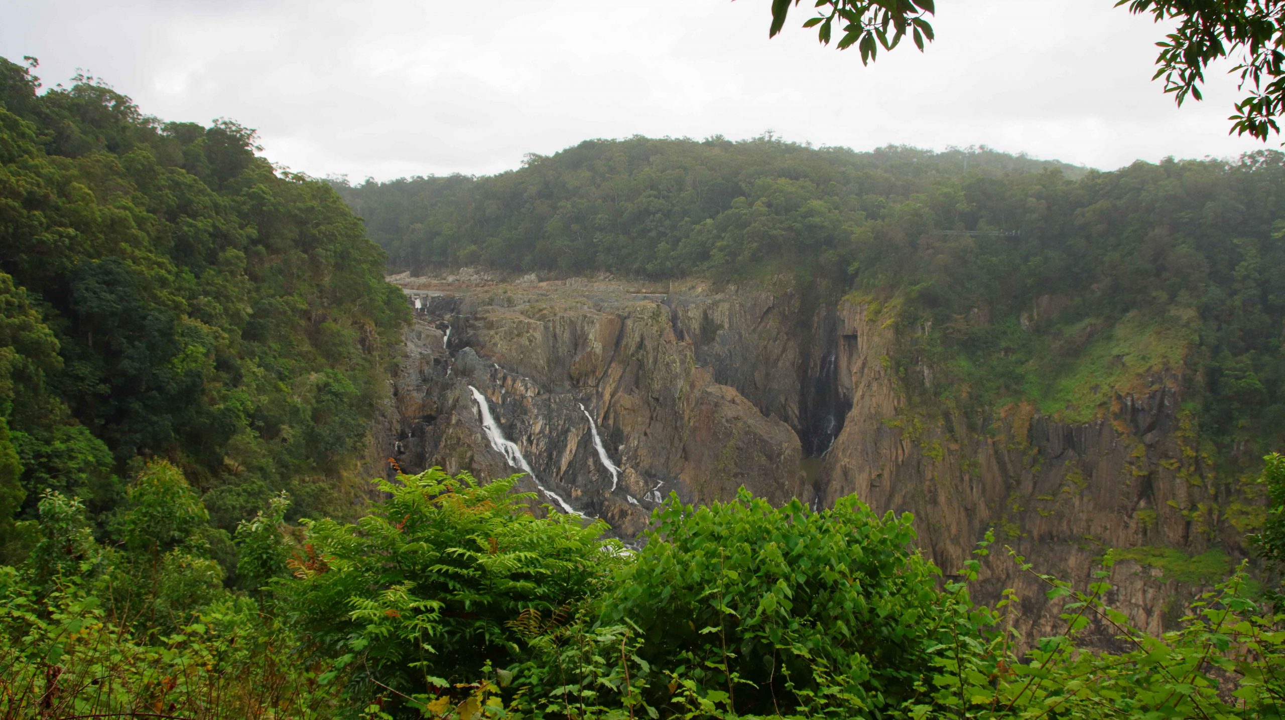
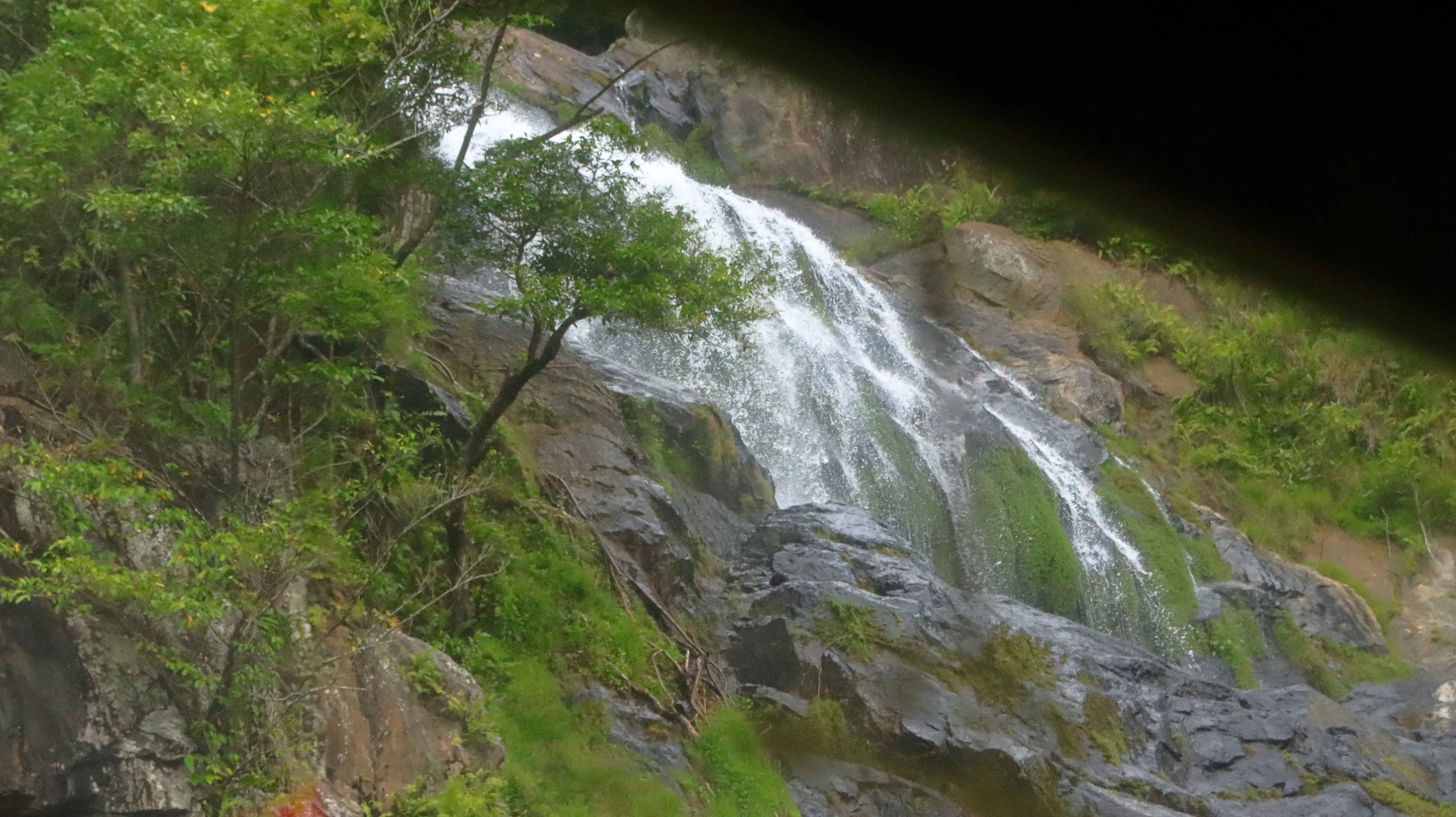
At Barron Falls, a staff member to whom we spoke, showed us video on his phone of the falls at full flow. It would be spectacular to see. By the time that we arrived, high flows of a week or two earlier had reduced, but there was still a good volume of water flowing over the drop.
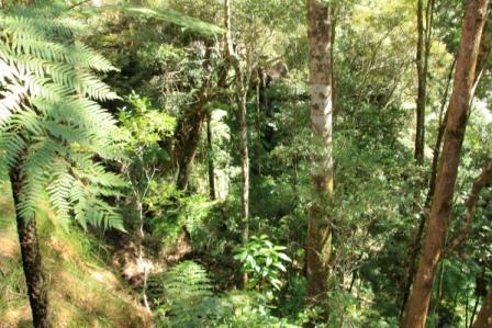
It is very peaceful gliding above the tree canopy. Breaks in the vegetation give glimpses of the under story, as do the walks at the stops. As you top Red Peak, the ranges of the Great Divide roll away into the distance and you look directly into Barron Gorge.
There is plenty of warning before the final station. The public address system asks you to look up so that a camera can take your photo while you are still in the gondola. For about $30 you can buy a copy of the photo. We passed on that.
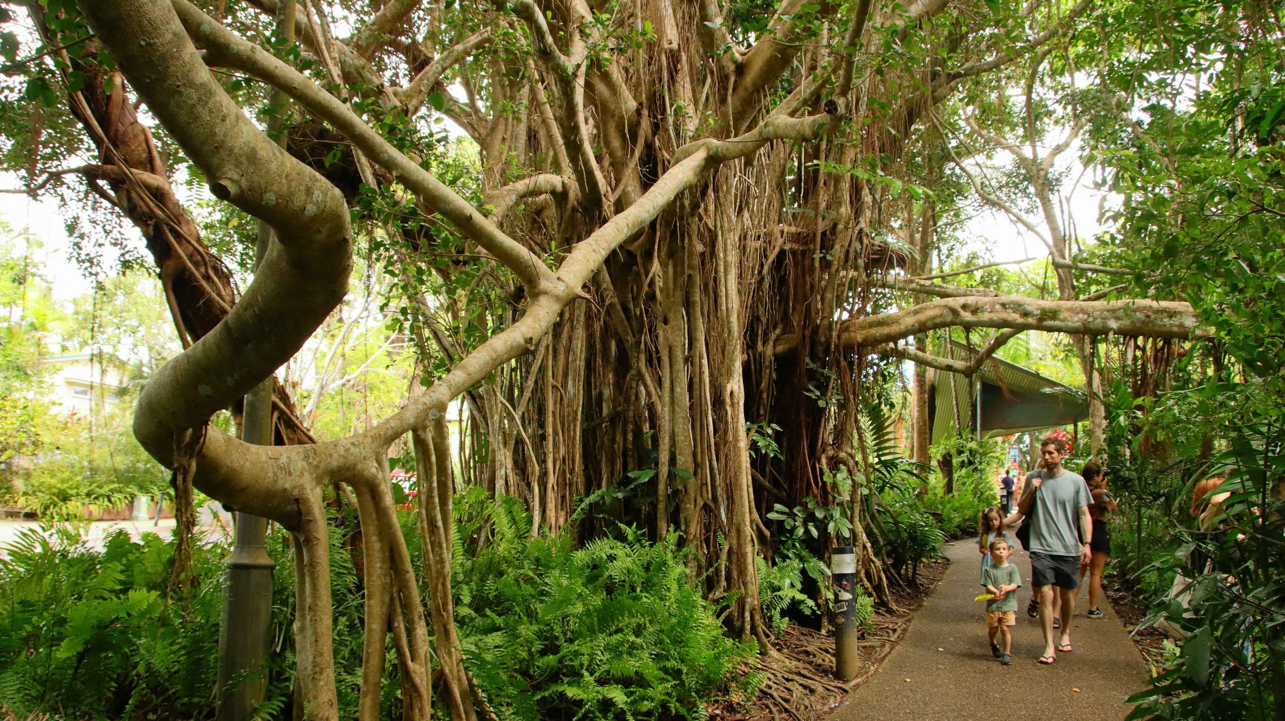
When booking, we enquired about transport to the town, as that’s where all the services are, including lunch. They weren’t very clear, but we suspected that it would be necessary to walk. Our suspicions were confirmed by the absence of obvious modes of transport. So, we set off on foot with the other arrivals.
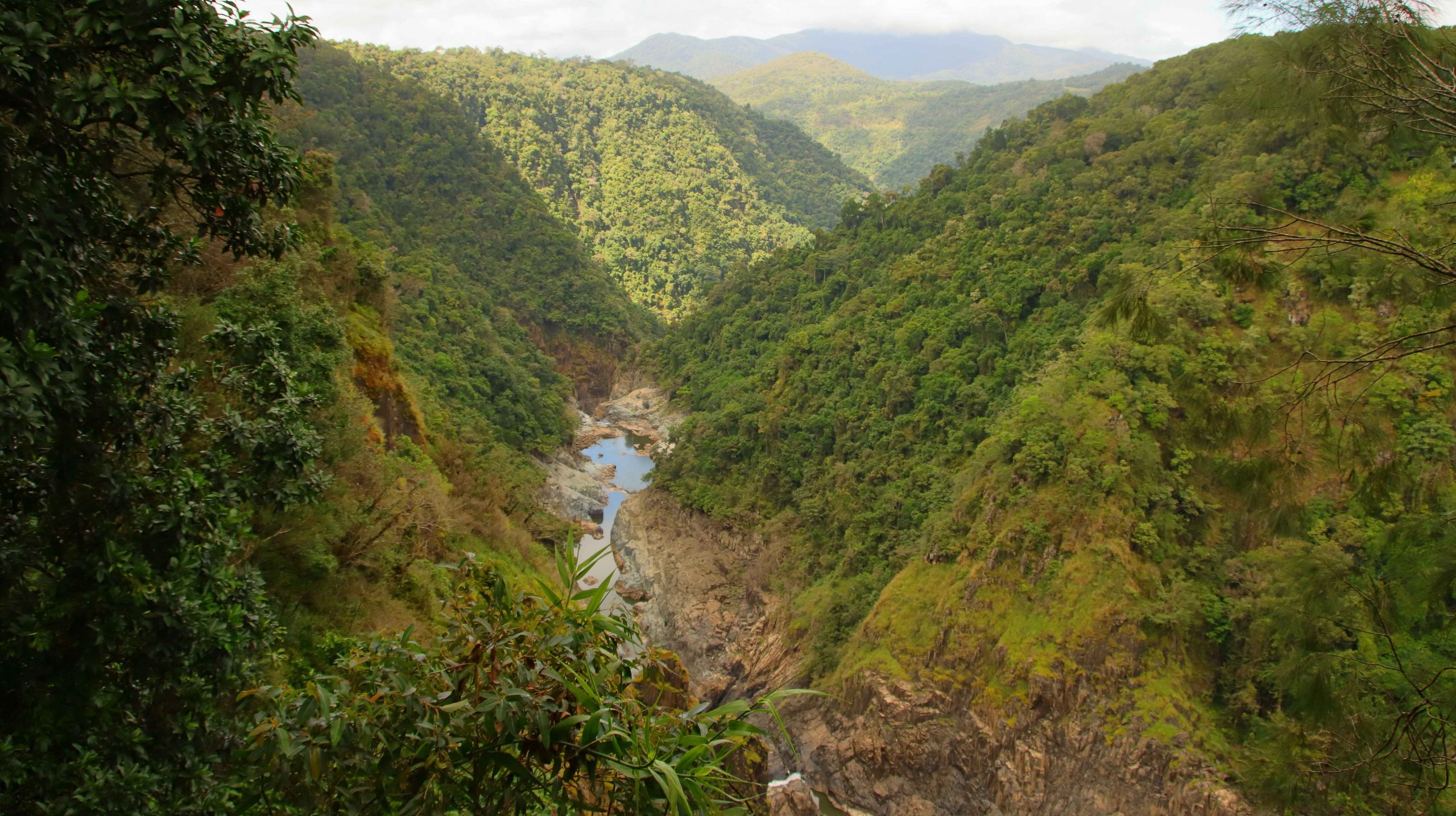
Barron Gorge and the hydro-power station, driven by water from a dam at the top of the Barron Gorge
The view into the Barron Gorge from Skyrail
Passengers on the short walk to the falls viewing point
Part of Barron Falls
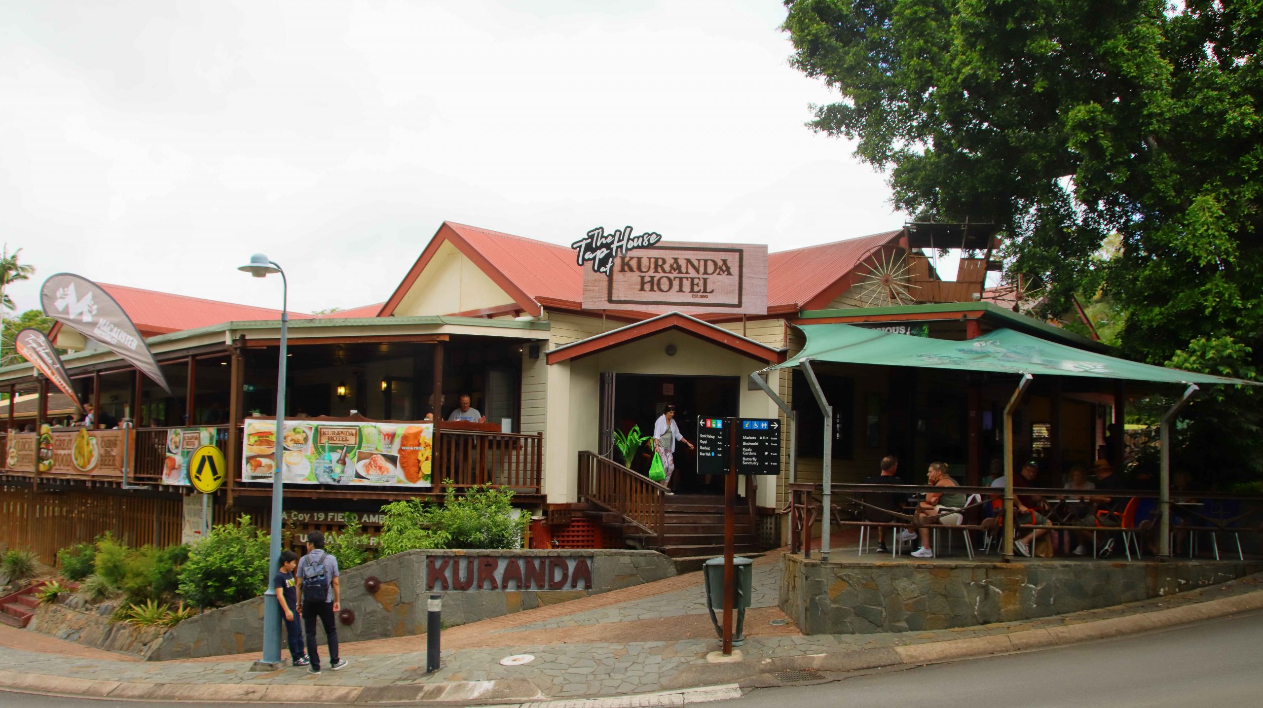
The walk was about 500 metres I guess, and moderately steep, but we made it with a couple of rest stops. The first cafe that we saw got our business. That was my first coffee for the day, so it was most welcome. Rested, we walked a bit of the town and then took the path back down to the Kuranda Scenic Railway station which is adjacent to the Sky Rail station. We were there in plenty of time to rest up for the train journey.
A Banyan tree on the walk to Kuranda township
The Kuranda Hotel. Too many steps for suitable lunch venu
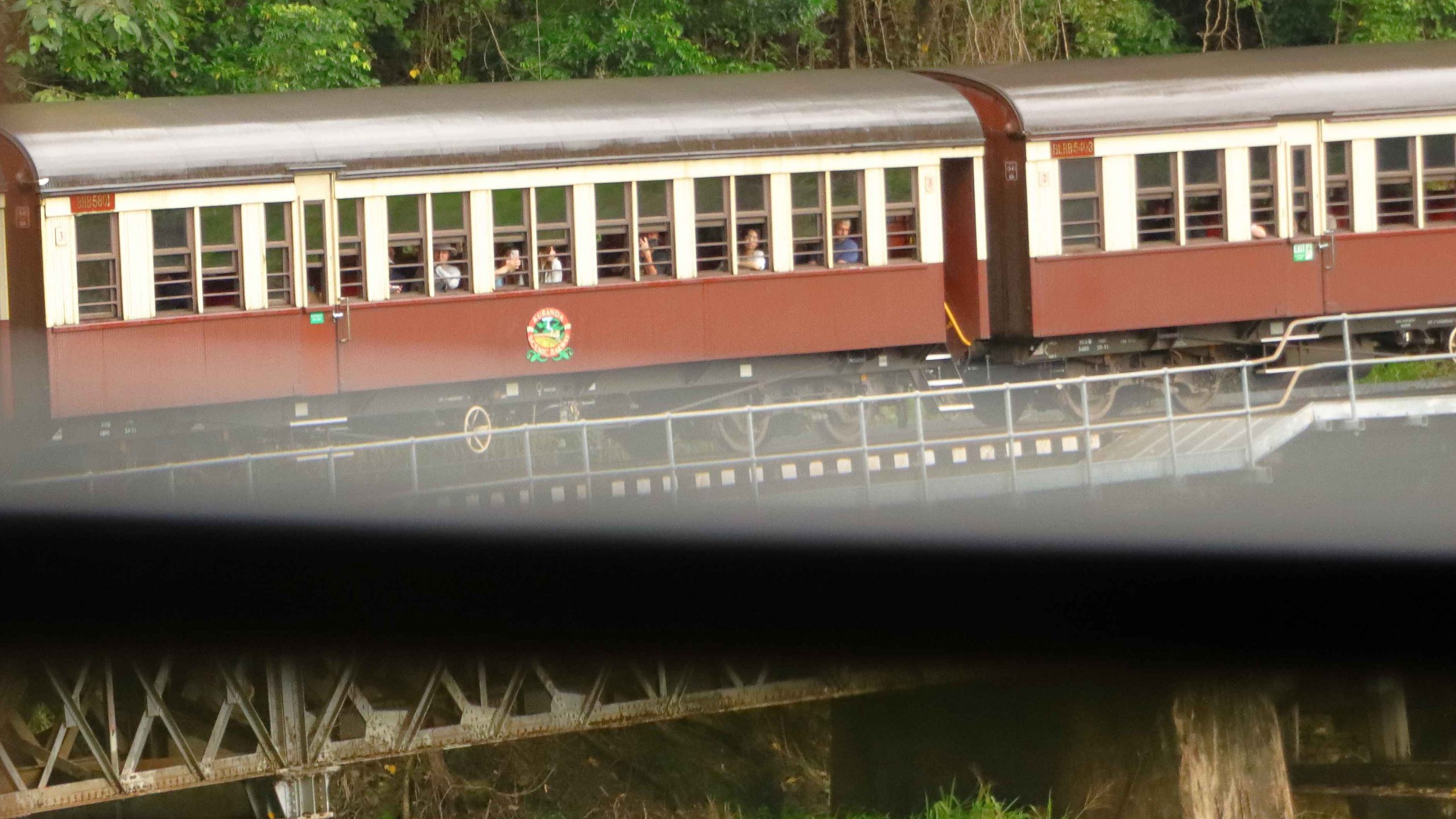
Last time we did the SkyRail and train experience we had seats to the left of the train when facing forward. That put other passenger heads between us and the view. The passenger in the window seat leaned out of the window most of the way taking photos so we saw little. This time we had a row of four seats to ourselves, so visibility was not a problem. Unfortunately, as the train stopped at Barron Falls Station, the rain started to fall so the photographic opportunities were quickly abandoned. The rain continued, so no one hung out of the windows taking photos.
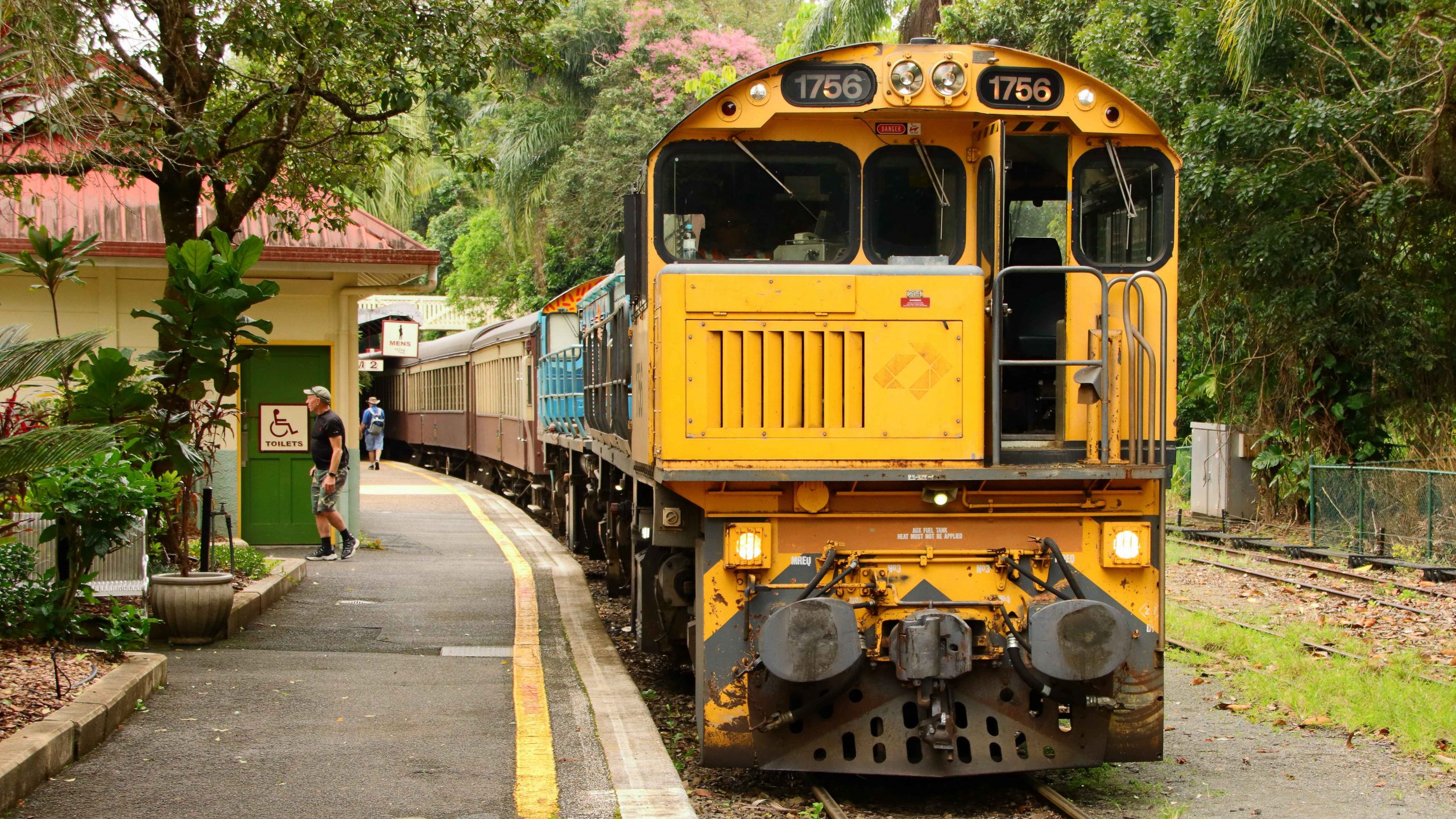
The leading engine on our train
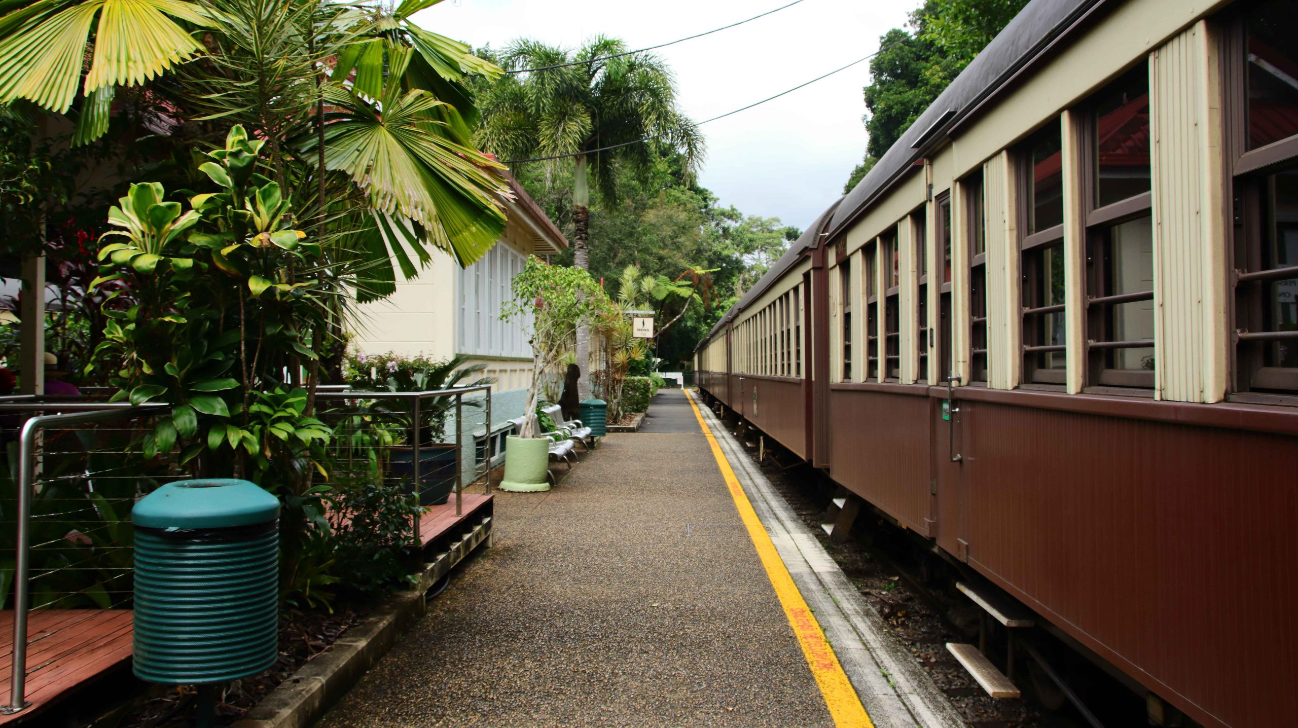
Carriages waiting for passengers
Barron Falls from the railway station
Towards the bottom of the steep part of climb the railway passes Stoney Creek Falls and the bridge over Stoney Creek. This bridge is the most outstanding bridge on the line. The falls can be seen to the west of the line, towering above the train and cascading for tens of metres into a waterhole. Shortly after this point the train negotiates Horseshoe Bend, a very tight turn in railway terms. Passengers can look back or forward, depending where they are sitting on the train, and see the opposite end of the train preceding or following them. Negotiating the turn is done at a very slow pace, with much screeching of wheels on steel rails.
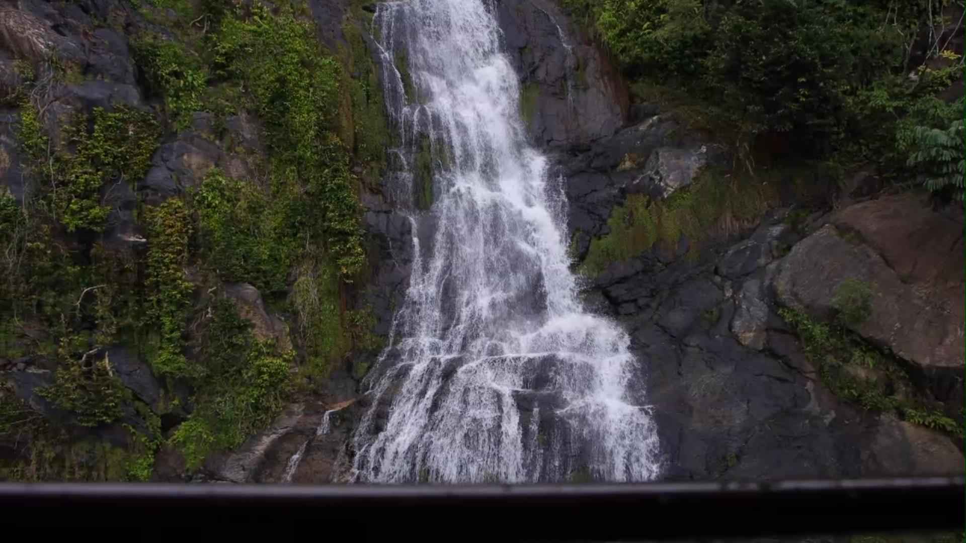
Stoney Creek Falls – View 1
Stoney Creek Falls – View 2
The rear of our train, partly obscured by the window frame
The sun was shining again by the time we reached Cairns. I walked back to our motel to collect the car, returned to the station to collect Ruth. Then back up fourteen steps.
During our almost 40 years of residence in South East Queensland, Ruth and I have visited Springbrook Mountain in the Gold Coast hinterland perhaps half a dozen times. But our activities have never taken us further afield than the town and the several spectacular lookouts along the lip of the impressive (by Australian standards) precipice, much of which overlooks the Gold Coast coastal strip.
Rush Creek above the falls
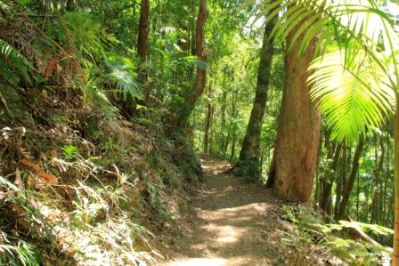
Encouraged by the rating of the Twin Falls Circuit walk as “easy” and the enthusiastic writings of Springbrook devotees on a Facebook walking sight that I follow, I decided to give my almost 82 year old legs a bit of a workout. The circuit is 4.3 km in length with an elevation gain, or loss in this case, of 179 metres. Time to complete is stated on the All Trails app as 1hr 29min. My daily walk to Moreton Bay and back is about the same difference but with much more gentle and less change in altitude.
View into the valley
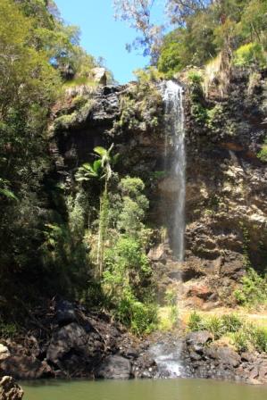
I had mistakenly believed that the Twin Falls Circuit was so named because within its length you encounter two waterfalls. I knew that the second was Blackfellow Falls but when I researched the name of the first I discovered that it, or perhaps they, were called Twin Falls. More in that later.
Twin Falls
We parked at the Tallanbana picnic area and with Ruth settled in the car with her knitting I slipped into my back pack and headed down the path, very conscious that I would need to come back up the path at the end of the walk.
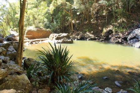
The pool at the foot of the falls
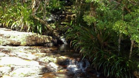
Twin falls are on Rush Creek which rises in the highest part of the range near the NSW border and ultimately, I think, joining a number of other streams in Little Nerang Creek which then flows into the Hinze Dam.
The track is easy with most areas smooth going
The track is easy, well formed and well maintained. Streams that intersect the track are bridged of have concrete stepping stones. Hand rails are provided in most places where steep drops into the gorge would cause death or serious injury. Stairs, timber, stone and steel, are provided in a number of places. There are a couple of formed concrete ramps.
A very pleasant walk through the rain forest
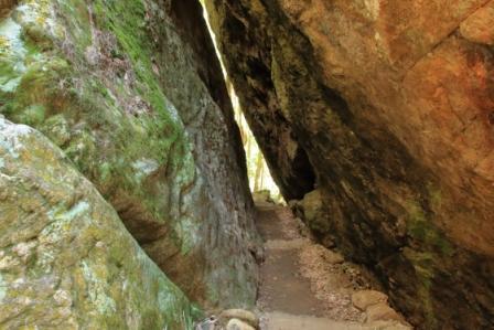
The trail soon crosses Rush Creek immediately above Twin Falls, then continues on a slowly declining angle along the ridge to a point where is switches back on itself to start the descent to the bottom of Twin Falls. At this point you take a narrow path between two huge boulders and then follow a number of changes in direction until the falls are reached.
The track runs between two huge boulders
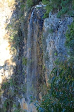
There, falling into the edge of a pool was the single fall of Twin Falls. It seems to only become twin falls after heavier rain, so when I saw it there was a single fall of water. That did not detract from its scenic beauty, but I would like to see in in full flow.
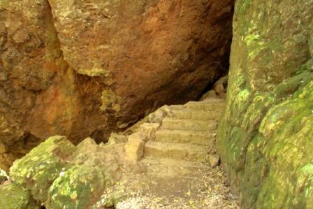
The track emerges between the boulders and is assisted by some steps
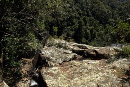
From the falls and pool the trail continues at the bottom of a cliff face to the left and a steep timbered slope to the right. The distance between the two sets of falls is about a kilometre. About halfway the track looses altitude via a succession of switch backs. It was at this point that I encountered a hiking couple coming in the other direction.
Part of the track runs along the base of a cliff
So I asked about the track ahead, as you do, to be told that it descended a fair distance, distance down that would ultimately become additional distance up later in the walk. I had been on the track for about an hour and had come about half way so concluded that the walk was going to take me about an hour longer than planned.
Considering the situation I decided to retrace my steps and leave Blackfellow Falls and the other half of the track for another day.
A look into the rain forwst
I spent the first 15 years of my life in the bush and have never lost my love of it, despite having spent the latter part in cities. This walk is a mix of rain forest and timbered ranges. Tall straight tree trunks emerge from rain forest thickets. Small streams and bubbling springs are located along the path. Stop and listen and you hear the calls of birds. Paradise!
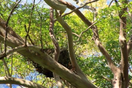
This large nest may belong to an Eagle
Eating places close early in Springbrook because most tourists visit in the AM, but the Springbrook pub/café was open and had not run out of food. A couple of pies with cold fruit drinks hit the spot.
Purling Falls
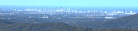
After lunch we drove down the street to the Purling Brook Falls lookout. Later, and on the way home, stopped off at Wunburra Lookout for its panoramic views over the Gold Coast high rise, before taking Pine Creek Road for a drive past the Hinze Dam before descending to Nerang and the highway to home.
Please Note: Videos covering the material in this blog post can be found at the bottom of the post.
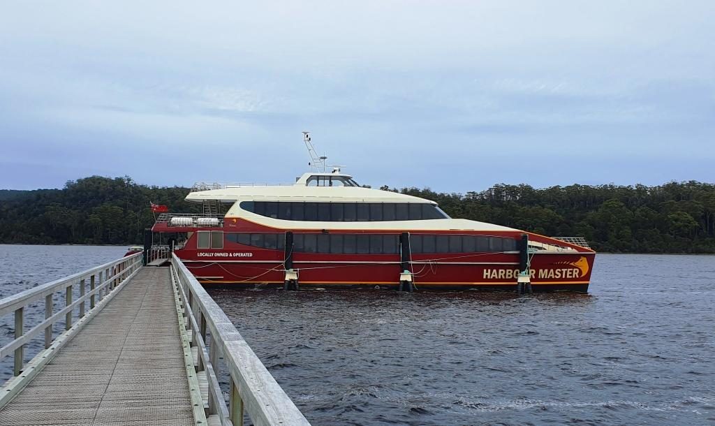
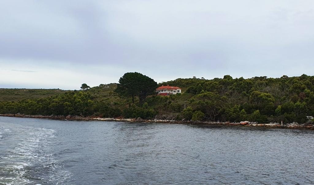
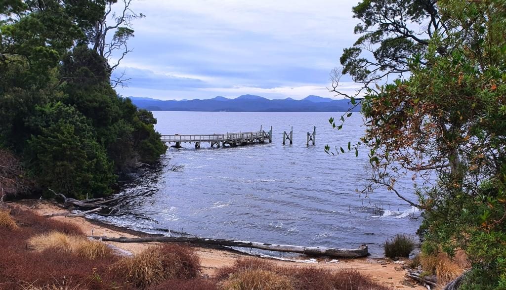
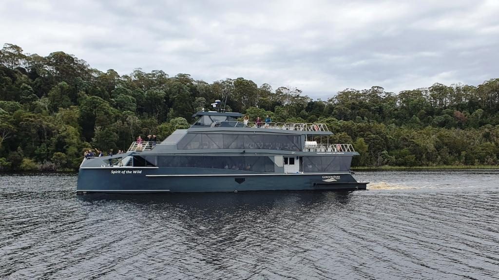
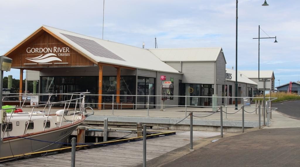
Heritage Tours boat “Harbour Master” at Sarah Island jetty
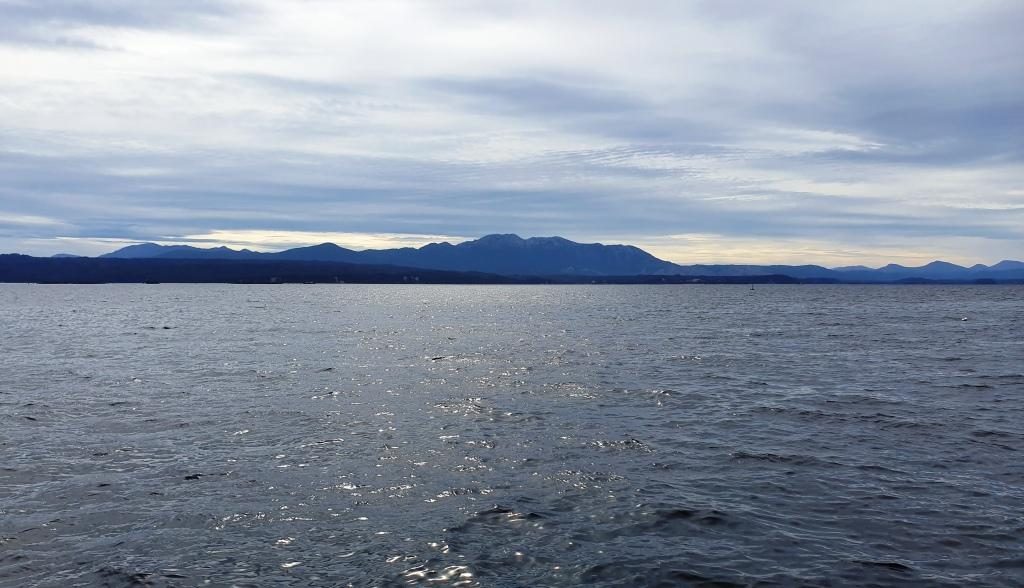
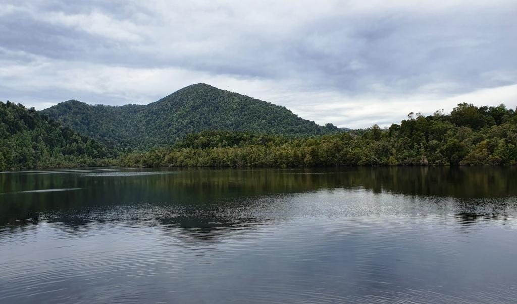
I suppose tours of Macquarie Harbour and The Gordon River were operating 45 years ago when we were last at Strahan, but I have no recollection of them. But that was well before the issue of the Franklin Dam and all of the disputes over Lake Pedder gave this area such prominence. We had become aware that the cruise was one of the attractions that draw tourists to Strahan. We booked in advance to make sure that we had a good seat.
The day started overcast and cool
but improved to produce sunshine by mid afternoon. We were not affected by the
morning chill as we were on board the “Harbour Master” our Heritage
Tours cruise boat, protected by its broad glass windows.
Departing Strahan cruise terminalStrahan Railway Station at Regatta Point
The cruise boat headed
directly to Hells Gates, the entrance through which ships had to pass to reach
the convict settlement on Sarah Island. The entrance is narrow and dangerous,
particularly when a sea is running. In the days of sail, ships would anchor
outside of the harbour, wait for slack tide and be towed through by sailors
rowing the ship’s longboat.
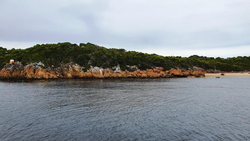
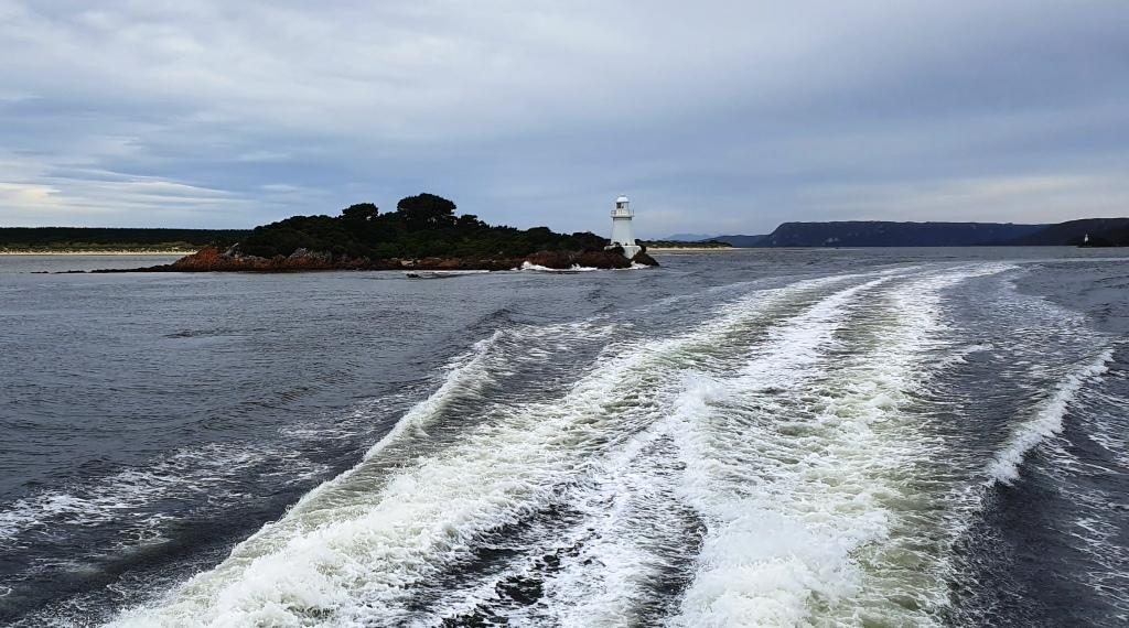
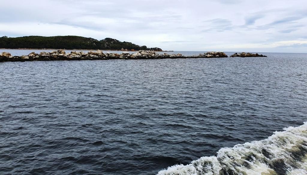
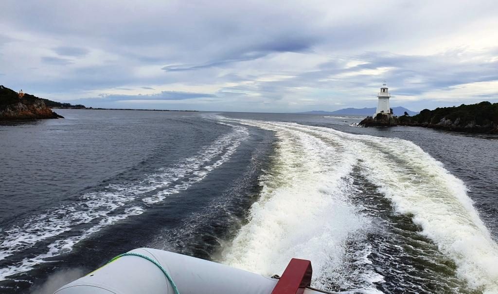
Old Macquarie Heads Signal StationColoured rocks at Hell’s GateHell’s Gate passage from the ocean side
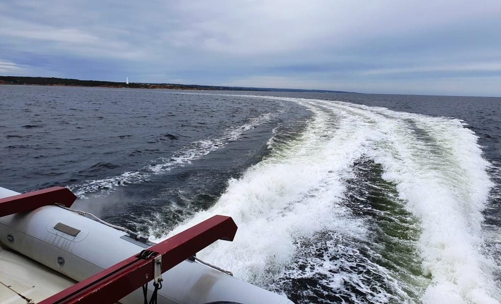
There was no sign of Hell at the gates. The sea was like a mill pond. Not only did we proceed through the heads at full speed but continued out past the Cape Sorrel lighthouse into the Indian Ocean for a look both ways along the coast. Such conditions only occur about five times per year, we were told.
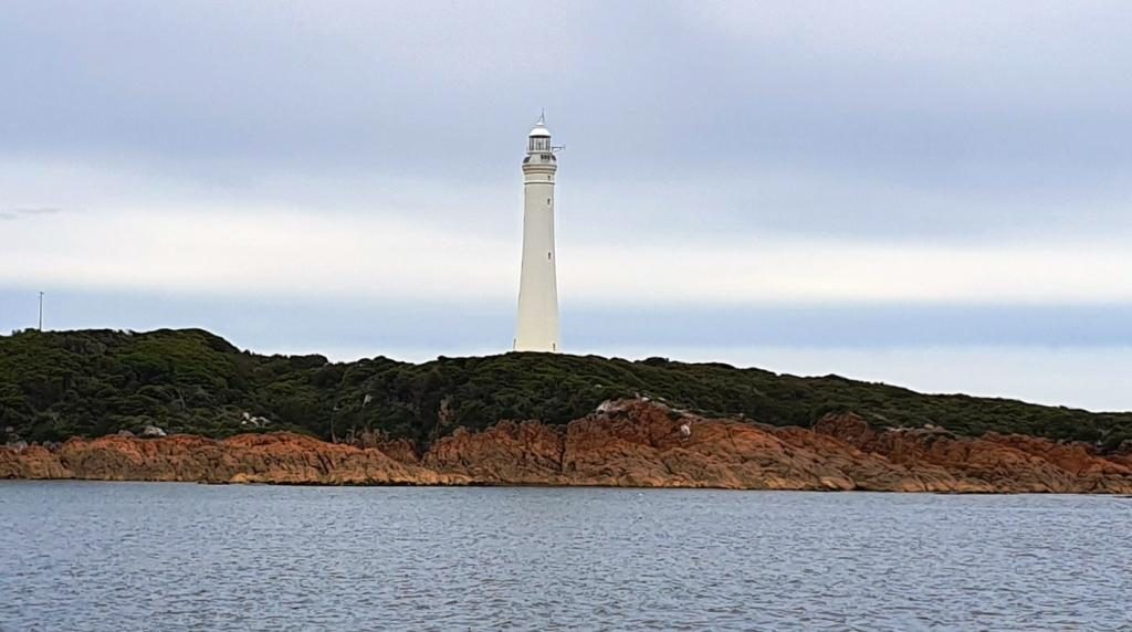
A breakwater and the coast outside Macquarie Harbour headsCape Sorrel Lighthouse at the south of Macquarie Harbour entranceIn the open sea. View south past Cape Sorrel LightView from inside Hell’s Gate out to sea. Ships entering and leaving port had to pass between the channel light and the point on the left.
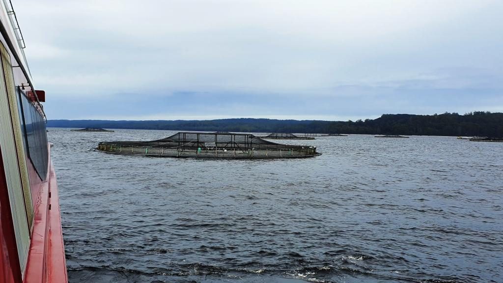
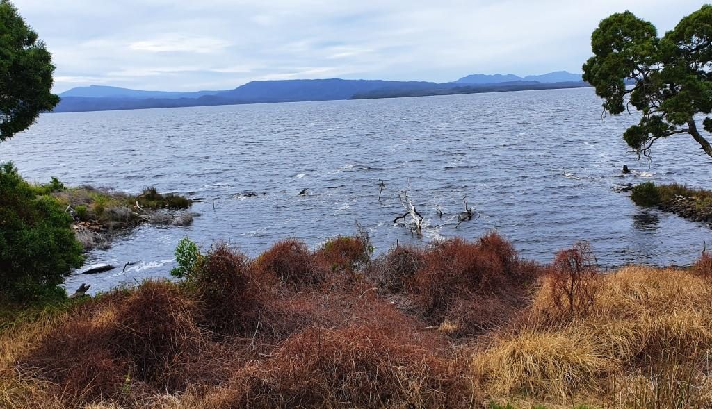
I had read about Sarah Island as a convict prison but for some reason thought that it was located near the heads. But it is at the other end of this rather long harbour. On our way to Sarah Island from Hell’s Gates we stopped to see the salmon and trout farms where the fish are grown to eating size in large circular mesh cages that are anchored in the waters of the harbour. There is nothing to see other than the nets but the skipper of the boat gave us quite a bit of information about the husbandry practices. In short, they feed the fish and the fish grow to eating size. What else is there to known?
Fish farms in Macquarie HarbourView to the east in Macquarie Harbour
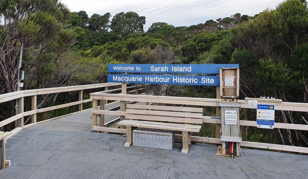
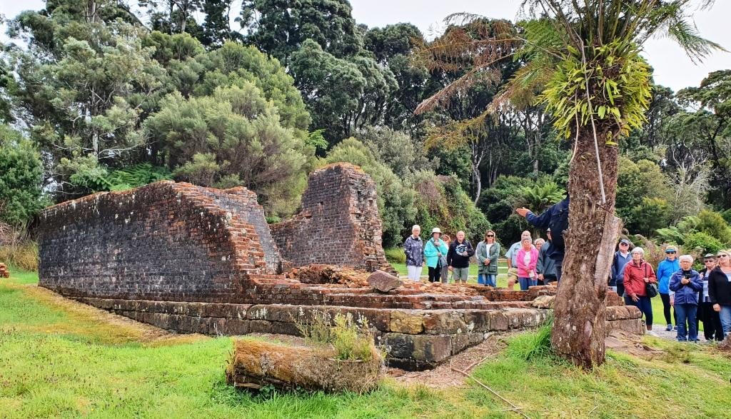
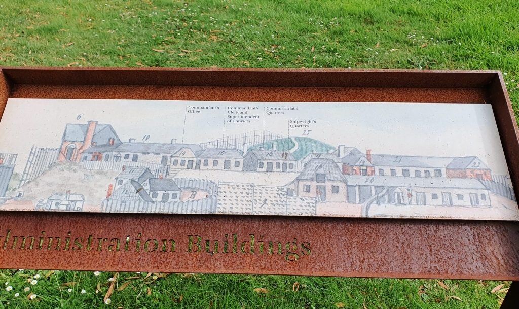
Sarah Island had the worst reputation of any Australian convict settlement. It was established to gather Huon pine from the surrounding forests, but when the difficult harbour entrance restricted the transport of the timber, shipbuilding was established at Macquarie Harbour at the Sarah Island convict settlement. Well over one hundred boats were built with over half of them ocean going ships.
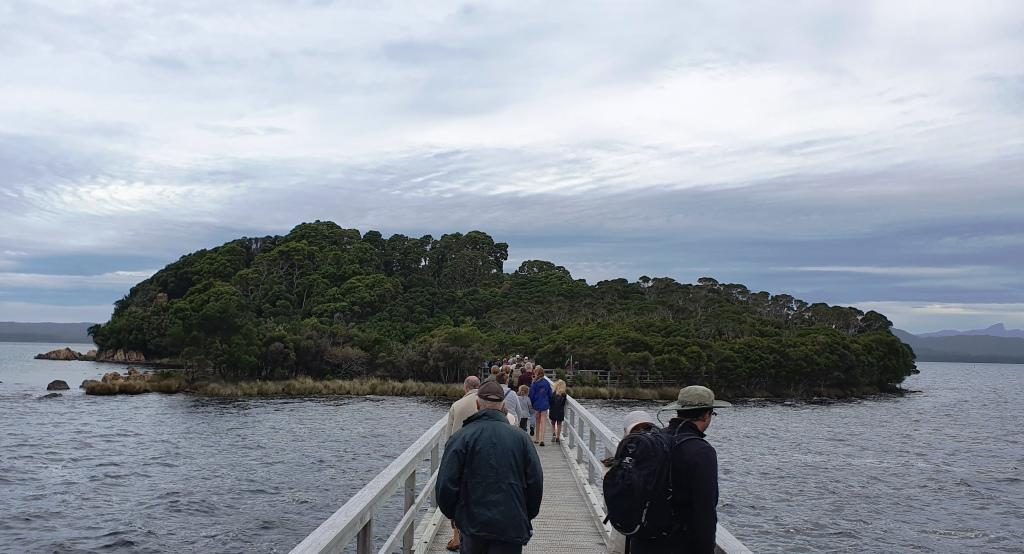
Walking ashore at Sarah IslandSarah Island landing
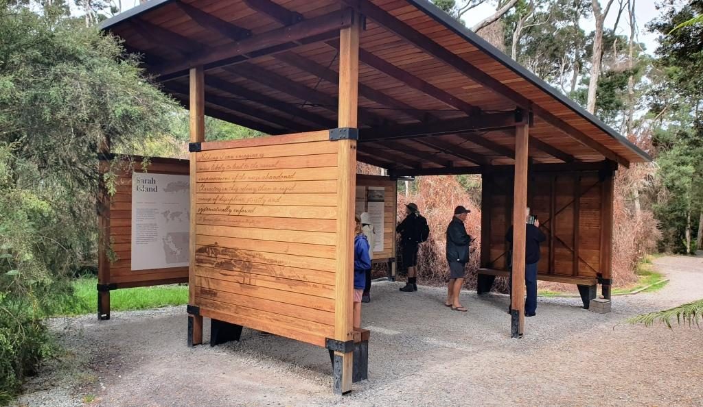
A solid path has been built linking the ruins to the jetty for ease of access. Guides are on hand to tell tourists all about the settlement. You can still see remnants of the construction slipways embedded in the shoreline. There are ruins of buildings with information signage throughout. It is all very well done.
Remnants of boat building slipways in the shore line of Sarah IslandA larger ship building slipway and an alternative landing jettyInformation shelter
As we departed Sarah Island, the crew prepared a delicious buffet lunch of cold meats and salad including slices of Camembert cheese so large that you would think the stuff was made in Tasmania.
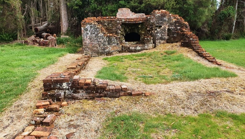
Cruise passengers with a guide at convict prison ruinsRuins of Sarah Island BakeryInformation plaque showing layout of Sarah Island administration building
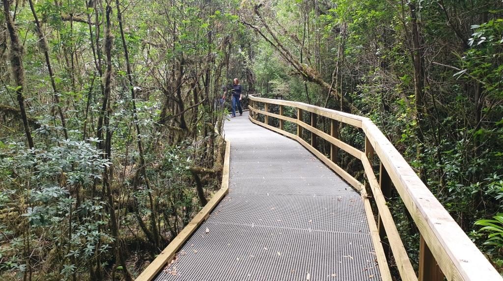
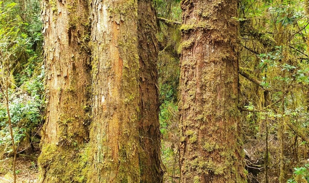
From Sarah Island we motored directly to the mouth of the Gordon River where speed was reduced to a sedate 5 knots or so. The destination in the river was Heritage Landing, where berthing facilities have been built for the boat and a board walk constructed to provide access to the rain forest that covers the steep sides of the Gordon valley. Particularly, it gives access to Huon pine in its natural setting. Huon pine is not only resistant to rot but also to the marine worm that destroys lesser timber. It is a slow growing tree. Large specimens are thousands of years old.
Excellent reflections are sometimes viewed on the Gordon but the wind had come up by the time we reached it so the surface was a series of ripples instead of a mirror.
The placid Gordon River near where it joins Macquarie HarbourBoardwalk to Huon pine viewing area at Heritage Landing
As we cruised slowly up the
river the skipper retold the story of the Franklin River protests of thirty or
forty years ago when the Tasmanian Hydro Electricity Commission wanted to build
a dam on the Gordon River downstream from where it is joined by the Franklin
River. If you are over 60 you will no doubt remember all the fuss.
Mature Huon pineThe “Blue Boat” from the other cruise operator at Strahan
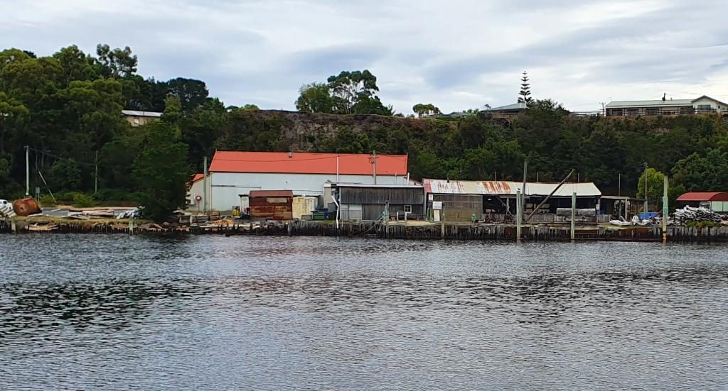
On the quayside at Strahan
there remains an operating sawmill that processes Huon pine. The cruise boat
completes the tour by berthing at the mill to enable passengers to see the Huon
pine being worked. The mill sells completed timber products including a range
to appeal to tourists with spare money. I would rather spend the money on the
finished product of the fish farm.
The sawmill that works Huon pine at Strahan wharf
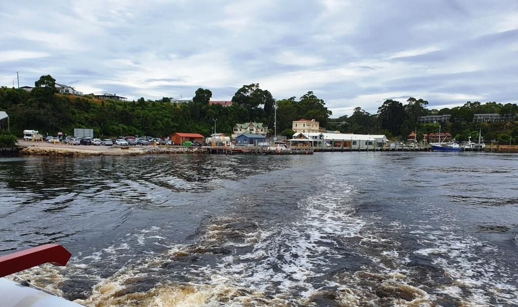
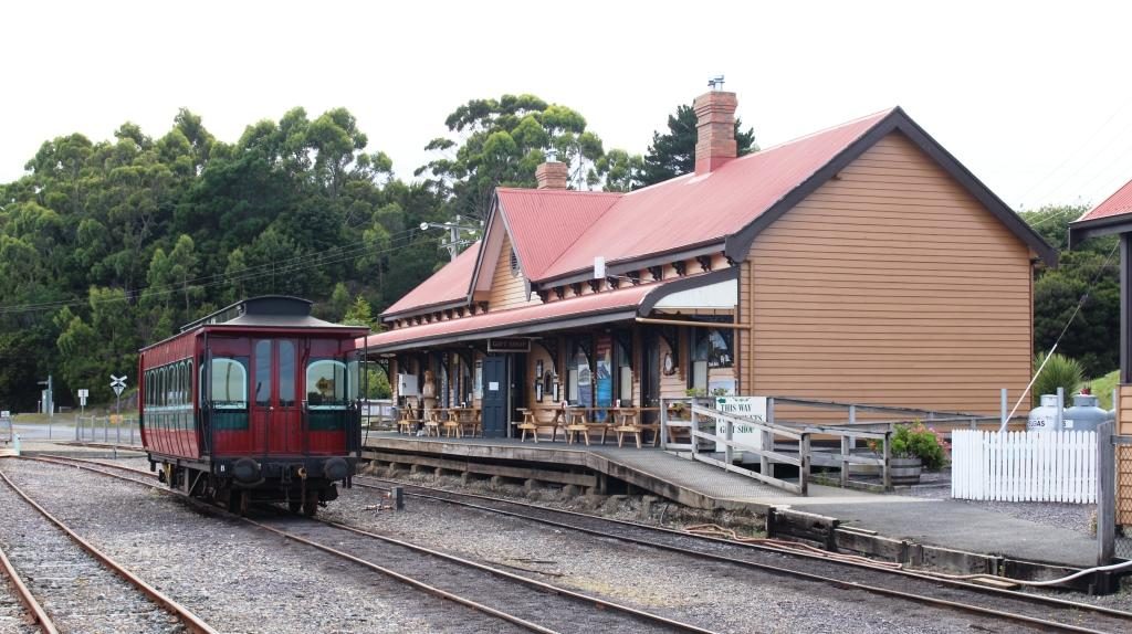
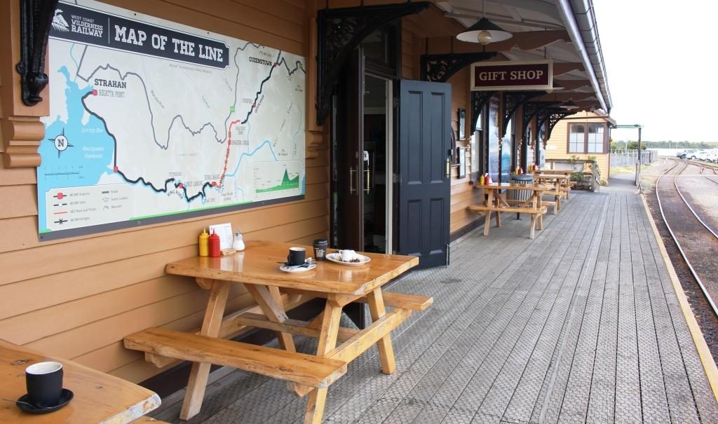
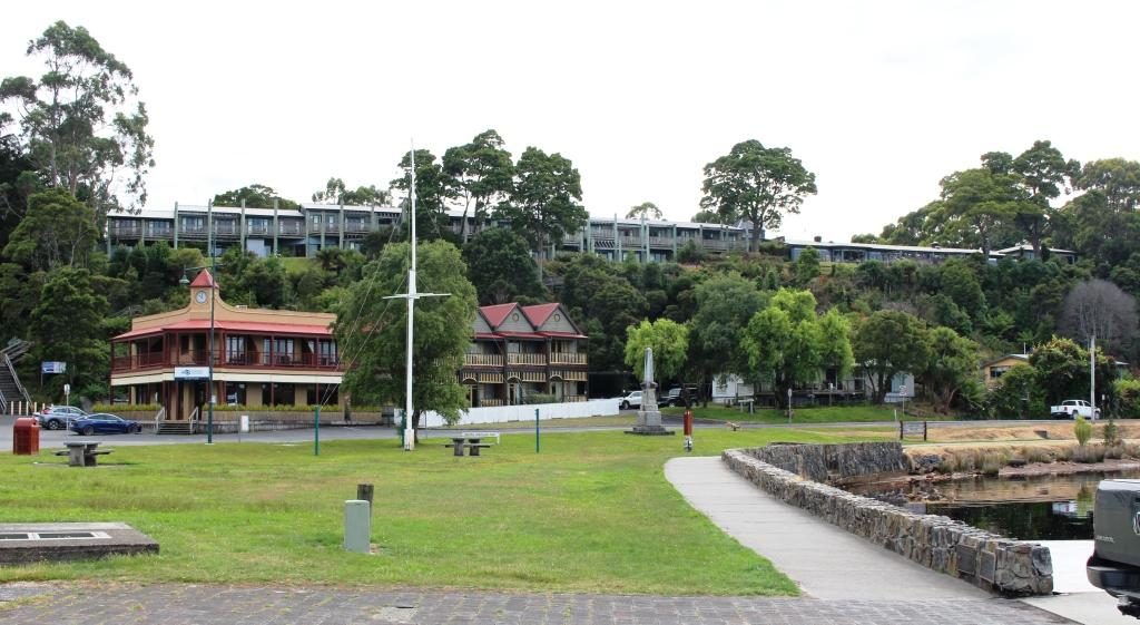
Our second day in the South West was set aside for a driving tour in the area. We did the triangle Strahan-Queenstown-Zeehan-Strahan, about 125 km. But before heading off on the 47 km first part of the trip to Queenstown we took a closer look at Strahan.
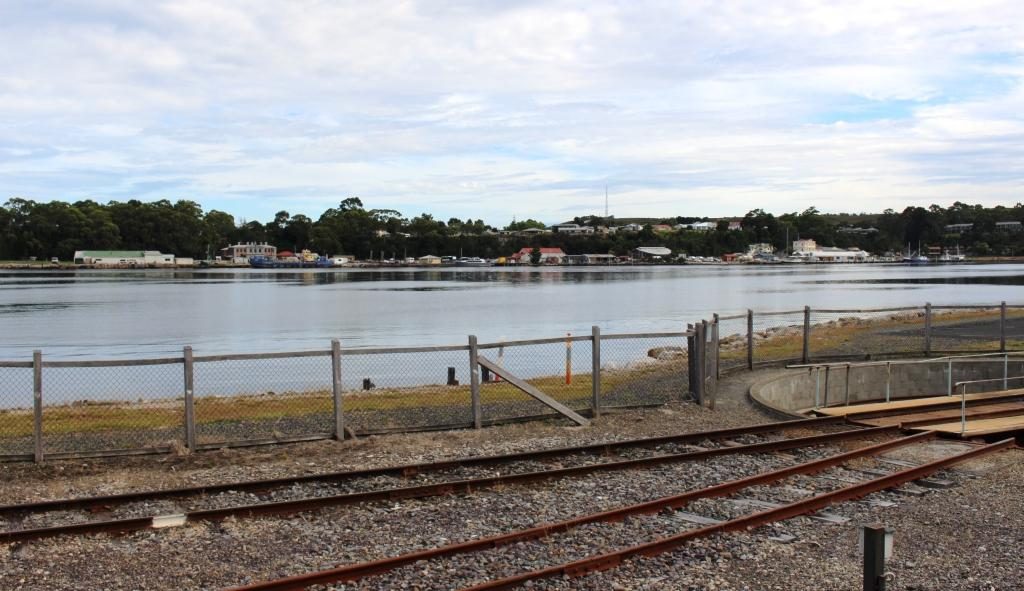
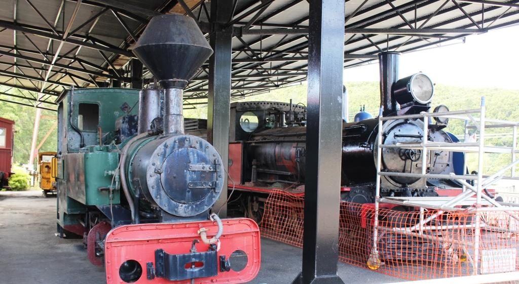
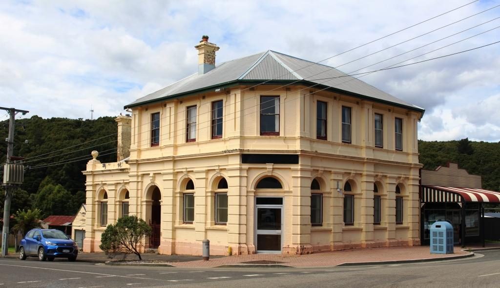
We first visited Regatta Point to look at the Strahan end of the Queenstown to Strahan tourist railway. This service operates on the railway built to get copper ore from the mines in Queenstown to the port, to be shipped to the world. Because of steep inclines on the route, part of the track uses a rack and pinion system where drive cogs on the engine engage with teeth in a track that is positioned between the normal rails.
Strahan historic railway stationCafe tables at Strahan stationStrahan waterfront area viewed from Regatta Point station
The station building in Strahan is the original, built in the late 1990s. It now contains a cafe and gift shop and normal tourist facilities. We were a bit early for coffee, but the view from the tables on the old platform is such that you would not want to finish your coffee too quickly.
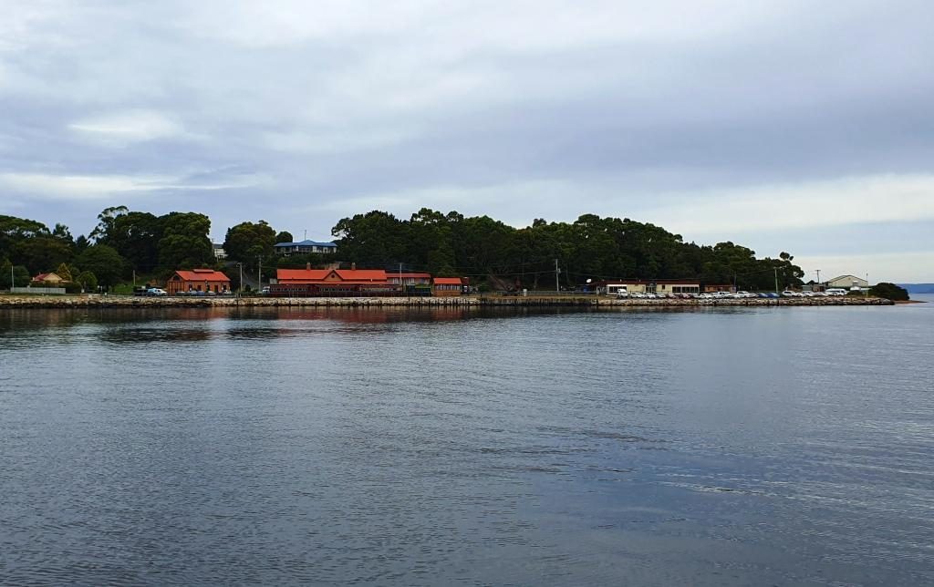
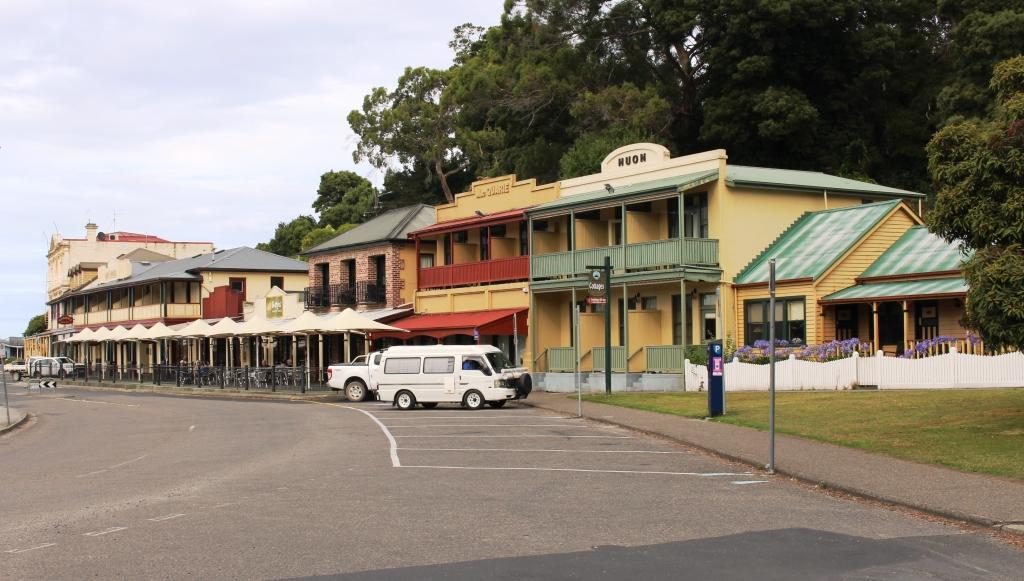
Historic buildings over the street from the wharf at StrahanTourist cruise base at StrahanStrahan main streetTourist accommodation overlooking Strahan waterfront
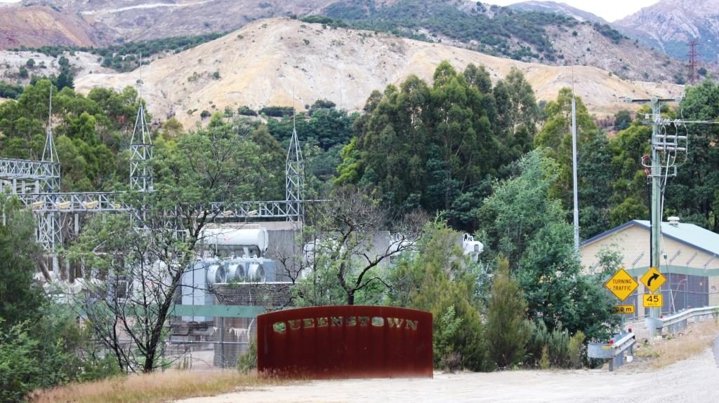
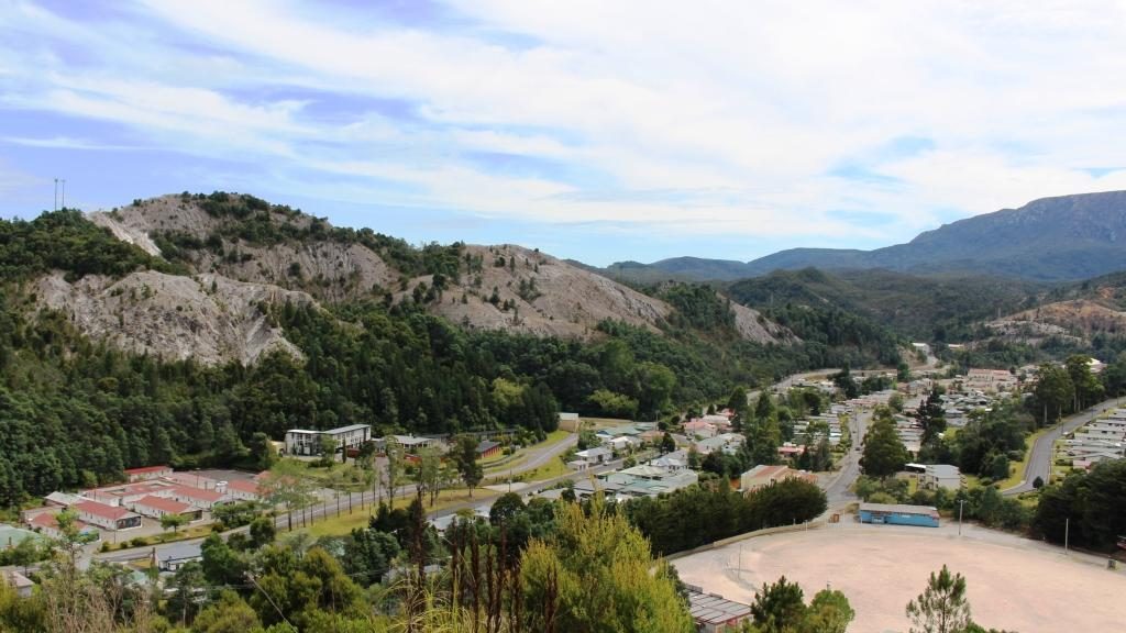
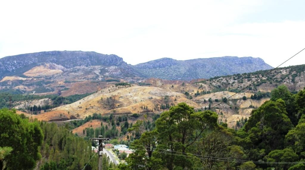
Queenstown occupies one of the most dramatic sites that you can imagine. It is totally surrounded by rocky mountain ranges, much without vegetation. Some naturally lack vegetation, but hills were denuded in a clearing frenzy to feed the copper smelters in the early days of mine operation. It is a town where I would prefer not to be on a hot day.
Rocky mountains approaching QueenstownQueenstown sign approaching from Strahan
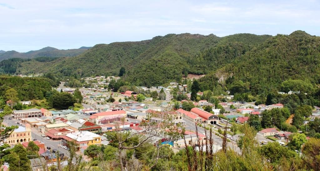
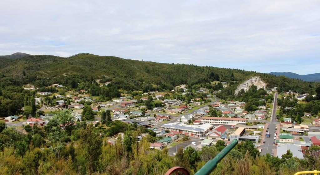
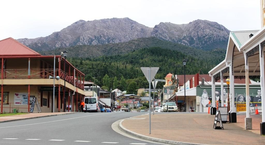
We drove around to get a feel for the place and then walked around the main streets of the commercial area. We then located the nearest street access to the Spoin Kopf lookout which is conveniently located near the CBD, almost in the centre of town. I climbed the steep track to the summit and I am glad that I did. The view was spectacular. The lookout was built as a memorial to its namesake, a battle for a hill during the Boer War in South Africa.
Main business area of Queenstown from Spion KopfQueenstown suburbs to the east of the central business districtMine workings and the corner of Queenstown where the highway passes throughHills surrounding Queenstown were stripped of vegetation to fire refinery furnaces. The area is slowly re-vegetating.
Queenstown’s history has long been tied to the mining industry. This mountainous area was first explored in 1862. Later alluvial gold was discovered at Mount Lyell, prompting the formation of the Mount Lyell Mining Company in 1881. In 1882 the company began searching for and discovered copper. The Mount Lyell company ultimately became the Mount Lyell Mining and Railway Company.
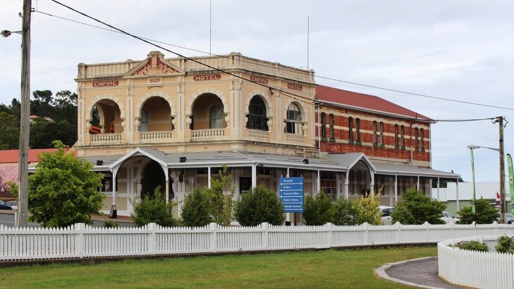
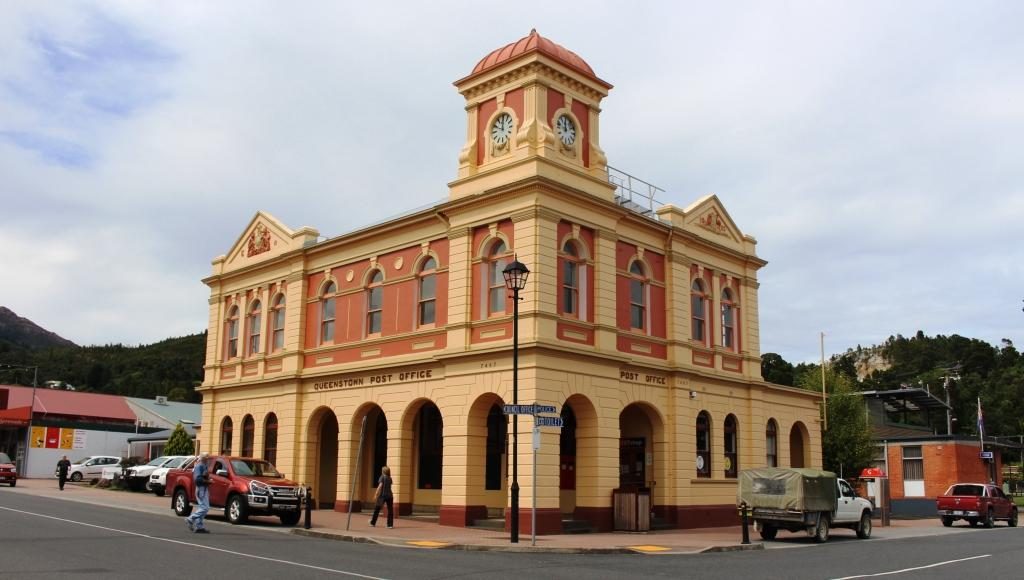
Queenstown’s Empire Hotel. Completed in 1901.View along Orr Street towards Mount OwenQueenstown Post Office. Built in 1902.
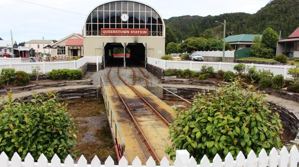
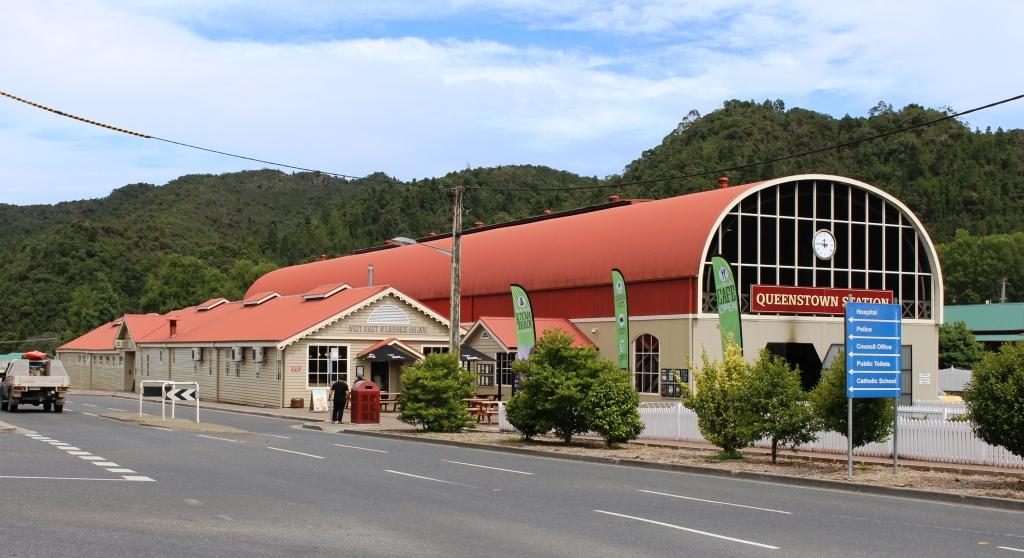
The Queenstown end of the railway has a smartly rebuilt station that offers the same facilities as its counterpart at Strahan, but on a larger scale. We had lunch in the cafe and then waited a few minutes to watch the train come huffing in from its return trip to a point about half way to Strahan. There was a good number of people on board who seemed to have enjoyed the experience.
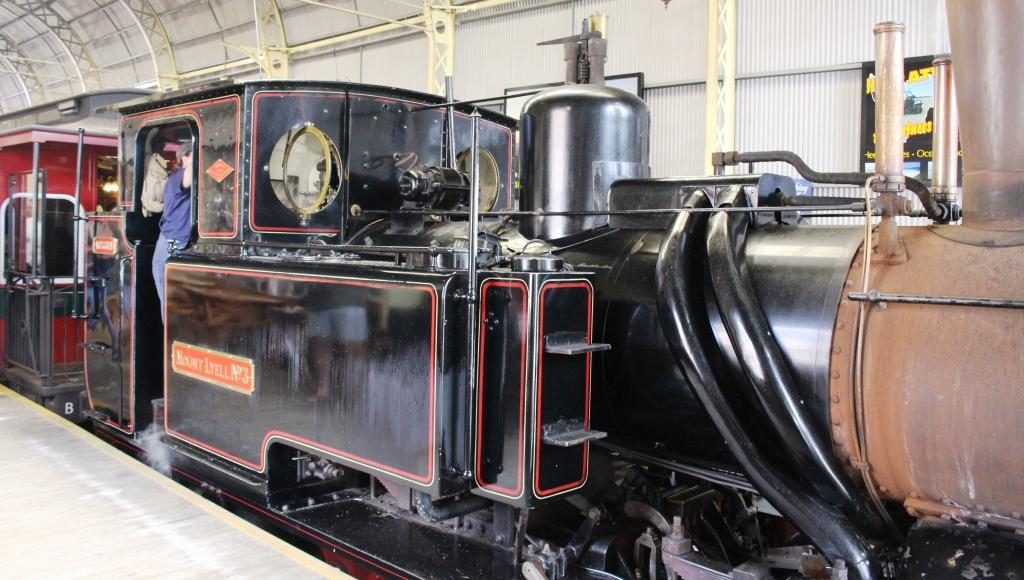
Queenstown Railway Station and engine turn tableQueenstown Railway Station. New building for the West Coast Wilderness RailwayA steam engine at the end of its days workTourist cafe at Queenstown Railway Station. You can watch the train through the glass wall on the right
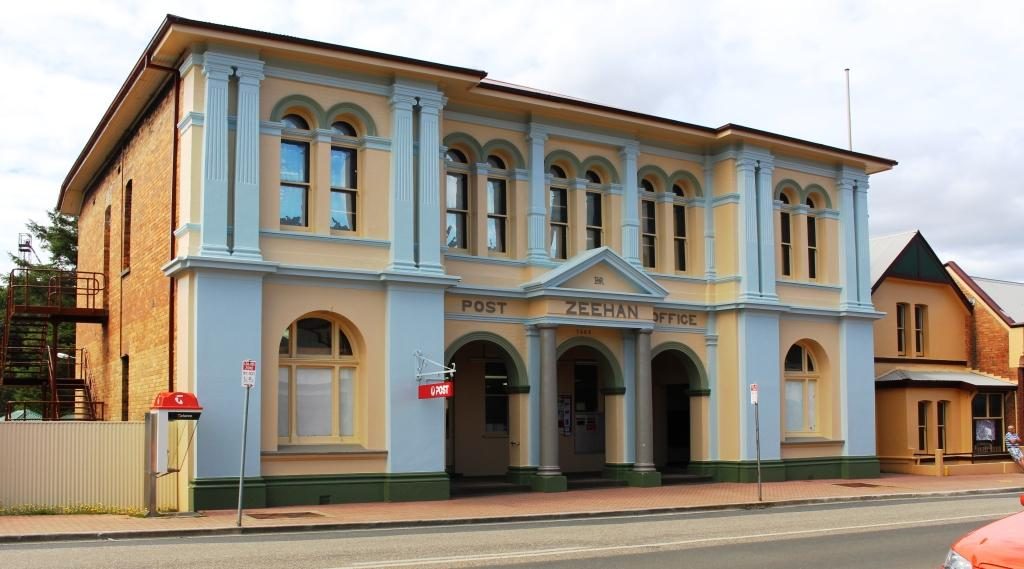
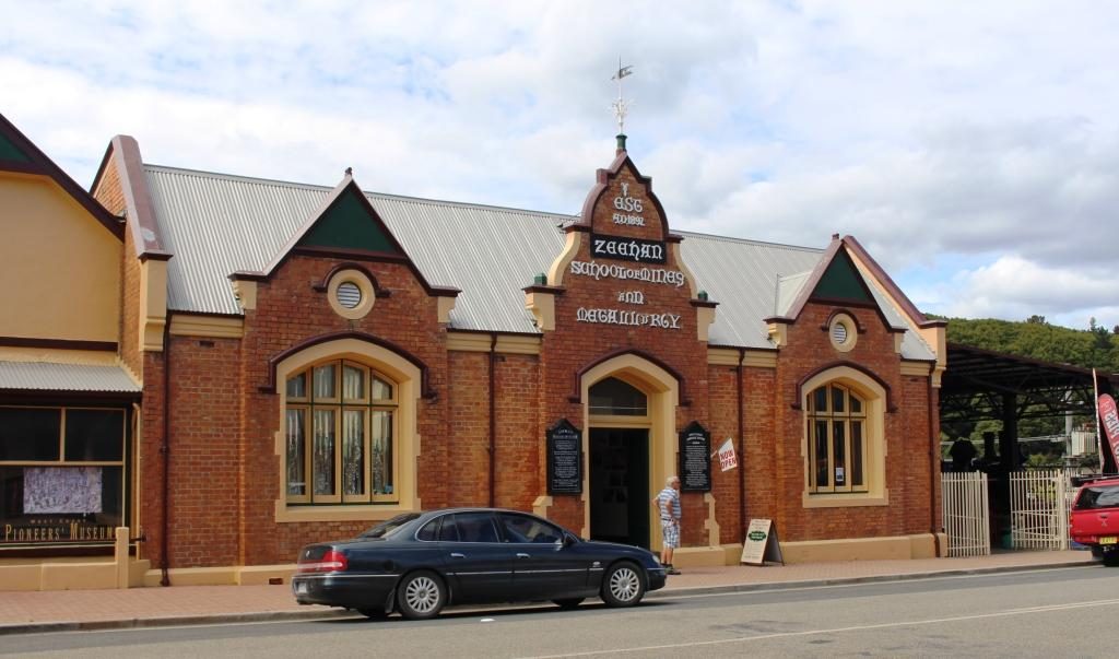
We then drove the 35 km or so to Zeehan, another mining town, but this time a producer of silver and zinc. I am not sure of the status of mining in Zeehan but the town appears to be partly closed down. But it had its days of grandeur, demonstrated by the fine buildings that line its main street. The West Coast Heritage Centre is in Zeehan, housed in the ornate School of Mining and Metallurgy building.
Gaiety Theatre and Grand Hotel, ZeehanZeehan Post OfficeZeehan School of Mines and Metallurgy is now the West Coast Heritage Centre The Railway Museum is part of the West Coast Heritage CentreOne of Zeehans banks
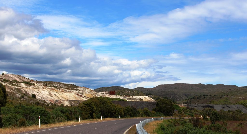
Returning to Strahan, we were on the same road as we had travelled two days before. We had noticed mining residue beside the road but we now had time to stop and take a look. Some old pieces of equipment were strewn over the area but it was not clear what kind of mining activity had been conducted there.
Mining area at Zeehan on the road to StrahanFour wheel drive access to the beach at Henty Dunes
With time left in the day, before we returned to our cabin, we took the opportunity to drive out to Macquarie Heads, to see it from the land as well as having seen it from the boat. It is Strahan’s closest surf beech with a reasonable drive over sealed and dirt roads. There is also a caravan park and on the way out, a neat little picnic area with a boat launching ramp.