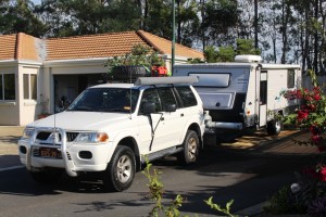
Cape York Adventure – Days 7 to 10

It is only about 45 km from the Crystal Creek camping area to Ingham, where we stopped to refuel, post some letters and refill a gas cylinder that had surprisingly run empty overnight. Surprising, because I thought that it was full. I had filled the second cylinder before we left home thinking that gave us two full. Oh well!

Hinchinbrook Island and Pasage

Hinchinbrook Island and Passage

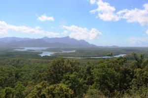
Shortly after passing through Ingham, the road enters the mountains south of Cardwell. The road over the range has been realigned and as a bonus the roads authority has provided a magnificent lookout that alllows views over the southern end of the Hinchinbrook Passage. It provides a great view of this magnificent island.

You may recall that Cardwell was hit by a bad cyclone (was it Darcy?) a couple of years ago, doing immense damage to the resort and marina. From the road we could see boats at moorings next to houses but painted over sign boards at the front gate suggested that the resort and marina is not yet back into full operation. But grey nomads are supporting the town. Caravans were parked in great numbers in the large rest area and along the main street. We have done this part of the coast before, so we kept on driving.

Innisfail was our lunch stop and I got some extra exercise looking for a replacement filter for our water tap. Bunnings let me down. I had to go to the old traditional Mitre 10 store to get what I wanted.

We turned inland for the Atherton Tableland at Innisfail, arriving at our camp site at the Mareeba rodeo grounds at about 4.30 pm. This is a low cost basic site but ideal for an overnight stop. It is run by volunteers to raise funds for their annual rodeo and is conducted like a military operation. In no time we were in a site with power and water. There must have been at least 250 caravans there.

More fuel and perishable food purchase next morning before we headed north for the southern end of the Cape York Developmental Road that commences just north of Mt Molloy, 42 km into our journey. The only significant points of population before reaching Lakeland is Mt. Carbine, a small mining town and the Palmer River Roadhouse, sighted on the river from which it takes its name.

If you don’t turn left at Lakeland you will end up in Cooktown, but that was not the plan, so we turned. Last time we were on this road, about 5 years ago, it was only partly sealed with work under way. The unsealed sections were appalling. Now it is a first class highway, realigned to minimise flood impact, including a new bridge aver the Laura River in place of the former flood prone low level version. As a result, Laura looks more prosperous with a new motel and several caravans in storage while their owners visit the Cape.

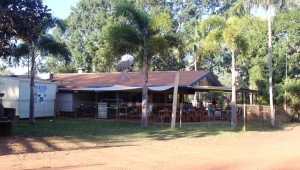
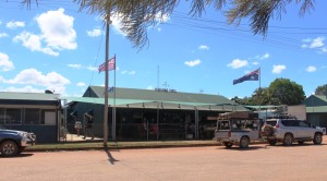
Hann River Roadhouse

Hann River Roadhouse

We stopped for lunch under a shady grove. I took the opportunity to let about 25% of the air pressure out of the tyres. We knew that we had several hundred kilometres of corrugations ahead of us. They start where the bitumen stops about 5 km north of town.

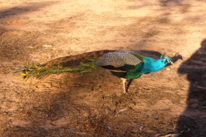
Part of Hann River's Zoo

Part of Hann River’s Zoo

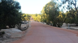
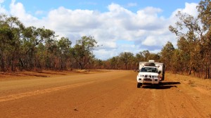
I had some idea of what to expect. The first 10 km or so was quite rough and had to be taken with care but the road then improved to a point where 60 to 65 kph was comfortable, so we made good progress. The terrain varies between flat and hilly. The best sections of road are generally across flat country with the hilly sections not as good. There are many creek crossings, mostly in pronounced dips in the road, almost all of which are sign posted. Both entry to and exit from dips tend to be badly corrugated and although most of the dips have asphalt or concrete at the bottom it is not always well aligned so caution is necessary. The result is that mush of the traffic jams its breaks on at the last minute and then accelerates out of the dip thus adding to the size of the corrugations.

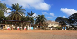
Historic Musgrave Station. Another oasis on a ling dry road

Historic Musgrave Station. Another oasis on a ling dry road

Every 30 km or so there are what are called passing opportunities. They are stretches of asphalt, full road width, from 5 to 10 km in length which give some respite from the dirt road. But most motorists don’t wait for the sealed strip. They come rocketing out of your cloud of dust, pass and pull in front of you and smother you in their dust. And then there are the road trains. They are something else again!

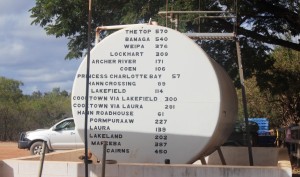
Distances from Musgrave on a fuel storage tank.

Distances from Musgrave on a fuel storage tank.

We did 75 km of unsealed road with about three sealed sections to bring us to the Hann River Roadhouse, where we spent our first night along the Cape Road. We joined about a dozen other camps, spread over the slight slope to the river. The roadhouse provides fuel, food and liquid refreshment, as well as accommodation to the travelling public. Facilities are basic but adequate. We enjoyed a comfortable night, after dining on two of their more than adequate hamburgers.

Coen's Exchange Hotel is frequently referred to as the Sexchange Hotel. Note the sign on the roof

Coen’s Exchange Hotel is frequently referred to as the Sexchange Hotel. Note the sign on the roof

There was more of the same next day. We stopped at Musgrave Station, the next road house along, for a bit of a look. It has a museum that tells the story of the overland telegraph, which we will investigate when we stop there over night on our return journey. Then on to Coen which is

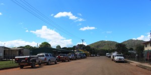
Coen's main street

Coen’s main street

the third most substantial settlement on the Cape (after Weipa and Bamaga) for fuel, lunch and some communication. The town has Telstra internet coverage. We then travelled on a further 60 km to Archer River Roadhouse as our overnight stop, making about 230 km for the day.

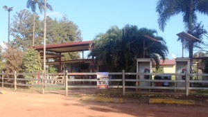
Archer River Roadhouse

Archer River Roadhouse

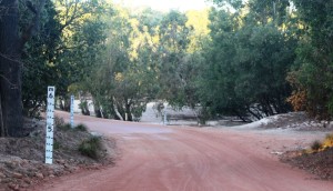
Archer River is a more modern establishment that Hann River, but provides the same services and charges about the same prices. Like Hann River, it sits on a hill above the river. Flood level markings on the amenities block indicate the amount

Relaxing after a hard day on the road in the Archer River

Relaxing after a hard day on the road in the Archer River

of water that rushes down these rivers during a cyclone.

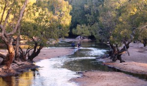
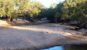
Archer River is a very pretty spot with the greatly reduced water flow of the dry season winding its way through extensive sand banks, to pass under the bridge in the

The Archer River winds through sand banks

The Archer River winds through sand banks

causeway, on its way to the Gulf of Carpentaria. Some travellers camp on the sand and unfortunately too many mark their stay with litter. Dinner in the van that night.


The Archer River Causeway

The Archer River Causeway

They have some decent floods around here

They have some decent floods around here

We were pleased that this vehicle headed out about 15 hours ahead of us

We were pleased that this vehicle headed out about 15 hours ahead of us

We started the next day a bit apprehensively, as we had been given a report in Coen that the road to Weipa was particularly bad. But the report was largely unfounded. There is a bad patch of about 10 km around 60 km out of Weipa, but the graders are working on it.

Morning coffee stop on the Cape York Developmental Road about 100 km east of Weipa

Morning coffee stop on the Cape York Developmental Road about 100 km east of Weipa

The rest is quite good and we did the 200 km in just over 4 hours, including two substantial stops.

We were greeted to Weipa by a closed boom gate and red lights and sat for a couple of minutes while one a huge dump truck made its slow passage

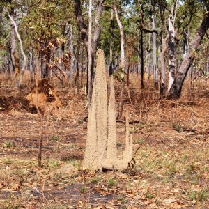
Ant  archetecture

Ant architecture

along the haul road bearing a load of bauxite to the processing plant where it will be processed for shipment to an alumina plant in Australia or overseas.

We are now ensconced in the Weipa camping grounds among a throng of campers, all doing what we are doing. Participating in their very own Cape York Adventure.

Cape York Adventure – Days 1 to 6

We have just about reached the end of day 6 of our trip as I  write this, sitting out beside the van in the Big Crystal Creek Camping Area in the Paluma National Park, about 60 km north of Townsville. We would have peace and tranquility if the people in the van near us were not playing rock music. But it’s not heavy rock.

The original plan was to take four days to Airlie Beach, travelling  via the inland route to Rockhampton and then the Bruce to Proserpine, but having lost the first day with unexpected things needing to be done to the van, we decided to do the Bruce Highway all the way and in three days instead of four.

The most striking feature of the drive was the number of vans coming south. We did a couple of counts. For much of the time we were meeting vans and motor homes at a rate of better than one a minute. It seems that most southerners coming north, travel through inland Queensland before turning towards the coast for the trip home. For this reason there were few vans travelling in our direction on the Bruce Highway.

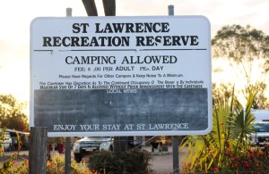
St Lawrence offers free camping to travelers - a donation is requested

St Lawrence offers free camping to travelers – a donation is requested

We reached Miriam Vale on the first day and St Lawrence the second, arriving at Airlie Beach at the end of the third day. At St Lawrence the council has provided an extensive over night camping area, supported by donations from
users. As well as extensive standing areas

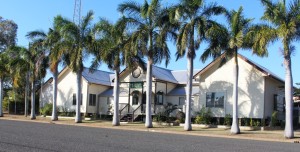
The old St Lawrence Shire Offices

The old St Lawrence Shire Offices

there is a modern amenities block with flush toilets and coin-in-the-slot showers. We drove into town before we left. The Post Office is the only retail business and the street was as quiet as Dodge City at high noon. St Lawrence was one of the first towns settled on the coast of Queensland.

We had come to Airlie Beach to do a cruise to Whitehaven Beach, as we had decided to spend a Red Balloon voucher that the family had given me for my birthday, on the cruise. And Airlie is on the way to Cape York anyway. And who needs an excuse to go there?

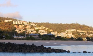
Units on the hill at Airlie Beach in the morning sunlight

Units on the hill at Airlie Beach in the morning sunlight

An early start was required. Out of bed at  5.00 am  and at the Cruise Whitsunday terminal at 6.10. Heavy cloud greeted us as day broke, but by the time we boarded the “Orca”, a sea going catamaran, the cloud had burned off to produce a clear sky that smiled on us all day.

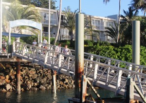
Arrival of the ferry at Daydream Island

Arrival of the ferry at Daydream Island

Cruise Whitsunday run the ferry service that connects the island resorts. The tours are run in conjunction with the passenger transfer service. The first call was Daydream Island to exchange passengers and then off for the 45 minute run to Hamilton Island. We stayed on board for both of these ports.

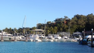
Boats in Hamilton Island harbour

Boats in Hamilton Island harbour

Then we were on our way to the main event. To reach Whitehaven Beach the boat passed to the north of Hamilton Island and then powered across relatively open sea to Solway Passage, the gap between the islands that leads to the Beach. There was reasonable swell

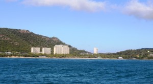
Hamilton Island High Rise from the east

Hamilton Island High Rise from the east

running, so the boat was moving around and spray was billowing from the bow. The kids on board loved it. And so did this big kid. The pure joy of a floor under my feet that moved with the sea.

When we reached our destination the boat nosed

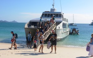
passengers disembarking at Whitehaven Beach

passengers disembarking at Whitehaven Beach

into the beach and we all disembarked via an extending ramp, along with some basic supplies so that we wouldn’t perish during the 2 hours that we were ashore. Our fellow passengers spread out on the huge beach. Some swam, others sun baked and others walked. Kids

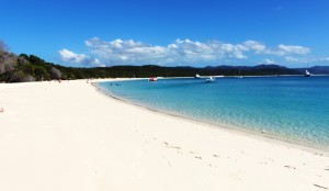
Beautiful Hhitehaven Beach is 98.5% silicia

Beautiful Whitehaven Beach is 98.5% silica

built sand castles. One Dad buried his daughter and turned her into a mermaid. We walked and then sat in the shade, fortified by a cold drink and a Mars Bar.

Back on board, the “Orca” headed north to make a complete circuit of Whitsunday Island as we returned to Daydream Island where we changed ferries for our return to Airlie Beach.


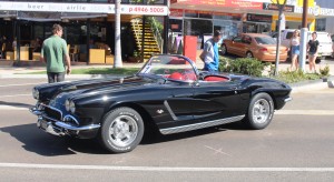
The one and only Chevy Corvette

The one and only Chevy Corvette

The Whitsunday Reef Festival was on this weekend so we walked along the main street of Airlie to take a look. Most activity is at night ,which befits a place like Airlie, but there was a brilliant display of restored classic cars, with a couple of vintage models as well. Oh, those Chevy Corvettes. Wow! There was also a very loud rock band. And I mean LOUD.

A bit of grocery shopping and then back to camp. A most enjoyable day!

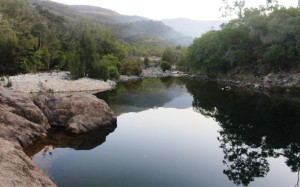
The tranquil waters of Crystal Creek with smoke from a mountain fire in the background

The tranquil waters of Crystal Creek with smoke from a mountain fire in the background

Today we have travelled from Airlie Beach, a distance of about 360 km. Some  cloud around this morning but a mostly clear afternoon. Very pleasant driving.

This camp site is on Big Crystal Creek which has a large rock pool, currently full of running water. And you have guessed it. The water is crystal clear. It is in great demand for swimming and had a real workout that day, we have been told.

Preparing for the Cape

All set up for last year's trip to the Centre

All set up for last years trip to the Center

The car went in for a pre- trip service on Monday so I walked down to a local McDonald’s to spend the waiting time reading and drinking their coffee. But I found myself in a construction zone. They are rebuilding the place around the customers. I hid in an outside corner. Thankfully it was a bit warmer than previous days.

To get us started, here is a rough outline of our itinerary as it currently stands.
Days 1 to 3 – Along the road on the way to Airlie Beach. 1000 km in 3 days. Why hurry?
Days 4 to 6 –  Airlie Beach including a half day trip to Whitehaven Beach. We are spending my 75th birthday present Red Balloon voucher. Thanks family.
Days 7 to 10 – Various stops along the way to Weipa
Days 11 to 14 – at Weipa
Days 15 to 16 – Merluna cattle station
Day 17 –  Bramwell Station Stay – an over night stop to break the final run to the top into two days.
Days 18 to 21 –  Punsand Bay. This is as for north as you will find a caravan park with all facilities. The Cape is just a few km away to the east. While here we will do a day trip to Thursday Island and Horne Island.
Day 22 – Bramwell Station again
Days 23 to 25 – Traveling back to the southern Cape area
Days 26 to 40 marking our way home by a still to be finalised route. But we may extended our time on the Cape.

So that is the initial plan. We will keep you updated as we travel.