Destination Tasmania – Part 4 – Strahan, Queenstown and Zeehan

10th & 11th February, 2020

Please Note: Videos covering the material in this blog post can be found at the bottom of the post.

Heritage Tours boat “Harbour Master” at Sarah Island jetty

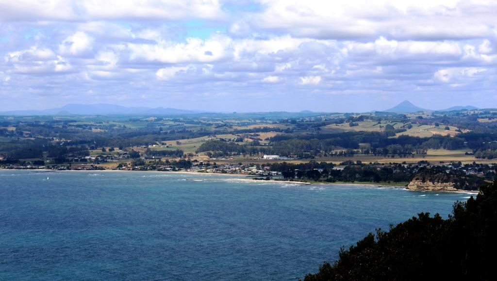
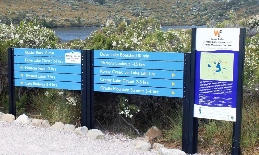
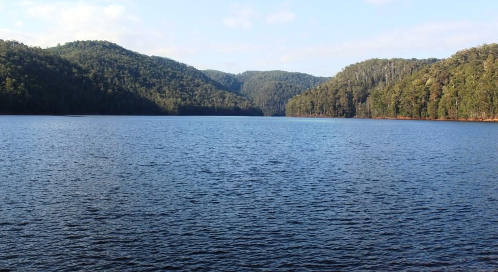
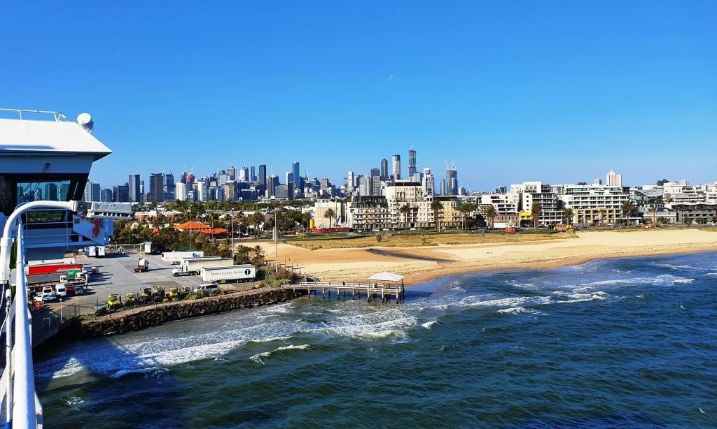
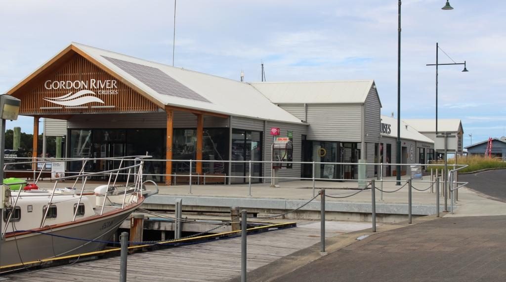
I suppose tours of Macquarie Harbour and The Gordon River were operating 45 years ago when we were last at Strahan, but I have no recollection of them. But that was well before the issue of the Franklin Dam and all of the disputes over Lake Pedder gave this area such prominence. We had become aware that the cruise was one of the attractions that draw tourists to Strahan. We booked in advance to make sure that we had a good seat.

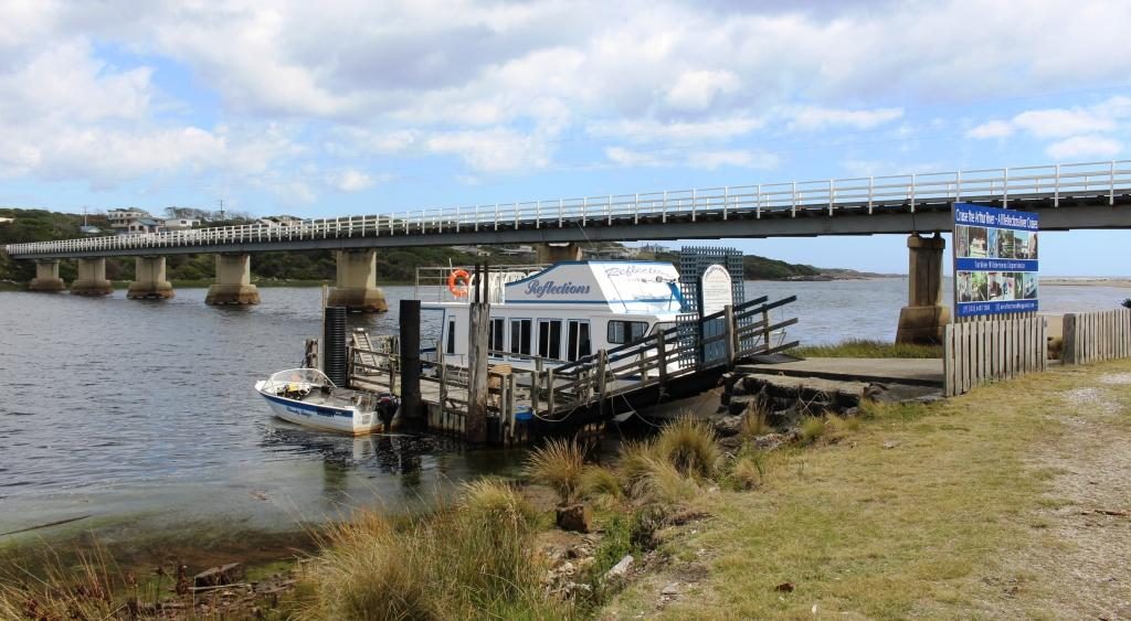
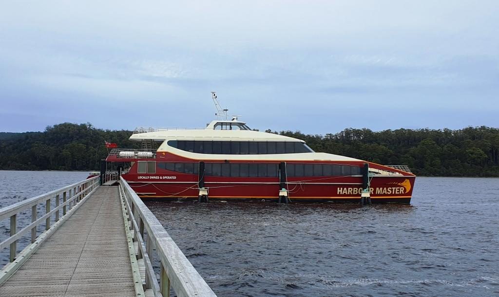
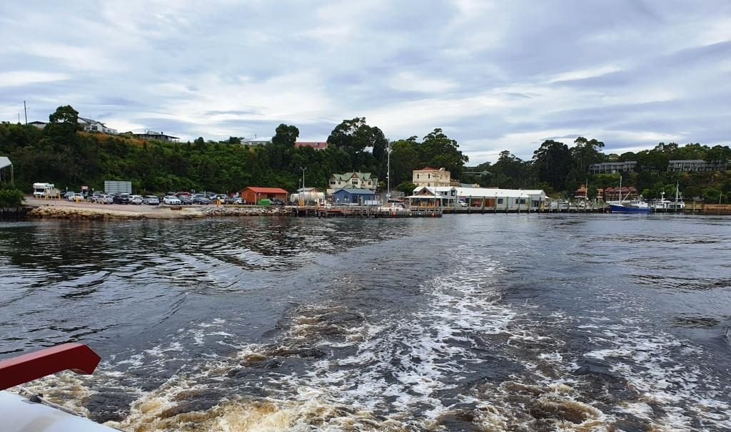
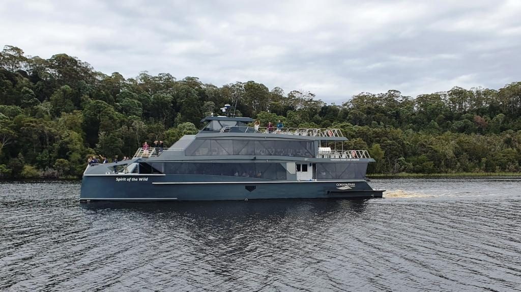
The day started overcast and cool but improved to produce sunshine by mid afternoon. We were not affected by the morning chill as we were on board the “Harbour Master” our Heritage Tours cruise boat, protected by its broad glass windows.

Departing Strahan cruise terminal
Strahan Railway Station at Regatta Point

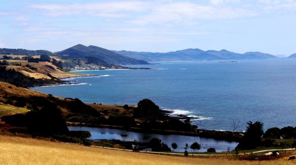
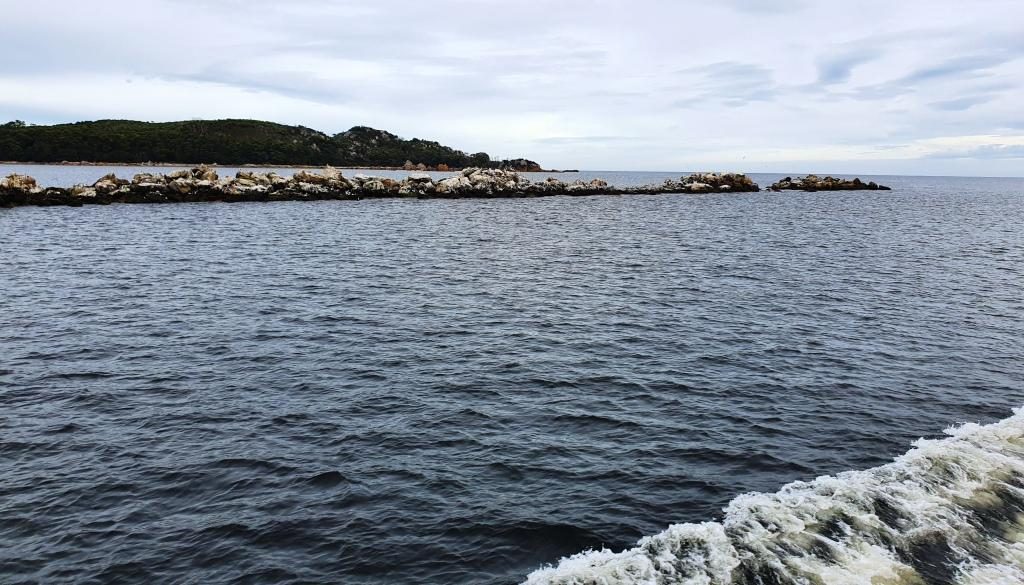
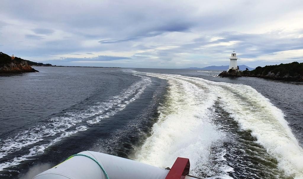
The cruise boat headed directly to Hells Gates, the entrance through which ships had to pass to reach the convict settlement on Sarah Island. The entrance is narrow and dangerous, particularly when a sea is running. In the days of sail, ships would anchor outside of the harbour, wait for slack tide and be towed through by sailors rowing the ship’s longboat.

Old Macquarie Heads Signal Station
Coloured rocks at Hell’s Gate
Hell’s Gate passage from the ocean side

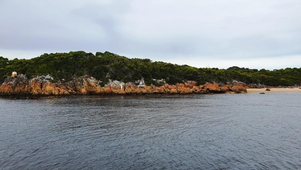
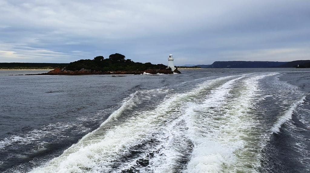
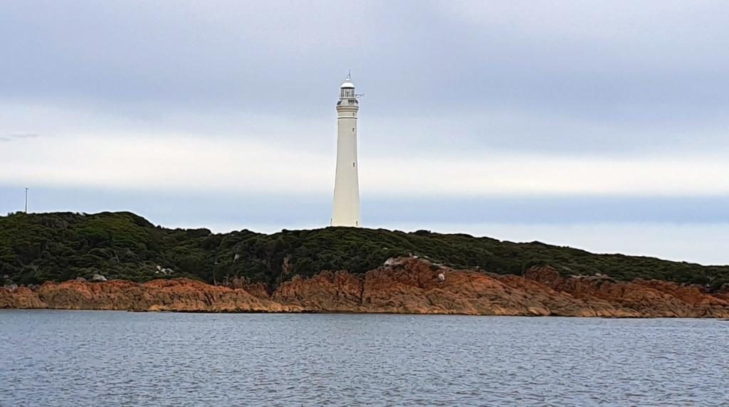
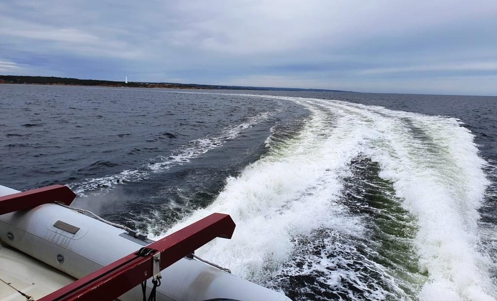
There was no sign of Hell at the gates. The sea was like a mill pond. Not only did we proceed through the heads at full speed but continued out past the Cape Sorrel lighthouse into the Indian Ocean for a look both ways along the coast. Such conditions only occur about five times per year, we were told.

A breakwater and the coast outside Macquarie Harbour heads
Cape Sorrel Lighthouse at the south of Macquarie Harbour entrance
In the open sea. View south past Cape Sorrel Light
View from inside Hell’s Gate out to sea. Ships entering and leaving port had to pass between the channel light and the point on the left.

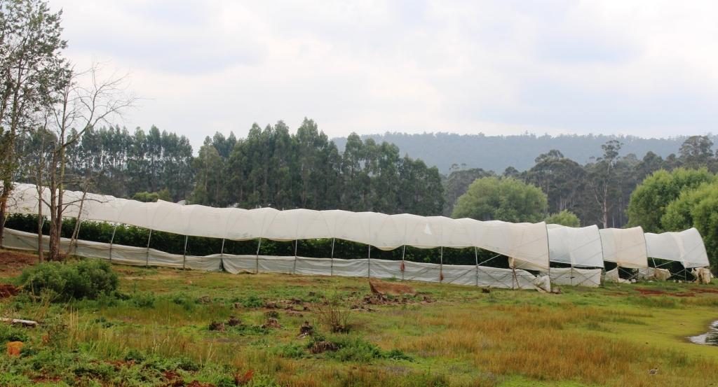
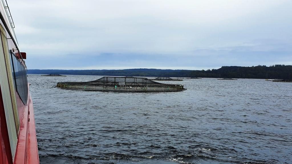
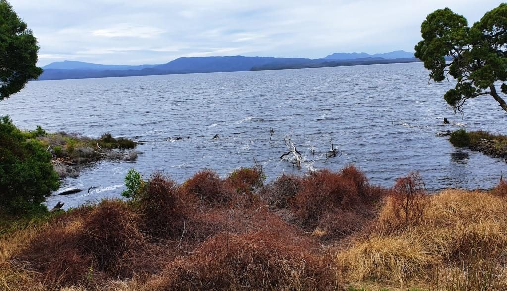
I had read about Sarah Island as a convict prison but for some reason thought that it was located near the heads. But it is at the other end of this rather long harbour. On our way to Sarah Island from Hell’s Gates we stopped to see the salmon and trout farms where the fish are grown to eating size in large circular mesh cages that are anchored in the waters of the harbour. There is nothing to see other than the nets but the skipper of the boat gave us quite a bit of information about the husbandry practices. In short, they feed the fish and the fish grow to eating size. What else is there to known?

Fish farms in Macquarie Harbour
View to the east in Macquarie Harbour

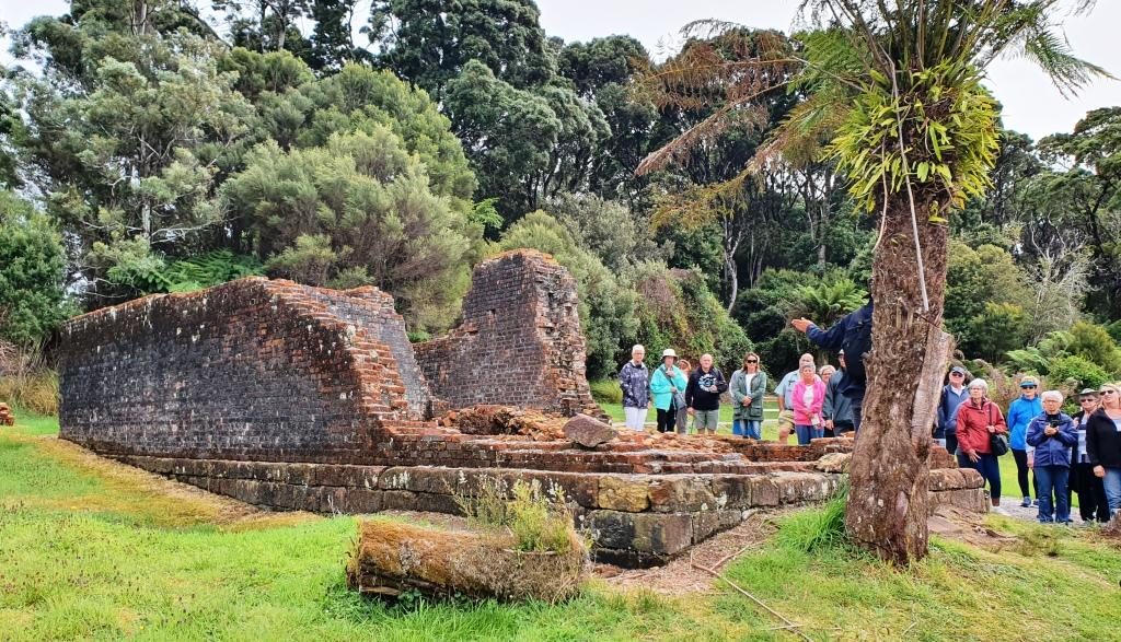
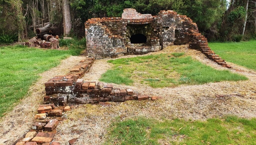
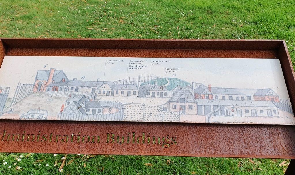
Sarah Island had the worst reputation of any Australian convict settlement. It was established to gather Huon pine from the surrounding forests, but when the difficult harbour entrance restricted the transport of the timber, shipbuilding was established at Macquarie Harbour at the Sarah Island convict settlement. Well over one hundred boats were built with over half of them ocean going ships.

Walking ashore at Sarah Island
Sarah Island landing

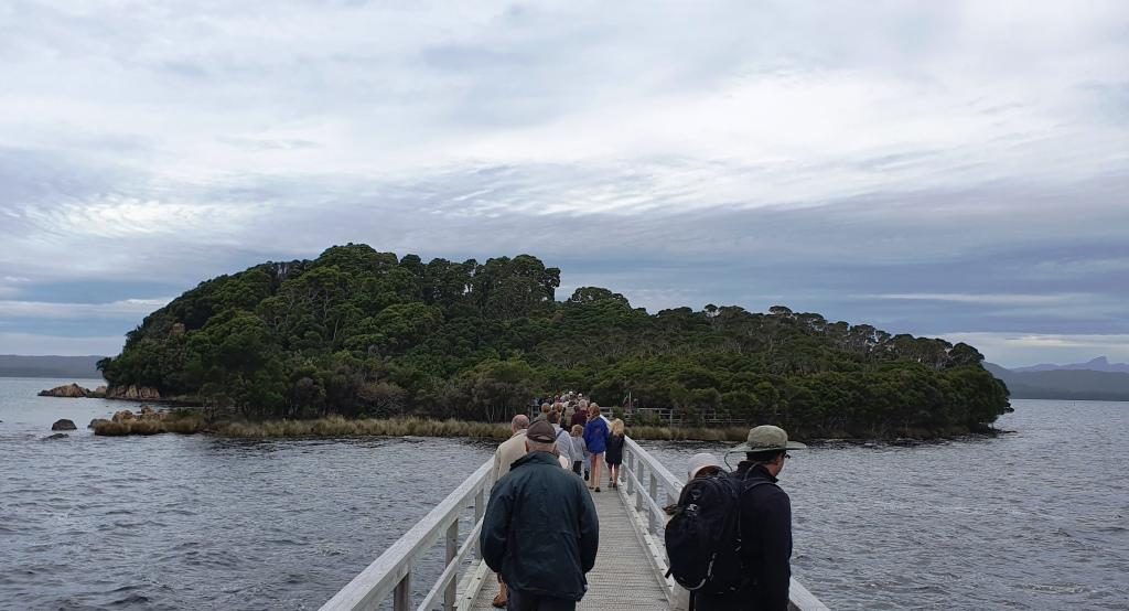
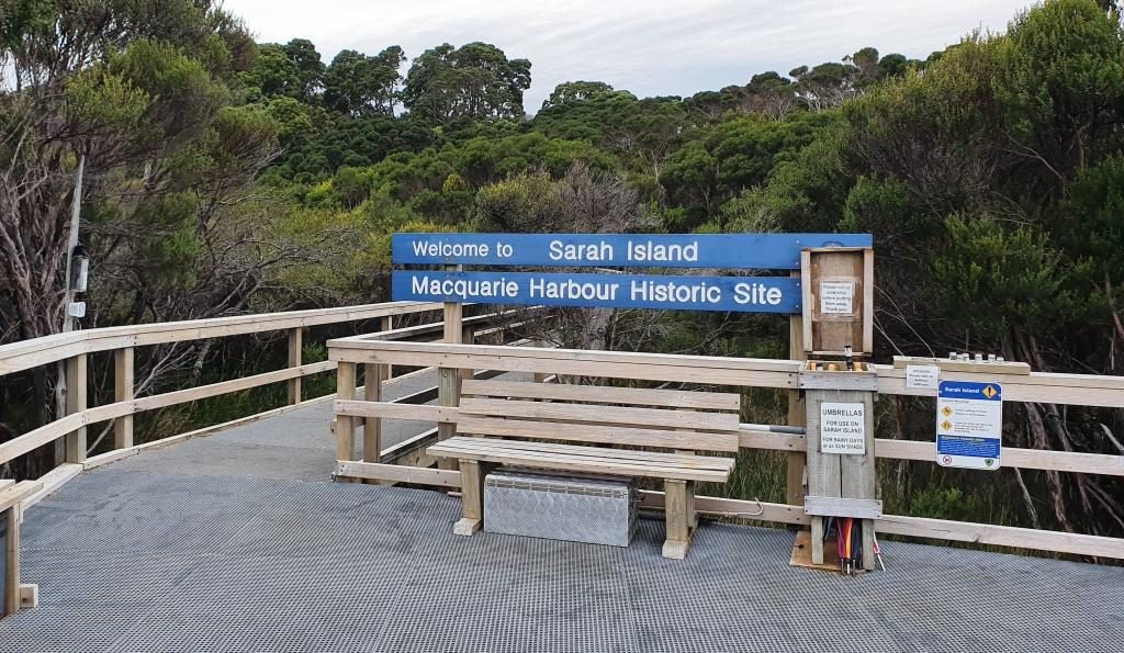
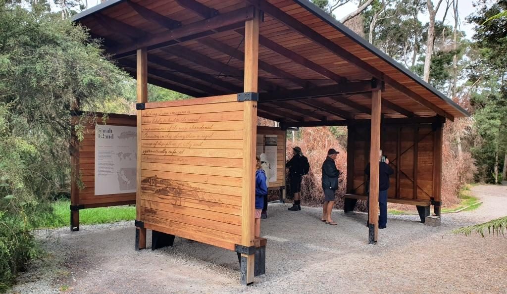
A solid path has been built linking the ruins to the jetty for ease of access. Guides are on hand to tell tourists all about the settlement. You can still see remnants of the construction slipways embedded in the shoreline. There are ruins of buildings with information signage throughout. It is all very well done.

Remnants of boat building slipways in the shore line of Sarah Island
A larger ship building slipway and an alternative landing jetty
Information shelter

As we departed Sarah Island, the crew prepared a delicious buffet lunch of cold meats and salad including slices of Camembert cheese so large that you would think the stuff was made in Tasmania.

Cruise passengers with a guide at convict prison ruins
Ruins of Sarah Island Bakery
Information plaque showing layout of Sarah Island administration building

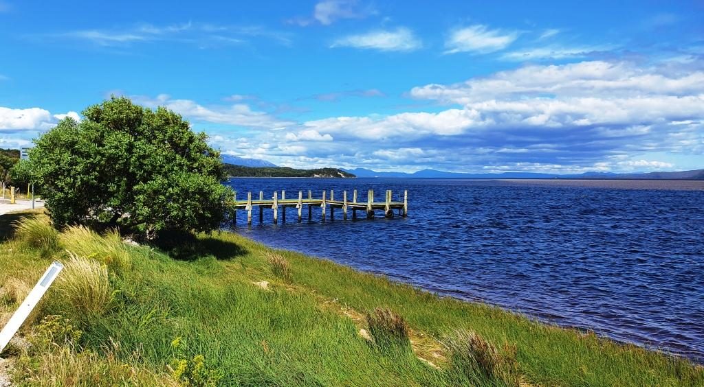
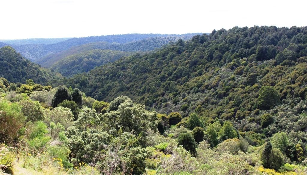
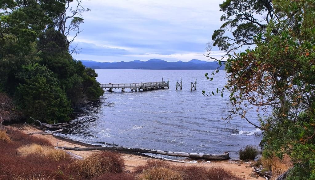
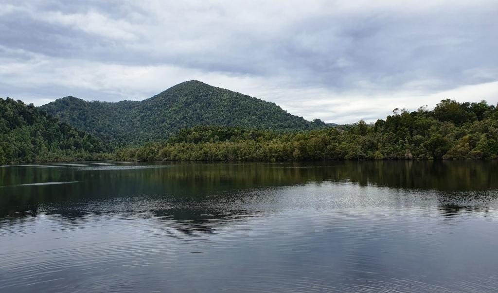
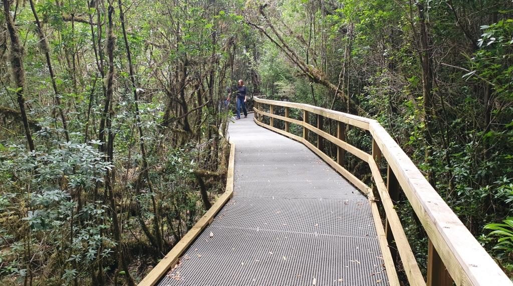
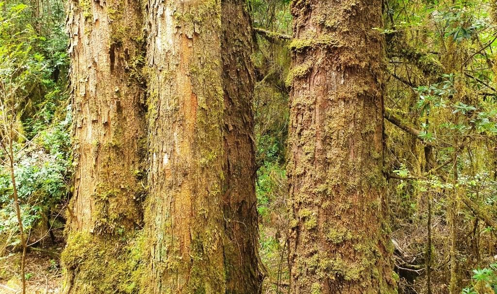
From Sarah Island we motored directly to the mouth of the Gordon River where speed was reduced to a sedate 5 knots or so. The destination in the river was Heritage Landing, where berthing facilities have been built for the boat and a board walk constructed to provide access to the rain forest that covers the steep sides of the Gordon valley. Particularly, it gives access to Huon pine in its natural setting. Huon pine is not only resistant to rot but also to the marine worm that destroys lesser timber. It is a slow growing tree. Large specimens are thousands of years old.

Excellent reflections are sometimes viewed on the Gordon but the wind had come up by the time we reached it so the surface was a series of ripples instead of a mirror.

The placid Gordon River near where it joins Macquarie Harbour
Boardwalk to Huon pine viewing area at Heritage Landing

As we cruised slowly up the river the skipper retold the story of the Franklin River protests of thirty or forty years ago when the Tasmanian Hydro Electricity Commission wanted to build a dam on the Gordon River downstream from where it is joined by the Franklin River. If you are over 60 you will no doubt remember all the fuss.

Mature Huon pine
The “Blue Boat” from the other cruise operator at Strahan

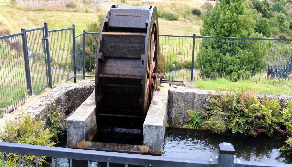
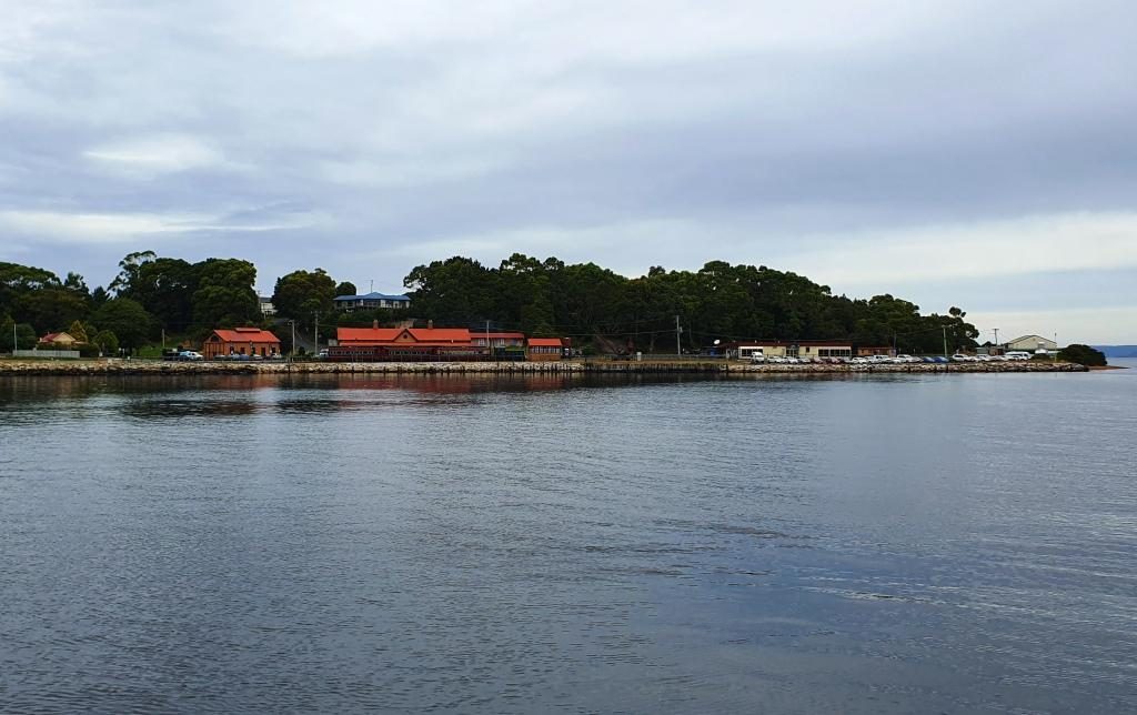
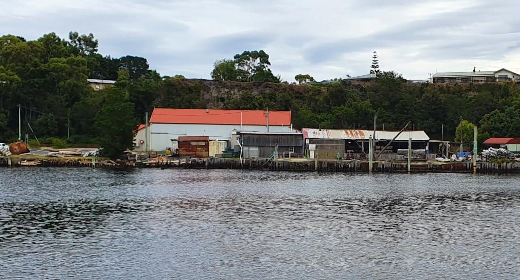
On the quayside at Strahan there remains an operating sawmill that processes Huon pine. The cruise boat completes the tour by berthing at the mill to enable passengers to see the Huon pine being worked. The mill sells completed timber products including a range to appeal to tourists with spare money. I would rather spend the money on the finished product of the fish farm.

The sawmill that works Huon pine at Strahan wharf

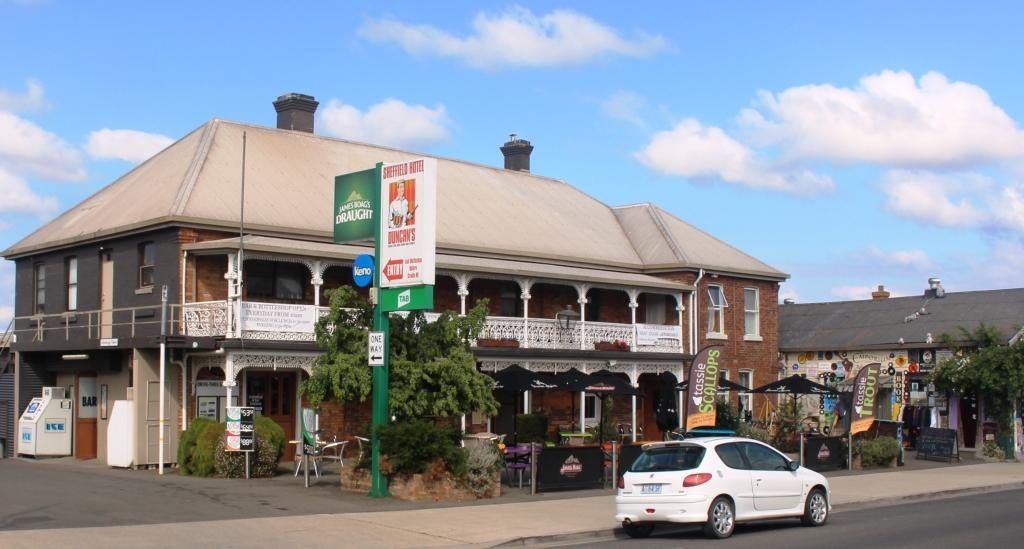
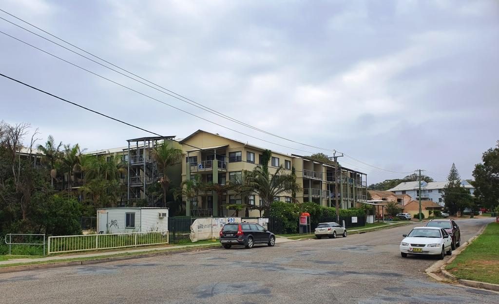
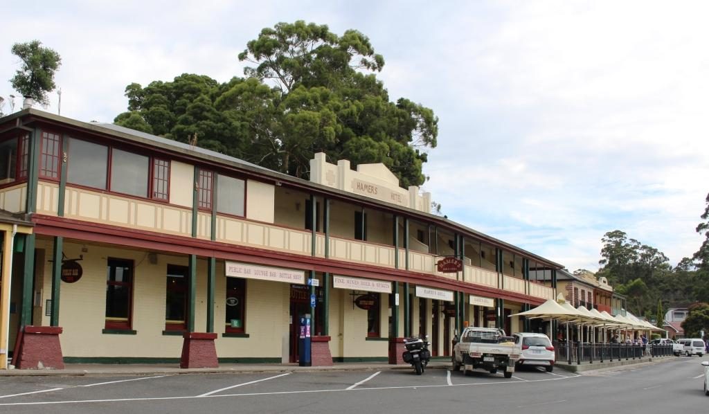
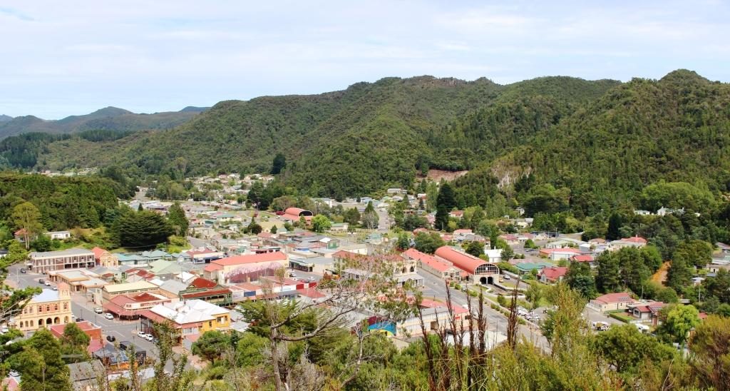
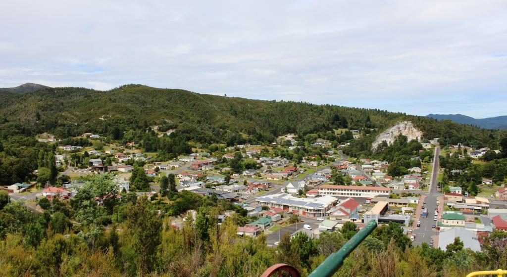
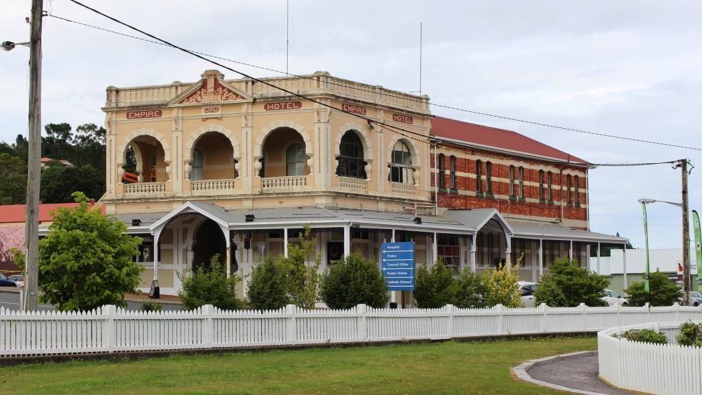
Our second day in the South West was set aside for a driving tour in the area. We did the triangle Strahan-Queenstown-Zeehan-Strahan, about 125 km. But before heading off on the 47 km first part of the trip to Queenstown we took a closer look at Strahan.

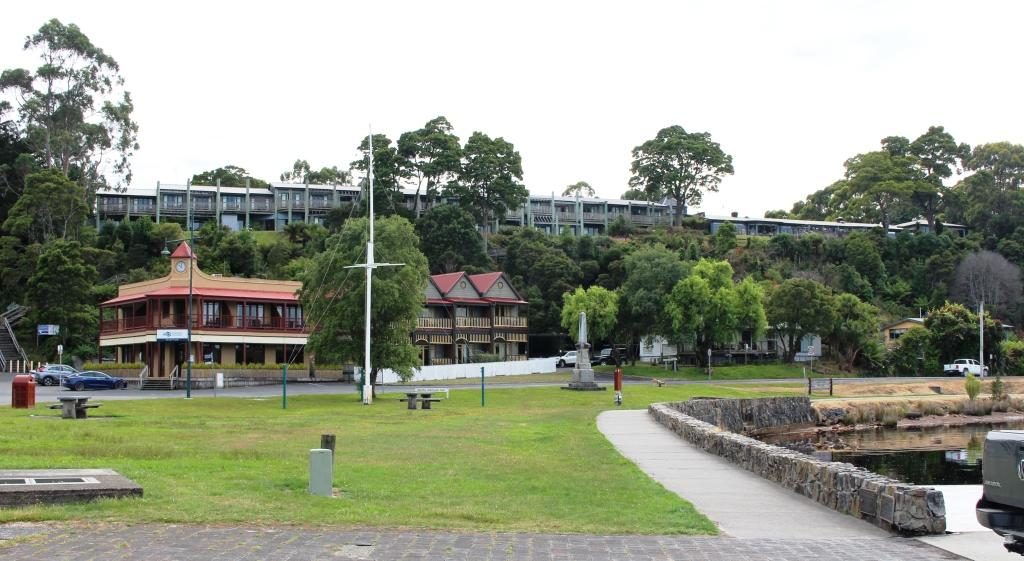
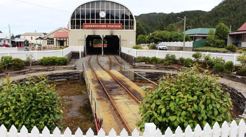
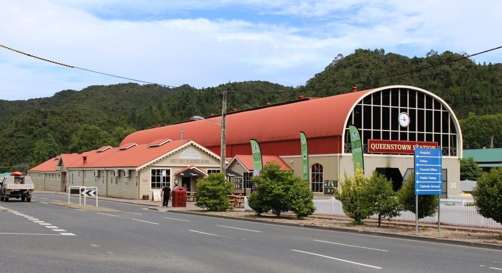
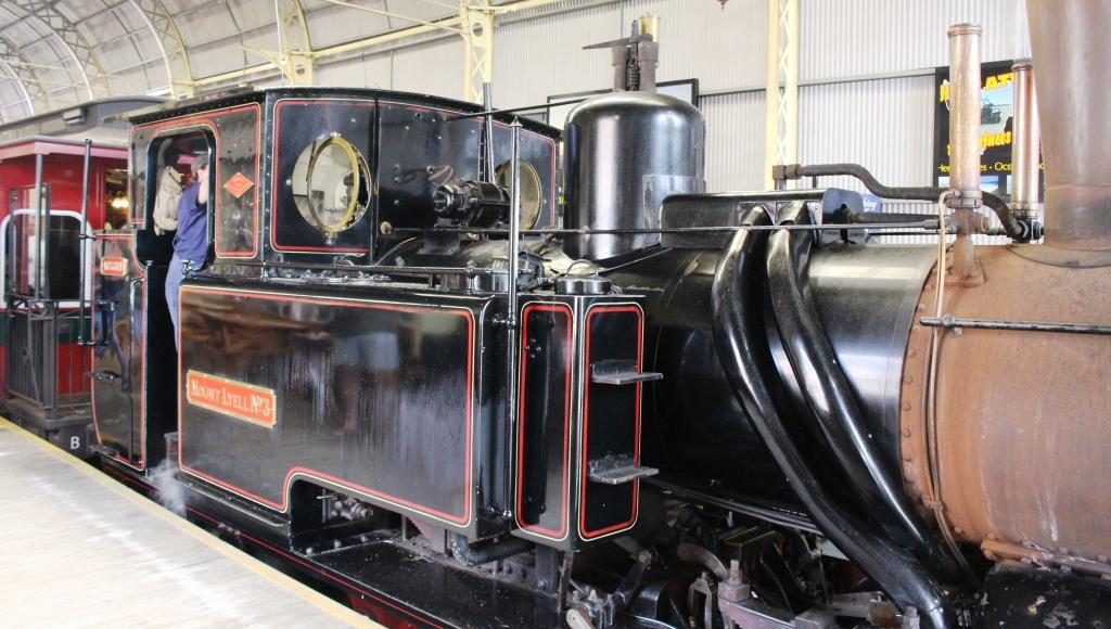
We first visited Regatta Point to look at the Strahan end of the Queenstown to Strahan tourist railway. This service operates on the railway built to get copper ore from the mines in Queenstown to the port, to be shipped to the world.  Because of steep inclines on the route, part of the track uses a rack and pinion system where drive cogs on the engine engage with teeth in a track that is positioned between the normal rails.

Strahan historic railway station
Cafe tables at Strahan station
Strahan waterfront area viewed from Regatta Point station

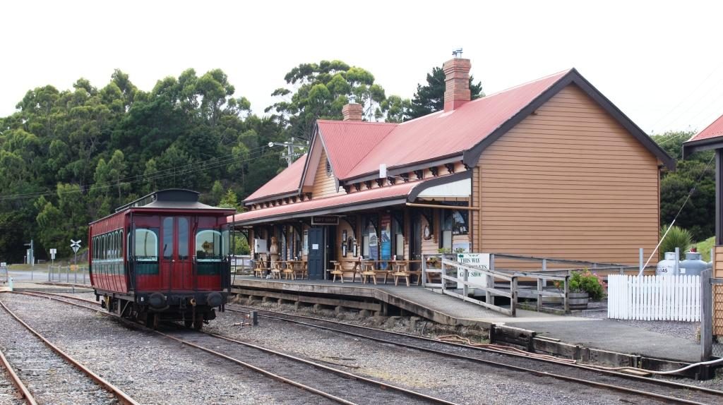
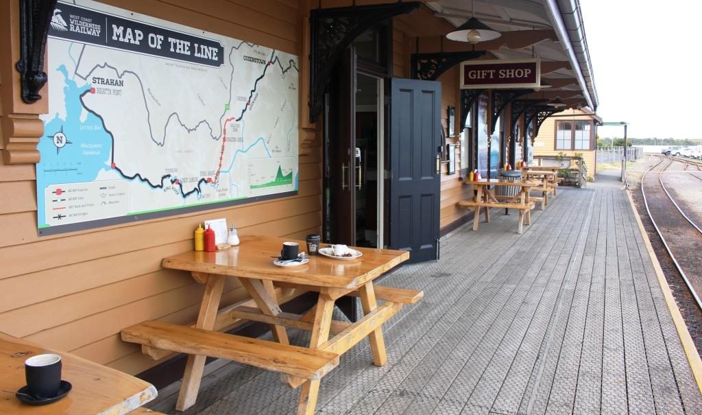
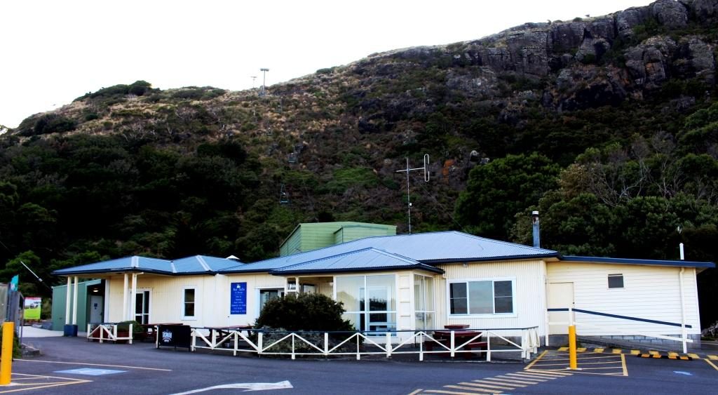
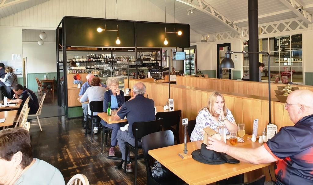
The station building in Strahan is the original, built in the late 1990s. It now contains a cafe and gift shop and normal tourist facilities.  We were a bit early for coffee, but the view from the tables on the old platform is such that you would not want to finish your coffee too quickly.

Historic buildings over the street from the wharf at Strahan
Tourist cruise base at Strahan
Strahan main street
Tourist accommodation overlooking Strahan waterfront

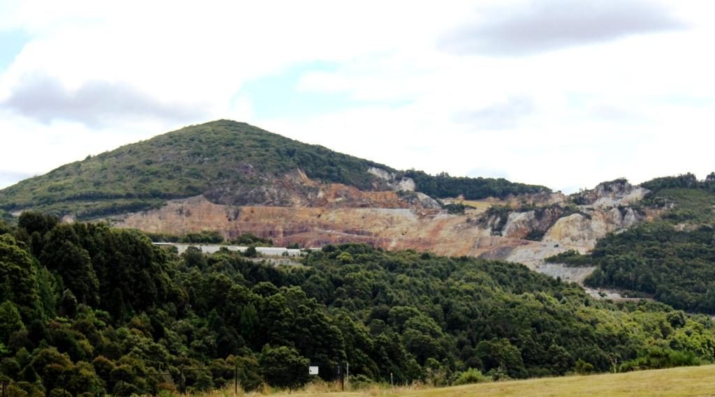
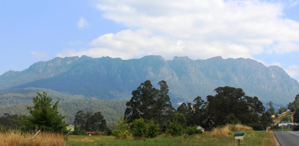
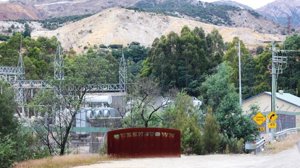
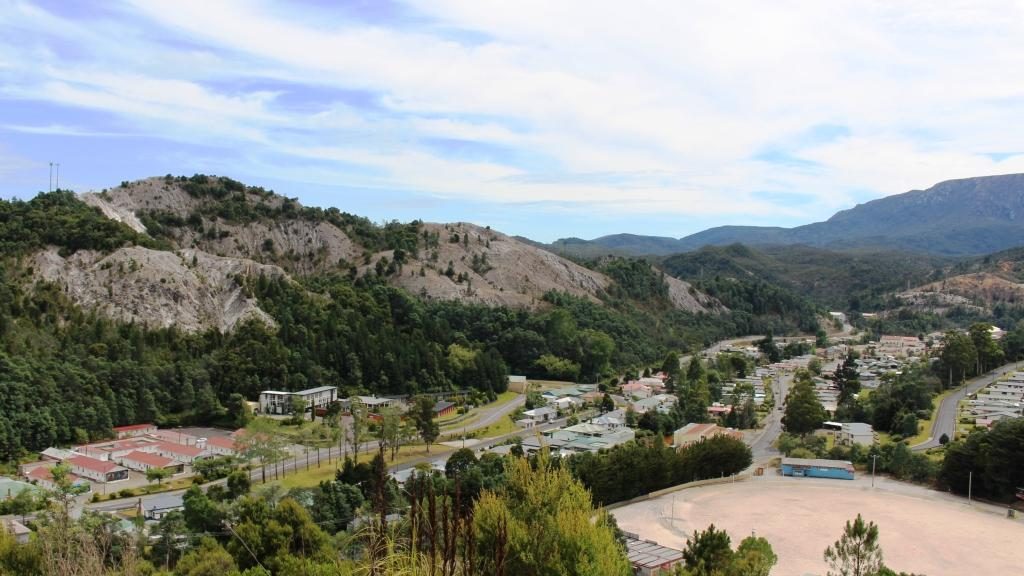
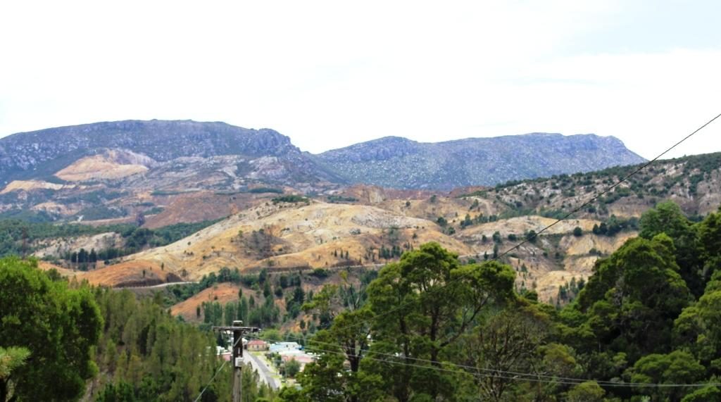
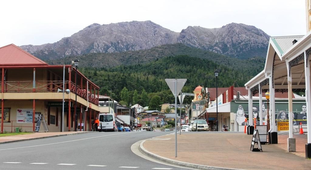
Queenstown occupies one of the most dramatic sites that you can imagine. It is totally surrounded by rocky mountain ranges, much without vegetation. Some naturally lack vegetation, but hills were denuded in a clearing frenzy to feed the copper smelters in the early days of mine operation.  It is a town where I would prefer not to be on a hot day.

Rocky mountains approaching Queenstown
Queenstown sign approaching from Strahan

We drove around to get a feel for the place and then walked around the main streets of the commercial area. We then located the nearest street access to the Spoin Kopf lookout which is conveniently located near the CBD, almost in the centre of town. I climbed the steep track to the summit and I am glad that I did. The view was spectacular. The lookout was built as a memorial to its namesake, a battle for a hill during the Boer War in South Africa.

Main business area of Queenstown from Spion Kopf
Queenstown suburbs to the east of the central business district
Mine workings and the corner of Queenstown where the highway passes through
Hills surrounding Queenstown were stripped of vegetation to fire refinery furnaces. The area is slowly re-vegetating.

Queenstown’s history has long been tied to the mining industry. This mountainous area was first explored in 1862. Later alluvial gold was discovered at Mount Lyell, prompting the formation of the Mount Lyell Mining Company in 1881. In 1882 the company began searching for and discovered copper. The Mount Lyell company ultimately became the Mount Lyell Mining and Railway Company.

Queenstown’s Empire Hotel. Completed in 1901.
View along Orr Street towards Mount Owen
Queenstown Post Office. Built in 1902.

The Queenstown end of the railway has a smartly rebuilt station that offers the same facilities as its counterpart at Strahan, but on a larger scale. We had lunch in the cafe and then waited a few minutes to watch the train come huffing in from its return trip to a point about half way to Strahan.  There was a good number of people on board who seemed to have enjoyed the experience.

Queenstown Railway Station and engine turn table
Queenstown Railway Station. New building for the West Coast Wilderness Railway
A steam engine at the end of its days work
Tourist cafe at Queenstown Railway Station. You can watch the train through the glass wall on the right

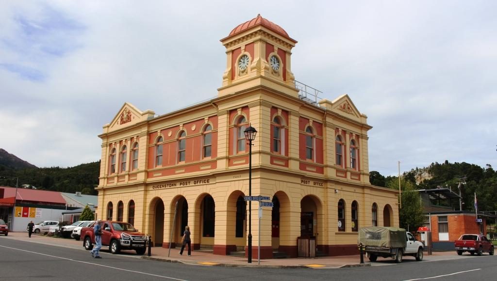
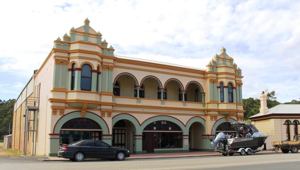
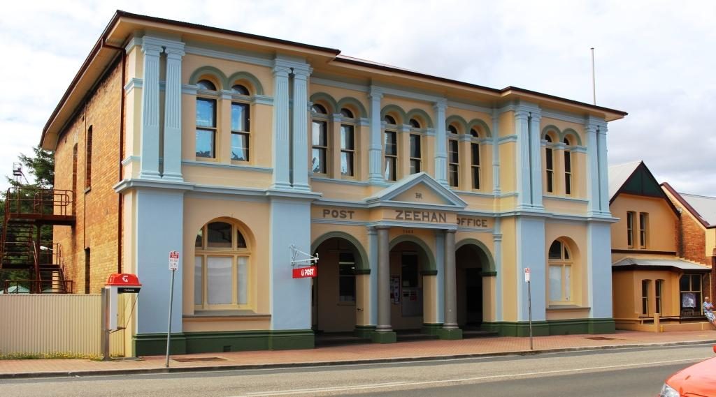
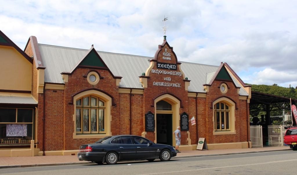
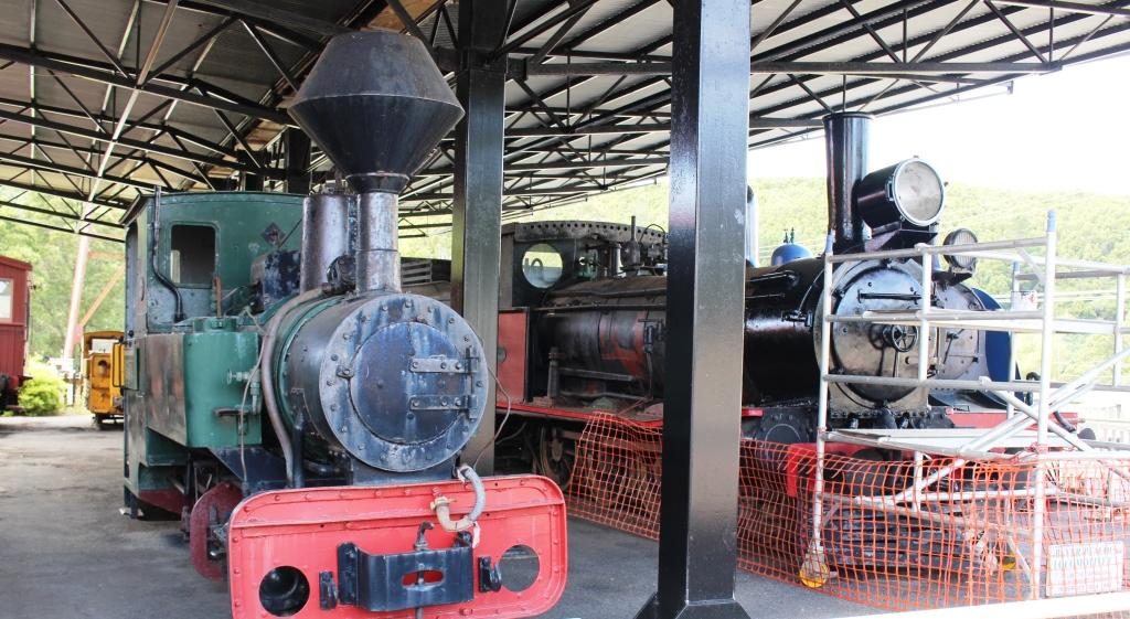
We then drove the 35 km or so to Zeehan, another mining town, but this time a producer of silver and zinc.  I am not sure of the status of mining in Zeehan but the town appears to be partly closed down. But it had its days of grandeur, demonstrated by the fine buildings that line its main street. The West Coast Heritage Centre is in Zeehan, housed in the ornate School of Mining and Metallurgy building.

Gaiety Theatre and Grand Hotel, Zeehan
Zeehan Post Office
Zeehan School of Mines and Metallurgy is now the West Coast Heritage Centre
The Railway Museum is part of the West Coast Heritage Centre
One of Zeehans banks

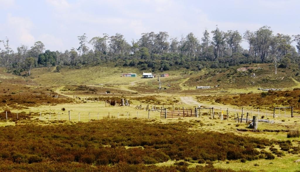
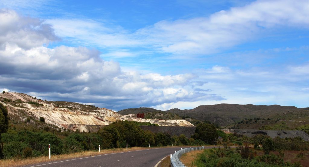
Returning to Strahan, we were on the same road as we had travelled two days before. We had noticed mining residue beside the road but we now had time to stop and take a look. Some old pieces of equipment were strewn over the area but it was not clear what kind of mining activity had been conducted there.

Mining area at Zeehan on the road to Strahan
Four wheel drive access to the beach at Henty Dunes

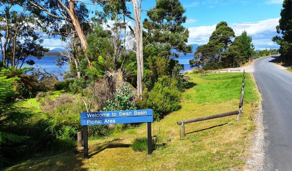
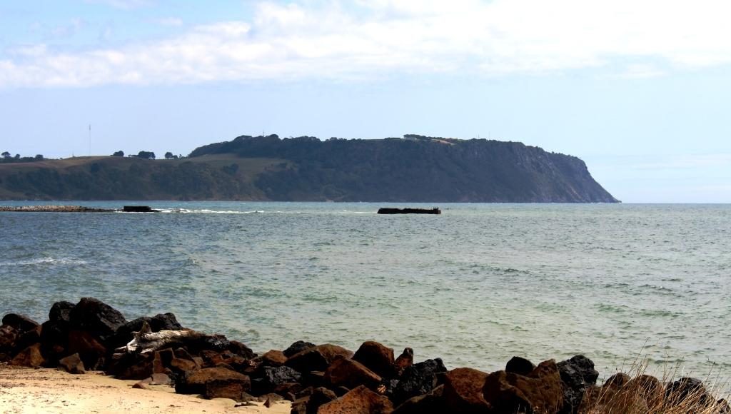
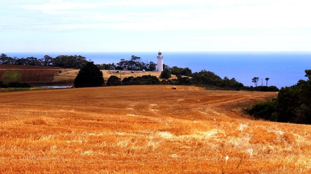
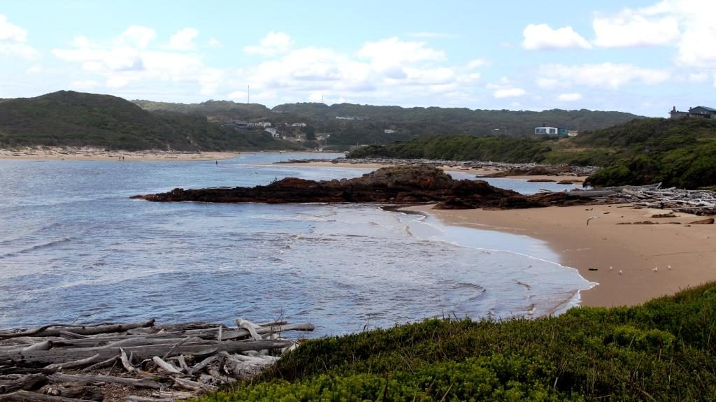
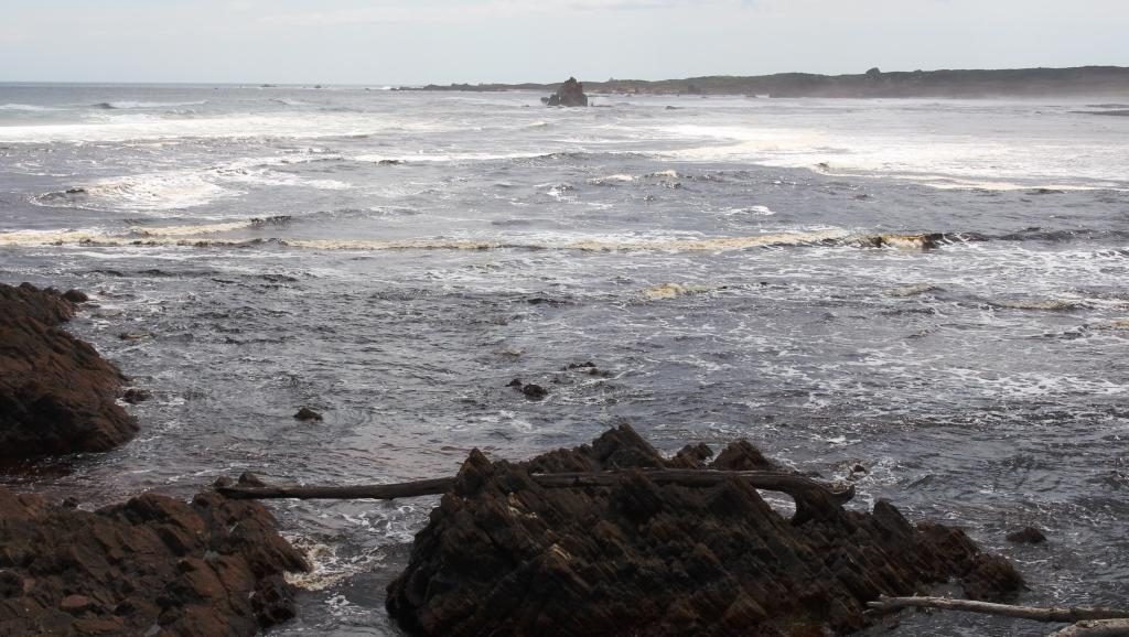
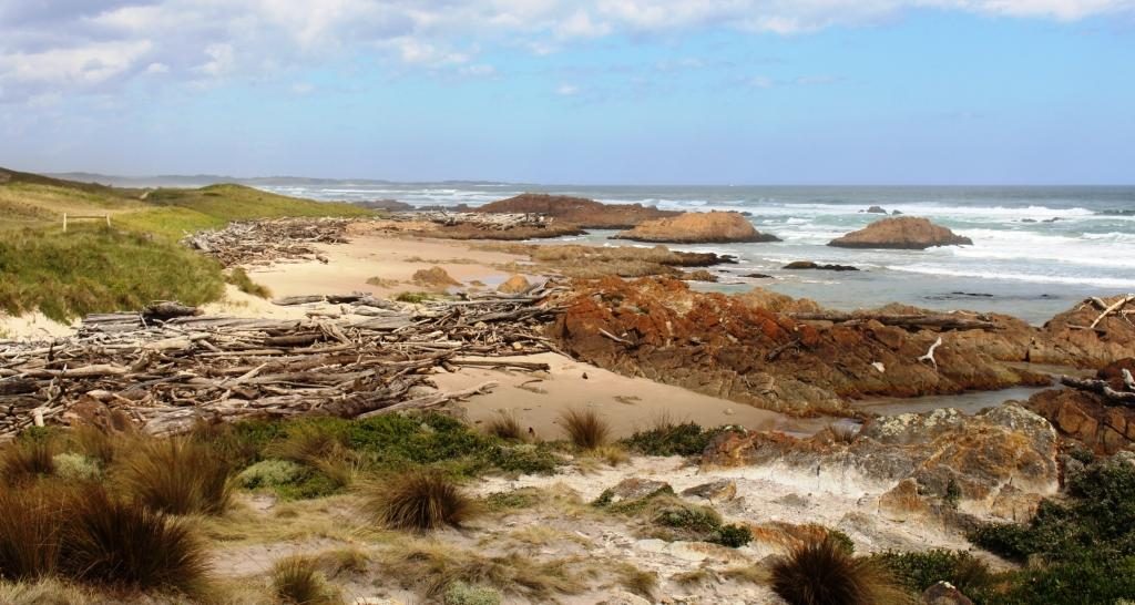
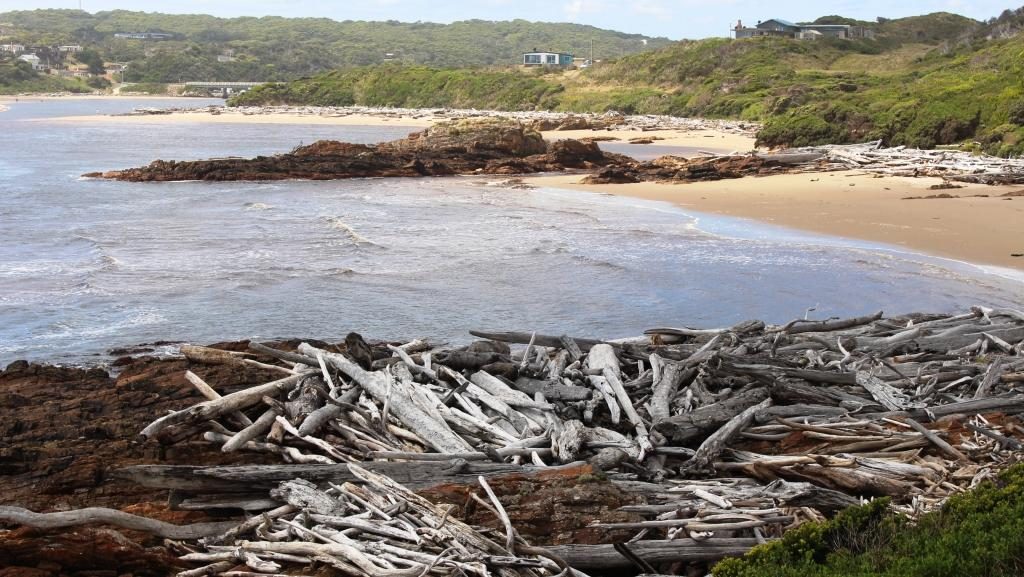
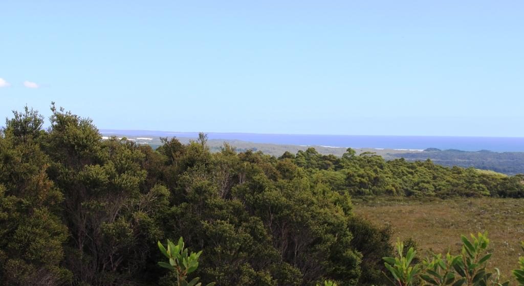
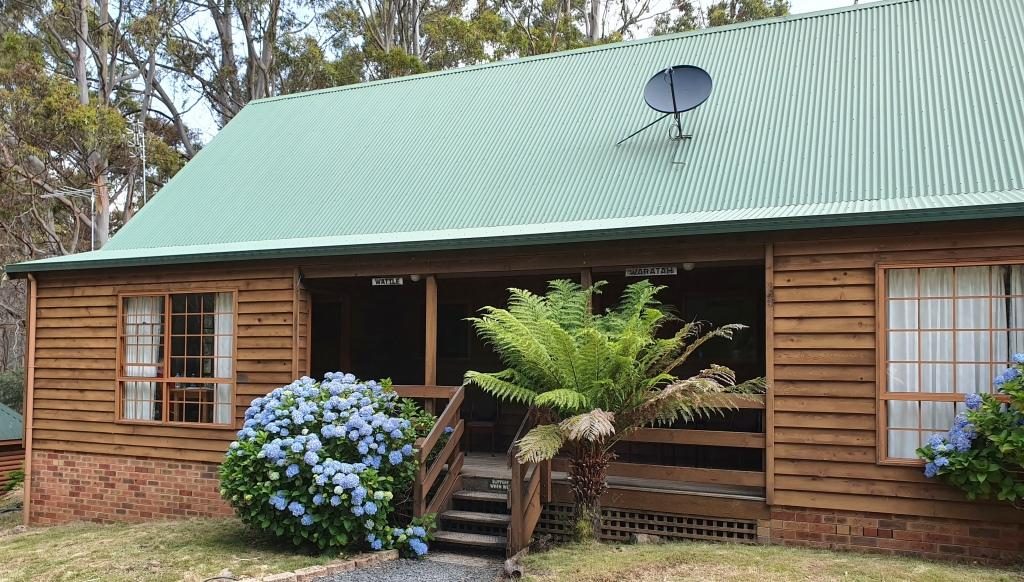
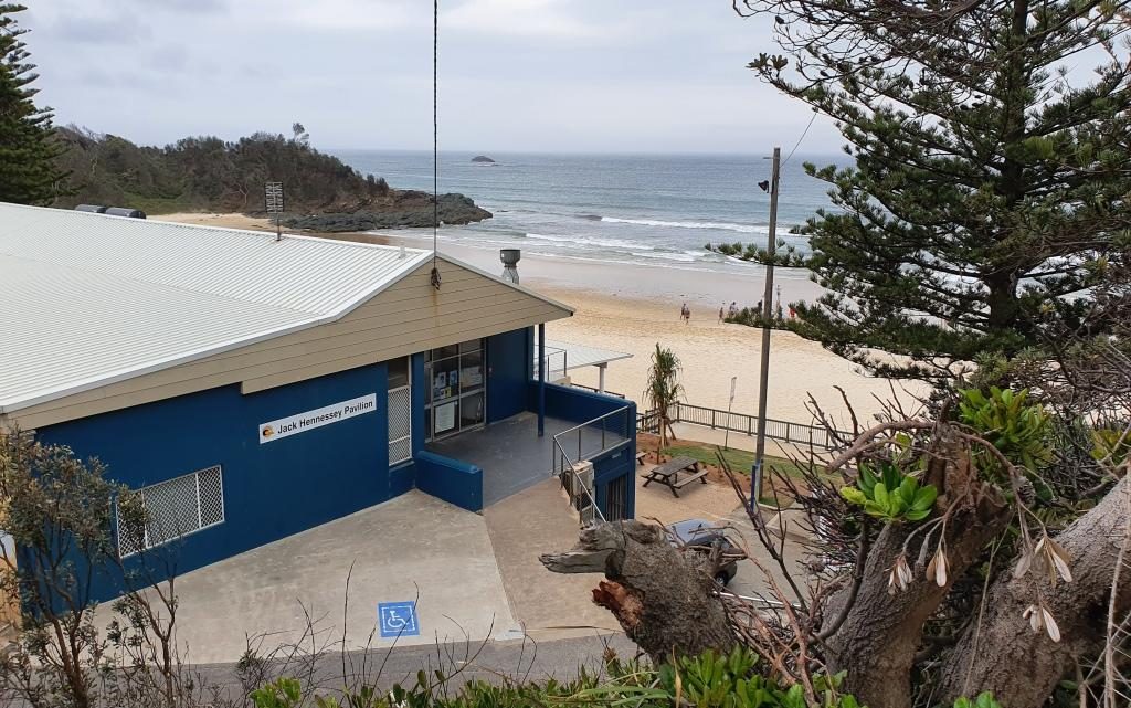
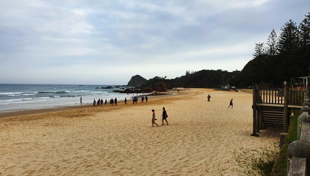
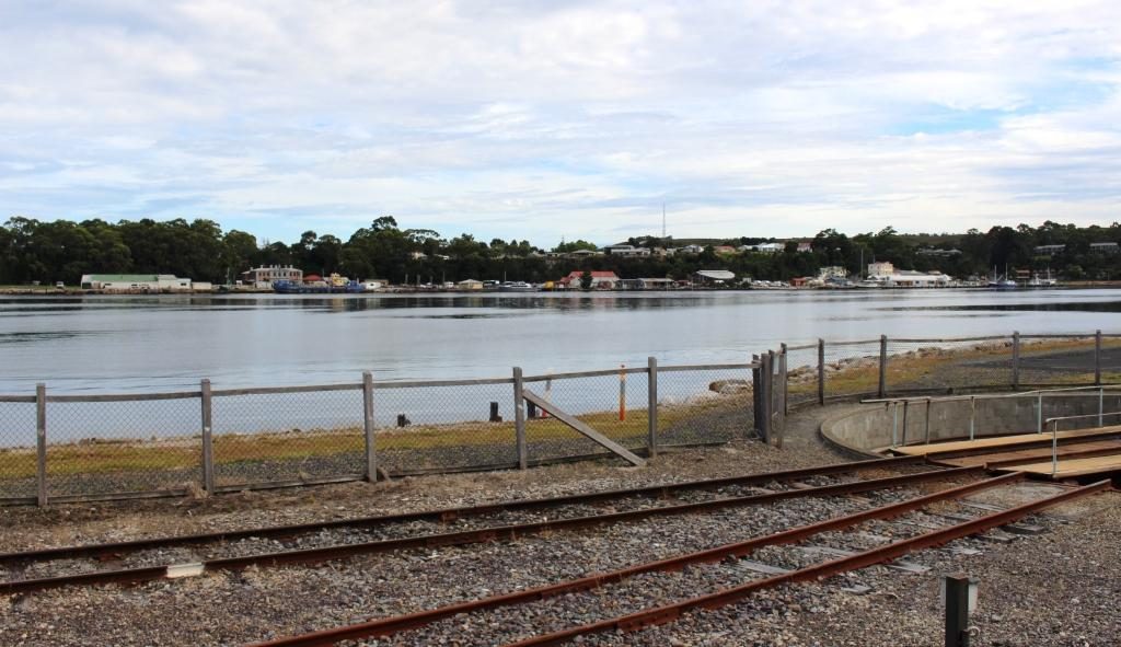
With time left in the day, before we returned to our cabin, we took the opportunity to drive out to Macquarie Heads, to see it from the land as well as having seen it from the boat. It is Strahan’s closest surf beech with a reasonable drive over sealed and dirt roads. There is also a caravan park and on the way out, a neat little picnic area with a boat launching ramp.

Jetty at Macquarie Heads
Swan Basin near Strahan

Destination Tasmania – Part 3 – North West Tasmania and the West Coast

8th & 9th February 2020

Please Note: Videos covering the material in this blog post can be found at the bottom of the post.

Leven River, Ulverstone

From Fourth we made the short drive to Ulverstone where we did morning coffee in a riverside park and had a drive around town. We then moved on to Penguin, where we again stopped to do the tourist thing. We were following the road nearest to the coast. Sometimes this was the Bass Highway and sometimes secondary coastal roads.

Sea side at Penguin
Ruth and the Big Penguin at Penguin
Penguin main street

After Penguin, Burnie is the next major town. It is a significant sea port, handling export cargo such as wood chips and it handles much of the freight to and from the mainland. This port doesn’t have a harbour or major river mouth but the wharf area gets some shelter from a bit of a bulge in the coast. Burnie is probably the major industrial centre on the Bass Strait coast of Tasmania.

Port of Burnie from the Bass Highway

Wynyard is the next town and is home to the Burnie-Wynyard airport, which services the North West area. Wynyard has a beach and some retirement homes but not much more, other that to provide the eastern approach to and view of Table Cape, a flat topped promontory that pokes out into Bass Strait. 

Table Cape from Wynyard

The cape is elevated and quite prominent. It is a rich agricultural area with crops rather that sheep and cattle. One of its crops is industrial poppies, grown under tight governmental control, for the pharmaceutical industry. At its highest point a lookout is provided near to its lighthouse. The views of the coast in both directions and to the mountainous inland are excellent. There is also a popular tulip farm but we were not there at tulip time.

Wynyard from Table Cape
Table Cape Lighthouse over harvest stubble
An industrial poppy field.
Boat Harbour and the western end of the North coast

We bypassed Stanley, our stop over place for the night, and passed through Smithton to join the road that would take us to Arthur River and the lookout known as The Edge of the World.

Arthur River is a small remote settlement in the Arthur-Pieman Conservation Area, a reserve that covers a substantial proportion of the northern part of the west coast of Tasmania. One of the tourist attractions is a cruise on the river. There appeared to be two cruise boats, a red boat and a blue boat, but I think they have the same operator. Under the right conditions the reflections in the river are said to be magnificent.

Arthur River estuary
The troubled waters of the Arthur River bar, on a calm day

But for those, like Ruth and I with less time, the attraction is the Edge of the World, a lookout on an elevated dune just south of the mouth of the Arthur River. It is so named because as you look west the next land is Argentina, 40,000 km away, so you can’t quite see it. When strong westerly winds blow, the waves can be huge. The light wind was out of the north, so it was relatively calm.

South from Arthur Mouth. Coloured rocks and drift wood
The Red Cruise boat at Arthur River
The Blue Cruise Boat and the Arthur River bridge.

Apart from a great view of the Indian Ocean and the river mouth, you get to see a display of driftwood in its larger form. Logs that wash into the sea during floods, or perhaps fall off the decks of ships, end up washed ashore on this coast and into the small coves and exposed rocks of the river estuary. Some of it is said to be Huon Pine.

Serious drift wood at Arthur River

We found a cup of tea and a biscuit to nibble at the towns small general store, then returned to Stanley to spend the night in a very comfortable cabin in the Stanley Caravan Park. The plan was to explore Stanley and the famous Stanley Nut next morning.

Sunday 9th February dawned in Stanley with the wind trying to blow the town into Bass Strait.  Overnight, yesterday’s mild northerly became a budding south easterly gale. It started howling around our cabin in the early hours of the morning and had lost none of its enthusiasm by get up time. Rows of white capped waves were dashing across the bay and dumping themselves on the beach.

Waves on Sawyer Bay, Stanley
And waves on Perkins Bay, Stanley.

The wind strength at the summit of the Nut would require you to hold on to your hat with one hand and a stout post with the other. This being the case, we abandoned my plan to ride the chair lift to the summit. Instead we looked around town before starting on our drive for the day. On the way out of town (we had noticed it on the way in) a road turned to a lookout.

The chair lift at Stanley Nut

The lookout is located on the next hill inland from The Nut and provided an elevated viewing platform and a giant picture frame, through which to view or photograph Stanley. The view emphasised that Stanley Nut is a promontory with bays on each side. It also provided good views of the pasture land that surrounds Stanley.

Stanley Nut inside of the frame

The road to the central west coast ( you can’t drive to the southern end of the west coast) turns near Burnie, so we had to retrace our route along the Bass Highway for about 50 km. On our way to the turn we stopped to take a closer look at the shipping wharf at Port Latta. This port is a long loading conveyor that makes its way out to deep water. Iron ore and magnetite are mined at Savage River near Queenstown and pumped as slurry through a pipeline. It is then solidified and converted to pellets at Port Latta and shipped overseas.

Loading conveyor at Port Latta. The Nut in the background.
Ore processing facility at Port Latta

We diverted to Burnie for a visit to a pharmacy. While we were there we had coffee, but at a handy McCafe, not at the pharmacy.

Burnie to Strahan is 180 km. After leaving the coast we travelled through dairy, beef and sheep country followed by endless forests, always with mountains in the far or muddle distance. About half way along, just off the highway to the right, is Waratah. About 40 km to the left, as the crow flies, is Cradle Mountain. You pass its turn to the left a bit further south.

Waratah information, water fall and tow,
Old mining ruins can be seen during a walk through this gorge at Waratah

As I learned in primary school, Waratah is the home of the Mount Bischoff tin mine. The body of ore was discovered in 1871 and mining commenced, initially using water from the water fall in the middle of the town, in a sluicing process. Later the water fall was used to power one of Tasmania’s first hydro electric generators to power the tin refining process.

Bischoff Hotel, Waratah
The Bischoff Hotel seems to be a Sunday destination for bikers.
A water wheel now used for a display instead of work

Tin mining continued until 1929, but was opened again in 1942, to support the war effort. It finally closed permanently 1947, about the time that I was learning about it at school.  Displays in the town relate to those times. A walking trail leads into the gorge where those with the time can see more of the mining relics. The excavation activities created a huge gouge into the face of the mountain, although much of the mining was under ground.

The above ground part of the Mount Bischoff tin mine
This hut was the home of James “Philosopher” Smith, one of the prospectors who discovered tin at Mount Bischoff

We continued south to Tullah, after which we had a choice of road. We chose the route nearest to the west coast, through Rosebery and Zeehan. Tullah is a Tasmanian Hydro Electricity town with some tourism based on two large man made lakes. Rosebery and Zeehan were both mining towns. Zeehan was a tin, silver and zinc mining town. We returned to Zeehan a couple of days later. Rosebery was a gold, zink and copper mining area.

After Zeehan the road swings west towards the coast and crosses a winding mountain range, the road running through rain forest that is often like a tunnel. As the ocean comes into view a lookout has been provided. It gives sweeping views of the coast including the distant Cape Sorrel Lighthouse at the mouth of Macquarie Harbour, but you need a long lens or binoculars to see the lighthouse clearly.

A view of the west coast to the north of Strahan and Macquarie Harbour.

The drive to Strahan from here is along the coastal plain, mostly behind sand dunes. The road, known as the Murchison Highway, for the entire distance from Burnie is well formed and sealed throughout, although a bit on the narrow side, as are many of the secondary roads in Tasmania. Our accommodation for the next three nights was in a cabin in the Strahan Caravan Park.

Destination Tasmania – Part 2 – Devonport Area and Cradle Mountain

6th to 8th February 2020

Please Note: Videos covering the material in this blog post can be found at the bottom of the post.

On our first day on Tasmanian soil our first priority was breakfast and then the purchase of some supplies. The food that we were able to take into Tasmania was limited to prepackaged items. We then drove south from Devonport to Sheffield.

Mural of Cradle Mountain
Farm scene on a church
Farm Lands and Mountains
Domestic Scene
Circus Animals on the Supermarket

This farming town is famous for its murals. It is built atop a hill, providing rural views in all directions. The most arresting view is to the south west where the huge bulk of Mount Roland fills the lower sky. The mountain is a multi peaked rocky range reaching a height of 1,234 metres. It has a number of walking tracks, but they were not in our plans. Tasmania is a walkers’ paradise, but you need time. Before we went there we had not even heard of Mount Roland, let alone its walking tracks.

Mount Roland behind the town
Farm lands at the end of the street
Mount Roland again taken, later in the day when our track came back past it.
Sheffield Hotel.

Sheffield is, like so many in Tasmania, comprised predominantly of older buildings. Many provide a suitable canvass upon which artists have painted expansive scenes. The town’s first mural was unveiled in December 1986. Since then over sixty murals, depicting the area’s rich history and beautiful scenery, have been painted on walls throughout the district.

Grazing dairy cows on the way to Railton
Topiary in Railton Main Street
Could that be a hippo?
Probably a sheep. There are a lot of sheep in Tasmania.
A crocodile?
This hedge is also a train.

After coffee, we moved on to the neighbouring town of Railton, known for topiary, which I learned, is the art of shaping trees, shrubs, hedges etc., by trimming them.

We then moved on to Elisabeth Town by continuing on the same road, until it met the Bass Highway, the main road that runs along the north coast of Tasmania. We were looking for the Christmas Hills Raspberry Farm, the sign for which was not visible from the Railton Road, which we had just driven, or perhaps we missed it.

We turned left at the intersection, stopped and entered the name into Google maps. We were directed to drive the way we were facing until we reached a left turn 8 km further on. But the indicated road was not there so the navigator revised its instructions that included a large increase in the distance. We could see that we were well towards Latrobe, a town that we wished to visit, so we kept on going.

The sign for the Australian Axmans Hall of Fame

Latrobe is known for its antiques and I am known for not being very interested in them. Its other claim to fame is that the sport of wood chopping was developed there. As the son of a onetime timber cutter, that fact held interest for me. There is a museum there which we drove past, but did not have time to examine.

But the town supplied a lunch stop on the banks of the Mersey River and a helpful lady at the information centre who supplied a map that showed us exactly where the raspberry farm was. It was a couple of kilometers in the opposite direction at Elizabeth Town.

Protective covering for raspberry vines

The raspberry then farm became our next destination. As a tourist attraction it is more a restaurant and ice-cream shop, but a walk leads past an ornamental lake (also their water supply) to the sheltered growing area. We had not long finished lunch, but ice-cream seemed appropriate. The raspberry flavour was delicious, as was the free sample chocolate coated raspberry.

Christmas Hills Raspberry Farm Restaurant
The main street of Moles Creek

The day was slipping away so we moved on. To reach Moina, where we were spending a couple of nights, we continued south to the edge of Deloraine and took Mole Creek Road. Mole creek is one of the locations where Tasmanian Devils can be seen in captivity. Just past the township we turned right, crossed a mountain range to arrive at the town of Paradise and then turned left over more mountainous roads, past more mountains before descending sharply down a steep grade and over the bridge at the foot of Cethana Dam on the Fourth River. We then climbed back up the next mountain, equally steep, to reach Moina.

Moina is situated where the road that we were on intersects with the Cradle Mountain Road. We had a comfortable unit in a bush setting. It is part of the Cradle Forest Inn, a Swiss or Bavarian themed mountain retreat that offers a café/restaurant and bar as well as accommodation. There is not much else of Moina but the road side signs suggest that there is no shortage of accommodation in the area. Logical since it is such a short drive away from the more expensive accommodation at Cradle Mountain.

Cradle Forrest Inn Reception and Dining/Bar
Our cabin was to the left. It was named “Wattle”.

During the latter part of our drive we encountered a lot of smoke haze that made mountain photography a bit difficult. Someone suggested that the cause was fires near Launceston.

The house and farm along Cradle Mountain Road.

On our second day in Tasmania we started by driving the 26 km to Cradle Mountain. The road leads through mountain farm land with a few isolated farms. The area is around 500 metres above sea level.

Part of the visitor centre at Cradle Mountain.

A new looking visitor centre has been built not too long ago, with a large parking area to handle the crowds. This is a popular place. The parking area was substantially full when we arrived at about 10.00 AM. It is possible to drive a bit further in, but our National Park pass provided free shuttle bus transport to the tourist area, so we chose that option.

After coffee in the café, I left Ruth lingering over her refreshments and caught the bus. It was quite a thrill to see Cradle Mountain for the first time. It and the picturesque Dove Lake suddenly appeared as we rounded a corner.

Dove Lake and Cradle Mountain from the bus stop
The smorgasbord of walks

After departing the bus stop I set out on the 6 km walk around Dove Lake. It is one of many walks in the area, some of them much longer, like the overland track to Lake St Clair that takes several days to complete.  Most of the Dove Lake track is an easy walk, good gravel and board walks with timber or stone steps where required. I walked clockwise as the earlier part of the walk is easier that way.

The boat shed viewed over the lake from near the start of the walk
Looking back early in the walk to the bus stop and other walkers behind me.
Cradle Mountain from about one third of the way around

The walk follows the edge of the lake for much of the distance but at about 75% of the way around there is a steep climb over a promontory that juts out into the lake, named Truginini Point. That slowed me down a bit. I was quite happy to see the old boat shed come into view as I reached the top of the ridge. The boat shed is only 10 minutes from the car park and bus terminal, so the end was in sight. Ruth had caught a later bus and was waiting at the finishing line. I achieved the 6.1 km in 1 hour 37 minutes including rests. That’s an average of about 3.8 km/hr. A few breathers were necessary on the steeper climbs.

Walking track ahead at about the half way point
The mountain from just before the start of the climb over Trunanini Point.
The much photographed boat shed on Dove Lake.

By the time we reached the visitor centre it was getting on for 2 o’clock, so we returned to the cafe for a late lunch and then returned to our unit at Moina. Then I had a nap. Totally appropriate for an 80 year old who had done all that walking.

Final view of lake and mountain from the rise near the end of the walk

We had planned Cradle Mountain at the start of our trip in the hope of getting good weather. The weather could hardly have been better. But it was now time to return to the coast and get on with our anti clockwise tour of the island.

Lake Barrington is formed by a dam on the Fourth River.

So on day three in Tasmania, breakfast done, we finished packing and headed down the mountain. At Wilmot we made a short detour to see Barrington Dam, one of three long thin dams that have been built on the Forth River. It backs up to where we had crossed the Fourth two days before. We were following the Forth River valley and rejoined the Bass Highway near the town of Forth. But now it was the 8th, the story of which will continue in the next post.,

Destination Tasmania – Part 1 – Home to Devonport

29th January to 5th February, 2020.

Please Note: A videos covering the material in this blog post can be found at the bottom of the post.

Tasmania has been in the planning for some time. We made plans to visit, with the caravan, in 2018. We even booked the passage on the Spirit of Tasmania, but then cancelled in favour of repeating our 2009 trip around Australia. You may recall that we reached South Australia, but returned home at that point due to the poor health of my brother Winston. Win died a couple of months later, so we had certainly made the right decision.

So, with the caravan and the Mitsubishi Challenger both sold, we set off on 29th January in our new Mitsubishi Eclipse Cross. Motel and caravan park cabin accommodation from how on.

An early start got us to Ballina at about 10.30 AM for morning coffee with our long time friends Joe and Thelma. For those who don’t know, Joe and Thelma have left Melbourne to continue their retirement at Ballina. These folks have been friends for almost all of our married life and all of theirs.

Ramada Resort, Flynn’s Beach, Port Macquarie
Flynn’s Beach Lifesaving Club
Viewing Flynn’s Beach to the south east

We had chosen Port Macquarie as our overnight stop and happily pulled up at the Ramada Resort at Flynn’s Beach after a drive of just less than 600 km.

Day two brought us from Port Macquarie to West Wallsend, a suburb of Newcastle. On the way we drove through some bush fire affected areas south of Taree. The Taree fires featured prominently in press coverage on the run up to Christmas.

Morning coffee at Bulahdelah

We detoured for morning coffee at my old home town of Bulahdelah at The Detour Cafe. The cafe looked familiar. I asked the lady who made the coffee if it had always been a café. She said that it had been for most of its existence. That is why it was familiar.  I used to call there for an after school milk shake about 65 years ago.

We then called on my eldest brother Ivan and his wife Marjorie, who live just off the highway north of Newcastle, where we had lunch and generally caught up on family matters and doings.

Then off to West Wallsend where we spent the night with Ruth’s eldest sister Judy and her husband Alan. Another session of catching up on family matters and news of mutual acquaintances and travels completed and planned.

Anglers Rest Hotel at Brooklyn on the Hawksbury River
Waiting for lunch to be prepared at Brooklyn
The new office for the Riverboat Mailman. We did the mail run a couple of years ago. The new office was just being built then.
The marina restaurant and shopping complex at Brooklyn.

The run to Sydney along the Pacific Motorway was easy with no congestion. We pulled off the highway at the exit on the north bank of the Hawksbury River and drove over the old bridge to reach Brooklyn. We like Brooklyn and have frequently stopped there over the years. Many years ago we hired a boat there and spent a great week on the river and Broken Bay. That was back in family holiday days.

Briony’s view of the city.

Day three brought us to daughter Briony’s unit in Erskineville, a near Sydney city suburb. February 3rd is Briony’s birthday. Our activities included hiding in a shopping mall and the car to avoid high 30s temperatures on Saturday and her personally organised birthday, with friends in a private room at the cafe at her complex, on the following, cooler day.

Briony and Ruth waiting for guests to arrive.

On Monday, her birthday, we enjoyed a delightful birthday lunch for just the three of us at Aqua Dining. This restaurant, with excellent outdoor seating, is near the front gate of Lunar Park and overlooks the North Sydney Olympic Pool. It is in part of the buildings that adjoin the pool. So we had a great view of a local school’s swimming carnival. Of course we also had views of the Sydney Harbour Bridge, the cruise liner terminal, the Sydney Opera House and a broad sweep of the harbour, both east and west of the city

This hardly needs a caption.
Harbour Bridge, Sydney city and the wall of the pool. But you knew that, didn’t you?
Children waiting for the next event.

On 4th February, with family commitments finalised, it was time to deal with the main objective of the trip, Tasmania. We set off at about eight, pausing “where the dog sits on the tucker box 5 miles from Gundagai” and stopping for lunch in Gundagai before reaching our Albury motel late in the afternoon. Another 544 km completed.

The Dog on the Tucker Box near Gundagai.
The signs are self explanatory.
The Kelly Museum at Glenrowan, Victoria.

We only had a short drive to Port Melbourne to the Spirit of Tasmania terminal (334 km), so detoured into Glenrowan, of Ned Kelly fame, and spent the remainder of time until boarding having lunch and shopping. We drove aboard at about 5.30 PM and sailed for Devonport just after seven o’clock.

Part of the passenger area on the Spirit of Tasmania.
More of the passenger area on the Spirit.

Daylight saving ensured that we sailed through Port Philip Heads in daylight. We had a smooth crossing, arriving at East Devonport at about 6.00 AM on Thursday 6th.

Medium rise accommodation at Port Melbourne.
A view of Melbourne city from the deck of the Spirit of Tasmania.

Our cabin was comfortable, catering in the dining areas, although we only ate casually, was adequate and in all a pleasant experience. We were in the car ready to go by before 7.00 AM, drove off without incident and headed around to Devonport proper (on the opposite side of the river) looking for breakfast.

Sunset over Port Philip Bay. We were almost out of the heads.
The Spirit of Tasmania berthed at East Devonport in the Mersey River.