Note: A video covering the material in this post can be found at the foot of this blog post.
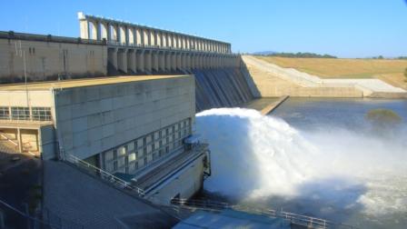
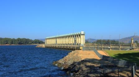
Excess water released from Hume Dam
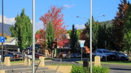
We left Phillip Island amid showers sweeping across Westernport Bay and the adjoining coastal plains. Our route lead along the South Gippsland Highway, Monash Freeway, skirting around the city to reach the Tullamarine Freeway and finally to the Hume Highway. We were headed to Bright to see if Autumn had yet reached the area, famous for its Autumn colours.
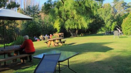
Afternoon tea on the lawn
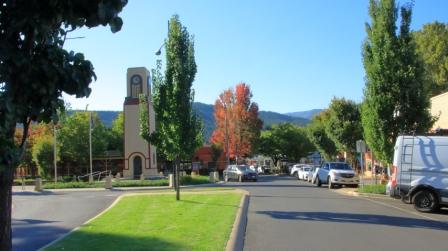
Bright Cenotaph
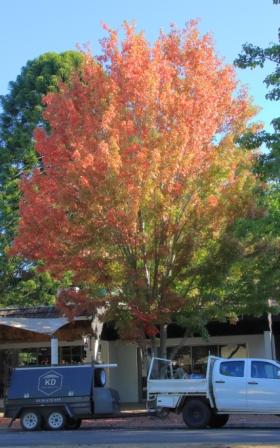
More colour in Bright
Rosella in the tree on the lawns
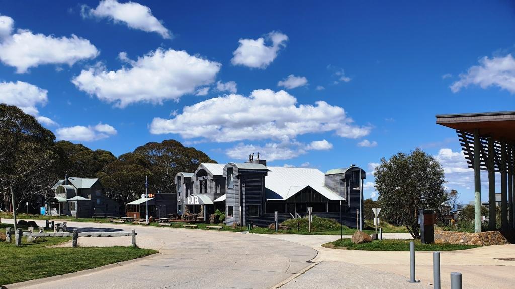
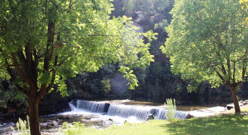
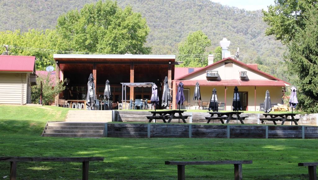
We only took necessary breaks, arriving in Bright in the late afternoon. Our motel backed onto lawns that run down to the path that runs along Ovens River. We look our afternoon tea to the lawn and were joined by some Parrots.
Early Autumn at Bright
The Liquid Amber trees were turning nicely but the Poplars and other deciduous trees had only just started to put on their show.
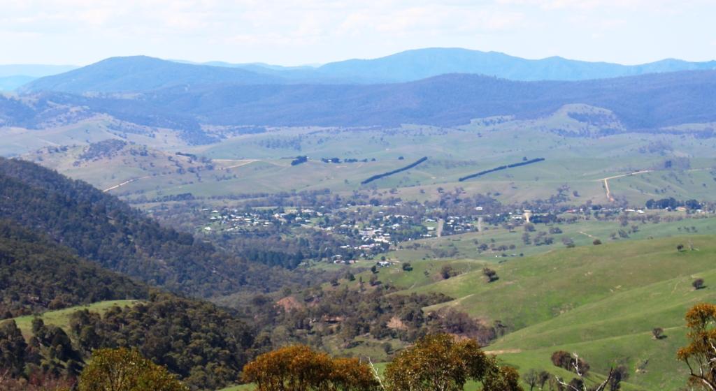
We left town next morning via Yackandandah, a nearby town also known for its colours, but it seemed to be running later than Bright.
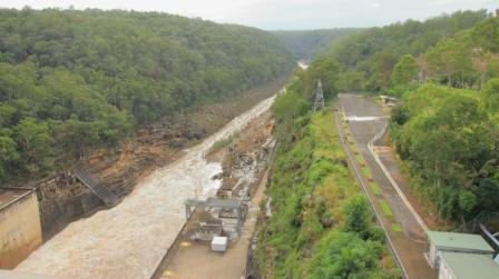
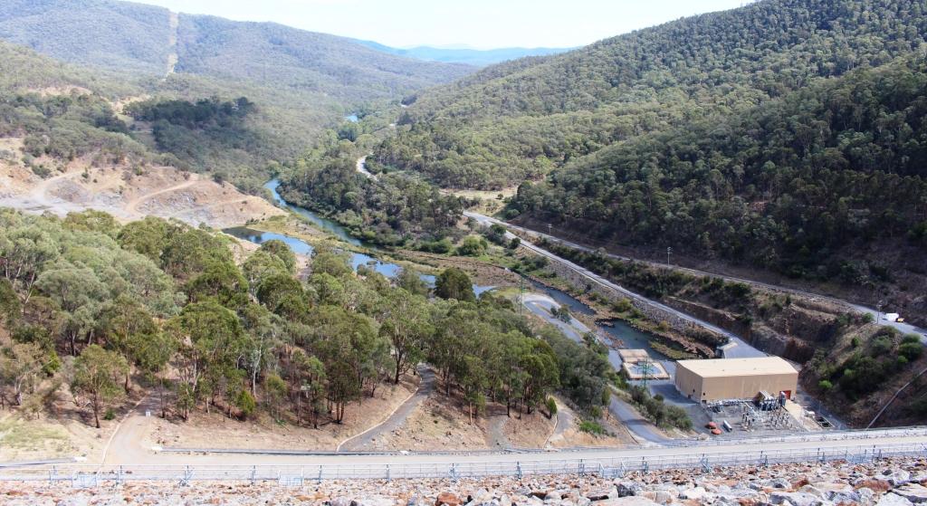
We were bound for Hume Dam on the Murray River to see what it looked when when full. Excess water was being released to a huge roar, in sufficient quantities to fill the river down stream to the top of its banks. When we came through there on our way home from Tasmania two years ago the water level was well below the spillway and further up stream, cattle were grazing on river flats that had been exposed for years but now are inundated by the water in the dam.
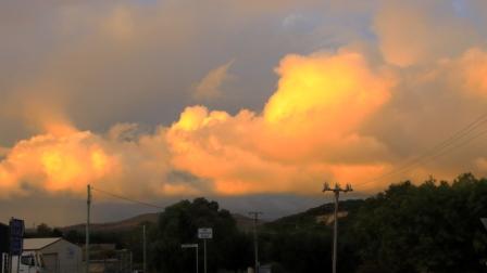
Sunlit clouds over Goulburn.
Lake Hume, full to the brim
We made our way to the Hume Highway and continued on to Goulburn for the night.
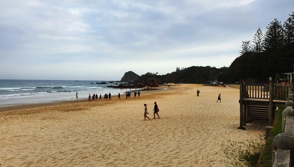
Heavy rain was forecast for the recently flooded North Coast of NSW so we decided to cross the Blue Mountains and make our way home inland. But first we wanted to see the recently overflowing Warragamba Dam. Warragamba was not far off our track.
Warragamba Dam, also full to the brim
Water released into the Warragamba River.
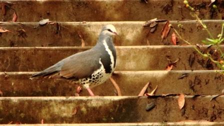
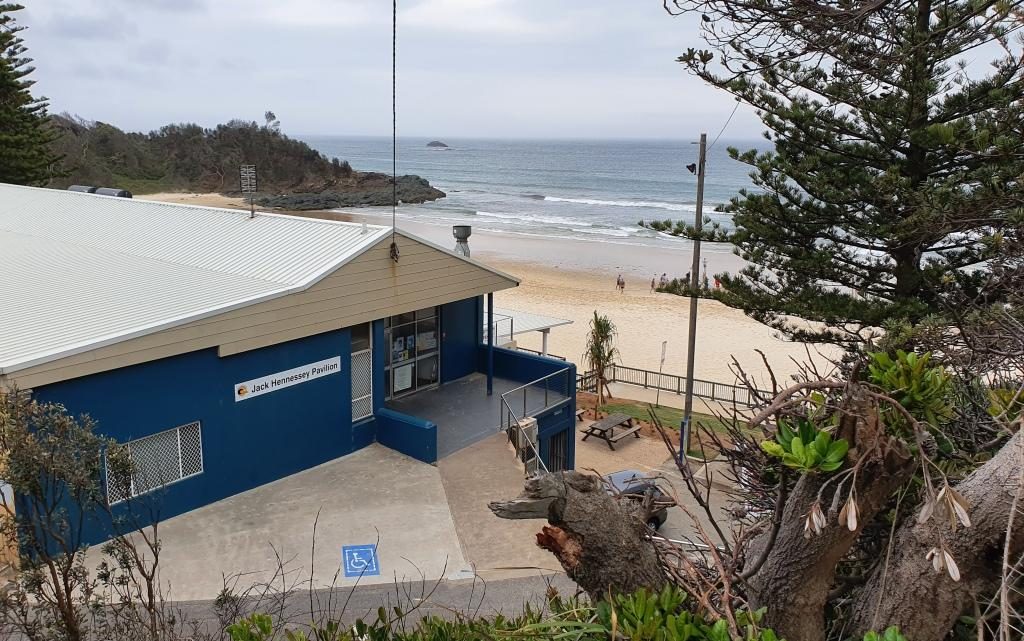
We thought that refreshments might be available at the visitor center at the dam, but no such luck. We did our tourist thing under increasingly threatening skies. Walking back from an observation point I took a wrong turn and came upon a pair of Rosellas. Then a Wonga Pigeon landed on stairs behind me, the first of this type that I had seen.
The visitor centre overlooks the dam
Soon, after departing the dam, the sky opened and stayed that way. As we approached the Great Western Highway, traffic congestion was becoming an issue so a quick change of plans and we were on the highway heading west. With the rain still falling and a stop becoming necessary, we found a convergent McDonald’s and stopped for lunch. Back on the road the rain continued to well on the way to Mudgee, our next overnight stop.
Wonga Pigeon at Warragamba Dam
Mudgee is a week end town, thriving on visitors from the coast, so they have their weekend on Monday and Tuesday. We were there on Monday night and found most restaurants were closed. The Chinese restaurant at the Gold Club was recommended. They served excellent food in huge quantities. We only eat half the food served to us but were able to take the leftovers. They were sufficient for dinner the following night.
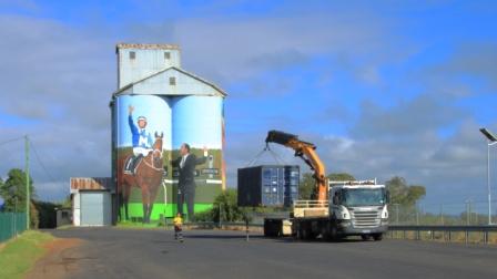
Silo artwork at Dunedoo in Central NSW
Next morning, we had passed through Gulgong and Dunedoo when a phone call from last night’s motel advised that I had left my binoculars behind. So, after returning the necessary 85 kilometres, we had coffee and started again. We left Mudgee, this time by the Ulan Road, then through Binnaway so saw some new country. Lunch at Coonabarabran and a stop for the last night at Moree to rest and deal with leftover Chinese food.
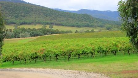
Vineyard near Mudgee
The plan was to do the last leg of the journey via the Gore Highway to Toowoomba and then the Warrego Highway to Brisbane but as we left Goondiwindi a roadside sign advised that the Gore Highway was closed. So on through continuing rain with a stop at Warwick and arrived home mid afternoon.
Eighteen days and a bit over 5,000 kilometres with average weather and escalating petrol prices. But we saw all of the relatives that were planned and respects paid at two grave sites. In all a successful trip.
Please Note. Two videos covering material in this post ate to be found at the bottom of the post.
Our tour was not quite over. The Victorian high country is among our favourite areas. So, having bid our hosts goodbye, we set off over the mostly flat country of Northern Victoria, heading to Bright in the western foothills of the Victorian Alps. We arrived at about the same time as singer Katy Perry, who was there to perform at a bush fire fund raiser. She performed for about six thousand locals at a sports ground. The only evidence of this extravaganza was more traffic than usual and barricades blocking some roads.
Our track took us through Redesdale, Heathcote, past the back of the Puckapunyal military area to Nagambie and over to the Hume Highway near Euroa. Heathcote and Nagambie are both wine producing areas. Puckapunyal produces soldiers. We left the highway north of Glenrowan to drive through the wine country at Milawa (Brown Brothers) and on to Bright. Much of this area was tobacco producing back when smoking was not a proscribed social evil. Tobacco drying sheds can still be seen on properties that have been converted to other agricultural purpose.
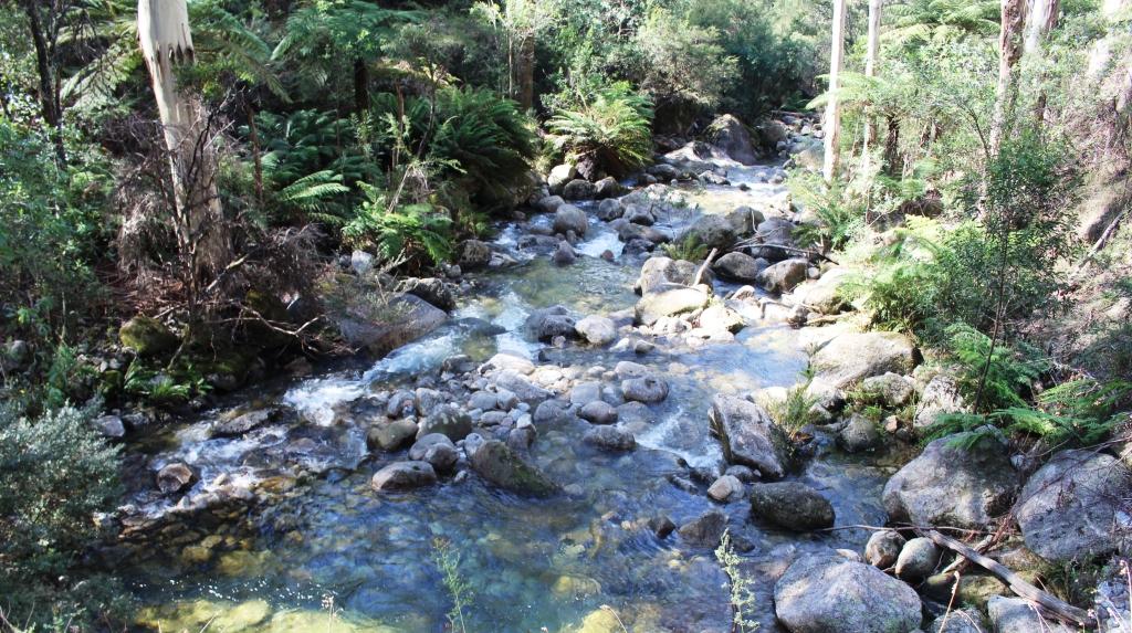
Eurobin Creek on the Mount Buffalo Road
Before reaching our destination we turned at Porepunkah intending to drive to the summit of Mount Buffalo. But it is a long drive, continually climbing on what is often a narrow road with a precipice on one side. We gave it away at about 900 metres and returned to earth. Its summit is 1,721 metres above sea level, so we still had a long way to climb. It is at times like these that advancing age starts to show.
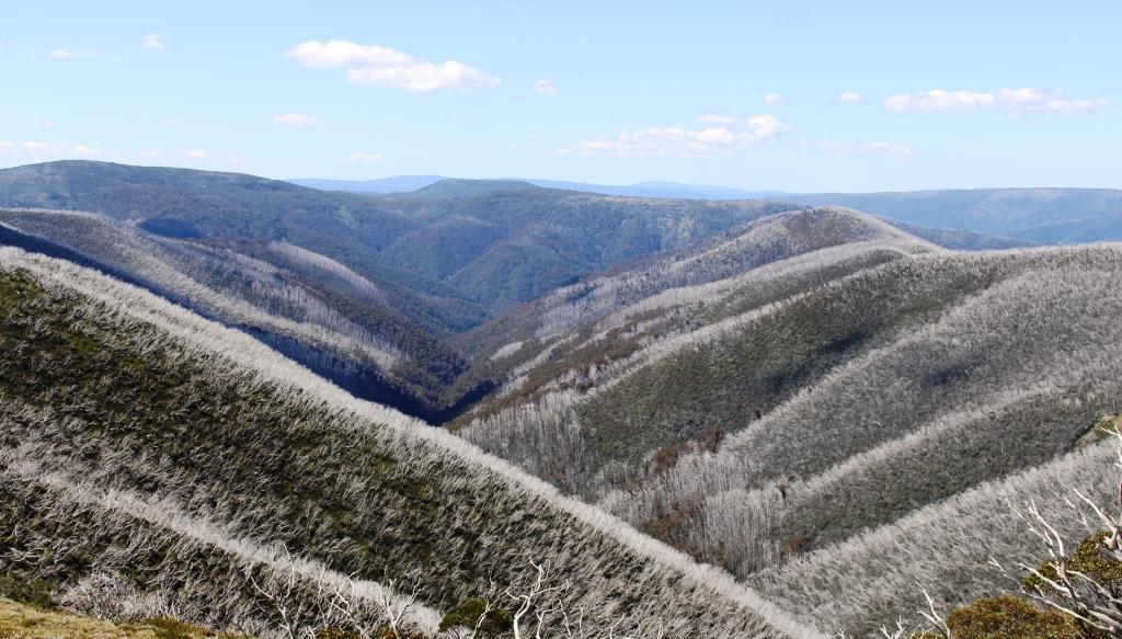
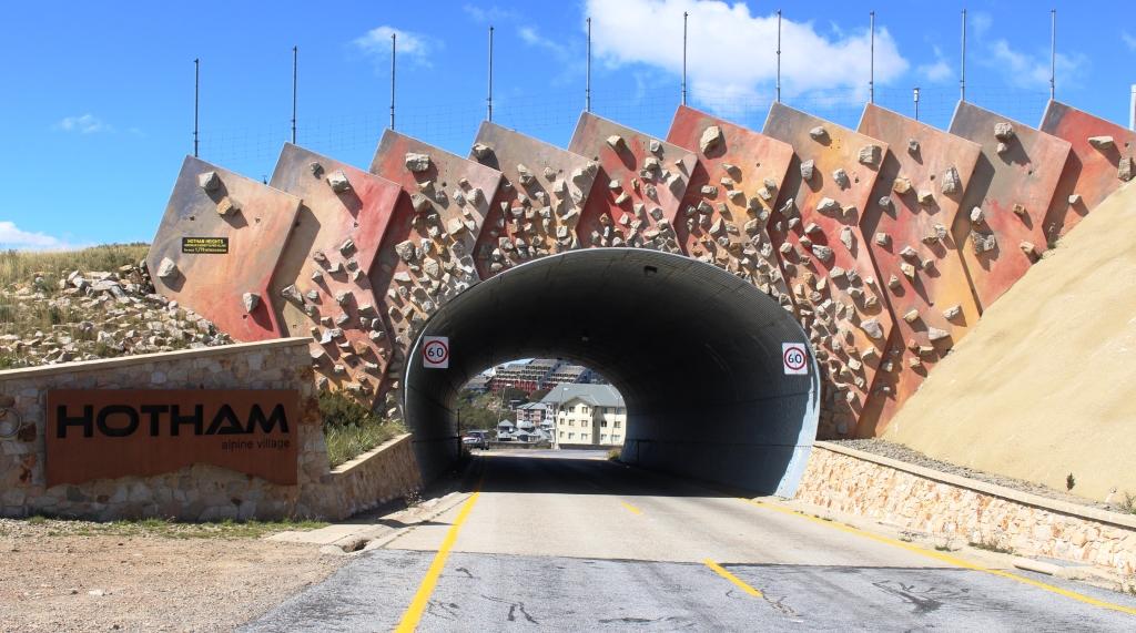
The Great Alpine Road approaching its highest point at Hotham Heights, travelling from Bright.
There was sufficient daylight when we arrived to see Bright, most of which we achieved while looking for our motel. It was hard to find, with Google Maps sending us along many streets that were never going to get us there. That was how we came across the Katy Perry barricades.
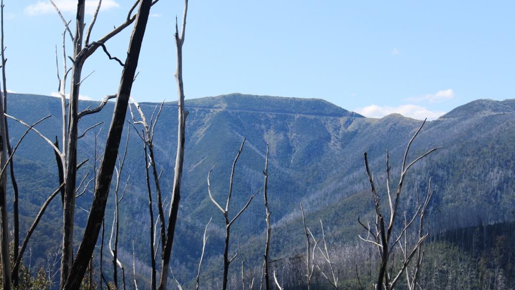
Dead trees from earlier bush fires appear like stubble on the ranges south of Hotham Heights
Unfortunately we were too early for autumn tints in the foliage. The copious quantities of poplars, maples and other deciduous trees had not yet started to stage their annual show. It is autumn colours that bring the influx of visitors to Bright each year.
Sorry, there are no photos of Katy Perry.
The western gateway to Mount Hotham Alpine Village
The next day, Thursday, was a perfect day in the high country. We enjoyed endless blue skies with only a light wind all day. We waited for the time to reach 9.00 am in Queensland, made a couple of phone calls and headed out through Harrietville towards Mt. Hotham.
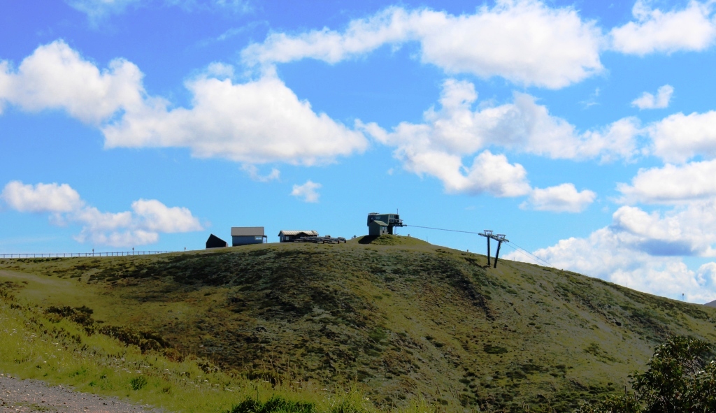
The top of a ski lift above Mount Hotham
Narrow winding roads with sheer drops to valley floors hundreds of metres down, only a few areas protected by Armco barriers and the possibility of meeting trucks and caravans. What fun! Actually we saw more cyclists than other vehicles, met no trucks and only one caravan.
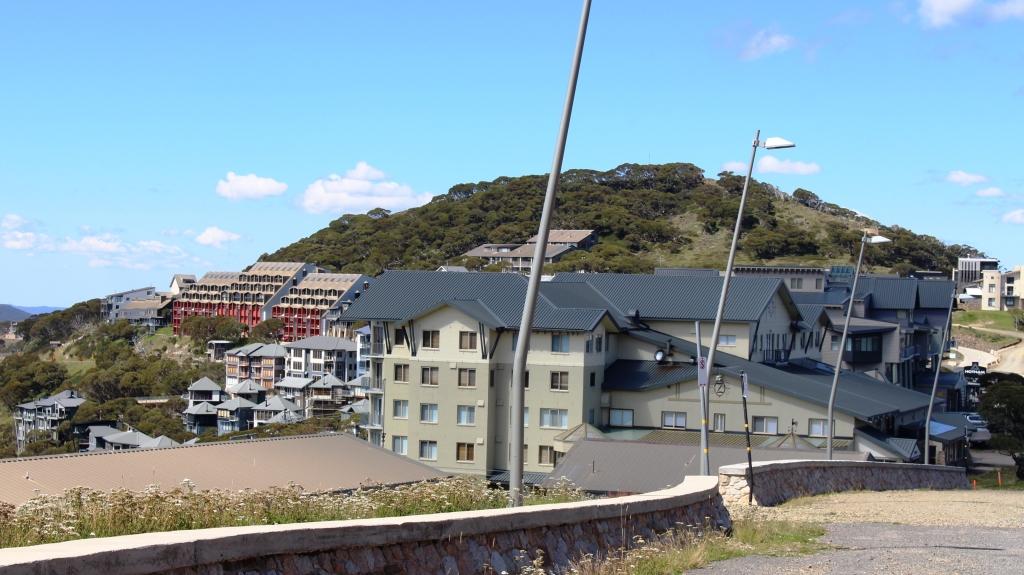
Part of Mount Hotham Alpine Village
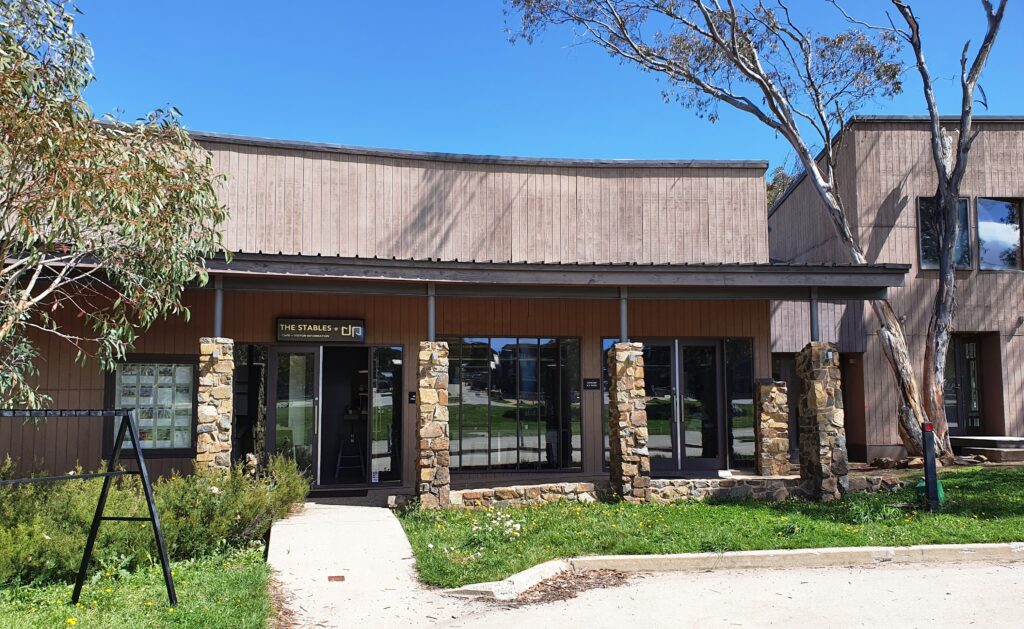
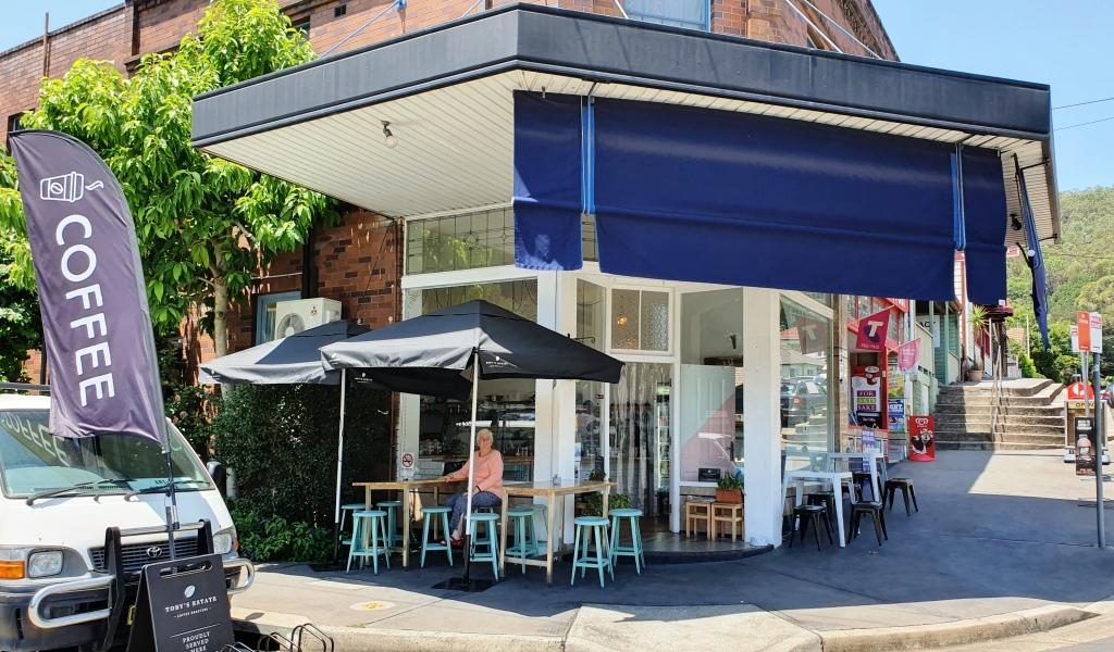
We stayed for only a short time at the 1,800 metres altitude of Hotham Heights before continuing to Dinner Plains, looking for lunch. We thought we were out of luck, but noticed a “coffee” sign and found a small shop called The Stables run by a very enthusiastic young lady who had only opened the doors of her new business on the previous Saturday.
Lunch stop at The Stables at Dinner Plains. The hotel at Dinner Plains is a good example of the architecture of the whole town. It was still closed for the summer season.
The road between Hotham and Omeo took us through several areas burned in the recent fires. Some parts were burned on just one side of the road but in other areas, where the fire had come up the mountain, it jumped the road and continued on its way towards the higher ground. The ski fields of Hotham seemed to be untouched so the ski season will not be adversely effected. The area has had much worse fires in the past.
After a refueling stop at Omeo we drove the remaining winding kilometres to our destination.
A view of Omeo from the Great Alpine Road.
We first saw the Blue Duck Inn in 1965 when we decided to return to our home in Drouin in Victoria from Sydney, via the Omeo Highway. It was all gravel then but now fully sealed. We saw the building as we drove past and thought it would be great to return and stay. We drove past again a couple of years ago on a day trip from Omeo, but this time we realised our ambition.
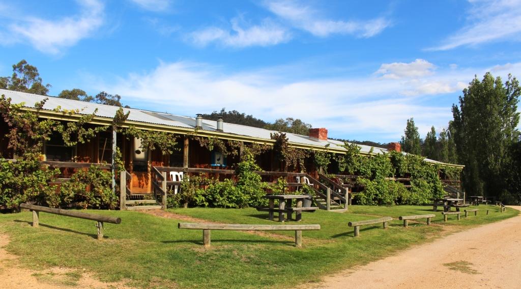
Accommodation at the Blue Duck Inn at Anglers Rest
We were the only guests when we arrived but another couple came later. The number of diners reached 6 when another couple of about our age, who had their caravan in a camping area over the river, came in to dine. We spent a pleasant evening in their company.
The Blue Duck Inn at Anglers Rest
The cabins at Blue Duck are spacious and well fitted but lined with unpainted timber and heated by a wood heater. Mains electricity does not reach Anglers Rest so they generate their own. The generator goes off at about 10.00 pm and batteries take over so our rest was not disturbed.
The hotel dining room at the Blue Duck Inn. But I think that my smoked trout came from Tasmania and not from the stream that flows by the hotel.
Omeo was a gold producing area with mostly alluvial mining, so streams in the area were prospected to within an inch of their lives. But no gold was found at Anglers Rest. Failure to find gold in a stream is known as a blue duck. So the hotel that dates back to the 1890s was named the Blue Duck Hotel.
The Blue Duck Inn viewed from the camping area on the opposite bank.
The objective of this part of the trip was to drive the Omeo Highway. Staying at the Blue Duck Inn was part of that. So after breakfast on Friday morning we set forth to complete the task. The distance from Omeo to Tallangatta is 167 km. When we resumed our journey we still had 139 km to go.
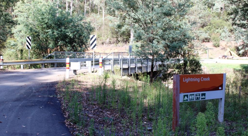
The turn to the Lightning Creek rest area on Snowy Creek near Mitta Mitta
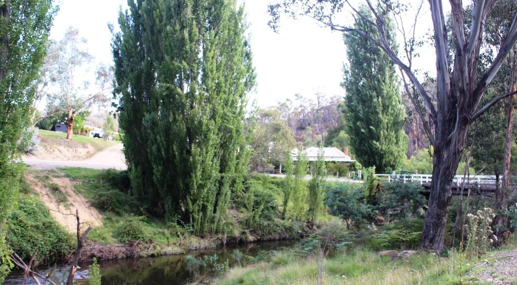
From Anglers Rest the road follows first the Cobungra River and then the Big River until it leads into serious mountains that carry the road to over 1,300 metres over the Great Dividing Range, before making its winding way into the Mitta Mitta Valley. The road then follows Snowy Creek all the way to the small town of Mitta Mitta where the creek flows into the Mitta Mitta River.
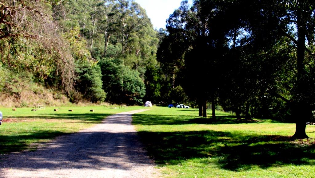
The Lightning Creek rest area had one tenant.
This neat riverside village is the first town past Omeo. There are several good rest areas with toilets and picnic and camping facilities along the way.
A weir in the Mitta Mitta River at Mitta MittaThe rear of the Laurel Hotel overlooks the Mitta Mitta weir.
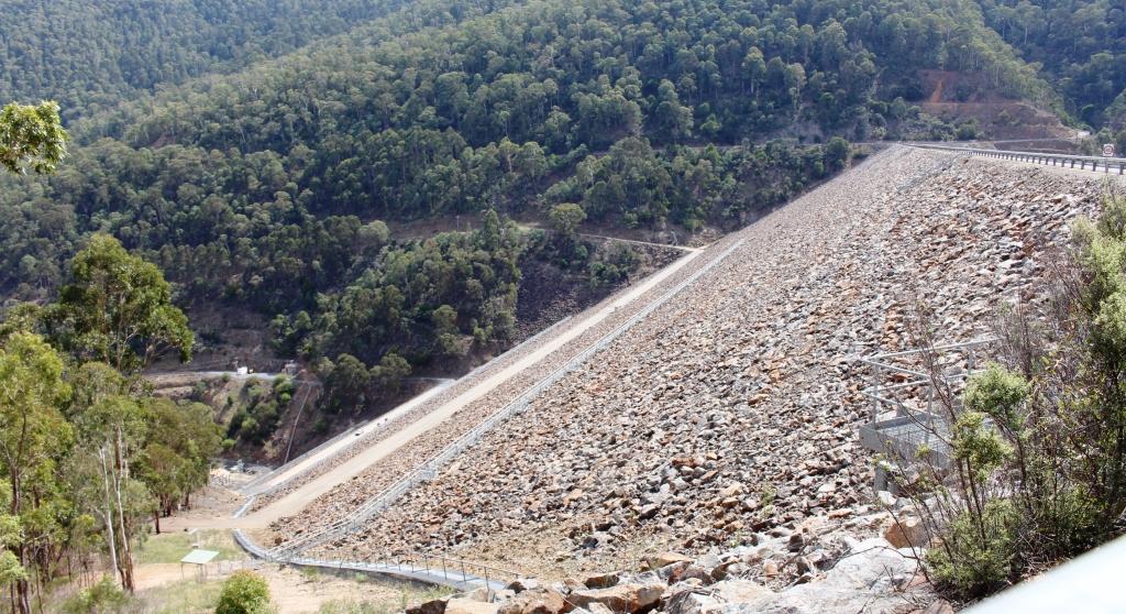
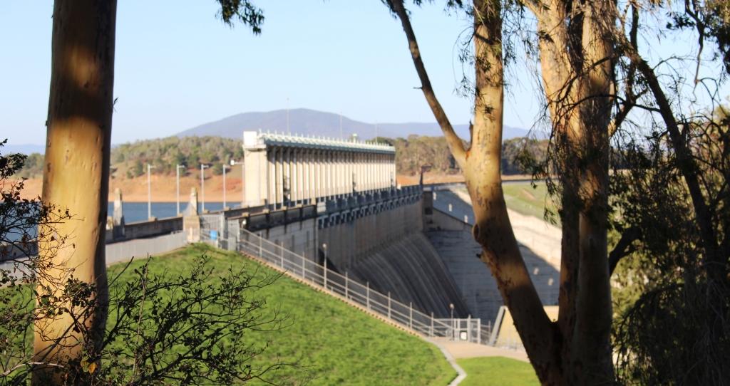
Very shortly after Mitta Mitta we reached the turn to the town of Dartmouth and the Dartmouth Dam. It is a detour of about 40 km return and well worth the effort. The wall, spillway and earth works are quite dramatic and would be awesome with water coming over the spillway. A hydro power station is located at the foot of the wall. A few km further downstream a small retaining wall has been built, with another power station, so the water is used twice before being released to flow down the valley into Hume Weir at Tallangatta.
The retaining wall at the Dartmouth DamThe face of the mountain was removed to construct the spillway at the Dartmouth DamDownstream view of the hydro power station and the Mitta Mitta River
We continued on to Tallangatta and then followed the Murray Valley Highway, that skirts the southern edges of Lake Hume, until we turned at Bonegilla to finally cross the Murray River into NSW and to our cabin at Lake Hume Village.
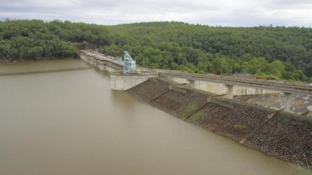
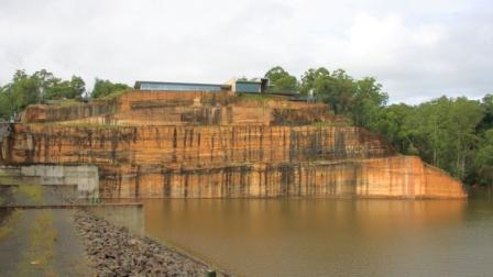
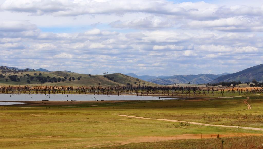
The extent of the water in Hume Dam. Initially it backed up to Tallangatta which had to be moved and rebuilt on higher ground.
The water level in the dam is well down, so the water is often a long way from the road. There are several kilometres of grass lands on the valley floor where the dam used to back up towards Tallangatta, with cattle grazing on well established grass. It is now several, perhaps many, years since the dam has been full. I speculate, but perhaps not since the conclusion of the Snowy Mountains dam construction, much of which is in the headwaters of the Murray River.
The flood gate controls and spillway at the Hume Dam in the Murray River near Albury.
Please Note: A videos covering the material in this blog post can be found at the bottom of the post.
Tasmania has been in the planning for some time. We made plans to visit, with the caravan, in 2018. We even booked the passage on the Spirit of Tasmania, but then cancelled in favour of repeating our 2009 trip around Australia. You may recall that we reached South Australia, but returned home at that point due to the poor health of my brother Winston. Win died a couple of months later, so we had certainly made the right decision.
So, with the
caravan and the Mitsubishi Challenger both sold, we set off on 29th
January in our new Mitsubishi Eclipse Cross. Motel and caravan park cabin
accommodation from how on.
An early start got us to Ballina at about 10.30 AM for morning coffee with our long time friends Joe and Thelma. For those who don’t know, Joe and Thelma have left Melbourne to continue their retirement at Ballina. These folks have been friends for almost all of our married life and all of theirs.
Ramada Resort, Flynn’s Beach, Port MacquarieFlynn’s Beach Lifesaving ClubViewing Flynn’s Beach to the south east
We had chosen
Port Macquarie as our overnight stop and happily pulled up at the Ramada Resort
at Flynn’s Beach after a drive of just less than 600 km.
Day two brought us from Port Macquarie to West Wallsend, a suburb of Newcastle. On the way we drove through some bush fire affected areas south of Taree. The Taree fires featured prominently in press coverage on the run up to Christmas.
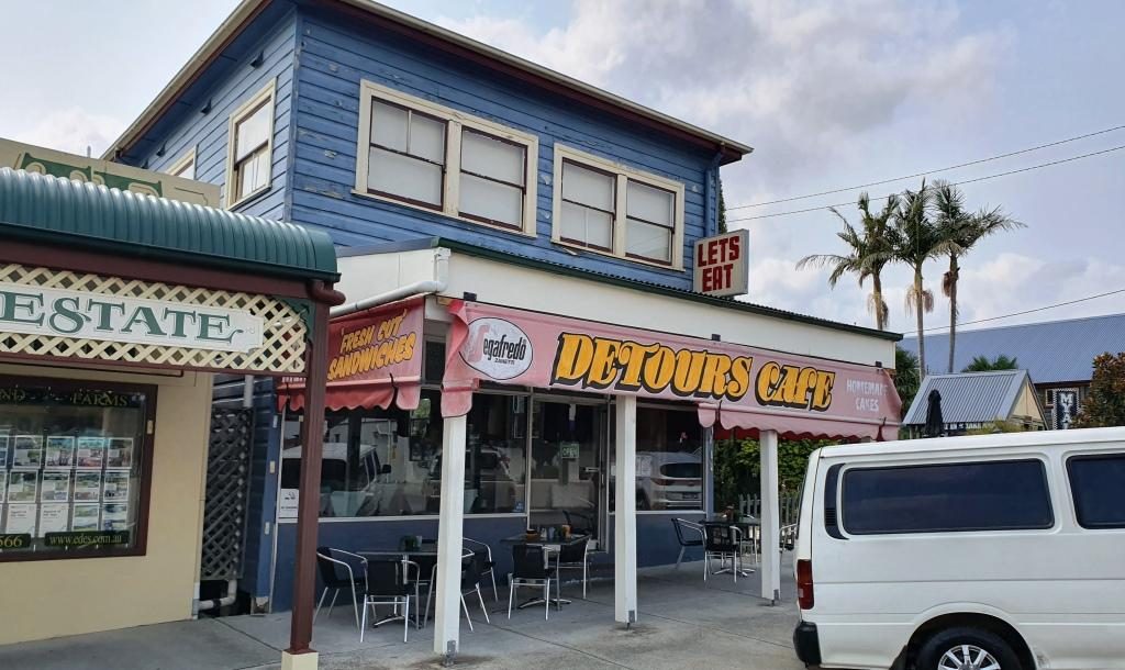
Morning coffee at Bulahdelah
We detoured for morning
coffee at my old home town of Bulahdelah at The Detour Cafe. The cafe looked
familiar. I asked the lady who made the coffee if it had always been a café.
She said that it had been for most of its existence. That is why it was
familiar. I used to call there for an
after school milk shake about 65 years ago.
We then called on my eldest brother Ivan and his wife Marjorie, who live just off the highway north of Newcastle, where we had lunch and generally caught up on family matters and doings.
Then off to West Wallsend
where we spent the night with Ruth’s eldest sister Judy and her husband Alan.
Another session of catching up on family matters and news of mutual
acquaintances and travels completed and planned.
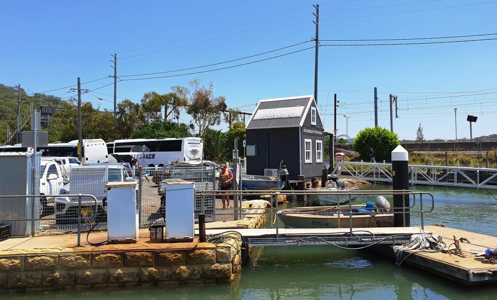
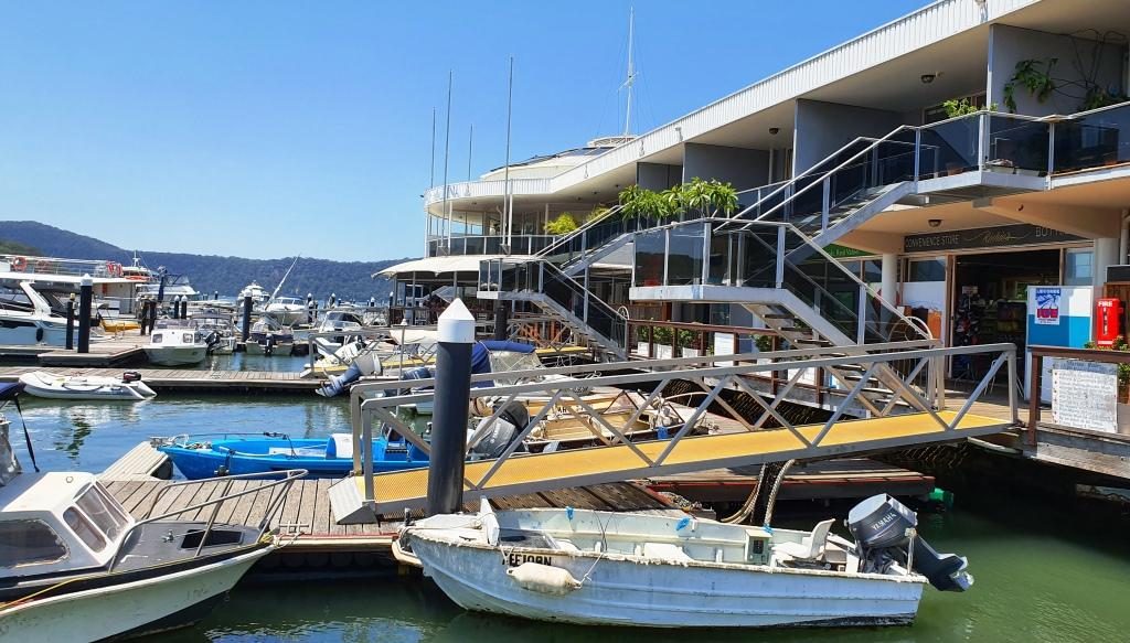
Anglers Rest Hotel at Brooklyn on the Hawksbury RiverWaiting for lunch to be prepared at BrooklynThe new office for the Riverboat Mailman. We did the mail run a couple of years ago. The new office was just being built then.The marina restaurant and shopping complex at Brooklyn.
The run to Sydney along the Pacific Motorway was easy with no congestion. We pulled off the highway at the exit on the north bank of the Hawksbury River and drove over the old bridge to reach Brooklyn. We like Brooklyn and have frequently stopped there over the years. Many years ago we hired a boat there and spent a great week on the river and Broken Bay. That was back in family holiday days.
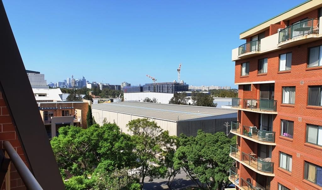
Briony’s view of the city.
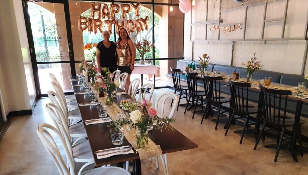
Day three brought us to daughter Briony’s unit in Erskineville, a near Sydney city suburb. February 3rd is Briony’s birthday. Our activities included hiding in a shopping mall and the car to avoid high 30s temperatures on Saturday and her personally organised birthday, with friends in a private room at the cafe at her complex, on the following, cooler day.
Briony and Ruth waiting for guests to arrive.
On Monday, her
birthday, we enjoyed a delightful birthday lunch for just the three of us at
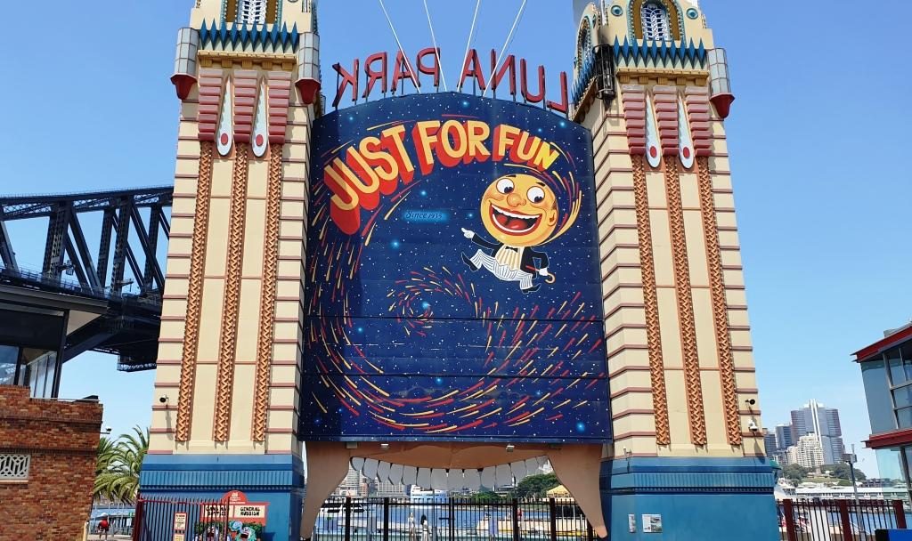
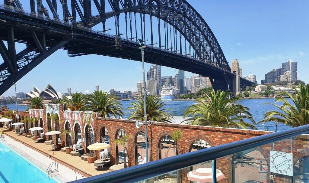
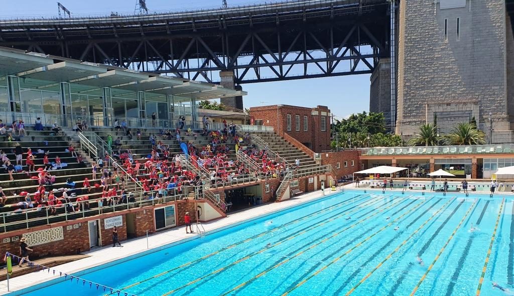
Aqua Dining. This restaurant, with excellent outdoor seating, is near the front
gate of Lunar Park and overlooks the North Sydney Olympic Pool. It is in part
of the buildings that adjoin the pool. So we had a great view of a local
school’s swimming carnival. Of course we also had views of the Sydney Harbour
Bridge, the cruise liner terminal, the Sydney Opera House and a broad sweep of
the harbour, both east and west of the city
This hardly needs a caption.Harbour Bridge, Sydney city and the wall of the pool. But you knew that, didn’t you?Children waiting for the next event.
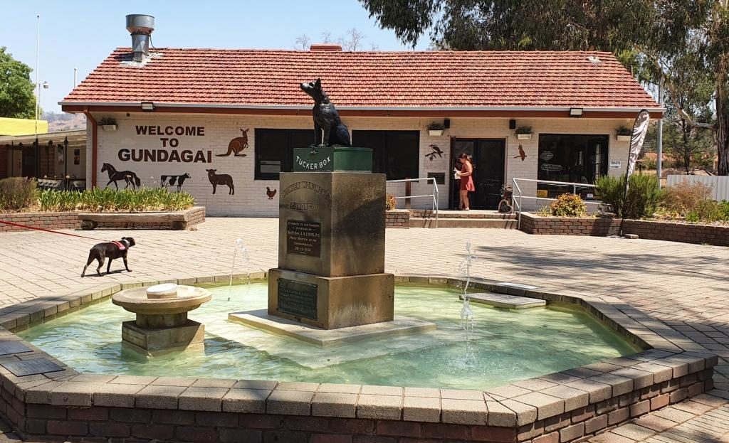
On 4th February, with family commitments finalised, it was time to deal with the main objective of the trip, Tasmania. We set off at about eight, pausing “where the dog sits on the tucker box 5 miles from Gundagai” and stopping for lunch in Gundagai before reaching our Albury motel late in the afternoon. Another 544 km completed.
The Dog on the Tucker Box near Gundagai.The signs are self explanatory.The Kelly Museum at Glenrowan, Victoria.
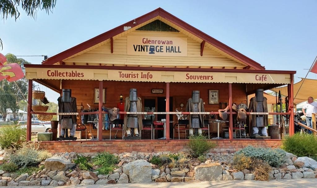
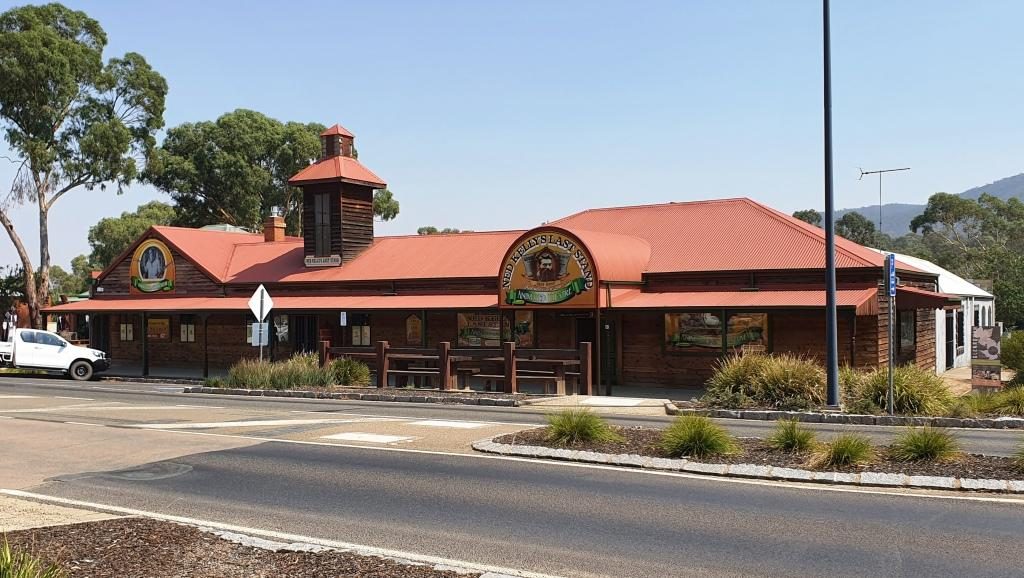
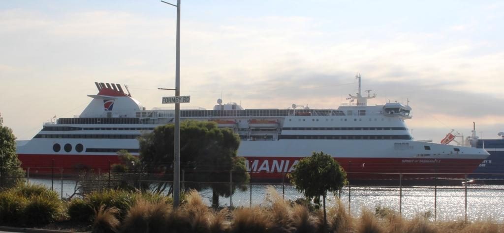
We only had a short drive to Port Melbourne to the Spirit of Tasmania terminal (334 km), so detoured into Glenrowan, of Ned Kelly fame, and spent the remainder of time until boarding having lunch and shopping. We drove aboard at about 5.30 PM and sailed for Devonport just after seven o’clock.
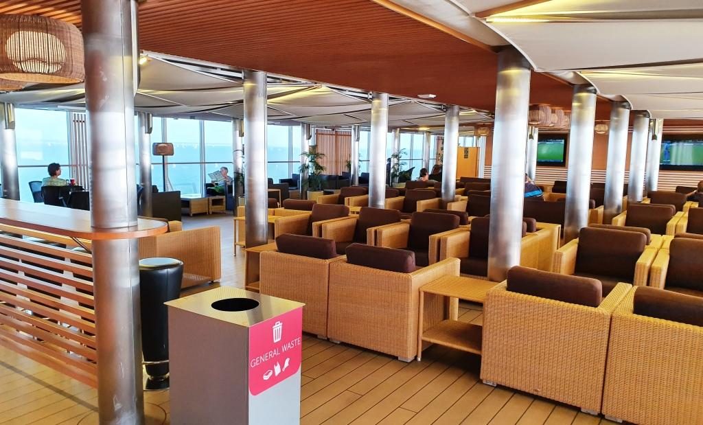
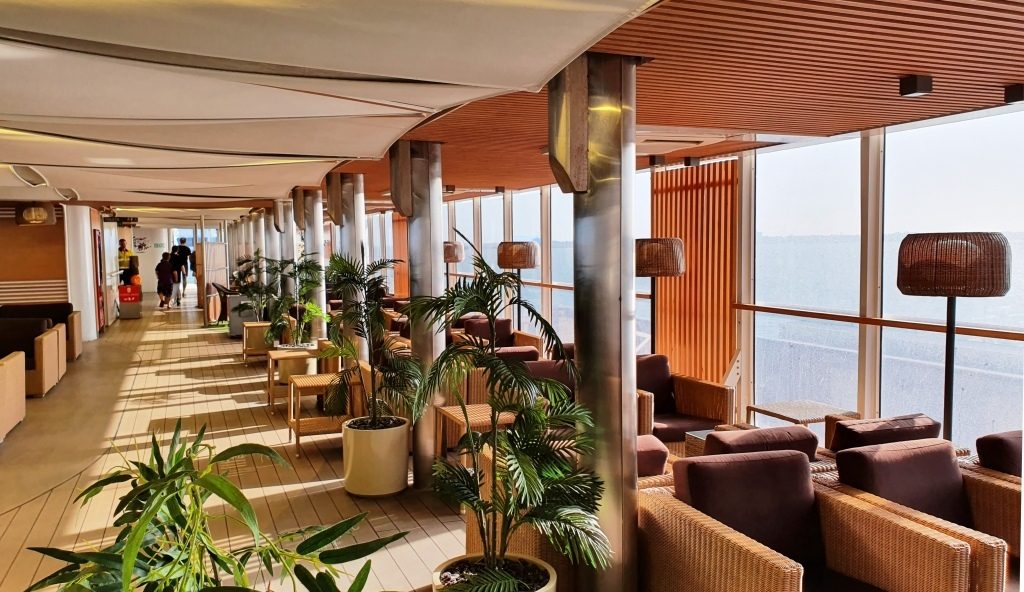
Part of the passenger area on the Spirit of Tasmania.More of the passenger area on the Spirit.
Daylight saving
ensured that we sailed through Port Philip Heads in daylight. We had a smooth
crossing, arriving at East Devonport at about 6.00 AM on Thursday 6th.
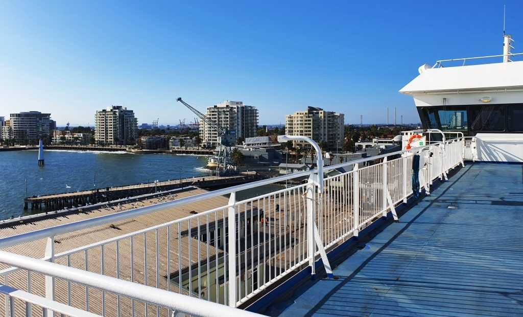
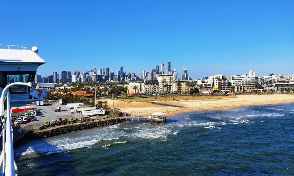
Medium rise accommodation at Port Melbourne.A view of Melbourne city from the deck of the Spirit of Tasmania.
Our cabin was comfortable, catering in the dining areas, although we only ate casually, was adequate and in all a pleasant experience. We were in the car ready to go by before 7.00 AM, drove off without incident and headed around to Devonport proper (on the opposite side of the river) looking for breakfast.
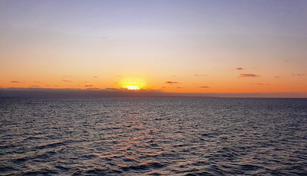
Sunset over Port Philip Bay. We were almost out of the heads.The Spirit of Tasmania berthed at East Devonport in the Mersey River.