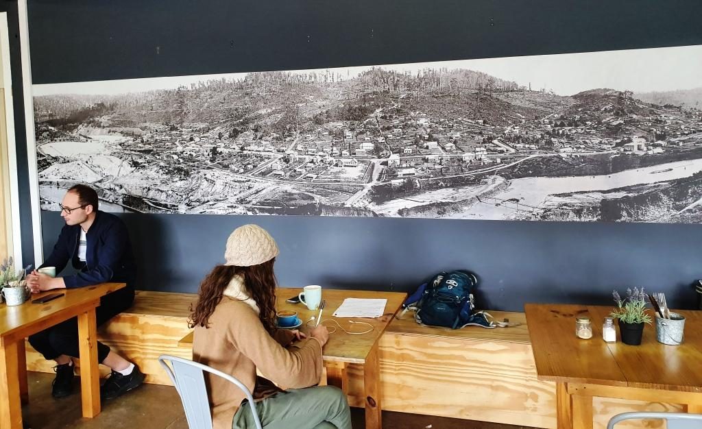
Please Note: At the foot of this post you will find videos covering the material that the blog post contains.
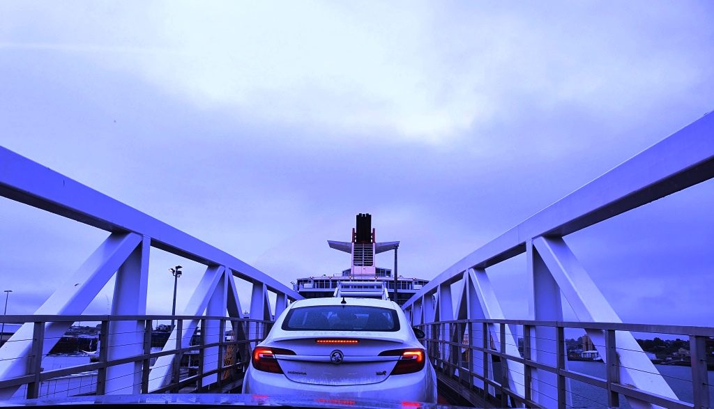
Our location for our last night in Tasmania provided a further benefit as we drove the short distance, through a morning shower, to the ferry. We had to turn at a roundabout that put all the traffic coming out of Devonport to catch the Spirit on our left, giving us right of way. But loading was still a slow progress as the ship arrived late from Melbourne. I felt sorry for the yellow coated attendants as they stood around in the rain waiting for something to happen.
Driving up the ramp to board the Spirit of Tasmania
We had another good Bass
Strait crossing. The expected strong winds did not eventuate. There was a
slight swell running through the Strait but not enough wind to produce white
caps.
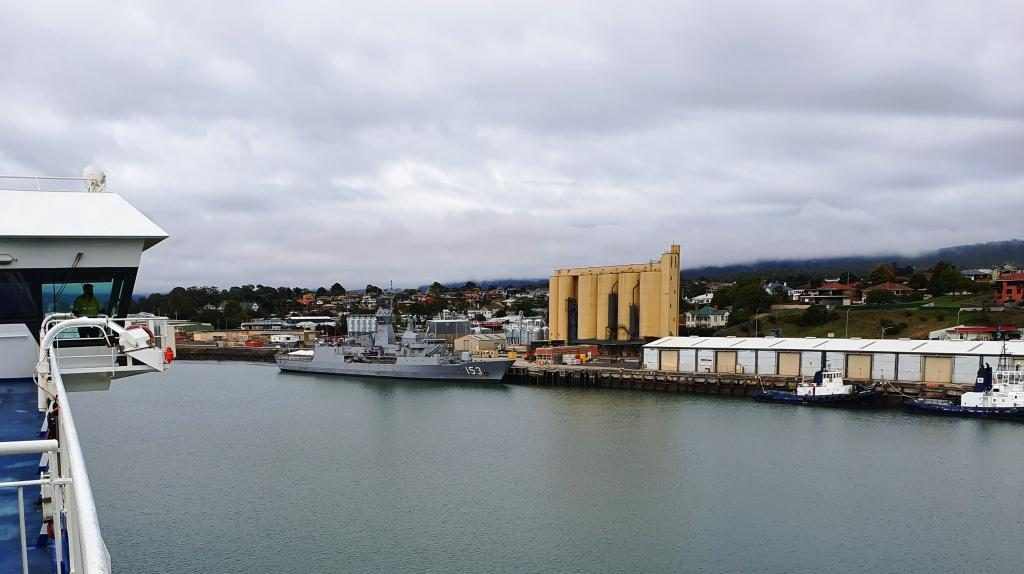
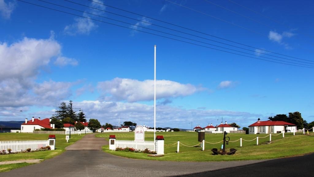
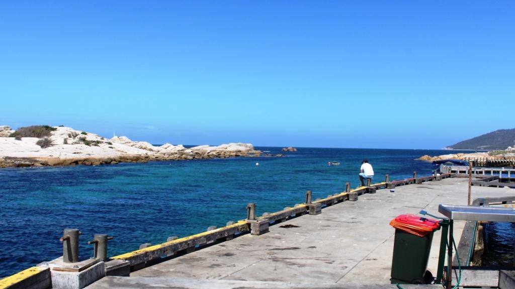
The wharves on the Mersey River and HMAS Stewart visiting its home port
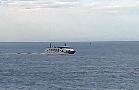
We had travelled south on Spirit of Tasmania One and returned on Spirit of Tasmania Two. They appear to be identical twins and very suited to their task. We had no complaints at all about either of them.
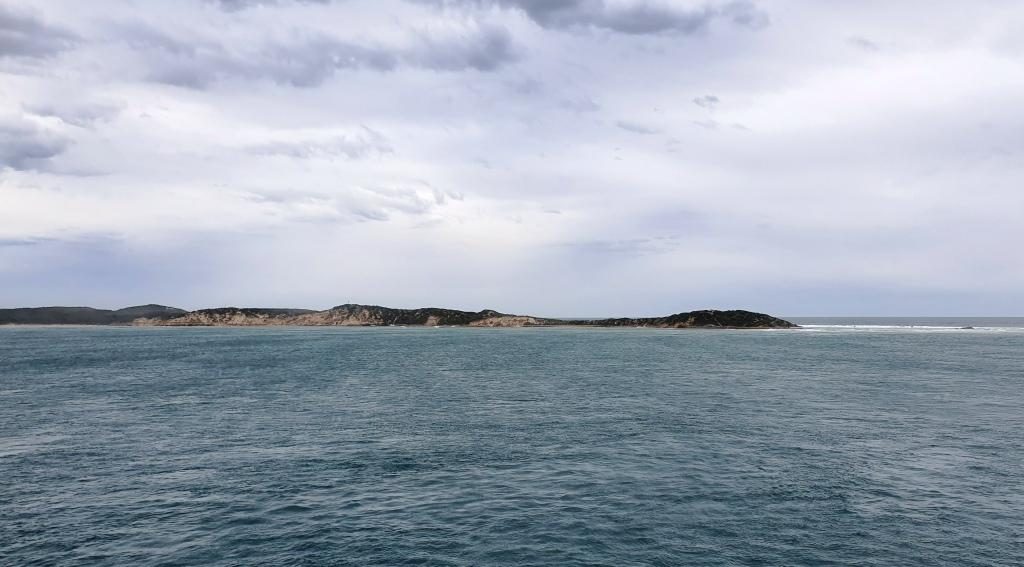
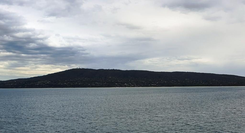
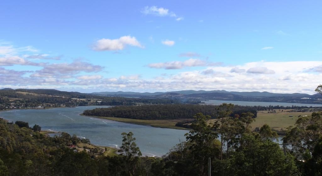
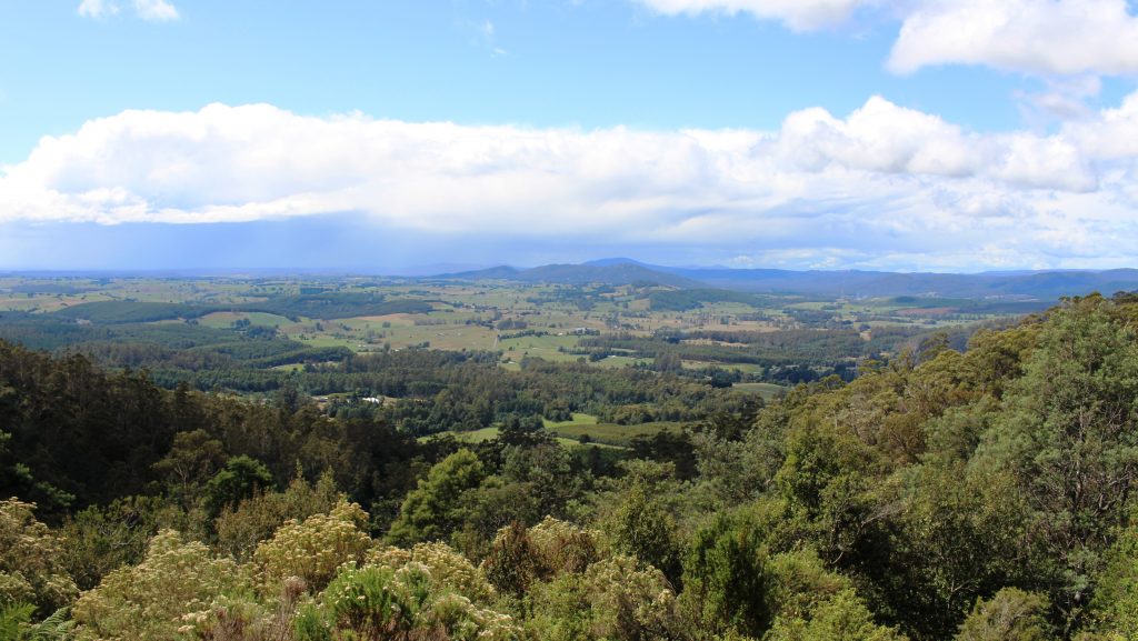
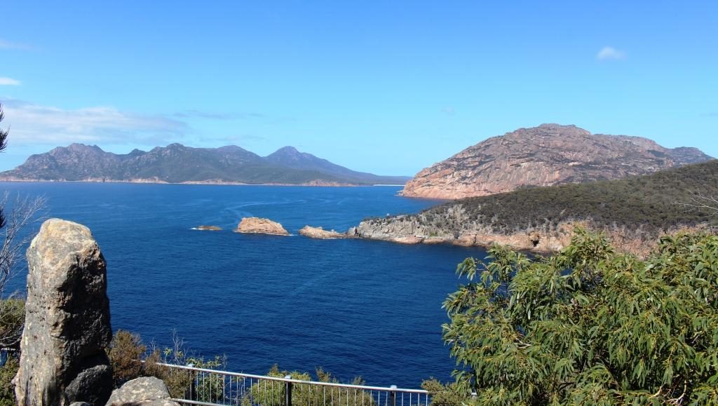
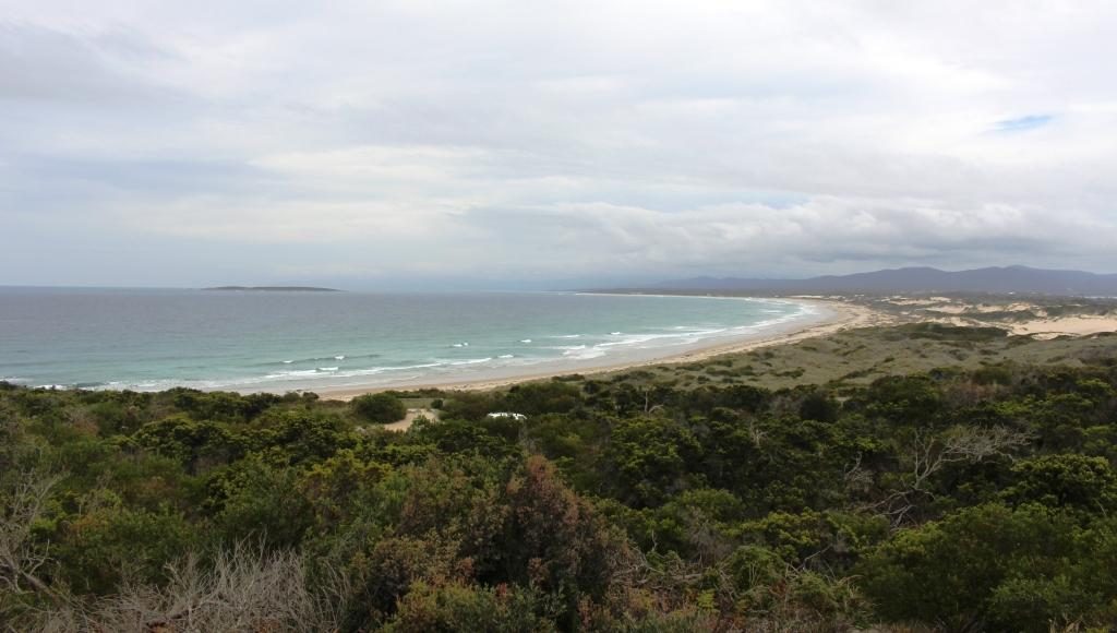
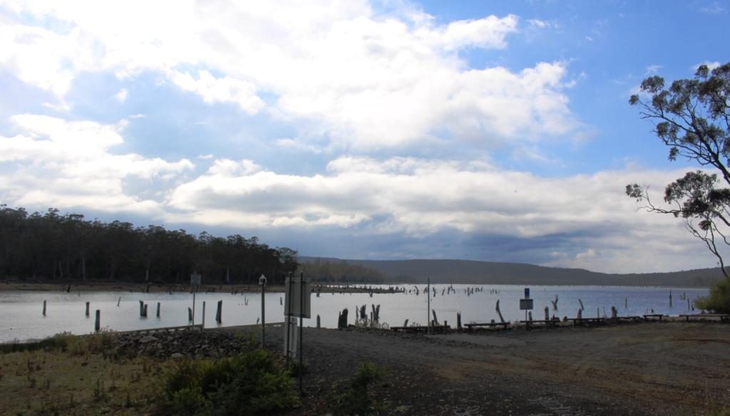
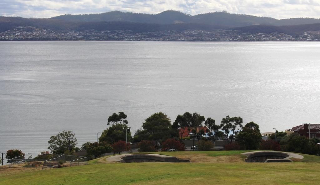
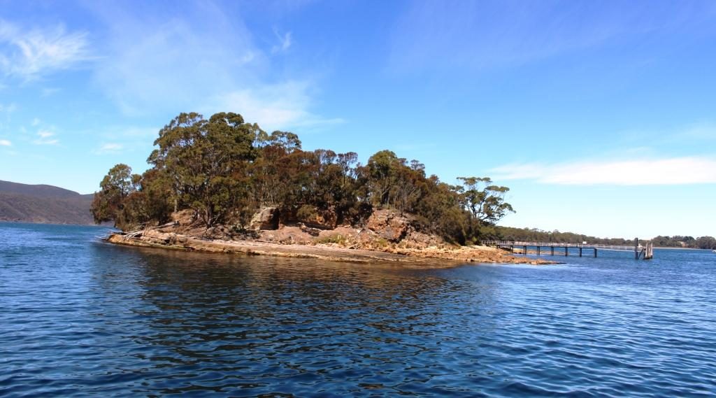
The north coast of Tasmania sliding under the horizon. The flat coast does not suggest the mountainous nature of Tasmanian topography.
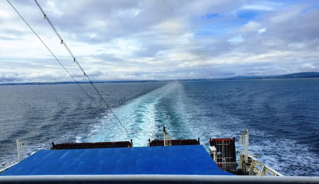
We had booked recliner
seats for the return, as a cabin was not needed for a day crossing. The
recliner seats are at the back of the vessel, facing towards the stern. There
are four rows and the seats have full height backs so unless you are in the
first row your view is of the back of the seat in front. So we spent much of
the day in the top deck lounge where the view of the water was good and we were
near food and coffee.
Point Nepean, the eastern headland of Port Philip Bay viewed from inside the heads
We reached Port Philip
Heads in daylight and came up the bay as the daylight faded. We docked in
darkness with the City of Melbourne a mass of lights ahead of us. Disembarking
was a slow process as Melbourne’s peak hour traffic made it difficult for
vehicles exiting the terminal to merge into the traffic flow.
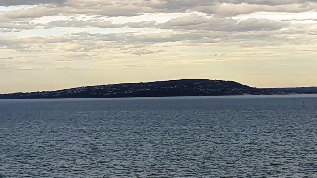
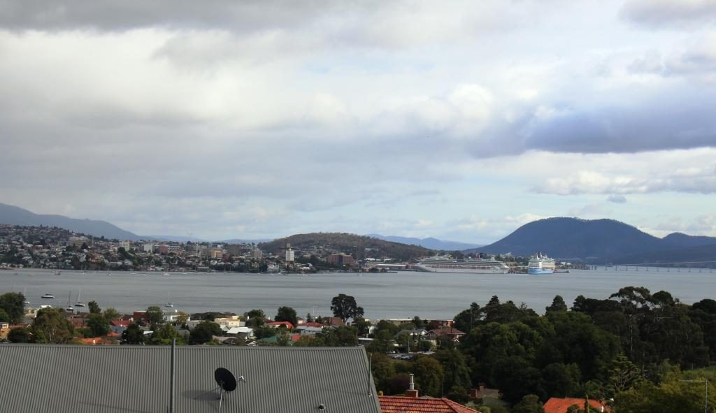
Mount Martha and bay side suburbs of the Mornington Peninsula
But eventually we were moving and making our way through the near city streets to the Monash Freeway. Streets in the near city area have changed since we lived in Victoria and I was working in a near city location. Google maps didn’t have it quite right but we found our way to our hotel in Waverley, without too much drama.
Mount Eliza with its covering of prestigious homes
Friends who we had
called on in Ballina on our way south were in Melbourne for a couple of weeks
and staying quite near to where we were. So we arranged to meet them at a
nearby shopping centre for morning coffee before we headed out to West
Gippsland to where we were spending a few days with my sister and her husband.
A vehicular ferry operates from Sorento to Point Lonsdale
A visit to a supermarket indicated that the shelf stripping that we had seen in Launceston stores was more prevalent that we thought. We now know the full story, of course, but then we thought that the cause was the many Asian tourists with whom we had shared Tasmania.
Empty shelves in a Melbourne supermarket
On Wednesday, after doing
normal family catch ups, we joined our hosts and other family members in a day
out into the mountains that are part of the southern Victorian Alps and lie to
the north of the rolling hills of the agricultural country of West Gippsland.
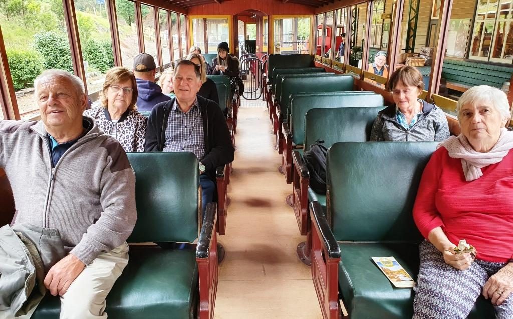
Walhalla Town Ride. Left to Right: Brother Bernard, Sister Aileen, Brother-in-law Colin, Sister-in-law Helen (widow of deceased brother Winston) and Ruth.
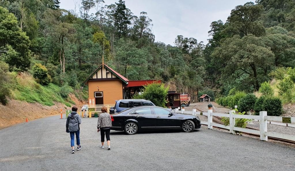
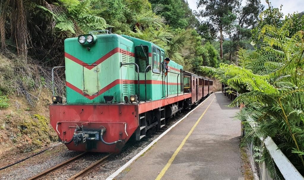
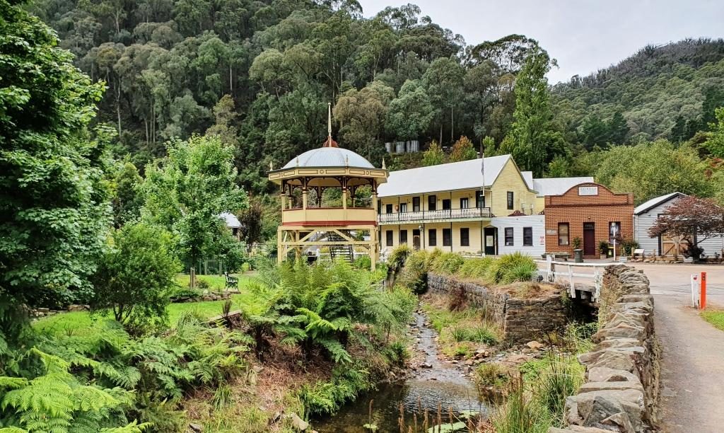
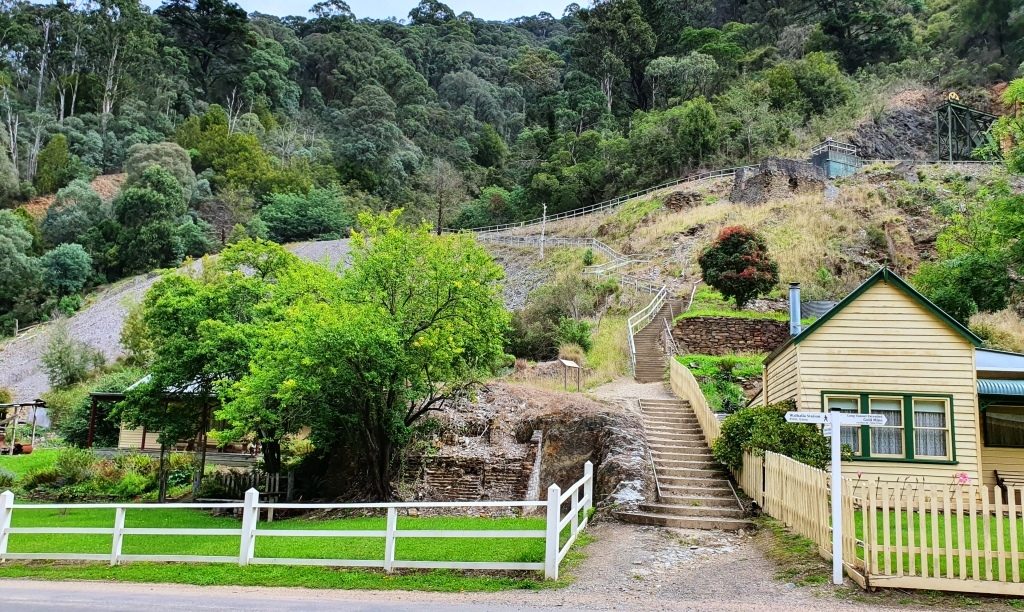
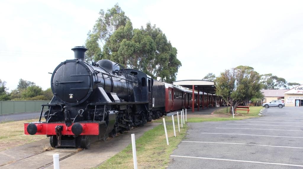
Walhalla is a historic gold mining town about 90 km from Drouin. It takes about 90 minutes to drive there. It is a well preserved heritage town with a full sized rebuilt railway that operates on several days of the week. It is popular with all ages and well patronised, particularly at weekends and very popular for school excursions.
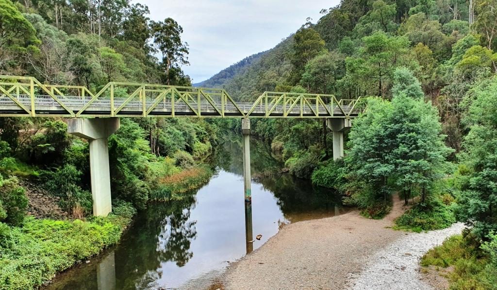
The road bridge over the Tomson River
The original rail connection arrived in the mid 1920s, just as the gold started to be worked out and the town started its decline. In more recent years enthusiastic volunteers restored the line, rolling stock and infrastructure and volunteers continue to operate and maintain it.
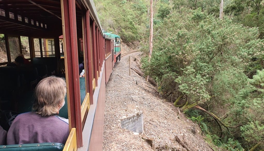
Running along beside Springers Creek on the outward journey.
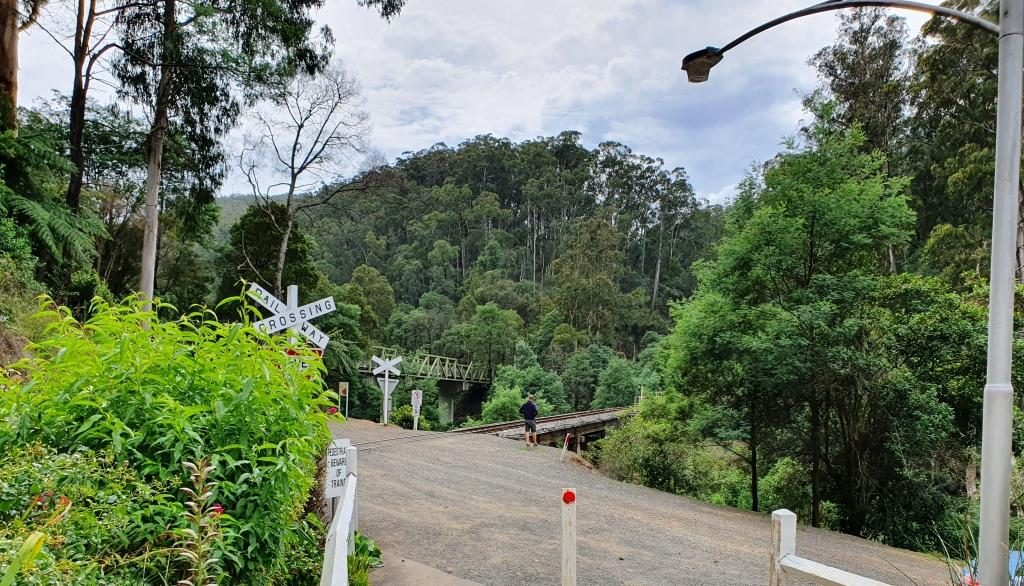
The final few kilometres of the road to Walhalla runs beside the Thomson River before crossing it to then follow its tributary, Springers Creek, to the town. Thomson River Station is located where the road bridge crosses the Thomson. It is to Thomson River Station that the train runs.
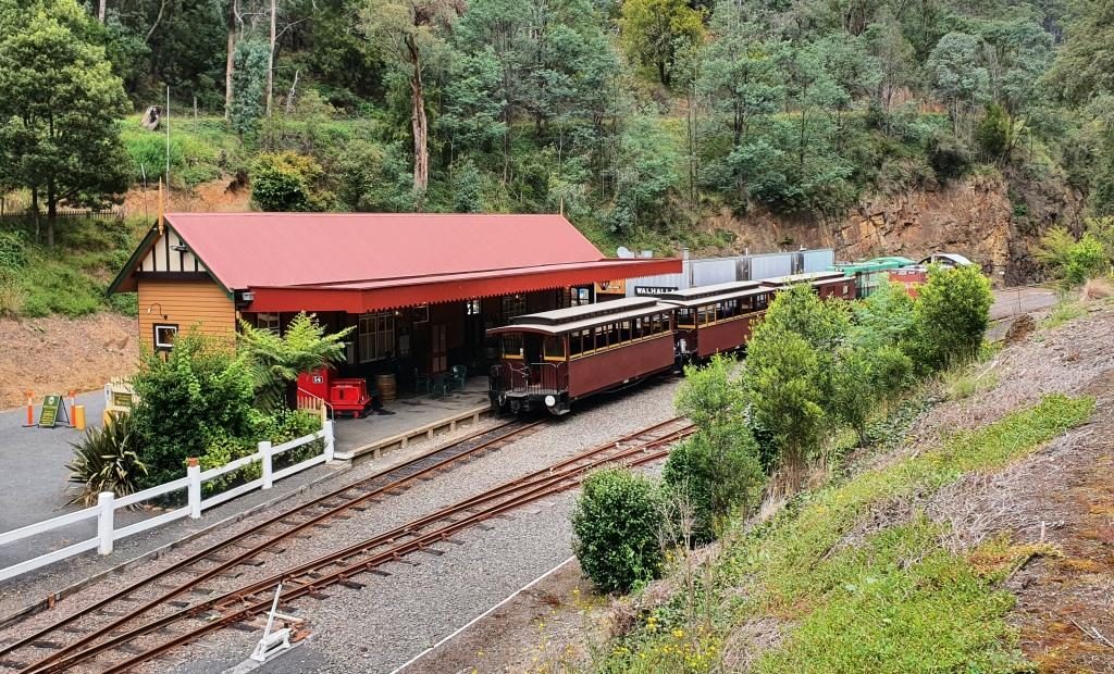
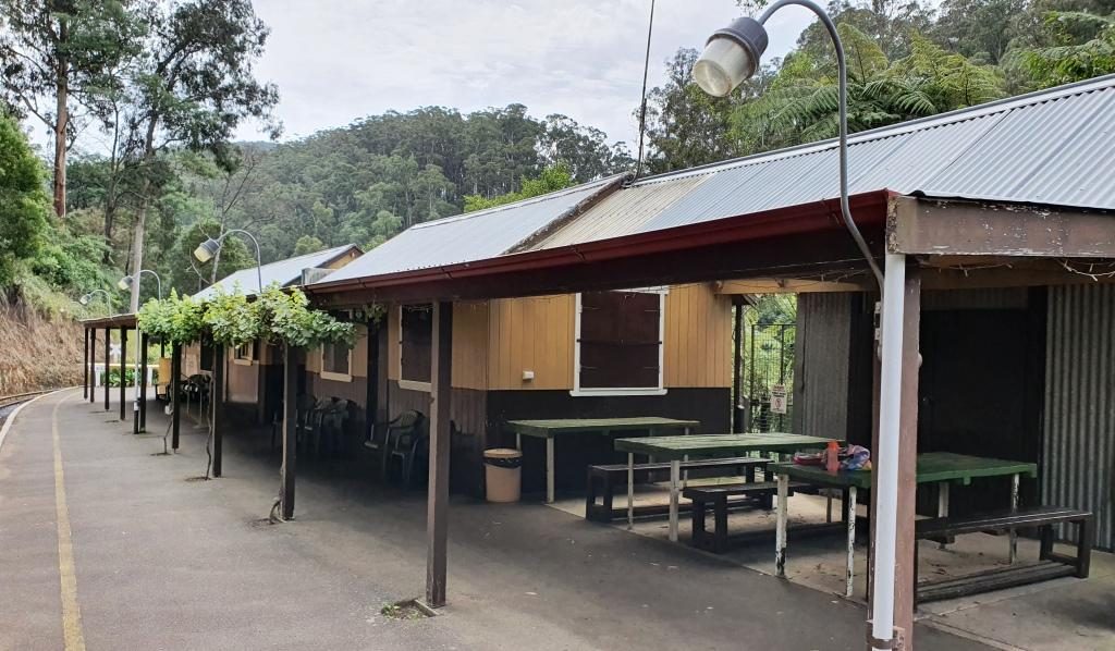
Walhalla Railway Station viewing outboundThe train ready for departure at Walhalla Station
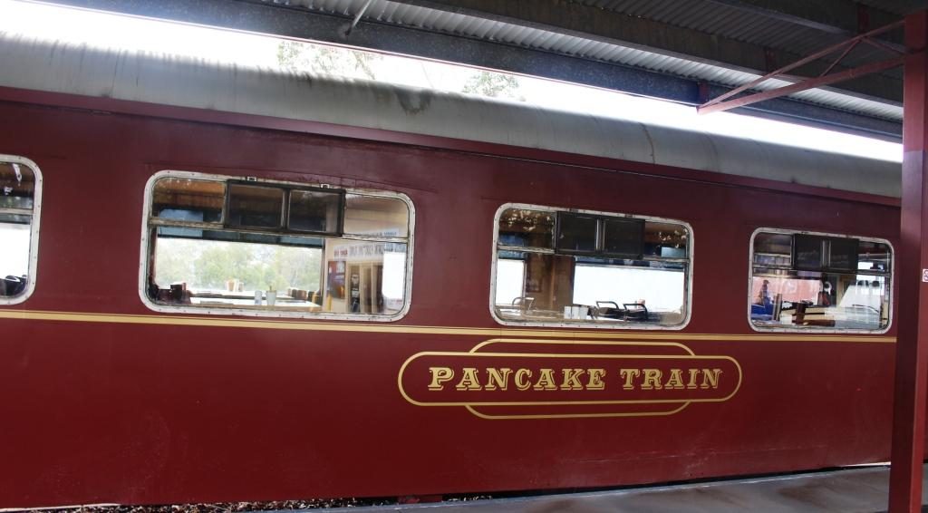
The railway runs along Springers Creek opposite to the road and when fully operational turned downstream beside the river after Thompson River Station. The ride is about 20 minutes out to Thomson River Station which is equipped with refreshment rooms just like the old days. The coffee was dispensed by a machine on the press of a button, so was not of coffee shop quality, but it was coffee and it was past coffee time by then. As we refreshed ourselves the train moved up the track so that the engine could be manoeuvred back to the front of the carriages for the return journey.
Thomson River Station with everyone aboard the trainThe train about to move off to change the engine to the other end for the return journeyThe Thomson River road and rail bridges viewed from the Thomson River Station
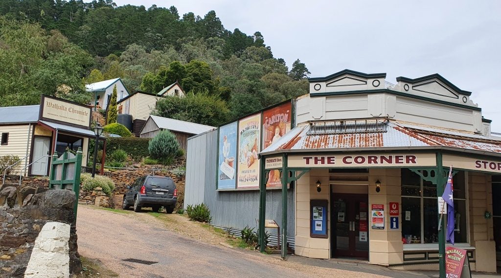
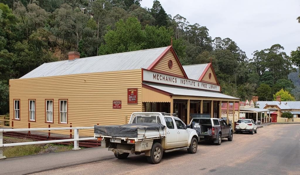
Train ride over, we drove up into the town and followed the main street as it wended its curving way through the narrow valley. The commercial buildings stand beside the road and on the flat land beside the creek, but the rest of the housing steps up the steep hillsides. The accompanying photos tell more of the the story.
Trading continues in original and historic buildings in Walhalla
As you enter the town the mining area is on the left with convenient foot tracks and stairs leading to points of interest. We have looked at these before, when we were much younger. We had no difficulty in resisting the temptation to climb the steps that lead to the hillside path.
Band Rotunda, Star Hotel (closed) and a solicitors branch office.The old Mechanics Institute building is now used for another purpose
The best known of the
Walhalla gold mines is the Long Tunnel Extended Mine. Access to this mine has
been preserved making it suitable for public inspection. Tours are conducted on
a regular basis and have just recommenced following Covid-19 shut down. $20
will gain entry for adults or $15 if you rate as a senior.
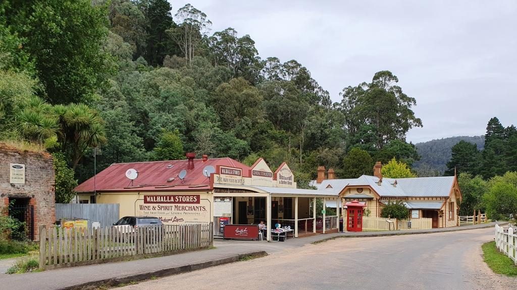
Old buildings beside Springers CreekMore historic buildings that are still in use
From the train we had
seen a group of teen age school children camping beside Springers Creek. As we
came out of the pub after lunch we saw them again. They had made it back to
town and had climbed to the hillside track to take a closer look at the mines.
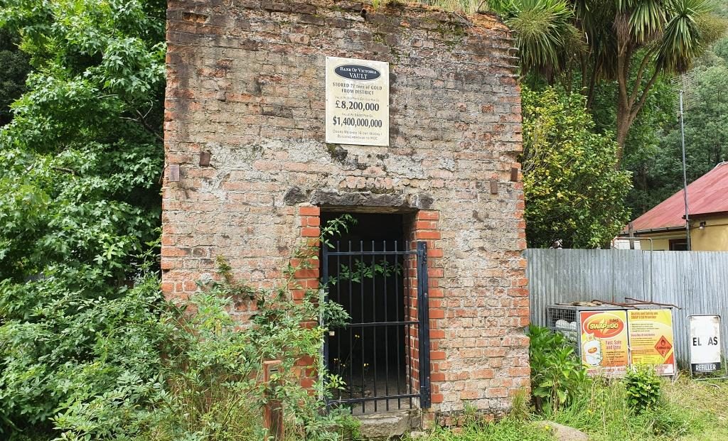
The facade of the original gold storage vaultThe stairway to the Long Tunnel Extended Mine
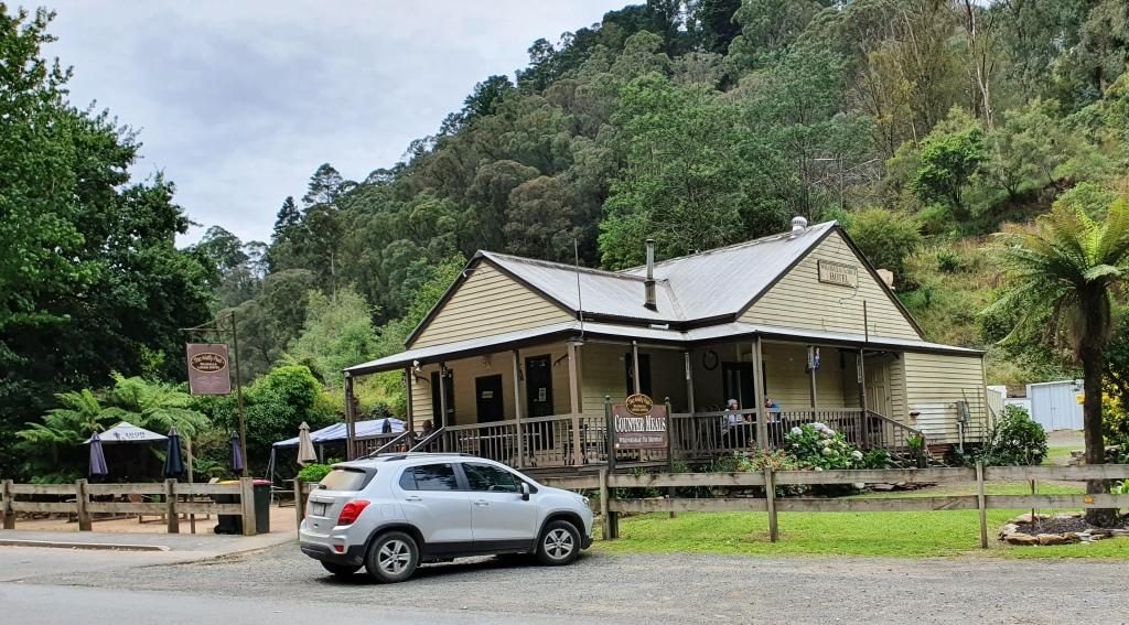
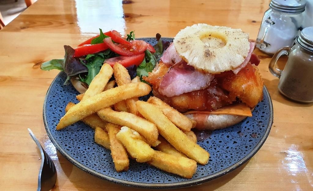
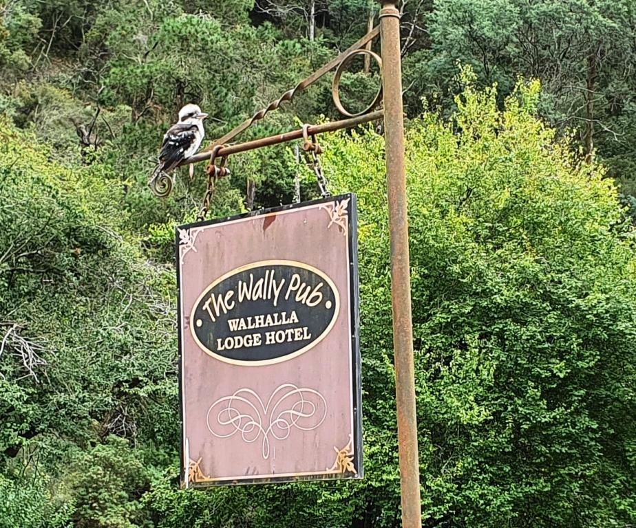
The only place
available for lunch was the Walhalla Lodge Hotel which is a fairly typical
country pub. The meals were generous in size and hit the spot after our train
ride.
Out luncheon venue, the Walhalla Lodge HotelA more than adequate lunch for oneA Kookaburra waits patiently on the hotel sign. Waiting for scraps perhaps?
On our way back to Drouin we made a detour to look at a house that our niece (sister’s daughter) and her family had just bought but had not yet moved into. Such are the interests of family visits.
Please Note: Videos covering the material in this blog post can be found at the bottom of this post.
We were now down to
our last two days in Tasmania. We had allocated Thursday 28th to the
eastern side of the Tamar Valley and Friday 29th (Leap Year Day) to
the west side and to make our way to Devonport to catch the Spirit of Tasmania
back to Melbourne on Saturday 1st March.
So on Thursday morning we set off to visit the area to the north and north east of Launceston, starting by following the East Tamar Highway on the east side of the river, through Georgetown to Low Head, to see the historic maritime facilities at the mouth of the Tamar River.
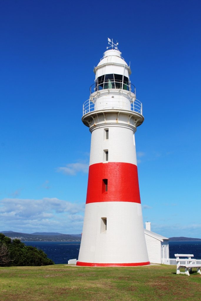
Low Head Lighthouse
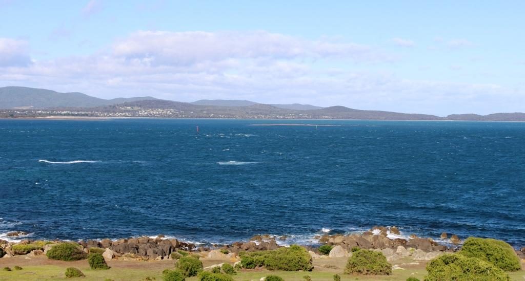
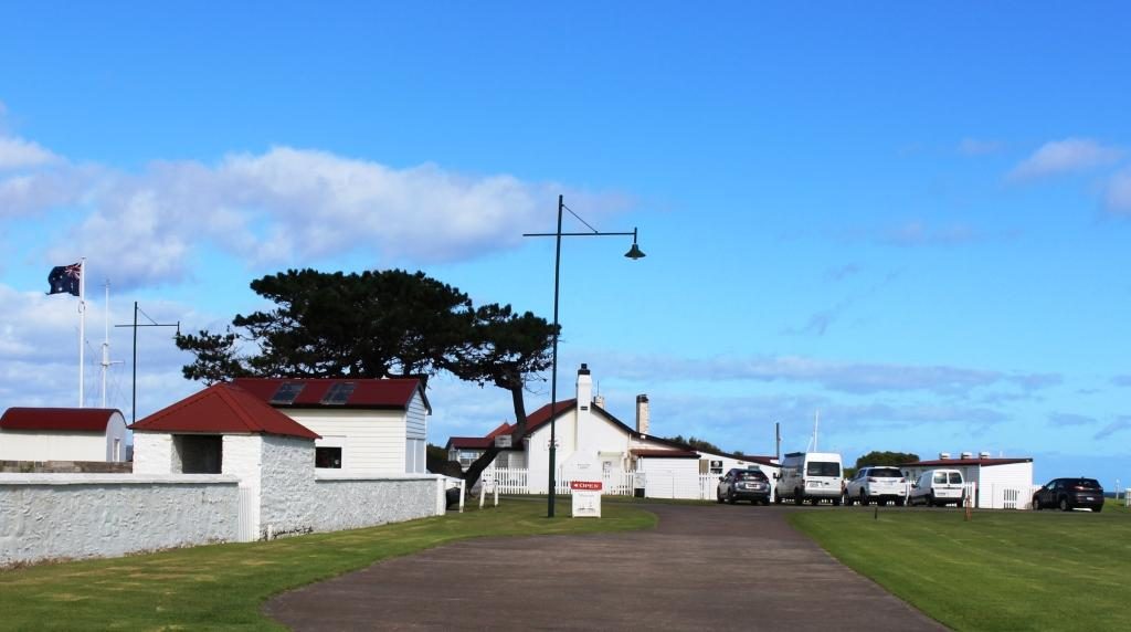
The Low Head lighthouse looks over Bass Strait and the river mouth. The area near the river is dotted with white painted brick houses with red roofs, with more modern and larger houses on the higher ground. These white houses were the homes of the many people needed to run the labour intensive services required in the early days when ships plied the Tamar River right up to Launceston. The original signal station still operates as does the pilot service. Bass Strait looked calm with the icy wind coming from the south west, but the sun was shining so it was pleasant in shelter.
View from the lighthouse at Low Head across the Tamar mouth to Greens Beach on the western headlandThe house at the centre is now a cafe. The building to the left is a maritime museam. The buildings of the signal station surround a village green
We returned to George Town, but history there is not recorded in the continuing use of old buildings. Driving through, it looked like most country towns. The town is built on an inlet from the river called Stone Quarry Bay.
George Town on Stone Quarry Bay
When we drove around to the other side and looked across, older houses were visible that we could not see from the main street and we had a better view of the town centre. A substantial and modern resort, the York Cove Holiday Hotel, on the south bank of the inlet, didn’t look very busy but we did see a house maid trundling her trolley between buildings.
York Cove Holiday Hotel at George Town
Bell Bay is only a short distance south of George Town. It is an
important industrial port with an aluminum refinery, a ferromanganese plant and
a port for handling cargo. It replaced the old docks in Launceston for handling
of freight for this part of Tasmania many years ago.
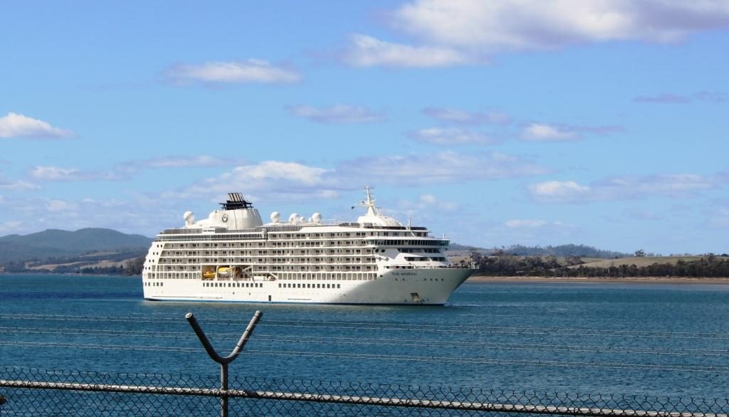
MV The World moored at Bell Bay
Upstream from the port a large white ship was at anchor. We took
it to be a cruise ship visiting Launceston at first but a closer look through
binoculars showed it to be passenger vessel named “The World” but
with no cruise line identification. A Google search informed that it is the
largest private yacht in the world. It is a floating block of apartments owned
by permanent residents and wealthy folk who take their holidays aboard and rent
their apartments when absent. It pulls up for several days at a time at various
ports. It cost $13.5 million to buy into the scheme initially, so it is not for
your every day battler.
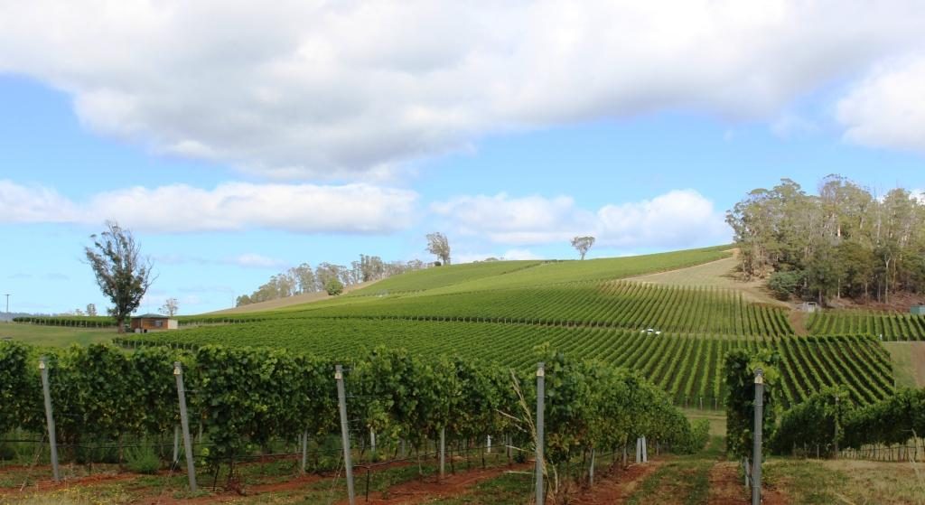
We moved on towards Bridport via the north Tasmanian wine trail.
We saw hillsides covered in lush green vines but mostly producing cool climate
white wines. The heavier end of the red wine range seems scarce in Tasmania. Pinot
Noir is as serious as wine production gets. The weather is probably too cold.
If you are looking for a Cab Sav or a Shiraz don’t bother with Tasmania.
Pipers Brook Vineyards
Pipers Brook is a well known brand of white wines. The winery is near to the road so we called in. The entrance driveway passes through a couple of kilometres of vineyards, making it a pleasant drive, but you do start to wonder when you will arrive. There is a cellar door and restaurant. We went in, but I don’t taste when driving and Ruth seldom does, so we had a look at some historical artefacts and then moved on. Winery restaurants are for more leisurely dining than we had in mind for that day.
Pipers Brook Winery and Cellar Door.
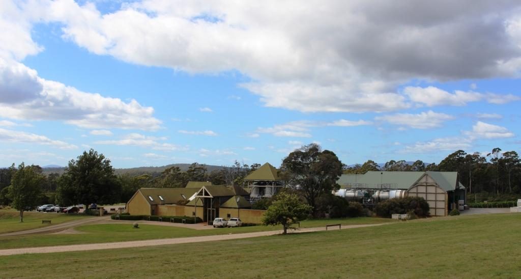
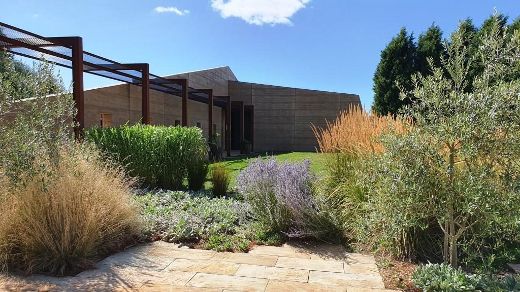
Located quite near to Pipers Brook is Clover Hill Wines. They specialise in sparkling wines produced by traditional methods. The cellar door building was quite new, very modern and attractive in the vineyard setting.
Clover Hill Wines Cellar Door
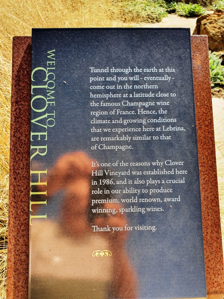
A sign near the buildings advised that if you were to dig through the earth from that spot that you would come up near the champagne area of France. I had always heard that you would come up in China. But France does sound a better proposition right now.
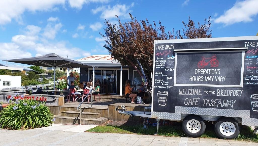
Bridport commands views over Bass Strait and is a pleasant town and is the principle beach side town on the eastern part of the north coast. We found a pleasant cafe that commanded those same views over Bass Strait and with seafood chowder on the menu. Well, what else could we do but go in and order? Ruth settled for fish. Our tastes in food often differ.
Bridport Cafe with indoor and alfresco dining
About 20 km south brought us to Scottsdale, the last major town through which we passed coming over from the east coast a couple of days before. This time we took an alternative road to Launceston that avoided the worst of mountain range. Scottsdale is 62 km from Launceston via the Tasman Highway (over the mountains) and 68 km via Lillydale. It is a substantial town and has a Woolworth’s anchored shopping mall as well as the kind of businesses that support agricultural production.
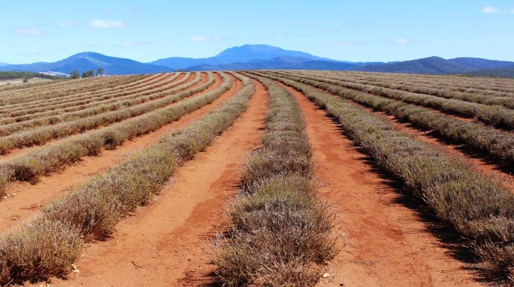
Sadly the lavender was not in bloom at Bridestowe Lavender Farm
The road through Lillydale brought us near to what is, I think, Australia’s largest lavender farm. Bridestowe Lavender Farm grows lavender which is converted to a wide range of products sold in the farm’s retail outlet.
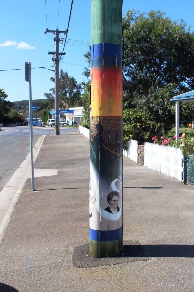
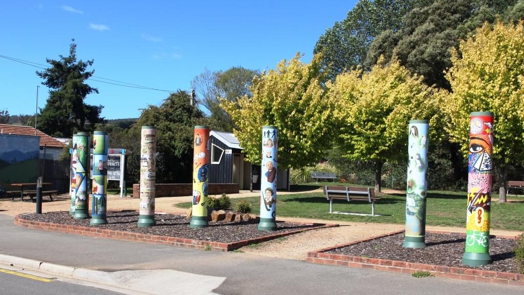
An artist decorated power pole at Lillydale
Later we drove through Lillydale, a town that has attracted artists to take up residence. As a community project, locals have assisted a number of the now local artists to paint murals on the electric power poles. Consequently Lillydale is known as The Town of the Painted Poles. It is about 28 km from Launceston.
Shorter decorated poles surround the park at the rest area.
We checked the time and decided that we would try for seats on
the last Tamar River cruise for the day, if seats were available. We would have
made it except for Launceston’s peak hour. I didn’t know it had one but we were
held up for about 20 minutes as traffic made its way from north to south
through the city. We returned to our unit for another quiet night.
The following morning we packed and loaded the car. As I sat in the seat to drive I noticed a slip of paper under the wiper blade. When I retrieved it I found that it was a note from the old neighbours who we had met on Bruny Island. They had spent the previous night under the same roof as we had.
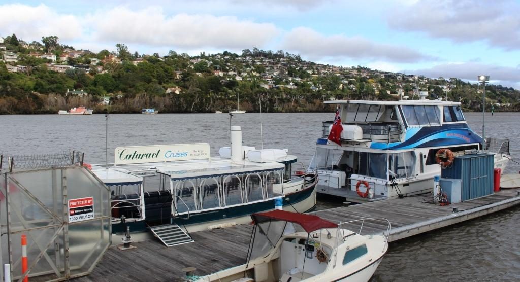
Launceston river cruise ferries. Our craft was the smaller boat with transparent blinds.
Before we set off to
explore the west side of the Tamar we gave the Cataract cruise another try. We
were successful and got tickets for the first cruise.
Walkways and modern accommodation now occupy this part of the river. This is the mouth of the North Esk River.
The opportunity to see Launceston and the Cataract Gorge from the water was better than the commentary from the expatriate Kiwi skipper, but he did add some interesting information. The day was sunny but with the same persistent cold wind that has apparently been blowing all summer. The see through blinds on the cruise boat were kept down.
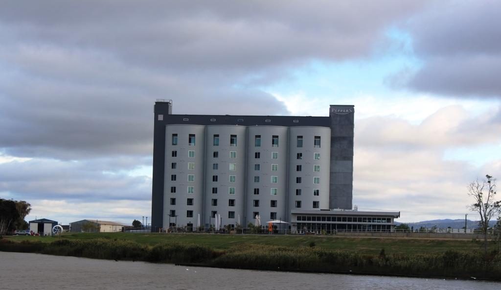
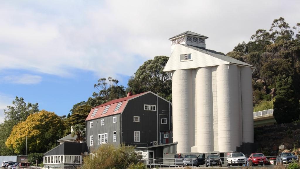
This Peppers hotel was developed in a set of four silos.A house on the western side of the river has its very own set of silos.
There has been a great deal of development of the old Launceston river waterfront with extensive walking and bike ways that run between the river and modern unit developments. Open space has not been forgotten. The development has provided for public access to the river bank. The development includes new hotels like the Pepper’s hotel developed in a set of four grain silos over the North Esk River mouth, directly opposite the tour boat wharf.
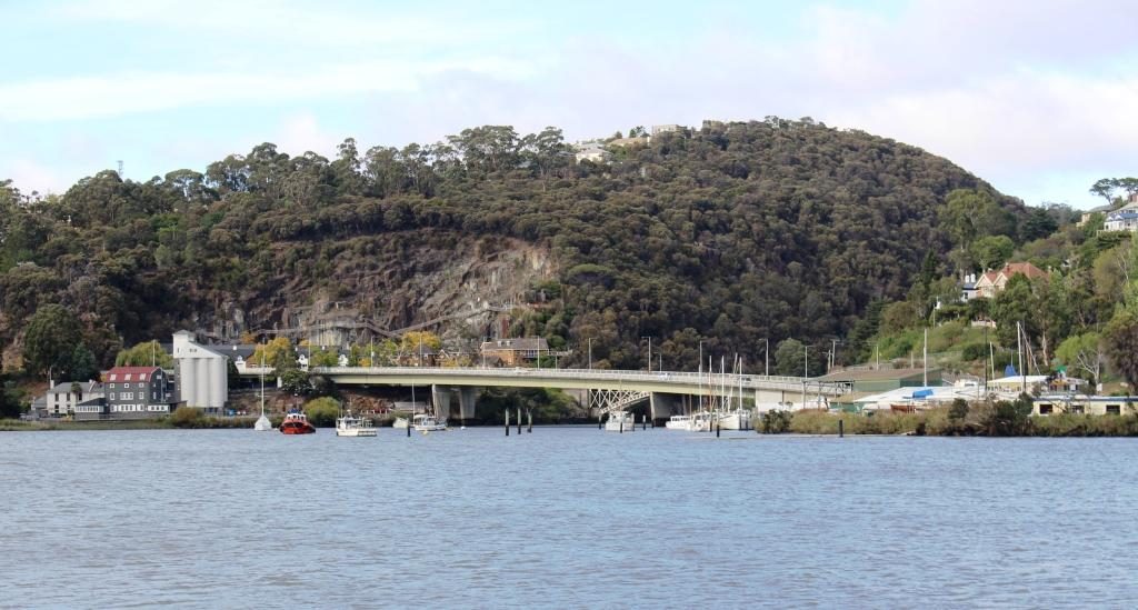
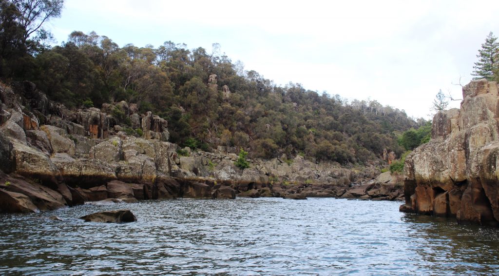
Bridges span the mouth of the South Esk River where it enters the Tamar. Original iron bridges carry local traffic while the new concrete bridge carry the through lanes of the West Tamar Highway.The navigable limit if the South Esk River within Cataract Gorge.
It is at the wharf
area that the Tamar splits into its two major tributaries, the North Esk and
South Esk Rivers. The North Esk River
turns to the east before moving off in a south easterly direction. The South
Esk River flows from south of Launceston, through Cataract Gorge and joins the
Tamar opposite the ferry terminal. We had crossed both Esk rivers on our drive
two days earlier to the stately estate homes to the south of Launceston.
Houses on the western bank of the Tarmar have fine views of the river and the city
We disembarked and set
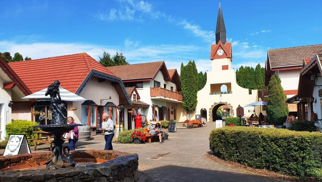
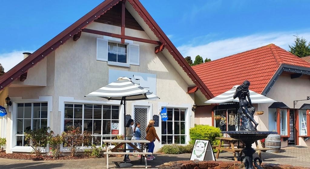
off on the day’s drive. Our first stop was the shopping village at the Aspect
Tamar Valley Resort at Grindelwald. There we found a neat little Swiss bakery
with good coffee and pastries as well as specialty shops, within a Swiss themed
shopping mall.
The Grindelwald Swiss themed mallThe Swiss bakery. Choosing a pastry to go with the coffee was quite a challenge
Having returned to the
West Tamar Highway our next stop was Brady’s lookout, named after Tasmanian
bush ranger Matthew Brady. The lookout provides sweeping views of the Tamar,
particularly to the north towards the river mouth.
The Tamar flowing towards Bass Strait from the vantage point of Brady’s Lookout.
We headed then towards
Beaconsfield, of gold mine collapse fame, but first made a detour to see and
cross the Batman Bridge over the Tamar River. It is a single span “A” frame
bridge with the span supported by cables. It looks quite spectacular but is not
new. But new to us!
The Batman Bridge over the Tamar between Launceston and the river mouth
The mine collapse at Beaconsfield
killed one miner and buried two more for a couple of weeks. The widely
publicized event put the town on the map.
The residents have worked hard to keep it there. The mine was on our
itinerary but our interest was sharpened when we heard a couple of days before
that the mine had been sold to a mining company and there were plans to restart
gold production.
The mine head facilities at Beaconsfield
There is real history in old buildings but the heritage centre built to commemorate the mine disaster is the focal point. There is a mining display in part of the original mine buildings but it costs $16 for an adult so you need time to get value. You can get the idea from outside and you can shop in the attached gift shop for souvenirs and the like.
The view of a water wheel through a window.
A new brewery has been
built next door that has used the gold theme for a partial free ride. It is
called the Miners Gold Brewery.
Buildings of the Miners Gold Brewery
Moving on, we drove directly to Greens Beach, a seaside town immediately opposite Low Head on the west side of the Tamar Mouth. If it has a commercial centre we didn’t find in but it does have many large homes overlooking Bass Strait and the river.
The view over the mouth of the Tamar from Greens Beach. The Low Head Lighthouse is on the tip of the point in the background.
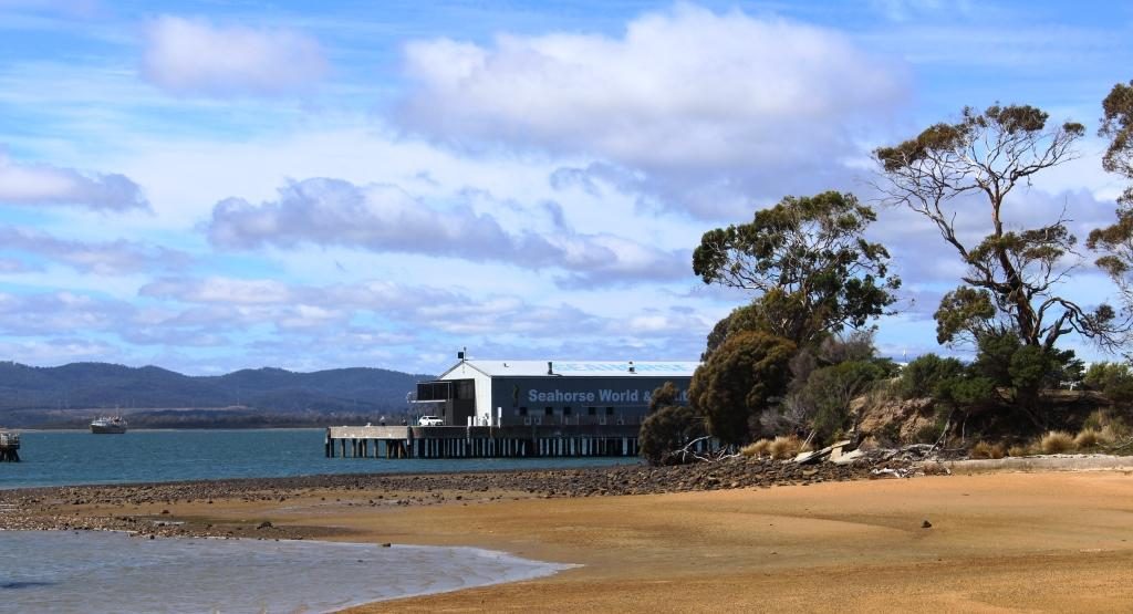
On the way back we
detoured to Beauty Point, a pleasant river side community where, among other
attractions, there is Seahorse World, an aquarium specialising, as you might
guess, in sea horses. On the same wharf structure you will find Platypus House
where you can see platypus and echidnas up close.
Seahorse World. The Platypus aquarium is out of sight behind the trees.
We stopped at the Jubilee Bakery for lunch as we passed back through Beaconsfield and discovered more history. The “Jubilee” part of the name was in honour of the 50th anniversary of the coronation of Queen Victoria. Irishman Paddy Manion opened the bakery in 1887. Some modernisation has since occurred but the original wood fired baking ovens remain in use. So my lunch time paste was cooked in the original wood fired oven, installed in 1887. The story goes that Paddy used to claim that his products were made with holy water because it came off the roof of the church next door.
Bakery and church at Beaconsfield. The holy water may have come from the roof of an earlier building.
We then drove south
over a collection of country roads to Deloraine before joining the Bass Highway
to Devonport.
Deloraine has park lands on both banks of the Meander River.
Deloraine, on the
Meander River, is another town of historic buildings. The town is close to the
mountain range known as The Great Western Tiers, named because of the way the
range steps down, with each successive mountain lower than the last, as it
progresses to the North West.
Historic buildings by the road side as you enter Deloraine from Launceston.
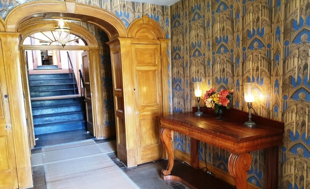
We spent the last night in Tasmania in a unit at the Postmasters Quarters, a modern development of historic buildings at East Devonport. This was another digital reception establishment with the access code texted to us, before our arrival. The interior decoration was a bit quirky but functional and comfortable. The location is within walking distance of the Spirit of Tasmania terminal. There is a pizza shop even closer.
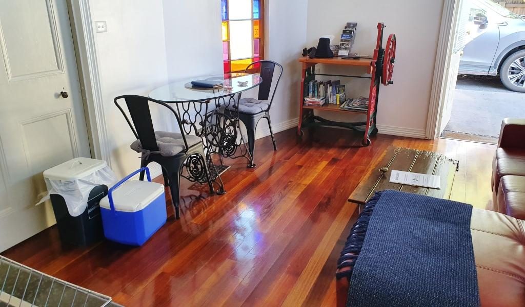
Both table and book shelves were adaptions of machines at The Postmaster’s Quarters.
Please Note: Videos covering the material in this blog post appear at the bottom of this post.
When we drew back the drapes that
morning the sun was a red orb in a strip of blue on the horizon. But that
didn’t last for long. Grey clouds blew in from the west and wiped it all away.
The day’s journey started as a repeat of the drive two days prior, as we needed to go via St Helens to reach the Tasman Highway to Launceston. We only just made it through morning coffee (made on a picnic table and taken back to the warmth of the car) before drops of rain appeared on the windscreen. A few minutes later, as we made our way out of town, we were in drenching rain.
Farming land near Ringarooma
The first part of the drive was mostly beside the sea, with regular ocean views over calm and unruffled waters. The road turns inland at St Helens and meanders its way over mountain after mountain and through valley after valley, until it reaches Launceston. The mountains are almost all heavily timbered but much of the area in the valleys are cleared for farming. We at last saw the emerald green Tasmania of which we had so often been told.
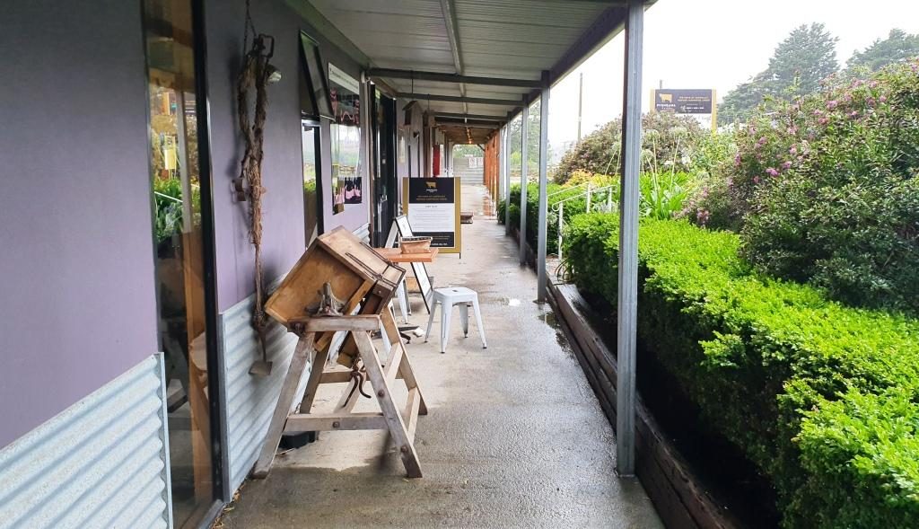
Old cheese making equipment on the veranda of the cafe at Pyengana Cheese
The plan for the day had
included visiting a couple of waterfalls and doing some short scenic walks, but
the rain put a stop to that. So our first tourist stop was at a farm and cheese
factory. Just off the main road at Pyengana, right on the farm, the factory and
a retail outlet and cafe attracts a large proportion of passing tourists from
this relatively busy highway. We had to line up to sample. We bought two cheese
flavours.
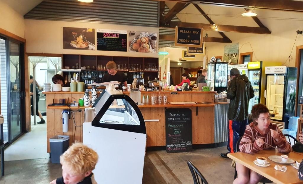
The Pyengana cafe
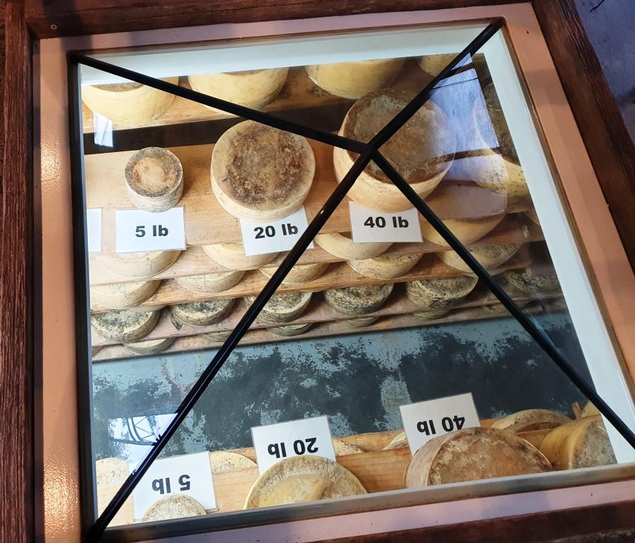
Immediately after we married, Ruth worked in the cheese producing Drouin Butter Factory in West Gippsland. We used to buy full cloth wrapped cheddar rounds, like those displayed at this cheese factory. On this occasion we satisfied ourselves with two small cheese wedges.
Cheeses on display under a glass pyramid in the cafe floor
Further down the road, past
the farm, were a couple of waterfalls, but the rain was too persistent for us to
see them and stay dry. So we returned to the highway and drove on steadily,
because that is the only way to handle Tasmanian roads, particularly in the
rain. But the scenery was attractive, even through the rain, so we did not feel
robbed.
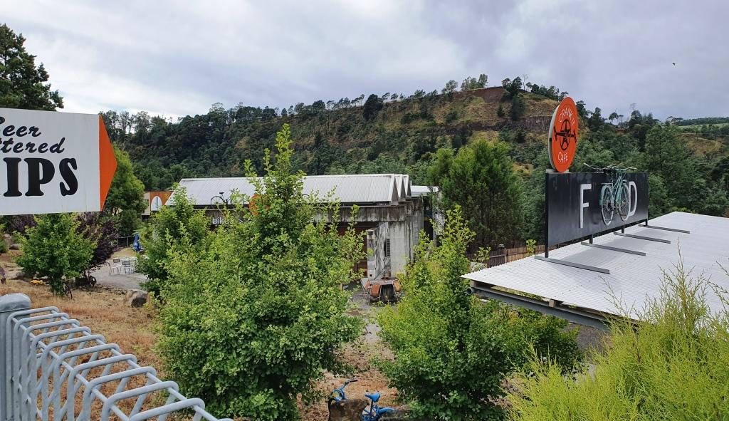
At about midday we reached the old tin mining town of Derby. The tin mines have long been closed but its history and its location on the road to the east coast has kept the town alive.
The mountain bike themed cafe at derby. Mullock heaps in the background.
The housing that remains lines the road that runs through the valley. To our right the hill was a large mullock heap from the mining activities.
The mining long gone, Derby has reinvented its self. It has become a Mecca for mountain biking. Bike tracks have been built in the surrounding hills that are drawing competition from around the World. One cafe has committed itself to mountain biking culture, whatever that is.
With rain abated we found the Two Doors Down Cafe (there has to be a story to that name) and enjoyed a pleasant lunch. An interesting feature of the cafe was a large picture on the wall showing the town in its mining heyday.
The picture of the old town of Derby displayed on the cafe wall
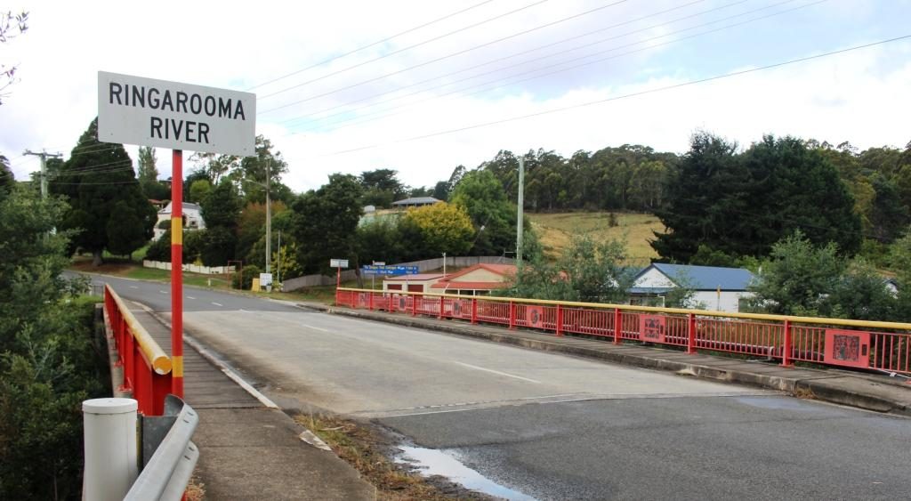
A bit further on we stopped at Branxholme to photograph the Chinese bridge over the Ringarooma River. Branxholme has a strong connection to the history of Chinese miners in Tasmania. It is a key point on what is known as The Trail of the Tin Dragon that links tin mining sites from Launceston to St Helens.
The Chinese bridge at Branxholme
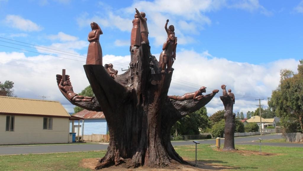
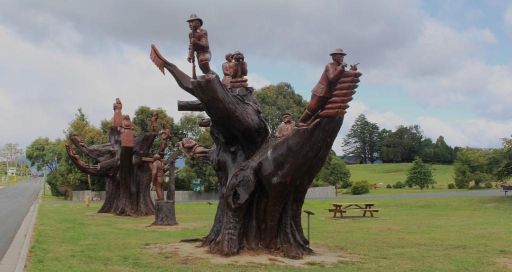
A short distance past Branxholme we detoured on what was not much more than a country lane, towards the town of Ringarooma to find the small town of Legerwood its carved trees. In 1918 seven trees were planted beside the road at the location that in 1936 became Legerwood, one for each of the locals who did not return from WWI.
Memorial chain sawed tree stump at Legerwood
By 2001 the trees has become
a safety risk so they were cut back and the stumps were carved into a memorial
for each of the men. The carving was carried out using a chain saw. A plaque on
a stand at each tree tells the individual serviceman’s story. A rest area has
been built behind the memorial trees with space for a few RVs to park
overnight.
A different perspective of the carved memorial trees
The only other stop was at Sideling Lookout near the summit of the Sideling Range, the last mountain before the commencement of the decent into Launceston. Even with low clouds the view was great. A sign says that on a clear day you can see features on the Bass Strait Islands to the north east.
View back towards Scottsdale from Sideling Mountain
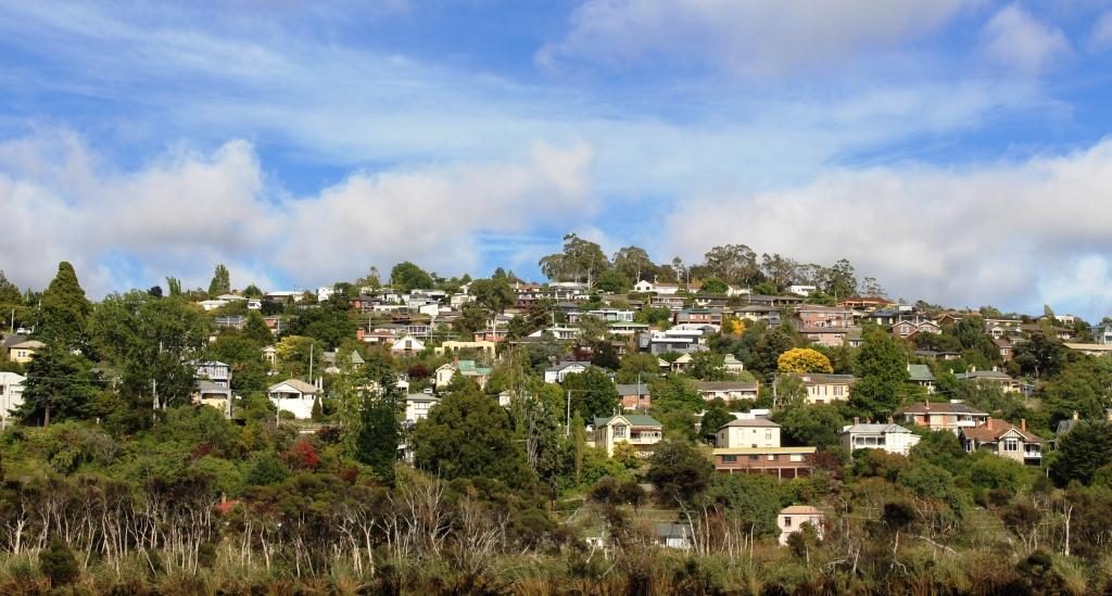
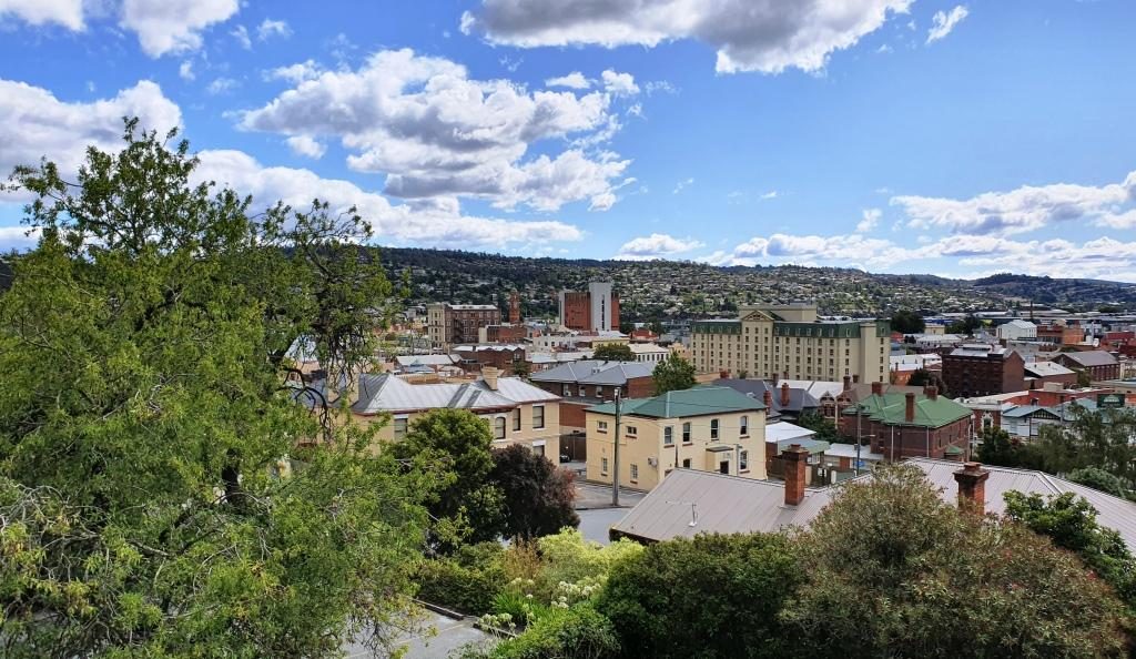
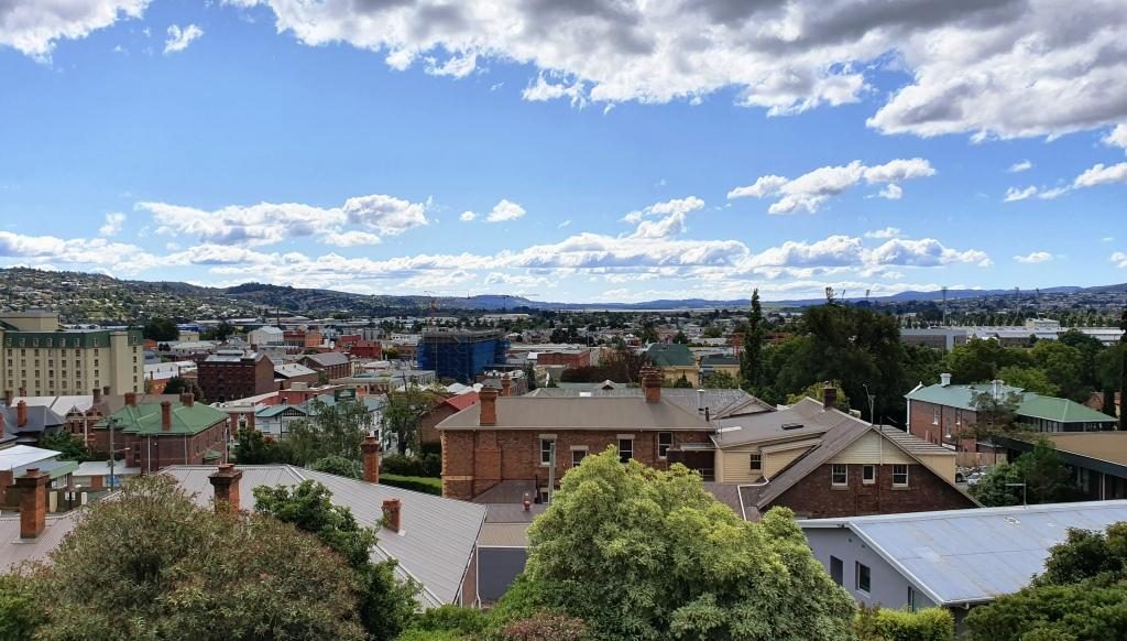
Our Launceston accommodation was at Adina Place Apartments on the steep slope above the Launceston central business district. Adina Apartments is a multi storey block with access to the rooms from a balcony that runs the length of the building, overlooking the road. The views from our windows were to the North and North West along the Tamar Valley.
View towards the north west from our Launceston accommodationLooking north from our unit. The water in the background is the Tamar River
The first day in Launceston was not very holiday friendly. We started out at 14C and (according to the BOM) feeling like 12C, with a strong and cold north-easterly gusting in from somewhere around the freshly fallen snow. It may have got to 16C later in the day. It was hard to tell.
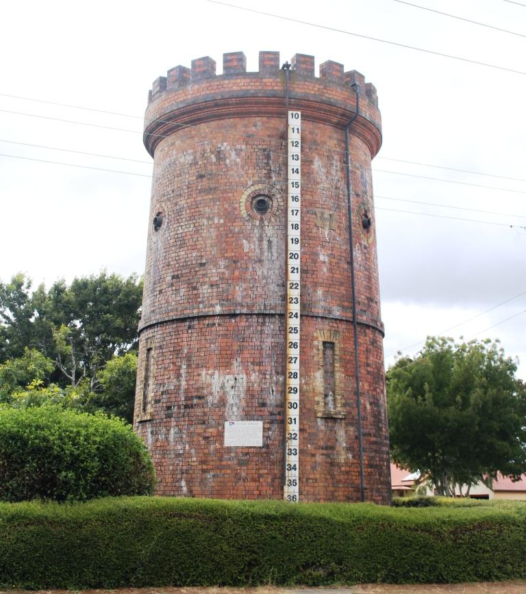
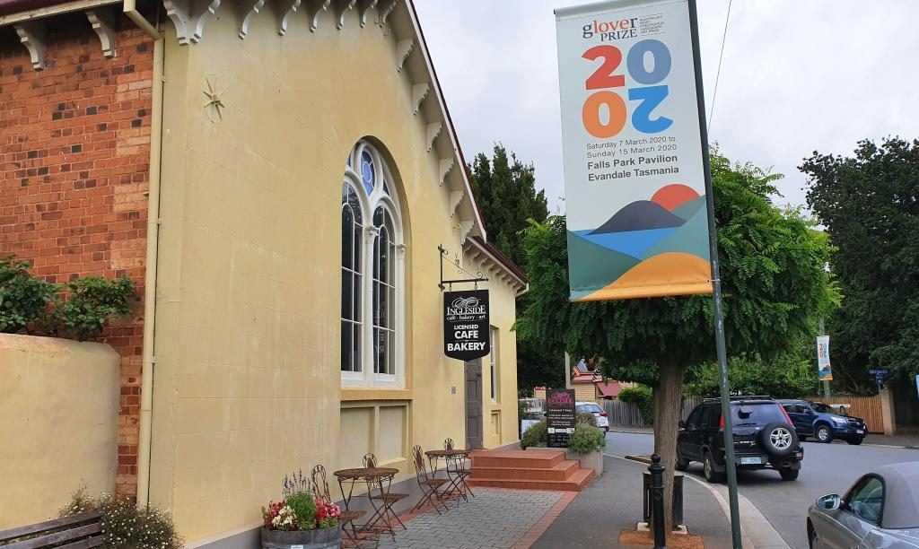
This historic water tower at Evandale is no longer used but kept full of water to help to preserve it.
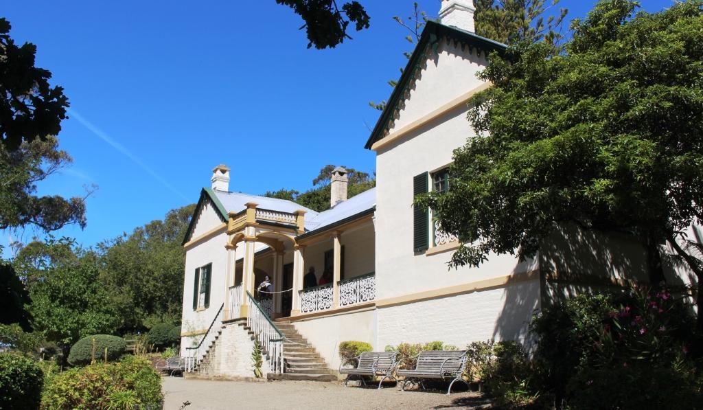
We had intended to start the day with a visit Ben Lomond, one of the highest mountain peaks in Tasmania and host to some of the local ski fields, but that had to be scrapped with forecasts of low temperatures, wind and possible snow. The plan would have taken us south of Launceston so we stuck with that plan to visit the other items that we had identified. These were mainly National Trust managed homes. All are open to the public for a fee, but with only a morning to spare we were only intending to look at them from the outside and to drive through the country side.
The Evandale Bakery. It was really a licensed cafe but also fulfilled the role of a bakery.
First we drove to Evandale, passing Launceston airport on the way. At Evandale we found a bakery so inviting that we went in for coffee. The warmth was very welcome as was the coffee smell and the wide range of cakes from which to choose.
Evandale, on the old Hobart to Launceston road, has almost all historic houses. It is like an English village. If you built a new house I think that you would need to make it look old to fit in.
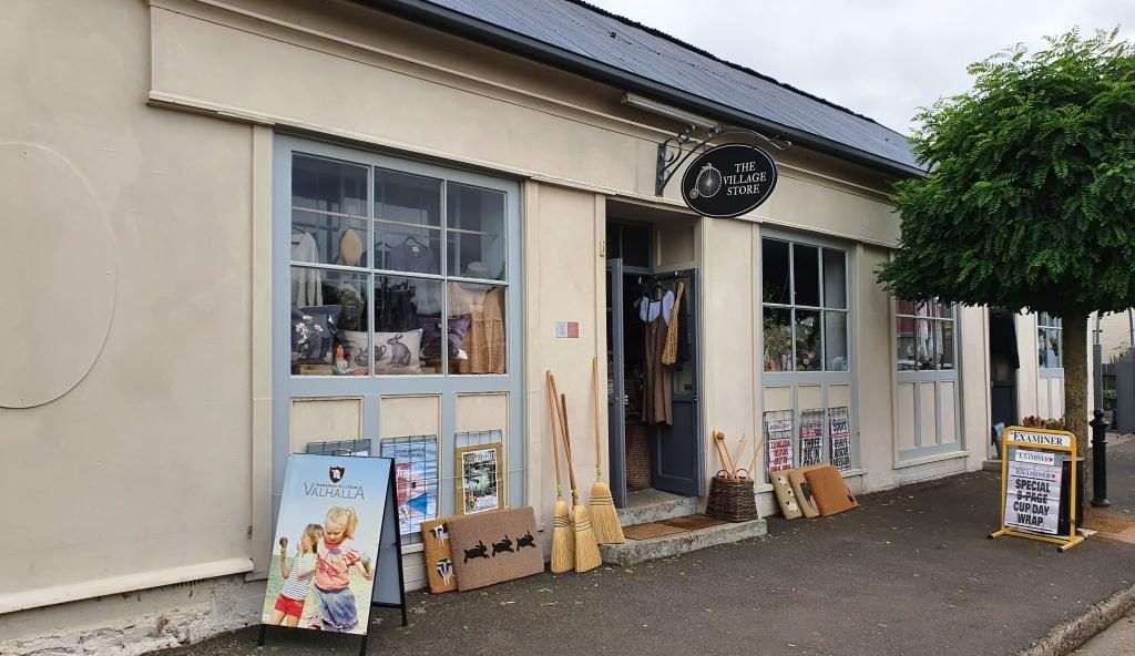
The Evandale Village Store
About a week before we were there Evandale hosted the annual penny farthing bicycle championships. The races are run over a triangular course in the village. A village fair forms part of the event featuring stalls, music, singing, dancing, vintage cars, historical costumes and a grand parade. It must be quite a day.
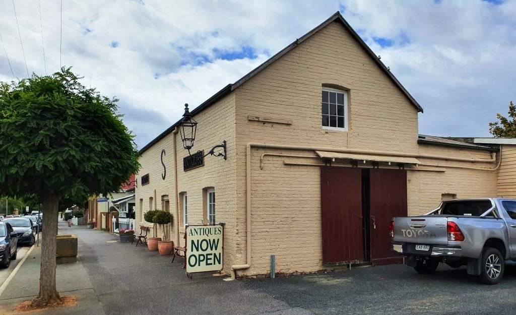
Antiques for sale from truly antique buildings.
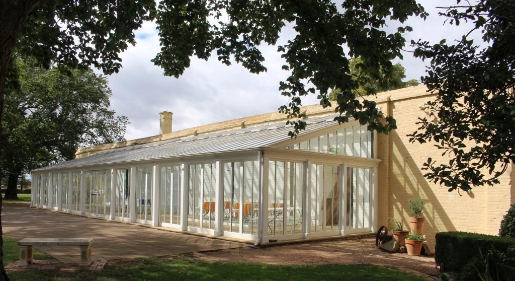
Of the National Trust homes that we visited, Clarendon is the stateliest. It was built in 1838 and must have been the centre of colonial social life in the area. Like its piers it is available to host special functions.
Extensions to Clarendon to accommodate functions such as weddings, balls and commercial promotions.
Brickendon and Woolmers Estate, near Longford, were built by the Archer brothers. Brickendon has been operated by the same family since 1824. Woolmers Estates dates back to 1817. Both properties were added to the National Estate in 1910 because their connection to convict history. Both were built by convict labour. The Archer brothers were regarded as humane masters. Jeffrey Archer became a member of parliament and played a role in the ending of transportation.
The visitors centre at Woolmers Estate. This National Trust property hosts functions and offers tourist accommodation.A peep into the back door of Brickendon Estate. The back door is the tourist entrance.
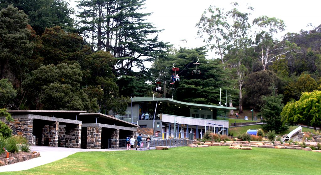
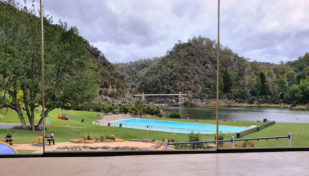
We came back to Launceston to
pay a visit to some friends of Briony at their place of business and then made
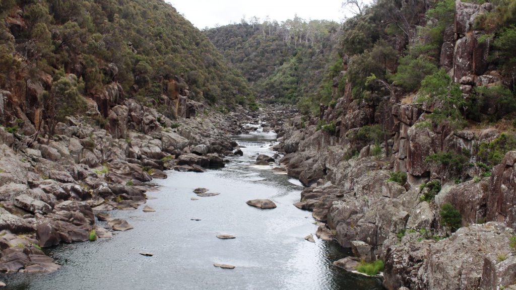
our way to Cataract Gorge. This geographic feature is quite close to the City
and surrounded by suburbia.
The cafe at Cataract Gorge with the chair lift overhead.
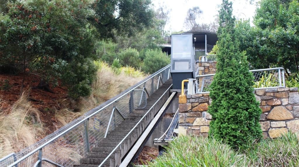
Some of the developments in the gorge have been there for a long time. We remember them from our previous visit. Other features are more recent. A suspension bridge and a chair lift carries people over a small lake and link to various walks. There is a swimming pool, surrounded by lawns, a cafe and a inclined elevator to make it easier for the less mobile to move between the various levels.
Chairlift and pool from the cafe at Cataract Gorge
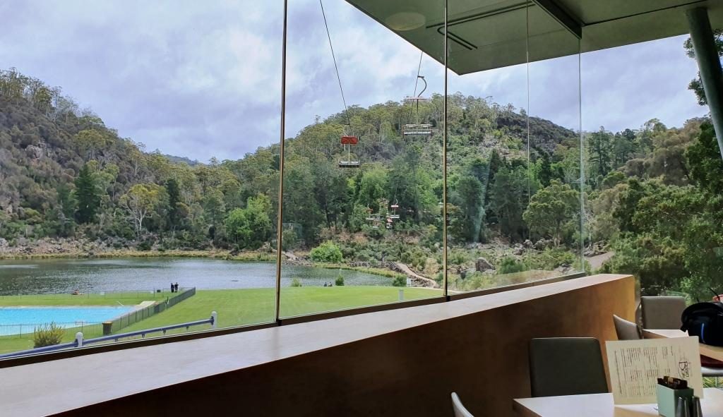
We started with late lunch in
the café. Then I went for a walk past the pool, returning via the suspension
bridge, while Ruth tried to hide from the cold. We gave the chair lift a miss,
as did almost everyone else that day.
Cataract Gorge pool lake and suspension bridgeThe South Tamar River flows through Cataract Gorge above the suspension bridge. This inclined elevator connects three levels at the Cataract Gorge cafe.
We finished
with a drive through city streets. Launceston is built in a narrow valley with
city and suburbs spreading up the sides of and over the hills. There are
streets that look like the plunge of a roller coaster.
By now there was not much of the day left so we returned to our apartment. It was pleasant to be able to turn the heat up on the air conditioner and settle back in warm comfort for a peaceful evening.
Please Note: Videos covering the material in this blog post can be found at the bottom of this post.
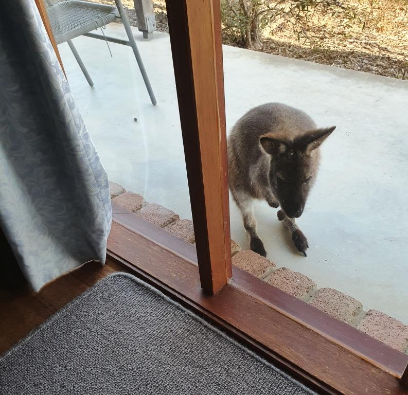
There was no sign of Tom or Jane when we departed Windsong next morning but we now know that Jane exists. We heard her voice through the wall. The only sign of life was a group of small marsupials, one of which was peeping through our bedroom window.
We made our way back along the dirt track, through two closed gates, back to the highway and turned north towards Swansea. We passed the small roadside community hall that appeared to be Little Swanport as we headed for the turn off to Coles Bay and the Freycinet National Park.
On the way Ruth’s sharp eyes spied a tourist spot of which I had read. It was the Spiky Bridge. For some reason the builder finished its parapets with sharp stones on end. It is now bypassed by the main road but we drove across, just for fun. The bridge now leads to a farm gate.
The Spiky Bridge near Swansea, Tasmania
But there is a story. The government official who controlled the purse strings for such expenditure was holding out on providing funds for a bridge to span a troublesome stream. A local land owner took the official for a ride in his horse drawn cart and drove over the road through the creek bed at top speed. He proved his point. Money for the bridge was made available. The Spiky Bridge is the result.
The Spiky Bridge was built in 1843. Not bad for almost 180 years old.
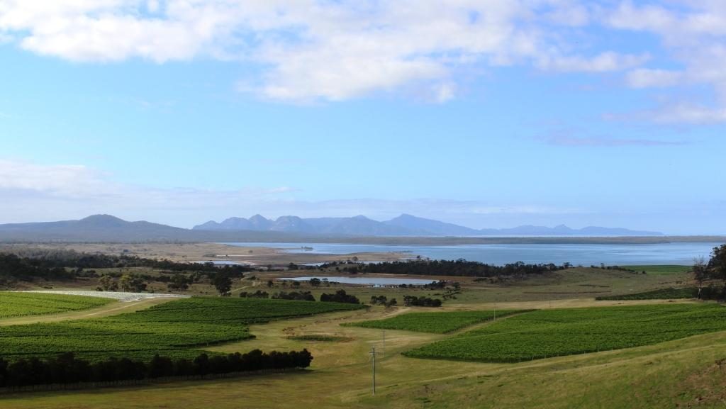
Continuing on, we crossed a
mountain range and came upon Devils Corner. An extensive vineyard has been
established there with vines planted on the lower slopes, reaching down towards
Oyster Bay. A three level viewing tower has been provided as part of a visitor
facility. The vineyard is well known for its Pinot Noir based wines. Views from
the deck are among the best to be had of Oyster Bay and the Freycinet
Peninsula.
Devils Bend Vineyard and WineryThe vineyards slope towards Oyster Bay. The ranges of the Freycinet Peninsula are in the background.
After coffee at Coles Bay we headed on into the park to the parking area for the walks to Wineglass Bay (a long walk) and the lookout (a much shorter walk). I intended to have a go at getting up to the lookout although I was a bit daunted by the 600 steps involved. But there was not a parking spot to be had in any of the three levels of the car park. Vehicles that could not find a parking space were parked nose to tail well back along the road towards Coles Bay. We decided not to add to the number fighting for a parking space. It would have been a long walk back just to get to the starting point.
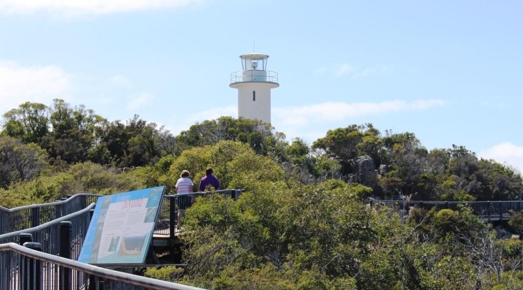
Cape Tourville LighthouseView south from the Cape Tourville boardwalk. Wineglass Bay is behind the rear headland on the right of the photo.
Instead we did the short but steep and winding drive to the Cape Tourville Lighthouse and lookout. The lookout is in the form of a board walk in a sort of semicircle around the edge of the cliff top, below the base of the lighthouse. The views south along the east coast are magnificent.
Ricky mountains at the northern end of the Freycinet Peninsula.Coles Bay Jetty. The Pennicott Wilderness Journeys boat tour to Wineglass Bay departs from here. Mountains on the Freycinet Peninsula in the background.
We returned from the
lighthouse to Coles Bay for lunch. At the bakery I finally found a scallop pie.
It met expectations. Not bad at all!
There is
only one road in to Coles Bay so we retraced our steps to the highway and
travelled another 12 km to Bicheno. Our accommodation for the next three nights
is a ground floor studio apartment in an older two story house on the southern
edge of town, overlooking the ocean.
The following day, Monday, the
sun had fled. It was cloudy with that persistent Tasmanian cool breeze. The
order of the day was a drive up the coast to St. Helens. But first some medical
needs.
I’d had a sore on the side of my head for all the time we had been in Tasmania.Since I have had skin cancers taken off my head previously, we thought it should be checked. Or what if I was growing a second head? So, I sought medical advice. It was just a persistent boil. The doctor squeezed it out (Ouch!) and prescribed some antibiotic cream to for me to apply.
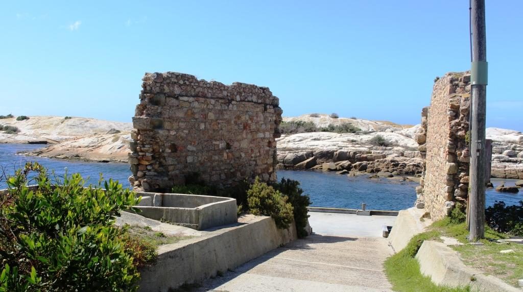
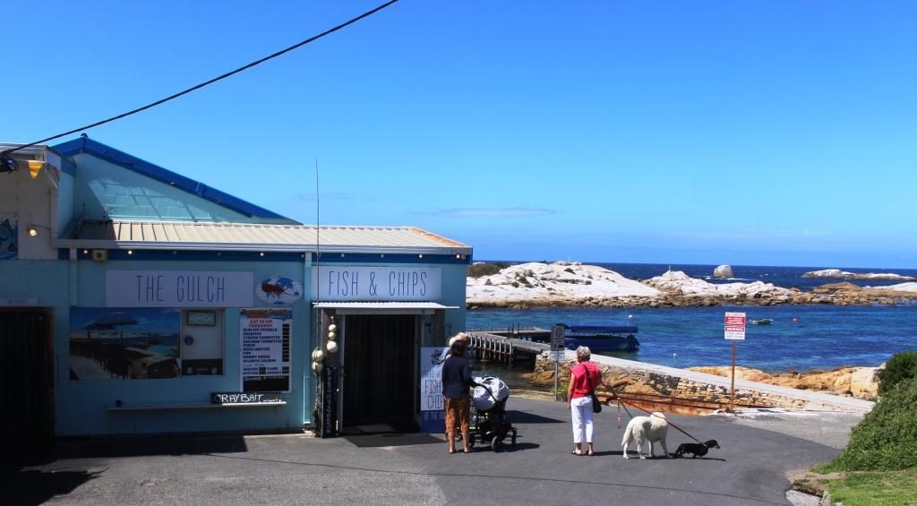
Ruins of an old port building and The Gulch at Bicheno.
That got rid of most of the morning. We spent the remainder of the morning looking around Bicheno. The main town is a little way back from the water but the small harbour is worth a visit. It is the base for lobster fishermen who ply this rocky area of coast. The small harbour, known as the Gulch, is a narrow and deep channel between a large rook and the mainland, with another rock island of similar size close in and to the north east.
Fishing wharf and the south end of The Gulch
The buildings at the wharf include a very busy fish shop
with dine in tables and a substantial take away business. Above the harbour, at
the road side, a red building houses the Lobster Shack which features, as its
specialty, the local lobster.
Seafood cafe and take away at The Gulch, Bicheno
After lunch (not at the Lobster Shack) we embarked on the activity of the day. St Helens is about an hour further up the coast. The town is located at the furthest point inland of the rather long Georges Bay. The bay runs to north east to south west and is contained on its south eastern side by a long and broad peninsula, largely composed of sand. The town of Akaroa and the small wharf at Burns Bay are at its north eastern end.
The fishing boat wharf at Burns Bay near St Helens, Tasmania
The first 10 km of the drive
was along a decent road lined with houses, some of which enjoyed sweeping views
of ocean and bay. Beyond the end of the road at the jetty the coast continues
around to St Helens Point. The scenery is very attractive with white sand and
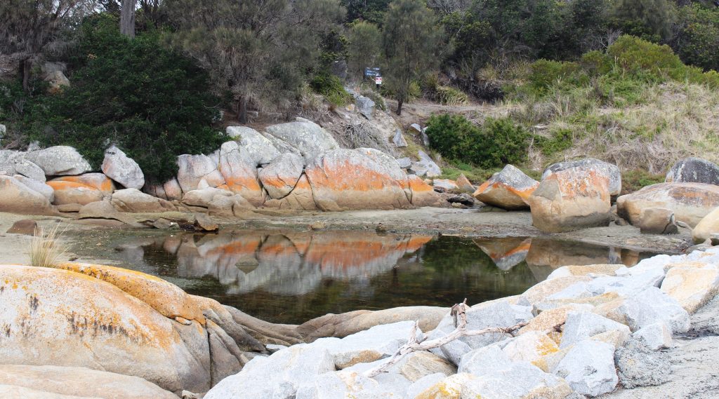
large rocks, many of which are partly covered by red lichen.
Rock pool surrounded by lichen coloured rocks.Ocean south of the beach near St Helens with St Helens Island in the distance.
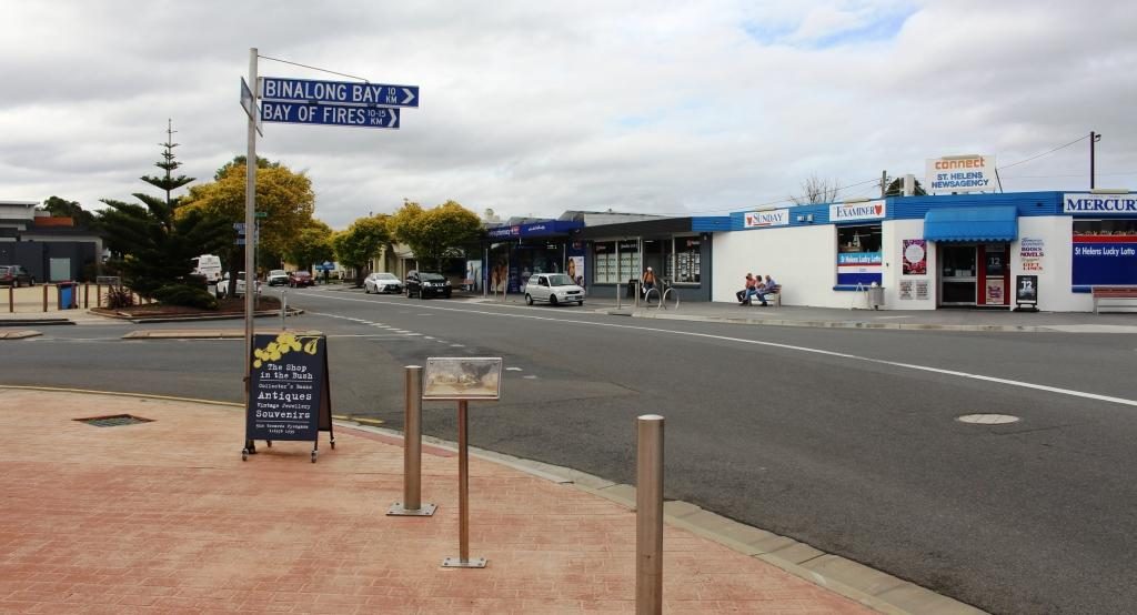
We drove through St Helens
and on the extra 10 km to Binalong Bay, mainly because Binalong Bay marks the
southern end of the long series of indentations into the coast known as the Bay
of Fires. The bay was named by Captain
Tobias Furneaux in 1773, because of the many fires that he observed along that
strip of coast.
View north along Bay of Fires from Binalong Bay
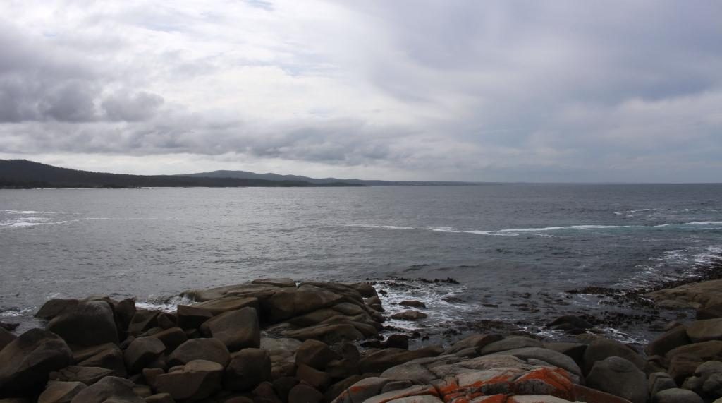
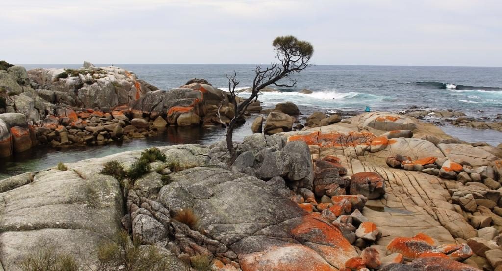
The Bay of Fires runs all the way from Binalong Bay to Eddystone Point. That is 61 km by road but probably about 35 km in a strait line. The southern headland is formed by huge boulders with many smaller boulders surrounding them. Their unique feature is patches of rusty coloured lichen, like those that we saw at Burns Bay.
Lichen covered rocks at the headland at Binalong Bay make for a very pretty picture.A mural on the side of a building in the main street of St HelensThe turn to Binalong Bay turn in the main street of St Helens
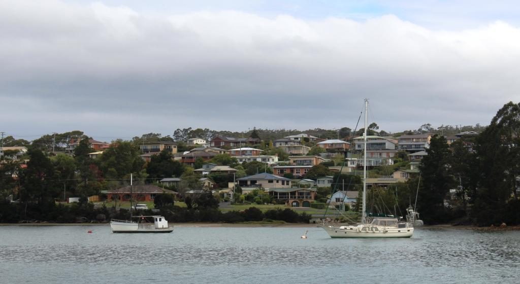
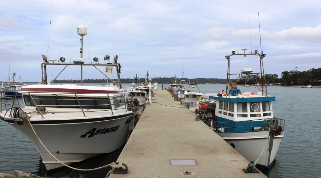
St Helens has a substantial
fishing fleet. Oyster beds are located in many of its bays and inlets. It is
the largest town on the east coast of Tasmania.
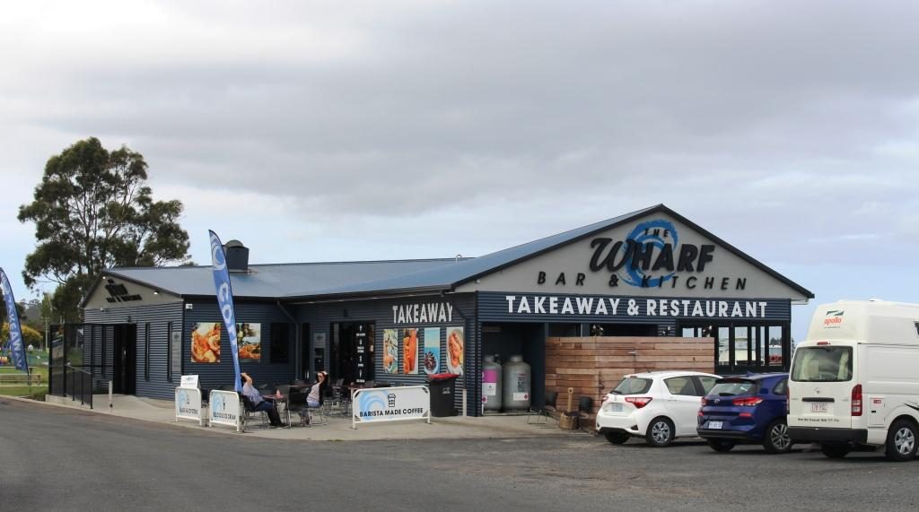
Houses over look Georges Bay and moored boats at St HelensFishing boats and wharf at St HelensTourist facilities at the St Helens port include eateries
The only other town that we
drove through, both coming and going, was Scamander. It is located where a
stream, which cuts the town in half, also cuts through the sand to reach the
sea. Like every town along this stretch of coast, where hills overlook the sea,
they are covered by houses built by those seeking that magic ocean view.
For the
first time in Tasmania we were seeing green fields that were not the result of
irrigation. It is mostly sheep country but vineyards regularly appear by the
road side, many with cellar doors and restaurants. Tourism is as important to
this part of Tasmania as to any other. The upper east coast is a very
comfortable drive from Hobart and has a superior climate. Grey nomads and not-yet-grey
backpackers are there in considerable numbers.
We used our second day
at Bicheno to travel inland to see the area that we missed by not travelling
directly between Hobart and Launceston. The route took us south, back past the
road into Coles Bay and past Devils Bend. The road that we were seeking is called
the Leake Highway. At its western end, it joins the Midland Highway just south
of Campbell Town. About the midpoint of the morning drive is Lake Leake, from
which the Highway takes its name.
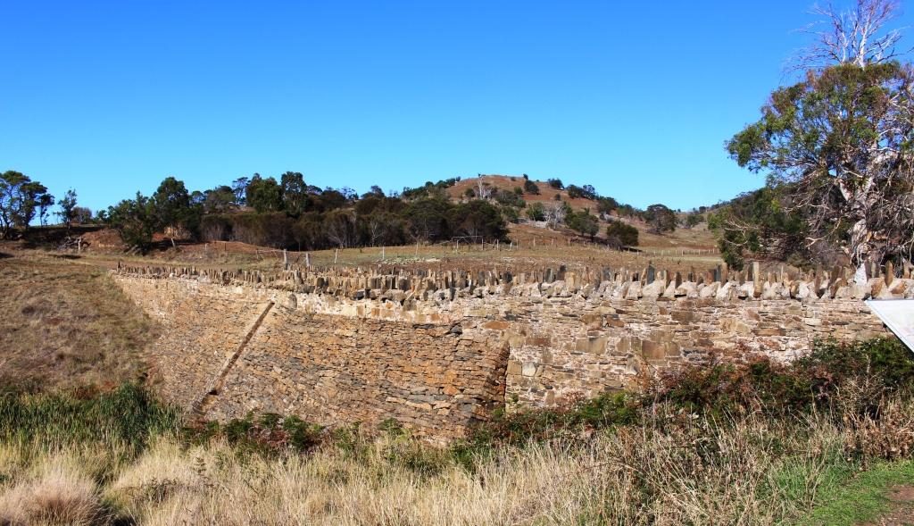
Lake Leake at less than full capacity
The lake has tourist facilities, so we followed the 7 km of dirt
road to the picnic area. It is a smallish dam that appears to hold water for
release into a larger dam. The area seems popular with fisher folk and deer
hunters. There is a sort of lodge/hotel adjacent to the retaining wall of the
dam.
Another Queensland registered vehicle pulled in. We spoke to the
occupants, as you do. They were a Redcliffe couple caravanning around Tasmania.
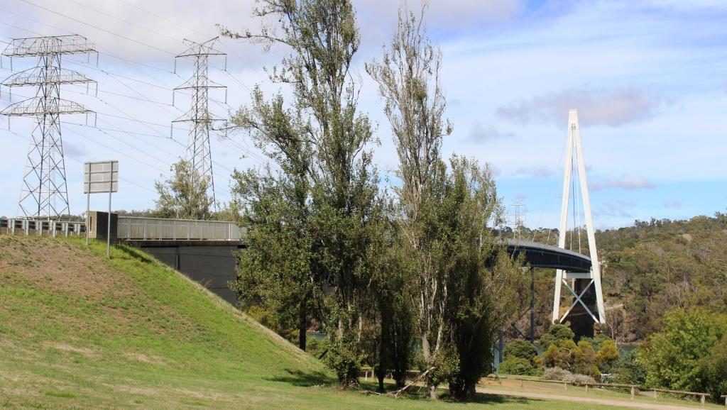
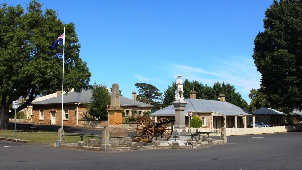
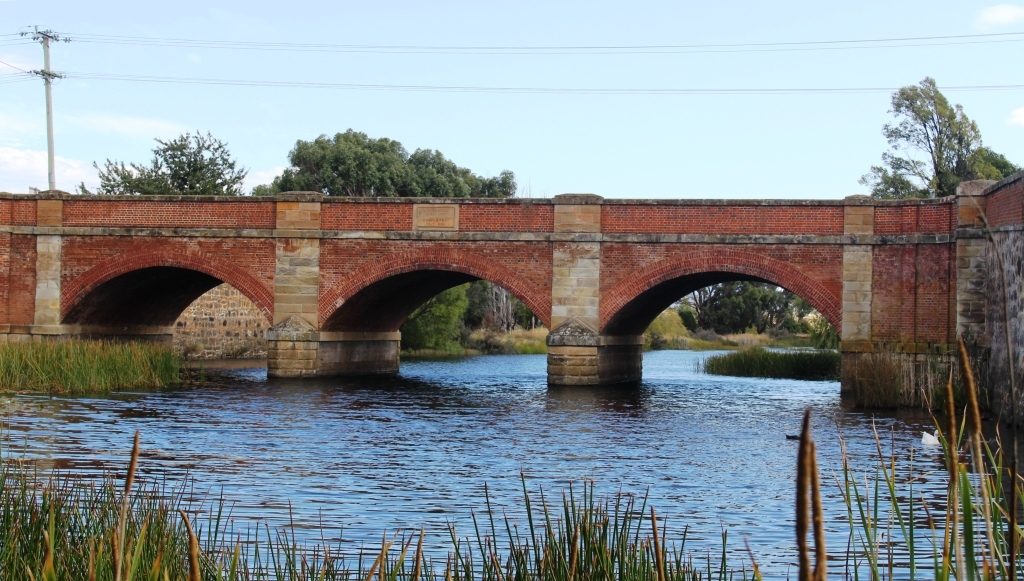
A view of Ross Bridge from the North. The bridge carries traffic over the Macquarie River.
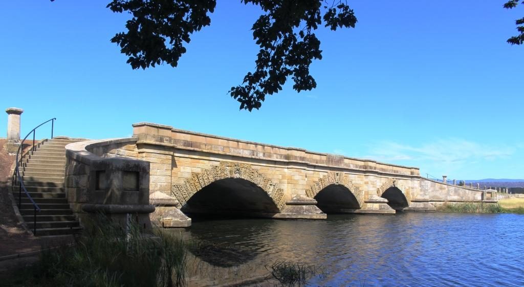
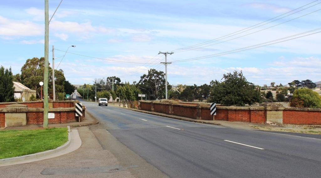
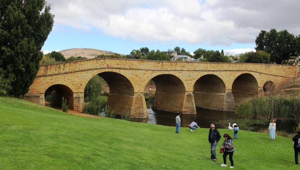
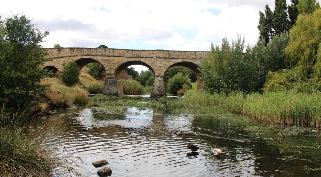
We drove on to Campbell Town and turned south to the small historic town of Ross. The convict built bridge over the Macquarie River at Ross vies with the bridge at Richmond in claims of design and age. Richmond wins at 1825 but Ross is not far behind, built just eleven years later. The Ross bridge has a greater amount of intricate stone work.
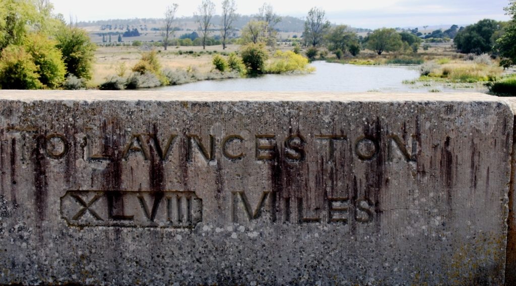
Bridge parapets were engraved with distances. The distance to Hobart is shown on the opposite parapet
Ross has been bypassed by the highway. The town does not appear to have been adversely effected by the change. The streets are wide and lined with British Elms. Every building in the main street is old, many historic. Businesses operate from historic structures and people live in houses getting on towards 200 years old.
The Uniting Church at Ross viewed from the Ross Bridge.The cenotaph at Ross
Ross has a wool centre building that tells the story of wool production in Tasmania and offers a range of woollen clothes for both ladies and men. There are samples of unprocessed wool and information on the development of merino sheep in Tasmania. Wool is still a vital product to this area. We drove past many flocks of sheep grazing on the pastures. The grass was not as lush as we had seen the day before but greener and more plentiful than in the west and highlands.
The Man O’ Ross Hotel (1835)
We found a bakery, one of two in town. Our choice was offering
both scallop pies and “the world’s best vanilla slice”. And coffee! So
the decision about lunch was easy to make. We chose the older establishment. It
was the original bakery and flour mill. The old mill building is now tourist
accommodation.
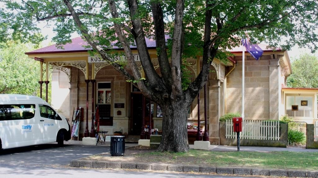
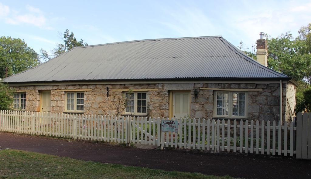
We sat in the shade of the tree to demolish our pies and vanilla slicesAn old house with bicycle hire next door.Ross Post Office, built in 1889 is a relative newcomer to Ross’ list of historic businesses. Cupid’s Nest B&B in the main street of Ross, Tasmania
We then drove back to Campbell Town, about 10 km north. Yet another historic bridge carries highway traffic over Elizabeth River, a tributary of the Macquarie. This one is known as the Red Bridge and was convict built in 1838. Like the Ross Bridge, the Campbell Town Bridge assisted the flow of traffic between Tasmania’s two major centres and was on the same road until Ross was bypassed.
Campbell Town’s Red Bridge was built in 1838. The Red Bridge at Campbell Town carries the Midland Highway over the Elizabeth River.
Campbell Town is substantially the larger centre and has a
greater amount of more recent construction as well as renovated and modified
buildings. But a great number of historic buildings remain, mostly still in use.
We could have spent more time as there was more to see.
Part of this old hotel is now a book shop.
We returned home via the Heritage Highway that follows the
Fingal Valley and a variety of rivers and creeks through to Conara, where it
meets the Midland Highway. Then through Avoca, Fingal and St Marys. The road
then crosses the coastal range over Elephant Pass on a narrow, steep winding route
until it meets the coast highway about 17 km north of Bicheno.
It was quite a varied and interesting drive. For much of the distance we were running beside and continually crossing a railway line that showed evidence of use. At Fingal we saw a coal washing plant and a bit further on the turn to a colliery. Question answered.
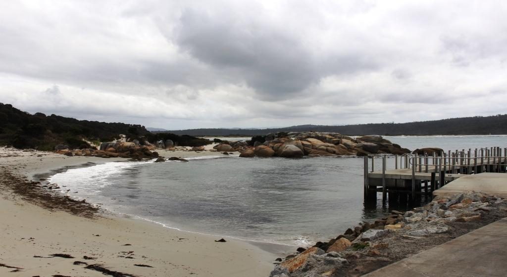
Between Bicheno town and port a rocky hill rises with a lookout on top, which must have great views all around. I am left with this assumption unproved because after a full day, with much walking, I lacked the energy to climb it.
Please Note: A video covering the material in tis blog post can be found at the bottom of this post.
Tasmania got rid of most of their trains many years ago. Only limited goods services remain and I am not certain that they are run by the government. But Tasmanians still seem to have an attachment to trains. You see museum and recreational railways often.
Margate Shopping Train
The top passenger train was the Tasman Limited. It operated between Hobart and Launceston but operations were stopped in 1978. Some enterprising people bought a complete train and set it up at the suburb of Margate, south of Hobart, as a boutique shopping centre. Original carriages have been set up as specialty shops, facing onto a covered platform.
Typical fitted speciality carriage
But the scheme seems to be running out of steam. Some shops were signed to open at 8.30 am but at almost 9 o’clock no one had turned up to open up anything. There were no signs saying that it was closed but I think perhaps that particular train is experiencing its second obsolescence.
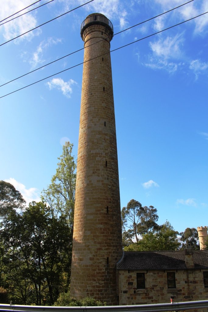
The Shot Tower
We drove on to the Shot Tower in the southern suburb of Taroona. Built in 1870 to manufacture lead shot for fire arms, it stands beside the main road, to the south. It is 58 metres high and was the tallest structure in Tasmania for 100 years.
Molten lead was carried to the top of the tower and dropped through a copper sieve. Surface tension shaped the lead particles into small balls as they fell, to be caught in a water filled cooling tank on the shot tower floor.
Outdoor section of the cafe
To get to the top 318 wooden steps had to be climbed. The stairway is there to this day. Visitors may climb them for a small fee for the experience and for the fine view of the lower Derwent.
We had a pleasant chat with the lady who runs the shop and with the wife of a man who was climbing it. Upon his decent he showed us his videos. The view is certainly grand. The Shot Tower has a shop that sells souvenirs as well as a coffee shop in its basement.
Shot tower building including the base of the tower
At the recommendation of the lady in the shop, as we drove on to Richmond, we detoured to the sight of the Alexandra Battery near Wrest Point Casino. It provided excellent views without needing to climb over 300 steps. Alexandra Battery was one of the many built around the Australian coast during the late 1800s when it was feared that the Russians would invade Australia’s east coast.
Houses on the hillside above the old Alexandra Battery site.The old gun foundations and the Derwent.An observation deck at the old battery site provides good views of the port, river and city.
We then passed through Hobart, crossed the Tasman Bridge and made our way by an indirect route to Richmond, where we spent the night. It was on this drive that we came upon the little town of Campania to the north of Richmond, where we had lunch. The fare was home made pies and coffee, which we dealt with seated at a small table in the grocery/hardware/post office/coffee shop/service station.
A bronze casting of school children at the original state school at Campania near Richmond.
Our drive took us through areas of vineyards and fruit orchards, interspersed by broad areas of brown dead grass. The drought is about four years old in this part of Tasmania, but irrigation keeps the fruit and grapes growing. Some growers were busy placing white netting over their crops. I assume that the fruit was starting to ripen and birds needed to be kept at bay.
Prison precinct coffee shop at Richmond
Had we come directly to Richmond we would have found plenty of places to have lunch. Historic buildings can be readily converted to purveyors of food and beverage.
A classic photo of Richmond Bridge.Richmond Bridge viewed from the other side at river level.St Johns Roman Catholic Church at Richmond.
We took a look at Richmond’s historic bridge and walked, as well as drove, over it. We then looked in at St Johns Catholic Church (1836), just a short drive away, followed by a walk around the Richmond prison precinct.
An old building in the Richmond prison precinct converted to a retail outlet.The original bakery has been modernised into an extensive Cafe and Coffee Shop.
Ruth was beginning to
be walked out so we checked into our accommodation. I returned to the historic
precinct on foot and walked and looked and read and took photos. St Lukes
Anglican Church is through the town on the other side of the river and a bit of
a walk so it marked my turning point to return to the town area.
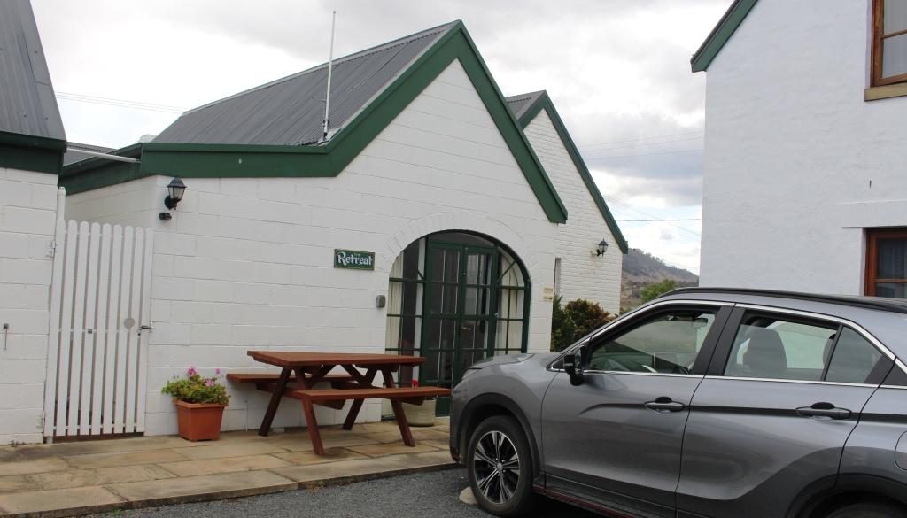
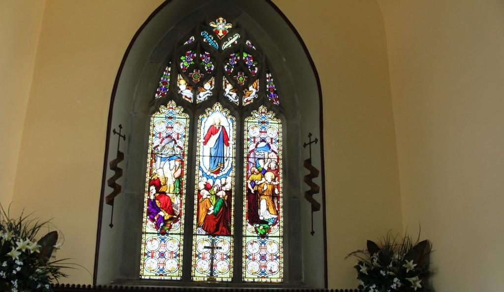
Our unit at The Barracks. It was called “The Retreat”.St Johns Anglican Church, Richmond was built in 1834.Stained glass windows at the sanctuary end if St Johns church
Richmond has a prison precinct that has been very well restored, with excellent use made of the old facilities. The prison itself remains largely unchanged and tours are available. As we were headed to Port Arthur the next day we didn’t tour the Richmond Prison. There are eating places within the prison area including a cafe in the original bakery.
By the time that I had covered this area I was walked out too, so returned to the unit to put my feet up for a while. Our accommodation was at The Barracks, small group of holiday units resulting from the renovation of old buildings. Very comfortable and well appointed.
The supermarket operates from a historic site. Richmond Arms HotelThe western end of Bridge Street, Richmond.
The following morning we left
Richmond for Port Arthur under clear blue skies which remained, with a few clouds
around the edges, for the rest of the day.
As we neared our destination we stopped to look at some touristy things. At Dunalley we checked out the canal that provides a short cut for smaller boats between Hobart and the east coast and it’s lift bridge. It seems to open on request from the passage making boat. This channel is quite short. The land to the south is almost an island. The protruding section of land that links the Tasman Peninsula to the Tasmanian main land is called the Forestier Peninsula.
The lift bridge on the canal at Dunalley.The east coast at the northern end of the Tasman Peninsula.
At Eaglehawk Neck, about 20 km further south, the same geographic phenomenon repeats, with Eaglehawk Bay, a long thin inlet from the west, almost joining the ocean at a short and narrow isthmus that leads to the Tasman Peninsula.
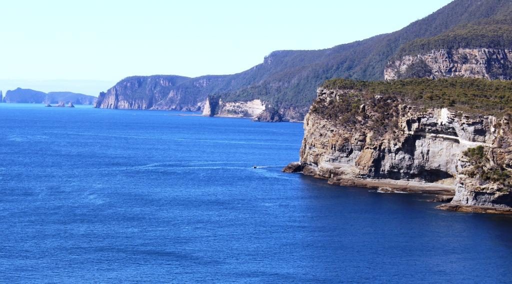
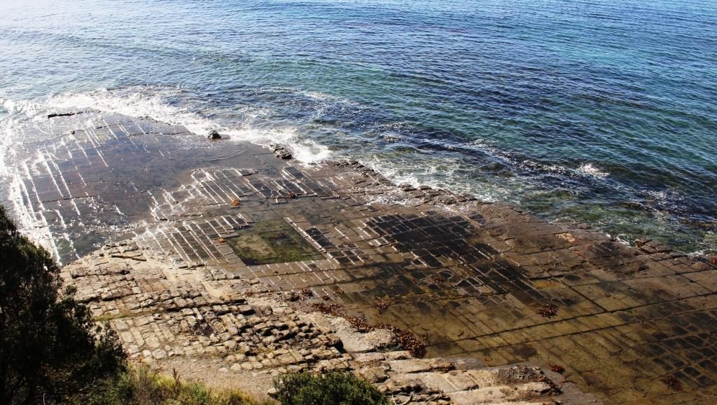
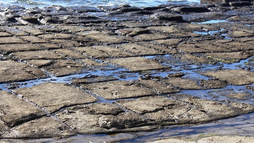
Tessellated Pavement at Eaglehawk Neck.
The Tessellated Pavement is reached from a road that turns just before the decent to Eaglehawk Neck, at the end of a drive of about 5 km. It is in the form of a broad shelf of rock that looks like an area of cobble stones.
The natural Tessellated Pavement has the appearance of laid cobblestones.
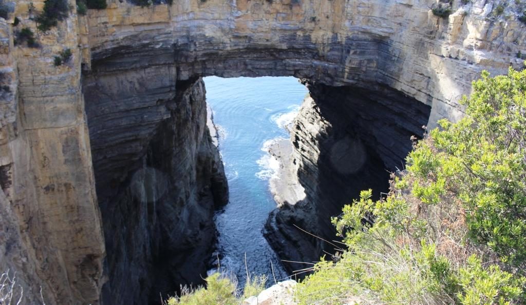
Tasman Arch and the Devil’s Kitchen are reached by a road that turns to the east after crossing Eaglehawk Neck and follows the ocean coast for another 5 km. The tide was low and the sea flat calm so there was nothing cooking in that kitchen. Because of the calm seas we didn’t worry about the near by blow hole. There would have been nothing to see there.
Tasman Arch from near to the car park. It is only a short walk.
Tasman Arch is best viewed from the water and that was probably how it was first discovered. The view from the land is courtesy of a sink hole that is large enough to allow a reasonable view.
The road to Port Arthur turns west along the southern shore of Eaglehawk Bay for a while and then turns inland and runs across the eastern part of the peninsula to Port Arthur.
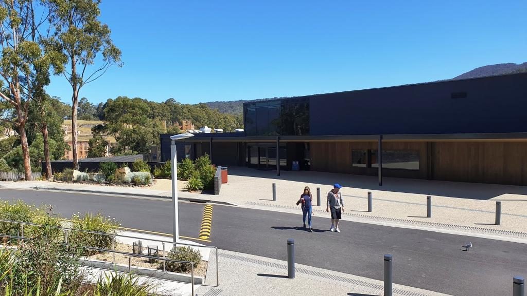
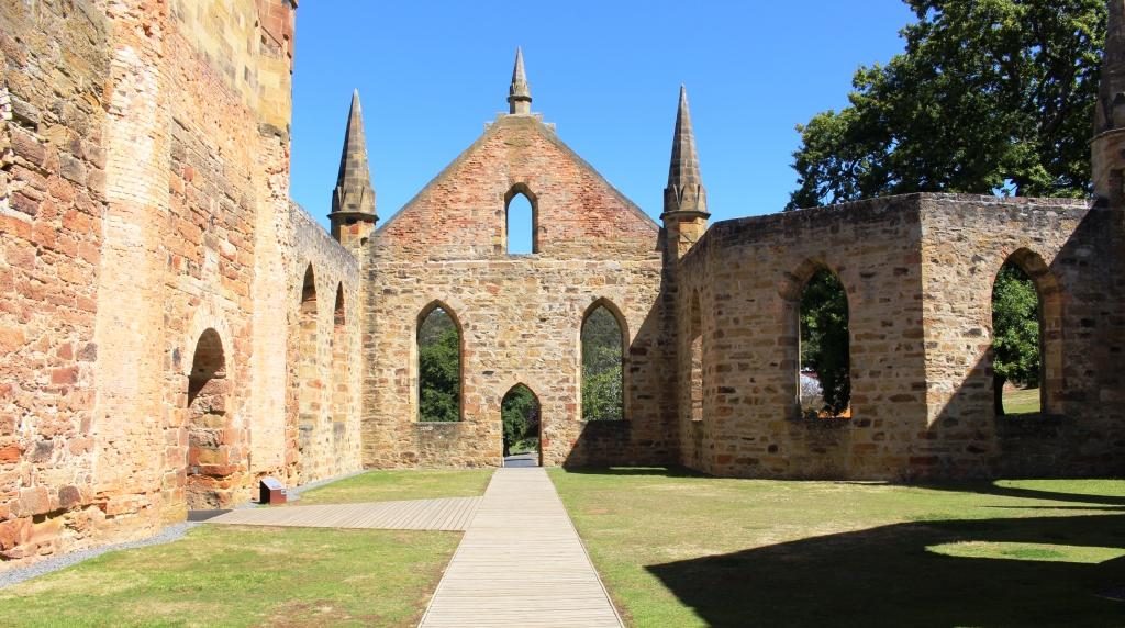
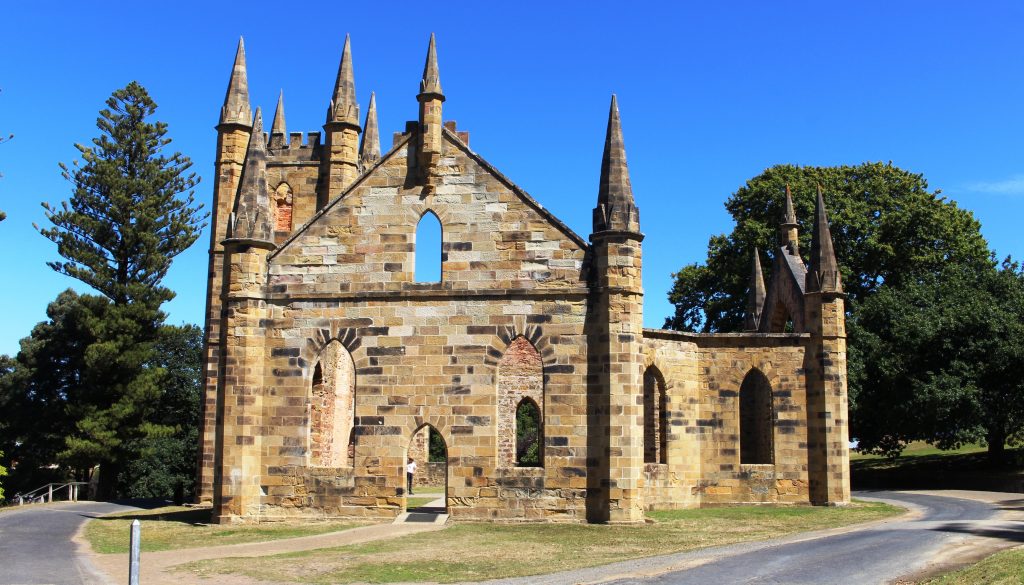
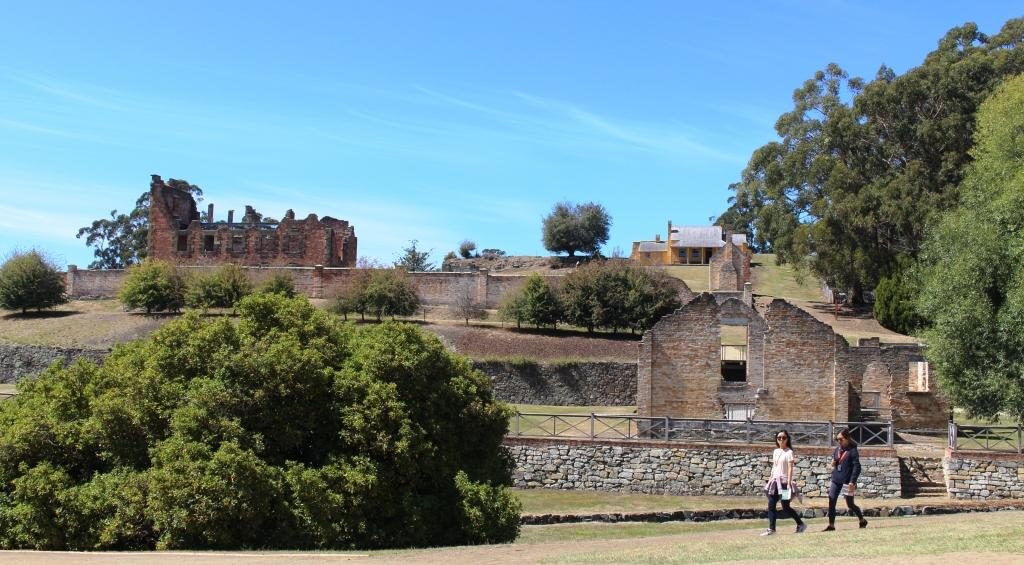
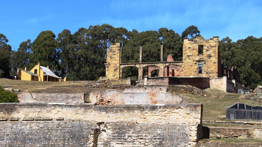
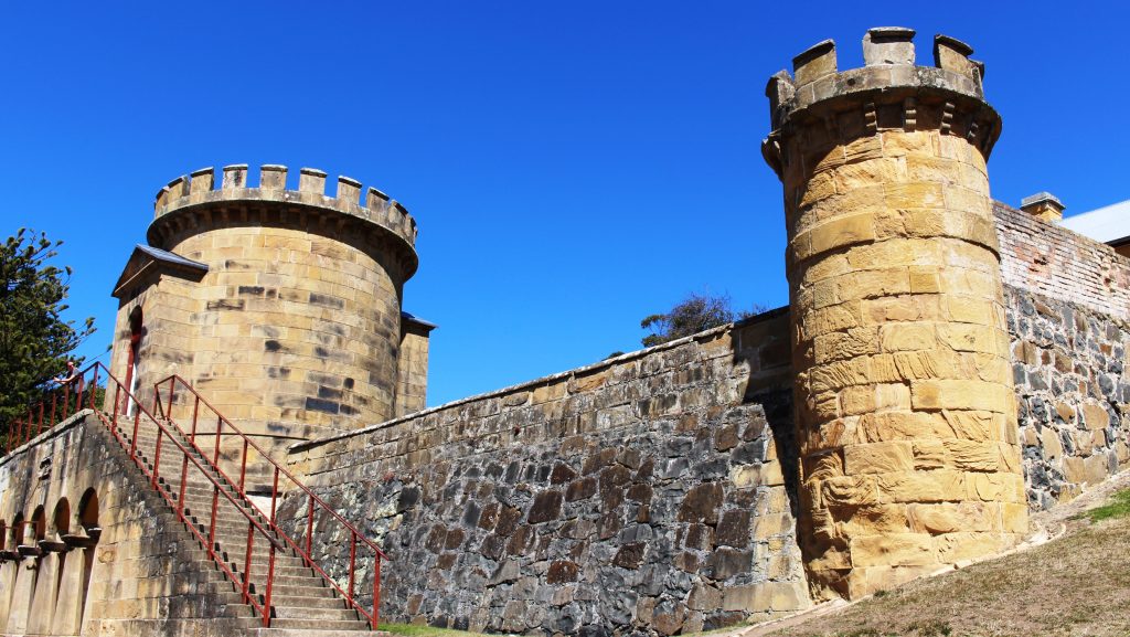
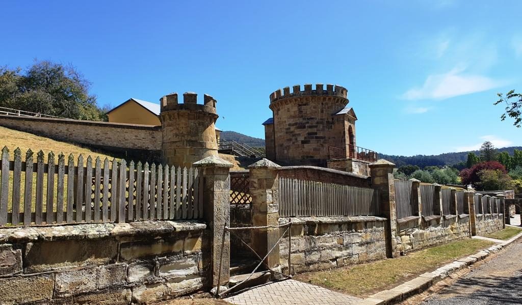
Port Arthur Visitor Centre with ruins in the background
We were last at Port Arthur about 45 years ago. The changes are significant. One of the most important is the huge visitor information centre with it’s displays, cafe, restaurant and the ability to handle large numbers of people. Port Arthur is a very popular attraction and included on most package tours to Tasmania’s south.
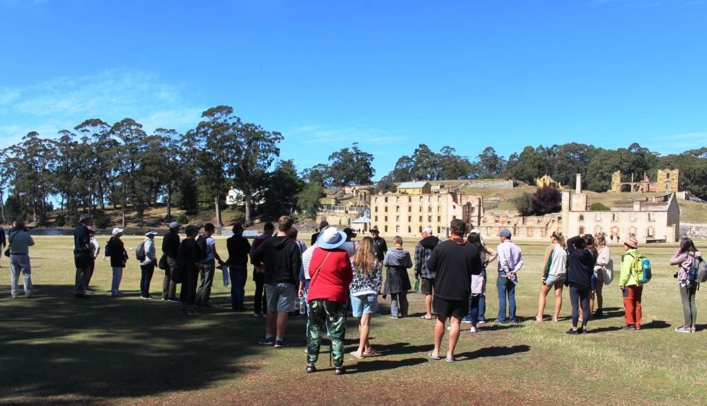
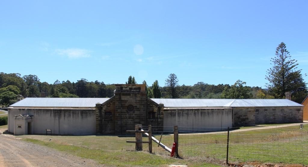
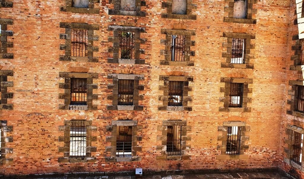
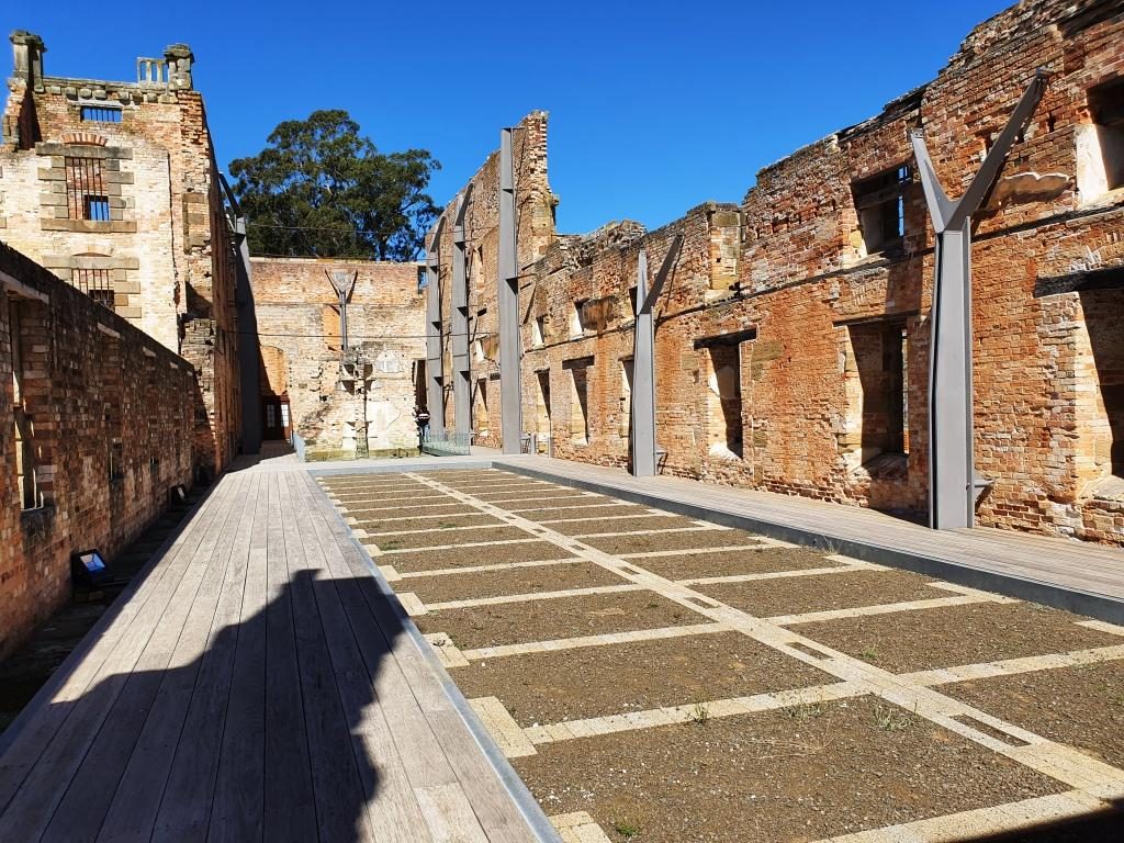
Our group listening to the guide.The Penitentiary. The hospital can be seen behind at the right. The Commandant’s house is at the left with the Guard Tower between it and the Penitentiary.
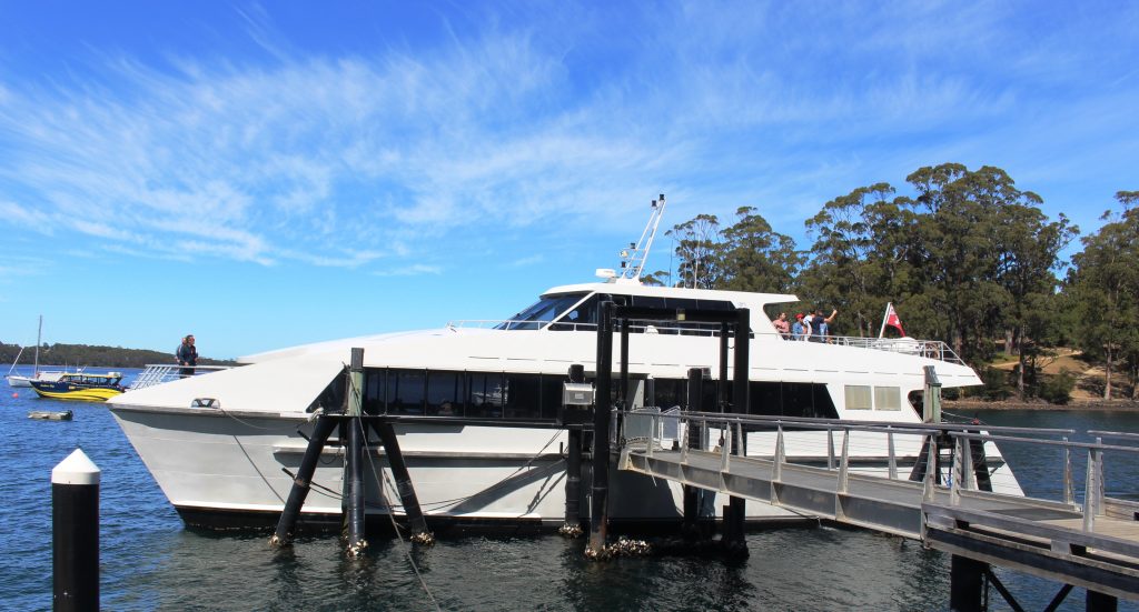
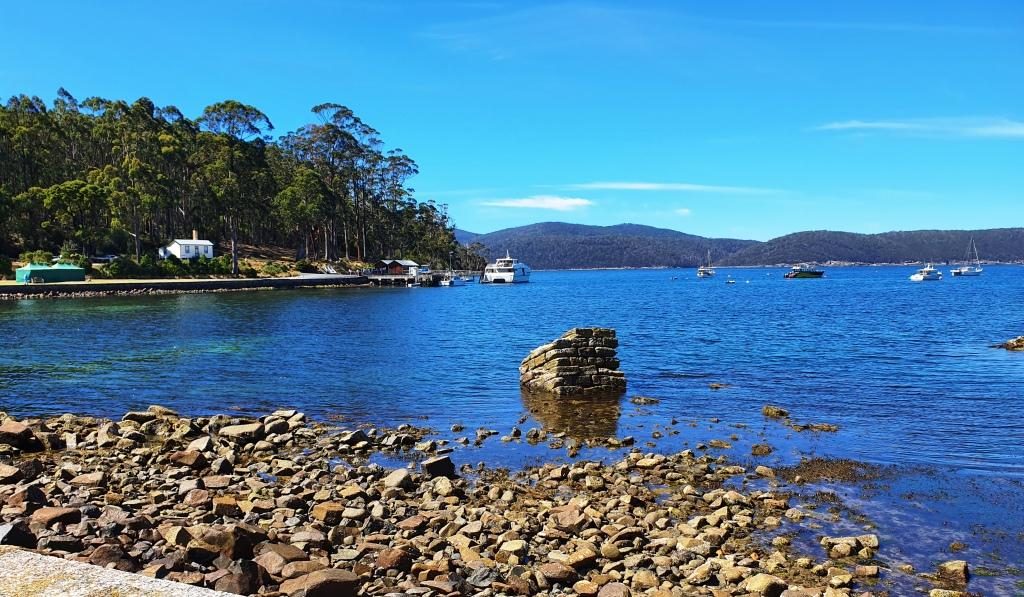
Forty five years ago the portion of the convict prison open to the public was much smaller than it is today. The admission ticket ($32.00 each for seniors) allows two days to see it all. An historical enthusiast would easily spend that much time if they stopped to read all the signs and study the exhibits. We had but one day and ageing legs. We covered the main penitentiary building and the area furthest from the water, where the separate prison and the asylum are located. We then joined a cruise on Mason Cove and the port of Port Arthur. The cruise is included in the ticketed cost.
The cruise passes the old
ship construction slipways, the site of the now nonexistent boys’ prison and
the Island of the Dead, the penitentiary cemetery. Visitors may land on the
island and be picked up by the next tour boat. We stayed on board and completed
the tour before going back to the visitor centre for lunch.
The Island of the Dead cruise boat. The short tour is included in the admission price.The Island of the Dead, Port Arthur cemetery.
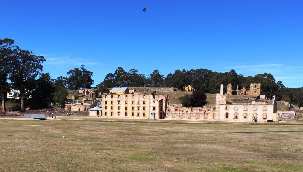
Tour guides tend to emphasise the cruelty to which inmates were subjected, but it happened over 150 years ago and was not abnormal for those times. The intention was to rehabilitate as well as punish. During the life of Port Arthur as a convict settlement, methods changed when existing practices were found not to be working. Unfortunately they were often replaced by something else that didn’t work. Rehabilitation of errant humans is not easy. Western society still has not got it right if re offending rates are any indication.
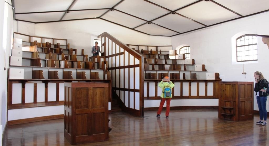
The Asylum was built in 1868 when it was found that incarceration methods were sending prisoners mad..The cafe at the Asylum provides an alternative to the walk back to the visitor centre for refreshment.The Government GardensThe church at Port Arthur demonstrates the important part that religion played in the reform of prisoners.Up to 1,100 people would attend church on a normal Sunday.
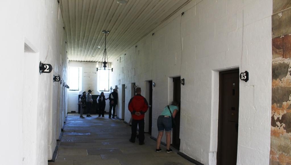
Ruth was done with walking so stayed at the visitor centre while I went back to walk through some other areas. I did the garden and the government cottages, the ruins of the church and had a closer look at the Separate Prison (where prisoners were known by a number and lived in solitary confinement), and the Asylum (needed for all the prisoners who went mad from solitary confinement).
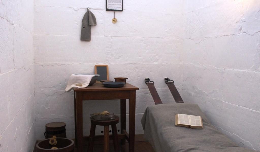
The front of the Separate Prison faces away from the remainder of the convict area at Port Arthur.A prison cell wing of the Separate Prison.A typical cell for one prisoner.Seating in the chapel was designed to keep prisoners separated during worship.
I then climbed through the ruins of the hospital, the guard tower and military accommodation areas, the commandant’s house and finally a detailed walk through the penitentiary. Quite a bit of walking.
The police station with the hospital in the background to the left.A front view of the hospital, built in 1842. The house at the back is Smith O’Brien’s cottage. O’Brien was an Irish political prisoner who had been transported for life.
Ruins of the guard tower and the military accommodation remain sufficiently intact to give a good idea of what was there originally. The court house is in the same vicinity, straight across the street from the penitentiary, the place from which most prisoners would be brought to appear before a magistrate and the place to which they would be returned, but possibly to a different section, depending on the sentence.
The Guard TowersThe guard towers with soldier accommodation at the rear.The Port Arthur Court HouseView of Mason Cove from the court house. The ship building slipways are past the cruise boat wharf.
The commandant’s house contains furniture that is either original or represents the period. Many rooms are set up as they would have been when occupied by it’s residents. Other rooms contain displays, rather like a museum. There is a display of information signs providing details of commandants, governors and other figures of authority.
Entry to the Commandant’s houseThe formal dining roomHistory and information displays in one of the formal rooms.The kitchenThe house steps up the hill. This is the stair way to the second level.Departing through the access gate from the grounds to the commandant’s house.
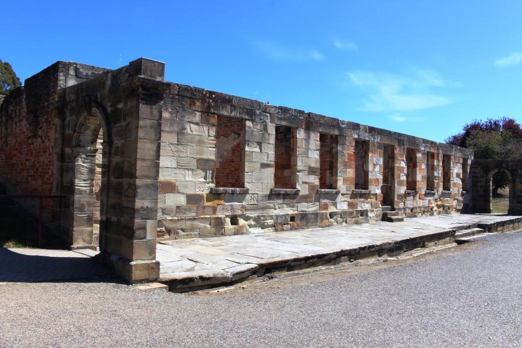
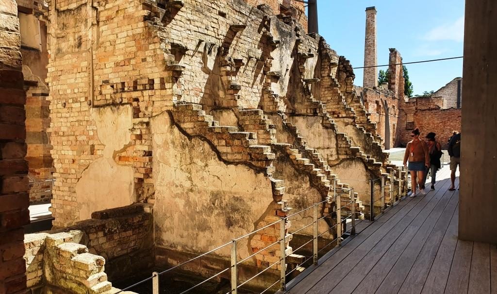
The penitentiary was built in 1845 as a flour mill and granary, with the flour mill powered by water wheels, or prisoner operated tread mills, when water flow was insufficient. To be assigned to the tread mill was one of the most harsh punishments available. You can just about imagine the convicts praying for rain.
Barred windows of the penitentiary cell block Partly demolished walls.
Competing demands for resources saw the flour mill closed in 1854. The building was converted to convict accommodation, completed in 1857. It was closed in 1877 and largely destroyed by fire in 1897. The ironwork that secures the outer walls that still stand is obvious and necessary.
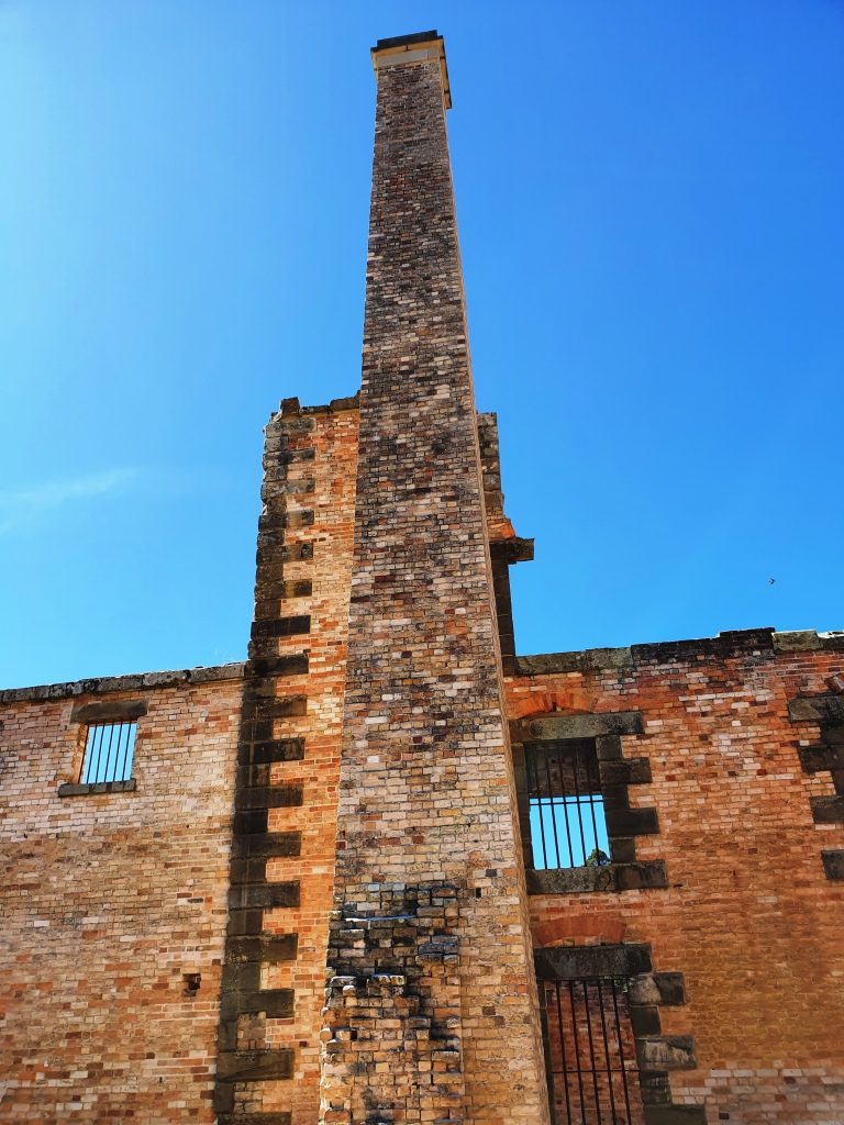
The fire gutted cell block showing the lay out of the cells. The walls are supported by steel reinforcing.The prison chimney.
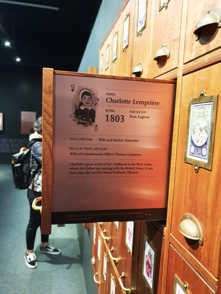
When you pay your entrance fee you are each given a card bearing the name and likeness of a person who was at Port Arthur. You then go downstairs to the gallery, find the likeness on a wall and pull out a panel to read the detail.
A slide out display exists for each person who was permanently at the convict prison. This is the wife of the accountant who’s name that I chose. His details are on the other side.
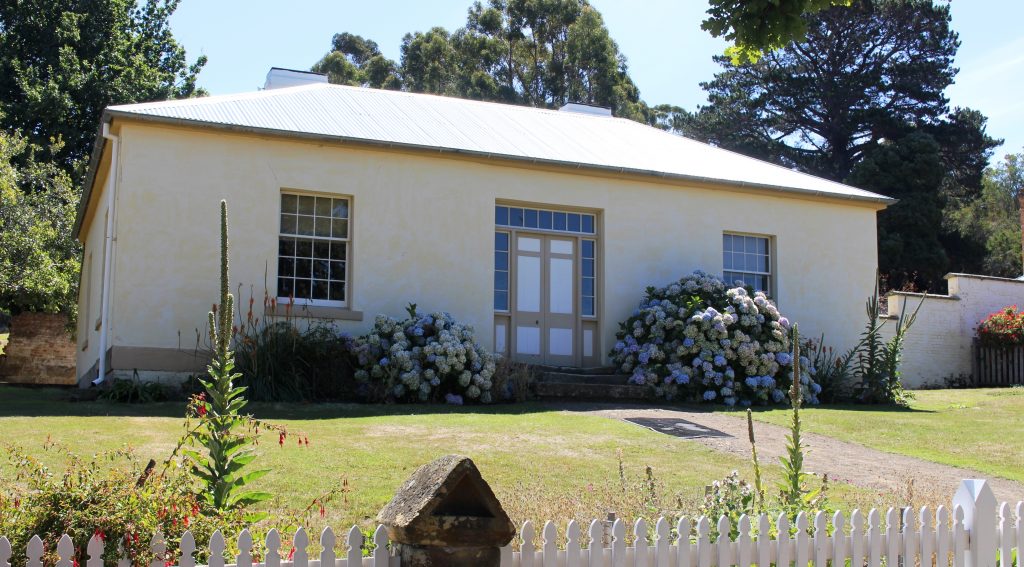
The character that I received was the accountant at the prison. Ruth got a character who, in England, lost his pension, threw a stone at the King, was charged with treason and transported. At Port Arthur he refused to do the King’s work or eat the King’s food so starved to death. As I walked I took particular notice of the accountant’s house.
The accountant’s house.
We were booked for the night at a place part way up the East Coast called Little Swanport. If I had realised how close we would be to Richmond on the drive we would have booked there for two nights. We wish we had done so.
We had done well with our accommodation arrangements so far but bombed out that night. The place was clean, tidy and comfortable, but inadequate. Windsong described itself as a B & B, but it was 5 km off the highway. The turn is near the community hall that calls itself Little Swanport and 15 km from the nearest source of nourishment. The host, Tom, who checked us in and told us to call if we needed anything had disappeared when I went to look for him to see if we could arrange an evening meal.
The table is set for a three course dinner, including wine glasses, but no stove or microwave to cook with or sink in which to wash our dishes and no tea towel to dry them. We had bread and food to make sandwiches, even a toaster, so we didn’t go hungry. But it did seem a bit odd. A continental breakfast was in the room for next morning.