The Family Responsibilities Tour – Part 2

Note: A video covering the material in this post can be found at the foot of this blog post.

Phillip Island south cost
A Common Starling greeted us at Trafalgar

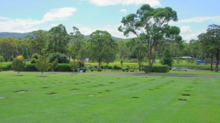
We had chosen Trafalgar to stay because it was conveniently located to my Sister’s new place of residence, following the death of her husband, Colin. After breakfast we picked her up from Moe South and headed back towards Melbourne to reach our destination at the Drouin cemetery. Colin rests in a lawn grave but with an elevated headstone. My parents and younger brother Winston occupy similar graves in this cemetery. We quietly paid our respects before proceeding with our day, for which we had made no further fixed plans.

On our previous trips to the area, we had visited a bakery in Neerim South, a picturesque farming and now retirement town, in the southern foothills of the Great Dividing Range. Aileen’s doctor is located in the town, so she and Colin often visited here and took a coffee break at the excellent bakery. My Sister and Brother-in-law had got to know the very friendly Vietnamese female proprietor. Condolences were expressed during a very pleasant country chat. Good coffee and a delicious cake set the occasion off nicely.

Village Central Restaurant at Baw Baw operates all year
Small chalet with snow shedding roof

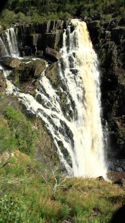
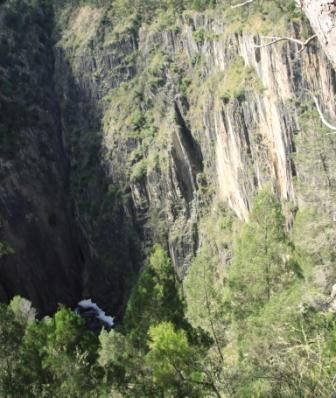
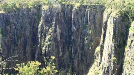
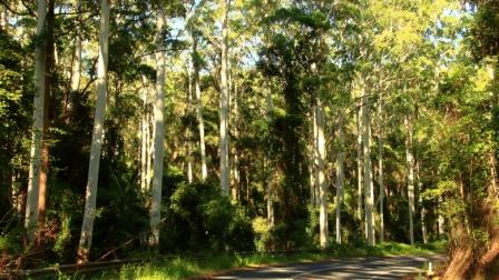
With most of the day still untouched, a suggestion to drive up to Mount Baw Baw was readily agreed to. We proceeded to the old timber town of Noojee and then followed the narrow winding road through Tanjil Bren to reach the 1,567-metre summit and site of the Baw Baw ski fields. There was no snow, thankfully, the day being mild. We probably would have launched on the sunny deck of the bistro if it had not been for the rather keen breeze blowing across the mountain. When we last visited, Boxing Day about three years ago, the mountain top was covered by thick cloud.

A memorial to one of the founders of the Mount Baw Baw ski village.

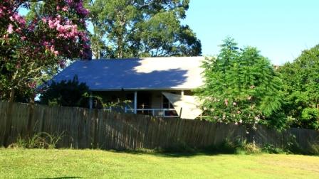
Part way back down the mountain a direct road to Moe turns off, so we took it, returning Aileen to her new home, a granny flat at the home of her daughter. We dropped her off and returned to our motel for a shower, as we were due back for dinner in the main house, with Aileen, her daughter and most of her family.

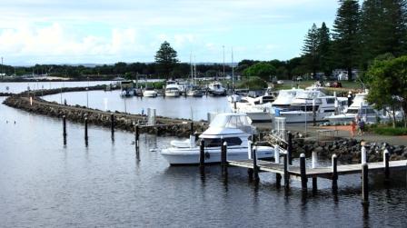
In our caravanning days we periodically met caravan owning siblings and others who hired a cabin, at a mutually convenient caravan park. We had decided to continue the practice notwithstanding our depleted numbers. For convenience we had booked for three nights at a caravan park at Cowes on Phillip Island, less than an hour’s drive from the area where our Victorian relatives live. And none of us are now caravan owners.

The weather was not brilliant but we were able to fit activities in between showers, without too much inconvenience. It was not beach weather but we are not beach people and the youngest of us doesn’t get much change out of eighty.

San Remo fishing port

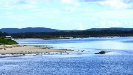
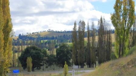
Philip Island is an area familiar to us from our time of residence in this part of Victoria very early in our married life. There have been many changes over the years but the area has not changed that much either. There is much more accommodation on offer and increased opportunities to spend money, but Phillip Island still is essentially an area of farmland with a couple of towns. But it is scenic and relaxed and a suitable place to take a few days of relaxation, its charms increased because it is all on an island.

San Remo Bridge to Phillip Island
Part of the main street of San Remo
Round Island and The Nobbies

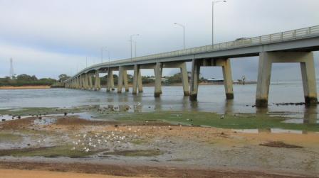
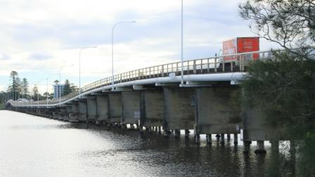
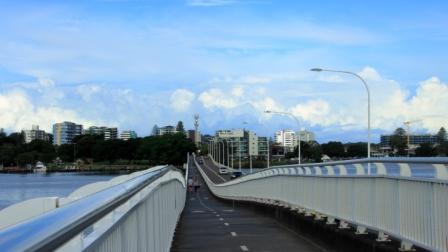
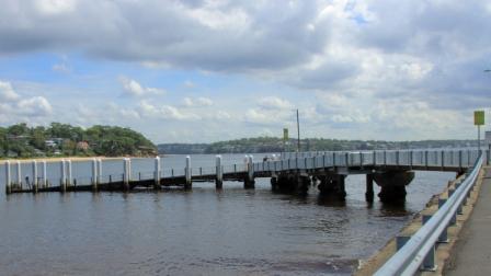
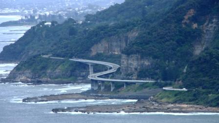
Tuesday was the day for travel to Cowes, but first we joined Aileen and a couple who are mutual friends, for coffee in Drouin. The road from Drouin to Cowes passes the front gate of youngest brother Bernard’s farm, so we headed off in convoy. At San Remo, where the bridge carries the road to Phillip Island, we stopped for lunch and probably overindulged a bit on local fish and chips.

Cape Barren Geese grazing. They are grass eaters.

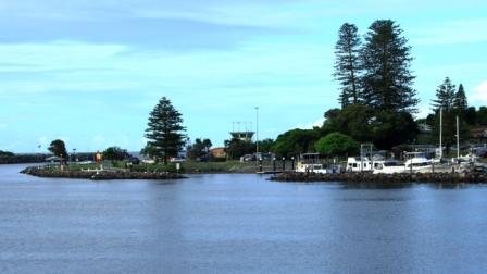
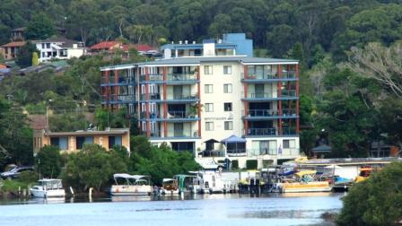
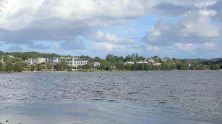
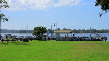
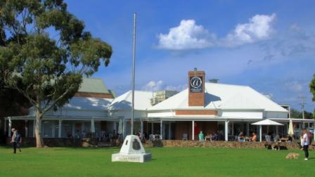
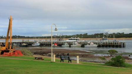
San Remo to Cowes is a 16 km drive.  We checked into our cabins and settled in. Rain had commenced so we had a cuppa, while watching it though the window. For dinner we found a bistro at a local pub and fed ourselves again, but a bit more sparingly this time.

A Cape Barren Goose watching Round Island

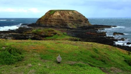
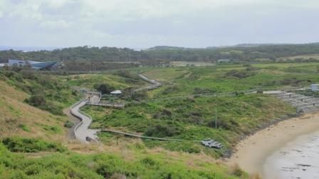
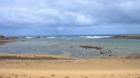
Wednesday dawned, an improvement on the previous day, so we set out for The Nobbies, where a visitor information centre is located at the south west tip of the island. This is Seal and Penguin territory but there were no Seals visible on Seal Rocks and you really need to return at night for the Penguins. Many years ago, when we lived not too far away from here, you could walk near the Penguin burrows during the day and see a few birds. In this modern tourist era such are the demands of commercialism and environmentalism that the whole area is now behind security fencing, with tiered seating on the sand dunes and even dugout bunkers for those willing pay more to see the Penguins up close.

Rear view of Nobbies Visitor Centre

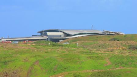
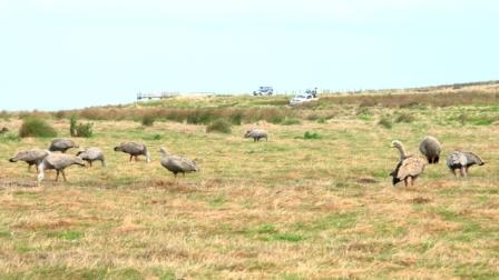
At The Nobbies, the visitor centre provides viewing areas in the rather elaborate National Parks souvenir shop which has an excellent café as well. The area overlooking Round Island and Seal Rocks is well supplied with boardwalks and wooden stairways, so viewing the scenery and the flora and fauna is easy. The wildlife available was the Cape Barren Geese that occupy the area in considerable numbers. An approaching rain squall encouraged us inside for coffee.

The Penguin viewing area at Summerland Bay, Phillip Island

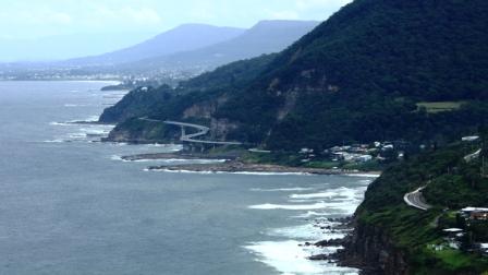
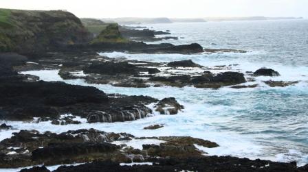
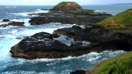
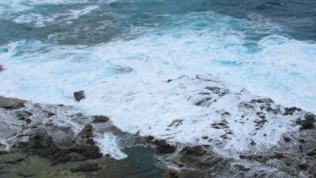
Coffee done and rain gone too, we made our way along the south coast until we reached the Phillip Island Grand Prix Circuit, turning into each road that would take us to the coast. This part of the coast is a series of coast scapes that are a photographer’s delight. With the weather deteriorating, we returned to our cabins via the supermarket, to acquire toasting bread and soup to provide us with the ingredients for a suitable lunch on a cool and damp afternoon.

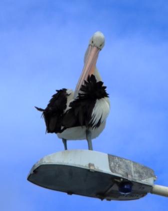
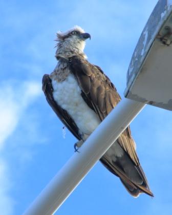
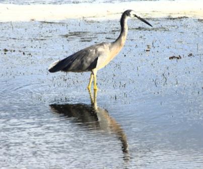
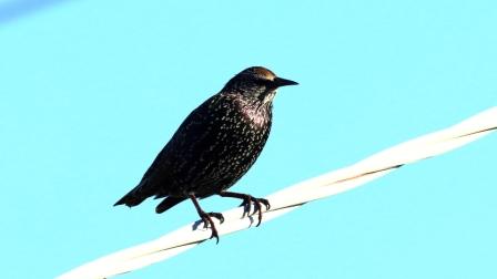
The clouds cleared later in the afternoon. A couple of our number went on separate walks. Aileen and I went looking for some birds for me to photograph, but we only found Kangaroos. We returned to the bistro of the previous night, for another excellent meal.

Part of Phillip Island’s south coast
Kitty Millar Bay
Woolamai Beach
Waves breaking on Cape Woolamai

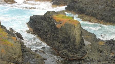
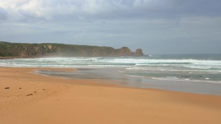
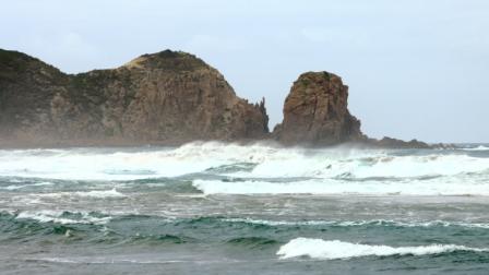
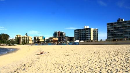
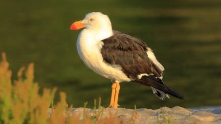
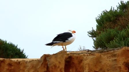
On Thursday morning we finished our tour of Phillip Island’s south coast. We drove to the Woolamai surf beach, parked in the provided area and walked along the beach to the east, as close as we could get to Cape Woolamai. There was a decent surf running so the wave action against the cliff face and exposed reefs was producing lots of spray and froth. Near the end of the beach a flight of stairs leads to the walking tracks that give access to the elevated areas of the Cape and the lookouts that are provided on these vantage points. A full day would be required to do the area properly. Flocks of Shearwater can be seen in that area but we didn’t see any. But there were Pacific Gulls that we don’t usually see around Brisbane.

Pacific Gull

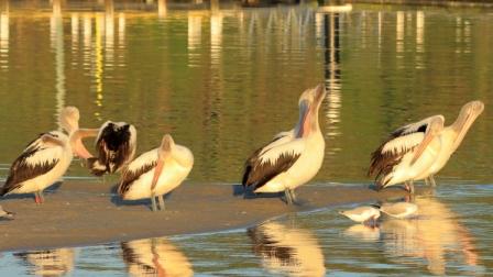
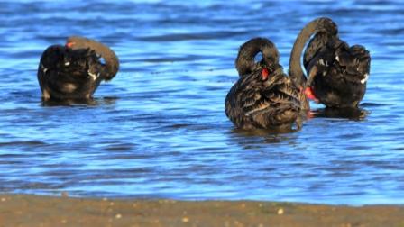
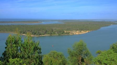
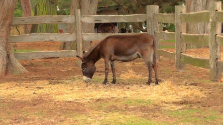
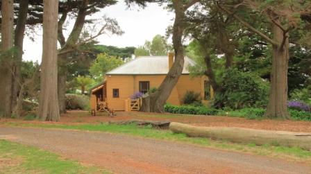
After coffee at Newhaven, we crossed the one lane bridge to Churchill Island. This island faces into Westernport Bay and was a farm. The old farm house is open for inspection and there are animals and historic displays. The elevated centre of the island provides good views of parts of Cowes and the waters that surround the island. These waters are home to many birds, including Black Swans, a variety of ducks, Ibis and others. In wetlands back on the main island there were more water birds, including Spoonbills and lots of Australasian Swamphens. Swamphens are common on Phillip Island.

A Donkey by on the walk near the old homestead
The old homestead on Churchill Island is open for inspection for a small fee

The afternoon was cool with a constant breeze. We repeated the previous day’s soup arrangements for lunch. It was both a soup day and a jacket day for us Queenslanders. The afternoon was spent quietly. I might even have had a nap. For dinner we feasted royally at a Chinese restaurant.

Waves break against the south coast of the island

That brought an end to this limited family reunion. We packed our gear into bags and the car and after breakfast headed off. The Victorians departed to their separate places of abode. Ruth and I went via the quickest route through Melbourne to the Hume Highway. Our journey home is covered in the next part of this story.

The Family Responsibilities Tour – Part 1

Note: A video covering the material in this post can be found at the foot of this blog post.

Apsley Falls in full flow. Walcha NSW.

On 23rd November 2021 I lost both my eldest brother, Ivan, and my brother-in-law Colin, my only sister Aileen’s husband. Colin passed in the morning, Ivan in the early evening. Ivan was in the northern suburbs of Newcastle and Colin at Moe in Victoria’s West Gippsland region. There was no connection in their deaths, just one of life’s coincidences.

Covid-19 was at its high point, with borders closed in some states but not in others. We could have travelled to NSW, possibly to Victoria, but we would not have been permitted back into Queensland. We faced a real travel ban. So we had to provide our condolences and the support that we so much wanted to give by phone call, email and text message. We decided that as soon as possible after borders opened, we would travel south to visit grieving relatives and graves.

The opportunity came in March. With borders open and three vaccinations completed we headed south on 12th March, just four days after what would have been Ivan’s 88th birthday celebration.

Apsley Gorge. Walcha NSW

Our intention had been to first spend a couple of days with friends in Ballina, but they had been evacuated a few days before due to flooding of the Richmond River, which had closed the Pacific Highway from Ballina to south of Grafton. Their home was not inundated, and they returned to it after a couple of days, but a visit was not practical so soon after the floods, so we opted for the New England Highway.

Our first family call was to Marjorie, my sister-in-law, who requires constant care and who had gone into respite care in a retirement home in Bulahdelah, which is located about an hour north of her home in Newcastle. You will possible have read of Bulahdelah in the pages of these blogs. It is the town near which I spent the first 15 years of my life and where I met Ruth, my wife of almost 60 years. Ruth, of course, has been part of all the travels covered by the mobilesheathers.com blogs.

Apsley Gorge. Walcha NSW
Forster-Tuncurry Bridge on Wallis Lake

We spent the first night in Armidale. On day two we drove south to Uralla and there turned to join the Oxley Highway at Walcha, to reach the coast again. When we travel for almost any reason we are touring and taking in sights and points of interest along the way. We had been hoping for some early Autumn colours in the roadside trees so were a bit disappointed by the lack of colour, but the area had not progressed far into Autumn but it was very green from recent rain.

But just east of Walcha the Apsley Falls were at their thundering best. On our previous visit, back in our caravanning days, the drought was it its height and there was not even a trickle of water on the falls, just a pool of brackish water at the bottom. Viewing facilities at the falls are excellent. Ruth was able to make her way to the main viewing deck and was able to see as much as I could. There are some good walks at the falls, but time did not permit. We had appointments to keep.

Wallis Lake, Forster NSW

We paused for lunch at Wauchope and made it to our motel at Forster, at the mouth of Wallace Lake, in good time. Time to fit in a walk! So, with camera in hand, I set off for the bridge that spans the lake at a narrow point between Forster and neighbouring Tuncurry. The bridge is about one kilometre long with a hump on each end to allow boats to pass underneath.

Resort building beside Wallis Lake

An area south of Forster, Tiona, was a favourite holiday destination during my childhood, as it offered a range of options for my fishing loving Father. There were two ways of getting there from where we lived back then. If we came via Tuncurry the car and trailer (containing our camping equipment) would be loaded onto a small punt which was pulled through the meandering channel to the other side. Now the sand bars that shaped the channel carry the pylon foundations that support the bridge.

The bridge provides a scenic vantage point for both towns, Wallace Lake, and the entry to the lake from the ocean. Ever watchful for sea birds I noticed an Eastern Osprey making long sweeps over the lake in search of dinner, or perhaps a late lunch. After several failed attempts, it landed on a bridge street light and remained on its perch as I walked past taking photos of it. A call at the ocean beach and it was time to return to the motel for dinner.

Wootton School now a community centre

The easiest route from Forster to our next call at the retirement home at Bulahdelah was to fallow the Pacific Highway but a more interesting way was to leave the highway south of Coollongolook and followed The Wootton Way to where it re-joins the highway just north of Bulahdelah. This detour took us past a school that I attended for a couple of years during primary school and past the property on which I and my family lived for about 5 years prior to moving to Victoria when I was 15.

Tall strait trees

The school is now a community centre and the town much smaller than it was 70 plus years ago. The road is sealed as, for a time, it was the Pacific Highway. Further on we drove through magnificent stands of white-trunked trees, typical of the area. Further on we came to the property where our house stood near the road. The house was moved shortly after we vacated. New owners built further back on the property, behind the tree line and have operated a farm stay business for many years.

The old shed in which I milked the house cows

We arrived at the nursing home in good time next morning to complete the Covid safety procedure before visiting sister-in-law Marjorie. We found her in good spirits despite having been told a few days previously that the nursing home was to close thus causing uncertainty about her future. We stayed for morning coffee and lunch before making our way further south. Happily, Marjorie’s future accommodation arrangements were settled a few days later when her two daughters completed arrangements for her to take up residence on the top floor of a facility near Lake Macquarie in Newcastle, where she will have views of the lake as well as, we hope, good care.

Bulahdelah Alum Mountain
The sloping lawns of the Lake Macquarie Memorial Park

We stayed two nights at Warners Bay, our motel overlooking the northern end of Lake Macquarie. Ivan is buried at Lake Macquarie Memorial Park at Ryhope, just a few hundred metres off the Pacific Motorway, south of Newcastle. A very convenient location for paying our respects during future trips south.

Warners Bay viewed across the lake

We met Ivan’s two daughters with their respective spouses at the park. They showed us to the grave site, already almost covered with grass. The plaques are under way and should be in place when next we call. The grave is in a pleasant area on the side of a gently sloping hillside. The entire garden area appears to be well kept and will continue to be so. We left the cemetery and drove to the sports club in Toronto where we lingered over coffee with nieces and nephews that we rarely see.

White-necked Heron at Warners Bay

The afternoon was fine and sunny so we parked, and I took a walk on the path provided between Warners Bay and Speirs Point. It is not always possible to keep up my walking schedule when we are travelling, so such opportunities are not to be missed. As a bonus there were birds to photograph, including a White-necked Heron, a first sighting for me.

Next morning, Tuesday, we took the short drive to the home of Ruth’s elders sister Judy and her husband Alan, at West Wallsend. Judy has mobility problems but maintains a positive attitude which is most demonstrated by her determination to keep travelling. So over lunch we discussed, as well as family, travel plans and experiences. Visit over, we headed for Sydney.

Cronulla Beach

We were to have spent two nights with our daughter Briony at her Erskinville home, but she had come down with a non-Covid virus that we did not want to catch. A quick change of arrangements took us to the Travelodge at Bankstown, a bit of an experience as it is also the Bankstown Sports Club. Temporary club membership was bestowed upon us so that we could use the facilities of the club.

Coffee shop at Cronulla Beach

On our second night with Briony we had planned to meet Ruth’s youngest sister Dorothy (Dot) for dinner. So, a quad became a threesome at the NEM Riverwood Vietnamese restaurant, for good food and a good old family catch up.

Ferry terminal at Bundeena

To fill in the intervening day we revisited old stamping grounds from the first period of joint residence in Sydney during the time of my appointment to East Coast Transport at Botany. We started with morning coffee at Cronulla, right on the water on a lovely sunny morning. We then drove past Miranda Fair, where we used to do our shopping and stopped for a look at our former residence at 4 Tulong Place, Kirrawee. This house was built on top a couple of huge boulders, with views over the Royal National Park. Every time I see this house, I wish that we still lived there.

Bundeena main street

Next, we drove into the Royal National Park to the town of Bundeena on the southern shore of Port Hacking. This was to have been our lunch location but, after a largish morning coffee we were just not ready for more food. After looking around Bundeena we returned to the road through the park that leads to its southern coast entrance at Otford. At this point you will find one of the best scenic lookouts in Sydney. Otford lookout has an elevated viewing platform, heaps of parking space, a kiosk and views over the coast and from Sea Cliff Bridge to Port Kembla. We had a snack there before driving back through Stanwell Tops and Waterfall to Bankstown and dinner.

The following morning, we left Sydney early and drove to Bowral in the Southern Highlands of NSW, to call on Ruth’s youngest brother Wallace and his wife Ginny. Wallace is in advanced stages of a degenerative disease (similar to Parkinson’s disease) so our visits are relatively short. We joined them for lunch and family news. These calls are always sad and happy events because you never know if each one will be the last.

View from the Monaro Highway

Our destination for the night was Canberra. We were joined for breakfast next morning by grandson Jeremy who now works in the National Capital. The remainder of the day was spent driving via the Monaro Highway to its junction with the Princes Highway at Cann River. Then the run through the East Gippsland mountains and Orbost brought us to Lakes Entrance for the night.

There is always bird life at Lake Entrance, so the long lens got some use that evening and again on my walk next morning. Swans and Pelicans predominate, but there are many others. After leaving Lakes Entrance we detoured to Metung for morning coffee, lunched in Traralgon and arrived at our accommodation in Trafalgar in time to unpack and go out to find some dinner.