
What ever is going on? Whales often take a look like this.
Hello Readers.
The reason for this post is to provide a link to some of the video that I took on our whale cruise at Hervey Bay.
Enjoy!
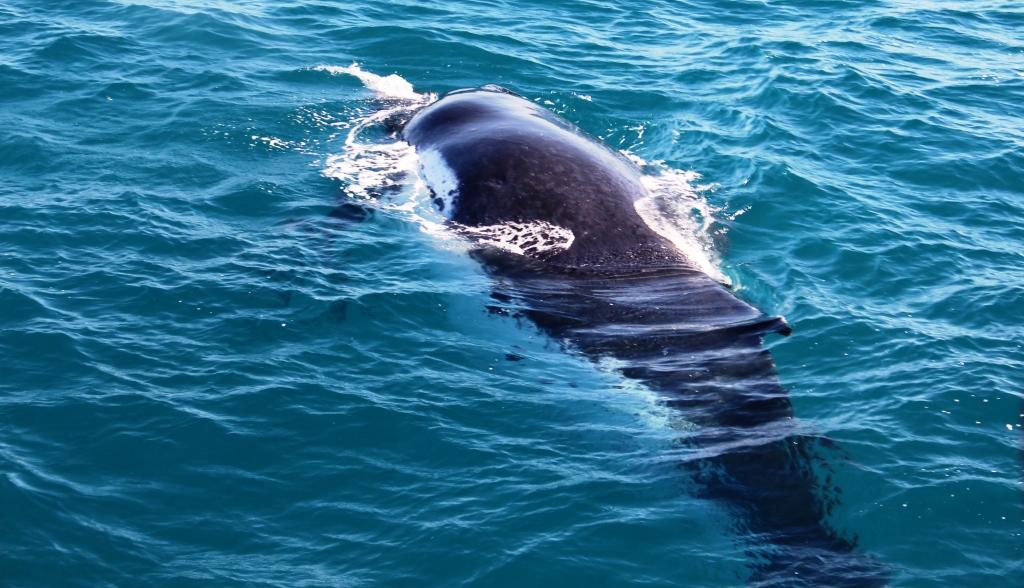
Another close view.

What ever is going on? Whales often take a look like this.
Hello Readers.
The reason for this post is to provide a link to some of the video that I took on our whale cruise at Hervey Bay.
Enjoy!
Another close view.
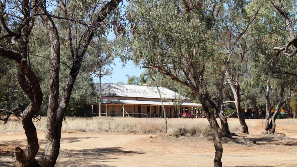
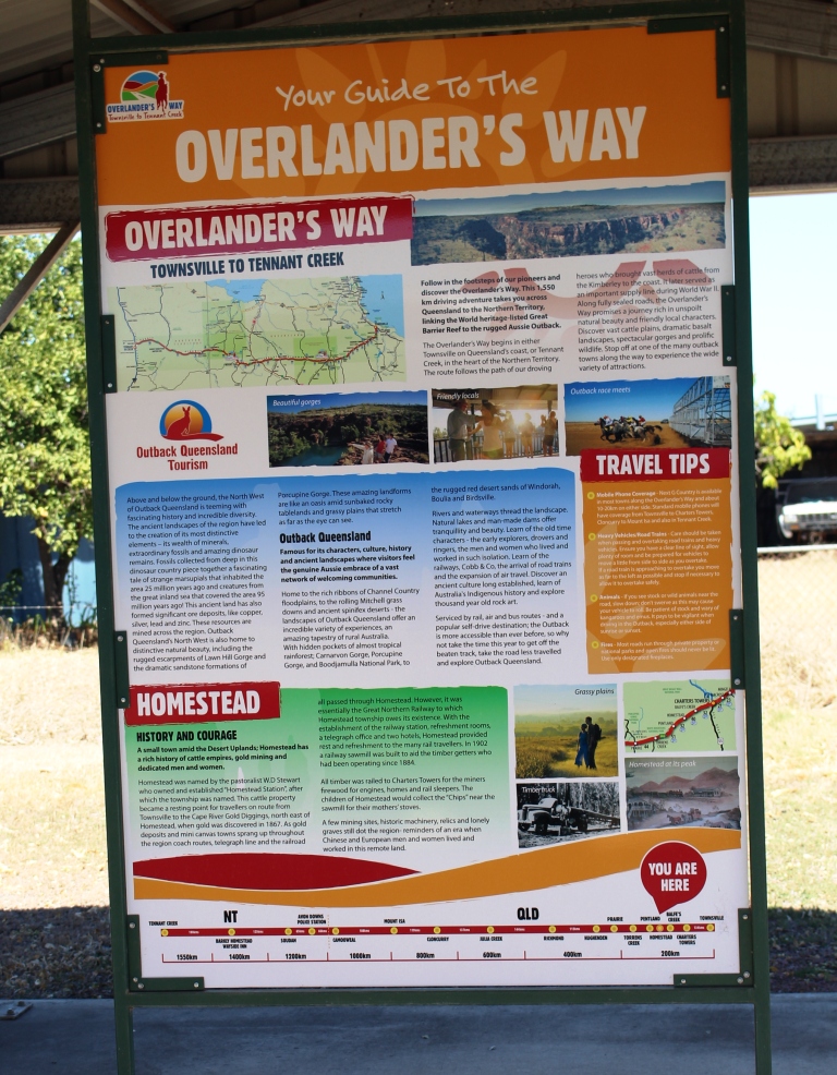
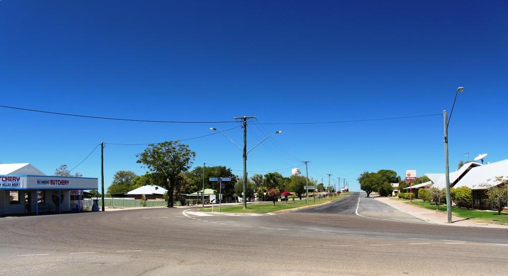
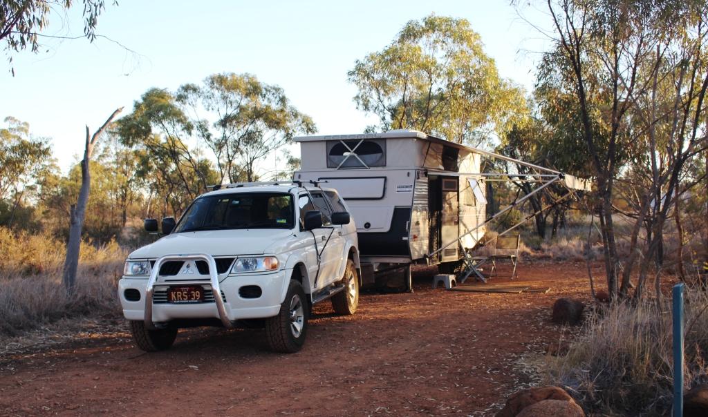
On this part of the trip we were no longer in north Queensland. Windorah is only a little north of due west from Brisbane but it is 1,200 kilometres by road. It was further that that for us as we diverted further to the south due to a change of plan.
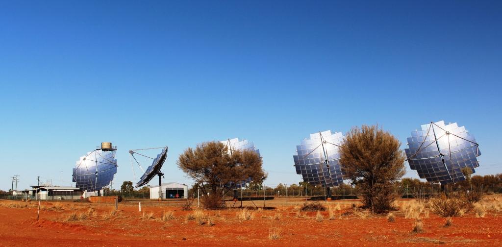
Windorah solar power station
We left Windorah fairly early on a fine sunny day, accompanied by a
pleasant following breeze. Our first stop was on the edge of town to look at Windorah’s much photographed solar power station. These giant panels individually follow the sun, so the one facing the wrong way may have been turned off.
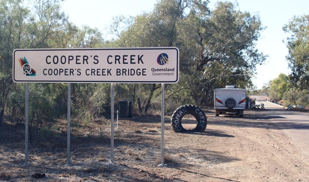
The next point of interest was the bridge on Cooper Creek, which is about 10 kilometres out of town, a bit further towards Quilpie than the road on which we had come in from Longreach. So once again we were on a road that was new to us
The Legendry Cooper Creek near Windorah
There is debate about the spelling of this legendary creek. Officialdom spells it with an apostrophe “s” but outback purists favour “Cooper Creek” or just “the Cooper”. Not far away from here the Thomson River is joined by the Barcoo River and jointly they become Cooper Creek. Hence the claim that Australia is the only country in the world where rivers flow into creeks.
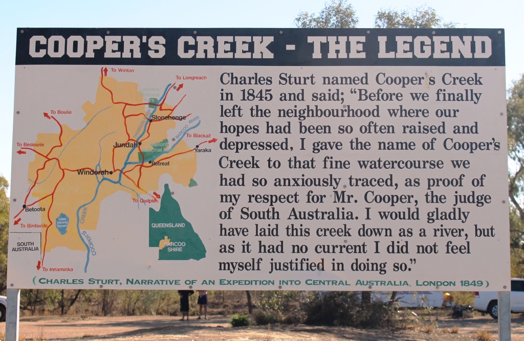
The legend of the naming of the Cooper
The story about how Cooper Creek became designated a creek rather than a river is told on this sign beside the campers amenities block. The reason goes right back to explorer Charles Sturt in 1845. The banks of Cooper Creek are a well known free camping area. There is plenty of shade and normally good supplies of water with fish and yabbies to be caught. The amenities block was in good condition and clean. This is another Barcoo Shire facility. As we came past there were few campers. Those that were Birdsville bound would have been long gone.

The Cooper Bridge. Some vans were heading east
Some travellers heading in our direction pulled out of the camping area and crossed the bridge as I stopped to take some photos. Note the single lane bridge. It is a solid structure and needs to be. Come flood time and it is well under water.
A well positioned Cooper caravaner
The picture opposite shows the amenity that is available to those who arrive early. No doubt these folk planned for a stay of a few days. They have chosen a great spot to spend their time.
Morning tea in a dry floodway
The drive from Windorah to Quilpie is over 246 kilometres of mostly river plains. There are no more large streams, but there are lots of floodways. We parked in one for morning tea. Cooper Creek flows to Lake Eyre. The Bulloo River at Quilpie does not, but empties out into swamps in north west NSW. The high ground between them is sufficient to create two distinct catchments but was not notiecable as we drove through.
A mini sand dune near Quilpie
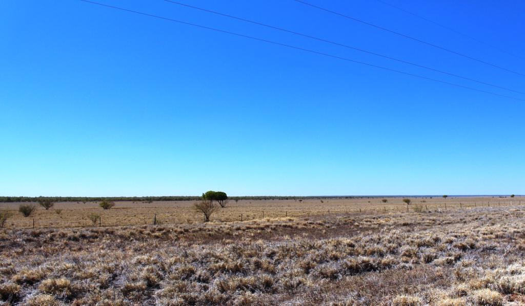
We were traversing grazing country, of course. We saw both cattle and sheep on this drive. Although we were heading into more densely populated areas we were reminded that deserts were not far away by the appearance by the road or in the distance of isolated sand dunes like this one.
We arrived in Quilpie for lunch and immediately turned the air conditioning on. The temperature was above 35 C with a warm breeze. It was the hottest day that we had experienced.
We waited for the sun to rise sufficiently to be out of our eyes when we left next morning. The road out of Quilpie heads almost due east. We continued to meet a string of Birdsville bound vehicles.
Our destination was Mitchell for an overnight stop at the Neil Turner Weir free camping area so our path took us through Charleville and Morven. We were through this area earlier in the year and covered it in our blog then.
We took our lunch break in the dining room of the Morven Road House. There we struck up a conversation with a couple, also from Brisbane, who were diverting through St. George to get home rather than face the almost continuous road works on the Warrego Highway. The Mitchell to St George Road had been in our plans for earlier in the year but the need to return to the Telstra shop in Roma forced us to take a different route. So here was our chance to fill in that gap in our journey over Australian roads.
Fishing person at Neil Turner Weir
We spent a pleasant and comfortable night by the weir. The area was quite crowded but most vans had lights out early. Most of them seemed to be Birdsville bound. Many had already departed by the time we emerged from the van next morning.
The Mitchell to St George Road starts as a single lane strip of asphalt with broken edges, winding over a series of low hills, but soon straightens out and widens to become a quite reasonable road. There was very little traffic sharing it so we made good time over its 209 kilometre length, arriving in St George for some quick shopping just before lunch time.
When free camping areas in southern Queensland are under discussion it is almost certain that someone will mention the Nindigully Pub on the Mooney River, south east of St George. The couple back at Morven had referred to it as a great place to stop overnight. We decided to make it a lunch stop.
Nindigully Pub – well over 100 years old
The pub has been in continuous operation since 1864, so I suppose it has quenched a few thirsts and dispensed a few headaches in almost 150 years of operation. Its other claim to fame is its culinary special. It serves the road train burger. I believe assistance is required to eat this burger. It is much too large for one person.
We drove past the building but we did not go in. We parked in the shade to partake of our modest lunch. A sandwich, probably! I wasn’t over impressed with the place as a camping area. It was very dusty and would be a quagmire after rain. The river was like the Yarra and was flowing upside down. (Sorry Victorian readers). But perhaps the charms of the pub eclipse these disadvantages for many thirsty travellers.

Only a fence between us and the tracks
That day’s journey ended just past the town of Inglewood in southern Queensland at a small caravan park overlooking the waters of the Coolmunda Dam. There were two memorable events that night. Our site in the park was near a railway line. It didn’t look busy but that didn’t stop a very long grain train from passing in the wee small hours. There was no mistaking what it was. It seemed to take half the night to pass.
The other memorable event was temperature related. After 35 C two days before the morning temperature at Coolmunda was just 8 C. Yes, we did turn on the heater.
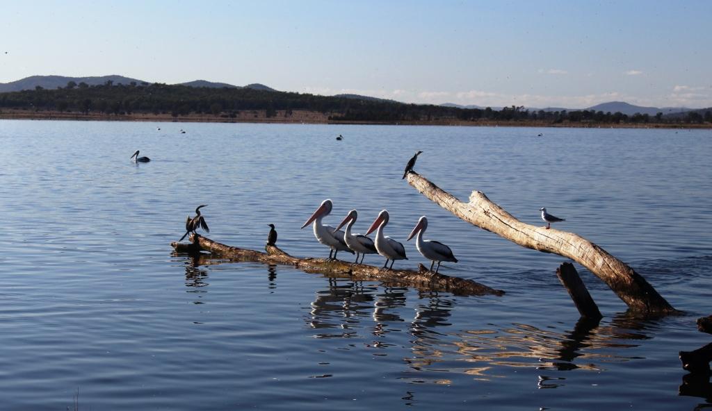
And pelicans all in a row!
Before commencing the final leg of our journey we drove to the dam. This is a popular fishing lake. The caravan park gets most of its business from fishing orientated tourists. It is a pleasant spot with another free camping area on its banks. I can imagine it being crowded during summer holidays. An attractive aspect of this lake was the number and variety of water birds. There would have been more there that we had seen in total up to that point in our trip.
We returned to the Cunningham Highway for a time but left it at Karara and travelled through the fertile Condamine Valley and the towns of Leyburn and Clifton. From Clifton we followed the picturesque Clifton to Gatton Road which returned us to the coastal area through the lush vegetable farms of the Lockyer Valley. After a quick burger at Plainland the next stop was home to those delightful chores of unloading, cleaning and washing.
So there ends another trip! Where to next, you may ask? No decisions yet and there will be nothing significant until 2014 but Cape York has been mentioned. We will need to see what the wet season does before such plans can be finalised.
But of one thing you may be sure. When the time comes near we will certainly let you know.
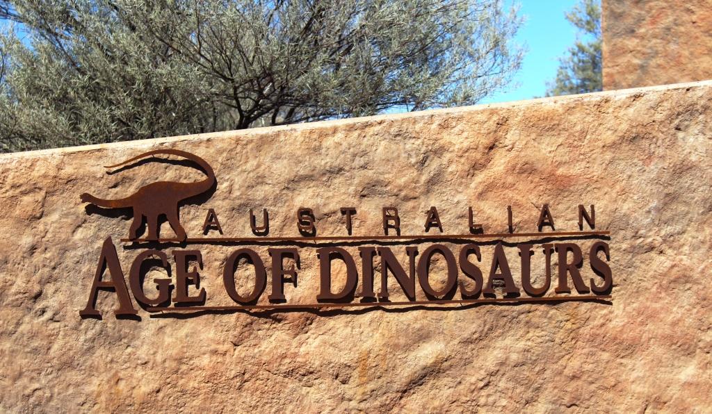
Australian Age of Dinosaurs sign at the Dinosaur museum and laboratory
We made an early start from Porcupine Gorge. Squally winds had roared through the trees all night so we were awake early and took advantage of the situation. The road back to Hughenden was a downhill run most of the way assisted by a brisk following wind. Refuelling in Hughenden took only a few minutes and we departed this pleasant town for Winton, the remaining corner of the Dinosaur Triangle. From Hughenden it is a run of 212 kilometres over flat grazing land on a single lane sealed road with some wider passing sections. We made two stops, the second of them at a place called Corfield pronounced the same as Caulfield in Victoria. And like its differently spelled namesake it runs, annually, a race meeting with – you guessed it – a Corfield Cup. The town contains a pub, two houses, a rest stop and, of course, a race track.
We had spent time at Winton in 2009 during our Big Lap and although there are still things that we want to do they could not be fitted into this trip. However, we did fill one gap by dining in Banjo’s Bar where the park offers a nightly three course dinner and then enjoyed the entertainment of Suzie the resident comedian bush poet. A great night’s entertainment provided by a very funny lady.
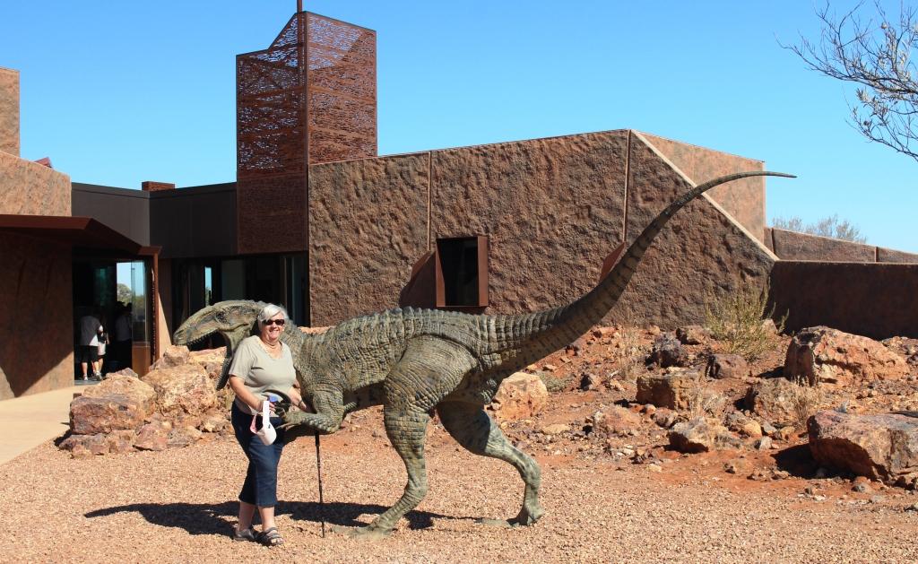
Ruth meets a dinosaur
The third corner of the Dinosaur Triangle is provided in part by the Australian Age of Dinosaur Centre located about 20 kilometres out of Winton. The other dinosaur highlight is Lark Quarry, the sight of the dinosaur stampede. But we saw that in 2009 and a repeat was not a possibility, or of interest for that matter. The turn to the Age of Dinosaur is on top of a mesa, or jump up, just 13 kilometres on the road to Longreach. Gravel starts immediately you leave the highway, so we followed the dusty road across the flat lands and up the jump up to the very adequate parking area. The facility was quite new and very modern. There is a shop, coffee shop and display at this sight. About 500 metres away there is a laboratory where restoration work is done.

Pastures toward Winton viewed from the dinosaur centre
The tour covers both locations but takes about 90 minutes and costs $28 each for seniors. This tested the level of our interest in pre-historic creatures. Coffee and cake won out. After partaking we returned to the low lands and made our way to Longreach. It is an easy drive. The road is reasonably wide and quite flat, although we initially climbed slowly from the Diamantina and then descended to the Thomson.
The road from the highway to the “Jump Up”
At a couple of locations quality facilities have been provided including regularly maintained toilets, spacious picnic shelters and enough space for overnight campers to keep out of each others hair. We arrived to find the caravan park in which we had stayed last time greatly enlarged. We had a site with the caravan between ourselves and the sun. This was most welcome as the temperature was around the mid 30s by mid-afternoon.
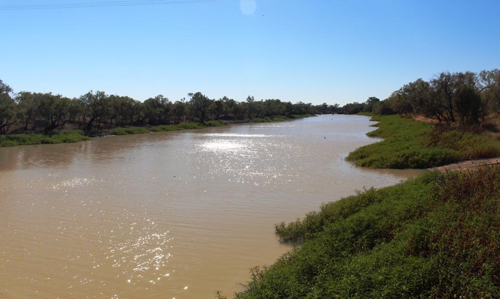
Good water levels in the Thomson River at Longreach
Our original intention had been to continue along the Landsborough Highway until it became the Capricorn Highway at Barcauldine. From there we had intended to visit the gem fields of Sapphire and Rubyvale before turning for home. But back along the road a bit we had changed our minds and decided to continue south. Well, south west actually. So on departure next morning, after a brief shopping excursion, we called to look at the well known, among its adherents, free camping area beside the Thomson River.
We found a few vans in a spacious area beside a river that contained much more water than we had expected. This is, of course, one of the wonders of the main waterways in the Channel Country. They have an ability to hold large pools of water for very long periods during hot weather.
Only one sealed lane but with well maintained shoulders
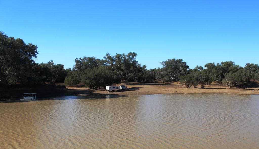
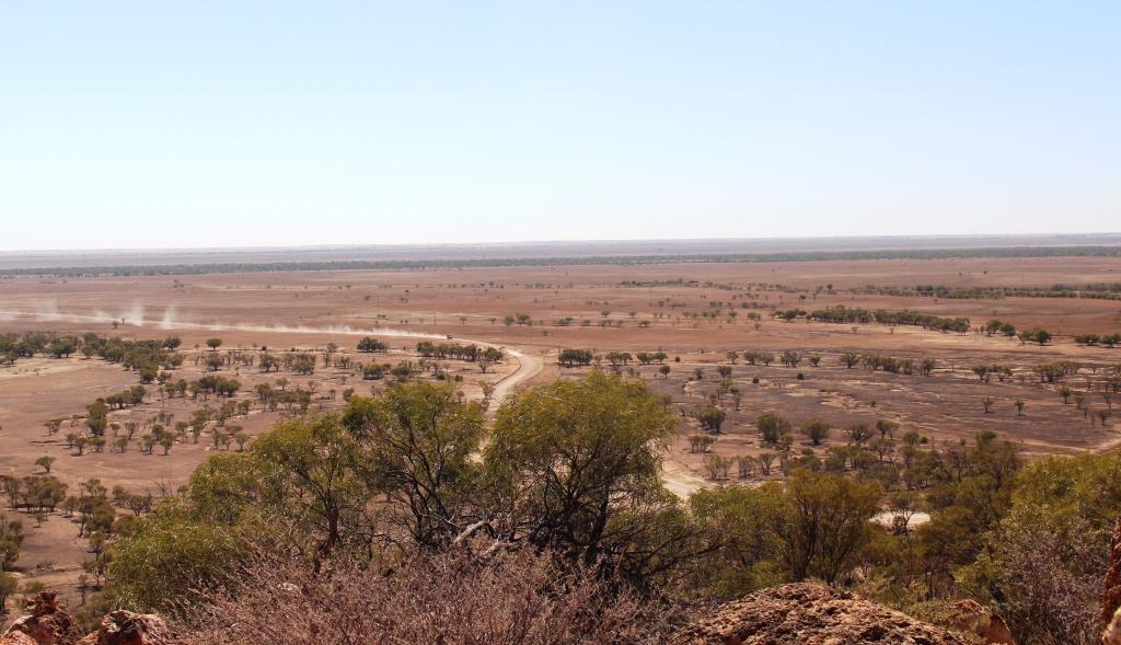
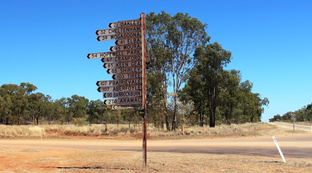
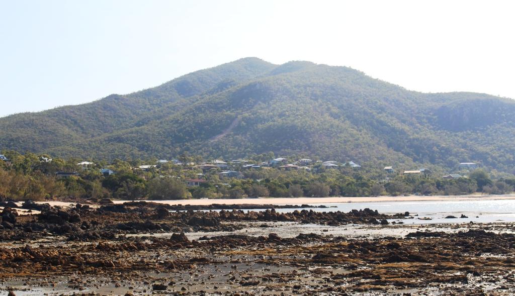
The Longreach Windorah Road follows the Thomson River between these towns, although most of the journey the river is out of sight. This is grazing country, mostly cattle but with some sheep for wool and meat production. The road is mostly unfenced and there are numerous cattle grids across the road. We saw some stock but not much as conditions are dry out there and areas of pasture are rested regularly and for long periods, so the stock could be somewhere else on the property. Of the 314 kilometres length of this road, most runs through the Barcoo Shire. This remote municipality of just 460 people covers 62,000 km2. The Thomson River runs through its length and is joined by the Barcoo in the south. Jointly they become Cooper Creek which flows, sometimes, into Lake Eyre.

Stonehenge – the entrance to and a large part of the town
We paused for morning tea at the roadside and then continued to the mini town of Stonehenge. This tiny community of about 100 people has, of course, a pub but no store, and it has a caravan park. The council has installed power heads, an amenities block with toilets, showers and a washing machine. Visitors may stay by paying, by an honesty system, $10 per night.
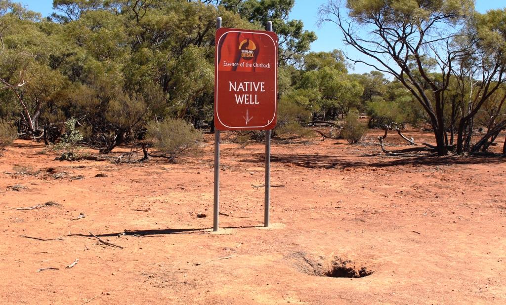
Long term Indigenous water supply
Soon after leaving Stonehenge the road rose steeply and levelled to a plateau. There, by the side of the road, is a well that indigenous people used as a water supply for who knows how long. Water is visible about 25 cm below the ground.
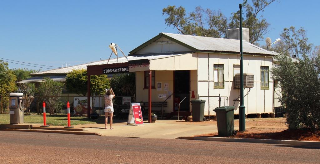
Jundah Store with unknown photographer
All passengers need a drink
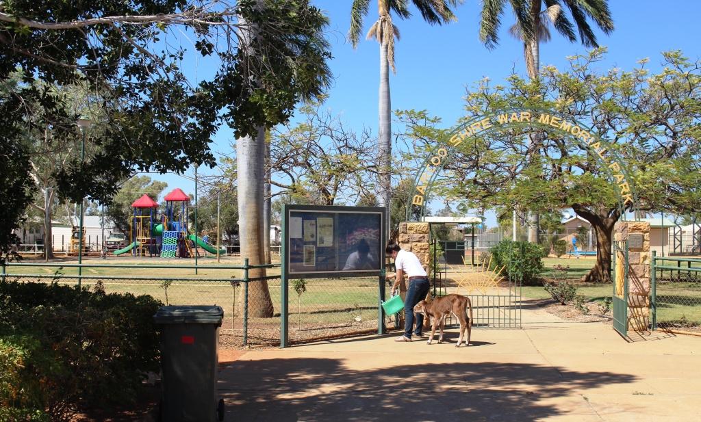
The next town is along this road is Jundah, the adinistrative centre of the Shire. It has about the same population as Stonehenge but appears to be a bit more substantial. It has a small store but no obvious fuel supply. There is a school and a police station. A small caravan park operates providing an alternative to the free camping areas on the banks of the Thomson. Beside the park, which is also the war memorial, the council has built a quality amenities block for the use of campers and other members of the travelling public.
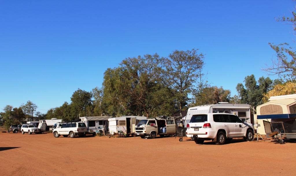
Vans at Windorah. Most are bound for Birdsville races.
The road crosses the Thomson River at Jundah and continues through flat riverplains until the Diamantina Developmental Road is reached just east of Windorah. Which, of course, brings us to the third of the three towns that comprise the urban areas of the Barcoo Shire.
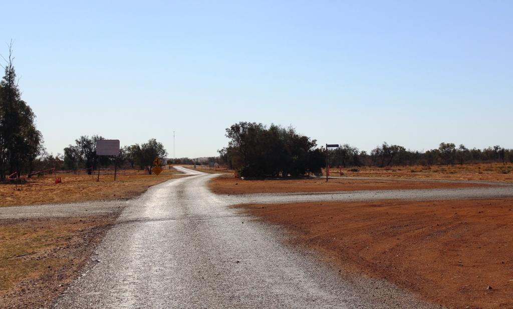
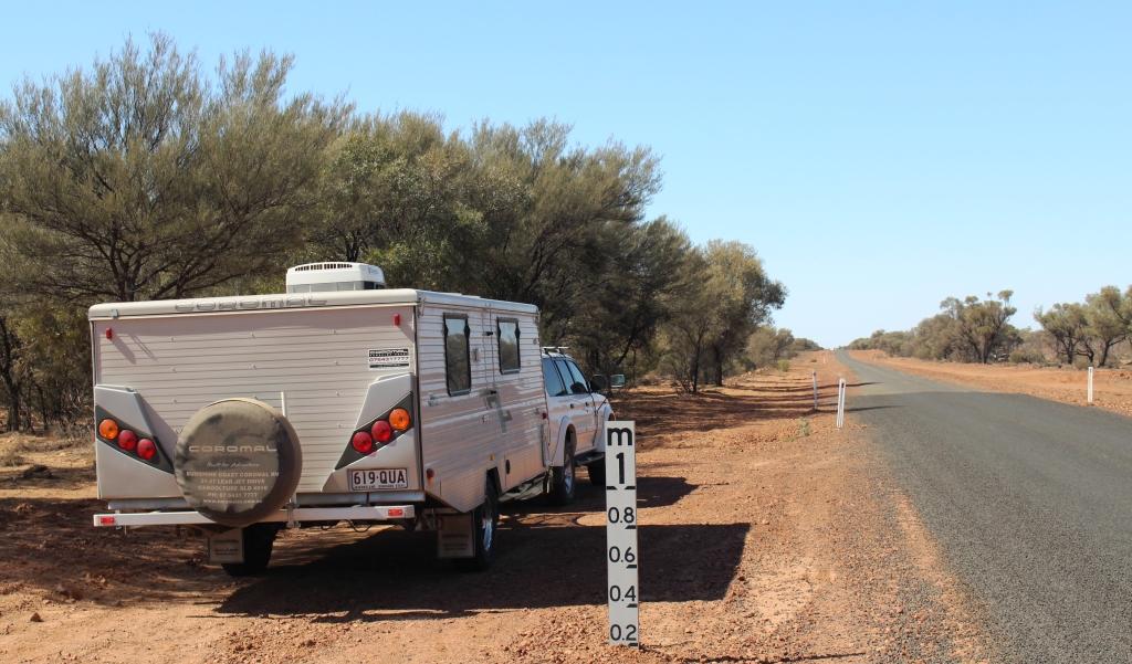
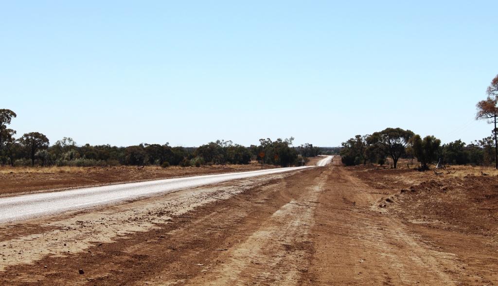
The road out of Windorah to Birdsville. There is 388 Km of it.
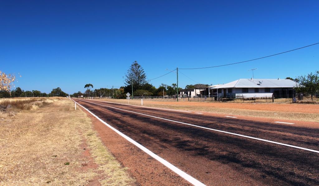
Windorah is the last town before Birdsville which is 388 kilometres further along the Diamantina Develpmental Road and the Birdsville Developmental Road. The greater part of the 200 kilometres of the Birdsville Developmental Road is sand, dirt and gravel. Consequently Windorah has businesses that offer succor to both traveller and vehicle. Long term blog readers will remember our failed attempt to reach Birdsville via the Birdsville Track in 2011 when we were thwarted by rain. We have not had the opportunity to try again so you can imagine my feelings as I gazed along that part of the road out of town that I could see from the gate of the caravan park.
The caravan park is operated by the council and it is another low cost park. Just turn up and sellect a site and a council employee will find you and collect $10 per van or tent. The amenitius were solid but very useable. Surprisingly it was possible to produce a lather under the shower. Our visit coincided with the annual pilgrimage to the Birdsville cup. Most of our fellow campers were headed there together with most of the several hundred vehicles that we met as we travelled east over the next couple of days. We heard estimates of 8,000 to 10,000 revellers at Birdsville for the Cup. In a town with a permanent population of less than 300 this is not the time of the year that I would want to visit.

Windorah Hotel with parking meters
Windorah does not look to be a prosperous town but it must be. Every person who passes through spends money there. Most vehicles would need to refuel and many would top up supplies. The hotel offers rooms and cabins and there is another establishment that offers cabin accommodation.
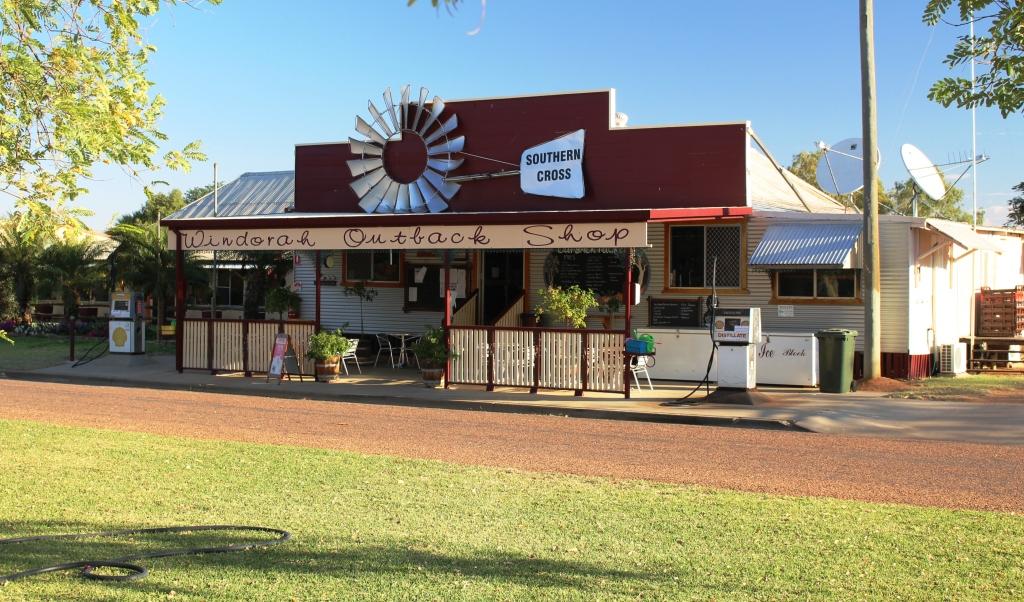
Windorah shop with fuel pumps
The normal flow of travellers south on the Birdsville Track and west over the Simpson Desert grows annually. In addition, increasing numbers are travelling this way to the Red Centre through Windorah to Bedourie and Boulia and then over the Donohue and Plenty Highways to Alice Springs. Councils, understanding the value of the tourist dollar, are putting more effort into road maintenance which means more regular grading. The dust is much easier to take if it doesn’t have bumps under it.
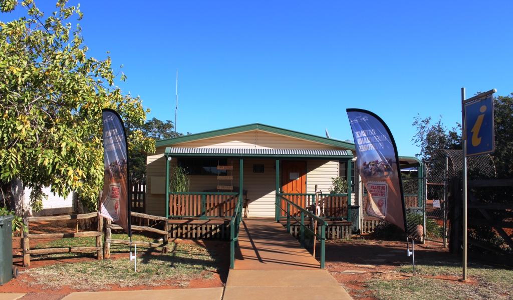
Windorah has a handy information centre
We were were much impressed by the effort by the Barcoo Council to encourage tourism. Not only are the caravan parks inexpensive, adequate and well maintained but the roads are in much better condition than in the neighbouring shires of Longreach and Quilpie. The quality of the roads literally change at the boundary. Barcoo puts great effort into keeping the shoulders graded with soil packed right to the edge of the single lane sealed strip. This reduces the risk of damage to tyres significantly.The only thing missing from the three Barcoo towns that would be useful is mobile phone coverage. With this service available we would return and spend a while. The camping places along the Thomson and Cooper looked quite attractive.
This was to have been the last blog in this series but I have too much material that won’t fit in. So watch out for the final part of the story as we share our trip home from Windorah.
The road to Hughenden through Homestead
There were things to see in Charters Towers but we treated it as an overnight stop. For time reasons we departed the next morning for Hughenden. The road, again, lead through grazing country, with cattle in evidence from time to time. We passed through the small towns of Homestead, Pentland, Torrens Creek and Prairie. At least some of these towns owe their existence to the original cattle station of which they were part. Their common feature is that they all have a pub.
There are a lot of cattle stations down this road.
Hughenden is the administrative centre of the Flinders Shire and is on the Flinders River which runs into the Gulf of Carpentaria. About 100 km east of Hughenden we had passed a sign informing us that we had entered the Lake Eyre catchment but must have passed out of it a bit further on.
Local councils put a great deal of effort into informative roadside material
Hughenden is one corner of the Dinosaur Triangle but is also the main stepping off point for Porcupine Gorge National Park.
Flat terrain near Richmond
We had planned to spend one night at Hughenden and then a night at Porcupine Gorge but the caravan sites at the camping area were all booked. As there were vacancies the next night we stayed in Hughenden for two nights and took a day trip to Richmond, the second corner of the Dinosaur Triangle, during the intervening day.
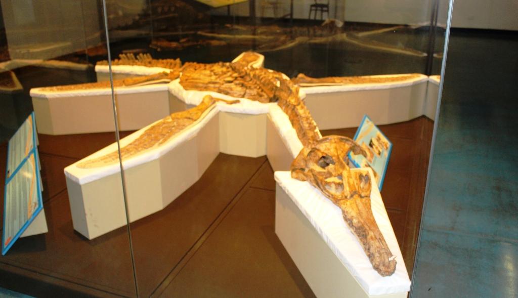
The Dinosaurs of Hughenden and Richmond

The land based dinosaur at Hughenden
The Flinders Discovery Centre at Hughenden dispenses visitor information but also houses the dinosaur museum. The establishment is not large but contains a large dinosaur replica made of parts cast from genuine fossilised bones of real dinosaurs. It dominates the building and is supported by displays of information about dinosaurs. The skeleton is made substantially from fossils found around Hughenden but has been supplemented by parts of Muttaburrasaurus, a dinosaur found at nearby Muttaburra.
Part of the display at Hughenden
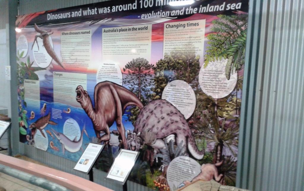
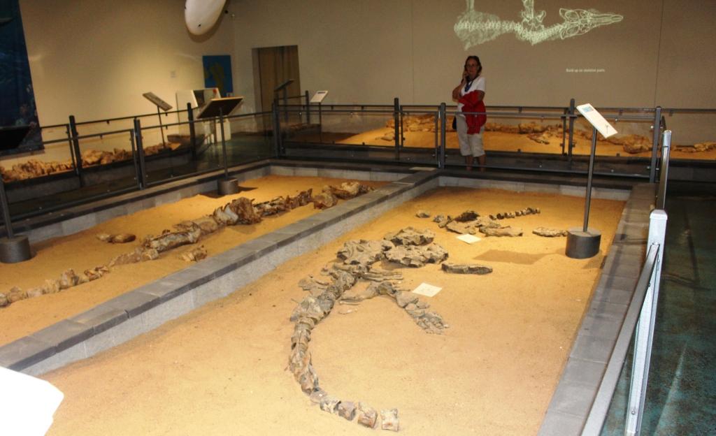
Dinosaur fossils were first found in the area in 1867, with finds increasing in recent years as interest has grown and governments have allocated more money to research. The dinosaurs on display at Hughenden are land dwelling but at Richmond many marine creatures have been found. The display at Kronosauraus Korner, as the museum at Richmond is named, is based on marine finds. Way back, we are told, this area was at the edge of a huge inland sea.
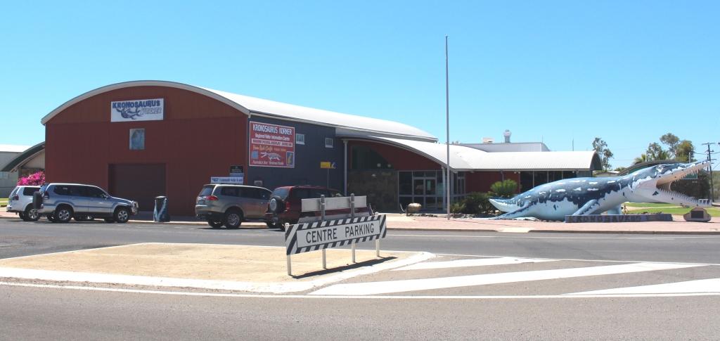
Kronosauras Korner at Richmond
The main street of Richmond
The Richmond Facility is world class. I think it is quite remarkable for a small town like Richmond that has only about 550 residents. The Pliasaur is undoubtedly the main attraction. It is one of the most complete dinosaur skeletons found anywhere in the World and is magnificently displayed in a gallery named for the station owner who found it on his Marathon Station.
Display at Richmond – note the light show on the wall
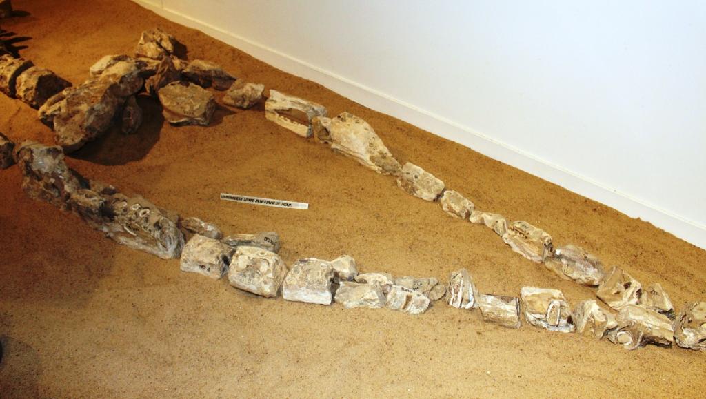
Fossilised Bones of Didosaur Head
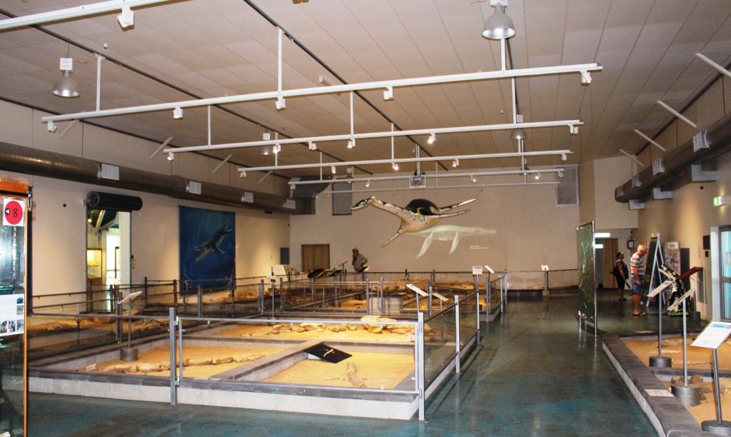
A general view of the Richmond display
Dinosaurs are a huge subject so I am not about to try to cover scientific detail here. Suffice to say that the whole subject is well and truly covered in the displays in both towns and is a major tourist attraction. I will allow my photographs to demonstrate.
The pride of Richmond museum – the Pliosaur
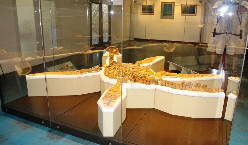
Another view of the Pliosaur
The council operated caravan park was close to full both nights that we stayed there and was well set out and well managed, with modern and well kept amenities. The standard of such infrastructure is indicative of the effort that councils put into maximising the value of the tourist dollar for their rate payers and residents.
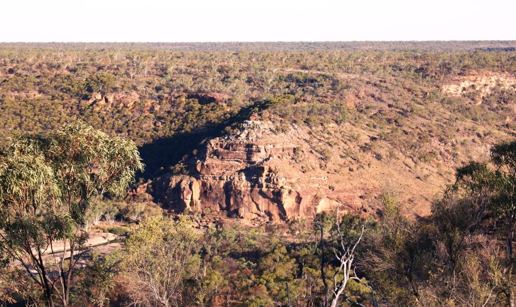
Porcupine Gorge
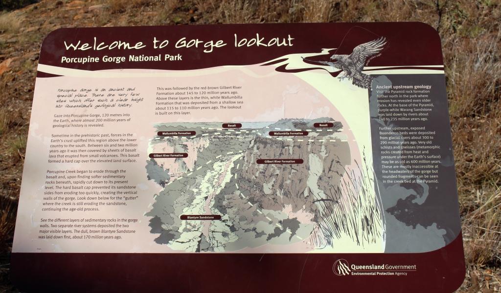
Sign at the Gorge Lookout
The gorge, well known to wandering grey nomads, is at the end on about 75 km of sealed road. The road is part of the Kennedy Developmental Road that starts at Winton and goes north. It ultimately becomes the Kennedy Highway that leads via the Atherton Tableland to Cairns. A gravel surface starts after Porcupine Gorge but the sealed surface returns further north.
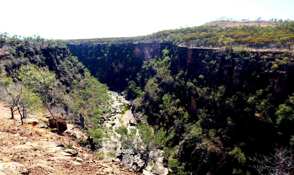
Gorge at the lookout
We arrived at the Gorge just before lunch. By this point in our travels the weather had warmed some and temperatures that day were reaching towards the mid 30s so I was keen to do my planned gorge walk. Ruth had withdrawn from the event due to her knee problems. I had a quick lunch and headed off, equipped with my camera and a bottle of water.
Our camp sight
The walk to the bottom of the gorge from the camping area is about 1.2 kilometres, of which the majority is the climb down. Fortunately there was a cool breeze blowing along the gorge and it kept conditions comfortable. On the way down I met several walkers, most of them senior citizens, making their way back up. I could see by the amount of puffing that most of them were doing that the climb back up would be a bit of a challenge.
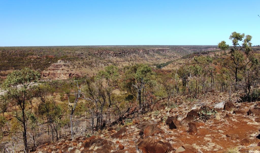
The gorge is in a flat landscape

The path lead over rocky steps
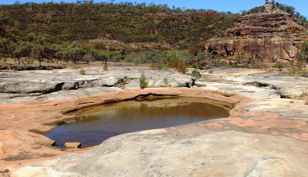
The gorge is a huge slash in the quite flat countryside, excavated over the millennia by the now quite modest Porcupine Creek which runs through its 15 km length and continues to run under the road in. Of course, in flood time it would be anything but modest. Because the area was an inland sea the rocks are sedimentary and relatively easily weathered. An inspection of the stone floor of much of the gorge shows clear signs of the continuing process of erosion.
Weathered rock forms the gorge floor

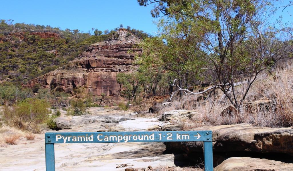
The Pyramid
The stream runs through this part of the gorge, expanding into water holes at various points. Some of the walkers were taking advantage of the pools to take a refreshing dip but most said that the water was very cold. At the lower end of this section of the gorge a geological feature known as The Pyramid stands in the path of the stream and turns it aside to find its way around a couple of turns and on its way. The pyramid is the weathered face of a cliff, named for it’s shape.

Is this a fishing or a swimming hole? But the fish are protected in the National Park
Back at the top looking down
Time to start the climb back up
I took my time climbing back up the incline. It is made up of dirt path with occasional steps and lengthy stairways constructed from the rocks that litter the hillside. The rangers have done a great job with access to the gorge but that doesn’t make the climb on a warm afternoon that much easier. I arrived back at the caravan more than ready for a long cold drink despite emptying my water bottle during the climb.
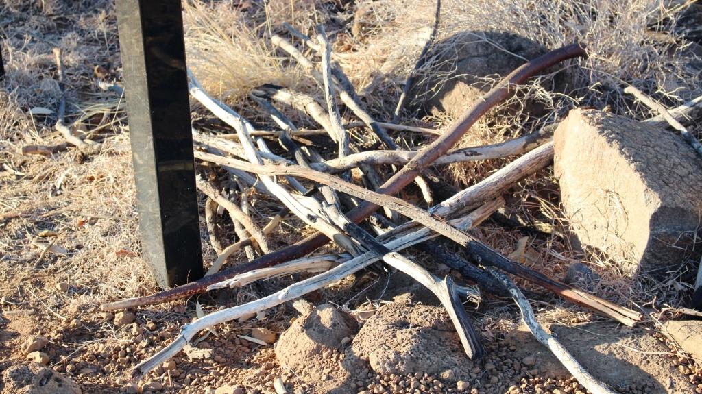
Discarded walking sticks
We departed next morning for Winton via Hughenden. Winton is the third corner of the Dinosaur Triangle but I will deal with that in the next blog post.
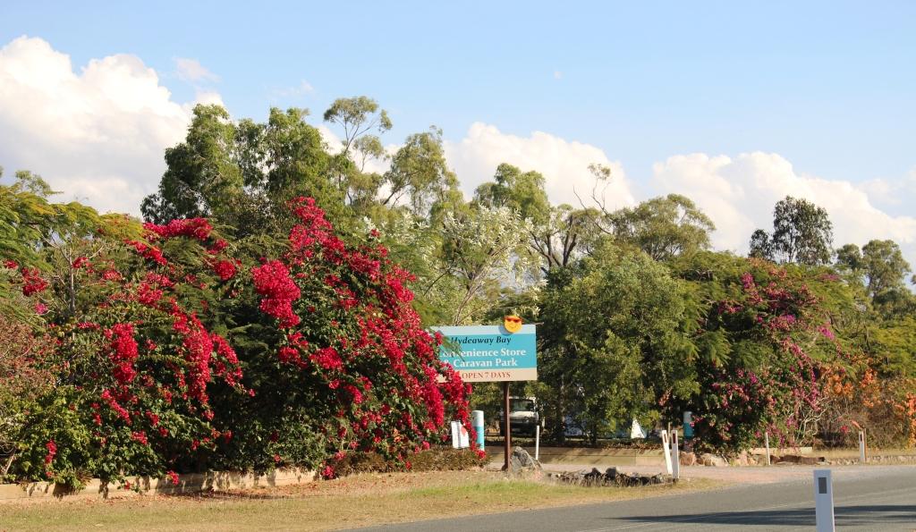
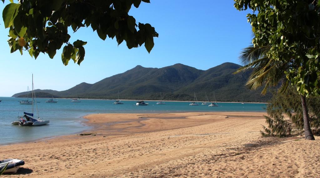
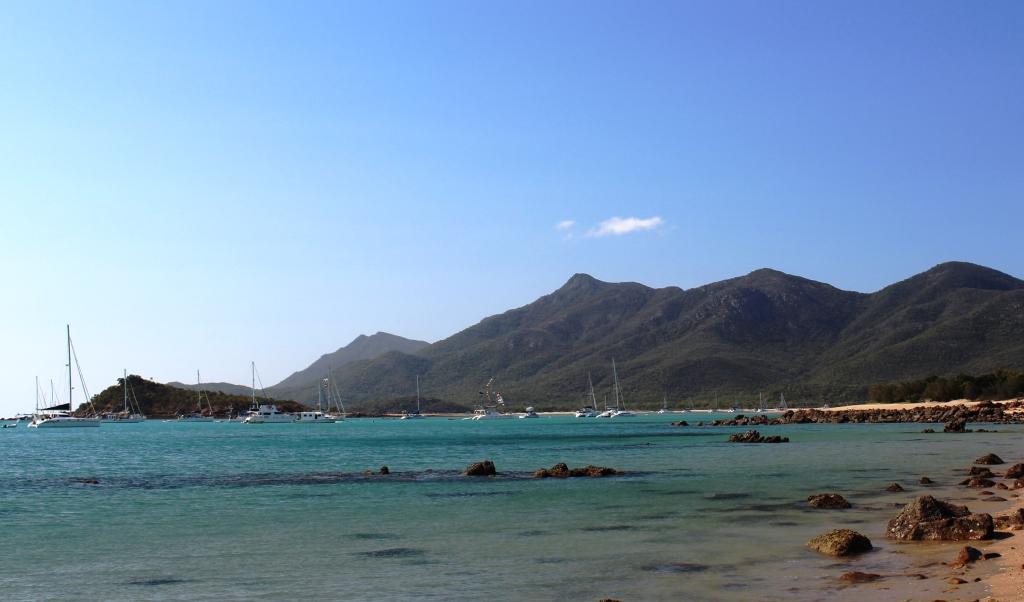
Hideaway Bay
Our next objective was Hideaway Bay. This quiet sea side corner is about 30 kilometres north of Proserpine on the north western end of the Whitsunday Peninsula, just before the coast swings away into the bay before Bowen. If travelling by sea, that is. It is about 700 road kilometres on from Hervey Bay.
The entrance to the caravan park
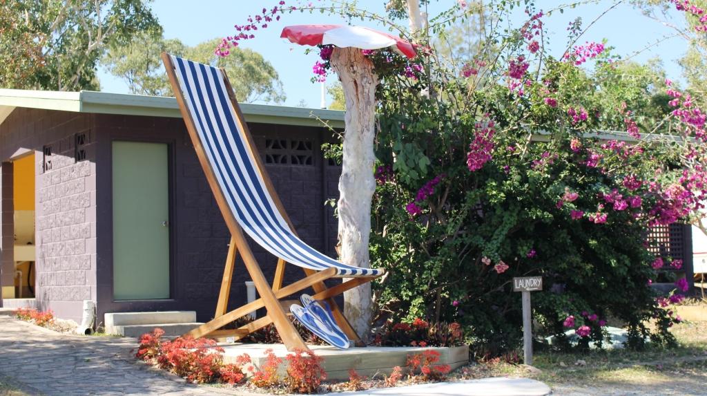
And you can relax big time!
We had planned to reach Rockhampton, about 400 km on, the first day but continued a further 100 and stopped in a pleasant roadside park at Marlborough. We easily made Mackay the next day, despite a lengthy chat with some fellow nomads from Tasmania at a rest stop along the way. It was then another 160 km to Hideaway Bay the next day.
Houses at Hideaway Bay – between the sea and the hills
Hideaway Bay is a collection of houses built on the lower slopes of the ranges that run down to the sea. Some are permanently occupied while others are holiday homes, both private and rented. The town has no shops. Its commercial centre is a telephone box. The caravan park is at the entrance to the town. At the other end of Hideaway Bay Road, where the sealed road ends, is a turning circle and what must be one of the best placed picnic shelters in the world.
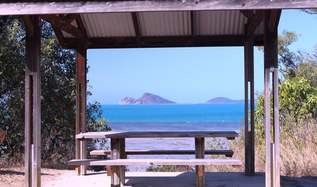
A well positioned picnic shelter
A gravel road continues from the turning circle and about 5 kilometres further on it passes Cape Gloucester, Gloucester Passage and Gloucester Island. On the western shore of Cape Gloucester two small resorts are located in what must be the most idyllic locations in the Whitsunday area. They are not flash establishments, in fact they are quite basic, but absolutely ooze charm.

Ruth and the view – and a drink
About 8 kilometres away is Dingo Beach which boasts a pub with attached store and fuel pumps and other essentials like bait sales and boat hire. For all else please drive to Proserpine.
Dingo Beach – A stroll at low tide

My “Fantasy Island” – off Dingo Beach
Outrigger boat on Dingo Beach
Clients of the caravan park include grey nomads escaping the rigors of southern winters, those who come for the fishing, including some of the nomads and people passing through, like us.
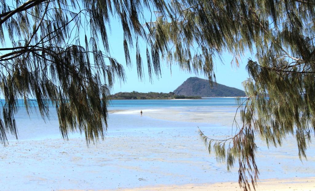
View from the beach to Gloucester Island
We stayed for three nights and did very little but did visit the beach and took a drive beyond Cape Gloucester to check out the resorts. As we rounded a further point we were surprised to find over 60 yachts, multihulls and power boats, anchored just off shore.
Boats at cnchor off Montes Resort
The Cape Gloucester Eco Resort was quiet but at Montes next door it was all “go”. You see, Montes were hosting the Shag Island Regatta, a charity fund raising event that has become a fixture. That explains all the anchored pleasure craft. We were told that there were many more to come. I’m not sure how it all works but last year they raised $35,000. But I get the impression that the pecking order among participants has more to do with drinking than nautical skills.

Preparing for the revelries at Montes Resort
Neighbours on one side at the caravan park were from Bairnsdale in Victoria. The lady had worked for an Orbost transport company with which I later had a close association so we knew many of the same people. They were also skilled fishing people which yielded a couple of meals of freshly caught sweet lip.
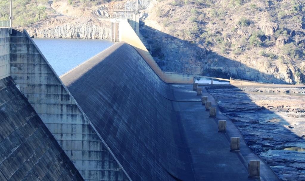
Our next target was the Burdekin Falls Dam. The Burdekin River flows into the Coral Sea after passing between the sugar cane towns of Home Hill and Ayr. My interest is that one of the transport companies for which I was responsible, after our relocation to Brisbane, carried into the sight substantial quantities of the materials used to construct the dam. We also had some heavy cranes on site. I had not visited during construction and have always wanted to see the final construction.
Ravenswood & Burdekin Falls Dam
Our plan had been to shorten the journey by using a mostly dirt and gravel road that cuts across from Ayr to Ravenswood, but when advised that it was in poor condition decided to travel further north before cutting back to the main access road. This meant spending an extra night somewhere, so we checked out a free camp at Giru, just north of Ayr, but finding it to be of a standard somewhere below ordinary we continued on to a park that we had used previously in Townsville’s southern suburbs.
Burdekin Falls Dan – a solid concrete structure
Ruth had previously received notification of a 25% discount sale at Noni B (where she used to work) and with a gift voucher burning a hole in her handbag had been hunting on the their web site, unsuccessfully, for a suitable purchase. Magnanimous Kev, seeing that it was Saturday morning, offered to drive past a Noni B store before we headed out of town.
Google search directed us to a shop that no longer exists but neighbouring traders pointed us in the right direction and a purchase was made. But that was the minor purchase. The more important one was some fresh cooked prawns that we devoured for lunch with fresh bread rolls with lashings of butter – well, margarine actually. I had forgotten that grey nomads had it so good!
The road to Burdekin Falls Dam leaves the Flinders Highway 90 kilometres from Townsville at the tiny village of Mingela, population 20. It is 121 kilometres to the dam from the turn but after 40 of them you reach the fascinating gold mining town of Ravenswood. The town is littered with remnants of its past, located right beside a town of about 500 people and ongoing gold mining activities. There is both an open cut and an underground mine in the area.
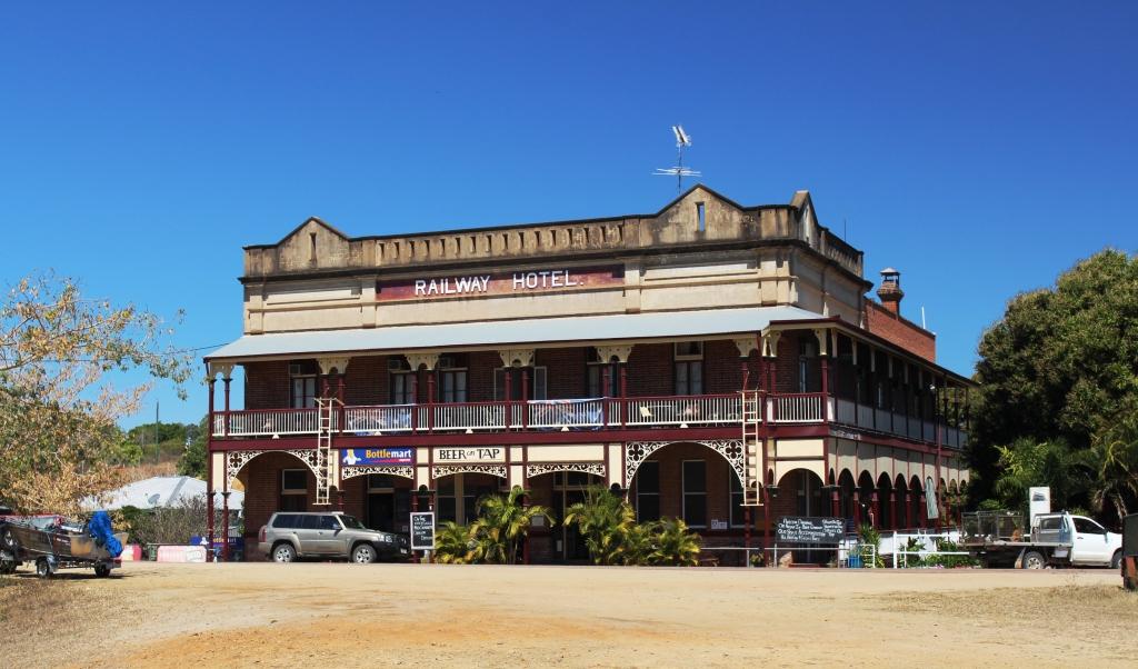
The Railway Hotel, Ravenswood
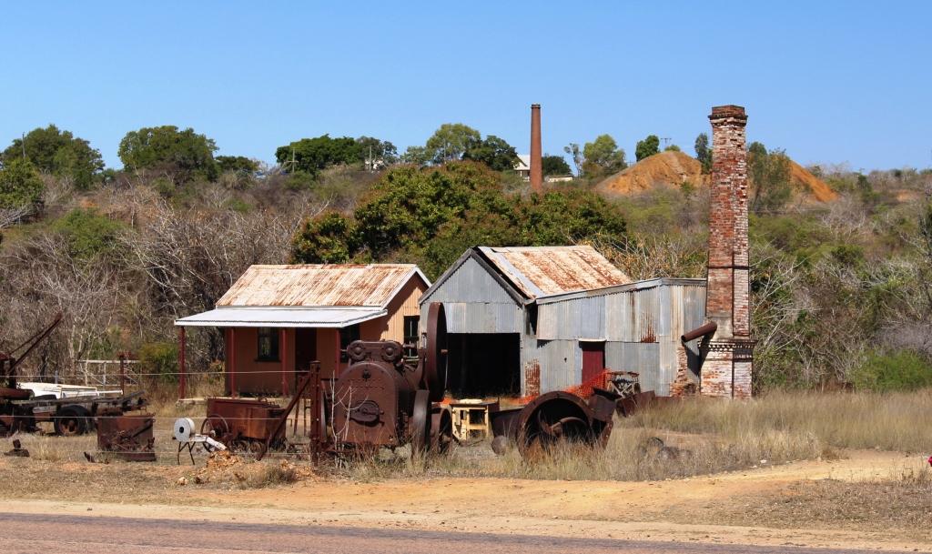
Relics of the town’s gold mining history are everywhere
Like most old gold mining towns its size and success is indicated by the number and quality of pubs. Ravenswood has three two storey hotel buildings two of which still operate and have been licensed for more than 100 years. Mining commenced in 1868 and faded away after a strike in 1912 and the outbreak of WWI. There were 48 pubs at the peak of operations and a population of around 5,000. A railway line came to the town for passengers and gold.
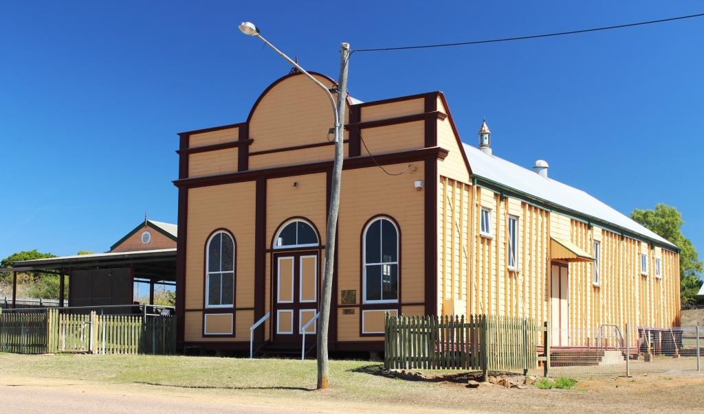
The School of Arts hall is in excellent condition
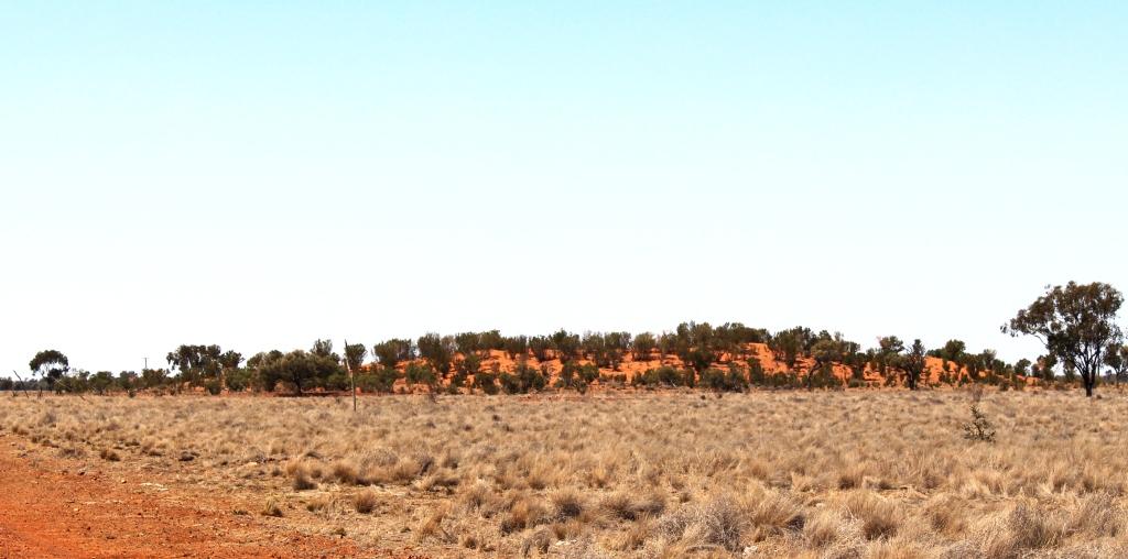
This is a town where it is possible to investigate much of the history up close. There are many heritage listed buildings and areas, most of which are quite accessible. Just out of town on the road to Ayr is a large white quartz outcrop known as the White Blow. The outcrop is 15 metres high and about 45 metres in diameter. It sits at the peak of a small hill in a conservation park of the same name. It is geologically unique in size and shape.
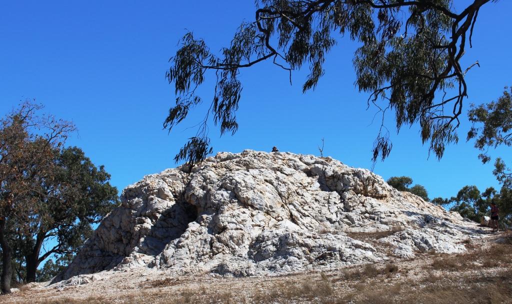
The White Blow is unique in both shape and size
It is a further 81 kilometres to the dam, through cattle country. The road is of redish bitumen, with painted centre lines and clear verges so that although cattle grids are used to minimise fencing the presence of hazards in the shape of beef cattle are easily seen. An interesting feature is the maze of cattle paths that run beside the road, leading to drinking holes and troughs. Generally the stock seems to stay clear of the road. We only encountered beasts on the road on two occasions although one was a very large hornless bull who refused to move as we scraped by.
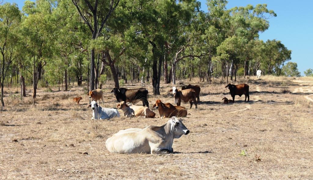
Cattle by the road side
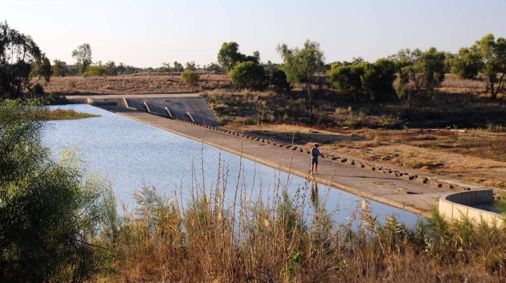
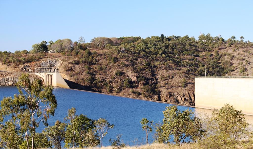
The Burdekin Falls Dam is quite a body of water. It dams the river at the head of a series of majestic falls and rapids that disappear from view around the bend in the gorge through which the river flows at this point. The wall is 876 metres in length and contains a spillway 504 metres long and 37 metres above the bed of the river. It has a surface area of 220 km2 and holds 1,860,000 mega litres. Get the picture? By comparison Sydney Harbour holds 500,000 mega litres and has a surface area of 55 km2.
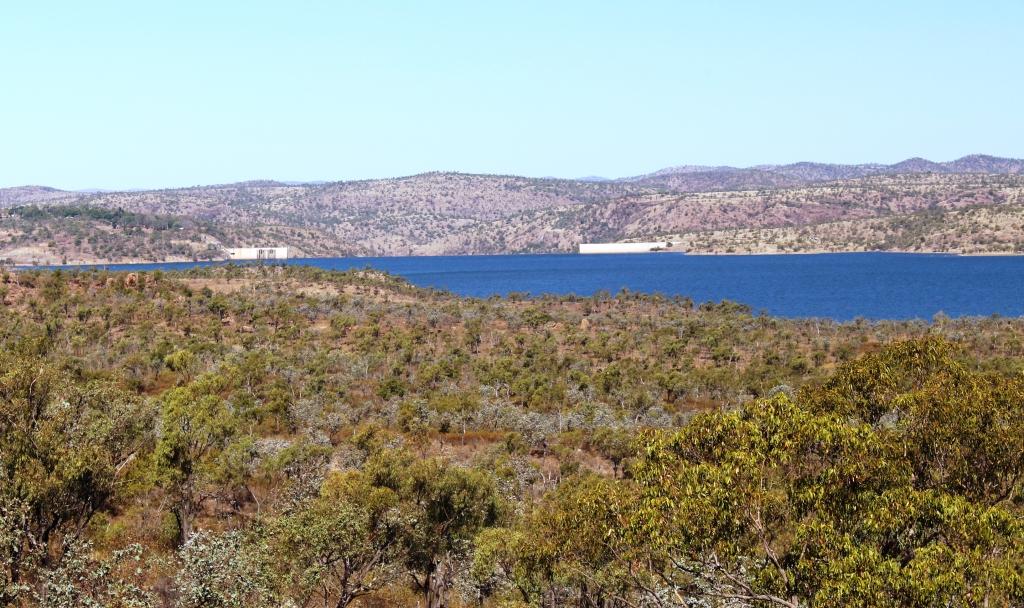
The body of water is known as Lake Dalrymple
There are no controlling gates so when the permanent bypass can no longer handle river flows the excess comes over the spillway. When this happens the road that leads on to Collinsville and the Bowen Basin coal area (it is a back road) is cut. The road, quite uniquely, runs at the foot of the spillway so is inundated as soon as the dam overflows
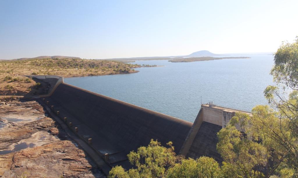
The road runs along the foot of the spillway
Because of the height of the wall, saddle dams have been built across ravines which would now be inundated with water at flood time. And when it comes to floods this river has some that were large.
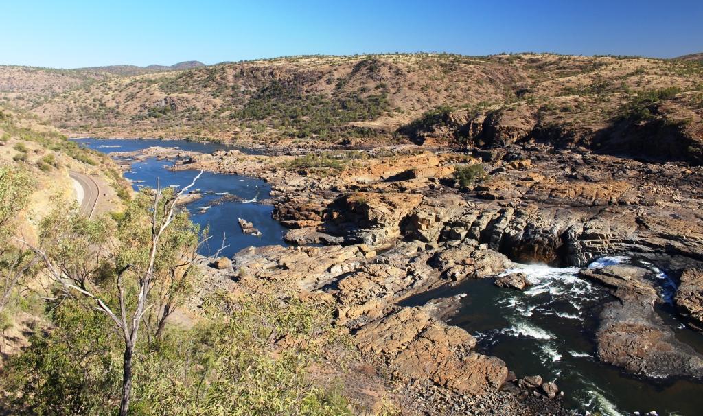
The Burdekin Falls start below the dam
Note the picture of the flood marker pole beside the road where the Flinders Highway crosses the Burdekin near Charters Towers and remember that the base if the pole stands above the level of the roadway. This location is well upstream from the dam.
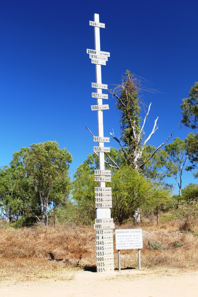
Burdekin River flood levels well upstream from the dam
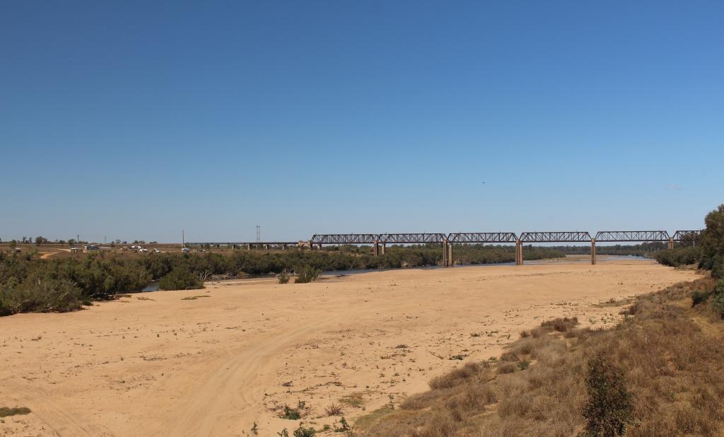
Railway bridge over the Burdekin River near Charters Towers
The only habitation at the dam is the resident rangers for SunWater and the caravan park that they run. With regularly watered grass, concrete pads for an annex, power, water and sullage it is the best value around at $15 per night for two adults. It has the added advantage of a flock of peacocks in residence, a great variety of visiting birds and regular visits from kangaroos. As a bonus we had a clear night with a magnificent display of stars.
The caravan Park is on the hill above the dam
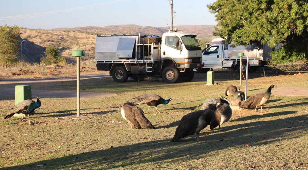
Peacocks waiting for food
We have moved on to Charters Towers for the night. Our stay in the park coincided with a three course dinner, run as a fund raiser by the local Lions Club. When I asked Ruth if she thought we should participate, her affirmative reply came without much hesitation.