Destination Tasmania – Part 8 – Richmond & Port Arthur

21st & 22nd February 2020

Please Note: A video covering the material in tis blog post can be found at the bottom of this post.

Tasmania got rid of most of their trains many years ago. Only limited goods services remain and I am not certain that they are run by the government. But Tasmanians still seem to have an attachment to trains. You see museum and recreational railways often.

Margate Shopping Train

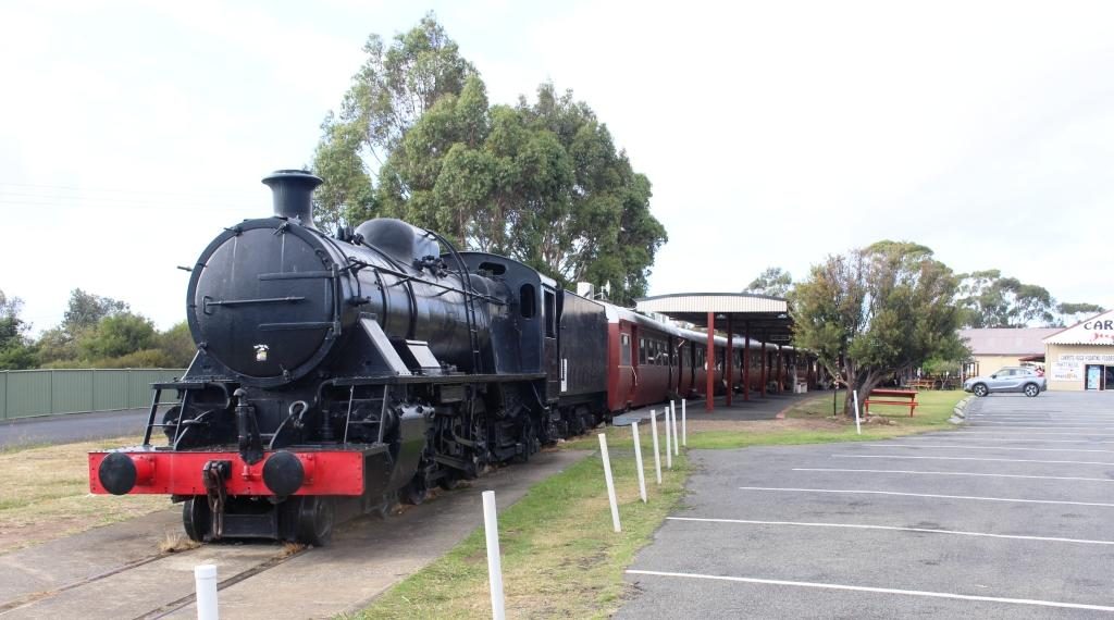
The top passenger train was the Tasman Limited. It operated between Hobart and Launceston but operations were stopped in 1978. Some enterprising people bought a complete train and set it up at the suburb of Margate, south of Hobart, as a boutique shopping centre. Original carriages have been set up as specialty shops, facing onto a covered platform.

Typical fitted speciality carriage

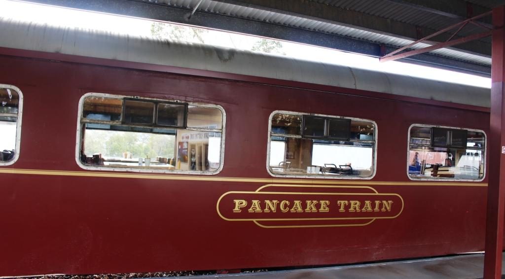
But the scheme seems to be running out of steam. Some shops were signed to open at 8.30 am but at almost 9 o’clock no one had turned up to open up anything. There were no signs saying that it was closed but I think perhaps that particular train is experiencing its second obsolescence.

The Shot Tower

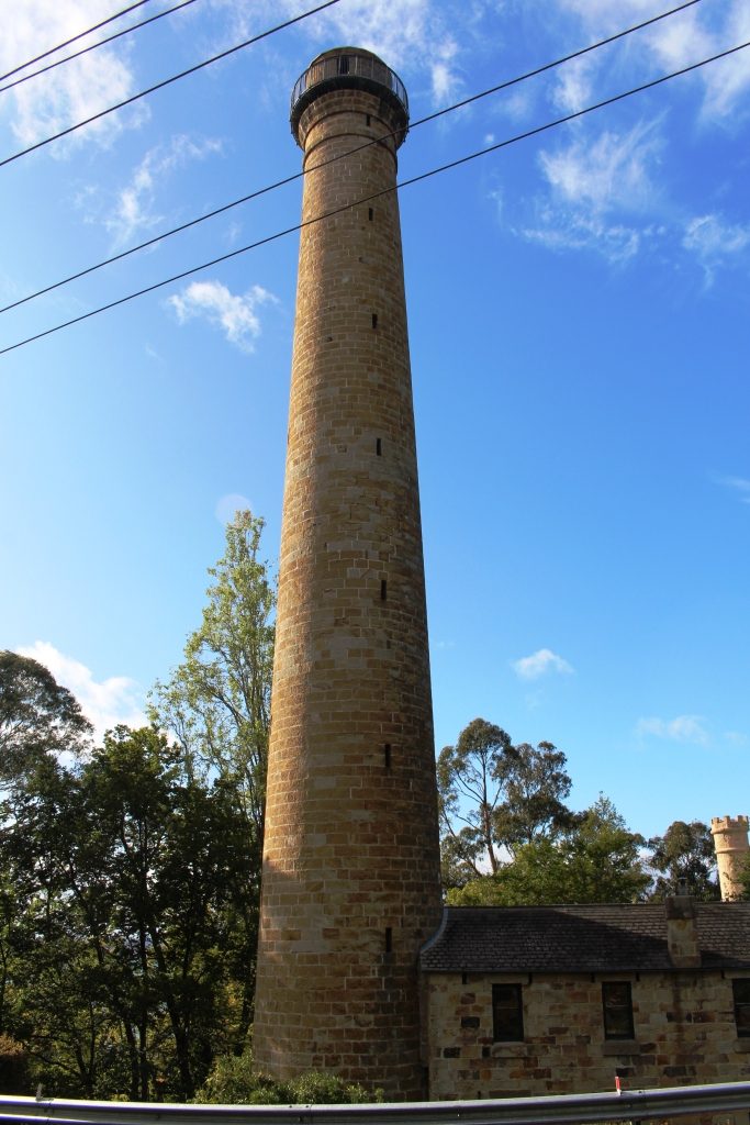
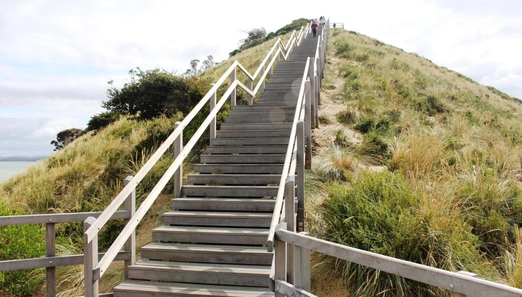
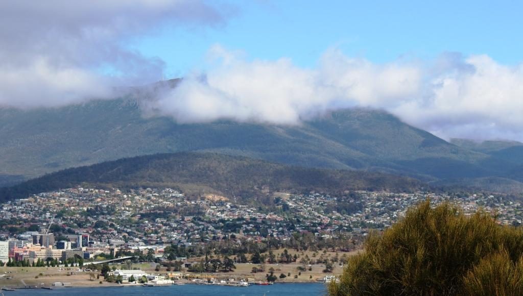
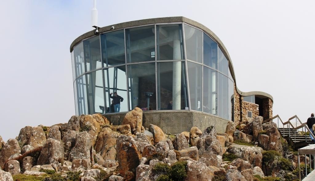
We drove on to the Shot Tower in the southern suburb of Taroona. Built in 1870 to manufacture lead shot for fire arms, it stands beside the main road, to the south. It is 58 metres high and was the tallest structure in Tasmania for 100 years.

Molten lead was carried to the top of the tower and dropped through a copper sieve. Surface tension shaped the lead particles into small balls as they fell, to be caught in a water filled cooling tank on the shot tower floor.

Outdoor section of the cafe

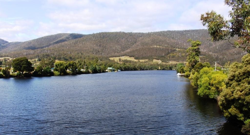
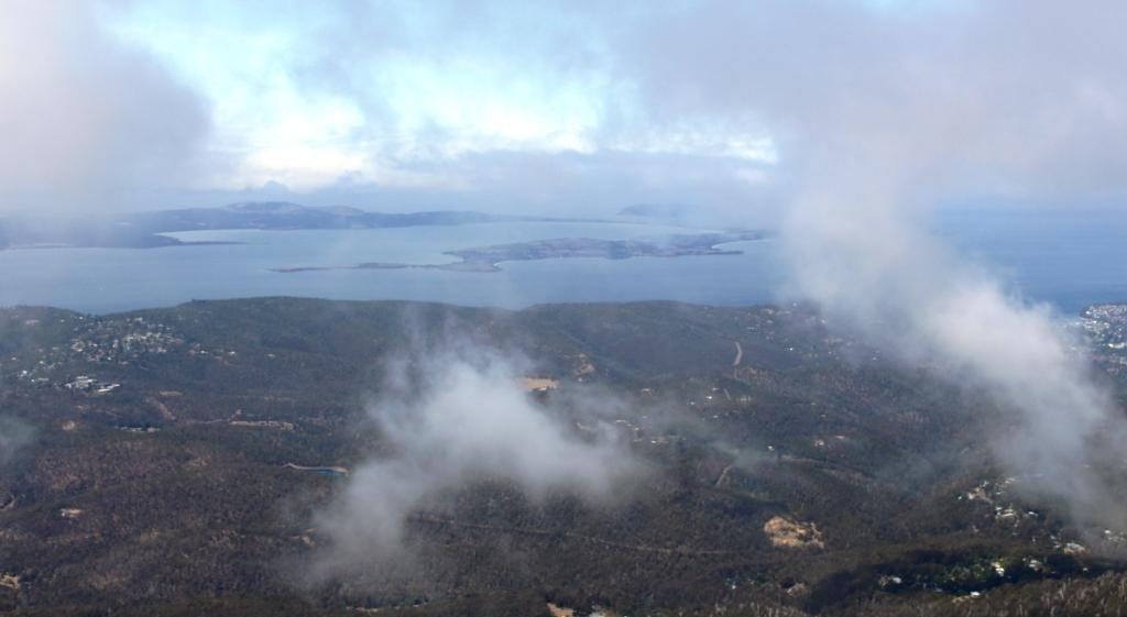
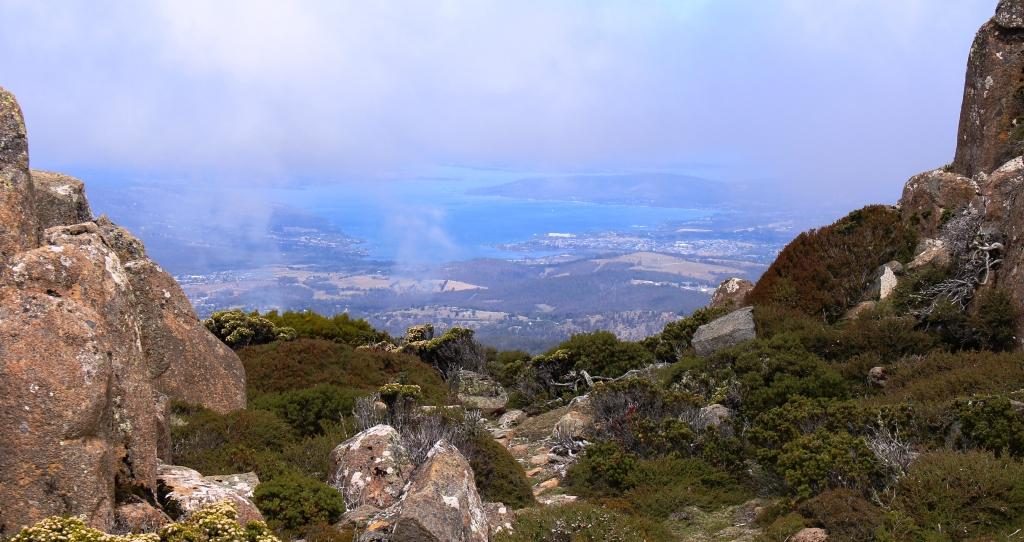
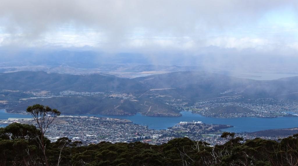
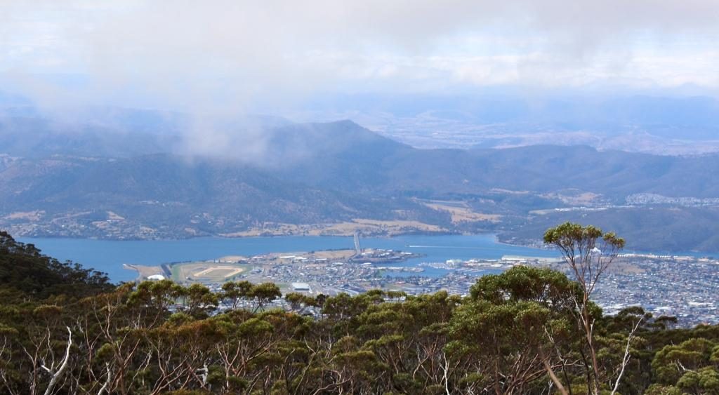
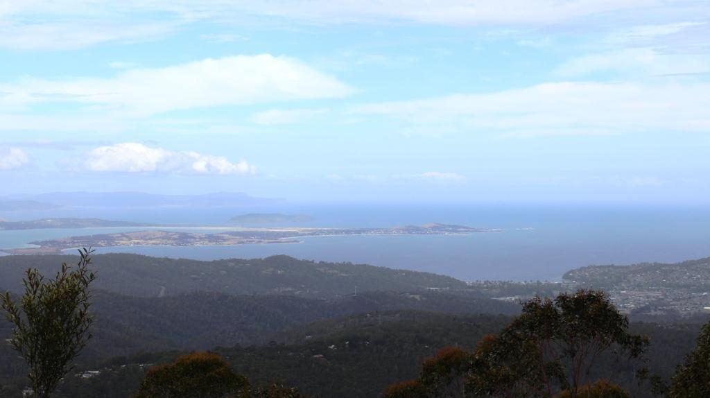
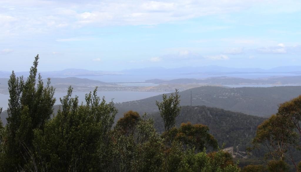
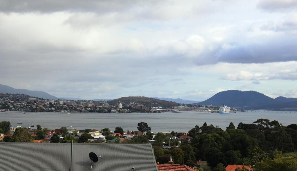
To get to the top 318 wooden steps had to be climbed. The stairway is there to this day. Visitors may climb them for a small fee for the experience and for the fine view of the lower Derwent.

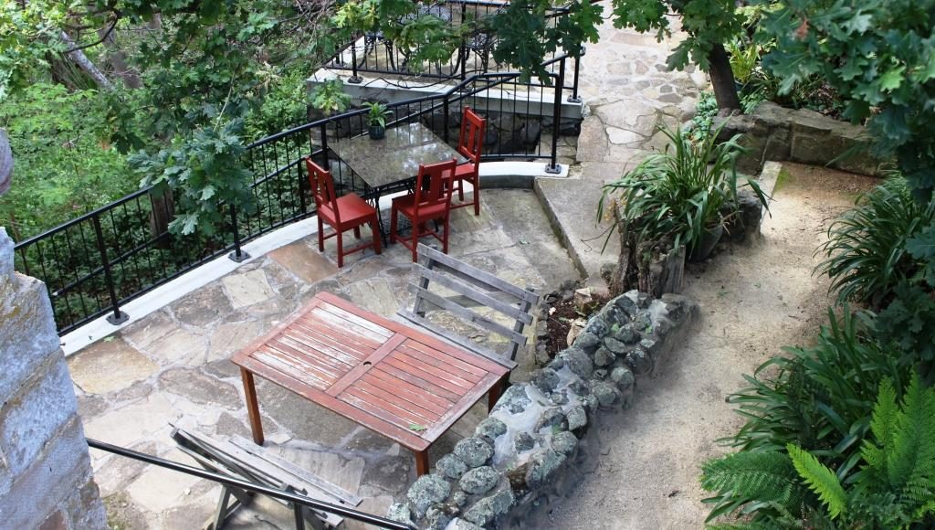
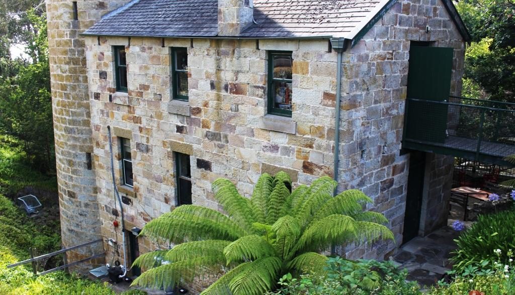
We had a pleasant chat with the lady who runs the shop and with the wife of a man who was climbing it. Upon his decent he showed us his videos. The view is certainly grand. The Shot Tower has a shop that sells souvenirs as well as a coffee shop in its basement.

Shot tower building including the base of the tower

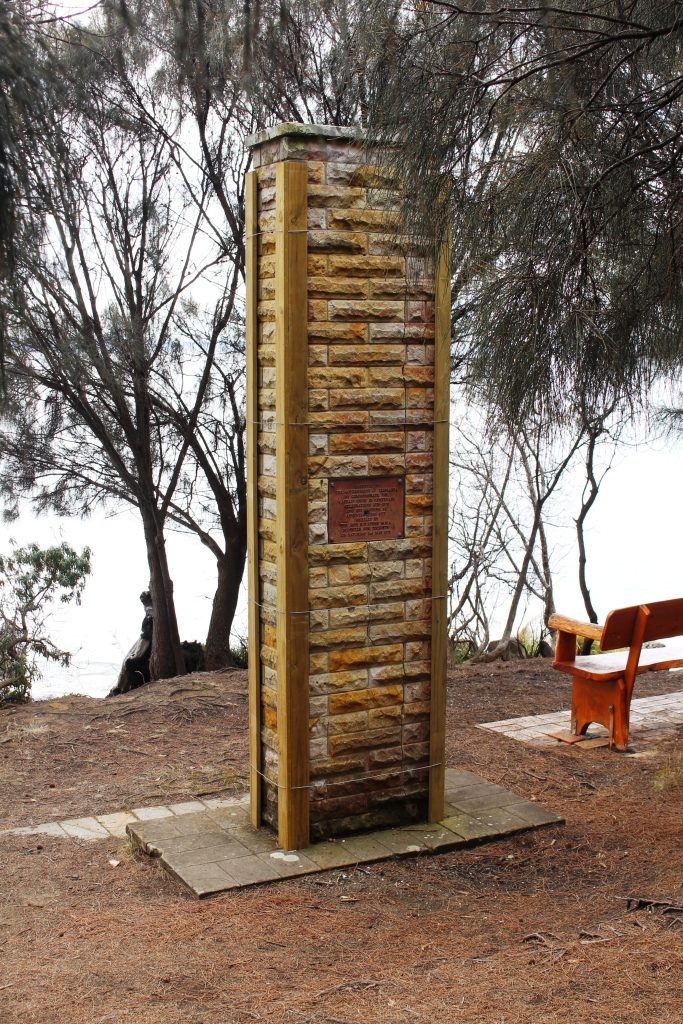
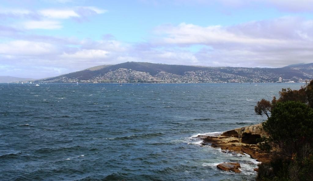
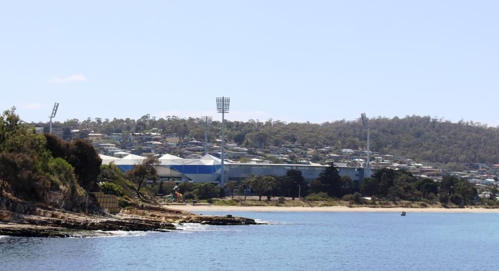
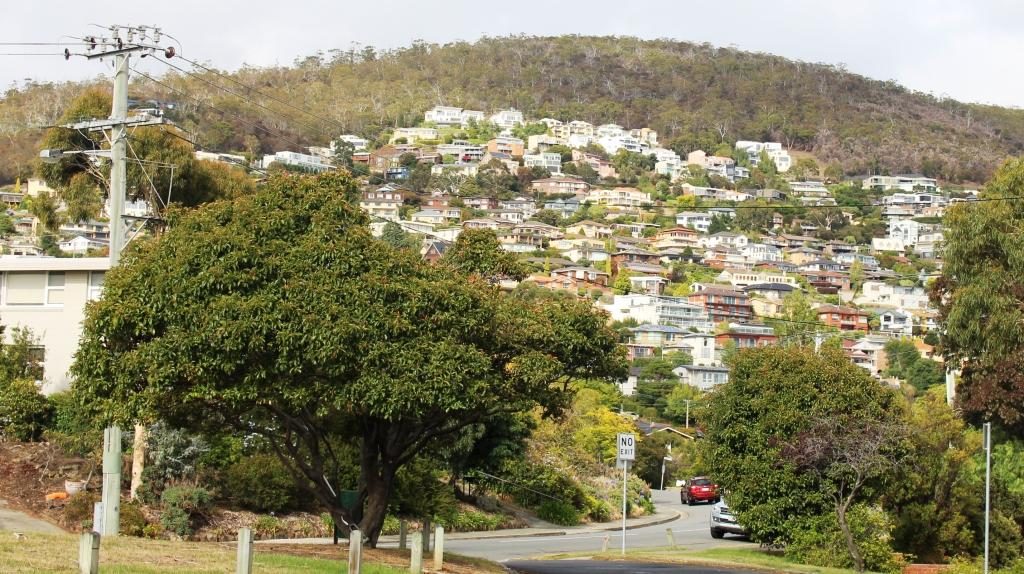
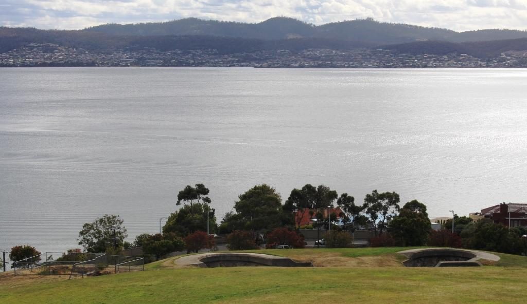
At the recommendation of the lady in the shop, as we drove on to Richmond, we detoured to the sight of the Alexandra Battery near Wrest Point Casino. It provided excellent views without needing to climb over 300 steps. Alexandra Battery was one of the many built around the Australian coast during the late 1800s when it was feared that the Russians would invade Australia’s east coast.

Houses on the hillside above the old Alexandra Battery site.
The old gun foundations and the Derwent.
An observation deck at the old battery site provides good views of the port, river and city.

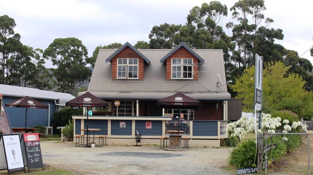
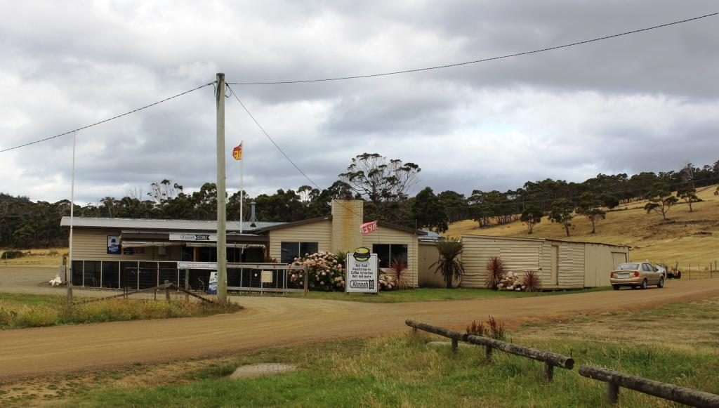
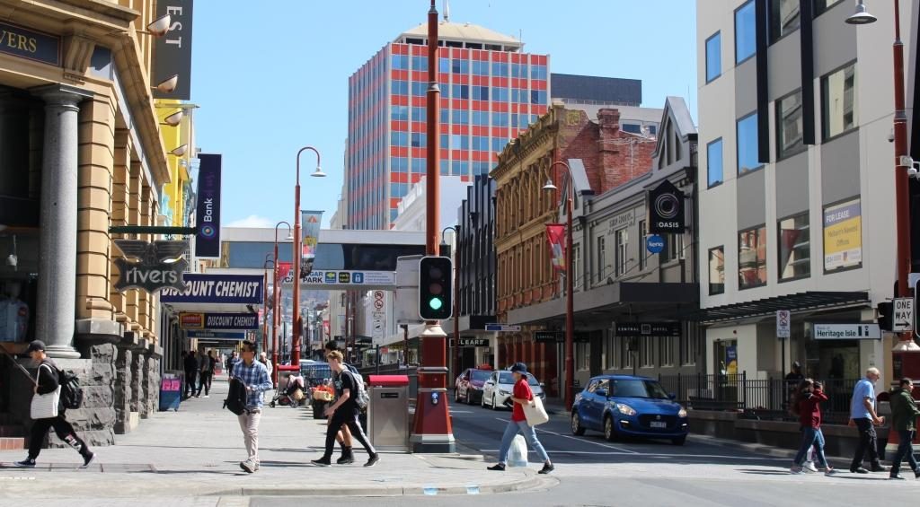
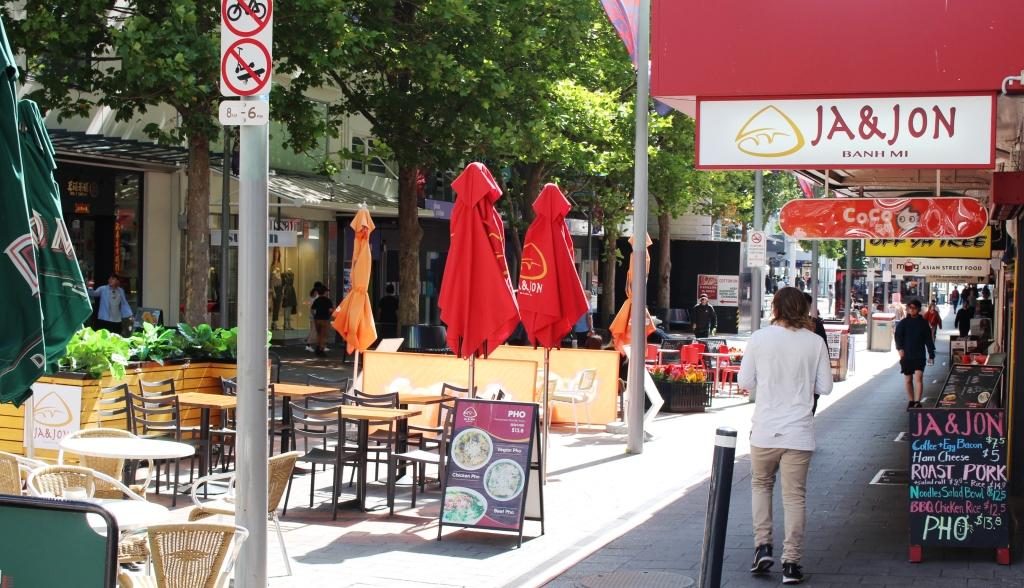
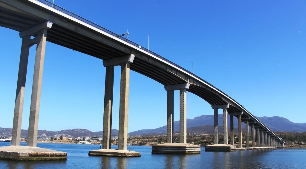
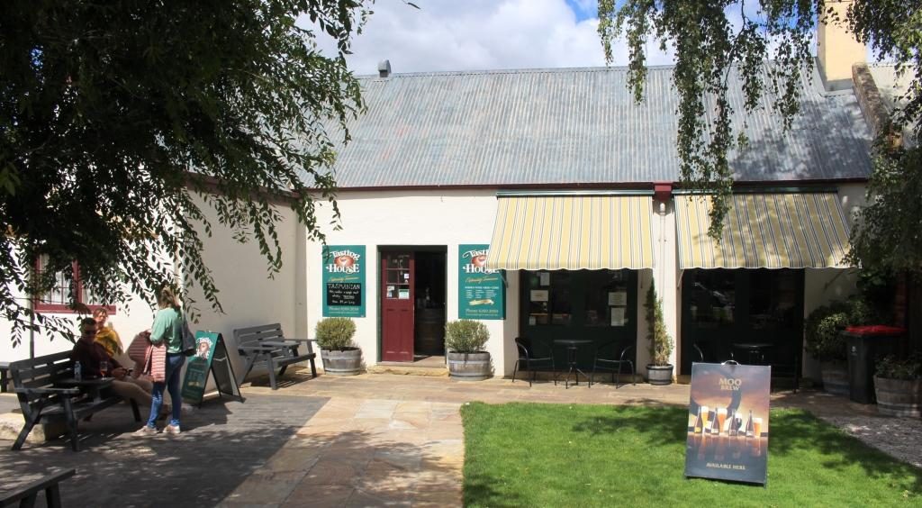
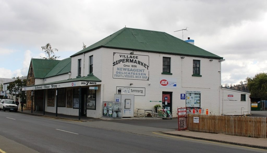
We then passed through Hobart, crossed the Tasman Bridge and made our way by an indirect route to Richmond, where we spent the night. It was on this drive that we came upon the little town of Campania to the north of Richmond, where we had lunch. The fare was home made pies and coffee, which we dealt with seated at a small table in the grocery/hardware/post office/coffee shop/service station.

A bronze casting of school children at the original state school at Campania near Richmond.

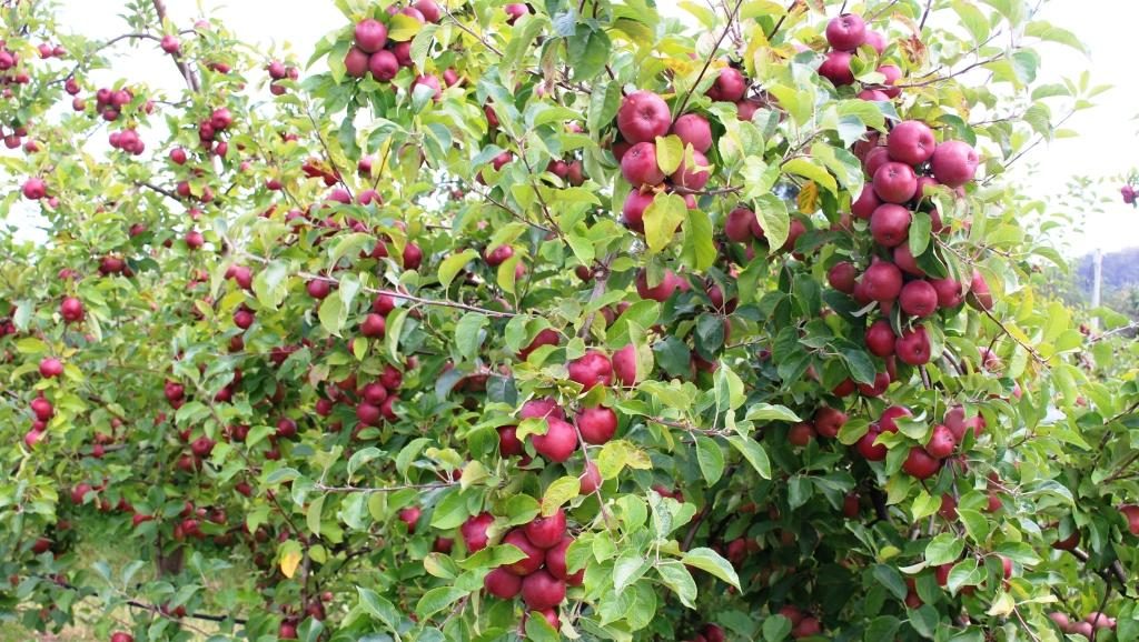
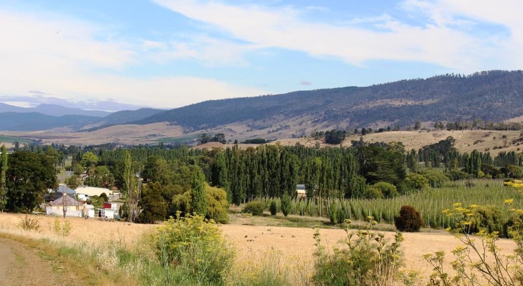
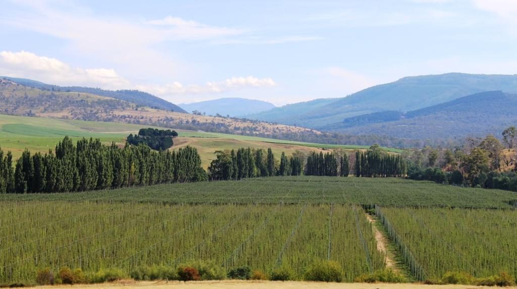
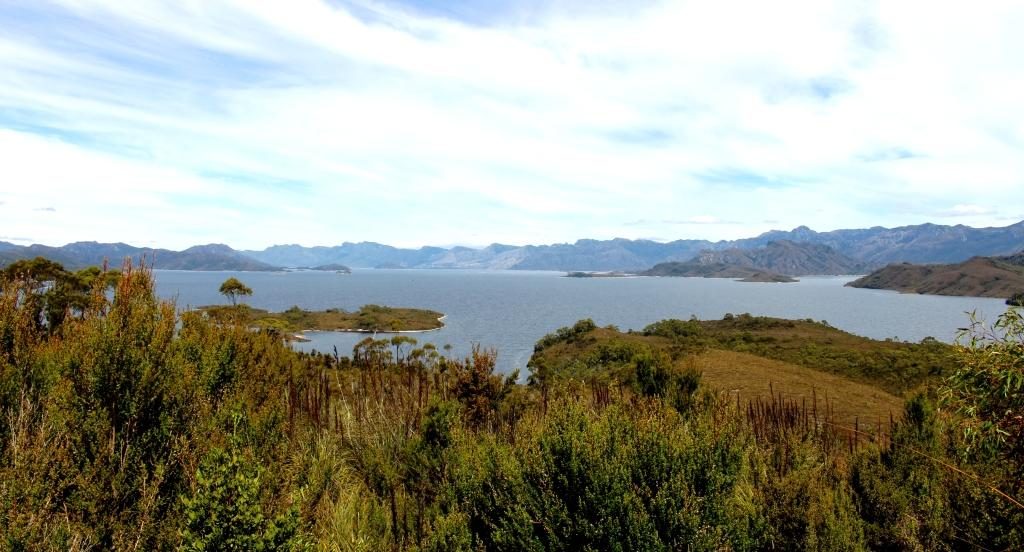
Our drive took us through areas of vineyards and fruit orchards, interspersed by broad areas of brown dead grass. The drought is about four years old in this part of Tasmania, but irrigation keeps the fruit and grapes growing. Some growers were busy placing white netting over their crops. I assume that the fruit was starting to ripen and birds needed to be kept at bay.

Prison precinct coffee shop at Richmond

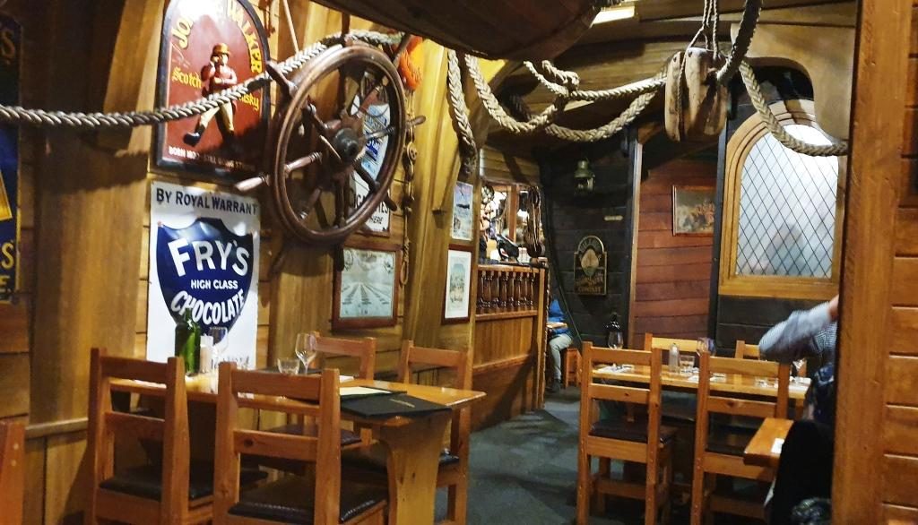
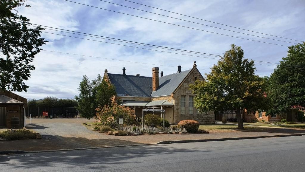
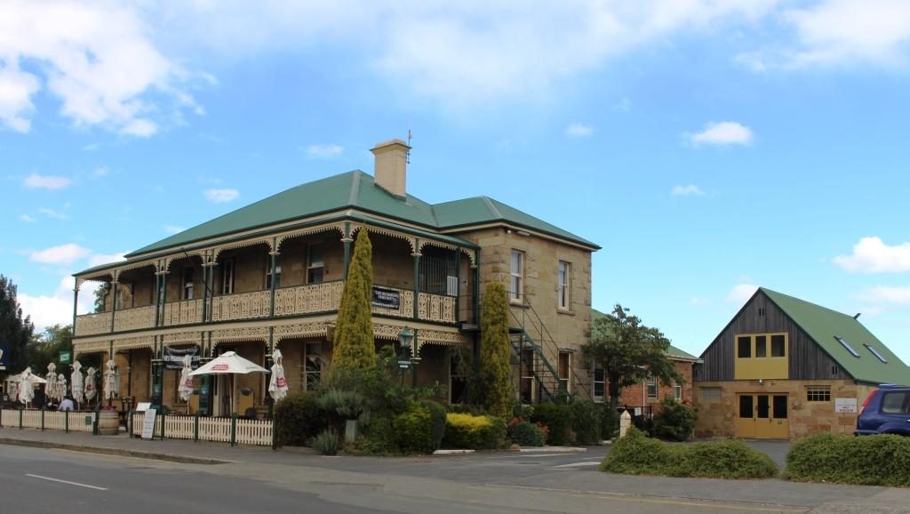
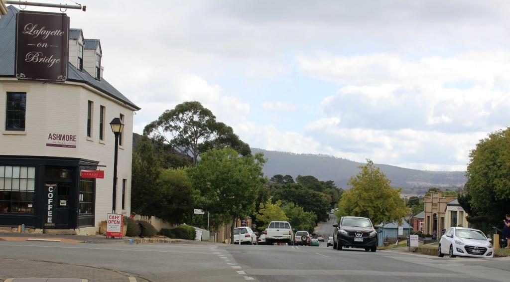
Had we come directly to Richmond we would have found plenty of places to have lunch. Historic buildings can be readily converted to purveyors of food and beverage.

A classic photo of Richmond Bridge.
Richmond Bridge viewed from the other side at river level.
St Johns Roman Catholic Church at Richmond.

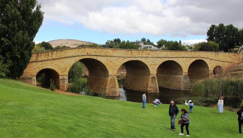
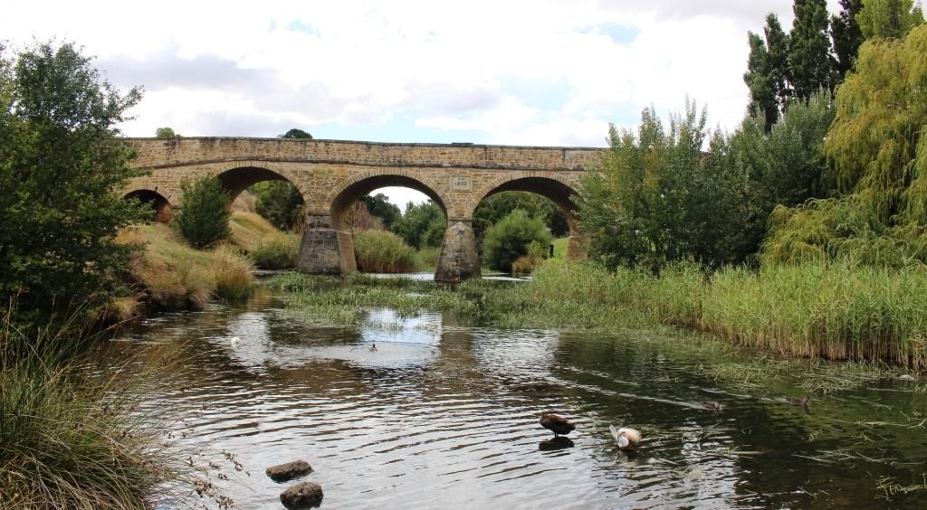
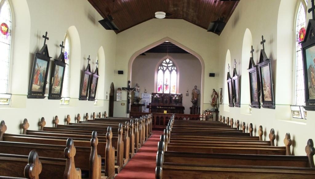
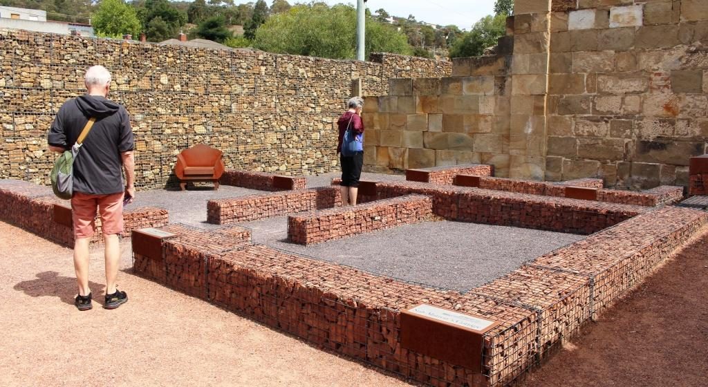
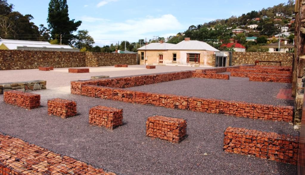
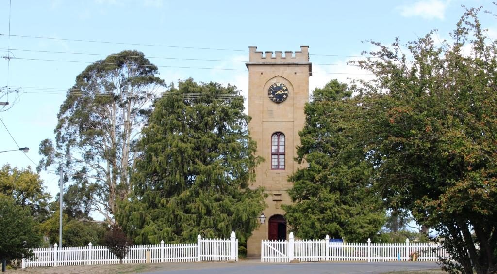
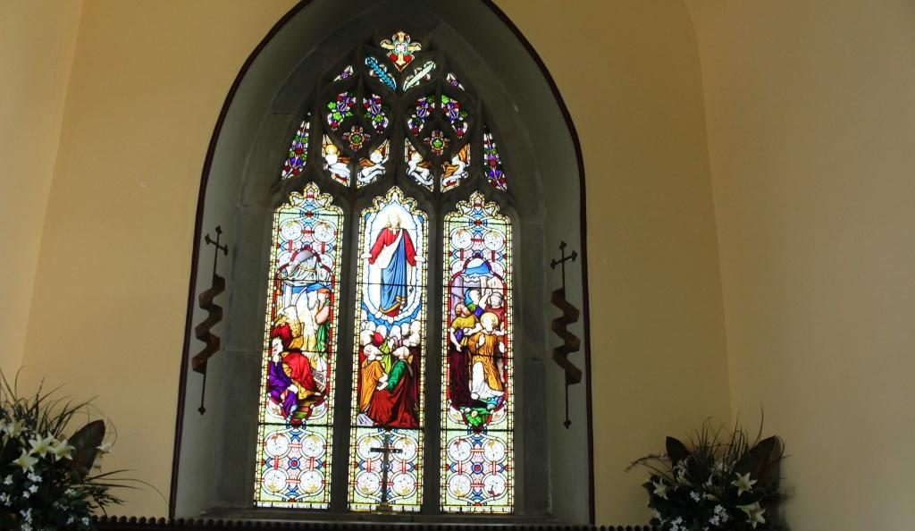
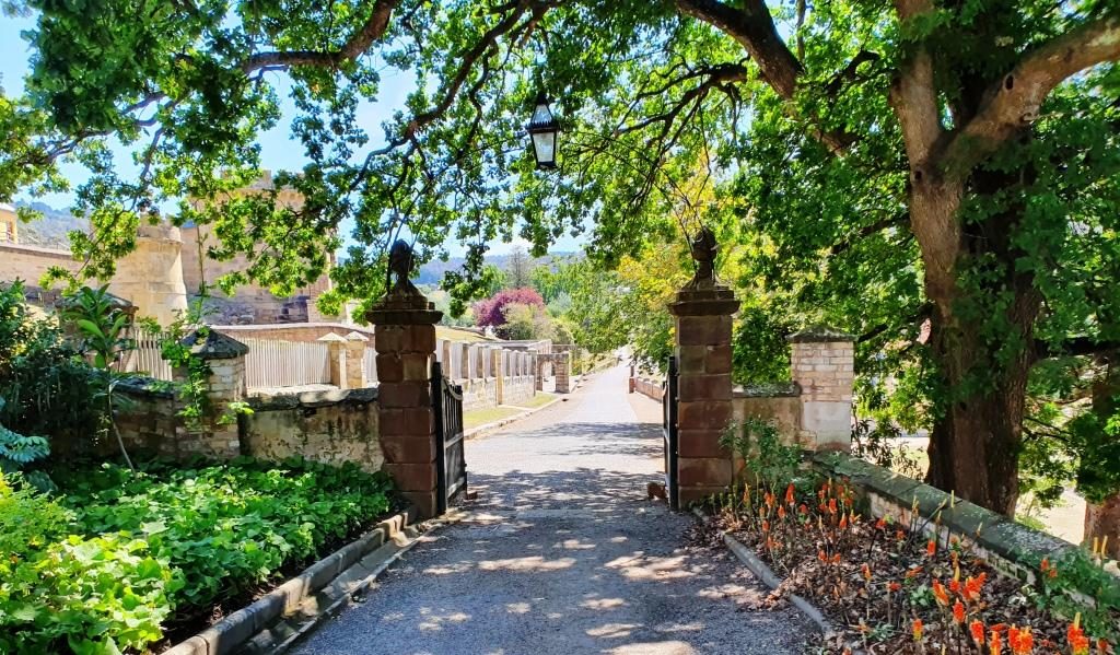
We took a look at Richmond’s historic bridge and walked, as well as drove, over it. We then looked in at St Johns Catholic Church (1836), just a short drive away, followed by a walk around the Richmond prison precinct.

An old building in the Richmond prison precinct converted to a retail outlet.
The original bakery has been modernised into an extensive Cafe and Coffee Shop.

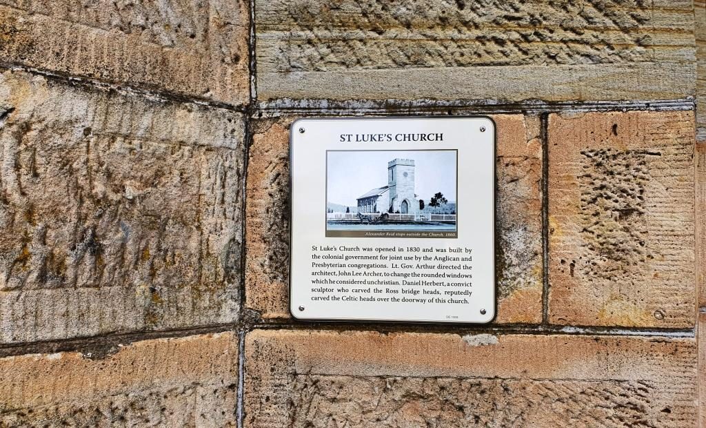
Ruth was beginning to be walked out so we checked into our accommodation. I returned to the historic precinct on foot and walked and looked and read and took photos. St Lukes Anglican Church is through the town on the other side of the river and a bit of a walk so it marked my turning point to return to the town area.

Our unit at The Barracks. It was called “The Retreat”.
St Johns Anglican Church, Richmond was built in 1834.
Stained glass windows at the sanctuary end if St Johns church

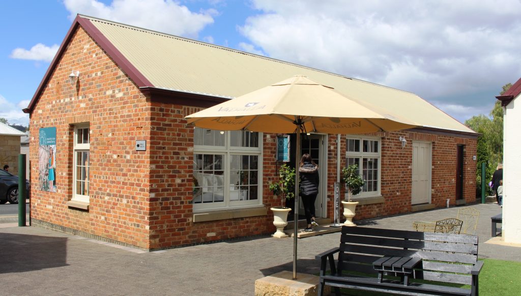
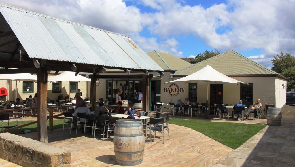
Richmond has a prison precinct that has been very well restored, with excellent use made of the old facilities. The prison itself remains largely unchanged and tours are available. As we were headed to Port Arthur the next day we didn’t tour the Richmond Prison. There are eating places within the prison area including a cafe in the original bakery.

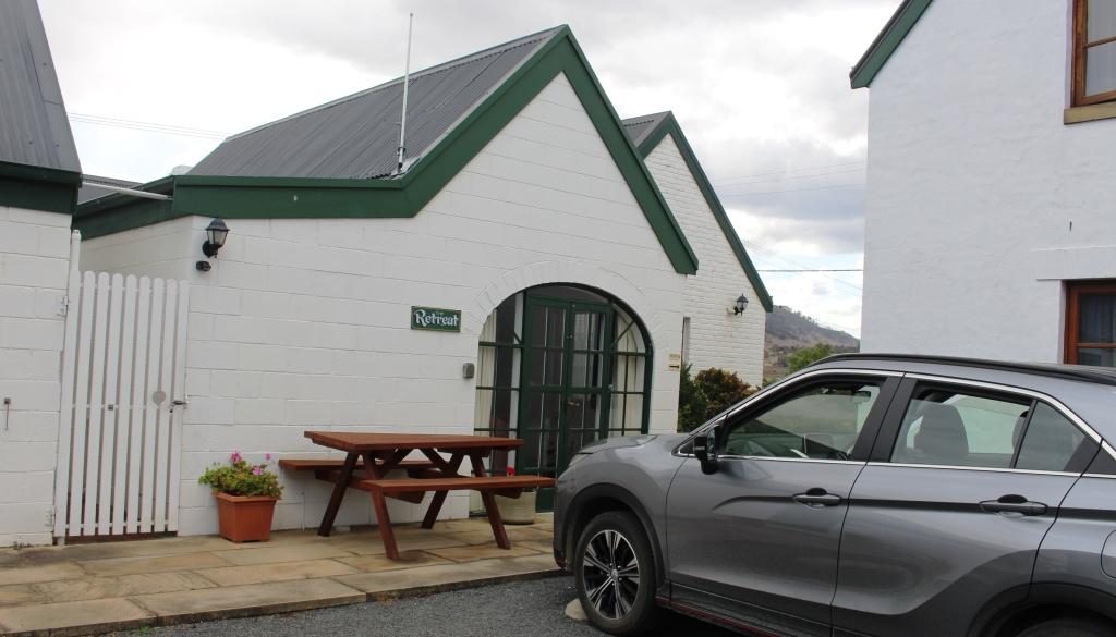
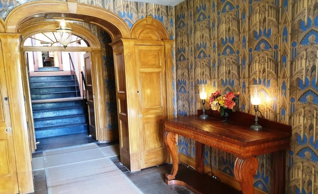
By the time that I had covered this area I was walked out too, so returned to the unit to put my feet up for a while.  Our accommodation was at The Barracks, small group of holiday units resulting from the renovation of old buildings. Very comfortable and well appointed.

The supermarket operates from a historic site.
Richmond Arms Hotel
The western end of Bridge Street, Richmond.

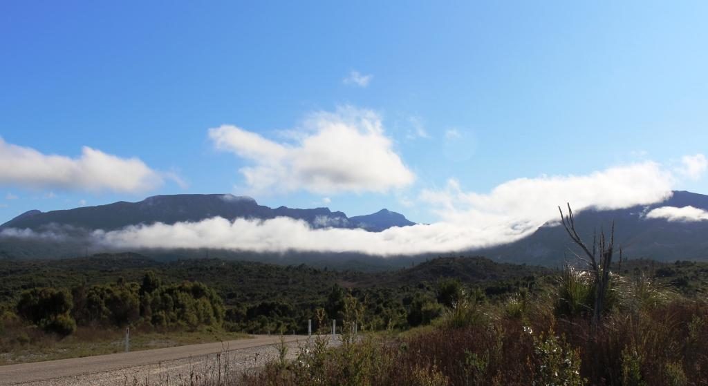
The following morning we left Richmond for Port Arthur under clear blue skies which remained, with a few clouds around the edges, for the rest of the day.

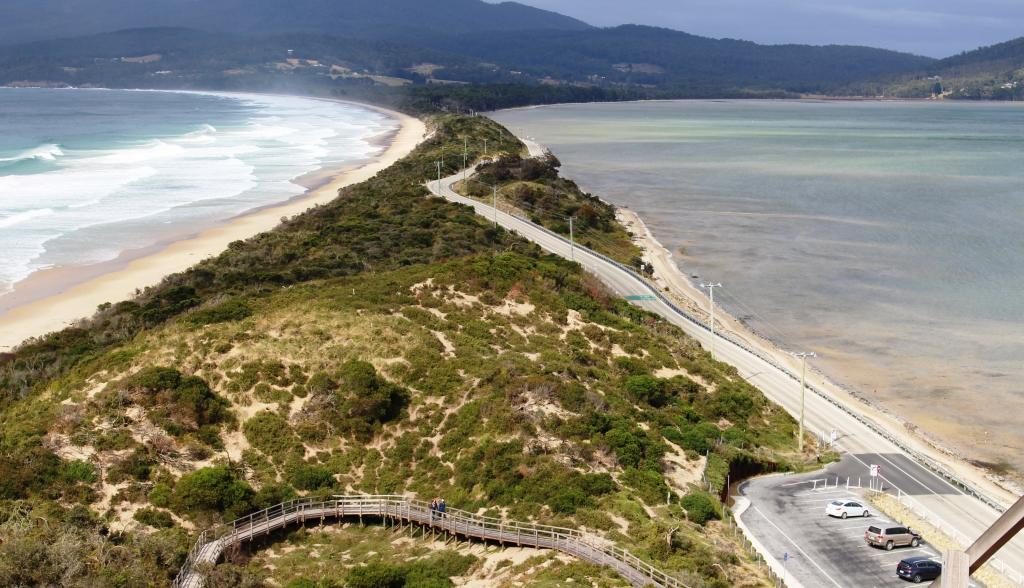
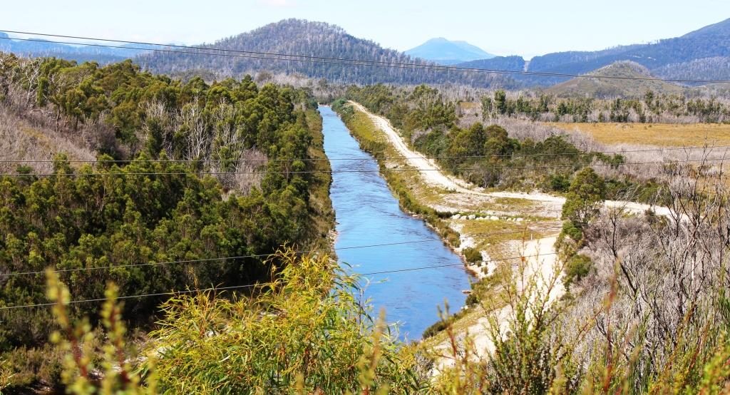
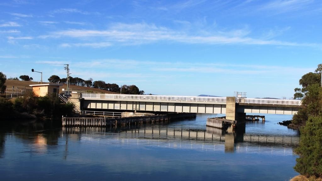
As we neared our destination we stopped to look at some touristy things. At Dunalley we checked out the canal that provides a short cut for smaller boats between Hobart and the east coast and it’s lift bridge. It seems to open on request from the passage making boat. This channel is quite short. The land to the south is almost an island. The protruding section of land that links the Tasman Peninsula to the Tasmanian main land is called the Forestier Peninsula.

The lift bridge on the canal at Dunalley.
The east coast at the northern end of the Tasman Peninsula.

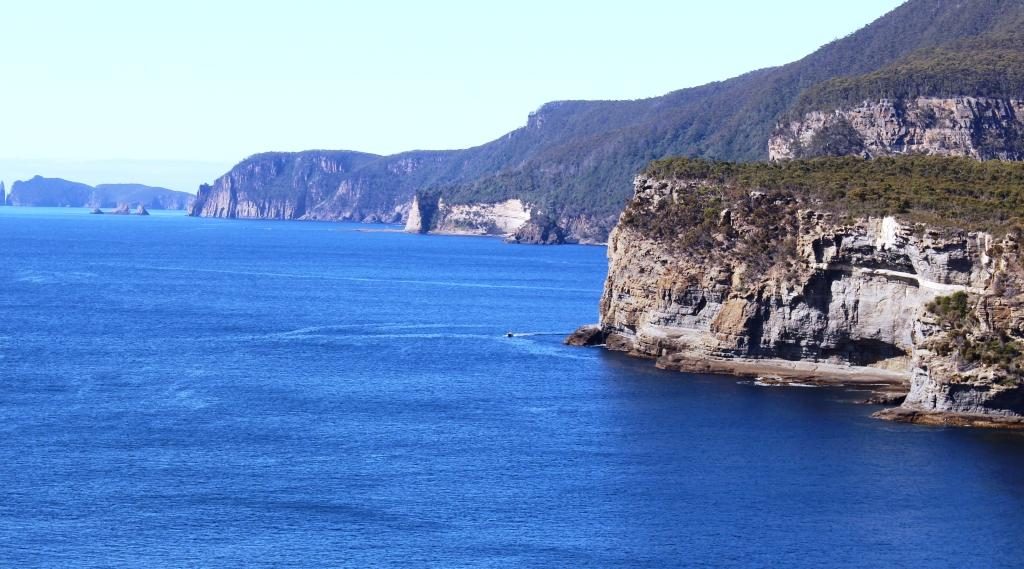
At Eaglehawk Neck, about 20 km further south, the same geographic phenomenon repeats, with Eaglehawk Bay, a long thin inlet from the west, almost joining the ocean at a short and narrow isthmus that leads to the Tasman Peninsula.

Tessellated Pavement at Eaglehawk Neck.

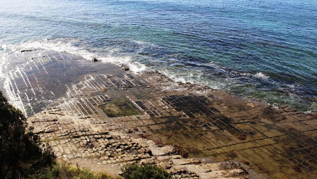
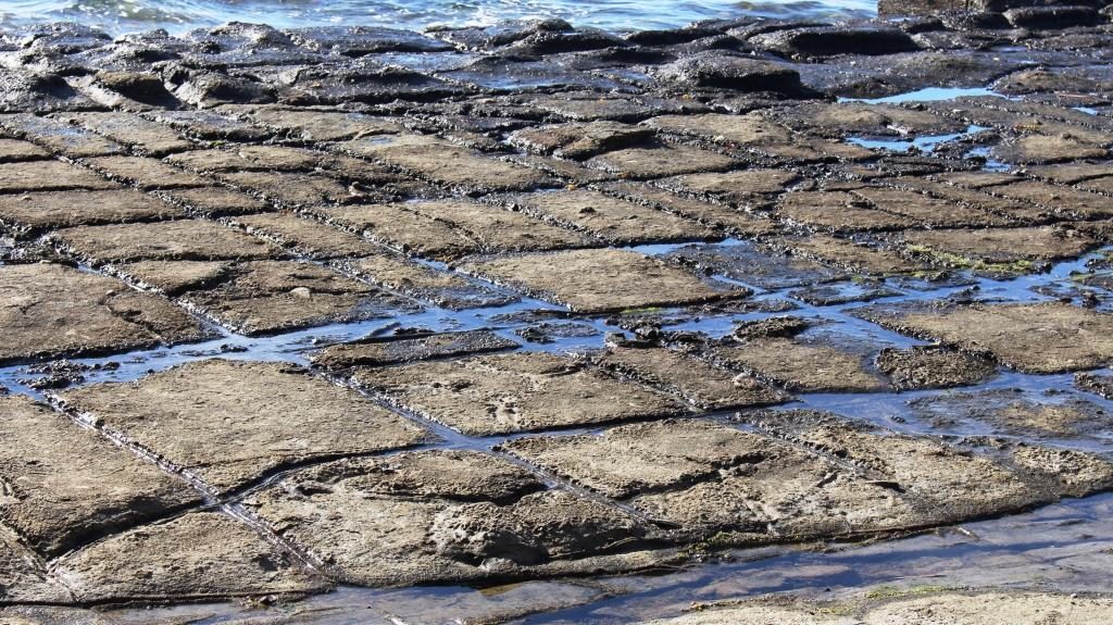
The Tessellated Pavement is reached from a road that turns just before the decent to Eaglehawk Neck, at the end of a drive of about 5 km. It is in the form of a broad shelf of rock that looks like an area of cobble stones.

The natural Tessellated Pavement has the appearance of laid cobblestones.

Tasman Arch and the Devil’s Kitchen are reached by a road that turns to the east after crossing Eaglehawk Neck and follows the ocean coast for another 5 km. The tide was low and the sea flat calm so there was nothing cooking in that kitchen. Because of the calm seas we didn’t worry about the near by blow hole. There would have been nothing to see there.

Tasman Arch from near to the car park. It is only a short walk.

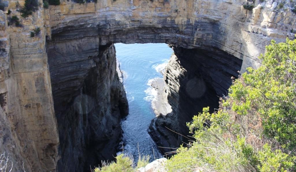
Tasman Arch is best viewed from the water and that was probably how it was first discovered. The view from the land is courtesy of a sink hole that is large enough to allow a reasonable view.

The road to Port Arthur turns west along the southern shore of Eaglehawk Bay for a while and then turns inland and runs across the eastern part of the peninsula to Port Arthur.

Port Arthur Visitor Centre with ruins in the background

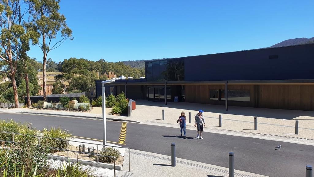
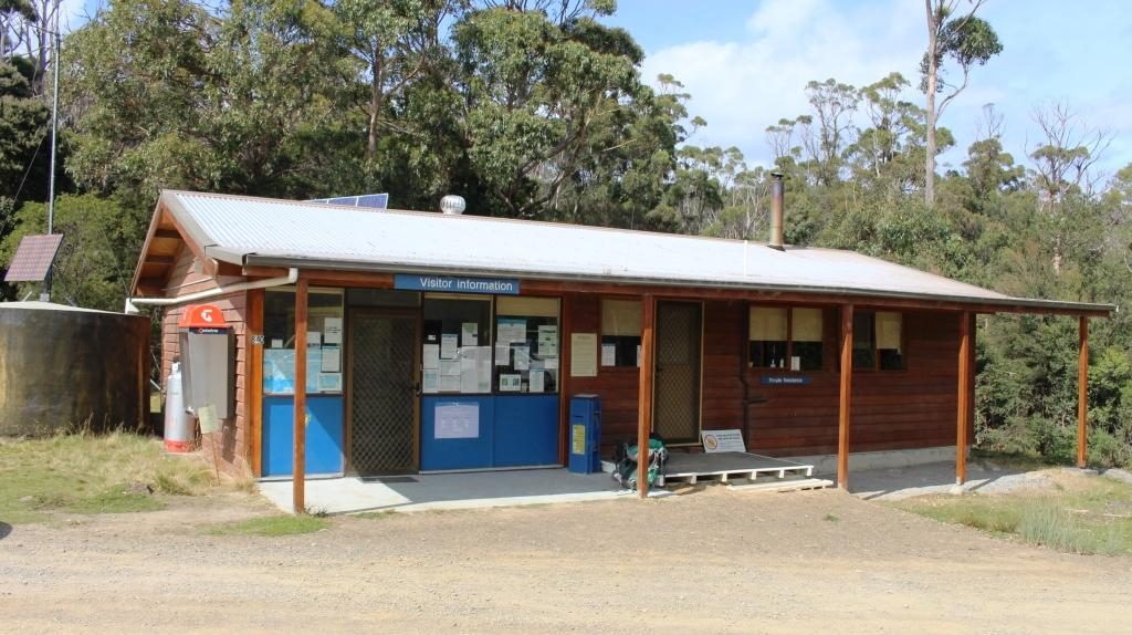
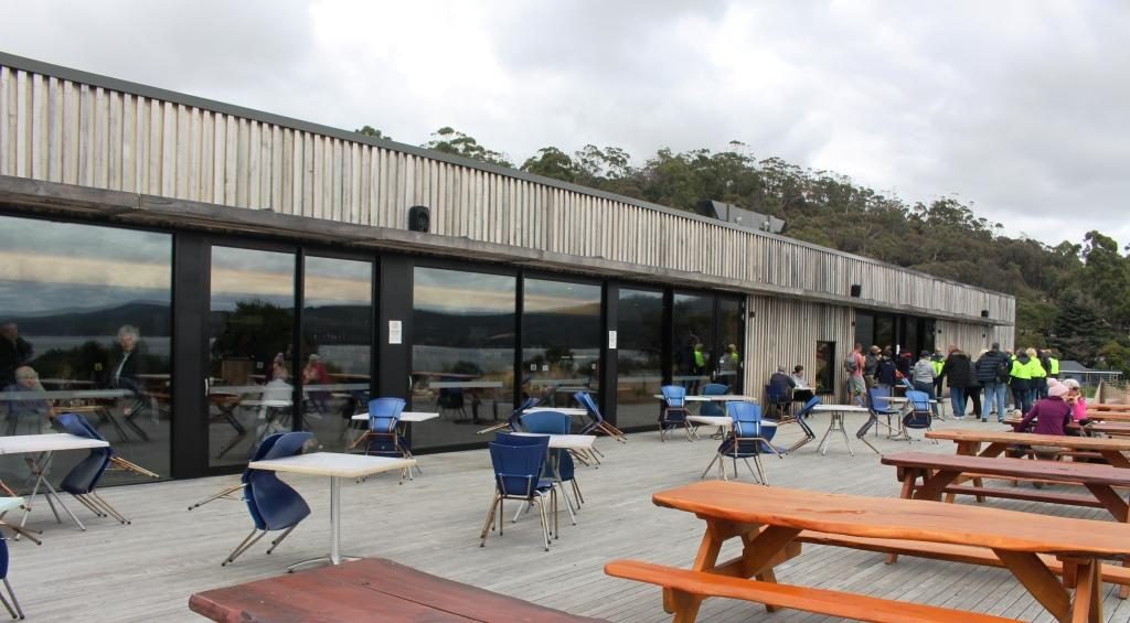
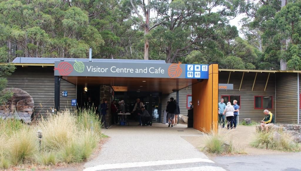
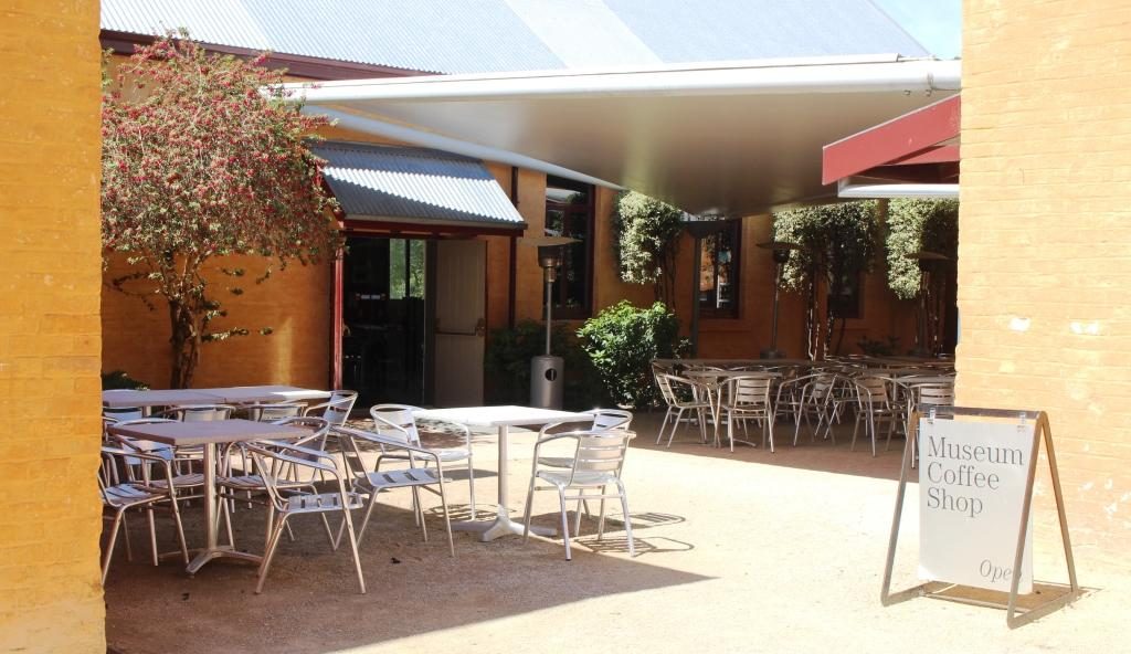
We were last at Port Arthur about 45 years ago. The changes are significant. One of the most important is the huge visitor information centre with it’s displays, cafe, restaurant and the ability to handle large numbers of people. Port Arthur is a very popular attraction and included on most package tours to Tasmania’s south.

Our group listening to the guide.
The Penitentiary. The hospital can be seen behind at the right. The Commandant’s house is at the left with the Guard Tower between it and the Penitentiary.

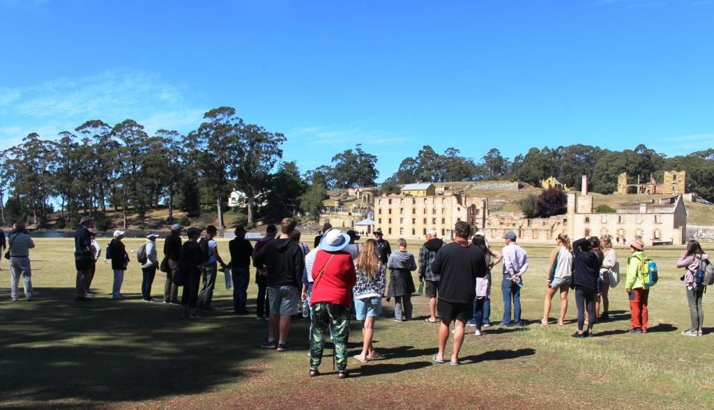
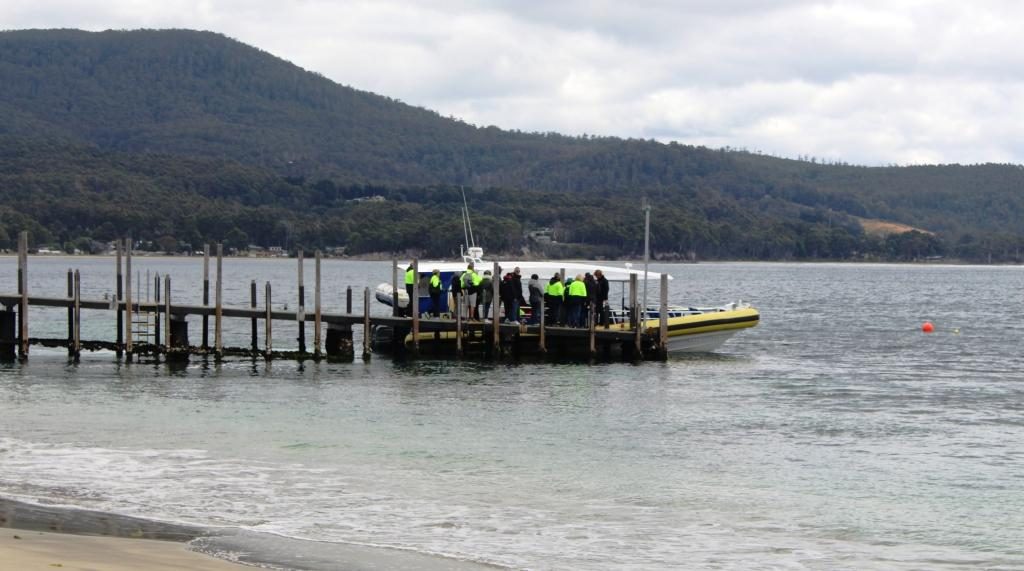
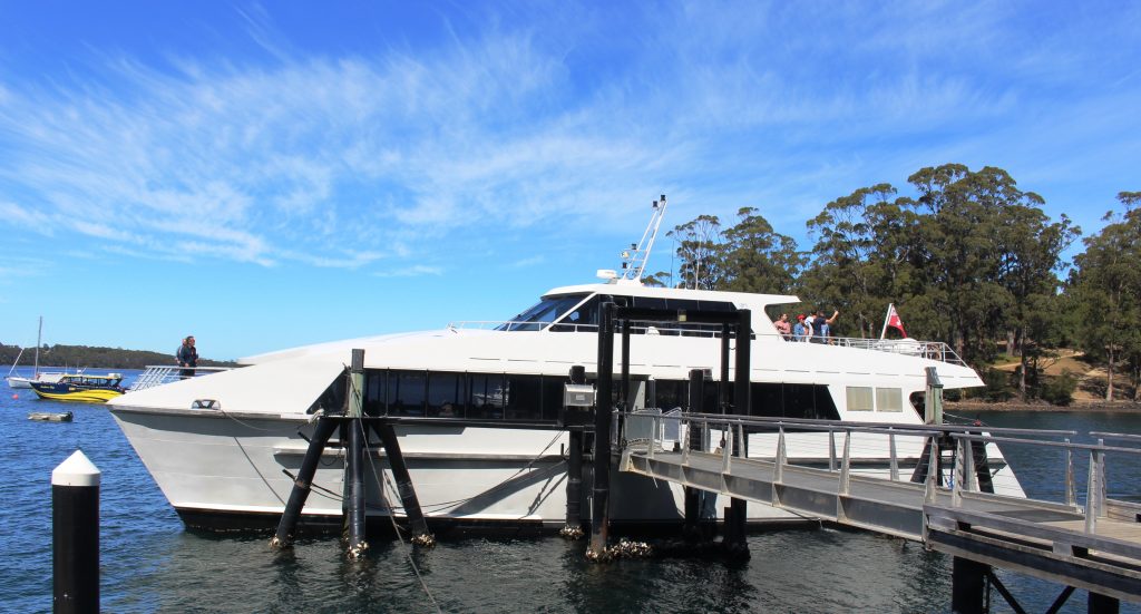
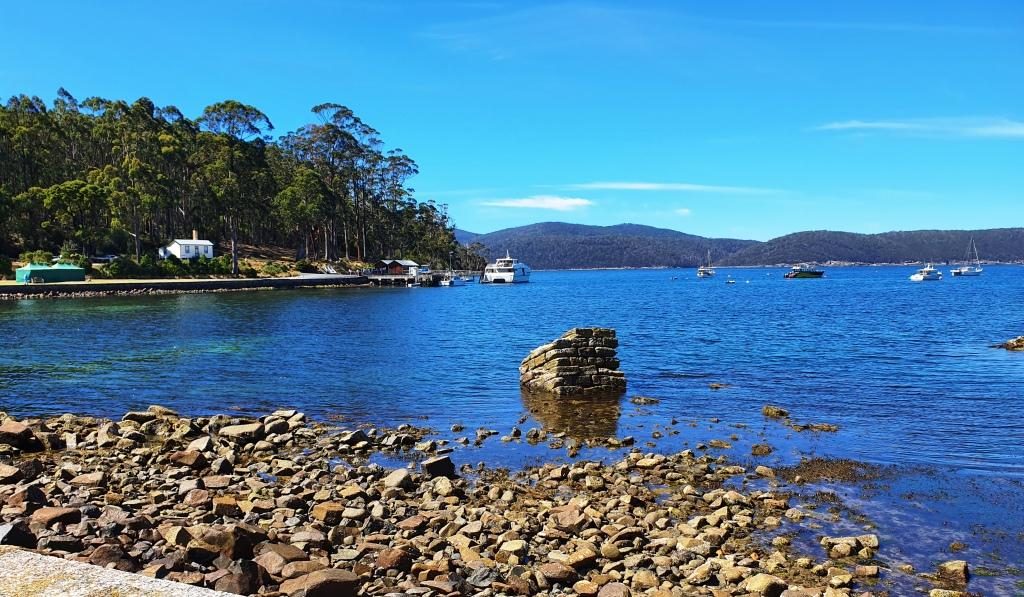
Forty five years ago the portion of the convict prison open to the public was much smaller than it is today. The admission ticket ($32.00 each for seniors) allows two days to see it all. An historical enthusiast would easily spend that much time if they stopped to read all the signs and study the exhibits.  We had but one day and ageing legs. We covered the main penitentiary building and the area furthest from the water, where the separate prison and the asylum are located. We then joined a cruise on Mason Cove and the port of Port Arthur. The cruise is included in the ticketed cost.

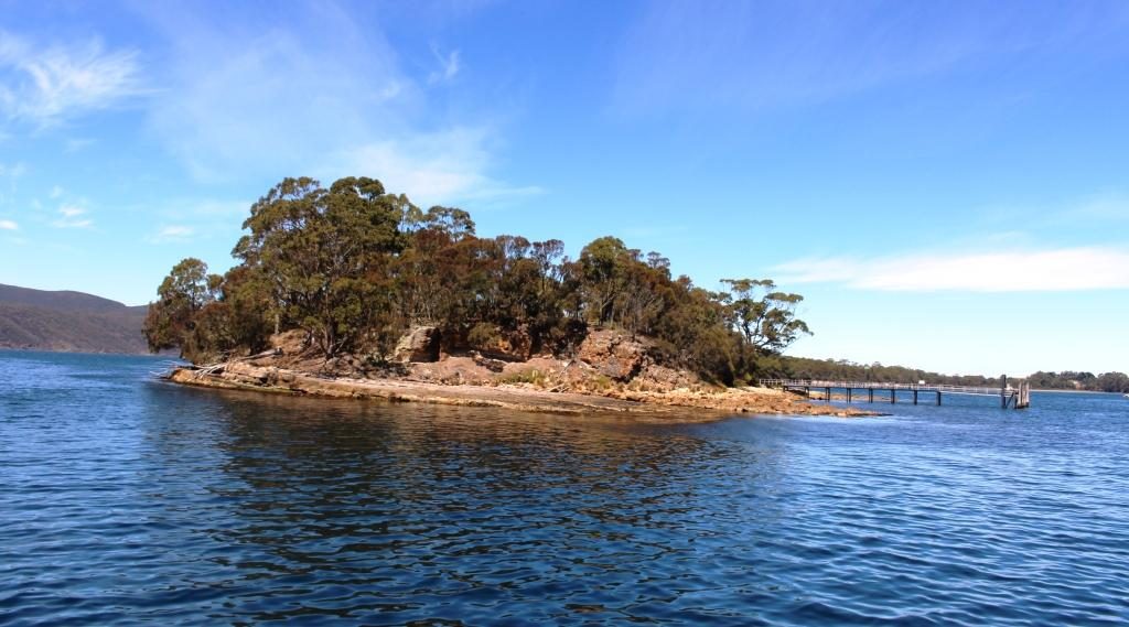
The cruise passes the old ship construction slipways, the site of the now nonexistent boys’ prison and the Island of the Dead, the penitentiary cemetery. Visitors may land on the island and be picked up by the next tour boat. We stayed on board and completed the tour before going back to the visitor centre for lunch.

The Island of the Dead cruise boat. The short tour is included in the admission price.
The Island of the Dead, Port Arthur cemetery.

Tour guides tend to emphasise the cruelty to which inmates were subjected, but it happened over 150 years ago and was not abnormal for those times. The intention was to rehabilitate as well as punish. During the life of Port Arthur as a convict settlement, methods changed when existing practices were found not to be working. Unfortunately they were often replaced by something else that didn’t work. Rehabilitation of errant humans is not easy. Western society still has not got it right if re offending rates are any indication.

The Asylum was built in 1868 when it was found that incarceration methods were sending prisoners mad..
The cafe at the Asylum provides an alternative to the walk back to the visitor centre for refreshment.
The Government Gardens
The church at Port Arthur demonstrates the important part that religion played in the reform of prisoners.
Up to 1,100 people would attend church on a normal Sunday.

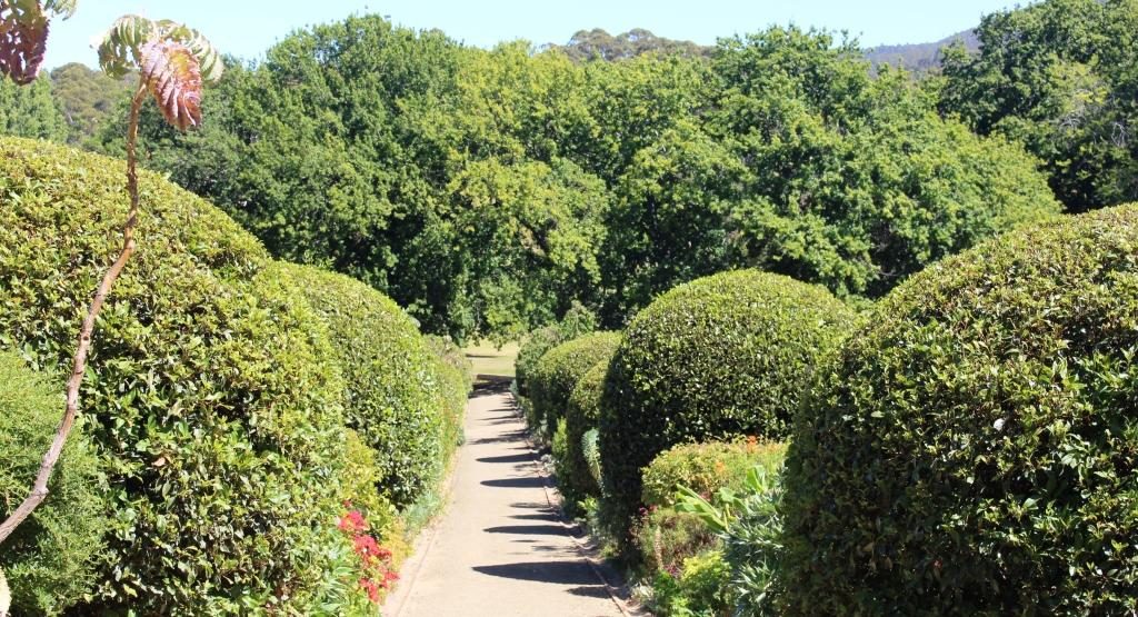
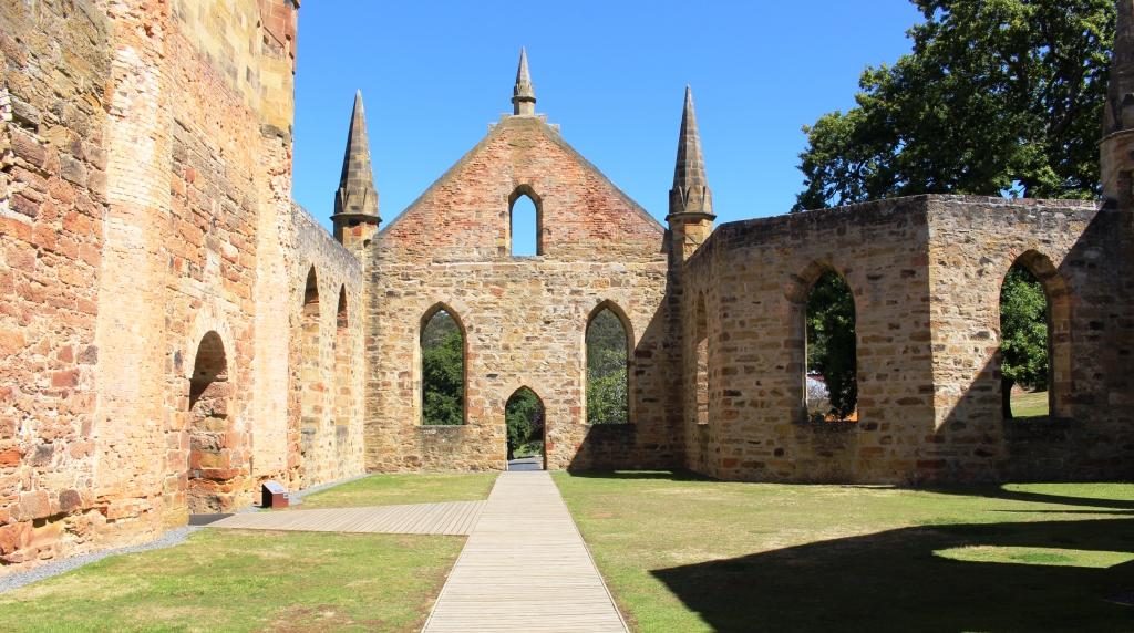
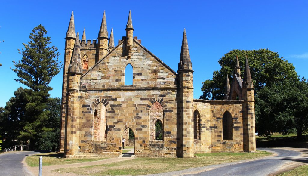
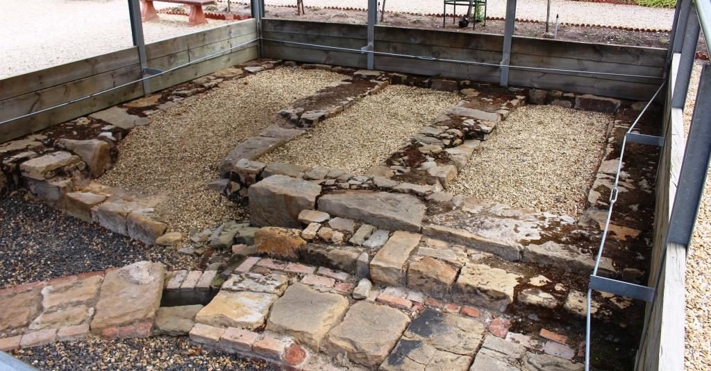
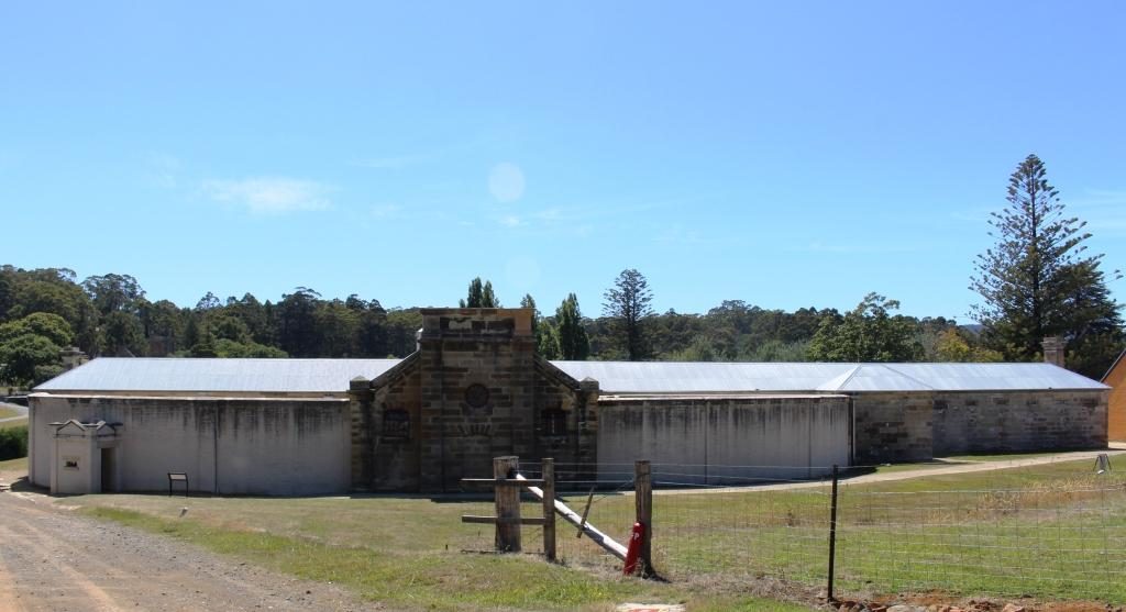
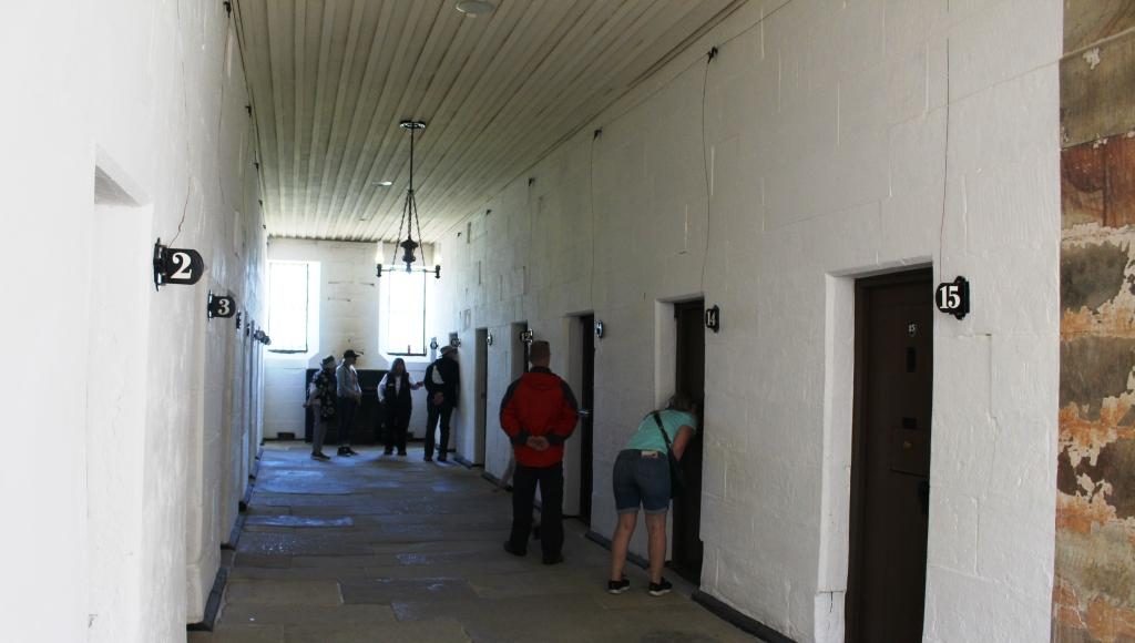
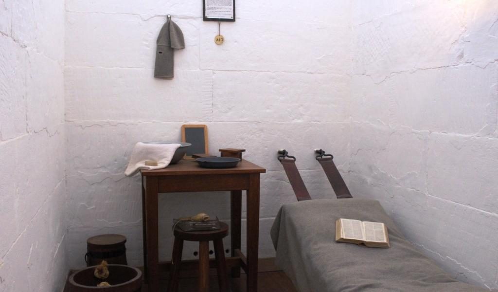
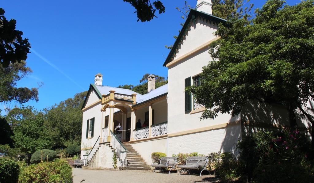
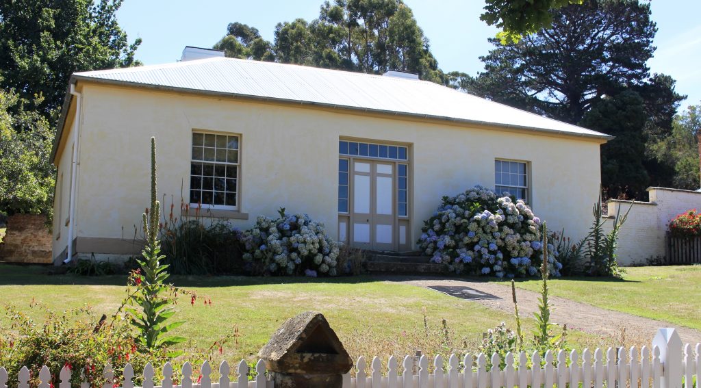
Ruth was done with walking so stayed at the visitor centre while I went back to walk through some other areas. I did the garden and the government cottages, the ruins of the church and had a closer look at the Separate Prison (where prisoners were known by a number and lived in solitary confinement), and the Asylum (needed for all the prisoners who went mad from solitary confinement).

The front of the Separate Prison faces away from the remainder of the convict area at Port Arthur.
A prison cell wing of the Separate Prison.
A typical cell for one prisoner.
Seating in the chapel was designed to keep prisoners separated during worship.

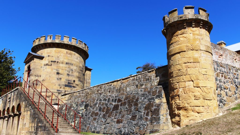
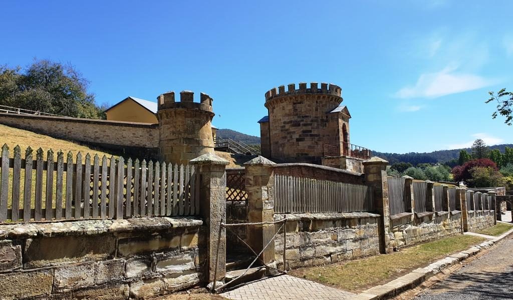
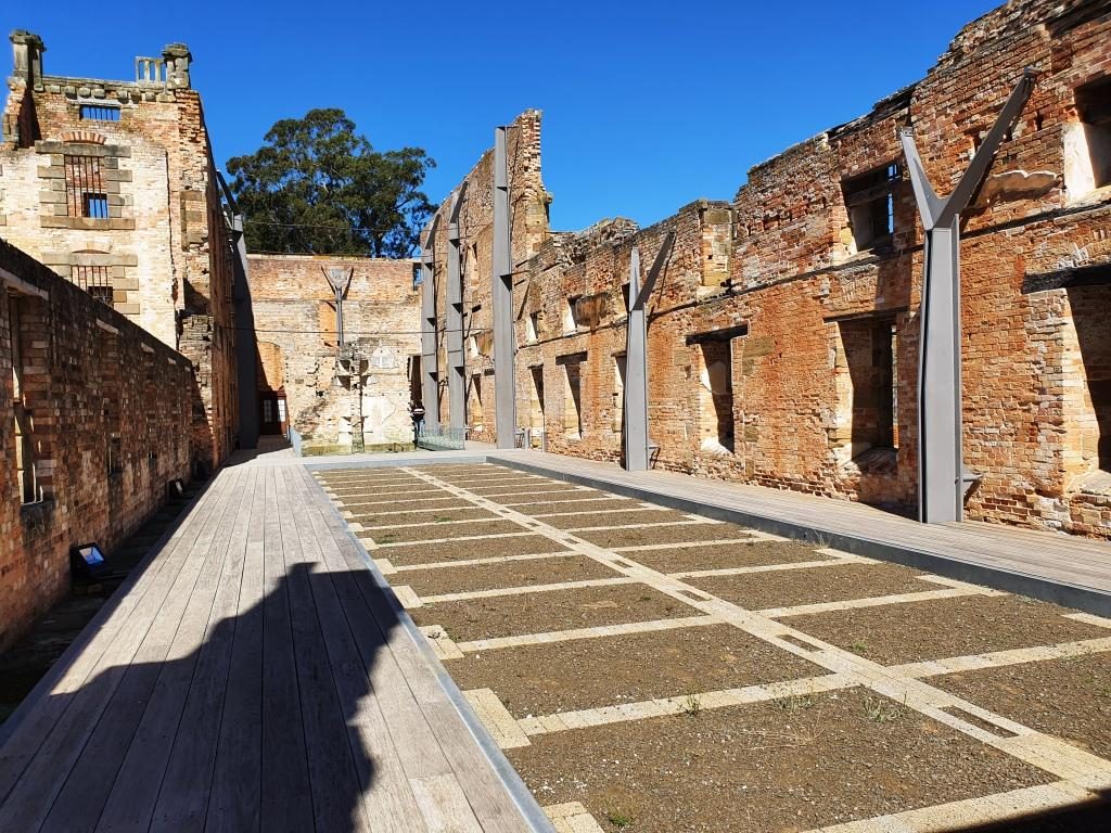
I then climbed through the ruins of the hospital, the guard tower and military accommodation areas, the commandant’s house and finally a detailed walk through the penitentiary. Quite a bit of walking.

The police station with the hospital in the background to the left.
A front view of the hospital, built in 1842. The house at the back is Smith O’Brien’s cottage. O’Brien was an Irish political prisoner who had been transported for life.

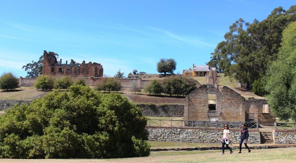
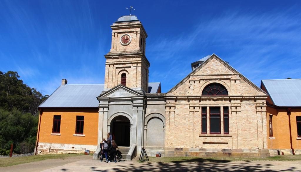
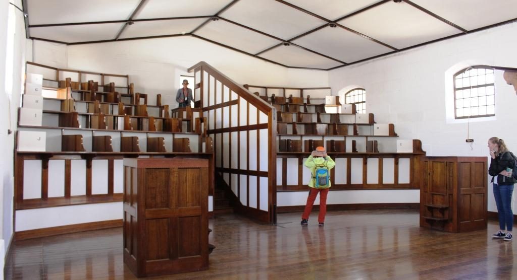
Ruins of the guard tower and the military accommodation remain sufficiently intact to give a good idea of what was there originally. The court house is in the same vicinity, straight across the street from the penitentiary, the place from which most prisoners would be brought to appear before a magistrate and the place to which they would be returned, but possibly to a different section, depending on the sentence.

The Guard Towers
The guard towers with soldier accommodation at the rear.
The Port Arthur Court House
View of Mason Cove from the court house. The ship building slipways are past the cruise boat wharf.

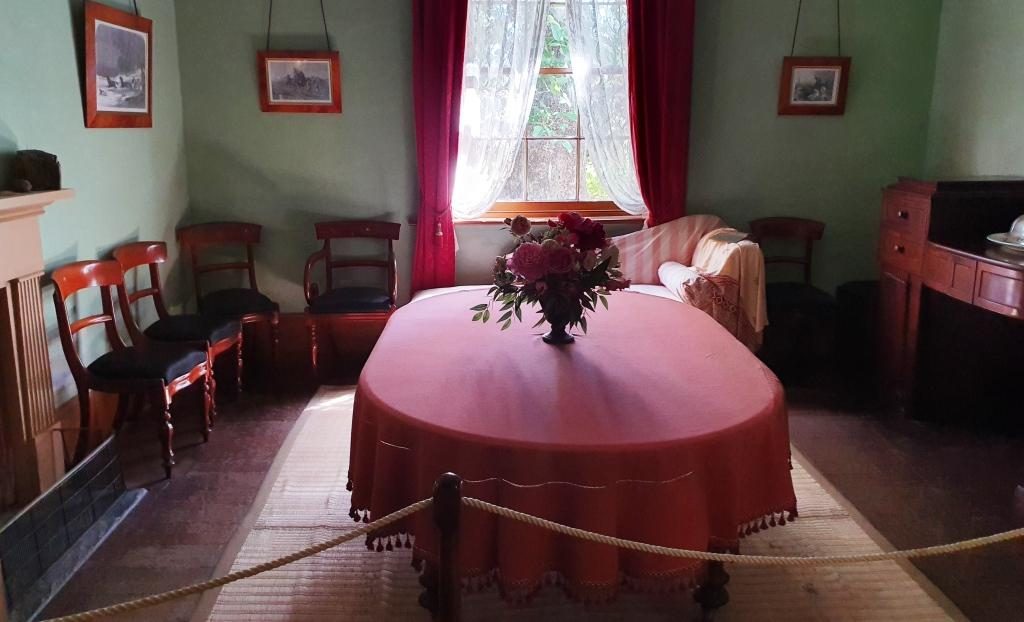
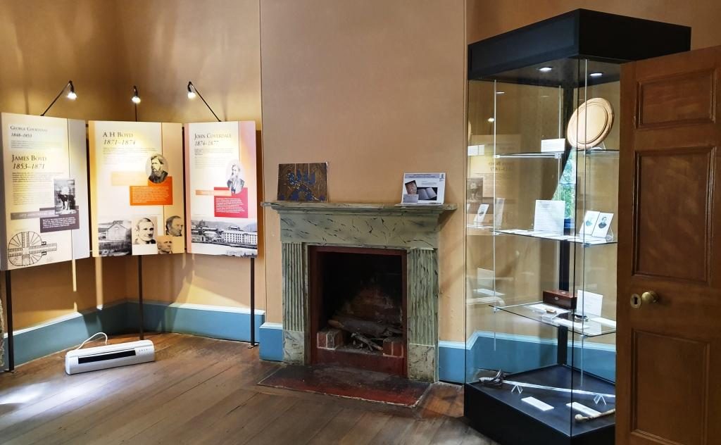
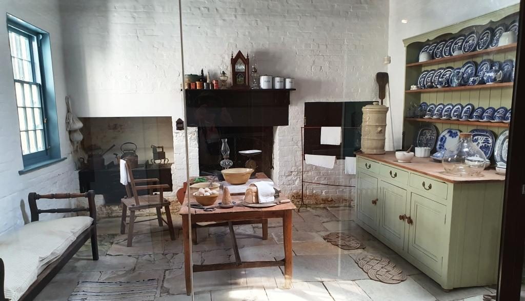
The commandant’s house contains furniture that is either original or represents the period. Many rooms are set up as they would have been when occupied by it’s residents. Other rooms contain displays, rather like a museum. There is a display of information signs providing details of commandants, governors and other figures of authority.

Entry to the Commandant’s house
The formal dining room
History and information displays in one of the formal rooms.
The kitchen
The house steps up the hill. This is the stair way to the second level.
Departing through the access gate from the grounds to the commandant’s house.

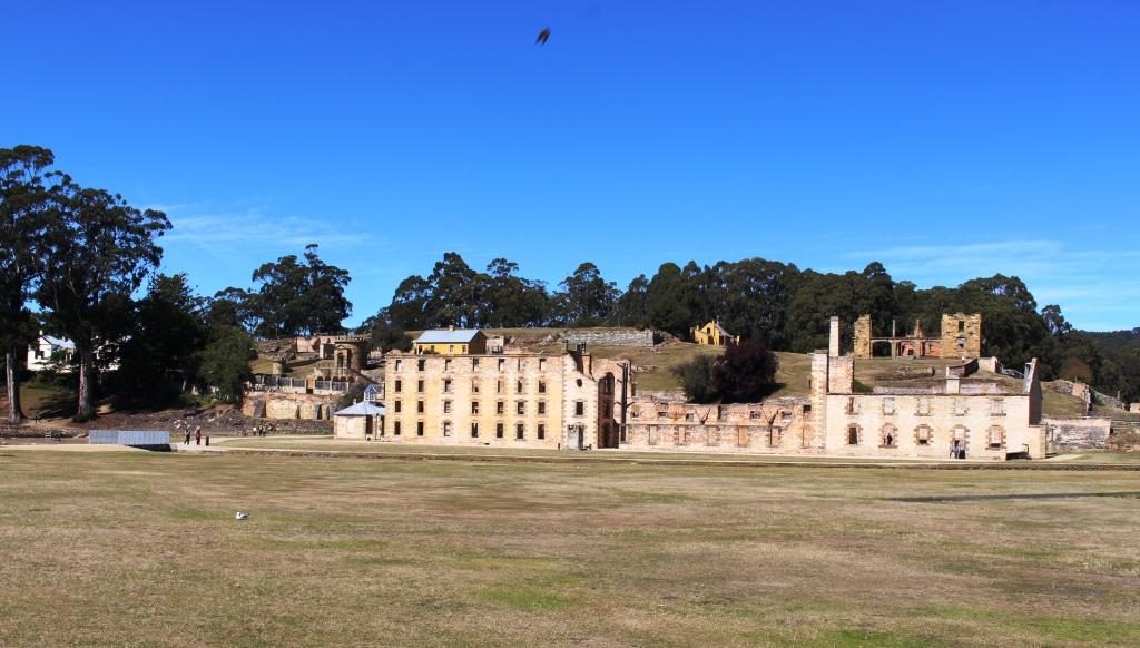
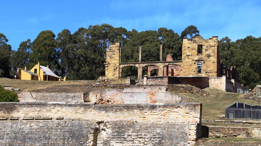
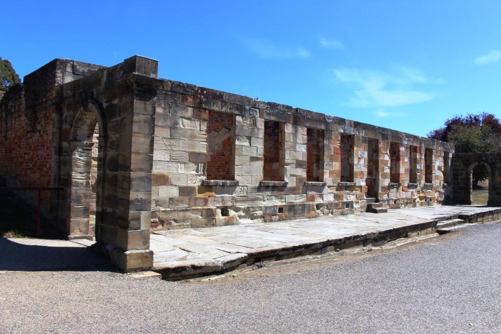
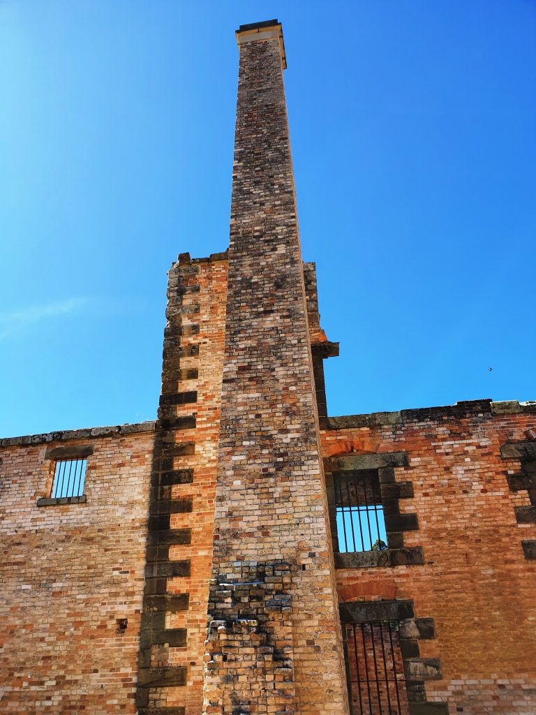
The penitentiary was built in 1845 as a flour mill and granary, with the flour mill powered by water wheels, or prisoner operated tread mills, when water flow was insufficient. To be assigned to the tread mill was one of the most harsh punishments available. You can just about imagine the convicts praying for rain.

Barred windows of the penitentiary cell block
Partly demolished walls.

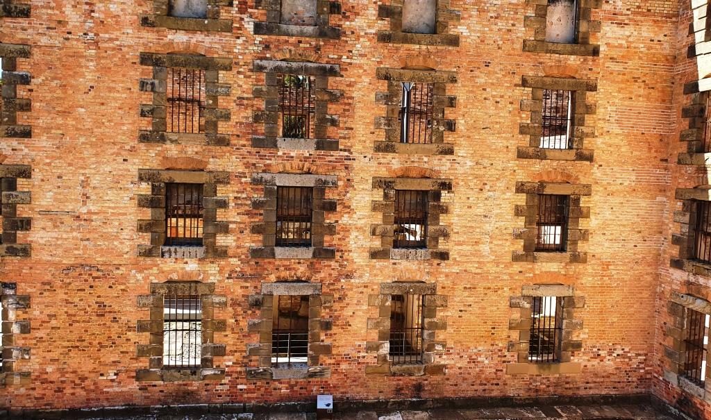
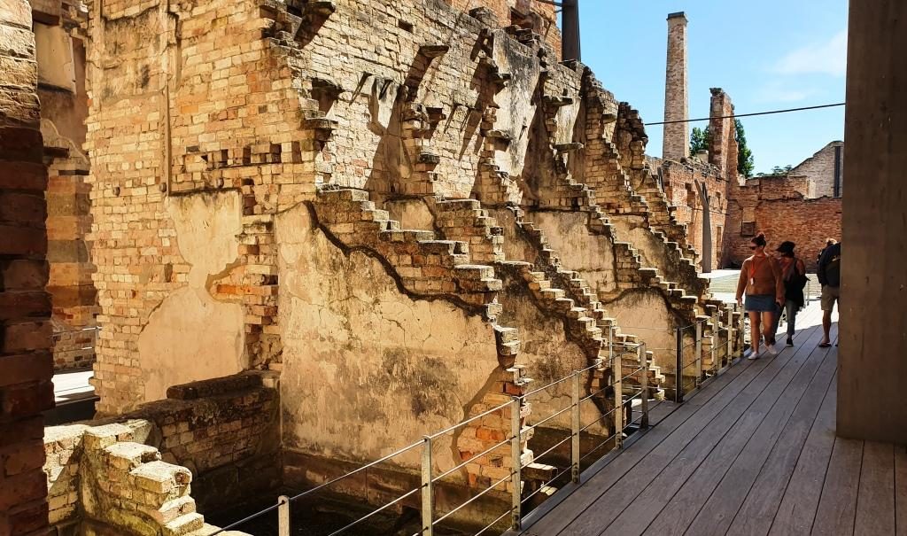
Competing demands for resources saw the flour mill closed in 1854. The building was converted to convict accommodation, completed in 1857. It was closed in 1877 and largely destroyed by fire in 1897. The ironwork that secures the outer walls that still stand is obvious and necessary.

The fire gutted cell block showing the lay out of the cells. The walls are supported by steel reinforcing.
The prison chimney.

When you pay your entrance fee you are each given a card bearing the name and likeness of a person who was at Port Arthur. You then go downstairs to the gallery, find the likeness on a wall and pull out a panel to read the detail.

A slide out display exists for each person who was permanently at the convict prison. This is the wife of the accountant who’s name that I chose. His details are on the other side.

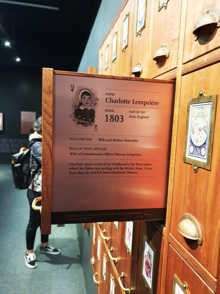
The character that I received was the accountant at the prison. Ruth got a character who, in England, lost his pension, threw a stone at the King, was charged with treason and transported. At Port Arthur he refused to do the King’s work or eat the King’s food so starved to death. As I walked I took particular notice of the accountant’s house.

The accountant’s house.

We were booked for the night at a place part way up the East Coast called Little Swanport. If I had realised how close we would be to Richmond on the drive we would have booked there for two nights. We wish we had done so.

We had done well with our accommodation arrangements so far but bombed out that night. The place was clean, tidy and comfortable, but inadequate. Windsong described itself as a B & B, but it was 5 km off the highway. The turn is near the community hall that calls itself Little Swanport and 15 km from the nearest source of nourishment. The host, Tom, who checked us in and told us to call if we needed anything had disappeared when I went to look for him to see if we could arrange an evening meal.

The table is set for a three course dinner, including wine glasses, but no stove or microwave to cook with or sink in which to wash our dishes and no tea towel to dry them. We had bread and food to make sandwiches, even a toaster, so we didn’t go hungry. But it did seem a bit odd. A continental breakfast was in the room for next morning.

A morning visitor at Windsong at Little Swanport.

Destination Tasmania – Part 7 – Huon Valley & Bruny Island

19th & 20th February 2020

Please Note: Videos covering the material in this blog post can be found at the bottom of the post.

The objective that day was to travel to the furthest point south on our trip and the furthest south ever, in a lifetime of travelling. To better the day’s effort we will need to go to New Zealand, South America or to the Antarctic.

Cockle Creek flows into Recherche Bay near the southern tip of Tasmania.

Go to Google Maps or I maps and enter Cockle Creek, Tasmania. That’s where we were headed, as far south as we could drive in Tasmania. There is not much of Tasmania south of Cockle Creek, is there?

We had rain overnight, both while we were out to dinner and while we were sleeping. It was drizzling as we loaded the car and a brisk 13C. It dropped to 11C as we drove south, drove inland and climbed a bit, but the day improved and was sunny by lunch time. The mercury probably struggled to about 16C by mid afternoon, depressed by a cold breeze from the ocean.

Southport bay and jetty. It was as cold as it looks.

We left Sandy Bay and used the Southern Outlet to Kingston and then went inland on the Huon Highway. Once we reached Huonville and crossed the bridge, the Huon River was to our left and remained there until we turned inland again. We returned to the water at Southport.

Southport Hotel has a caravan park at the rear.

Southport is a short detour from the main road. It has only a tavern with a caravan park attached by way of commercial facilities. The houses in the area mostly occupy high ground with water views, so are probably mostly holiday homes. We sat in the warmth of the car for coffee, which I made on the top of a post. Picnic facilities are scarce in Tasmania.

Day visitor facilities at Cockle Creek

Southport to Cockle Creek is about 30 km, 20 km of which is fair quality gravel. The rest is sealed. There are a couple of small hamlets overlooking Recherché Bay and then a succession of free camping areas, each with at least one toilet. At the end of the road is a more substantial area with a volunteer caretaker and individual camping spaces. It is a very attractive location. Had we still been caravaning we probably would have stopped there for a day or so.

Cockle Creek visitor centre has a resident volunteer caretaker during the tourist season.

We drove as far as we reasonably could without a 4WD vehicle. In turning to find a spot to park so that we could look around, I forgot about the whale lookout and its bronze whale sculpture, produced by the sculpturer mentioned in our post of the Central Highlands. Bother! Now we will have to go back one day. We would be happy to do that, actually.

On the return journey, we paid more attention to the towns that we had passed through on our outward journey. Of these the most significant are Dover, Geeveston, Port Huon, Franklin and Huonville.

The residential coastal strip at Dover.

Dover is an oyster port. Geeveston calls itself the “Timber Town” and seemed to be a busy centre. We stopped there for lunch. There is a timber themed park not far away but it has been closed since it was damaged by bush fires last year. There are also national parks and caves in the area.

Oyster sheds and wharf at Dover.

Port Huon has a substantial wharf which is now a service area for the numerous salmon and trout farms in the Huon estuary. A salmon industry support boat that we had seen in Hobart on Monday, was at the wharf as we passed.

The vessel on the left is the Tuna support vessel berthed at Hobart. The ship on the right is a French Antarctic expedition vessel.

Franklin appears to have been the major river port in the days before road, when supplies came from Hobart by boat. The town is host to the Wooden Boat Information Centre. The Centre is just what its name suggests but also conducts a school of wooden boat building. Visitors can look through glass partitions to watch ship wrights in action.

The Wooden Boat Centre at Franklin.

Tasmania conducts a wooden boat festival every other year, based at Franklin. This was an off year. If the festival had been on this year we would have tried to fit it into our itinerary.

Day sailing sail boat at Franklin wharf. The Huon River is wide at this point.

Huonville is the major town in the Huon Valley and is by far the largest. The Huon River is a broad stream where the road crosses it south of the town and broadens further into a substantial inlet, as it nears the sea.

Apples almost ready to pick. I resisted the temptation to sample one.

The Huon Valley is still a major fruit producing area although it produces nothing like the volumes export fruit of the days before Great Briton joined the European Economic Community.  Apple production remains substantial. Pears and stone fruit, berries and of course grapes, are also grown in the area.

THe Huon River at the bridge at the south of the town.

We turned off at Huonville to pass through Cygnet, itself a town of reasonable size, before cutting across to the small town of Snug where we planned to snuggling for the next two nights. The heater supplied in the cabin was most welcome.

Kettering receding in our wake as we head for Bruny Island.

Snug is near Kettering, the small town from which the ferry sails to Bruny Island. Its proximity was why we stayed there.  A drive of about 6 km brought us to Kettering and to a ramp facility designed for its purpose. A similar facility on North Bruny only has a snack bar in addition to the ramp.

We travelled on the lower deck. More cars above.

Bruny Island is a piece of rural southern Tasmania that remained detached from the rest, so needs a 15 minute ferry journey to get there. That costs $38 return unless you catch an early ferry. That will save you about $6.

A sister ferry returning from Bruny Island.
Arrival and departure ramp at Bruny Island. There is no town there. Only a snack bay for long queue days.

North and South Bruny Island are joined by a long narrow isthmus named The Neck. It is mostly composed of sand, with beaches on both sides and a prominent hill (probably a sand dune) at the northern end. Stairs and boardwalks lead to the top of the hill for views and to the beach. Views are 360 degrees and sweeping, particularly to the south . Toilet facilities are located here. Tourist busses stop for the view.  A Penguin rookery is located on the ocean beach.

Stairs to the lookout at The Neck.
The Neck stretches south to South Bruny Island.

Like most places where mountains meet the sea there is spectacular scenery, particularly at the southern tip around the Cape Bruny Lighthouse and at Adventure Bay to the south east.

To the south east Grass Point marks the eastern land point. Adventure Bay is located to the left of Grass Point.

You get to the Lighthouse and its scenery under your own steam on a typical national park road with a very rough section inside the lighthouse grounds. Excellent scenery along the road with plenty of places to pull over and look.

Cape Bruny and the original lighthouse. The new light is on the hill to the left. If you look closely you can see it.
From the lighthouse looking north west towards Southport.

I didn’t get to see the interior of the lighthouse or climb to its observation deck. It was fully booked to bus tour groups. But I was able to walk to the original and now unused lighthouse and enjoy the magnificent views of the coast. A new automatic lighthouse has been built on an adjoining headland, to the east.

The original lighthouse is reached by a short walk from the car park.
Lighthouse keeper cottages. Nearest is a museum and visitor facility. The others are available for holiday rental.
View from the car park towards the north east and the south eastern tip of South Bruny Island.

Adventure Bay is reached by a drive of 40 km, if you choose the best road. You head back to the southern end of The Neck and then turn south for about 10 km.

A smaller Tasmanian cruise boat that does tours around the south coast. It was in Adventure Bay.

Pennicott Wilderness Journeys have a base at the end of the road where they will put you into a small boat to show the wonders that are out of sight around Grass Point. On that tour you get to see Fluted Cape and Penguin Island plus wild life, including seals. That costs about $125 and you could get cold and wet. But that is adventure for you. On the day of our visit the seas were smooth and there was no rain, so the experience would have been quite pleasant. Bookings are normally necessary. The tours were fully booked several days in advance of our visit.

The deck at the Pennicott tour base at Adventure Bay. The restaurant is behind the glass doors.
A tour boat preparing to depart on the Fluted Cape tour.

We knew that the tour base has a great restaurant, so it was on our list as a lunch spot. The building is on the back of a sand dune. The restaurant overlooks a broad deck and has a view to the north east over Adventure Bay. We were not disappointing with our choices from the extensive menu. See below.

Adventure Bay lunch. Soup was good on a cool day and I love fresh smoked salmon.
The cafe/coffee shop at Adventure Bay township. Bruny Island’s main caravan aprk is just down the road.

That part of the island has historical significance in that Captain James Cook landed there during his third exploration in 1777. A monument has been erected at the landing site. Also former Captain, but by then Governor William Bligh, visited and planted some of the first fruit trees to be grown in Tasmania.

The monument to the 1777 visit of Lt (Captain) James Cook.

Antoine Raymond Joseph de Bruni, chevalier d’Entrecasteaux  (1737 – 1793) was a French mariner who explored part of the east coast of Australia in 1792, including this part of Tasmania, during his search for the missing exploration party of La Perouse. The channel between Bruny Island and the Tasmanian main land is named after him and the island clearly took its name from a misspelled portion of his name. The d’Entrecasteaux Channel is pronounced “Doncastro”, or something similar.

The previous day, near Cockle Creek, we had seen a sign marking the place where
d’Entrecasteaux came ashore for water in a sheltered cove. A fresh water stream runs nearby.

The sign marking the visit of d’Entrecasteaux . A fresh water stream is nearby.

On the drive down to Cape Bruny we had passed through Aloonah, the “capital” of Bruny Island and drove back through the town again on the way back, as the turn to Adventure Bay is about a further 5 km to the north. So, as our return drive to the ferry took is within 5 km of Aloonah, we decided to drive back to take a closer look at this small town.

The general store and cafe at Aloonah.

I walked over to the shore line to photograph the island’s only hotel. As I looked, prior to taking the photo, I saw a couple who I thought looked like neighbors from our days at Murrumba Downs, but then thought probably not! But as I walked back to the car they were walking right in front of me as they returned to their tour bus from their lunch stop. Absolutely no doubt now!

Bruny Island Hotel at Aloonah. Our former neighbours are the couple in the outdoor area.

They told us that they had seen us in the street at Geeveston the day before, as we walked past where they were having lunch. They planned to intercept us on our return but we stopped for lunch further down the street. It truly is a small world.

The honey shop without bee boxes. But we say many areas with bee boxes all over Tasmania, particularly in the National Parks.

The other tourist attractions on Bruny Island are man made and while legitimate activities for Tasmania, lack authenticity because they have so obviously been put there to be tourist attractions. Things like an oyster shop well away from the sea, a honey shop without a bee box in sight and a place selling cheese with only two types available for tasting and a clear emphasis on selling on line.

We returned from Bruny Island on the smallest of their ferries.

But the visit made for a pleasant day. The roads are narrow and winding but mostly sealed. Gravel roads, of which there are a few, are mostly well maintained and smoother often than the sealed roads. The worst were within the grounds of the lighthouse.

Most tourist activities are to the south of the ferry landing. The largest settlement is Dennes Point in the extreme north. This town is reached by a good gravel road that provides sweeping views of the ocean and bays on both sides of the island. It is well worth the effort, if you have time

Visitors with more time would find a lot more to see and do on the island. There are lots of walks to suit all levels of ability in the most scenic parts of the island.

In summary, we are glad that we visited Bruny, but much was not as I expected. And after calling at a whiskey outlet (enquiring for a friend), I will never again complain of cellar door prices for wine.

Destination Tasmania – Part 6 – Hobart

15th to 18th February 2020

Please Note: Videos covering the material in this blog post can be found at the bottom of the post.

Saturday morning and we awoke to pools of water on the balcony and driveway. The first real rain since we had arrived in Tasmania had fallen over night. Patchy cloud in the morning cleared to a sunny day with a cold south easterly breeze.

We left New Norfolk, heading for Hobart, but we needed to fill in time to check in. So we drove down river, crossed to the east side and made our way to the Tasman Highway that passes the airport and ultimately leads to Port Arthur and the East Coast. We wanted to see what the suburbs over the river from Hobart were like and to view the city from the eastern shore.

The western end of Seven Mile Beach

We made a quick call into Seven Mile Beach. Craig and Anne Sheather and the girls spent a few days there as their Hobart base in December. The beach was bleak, as the cloud cover had intensified and the wind was coming in over the bay. We quickly made thermos coffee and returned to the car to drink it.

Hobart’s southern most west side suburbs

After retracing our steps back towards Hobart, we turned left and drove down the South Arm Peninsula to the southern end of the bay that is encompassed by the sweep of the peninsula as it turns back to the north. By this time we realised that we were too far south to see Hobart so we turned back north, keeping as close to the western shore of the Derwent as possible.

Cloud covered Mount Wellington
Port and City of Hobart from Rosney Hill Lookout

We drove past what used to be the Tasmania cricket ground, now their major sports stadium, and then turned back to the shore at Bellerieve. Then, quite by chance, because we turned left instead or going ahead, we came upon Rosney Hill Lookout near the eastern end of the Tasman Bridge. This elevated lookout gives splendid views of Hobart and it’s immediate suburbs on the west side of the Derwent, as well as of the Tasman Bridge. Mount Wellington provided a backdrop for the city. It’s summit was covered in cloud. Not the day to drive the road to the summit, we decided.

Those western shore suburbs again

It was now lunch time, so we returned to the Rosney Park Mall in search of food. When we returned to the car Mount Wellington was clear of cloud, so with an hour to go to check in time we decided to drive to Mount Wellington prior to going to Sandy Bay to check in.

Mount Wellington summit is clear. Let’s go!

Mountain weather is not to be trusted, particularly as far south as Hobart. As we approached the summit we could see cloud drifting over. By the time that we had parked at the summit only glimpses of the views were to be had through gaps in the cloud. The wind over the summit was strong and cold. Ruth sheltered in the car while I dashed around getting the photos that I could.

The trig point at the summit of Mount Wellington.
Mount Wellington viewing shelter gives good views of the city, provided that there are no clouds.
Bruny Island through the clouds
City and the Derwent River
The cloud cover is complete but below the summit

There were better photo opportunities down the mountain, but not with the same panorama as that available from the summit, but with less cloud. We stopped while I took a few more shots.

The Derwent upstream of the city
North of Hobart and the Tasman Bridge

Our Hobart accommodation was the Bay Hotel Apartments at Sandy Bay, just a short drive from the City. The units are old but have been renovated to provide comfortable accommodation. We stayed for four nights, giving us three days in Hobart.

Our first day in Hobart was Sunday. We opted for a restful morning, so stayed in doors. After lunch we set off to check out the city, particularly the waterfront area. We found a parking station in the City. Street parking was near to impossible.

Elizabeth Street, Hobart
Part of the City Mall

Our first port of call was the Information Centre where we loaded up with brochures. We then went dockside, just a short walk away.

Full size replica of the Lady Nelson. In 1800 the original was the first ship to sail west to east through Bass Strait, shortening the voyage from England to Port Jackson. During the following years Lady Nelson was closely involved with exploring and settlement of Australia, particularly in the establishing of settlements at Hobart, Launceston and Port Philip Bay.
The old Henry Jones IXL building is now a the up market Henry Jones Art Hotel

The day was cool but sunny in the afternoon. Despite car parking spaces being full there did not seem to be many people about. The dock area has many eating establishment, plus museums, boat cruises and shopping.

The Drunken Admiral Restaurant behind boats of the Hobart fishing fleet
Dock, city and mountain

The cruise ship Viking Queen was in port but any resulting increase to the pedestrian traffic was not noticeable.  We alternatively wandered and sat, snapping photos all the while.

The cruise ship Viking Queen viewed through the rigging of the sail training vessel Rhona H

Situated directly behind the Constitution Dock area is a replica of the hut built by Sir Douglas Mawson and his group of polar explorers during the voyage to Antarctica during the period 1911 to 1914. We didn’t tour it, but it is an exact replica and houses a display of artifacks relating to Antarctica and the expedition. Hobart is the port from which services to Australia’s Antarctic bases are provided.

Hobart replica of the hut that Sir Douglas Mawson built during his 1911 to 1914 expedition to Antarctica

Ruth’s sister Judy had suggested we visit the old signal station on Mount Nelson, so we decided to go home that way. The observation point provides excellent views of the maritime approaches to Hobart. Judy also mentioned Devonshire teas at the cafe at the the car park. We can recommend them as well. There are excellent views from the observation area and the cafe.

Bruny Island in the foreground and the South Arm Peninsula, in the background. The mouth of the Derwent River lies between. The d’Entrecasteaux Chanel separates Bruny Island from the main island of Tasmania

We then dropped down to the coast road at Wrest Point (literally, the road was very steep) and drove down the coast to Taroona. We didn’t realise that we were almost down to the historic shot tower, but a visit to the tower was on the list of things to do coming back through Hobart, after we had been south to the Huon Valley and Bruny Island.

We then returned to the unit for a quiet evening.

A painting of racing yachts in the Maritime Museum

We returned to the city on Monday morning, found a long term parking space and made our way to the Tasmania Maritime Museum. This interesting place is conveniently located over the street from the Information Centre. There is a huge amount of nautical material to absorb, much of it historical. Some was familiar, some new. But it took up the early part of the morning.

Models of boats in the Museum
This is part of bow and keel from an unidentified wreck in Tasmanian waters

We had a late coffee and a walk before boarding the Spirit of Hobart for a 90 minute luncheon cruise. The route took us over the Derwent estuary area, both upstream and downstream of the harbour, being informed as we dined about a huge range of historical, political and social happenings. Part of the trip crossed the finishing line of the Sydney Hobart Yacht Race, but going the opposite direction to competing yachts. The lunch was excellent. The trip was really good value.

The saloon area of the Spirit of Hobart
The judges box at the finishing line for the Sydney Hobart Yacht Race
A moored yacht with some of Hobart’s southern suburbs in the background. They would get a great view of finishing Sydney Hobart yachts from those homes.
The former Hobart Cricket ground at Bellerieve is now an all purpose stadium
Passing under the Tasman Bridge

Back on shore, we took the short walk to the Salamanca precinct where old warehouse buildings have been converted to up stairs apartments and to commercial premises down stairs. Many of the businesses are food related. One interesting place is a laundry cafe. Lunch or snacks while the washing machine and the dryer churn seemed to be popular.

Salamanca Fruit Market
Courtyard area at Salamanca Markets.
The Salamanca laundry cafe

With some time still left to the afternoon, we drove out to the convict women’s prison at Cascade. Traffic was thick on near city streets because of an accident, so by the time we arrived there was only 20 minutes till closing time. The place is heritage listed and looked interesting so we decided to return the next day. About 10,000 female convicts were sent to Hobart.

Original buildings at Cascade Brewery

Since we were in Cascade we went another 500 metres or so to take a look at Cascade Brewery. It proved to be a quite substantial establishment. Judging by the size of a tour group that we saw the tours are popular. No doubt a sample of the product is included.

Covered portion of the Hobart city mall

Tuesday was our last day in Hobart, so we started in the city centre, checking shops for a couple of things that we needed. But a city centre is a city centre and they are all similar. From those many years ago when we toured Tasmania I recalled the Cat and Fiddle arcade as a sort of quirky kind of place. We found it again but it is now quite bland. Just a mall with shops.

The main gate of the Hobart Botanical Gardens

Next stop was the Botanical Gardens. They are located a short drive from the City and parking was not an issue. We walked through sufficient of the area in a couple of hours to get a good feel for the place. Botanical gardens, particularly those in capital cities, rarely disappoint and Hobart’s effort is no exception.

Fern covered waterfall on the hill side
Water Lilly ponds and deck
The floral clock. Sorry about the gardener in the photo.
Gardens at the entrance if the conservatory in the gardens

Inside, the conservatory is spacious with seating for those who want to sit for a while.
Administration offices, gift shop and cafe
Entrance to the Japanese garden
Water wheel and water fall in the Japanese garden

A drive to the northern suburbs followed. We stopped in Glenorchy for some lunch and then came back for a second try at the female convict penitentiary. Back in the day the female convict establishment was called a factory. Placing female convicts into service with Hobart households was part of the transportation plan. To have worked in a factory did not have the stigma of having been an inmate of a prison.

This was the layout of a supervisor’s cottage
The layout of prisoner accommodation buildings with original buildings in the background.
An area of original convict workmanship

But jails they were, with sentences to be served behind stone walls. A couple of buildings still stand but in most of the area the lay outs of buildings are marked by wire crated stones. Information plaques are widely used to explain it all. It is well worth a visit. Conducted tours are lead by theatre folk, so for a added cost you can have the story told by an actress who will provide a full costumed performance.

South Arm Peninsula over the Derwent, viewed from part way up Mount Wellington

We looked up at Mount Wellington again but its summit was playing tag with cloud. So we drove about half way up to where we were well below the cloud base but there are lookout points provided at the end of a short walk. The views were worth the effort.

View beyond Hobart and the Derwent over the airport area, Seven Mile Beach and the Tasman Peninsula

We concluded our stay in Hobart by dining out in the evening at The Drunken Admiral Restaurant. Located in one of the wharf side buildings, this well known eatery has been in continuous operation for over forty years. I had dined there when in Hobart on business early in its life, so decided to take Ruth there. I chose the same dish as on the previous visit, the signature dish of seafood chowder. It was as I remembered. The waitress assured me that the recipe had not changed.

Neighbouring tables at The Drunken Admiral where we went to dinner.

Destination Tasmania – Part 5 – Mountain Roads and Highland Lakes

12th to 14th February 2020

Please Note: Videos covering the material in this blog post can be found at the bottom of the post.

Clouds against mountains approaching Queenstown from Strahan

There was a suspicion of drizzle as we packed the car to leave Strahan.  In several areas, as we drove to Queenstown, our way was partly obscured by cloud cover that sat atop the mountains like a blanket. The point from which we viewed the mountains behind Queenstown the previous morning was a totally clouded, with no view at all.  As we approached Queenstown, banks of cloud hung in front of the mountain range, but all of the cloud vanished as we drove up the range towards the east to give us an almost cloudless sky.

Queenstown from the Lyell Highway heading east
Queenstown in the valley and the road east clinging to the side of the mountain
A caravan making its way up the mountain from Queenstown

We paused at Queenstown for fuel and stopped again at the observation point part way up the baron slopes for that final view of the town.

Lake Burberry is one of Tasmania’s newer dams. The Lyell Highway crosses it by bridge at its narrowest point.  A National Parks camping area on the east bank provides picnic facilities, so we stopped there for morning coffee.

Lake Burberry has a good boat launching ramp

The road from the dam to Derwent Bridge runs through endless national park, and is lined with an infinite variety of vegetation as it passes over mountain ranges and through rain forest filled valleys.

Information at the highest point on the Lyell Highway between Queenstown and Derwent Bridge
A view into misty mountains at the geographic high point

At a number of places along this road there are parking areas giving access to short to medium walks to features such as lookouts and waterfalls.  One parking area is the starting point for longer walks that extend to several days in the area of the Frenchman’s Cap range.  Another stop marks the highest point in the range that divides east from west. Interestingly, we could see Frenchman’s Cap from the boat on Macquarie Harbour.  At 1,446 metres it is quite prominent.

National Park visitor centre at Lake St. Clair

We turned at the small town of Derwent Bridge for the short drive to the Lake St Clair National Park Visitor Centre.  As well as being a worthwhile place to call, it is the southern end of the Cradle Mountain to Lake St Clair 6 to 7 day walk.  Many hikers, carrying back packs, were either arriving from the walk or waiting to leave to walk north.  A ferry service links the southern end of the walk with the visitor centre at Lake St Clair.

The official end of the Overland Trail from Cradle Mountain to Lake St Clair

We had intended to have a picnic lunch at Lake St Clair, but we were attacked by a swarm of March flies. Tasmania seems to have a March fly plague but today was the worst that we had encountered.  So the picnic went back in the car and we took refuge in the restaurant.

Arriving and departing hikers at Lake St Clair ferry

It is about 140 km from Derwent Bridge, mostly down the Derwent Valley, to New Norfolk. Most of the journey is through mountainous timbered country. The road passes a number of dams used for hydro electricity generation.  In the Tarraleah area, we saw a couple of sets of huge water supply pipes descending steeply into power stations.

Derwent Valley near New Norfolk
Hop fields, Derwent Valley

The forests finally give way to farm country with grazing cattle beside the road.  Just before New Norfolk, orchards appear along the banks of the Derwent, which is quite a substantial river at this point.

Our apartment was on a hillside overlooking the Derwent River, with views over the town on the eastern bank and the mountains beyond. We were there for three nights. New Norfolk was our first encounter with a digital reception. A sign on the door gave a phone number to call, A code was then sent, by text message. The code was our door key.

New Norfolk and the Derwent River from our balcony at New Norfolk
Lyell Highway bridge over the Derwent at New Norfolk

If someone tells you that more trees should be planted, tell them to visit Tasmania. We spent yet another day driving through trees, trees and more trees. Tasmania’s south and south west have an abundance of trees.

We started the day with some medical maintenance at a New Norfolk pharmacy and then headed for the trees and the mountains. In Tasmania trees and mountains seem to go together.

The road on the west side of the Derwent is a shorter route to Mount Field National Park. There is quite a lot to do in this extensive park but time limited us to the short walk to Russell Falls. Like many falls walks the path leads along the ravine that carry the waters of the host stream. The view of the tiered cascade is all the reward needed for the easy 30 minute walk.

Russell Falls, Mount Field National Park
Russell Falls are popular. It was hard to get photos without strangers in them.

Like Lake St Clair, the visitor centre here was busy. There are a number of walks and other attractions and it is only about 80 km from Hobart. Some walks lead to elevations that provide views back along the Derwent Valley to Hobart. Given an absence of cloud, of course.

Mount Field National Park Visitor Centre.

We then drove on a further 95 km along the Gordon River Road to reach the Gordon Dam and Lake Gordon. It is a lonely road passing through a handful of small locations, the last and most substantial of which is Maydena, followed by 70 km of sealed mountain forest road.

Misty mountain on the road to Gordon Dam

Lake Gordon and its neighbour, the better known Lake Pedder, are just over a ridge from each other at Strathgordon. There was a huge environmental fight over Lake Pedder that the Hydro Commission eventually won, which helped achieve its icon status.

The Sentinel Range near Lake Pedder

Strathgordon was only ever a dam construction town. Nothing much has changed, with administration and some worker accommodation still there. What was, I think, the single worker facility, is now a wilderness lodge that provides accommodation as well as the facilities of a pub, cafe, restaurant and coffee shop.  Fuel is available as well.

Lake Pedder Wilderness Lodge
View of Lake Pedder from the Lodge

These huge water storages look fantastic as they lie among the mountain ranges, some of which are densely forested and others massive piles of almost bare rock. A clear sky produced striking reflected blue water.

Gordon dam is 140 metres high

The dam that holds back the waters of Lake Gordon is quite a sight at 140 metres high with a pronounced curve in the wall to cope with extreme pressure. Both lakes cover more than 500 square kilometres and hold the equivalent of 37 Sydney harbours.

The bottom of the wall of Gordon Dam is accessible by these stairs. It is a long way down.
Outlet and part of the power station at Lake Gordon
Lake Pedder from the road to Gordon Dam
This channel carries water from Lake Pedder to Lake Gordon

Gordon and Pedder dams are connected by a narrow channel that carries water from Lake Pedder to Lake Gordon. Lake Pedder appears not to have its own hydro power generator. Its water is directed through the Lake Gordon.

The return journey is over the same road as we travelled outward bound. We used Maydena as an ice-cream stop, pleasantly absorbing the warmth of the afternoon sun as we enjoyed the treats. And so, back to our comfortable unit, which was easily the best accommodation that we had so far occupied in Tasmania.

The next day, Friday, dawned overcast with a chill breeze. Just the day to drive through areas where snow regularly falls during winter. We were bound for The Great Lake in the Central Highlands of Tasmania but by an indirect route.

We drove down the east bank of the Derwent River to Bridgewater and joined Highway One, heading north. Downstream from New Norfolk, the river is not as confined by its banks and sprawls into wider expenses of water, some of which are shallow and marshy. The bridge at Bridgewater is at one this wider area so the bridge is rather long with a causeway and a lift section for taller boats.

Historic houses at Bothwell are still in use

Highway One, the Midland Highway is the main road link between Launceston and Hobart. After about 50 km we turned left for Bothwell, a small rural town, full of historical buildings. A sheltered corner in the park provided a morning coffee stop and a pause while we looked at history dating back to early settlement in Tasmania. The area was settled by farmers in the 1820s.

The visitor information centre at Bothwell
Historic plaque on St Lukes church in Bothwell, The plaque dates the building at 1830.
St Lukes church was built in 1830
Part of St Lukes’ cemetery

After Bothwell, the road continues to the North West until Miena is reached. Miena is a spread out town of highland holiday houses and well housed permanent residents. A couple of small hills provide lots of water view opportunities over the southern end of the Great Lake.

The Steppes Sculptures information board

The only real point of interest along the road to Miena, about half way, is a collection of sculptures, in the bush just off the road. They are at the end of a short dirt road with a small parking area. The road is marked by a simple sign that announces the “Steppes Sculptures”.

Plinths holding animal sculptures form a circle

A short walk away a circle of twelve stone plinths each hold a bronze sculpture with a thirteenth in the centre. They are the work of Stephen Walker, a well known sculpture who has work that decorates the Hobart waterfront and who sculpted the whale memorial at Cockle Creek. More of Cockle Creek in a future post.

This appears to be a Tasmanian Devil
Sculpture of Platypus

The area is known as The Steppes, presumably because it is part of the area that “steps” up to the highlands. A historic farm house on the property can be visited either by a short walk or a short drive. We passed up on the house as it is not often open and it was not a day to be out of the car for too long without being rugged up.

Just before Miena we pulled off the road to look at the Miena Rockfill Dam the construction of which created The Great Lake by backing up the Shannon River and caused two smaller lakes to become one much larger lake. A lookout provides excellent views of the retaining wall and the lake that backs up to the north, way out of sight. On the south side of the lake is Shannon Lagoon. But more of that shortly.

Mienna Rockfil Dam holds back the waters of The Great Lake
The Great Lake viewed from the South

We drove further into this very spread out town and found the Central Highlands Lodge, a sort of guesthouse hotel of the kind that you find in these kinds of places. We were served a good hot meal suitable for the day and, of course, coffee. We then drove on through the town and along the road to the west of the lake that would have taken us to the Bass Highway, but the clouds were below the tops of the distant mountains and showers of rain were moving over the surrounding planes and across the lake. Frankly, it was quite uninviting, so we turned around and headed back into town.

Central Highlands Lodge provided a lunch suitable for a cold day
Part of the town of Miena

When I was learning about Mount Bischoff tin and Mount Lyell copper at school I was also learning about the Tasmanian hydro electric generation industry and particularly Tarraleah and Waddamana. I remembered Tarraleah because we had spent a night there 45 years ago and it had snowed. We had driven through this town two days before and noted its steeply sloping water pipes feeding the generators. But where was Waddamana? That question was answered on the drive earlier in the day when we had seen a sign pointing to Waddamana and the historic hydro electric trail. The turn was about 15 km back towards Bothwell.

The Historic Hydra Trail had information signs at regular intervals describing the project
The water supply channel as pictured on the information sign
Water supply channel as it is now

The great lake is the birthplace of serious hydro electricity generation in Australia. It all started in about 1910 when a dam was built at the bottom of The Great Lake which channelled water through pondages and canals to the top of a steep slope and shot it down the slope to Waddamana A power station. The scheme was commissioned in 1916, held up by bad weather and the start of WWI.

Penstock Lagoon was the final holding basin before the water was released into the channel and pipes that fed the turbines
Old water supply pipes protruding from the retaining wall at Penstock Lagoon
This channel leads to the point where the water enters the large pipes for the final plunge to the turbines

Shannon Lagoon was a balancing pondage which fed water into a manmade channel that carried water to Penstock Lagoon. From this temporary storage water was released into another man made channel and then down the precipitous mountain side to Waddamana A. There was a construction town named Shannon but it ceased to exist many years ago.

Entrance to Waddamana power station
Information boards for stations A and B at Waddamana

Waddamana B was commissioned 1946 so was slowed, in its turn, by WWII. This expansion of generation capacity greatly increased the output of Waddamana and helped to set the paten for future power generation.

Turbines in Station A. The water was used several times as it flowed through the line of turbines. This photo shows a turbine with its protective cover removed.

Waddamana A is now a museum with most of its turbines still in place with some cut away to show what really makes the system work. I was able to walk through among the equipment and gained a good understanding of it. Most of the pipes that fed water to the turbines are still in place although truncated and often incomplete.

A partly stripped view of the electricity generator
Truncated pipes at the bottom of the hill behind the power stations.

There was a small town at Waddamana back then which is still there but not used for power station workers any more. Some of the houses appeared to be occupied. On a hill above the town and power station a new and substantial wind farm has been built. The wind vanes were still against the afternoon sky but we heard on the news a few days later that is had been officially commissioned and was in production.

Waddamana A on the left and B on the right,.

We made our way home on an alternative road that was sealed so long ago that it was like driving on gravel but it was in surprisingly good condition. It brought us back to the Lyell Highway at the town of Ouse which is on the Ouse River, a tributary of the Derwent. The final part of our drive was again through the vinyards, orchards and hop fields of the Derwent Valley.