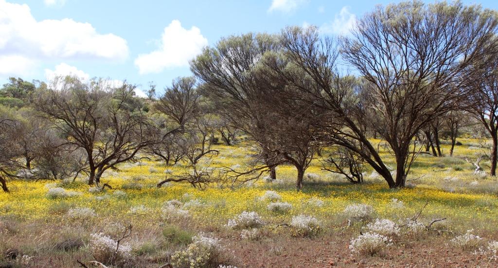
I have started the process of turning our photographs and video clips into videos. The first is a compilation of the wild flowers that we photographed during the trip. The first shots were taken near Blackall in Western Queensland and the last between St. George and Dalby.
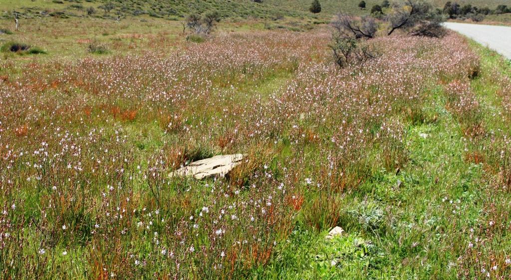
We loved the extensive blankets of blooms over so much of the country side so broad expenses dominate, rather than individual blooms. We hope you enjoy the beauty.
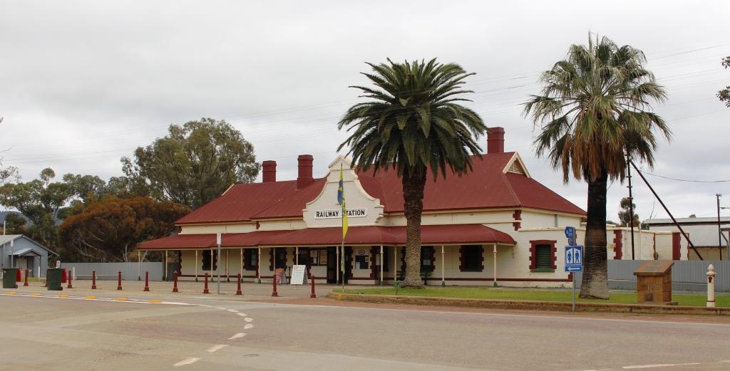
The Quorn Railway Station serviced the Ghan and is now the end of the Pichi Richi line.
We had decided overnight that we would go back to Quorn the next day, irrespective of weather conditions. The sun was shining between the clouds at Hawker but we encountered showers as we drove towards Quorn. We arrived in that town to a very wintry day, with cold south westerly winds and intermittent showers. We were sitting considering our options when I received a message that folk with whom we had earlier contact, who live in Quorn but had been away, had arrived home.
History in Quorn’s main street
Some of you know of my involvement with the www.exploroz.com web site. EcplorOz used to have a “birthday fairy” feature whereby on member’s birthdays a forum post would extend birthday greetings to all whose birthdays fell on that day. Members listed would usually wish each other a happy birthday. In that way I got to know Graham. When I learned that he lived in the Flinders Ranges I asked him questions about the area. It was always understood that when we visited that we would make contact. I had contacted Graham when we had arrived in Port Augusta, only to learn that he and his wife were in Western Australia. They travel around Australia more than we do.
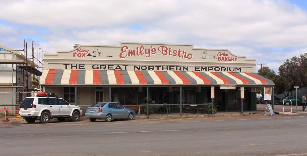
Our meeting place for coffee in Quorn, Emily’s.
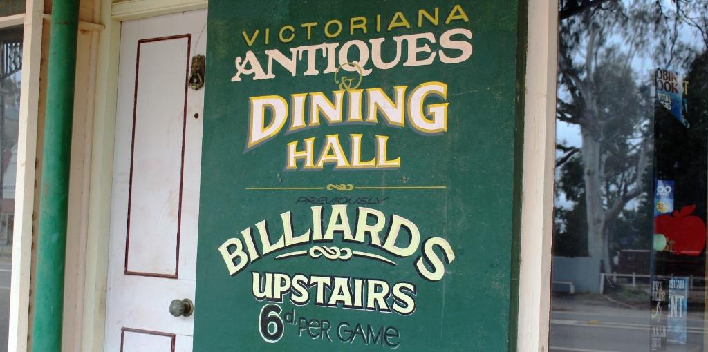
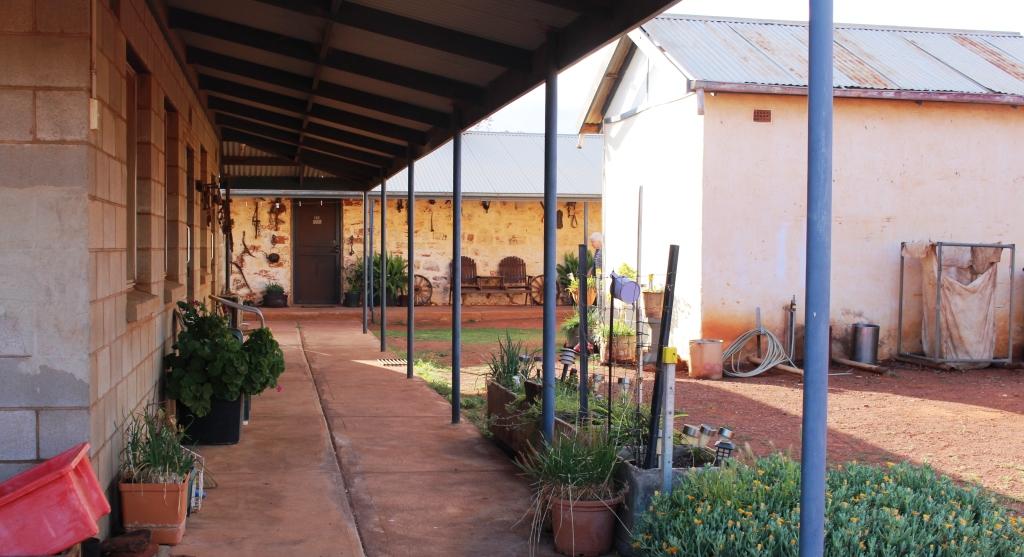
We made contact that afternoon and agreed to meet for coffee the following morning. We met at an interesting bistro and coffee shop called Emily’s. This relatively new business venture has been established in what was previously a general store. Much of its charm is the result of many of the original fittings being left in place. The original grocery shelves occupy one wall and contain a display of grocery and other items from yesteryear. Some of the furnishings are of vintage, but solid, appearance and items such as mannequins, dressed for the period of the original store’s heyday, help to create the atmosphere.
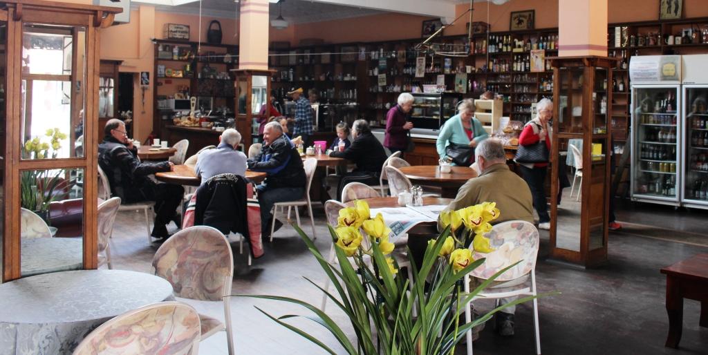
Inside Emily’s Bistro & Coffee Lounge. Note the old fixtures.
Refrigerators and display cases for food are new, with the normal paraphernalia of the modern coffee shop. Behind the scenes is a very modern kitchen with bakery facilities. The output that we sampled, as we got to know Graham and Maxine, were excellent as was the coffee.
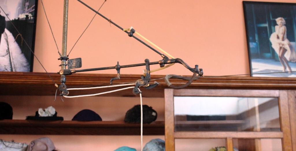
An empty cash transfer machine. A reminder of my youth.
But the retained feature that caught my eye took me back over fifty years to my first job. The general store had used an elevated cash transfer system, known as a flying fox, that conveyed client payments to a central cashier, in small containers sent on their way by a rubber catapult arrangement. I had used one of these contraptions all those years ago.
When I commented to the lady behind the counter on my experience with this old equipment, she asked if I would like to relive old times by pulling the handle to send a container whizzing along its wire. Of course I did! So I was taken into the original cashier’s enclosure and for a moment relived part of my youth.
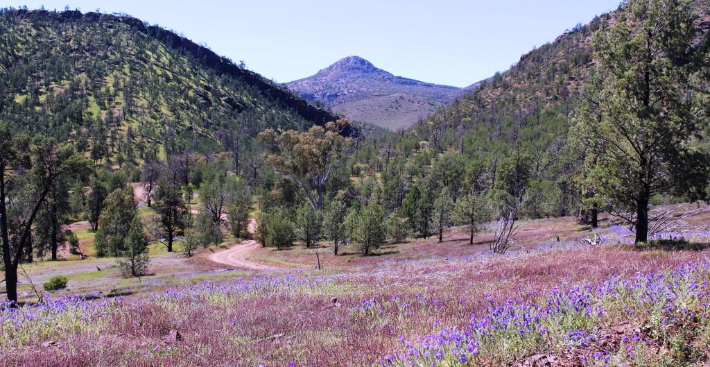
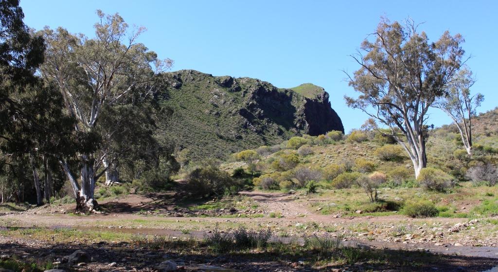
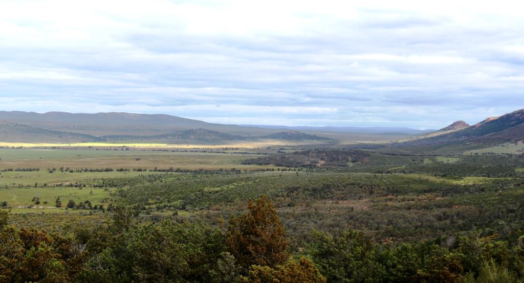
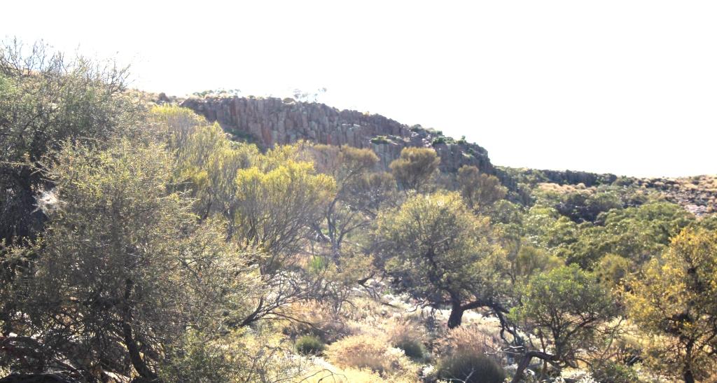
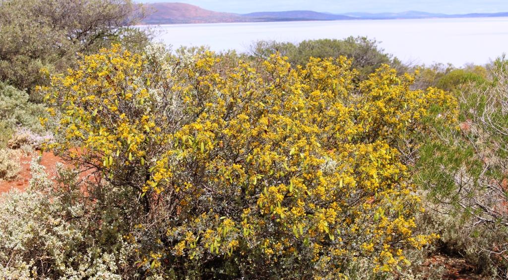
Wild flowers against the background of the northern end of the Elder Range.
During our discussion Graham suggested that we do a drive through Moralana Scenic Drive. The drive links the Hawker to Blinman Road with the Hawker to Parachilna Road by way of a gap in the ranges between the northern end of the Elder Range and the southern walls of Wilpena Pound. Having made that arrangement we parted until the next morning.
An elevated crossing of the road to Port Augusta by the Pichi Richi Railway. This was formerly the track of the famous Ghan railway to Alice Springs.
After a late lunch, we drove towards Port Augusta, through the Pichi Richi Pass, the gap in the mountains from which the Pichi Richi Railway tales its name. It is an attractive drive, crossing and passing under the railway line several times and with water washing over a normally dry causeway. As we reached the point where we intended to turn around we could see Port Augusta in the distance so we continued on to do some necessary shopping.
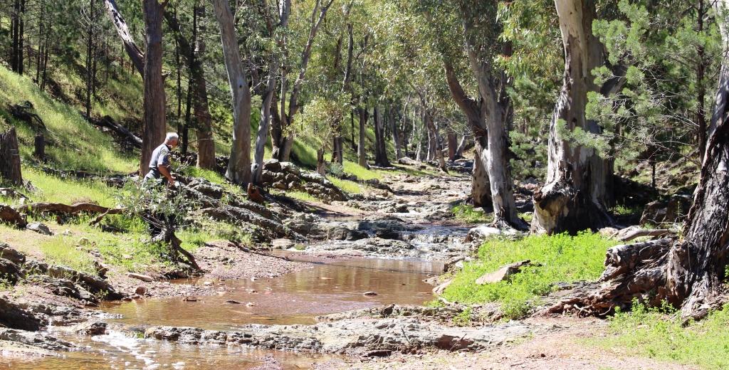
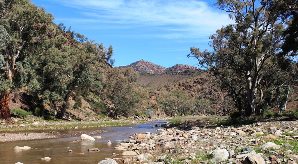
River Red Gums line the banks and stand in the beds of many Flinders Ranges creeks.
At 10.30 the following morning, Friday, we set off on the 70 kilometre drive back to Hawker and the further 25 kilometres to the start of the Moralana Scenic Drive. The track had only reopened that morning but was not particularly wet, although the streams crossed were mostly running, but shallow. The track is, in reality, station tracks for Arkaba and Merna Mora Stations, through whose grazing land it passes.
Black Gap provides a hiking trail into Wilpena Pound.
The hills on each side were green with lush grass. Periodically, wild flowers decorated the road side, often running in a blanket of yellow or purple up a hill side or disappearing between the stands of native pines. The occasional kangaroo raised its head to look as us as we passed its feeding place.
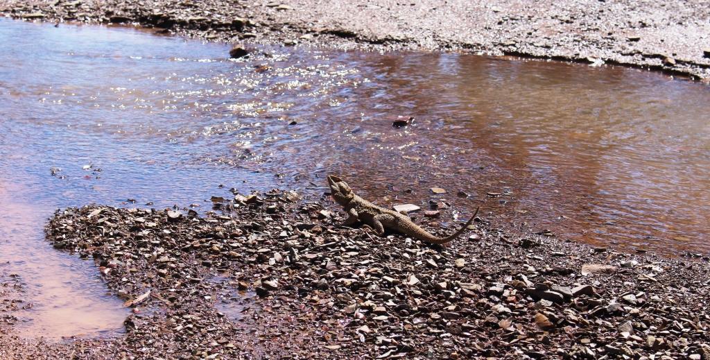
A Bearded Dragon pauses to search the sky while drinking at a running stream – in the middle of the track.
There are two places of particular interest on this road, both near the half way mark. The first is a side track into Black Gap. The creek bed that forms part of the track was flowing with water from the recent rain and was fairly deep in one place. This part of the track was a bit interesting, as water obscured the rocky creek bed, hiding the small boulders over which we had to drive.
The hiking track into Wilpena Pound runs along the banks of this stream.
Black Gap is a hiker’s entrance into Wilpena Pound. The previously mentioned Heysen Trail passes through Black Gap. From the car park at the end of the track it is about a 12 kilometres walk across the floor of the Pound and through the main entrance, to reach the Wilpena Resort. The hills on either side of the track are lightly covered in native pines but were lush with grass. There should have been many happy kangaroos in those hills.
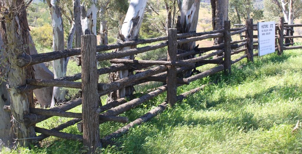
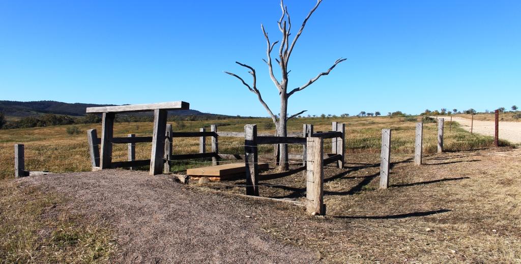
Rebuilt cueing yards are right beside the Meralana Scenic Drive.
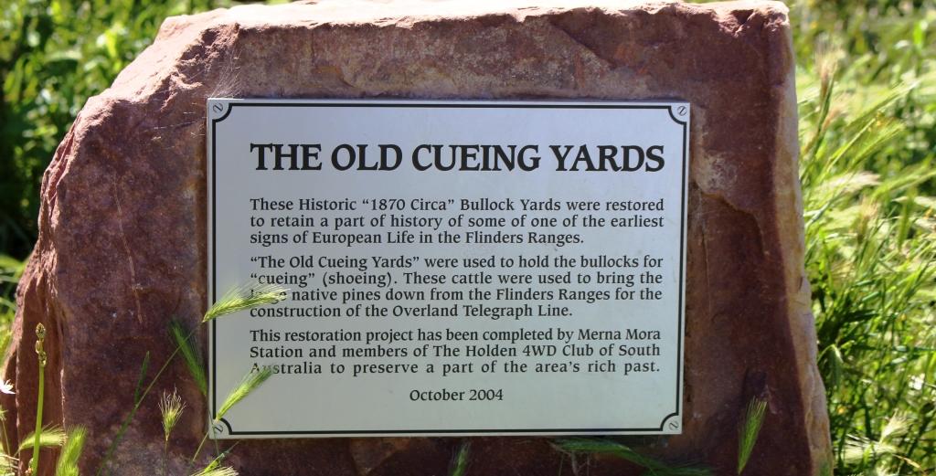
Back on the main track, we came to the second point of interest. During the construction of the Overland Telegraph Line native pine trees from the Flinders Ranges were used to support the wires where the line came through the adjoining area and further afield, where there were no suitable trees. The pine logs were pulled out of the mountains using teams of bullocks.
The information plaque at the rebuilt cueing yards
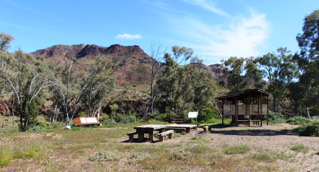
But the Flinders Ranges are mostly comprised of rock which badly damaged the bullocks’ feet. To protect the feet they were fitted with steel shoes, much the same as used with horses. But the bullock shoes were called cues and the process of shoeing was known as cueing. Yards that were used for the cueing process are beside the track by a stream. Merna Mora Station, on whose land the old yards were built and were falling into decay, have rebuilt them and provided a picnic table as well. We paused there for a late morning coffee.
The drive emerges from the ranges and leads over the Moralana Plain to its intersection with the Hawker to Parachilna Road. We completed the drive, through a few more creek beds to reach the sealed road and returned the 40 kilometres or so to Hawker, where we stopped at the Sightseer Café for lunch, before returning to Quorn.
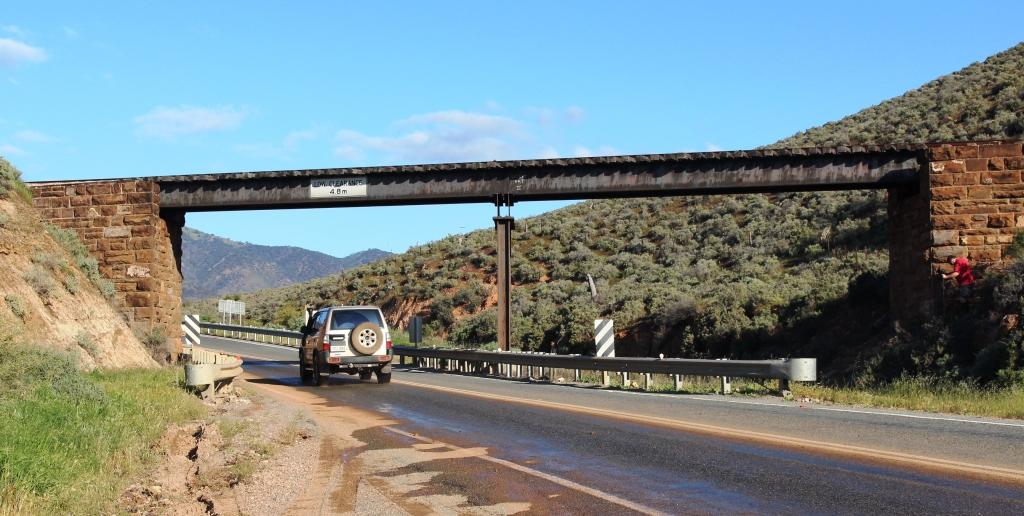
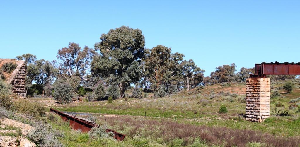
Flood damaged bridge on the old Ghan railway.
On the way back to Quorn from Hawker we got the benefit of local knowledge. We turned from the main road onto a track that, after a couple of kilometres, brought us to a stream that had been bridged all those years ago to carry the line for the Ghan. But in 2011 the bridge that had stood for so long lost a pillar and two spans to the flood waters of that wet year. Stones used in construction of the fallen support pillar weighing at least two tones each, were tumbled down stream for hundreds of metres. One steel span was pushed onto the bank while the other was carried several hundred metres down stream as well.
Hugh Proby’s grave is located near to the place where he lost his life.
We then retraced our steps of about half a century ago, past areas where we had camped and visited. These included Warren Gorge and Proby’s grave. Hugh Proby, third son of an English lord, was drowned in Willochra Creek, north of Quorn, in 1858, after ignoring the advice from an Aboriginal stock man about crossing a flooded creek. The stock man and Proby’s horse survived and lived to see old age. The grave remains a tourist attraction because of the huge marble memorial stone that Proby’s family had shipped from England and transported to a sight near to the location at which he drowned. So the message is naw as it was then. “If its flooded, forget it!”
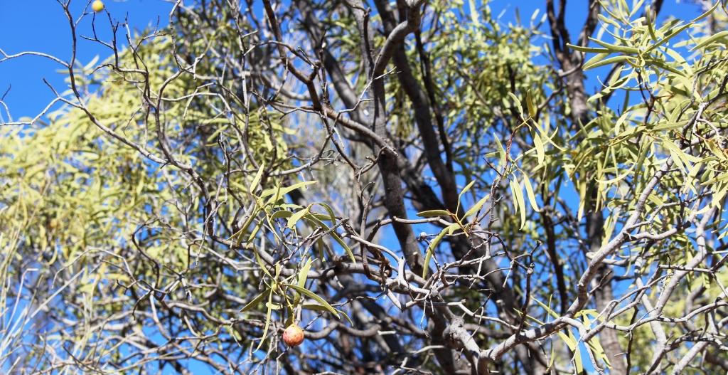
Not much fruit on this Quandong tree.
At one point we stopped beside a couple of Quandong trees to receive a lesson in botany from Graham. Quandong trees grow wild but can be cultivated. They are popular in the Quorn area and common in the gardens of residents. The berry is similar to a cherry but quite tart so apple and much sugar are often added to improve taste. Quandong berries are mainly used to make jam. Quandong jam can be bought almost anywhere in Quorn.
A view along a Quorn footpath.
We said goodbye to our new friends over a cup of tea at their home. We then returned to the caravan park to prepare for departure the next day. We had decided to start making our way home. There was no sign of improvement in the weather. Rain fell again over night, with a minimum temperature of 4 degrees. The outlook for the next couple of weeks was more of the same.
The recent black out in South Australia occurred just two days after we crossed into New South Wales on our way home.
Monday dawned sunny, with a chilly breeze still blowing, but with the news that the road through Parachilna Gorge was open with caution at creek crossings. This made possible a loop of about 250 kilometres, past Wilpena Pound to Blinman, then to Parachilna with a return on tha Hawker Parachilna Road.
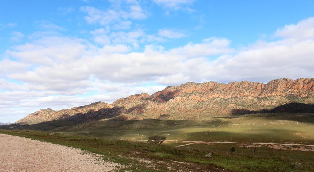
The Heyson Range from the Hawker Parachilna Road
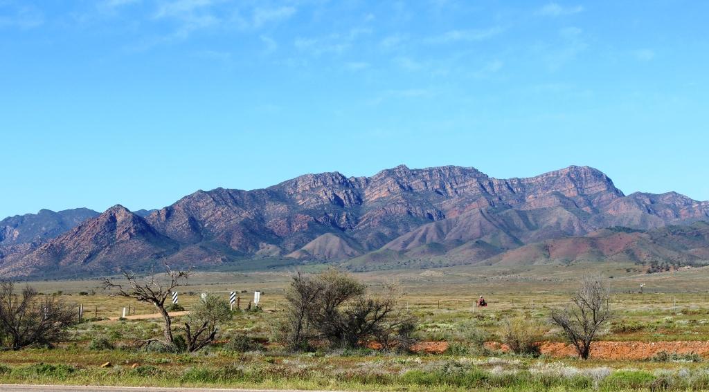
This is a very nice drive, through the mountains to Blinman, through the Parachilna Gorge, crossing and recrossing Parachilna Creek and then south, travelling beside the western ramparts of the range. First, the Heysen Range, named for artist and Flinders Ranges lover Hans Heysen, is passed and then the Elder Range appears. It is named for Sir James Elder, grazier in this area and founder of the pastoral company Elder Smith,
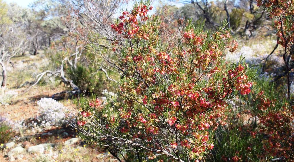
Carpets of colour beside the road
now known as the real estate operator called simply Elders. There is also a walking trail named the Heysen Trail that starts at Cape Jervis, opposite Kangaroo Island and ends at the road that runs through Parachilna Gorge. I believe that there are people who have walked its entire length.
Mountains of the north wall of Wilpena Pound
At several points along the 107 kilometre drive to Blinman, observation points have been provided to view the wonders of nature. The road runs through the heart of the ranges and through the Flinders Ranges National Park. Not far along the way roadside parking areas provide good views of the Arkaba Hills and of the Elder Range. A bit further on, the road passes Rawnsley Bluff, one of the most prominent features of the area and part of the south eastern wall of Wilpena Pound.
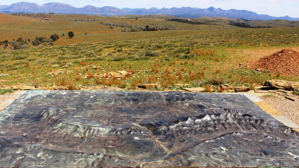
The Wilpena diorama viewed against the background of some of the mountains that it depicts
We bypassed the turn to Wilpena as we had plans to visit it as part of another activity. Not too far further north the twin elevated lookouts of Hucks and Stokes Hill provide panoramic views back over Wilpena Pound with Stokes Hill also providing views of the Loves Mine Range and The Bunkers to the north. At the summit of Stokes Hill a bronze diorama of Wilpena Pound has been placed so that it can be compared with the real thing. As a combination of ancient and modern, visitors may connect their smart phones to WiFi to listen to Dream time stories.
Part of the Great Wall of China near Blinman
Nearer to Blinman, two hills are crowned with natural stone walls, known as the Great Wall of China, because their similarity to their namesake. A short drive along a gravel track leads to a couple of elevated positions from which good views are available. As a bonus, the mountains that are behind you as you view the Great Wall are also worth viewing.
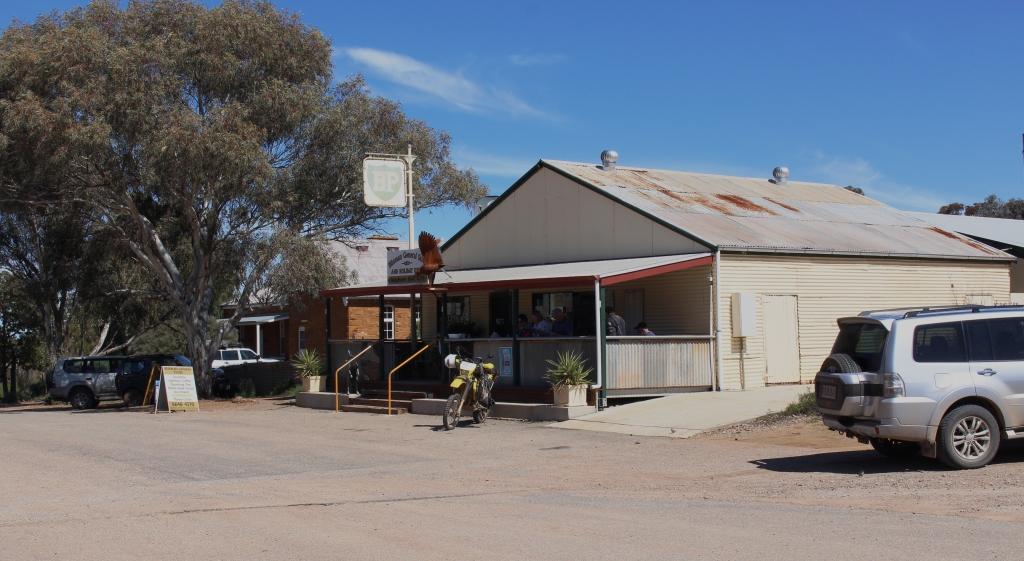
The Blinman General store
Blinman is officially the highest town, in terms of meters above sea level, in South Australia. In its heyday in the 1880s, at the peak of copper production from its mine, it had a population of 1,500. Now it has a mere 18 permanent residents. Its focal points are the restored mine office and conducted tours of the underground copper mine and of course, the meat pies available from the general store. We tried a couple of pies for lunch. They are much larger than city pies and are full of chunks of real beef. With a cappuccino each, they went down a treat.
This old miners cottage in Blinman has been restored and is available for vacation rental
Blinman also has a pub, which is the most popular place for lunch. Four wheel drive vehicles, angle parked, lined the kerb on both sides of the road in its vicinity. Camping facilities are available in the national park, at private caravan parks and on numerous cattle stations, many of which offer four wheel drive tracks to their guests. So Blinman is a place to go for lunch and to top up supplies at the general store, which also offers a coffee shop. This is the source of supply for pies at Blinman.
A view of a mountain on the Parachilna Gorge Road
Facilities at the north end of the Heyson Trail
Parachilna Creek was flowing as a result of recent rain
The road on to Parachilna runs through Parachilna Gorge, following a creek if the same name. It is a pleasant drive on a winding dirt road that threads between spectacular hills and crosses the creek several times. On this drive the creek was running, but only a few centimetres deep. The road emerges from the gorge to run several kilometres across the northern Moralana Plain to reach Parachilna, located on the Hawker Parachilna Road.
The Prairie Hotel at Parachilna
The town is located on the old Ghan railway line. Remnants of the rail service are on display by the old station building. The Prairie Hotel now is the town. It has achieved notoriety for the signature dishes from its restaurant. The FMG (feral mixed grill) includes camel, emu and kangaroo meat. I am told that the cost of these delicacies is $38 per plate. The luncheon pies at Blinman now sound even better at $5 each.
But we did award Parachilna the title of Fly Capital of Australia!
Part of the original Ghan railway station at Parachilna
The drive back to Hawker is about 90 kilometres of good tar. A pleasant journey, with the ranges on the left, bathed in the afternoon sun. On the way, we passed the western entrance to Moralana Scenic Drive. It that had been closed but had been opened with restrictions. It couldn’t have been too bad as a girl riding a bike and carrying all her camping gear peddled out of the road onto the highway as we drove past.
On the opposite side of the road is the gate to Merna Mora Station, which has been offering accommodation to travellers for many years. It offers powered van sites and station tracks that allow access to Lake Torrens, among other drives. So we called in and booked for the next three nights, but with fingers crossed that forecast rain would not upset the plan.
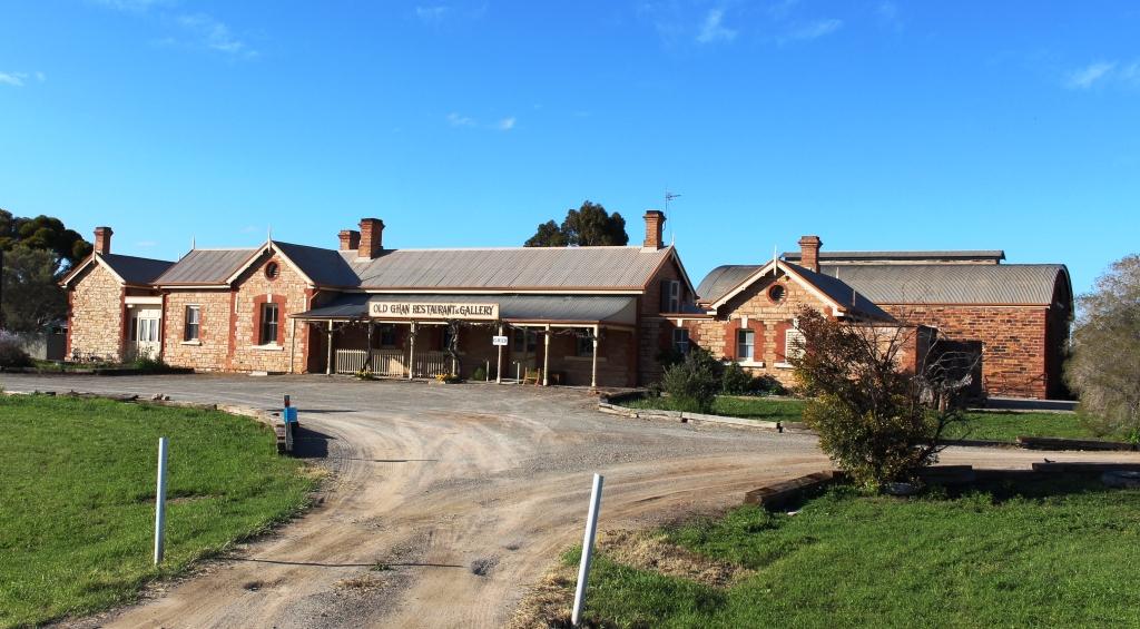
The old Ghan railway station in Hawker is now a gallery and restaurant
But it did. Heavy rain next morning closed national park roads and station tracks again. So we cancelled Merna Mora and booked another night at Hawker to see what would happen with the weather.
The Iron Knob mine, viewed from the Iron Knob Kingoonya Road
The water in the showers was little more than warm on our first morning at Mt Ive Station. On the second morning it was hard to tell the hot tap from the cold tap if judged by the water temperature. A check at the hot water donkey revealed an extinct fire and not much ash. The stoker had obviously fallen down on the job. Ruth and I made the best of it with a quick cold wash. When we drove out of the camping area we could see the stoker hard at work getting the fire going again. A grim faced lady in a pink dressing gown was marching up and down keeping him under close surveillance as she waited for hot water for her shower.
The Edward John Eyre commemorative plaque
In returning to Port Augusta via Iron Knob we were retracing our steps, so did not expect to see anything new. But we were wrong. Not far into our journey we found a plaque advising that Edward John Ayer had camped for the sixth night in his exploration at a point near where the road now runs. He passed that way on 23rd September 1839. There was a picnic table nearby and a sign to advise that the table and plaque had been placed there by the Gawler Ranges Progress Association. Thank you GRPA.
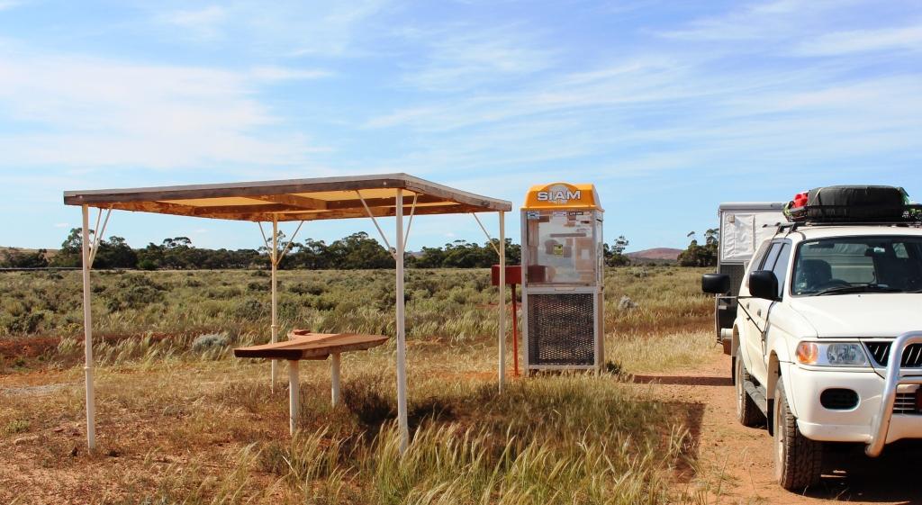
The “donation” telephone box
About 60 kilometres further on, the homestead for Siam Station stands a few hundred metres off the road. Beside the road, within sight of the homestead, stands a telephone box, next to a small picnic shelter. The shelter has a single piece table top sawn from a large log, but no seats. The phone is still in the phone box but it is not connected. Instead the coin box has been converted into two donation boxes, one for the Gawler Ranges Progress Association and the other for the Royal Flying Doctor Service.
The phone box is covered with bumper stickers from organisations with an interest in the area. There are also large stickers warning that the box is under closed circuit TV surveillance. We stopped in the parking area provided, for a coffee break, placed donations in each of the boxes and moved on. They are very practical folks in the Australian bush and passionate about the RFDS. There are no shortages of opportunities to donate.
The cliff top view of the northern extremity of Spencer Gulf and the lower Flinders Ranges
Before entering Port Augusta on our return we deviated north a bit to a lookout from a cliff top by the very top of Spencer Gulf, on the shores of which the town is built. The arid lands botanical garden is in the same area but we did not have time to visit there. But the cliff top parking area suited the dual purpose of a place to stop for lunch and a different view of Port Augusta. It also provides excellent views of the lower Flinders Ranges that extend well south towards Adelaide.
Part of the main street of Port Pirie
When putting out our awning at Mt. Ive, a vital bit broke off one of the handles that are used to slide the extendable arms that hold it the awning in the extended position. The result was that we could not fully extend the awning, not a good situation in wet or hot weather. To replace the handle was a bit of a priority. We were not able to source one in Port Augusta but did
A stately home in Port Pirie
locate one at Port Pirie, about 90 kilometres to the south. So instead of heading for Quorn, a small town in the Flinders Ranges just north east of Port Augusta, we continued on, picked up our handle and proceeded to a local caravan park to spend the night and make the necessary repairs.
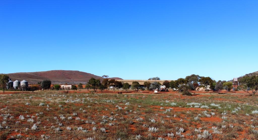
Quorn’s main claim to fame is that of its connection with the Pichi Richi railway. The steam and vintage diesel trains that comprise the railway operate on part of the old Ghan railway line, to the south of the town, to Port Augusta. It gets its name from its passage through the Pichi Richi Pass, the gap in the range by which both road and rail reaches Port Augusta. Some trips start at Port Augusta and return later in the day, having given passengers a couple of hours to look around Quorn and have lunch. Other services start from and return to Quorn. The train operates at weekends and more frequently during school holidays. If you are relatively wealthy, you can book a ticket and go for a train ride for a couple of hours, or the best part of a day, depending on the service that you choose. If very wealthy you can book a seat on the lunch train, known as The Coffee Pot.
There must be a few wealthy people around as when we tried to book into the caravan park for a Saturday night stop over we found it to be fully booked, because the train was operating that weekend. As the caravan park is the only such establishment in town we opted to drive a further 70 kilometres or so to Hawker. Hawker was our next destination after Quorn, so we were not inconvenienced. We had intended to spend one night in Hawker and then move on further into the ranges. Hawker is built on a plain within the ranges. Mountains are visible all around but the town is flat.
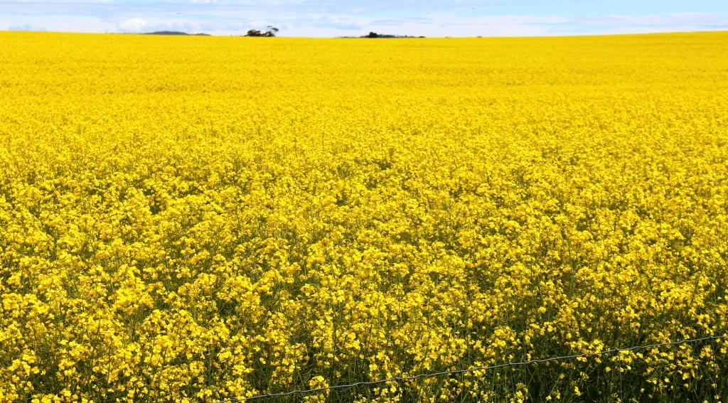
Canola in full bloom at the top of Port Germein Gorge
We made our way from Port Pirie through the Port Germein Gorge to Murray Town, then through Wilmington and Quorn to Hawker. The Port Germein Gorge is a very interesting drive. The road is narrow and winding and faithfully follows a stream that would be an interesting sight during heavy rain. Unfortunately there was nowhere to stop to take photos, so our passage through is unrecorded. But as we emerged on the eastern side of the range we were met by the yellow brilliance of flowering canola. This area is part of the Southern Flinders Ranges.
Floral decorations at our roadside lunch stop
Rain was forecast and we found the start of it at Melrose, a small town with a pub beloved by bikers, that stands at the foot of the rather remarkable Mount Remarkable. The rain was only showers but required application of the windscreen wipers from time to time. We reached Hawker at about the same time as the rain, although it did give us time to set up before it became heavy. But rain had been falling to the north of Hawker for much of the day, so all of the unsealed national park roads and most station tracks were closed.
The ruins of Kanyaka Homestead 25 Km south of Hawker. It was built in 1860 and abandoned in 1888
The rain cleared as Sunday morning dawned, but with so many roads closed we decided to stay at Hawker for two more nights to give them a chance to dry out. But sunshine and a brisk wind dried out some local roads quickly, allowing us to get out and see some things after lunch. Ruth had been busy with washing during the morning, battling with a clothes dryer that was reluctant to do its job.
Stately River Red Gums in the bed of the creek at Willow Waters camping area
We drove east of the town in search of Willow Waters Gorge that appeared to be not far from town. But when we reached its apparent location we were only at the turn from the main road, with a further 14 kilometres to travel to the gorge. The road was solid with only a few puddles but we had to negotiate a number of cattle grids and a small flock of rams being herded along by a two stock men in utilities. We met them on the bay back and they hadn’t made much progress.
The road up Pugilist Hill. It is steeper than it looks.
After returning to town we drove up the road that leads to Wilpena Pound, turning just before the national park boundary into Martins Well Road, to find a lookout on the quaintly named Pugilist Hill. Martins Well Road leads 48 kilometres to a cattle station of that name but then, like so many station access roads in remote Australia, leads on to other destinations.
Part of the Chase Range from Pugilist Hill Lookout
Pugilist Hill Lookout provides a vantage point for viewing the Chase Range, one of the major and most picturesque ranges in the Flinders Ranges. It is long, with many peaks, its red rock mass forming one side of a long valley. Vegetation struggles to maintain a foothold on its precipitous slopes. The Chase Range is at its best in afternoon sunshine but there were still clouds lingering, which spoiled the effect to some extent. But it was still awesome. As was the drive to the summit of Pugilist Hill, and the subsequent decent!
Part of the view from Jarvis Hill of the area to the south of Hawker
As a last activity for the day we drove about 8 kilometres west of the town to Jarvis Hill Lookout, another sharp climb from the plain. Unfortunately, attaining the lookout point requires a scramble over rocks and rough ground, so I didn’t walk the whole distance. But the view was good, although I could not see Hawker, but I did find more wild flowers that we had not previously seen.
We returned to the van as the sun disappeared behind the range that we had just ascended, to crank up the heater in preparation for another cold night. The temperatures have been around 13 to 15 during the day and often down to 2 or 3 during the night. The heater is frequently on all night.
Oh, and did I mention flies? We have been coping with them in increasing numbers since Rockhampton.
The fine weather did eventuate and with a forecast that suggested a few days of fine weather the decision was made to visit the Gawler Ranges. So we phoned Mt Ive Station to ensure that a powered site was available. Having received a satisfactory answer, we set off into a stiff head wind that stayed with us for the entire 200 kilometre journey.
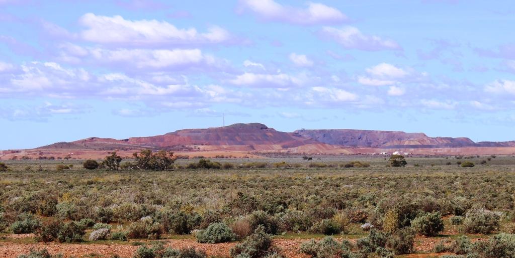
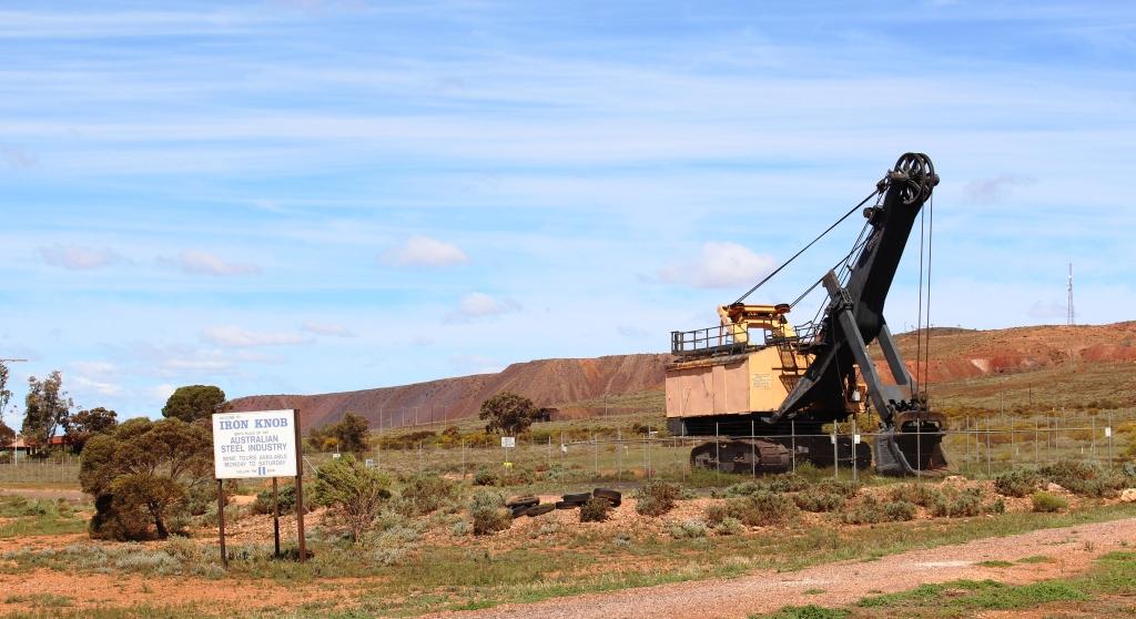
A “retired” excavator against the background of mine overburden at Iron Knob
The turn to Mt Ive Station is at Iron Knob, a distance of a little over 70 kilometres. We last visited Iron Knob over 50 years ago. At that time it was a thriving mining town. Now it is little more than a ghost town. The mine still appears to be in operation so it must have changed to a fly in fly out basis of staffing. A pity, but that’s progress, I suppose. We stopped for morning coffee and to air down the tyres in preparation for 125 kilometres of dirt and gravel.
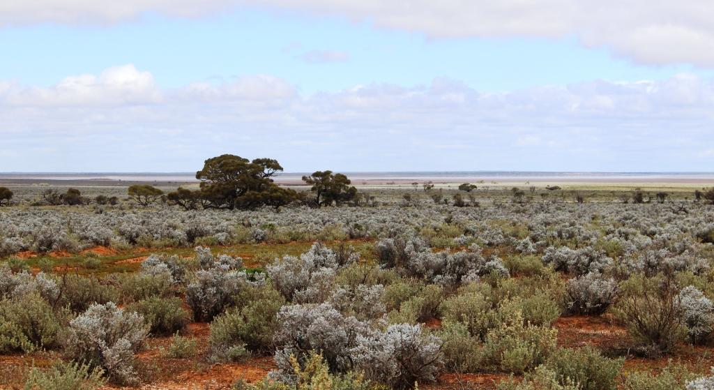
We passed several flocks of sheep. Stations in the Gawler Ranges area are mostly involved in wool production.
The road was in quite good condition. Much of it has been recently graded and a grader was working on a section of road as we came through. Although we were entering a range of mountains the road was mostly without hills, just a series of low ridges and shallow gullies. We were travelling through a long narrow gap in the range. Creek beds had all been stabilised so were not a hindrance to maintaining a reasonable speed. As always on these types of roads the cattle grids required careful negotiation.
Yellow daisies decorated the hillside
There were wild flowers along the way but in unique areas. In between and interspersed with the flowers was thousands of hectares of a small silvery green leafed plant with small white flowers. It proliferated in the valleys and lower slopes of the ranges put did not reach the hill tops, at least not in quantity.
Some of the historic stone buildings
We reached the homestead in the early afternoon. Mt. Ive homestead is itself set in a valley between two prominent mountains, one of which is Mt. Ive. The station has been in continuous operation since 1864. Many of the buildings are original and are built of local stone. Much of the local stone naturally breaks into blocks, suitable to use as building material. Later structures are of more modern materials.
View towards the shearers quarters and part of the caravan park area. Mount Ive is in the background.
We have arrived here at a quiet time of the year and some potential visitors have probably been deterred by forecast rain. There was only one van and a camper trailer when we arrived but a couple of car loads arrived later to stay in some of the stone cottages. The area is popular as a long weekend destination from Adelaide and is busy during school holidays in the cooler months.
The clouds have dispersed to reveal a clear starry sky but the wind had continued so it was quite chilly. Thumbs up for the power supply and the heater!
The hot water system was not very efficient
Mt. Ive Station is popular for its many four wheel drive tracks. As we were only there for two nights we were limited in what we could do so we chose the premier drive, that to Lake Gairdner, which is reached via Mt. Ive station tracks but is enclosed within Lake Gairdner National Park. Lake Gairdner is a huge salt lake with a dry lake bed in the warmer months. It has been the site of several land speed attempts and annually is the location for salt lake car races. A club house for this event stands by the lake.
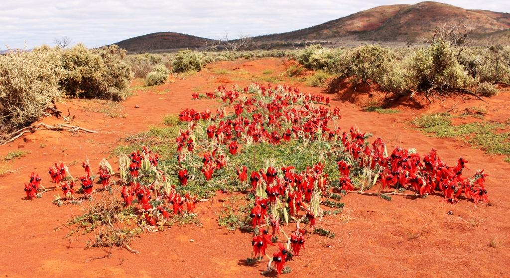
A clump of Sturts Desert Pea growing in a roadside drainage channel
The track is really a road and although corrugated was in quite good condition for a road of its type and location. Not so vehicle friendly was two side roads that lead to other points of interest. They were real four wheel drive tracks and required driver attention to negotiate them safely.
The organ pipes are at the top of a ravine
The first side road leads to an area known as The Organ Pipes. The Gawler Ranges contains areas of a stone named rhyolite, the main characteristic of which is to separate into columns. There are several other areas in Australia with similar formations with similar names. One of the best known is in the Mt. Kaputar National Park in New South Wales between Narrabri and Bingara.
A flowering bush beside the path to the organ pipes
After negotiating about three kilometres of loose stones and a steep gulley we arrived at the parking area. The rock formation was at the top of a second ravine. Younger legs than mine would have made short work of the stony climb. I satisfied myself with walking until I had a clear view and snapping some pictures. But I did find and photograph two new flowering trees that I had not previously seen.
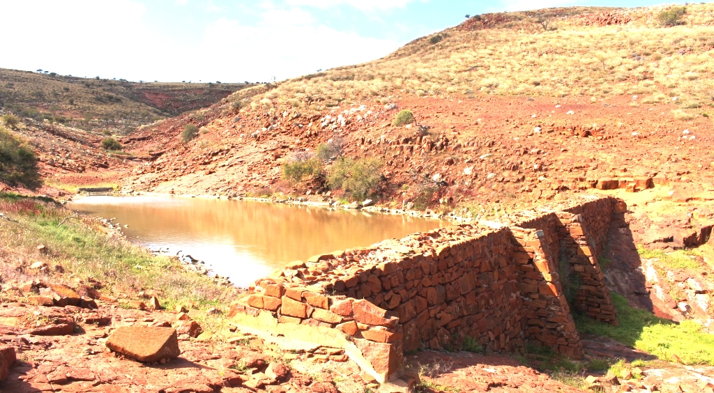
This water storage was built in the 1880s
The second side road leads to the site of a stone dam that was built of local stone in the 1860s. It still retains water and is an excellent illustration of rock wall construction. It spans the head of a charming ravine, the rocky sides of which are decorated with wild flowers that appear almost as a planted garden. Views down the valley to the hills opposite would have made this an excellent site for a dwelling, at least during a relatively wet winter. Summer would be quite different.
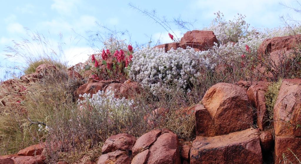
Nature’s rock garden
Chunks of salt at the edge of the lake.
A further ten kilometres from the second road brought us to the lake. Lake Gairdner is huge, with sweeping bays formed by hills that protrude into the lake in the form of promontories. About 200 mm of water currently covers the salt floor but lumps of salt rock are visible along the shoreline. The corrugated iron club house overlooks this magnificent view. Motor racing would be the last
The Wattle was in bloom by the lake
thing that you would expect to see here. Aquatic sports seem more likely but such are the contradictions of remote Australia.
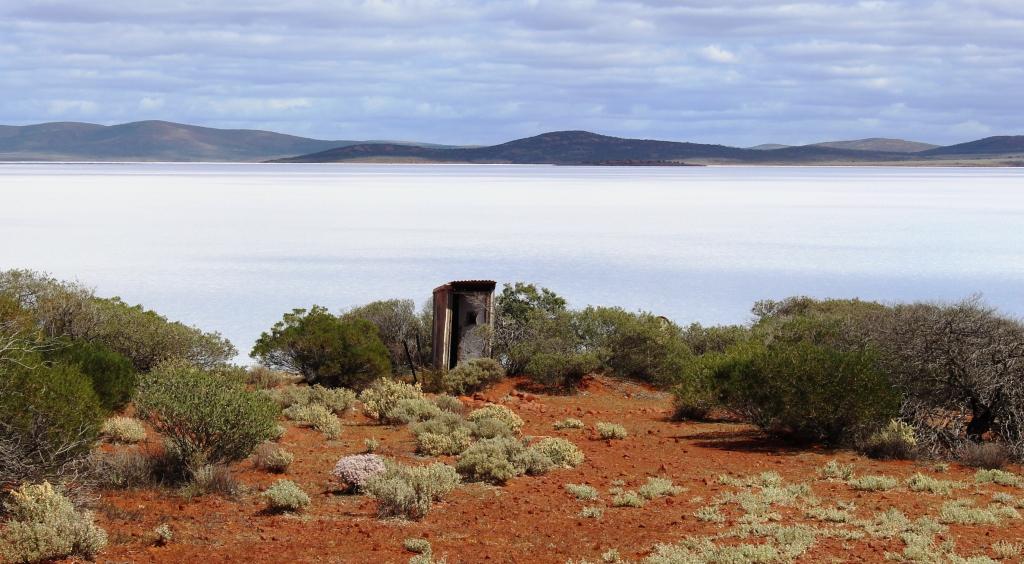
The loo against a view
I am sure that the club house contains toilet facilities, but when not in use it is securely locked. So a single toilet has been provided for casual visitors. It sits on a point with its back to a magnificent view. It has a small glass panel in the door in lieu of a lock. Two stout ropes, secured on either side by steel pegs, go over the roof to ensure that it does not float away in a flood.
The Challenger parked next to the motor racing club
We enjoyed morning coffee at a picnic table at the front of the club house, drinking in, in addition to the coffee, all this natural wonder and beauty. The 400 kilometre return journey, 250 kilometre of which is unsealed, was very worthwhile. Mt, Ive Station and Lake Gairdner are now ticked off the bucket list.
The light of the setting sun colours a bank of clouds in the eastern sky
We had intended to spend a couple of nights in the Gawler Ranges National Park but it is far too cold at night at the moment to be 100 kilometres away from a power point.