Central Highlands and Mackay – 6 to 8 June 2016 – From Dingo to Finch Hatton

Roadworks. This ravine was much deeper than it appears.

Roadworks. This ravine was much deeper than it appears.

Day 5

Yet another sunny morning!  There is hardly a cloud in the sky, but it is quite chilly.  It is time to break out the “long johns” I think.

Much of the Fitzroy Developmental Road was quite new and easy going. Later in the day the roads became narrower and bumpier from constant use by heavy transport vehicles. There were road and bridge works under way in several places. At one point we plunged into a deep ravine and out the other side on a temporary road.
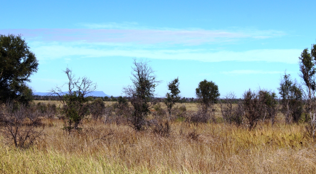
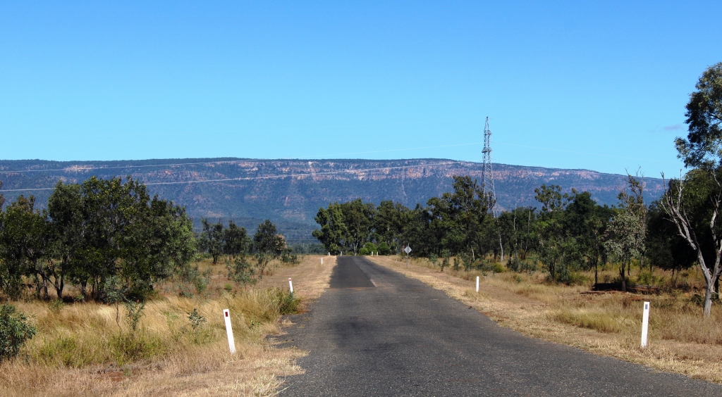
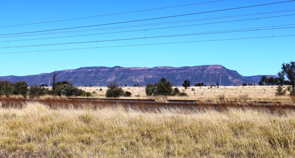
Not many hills in this area but Blackdown Tableland can be seen in the distance

Not many hills in this area but Blackdown Tableland can be seen in the distance

We drove north from Dingo for about one hundred kilometres on the Fitzroy Developmental Road deep into the southern Bowen Basin. There is no coal mining at Dingo or any sign of it until near Middlemount , which we reached a few minutes after turning of the Fitzroy Developmental Road. From Middlemount to Dysart there are mines, but not prominent and most are well off the road. Middlemount and Dysart are both mining towns.

Public sporting facilities at Dysart

Public sporting facilities at Dysart

Both are modern with extensive community facilities and shopping centres that contain the shops that sell the essentials and some that sell luxuries.

Further on, we reached the longer established mining area where the mining activity is more extensive and visible. The road runs right through the middle of Peak Downs mine. Two over passes carry mining traffic over
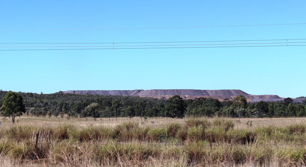
Overburden is a sure sign of a coal mine

Overburden is a sure sign of a coal mine

the highway, traffic including the huge dump trucks that carry the coal from the mine to the processing and loading facilities. We parked beside the road and while I walked around taking photos Ruth had the best seat in the house. She sat in the front of the car and watched the parade of dump trucks crossing the over pass no more than 200 metres in front of her.
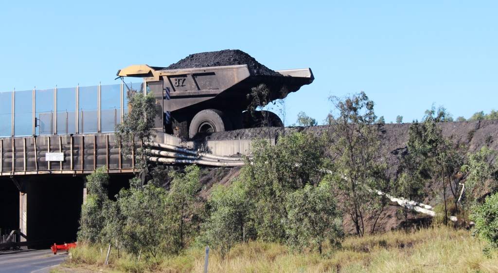
 

A coal laden dump truck traveling from the mine to the loading facility

A coal laden dump truck traveling from the mine to the loading facility

Coal production equipment at Peak Down Mine

Coal production equipment at Peak Down Mine

Peak Downs Mine coal washing plant
Peak Downs Mine coal washing plant


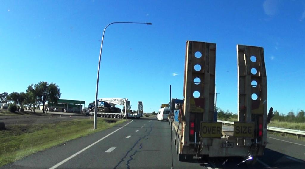
The wide load turning off the highway ahead of us

The wide load turning off the highway ahead of us

Just before turning onto the Peak Downs Highway near Moranbah we came up behind a very wide load. The escorts were not interested in letting anyone get past so the journey to the junction of the road into Moranbah was a bit slow. We had visited that particular town when in the area two years ago, so we refueled and continued on the few kilometres to our

Vans parked at the Isis River camping area

Vans parked at the Isis River camping area

stopping off point for the night beside the Isaac River.
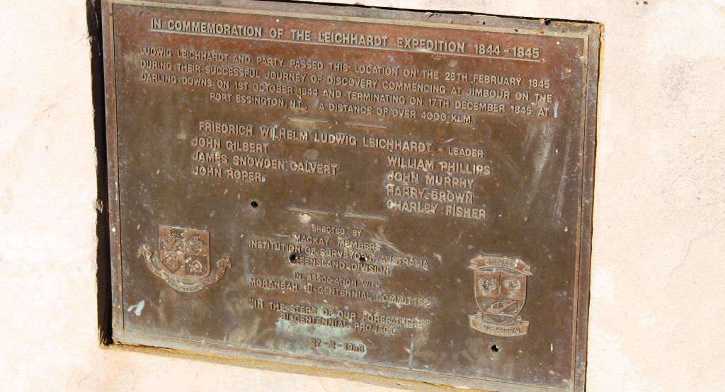


A plaque commemorates the passing of this site by the Leichhardt expedition in 1844-45

A plaque commemorates the passing of this site by the Leichhardt expedition in 1844-45

Day 6 

The weather is starting to get boring. It’s sunny and cool again but with temperatures in the mid 20s promised. The activity today was to get ourselves from Isaac River to Finch Hatton, a small town inland from Mackay, in the Pioneer Valley.

There was not much traffic going our way but there was a constant stream of oncoming traffic, most of it large trucks bound for the mining area. The Fitzroy Developmental Road that we had started out on the previous day, but left after about 100 kilometers, joins the Peak Downs Highway not far into our day’s journey. As we approached the intersection flashing yellow lights confirmed the chatter that we had been hearing on the two way radio and a truck carrying a very long bridge beam entered the road right in front of us.
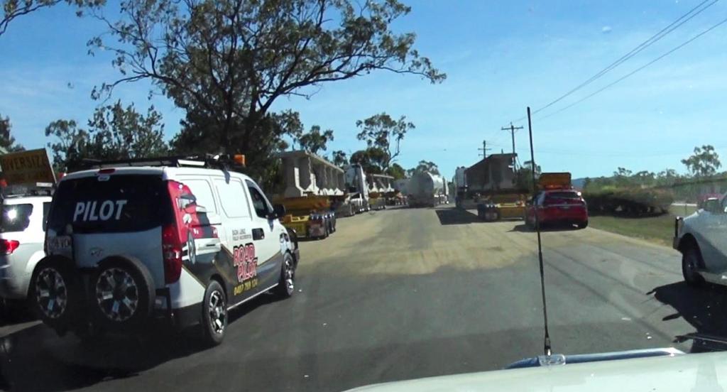
About to drive through the parked convoy vehicles

About to drive through the parked convoy vehicles

We soon found that there were two more ahead, making a convoy of three over dimensional trucks and six escorts vehicles. We, and the string of vehicles behind us, knew that we could not pass, so we settled in to be part of a convoy of ever increasing length. Fortunately the large trucks up ahead were able to maintain speeds of about 80 to 90 kph so everyone was happy. This arrangement continued until the trucks pulled off for a rest break at the small town of Nebo.

That was the end of excitement for the day.

Those familiar with this end of the Peak Downs Highway might be interested to know that work is under way to bypass the steep winding section where the road climbs from the Pioneer Valley to the plateau that leads to the Bowen Basin. The work is well under way.
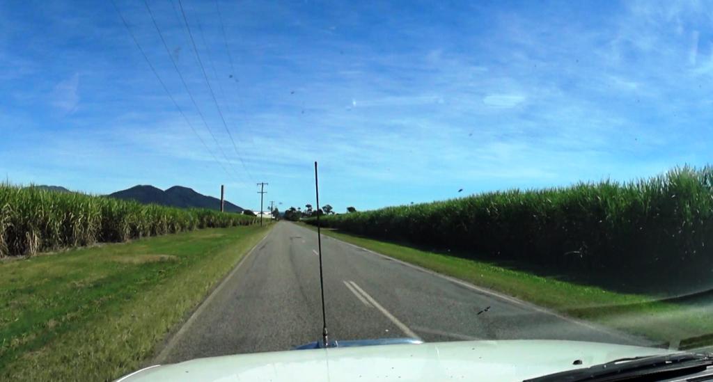
Driving through cane fields

Driving through cane fields

The drive from Eaton to Finch Hatton is through sugar cane fields where the harvest was just getting under way. Cane harvest produces hazards on the road, particularly cane trains at level crossings, slow moving cane transport vehicles and cane harvesting machinery as it moves from farm to farm. The approach to a sugar mill is marked by that tell tale sweet smell of sugar juice. But to the ,locals the smell is the odor if liquid gold.

We drove to Finch Hatton via Marian, for fuel, and then drove through the neighboring town of Mirani. I was amazed at the extent to which suburbia has reached out from Mackay to those towns. Partly the result of housing demand from the mining boom, I suppose.

We arrived and set up in the Finch Hatton showground, which doubles as their caravan park, in time for a late lunch. We spent a lazy afternoon, mostly reading.

Day 7

Our reason for visiting Finch Hatton was to see Finch Hatton Gorge. A few years ago we drove to the start of the walks but didn’t have time to do any of them.

Finch Hatton Gorge is not a gorge in the normal expectation of gorges that are tourist attractions. It runs into a rain forest covered mountain range and its floor and sides are rain forest covered. It’s unique feature is the stream that runs through it, but more particularly two features of the stream.

There are two walks, the second being an extension of the first.  The walk to reach Araluen Cascades is about 1.4 kilometres from the car park. The path winds through dense rain forest, around the heads of a number of gullies, for about 900 metres and then descends about 500 metres to the falls. A viewing platform provides an close view of the falls themselves but a staircase has been provided to access the rock pools into which the water tumbles.

I have put my video clips and images into a short video to give you an idea about the drive in to the area, the walk to the cascades and the Araluen Cascades themselves. Here it is.

[youtube]https://www.youtube.com/watch?v=yjQv55Cpd4k[/youtube]

We did the walk to this point and spent 30 minutes or so just absorbing the beauty and atmosphere of the place. While there, a couple of French backpackers arrived. On our walk back we met several groups of walkers, many of who were in our age group. This is the most ambitious walk that Ruth has done since her knee replacement. She passed the challenge with flying colours.

The extension to the walk is a further 1.4 kilometre return to Wheel of Fire rock pool. We didn’t do this part but understand the feature to be a particularly large rock pool suitable for swimming. Both locations are popular with locals as swimming facilities, particularly in summer time and because they are free of crocodiles. The water looked to be well below swimming temperature to me but I suppose it is warmer in Summer.
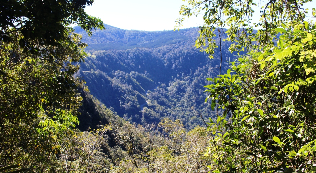
The road winds up the mountain to Eungella village

The road winds up the mountain to Eungella village

After lunch we drove up the remainder of the Pioneer Valley and ascended the steep climb to the village of Eungella and the Eungella section of the National Park of the same name. Finch Hatton Gorge is also in the Eungella National Park. Before taking in the views from Eungella we drove on to Broken River with a objective of spotting a Platypus.
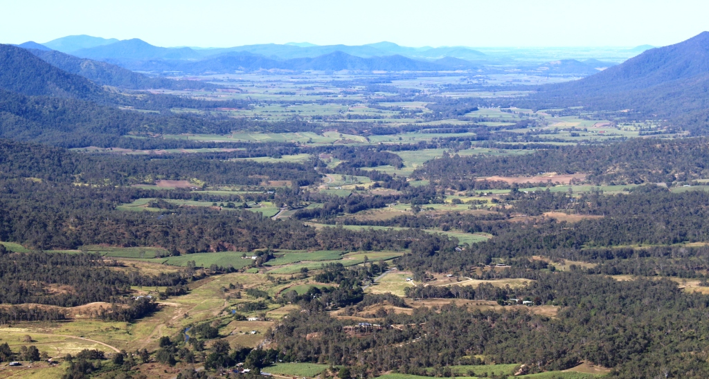
The Pioneer Valley from a Sky Window viewing area

The Pioneer Valley from a Sky Window viewing area

But first we came to that 300 metre stroll known as Sky Window.  I had forgotten all about it. The loop track leads to two excellent views. The first is over the mountain side where the road snakes up from the valley. The road is clearly visible from this vantage point. The second view is of the Pioneer Valley and the mountain ranges that form it. Today the view was clear with not much haze.  The patch work of cane farms is quite attractive.
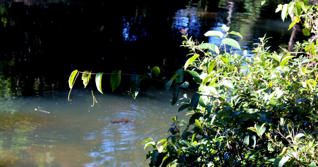
Our Platypus sighting

Our Platypus sighting

Our luck was in at Broken River. We sighted a Platypus three times before it headed for the river bank, probably going home to its burrow.

We returned to Eungella village to take in that perspective of the Pioneer Valley from a different angle before descending to the valley and returning to Finch Hatton for the night.

Just for fun, I edited some action camera videos, that we had filmed on the way up the range and coming down again, to give you an idea of what the drive is like. Here it is:

[youtube]https://www.youtube.com/watch?v=RSdqdmS5JIw[/youtube]

Central Highlands and Mackay – 2 to 5 June 2016 – From Home to Dingo

Day 1 – Thursday 2nd June

Free campers set up for the night at Gympie

Free campers set up for the night at Gympie

Once again we were on the Bruce Highway, travelling north. We followed the Bruce to just past Gympie, turned left into the Wide Bay Highway for 20 kilometers, turned right to pass through Woolooga and ultimately to Biggenden,  where we finally turned  south west to our overnight stop at Ban Ban Springs.

The distance is 301 km. The map showed the road via Woolooga as being sealed all the way but there is an unsealed strip of about 20 km that winds its way over a range. We had been encountering showers all morning. A particularly heavy deluge arrived just as we hit the gravel. The wheel ruts almost immediately became rivulets that obscured the actual road surface. I thought we were going to arrive at our stopover with a dirty van but the rain continued for long  enough after we came back on the tar to give us a quite effective wash.

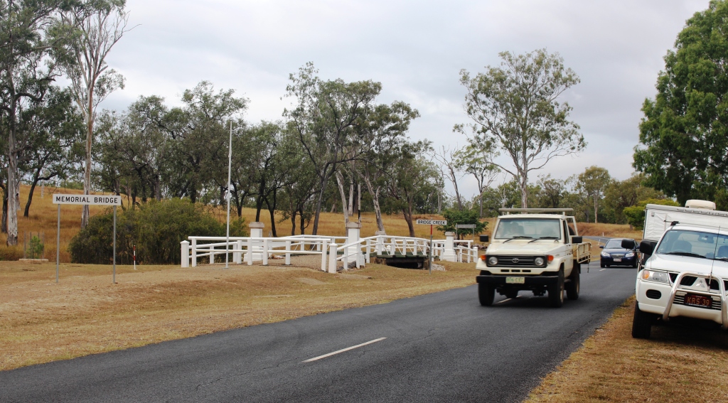
To preserve the memorial bridge it has been bypassed by the road

To preserve the memorial bridge it has been bypassed by the road

Further on, but before Biggenden, we came across (not literally) a memorial bridge, which used to be in service, but has now been preserved by the side of the realigned road. It spans Bridge Creek right beside it’s replacement. Signage claims it to be the only privately funded memorial bridge in Australia.

One of the pillar style end posts commemorate local fallen from WWI

One of the pillar style end posts that commemorate local fallen from WWI

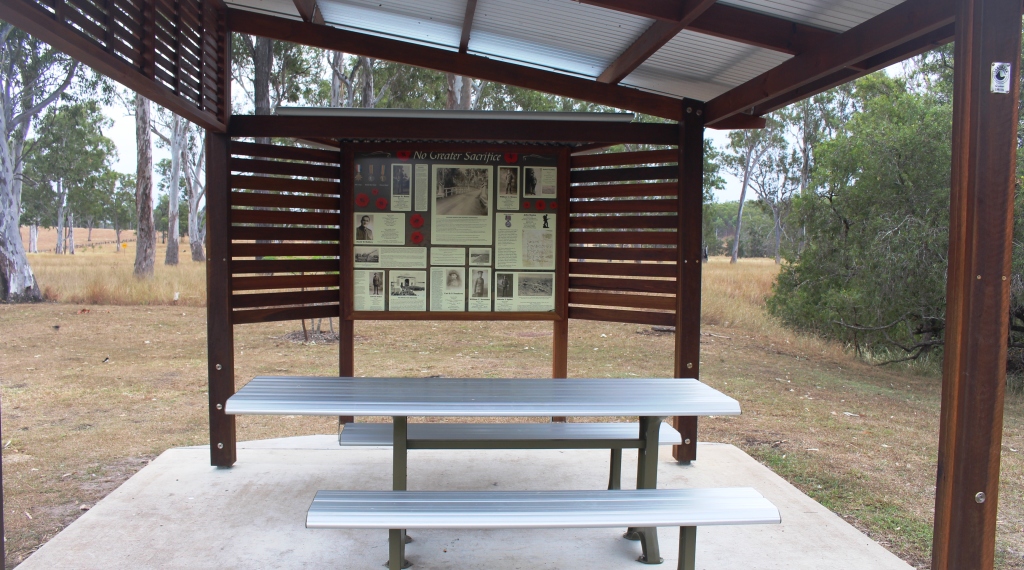
Adjacent to the bridge, but a bit further from the road, a picnic shelter has been erected. Its one wall (three sides are open) contains material about soldiers who did not return, including a letter from a soldiers fiance seeking information about his death. At both ends of each bridge rail stand small but monumental posts of stone. One of those at the northern end lists the local fallen from the First World War while the other lists those who served and returned.


Memorabilia from WWI relating to locals who served

Memorabilia from WWI relating to locals who served

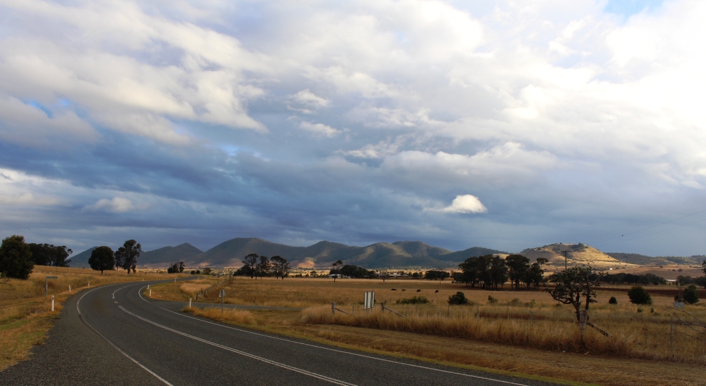
Light and shade on the hills as we approach Ban Ban Springs

Light and shade on the hills as we approach Ban Ban Springs

Rain was still falling as we reached Biggenden but cleared as we drove the 36 km to Ban Ban Springs. The sun broke through as we crested a hill to illuminate an agricultural valley. Clumps of trees stood out like stage props under a spot light, while cloud shadows patterned the hills that stretched across the scene like a backdrop.

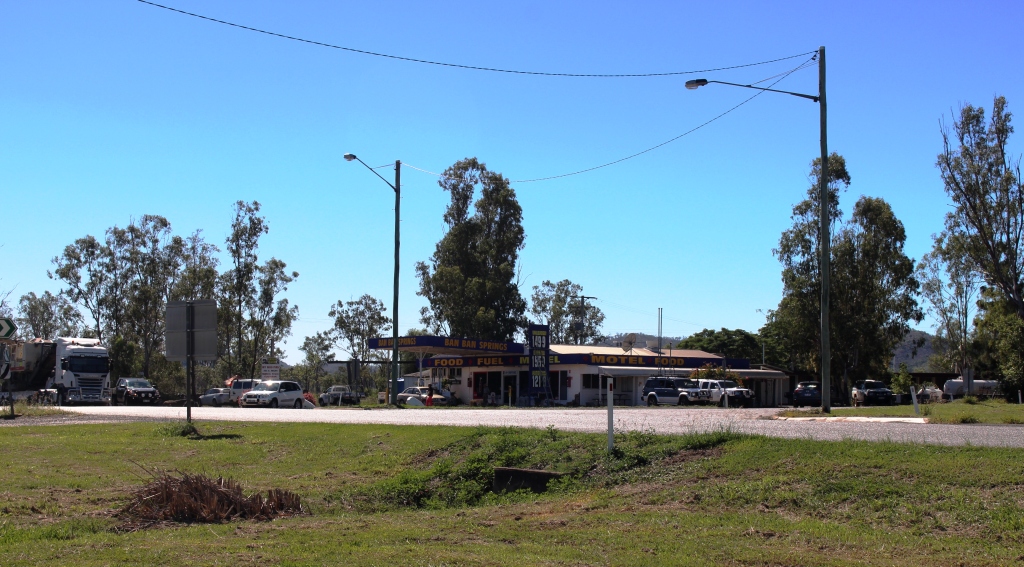
Ban Ban Springs is a roadhouse and motel at the junction of the Isis and Burnett Highways. The rest area, where caravans stop over night, is right across the road. Since arriving her I have remembered that this route is a favorite truckies short cut for heavy vehicles travelling between North Queensland and Melbourne and Adelaide. I’ll let you know how much sleep we get.

Ban Ban Springs Roadhouse

Ban Ban Springs Roadhouse

Day 2 – Friday 3rd June

The trucks did not interrupt out sleep. Traffic reduced after around 8.00 pm and we only heard the odd vehicle go by. In no time at all the sun was peeping through the overcast of cloud, something that it continued to do during the day. We encountered little of the forecast rain.

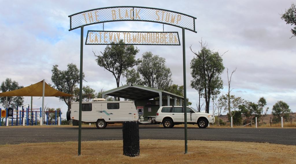
IMG_4248We stopped at Mundubbera for morning coffee and at Monto for lunch, on both occasions using the excellent roadside facilities provided in this area. Both include driver reviver facilities for holiday periods.

Traffic was relatively lite with not as many caravans as we expected. Caravans on the road were mainly travelling south with few moving in our direction. Caravan parks don’t seem to be busy either. Perhaps the Burnett Highway is not a popular tourist route.

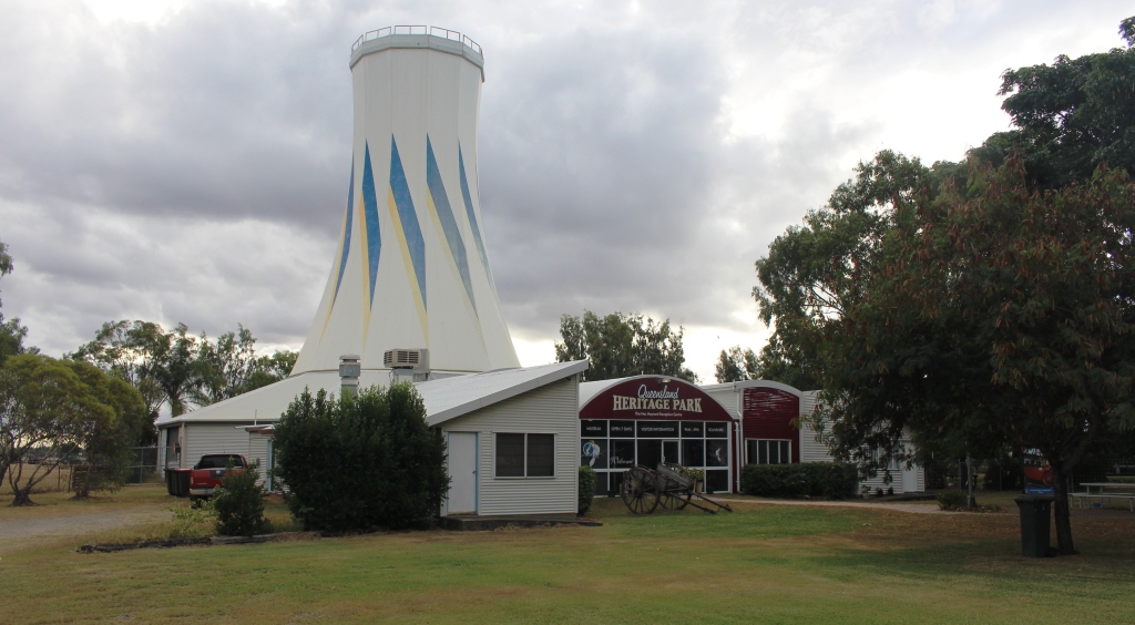
The main feature of Heritage Park is the ex Expo 88 Primary Industries silo

The main feature of Heritage Park is the ex Expo 88 Primary Industries silo

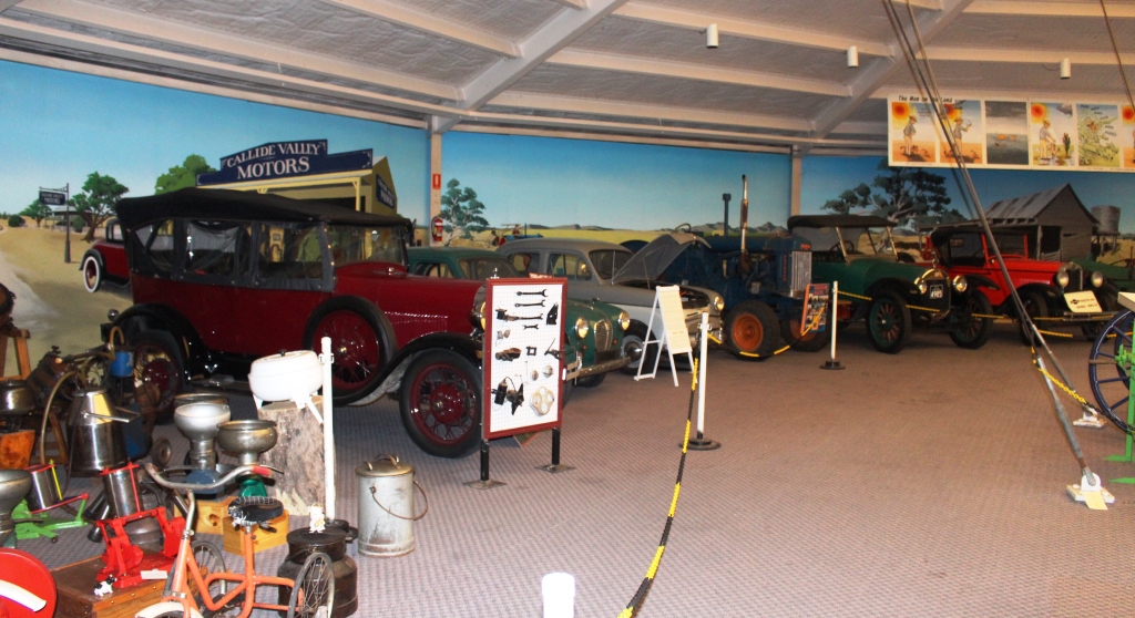
So it is not surprising that we are in a very lightly populated park tonight. We are in the 48 hour rest area that is part of the Queensland Heritage Park in Biloela. The park is managed by a club of historic machinery enthusiasts. They have a huge display of old agricultural machinery, small and large, and displays of the kind of household memorabilia with which I shared my early years. But much of the collection is older than I am. The central building of the complex that houses much of the display is the Primary Industries pavilion from Brisbane Expo 88. I had a close association with that particular building during Expo.

Part of the Heritage Park display

Part of the Heritage Park display –  including a variety of cream separators

Motor vehicles have been lovingly restored to their former glory

Motor vehicles have been lovingly restored to their former glory

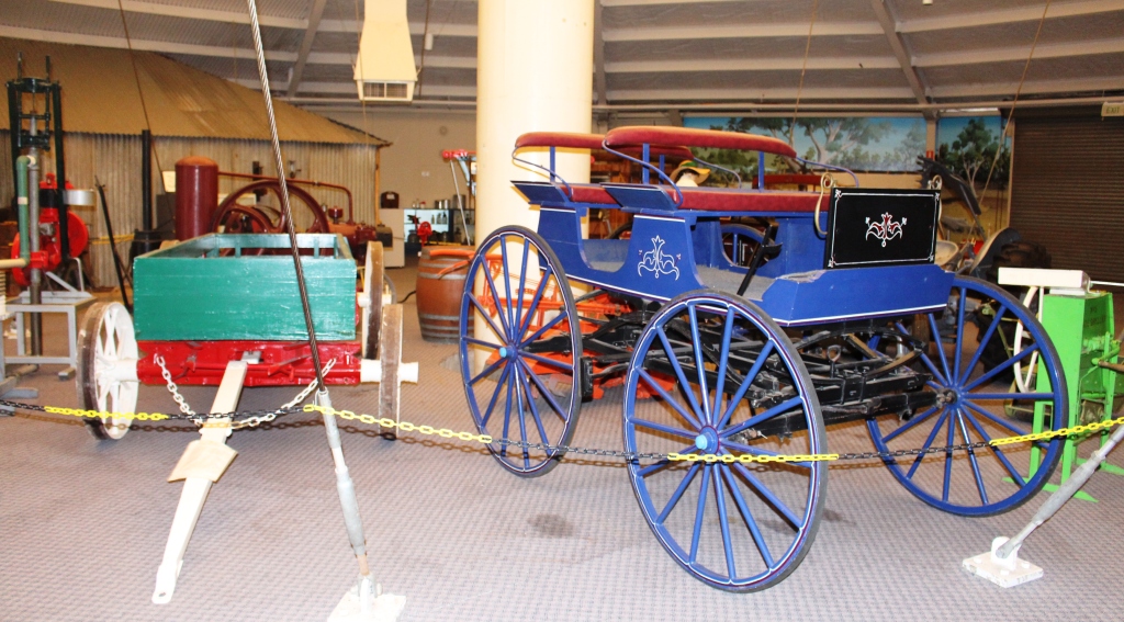
Transport from an era long passed

Transport from an era long passed

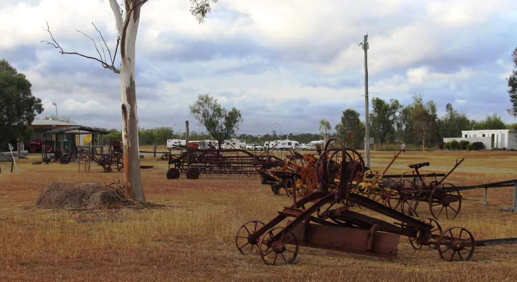
Old farm machinery with visiting caravans in the background

Old farm machinery with visiting caravans in the background

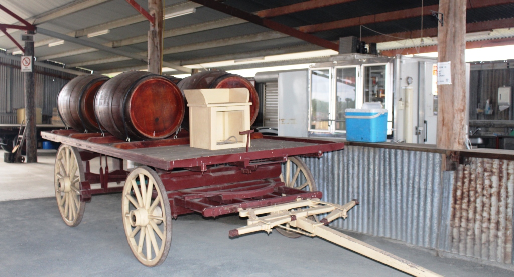
Wagon and wine barrels standing beside the bar in the function shed

Wagon and wine barrels standing beside the bar in the function shed

Thunder storms are forecast for tonight but as yet only a few rain drops and no thunder. Perhaps we will sleep through the noise even if it does occur.


Day 3 – Saturday 4th June

The storm arrived at midnight and woke us with torrents of rain drumming on the roof of the van. Our first thought was for the lady travelling alone in a vehicle with a roof top tent parked next to us. My next thought was, “Did I close the window of the car after I wound it down to insert the card that opened the gate to the camping area?”. That question had to be answered so up I got, put on wet weather gear and ran around the front of the car to check. Yes, securely closed! So I dashed back into the van with wet PJ pants and black mud all over my feet. After a thorough foot wash and a change of PJs we had a cup of tea and went back to bed

Recently plowed land with house and sheds north of Biloela

Recently plowed land with house and sheds north of Biloela

The rain had gone by the morning but the mud had not. Despite a covering of recently mowed grass the mud found its way through on to boots and shoes. Black mud and mower clippings make a challenging mess when clinging to the soles of said boots and shoes.

Today’s journey has taken us north to the Capricorn Highway via the small town of Dululu, where we made the mandatory stop at the loo. The overcast sky again gave way to sunshine but an unexpected storm came back from the opposite direction to that of the storm last night. It only lasted for 15 minutes or so.

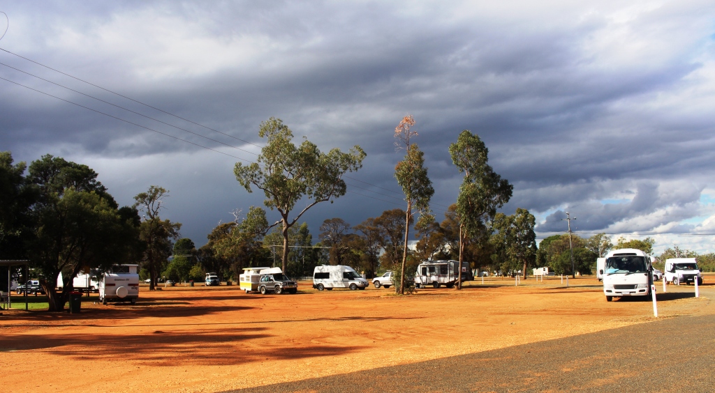
Vans in the Dauringa camping area

Vans in the Duaringa camping area

We had intended to reach Dingo but the camping area at Duaringa looked inviting and with plenty of space, so we decided to stay. That decision was confirmed when we found the lady with the roof top tent from the previous evening.  She joined us for a cup of tea and we found out a bit about her.

Her name is Annie. She is a single middle aged lady who loves to travel and particularly in Australia, as this is her third consecutive Australian winter. She has a Nissan Patrol with all necessary gear, which she leaves here in preparation for the next visit. She has covered a great deal of Australia, particularly the outback. She left the following morning, headed for a Simpson Desert crossing.

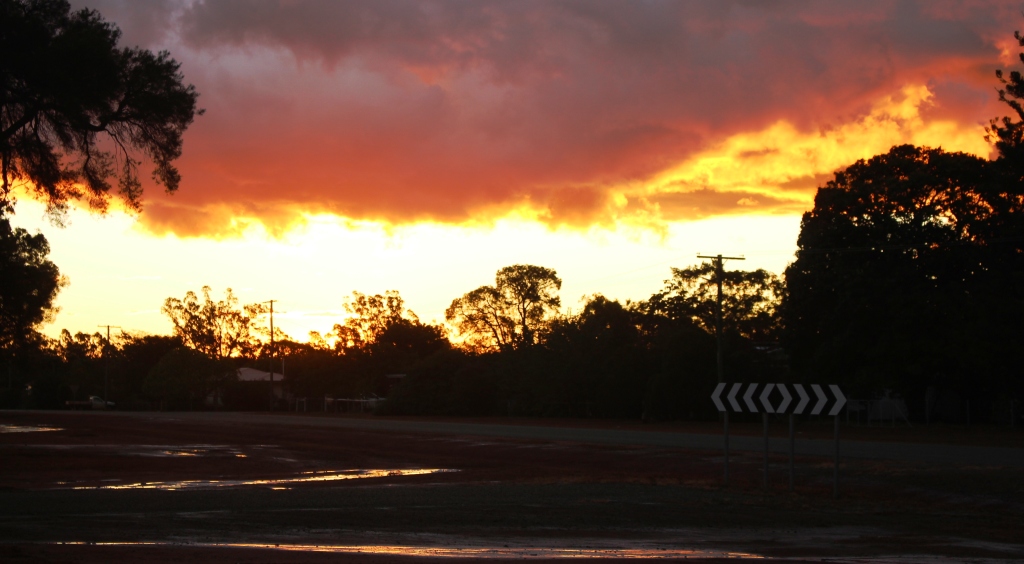
The setting sun lights up the edge of the departing storm clouds

The setting sun lights up the edge of the departing storm clouds

After the storm the setting sun broke through to produce a stunning sunset that lit up the clouds through the entire 360 degrees of the horizon.


Day 4 – Sunday 5th June

The sun rose into a clear sky again. We didn’t see a cloud all day and at the end of the day, at Dingo, the sun set, producing a brilliant strip of orange light across a flat horizon.

The view approaching Blackdown Tableland

The view approaching Blackdown Tableland

We came on the final 36 km to Dingo, refueled and parked the van in a large parking area behind the Dingo Roadhouse. We set up, put our security arrangements in place,  packed a picnic lunch and headed west on the highway for the 12 km to the turn to Blackdown Tableland National Park. The next 12 km to the foot of the mountain runs through unfenced cattle country with plenty of grazing stock that seem to prefer the roadside grass to that further away from traffic. They were healthy looking beef cattle of various breeds.

The road that runs at the base of the cliff as the summit is neared

The road runs at the base of the cliff as the summit is neared

The road to the summit of Blackdown Tableland is sealed, but steep and winding. From the time that we left the highway we could see the long Cliffs of coloured sandstone that gives this mountain its special appearance. The climb was through dense forest for much of the way but near the summit the road runs directly below the cliffs.

A gap in the cliff face beside the road

A gap in the cliff face beside the road

The end of the sealed road at the start of the park plateau

The end of the sealed road at the start of the park road

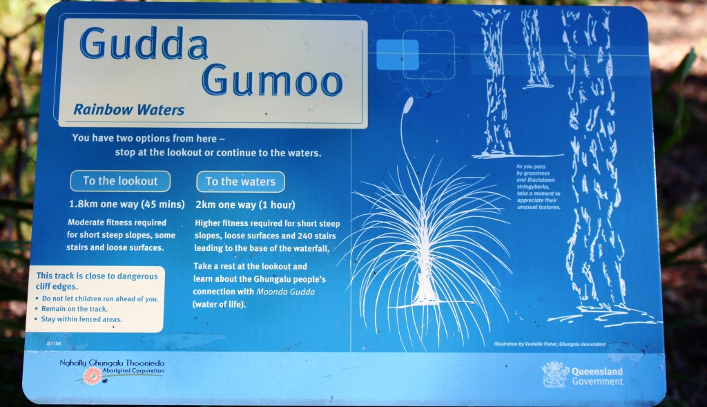
The sealed road ends at the information shelter but the dirt road was in good condition and adequate for the 60 kph speed limit within the park. We drove to the southern car park, which is as far as you can drive. Walks start there for what seems to be a significant waterfall but the distance and terrain was a bit much for the time we had available.

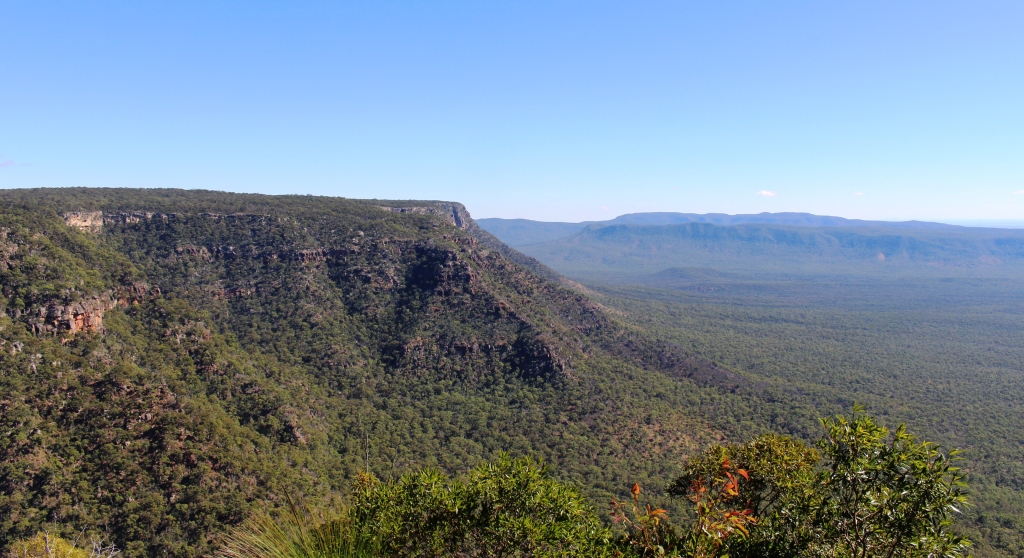
The view from the lookout that we reached

The view from the lookout that we reached

The sign for the walks that we did n

The sign for the walks that we did not do

We were thwarted in reaching a lookout by a chain locked across the access road, but did make it to the lookout that provides a view to the north and northeast. It was only a 100 meter paved walk but the view was fairly spectacular.

There is a camping area about 5 km past the information shelter where a few campers were in residence. The lengths of the walks are more suitable for campers than for day trippers unless the day trippers arrive early and are young and fit.

We finished the day by driving on to Backwater. The town is all about coal and promotes itself as the coal capital of Queensland. Apart from mining activity and coal trains the town was quiet on a Sunday afternoon.

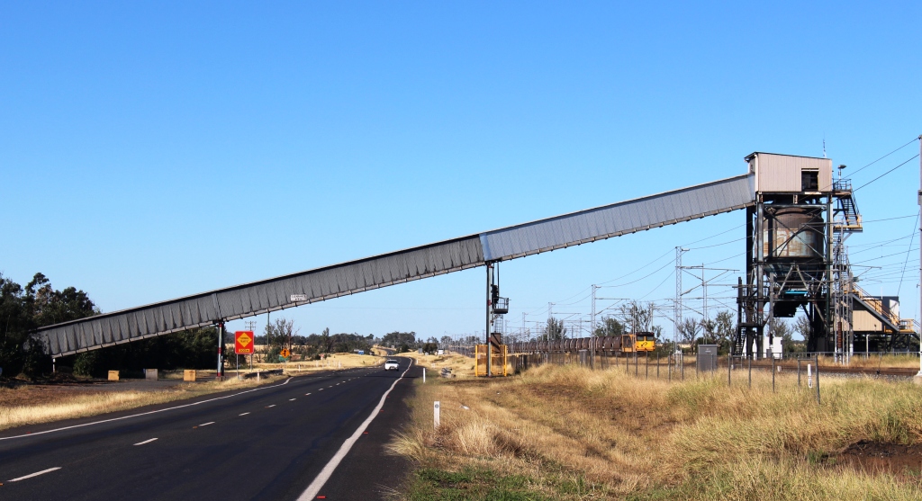
Coal conveyor and loaded train near Blackwater

Coal conveyor and loaded train near Blackwater

The coal trains run along beside the highway in this area. At Dingo Roadhouse there is a truck parking area, the roadhouse, the highway and a strip of vacant land between us and the twin sets of rails of the coal line. A stiff south easterly breeze had been blowing the sound away from us but when the breeze dropped as evening fell it was as if the volume had been turned up.

The entrance path and old mining equipment at Blackwater

The entrance path and old mining equipment at Backwater coal information centre

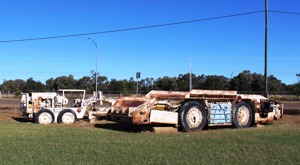
Retired underground mining equipment at Blackwater

Retired underground mining equipment at Backwater

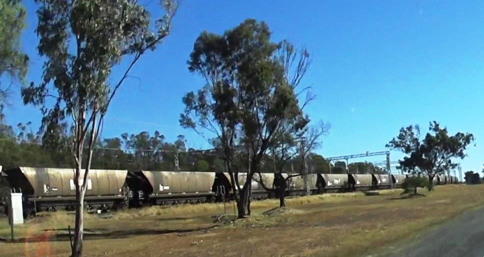
Driving past a long coal train

Driving past a long coal train

The trains are rather large, typically with about 100 coal wagons and three engines, with an engine at each end and one in the centre. So as they pass, you have the rumble of wheels and the scream of electric motors. The line is electrified. Trains go by at a rate of three to four per hour. So, yes, our sleep was a bit disturbed.

A final view of Blackdown Tableland as we drive back to Blackwater

A final view of Blackdown Tableland as we drive back from Blackwater

Massed water lilies in a roadside pond near Dingo

Massed water lilies in a roadside pond near Dingo

You have read the book – now see the movie : Cape York 2015

After we return from each of our extended tours I go through our images and videos and combine them into a video, or in some cases into a series of videos. When we did the Big Lap in 2009 the material took up almost all of 4 DVDs.

Normally I have produced one long story for each trip which has not been easy to break into sections. But for the Cape York trip last year I complied twelve shorter videos, which when combined, ran for almost an hour.

I have put links to some small video clips in various blog posts covering the Cape York trip so I thought I may as well break the longer production into manageable portions and load them to You Tube, to make the material more easily accessible to my blog readers.

The end result is six videos, each of a bit less than.ten minutes duration. Here is a summary of the videos and the link to each.

Cape York Adventure 2015 – Part 1. Covers from home to Airlie Beach and a day cruise through the Whitsunday Passage to Whitehaven Beach.

[youtube]https://youtu.be/Gb-xM_mio00[/youtube]

Cape York Adventure 2015 – Part 2. This video tells of the section from Airlie Beach to Weipa and our explorations around Weipa

[youtube]https://youtu.be/s3l03Rt5bdc[/youtube]

Cape York Adventure 2015 – Part 3. You will see much of what we saw as we travelled from Weipa to Punsand Bay, our visit to The Tip and our trips around Bamaga and Seisia

[youtube]https://youtu.be/Q693fD5CiFo[/youtube]

Cape York Adventure 2015 – Part 4. This covers two separate day trips to Thursday and Horne Islands. The material is combined into one story.

[youtube]https://youtu.be/1G168MSeuik[/youtube]

Cape York Adventure 2015 – Part 5. Join us as we travel down the East Coast of Far North Queensland from Seisia to Cairns and then visit Cairns city and the rain forest areas of Daintree and Cape Tribulation

[youtube]https://youtu.be/LrKySa1q42w[/youtube]

Cape York Adventure 2016 – Part 6. This video wraps up our trip with our visits to Tully Gorge and the Central Queensland gem field towns of Rubyvale and Sapphire.

[youtube]https://youtu.be/q0-Aud4KUYU[/youtube]

We hope that you will enjoy seeing something of the scenery and points of interest that we encountered on this enjoyable and challenging journey.

Until next time,

Kevin


Days 34 to 37 – Cape York Adventure

We departed Kurrimine Beach on Saturday morning, needing to be home on the next Wednesday; with a little over 1,600 km to do via the coast and a bit more if we took the inland route. Inland won, as that gave us a chance to at least drive through the gem fields. We had intended to spend two or three days there.

Ready for a quiet night

Ready for a quiet night

We left the Bruce Highway at Townsville and took the Flinders Highway, heading for Charters Towers. The revised plan was to spend the Saturday night at Macrossan Park on the east bank of an almost dry Burdekin River. Macrossan Park is a popular overnight stop, with flushing toilets and cold showers for the Spartan.

Information shelter and toilets at Macrossan Park

Information shelter and toilets at Macrossan Park

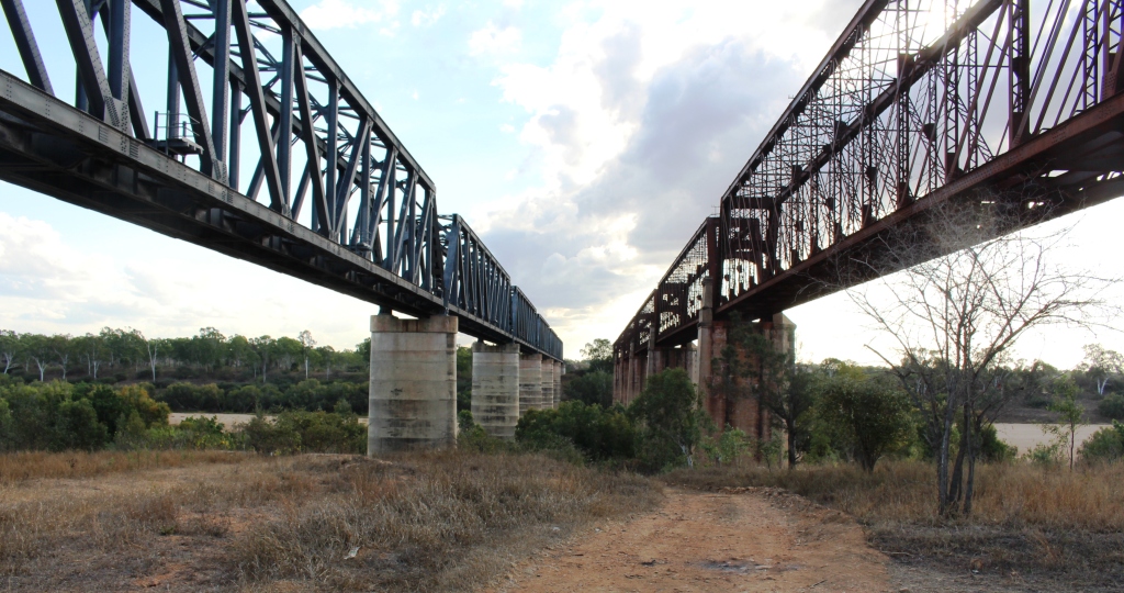
The camping area is between the highway and the railway, which is carried over the river by an impressive iron bridge. With the van set up for a comfortable night I went for a walk, to have a closer look at the rail bridge. Imagine my surprise when I found two rail bridges. It seems that many years ago the original iron bridge was replaced by a new bridge of similar design. The old one probably became unsafe, so a new bridge was built, just a few meters to the south. Once you know that the second bridge is there you see it straight away. But if you are expecting only one bridge then chances are that is what you will see, the structures are so similar.

[youtube]https://youtu.be/vfoHUPAXhUg[/youtube]
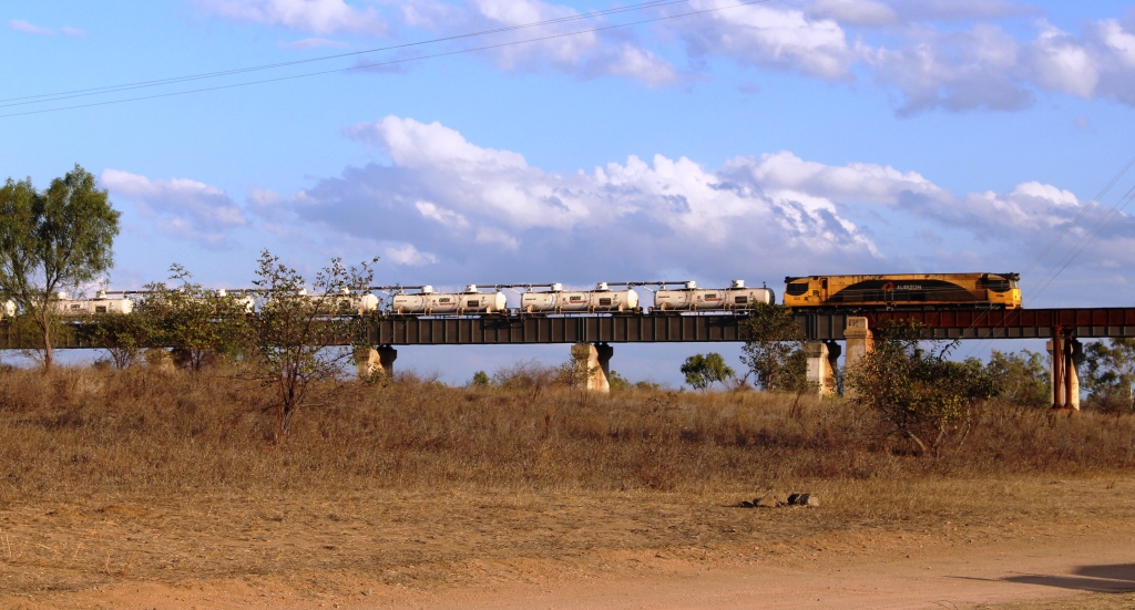
Fertiliser train approaching the main bridge

Fertiliser train approaching the main bridge

Queensland National obliged by sending a long fertiliser train over the bridge before dark and an other one after dark. There was at least one more during the night. The sun slid quietly behind the low range of hills that constitute the horizon, with a tinge of colour in the distant clouds which were rather a dark shade of grey. But the cloud

Tinges of sunset on the edge of storm clouds

Tinges of sunset on the edge of storm clouds

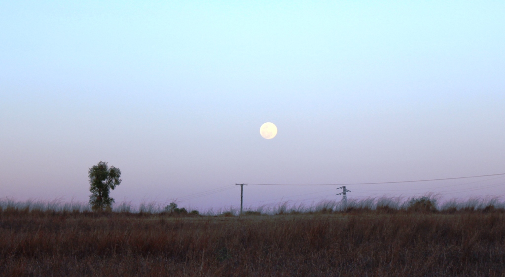
vanished westward with the sun and left us with a full moon rising into a clear sky.


A full moon commences its assent

A full moon commences its assent

Res, there really are two bridges

There really are two bridges

On Sunday morning, a short run brought us to Charters Towers, where we refueled for the run south through Belyando Crossing and Clermont to our next overnight stop. Quite early in the trip we started to see signs of recent reasonably heavy rain. There looked to have been enough rain to put a smile on local farmers’ faces. When we crossed the first range from the coast the previous day, we could see how dry it was. That amount of rain would at least have brought some relief for beleaguered farmers. It certainly explained the grey clouds on the horizon the previous evening.

The Gregory Developmental Road passes through a mix of flat and undulating grazing country on its way through Emerald to Springsure, where it becomes the Dawson Highway, but we were not going that far. We refueled at the Belyando Crossing Roadhouse and continued on into the coal mining area of Clermont where we turned onto minor

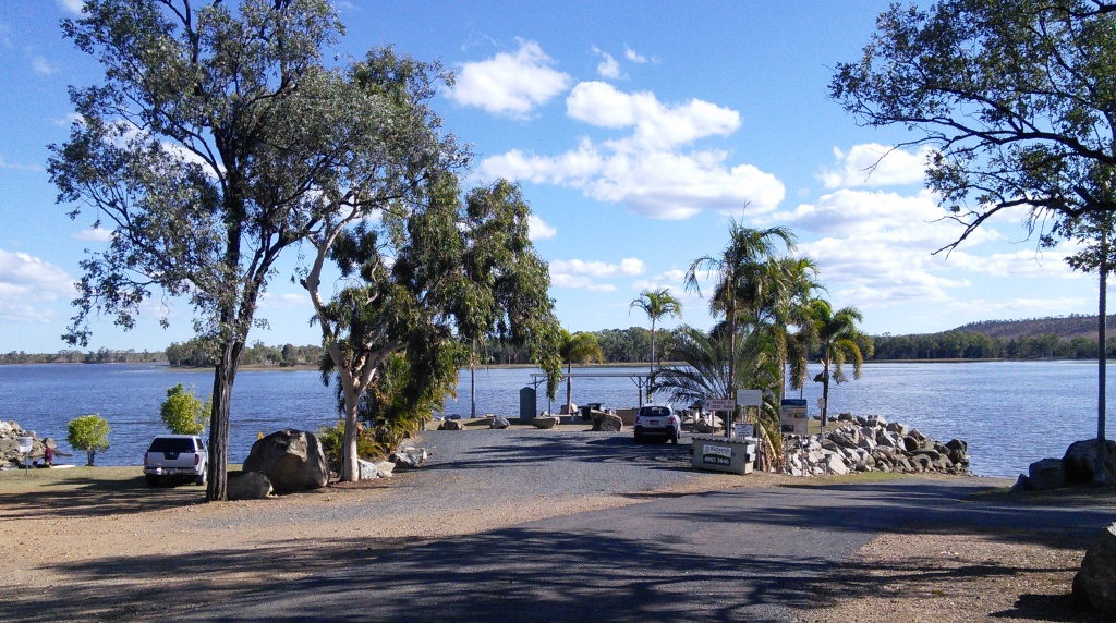
Theresa Creek Dam

Theresa Creek Dam

roads to reach the caravan park at Theresa Creek Dam, about 25 km to the south west of the town. We noticed that one long coal carrying conveyor that was working when we came through this area last year was now stationery, a victim of the slowdown in coal exports, probably.

Theresa Creek Dam has been there for many years with a recreation area for locals on its banks. But in recent years the local council has developed what was formerly an informal camping area into a comfortable caravan park. We lined up with other vans in the overnight area, but at a comfortable distance from our neighbor.  But not for enough away not to hear our next door neighbor’s generator. Peace was restored when it was turned off an hour later but we had spent that time walking about the caravan paek, so were not really inconvenienced.

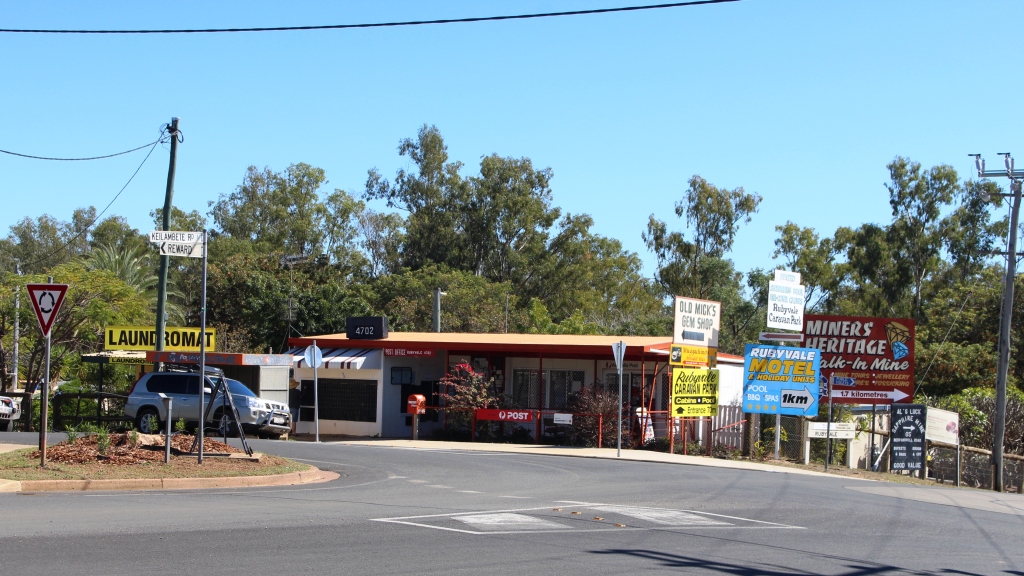
Rubyvale Post Office

Rubyvale Post Office

After another peaceful night we moved on for our drive through the gem fields. It wasn’t very far, probably about 50 km and we were parked in Rubyvale. Gem mining towns tend to be a bit of a shambles, due, I think, to the kind of people who become gem miners and the limited means with which they initially ply their trade.

Rubyvale town centre

Rubyvale town centre

Rubyvale, however, has a very orderly centre with a general store, post office, caravan park and a new gem display and sales gallery that also houses a stylish coffee shop. There were not many gems in the gallery priced below $1,000 but the commodious coffee shop, probably built with the tourist coach trade in mind, had very affordable Devonshire Tea (or coffee). We also bought a small bag of washed gravel to put aside

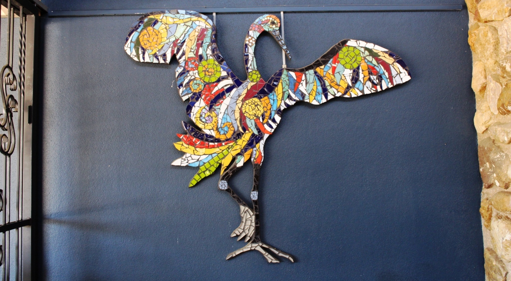
Decorations on the coffee shop wall

Decorations on the coffee shop wall

for sieving with our granddaughters at some suitable time. Perhaps we are sitting on a fortune. And perhaps not! But we may find something worth cutting and mounting into a piece of jewelry.

Coffee and scones consumed, we continued on to Sapphire, another ragged town with a less orderly centre than Rubyvale, but it’s town centre is clearly older. After a look around we continued to the

Sapphire General Store

Sapphire General Store

Capricorn Highway and then to a lunch stop at Emerald.

At Emerald we were back on the Gregory Developmental Road for the 56 km to Springsure. It was now a matter of how much further we went that day. We had in mind a river side camp where the Dawson Highway crosses the river from which it takes its name, but the caravans already there appeared to have been inserted by a sardine packing machine. We continued a further 20 km to the largely deserted caravan park in Moura. It is a large park, mostly of motel units and cabins for mine workers.

Hills near Springsure

Hills near Springsure

Our site was adjacent to a very noisy Coca-Cola machine that seemed to be trying to freeze its contents. We didn’t check. It was more of a night for hot drinks in this Central Highland town, the sleeping part of which we spent under a doona.

Home was now not much more than 600 km away with two days in hand, so we had the option of spending another night on the road or go for home. I find that these kinds of decisions take care of themselves. As the day progressed it was resolved in favor of going for home. We took a mid morning break at Monto, lunch at Ban Ban Springs and as the afternoon wore on stopped at Kybong, south of Gympie, for a very large container of caffeinated coffee and a serve of crisp hot chips.

So that brought us to the end of 37 days of fascinating adventure. Before we left home I had read a comment on Facebook where someone had remarked that a trip to Cap York was more an adventure than a holiday. That is one reason that I called this series of posts our Cape York Adventure. It’s both, really. Whoever said that you can’t have an adventure while on holiday?

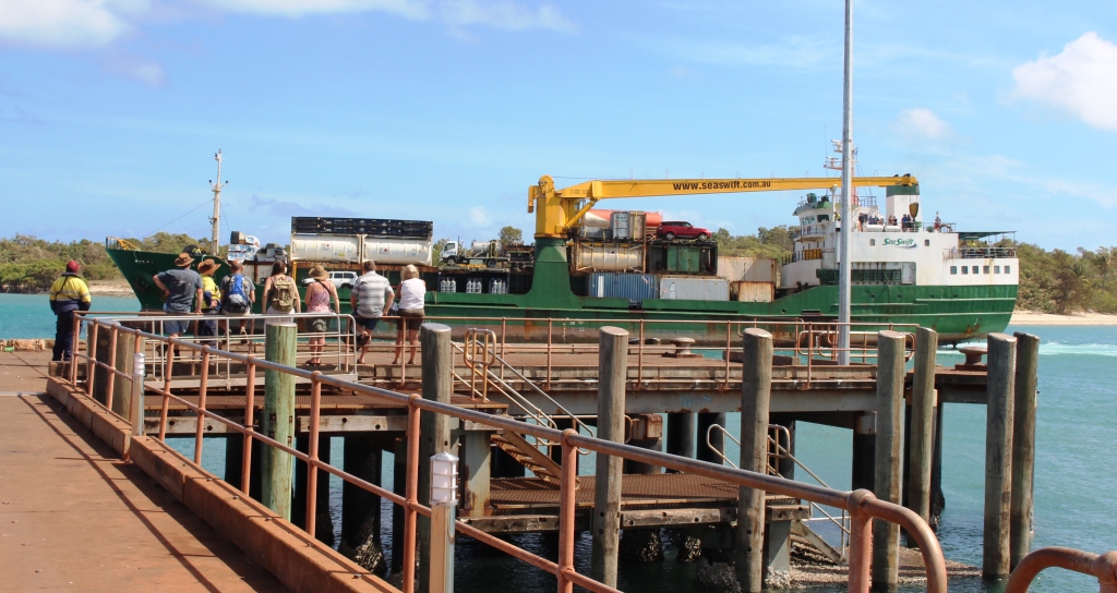
MV Trinity Bay berthed at Saisia wharf

MV Trinity Bay berthed at Saisia wharf

The opportunity to return by ship was pure luck, but the experience added greatly to the memories. I don’t mind driving on rough roads as we have the equipment to handle them, but I don’t go looking for them. If there is a choice of a sealed road that doesn’t take me too far out of my way I will opt for it every time, but there are iconic remote dirt roads and I get a great sense of satisfaction successful driving them.

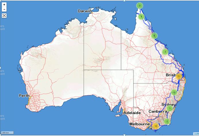
2015 travels

2015 travels. The blue line traces our path.

I have mentioned previously that we track our movements using a satellite tracking device. This provides a recorded track that can be superimposed on a map. I had a look at ours the other day, only to realise that  we had literately travelled from one end of the country to the other during the last twelve months. In the dying days of 2014 we were at Wilson’s Promontory and less than a month ago were at the tip of Cape York. Here is how it looks on the map.

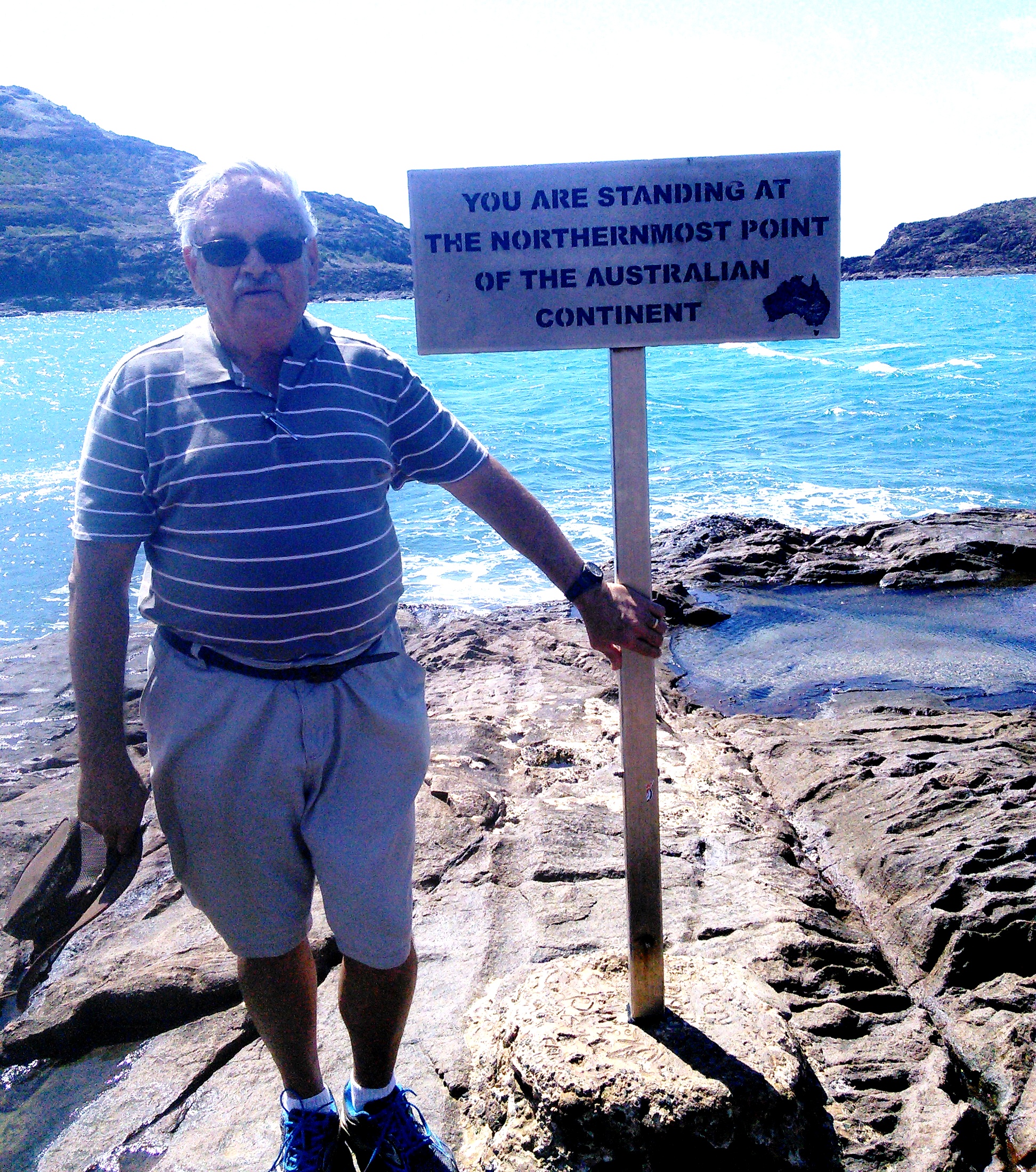
A windblown yours truly at the Tip

A windblown yours truly at the Tip

So, until next time, thanks for coming along with us to the Tip.

Days 29 to 33 – Cape York Adventure – Daintree & Tully Gorge

We had originally intended to spend a couple of days at Cape Tribulation on our return from Cape York, but returning south on MV Trinity Bay meant that we had landed further south so had to decide whether or not to take the van back north. We finally decided to reduce that part of the plan to a day trip, even though to do so meant that we would not have time to drive the Bloomfield Track as we had planned. When we visited Cooktown in 2010 we had driven the northern end of the track, south to the Bloomfield River. During the planned stay at Cape Tribulation we had intended to fill the gap on our “where we have been” map, between Cape Tribulation and the Bloomfield River. But you can’t do everything.

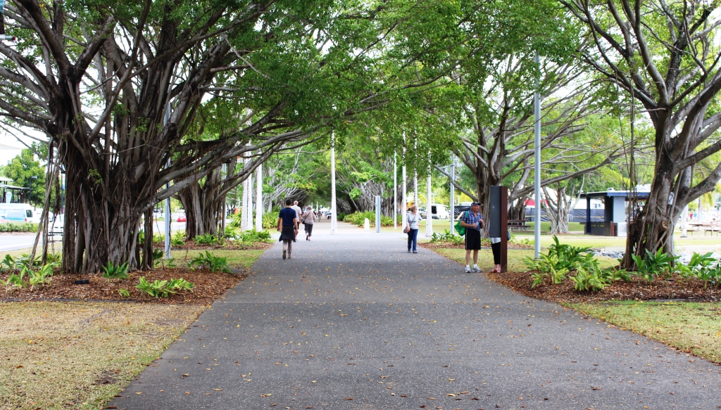
In the park by the waterfront

In the park by the waterfront

IMG_3796

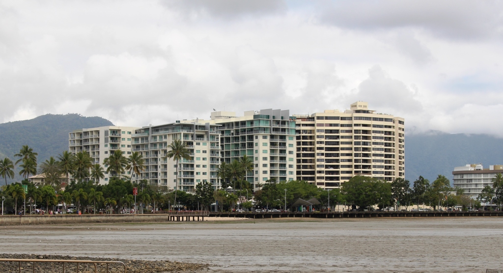
Water front high rise at Cairns

We had based ourselves at Lake Placid Tourist Park, which is the northern most caravan park in suburban Cairns. But to visit the Cairns area without paying a visit to the city itself was unthinkable, so we spent our second morning pounding the pavement and wandering the waterfront. There is always something going on in this ever expanding tourist Mecca. Tourist boats were coming and going, helicopters were fetching and taking passengers and people were moving around as they went about their business or leisure. There was a set for some kind of circus under construction on the grass near the large swimming pool.

Of course, most tourists were out doing tourist things. Cairns central would come alive at night as the restaurants and bars began to fill. The street that runs adjacent to the waterfront seems to be an endless succession of such establishments, punctuated by tour booking offices.

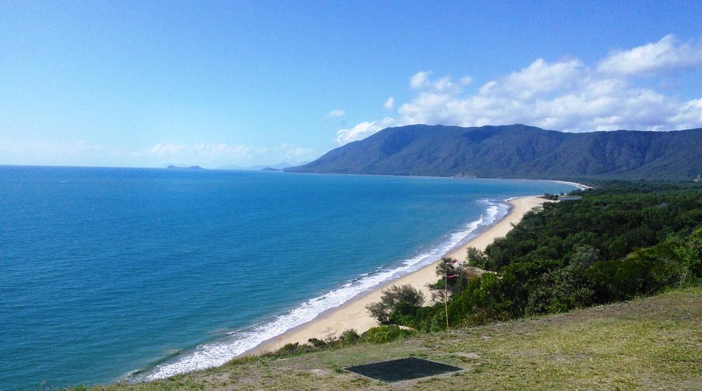
The coast south of Port Douglas

The coast south of Port Douglas

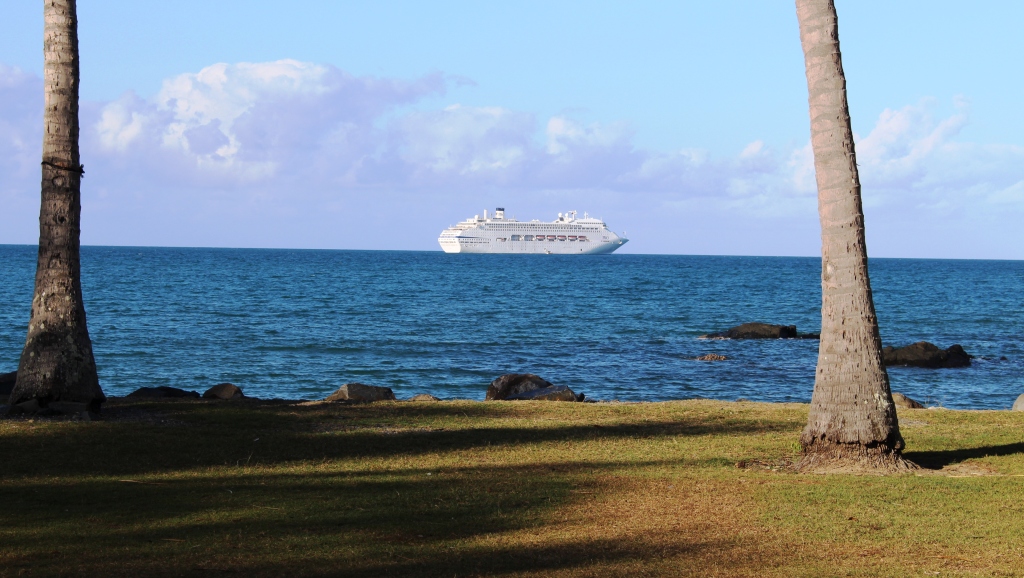
I have probably said in previous blog posts that the coast between Cairns and Port Douglas is one of the most attractive drives in Australia, particularly the section where the road hugs the coast. We had struck a fine sunny day, so the sea and most of the sky was blue and the traffic was not too heavy. A cruise liner was off the coast as we approached Port Douglas, but we drove on, with still some distance to go to reach our destination.

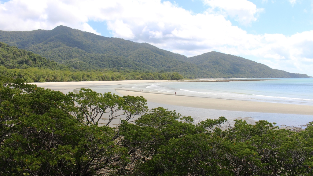
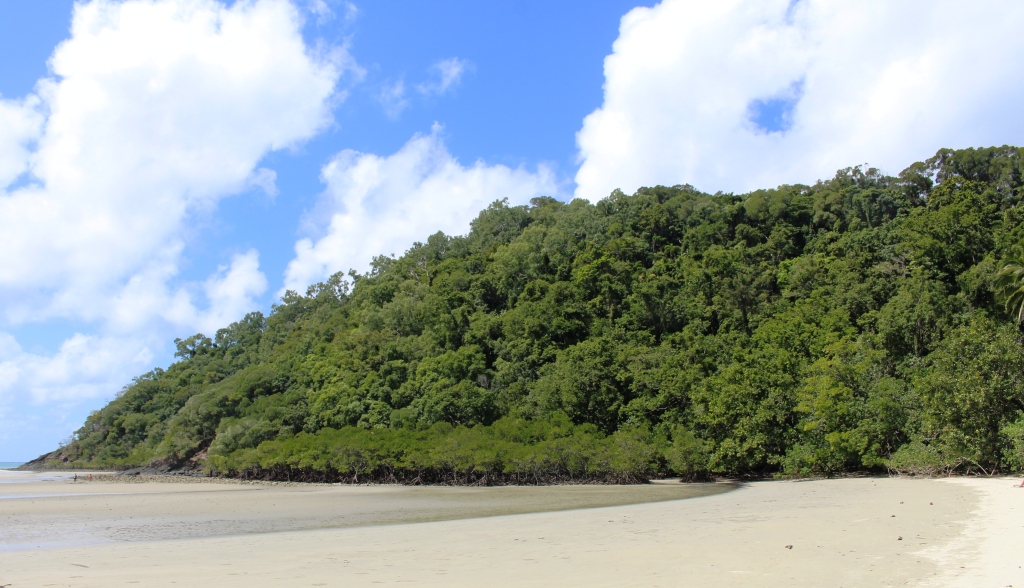
Cape Tribulation Beach

Cape Tribulation Beach

The picnic shelter where we had morning coffee at Mossman was shared with another couple just returned from Cape York. Returning Cape travelers are rather thick on the ground at this time of the year around Cairns.

We reached Cape Tribulation in good time and spent the remainder of the morning looking around. This included a walk to the beach, which

Rain forest on Cape Tribulation

Rain forest on Cape Tribulation

can now be viewed from a vantage point accessible by a wheel chair friendly concrete path. As usual, the sand on the beach was firm, almost wheel chair friendly.

Following lunch at Mason’s Café, we headed back south, but as on a previous occasion, stopped in at the place where they make ice-cream from local native and

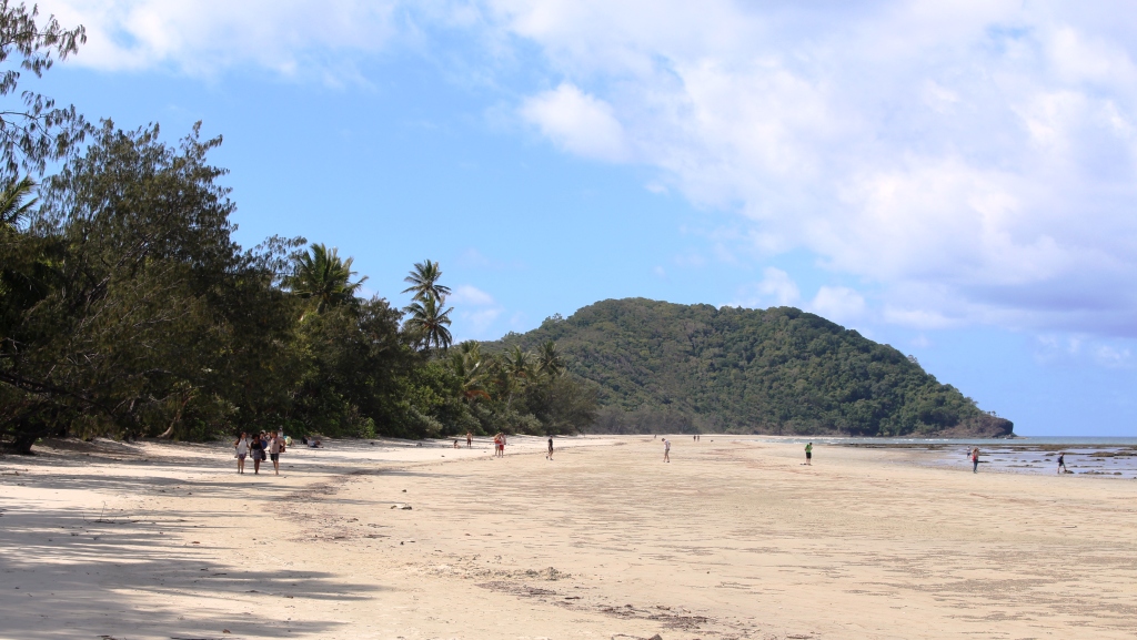
Myall Beach is immediately south of Cape Tribulation

Myall Beach is immediately south of Cape                                         Tribulation

introduced fruit. How fashionable is that? The main luncheon course at one establishment and desert at another?


Mason's Cafe at Cape Tribulation

Mason’s Cafe at Cape Tribulation

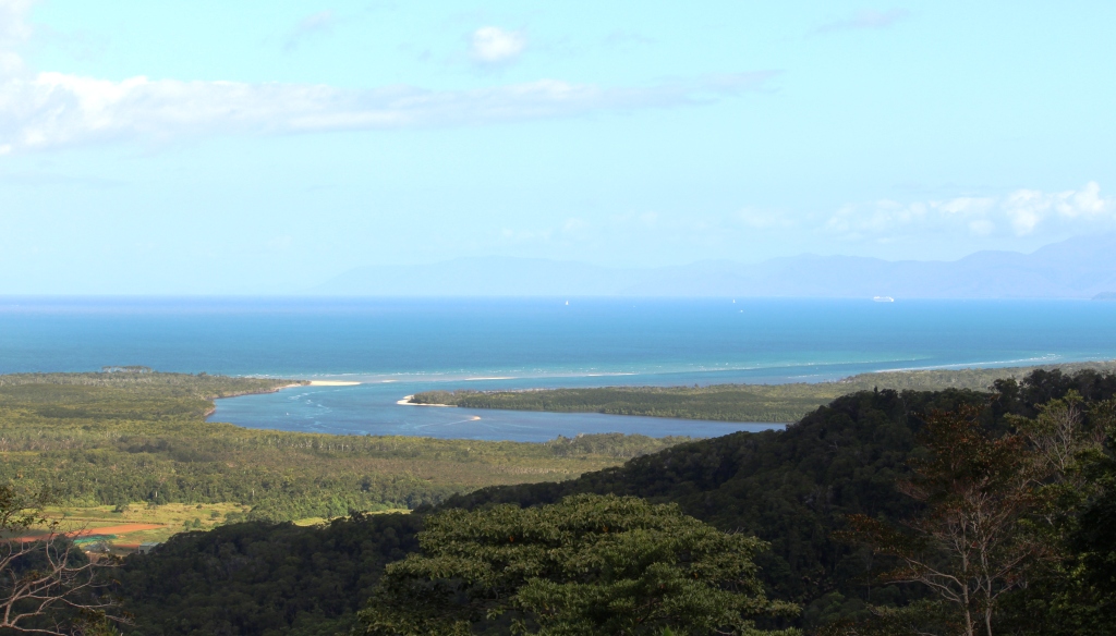
The Daintree Estuary

The Daintree Estuary

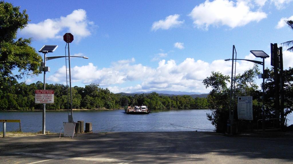
Before reaching the Daintree River ferry, we made the mandatory stop at the lookout that provides such superb views of the Daintree estuary and the coast south towards Port Douglas. Last time that we were here the area was enveloped in cloud so low that there was no view at all.


The Daintree Ferry

The Daintree Ferry

The Pacific Dawn at anchor off Port Douglas

The Pacific Dawn at anchor off Port Douglas

As we approached Port Douglas, we noticed that the cruise liner that we had seen in the morning off the coast was actually at anchor. Passengers were obviously having a day ashore. So we drove in to take a look. The town was busy as usual with lots of people still on the beach at 4.00 pm. The harbor was busy too, with boats that normally take people out to the Great Barrier Reef running shuttle services transporting passengers back to

Ferrying passengers back to Pacific Dawn

Ferrying passengers back to Pacific Dawn

the cruise liner from their day ashore. We believe that the cruise liner was the Pacific Dawn.


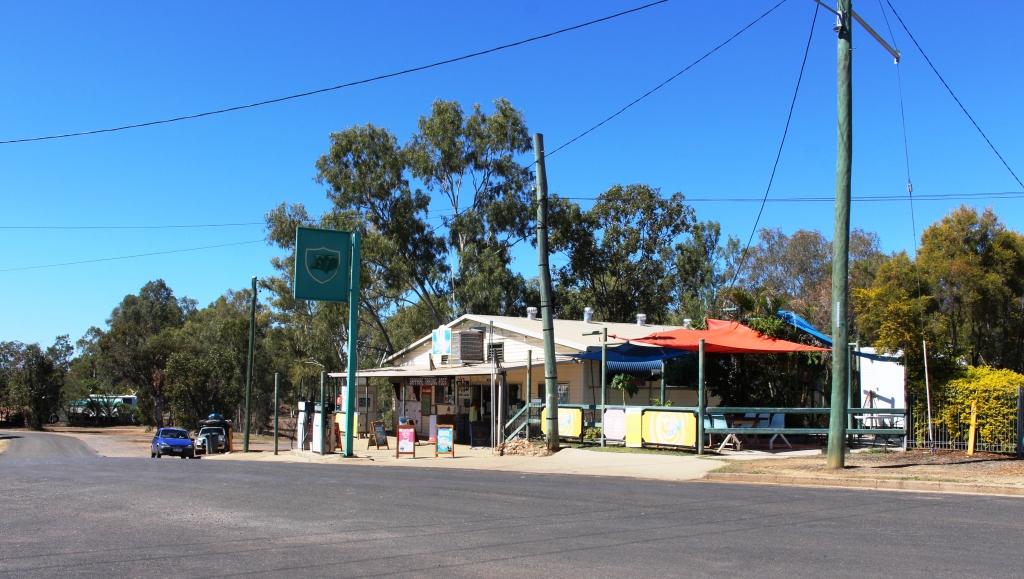
The following morning we left to spend a couple of nights at Kurrimine Beach. We had selected it as a base to explore the Tully Gorge. Not long after our arrival we received news of the passing of a colleague from transport industry days. Our association was at both a business and family level, so our spirits were rather dampened. We received information about funeral arrangements next morning, so were able to plan to be back in Brisbane for the funeral service.

Power substation in Tully Gorge

Power substation in Tully Gorge

Timing still allowed us a day to visit Tully Gorge. This part of our plan was a legacy of our trip to the Atherton Tablelands in 2010. On that occasion we had driven in to the point where the Tully River tumbles over the edge of the Tableland and down a series of waterfalls, to the valley floor below. The initial fall is in a deep gorge and cannot be seen from the lookout, but after heavy rain it can certainly be heard. We decided then that we would like, one day, to see it from the bottom.

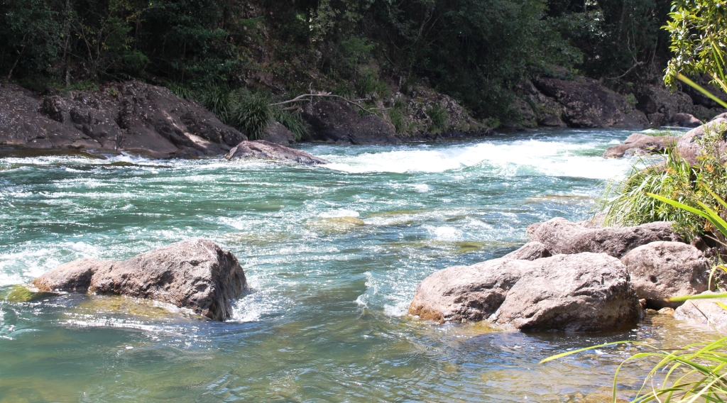
Tully River white water

Tully River white water

Tully Gorge is known throughout the tourist industry as a popular white water rafting location. As we drove in we saw vehicles associated with rafting but did not see any rafting groups. Water levels are low in the river at the moment, making it more suitable for kayaks than for inflatable rafts.

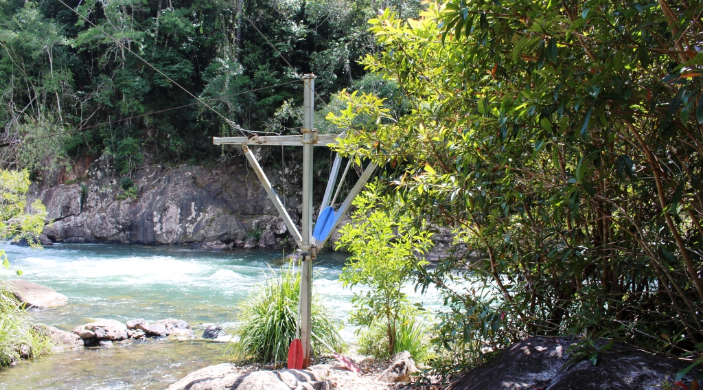
The river end of a raft lalunching system

The river end of a raft lalunching system

The drive in is about 50 km to the point where the road terminates at an electrical substation that we think takes power from a hydro plant at the dam on the river above the falls. This effective barrier prevents you from reaching the falls, but you can see the white water cascading down the side of the gorge further up but too far away for a good photo.

The first part of the drive is through cattle country with abundant grass reaching well up the sides of the grazing animals. Cattle properties are interspersed with the odd sugar plantation. Then comes the banana plantations. Reaching back into the foothills on both sides of the valley, they line about 15 km of roadside. Plantations are enclosed in new barbed wire fencing with locked gates and “Keep Out” signs. Employee vehicles are parked on the roadsides. Owners are serious about keeping the disease that is damaging banana crops in North Queensland, out of their plantations.

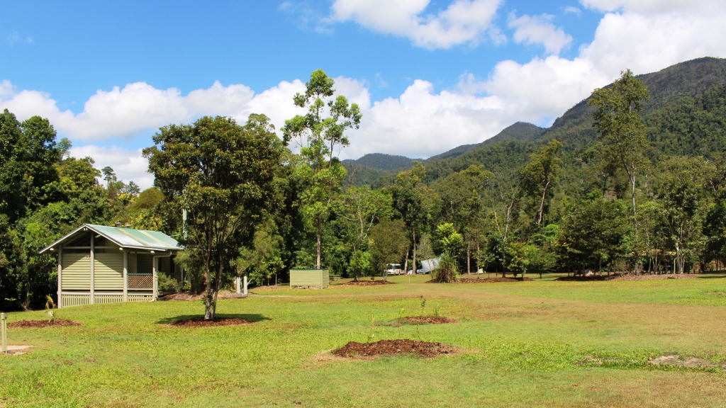
Tully Gorge National Park camping area

Tully Gorge National Park camping area

At the mouth of the gorge the road crosses to the south bank of the river and follows the stream quite closely, to the end of the road. Thick roadside vegetation hides the river for much of the drive but there are a number of vantage points and access roads used by the tour operators to reach the river. At a number of locations flying fox type structures make transporting the rafts to the water’s edge easier than it would otherwise be possible.

The retrieval pond at the NP camping area

The retrieval pond at the NP camping area

The Tully Gorge lies within the Tully Gorge National Park. Park authorities have provided an extensive day use and camping area with toilets, showers and change facilities that doubles as a local base for tour operators and provides facilities for overnight or more extended accommodation.

The road is sealed over its entire length. The gorge is deep with towering escarpments, covered by lush rain forest that rises directly from the river banks.

Tully Gorge is a worthwhile drive for anyone wanting a break from the beach and humiditywhile holidaying in the Tully and Mission Beach area.