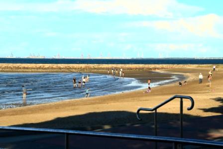
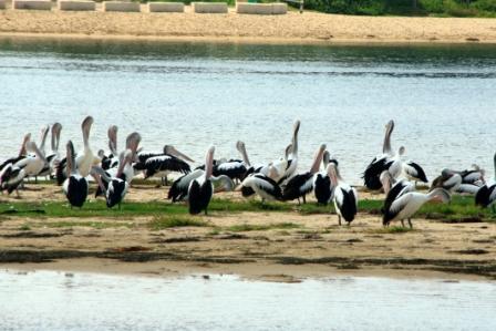
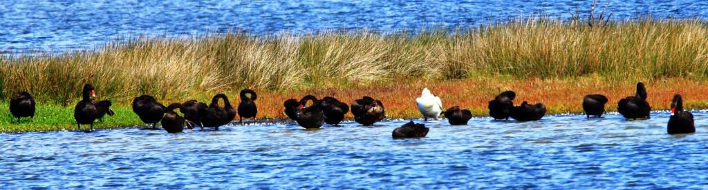
Last Wednesday was a sunny day and quite pleasant notwithstanding the cool breeze from the South West. But the shore line at Deception Bay is sheltered with winds from that direction. With the tide ebbing it was likely that wading birds would be there to take advantage of the drying floor of the bay, the exposed area increasing as the tide receded.
Deception Bay is deceptive. At high tide it appears to be a body of deep water but any but the most shallow draft vessel that moves outside of the dredged channel into Newport Waterways will soon learn of its deceptive nature. So while limiting for boats it is a great feed area for birds.
The first bird I saw as we drove along The Esplanade was a brown and white bird in the water, just off shore. I parked, grabbed the camera and walked towards it, but before I could get near to it someone buzzed it with a drone. It took off and vanished over the trees to the south.
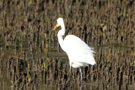
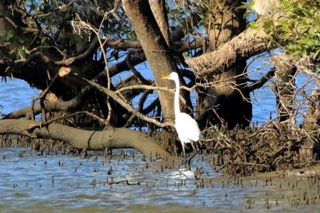
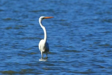
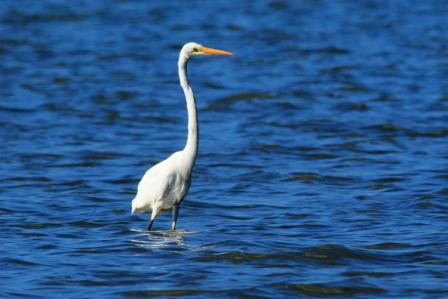
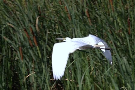
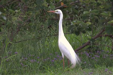
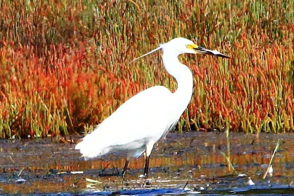
Eastern Great Egret
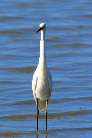
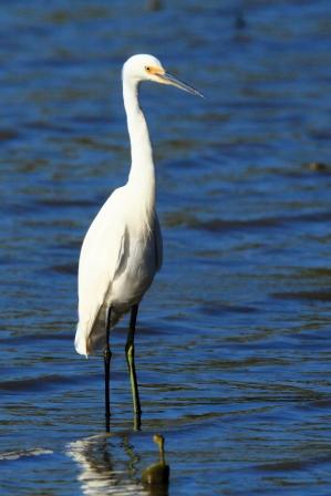
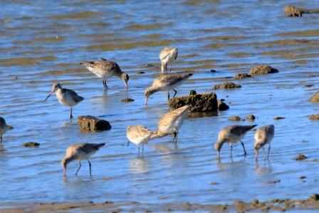
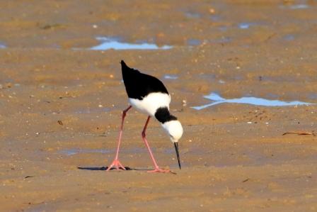
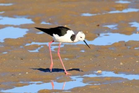
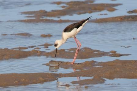
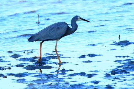
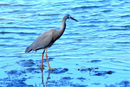
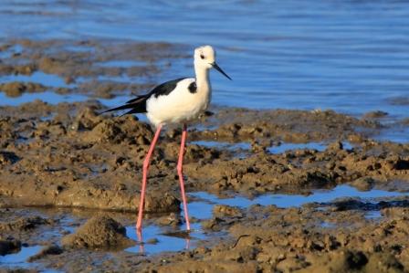
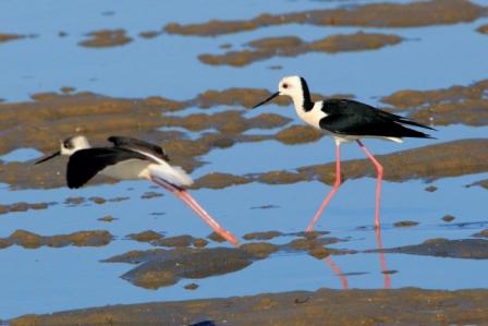
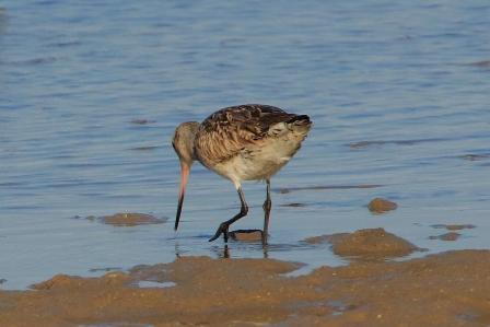
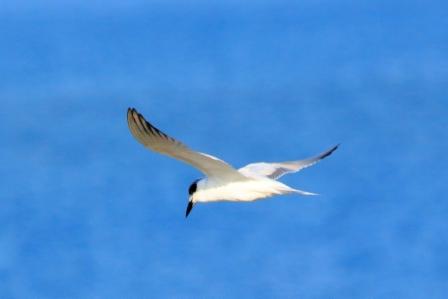
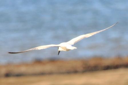
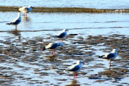
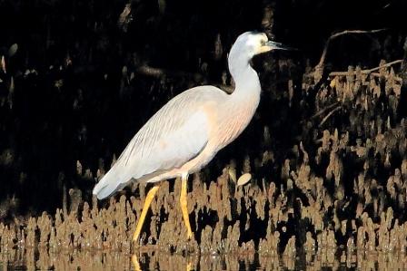
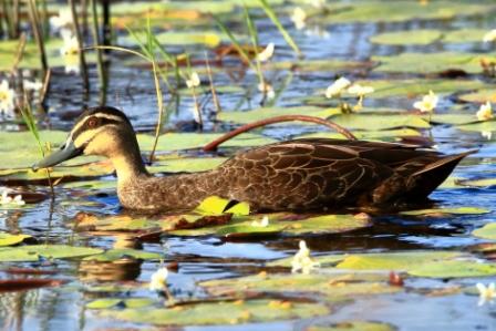
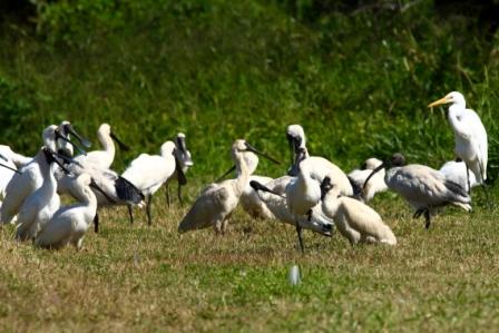
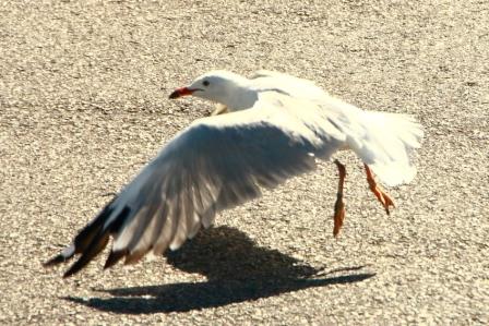
As the tide ebbed further, more birds came in. Smaller birds included Silver Gulls, Gull-billed Terns, Pied Stilts and Bar-tailed Godwits. Larger birds were represented by Egrets, both Great and Intermediate and White-faced Herons. This was by first opportunity to get a close look and a photo of the White-faced Heron.
Intermediate EgretEastern Great EgretEastern Great Egret
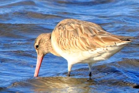
Eastern Great Egret in the shallowsA group of Bar-taited Godwits
Stilts enjoying a late lunch
White-faced Heron
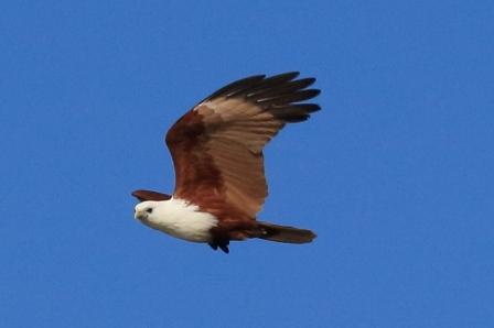
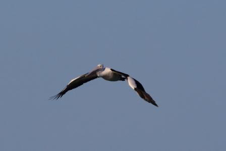
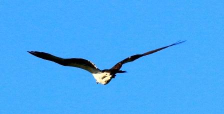
Bar-tailed GodwitsBrahminy KiteInbound Australian Pelican
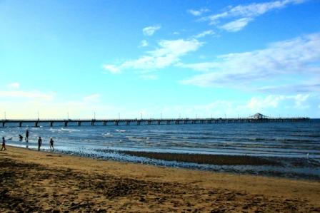
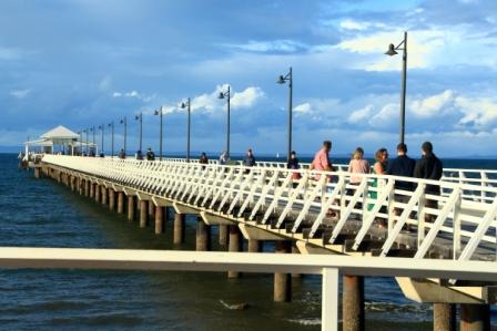
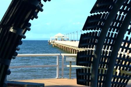
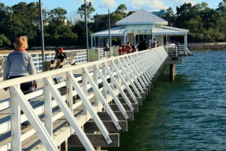
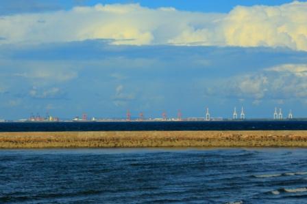
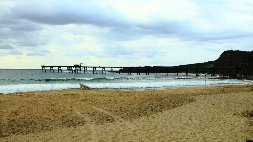
Shorncliffe Pier is, not surprisingly, at Shorncliffe in suburban Brisbane. It runs from the beach at Lower Moora Park, below Saint Patrick’s College. The current version of the pier was opened in 2016 after a complete rebuild. It is an attractive and popular structure with a broad timber deck, white timber railing, colonial street lamps and a resting shelter towards its outer end. It extends 351.5 metres into the waters of Bramble Bay, which is part of Moreton Bay. It is just a few kilometres north east from the mouth of the Brisbane River and provides a view of the operations of the Port of Brisbane. It is the longest recreational timber pier in Brisbane and one of the longest in Australia.
Shorncliffe Pier
Shorncliffe, and its neighbour Sandgate, were popular beach side suburbs in the early days of Brisbane and popular for day trips.
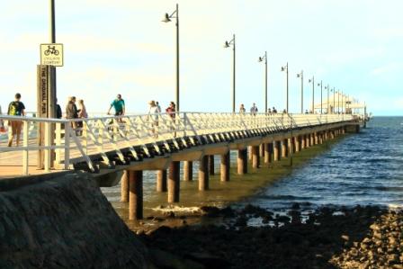
The pier is popular with walkers
The first attempt to build a pier at Shorncliffe was in 1885, but lobbying to the Queensland Government failed. In 1879 local hotel proprietor William Deagon built a jetty opposite his hotel. It was smaller than the current pier but large enough to have a tram track on it.
The pier through a modern sculpture
The last ferry to Brisbane ran in 1928 after mixed commercial success during preceding years. At that time the pier housed an amusement parlour including gaming machines and an open air picture theatre.
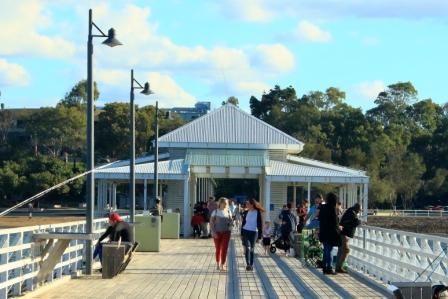
The pavilion on the pier
In 1882 a decision was taken that the jetty was not big enough and a company was formed to build a new pier. Between 1883 and 1884 the new pier, with a length of 260 metres, was built and later extend by a further 91.5 meters to its current length. The additional length made the berthing of ferries possible, facilitating travel between Brisbane and the bay side area. A small toll was collected at the entry to the pier.
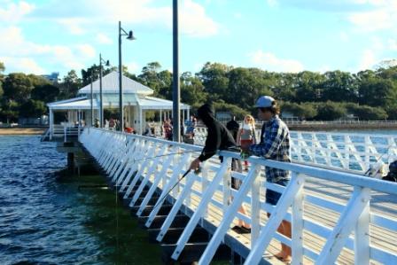
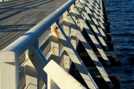
A useful fishing platform
In 2012, lead by then Lord Mayor of Brisbane Graham Quirk, the Brisbane City Council decided to rebuild the pier, so it was closed to the public and rebuilt from the ground up. Or should that be from the sea bed up? The renewed pier design includes concrete and steel substructure and timber joists, decking, handrails and rotunda. There was also a larger hammerhead and a lower platform at the end of the pier, fish cleaning stations, water fountains, benches and light poles. The colonial style of light pole were retained. The removal works commenced in November 2014 and the new structure was opened on Good Friday, 25th March 2016.
The opening date was appropriate as the jetty is the starting point for the Brisbane to Gladstone yacht race, conducted at Easter each year, which starts at 10.00 AM each Good Friday. The pier is one end of the starting line.
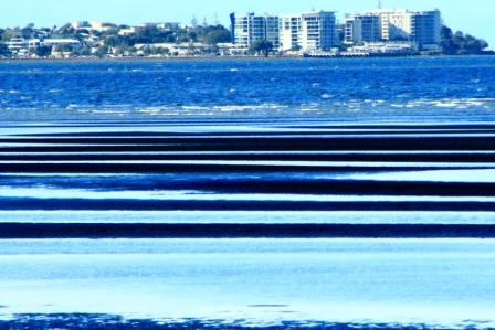
The pier is a popular tourist destination but these days visitors arrive by car rather than by ferry. Views of the Port of Brisbane and the shore adjacent to the Brisbane Airport are to the south and Boondal Wetlands, Bramble Bay and the Redcliffe Peninsula with the Woody Point pier and high rise, clearly visible to the north.
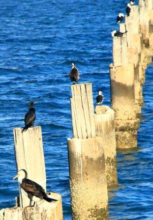
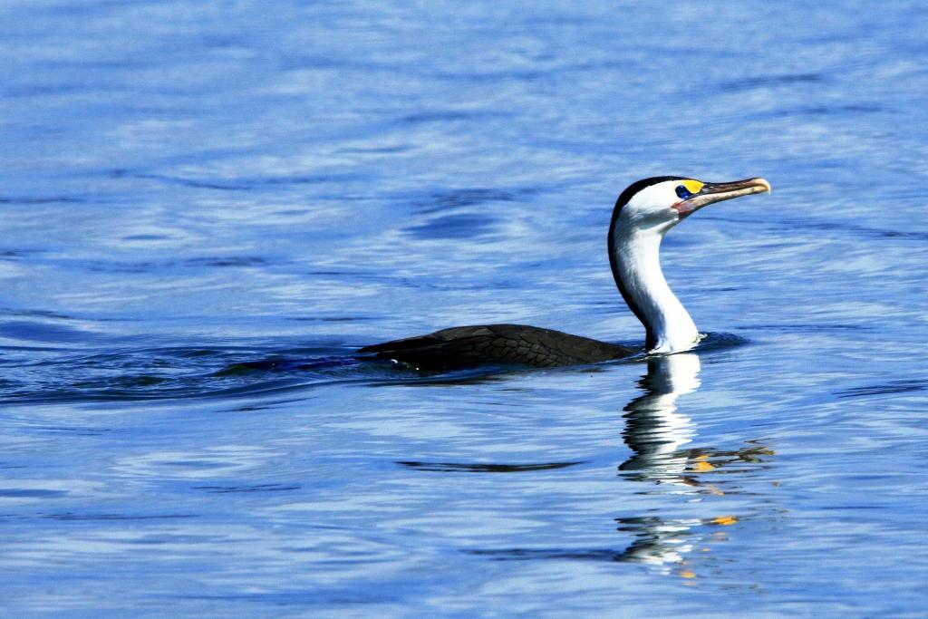
Pied Cormorants each have their own perch
Earlier in the life of the pier an area between its southern rail and the beach was enclosed by netting to form a safe swimming enclosure. The netting and other parts of the structure have long since disappeared but the concrete posts remain to the delight of sea birds like these Pied Cormorants.
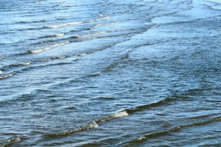
Patterns of waves
The foreshore has been improved over the years, as has the adjacent park area on the hill. It the shelter of shade trees and pergolas, several picnic tables with seating have been provided. Be early on a sunny day if you want a table, particularly at weekends. The street behind the hillside park offers some dining options. A coffee van is often to be found near the base of the jetty adjacent to parking area.
Winter bathersSilver Gulls waiting ….Port of Brisbane from the peirHigh-rise at Woody Point from the peir
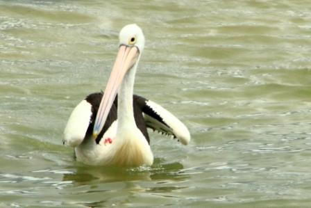
Australian Pelicans at The Entrance, NSW. Pelecanus conspicillatus
I have been thinking about adding bird photographs to our blog pages for a while. I have been interested in bird photography for many years but did not own the lenses necessary to do anything about it.
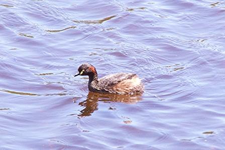
Australasian Grebe Tachybaptusnovaehollandiae
My camera is a Canon 700D which I purchased in about 2015. It came with two kit lenses, a 18 – 55 mm primary and a 55 – 250 mm short telephoto lens. But changing lenses all the time is a pain in the neck so I mainly used the primary lens and cropped photos to bring distant subjects a bit closer. I mostly used the camera in one of the automatic modes as most photos were to support my travel blog text.
About a year ago I was able to obtain at a reasonable price a Sigma 18 – 250 mm telephoto lens. This was a great improvement but still placed me too far away from subject birds to achieve satisfactory results.
Then, on the principle of you can’t take it with you I went looking for something better and found a Sigma 150 – 600 mm telephoto. Used with my crop sensor camera I have an effective 900 mm reach. Much better.
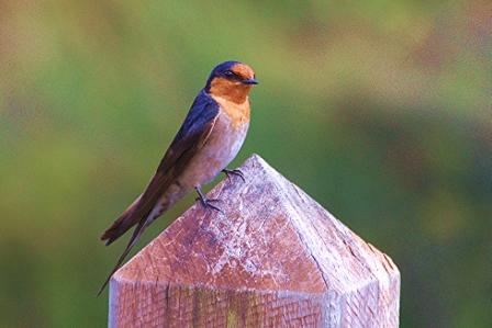
Welcome Swallow Hirundo neoxena
I also started to really study the capabilities of my camera and began to shoot in manual mode. I purchased a high capacity data card for the camera and began shooting in RAW at maximum megapixels (18) and converting RAW data into JPEG in Canon Digital Photo Professional 4.
During processing I identify the bird by using apps and field guide books. A handy aid to identification is the “Google Lens” phone app. Available from your phone’s app store, it allows you to scan a bird photo on the computer screen and gives you a selection of photographs to use in identification.
I also use Cornell University’s “Merlin” app and the “Australian Birds” app. There are other that you can try for yourself. I also have a copy of the Michael Morcombe Field Guide to Australian Birds.
Sightings are recorded on an Excel spreadsheet where I record bird and variety and location and date sighted. My computer files are kept by location.
Future Posts
For the future I intend to post my better shots from each outing, together with some information on location and the featured birds. Unless I change my mind, of course.
But for now, here are some of the photos that I have accumulated to date.
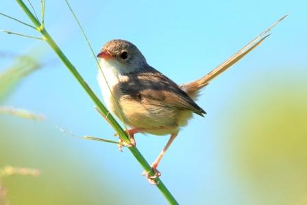
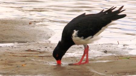
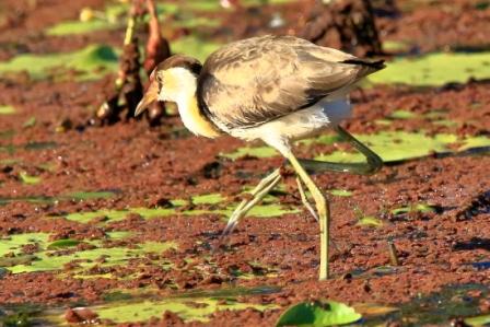
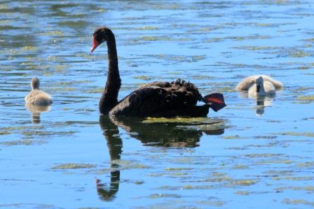
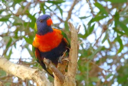
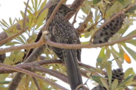
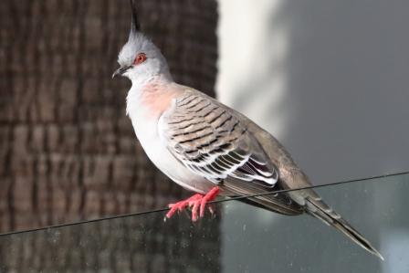
Noisy Mina Manorina melanocephalaWhite-faced Heron Egretta novaehollandiaeRed-backed Fairy-wrenAustralian Pelican Pelecanus conspicillatusPeaceful Dove Geopelia placidaPied Oystercatcher Haematopus longirostrisComb-crested Jacana Irediparra gallinacea
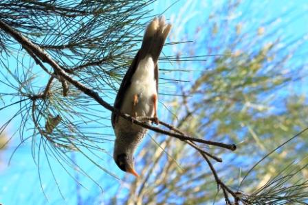
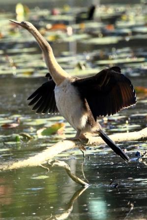
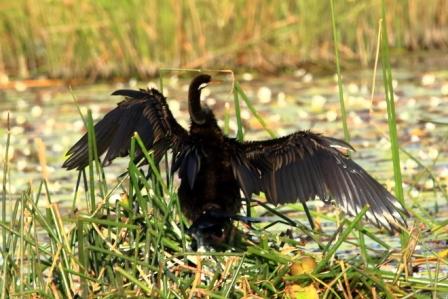
Australasian Darter Anhinga novaehollandiae – front view
At breakfast, I confirmed with my niece that a left turn back at the main road, the Old Hume Highway, would take us through Camden and Picton. I used to know that road well until it changed its character completely, when multiple suburbs were built along it and it ceased to be the Hume Highway. But I forgot the second left turn at Narellan town centre. We were crossing Peter Brock Drive at Oran Park before I realised my mistake.
We turned and allowed Google Maps to guide us over several country roads, including one called Sheather Lane, until we reached Camden. The Old Hume Highway then lead us over The Razorback to Picton, where we stopped for coffee. The wrong turn had cost us time, so the quickest route, out to the motorway and directly to Bowral, was needed to bring us to our destination on schedule. We didn’t want to be late for lunch.
The next call was very much of the reason for the trip. Ruth’s youngest brother lives with his wife in the beautiful eastern suburbs of Bowral, in the NSW Southern Highlands. Wallace and Virginia (Wall & Jinny) have lived in Bowral for many years. As time passed they bought the block in a then new area to the east of the town and built a nice house around which they have laid out beautiful gardens.
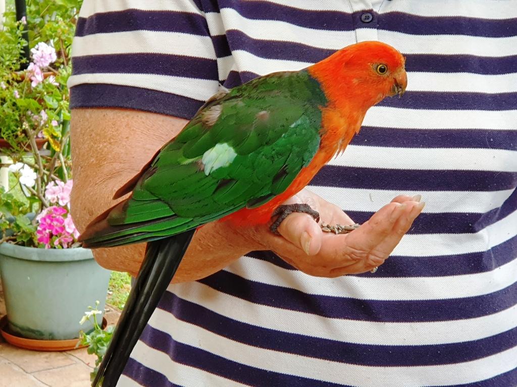
Our hostess with a regular visitor. Guess why it calls?
Sadly Wall is in advanced stages of Parkinson’s disease. Jinny is his devoted carer these days. We spent a night with them and left next morning. We had as pleasant a time together as circumstanced would allow. It was pretty good.
Not only is Jinny a keen gardener but loves birds. Local birds know it as a good place for a regular feed. The current favourite is a Crimson Rosella that sits on Jinny’s thumb and eats out of the palm of her hand. Kookaburras call and laugh and other Australian native birds in the vicinity drop in.
For a couple of days we had been watching wet weather approach from the south. As we departed Bowral on that Saturday morning, it was clear that we were heading towards the front of the change. We reached Goulburn in slight drizzle. After coffee we took the Crookwell Road to the north, heading for a lunch stop at Bathurst. Beyond Crookwell the road passes through several kilometres of mountains, resulting in steep winding roads. It was on this section of road that the weather caught up with us. Heavy rain and gusty winds added to the challenge but there was not much other traffic.
Approaching Bathurst, we attempted to take a drive around the Mount Panorama circuit. It was not to be. From the foot of the serious mountains until the outskirts of Bathurst, road side signs warned of cycling activity in the area. We discovered that the centre for this Lycra clad event was the straight and buildings of the Mount Panorama racing circuit. Spectators were driving into parking areas and barriers protracted the track.
From Bathurst we drove through intermittent rain to Orange, Wellington and finally Dubbo, where we spent the night. The next day we followed the Newell Highway to Coonabarabran where we turned for Gunnedah. We enjoyed views of lush green Western Plains, so different to the drought conditions of recent trips. The grasshopper plague, part of which spread itself over the front of the car, was less welcome. We progressed under sunny skies having temporarily left the rain behind. It really was a pleasant drive. Morning coffee was taken at Coonabarabran and lunch at Gunnedah.
The lookout on Moonbi Hill
We joined the New England Highway at Moonbi after skirting to the north of Tamworth. This is quite a good alternative if you want to avoid Tamworth and interesting scenery, as the road runs through the collection of huge boulders known as the Moonbi Gap. A short side trip took us to the summit of Moonbi Hill. From there we drove to Armidale for the night.
The view Tamworth from Moonbi Lookout
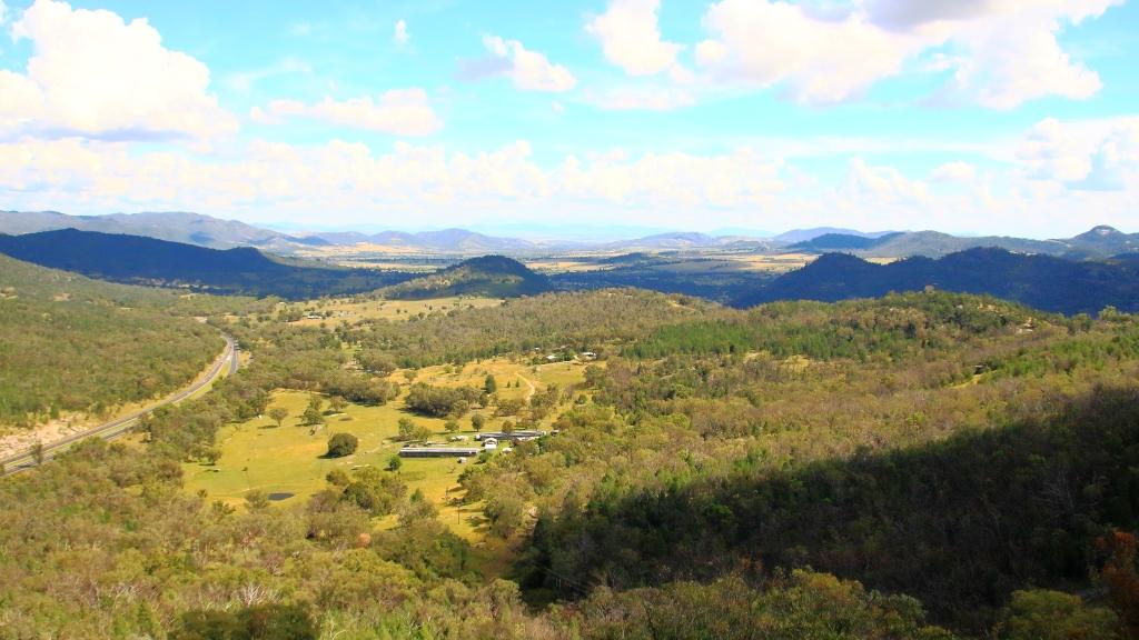
Sunday 14th April dawned in Armidale with blue skies overhead but heavy cloud to the south west. We could have kept to the New England Highway by continuing north, but we figured that we could make it along the Waterfall Way and check out the area after recent rain, before more rain fell. So off we went.
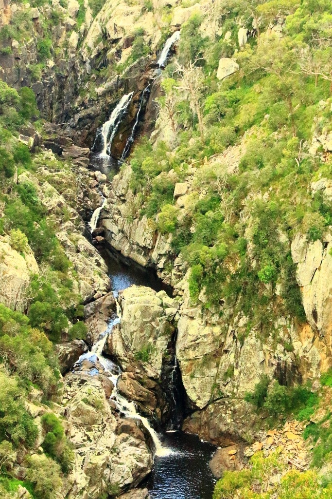
Bakers Creek Falls are a series of smaller falls
There is a lot to see along this road but we stuck to waterfalls. The first call was at falls that we had not previously visited. About 20 km east of Armidale you turn to the right into Old Hillgrove Road, which starts as a narrow sealed road but quickly changes to corrugated gravel. The road leads down a hill, over an old wooden bridge over Bakers Creek and up the other side to a small car park hidden behind trees. A rough bush path leads to a surprisingly elaborate timber viewing platform that provides good views of the falls. It is a good spot and worth the roughish road.
Bakers Creek flows down this gorge from the falls.
From Bakers Creek Fall you can continue on Old Hillgrove Road to the historic mining town of Hillgrove, returning to the Waterfall Way via Stockton Road, that is now the main access to Hillgrove. We retraced our steps to Waterfall Way, having visited Hillgrove on a previous journey.
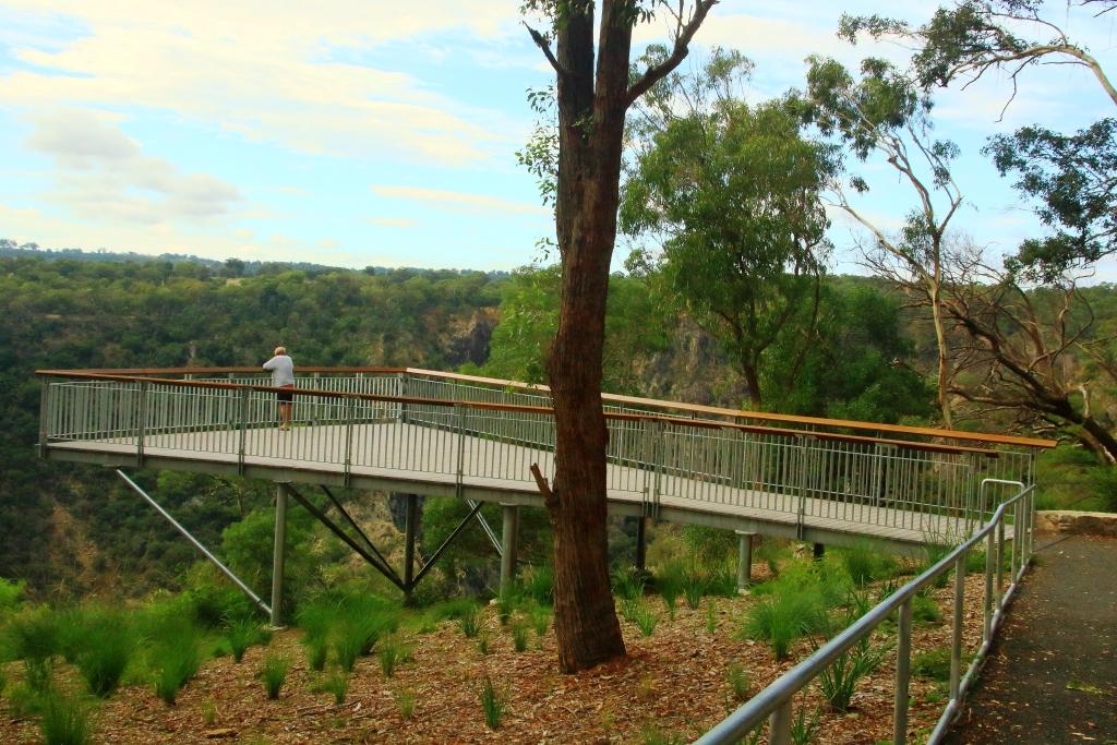
Wollomombi Falls viewing deck
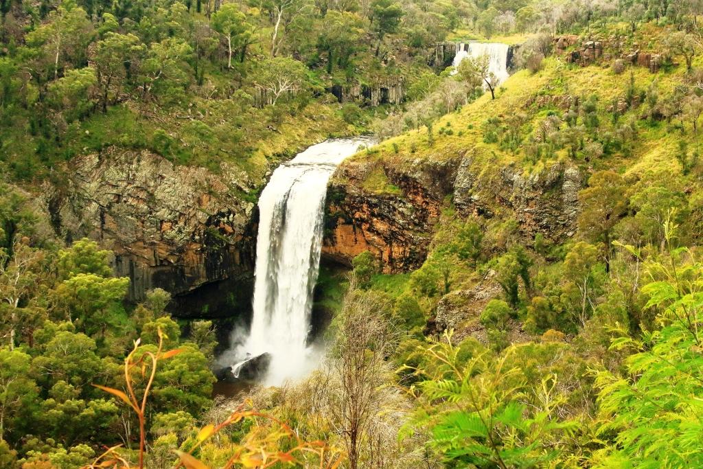
Next up was the Wollomombi Falls. Just a few kilometres along the Waterfall Way the turn again is to the right. A sealed road leads for about a kilometre, through a farm, into the Oxley Wild Rivers National Park. It is then only a few hundred metres to the day visitors’ area located on the edge of the gorge. The falls can be viewed through the trees at the edge of the picnic area, but a better view is had by taking a short walk to a commodious viewing platform.
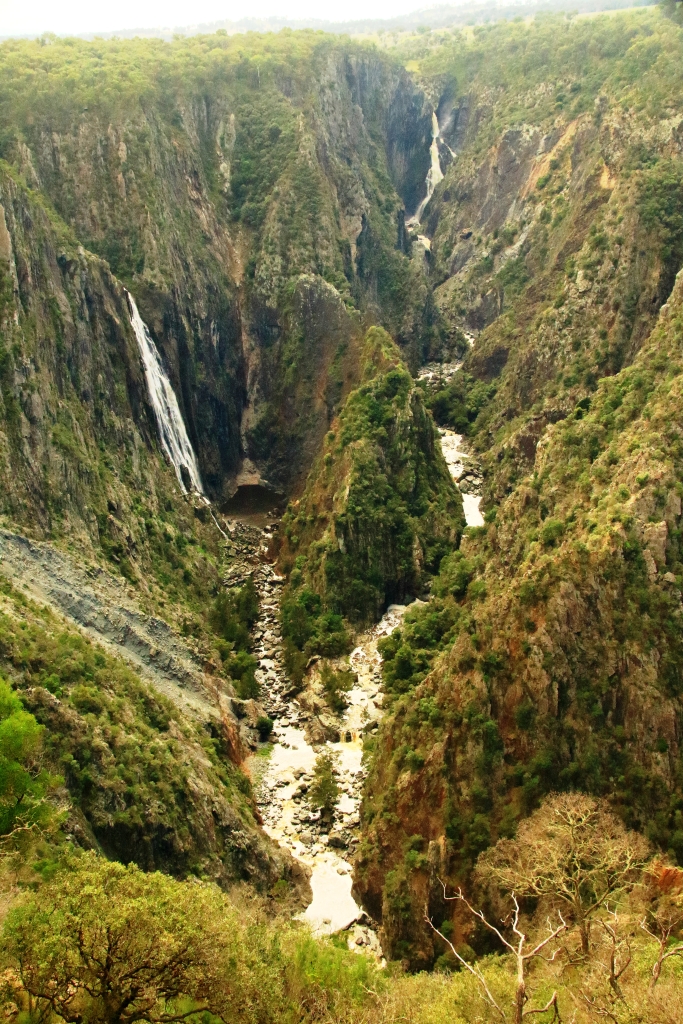
Wollomombi Falls
The falls, which are on the Wollomombi River, are a spectacular 150 to 230 metre drop into Wollomombi Gorge. The elevation of the top of the falls above sea level is 907 meters.
At our last visit there was no water at all so it was great to see the falls flowing. Just downstream of the falls the Wollomombi River joins the Chandler River which empty into other rivers until the water reaches the Macleay River which flows through Kempsey and enters the Pacific Ocean at South West Rocks.
Not far along the highway, a turn to the left leads over a rise to the village of Wollomombi, where the general store provided acceptable coffee and with morning nibbles or lunch. It was too early for lunch so we nibbled with our coffee.
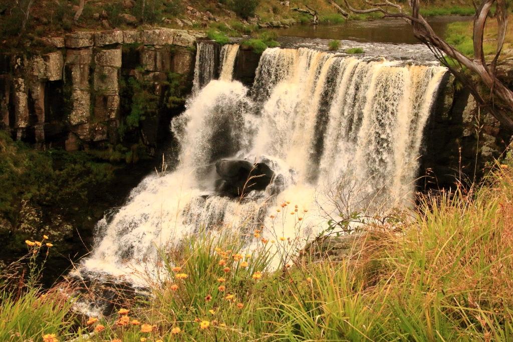
The top fall at Ebor Falls
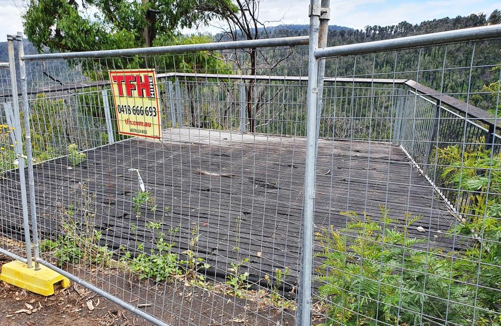
Ebor is the next waterfall stop along the road but to get there you pass the turn on the right that leads to the magnificent views of Point Lookout and a trout hatchery that offers smoked trout. Today the views would probably be of clouds and fog. On the left you pass the Cathedral Rock National park and the road to Guyra. Ebor falls are to the left before you reach the town. Views of the cascades in this impressive river are unfortunately marred by wire mesh barricades. As is so often the case, NSW authorities find it easier to erect a fence instead of maintaining tourist facilities. This is a very odd approach at a time when they are spending big on advertising programs to entice tourists to holiday in their own state. But we don’t do public tourist facility maintenance very well anywhere in Australia.
Barricades preventing access to the viewing platformAn example of deteriorationBoth of the cascades of Ebor Falls
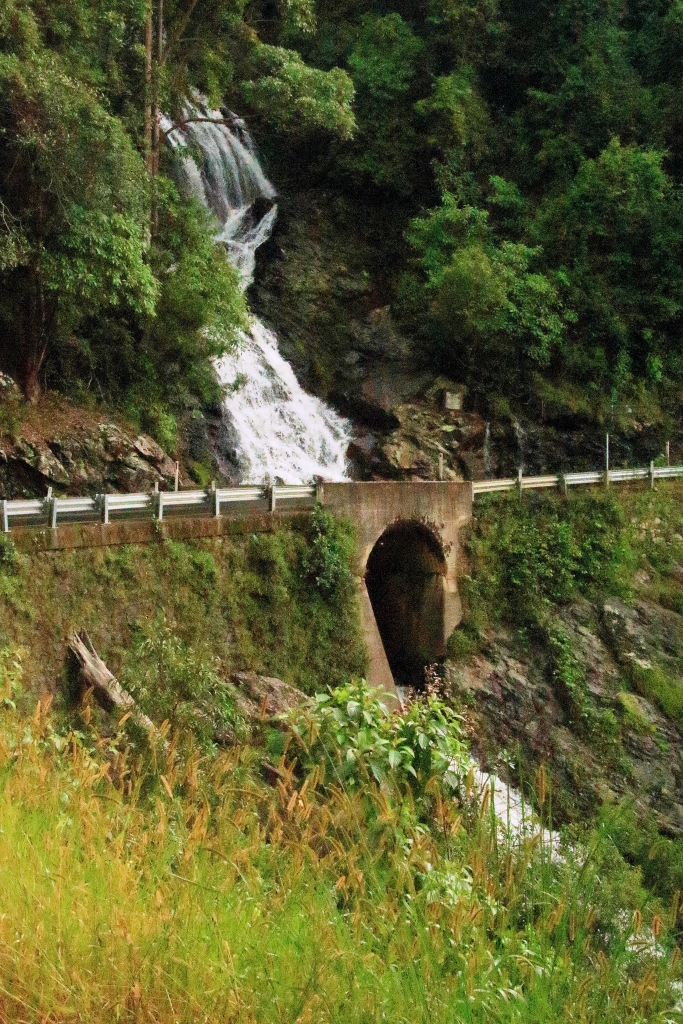
From Ebor we drove the undulating plateaux to Dorrigo where we headed to the Canopy Café at the Dorrigo National Park, for lunch. We took the mandatory walk along the Skywalk Lookout before returning to the car. As we returned to the highway the first sprinkles hit the windscreen but the deluge waited until we had descended the mountain to Urunga before it started. By the time we reached Coffs Harbour almost all of the deceased grasshoppers that had spread themselves over the front of the car were washed away.
A waterfall beside the road between Dorigo and Urunga
We stayed two nights at Coffs, in a small apartment a little to the north of the main area, with glimpses of the ocean. The heavy rain experienced over night withdrew sufficiently for us to visit the lookout on the mountain behind Coffs Harbour and to drive to Sawtell where we had lunch in a pleasant cafe in the main street. We checked out the observation points in the area before returning north along the road nearest the coast. Just a quick look in at the harbour area and back to the unit as the rain became serious again.
Observation deck at the lookout on the hill behind Coffs HarbourA view from the deck over Coffs Harbour and the harbourBoambee Beach near Coffs Harbour airportSawtell Beach and Bonville Head
The trip ended with the drive home from Coffs Harbour the next day. We had been away for exactly two weeks.
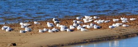
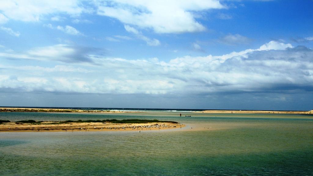
Sleeping water birds at a mini island in Tuggerah Lake, near The Entrance.
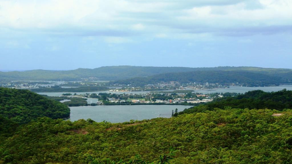
Our destination for the day was Mount Annan, near Liverpool, south of Sydney. Tollways with 80kph speed limits now bypass Sydney. You don’t see a single traffic light until after turning off the Hume Highway at Campbelltown. With a mid afternoon ETA we had time to spare, so stayed east of the Newcastle bypass highway, travelling down the Old Pacific Highway until we turned further east to join the real coast road at Budgewoi.
Most of our drive was familiar, but not all. We had intended to do a run into Caves Beach, just south of Swansea, but missed the turn in the new (to me) road arrangements south of the bridge over the entrance to Lake Macquarie. But we did take a run into Catherine Hill Bay. I wanted to see the old coal loading jetty, last viewed during an inshore tack when sailing a newly acquired yacht from Sydney to Brisbane, many years ago.
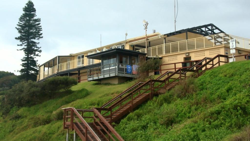
The historic Catherine Hill Bay coal jetty is under threat after damage from the bush fires in the area last year.Catherine Hill Bay Surf Lifesaving Club overlooks the beach.
This was a coal mining area, of course. As you approach the beach and jetty, you pass through streets lined by old miner’s cottages, many under renovation, probably reaching seven figure valuations as a result. We parked above the beach so that I could walk down a sandy ramp to the ocean’s edge to take some photos.
The entrance to Tuggerah Lake at The Entrance.In past times Pelican feeding was a feature activity in Marine Parade at The Entrance. Pelicans still wait on a small adjacent island. They must have long memories.
We re-joined the highway via the southern access to the town, passing new houses, including large homes with ocean views and a new subdivision, down in a valley, with no views at all. At Doyalson we turned in again to the coast, driving through Budgewoi, over the bridge that spans the narrow waterway that joins Lake Munmorah and Lake Budgewoi. We then travelled through Toukley and Noraville to The Entrance which we made our morning coffee and photo stop.
Residential accommodation on Marine Parade at The Entrance.
As we had approached The Entrance we both noticed water birds in Tuggerah Lake. With morning coffee done, we returned the couple of kilometres to where we had seen the birds. I fitted my long lens and took a number of photos, including some with which I was reasonably happy.
The road bridge over the entrance to the lakes at The Entrance.An Intermediate Egret showing some breeding plumage.A Pied Cormorant out for a swim.
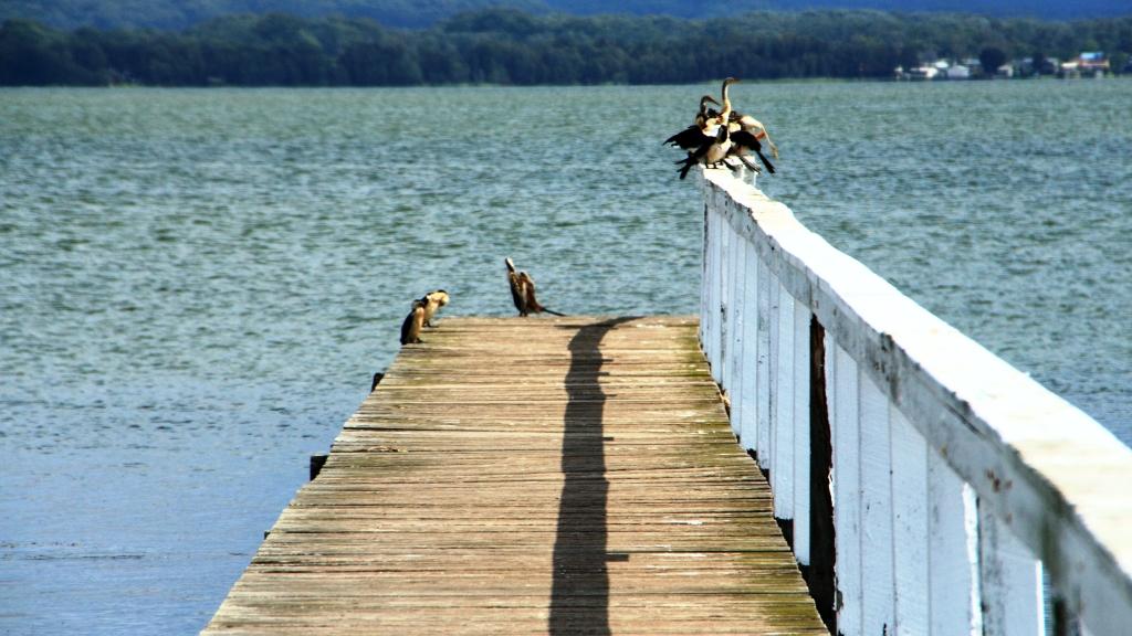
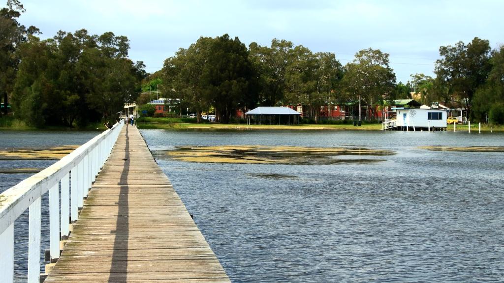
Retracing our steps, we drove through The Entrance to Long Jetty, on the eastern shore of Tuggerah Lake. Long Jetty is both a suburb and a long jetty. I had heard of it in both forms and driven through the suburb a number of times. Today we called to visit.
Water birds perched on the end of the long jetty at Long Jetty NSW.
The jetty is intended for foot traffic, with a hand rail on one side. The timber deck is about a metre above the water. On the outer end of the jetty I could see a group of water birds, sitting on the rail. My bird lens was not attached to the camera but the smaller one would do. But on the spur of the moment I forgot to change the camera settings from general sightseeing to bird photography. The result was photos of less quality than they could have been. We live and, hopefully, learn and remember in the future.
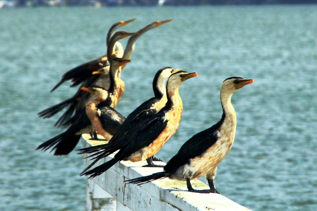
A closer view of the perched birds on Long Jetty. Australian Darter and Pied Cormorants.Long Jetty suburb at the shore end of the long jetty.An example of what you get when you do not have correct settings on your camera.
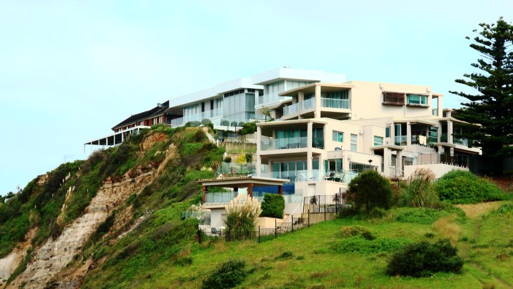
We continued south, keeping as near to the ocean as possible, turning east for a better view of the coast whenever the opportunity presented. Then we came to Terrigal and I realised that I had never been there. I was impressed. We drove through town to the bay where the launching ramp is located and where views are to be had over the bay, back to the residential and commercial development of the town centre. This location provided views of magnificent sea cliff top houses, the kind that dreams are made of.
Part of Terrigal across the bay.
After a viewing and photo stop we drove around point Kurrawyba with its two headlands and then via the Scenic Highway to eventually reach Woy Woy. There we did some necessary shopping and returned to the Pacific Motorway near Gosford to continue south. So after crossing the Hawkesbury River and reaching Hornsby we were taken underground for a long sweep to the west on the M7 until we swung back east to the Hume Motorway at Casula. It was then a quick and easy drive to Mount Annan, our destination.
The Skillion is the southern most of the two headlands on the point at Terrigal.
There we caught up with Ruth’s youngest sister Dorothy (Dot) and her family, including newly minted grandson Max. We also caught up with Max’s mum Deahna, our niece Madison, Madison’s fiancé Josh and Dot’s other half, Peter. Max’s dad had work commitments.
Luxury homes overlook the Pacific Ocean at Terrigal Beach.
After much talking and taking of refreshments, Peter took to the barbeque to produce the protein to accompany the other portions of the meal, previously prepared. With a libation or two we all enjoyed a very pleasant evening, called to an earlier close than might otherwise have been the case by our hosts need to make early departures for work the following morning.
A final view of Woy Woy before we re-joined the Pacific Motorway near Gosford.