Visiting Relatives and Alpine New South Wales

Those of you who have followed our travels will be aware that we give a high priority to keeping in touch with family and have done so more frequently as we have all aged. We have seen this as a responsibility partly, at least, brought about by our frequent moves, particularly the move to Brisbane about forty years ago.

Increasing age does not make travelling any easier. We had suggested to my two remaining siblings that Victoria was a long way from Brisbane and that they might make the task easier for us by meeting us half way, or at least some of the way. Earlier this year they called us on the offer. I am always on for a trip to the alpine regions outside of the snow season so we agreed that meeting at Jindabyne in the Snowy Mountains was a suitable compromise. The southern most relatives to visit on this trip live at Bowral in the Southern Highlands of New South Wales. Not that much further to Jindabyne.

But it was a close-run thing with the snow season. A week after we visited, areas around Thredbo, not far from Jindabyne, had snow.

Poplars by the highway south of Glen Innes

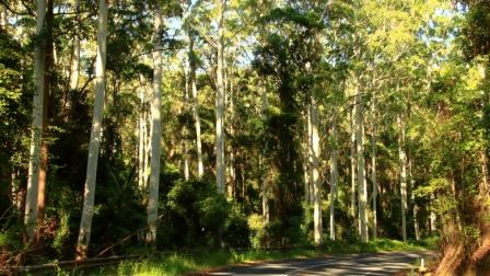
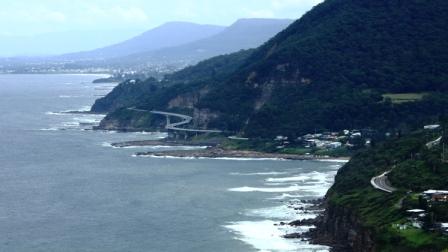
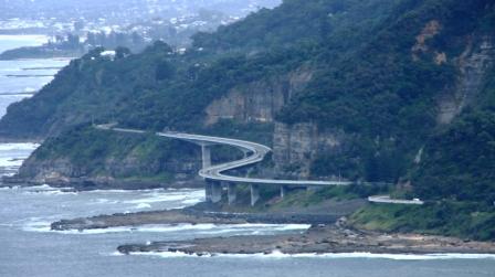
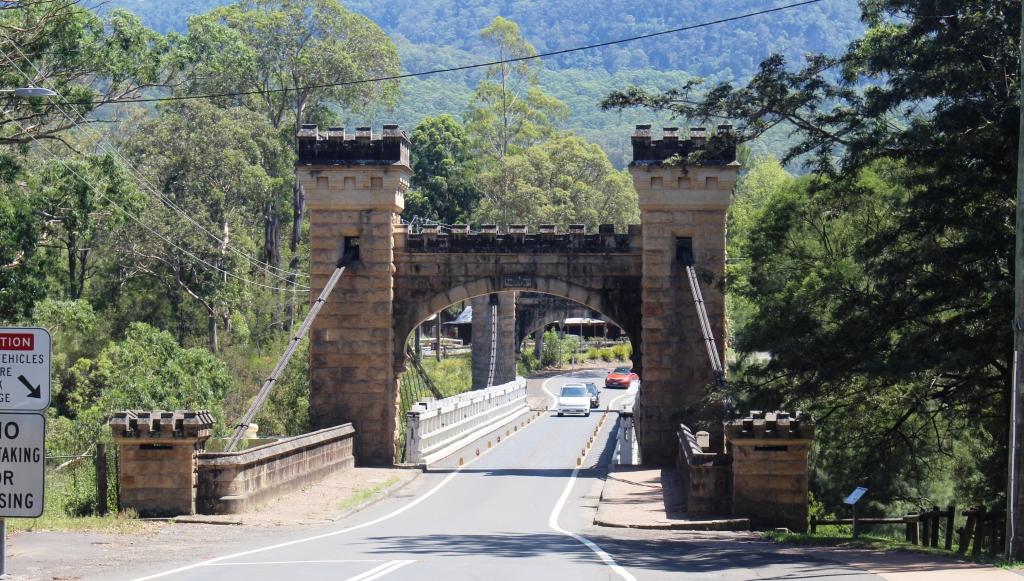
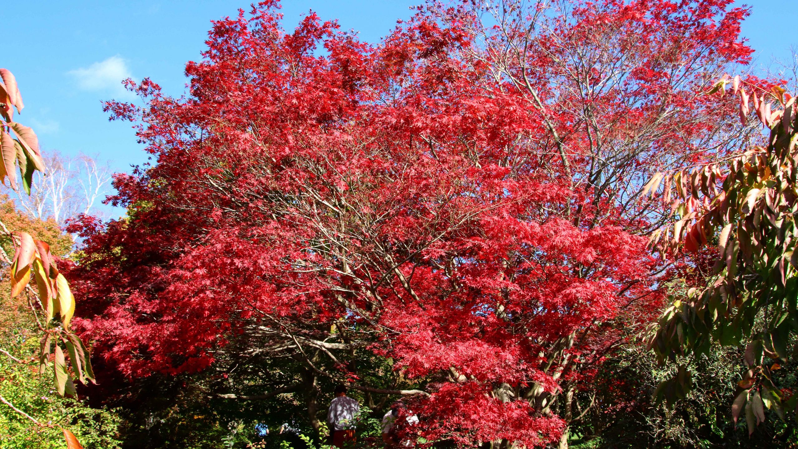
We chose the New England Highway as our route to Newcastle where our first call was to be made. A drive through the Granite Belt and New England areas is not to be missed in Autumn. The colours did not disappoint but our opportunities to see them did. We were delayed for an hour just south of Wallangarra by a two-vehicle collision that blocked the highway for over an hour. Darkness accompanied our arrival at Armidale for the night and low cloud and drizzle greeted us next morning for our drive to Newcastle.

Autumn colour opposite our motel in Armidale.

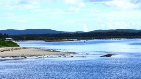
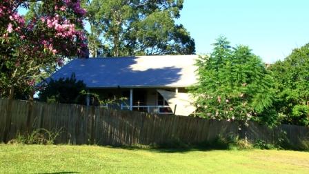
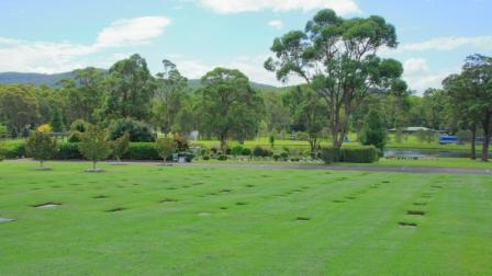
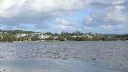
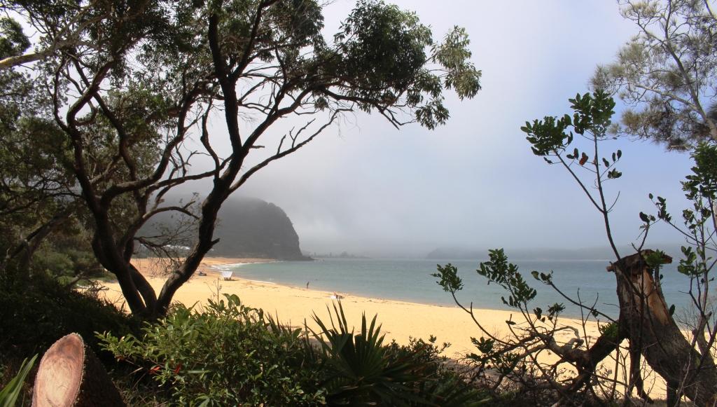
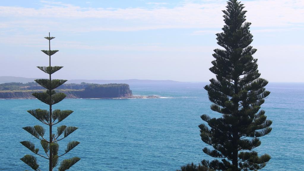
The next morning, Friday, we first called on sister-in-law Marjorie in her retirement home that overlooks Lake Macquarie. We then moved on to call on Ruth’s sister Judy and Alan her husband at West Wallsend. Finally, after a call to brother Ivan’s newly completed grave at Ryhope cemetery, we completed our journey to our daughter’s unit in Erskineville, through Sydney Friday afternoon peak hour traffic.

Visiting Rainbow Lorikeet on Briony’s sixth floor balcony rail.
Newtown street scene. I don’t know why the young lady was sitting there.
Lots of quality graffiti artwork. It adds to the ambiance.

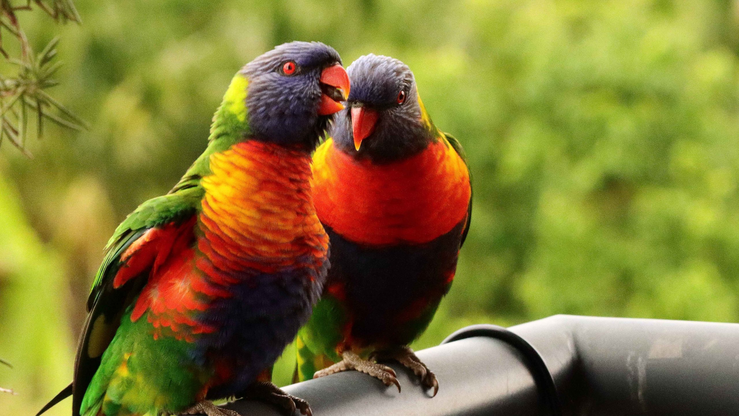
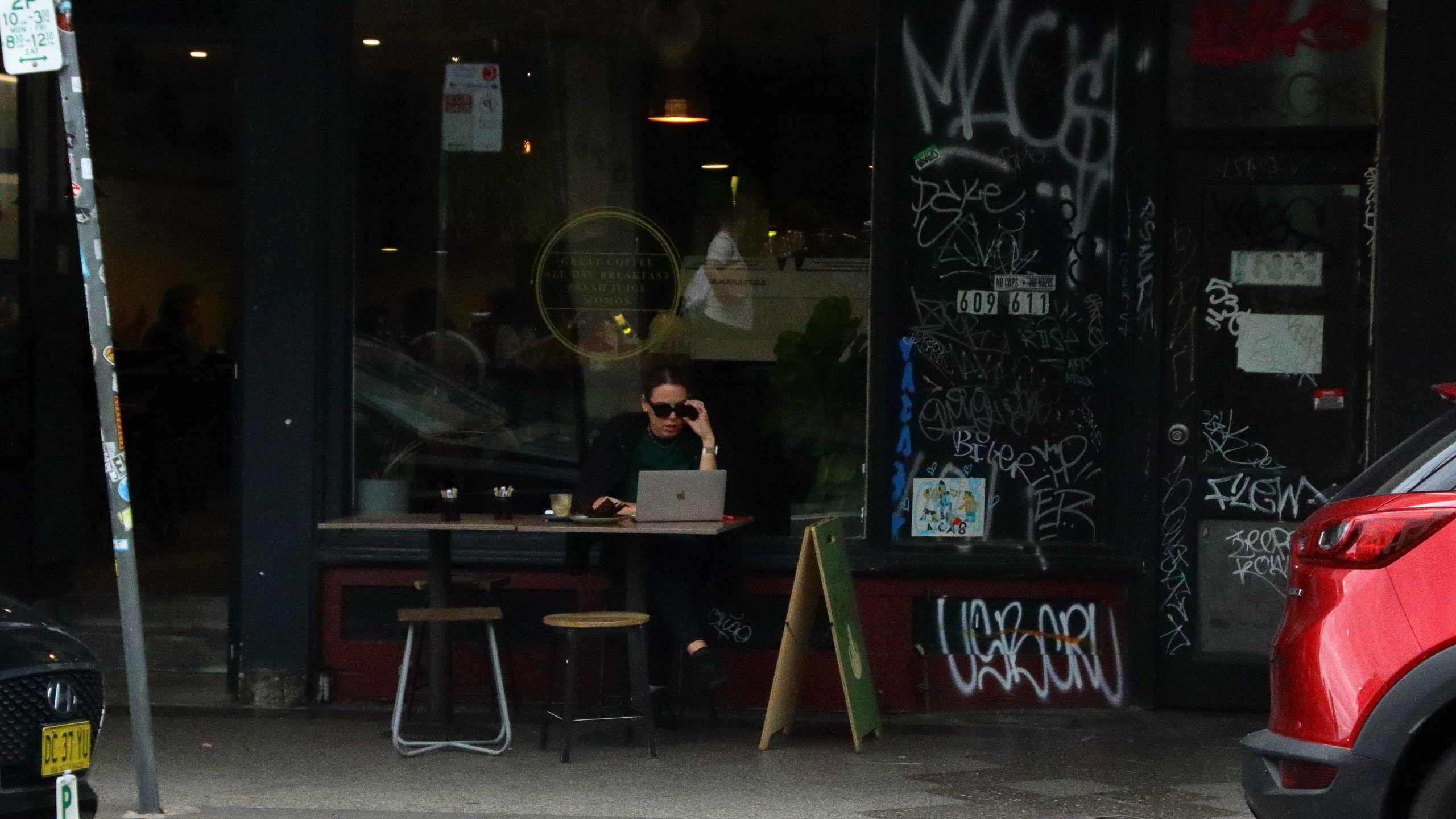
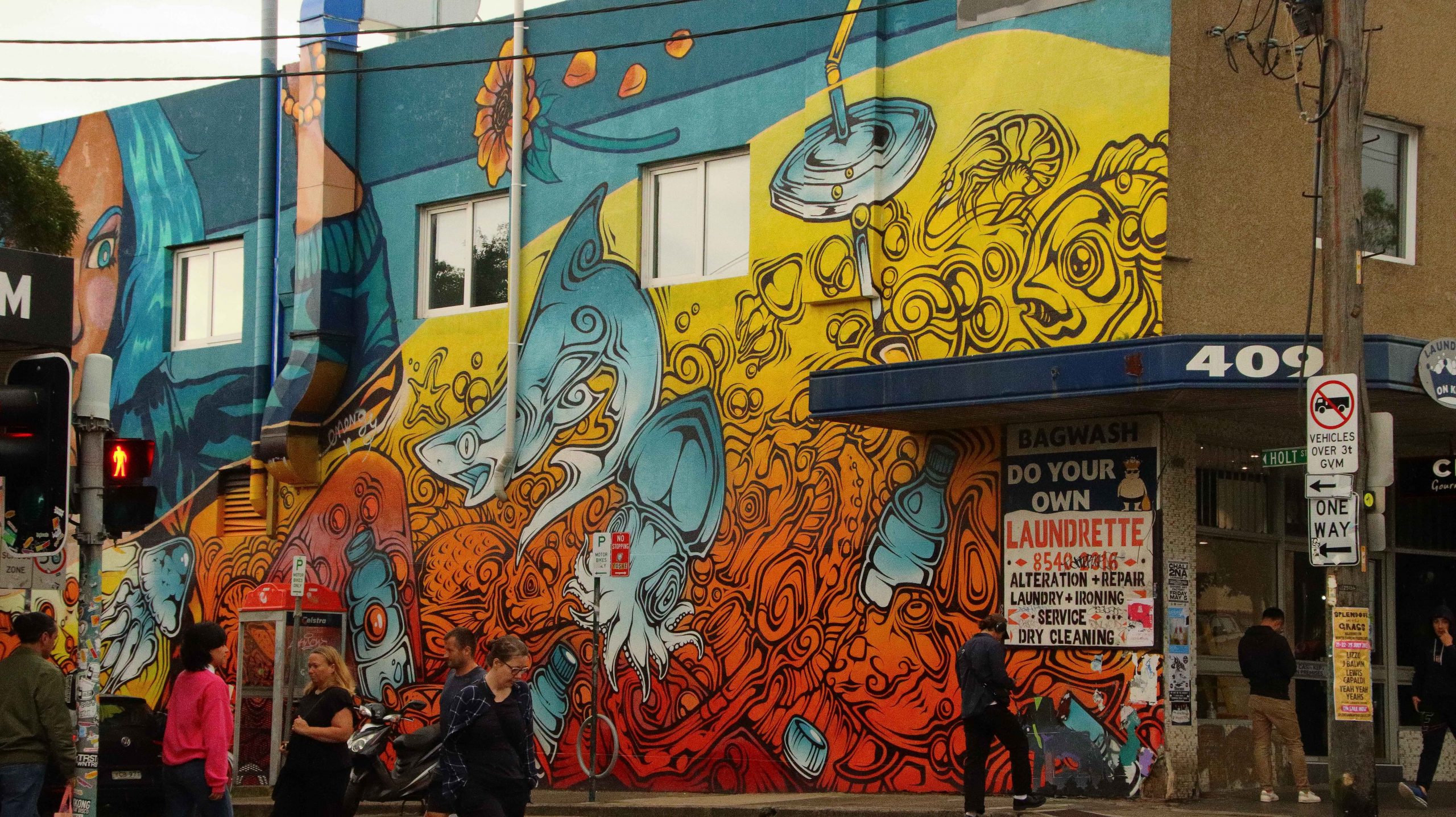
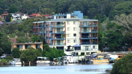
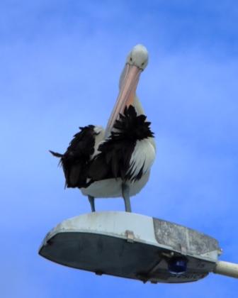
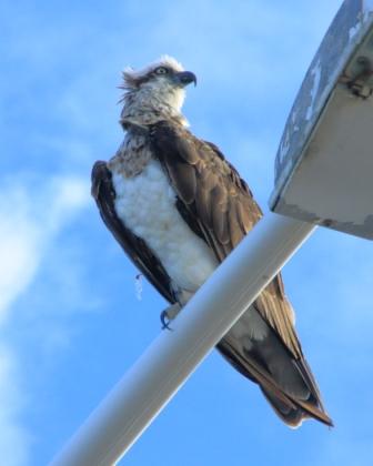
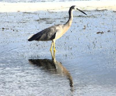
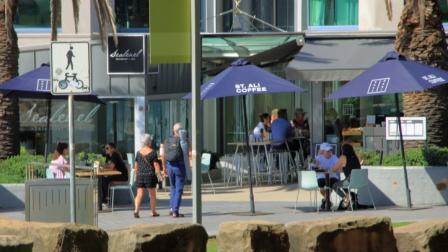
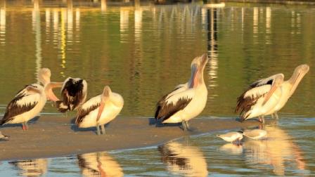
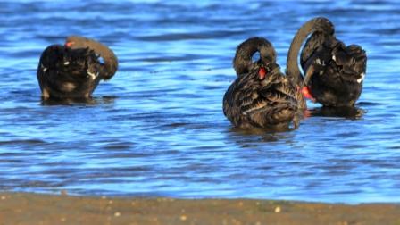
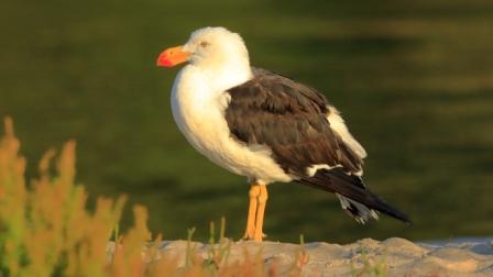
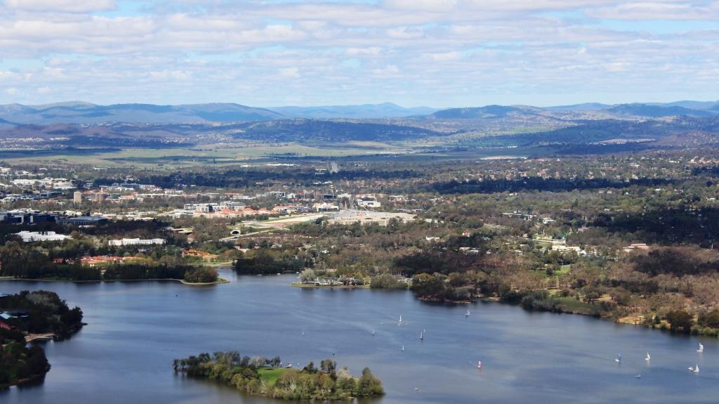
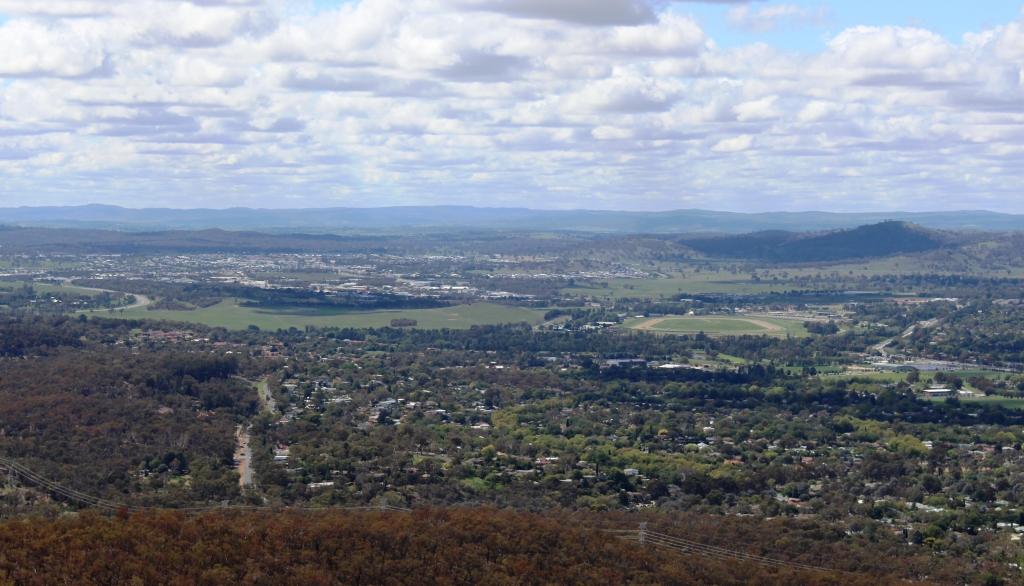
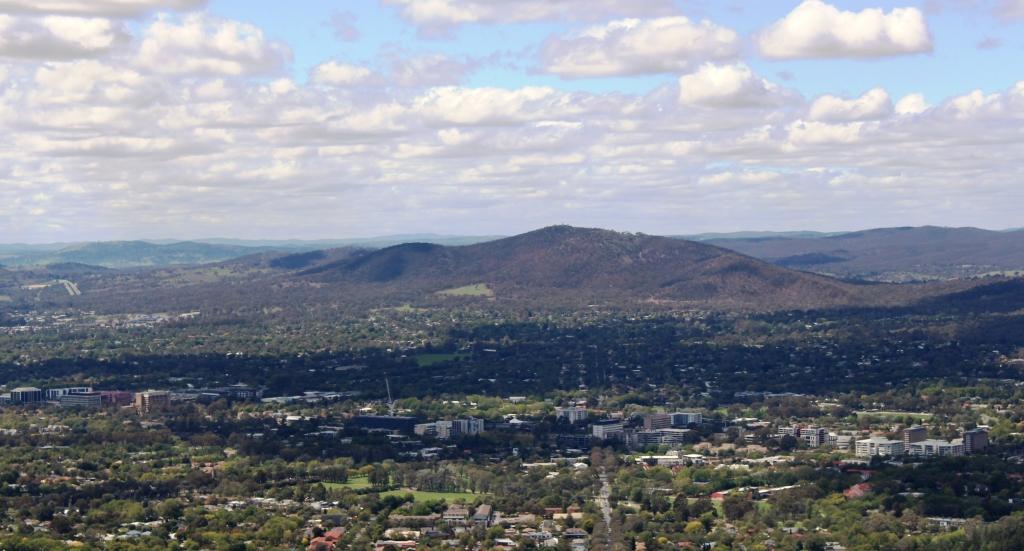
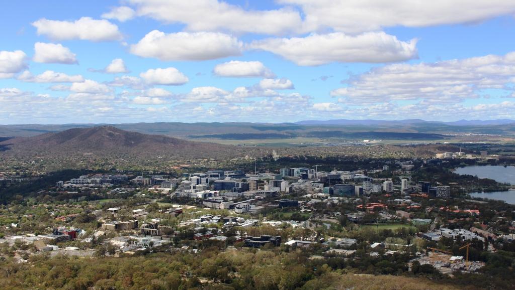
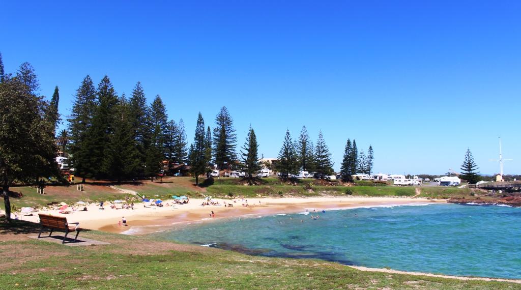
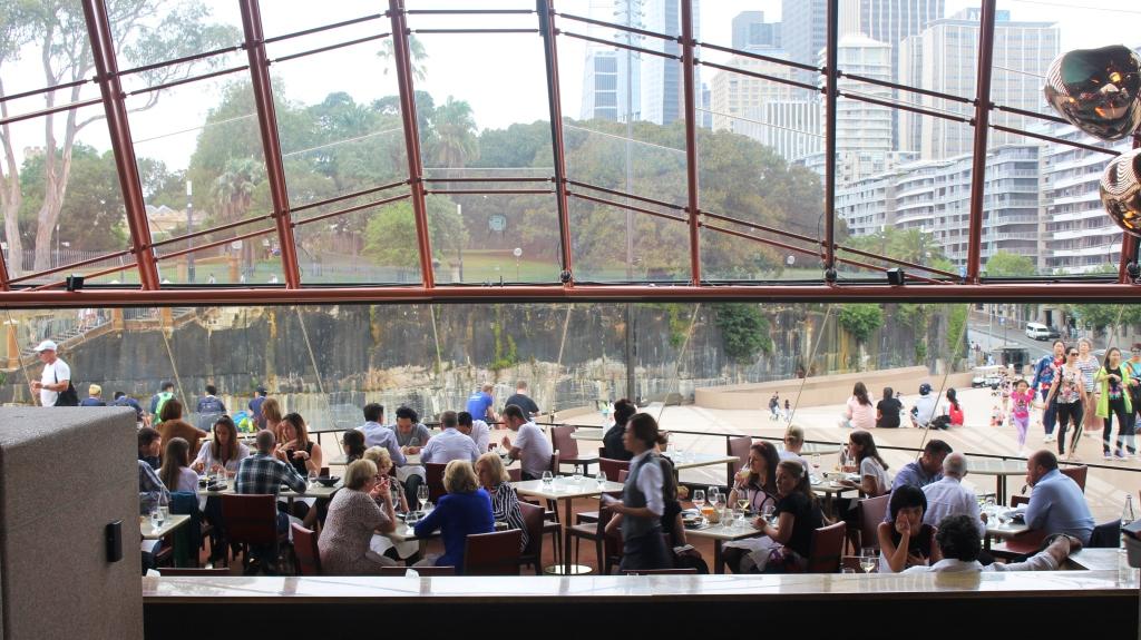
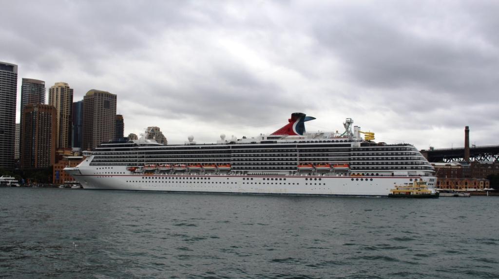
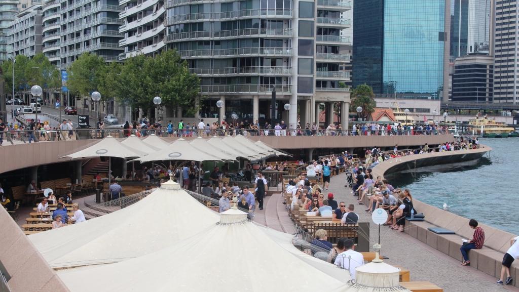
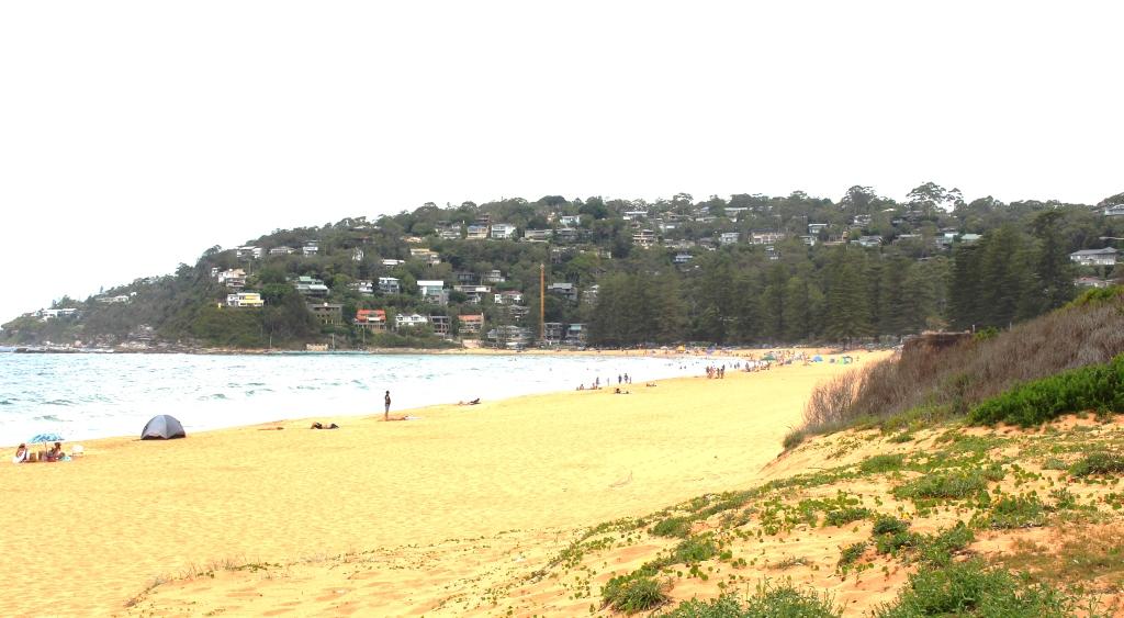
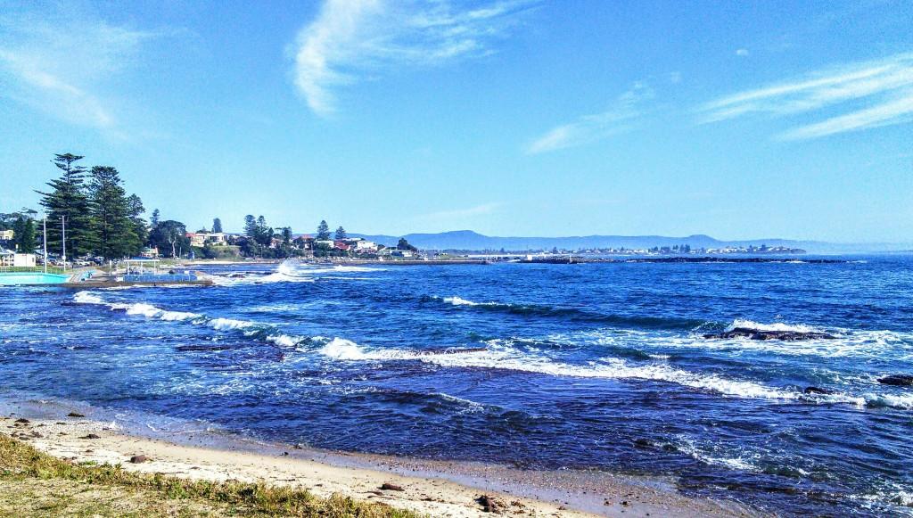
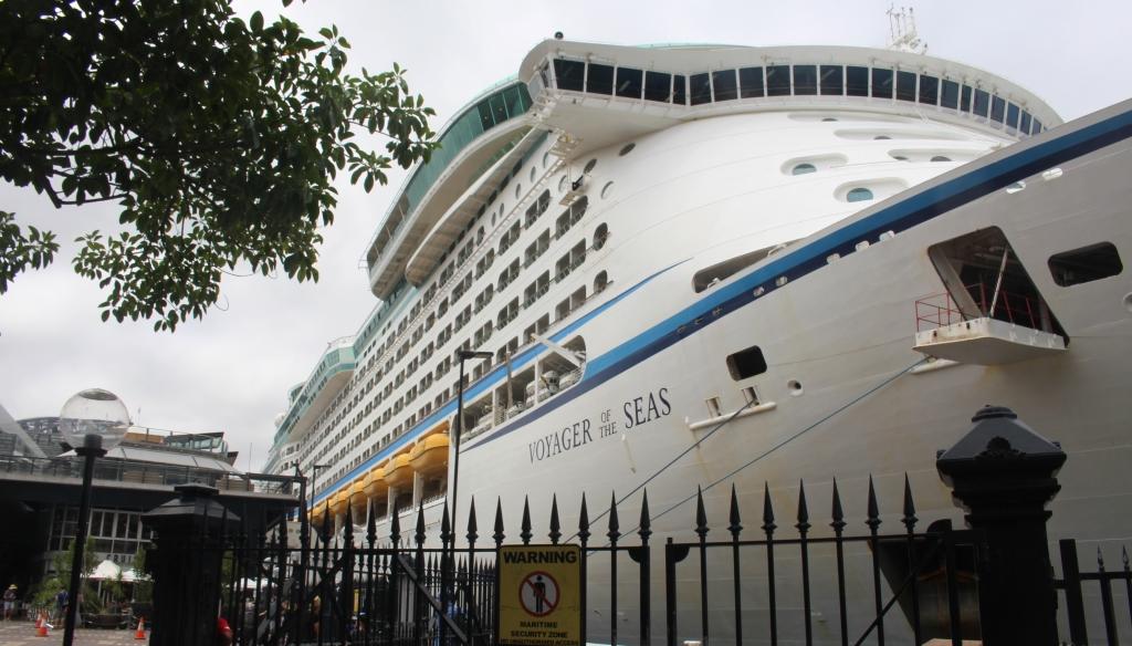
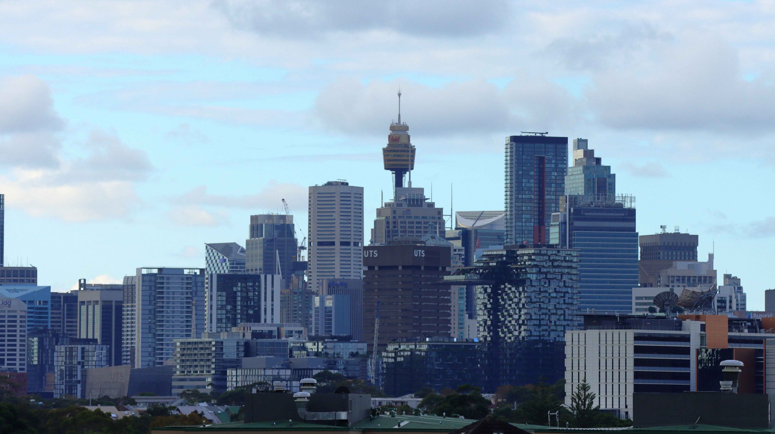
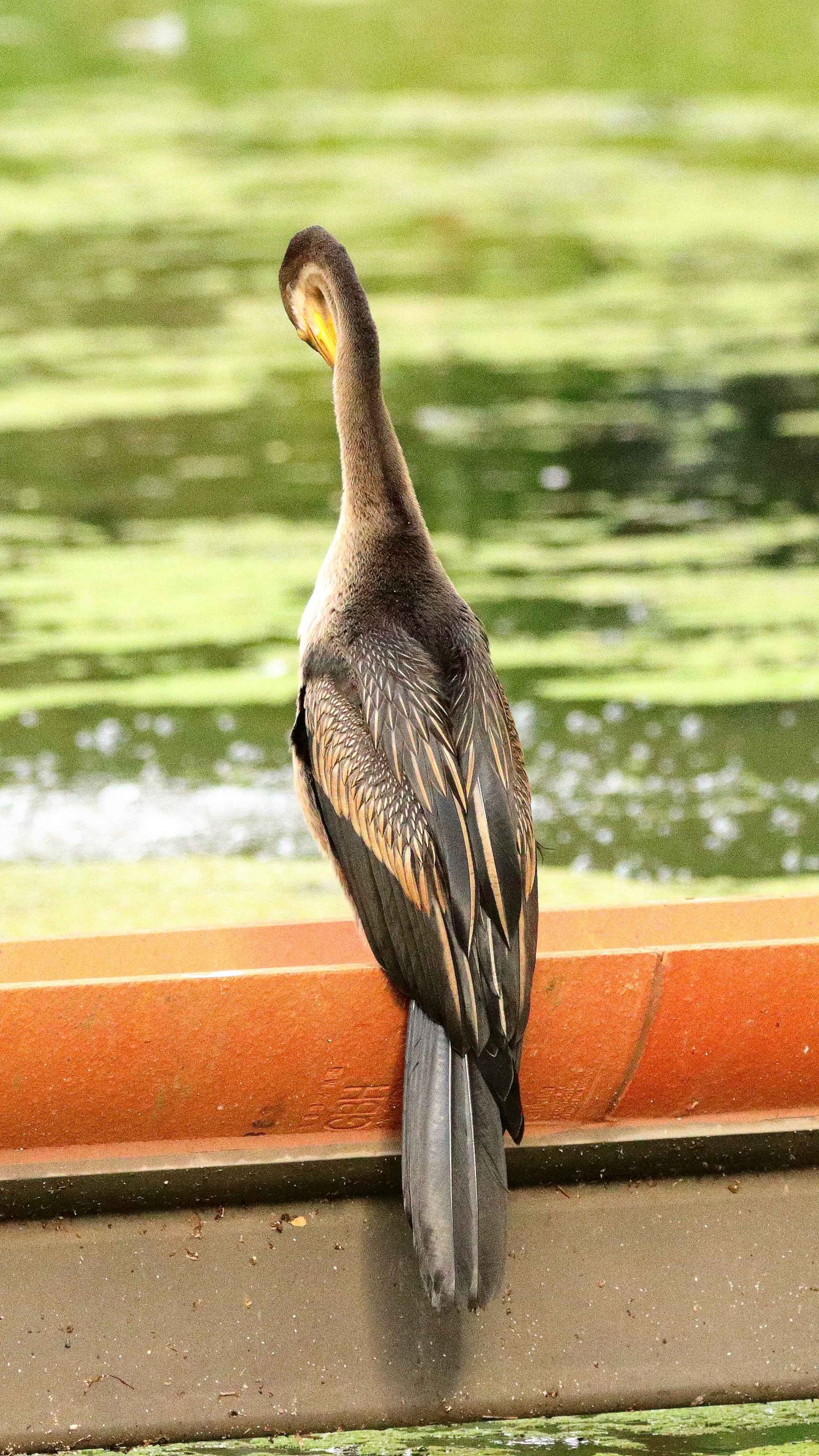
We spent a quiet morning on Saturday. In the afternoon I walked to near-by Newtown to do some street photography. On Sunday morning Briony accompanied us to brunch at Mount Annan Botanic Gardens Café where we met Ruth’s sister Dorothy and her family. We returned via Costco at Casula for some bulk shopping. Later in the afternoon I spent a couple of hours photographing birds and humans at Sydney Park which offers wetlands and an elevated viewing position overlooking that part of Sydney. The park is right across the street from Briony’s unit.

View from the top of the hill in Sydney Park. Looking towards Redfern.
An Australian Darter at the Sydney Park wetlands.
Family group at brunch at Mount Annan.

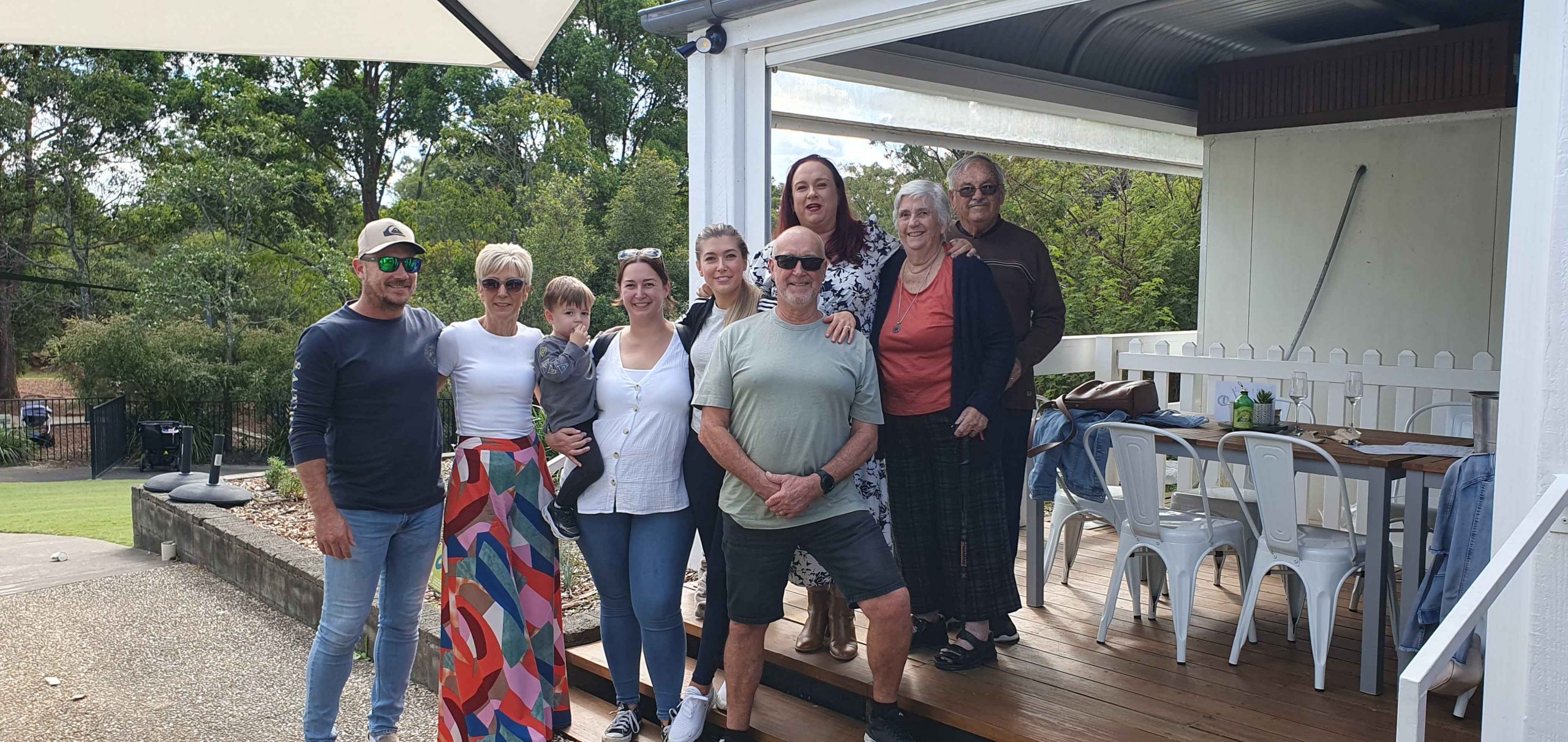
An 8.00 AM departure saw us at Ruth’s younger brother’s home at Bowral for a coffee stop. Wallace is in advanced stages of a wasting disease that has robbed him of movement and speech but not mental capacity. But he never complains and communicates to the best of his ability. Ruth is particularly close to his wife and her sister-in-law Ginny. The visit was both a sad and happy time.

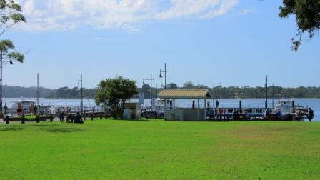
Bernard and Aileen had arrived at the caravan park at Jindabyne where our cabins were located when we checked in. So we had a bit of a chat over a cup of tea and went out to dinner. We were at Jindabyne for three nights. We dined at three different eating establishments on the three nights and spent the days seeing the sites.

The Snowy River near to its source.

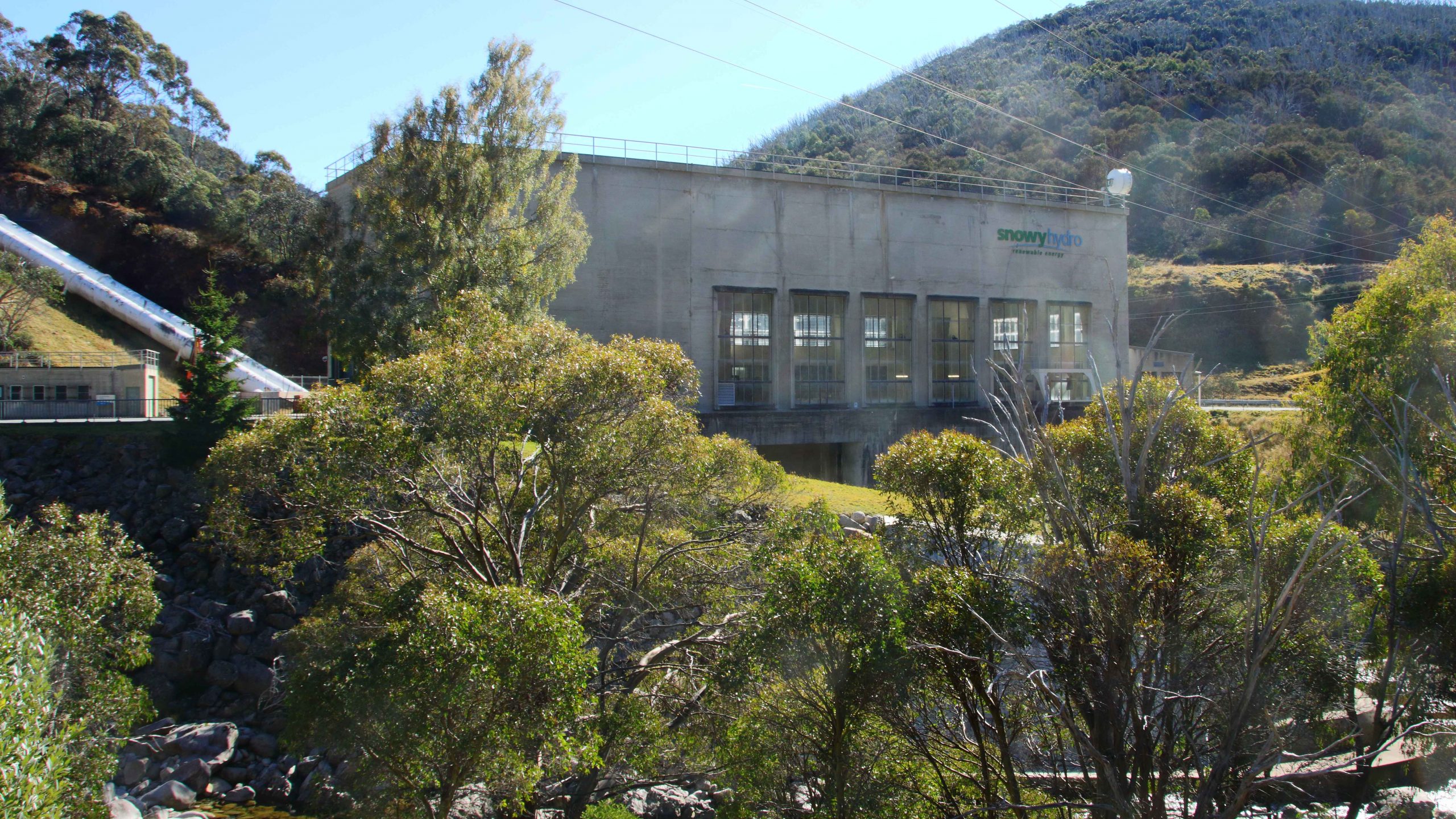
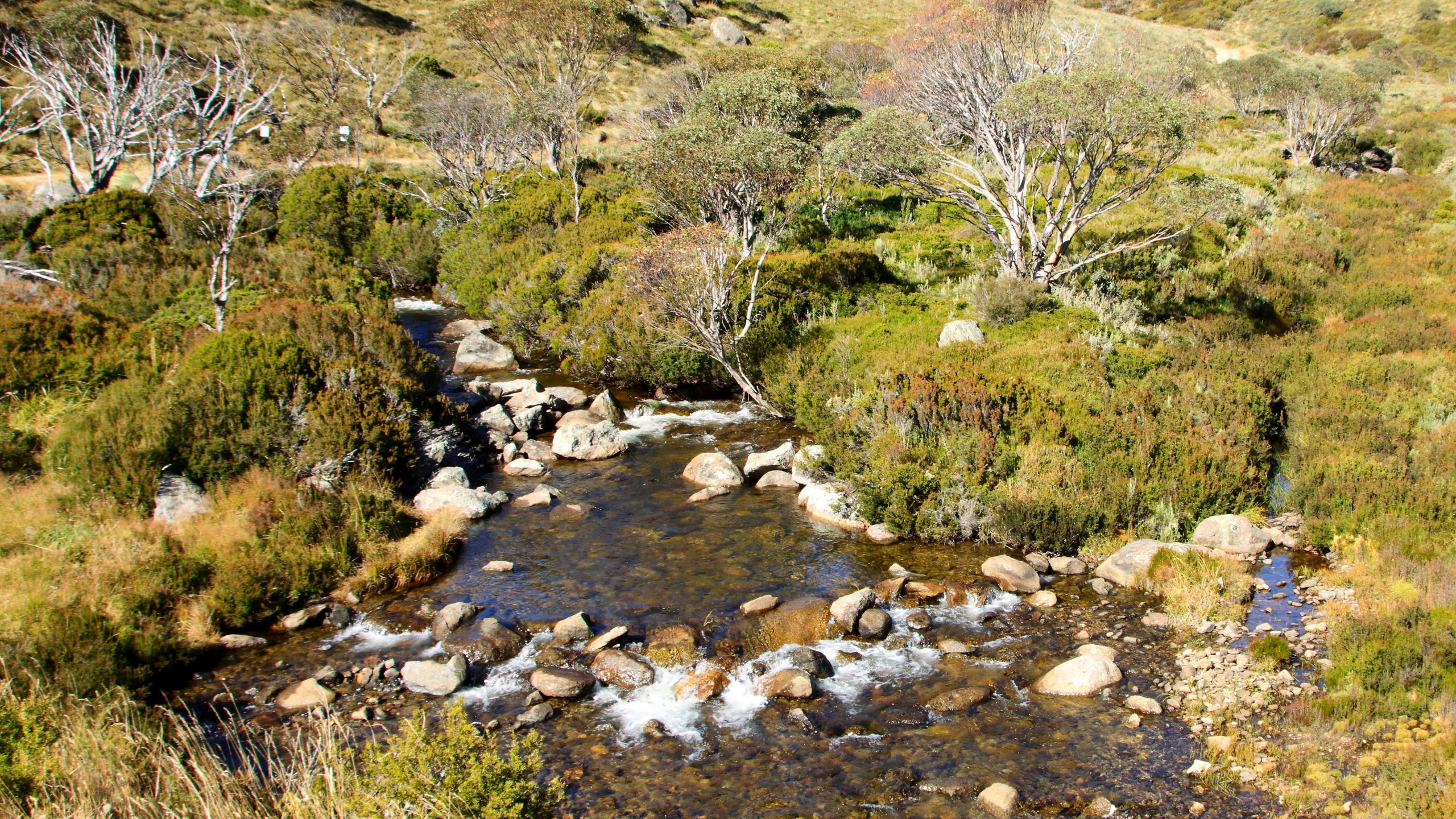
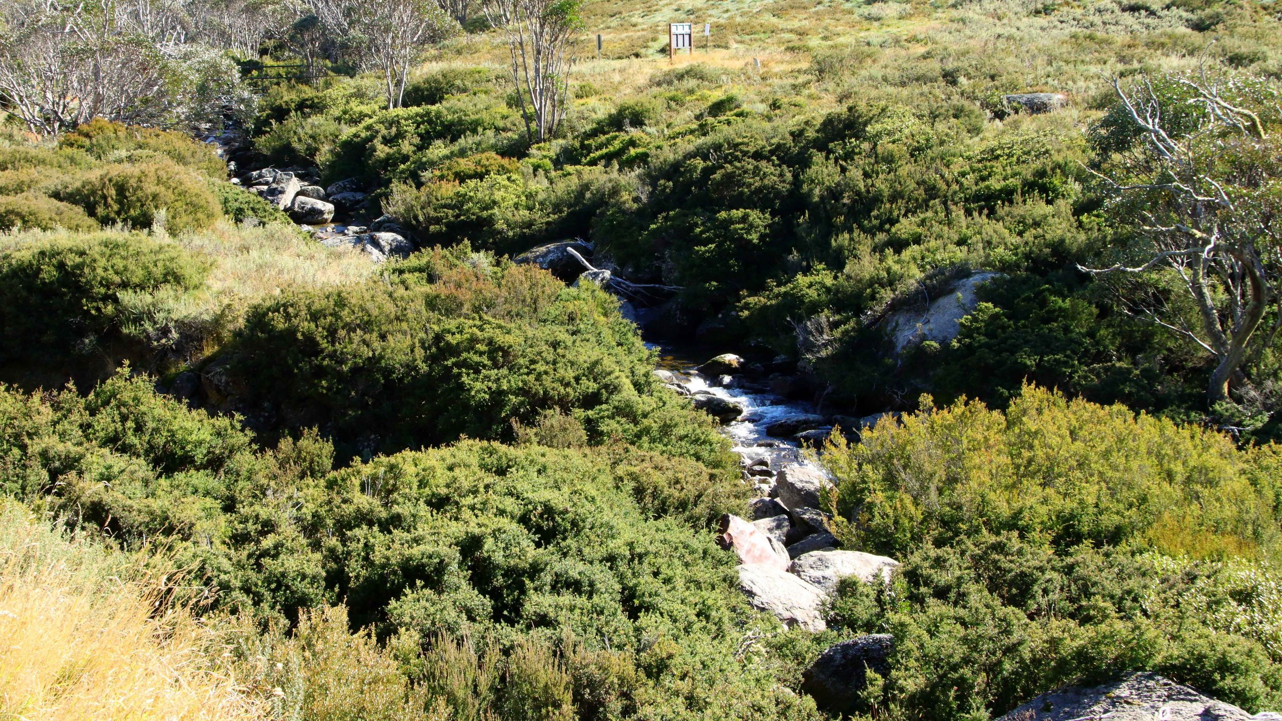
On Tuesday we drove to Charlotte Pass, diverting to visit the Guthega power station and follow the Snowy River until we turned into a gravel road that took us back to Kosciuszko Road at Smiggin Holes.

Charlotte Pass viewed from the lookout above the resort.

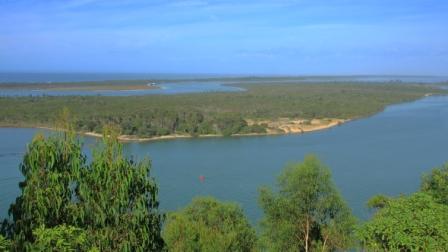
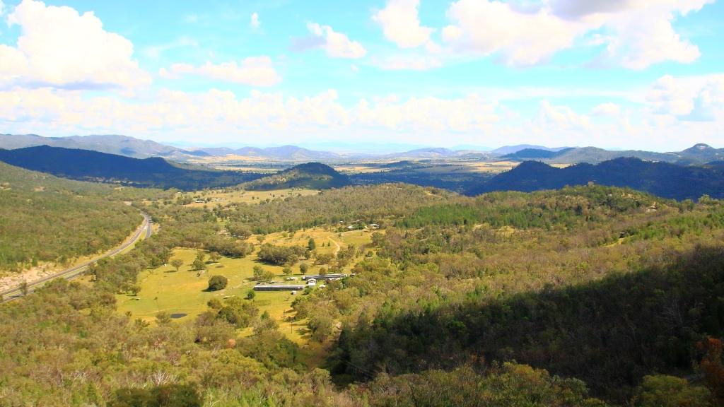
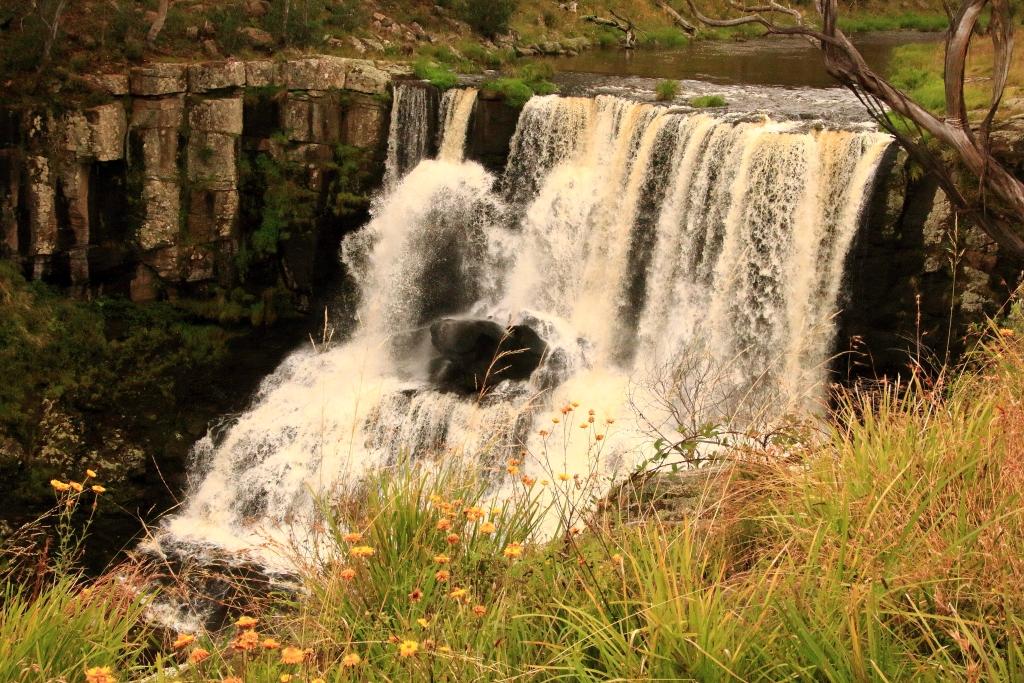
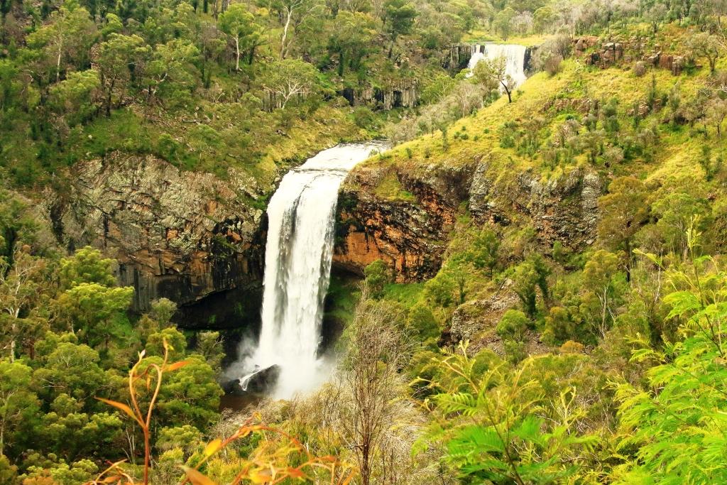
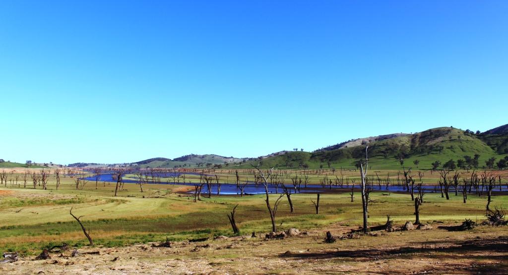
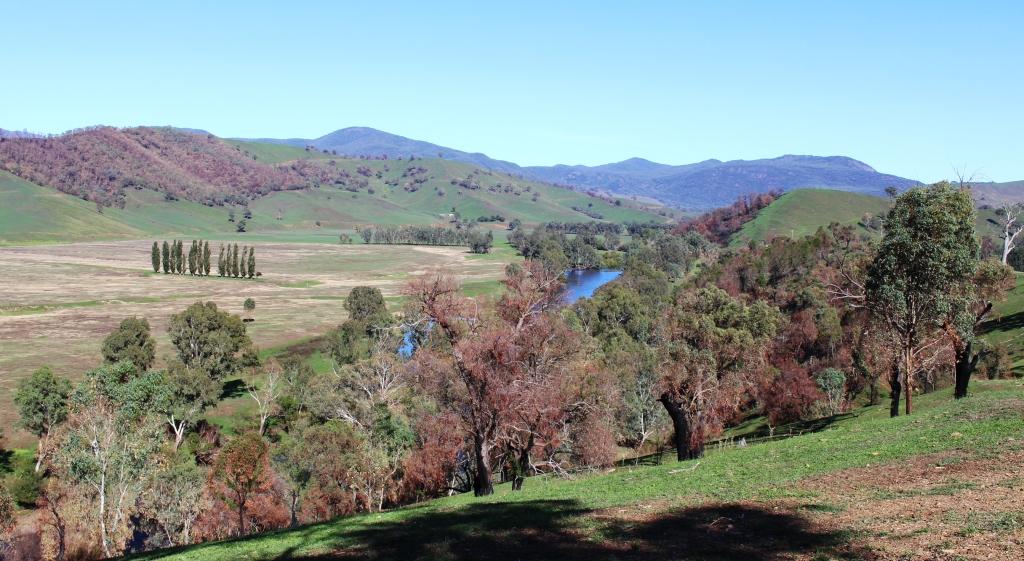
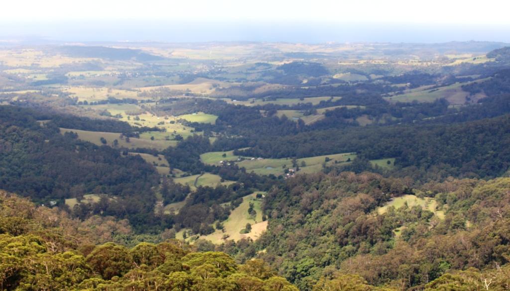
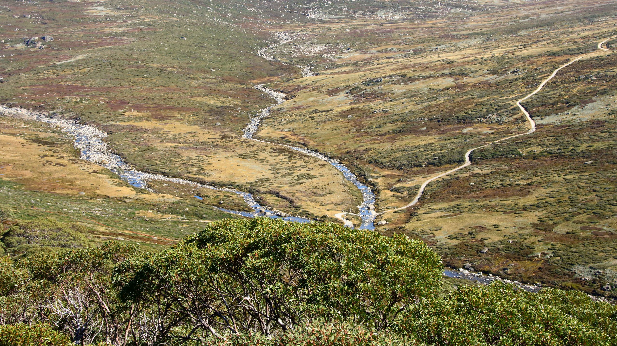
The car park at the lookout above Charlotte Pass village was busy but we grabbed a parking spot for long enough to walk the board walk to the lookout that gives such a great view of the Kosciuszko range, including Kosciuszko’s peak and the Snowy River making its way through the valley at is feet, to the dams that interrupt is path to the ocean at Marlo in Victoria. This view always makes me want to don my hiking shoes and take off into the mountains. Instead, we drove to the village for a late morning coffee, or in Bernard’s case, a cup of tea.

The pipeline leading to Guthega power station.
Jindabyne from the Mount Kosciuszko Road.
Jindabyne Dam that holds back the waters of Lake Jindabyne on the Snowy River.

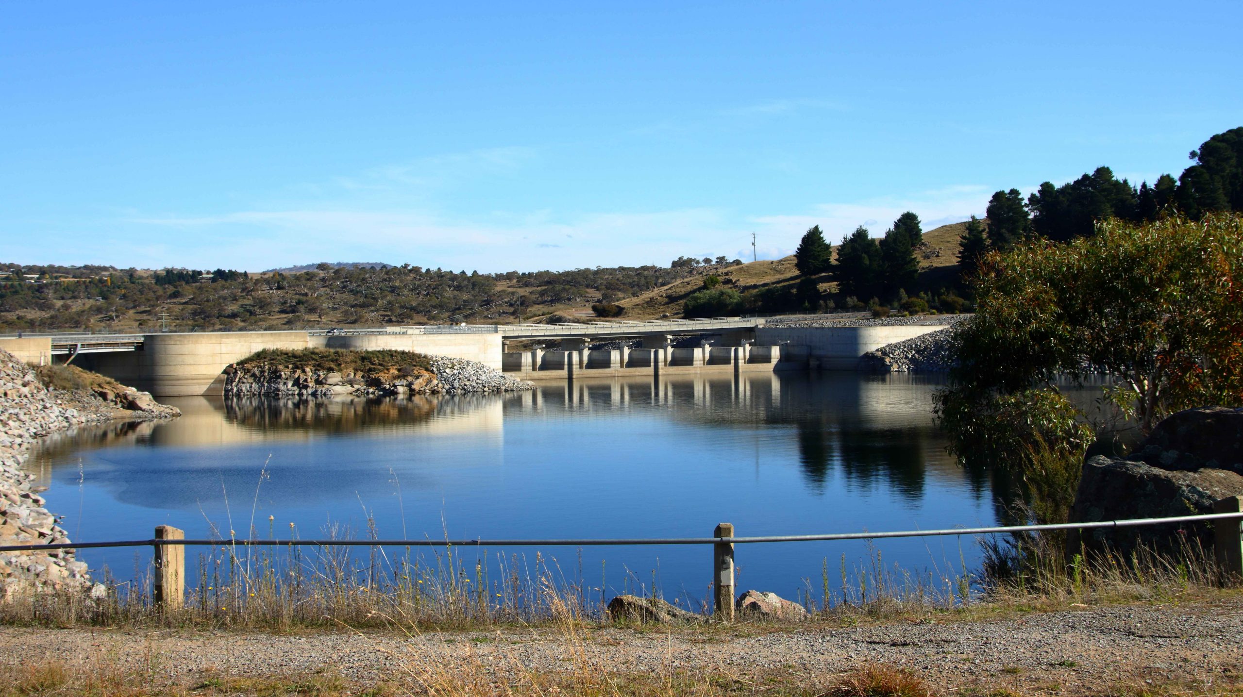
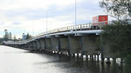
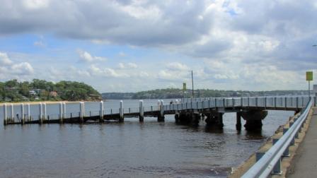
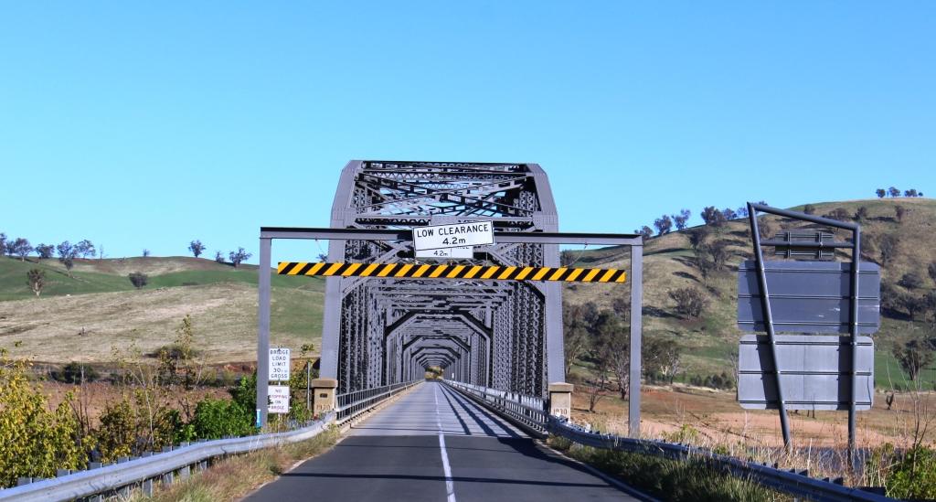
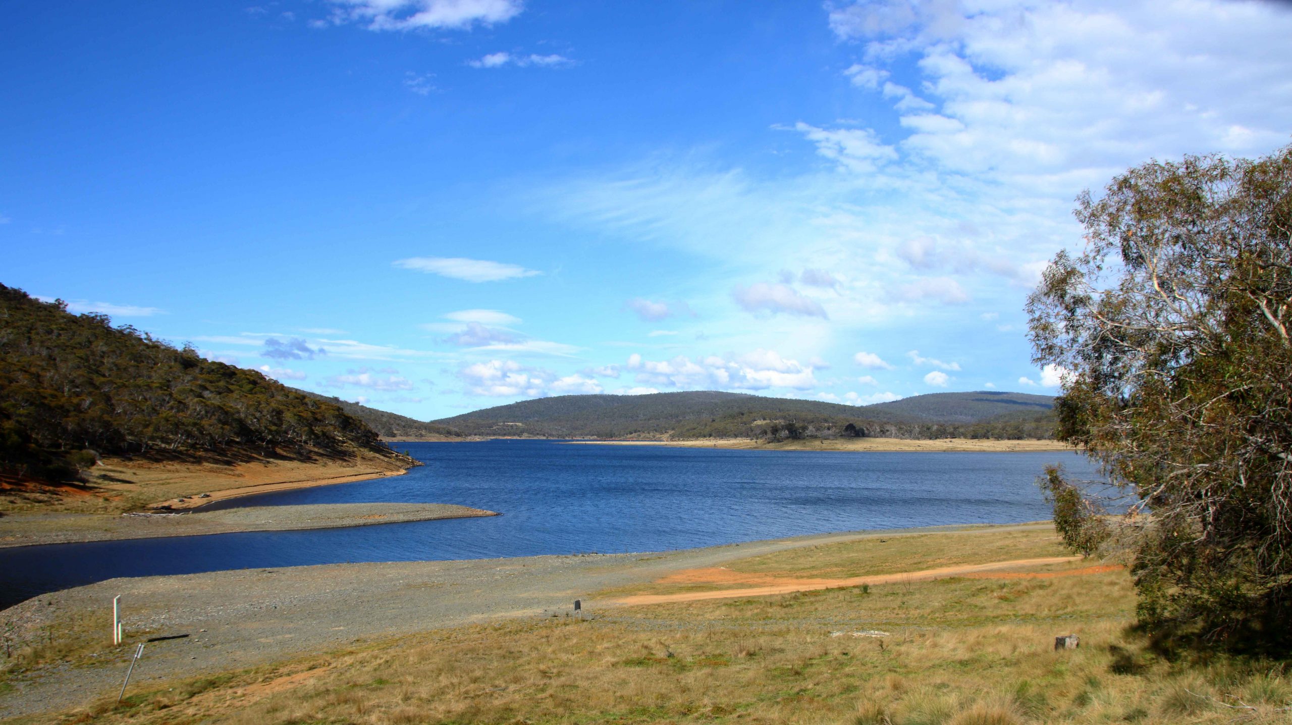
After a stop for photographs of Lake Jindabyne and the town we visited the dam that holds back the waters of the lake. Water levels are quite high as we could see as we drove over the road the previous day. The dam serves as a platform for the main road into Jindabyne and the Snowy Mountains.

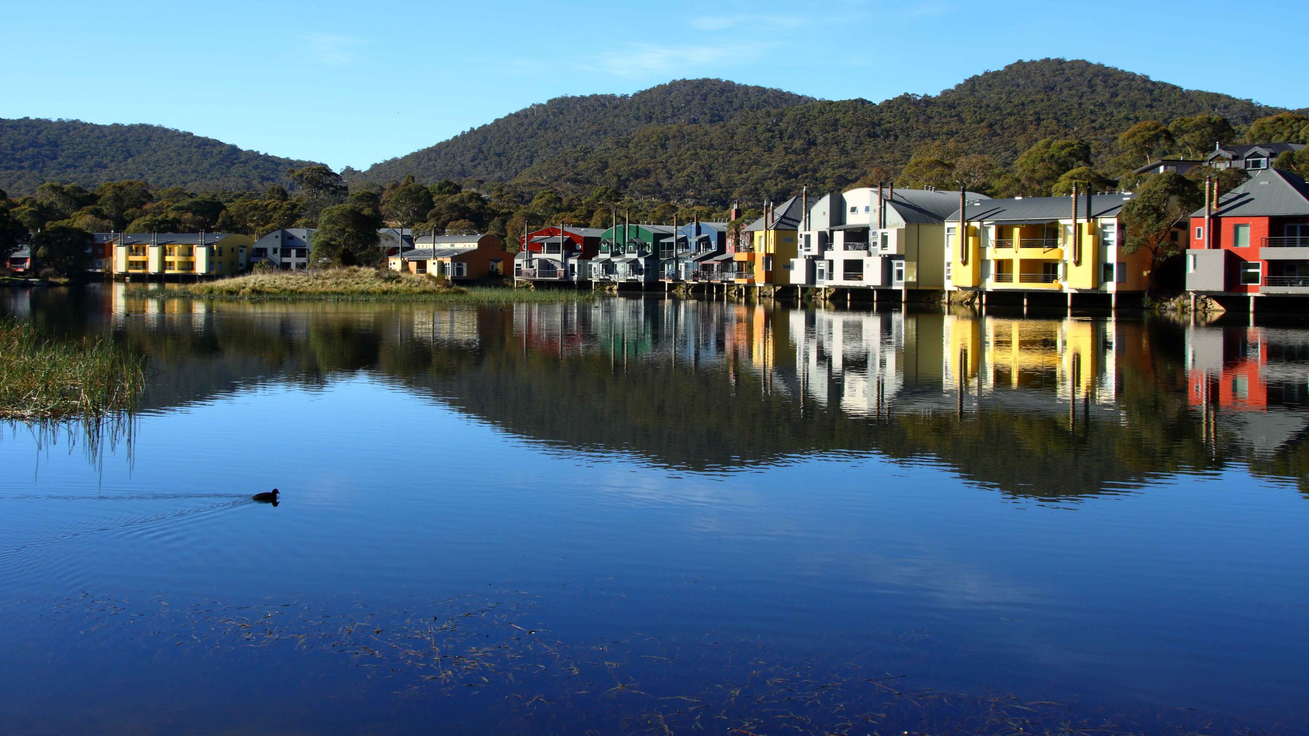
On Wednesday we drove towards Thredbo on the Alpine Way, first stopping for a look at Crackenback Resort. What a beautiful place, with attractive accommodation huddled around the lake. A Eurasian Coot completed the picture as it coasted across the calm waters, creating its own ripples.

Reflections of Crackenback Resort on Lake Crackenback.

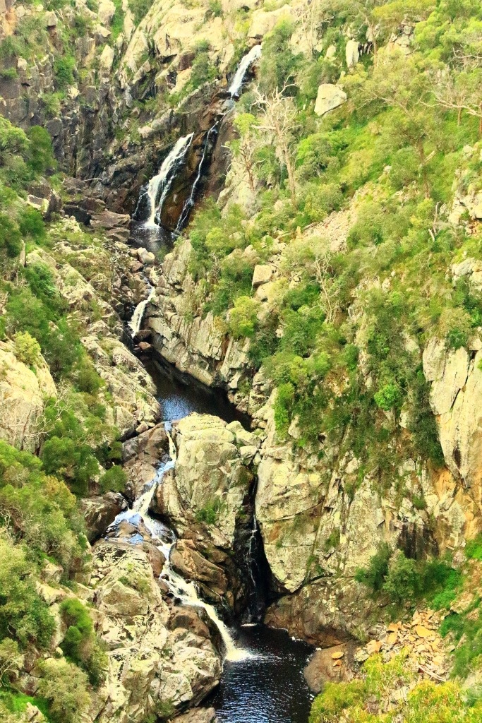
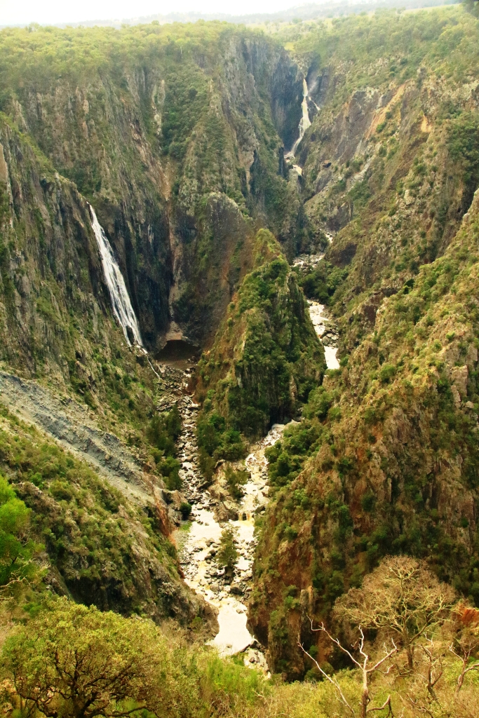
Before calling at Thredbo, we drove on to The Pilot Lookout, Dead Horse Gap and the Cascades on Dead Horse Creek. Reports have it that wild brumbies can be seen at Dead Horse Gap, although a place so named seems an unlikely place for brumbies to gather. The only thing of note was a sign advising that a section of the park was closed for vermin eradication. Perhaps the brumbies had been warned, although the sign did say that they were excluded from the cull.

The Cascades on the Dead Horse Gap Creek near the junction with Thredbo River.
The Thredbo River near the alpine resort town of Thredbo.

We drove into Thredbo but found it to be largely inaccessible due to tourists and tradesman who had got there before we did and areas barricaded off by witches’ hats by the workers. We had intended to ride the tourist chair lift that takes visitors to the main skiing area and the track to Kosciusko but we could not park close enough to the lifts to make that an achievable objective.

We hadn’t even managed to get ourselves a cup of coffee, so we returned to our units for a soup and toast lunch and a cup of coffee. It was good soup weather, although better than we expected. Both touring days provided brilliant blue skies and temperatures in the low twenties. Nights were cold, well below 10C.

The view towards Thredbo from Dead Horse Gap on the Alpine Way.

On Thursday 27th April we departed Jindabyne, Aileen and Bernard for a few days at Merimbula and we to return home but by an indirect route. We had enjoyed our few days together and departed resolved to repeat the exercise before too long.

The western end of Lake Eucumbene at Providence Portal.

Ruth and I drove back to the road to the Snowy Mountains Highway and Tumut. We drove through relocated Adaminaby and stopped in at Providence Portal where water from elsewhere in the mountains runs into the western extremity of Lake Eucumbene. From there we paused for a comfort stop at deserted Kiandra, then proceeding through Tumut to Gundagai, where we stopped for lunch.

Tumut is the location of much of the work on Snowy Hydro II but we saw little activity, most of which was off the beaten track or underground.

Cowra sunset.

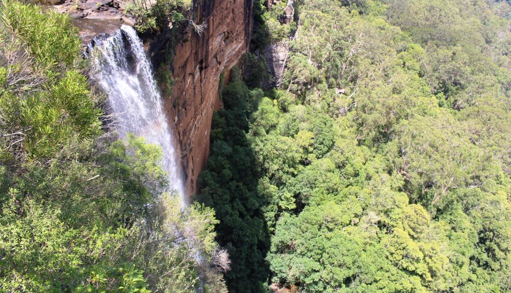
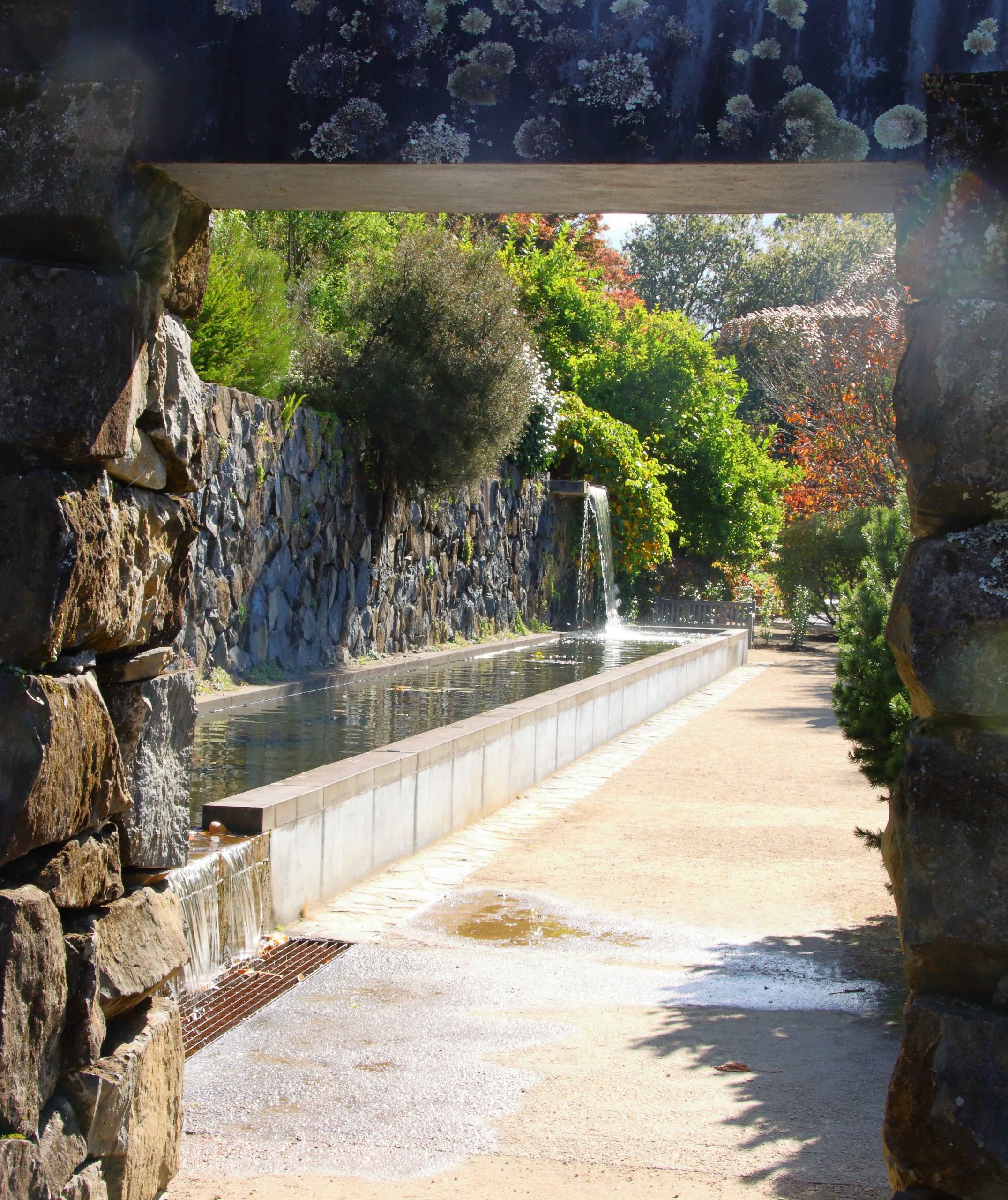
We spent Thursday night at Cowra, proceeding through Blayney, Bathurst and Lithgow and along the Bells Line of Road to Mount Tomah to visit the Blue Mountains Botanic Gardens. Two previous attempts to visit had been frustrated by fog and rain. The wait was worth while. The garden is actually a series of small gardens comprised of mostly trees and shrubs with fountains and rockeries with waterfalls and pools. There is an excellent visitor centre with a very handy café.

Autumn in Mount Tomah gardens.
Fountain Terrace, viewed through the archway at Mount Tomah.

We journeyed on through Kurrajong, Richmond and Windsor to Vineyard where we spent the night at a large hotel with an attendant motel. A very nice seafood dinner ensued.

A damp morning followed for our drive along the Putty Road to Singleton. The Grey Gum Café at Putty normally teams with motor bikes on weekends but motor bike riders had been discouraged or delayed by the wet. We shared the establishment for coffee with a couple of motorists and a solitary motor bike rider.

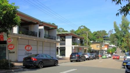
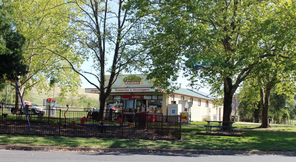
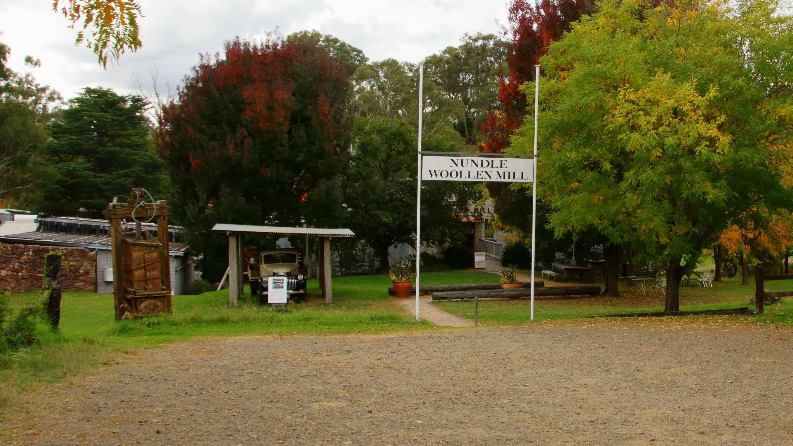
Our overnight objective was Tamworth with a side trip to Nundle. Nundle is one of those towns to which signposts point as you drive by down the main road. We knew of it from our regular use of the New England Highway and my transport days involvement in the New England area. More recently, for some unknown reason it had started popping up on my Facebook news feed.

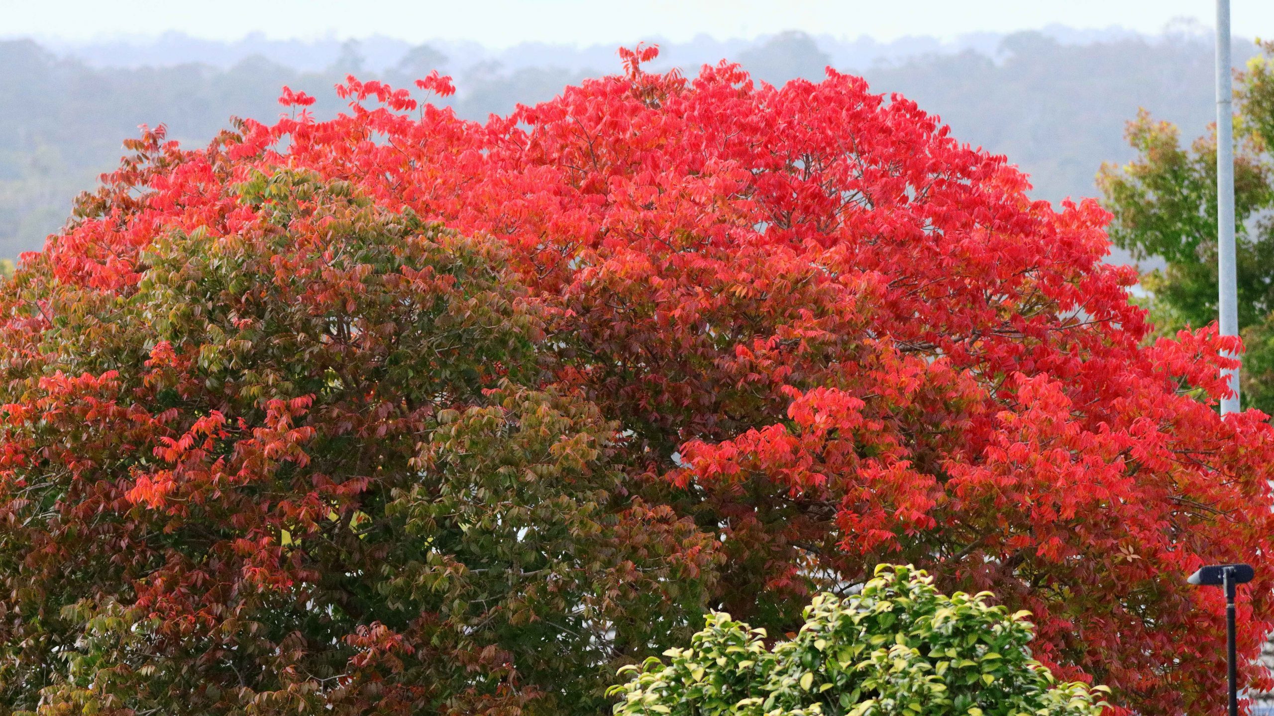
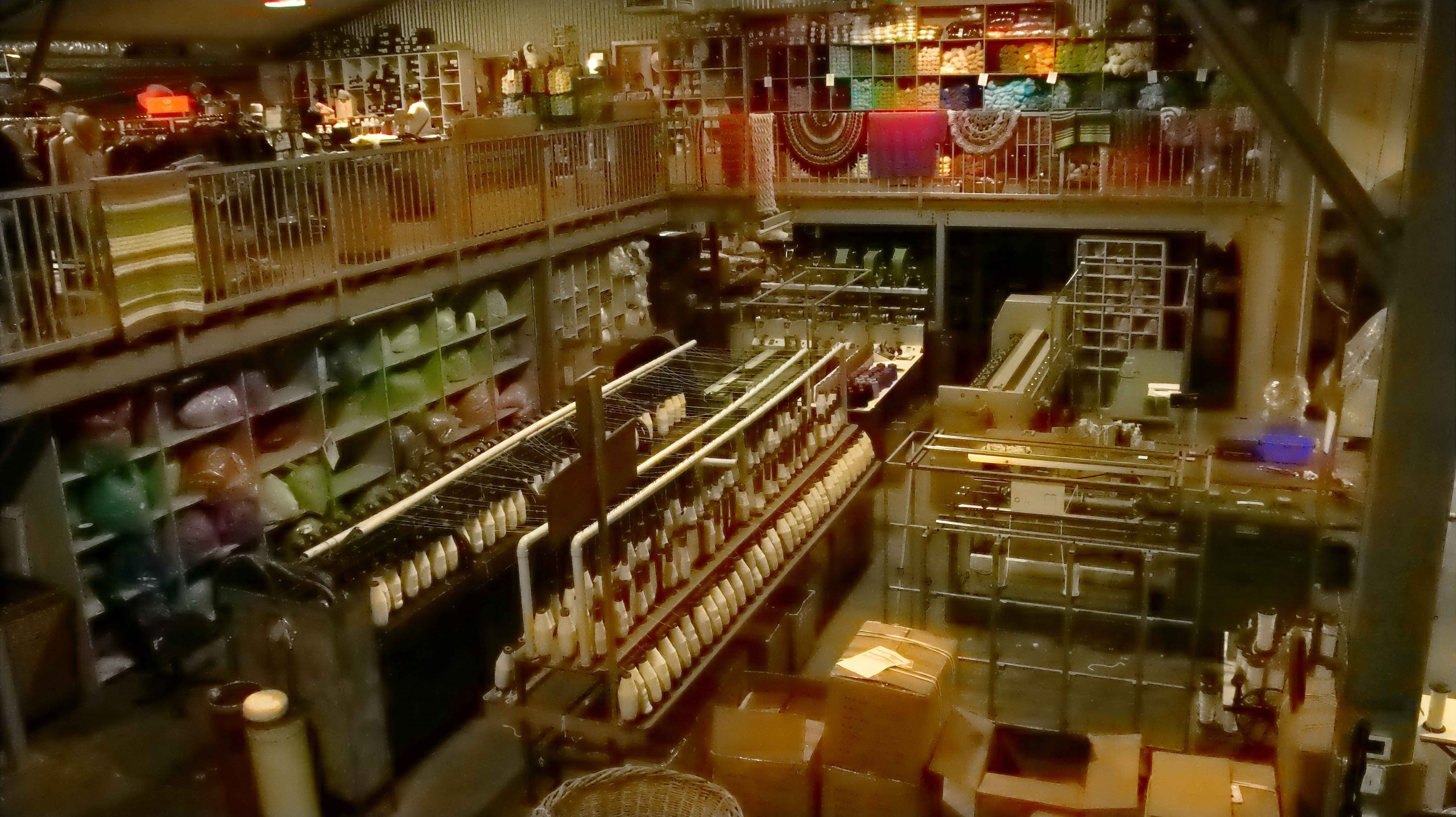
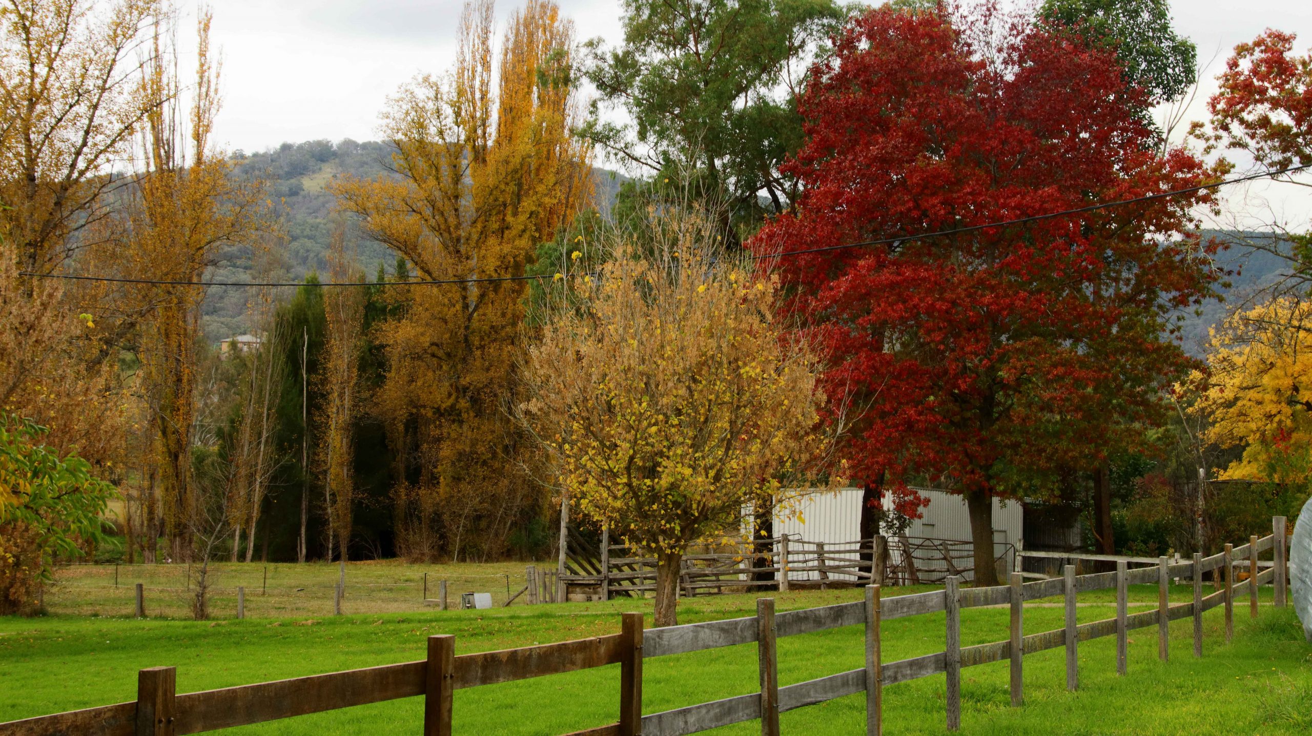
Nundle is a small and attractive farming community with the addition of a historic woollen mill, one of the last operating in Australia. The mill is still owned and operated by its original founding family who started it over a century ago. The brilliant Autumn foliage really lifted the town on what was by then a very dull afternoon.

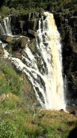
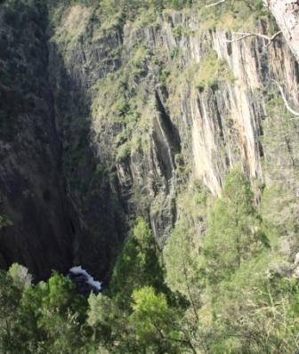
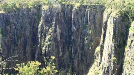
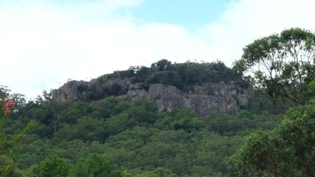
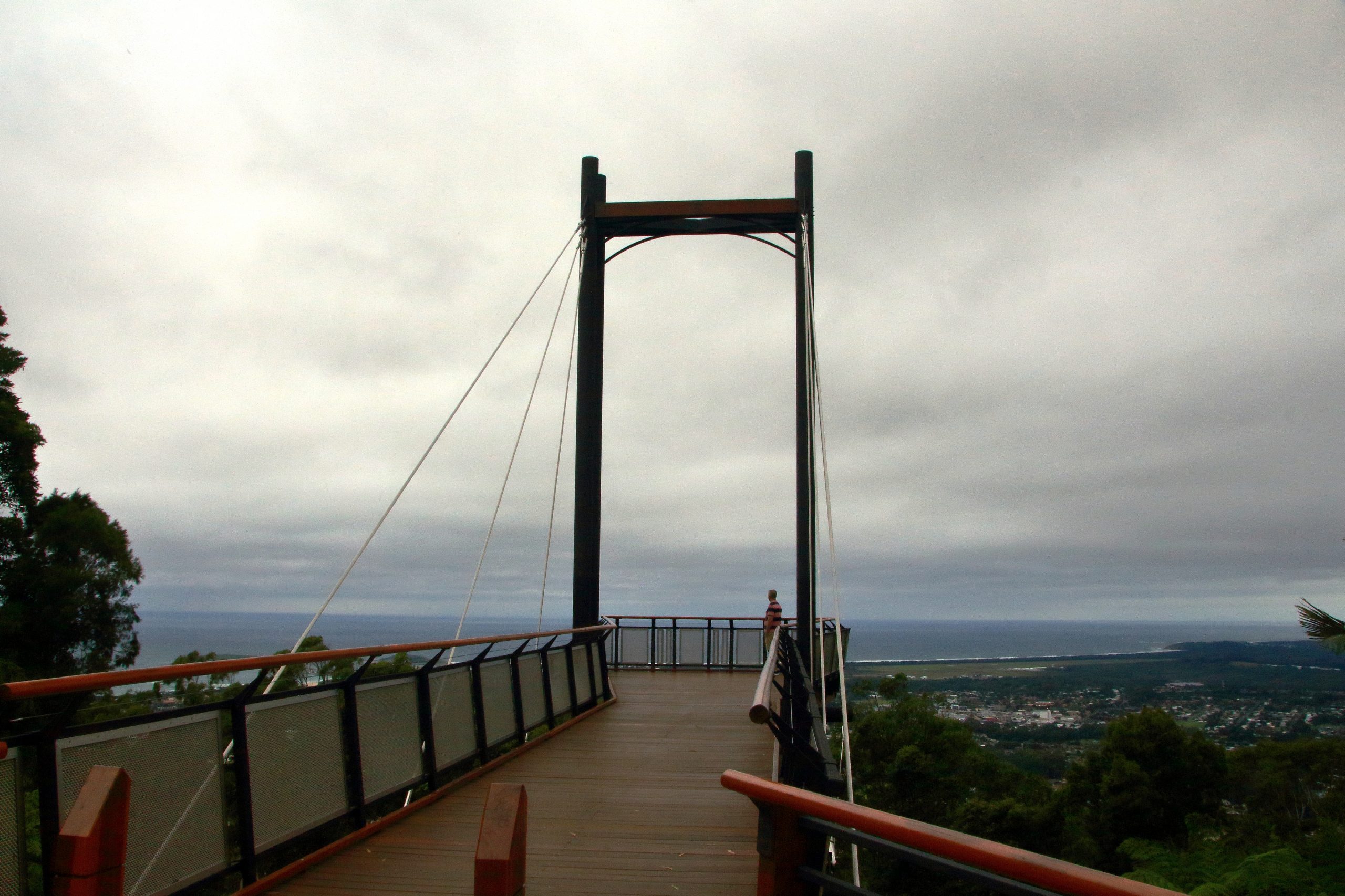
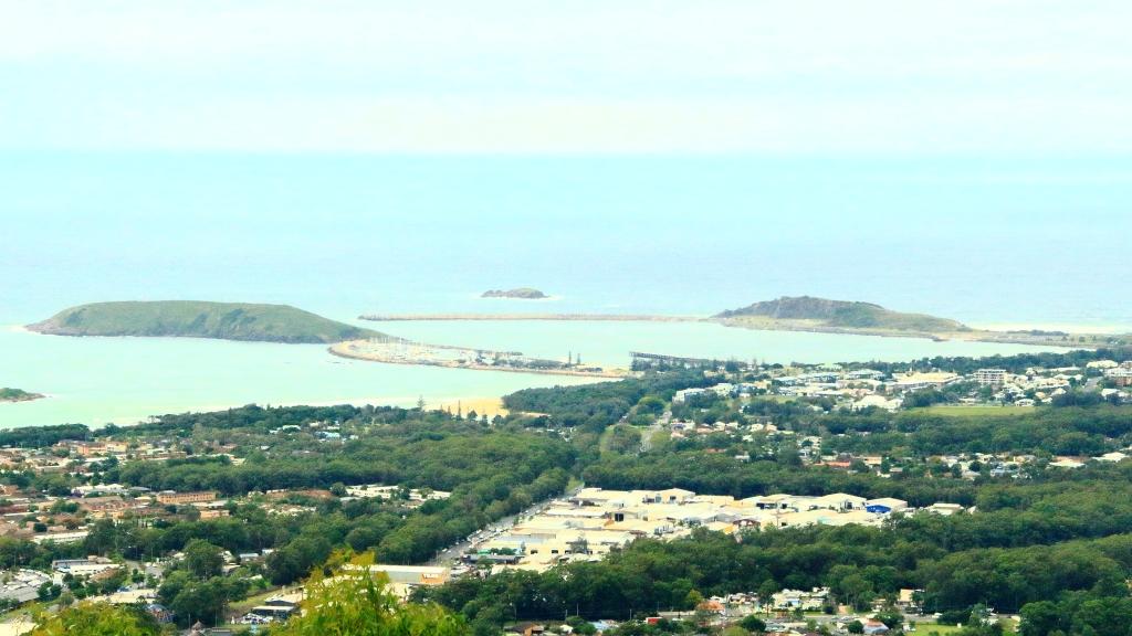
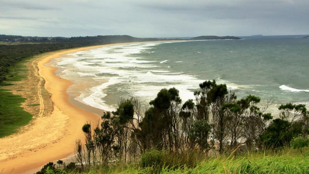
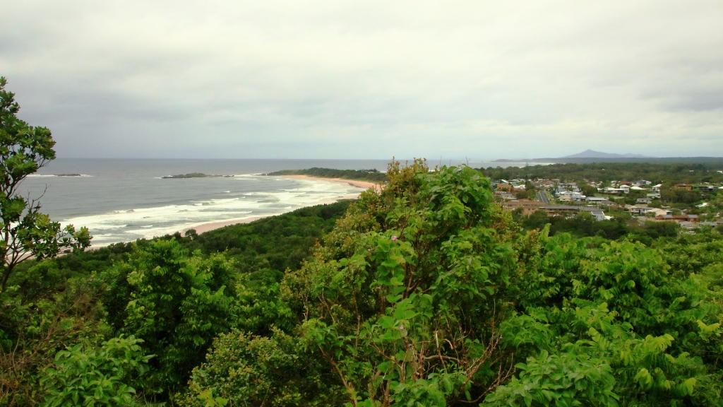
With the day drawing in we drove up to Hanging Rock Lookout with rain threatening to return. To be able to see the hanging aspects of the rock clearly required a different vantage point but the lookout did provide great views of the surrounding mountains.

Entrance to the Nundle Woollen Mill.
Part of the manufacturing equipment at Nundle Woollen Mill.
Autumn colour in the park at Nundle.

On our drive to Tamworth, we passed Chaffey Dam on the Peel River, of interest to me because of my involvement in the transport of materials to the sight during its construction.

Rain had returned by the time we reached our Tamworth motel and the forecasts made it clear that the precipitation would continue next day. We had planned to visit a couple of other places connected with my earlier association with the area but when we realised that we could still cancel our Inverell motel we decided to do so and head home a day earlier.

More New England colour near Glen Innes NSW.

We departed Tamworth with the clouds well below the surrounding mountains. Rain and drizzle continued but by the time that we stopped at Glen Innis for coffee the temperature was up to 10C. By lunch time at Warwick it had reached 15C. Once we had crossed the Great Dividing Range it increased further. We arrived home on rather a balmy evening, reminding us of one of the reasons that we live here.

So, another successful trip of around 3,500 kilometres completed with most objectives achieved. We don’t have any other travel plans currently although we will probably do something else in the near future. What ever it is we will keep you informed.

The Family Responsibilities Tour – Part 1

Note: A video covering the material in this post can be found at the foot of this blog post.

Apsley Falls in full flow. Walcha NSW.

On 23rd November 2021 I lost both my eldest brother, Ivan, and my brother-in-law Colin, my only sister Aileen’s husband. Colin passed in the morning, Ivan in the early evening. Ivan was in the northern suburbs of Newcastle and Colin at Moe in Victoria’s West Gippsland region. There was no connection in their deaths, just one of life’s coincidences.

Covid-19 was at its high point, with borders closed in some states but not in others. We could have travelled to NSW, possibly to Victoria, but we would not have been permitted back into Queensland. We faced a real travel ban. So we had to provide our condolences and the support that we so much wanted to give by phone call, email and text message. We decided that as soon as possible after borders opened, we would travel south to visit grieving relatives and graves.

The opportunity came in March. With borders open and three vaccinations completed we headed south on 12th March, just four days after what would have been Ivan’s 88th birthday celebration.

Apsley Gorge. Walcha NSW

Our intention had been to first spend a couple of days with friends in Ballina, but they had been evacuated a few days before due to flooding of the Richmond River, which had closed the Pacific Highway from Ballina to south of Grafton. Their home was not inundated, and they returned to it after a couple of days, but a visit was not practical so soon after the floods, so we opted for the New England Highway.

Our first family call was to Marjorie, my sister-in-law, who requires constant care and who had gone into respite care in a retirement home in Bulahdelah, which is located about an hour north of her home in Newcastle. You will possible have read of Bulahdelah in the pages of these blogs. It is the town near which I spent the first 15 years of my life and where I met Ruth, my wife of almost 60 years. Ruth, of course, has been part of all the travels covered by the mobilesheathers.com blogs.

Apsley Gorge. Walcha NSW
Forster-Tuncurry Bridge on Wallis Lake

We spent the first night in Armidale. On day two we drove south to Uralla and there turned to join the Oxley Highway at Walcha, to reach the coast again. When we travel for almost any reason we are touring and taking in sights and points of interest along the way. We had been hoping for some early Autumn colours in the roadside trees so were a bit disappointed by the lack of colour, but the area had not progressed far into Autumn but it was very green from recent rain.

But just east of Walcha the Apsley Falls were at their thundering best. On our previous visit, back in our caravanning days, the drought was it its height and there was not even a trickle of water on the falls, just a pool of brackish water at the bottom. Viewing facilities at the falls are excellent. Ruth was able to make her way to the main viewing deck and was able to see as much as I could. There are some good walks at the falls, but time did not permit. We had appointments to keep.

Wallis Lake, Forster NSW

We paused for lunch at Wauchope and made it to our motel at Forster, at the mouth of Wallace Lake, in good time. Time to fit in a walk! So, with camera in hand, I set off for the bridge that spans the lake at a narrow point between Forster and neighbouring Tuncurry. The bridge is about one kilometre long with a hump on each end to allow boats to pass underneath.

Resort building beside Wallis Lake

An area south of Forster, Tiona, was a favourite holiday destination during my childhood, as it offered a range of options for my fishing loving Father. There were two ways of getting there from where we lived back then. If we came via Tuncurry the car and trailer (containing our camping equipment) would be loaded onto a small punt which was pulled through the meandering channel to the other side. Now the sand bars that shaped the channel carry the pylon foundations that support the bridge.

The bridge provides a scenic vantage point for both towns, Wallace Lake, and the entry to the lake from the ocean. Ever watchful for sea birds I noticed an Eastern Osprey making long sweeps over the lake in search of dinner, or perhaps a late lunch. After several failed attempts, it landed on a bridge street light and remained on its perch as I walked past taking photos of it. A call at the ocean beach and it was time to return to the motel for dinner.

Wootton School now a community centre

The easiest route from Forster to our next call at the retirement home at Bulahdelah was to fallow the Pacific Highway but a more interesting way was to leave the highway south of Coollongolook and followed The Wootton Way to where it re-joins the highway just north of Bulahdelah. This detour took us past a school that I attended for a couple of years during primary school and past the property on which I and my family lived for about 5 years prior to moving to Victoria when I was 15.

Tall strait trees

The school is now a community centre and the town much smaller than it was 70 plus years ago. The road is sealed as, for a time, it was the Pacific Highway. Further on we drove through magnificent stands of white-trunked trees, typical of the area. Further on we came to the property where our house stood near the road. The house was moved shortly after we vacated. New owners built further back on the property, behind the tree line and have operated a farm stay business for many years.

The old shed in which I milked the house cows

We arrived at the nursing home in good time next morning to complete the Covid safety procedure before visiting sister-in-law Marjorie. We found her in good spirits despite having been told a few days previously that the nursing home was to close thus causing uncertainty about her future. We stayed for morning coffee and lunch before making our way further south. Happily, Marjorie’s future accommodation arrangements were settled a few days later when her two daughters completed arrangements for her to take up residence on the top floor of a facility near Lake Macquarie in Newcastle, where she will have views of the lake as well as, we hope, good care.

Bulahdelah Alum Mountain
The sloping lawns of the Lake Macquarie Memorial Park

We stayed two nights at Warners Bay, our motel overlooking the northern end of Lake Macquarie. Ivan is buried at Lake Macquarie Memorial Park at Ryhope, just a few hundred metres off the Pacific Motorway, south of Newcastle. A very convenient location for paying our respects during future trips south.

Warners Bay viewed across the lake

We met Ivan’s two daughters with their respective spouses at the park. They showed us to the grave site, already almost covered with grass. The plaques are under way and should be in place when next we call. The grave is in a pleasant area on the side of a gently sloping hillside. The entire garden area appears to be well kept and will continue to be so. We left the cemetery and drove to the sports club in Toronto where we lingered over coffee with nieces and nephews that we rarely see.

White-necked Heron at Warners Bay

The afternoon was fine and sunny so we parked, and I took a walk on the path provided between Warners Bay and Speirs Point. It is not always possible to keep up my walking schedule when we are travelling, so such opportunities are not to be missed. As a bonus there were birds to photograph, including a White-necked Heron, a first sighting for me.

Next morning, Tuesday, we took the short drive to the home of Ruth’s elders sister Judy and her husband Alan, at West Wallsend. Judy has mobility problems but maintains a positive attitude which is most demonstrated by her determination to keep travelling. So over lunch we discussed, as well as family, travel plans and experiences. Visit over, we headed for Sydney.

Cronulla Beach

We were to have spent two nights with our daughter Briony at her Erskinville home, but she had come down with a non-Covid virus that we did not want to catch. A quick change of arrangements took us to the Travelodge at Bankstown, a bit of an experience as it is also the Bankstown Sports Club. Temporary club membership was bestowed upon us so that we could use the facilities of the club.

Coffee shop at Cronulla Beach

On our second night with Briony we had planned to meet Ruth’s youngest sister Dorothy (Dot) for dinner. So, a quad became a threesome at the NEM Riverwood Vietnamese restaurant, for good food and a good old family catch up.

Ferry terminal at Bundeena

To fill in the intervening day we revisited old stamping grounds from the first period of joint residence in Sydney during the time of my appointment to East Coast Transport at Botany. We started with morning coffee at Cronulla, right on the water on a lovely sunny morning. We then drove past Miranda Fair, where we used to do our shopping and stopped for a look at our former residence at 4 Tulong Place, Kirrawee. This house was built on top a couple of huge boulders, with views over the Royal National Park. Every time I see this house, I wish that we still lived there.

Bundeena main street

Next, we drove into the Royal National Park to the town of Bundeena on the southern shore of Port Hacking. This was to have been our lunch location but, after a largish morning coffee we were just not ready for more food. After looking around Bundeena we returned to the road through the park that leads to its southern coast entrance at Otford. At this point you will find one of the best scenic lookouts in Sydney. Otford lookout has an elevated viewing platform, heaps of parking space, a kiosk and views over the coast and from Sea Cliff Bridge to Port Kembla. We had a snack there before driving back through Stanwell Tops and Waterfall to Bankstown and dinner.

The following morning, we left Sydney early and drove to Bowral in the Southern Highlands of NSW, to call on Ruth’s youngest brother Wallace and his wife Ginny. Wallace is in advanced stages of a degenerative disease (similar to Parkinson’s disease) so our visits are relatively short. We joined them for lunch and family news. These calls are always sad and happy events because you never know if each one will be the last.

View from the Monaro Highway

Our destination for the night was Canberra. We were joined for breakfast next morning by grandson Jeremy who now works in the National Capital. The remainder of the day was spent driving via the Monaro Highway to its junction with the Princes Highway at Cann River. Then the run through the East Gippsland mountains and Orbost brought us to Lakes Entrance for the night.

There is always bird life at Lake Entrance, so the long lens got some use that evening and again on my walk next morning. Swans and Pelicans predominate, but there are many others. After leaving Lakes Entrance we detoured to Metung for morning coffee, lunched in Traralgon and arrived at our accommodation in Trafalgar in time to unpack and go out to find some dinner. 

Relative Travel – Days 10 to 14

At breakfast, I confirmed with my niece that a left turn back at the main road, the Old Hume Highway, would take us through Camden and Picton.  I used to know that road well until it changed its character completely, when multiple suburbs were built along it and it ceased to be the Hume Highway.  But I forgot the second left turn at Narellan town centre.  We were crossing Peter Brock Drive at Oran Park before I realised my mistake.

We turned and allowed Google Maps to guide us over several country roads, including one called Sheather Lane, until we reached Camden. The Old Hume Highway then lead us over The Razorback to Picton, where we stopped for coffee. The wrong turn had cost us time, so the quickest route, out to the motorway and directly to Bowral, was needed to bring us to our destination on schedule. We didn’t want to be late for lunch.

The next call was very much of the reason for the trip. Ruth’s youngest brother lives with his wife in the beautiful eastern suburbs of Bowral, in the NSW Southern Highlands. Wallace and Virginia (Wall & Jinny) have lived in Bowral for many years. As time passed they bought the block in a then new area to the east of the town and built a nice house around which they have laid out beautiful gardens.

Our hostess with a regular visitor. Guess why it calls?

Sadly Wall is in advanced stages of Parkinson’s disease. Jinny is his devoted carer these days. We spent a night with them and left next morning. We had as pleasant a time together as circumstanced would allow.  It was pretty good.

Not only is Jinny a keen gardener but loves birds. Local birds know it as a good place for a regular feed. The current favourite is a Crimson Rosella that sits on Jinny’s thumb and eats out of the palm of her hand. Kookaburras call and laugh and other Australian native birds in the vicinity drop in.

For a couple of days we had been watching wet weather approach from the south. As we departed Bowral on that Saturday morning, it was clear that we were heading towards the front of the change. We reached Goulburn in slight drizzle. After coffee we took the Crookwell Road to the north, heading for a lunch stop at Bathurst. Beyond Crookwell the road passes through several kilometres of mountains, resulting in steep winding roads. It was on this section of road that the weather caught up with us. Heavy rain and gusty winds added to the challenge but there was not much other traffic.

Approaching Bathurst, we attempted to take a drive around the Mount Panorama circuit. It was not to be. From the foot of the serious mountains until the outskirts of Bathurst, road side signs warned of cycling activity in the area. We discovered that the centre for this Lycra clad event was the straight and buildings of the Mount Panorama racing circuit. Spectators were driving into parking areas and barriers protracted the track.

From Bathurst we drove through intermittent rain to Orange, Wellington and finally Dubbo, where we spent the night. The next day we followed the Newell Highway to Coonabarabran where we turned for Gunnedah.  We enjoyed views of lush green Western Plains, so different to the drought conditions of recent trips.   The grasshopper plague, part of which spread itself over the front of the car, was less welcome.  We progressed under sunny skies having temporarily left the rain behind. It really was a pleasant drive.   Morning coffee was taken at Coonabarabran and lunch at Gunnedah.

The lookout on Moonbi Hill

We joined the New England Highway at Moonbi after skirting to the north of Tamworth. This is quite a good alternative if you want to avoid Tamworth and interesting scenery, as the road runs through the collection of huge boulders known as the Moonbi Gap.  A short side trip took us to the summit of Moonbi Hill.  From there we drove to Armidale for the night.

The view Tamworth from Moonbi Lookout

Sunday 14th April dawned in Armidale with blue skies overhead but heavy cloud to the south west. We could have kept to the New England Highway by continuing north, but we figured that we could make it along the Waterfall Way and check out the area after recent rain, before more rain fell. So off we went.

Bakers Creek Falls are a series of smaller falls

There is a lot to see along this road but we stuck to waterfalls. The first call was at falls that we had not previously visited.  About 20 km east of Armidale you turn to the right into Old Hillgrove Road, which starts as a narrow sealed road but quickly changes to corrugated gravel.  The road leads down a hill, over an old wooden bridge over Bakers Creek and up the other side to a small car park hidden behind trees. A rough bush path leads to a surprisingly elaborate timber viewing platform that provides good views of the falls. It is a good spot and worth the roughish road.

Bakers Creek flows down this gorge from the falls.

From Bakers Creek Fall you can continue on Old Hillgrove Road to the historic mining town of Hillgrove, returning to the Waterfall Way via Stockton Road, that is now the main access to Hillgrove. We retraced our steps to Waterfall Way, having visited Hillgrove on a previous journey.

Wollomombi Falls viewing deck

Next up was the Wollomombi Falls. Just a few kilometres along the Waterfall Way the turn again is to the right. A sealed road leads for about a kilometre, through a farm, into the Oxley Wild Rivers National Park.  It is then only a few hundred metres to the day visitors’ area located on the edge of the gorge. The falls can be viewed through the trees at the edge of the picnic area, but a better view is had by taking a short walk to a commodious viewing platform.

Wollomombi Falls

The falls, which are on the Wollomombi River, are a spectacular 150 to 230 metre drop into Wollomombi Gorge.  The elevation of the top of the falls above sea level is 907 meters.

At our last visit there was no water at all so it was great to see the falls flowing. Just downstream of the falls the Wollomombi River joins the Chandler River which empty into other rivers until the water reaches the Macleay River which flows through Kempsey and enters the Pacific Ocean at South West Rocks.

Not far along the highway, a turn to the left leads over a rise to the village of Wollomombi, where the general store provided acceptable coffee and with morning nibbles or lunch. It was too early for lunch so we nibbled with our coffee.

The top fall at Ebor Falls

Ebor is the next waterfall stop along the road but to get there you pass the turn on the right that leads to the magnificent views of Point Lookout and a trout hatchery that offers smoked trout. Today the views would probably be of clouds and fog. On the left you pass the Cathedral Rock National park and the road to Guyra.  Ebor falls are to the left before you reach the town. Views of the cascades in this impressive river are unfortunately marred by wire mesh barricades. As is so often the case, NSW authorities find it easier to erect a fence instead of maintaining tourist facilities. This is a very odd approach at a time when they are spending big on advertising programs to entice tourists to holiday in their own state. But we don’t do public tourist facility maintenance very well anywhere in Australia.

Barricades preventing access to the viewing platform
An example of deterioration
Both of the cascades of Ebor Falls

From Ebor we drove the undulating plateaux to Dorrigo where we headed to the Canopy Café at the Dorrigo National Park, for lunch. We took the mandatory walk along the Skywalk Lookout before returning to the car. As we returned to the highway the first sprinkles hit the windscreen but the deluge waited until we had descended the mountain to Urunga before it started. By the time we reached Coffs Harbour almost all of the deceased grasshoppers that had spread themselves over the front of the car were washed away.

A waterfall beside the road between Dorigo and Urunga

We stayed two nights at Coffs, in a small apartment a little to the north of the main area, with glimpses of the ocean. The heavy rain experienced over night withdrew sufficiently for us to visit the lookout on the mountain behind Coffs Harbour and to drive to Sawtell where we had lunch in a pleasant cafe in the main street. We checked out the observation points in the area before returning north along the road nearest the coast. Just a quick look in at the harbour area and back to the unit as the rain became serious again.

Observation deck at the lookout on the hill behind Coffs Harbour
A view from the deck over Coffs Harbour and the harbour
Boambee Beach near Coffs Harbour airport
Sawtell Beach and Bonville Head

The trip ended with the drive home from Coffs Harbour the next day. We had been away for exactly two weeks.

Destination Tasmania – Part 16 – Southern NSW, Canberra and Home

14th to 18th March 2020

Please note: A link to a video covering material included in this blog post can be found at the bottom of the post.

We awoke to a view over Lake Hume and a chilly morning with blue skies. Great touring weather but the tour is almost over.

The plan had been to stay at Corryong or Khancoban the previous night and drive the Alpine Way to Jindabyne that day But we had not reckoned with the Bush Fire Relief Fun Day to be held that day in Corryong, or the weather. There was not a bed to be had in that area so we ended up at Hume Weir, as reported in the previous post. And despite our clear morning the forecast for Thredbo was snow above 1,400 metres, rain and temperatures ranging from zero to 6C. The chill wind was a north easterly, blowing from where we had intended to be. It felt as if the snow was already falling.

So we started the day by taking a look at the Hume Dam retaining wall and floodgates (pictured in the previous day’s post). The floodgates don’t appear to have been used recently. Then, rather than spend the day with the tedium of a four lane highway all the way, we added a side trip.

The bridge over the Murray River at Bellbridge, Victoria

We crossed the Murray River proper over a rather magnificent iron bridge just north of the dam, back into Victoria, at the small town of Bellbridge. The road that we had travelled the previous day followed the inlets on the south side of southern arm of Lake Hume that swing back into Victoria, the inlets created by streams flowing in from the south. Today we followed the NSW/Victorian border, which is the southern bank of the Murray, initially following the south bank of the northern arm of the lake and then driving mostly within sight of the stream.

Trees that have died while inundated by the waters of Lake Hume now line the banks of the clearly defined original stream.

After 95 km we crossed the Murray at Jingellic, pausing there for coffee. It is a place that I had wanted to see, after passing signs on the Hume Highway that point towards it, for the better part of 60 years.

There is not much to the town. It has just a few houses, a general store, a show grounds that double as a low cost caravan park and a pub. We missed the pub. It was down a side road out of sight.

Mount Alfred Gap Lookout rests on a summit on the Victorian side of the border with NSW, provides picnic facilities and a view of the Murray valley. And a fine sculpture of a Wedge tailed eagle.

The countryside is beautifully green with mobs of cattle, mostly dairy cows, grazing on the lushness. Periodically, we came upon caravans parked right on the river bank. We passed the last of the backed up water well before we reached the point to which the water had backed in earlier days.

The view from Mount Alfred Gap Lookout

Just before we crossed the river at Jingellic we started to pass through extensive burned areas. Whole mountain sides of bush and pine plantations had been scorched. Jingellic had not been missed by much. Fires north of there, near Tumbarumba, were reported on news broadcasts as being quite severe with that town largely evacuated.

Jingellic General Store

We returned to the Hume Highway at Holbrook, an inland town known as the home of a submarine. One of the Japanese subs that attacked Sydney Harbour during WWII was on display in a park for as long as I can remember. But the Japanese sub has gone and been replaced by the top half (cut off at the waterline) of HMAS Otway, a decommissioned Australian submarine.

The top half of the HMAS Otway on display by the roadside at Hollbrook, NSW

I can’t find what happened to the Japanese sub but I think it is in a museum somewhere. Or was it returned to the Japanese? Can someone tell me?

The Hume Highway was not carrying much traffic so we made good time, pausing at Gundagai for lunch and arriving at Canberra just as rain started to fall. We were booked into Canberra for two nights. There are always things to see in Canberra. A visit to the War Memorial is never a waste of time so was on the agenda.

Canberra is a widely spread city. Our accommodation was at a hotel at Gungahlin, in the outer northern suburbs. We had a drive of near to 20 km to our first visiting point.

Parliament House from the Telstra tower

Two nights in Canberra meant a sleep in. Partly to let the clouds drift away and partly to be a bit lazy, we spent the morning in, delaying sightseeing until after an early lunch.

Telstra Tower viewed from the car park at the summit of Black Mountain.

If you want to see all of Canberra there is only one place to go and that’s to the Telstra Tower on Black Mountain. This rocky peak is located in the middle of Greater Canberra. It rises to 812 metres above sea level. The Telstra Tower is at the top. Two levels of observation decks are accessible by elevator. This vantage point allows for a full overview of Canberra, its suburbs and the surrounding hills and countryside.

Parliament House and Lake Burley Griffin

I took a series of photos giving views all the way around from the top open deck. A selection appears below.

View to the south from Telstra Tower. Government House is located on the peninsula on the lower right.
A view to the south west. Note new suburbs under construction
The high rise by the smaller lake is the suburb of Belconnen and its surrounds.
The view to the north east from Telstra Tower
Mount Majura provides a eastern boundary for Canberra suburbs.
Canberra city area. Canberra airport can be seen at the centre right of the photo.

We then visited the Australian War Memorial. We normally spend some time there when we visit Canberra. There are normally changes and new exhibits, particularly if we have not visited recently.

The central courtyard at the War Memorial is flanked by the galleries that record the names of the fallen. Note the remembrance poppies that can be seen beside names in the gallery to the right.

I didn’t take any photos of the displays but only some outside shots. Because we were there towards the end of the day we were able to stay for the daily closing ceremony. We had time for a quick afternoon tea break at the conveniently located Poppy’s Café. We had to be quick as they were about to close.

Family members and those laying wreaths wait for the start of the ceremony.

Each day a different service person who lost their life during hostilities is featured. Their photo is displayed and their story told by a currently serving member of the armed forces. Often relatives of the fallen service person are present and take part in a wreaths laying ceremony. The National Anthem is sung and the last post sounded. The ceremony is held in the central court near to the reflective pool and the eternal flame. It was a very moving experience.

The photo of the honoured service person of the day with wreaths placed during the ceremony.
The final message at the pedestrian entrance to the car park.

We had planned to spend a couple of days at daughter Briony’s unit in Sydney, as she was away for a few days. But with the seriousness of the corona virus situation becoming clearer, we had decided to give up on that plan and head home.

Our interim destination became Bowral, in the NSW Southern Highlands, to visit Ruth’s youngest brother and our sister-in-law. We had an invitation to lunch. Following this very pleasant occasion we departed mid afternoon for Katoomba, to spend the second last night of our trip.

Travel via Katoomba was a longer way home but we wanted to see fire damage in the Blue Mountains. We had heard that fire had burned very close to the Three Sisters. There was no sign of fire damage from the Great Western Highway.

It was drizzly and cold when we arrived at the motel so we deferred visiting Echo Point until next morning.

Big mistake! Next morning dawned with a thick fog over the mountains that hung well below the altitude of Katoomba. We didn’t break out of the fog until well on the way to Lithgow.

We spent one more night along the way at Moree, arriving home about mid afternoon on Wednesday 18th March.

In all we had driven just over 10,000 km and had been away for 50 days. The distance Melbourne – Devonport – Melbourne did not register on the odometer, of course but was a further 436 km each way.

Would we visit Tasmania again? Yes! But realistically, at our age, we don’t expect to have the opportunity again.

https://youtu.be/4ghY-BZJY3w

Sydney 2017 and the “Big Birthday Bash”

We have just returned from a 20 day excursion to Sydney. A visit to Sydney for daughter Briony’s birthday celebrations (she likes to refer to it as her “f” birthday) had been intended as the first part of a rather longer trip, but circumstance necessitated a return to Brisbane for a few days. We hope to set off again around the middle of March, unless something else happens to derail the plan.

The foot bridge near the mouth of South West Rocks Creek

We left Brisbane on 27th January for Maclean, on the Clarence River, where we paused for a night to call on Ruth’s youngest sister Kathy and her husband Barry, who live in the area. We then had a couple of days set aside for the Gloucester and Barrington area but high inland temperatures persuaded us that it was much smarter to stay on the coast.

The result was two nights at South

The same bridge with the tide out

West Rocks, which increased to four nights when we saw how hot it was to be at our intended next destination, just to the north of Newcastle. So we opted for temperatures in the low 30s instead of the low 40s. We used the time to enjoy sea breezes, check out South West Rocks and the adjacent area of Trial Bay. We drove out to Smokey Cape where I climbed up to the lighthouse to take in and photograph the 360 degree views.

Dredging at the mouth of South West Rocks Creek

The actual South West Rocks at South West Rocks. The town’s name was derived from the instruction giver to early ships captains to “Anchor with the rocks to the south west”.

View over Trial Bay to the old prison on the point

The beach side caravan park. We were at a different park.

The old Trial Bay Goal, formally the home of convicts.

Smokey Cape lighthouse

Secluded bays to the north of the lighthouse are accessed mostly by walking tracks.

The view to the south of the lighthouse towards Hat Head

We spent the next evening parked in my Brother Ivan’s driveway at Woodberry while we enjoyed hospitality provided by Ivan and Marjorie, his wife. Next day, a lunch stop at West Wallsend allowed us to spend time with Ruth’s Sister Judy and husband Alan and one of Ruth’s cousins and husband. Then it was on to Sydney to our space at the Lane Cove River Tourist Park on the edge of the Lane Cove National Park, at suburban Macquarie Park.

Bennelong Restaurant at the Sydney Opera House

All this brought us to the day. February 3rd is Briony’s birthday. Don’t tell her that I told you, but counting this one, she has had 40 of them. This was a BIG one.

We made our way to Briony’s Erskineville unit, arriving just before lunch. With Briony and her house guest Tiani, over from Perth for the celebrations, we made our way into Sydney for a delightful lunch at the Bennelong Restaurant at the Sydney Opera House. Excellent food and service, outstanding views and the reason that we were there, made it an event to remember.

We had great views of a cruise liner from the restaurant.

Time then for a bit of a rest while the guest of honor visited the hair dresser and then it was time for the main event. Briony had booked an upstairs room at the Rose of Australia Hotel at Erskineville. The event was a cocktail party with finger food. The 75 guests, about 20 of whom travelled from Brisbane for the occasion, were adequately provided with both food and drink. For us it was an evening of meeting friends whose names we knew from Briony’s interaction with them on Facebook and renewing some old acquaintances. We met some of Briony’s Sydney friends for the first time.

The general restaurant and bar area at the Opera House.

The following day Briony had arranged for bare foot bowls and lunch at the Erskineville Bowls Club but the day was hot and only the hardy saw the game to its conclusion. I retired to the shade and a long cool drink after bowling only two ends. Ruth had opted to be a spectator.


The lighthouse on Barrenjoey Headland at the northern end of Palm Beach.

We then had two quite hot days to get through before we left Sydney to go further south. The first we split between lunch at a local shopping mall and a drive to Palm Beach. The air-conditioning in the car was almost as good as the cool of the shopping mall but had the additional advantage of the fantastic views of and from Sydney’s northern beaches.

Luxury homes overlooking Palm Beach

Our ferry at the Brooklyn ferry terminal.

On the second hot day, the Monday, we had booked a cruise with the Riverboat Mailman on the Hawkesbury River. An air-conditioned passenger catamaran fulfils the twin functions of providing an informative and scenic tour of part of the river north of Brooklyn and delivering the mail to a number of small riverside communities.

Naturally decorative rocks on the shore of Long Island Nature Reserve near Brooklyn

The tour lasts for three hours, includes morning tea and lunch and includes delivery and collection of mail to the small river communities whose only access to the outside world is by the river. Mario, the skipper, provided an interesting and at times humorous commentary about the history of the river and life upon its banks. The passage of the boat provided cooling breezes that supplemented the AC and made life on the upper deck tolerable, but only for short periods. The mercury was at around 38 Celsius.

The road bridges over the Hawkesbury near Brooklyn. The new highway bridge is on the left.

A small community on the river

A real estate investment opportunity at Marlow, the most distant mail drop of the day.

A derelict oyster wharf near the site of the former Sheather’s Wharf.

When the cruise finished at 1.00 pm we still had half of a hot day to deal with, so we went in search of Sheather’s Wharf. We had seen a photo in our local pharmacy’s calendar of this jetty. Not everyone has a wharf in the family. Naturally we wanted to see it. Alas, it is no more but appears to have been demolished relatively recently to make way for a marina and restaurant. I photographed its poor relation near by to give you the idea. If you want to see the real thing simply Google “Sheather’s Wharf” and you will see it in all its splendour. If I were to reproduce the photo here I would probably be breaching someones copyright.

Fog obscuring the view near Patonga.

Because I had never been there before, we drove on to Patonga. This small hamlet is located on a beach on the northern shore of the Hawkesbury. Glimpses of Barrenjoey Headland are to be had from the right spot. A passenger ferry service links the town to Palm Beach.

The surprise to me of the area was the thick banks of fog rolling in on such a hot day. There was not much wind so the fog was rolling in slowly, obscuring the scenery as it rolled.

Point Perpendicular would you believe? It is located just north of Kiama.

The plan had been to move on to Camden for three nights before heading home, but the weather intervened again. Temperatures in the low 40s were predicted for the days that we were to head back north so, as a compromise, we decided to stay on the coast and booked six nights at Shellharbour, just south of Wollongong.


Kiama harbour and headland

So on Tuesday we drove to Shellharbour. After packing up in drizzling rain we drove through a thunder storm as we crossed Sydney’s near western suburbs and then, at the top of the range before descending to Wollongong, we struck fog so thick that the road side warning signs instructed us to turn on our hazard lights. That has never happened to us before. It was a bit spooky driving down a very steep gradient with no visibility and have sets of flashing lights coming out of the fog behind us and disappearing again into it ahead of us. Thankfully we were on a divided highway.

The view from the Shellharbour Caravan Park.

The caravan park at Shellharbour is on a headland and rather exposed. On Tuesday evening a rain cell made its way up the coast from the south and tipped torrents of rain onto us for about three hours. There were reports of flash flooding next morning but we didn’t see any excess water as we made our way to Bowral.

Ruth’s youngest brother Wallace and his wife Ginny have been residents of Bowral for many years. We have visited them many times before but never via the Macquarie Pass. Bowral has an altitude of 680 metres while Shellharbour is at about 10 meters, so it is a sharp ascent. Part way up, the rain started again and the fog came down. No divided highway today but the winding road was mercifully quiet.

We spent a pleasant day with Wall and Ginny and many mutual experiences were relived. We than took ourselves off to visit Ruth’s younger half-sister Dorothy and her husband Peter, where we enjoyed dinner and the company of their two daughters and one boyfriend and spent the night in a comfortable air-conditioned room.

The Brackens are a working family so it was an early start to be out of their way as they commenced their day. Our next call was with retired friends who live in a retirement complex on the northern beaches of Wollongong. Marion is a friend from Ruth’s childhood. I have known her and Cliff, her husband, since their marriage. They stayed with us on their honeymoon trip to Tasmania all those years ago, when we lived in suburban Melbourne. Again much reminiscing! How good those old times were! That’s how we remember them, anyway.

Hampden Bridge in the Kangaroo Valley, inland from Kiama.

We now were faced with a hot Friday and weekend, before we made our way home. Friday was spent partly shopping, partly sitting in the sea breeze and the rest in the relative comfort of the caravan. On Sunday we opted for the AC in the car again and went for a drive. First to Kiama and then inland, over the coastal range to Kangaroo Valley and then up the escarpment to Fitzroy Falls. The walk to the falls, although short was warm, with the temperature around 38. I walked on another 800 meters to another

Fitzroy Falls up close …

viewing point for the falls and wondered part way if that was a wise move, but I made it back without harm.

We lunched and then returned down the mountain by a different road, calling in to an excellent lookout that provided views over the coastal plain around Kiama before returning to the van via the rather attractive rural town of

… and from a vantage point gained by a hot 500 meter walk in 38 degrees.

Jamberoo, with its streets lined with flowering trees and its quaint brick churches complete with square battlement topped steeples.


A view over the coastal plane near Kiama.

Formally a church, this historic building is now a restaurant.

This cliff foot Sea Cliff Bridge spans the breakers beneath.

The weather cooled on Sunday and was much more pleasant. Initially we drove north along the coast to Stanwell Park, past the many historic coal mining towns and over that stretch of highway built out over the ocean around the foot of the cliffs. We did that drive from both directions with the action video camera in operation. The results are attached for you to see.

Busy Manly Beach

From Stanwell Park we drove up to Helensburgh, parked the car and caught the train to Sydney. Circumstance had prevented us from going afloat on Sydney Harbour and we had never before travelled into the city from the south by train. The tip took an hour to Circular Quay where we caught the ferry to Manly.

Manly was a popular place that day. The crowd on the ferry was reminiscent of a morning commute. But the sun was out and so were the pleasure craft. Having sailed my own yacht on Sydney Harbour I derive much pleasure from watching the variety of craft on its waters.

Another cruise liner at the Circular Quay passenger terminal.

The beach was busy with a couple of surf related activities under way which partly explained the crowds. We found a vacant table on the footpath at a restaurant within view of the beach and within reach of the sea breeze, where we dined on good old Sydney sea food.

Lunch over, we made our way back by ferry and  at Circular Quay, took a walk to see the cruise ship “Voyager of the Seas” that was in at the adjacent cruise liner birth. Then we were back on the train to Helensburgh.

The south coast of NSW near Wollongong as viewed from Sublime Point.

On the way back to Shellharbour we called in at Sublime Point for that stunning view of Wollongong and travelled down Bulli Pass to remind ourselves why we do not use that road when towing the caravan.

On Monday morning we were homeward bound! We spent Monday night with my Brother near Newcastle to make up for the night that we had missed on the way south.

Although I had lived in the area in my early years I had never been on what was the Old Pacific Highway that ran through Gloucester and Krambach to Taree. These days, it is called The Buckets Way. So this time we did the detour. Much of the road needs maintenance but parts have been rebuilt. It is quite a pretty drive.

Two more nights spent one each at Old Bar, near Taree, and Ballina and we were home again, just before lunch on Thursday.

Here is the video of the drive along the Sea Cliff Bridge near Wollongong.

A Drive Along the Sea Cliff Bridge