We are both parents, and grand parents, and will never see 70 again and recently cellebrated our 50th wedding anniversary.
Ruth has retired and Kevin has done so partially but with an arrangement that allows extensive periods of travel in out Coromal Magnum off road pop top caravan towed by a 2001 3 litre turbo diesel Holden Jackaroo.
We love the outback with its rugged scenary and wide open spaces but are a bit constrained by the need for regular internet to meet work committments. But we love the coastal areas as well.
The purpose of this blog site is to keep interested people informed of our travels. We report in as often as we reasonably are able with recent doings.
So stand by. The next trip is never too far off.
Please Note: Videos covering the material in this blog post can be found at the bottom of the post.
On our first day on Tasmanian soil our
first priority was breakfast and then the purchase of some supplies. The food
that we were able to take into Tasmania was limited to prepackaged items. We
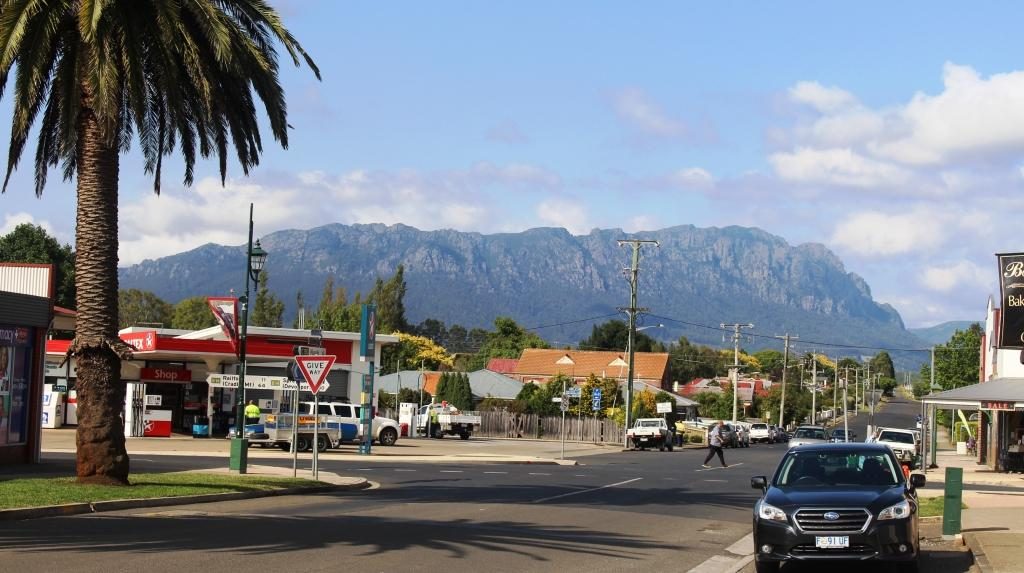
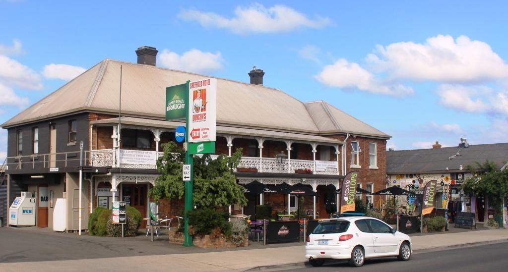
then drove south from Devonport to Sheffield.
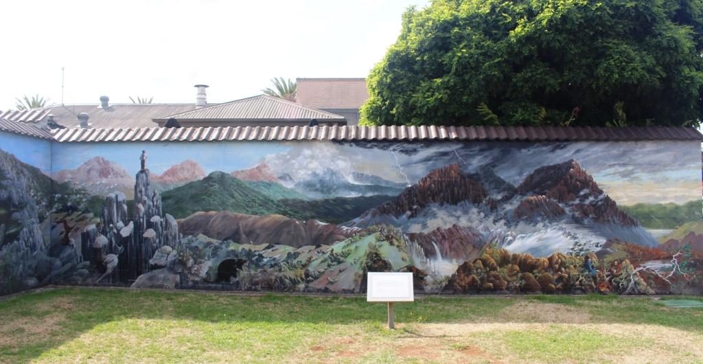
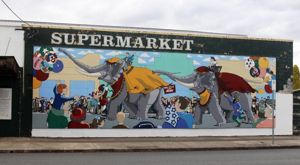
Mural of Cradle MountainFarm scene on a churchFarm Lands and MountainsDomestic SceneCircus Animals on the Supermarket
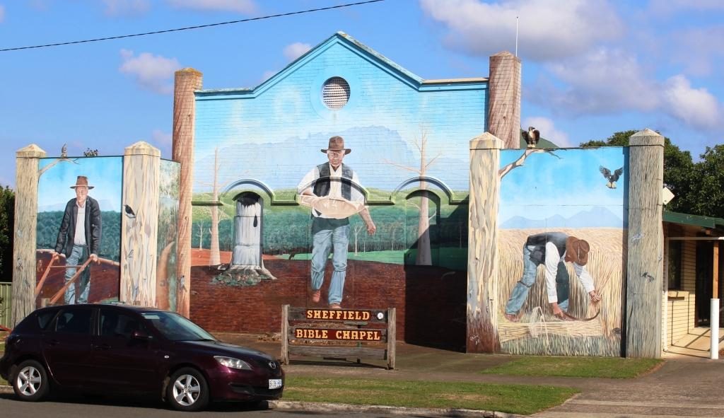
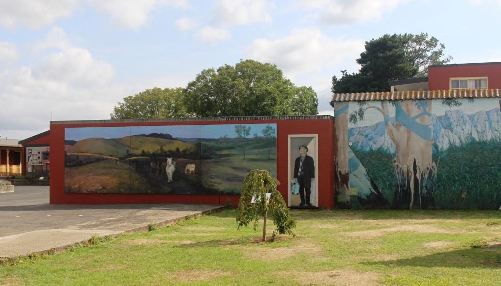
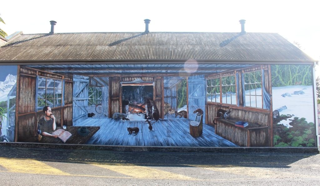
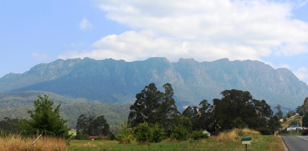
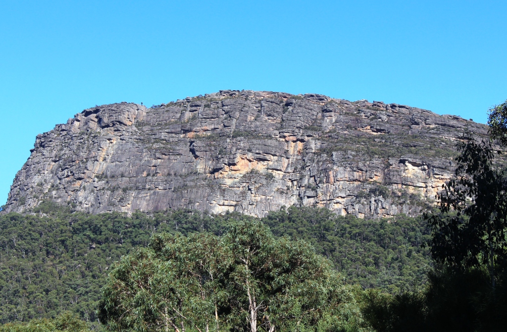
This farming town is famous for its murals. It is built atop a hill, providing rural views in all directions. The most arresting view is to the south west where the huge bulk of Mount Roland fills the lower sky. The mountain is a multi peaked rocky range reaching a height of 1,234 metres. It has a number of walking tracks, but they were not in our plans. Tasmania is a walkers’ paradise, but you need time. Before we went there we had not even heard of Mount Roland, let alone its walking tracks.
Mount Roland behind the townFarm lands at the end of the streetMount Roland again taken, later in the day when our track came back past it.Sheffield Hotel.
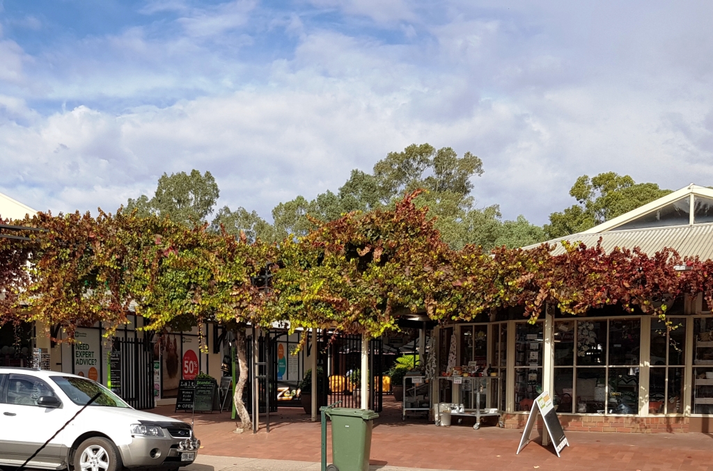
Sheffield is, like so many in Tasmania,
comprised predominantly of older buildings. Many provide a suitable canvass
upon which artists have painted expansive scenes. The town’s first mural was unveiled in December 1986. Since then
over sixty murals, depicting the area’s rich history and beautiful scenery,
have been painted on walls throughout the district.
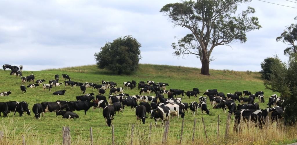
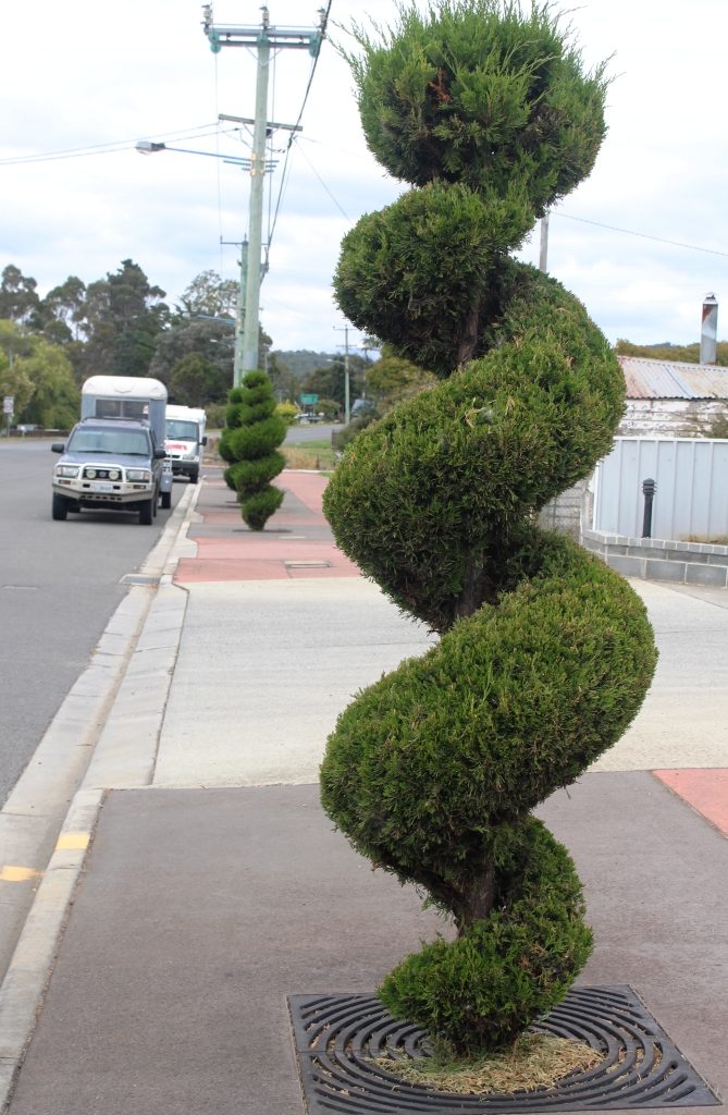
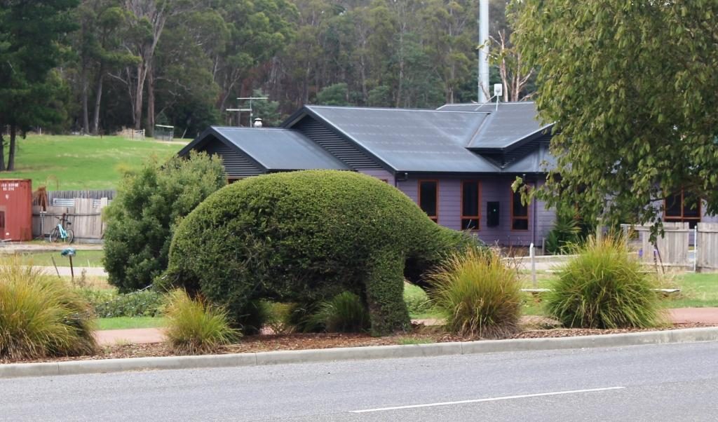
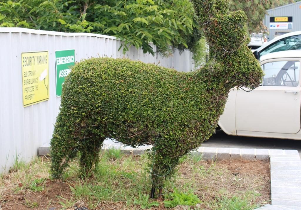
Grazing dairy cows on the way to RailtonTopiary in Railton Main StreetCould that be a hippo?Probably a sheep. There are a lot of sheep in Tasmania.A crocodile?This hedge is also a train.
After coffee, we moved on to the neighbouring town of Railton, known for topiary, which I learned, is the art of shaping trees, shrubs, hedges etc., by trimming them.
We then moved on to Elisabeth Town by continuing on the same road, until it met the Bass Highway, the main road that runs along the north coast of Tasmania. We were looking for the Christmas Hills Raspberry Farm, the sign for which was not visible from the Railton Road, which we had just driven, or perhaps we missed it.
We turned left at the intersection,
stopped and entered the name into Google maps. We were directed to drive the
way we were facing until we reached a left turn 8 km further on. But the indicated
road was not there so the navigator revised its instructions that included a
large increase in the distance. We could see that we were well towards Latrobe,
a town that we wished to visit, so we kept on going.
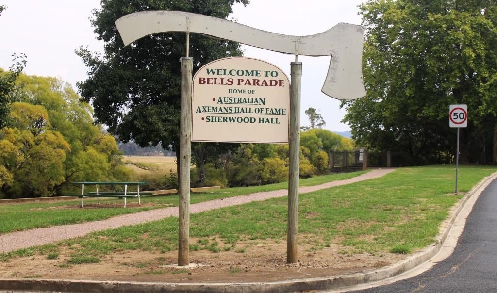
The sign for the Australian Axmans Hall of Fame
Latrobe is known for its antiques and I
am known for not being very interested in them. Its other claim to fame is that
the sport of wood chopping was developed there. As the son of a onetime timber
cutter, that fact held interest for me. There is a museum there which we drove
past, but did not have time to examine.
But the town supplied a lunch stop on
the banks of the Mersey River and a helpful lady at the information centre who
supplied a map that showed us exactly where the raspberry farm was. It was a
couple of kilometers in the opposite direction at Elizabeth Town.
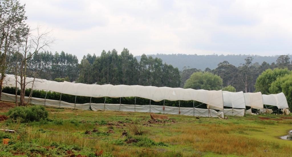
Protective covering for raspberry vines
The raspberry then farm became our next
destination. As a tourist attraction it is more a restaurant and ice-cream
shop, but a walk leads past an ornamental lake (also their water supply) to the
sheltered growing area. We had not long finished lunch, but ice-cream seemed
appropriate. The raspberry flavour was delicious, as was the free sample
chocolate coated raspberry.
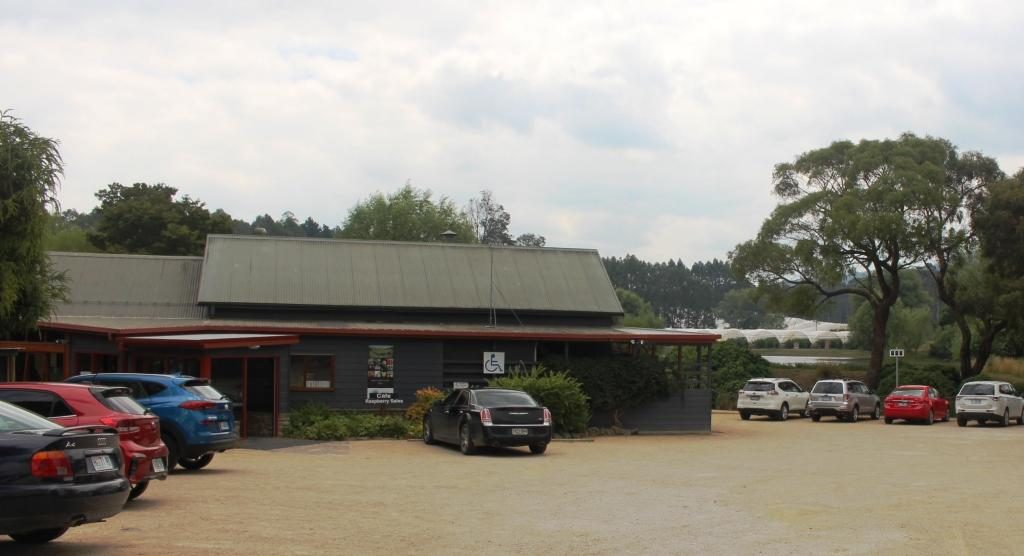
Christmas Hills Raspberry Farm RestaurantThe main street of Moles Creek
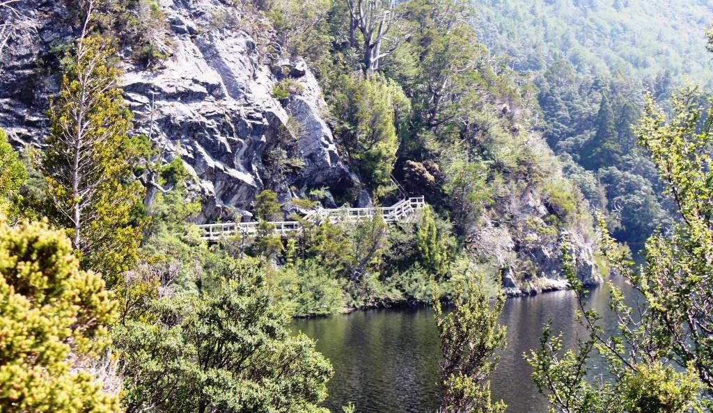
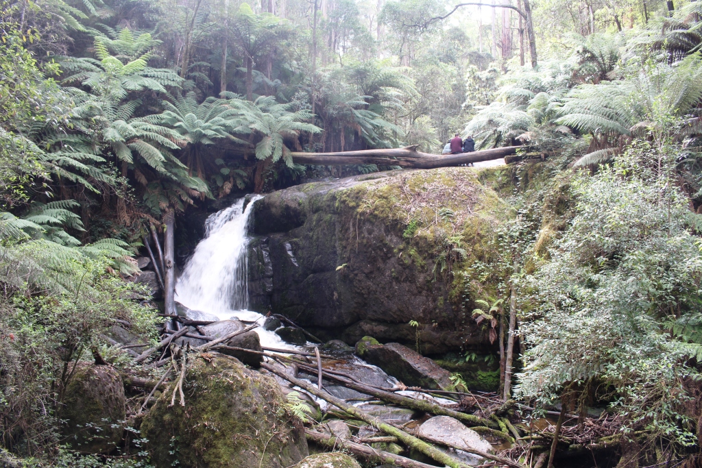
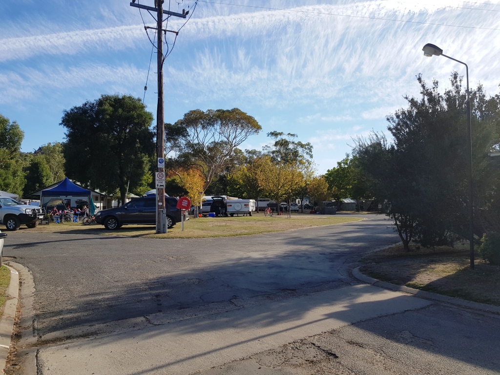
The day was slipping away so we moved on. To reach Moina, where we were spending a couple of nights, we continued south to the edge of Deloraine and took Mole Creek Road. Mole creek is one of the locations where Tasmanian Devils can be seen in captivity. Just past the township we turned right, crossed a mountain range to arrive at the town of Paradise and then turned left over more mountainous roads, past more mountains before descending sharply down a steep grade and over the bridge at the foot of Cethana Dam on the Fourth River. We then climbed back up the next mountain, equally steep, to reach Moina.
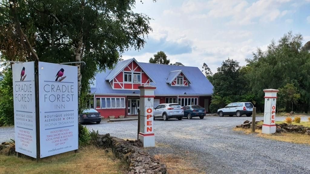
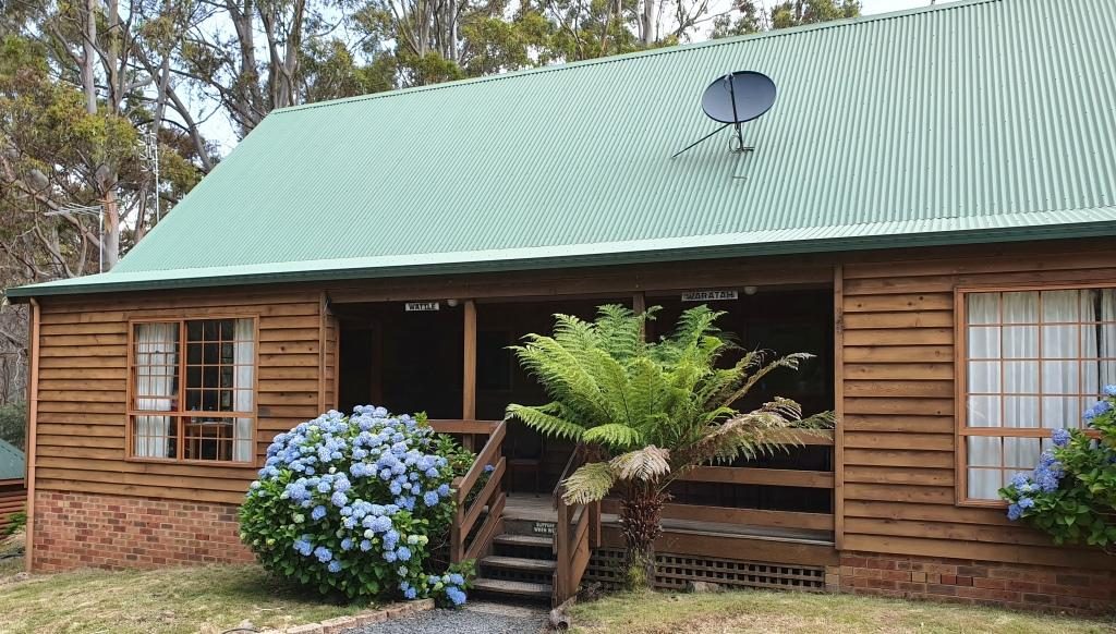
Moina is situated where the road that we
were on intersects with the Cradle Mountain Road. We had a comfortable unit in
a bush setting. It is part of the Cradle Forest Inn, a Swiss or Bavarian themed
mountain retreat that offers a café/restaurant and bar as well as
accommodation. There is not much else of Moina but the road side signs suggest
that there is no shortage of accommodation in the area. Logical since it is
such a short drive away from the more expensive accommodation at Cradle
Mountain.
Cradle Forrest Inn Reception and Dining/Bar Our cabin was to the left. It was named “Wattle”.
During the latter part of our drive we encountered a lot of smoke haze that made mountain photography a bit difficult. Someone suggested that the cause was fires near Launceston.
The house and farm along Cradle Mountain Road.
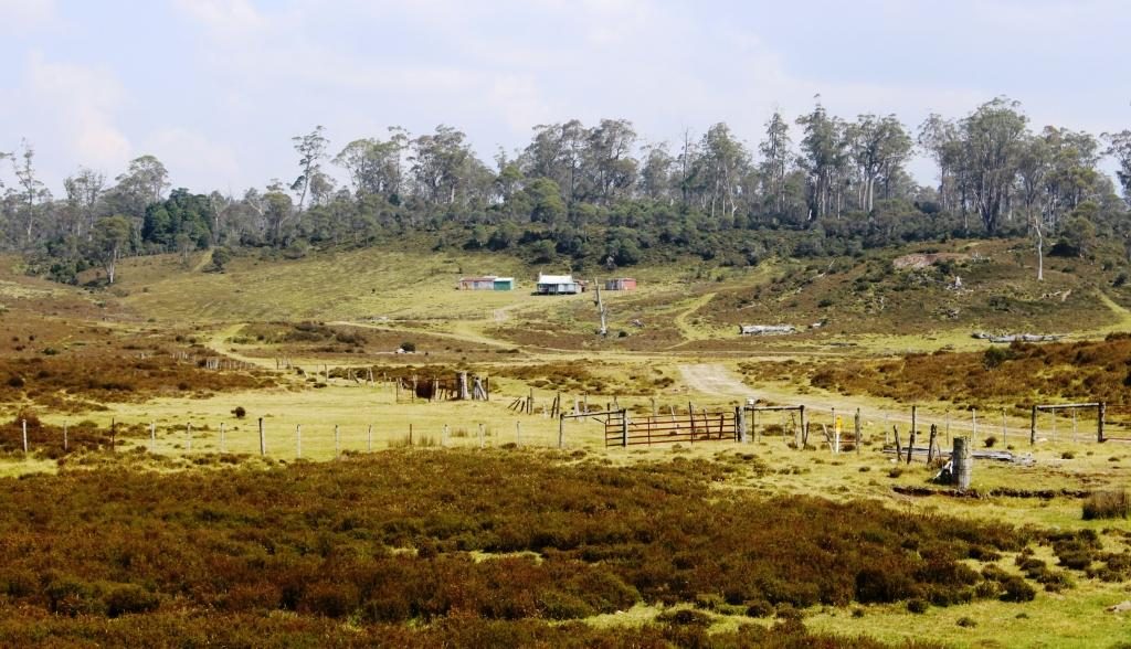
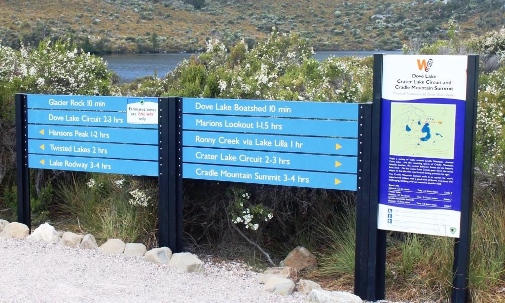
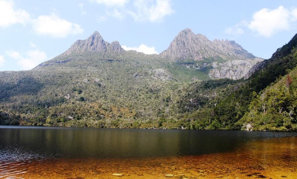
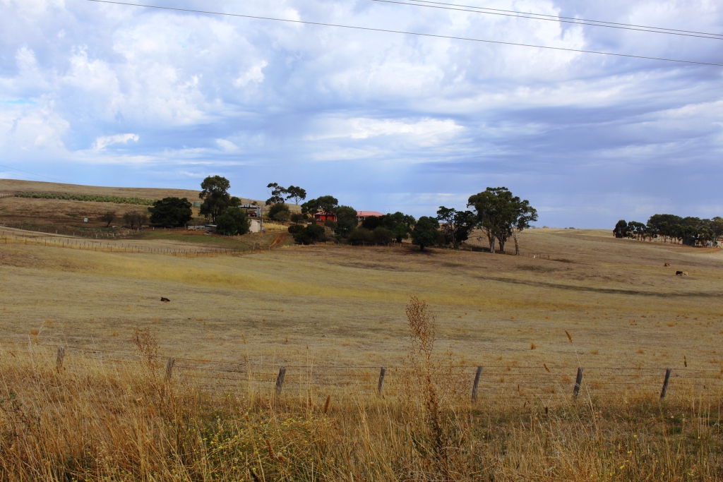
On our second day in Tasmania we started by driving the 26 km to
Cradle Mountain. The road leads through mountain farm land with a few isolated farms.
The area is around 500 metres above sea level.
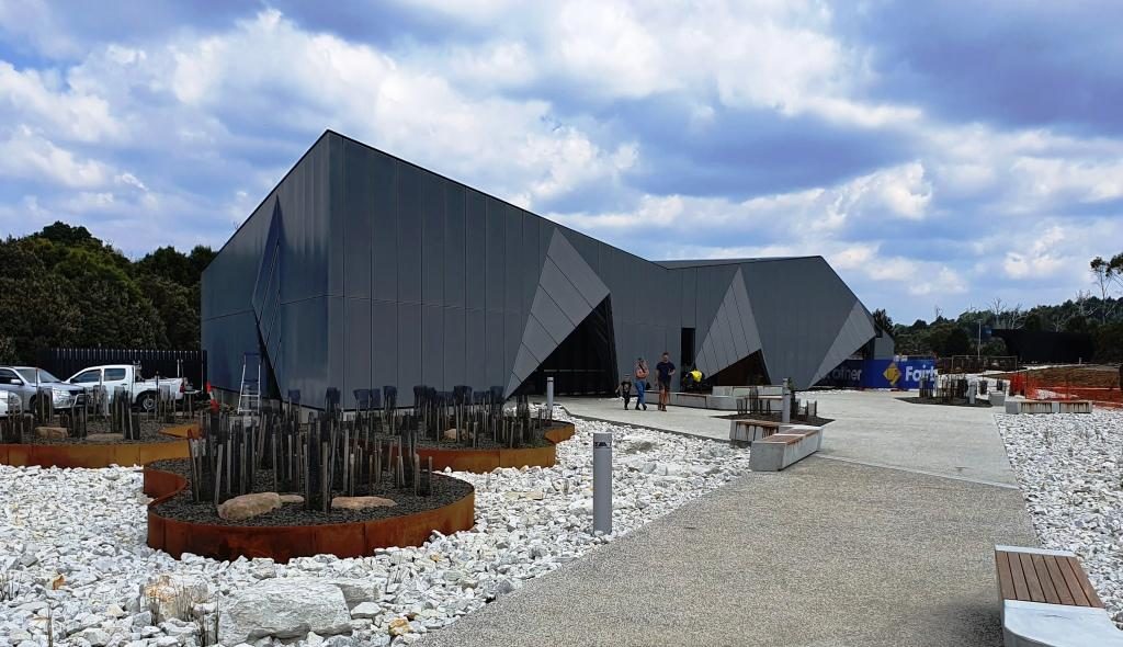
Part of the visitor centre at Cradle Mountain.
A new looking visitor centre has been built not too long ago,
with a large parking area to handle the crowds. This is a popular place. The
parking area was substantially full when we arrived at about 10.00 AM. It is
possible to drive a bit further in, but our National Park pass provided free
shuttle bus transport to the tourist area, so we chose that option.
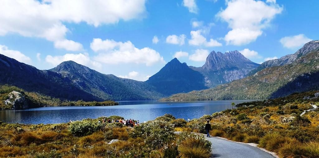
After coffee in the café, I left Ruth lingering over her
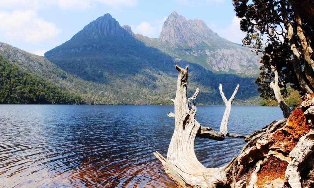
refreshments and caught the bus. It was quite a thrill to see Cradle Mountain
for the first time. It and the picturesque Dove Lake suddenly appeared as we
rounded a corner.
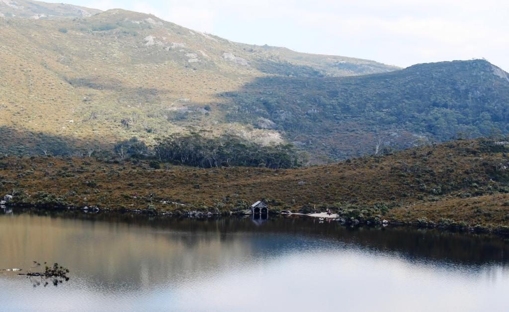
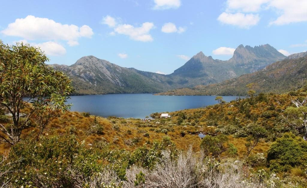
Dove Lake and Cradle Mountain from the bus stopThe smorgasbord of walks
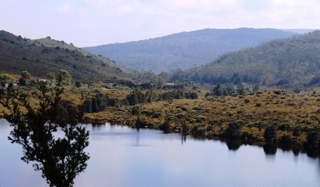
After departing the bus stop I set out on the 6 km walk around Dove
Lake. It is one of many walks in the area, some of them much longer, like the
overland track to Lake St Clair that takes several days to complete. Most of the Dove Lake track is an easy walk,
good gravel and board walks with timber or stone steps where required. I walked
clockwise as the earlier part of the walk is easier that way.
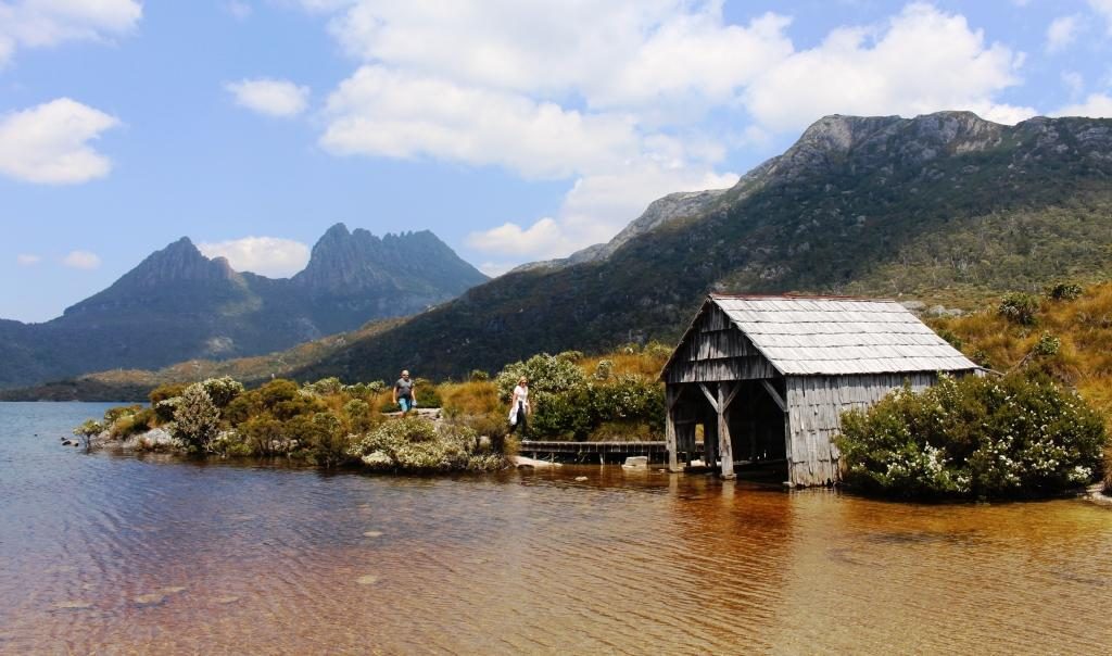
The boat shed viewed over the lake from near the start of the walkLooking back early in the walk to the bus stop and other walkers behind me.Cradle Mountain from about one third of the way around
The walk follows the edge of the lake for much of the distance
but at about 75% of the way around there is a steep climb over a promontory
that juts out into the lake, named Truginini Point. That slowed me down a bit. I
was quite happy to see the old boat shed come into view as I reached the top of
the ridge. The boat shed is only 10 minutes from the car park and bus terminal,
so the end was in sight. Ruth had caught a later bus and was waiting at the finishing
line. I achieved the 6.1 km in 1 hour 37 minutes including rests. That’s an average
of about 3.8 km/hr. A few breathers were necessary on the steeper climbs.
Walking track ahead at about the half way pointThe mountain from just before the start of the climb over Trunanini Point.The much photographed boat shed on Dove Lake.
By the time we reached the visitor centre it was getting on for 2 o’clock, so we returned to the cafe for a late lunch and then returned to our unit at Moina. Then I had a nap. Totally appropriate for an 80 year old who had done all that walking.
Final view of lake and mountain from the rise near the end of the walk
We had planned Cradle Mountain at the start of our trip in the
hope of getting good weather. The weather could hardly have been better. But it
was now time to return to the coast and get on with our anti clockwise tour of
the island.
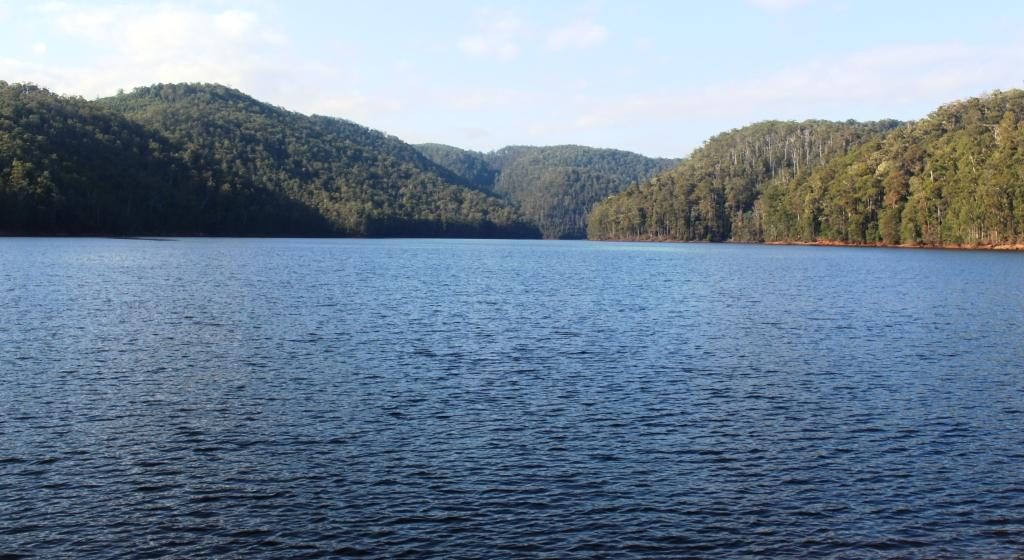
Lake Barrington is formed by a dam on the Fourth River.
So on day three in Tasmania, breakfast done, we finished packing and headed down the mountain. At Wilmot we made a short detour to see Barrington Dam, one of three long thin dams that have been built on the Forth River. It backs up to where we had crossed the Fourth two days before. We were following the Forth River valley and rejoined the Bass Highway near the town of Forth. But now it was the 8th, the story of which will continue in the next post.,
Please Note: A videos covering the material in this blog post can be found at the bottom of the post.
Tasmania has been in the planning for some time. We made plans to visit, with the caravan, in 2018. We even booked the passage on the Spirit of Tasmania, but then cancelled in favour of repeating our 2009 trip around Australia. You may recall that we reached South Australia, but returned home at that point due to the poor health of my brother Winston. Win died a couple of months later, so we had certainly made the right decision.
So, with the
caravan and the Mitsubishi Challenger both sold, we set off on 29th
January in our new Mitsubishi Eclipse Cross. Motel and caravan park cabin
accommodation from how on.
An early start got us to Ballina at about 10.30 AM for morning coffee with our long time friends Joe and Thelma. For those who don’t know, Joe and Thelma have left Melbourne to continue their retirement at Ballina. These folks have been friends for almost all of our married life and all of theirs.
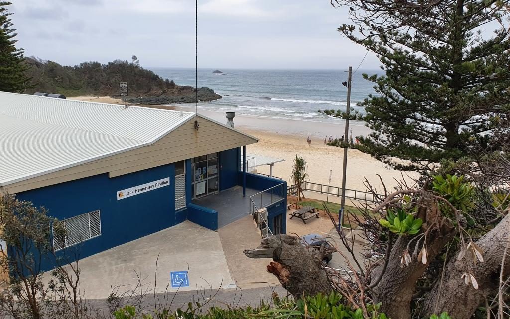
Ramada Resort, Flynn’s Beach, Port MacquarieFlynn’s Beach Lifesaving ClubViewing Flynn’s Beach to the south east
We had chosen
Port Macquarie as our overnight stop and happily pulled up at the Ramada Resort
at Flynn’s Beach after a drive of just less than 600 km.
Day two brought us from Port Macquarie to West Wallsend, a suburb of Newcastle. On the way we drove through some bush fire affected areas south of Taree. The Taree fires featured prominently in press coverage on the run up to Christmas.
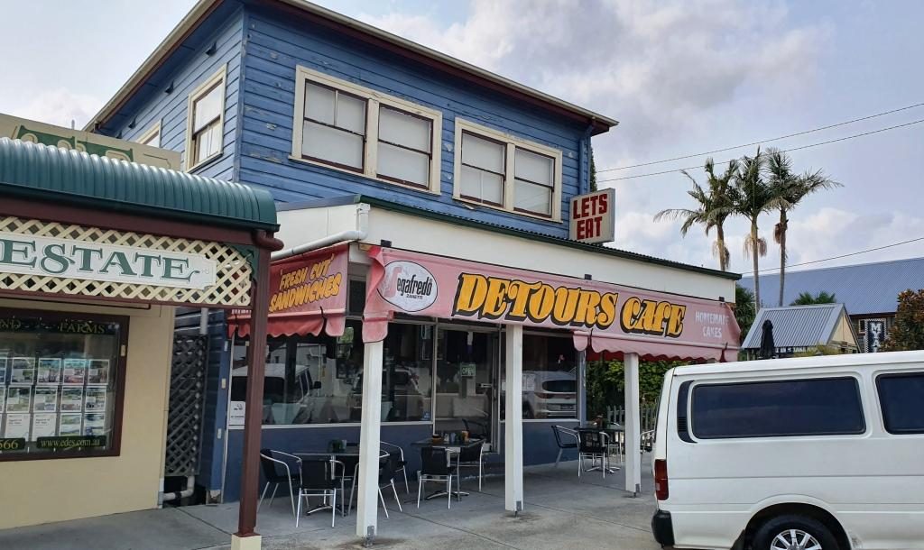
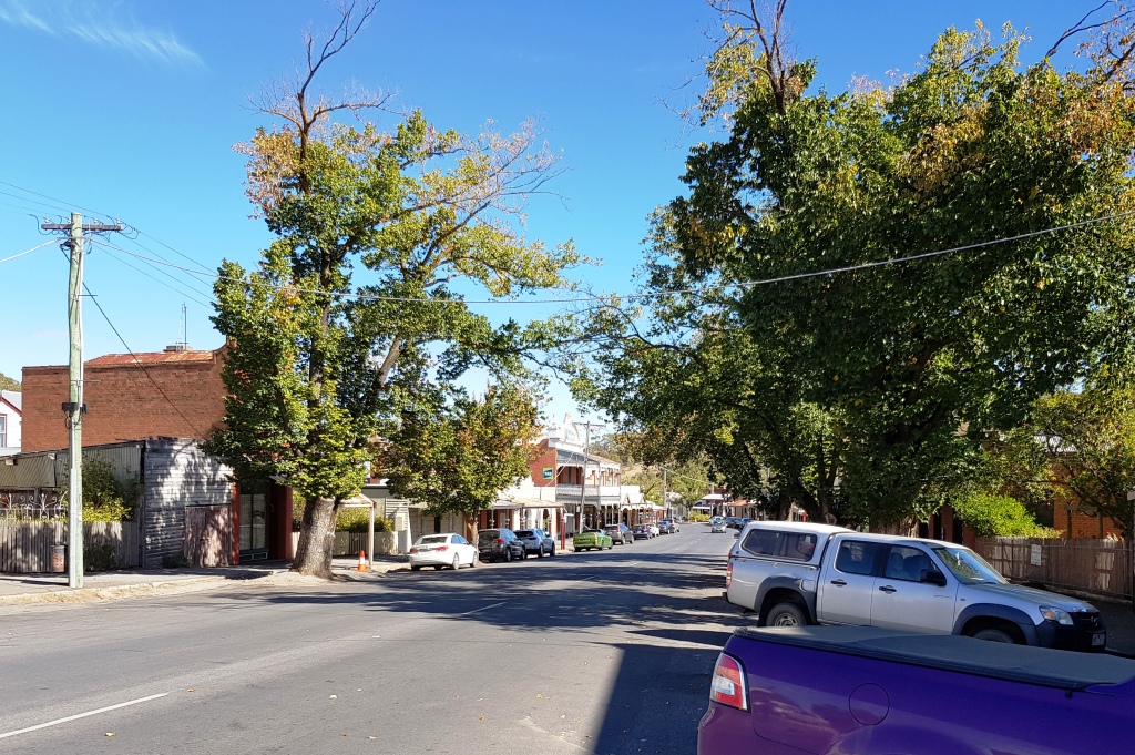
Morning coffee at Bulahdelah
We detoured for morning
coffee at my old home town of Bulahdelah at The Detour Cafe. The cafe looked
familiar. I asked the lady who made the coffee if it had always been a café.
She said that it had been for most of its existence. That is why it was
familiar. I used to call there for an
after school milk shake about 65 years ago.
We then called on my eldest brother Ivan and his wife Marjorie, who live just off the highway north of Newcastle, where we had lunch and generally caught up on family matters and doings.
Then off to West Wallsend
where we spent the night with Ruth’s eldest sister Judy and her husband Alan.
Another session of catching up on family matters and news of mutual
acquaintances and travels completed and planned.
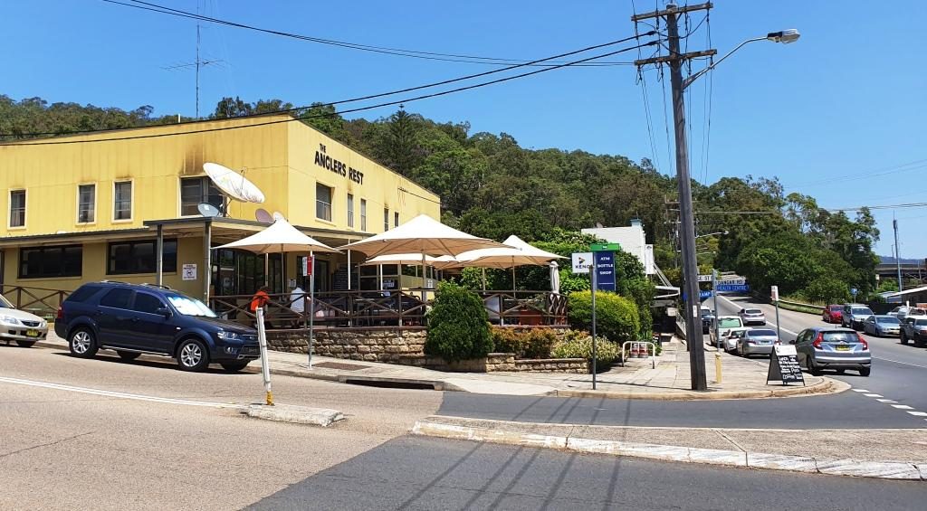
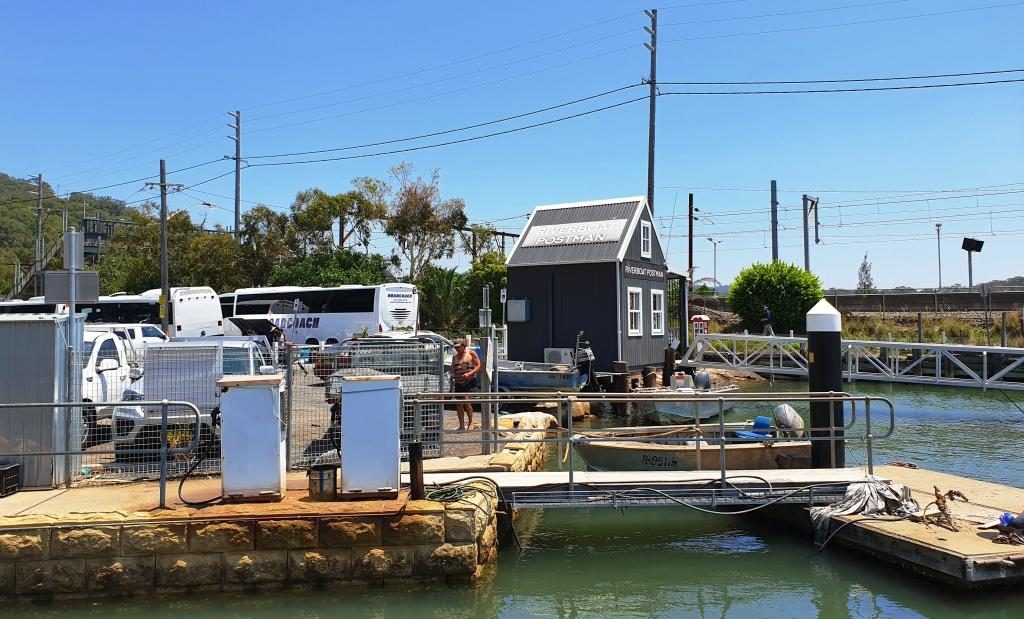
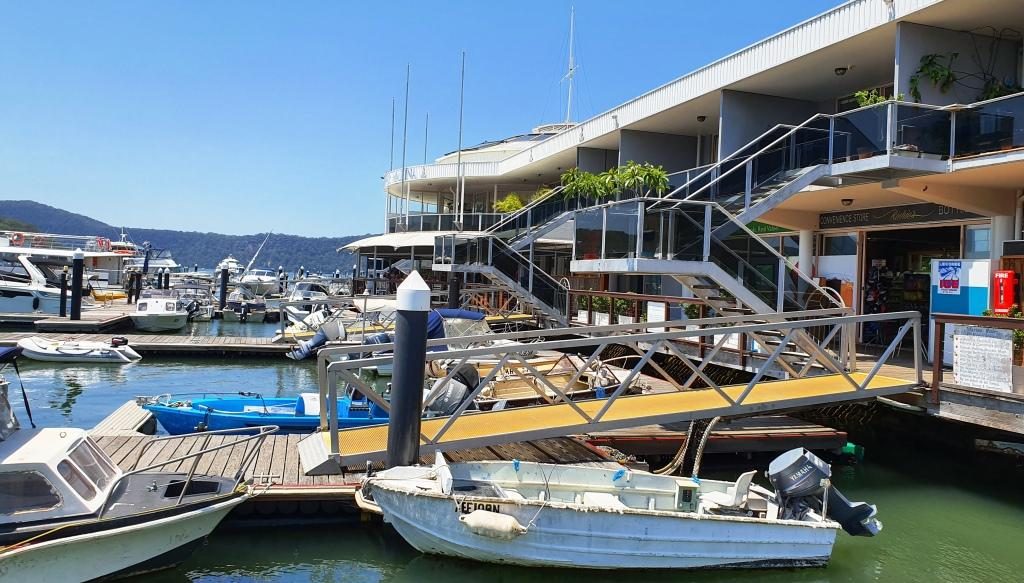
Anglers Rest Hotel at Brooklyn on the Hawksbury RiverWaiting for lunch to be prepared at BrooklynThe new office for the Riverboat Mailman. We did the mail run a couple of years ago. The new office was just being built then.The marina restaurant and shopping complex at Brooklyn.
The run to Sydney along the Pacific Motorway was easy with no congestion. We pulled off the highway at the exit on the north bank of the Hawksbury River and drove over the old bridge to reach Brooklyn. We like Brooklyn and have frequently stopped there over the years. Many years ago we hired a boat there and spent a great week on the river and Broken Bay. That was back in family holiday days.
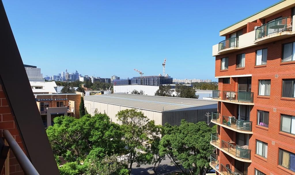
Briony’s view of the city.
Day three brought us to daughter Briony’s unit in Erskineville, a near Sydney city suburb. February 3rd is Briony’s birthday. Our activities included hiding in a shopping mall and the car to avoid high 30s temperatures on Saturday and her personally organised birthday, with friends in a private room at the cafe at her complex, on the following, cooler day.
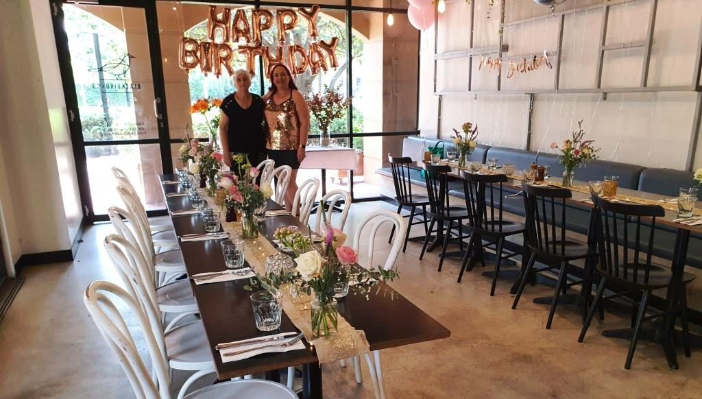
Briony and Ruth waiting for guests to arrive.
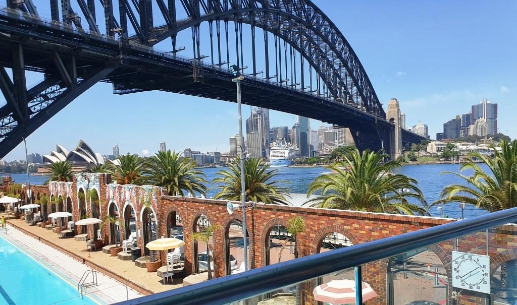
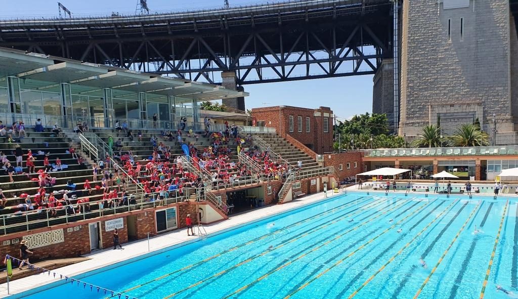
On Monday, her
birthday, we enjoyed a delightful birthday lunch for just the three of us at
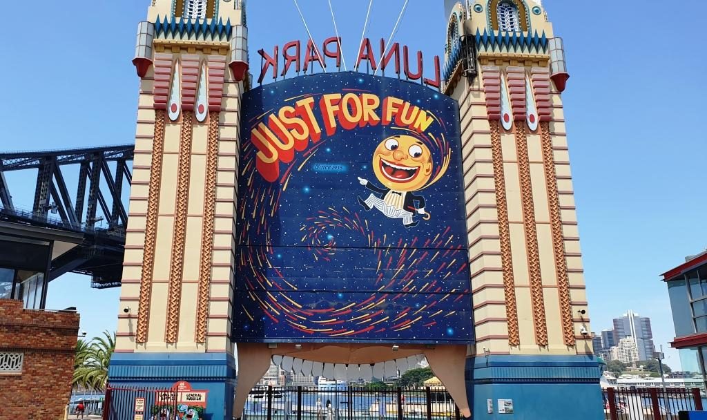
Aqua Dining. This restaurant, with excellent outdoor seating, is near the front
gate of Lunar Park and overlooks the North Sydney Olympic Pool. It is in part
of the buildings that adjoin the pool. So we had a great view of a local
school’s swimming carnival. Of course we also had views of the Sydney Harbour
Bridge, the cruise liner terminal, the Sydney Opera House and a broad sweep of
the harbour, both east and west of the city
This hardly needs a caption.Harbour Bridge, Sydney city and the wall of the pool. But you knew that, didn’t you?Children waiting for the next event.
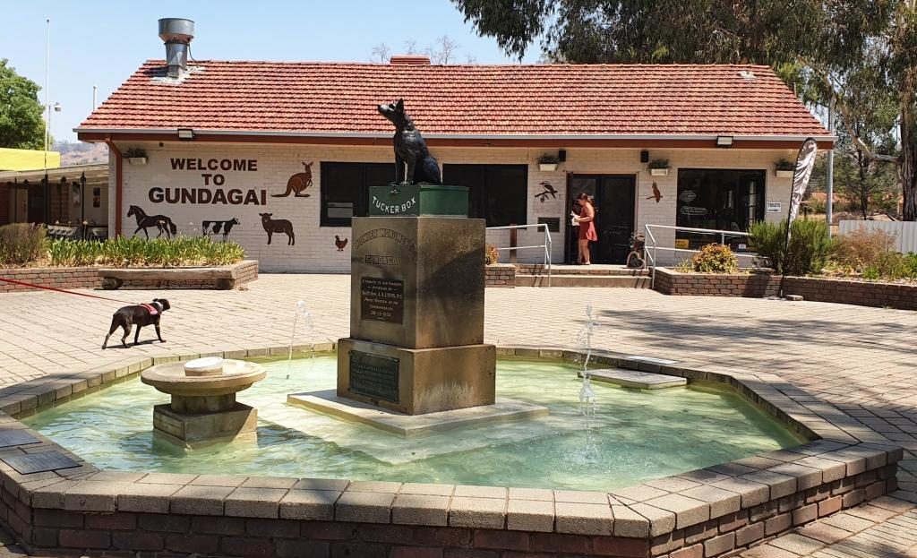
On 4th February, with family commitments finalised, it was time to deal with the main objective of the trip, Tasmania. We set off at about eight, pausing “where the dog sits on the tucker box 5 miles from Gundagai” and stopping for lunch in Gundagai before reaching our Albury motel late in the afternoon. Another 544 km completed.
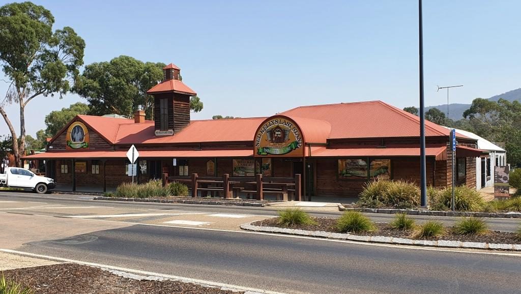
The Dog on the Tucker Box near Gundagai.The signs are self explanatory.The Kelly Museum at Glenrowan, Victoria.
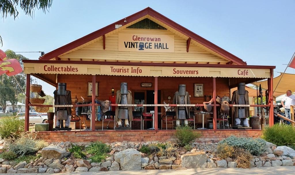
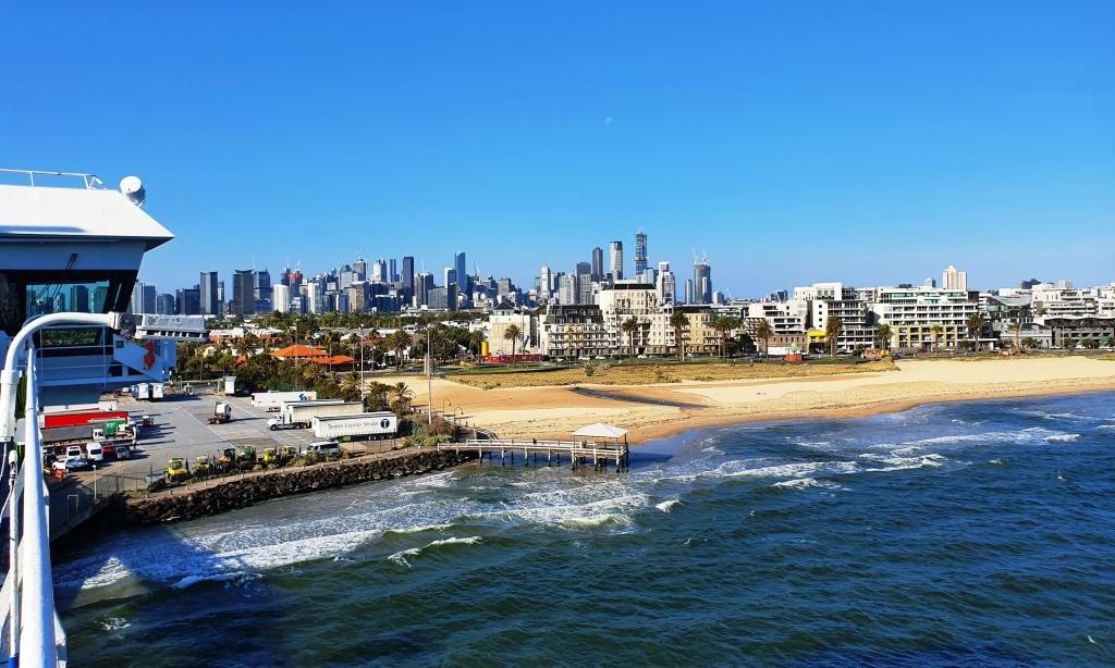
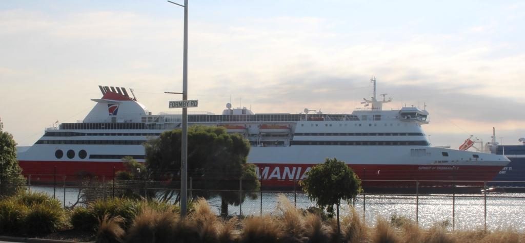
We only had a short drive to Port Melbourne to the Spirit of Tasmania terminal (334 km), so detoured into Glenrowan, of Ned Kelly fame, and spent the remainder of time until boarding having lunch and shopping. We drove aboard at about 5.30 PM and sailed for Devonport just after seven o’clock.
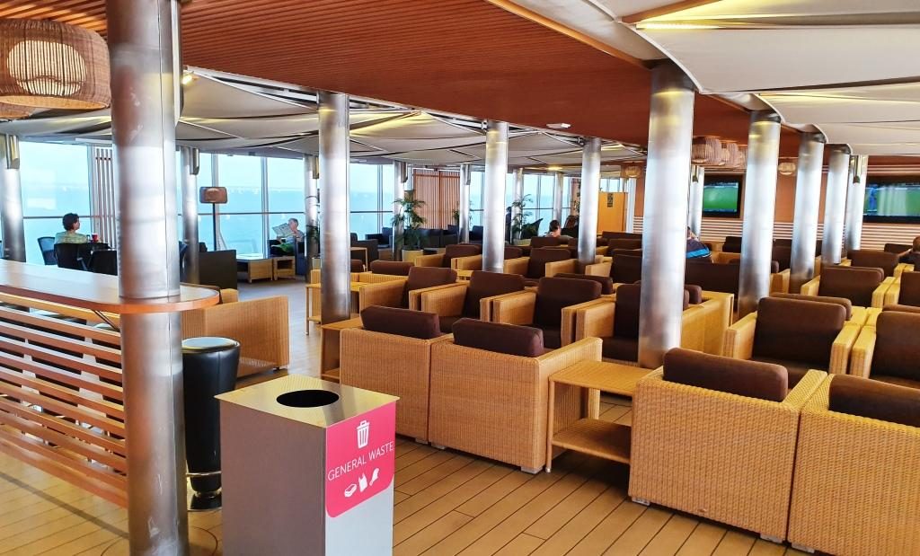
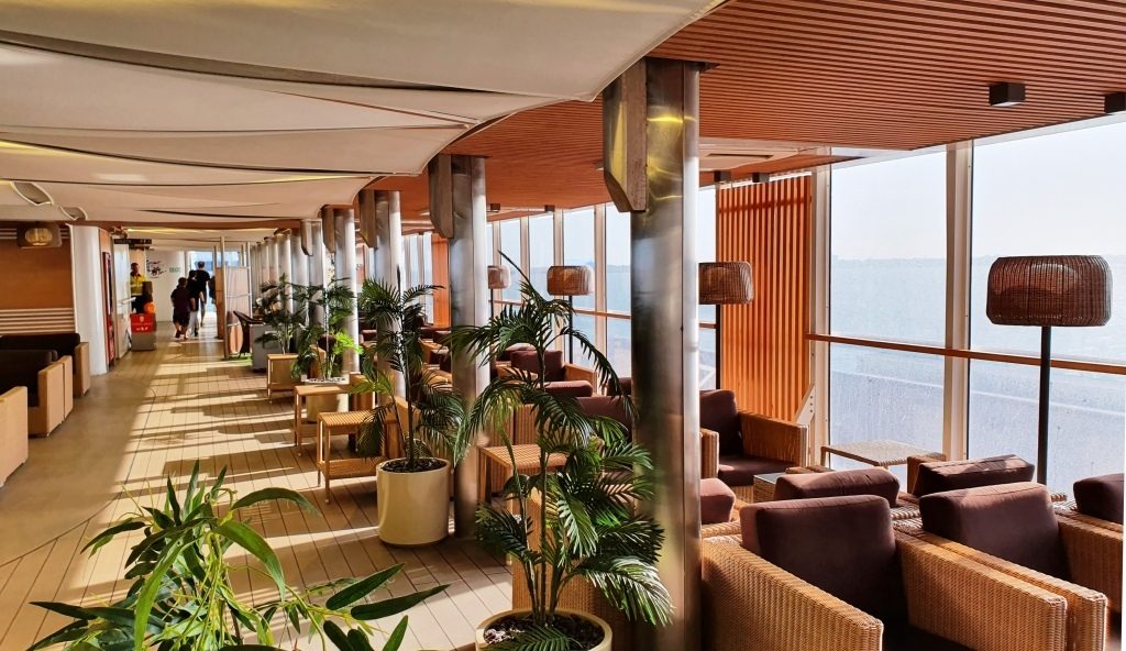
Part of the passenger area on the Spirit of Tasmania.More of the passenger area on the Spirit.
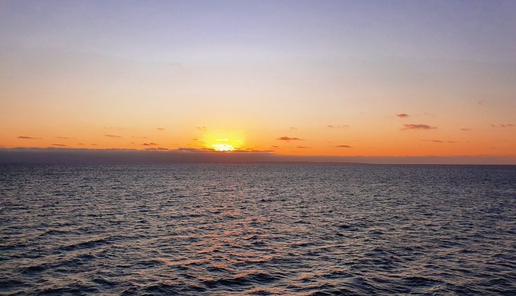
Daylight saving
ensured that we sailed through Port Philip Heads in daylight. We had a smooth
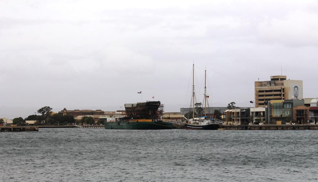
crossing, arriving at East Devonport at about 6.00 AM on Thursday 6th.
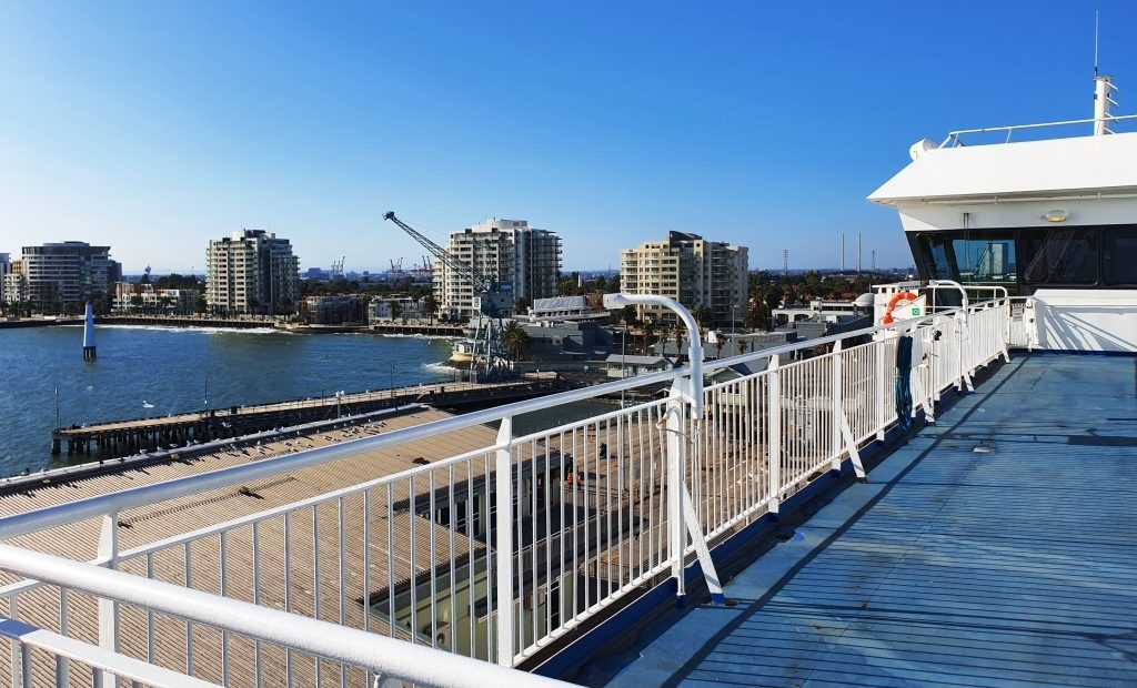
Medium rise accommodation at Port Melbourne.A view of Melbourne city from the deck of the Spirit of Tasmania.
Our cabin was comfortable, catering in the dining areas, although we only ate casually, was adequate and in all a pleasant experience. We were in the car ready to go by before 7.00 AM, drove off without incident and headed around to Devonport proper (on the opposite side of the river) looking for breakfast.
Sunset over Port Philip Bay. We were almost out of the heads.The Spirit of Tasmania berthed at East Devonport in the Mersey River.
Please Note: A link to a short video covering the material in this blog post can be found at the bottom of the blog.
It was Friday morning 20th April and crunch time!
We had to decide if we were to go on or go home. After further discussion we agreed that the only responsible course of action was to return home. So we phoned our friends in Quorn to advise them of the changed plans. We are disappointed, of course, but disappointment is part of life. We probably won’t have another opportunity do Western Australian but another attempt at the Flinders Ranges is certainly a possibility.
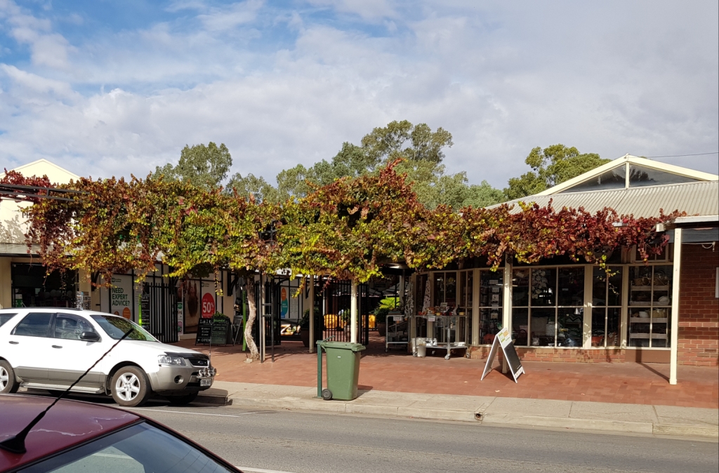
The Zest Cafe, where we have previously enjoyed coffee in Clare, is hidden behind the grape vines.
During our conversation, Graham told me that an on line acquaintance who we know through the ExplorOz web site and who Graham has met, works in Quorn. So before we left town Ruth and I called, met him and had a chat about matters of mutual interest. So another cyber contact has become a real person to us.
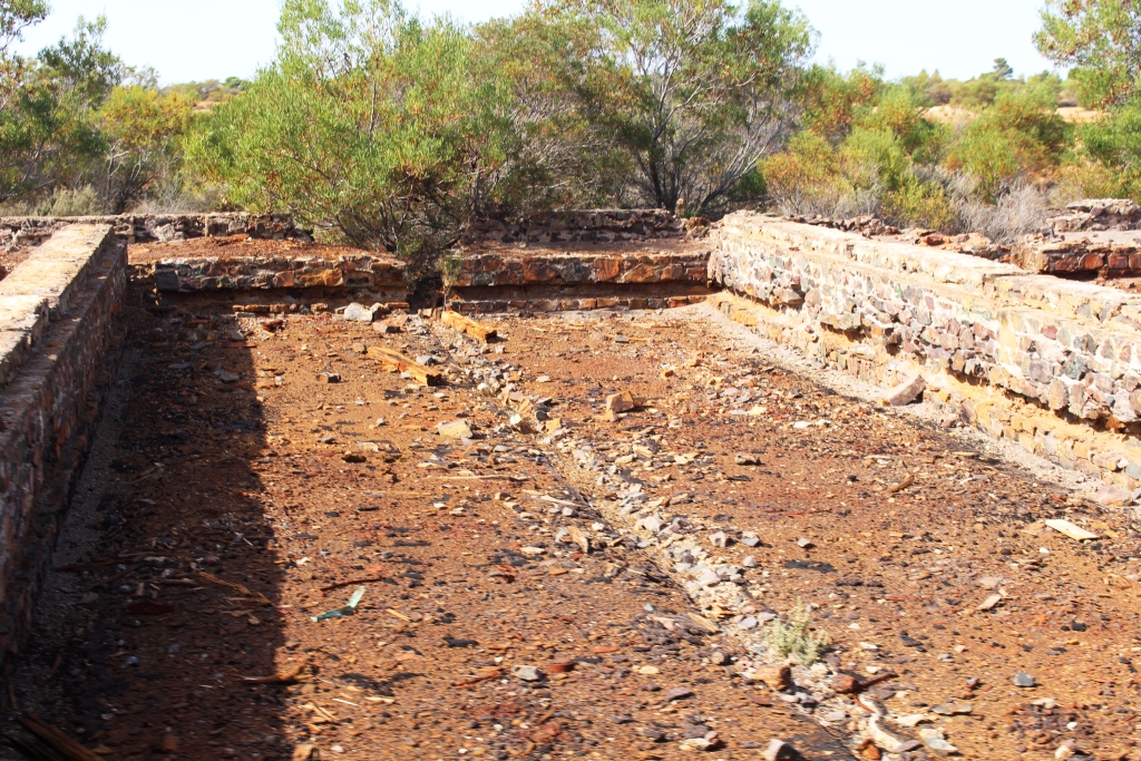
History is relived on this abandoned railway siding near Morgan, SA.
We departed Clare to the south, travelling through more vineyards until we turned east for Eudunda and then Morgan, on the Murray River. The run to Eudunda was mostly through more grain country with the area between Eudunda and Morgan mostly salt bush and Mallee scrub. At Morgan we crossed the Murray by ferry before following the river down stream to Blanchetown.
At the end of the ferry ride on the Murray at Morgan.
Crossing the river put us on the road that runs along the top of the river side cliffs. For much of its journey through South Australia, the Murray has cliffs on one side and normal river banks on the other. The cliff top provides great views of the river and surrounding agricultural areas.
The Murray at Morgan, looking up stream from the ferry.
Moored house boats at Morgan
Blanchetown is at the point where the Sturt Highway that leads to Mildura crosses the Murray. We turned east and followed it to another river side town, Waikerie, where we spent the night.
A view of the Murray River at Swan Reach
We plan to arrive home next Friday, so we need to travel about 300 km per day. So we set out for Euston, a small town on the Murray in NSW, travelling through the regional towns of Renmark, Barmera and Mildura.
There are areas of Mallee, fruit and grain, but grape production predominates. The facilities to process this huge harvest frequently appear by the side of the road. Some are large, with multiple storage tanks. I don’t know why, but the grape vines in this area are much greener than those even in the neighboring Riverland area of SA. It might be that the grapes here are different varieties. I believe there are more table grapes produced in the Mildura area, so that might be a reason.
Saturday night was spent in the Riverside Caravan Park in the small NSW town of Euston, just across the Murray from Robinvale.
Sunday produced another cool morning with heavy cloud cover in the west, but cleared to a brilliant sunny day with mostly light winds. The run today was from Euston to Narrandera. The Sturt Highway generally follows the Murrumbidgee River, but mostly at a distance.
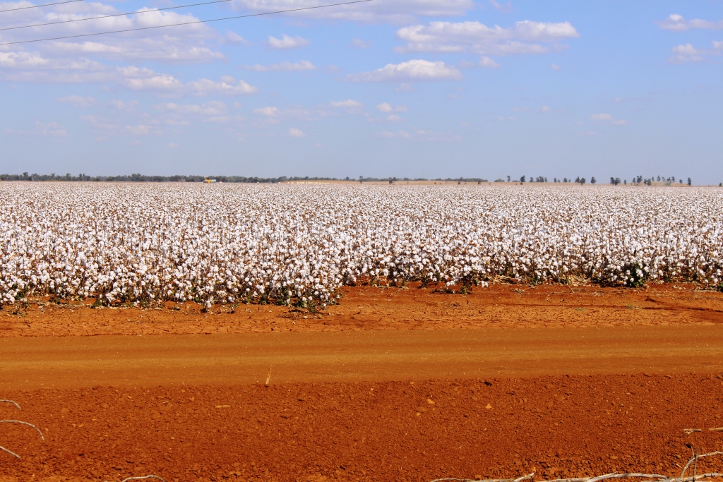
Cotton growing beside the highway
We were driving through grazing country, much of which has been turned to cotton production. Hundreds of hectares of cotton were in bloom with more not yet reaching that point. Large areas of adjacent land had been prepared for planting. Sunday traffic was light, with westbound caravans outnumbering the trucks. We wondered how many of them were heading off on the clockwise trip around Australia that we had so recently abandoned.
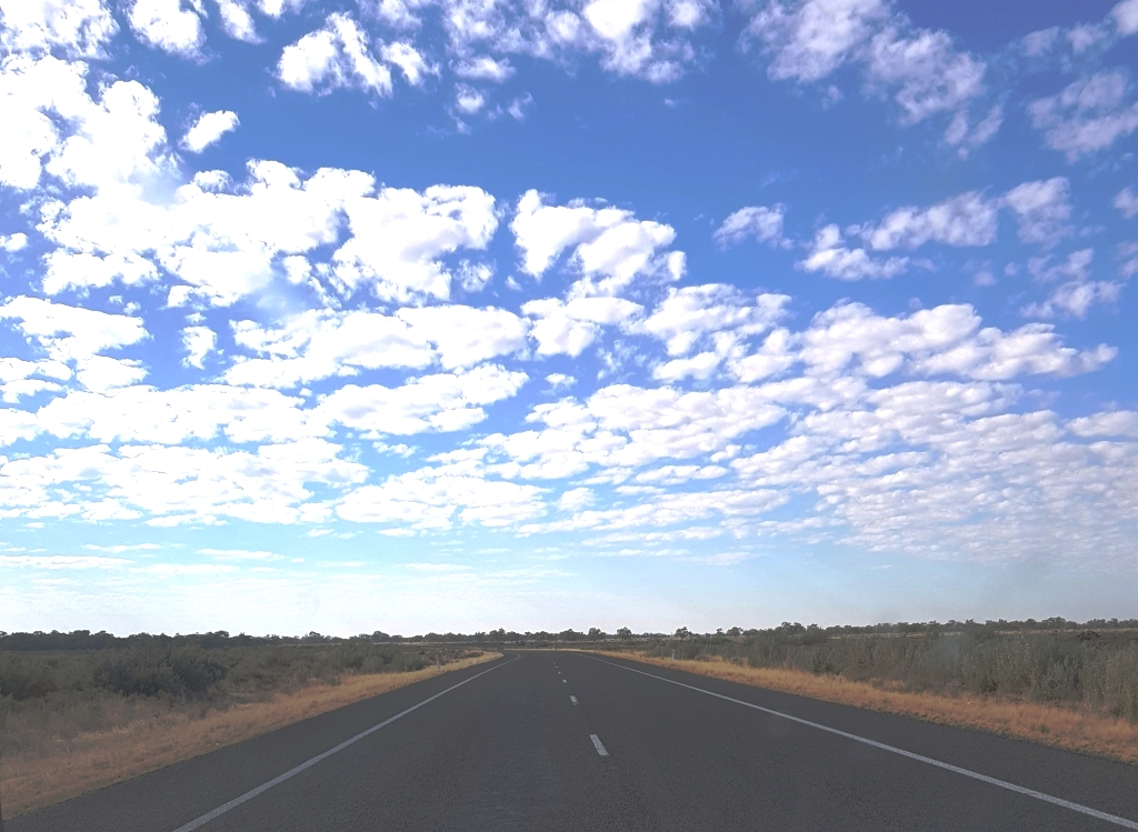
The Open Road. No emus here!
It was a rather ordinary day’s travel but there were a few moments of excitement when we had an encounter with a suicidal emu.
We had just been passed by a small car when an emu ran across the road in front of it. The car slowed and just missed the emu. The bird lost its footing in loose gravel at the edge of the road and fell over. It quickly righted itself and started to run back in our direction, parallel to the road. But it saw one last chance at suicide and turned into our path, shied at the sight of the front of the car and ran into the side of the caravan with a loud thump. In the rear vision mirror I could see a mass of flailing legs and flying feathers.
We quickly pulled off the road and stopped to see if it had survived but when we walked back it had gone. It must gave regained its feet and run away. It gives real meaning to the expression “tough old bird”. I had to perform a minor panel beating task as a result of the impact.
Parked on the hillside at Lake Talbot near Narrandera
We finished the day at the Lake Talbot Caravan Park at Narrandera, overlooking a section of the Murrumbidgee River where ski boat owners like to play. One boat gave us a small taste of what it is like on a busy day. We have previously been in this park on a busy boating day. It is not a time during which you can take a nap.
Monday and the start of another week. The destination today was to have been Wellington, to take us off the main highway, but we changed it to Parkes at morning coffee time. At lunch time, now at Forbes, we decided to press on to Dubbo but changed that to the neighboring town of Narromine when we realised that Dubbo would be full of school holiday makers visiting the Western Plains Zoo. We noted that caravan park fees were markedly higher than normal as a result.
Our path today took us past Ardlethan and through West Wyalong, Forbes, Parkes, Peak Hill and Tomingley, a total distance of about 400 km. We will give ourselves an easier day tomorrow.
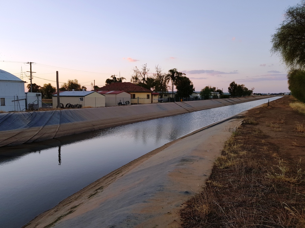
Irrigation canal at Narromine
Narromine is a grain and grazing town of around 4,000 residents. Our caravan park is located on the edge of the airport, not far from the gliding base and the flight museum. Fifty meters away from where I am sitting a levee bank marks one bank of an irrigation channel. A little further in that direction the Castlereagh River flows, having made its meandering way from Dubbo.
We have driven through grain and grazing country all day. Like so much of the country that we have driven through on this trip this area is also lacking rain. But the further north we come the more farmers are cultivating their land to plant the coming season’s crops. Tell-tale clouds of dust were a common site today.
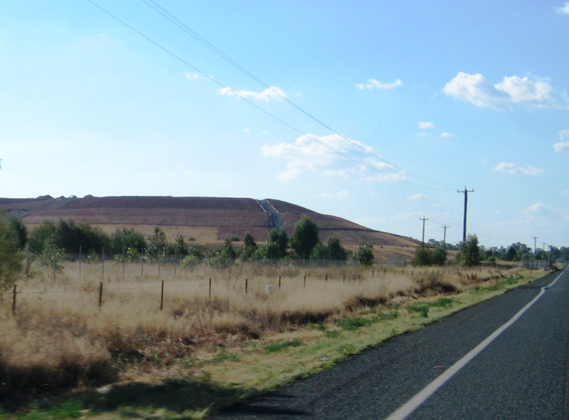
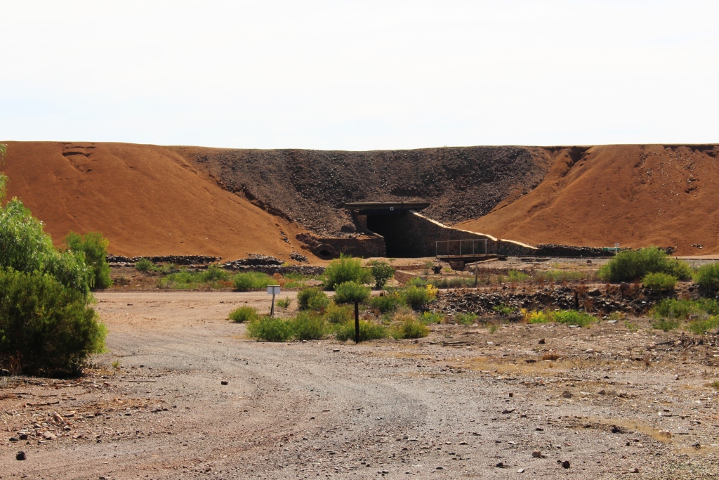
Gold mining at Tomingley near Dubbo
At Tomingley we drove between two huge piles of dirt on either side of the highway. The Peak Hill gold mine has ceased production. Now a substantial open cut operation is under way at Tomingley.
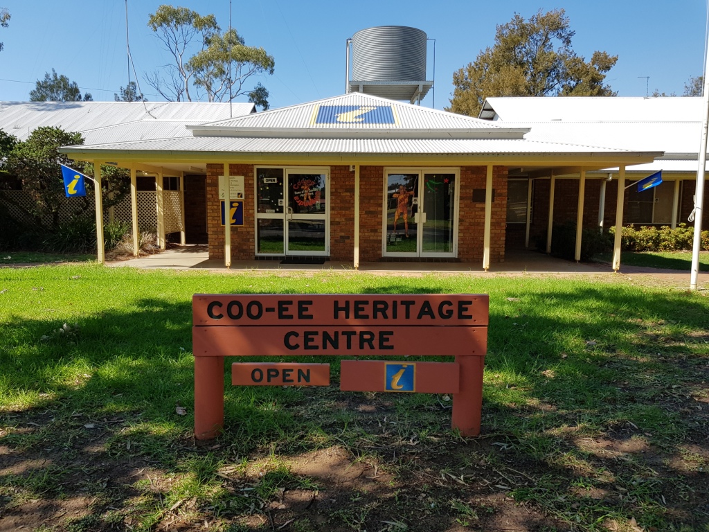
Cooee Memorial and Information Centre at Gilgandra
Tuesday 24th April was Anzac Day eave. After leaving Narromine and passing through Dubbo, the first town on our journey was Gilgandra, home of the Cooee March Memorial. In 1915 a small group of men left Gilgandra to march to Sydney to sign up to fight in France. As they marched through towns along their route they shouted “Cooee! Come and join us!” About 260 men did join them by time they reached their destination. Other recruitment marches followed, in different areas, during 1915 and early 1916.
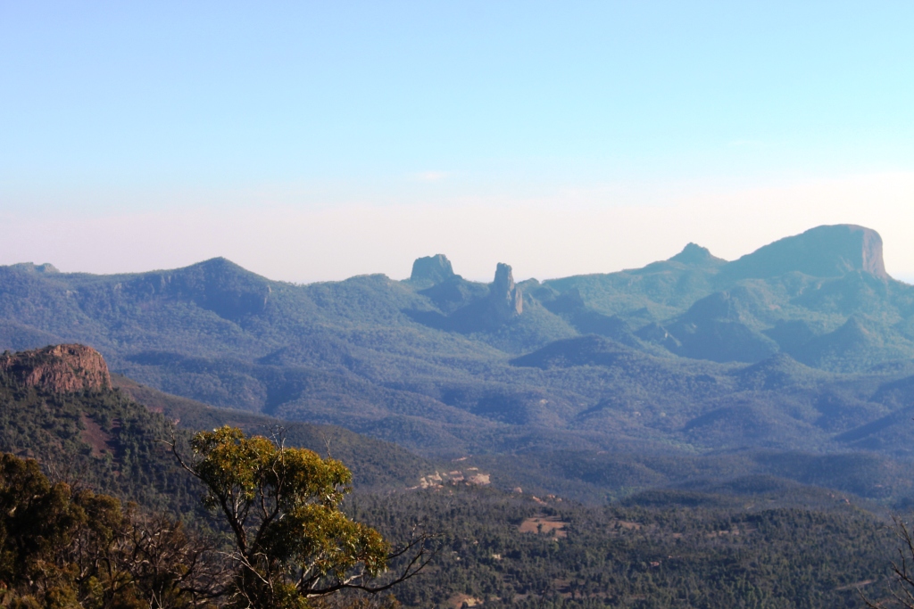
The Warrumbungle Ranges from the Observatory
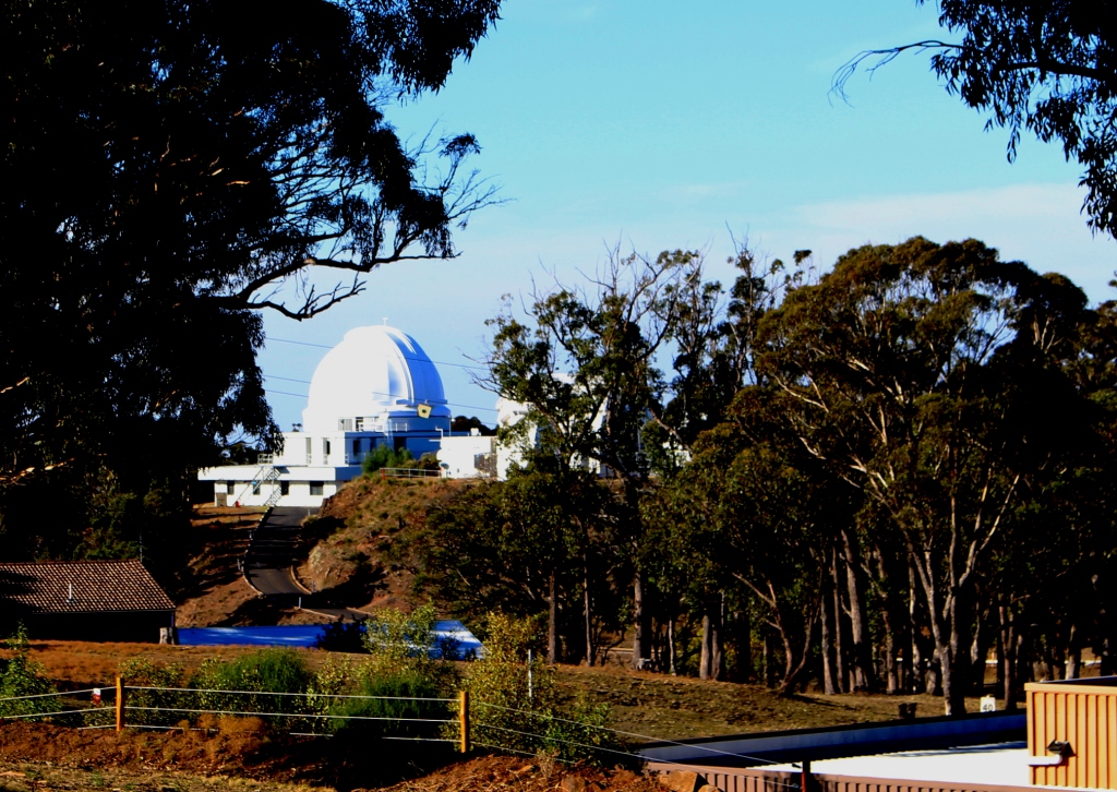
We arrived at Coonabarabran at about 1.00 PM and booked into the John Oxley Caravan Park. We had decided to give ourselves time to visit the Siding Spring Observatory and the National Park. Time did not allow us to see the park, but we did make it to the observatory.
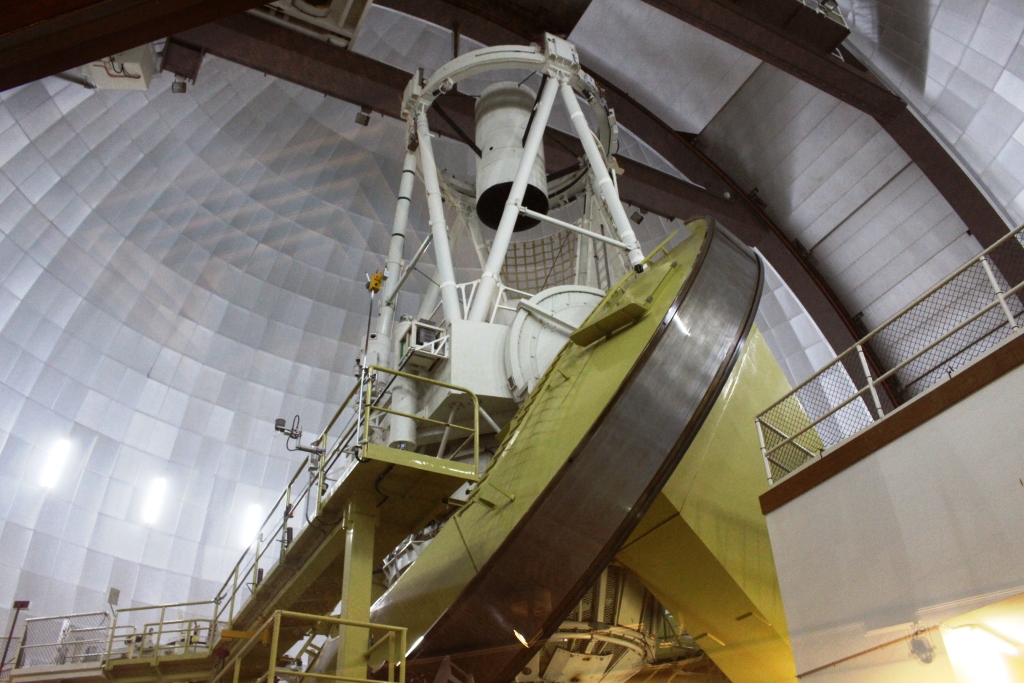
Another telescope at Siding Spring
Siding Spring is part of the Australian National University and associated with the Mount Stromlo Observatory in Canberra. The main telescope at Siding Spring is the Angelo-Australian Astronomical Telescope. There are 17 telescopes on the mountain, all with a special purpose. Many nations are involved, operating with a great deal of cooperation.
Looking up at the telescope dome from ground level
The first point of contact when you arrive at the top of the mountain is a visitor centre and a visitor car park. The visitor centre contains a series of displays that provide information to help visitors to understand what happens at the observatory and a shop that sells souvenirs and refreshments.
Behind the information centre, a path leads to the Angelo-Australian telescope, which is located at the very summit of the mountain. The dome covering the telescope can be seen from the Newell Highway south of Coonabarabran.
The Angelo-Australian Telescope
At the telescope, several flights of stairs, or an elevator, takes you to a viewing gallery where you can see and photograph the huge instrument. As it was day time it was not operating and the roof was closed. All observing is carried out at night. Daylight and artificial light are the enemies of the work that is done here and is a major reason that the Siding Spring location was chosen.
We returned to town to top up our food supplies and treat ourselves to fish and chips for dinner.
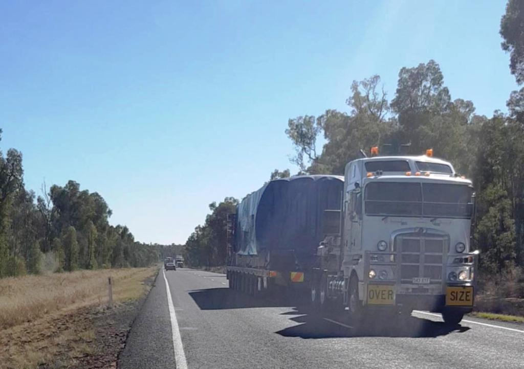
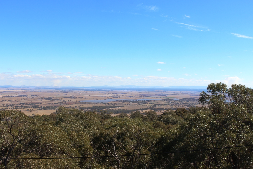
We spent ANZAC Day on the highway between Coonabarabran and Goondiwindi. There were more trucks sharing the road with us than the earlier days of the week, but most of the road today was over the plains of North Central NSW with much of it quite wide and easier to let faster traffic pass.
Pulled off the road for a wide load taking advantage of lighter Anzac Day traffic
We didn’t see any signs of ANZAC services as we came along, but Narrabri and Moree were very quiet, as you would expect on a public holiday. The day was a complete contrast to what we had originally planned. We had intended to be at the dawn service at Villers-Bretonneau in France until our plans were wrecked by my encounter with cancer. April 24th was the 100th anniversary of the taking of that town by Australian forces supported by the Americans. My father participated in that attack as a Lewis machine gunner.
We spent the night at the Showgrounds camping area in Goondiwindi. Warwick tomorrow night and home on Friday!
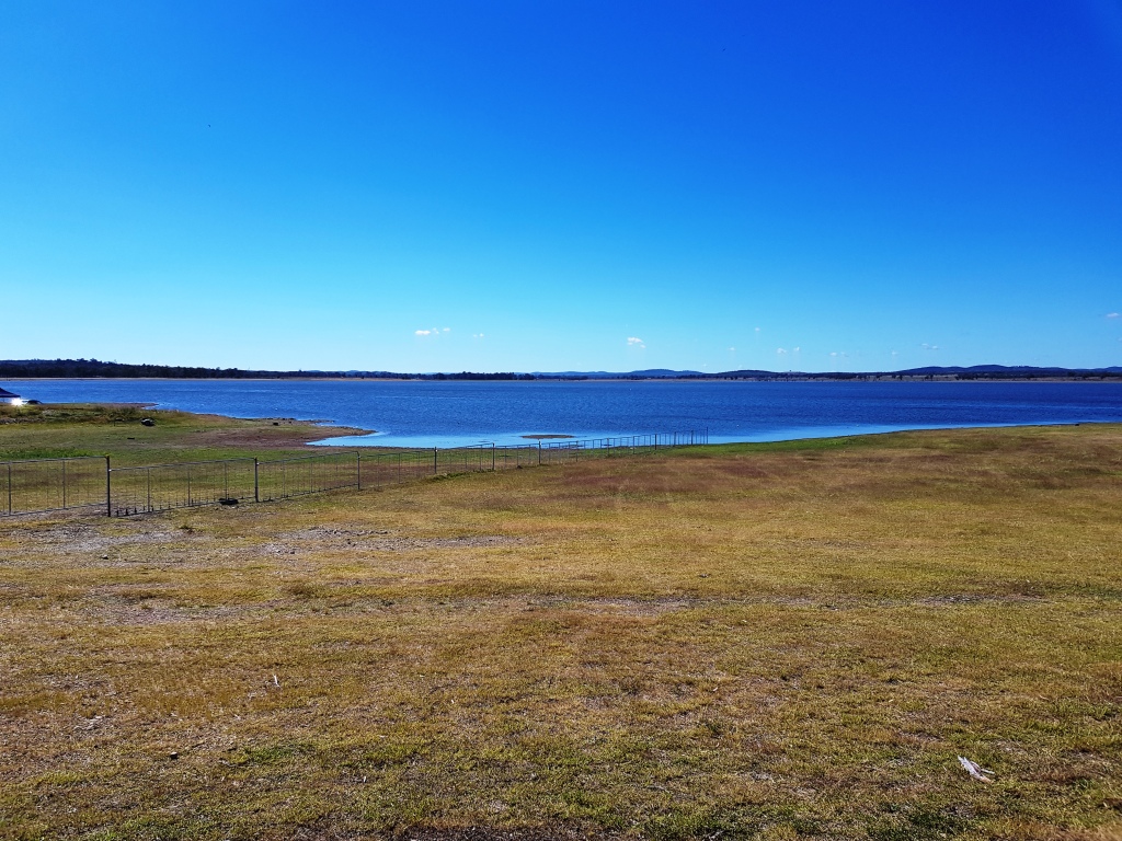
Coolmunda Dam
Thursday dawned sunny with a following wind for a change. This was the first morning for most of this trip where we didn’t need to use the heater in the van. Of course! We are back in Queensland!
The drive was unremarkable but we did leave the highway briefly to take our coffee break by the shores of Lake Coolmunda near Inglewood. We arrived at our Warwick caravan park at about 12.30 PM.
We had stopped for the night to visit Ruth’s eldest sibling, her Brother David and his wife Ann. We spent a pleasant afternoon and evening with them.
The last day was an easy drive. We arrived home at about 1.30 PM and set about the task of unloading the van and doing all of the other things that coming home entails.
We have arrived home about three months early with a sense of disappointment but also a feeling that we have definitely made the correct decision. We will do some other trips in Queensland during the winter months, probably to the north but not so far away that we can’t get to Victoria quickly. We won’t go anywhere, other than south, if Winston’s condition is seriously deteriorating.
Circumstances permitting, we will attend a gathering of members of the ExplorOz web site to be held at Kilcowera Station near Thargomindah in SW Queensland early in October. We may be able to combine another attempt at Flinders Ranges with that dstination. Blog readers will be kept informed.
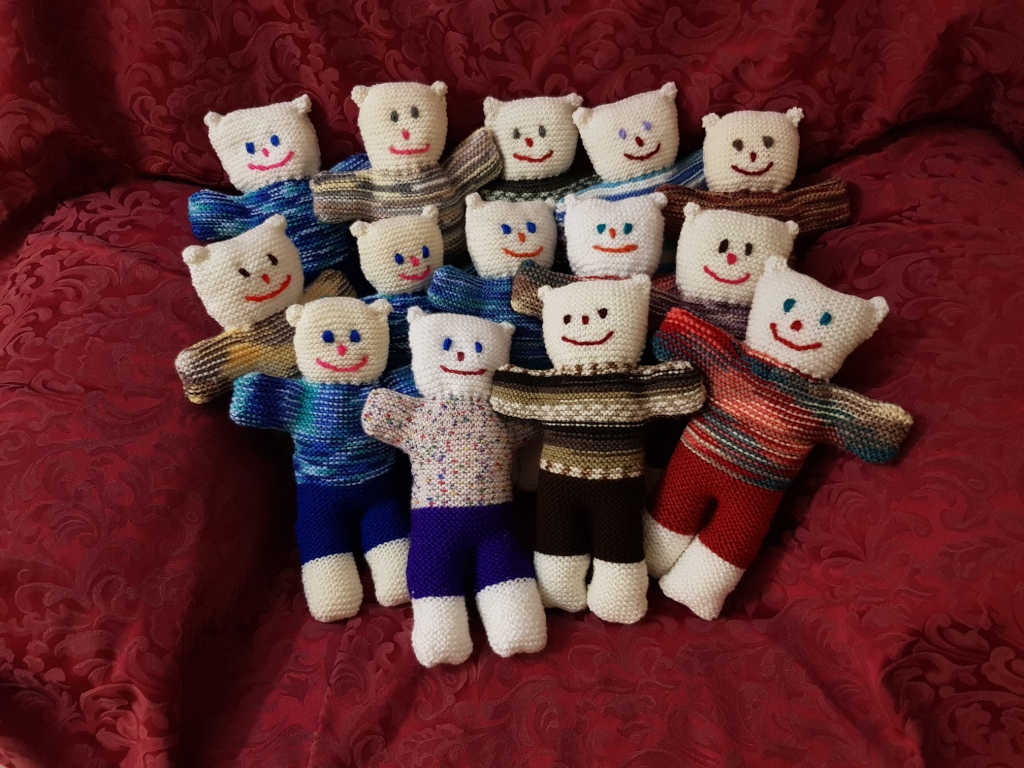
The latest batch of comfort teddies resulting from Ruth’s knitting on this trip
As is usual, Ruth has knitted as I have driven. The result is as pictured, twelve new comfort teddies, soon to be on their way to HIV positive children in Papua New Guinea.
Please Note: A link to a short video covering the material in this blog post can be found at the bottom of the blog.
Our first day in the Adelaide area started fine and calm but didn’t stay that way. We spent the morning in camp. The first job was to take in the awning in preparation for the wind. The blow started mid morning and continued until late. We went out to do some shopping after lunch. Heavy rain arrived soon after our return, but passed through in about an hour. Then it was wind and occasional showers until around dark when the rain ceased and the wind moderated. By 9.00 PM we had stars over the visible sky.
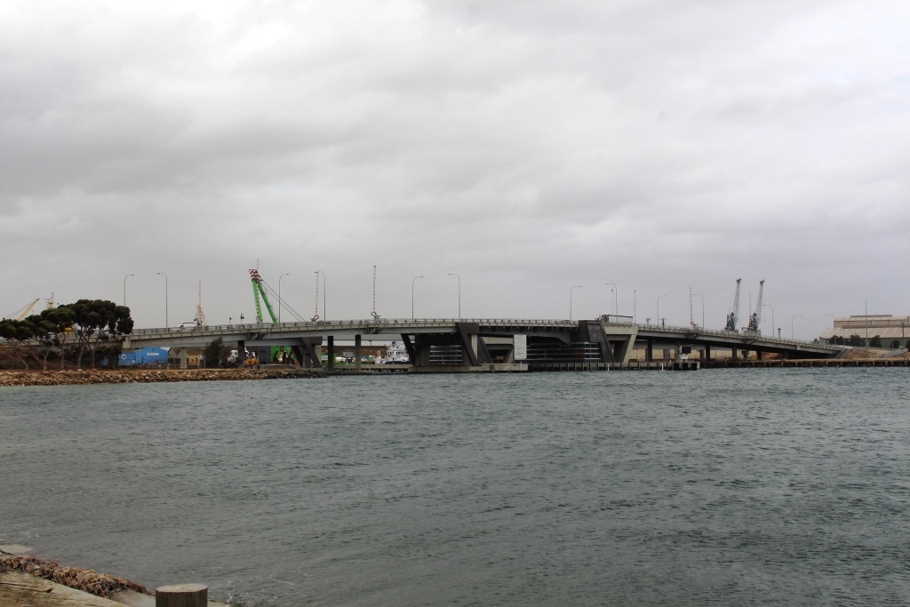
Lift bridge for access to boat harbour
On our second day in Adelaide, the morning was wet and windy. The rain abated at lunch time but the high winds continued. We took a drive.
We went west to Virginia, a route that took us past the Edinburgh Air Force base. This is very flat country, formally an area of small crop farming. Green houses abound but most look disused. Property developer signs are starting to appear at the roadside. At least one new housing development has sprouted in the middle of formally productive agricultural land.
We continued south to Port Adelaide. There has been considerable development since we last visited, some of it industrial, but some related to residential and leisure activities.
Glenelg has always been one of my favorite parts of Adelaide, so that was the next point on the drive. Glenelg is near to both Adelaide Airport and the mouth of the Torrens River. It has its own inlet from the sea, around which there has been a great deal of high value residential development, a marina and hotels. Of particular interest to me is the diving chamber used by scientist and petroleum explorer Reg Sprigg during his search for off shore oil deposits. Reg Sprigg developed the ecological resort at Arkaroola in the northern Flinders Ranges and was heavily involved in the launching of petroleum companies Santos and Beach Petroleum. He was also a close associate of South Pole explorer Sir Douglas Mawson.
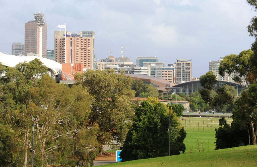
The statue of Colonel Light, designer of Adelaide City. Colonel Light is said to have used this point to lay out the design for his city.
From Glenelg we drove into the City via the Anzac Highway. Even on a windy Saturday parking spaces in the city were hard to find, so we drove through, west to east, then turned north to find the Colonel Light statue and viewing point. There used to be good city views from this point but they are now partly obscured by the huge white canopies of the football stadium.
One of the joys of driving through Adelaide is the superb homes and public buildings built from local stone. They are best viewed on foot, but on a day like we were experiencing, we settled for viewing them from the car.
View of Adelaide City from the statue in North Adelaide
It was approaching 4.00 PM, so we sought coffee and found it with scones, jam and cream. Satisfied that we had made the best possible use of a bad afternoon, we returned to the caravan for the evening.
The roof on the football stadium now obscure some of the city views
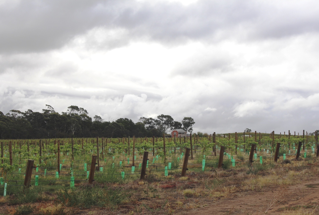
New planting of grape vines
A wet morning greeted us on Sunday, so we stayed in for the morning, but ventured out after lunch to top up food supplies before we moved on from Adelaide. While out, we decided to have a bit of a run through the Barossa Valley between the rain showers. We drove through Gawler, Lyndoch, Tanunda and Nuriootpa before returning to base.
We called at a winery suggested by Briony, but it had closed by the time we arrived.
Post harvest grape vines
We did manage to stumble across Maggie Beer’s Farm Shop. The weather had kept most people away from the area, so the normal popular spots were quite. But Maggie had pulled a crowd. There was hardly a spare table in the coffee shop area. It just shows what a TV profile will do for your business.
On our way back we passed the huge Seppelt winery at
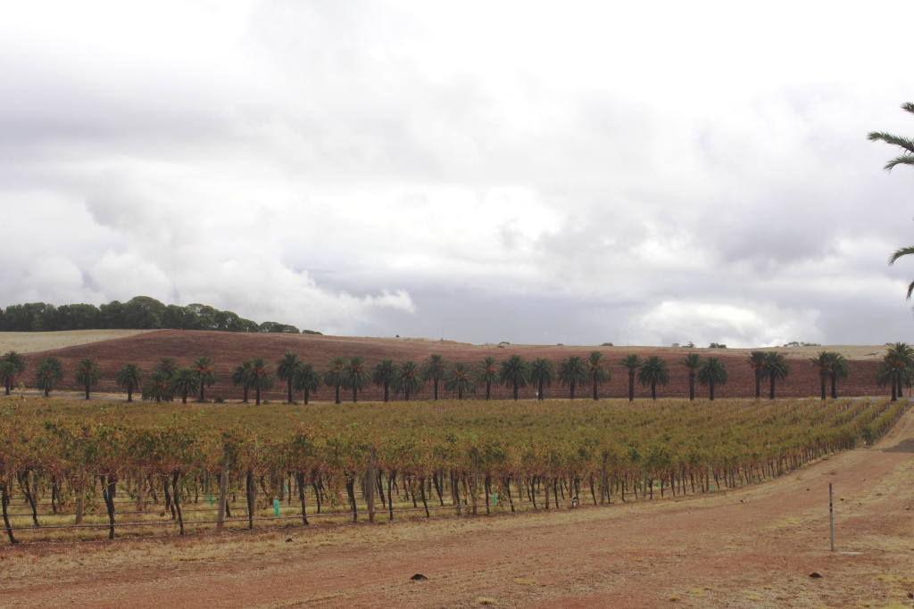
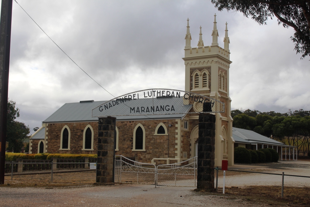
A Lutheran church among the vivyards
Seppeltsfield and saw the Seppelt family mausoleum, a large columned building on the side of a hill, at the end of an avenue of large palm trees. Most of the roads in the area are similarly lined with palm trees.
Regular rain showers swept over the area, one of them seemingly appearing each time that I wanted to take a photo. But there were some opportunities for photos, as the illustrations to this blog post attest.
The Seppelt mausoleum
Come Monday morning, we packed up amid periods of drizzle, but not too much wind. The wind returned later to blow frequent rain showers across the flat landscape through which we drove, the dark grey cloud appearing to brush the ground.
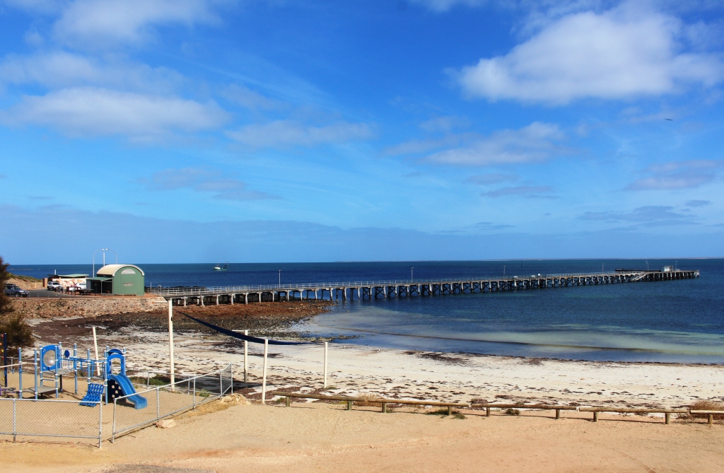
Ardrossan jetty
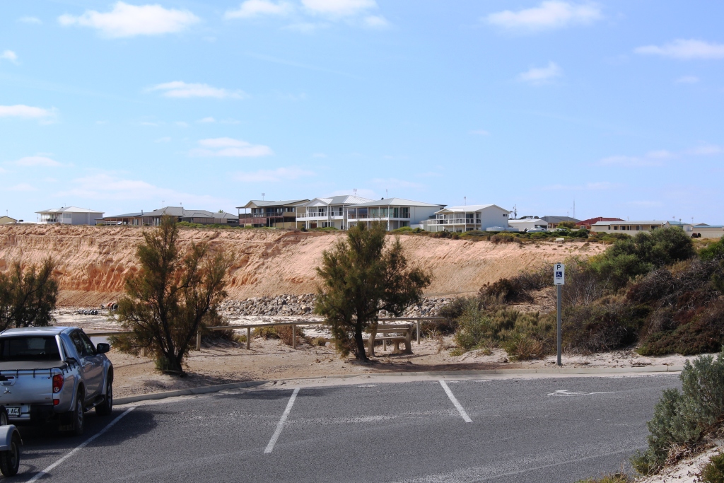
The area north of Adelaide and the top of the York Peninsula are quite flat. We stared out over the same flat coastal agricultural plain that we had driven through on Saturday, past areas of swampy salt bush country and finally into the grain production areas of the York Peninsula. We detoured to visit the town of Ardrossan on the upper east coast, before turning west to cross the Peninsula to our destination at Port Victoria.
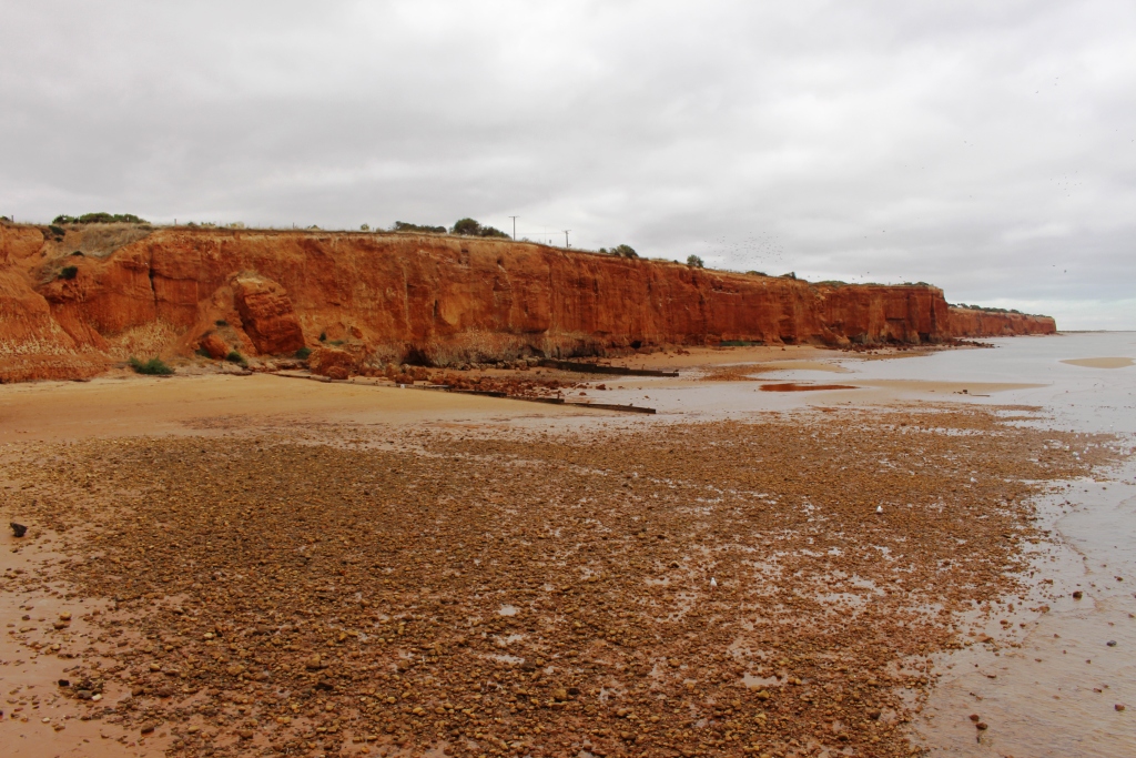
Red cliffs along the shore at Ardrossan
We had camped at Ardrossan about 45 years ago. I remembered a long jetty that is still there, although it doesn’t seem to be as long as I remember it. A second jetty at the grain silos, which I don’t remember, reaches much further to sea to provide deep water access for bulk carriers.
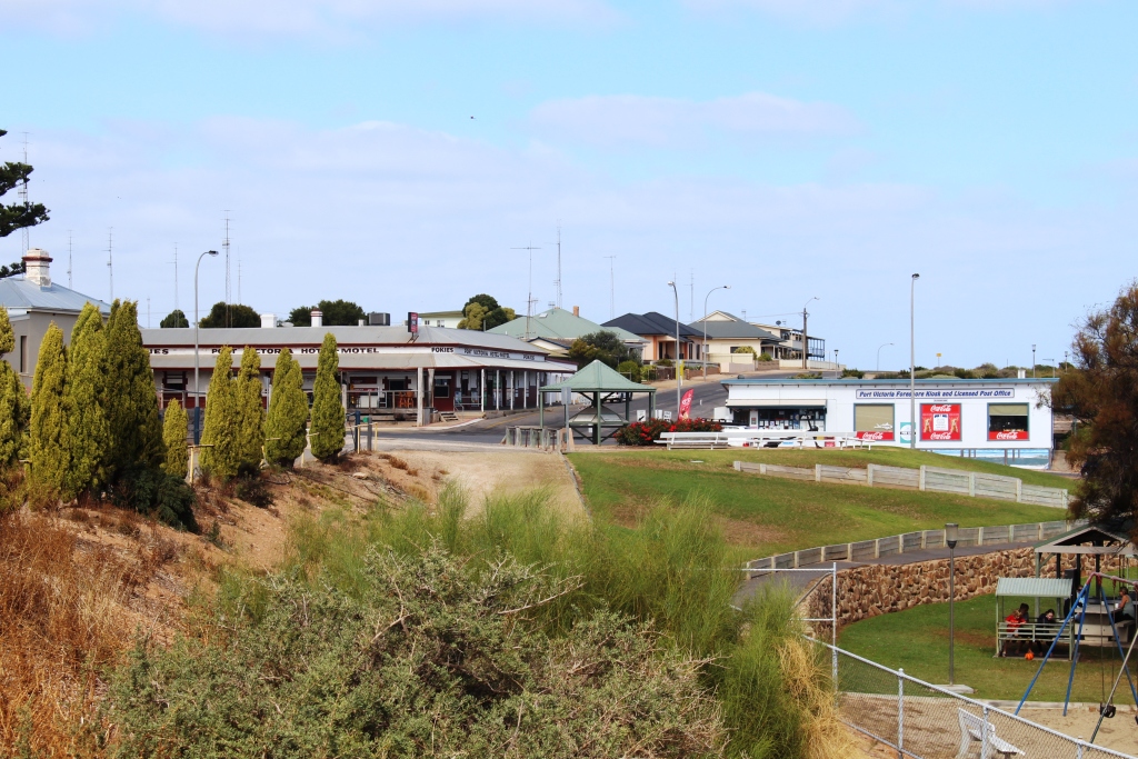
The rain moved on to the east about lunch time. We arrived at Port Victoria to a cool wind from the sea and grey skies, but things looked up later in the afternoon with the sun trying to break through. Expectations for tomorrow are much brighter.
Hotel and general store at Port Victoria
Tuesday started overcast but improved as the day progressed. We didn’t set out on the day’s activities until after morning coffee. Some days require a slow start.
Port Victoria jetty
We took a gravel road nearer to the coast to reach Balgowan. This small town has been discovered by retirees, but in a limited way, as new land seems to be released sparingly, ensuring that it brings a good price and limiting growth in a small town with
Houses overlooking the sea at Balgowan
limited services. Like many towns on this peninsular it has a jetty, launching ramp, pub, general store and a caravan park. Largish quality houses occupy any high ground with sea views. The main leisure activity seems to be fishing. Some towns on the Peninsula have golf courses and bowling greens and, of course, an Australian Rules football ground.
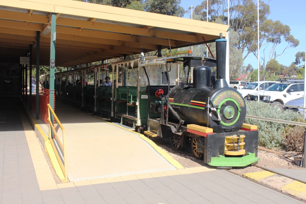
The excursion train at Moonta mining site
We continued on the gravel road until almost to Moonta, our main destination for the day. Moonta is a historic copper town, the heritage of which has been retained in its buildings and a museum. Copper was mined there between 1861 and 1923 during a period when prices for the commodity were high. Wealth and growth quickly followed. Copper development in South Australia closely followed gold discoveries in NSW and Victoria, to where many local men had departed to make their fortune. A shortage of labour resulted.
The excursion train passes under an old mullock pile
The need for a work force in South Australia coincided with the closure of copper mines in Cornwall so almost an entire workforce immigrated to the South Australian mining area. Claims are made that as much as 95% of the Moonta workforce were Cornish men and boys. To Cornish people that area was known as Little Cornwall. The traditional Cornish pasty, a staple of the diet of the day, may still be enjoyed in eating establishments in the town, as we proved.
Part of the copper refining plant
It would not be difficult to spend a couple of days examining this town, but we had less than a day. So we decided on a tour on the narrow gauge railway that utilises the original railway station as its starting point. In the same area the original School of Mining has become an extensive mining museum, which time did not allow us to visit.
Copper was initially shipped from the area through the neighbouring port of Wallaroo, but later the area was connected to Adelaide by rail.
The old Town Hall in Moonta is now partly used as a picture theater
For almost an hour the train meanders through the mining area. It is a one man operation. Driver Ian not only drives but changes the points, collects the money and talks. During the entire tour he hardly stopped for a breath. But it was all interesting. He recited facts and figures, most of which we don’t remember, without hesitation.
The train stops at one point at the remains of the main processing plant where details of the very labour intensive process of extracting copper from the mined ore are set out on a wall in storyboard fashion. Stories included that of the discovery of commercial copper in the area being made by an alcoholic Irishman who drank himself to death on the proceeds. That seems to have happened in other places.
An old Methodist (now Uniting) church. Most Cornish miners were Methodists.
A partly eaten Cornish pasty with tomato sauce and cream
The tour completed, we drove back to town to lunch on the traditional Cornish pasty. Part of the ordering process was an explanation of this imported delicacy. We discovered that the traditional Cornish pasty is partly filled with meat and vegetables and partly with stewed apple, in about two thirds one third proportions. Ours were served with salad, tomato sauce and cream. I doubt that those served to the miners included these embellishments.
Houses overlooking the sea at Moonta Bay
With the day quickly ending, we visited the adjacent coastal towns of Moonta Bay and Port Hughes and found another coastal community that has been discovered by well healed retirees, with many modern houses lining the top of a miniature red cliff that seems to be a common feature of the York Peninsula coast.
We returned to Port Victoria on the sealed road, via Maitland.
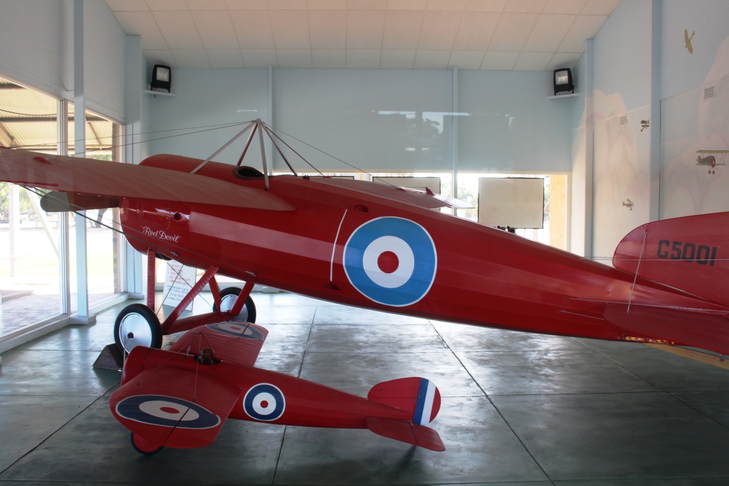
The Red Devil with a replica model at the Captain Harry Butler memorial
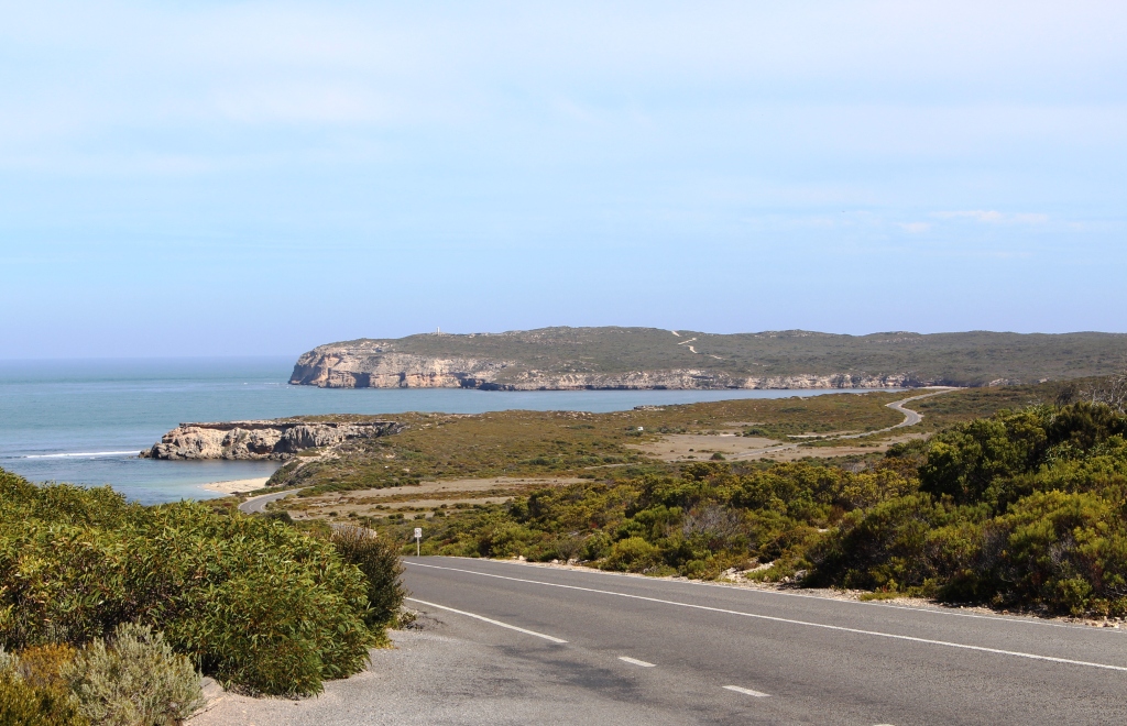
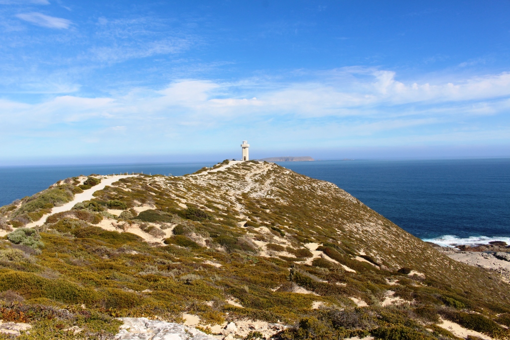
The days were improving. Early Wednesday was a bit cold but developed into a great day for our trip to the southern end of the York Peninsula. Innes National Park was our ultimate destination, but first we travelled through Minlaton where we stopped to buy a National Parks pass and to view the memorial to Captain Harry Butler AFC. Butler was another flying pioneer who got his start in England during WWI as an Air Force pilot. Back in Australia and his home town of Minlaton, he was famous for his small aircraft called “The Red Devil” in which he performed aerobatics and provided joy flights. His memorial is at the northern entrance to the town.
A scene from the road in Innes National Park
The small town of Warooka is the only settlement during the 90 km between Minlaton and Marion Bay, the small coastal town near the National Park entrance. Initially the road runs through fields that produce wheat, barley, canola, legumes and other grains, but as you travel further south the terrain becomes rougher and scrub covered. Sheep and cattle appear at the roadside. The grain fields contain only stubble, as the time for planting has not yet arrived.
Another view of Innes National Park
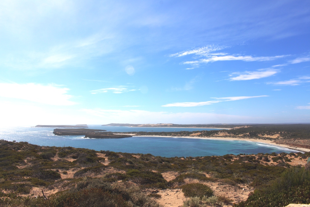
Innes National Park is truly a beautiful place. The southern extremity of the peninsula is rugged with promontories, bays, islands and off lying reefs. Over every hill top and around every corner a new view of headlands, bays, beaches and blue ocean appear, while the hills are blanketed in a hundred shades of green. One day is not enough to see it properly. Just to complete the walks would take several days.
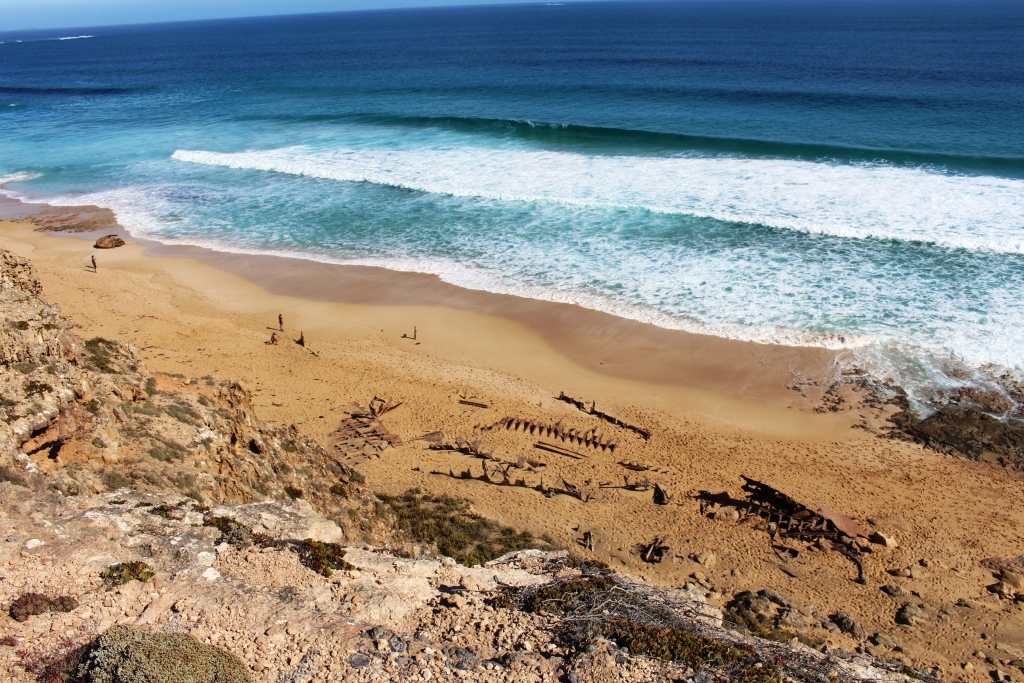
The remains of the sailing ship “Ethel” wrecked on this beach over 100 years ago
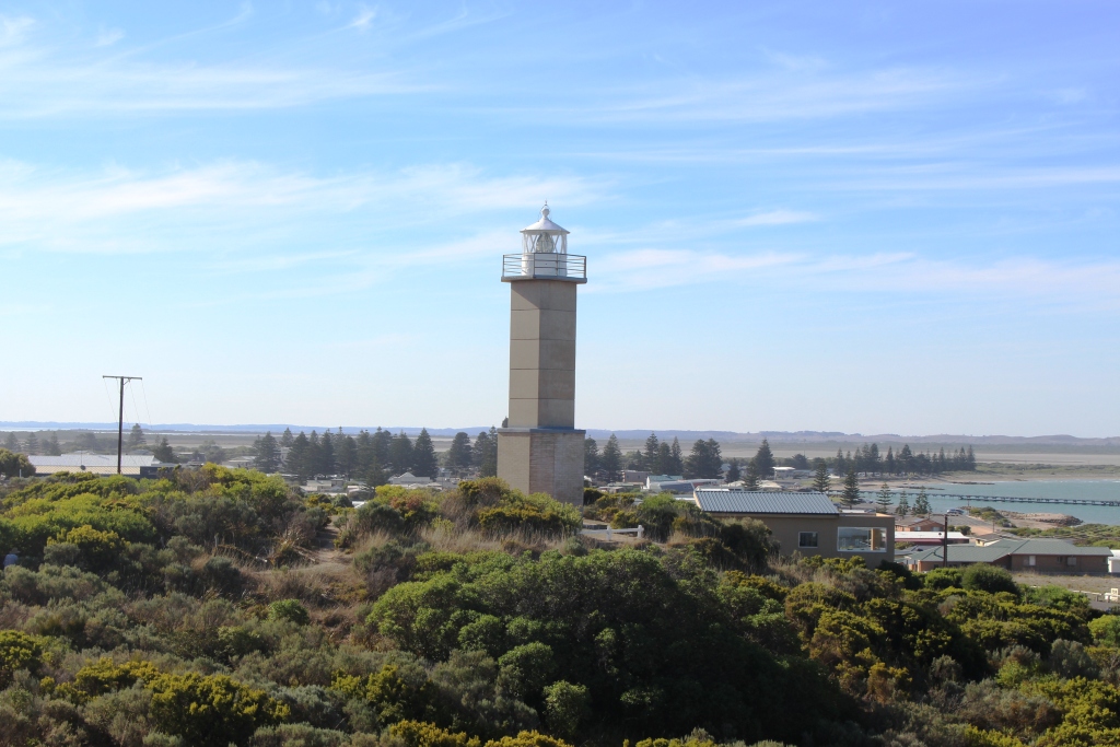
Cape Vincent lighthouse. There are about half a dozen lighthouses in the area
We drove as far as the fishing village at Pondalowie Bay before working our way back to the start via all of the points of interest along the way. It is an area well worth a visit.
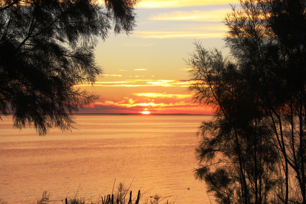
Sunset at Port Victoria
For a partly different route home we detoured at Warooka to drive through Yorktown, finding there a substantial but spread out town and a couple of really pink salt lakes. At this point we turned for home, travelling via Maitland. We arrived back in time to see a rather magnificent sunset.
Overnight, Ruth and I had a serious discussion about the future of our trip. We are aware that if we continue to Western Australia we will be placing ourselves in a position where we would not be available should something happen to brother Winston before the end of July, the time that we plan to
Sunset at Port Victoria
return home. Additionally, I have developed some health issues that need to be addressed by medical professionals. We have plans in place to fly back home for a few days for my quarterly endoscopy but we are now asking ourselves if it might not better to return home and see how things work out.
Later in the same sunset
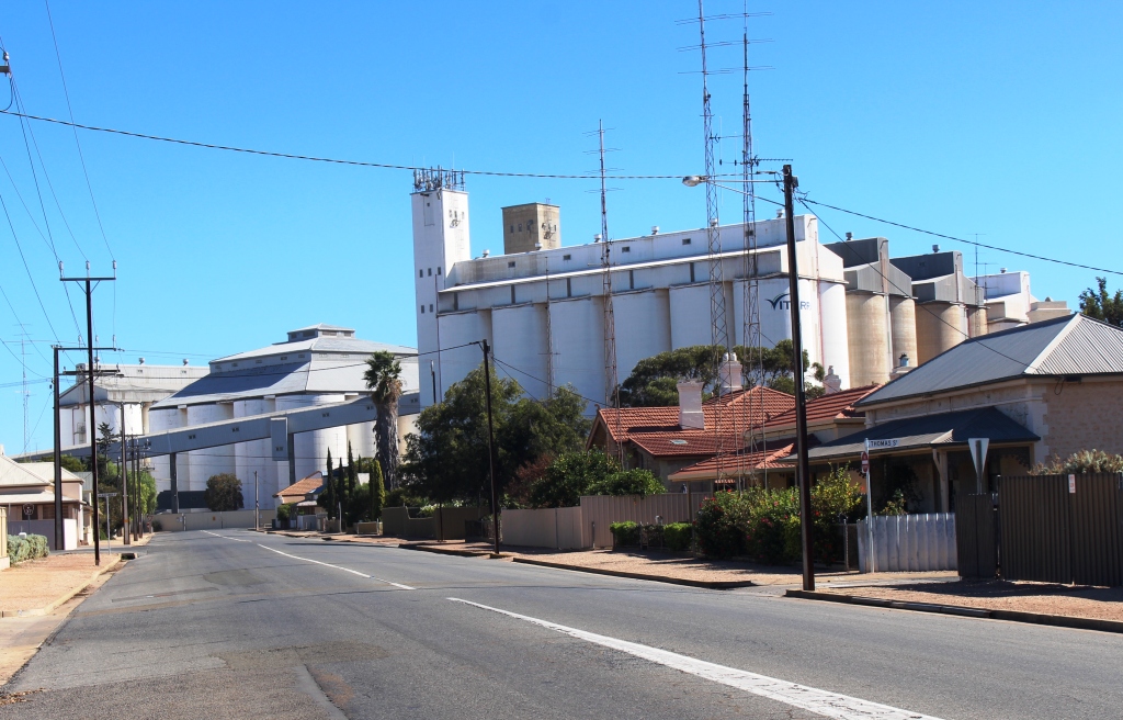
Thursday dawned the best day for some time. We first drove north to look at the Port town of Wallaroo and the neighbouring town of Kadina. Copper ore from Moonta was originally shipped from Wallaroo before the railway line was built. The port facilities now handle export of much of the grain grown in the area.
Grain silos at Wallaroo
From Kadina we travelled east towards Clare. The road that we were on, called the Alt 1, runs through endless grain production country, countless hectares of stubble. We did see one farmer ploughing, a huge array of earth tilling equipment and a seed or fertiliser bin behind a huge farm tractor, with a trail of brown dust rising into the sky.
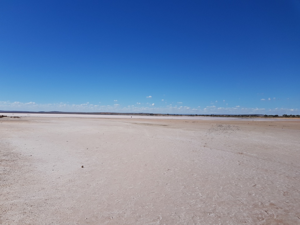
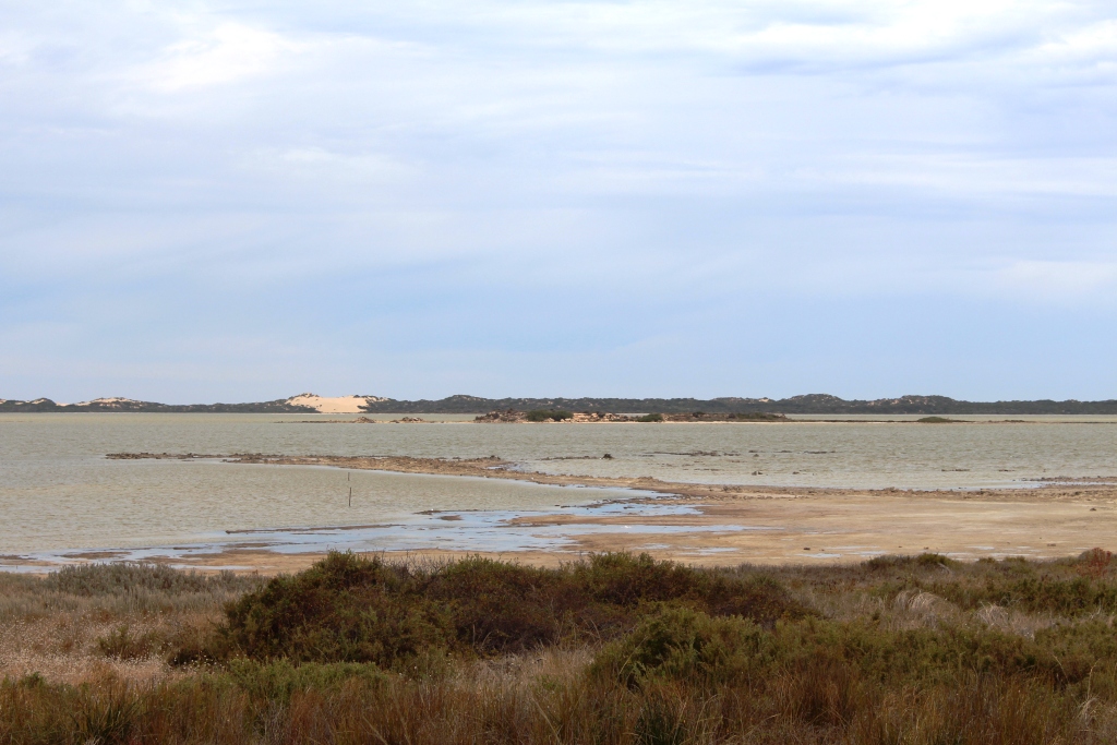
The pink lake at Lochiel
At the tiny town of Lochiel the road that we were on crosses the main Adelaide to Port Augusta Highway. The town is on Lake Bumbunga, one of South Australia’s pink lakes. Pink lakes are salt pans that have a marked shade of pink when the sun shines on them. As we had lunch we watched a succession of tourists walk onto the solid salty surface to take selfies with the pink salt in the background.
A vine covered arcade in Clare contains a rather good bakery and coffee shop
The vineyards start as soon as you top the hill driving into the Clare Valley. The town and its surrounds are most attractive. Many of the vine areas have achieved the russet colour of post harvest autumn and the deciduous trees are wearing their autumn outfits. We spent the night at the Clare caravan park.
Please Note: A link to a short video covering the material in this blog post can be found at the bottom of the blog.
There was something to blog about in our family visit at Drouin. On reflection, I think our visit there should be recorded, as it is part of the experience of our trip.
Family group. Lest to right: Colin, Aileen, Ruth and Bernard
Our reason for coming so far south on a trip to South and Western Australia is the medical condition of my brother Winston. He has been assessed as terminally ill, with probably only months to live. We visited him in his nursing home and on the following day he was able to attend a family lunch at his old home. He is wheelchair bound and can only move to other seating with a great deal of help. But it was a happy occasion. He was able to spend time with his only grandchild, an eight month old girl, and other members of his immediate family.
We parted after we had delivered Winston back to his nursing home. As we shook hands we were both very aware that this might be the last time that we would see each other. We can only hope for a miracle.
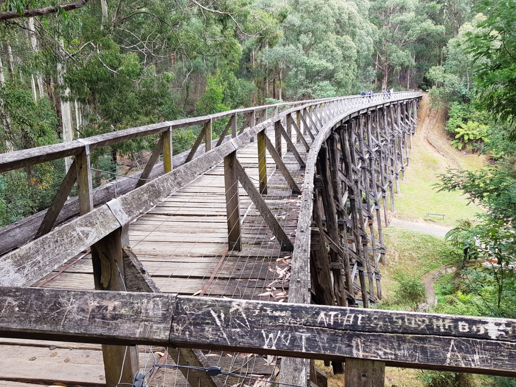
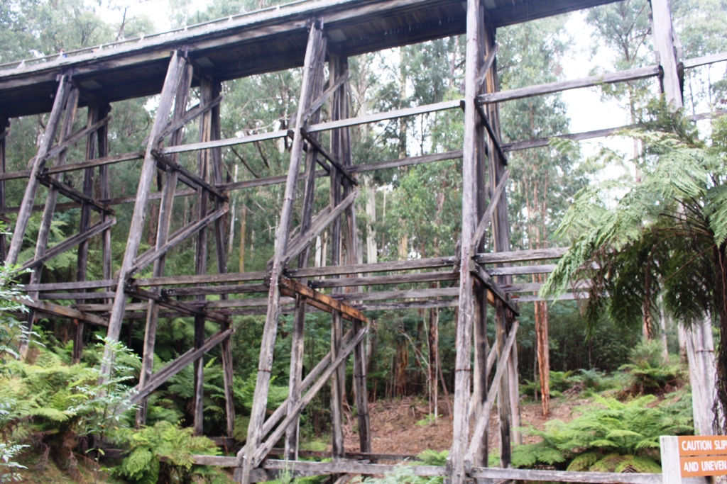
The Noojee trestle bridge at deck level
The following day, in company with my sister Aileen, her husband Colin and my youngest brother Bernard, we drove into the hills to the north of Drouin in search of the restored Noojee trestle bridge. The bridge was part of the now long closed Warragul to Noojee railway line, built mainly for the transport of timber. The bridge was partially destroyed by fire many years ago. It has been restored as a tourist attraction. If success is to be judged by the number of people visiting it then the strategy has worked.
Trestles supporting the Noojee bridge
We had stopped for coffee at the Neerim South Bakery, another place enjoying a brisk tourist trade, visited the bridge and then drove into Noojee for lunch. We enjoyed a pasty at the general store, and then drove out to the parking area for the water falls on the Tooronga River. The walk takes in the Tooronga and Amphitheatre Falls during a brisk walk of a bit more than two kilometres. There are some steep parts and steps, but generally an easy walk.
Family group minus Ruth at Amphitheater Falls
Tooronga Falls
The river runs beneath rock falls in some places
Next morning we moved on to Melbourne, to a caravan park at East Doncaster, to visit long time friends Thelma and Joe. Our caravan won’t fit on their property because of narrow streets, so we commute from the caravan park. Short visits like this are mostly spent talking, catching up with news and the doings of family and friends. We did a very pleasant lunch with them at the Ringwood Club, near their home.
A street in Maldon
Planning the next move forward always includes keeping an eye on the weather. We were a bit shocked, after the cold weather we had experienced, to find our planned route would lead us back into southern summer like extremes. We planned to go to Castlemaine and then to Mildura, before following the Murray River to South Australia. But temperatures were forecast to be in the high thirties. Clearly it was advisable to stay in the south for a few days.
View from the mountain top. The water is Cairn Curran Dam
Keith and Lynda have a great spot for a caravan at the front of their house in Castlemaine. We had planned a one night stop over but, at their invitation, extended it to two. Again much chatting, but we did fit in a tour to the nearby gold town of Maldon, for lunch and a stroll along the historical streets. There are many fine restored buildings in streetscapes which preserve their heritage. There was no time to research gold rush history, but we did return home via the panoramic views from Mount Tarrengower and a park by the waters of the Cairn Curran Dam.
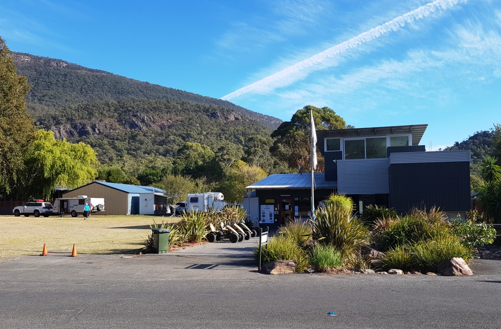
Parked in the guest space at Halls Gap
It’s Saturday 7th April and time to move on again. The plan is to do a short leg to Ararat for perhaps two nights, but we want to catch up with an old friend at Dunkeld, so we called ahead to her mobile. She answers it from her hospital bed in Geelong. She had a mild heart attack on Easter Friday. She awaits news of future treatment but meanwhile is bored. Know the feeling? After hearing our proposed schedule she suggests that we overnight at Halls Gap, where her daughter and son-in-law manage the Big 4 caravan park. I suggest that it will be booked out with school holidays and we say our goodbyes. Five minutes later, she calls back to say that she has talked to her daughter and they have a site for us. So here we are!
Update: Do has had two stents inserted into the troublesome artery. She is fine and will soon be back to normal. In her early eighties, she is planning another tag-along tour in a desert somewhere in Western Australia.
The park at Halls Gap was busy
To reach Halls Gap we passed through the larger towns of Maryborough and Ararat and some smaller settlements. We crossed the sheep country of the Moolort Plains and through some of the hills of the Pyrenees Ranges. Finally we drove the Great Western Highway from Ararat to Stawell before turning off to Halls Gap. The entire area through which we drove needs rain.
The Grampians on the way to Dunkeld
We left Halls Gap at about 9.00 AM, bound for Dunkeld, then Hamilton and on through the small towns of Marino and Sanford to Casterton. After lunch we continued to Penola and turned south west to our final destination. The quiet caravan park at Millicent, near Mt. Gambier, should be ideal to catch up on washing, blogging and general record keeping.
Brown farm land near Casterton in Western Victoria
The Autumn colours were appearing in Casterton
A lighthouse stands above Beachport
Sunday 8th was Ruth’s birthday and we had travelled all day. Ruth spent part of the day fielding telephone calls and Facebook posts. By way of celebration, we went to a local hotel recommended by the caravan park management and enjoyed a pleasant relaxing meal.
After lunch next day, with chores substantially complete, we drove the 35 km west to the beach side town of Beachport, located at the south eastern end of a chain of lakes that run just inside the coast to the north west to the better known holiday and lobster town of Robe. Beachport is an attractive town with a great deal of tourist accommodation. I suspect that many Adelaide residents find it to be something of a refuge during the summer heat of holiday time.
Beaches along the scenic drive
A scenic drive follows the rugged coast to the north west, with observation points that provide views of the rocky promontories and small sheltered beaches that reach up the coast and views back over the town and along the sweep of the beach to Southend in the far distance.
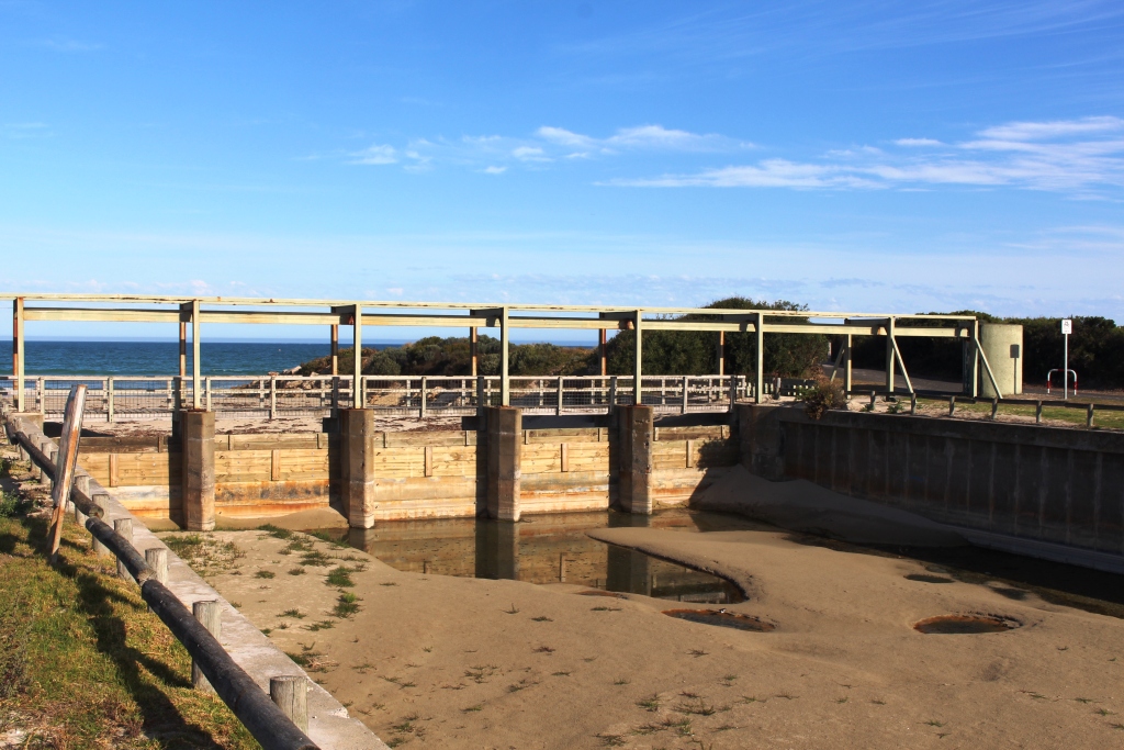
The barrier at the mouth of the drainage chanel
At the entrance to Beachport a drain reaches the sea, but its entrance is protected by a barrier to stop the entry of salt water. We noticed a number of such drains the next day. The area is very flat and near to sea level. It was drained to make it suitable for farming activities, many long years ago.
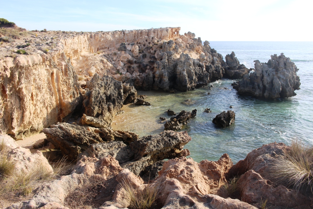
Weathered rocks at Southport
On the way back to Millicent, we did a detour to Southend. It is a typical seaside village with almost no commercial centre. But a does have a headland with interesting erosion patterns in the rocks, which seem to be of a material that selectively weathers. From the headland you can see back to Beachport.
With forecasts suggesting Adelaide weather returning to sanity, we left Millicent on Tuesday 10th, bound for Port Elliot and Victor Harbour. It was a 400 km drive into a strong head wind. Unpleasant conditions made worse when the caravan tyre that had been repaired in Orbost again went flat. So out with the compressor to add some air! We made the 15 km into Meningie before it went flat again. But this time it has suffered mortal damage, probably from a sharp edge to the pavement. Fitting a tube got us back on the road, but the tyre will have to be replaced before we go too far.
Views over The Coorong
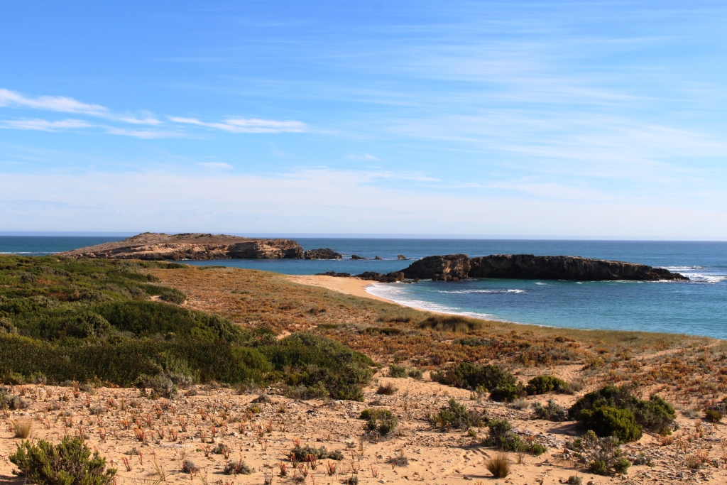
The drive from Millicent is over very flat terrain for most of the way. It is mostly dairying and grazing country with both cattle and sheep. Pine forests can be seen in the distance to the right. The road was rather bumpy. The views are of brown land in need of rain. The highway joins the coast at Kingston SE. Soon after that a long strip of water enclosed within its own National Park, known as the Coorong, appears to the left and stays there for most of the 130 Km to the next town of Meningie.
The Victor Harbour to Goolwa steam train runs through Port Elliot
We turned left and took the ferry over the Murray at Wellington, travelling through the vineyards of Langhorne Creek and via Strathalbyn to reach Port Elliot. We set up at the showgrounds where a basic caravan park operates. You have to save money when you can. The tyres on an off road caravan are expensive.
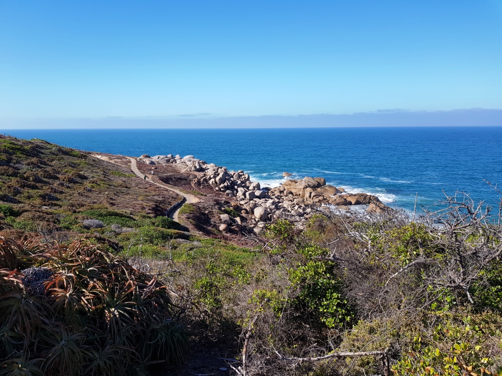
A walking track follows the coast as Port Elliot
As we approached Port Elliot, Ruth phoned her long time friend Margaret who is retired, with her husband Brian, in the town. We found that her retirement village backs on to the Showgrounds. Brian was in hospital in Adelaide having a new knee fitted. Margaret was not visiting him the next day so we arranged to meet for coffee. We met in the street and did a short foot tour, walking up to the headland that provides views to Victor Harbour to the west and
Protected stone buildings in Port Elliot
Goolwa to the east. Brian’s forebears were among the earliest settlers in the area, so we heard some interesting stories before returning to the coffee shop/post office for coffee and a long chat, as Margaret and Ruth covered many years of not seeing each other very often.
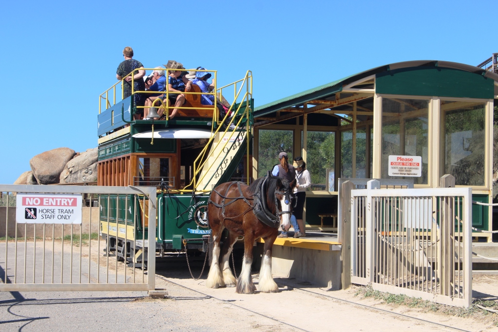
The Granite Island horse drawn tram
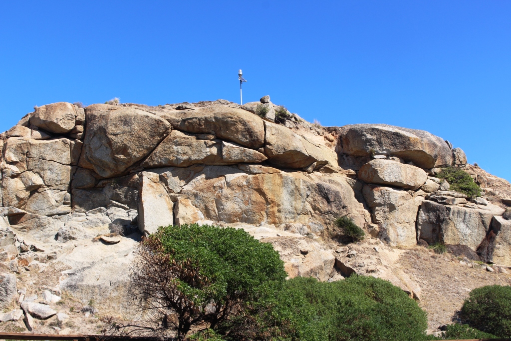
The granite pile in the centre of the island
With coffee long finished, we took our leave and drove to Victor Harbour. One of the features of that fine resort town is the off lying Granite Island, which is linked to the mainland by a timber causeway. There is a regular and popular horse drawn tram service to transport tourists to the island. The alternative is to walk. And a pleasant walk it would be.
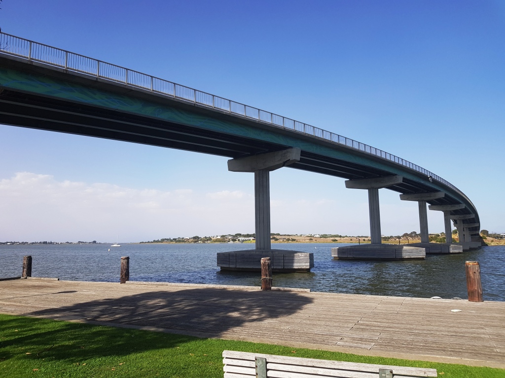
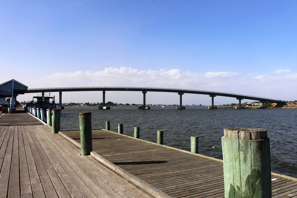
The Hindmarsh Island or “Secret Women’s Business” bridge
But we caught the tram. I ascended the wooden stairway to the top of the granite pile for the view and photos. Then we caught the tram back to the mainland. The island also hosts an under water observatory and, just off the island, a circular enclosure where you may swim with tuna, if that activity takes your fancy.
After lunch we drove back east to the old river port town of Goolwa, to visit the restored wharf area which includes the Goolwa station of the Victor Harbour to Goolwa steam railway. The train normally operates on Wednesdays but was dormant for our visit, probably undergoing maintenance in preparation for a coming busy school holiday schedule. As we stood on the wharf, towering above us was what I call the Secret Women’s Business Bridge.
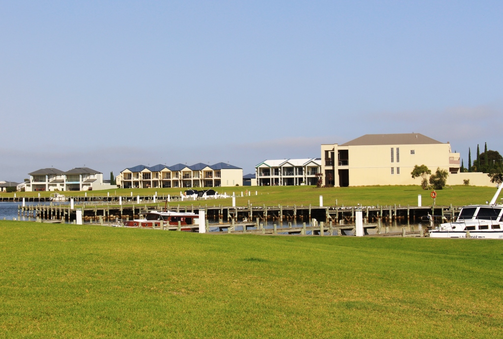
Houses at the Hindmarsh Island Marina
Do you remember the kerfuffle when activists used the secret women’s business ploy in an attempt to stop the building of the bridge and a marina on Hindmarsh Island? The protest failed, as the completed bridge demonstrates. Accompanying photo illustrates that the marina, which was being protested at the same time, was also built. Where do the people come from with the money to buy all of the houses and units this far from Adelaide, I wonder?
The bridge and the old wharf
During our drive, Margaret called to invite us to dinner. So a pleasant evening was spent with old times getting a thorough going over. Margaret is a retired nursing sister, with most of her working life spent in the Northern Territory, but she has also worked in the United Kingdom and Zambia. There were some interesting stories. Oh, yes! Brian’s knee operation went well.
Thursday gave us a leisurely start. The appointment to get the new caravan tyre fitted was at 11.30 with check out time at the caravan park at 10.00, so we found a high spot with good views to spend the intervening hour or so. I had ground some coffee beans that morning, while we had power, so we enjoyed homemade cappuccino while we admired the view.
New tyre fitted, we set out for the northern suburbs of Adelaide, where we are set up in the Gawler Gateway Tourist Park for four nights. The forecast for our stay is for cool weather, with winds to 45 kph and some rain. That will be horizontal rain, no doubt. I will let you know in the next post.