Far North Queensland Again – 2024 – Days 1 &  2

Note: Click on pictures to enlarge.

Each year, as winter arrives in South East Queensland, I start to make comments about moving to Cairns. At least for the remainder of the Winter. But it is in jest. To do so is not practically achievable. But we can visit.

Fraser Island viewed from Matthew Flinders LOokout
Fraser Island viewed from Matthew Flinders Lookout

Since our retirement in 2009, we have tried to spend as much of Winter as possible travelling in warmer climes, even if that created the need to travel through colder areas coming from or going to the warmer parts of the country.

For the last few years, at least since we sold our caravan, we have travelled North, usually during August. By the start of August, the colder weather has usually got to me to the extent that a chance to start Spring early is very persuasive. We missed last year, as our daughter who works in India, was back in Australia, but this year we put plans in place.

Ariadne was the first ship to bring settlers direct;y yo Hervey region

Originally the plans were to go to Cairns by train, with a sleeper berth on the Spirit of Queensland but we ultimately recognised that Ruth’s balance and mobility issues made that a poor choice. That arrangement would have had us returning home by air but we recognised that air travel out of a regional airport also had its problems. So, we decided that I would drive, but that we would take it in easy stages. We sort of did that, but necessity did dictate some variations.

Memorial and Plaque to commemorate the landing of Lt Flinders at Hervey Bay.

We left home on 16th August with Hervey Bay our first destination. We left home after morning coffee and made Gympie by lunch time. The new bypass is not yet open, but beyond barriers we could see the new dual carriageway stretching ahead of us. We came into town for lunch and departed in the direction of Rainbow Beach until we reached the road to Maryborough, which we followed to that town and proceeded to Urangan.

A Crested Tern in the rail of Urangan Pier.

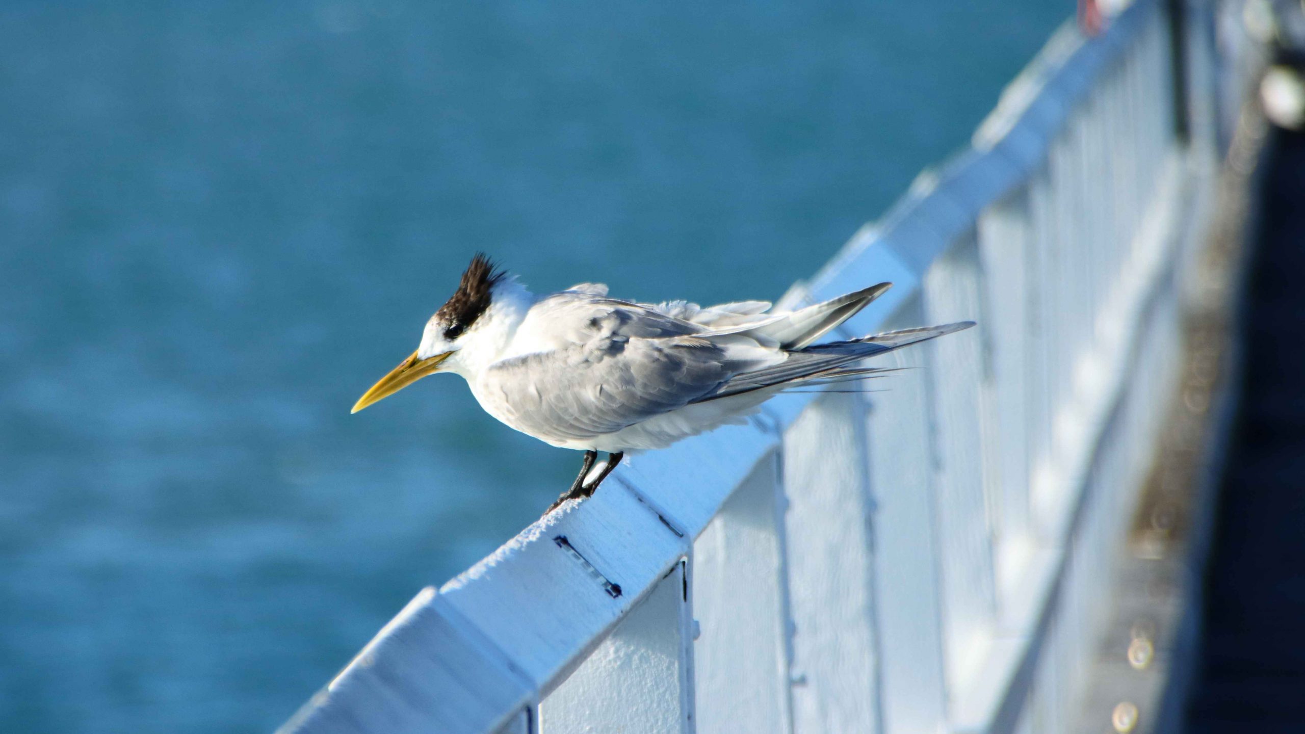
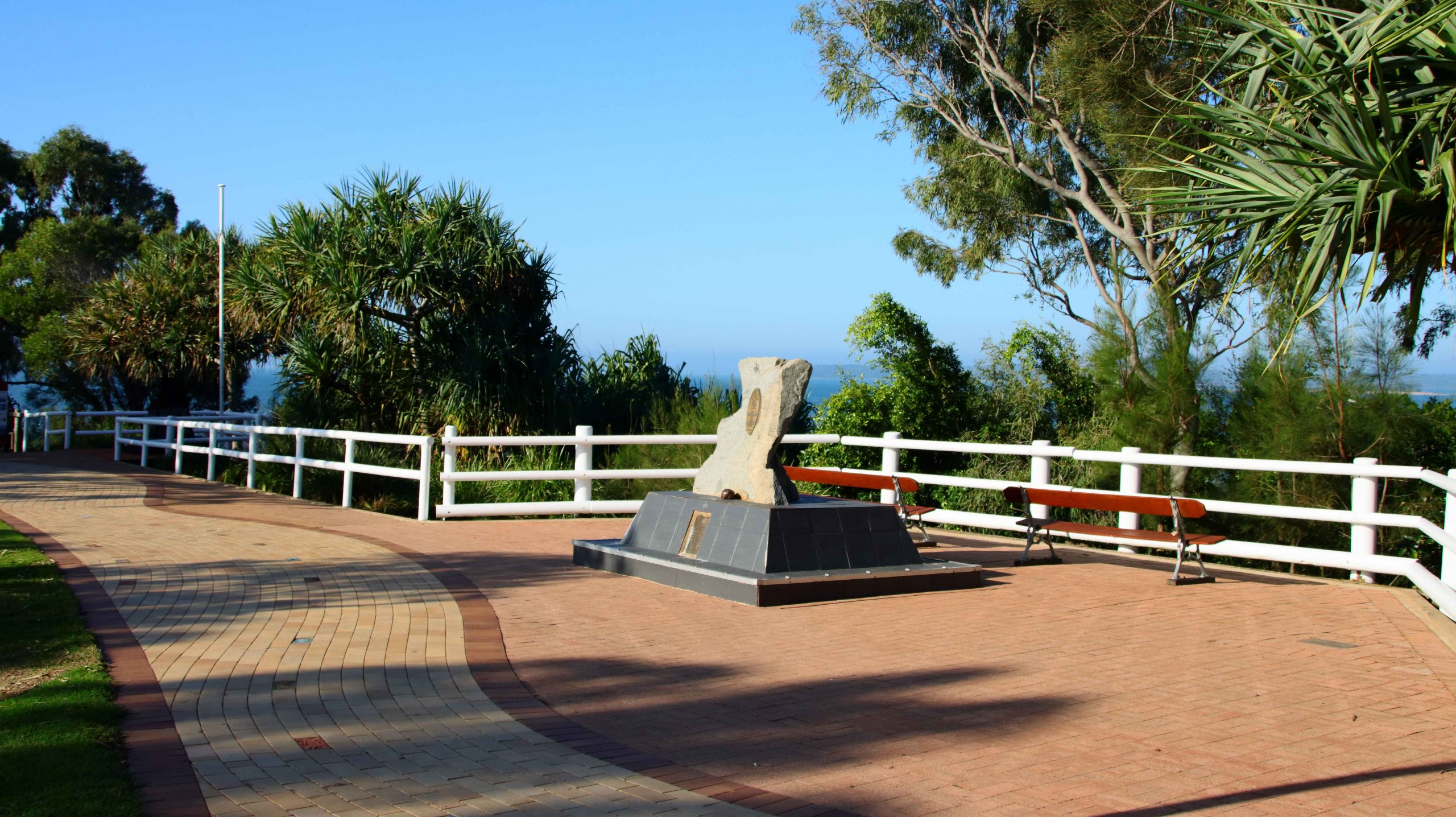
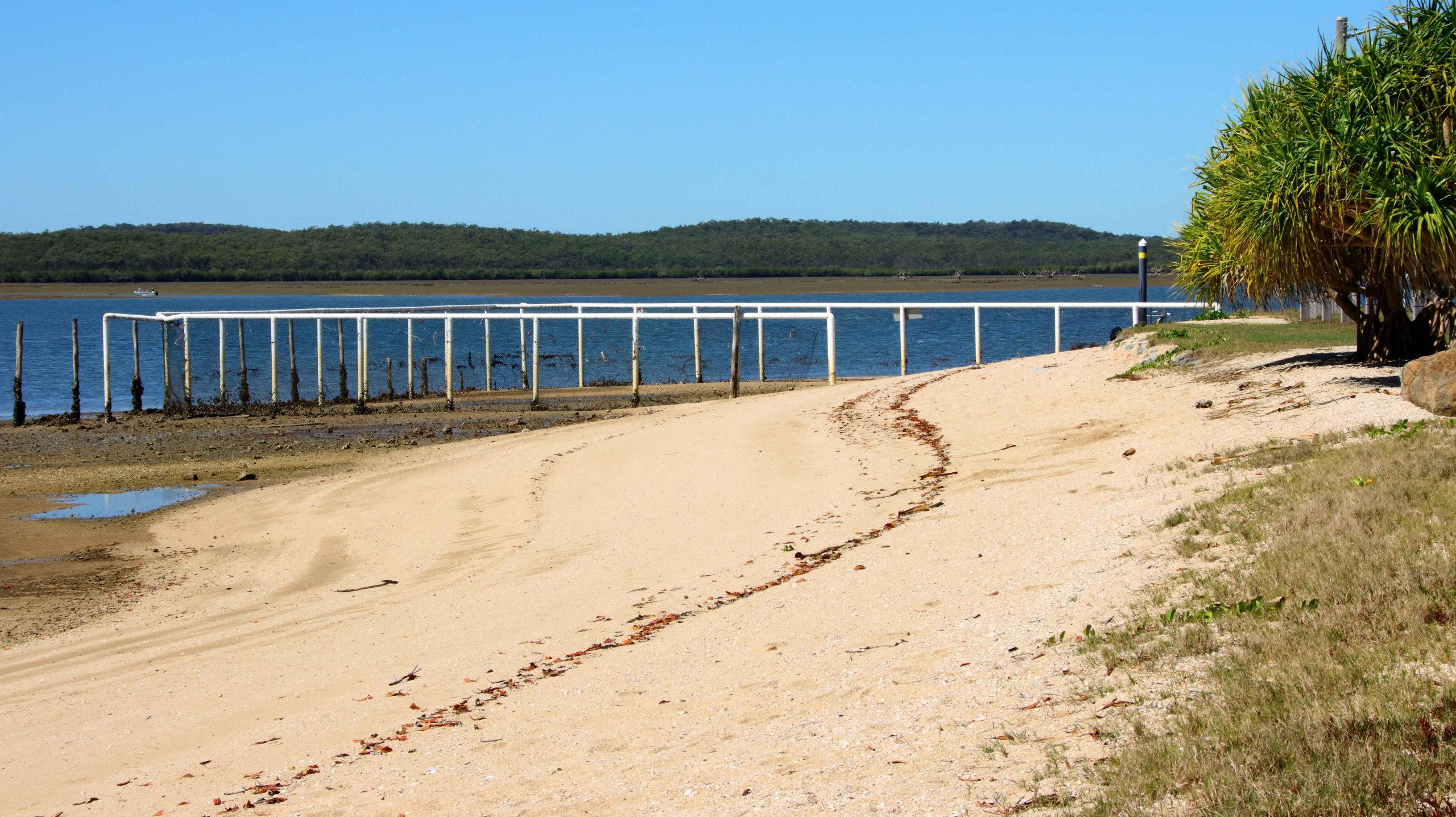
While looking at maps before departure I had noticed the Matthew Flinders Lookout that is located between Urangan Harbor and the Urangan Pier. The lookout provided photographic opportunities, a parking space and toilets. Afterwards we moved the short distance to the base of the pier. Ruth remained in the car but I took more photos as I added to my daily step count along the famous Pier.

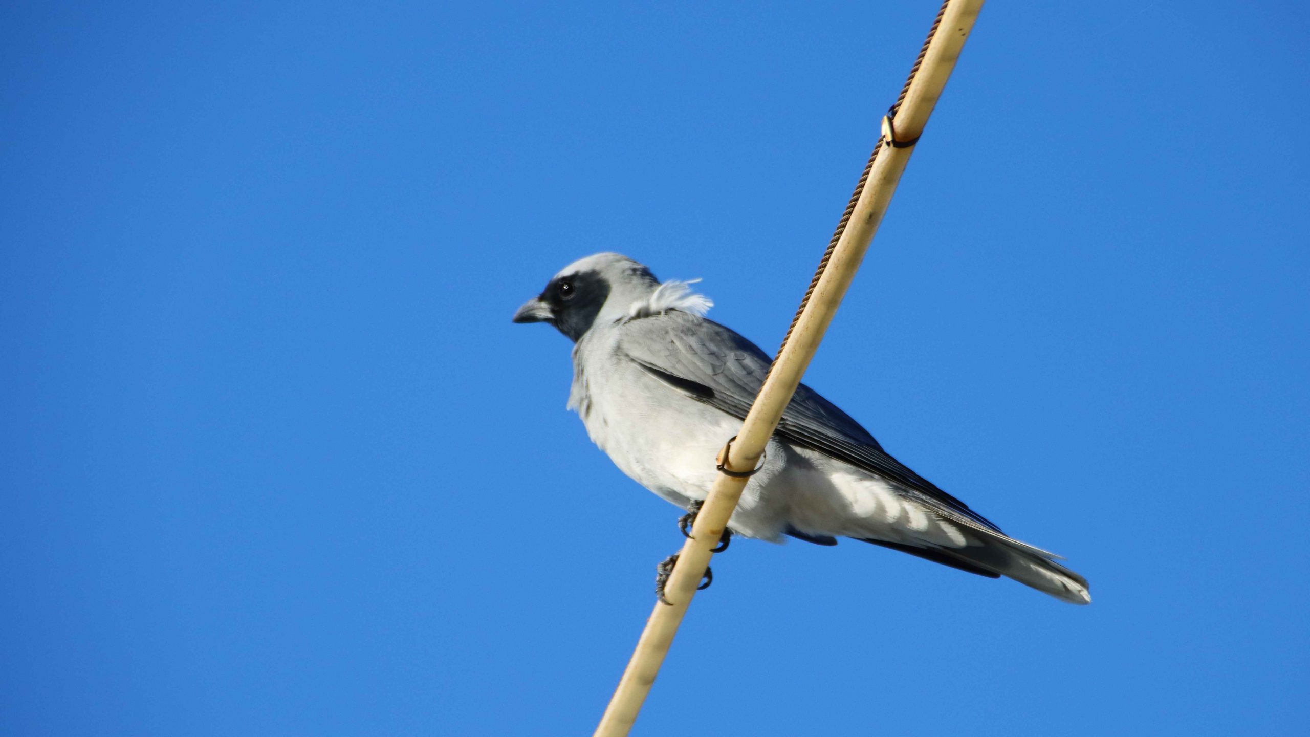
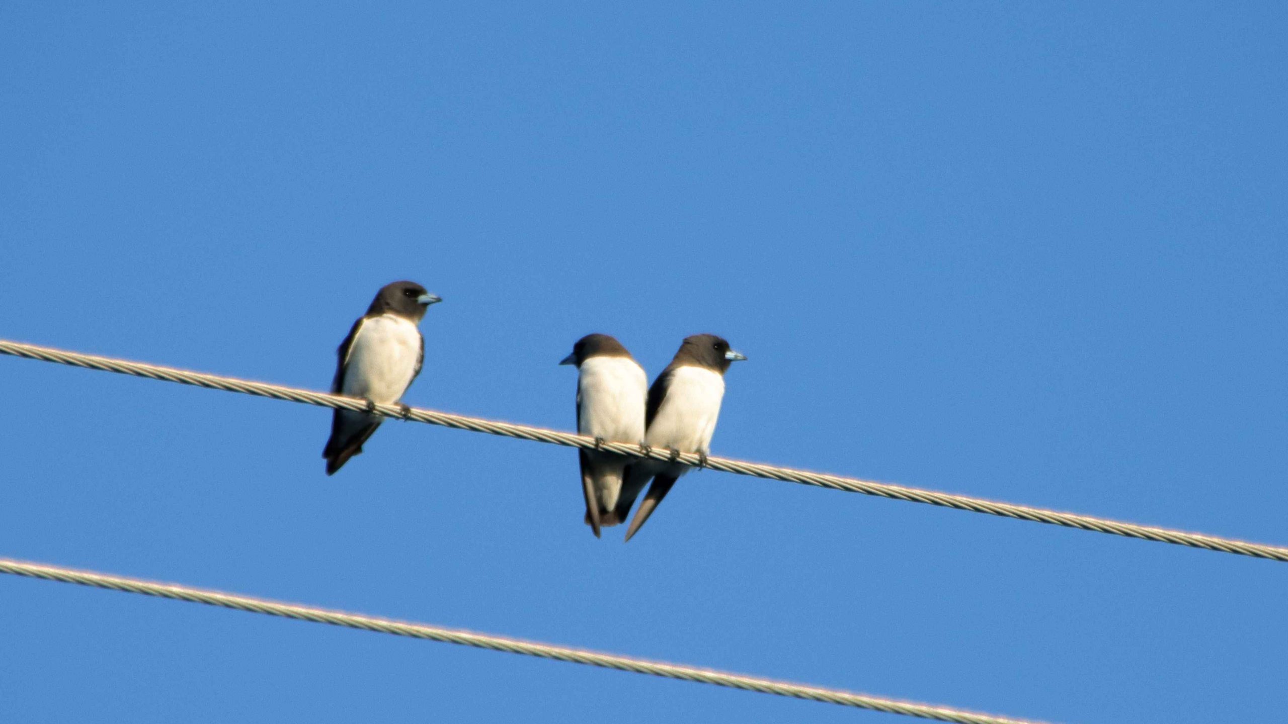
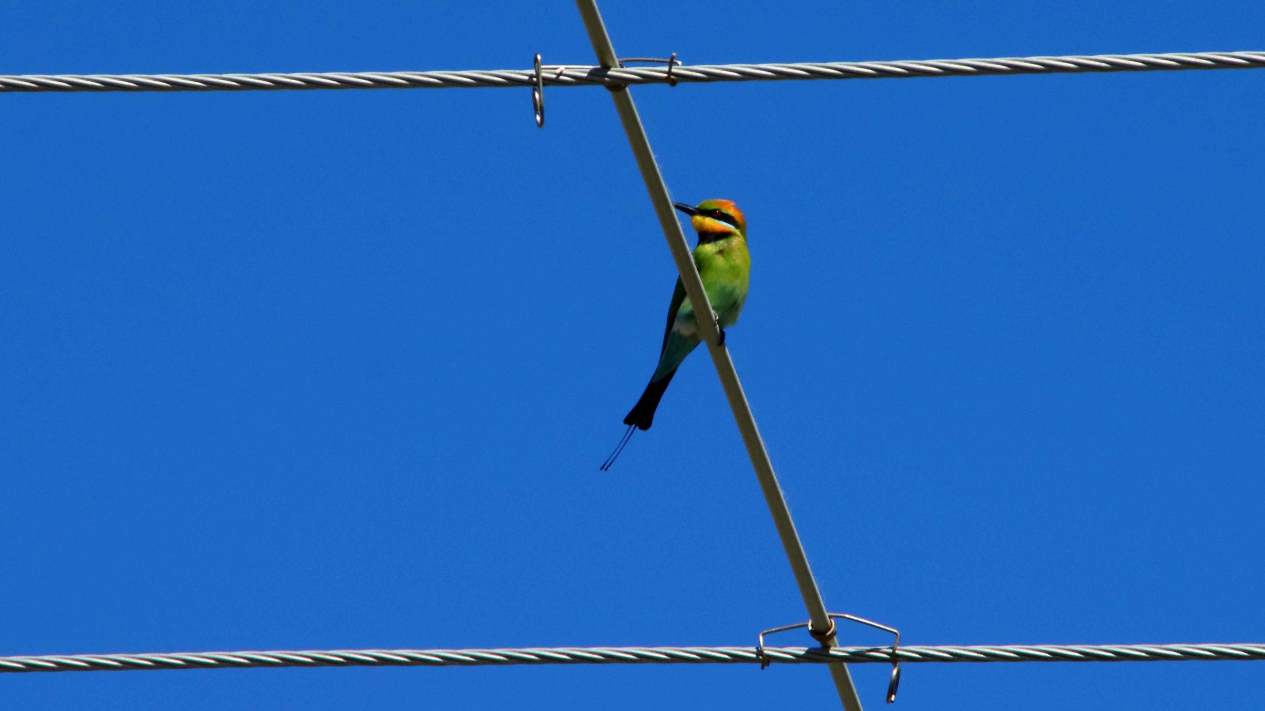
Our motel was at Pialba. After settling in I took my camera on a walk to acquire supplies for the evening. Perched on a power line just behind the motel I spied some birds, which I photographed. They were new to me and when compared to my bird identification book turned out to be a Black-face Cuckoo-shrike and a small group of White-breasted Swallow.

Black-faced Cuckoo-shrike
White-breasted Swallow
Pleasure boat at anchor at Turkey Beach

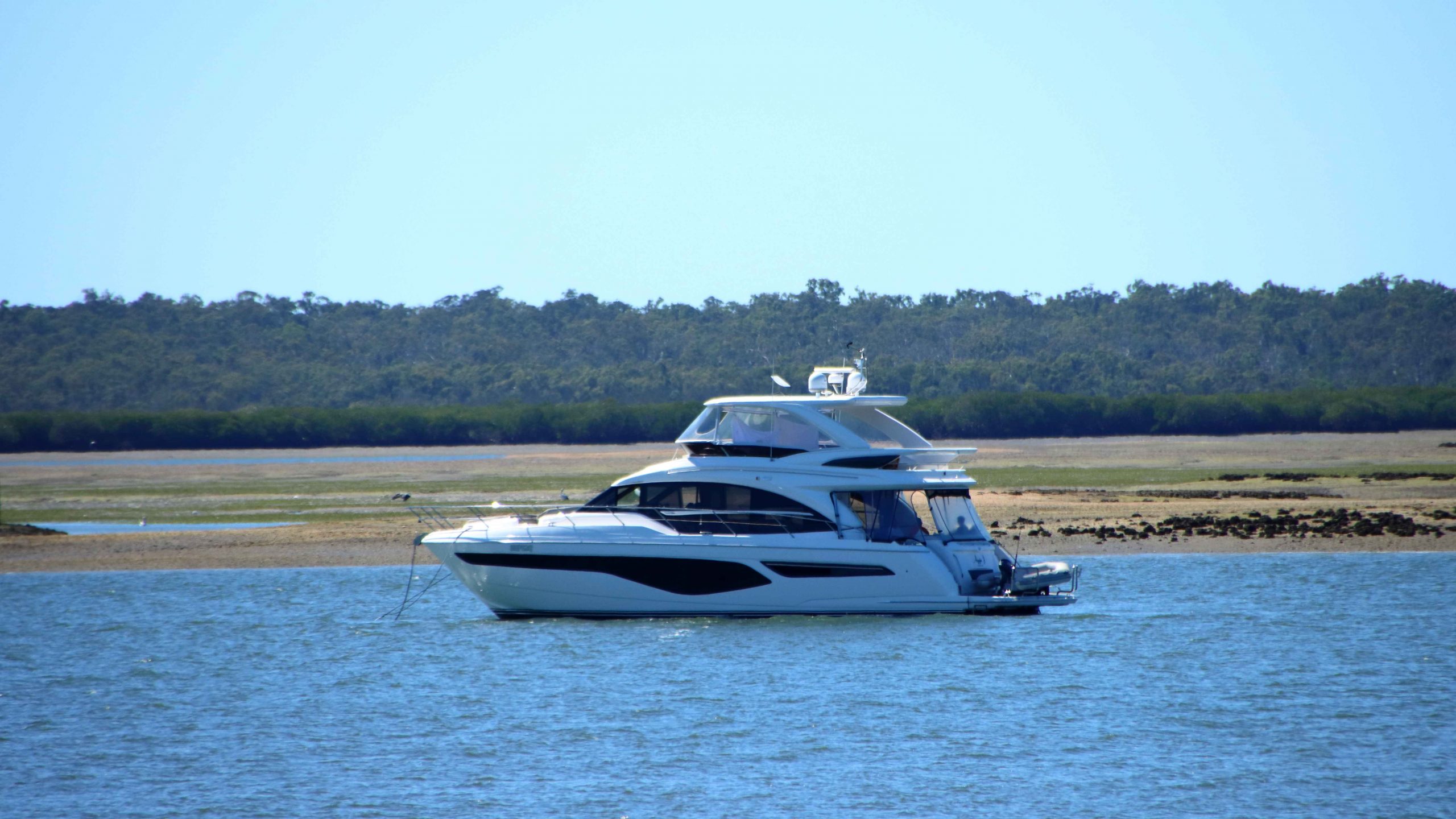
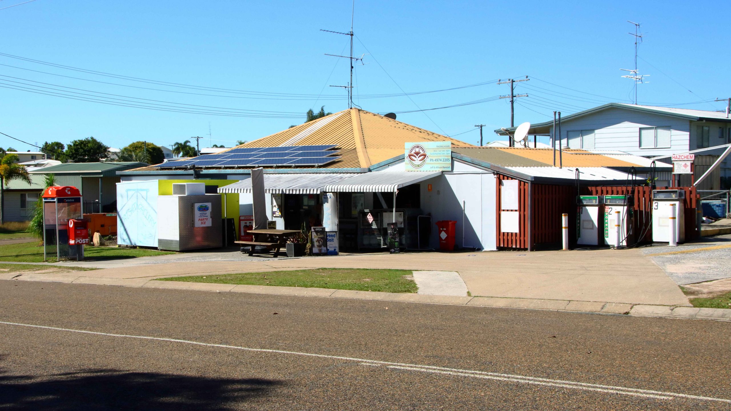
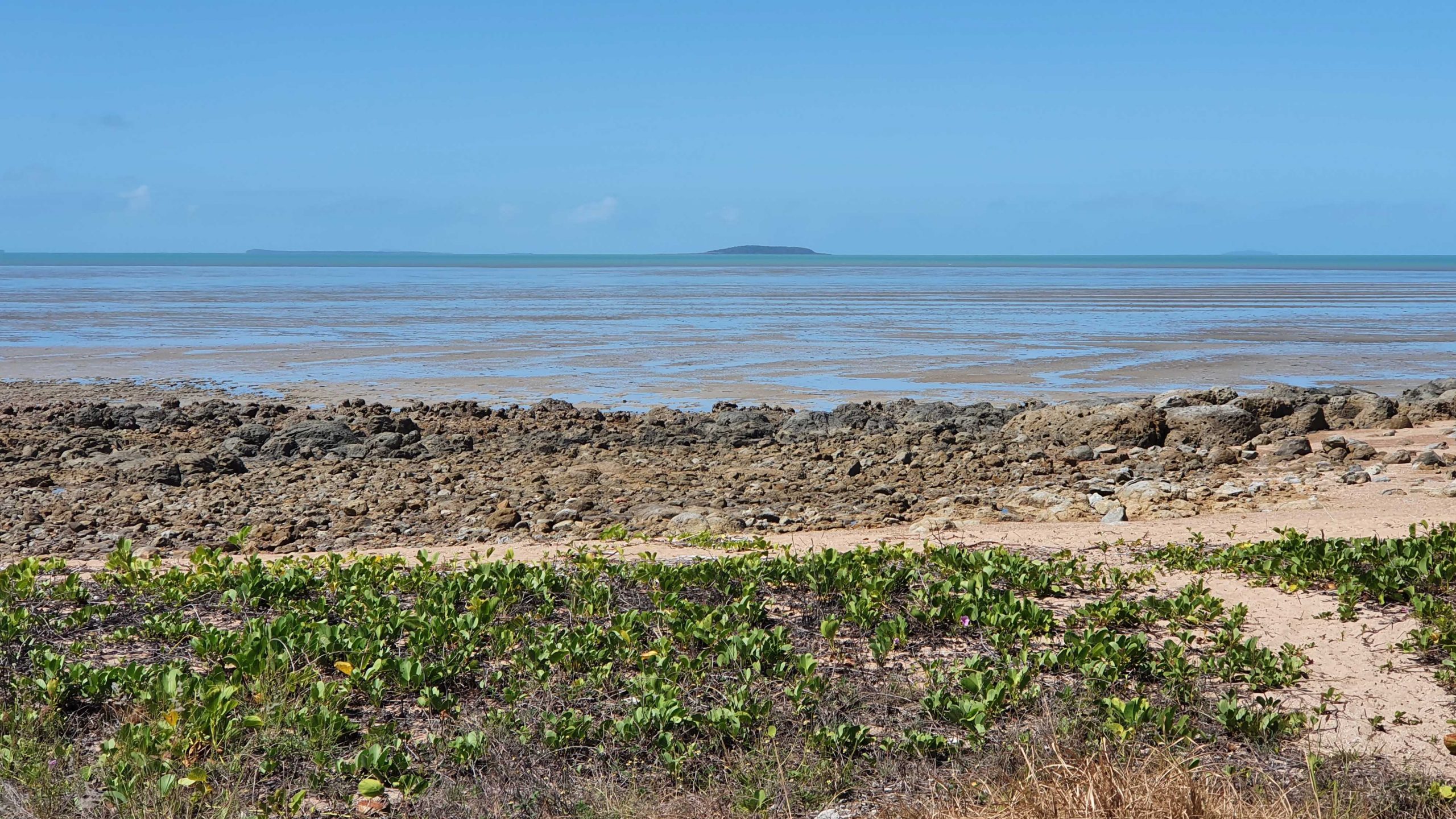
Rockhampton was our next destination. Just a little under 400 km for the day, we added about another 50 km by doing a detour to Turkey Beach, a town that most motorists just pass by. Turkey Beach is one of the few, perhaps the only, outpost of civilisation between Seventeen Seventy and Tannum Sands. It is a fishing village on one of the many inlets from the ocean that extend among the peninsulas and Mangrove swamps of the area.

Kangaroos at Turkey Beach picnic area
Memorial to Mr Ken O’Dowd MP former federal member for Wide Bay
Stinger free swimming enclosure
Rainbow Bee-eater on a power line

A good picnic area with amenities and a general store are its main amenities along with a launching ramp and stinger free swimming enclosure. A couple of women, enjoying the playground facilities with their children, assured us that it was a magic place to live.

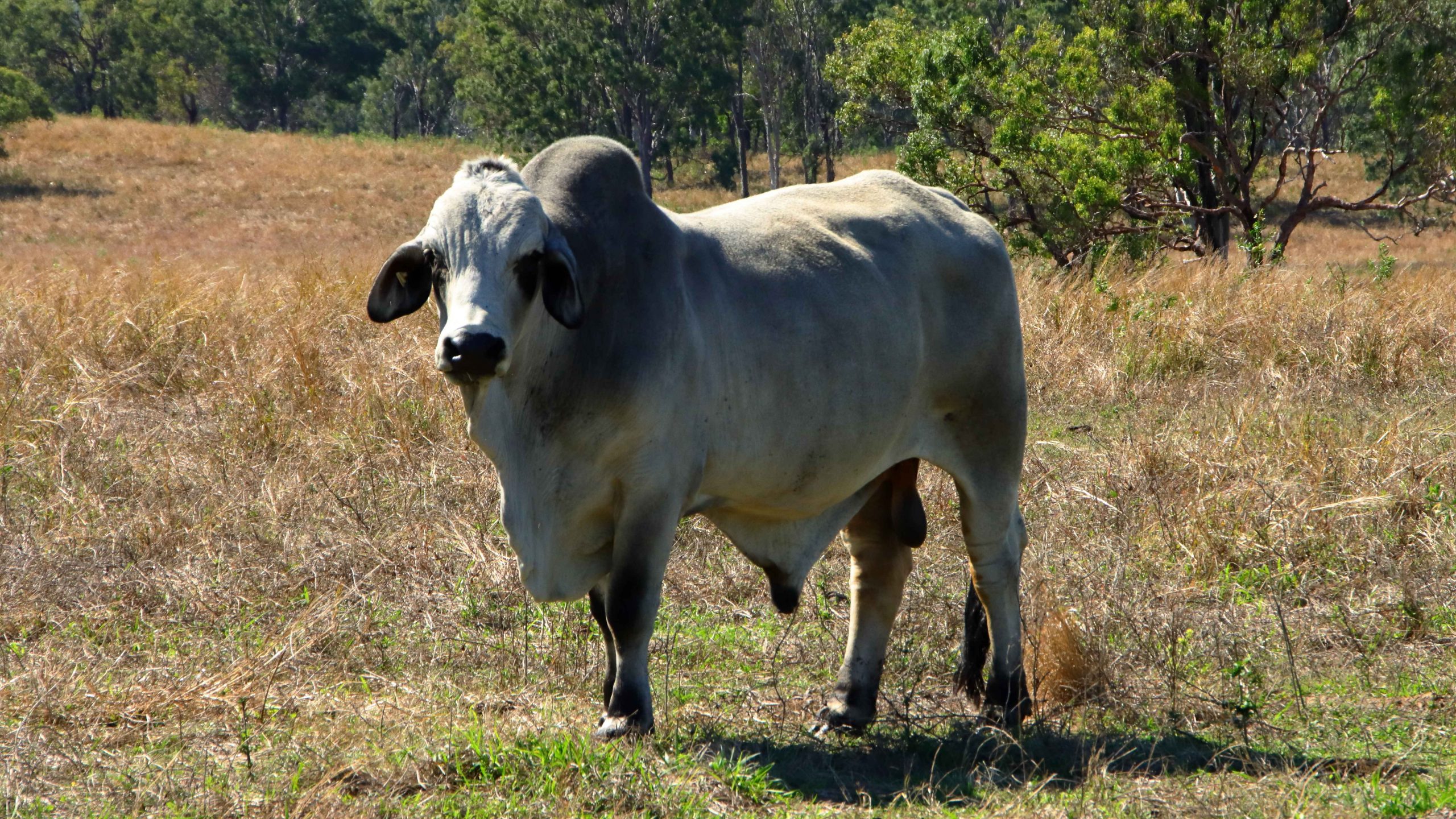
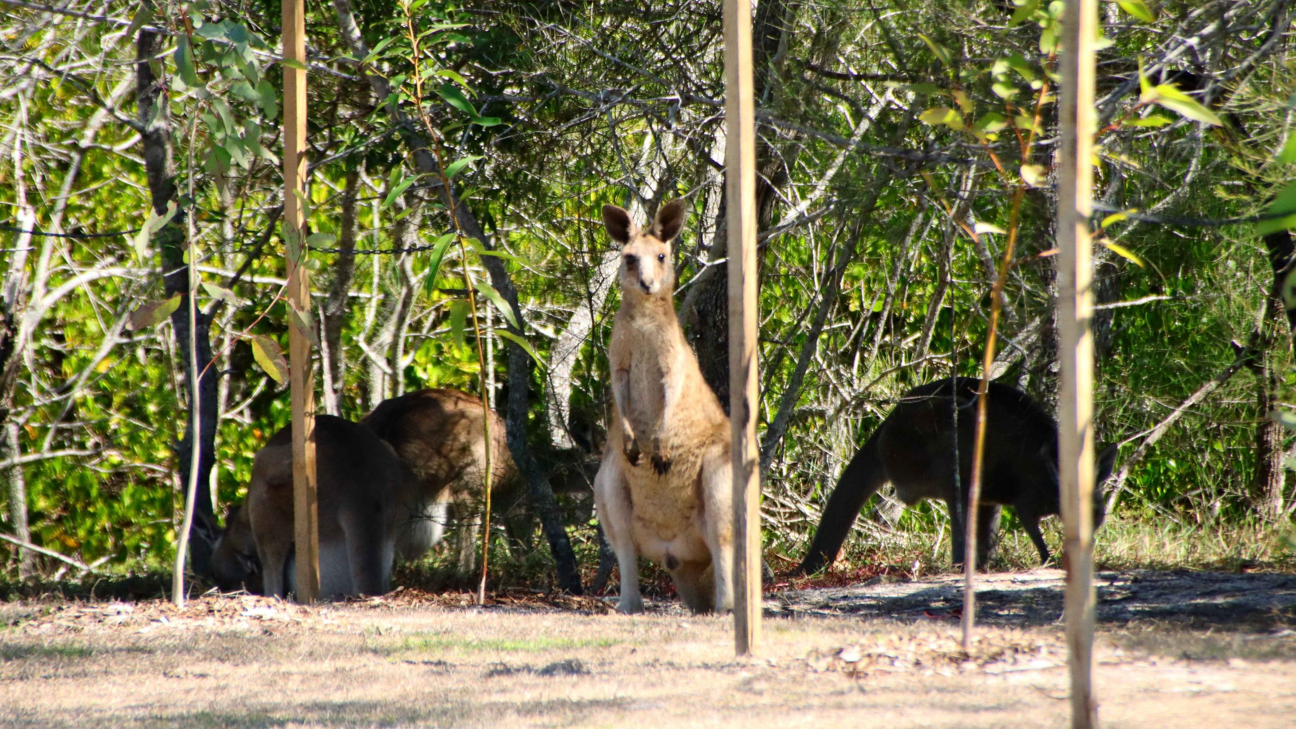
A short drive, during which we stopped to examine a couple of American Brahmin bulls, brought is to the regional city of Rockhampton, situated as it is beside the broad waters of the Fitzroy River, with its many moored boats and hidden crocodiles.

Turkey Creek general store
Now, that is a lot of Bull

Interrupted Journey – North Queensland 2022 – Part 7

Travelling Home

A video link appears at the bottom of this blog post.

On Board the Magnetic Island Ferry

On disembarking from the Magnetic Island ferry, we headed directly to Bowen, pausing only for necessities and roadwork. We stayed at the Bowen Arrow Motel. Now, who could resist it with a name like that?

More roadworks south of Bowen. One 20 km strip with 15 km at 60 kph and the other 5 at 80 kph. Traffic was not heavy, so the drive was pleasant. The skies were partly cloudy with enough sprinkles at Proserpine to kick the automatic wipers into action for a swish or two.

We used the Mackay Ring Road for the first time. It completely misses the city, leaving the Bruce (north bound) at the BP truck stop south of town, runs west for about 3 km and then turns north to re-join the Bruce near Farleigh sugar mill. Three km at 80 kph and 8 at 100 kph. Saves a bit of time and city traffic.

Ferry Arriving at Nelly Bay.
Nelly Bay Harbour Entrance from Inside.

If you break a Bowen to Brisbane trip into three days travel, then Marlborough is where you end up on the first night. We have stayed there in the caravan, but never used the motel. It is dated, perhaps bit tired, but so are we. But we had a comfortable night and a good meal in the restaurant. There are also workers camps on site, so they get good patronage from camp occupants.

Our Lunchtime View at Clairview.
BarraCrab Caravan Park at Clairview.
Caravans at Marlborough Motel & Caravan Park.

We stopped for lunch at Clairview. The caravan park has grown and is now called the BarraCrab Caravan Park and boasts a bistro and bar. But we ate our sandwiches seated in a picnic shelter overlooking the Coral Sea….with the tide out.

The final two days of our trip were just more driving but keeping daily distance to about 400 km. We did morning coffee at a pie cart at the south of Rockhampton.

We turned off at Fred Haig Dam, just north of Gin Gin. This dam holds back the waters of Lake Monduran. It supplies irrigation water to Bundaberg primary producers. We had spent a night there about 12 years ago. It has a good caravan park, built below the retaining wall and patronised by Barramundi fishermen.

We spent Saturday night at Childers in a pleasant motel on the southern end of town. Childers proved to be the start of cool wet weather. We had intermittent rain all the way home.

A View From the Top Deck of the Ferry.

South of Maryborough, in fact south of Tiaro, a sign by the highway advises of a tourist drive through Bauple. We have both seen and ignored it many times. But this was the day that we finally succumbed to curiosity and took the drive.

The Retaining Wall at Fred Haig Dam.

Bauple is a small, old town but that is about all. Not much there but we did see a sign advising of a “bypass meeting” which suggests that the highway diversion around Gympie might just be diverting through Bauple. We didn’t stop for photos

It was too wet for a picnic morning coffee so we called at The Coffee Club at Gympie. This store of TCC has about the best range of cakes of any and seems to be a popular meeting place for Gympieites. It is always busy.

We arrived home at about 12.30 pm and got on with unpacking. Another successful trip under our belt, despite being interrupted.

Guest Cabins Overlook Lake Monduran.

Thanks, Ruth, for agreeing to being dragged around the bush again. I am never so happy as when I am driving down another remote country road, in pursuit of another bit of Australiana. Ruth knows that you can’t take the bush out of the boy. Even when he has become an old boy.